Siberian State Academy of Geodesy
|
|
|
- Magnus Gordon
- 5 years ago
- Views:
Transcription
1 Siberian State Academy of Geodesy USING LASER SCANNING FOR ESTIMATING MINES OUTPUT VOLUMES AND 3D MODELING OF GEOLOGICAL SITUATION Vladimir A. Seredovich, Alexander V. Seredovich, Michael D. Kozoriz Russian Federation FIG Commissions 5, 6 and SSGA Workshop Innovative Technologies for an Efficient Geospatial Management of Earth Resources July 2009 Lake Baikal, Listvyanka, Russian Federation
2 REGIONAL CENTRE FOR LASER SCANNING (RCLS) Year of foundation The number of terrestrial laser scanners 5 sets The number of total stations 3 sets Software Cyclone, RealWorks Survey, AutoCAD, RapidForm, Microstation Regular staff members 5 persons The number of educational programs 3 Candidates degrees 3 Postgraduate students number 3
3 Topographic surveys of 1:500 1:1000 scales using terrestrial laser scanning Experience of carrying out operations at the sites like the following: Industrial enterprise Oil-and-gas production enterprise Long-term construction Urban territories Total area of the conducted large-scale topographic surveys 1,200 hectares


4 Topographic surveys of 1:500 1:1000 scales using terrestrial laser scanning Oil processing and pumping shop


5 Topographic surveys of 1:500 1:1000 scales using terrestrial laser scanning Long-term construction site


6 Topographic surveys of 1:500 1:1000 scales using terrestrial laser scanning Big-City
7 Topographic surveys of 1:500 1:1000 scales using terrestrial laser scanning Basic advantages of laser scanning 3 times increased rate of surveys Better accuracy of topographic surveys Cost of works traditional (like that of usual methods)


8 Surveying of mines quarries and storages yards

9 Topographic surveys of 1:500 1:1000 scales using terrestrial laser scanning 3D modeling of coal open-casts

10 LASER SCANNING SURVEY OF QUARRIES AND STORAGES YARDS 3D modeling of coal open-casts


11 LASER SCANNING SURVEY OF QUARRIES AND STORAGES YARDS Monitoring of pit edges
12 LASER SCANNING SURVEY OF QUARRIES AND STORAGES YARDS Determination of current volumes of products at store yards

13 LASER SCANNING SURVEY OF QUARRIES AND STORAGES YARDS Determination of outputs

14 LASER SCANNING SURVEY OF QUARRIES AND STORAGES YARDS 3D modeling of subsurface geology

15 LASER SCANNING SURVEY OF QUARRIES AND STORAGES YARDS 3D modeling of subsurface geology

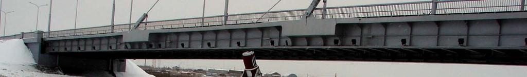
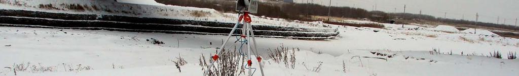

16 Surveying and monitoring of bridges


17 Surveying and monitoring of bridges Renewal of design drawings
18 Surveying and monitoring of bridges Fixing stay cables 1 Fixing stay cables 2 Pylon foundation Determination of bearing structures deformations

19 Surveying and monitoring of bridges 3D modeling of bridges
20 Surveying and monitoring of bridges Вертикальные колебания балки моста :35:32 17:35:47 17:36:06 17:36:41 17:36:52 17:37:02 17:37:14 17:37:23 17:37:31 17:37:40 17:37:49 17:37:59 17:38:12 17:38:35 17:38:57 17:39:24 17:39:49 17:40:12 17:40:35 17:41:04 17:41:37 17:41:50 17:42:09 17:42:49 17:43:22 17:43:51 17:44:30 17:45:06 17:45:35 17:46:04 17:46:50 17:47:35 17:48:10 17:48:41 17:49:12 17:49:42 17:50:37 17:51:23 17:52:21 17:52:45 17:53: Pylon foundation Determination of bearing structures vibrations frequency and amplitude

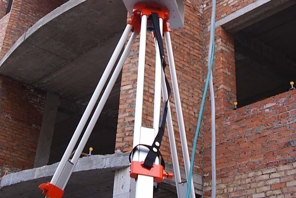
21 3D modeling of objects Preparation of 3D foundation for projects designing and reconstruction

22 3D modeling of objects Preparation of 3D foundation for projects designing and reconstruction

23 3D modeling of objects Preparation of 3D foundation for projects designing and reconstruction

24 3D modeling of objects Development of 3D general plans of industrial enterprises
25 3D modeling of objects Control of industrial parts making

26 3D modeling of objects Control of industrial parts making

27 Surveying of highways and railways 3D roads modeling


28 Surveying of highways and railways Determination of pavement faults characteristics and amounts


29 Surveying of highways and railways Road axis section construction

30 Surveying of highways and railways Roadway drawing

31 Surveying of highways and railways Engineering-and-repair works volume estimation

32 Surveying of facades

33 Surveying of facades 3D model generation of buildings


34 Surveying of facades Making measurement drawings of any section

35 Surveying of facades 3D modeling and drawings of complicated architectural structures
36 Siberian State Academy of Geodesy Thank you very much for your attention!
Terrestrial 3D laser scanning Practical aspects
 Terrestrial 3D laser scanning Practical aspects ISPRS WG VI/5&SC Summer School 2007 by Gregor Bilban 3D laser scanning Benefits Lower data collection costs Reduction or elimination of re-visits More accurate
Geospatial Engineering Problems & Solutions Associated With NDP Roads, Tunnelling & Civil Engineering Projects Use of HDS Leica Laser Scanners
 Geospatial Engineering Problems & Solutions Associated With NDP Roads, Tunnelling & Civil Engineering Projects Use of HDS Leica Laser Scanners Laser Scanning Laser Scanning is a method of collecting large
2/9/2016. Session Agenda: Implementing new Geospatial Technologies for more efficient data capture
 Implementing new Geospatial Technologies for more efficient data capture Jay Haskamp Applied Geospatial Engineer Steve Richter VP Sales Session Agenda: Today s changing technologies and what lies ahead
Training in Mapping Changes on an Archaeological Site
 Training in Mapping Changes on an Archaeological Site Presented at the FIG Congress 2018, May 6-11, 2018 in Istanbul, Turkey Pierre-Yves Gilliéron Bertrand Merminod Jérôme Zufferey EPFL Presentation 04.2015
Trimble MX2 mobile mapping
 Trimble MX2 mobile mapping user applications Point clouds within your reach The Trimble MX2 is a vehicle-mounted spatial imaging system which combines high resolution laser scanning and panoramic cameras
3D Scanning Technology in the Transportation Infrastructure: Case Studies from Around the Globe
 John Whitehead Director of Sales, Asia-Pacific JANUARY 2018 3D Scanning Technology in the Transportation Infrastructure: Case Studies from Around the Globe Overview What does 3D Scanning have to do with
HIGH-DEFINITION SURVEY AND BIM PRESENTATION FOR BIM-MEP AUS
 www.aamgroup.com/bim HIGH-DEFINITION SURVEY AND BIM PRESENTATION FOR BIM-MEP AUS Matt Rumbelow, B.Arch AAM BIM Coordinator ABOUT AAM Reality Captured. Certainty Delivered Reality Captured. Certainty Delivered
UAS for Surveyors. An emerging technology for the Geospatial Industry. Ian Murgatroyd : Technical Sales Rep. Trimble
 UAS for Surveyors An emerging technology for the Geospatial Industry Ian Murgatroyd : Technical Sales Rep. Trimble Project Overview Voyager Quarry, located near Perth Australia Typical of hard rock mines,
APPLICATION OF 3D TERRESTRIAL LASER SCANNING IN THE PROCESS OF UPDATE OR CORRECTION OF ERRORS IN THE CADASTRAL MAP
 Presented at the FIG Working Week 2017, May 29 - June 2, 2017 in Helsinki, Finland Dr.-Eng. Gintcho Kostov GEO ZEMIA Ltd. 1 1. Introduction 3D Terrestrial laser scanning delivers highly accurate spatial
ADVANCED CAPABILITY USING LIDAR TECHNOLOGY IN GEODETIC SURVEY
 ADVANCED CAPABILITY USING LIDAR TECHNOLOGY IN GEODETIC SURVEY 2015 LiDAR IT IS ONE OF THE MOST CONTEMPORARY TYPES OF SURVEY, WHICH ENABLES GETTING INFORMATION ABOUT THE AREA. IN THE LATEST DECADE DATA
An Undergraduate Project with Terrestrial Laser Scanner for Purpose of Architectural Survey
 Theory and Application of Laser Scanning ISPRS Summer School 2007 Ljubljana,Slovenia An Undergraduate Project with Terrestrial Laser Scanner for Purpose of Architectural Survey Cemal Özgür KIVILCIM ISPRS
3D Terrestrial Laser Scanner Innovative Applications for 3D Documentation
 3D Terrestrial Laser Scanner Innovative Applications for 3D Documentation Rodney Chaffee Head of Sales, FARO Asia Pacific 3D Laser Scaning Market 2017 2.3 Billion $ 2012 1.3 Billion $ CAGR : > 12% Source:
Jeffrey A. Schepers P.S. EIT Geospatial Services Holland Engineering Inc. 220 Hoover Blvd, Suite 2, Holland, MI Desk
 Jeffrey A. Schepers P.S. EIT Geospatial Services Holland Engineering Inc. 220 Hoover Blvd, Suite 2, Holland, MI 49423 616-594-5127 Desk 616-322-1724 Cell 616-392-5938 Office Mobile LiDAR - Laser Scanning
Explore Laser Scanning in As-Built Survey. Vijay Chowdhary SE: BIM/CIM
 Explore Laser Scanning in As-Built Survey Vijay Chowdhary SE: BIM/CIM About FARO The world leader in portable 3-D measurement and imaging technology EMEA Headquarters Korntal-Münchingen, Germany APAC Headquarters
Virtual Assembly Technology on Steel Bridge Members of Bolt Connection Zhu Hao
 Advances in Engineering Research (AER), volume 132 2017 Global Conference on Mechanics and Civil Engineering (GCMCE 2017) Virtual Assembly Technology on Steel Bridge Members of Bolt Connection Zhu Hao
TERRESTRIAL LASER SCANNER TECHNIC AS A METHOD FOR IDENTIFICATION AREAS OF SLOPS
 77 TERRESTRIAL LASER SCANNER TECHNIC AS A METHOD FOR IDENTIFICATION AREAS OF SLOPS Bartłomiej Ćmielewski, Bernard Kontny Institute of Geodesy and Geoinformatics, Wroclaw University of Environmental and
USE THE 3D LASER SCANNING FOR DOCUMENTATION THE RIGA CATHEDRAL IN LATVIA
 USE THE 3D LASER SCANNING FOR DOCUMENTATION THE RIGA CATHEDRAL IN LATVIA Maris Kalinka, Elina Rutkovska, Department of Geomatic, Riga Technical University, Azenes 16-109, Riga, Latvia, geomatika@geomatika.lv
UAVs & IMAGES ACCESSORIES ABOUT GEXCEL
 LIDAR SOFTWARE UAVs & IMAGES MONITORING MOBILE MAPPING ACCESSORIES OTHER ABOUT GEXCEL BUSINESS TEAM LOCATIONS Gexcel offices are located in Italy in two Innovation Centers SALES NETWORK Gexcel s worldwide
Terrestrial radar and laser scanning for deformation monitoring: first steps towards assisted radar scanning
 Terrestrial radar and laser scanning for deformation monitoring: first steps towards assisted radar scanning Daniel Wujanz 1, Frank Neitzel 1, H.P. Hebel 2, J. Linke 2, W. Busch 2 1 Chair of Geodesy and
The Institute of Remote Sensing and Digital Earth, Chinese Academy of Sciences liqi
 Fine Deformation Monitoring of Ancient Building Based on Terrestrial Laser Scanning Technologies The Institute of Remote Sensing and Digital Earth, Chinese Academy of Sciences liqi Outline Introduce the
INTEGRATING PHOTOGRAMMETRIC TECHNOLOGIES AND GEODETIC METHODS FOR 3D MODELING
 INTEGRATING PHOTOGRAMMETRIC TECHNOLOGIES AND GEODETIC METHODS FOR 3D MODELING Georgeta Pop Faculty of Geodesy, Geodesy and Photogrammetry Department, Technical University of Civil Engineering Bucharest,
Аnna B. Galieva 1,*, Vladimir N. Alekhin 1, Alexey A. Antipin 1, and Sergey N. Gorodilov 1
 Defects search during the inspection of civil and industrial buildings and structures on the basis of laser scanning technology and information modeling approach (BIM) Аnna B. Galieva 1,*, Vladimir N.
2/19/2018. Who are we? Who am I? What is Scanning? How does scanning work? How does scanning work? Scanning for Today s Surveyors
 2/19/2018 Who are we? Scanning for Today s Surveyors Survey, GIS, and Construction dealer Founded in 1988 Employee Owned Headquartered in Bismarck, ND States covered: ND, SD, MN, MT, WY, CO, UT, ID, WA,
Surveying of inaccessible rock faces and volume calculation of the irregular solids using robotic total station
 Surveying of inaccessible rock faces and calculation of the irregular solids using robotic total station Štefan Rákay 1, Jozef Zuzik 2, Gabriel Weiss 1 and Slavomír Labant 1 In the present-day geodetic
ROAD-SCANNER COMPACT APPLICATION FIELDS MAIN FEATURES
 ROAD-SCANNER COMPACT Mobile Mapping System by GEXCEL & SITECO collaboration A smaller mobile system for asset management and cartography suited for ZOLLER & FRÖHLICH PROFILER 9012 laser scanner. 2 + 3
ERROR SOURCES IN PROCCESSING LIDAR BASED BRIDGE INSPECTION
 The International Archives of the Photogrammetry, Remote Sensing and Spatial Information Sciences, XLII-/W7, 07 ISPRS Geospatial Week 07, 8 September 07, Wuhan, China ERROR SOURCES IN PROCCESSING LIDAR
OPEN-PIT MINE SCANNING IN INDONESIA, HYDRONAV SERVICES OF SINGAPORE
 OPEN-PIT MINE SCANNING IN INDONESIA, HYDRONAV SERVICES OF SINGAPORE TRIMBLE 3D SCANNING CASE STUDY BY PAUL BIDDISCOMBE Nusa Tenggara is the Indonesian name for the more than 500 islands east of Bali, running
IDENTIFICATION DEFORMATION AREAS OF SLOPS USING TERRESTRIAL LASER
 IDENTIFICATION DEFORMATION AREAS OF SLOPS USING TERRESTRIAL LASER SCANNER PRELIMINARY RESEARCH Bartłomiej Ćmielewski 1 Abstract The identification of the deformation of superficial objects, not monolithic,
3D-Laser Scanning and Surveying Collide. >> By H. Tate Jones, LS
 An architectural firm called on LandAir Surveying surveyors to scan downtown Cobb County in the area of a proposed courthouse, create a 3D model and then incorporate the new courthouse design into the
Control System International a.s., Papírenská 114/5, Praha 6, Czech Republic Web site: www. controlsystem.cz,
 129 Consequences of a complex using of 3D approach in the implementation of the road reconstruction - usage of TLS stop&go and usage of paving control system for milling machines Přikryl, M. and Kutil,
Mobile LiDAR for Ground Applications. Spar 2006, March Paul Mrstik, Terrapoint Canada Inc. Craig Glennie, Terrapoint USA LLC
 Mobile LiDAR for Ground Applications Spar 2006, March 27 2006 Paul Mrstik, Terrapoint Canada Inc. Craig Glennie, Terrapoint USA LLC Agenda Introduction to Terrapoint What is mobile LiDAR? Advantages of
Mobile Mapping The StreetMapper Approach. Andrew Fuller LiDAR Systems Engineer
 Mobile Mapping The StreetMapper Approach Andrew Fuller LiDAR Systems Engineer UK company based in Nottingham Global 3D Laser Mapping Solutions Innovative solutions StreetMapper Over 11 years experience
COMPANY PROFILE JOVYATLAS WÄRTSILÄ JOVYATLAS EUROATLAS GMBH
 COMPANY PROFILE JOVYATLAS WÄRTSILÄ JOVYATLAS EUROATLAS GMBH 1 Wärtsilä JOVYATLAS Overall Company Information Foundation 1.12.1945 Employees 140 (JOVYATLAS) Turnover 2014 20.3 Mio Area m² 23.700 site 8.300
The Trimble 3D Scanning Solution: Designed by Surveyors for Surveyors
 The Trimble 3D Scanning Solution: Designed by Surveyors for Surveyors TRIMBLE 3D SCANNING Designed by surveyors for surveyors, the Trimble 3D scanning solution follows the surveying workflow you re familiar
COMPANY PROFILE JOVYATLAS WÄRTSILÄ JOVYATLAS EUROATLAS GMBH
 COMPANY PROFILE JOVYATLAS WÄRTSILÄ JOVYATLAS EUROATLAS GMBH 1 JOVYATLAS Overall Company Information Foundation 1.12.1945 Employees 140 (JOVYATLAS) Turnover 2014 20.3 Mio Area m² 23.700 site 8.300 operation
Real World to Virtual World. With Geomagic Design X
 Real World to Virtual World With Geomagic Design X About OR3D OR3D based in UK with offices in Wrexham (Wales) and Bristol (England) Cover the UK and Internationally UK s largest supplier of Geomagic software
Empirical Development of 3D Terrain Processing Platform for Autonomous Excavation System
 Empirical Development of 3D Terrain Processing Platform for Autonomous Excavation System Seok Kim 1, Tae-yeong Kim 2, Soonwook Kwon 3, Jongwon Seo 4 1 Senior Researcher, Korean Institute of Civil Engineering
Intergovernmental/ multilateral arrangement for power interconnection in Northeast Asia: Russia s case Energy Systems Institute of Siberian Branch of
 Intergovernmental/ multilateral arrangement for power interconnection in Northeast Asia: Russia s case Energy Systems Institute of Siberian Branch of the Russian Academy of Sciences Russia NEA countries
TERRESTRIAL LASER SCANNING AND APPLICATION IN GEODETIC ENGINEERING
 TERRESTRIAL LASER SCANNING AND APPLICATION IN GEODETIC ENGINEERING Marko Pejić U n i ve rs i t y o f B e l g ra d e, Fa c u l t y o f C i v i l E n g i n e e r i n g Mostar, 10.19.2017. TLS method and
SSC-JE CIVIL ENGINEERING STUDY MATERIAL SURVEYING ENGINEERING STAFF SELECTION COMMISSION SURVEYING. Page 1 of 98 SSC-JE CIVIL ENGINEERING
 Page 1 of 98 SSC-JE STAFF SELECTION COMMISSION CIVIL ENGINEERING STUDY MATERIAL ENGINEERING Page 2 of 98 SSC-JE Civil Engineering : Surveying syllabus Surveying: Principles of surveying, measurement of
Mobile Mapping Solutions for Ohio s Integrated Transportation Network. Brian Foster, CP
 Mobile Mapping Solutions for Ohio s Integrated Transportation Network Brian Foster, CP About Woolpert Established in 1911 Over 600 Professionals 25 Offices $12,000,000 invested in new technology in last
Engineering Geology. Engineering Geology is backbone of civil engineering. Topographic Maps. Eng. Iqbal Marie
 Engineering Geology Engineering Geology is backbone of civil engineering Topographic Maps Eng. Iqbal Marie Maps: are a two dimensional representation, of an area or region. There are many types of maps,
3-D Modeling of Angara River Bed
 3-D Modeling of Angara River Bed Igor Bychkov, Andrey Gachenko, Gennady Rugnikov, and Alexei Hmelnov Matrosov Institute for System Dynamics and Control Theory of Siberian Branch of Russian Academy of Sciences,
Leica ScanStation C10 The All-in-One Laser Scanner for Any Application
 The All-in-One Laser Scanner for Any Application Versatility, Productivity, Value Many organizations interested in laser scanning to diversify and/or improve current business have been waiting for a scanner
Australia s national positioning program. Dr John Dawson, Section Leader Positioning
 Australia s national positioning program Dr John Dawson, Section Leader Positioning Geoscience Australia s Role Geoscience Australia is Australia's pre-eminent public sector geoscience organisation Federal
NATIONAL CERTIFICATE in Gunsmithing (Master) (Level 5)
 (Level 5)") NZQF NQ Ref 0347 Version 3 Page 1 of 10 NATIONAL CERTIFICATE in Gunsmithing (Master) (Level 5) Level 5 Credits 85 This qualification has been reviewed. The last date to meet the requirements is 31 December
NZQF NQ Ref 0347 Version 3 Page 1 of 10 NATIONAL CERTIFICATE in Gunsmithing (Master) (Level 5) Level 5 Credits 85 This qualification has been reviewed. The last date to meet the requirements is 31 December
2011 Bentley Systems, Incorporated. Bentley Descartes V8i Advancing Information Modeling For Intelligent Infrastructure
 Bentley Descartes V8i Advancing Information Modeling For Intelligent Infrastructure Agenda Why would you need Bentley Descartes? What is Bentley Descartes? Advanced Point Cloud Workflows Advanced Terrain
Laser Scanning. 3D Model is not existing and is required for: studies revamping maintenance HSE integration in another 3D model archiving
 Laser Scanning Laser Scanning Laser scanning is used whenever: 3D Model is not existing and is required for: studies revamping maintenance HSE integration in another 3D model archiving 2 Object acquisition
Integrated Multi-Source LiDAR and Imagery
 Figure 1: AirDaC aerial scanning system Integrated Multi-Source LiDAR and Imagery The derived benefits of LiDAR scanning in the fields of engineering, surveying, and planning are well documented. It has
Trimble Business Center Software, v3.30
 Trimble Business Center Software, v3.30 We are pleased to announce a new version of the Trimble Business Center software, version 3.30. This new version includes over 30 new features and enhancements increasing
Maintain, Repair, Rebuild, Protect. Solutions for Industrial Asset Maintenance and Reliability
 Maintain, Repair, Rebuild, Protect Solutions for Industrial Asset Maintenance and Reliability Henkel. Solutions for All Your Maintenance Challenges. Maintain, Repair, Rebuild and Protect Industrial Equipment.
Digital photogrammetry project with very high-resolution stereo pairs acquired by DigitalGlobe, Inc. satellite Worldview-2
 White PAPER Greater area of the City of La Paz, Bolivia Digital photogrammetry project with very high-resolution stereo pairs acquired by DigitalGlobe, Inc. satellite Worldview-2 By: Engineers Nelson Mattie,
A new geodetic methodology for the accurate Documentation and Monitoring of inaccessible surfaces.
 A new geodetic methodology for the accurate Documentation and Monitoring of inaccessible surfaces. Ε. Lambrou, G. Pantazis Lecturers at NTUA School of Rural and Surveying Engineering National Technical
coal mining Solutions
 coal mining Solutions Ampcontrol connects you to coal mining solutions For nearly 50 years Ampcontrol has designed, manufactured and delivered integrated electrical solutions that improve safety, maintain
SVKM S NMIMS Mukesh Patel School of Technology Management & Engineering BTI 1
 Mukesh Patel School of Technology Management & Engineering BTI 1 Structure of B. Tech Integrated - Civil Engineering Annexure 1 Semester I Communication Skills Mathematics I Physics-I Chemistry-I Basics
Case studies about using Mobile Mapping System (MMS) on traffic network mapping
 on traffic network mapping") HUNGARIAN GEODETIC AND MAPPING CORPORATION LTD. Case studies about using Mobile Mapping System (MMS) on traffic network mapping Peter Csörgits Chief Engineer Hungarian Geodetic and Mapping co. Ltd. What
HUNGARIAN GEODETIC AND MAPPING CORPORATION LTD. Case studies about using Mobile Mapping System (MMS) on traffic network mapping Peter Csörgits Chief Engineer Hungarian Geodetic and Mapping co. Ltd. What
Interdisciplinary Approach to Design, Analysis, and Modeling of Deformation Surveys
 Interdisciplinary Approach to Design, Analysis, and Modeling of Deformation Surveys Anna Szostak-Chrzanowski and Adam Chrzanowski Canadian Centre for Geodetic Engineering University of New Brunswick Fredericton,
Development of Optimum Assessment Technique for Railway Infrastructure Clearances
 Development of Optimum Assessment Technique for Railway Infrastructure Clearances F. Moghadasnejad 1 and M. Fathali 2 1- Assistant Professor, moghadas@aut.ac.ir 2- PhD. Student, m_fathali@aut.ac.ir Amirkabir
Aerial and Mobile LiDAR Data Fusion
 Creating Value Delivering Solutions Aerial and Mobile LiDAR Data Fusion Dr. Srini Dharmapuri, CP, PMP What You Will Learn About LiDAR Fusion Mobile and Aerial LiDAR Technology Components & Parameters Project
Federica Zampa Sineco SpA V. le Isonzo, 14/1, Milan, 20135, Italy
 LYNX MOBILE MAPPER TM : THE NEW SURVEY TECHNOLOGY Federica Zampa Sineco SpA V. le Isonzo, 14/1, Milan, 20135, Italy federica.zampa@sineco.co.it Dario Conforti Optech Incorporated 300 Interchange Way, Vaughan,
Simulation As a Tool for Debugging and Testing of Control Programs for Process Control Systems in Coal Mining*
 Simulation As a Tool for Debugging and Testing of Control Programs for Process Control Systems in Coal Mining* Victor Okolnishnikov, Sergey Rudometov, and Sergey Zhuravlev Design Technological Institute
MANY DISCOVER THE BENEFITS OF 3D MEASUREMENT TECHNOLOGY IN LONDON
 MANY DISCOVER THE BENEFITS OF 3D MEASUREMENT TECHNOLOGY IN LONDON Last week UK delegates were shown the benefits and uses of 3D measurement systems and software at a free event held by 3D Laser Mapping,
Airborne and Mobile LiDAR for Transport Corridor Survey Dr. Bharat Lohani Director, Geokno India Pvt. Ltd. & Professor, Geoinformatics IIT Kanpur
 www.geokno.com Airborne and Mobile LiDAR for Transport Corridor Survey Dr. Bharat Lohani Director, Geokno India Pvt. Ltd. & Professor, Geoinformatics IIT Kanpur Geokno has executed and is executing multiple
InteLAS Family of Mobile LiDAR Systems
 InteLAS Family of Mobile LiDAR Systems September 2015 What we do ilinks Geosolutions LLC Hydrographic surveying and seabed modeling Topographic surveying and mobile mapping Systems engineering and integration
Artescan, 3D Scanning IPN TecBis, Edif. E Rua Pedro Nunes, Coimbra, Portugal
 1 Displacement and surface pathology monitoring of former Tejo Power Station building by combining terrestrial laser scanning, micro-geodesy, photogrammetry and GIS Adriano OLIVEIRA, João BOAVIDA, Bruno
CREATION OF THE SYSTEM OF DISTRIBUTED SHAREABLE GEOGRAPHICAL DATA BASES FOR CARRYING OUT COMPLEX RESEARCHES OF TERRITORIES
 CREATION OF THE SYSTEM OF DISTRIBUTED SHAREABLE GEOGRAPHICAL DATA BASES FOR CARRYING OUT COMPLEX RESEARCHES OF TERRITORIES Irina K. Lourie, Aly R. Alyautdinov, Dmitryi V. Michayilov Department of Cartography
High Definition Modeling of Calw, Badstrasse and its Google Earth Integration
 Master Thesis Yuanting LI High Definition Modeling of Calw, Badstrasse and its Google Earth Integration Duration of the Thesis: 6 months Completion: July, 2014 Supervisors: Prof.Dr.-Ing.Dieter Fritsch
EXPERIENCES OF WPG S.A IN THE USAGE OF TERRESTIAL LASER SCANNERS FOR BUILDING INVENTORY PURPOSES
 EXPERIENCES OF WPG S.A IN THE USAGE OF TERRESTIAL LASER SCANNERS FOR BUILDING INVENTORY PURPOSES Uchański Jacek, Falkowski Piotr Warszawskie Przedsiębiorstwo Geodezyjne S.A. 1. INTRODUCTION Warszawskie
B C. N Ajuntament de Barcelona. BARCELONA Building Resilience Strategies MANUEL VALDÉS DEPUTY MANAGER OF INFRASTRUCTURE AND URBAN COORDINATION
 B C BARCELONA Building Resilience Strategies N MANUEL VALDÉS DEPUTY MANAGER OF INFRASTRUCTURE AND URBAN COORDINATION Resilience Department Structure and main Working Lines 1. CONTROL ROOM 1. RESILIENCE
Example of Monitoring Requirement
 CEGE Department 3DIMPact of Civil, Environmental & Geomatic Engineering (CEGE) 3D Imaging, Metrology, Photogrammetry Applied Coordinate Technologies (3DIMPact) Optical non-contact railway track measurement
Enabling Precise Geo- Spa3al Applica3ons by Development of Mul3- GNSS Con3nuously Opera3ng Reference Sta3on (CORS) Network for Pakistan
 Network for Pakistan") Enabling Precise Geo- Spa3al Applica3ons by Development of Mul3- GNSS Con3nuously Opera3ng Reference Sta3on (CORS) Network for Pakistan Presented by: Syed Zahid Jamal Divisional Head (GNSS) Pakistan Space
Enabling Precise Geo- Spa3al Applica3ons by Development of Mul3- GNSS Con3nuously Opera3ng Reference Sta3on (CORS) Network for Pakistan Presented by: Syed Zahid Jamal Divisional Head (GNSS) Pakistan Space
COMPANY PRESENTATION
 COMPANY PRESENTATION About us Leading Russian strategy consulting firm in middle price segment SBS Consulting was founded in 2006. Previously, the company was called LLC "Business Solutions" Our client
Comparison of 3D Laser Scanning and Classical Survey Data Deformation Analysis of Industrial Facilities in Oil Refinery
 Comparison of 3D Laser Scanning and Classical Survey Data Deformation Analysis of Industrial Facilities in Oil Refinery Almin ĐAPO, Luka BABIĆ, Boško PRIBIČEVIĆ, Antonio ANTUNOVIĆ University of Zagreb,
Smart City Aspern laying the foundation for a sustainable energy system ASCR 2016 All rights reserved.
 Aspern Smart City Research Smart City Aspern laying the foundation for a sustainable energy system ASCR All rights reserved. Seestadt Aspern Facts and Figures 20.000 Jobs Total size:2.4 million m² Appartements
Automatic registration of terrestrial laser scans for geological deformation monitoring
 Automatic registration of terrestrial laser scans for geological deformation monitoring Daniel Wujanz 1, Michael Avian 2, Daniel Krueger 1, Frank Neitzel 1 1 Chair of Geodesy and Adjustment Theory, Technische
Scanning experience in underground copper ore mines at KGHM Polska Miedz S.A.
 Scanning experience in underground copper ore mines at KGHM Polska Miedz S.A. Ryszard HEJMANOWSKI Agnieszka MALINOWSKA AGH University of Science and Technology /Poland Grzegorz Patykowski Jacek Młynarczyk
BEFORE YOU BUY: SEVEN CRITICAL QUESTIONS TO ASK ABOUT LASER SCANNERS. Robert Gardiner
 BEFORE YOU BUY: SEVEN CRITICAL QUESTIONS TO ASK ABOUT LASER SCANNERS Robert Gardiner Table of Contents Introduction... 3 Horizontal and Vertical Angular Accuracies... 4 Movement Tracking... 6 Range Limitations...
User Manual. For Geographical Information System. Last Updated: 1-July-2013 Document No. : - 1 Document version: - 1
 User Manual For Geographical Information System Client: Department of Mines and GIS Government of Karnataka Last Updated: 1-July-2013 Document No. : - 1 Document version: - 1 (Geographical Information
Plateia. BIM-Ready Roadway Design Solution. by CGS Labs. Professional software solutions for Civil Engineering. (C) 2017 by CGS Labs
 2017 by CGS Labs") Plateia by CGS Labs BIM-Ready Roadway Design Solution Professional software solutions for Civil Engineering (C) 2017 by CGS Labs BIM Solution for Roadway Design & Reconstruction Plateia is a professional,
Plateia by CGS Labs BIM-Ready Roadway Design Solution Professional software solutions for Civil Engineering (C) 2017 by CGS Labs BIM Solution for Roadway Design & Reconstruction Plateia is a professional,
Optimal Configuration of Standpoints by Application of Laser Terrestrial Scanners
 Optimal Configuration of Standpoints by Application of Laser Terrestrial Scanners Alojz KOÁČIK and Michaela KORBAŠOVÁ, Slovak Republic Key words: terrestrial laser scanner (TLS), point position by TLS,
THREE-DIMENSIONAL MAPPING OF AN ANCIENT CAVE PAINTINGS USING CLOSE-RANGE PHOTOGRAMMETRY AND TERRESTRIAL LASER SCANNING TECHNOLOGIES
 THREE-DIMENSIONAL MAPPING OF AN ANCIENT CAVE PAINTINGS USING CLOSE-RANGE PHOTOGRAMMETRY AND TERRESTRIAL LASER SCANNING TECHNOLOGIES Z. Majid a, M. F. M. Ariff a, K. M. Idris a, A. R. Yusoff a, K.M. Idris
Recent developments in laser scanning
 Recent developments in laser scanning Kourosh Khoshelham With contributions from: Sander Oude Elberink, Guorui Li, Xinwei Fang, Sudan Xu and Lucia Diaz Vilarino Why laser scanning? Laser scanning accurate
EC&O References. April 2017
 EC&O References April 2017 Teixeira Duarte Established in 1921, Teixeira Duarte has grown into one of the largest Portuguese business groups. With over 13,000 employees and a presence in 16 different countries,
Advanced Highway Maintenance and Construction Technology Research Center
 Advanced Highway Maintenance and Construction Technology Research Center Department of Mechanical and Aerospace Engineering University of California at Davis Creating Standards and Specifications for the
Mining Engineering Technician: Speciality Mine Exploitation
 Mining Engineering Technician: Speciality Mine Exploitation FIRST YEAR PHYSICAL BASES OF ENGINEERING 9220001 Core 1st 1st semester 6 7.2 Mechanics. Electricity. Thermodynamics. Fluid mechanics. Classes
BLAZE 600M HIGH-ACCURACY BLUE LIGHT MEASUREMENT SYSTEM PRODUCT BROCHURE
 BLAZE 600M HIGH-ACCURACY BLUE LIGHT MEASUREMENT SYSTEM PRODUCT BROCHURE BLAZING SPEED, DAZZLING PERFORMANCE The BLAZE 600M portable blue light measurement system from Hexagon Manufacturing Intelligence
Developing a Method Using Field Surveying Techniques and Instruments to Create 3D Terrain Models. Faheem Muhammad
 Developing a Method Using Field Surveying Techniques and Instruments to Create 3D Terrain Models Faheem Muhammad Office of Science, Science Undergraduate Laboratory Internship (SULI) Savannah State University
Digital Softcopy Photogrammetry
 LLP Erasmus IP EPOCHE 2013 Thassos Island, Greece, 2-16 June 2013 Digital Softcopy Photogrammetry Prof. Levente DIMEN The 1 Decembrie 1918 University of Alba Iulia, Romania GENERAL CONTEXT In the last
Climate Change/Extreme Weather Vulnerability Risk Assessment:
 Climate Change/Extreme Weather Vulnerability Risk Assessment: Federal Highway Administration (FHWA) Pilot Study for the Dallas-Fort Worth Region June 4, 2014 2014 TxDOT Transportation Planning Conference
Ability of Terrestrial Laser Scanner Trimble TX5 in Cracks Monitoring at Different Ambient Conditions
 World Applied Sciences Journal 34 (12): 1748-1753, 2016 ISSN 1818-4952 IDOSI Publications, 2016 DOI: 10.5829/idosi.wasj.2016.1748.1753 Ability of Terrestrial Laser Scanner Trimble TX5 in Cracks Monitoring
TRIMBLE TOTAL STATIONS: TRUSTED TODAY, DESIGNED FOR TOMORROW.
 GEOSPatial SOLUTIONS Trimble S-SERIES TOTAL Stations TRIMBLE TOTAL STATIONS: TRUSTED TODAY, DESIGNED FOR TOMORROW. For more than a decade, on countless jobs all over the world, Trimble Robotic s have delivered
technical notes trimble realworks software
 technical notes trimble realworks software A POWERFUL 3D LASER SCANNING OFFICE SOFTWARE SUITE Designed for today s multifaceted scanning professional, Trimble RealWorks is a powerful office software that
Trimble S6. General. The Trimble S6 Total Station provides the power and flexibility required by today\'s surveying professionals.
 Trimble S6 General Product Description Product Brochure The Trimble S6 Total Station provides the power and flexibility required by today\'s surveying professionals. /upload/165-868-5836.pdf Demonstration
Trimble Realworks Software
 TECHNICAL NOTES Trimble Realworks Software A Powerful 3D Laser Scanning Office Software Suite DESIGNED FOR TODAY S MULTIFACETED SCANNING PROFESSIONAL, TRIMBLE REALWORKS IS A POWERFUL OFFICE SOFTWARE THAT
International Monitoring System
 International Monitoring System International Monitoring System Introduction The International Monitoring System (IMS) consists of 321 monitoring stations and 16 radionuclide laboratories throughout the
3D BUILDINGS MODELLING BASED ON A COMBINATION OF TECHNIQUES AND METHODOLOGIES
 3D BUILDINGS MODELLING BASED ON A COMBINATION OF TECHNIQUES AND METHODOLOGIES Georgeta Pop (Manea), Alexander Bucksch, Ben Gorte Delft Technical University, Department of Earth Observation and Space Systems,
Mobile Laser Scanning Technology for Surveying Application: From Data Collection to End-Products
 Mobile Laser Scanning Technology for Surveying Application: From Data Collection to End-Products Valerie USSYSHKIN, Canada Key words: laser scanning, remote sensing, professional practice, mobile lidar;
Terrestrial Laser Scanning for underground marble quarry planning: Comparison of multi-temporal 3D point clouds
 Terrestrial Laser Scanning for underground marble quarry planning: Comparison of multi-temporal 3D point clouds Oliveti M., Mastrorocco G., Esposito G., Di Bartolo S., Seddaiu M., Rindinella A., Salvini
EXPERT TIPS & TRICKS MAR/APR 2017
 VOLUME 7 ISSUE 2 MAR/APR 2017 EXPERT TIPS & TRICKS 21 27 30 DRONE-BASED LIDAR STUDY To evaluate the effectiveness of drone-based LIDAR tech Juniper Unmanned conducted a unique empirical study OIL AND GAS
High resolution survey for topographic surveying
 IOP Conference Series: Earth and Environmental Science OPEN ACCESS High resolution survey for topographic surveying To cite this article: L C Luh et al 2014 IOP Conf. Ser.: Earth Environ. Sci. 18 012067