Multi-ray photogrammetry: A rich dataset for the extraction of roof geometry for 3D reconstruction
|
|
|
- Nathan Dickerson
- 5 years ago
- Views:
Transcription
1 Multi-ray photogrammetry: A rich dataset for the extraction of roof geometry for 3D reconstruction Andrew McClune, Pauline Miller, Jon Mills Newcastle University David Holland Ordnance Survey
 Xiong et al,")
2 Background Approaches used in latest ISPRS benchmark on 3D reconstruction: 10 methods using original ALS 1 method using DSM from ALS 2 methods using imagery 1 method combined ALS and imagery (Rottensteiner et al, 2014) Xiong et al, 2014

3 Multi-ray photogrammetry 1 image Number of images per pixel 15 images Analogue camera overlap Digital camera overlap Haala, 2014
4 Aim & Objectives The aim of this project is to use data produced from multi-ray photogrammetry to automatically extract and reconstruct LoD 2 3D building models, with accurate geometry of roof vertices: Investigate current methods used for building modelling and rooftop extraction, examining their strengths and weaknesses; Develop an automated procedure for the extraction of 2D and 3D rooftop vertices from the datasets created from multi-ray photogrammetry; Integrate and refine the extracted data from Objective 2 to create a 3D roof model and then integrate with a LoD 1 building model to create the final LoD 2 building model. Validate and refine the developed methodology, delivering appropriate metrics on accuracy and reliability.


5 Newcastle upon Tyne, UK Imagery captured using UltraCam XP camera in November 2010, Data processed in UltraMap 3.0 Raster DSM Image based point cloud True Orthophoto Test Site

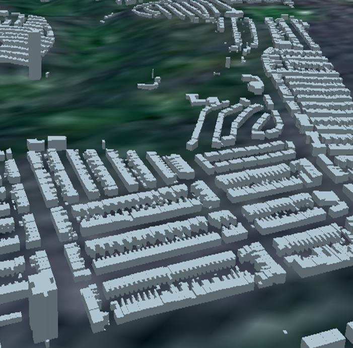
6 Workflow & Test Site


7 2D: Edge Detection Building extracted using OS Mastermap data. Investigation of common edge detectors Canny edge detector to extract perimeter of roof, ridge and valley lines Also extracts noise from roof texture and shadow Roof extracted from orthophoto Canny edge detection


8 3D: Scan line segmentation Originally proposed by Jiang & Bunke (1994) for segmentation of close range imagery. Classify cross sections of an image into lines then perform region growing to merge neighbouring lines and form planes. Investigated by Alharthy & Bethel (2004) for 3D reconstruction of buildings from lidar Limitations from point cloud spacing and polygon extraction moving the nodes from true position. Alharthy & Bethel, 2014


9 Scan line segmentation Gable roof Detection of breakpoints based on a change in the sign of the slope Ortho extraction ndsm profile Scan line segmentation Profile of detected breakpoints


10 Scan line segmentation M-Shaped roof Detection of breakpoints based on a change in the sign of the slope Ortho extraction ndsm profile Scan line segmentation Profile of detected breakpoints
11 Integration of datasets Canny edge detection extracts accurate location of roof edges but also extracts false positives from roof planes Scan line segmentation can be used as part of a process to extract planes but does not extract accurate location of roof edges
12 Scan line segmentation with edge detection Linear Regression of detected Canny edges incorporated into Iteratively fit line through data points and remove edges based on residuals of the fit


13 Scan line segmentation with edge detection Linear Regression of detected Canny edges Iteratively fit line through data points and remove edges based on residuals of the fit Canny edge detection Roof breakpoints from scan line segmentation
14 Conclusions & Future Work Conclusions Multi-ray photogrammetry offers an abundance of dense data that can be used for roof geometry extraction; Canny edge detection and scan line segmentation have their individual strengths which can overcome weaknesses for extracting roof geometry; Future Work Exploring threshold sensitivity of canny edge detection and linear regression Vectorising of extracted breakpoints Developing scan line segmentation approach for removal of vegetation
15 Thank you for listening References Alharthy, A. and Bethel, J. (2004) 'Detailed building reconstruction from airborne laser data using a moving surface method', International Archives of Photogrammetry and Remote Sensing, 35, pp Haala, N. (2014) High density image matching EuroSDR EduServ 2014 Pre-course seminar, Lecture conducted from Trento, Italy. Jiang, X. and Bunke, H. (1994) 'Fast segmentation of range images into planar regions by scan line grouping', Machine Vision and Application, (7), pp Rottensteiner, F., Sohn, G., Gerke, M., Wegner, J.D., Breitkopf, U. and Jung, J. (2014) 'Results of the ISPRS benchmark on urban object detection and 3D building reconstruction', ISPRS Journal of Photogrammetry and Remote Sensing, 93(0), pp Xiong, B., Oude Elbrink, S., Vosselman, G., (2014) A graph edit dictionary for correcting errors in roof topology graphs reconstructed from point clouds. ISPRS Journal of Photogrammetry and Remote Sensing 93, Acknowledgements This project is part funded by the Ordnance Survey and ESPRC. The authors would like to thank Ordnance Survey for the provision of aerial imagery, photogrammetric point cloud and DSM.
AUTOMATIC 3D BUILDING RECONSTRUCTION FROM A DENSE IMAGE MATCHING DATASET
 AUTOMATIC 3D BUILDING RECONSTRUCTION FROM A DENSE IMAGE MATCHING DATASET Andrew P. McClune a, Jon P. Mills a, Pauline E. Miller b, David A. Holland c a School of Civil Engineering and Geosciences, Newcastle
AUTOMATIC GENERATION OF DIGITAL BUILDING MODELS FOR COMPLEX STRUCTURES FROM LIDAR DATA
 AUTOMATIC GENERATION OF DIGITAL BUILDING MODELS FOR COMPLEX STRUCTURES FROM LIDAR DATA Changjae Kim a, Ayman Habib a, *, Yu-Chuan Chang a a Geomatics Engineering, University of Calgary, Canada - habib@geomatics.ucalgary.ca,
Automated Extraction of Buildings from Aerial LiDAR Point Cloud and Digital Imaging Datasets for 3D Cadastre - Preliminary Results
 Automated Extraction of Buildings from Aerial LiDAR Point Cloud and Digital Imaging Datasets for 3D Pankaj Kumar 1*, Alias Abdul Rahman 1 and Gurcan Buyuksalih 2 ¹Department of Geoinformation Universiti
AUTOMATIC MODEL SELECTION FOR 3D RECONSTRUCTION OF BUILDINGS FROM SATELLITE IMAGARY
 AUTOMATIC MODEL SELECTION FOR 3D RECONSTRUCTION OF BUILDINGS FROM SATELLITE IMAGARY T. Partovi a *, H. Arefi a,b, T. Krauß a, P. Reinartz a a German Aerospace Center (DLR), Remote Sensing Technology Institute,
Presented at the FIG Congress 2018, May 6-11, 2018 in Istanbul, Turkey
 Presented at the FIG Congress 2018, May 6-11, 2018 in Istanbul, Turkey Evangelos MALTEZOS, Charalabos IOANNIDIS, Anastasios DOULAMIS and Nikolaos DOULAMIS Laboratory of Photogrammetry, School of Rural
HEURISTIC FILTERING AND 3D FEATURE EXTRACTION FROM LIDAR DATA
 HEURISTIC FILTERING AND 3D FEATURE EXTRACTION FROM LIDAR DATA Abdullatif Alharthy, James Bethel School of Civil Engineering, Purdue University, 1284 Civil Engineering Building, West Lafayette, IN 47907
BUILDING MODEL RECONSTRUCTION FROM DATA INTEGRATION INTRODUCTION
 BUILDING MODEL RECONSTRUCTION FROM DATA INTEGRATION Ruijin Ma Department Of Civil Engineering Technology SUNY-Alfred Alfred, NY 14802 mar@alfredstate.edu ABSTRACT Building model reconstruction has been
AUTOMATED MODELING OF 3D BUILDING ROOFS USING IMAGE AND LIDAR DATA
 AUTOMATED MODELING OF 3D BUILDING ROOFS USING IMAGE AND LIDAR DATA N. Demir *, E. Baltsavias Institute of Geodesy and Photogrammetry, ETH Zurich, CH-8093, Zurich, Switzerland (demir, manos)@geod.baug.ethz.ch
Unwrapping of Urban Surface Models
 Unwrapping of Urban Surface Models Generation of virtual city models using laser altimetry and 2D GIS Abstract In this paper we present an approach for the geometric reconstruction of urban areas. It is
Comeback of Digital Image Matching
 Photogrammetric Week '09 Dieter Fritsch (Ed.) Wichmann Verlag, Heidelberg, 2009 Haala 289 Comeback of Digital Image Matching NORBERT HAALA, Stuttgart ABSTRACT Despite the fact that tools for automatic
COMBINING HIGH SPATIAL RESOLUTION OPTICAL AND LIDAR DATA FOR OBJECT-BASED IMAGE CLASSIFICATION
 COMBINING HIGH SPATIAL RESOLUTION OPTICAL AND LIDAR DATA FOR OBJECT-BASED IMAGE CLASSIFICATION Ruonan Li 1, Tianyi Zhang 1, Ruozheng Geng 1, Leiguang Wang 2, * 1 School of Forestry, Southwest Forestry
NATIONWIDE POINT CLOUDS AND 3D GEO- INFORMATION: CREATION AND MAINTENANCE GEORGE VOSSELMAN
 NATIONWIDE POINT CLOUDS AND 3D GEO- INFORMATION: CREATION AND MAINTENANCE GEORGE VOSSELMAN OVERVIEW National point clouds Airborne laser scanning in the Netherlands Quality control Developments in lidar
AUTOMATIC BUILDING DETECTION FROM LIDAR POINT CLOUD DATA
 AUTOMATIC BUILDING DETECTION FROM LIDAR POINT CLOUD DATA Nima Ekhtari, M.R. Sahebi, M.J. Valadan Zoej, A. Mohammadzadeh Faculty of Geodesy & Geomatics Engineering, K. N. Toosi University of Technology,
FOOTPRINTS EXTRACTION
 Building Footprints Extraction of Dense Residential Areas from LiDAR data KyoHyouk Kim and Jie Shan Purdue University School of Civil Engineering 550 Stadium Mall Drive West Lafayette, IN 47907, USA {kim458,
AUTOMATIC ROOF OUTLINES RECONSTRUCTION FROM PHOTOGRAMMETRIC DSM
 AUTOMATIC ROOF OUTLINES RECONSTRUCTION FROM PHOTOGRAMMETRIC DSM F. Nex, F. Remondino 3D Optical Metrology (3DOM) unit, Bruno Kessler Foundation (FBK), Trento, Italy @fbk.eu, http://3dom.fbk.eu
BUILDING DETECTION AND STRUCTURE LINE EXTRACTION FROM AIRBORNE LIDAR DATA
 BUILDING DETECTION AND STRUCTURE LINE EXTRACTION FROM AIRBORNE LIDAR DATA C. K. Wang a,, P.H. Hsu a, * a Dept. of Geomatics, National Cheng Kung University, No.1, University Road, Tainan 701, Taiwan. China-
Multiray Photogrammetry and Dense Image. Photogrammetric Week Matching. Dense Image Matching - Application of SGM
 Norbert Haala Institut für Photogrammetrie Multiray Photogrammetry and Dense Image Photogrammetric Week 2011 Matching Dense Image Matching - Application of SGM p q d Base image Match image Parallax image
Automatic Building Extrusion from a TIN model Using LiDAR and Ordnance Survey Landline Data
 Automatic Building Extrusion from a TIN model Using LiDAR and Ordnance Survey Landline Data Rebecca O.C. Tse, Maciej Dakowicz, Christopher Gold and Dave Kidner University of Glamorgan, Treforest, Mid Glamorgan,
Terrestrial Laser Scanning: Applications in Civil Engineering Pauline Miller
 Terrestrial Laser Scanning: Applications in Civil Engineering Pauline Miller School of Civil Engineering & Geosciences Newcastle University Overview Laser scanning overview Research applications geometric
AUTOMATIC RECONSTRUCTION OF BUILDING ROOFS THROUGH EFFECTIVE INTEGRATION OF LIDAR AND MULTISPECTRAL IMAGERY
 AUTOMATIC RECONSTRUCTION OF BUILDING ROOFS THROUGH EFFECTIVE INTEGRATION OF LIDAR AND MULTISPECTRAL IMAGERY Mohammad Awrangjeb, Chunsun Zhang and Clive S. Fraser Cooperative Research Centre for Spatial
REGISTRATION OF AIRBORNE LASER DATA TO SURFACES GENERATED BY PHOTOGRAMMETRIC MEANS. Y. Postolov, A. Krupnik, K. McIntosh
 REGISTRATION OF AIRBORNE LASER DATA TO SURFACES GENERATED BY PHOTOGRAMMETRIC MEANS Y. Postolov, A. Krupnik, K. McIntosh Department of Civil Engineering, Technion Israel Institute of Technology, Haifa,
AUTOMATED RECONSTRUCTION OF WALLS FROM AIRBORNE LIDAR DATA FOR COMPLETE 3D BUILDING MODELLING
 AUTOMATED RECONSTRUCTION OF WALLS FROM AIRBORNE LIDAR DATA FOR COMPLETE 3D BUILDING MODELLING Yuxiang He*, Chunsun Zhang, Mohammad Awrangjeb, Clive S. Fraser Cooperative Research Centre for Spatial Information,
AUTOMATIC EXTRACTION OF BUILDING ROOFS FROM PICTOMETRY S ORTHOGONAL AND OBLIQUE IMAGES
 AUTOMATIC EXTRACTION OF BUILDING ROOFS FROM PICTOMETRY S ORTHOGONAL AND OBLIQUE IMAGES Yandong Wang Pictometry International Corp. Suite A, 100 Town Centre Dr., Rochester, NY14623, the United States yandong.wang@pictometry.com
OBLIQUE AERIAL IMAGERY FOR NMA SOME BEST PRACTICES
 OBLIQUE AERIAL IMAGERY FOR NMA SOME BEST PRACTICES F. Remondino 1, I. Toschi 1, M. Gerke 2, F. Nex 2, D. Holland 3, A. McGill 4, J. Talaya Lopez 5, A. Magarinos 5 1 3D Optical Metrology (3DOM) unit, Bruno
OBLIQUE AERIAL IMAGES: POTENTIALITIES, APPLICATIONS AND BEST PRACTICES FRANCESCO NEX
 OBLIQUE AERIAL IMAGES: POTENTIALITIES, APPLICATIONS AND BEST PRACTICES FRANCESCO NEX f.nex@utwente.nl The history of oblique imagery First recorded aerial photo in the US (1860) by J.W. Black and S. King
Optics and Lasers in Engineering
 Optics and Lasers in Engineering 51 (2013) 493 502 Contents lists available at SciVerse ScienceDirect Optics and Lasers in Engineering journal homepage: www.elsevier.com/locate/optlaseng Integration of
AUTOMATIC EXTRACTION OF BUILDING FEATURES FROM TERRESTRIAL LASER SCANNING
 AUTOMATIC EXTRACTION OF BUILDING FEATURES FROM TERRESTRIAL LASER SCANNING Shi Pu and George Vosselman International Institute for Geo-information Science and Earth Observation (ITC) spu@itc.nl, vosselman@itc.nl
CO-REGISTERING AND NORMALIZING STEREO-BASED ELEVATION DATA TO SUPPORT BUILDING DETECTION IN VHR IMAGES
 CO-REGISTERING AND NORMALIZING STEREO-BASED ELEVATION DATA TO SUPPORT BUILDING DETECTION IN VHR IMAGES Alaeldin Suliman, Yun Zhang, Raid Al-Tahir Department of Geodesy and Geomatics Engineering, University
3D BUILDING MODEL GENERATION FROM AIRBORNE LASERSCANNER DATA BY STRAIGHT LINE DETECTION IN SPECIFIC ORTHOGONAL PROJECTIONS
 3D BUILDING MODEL GENERATION FROM AIRBORNE LASERSCANNER DATA BY STRAIGHT LINE DETECTION IN SPECIFIC ORTHOGONAL PROJECTIONS Ellen Schwalbe Institute of Photogrammetry and Remote Sensing Dresden University
ROOF PLANE SEGMENTATION BY COMBINING MULTIPLE IMAGES AND POINT CLOUDS
 ROOF PLANE SEGMENTATION BY COMBINING MULTIPLE IMAGES AND POINT CLOUDS Franz Rottensteiner Institute of Photogrammetry and GeoInformation, Leibniz University Hannover, Nienburger Strasse 1, 30167 Hannover,
[Youn *, 5(11): November 2018] ISSN DOI /zenodo Impact Factor
![[Youn *, 5(11): November 2018] ISSN DOI /zenodo Impact Factor](/thumbs/91/105079225.jpg "[Youn *, 5(11): November 2018] ISSN DOI /zenodo Impact Factor") GLOBAL JOURNAL OF ENGINEERING SCIENCE AND RESEARCHES AUTOMATIC EXTRACTING DEM FROM DSM WITH CONSECUTIVE MORPHOLOGICAL FILTERING Junhee Youn *1 & Tae-Hoon Kim 2 *1,2 Korea Institute of Civil Engineering
GLOBAL JOURNAL OF ENGINEERING SCIENCE AND RESEARCHES AUTOMATIC EXTRACTING DEM FROM DSM WITH CONSECUTIVE MORPHOLOGICAL FILTERING Junhee Youn *1 & Tae-Hoon Kim 2 *1,2 Korea Institute of Civil Engineering
ACCURATE BUILDING OUTLINES FROM ALS DATA
 ACCURATE BUILDING OUTLINES FROM ALS DATA Clode S.P. a, Kootsookos P.J. a, Rottensteiner F. b a The Intelligent Real-Time Imaging and Sensing Group School of Information Technology & Electrical Engineering
The ISPRS Benchmark on Urban Object Classification and 3D Building Reconstruction
 Franz Rottensteiner XXII ISPRS Congress Melbourne 2012 26 August 2012 The ISPRS Benchmark on Urban Object Classification and 3D Building Reconstruction Franz Rottensteiner a, Gunho Sohn b, Jaewook Jung
Cell Decomposition for Building Model Generation at Different Scales
 Cell Decomposition for Building Model Generation at Different Scales Norbert Haala, Susanne Becker, Martin Kada Institute for Photogrammetry Universität Stuttgart Germany forename.lastname@ifp.uni-stuttgart.de
A SEMI-AUTOMATIC APPROACH TO OBJECT EXTRACTION FROM A COMBINATION OF IMAGE AND LASER DATA
 In: Stilla U, Rottensteiner F, Paparoditis N (Eds) CMRT09. IAPRS, Vol. XXXVIII, Part 3/W4 --- Paris, France, 3-4 September, 2009 A SEMI-AUTOMATIC APPROACH TO OBJECT EXTRACTION FROM A COMBINATION OF IMAGE
RECOGNISING STRUCTURE IN LASER SCANNER POINT CLOUDS 1
 RECOGNISING STRUCTURE IN LASER SCANNER POINT CLOUDS 1 G. Vosselman a, B.G.H. Gorte b, G. Sithole b, T. Rabbani b a International Institute of Geo-Information Science and Earth Observation (ITC) P.O. Box
BUILDING BOUNDARY EXTRACTION FROM HIGH RESOLUTION IMAGERY AND LIDAR DATA
 BUILDING BOUNDARY EXTRACTION FROM HIGH RESOLUTION IMAGERY AND LIDAR DATA Liang Cheng, Jianya Gong, Xiaoling Chen, Peng Han State Key Laboratory of Information Engineering in Surveying, Mapping and Remote
Oblique aerial imagery in the praxis: applications and challenges
 ISPRS / EuroSDR Workshop on Oblique aerial cameras sensors and data processing Barcelona, 10 October 2017 Oblique aerial imagery in the praxis: applications and challenges Daniela Poli, Kjersti Moe, Klaus
ISPRS Journal of Photogrammetry and Remote Sensing
 ISPRS Journal of Photogrammetry and Remote Sensing 83 (2013) 1 18 Contents lists available at SciVerse ScienceDirect ISPRS Journal of Photogrammetry and Remote Sensing journal homepage: www.elsevier.com/locate/isprsjprs
GENERATING BUILDING OUTLINES FROM TERRESTRIAL LASER SCANNING
 GENERATING BUILDING OUTLINES FROM TERRESTRIAL LASER SCANNING Shi Pu International Institute for Geo-information Science and Earth Observation (ITC), Hengelosestraat 99, P.O. Box 6, 7500 AA Enschede, The
International Archives of Photogrammetry and Remote Sensing. Vol. XXXII, Part 5. Hakodate 1998
 International Archives of Photogrammetry and Remote Sensing. Vol. XXXII, Part 5. Hakodate 1998 RAPID ACQUISITION OF VIRTUAL REALITY CITY MODELS FROM MULTIPLE DATA SOURCES Claus Brenner and Norbert Haala
FAST PRODUCTION OF VIRTUAL REALITY CITY MODELS
 FAST PRODUCTION OF VIRTUAL REALITY CITY MODELS Claus Brenner and Norbert Haala Institute for Photogrammetry (ifp) University of Stuttgart Geschwister-Scholl-Straße 24, 70174 Stuttgart, Germany Ph.: +49-711-121-4097,
1. Introduction. A CASE STUDY Dense Image Matching Using Oblique Imagery Towards All-in- One Photogrammetry
 Submitted to GIM International FEATURE A CASE STUDY Dense Image Matching Using Oblique Imagery Towards All-in- One Photogrammetry Dieter Fritsch 1, Jens Kremer 2, Albrecht Grimm 2, Mathias Rothermel 1
Chapters 1 7: Overview
 Chapters 1 7: Overview Photogrammetric mapping: introduction, applications, and tools GNSS/INS-assisted photogrammetric and LiDAR mapping LiDAR mapping: principles, applications, mathematical model, and
CHANGE DETECTION FOR TOPOGRAPHIC MAPPING USING THREE- DIMENSIONAL DATA STRUCTURES
 CHANGE DETECTION FOR TOPOGRAPHIC MAPPING USING THREE- DIMENSIONAL DATA STRUCTURES D. M. Barber a, D. Holland b, J. P. Mills c a DSTL, Porton Down, Salisbury, SP4 OJQ, UK dbarber@dstl.gov.uk b Ordnance
Segmentation of 3D Photogrammetric Point Cloud for 3D Building Modeling
 Segmentation of 3D Photogrammetric Point Cloud for 3D Building Modeling EMRE ÖZDEMİR 1,2, Fabio Remondino 1 1 3D Optical Metrology unit Bruno Kessler Foundation (FBK) Trento, Italy https://3dom.fbk.eu
Lidar and GIS: Applications and Examples. Dan Hedges Clayton Crawford
 Lidar and GIS: Applications and Examples Dan Hedges Clayton Crawford Outline Data structures, tools, and workflows Assessing lidar point coverage and sample density Creating raster DEMs and DSMs Data area
Advanced point cloud processing
 Advanced point cloud processing George Vosselman ITC Enschede, the Netherlands INTERNATIONAL INSTITUTE FOR GEO-INFORMATION SCIENCE AND EARTH OBSERVATION Laser scanning platforms Airborne systems mounted
Aalborg Universitet. Published in: Accuracy Publication date: Document Version Early version, also known as pre-print
 Aalborg Universitet A method for checking the planimetric accuracy of Digital Elevation Models derived by Airborne Laser Scanning Høhle, Joachim; Øster Pedersen, Christian Published in: Accuracy 2010 Publication
A DATA DRIVEN METHOD FOR FLAT ROOF BUILDING RECONSTRUCTION FROM LiDAR POINT CLOUDS
 A DATA DRIVEN METHOD FOR FLAT ROOF BUILDING RECONSTRUCTION FROM LiDAR POINT CLOUDS A. Mahphood, H. Arefi *, School of Surveying and Geospatial Engineering, College of Engineering, University of Tehran,
A STUDY ON ROOF POINT EXTRACTION BASED ON ROBUST ESTIMATION FROM AIRBORNE LIDAR DATA
 Journal of the Chinese Institute of Engineers, Vol. 31, No. 4, pp. 537-550 (2008) 537 A STUDY ON ROOF POINT EXTRACTION BASED ON ROBUST ESTIMATION FROM AIRBORNE LIDAR DATA Shih-Hong Chio ABSTRACT The airborne
BUILDING ROOF RECONSTRUCTION BY FUSING LASER RANGE DATA AND AERIAL IMAGES
 BUILDING ROOF RECONSTRUCTION BY FUSING LASER RANGE DATA AND AERIAL IMAGES J.J. Jaw *,C.C. Cheng Department of Civil Engineering, National Taiwan University, 1, Roosevelt Rd., Sec. 4, Taipei 10617, Taiwan,
COMBINING HIGH RESOLUTION SATELLITE IMAGERY AND AIRBORNE LASER SCANNING DATA FOR GENERATING BARELAND DEM IN URBAN AREAS
 COMBINING HIGH RESOLUTION SATELLITE IMAGERY AND AIRBORNE LASER SCANNING DATA FOR GENERATING BARELAND IN URBAN AREAS Guo Tao *, Yoshifumi Yasuoka Institute of Industrial Science, University of Tokyo, 4-6-1
CELL DECOMPOSITION FOR THE GENERATION OF BUILDING MODELS AT MULTIPLE SCALES
 CELL DECOMPOSITION FOR THE GENERATION OF BUILDING MODELS AT MULTIPLE SCALES Norbert Haala, Susanne Becker, Martin Kada Institute for Photogrammetry, Universitaet Stuttgart Geschwister-Scholl-Str. 24D,
STEREO IMAGE POINT CLOUD AND LIDAR POINT CLOUD FUSION FOR THE 3D STREET MAPPING
 STEREO IMAGE POINT CLOUD AND LIDAR POINT CLOUD FUSION FOR THE 3D STREET MAPPING Yuan Yang, Ph.D. Student Zoltan Koppanyi, Post-Doctoral Researcher Charles K Toth, Research Professor SPIN Lab The University
A LINE-BASED 3D ROOF MODEL RECONSTRUCTION ALGORITHM: TIN-MERGING AND RESHAPING (TMR)
") A LINE-BASED 3D ROOF MODEL RECONSTRUCTION ALGORITHM: TIN-MERGING AND RESHAPING (TMR) Jiann-Yeou Rau Assistant Professor, Department of Geomatics, National Cheng Kung University, No.1 University Road, Tainan
A LINE-BASED 3D ROOF MODEL RECONSTRUCTION ALGORITHM: TIN-MERGING AND RESHAPING (TMR) Jiann-Yeou Rau Assistant Professor, Department of Geomatics, National Cheng Kung University, No.1 University Road, Tainan
AN IMPROVED APPROACH FOR AUTOMATIC DETECTION OF CHANGES IN BUILDINGS
 AN IMPROVED APPROACH FOR AUTOMATIC DETECTION OF CHANGES IN BUILDINGS Leena Matikainen *, Juha Hyyppä, Eero Ahokas, Lauri Markelin, Harri Kaartinen Finnish Geodetic Institute, Department of Remote Sensing
Vexcel Imaging Ve V x e c x el e I l maging I G maging mbh www. wwwv. e v x e c x e c l e -limaging. - c imaging. om c
 Vexcel Imaging History 2016 MBO: becomes a privately owned company again 2006 Vexcel Imaging acquired by Microsoft Corp., Redmond/USA 2003 1992 1985 Merger of Vexcel Corp. & Vexcel Imaging 1 st Digital
INTEGRATION OF LIDAR DATA INTO A MUNICIPAL GIS TO STUDY SOLAR RADIATION
 International Archives of the Photogrammetry, Remote Sensing and Spatial Information Sciences, INTEGRATION OF LIDAR DATA INTO A MUNICIPAL GIS TO STUDY SOLAR RADIATION P. Africanib, G. Bitellia, A. Lambertinia,,
Interpretation of Urban Surface Models using 2D Building Information Norbert Haala and Claus Brenner Institut fur Photogrammetrie Universitat Stuttgar
 Interpretation of Urban Surface Models using 2D Building Information Norbert Haala and Claus Brenner Institut fur Photogrammetrie Universitat Stuttgart Geschwister-Scholl-Strae 24, 70174 Stuttgart, Germany
A COMPETITION BASED ROOF DETECTION ALGORITHM FROM AIRBORNE LIDAR DATA
 A COMPETITION BASED ROOF DETECTION ALGORITHM FROM AIRBORNE LIDAR DATA HUANG Xianfeng State Key Laboratory of Informaiton Engineering in Surveying, Mapping and Remote Sensing (Wuhan University), 129 Luoyu
The raycloud A Vision Beyond the Point Cloud
 The raycloud A Vision Beyond the Point Cloud Christoph STRECHA, Switzerland Key words: Photogrammetry, Aerial triangulation, Multi-view stereo, 3D vectorisation, Bundle Block Adjustment SUMMARY Measuring
EVOLUTION OF POINT CLOUD
 Figure 1: Left and right images of a stereo pair and the disparity map (right) showing the differences of each pixel in the right and left image. (source: https://stackoverflow.com/questions/17607312/difference-between-disparity-map-and-disparity-image-in-stereo-matching)
SEGMENTATION AND CLASSIFICATION OF POINT CLOUDS FROM DENSE AERIAL IMAGE MATCHING
 SEGMENTATION AND CLASSIFICATION OF POINT CLOUDS FROM DENSE AERIAL IMAGE MATCHING ABSTRACT Mohammad Omidalizarandi 1 and Mohammad Saadatseresht 2 1 University of Stuttgart, Germany mohammadzarandi@gmail.com
Automatic image network design leading to optimal image-based 3D models
 Automatic image network design leading to optimal image-based 3D models Enabling laymen to capture high quality 3D models of Cultural Heritage Bashar Alsadik & Markus Gerke, ITC, University of Twente,
POINT CLOUDS AND DERIVATIVES FOR NATIONWIDE GEOSPATIAL INFORMATION GEORGE VOSSELMAN
 POINT CLOUDS AND DERIVATIVES FOR NATIONWIDE GEOSPATIAL INFORMATION GEORGE VOSSELMAN OVERVIEW Point cloud generation and quality control New lidar technologies Dense matching Updating nationwide point clouds
OBJECT extraction and modeling from images has been
 IEEE GEOSCIENCE AND REMOTE SENSING LETTERS, VOL. 12, NO. 1, JANUARY 21. THIS IS A SUBMITTED VERSION; FINAL VERSION OF A PAPER IS HERE.1 A Metric for Polygon Comparison and Building Extraction Evaluation
GRAPHICS TOOLS FOR THE GENERATION OF LARGE SCALE URBAN SCENES
 GRAPHICS TOOLS FOR THE GENERATION OF LARGE SCALE URBAN SCENES Norbert Haala, Martin Kada, Susanne Becker, Jan Böhm, Yahya Alshawabkeh University of Stuttgart, Institute for Photogrammetry, Germany Forename.Lastname@ifp.uni-stuttgart.de
Building Segmentation and Regularization from Raw Lidar Data INTRODUCTION
 Building Segmentation and Regularization from Raw Lidar Data Aparajithan Sampath Jie Shan Geomatics Engineering School of Civil Engineering Purdue University 550 Stadium Mall Drive West Lafayette, IN 47907-2051
IMPROVING 2D CHANGE DETECTION BY USING AVAILABLE 3D DATA
 IMPROVING 2D CHANGE DETECTION BY USING AVAILABLE 3D DATA C.J. van der Sande a, *, M. Zanoni b, B.G.H. Gorte a a Optical and Laser Remote Sensing, Department of Earth Observation and Space systems, Delft
Building Extraction from Satellite Images
 IOSR Journal of Computer Engineering (IOSR-JCE) e-issn: 2278-0661, p- ISSN: 2278-8727Volume 12, Issue 2 (May. - Jun. 2013), PP 76-81 Building Extraction from Satellite Images A.S. Bhadauria, H.S. Bhadauria,
BUILDING RECONSTRUCTION USING LIDAR DATA
 BUILDING RECONSTRUCTION USING LIDAR DATA R. O.C. Tse, M. Dakowicz, C.M. Gold, and D.B. Kidner GIS Research Centre, School of Computing, University of Glamorgan, Pontypridd, CF37 1DL, Wales, UK. rtse@glam.ac.uk,mdakowic@glam.ac.uk,cmgold@glam.ac.uk,
2. POINT CLOUD DATA PROCESSING
 Point Cloud Generation from suas-mounted iphone Imagery: Performance Analysis A. D. Ladai, J. Miller Towill, Inc., 2300 Clayton Road, Suite 1200, Concord, CA 94520-2176, USA - (andras.ladai, jeffrey.miller)@towill.com
Image-based 3D Data Capture in Urban Scenarios
 Photogrammetric Week '15 Dieter Fritsch (Ed.) Wichmann/VDE Verlag, Belin & Offenbach, 2015 Haala, Rothermel 119 Image-based 3D Data Capture in Urban Scenarios Norbert Haala, Mathias Rothermel, Stuttgart
IEEE JOURNAL OF SELECTED TOPICS IN APPLIED EARTH OBSERVATIONS AND REMOTE SENSING 1
 IEEE JOURNAL OF SELECTED TOPICS IN APPLIED EARTH OBSERVATIONS AND REMOTE SENSING 1 An Automatic and Threshold-Free Performance Evaluation System for Building Extraction Techniques From Airborne LIDAR Data
LOCALIZED SEGMENT BASED PROCESSING FOR AUTOMATIC BUILDING EXTRACTION FROM LiDAR DATA
 LOCALIZED SEGMENT BASED PROCESSING FOR AUTOMATIC BUILDING EXTRACTION FROM LiDAR DATA Gaurav Parida a, K. S. Rajan a a Lab for Spatial Informatics, International Institute of Information Technology Hyderabad,
INTEGRATED METHOD OF BUILDING EXTRACTION FROM DIGITAL SURFACE MODEL AND IMAGERY
 INTEGRATED METHOD OF BUILDING EXTRACTION FROM DIGITAL SURFACE MODEL AND IMAGERY Yan Li 1, *, Lin Zhu, Hideki Shimamura, 1 International Institute for Earth System Science, Nanjing University, Nanjing,
Article HRTT: A Hierarchical Roof Topology Structure for Robust Building Roof Reconstruction from Point Clouds
 Article HRTT: A Hierarchical Roof Topology Structure for Robust Building Roof Reconstruction from Point Clouds Bo Xu 1, Wanshou Jiang 1, *, and Lelin Li 2 1 State Key Laboratory of Information Engineering
Semi-Automatic Building Extraction from High Resolution Imagery Based on Segmentation
 Semi-Automatic Building Extraction from High Resolution Imagery Based on Segmentation N. Jiang a, b,*, J.X. Zhang a, H.T. Li a a,c, X.G. Lin a Chinese Academy of Surveying and Mapping, Beijing 100039,
Urban Site Modeling From LiDAR
 Urban Site Modeling From LiDAR Suya You, Jinhui Hu, Ulrich Neumann, and Pamela Fox Integrated Media Systems Center Computer Science Department University of Southern California Los Angeles, CA 90089-0781
ifp ifp Project Implementation Institut für Photogrammetrie virtualcitysystems, Dresden 3D Geo, Potsdam (now part of Autodesk) Starsoda, Berlin
 Starsoda, Berlin") Institut für Photogrammetrie The 3D Berlin Project Un niversit Martin Kada Institute for Photogrammetry y of Stut Project Implementation virtualcitysystems, Dresden Reconstruction ti of 3D building geometry
Institut für Photogrammetrie The 3D Berlin Project Un niversit Martin Kada Institute for Photogrammetry y of Stut Project Implementation virtualcitysystems, Dresden Reconstruction ti of 3D building geometry
WAVELET AND SCALE-SPACE THEORY IN SEGMENTATION OF AIRBORNE LASER SCANNER DATA
 WAVELET AND SCALE-SPACE THEORY IN SEGMENTATION OF AIRBORNE LASER SCANNER DATA T.Thuy VU, Mitsuharu TOKUNAGA Space Technology Applications and Research Asian Institute of Technology P.O. Box 4 Klong Luang,
BUILDING MODELING FROM NOISY PHOTOGRAMMETRIC POINT CLOUDS
 BUILDING MODELING FROM NOISY PHOTOGRAMMETRIC POINT CLOUDS B. Xiong a, *, S. Oude Elberink a, G. Vosselman a a ITC, University of Twente, the Netherlands - (b.xiong, s.j.oudeelberink, george.vosselman)@utwente.nl
FUSION OF AIRBORNE OPTICAL AND LIDAR DATA FOR AUTOMATED BUILDING RECONSTRUCTION
 FUSION OF AIRBORNE OPTICAL AND LIDAR DATA FOR AUTOMATED BUILDING RECONSTRUCTION Nikolaos Kokkas, Experimental Officer (PhD researcher in UCL*) Institute of Engineering Surveying & Space Geodesy School
BUILDING POINT GROUPING USING VIEW-GEOMETRY RELATIONS INTRODUCTION
 BUILDING POINT GROUPING USING VIEW-GEOMETRY RELATIONS I-Chieh Lee 1, Shaojun He 1, Po-Lun Lai 2, Alper Yilmaz 2 1 Mapping and GIS Laboratory 2 Photogrammetric Computer Vision Laboratory Dept. of Civil
Development of Geospatial Smart Cities and Management
 Presented at the FIG Congress 2018, May 6-11, 2018 in Istanbul, Turkey Development of Geospatial Smart Cities and Management (E. Yılmaz, F. Kartal, E. Uçar, K. Eren) FIG2018 - Istanbul, 8 th May 2018 1
LASERDATA LIS build your own bundle! LIS Pro 3D LIS 3.0 NEW! BETA AVAILABLE! LIS Road Modeller. LIS Orientation. LIS Geology.
 LIS 3.0...build your own bundle! NEW! LIS Geology LIS Terrain Analysis LIS Forestry LIS Orientation BETA AVAILABLE! LIS Road Modeller LIS Editor LIS City Modeller colors visualization I / O tools arithmetic
THE ISPRS/EUROSDR BENCHMARK ON MULTI-PLATFORM PHOTOGRAMMETRY: RESULTS AND LESSON LEARNT FRANCESCO NEX AND MARKUS GERKE
 THE ISPRS/EUROSDR BENCHMARK ON MULTI-PLATFORM PHOTOGRAMMETRY: RESULTS AND LESSON LEARNT FRANCESCO NEX AND MARKUS GERKE Overview Summary of the results Statistics Data release What s next? ISPRS / EuroSDR
ON MODELLING AND VISUALISATION OF HIGH RESOLUTION VIRTUAL ENVIRONMENTS USING LIDAR DATA
 Geoinformatics 2004 Proc. 12th Int. Conf. on Geoinformatics Geospatial Information Research: Bridging the Pacific and Atlantic University of Gävle, Sweden, 7-9 June 2004 ON MODELLING AND VISUALISATION
Prof. Jose L. Flores, MS, PS Dept. of Civil Engineering & Surveying
 Prof. Jose L. Flores, MS, PS Dept. of Civil Engineering & Surveying Problem One of the challenges for any Geographic Information System (GIS) application is to keep the spatial data up to date and accurate.
FAST REGISTRATION OF TERRESTRIAL LIDAR POINT CLOUD AND SEQUENCE IMAGES
 FAST REGISTRATION OF TERRESTRIAL LIDAR POINT CLOUD AND SEQUENCE IMAGES Jie Shao a, Wuming Zhang a, Yaqiao Zhu b, Aojie Shen a a State Key Laboratory of Remote Sensing Science, Institute of Remote Sensing
Surface and Terrain Models
 Advanced Matching Techniques for High Precision Surface and Terrain Models Introduction Comeback of image matching for DTM & DSM generation Very few professional tools for DSM generation from image matching
3D Topography acquisition Literature study and PhD proposal
 3D Topography acquisition Literature study and PhD proposal Sander Oude Elberink December 2005 RGI 3D Topo DP 1-4 Status: definitive i Table of contents 1. Introduction...1 1.1. Background...1 1.2. Goal...1
Creating and Maintaining Your 3D Basemap. Brian Sims Dan Hedges Gert van Maren
 Creating and Maintaining Your 3D Basemap Brian Sims Dan Hedges Gert van Maren Complementary Resource Email (no marketing) A copy of the presentation Links to today s web demos Links to training materials
Trimble Geospatial Division Integrated Solutions for Geomatics professions. Volker Zirn Regional Sales Representative
 Trimble Geospatial Division Integrated Solutions for Geomatics professions Volker Zirn Regional Sales Representative 1 Agenda Trimble GeoSpatial Division Airborne System Solutions Trimble Inpho Software
STATUS OF AIRBORNE OBLIQUE IMAGING EUROSDR COMMISSION I PROJECT OBLIQUE IMAGERY. Markus Gerke May 15, 2014
 STATUS OF AIRBORNE OBLIQUE IMAGING EUROSDR COMMISSION I PROJECT OBLIQUE IMAGERY Markus Gerke May 15, 2014 THE FIRST AIRBORNE PHOTOS WERE OBLIQUE First recorded aerial photograph in the US (Boston), by
REFINEMENT OF BUILDING FASSADES BY INTEGRATED PROCESSING OF LIDAR AND IMAGE DATA
 In: Stilla U et al (Eds) PIA07. International Archives of Photogrammetry, Remote Sensing and Spatial Information Sciences, 36 (3/W49A) REFINEMENT OF BUILDING FASSADES BY INTEGRATED PROCESSING OF LIDAR
STATE-OF-THE-ART in DENSE IMAGE MATCHING
 STATE-OF-THE-ART in DENSE IMAGE MATCHING Fabio REMONDINO 3D Optical Metrology (3DOM) Bruno Kessler Foundation (FBK) Trento, Italy Email: remondino@fbk.eu http://3dom.fbk.eu Bruno Kessler Foundation (FBK)
APPLICATION OF SOFTMAX REGRESSION AND ITS VALIDATION FOR SPECTRAL-BASED LAND COVER MAPPING
 APPLICATION OF SOFTMAX REGRESSION AND ITS VALIDATION FOR SPECTRAL-BASED LAND COVER MAPPING J. Wolfe a, X. Jin a, T. Bahr b, N. Holzer b, * a Harris Corporation, Broomfield, Colorado, U.S.A. (jwolfe05,
AN ADAPTIVE APPROACH FOR SEGMENTATION OF 3D LASER POINT CLOUD
 AN ADAPTIVE APPROACH FOR SEGMENTATION OF 3D LASER POINT CLOUD Z. Lari, A. F. Habib, E. Kwak Department of Geomatics Engineering, University of Calgary, Calgary, Alberta, Canada TN 1N4 - (zlari, ahabib,