Small-footprint full-waveform airborne LiDAR for habitat assessment in the ChangeHabitats2 project
|
|
|
- Gregory Randall
- 5 years ago
- Views:
Transcription


1 Small-footprint full-waveform airborne LiDAR for habitat assessment in the ChangeHabitats2 project Werner Mücke, András Zlinszky, Sharif Hasan, Martin Pfennigbauer, Hermann Heilmeier and Norbert Pfeifer Research Groups Photogrammetry & Remote Sensing Department of Geodesy and Geoinformation Vienna University of Technology geo.tuwien.ac.at
 European")


2 Motivation (c) European Commission 2011: ~ km² ~ 18% of EU landmass Netherlands, November 2013 W. Mücke 2


3 Motivation Natura 2000 habitat quality assessment Carried out by ecologists / biologists 760k km² experts in landscape character assessment AND in-situ, manually and terrestrially Obligatory frequent monitoring Reporting periods of 6 years More realistically it s 10 years! How can we use remote sensing to support this process? Netherlands, November 2013 W. Mücke 3
4 Motivation?? LiDAR data become increasingly available in better and better quality with wider and wider coverage There is more to them than?? / Legend LIDAR coverage of Europe? none/no data no info full scan complete partial LIDAR coverage just a DSM and a DTM ;-) full scan in progress Netherlands, November 2013 W. Mücke 4
5 CH2 approach and selected applications Habitat quality can be defined by three main parameters: Species Structure Disturbance Assess various metrics based on LiDAR data Some describe parameters directly, others indirectly (proxies) 3 applications and derivation of relevant metrics 1. Classification of grassland types 2. Identification of dead wood in forests 3. Detection of linear features in landscapes Netherlands, November 2013 W. Mücke 5

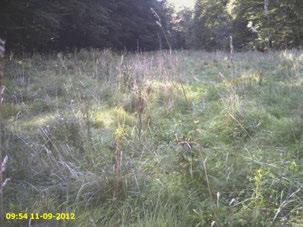
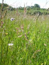
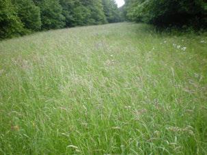

6 Grassland types: Aims Not vegetation Wet high Open soil Wet meadow Abandoned Fringe Dry meadow Lowland hay meadow Meadow - like Netherlands, November 2013 W. Mücke 6
 + March 2012 (leaf-off) RIEGL LMS-Q680i point density: last echoes: 12,8 / m² Height accuracy: 3.1 cm Swath discrepencies Netherlands, November 2013 W.")
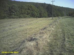
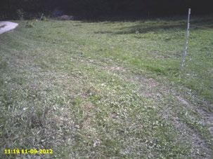
7 Grassland types: Study site and data Field data May + Sept 2012, April + May 2013 mapped literally everything they saw and could parameters related to species, structure or disturbance LiDAR data July 2011 (leaf-on) + March 2012 (leaf-off) RIEGL LMS-Q680i point density: last echoes: 12,8 / m² Height accuracy: 3.1 cm Swath discrepencies Netherlands, November 2013 W. Mücke 7
8 Training data Grassland types: Method(s) Classifier settings Learning process Validation data LiDAR input / primary layers 0,5 * 0,5 m² rasters of... Echo Width Reflectance Sigma Z Openness LiDAR metric Correlates with vegetation... biomass, penetration water content (dryness) surface roughness, penetration surface pattern Subset of layers Expert validation Trained classifiers Classified vegetation maps Quality control ndsm Canopy height Netherlands, November 2013 W. Mücke 8


")


9 Grassland types: Method(s) 0,5 * 0,5 m² rasters of... Echo Width Training data LiDAR metric Correlates with vegetation... Classifier settings biomass, penetration Learning process Validation data LiDAR Reflectance input / primary layers Sigma Z Openness ndsm water content (dryness) surface roughness, penetration surface pattern Subset of layers Canopy height Expert validation Trained classifiers Classified vegetation maps Quality control Netherlands, November 2013 W. Mücke 9

10 Training data Grassland types: Method(s) Classifier settings Learning process Validation data LiDAR input / primary layers 0,5 * 0,5 m² rasters of... Echo Width Reflectance Sigma Z Openness ndsm LiDAR metric Correlates with vegetation... surface roughness, penetration water content (wet- or dryness) surface roughness, penetration surface pattern Canopy height Subsets of layers Expert validation Trained classifiers Classified vegetation maps Quality control Netherlands, November 2013 W. Mücke 10
11 Grassland types: Example LiDAR subsets in study site 50 Meters Netherlands, November 2013 W. Mücke 11

12 Grassland types: Results No data / masked 50 Meters Netherlands, November 2013 W. Mücke 12


13 Grassland types: Results No data / masked 50 Meters Adding class probability Netherlands, November 2013 W. Mücke 13

14 Grassland types: Results and evaluation Classified as Reference class not open low. hay meadow dry wet user's acc. vegetation soil shrub fringe abandoned mea. like Lawn wet meadow meadow high totals [%] not vegetation ,9 open soil ,3 Automatic shrub ,2 fringe ,9 Reproducible abandoned ,7 lowland hay meadow ,3 Robust meadow like ,9 artificial lawn ,8 wet meadow ,3 dry meadow ,2 wet high ,5 totals producer s acc. [%] 93,9 37,9 76,5 36,2 48,3 57,4 23,0 88,8 45,3 45,2 65,1 68,8 Netherlands, November 2013 W. Mücke 14
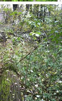
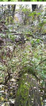
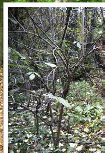
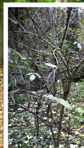
15 Deadwood detection: Aims Netherlands, November 2013 W. Mücke 15
16 Deadwood detection: Study site and data ALS data Spring 2012 (March 28) RIEGL LMS-Q680i point density: all echoes: 29,4 / m² last echoes: 10,9 / m² Height accuracy: 2.9 cm Strip discrepancies Netherlands, November 2013 W. Mücke 16

17 Deadwood detection: Study site and data Field data Collected in Spring, Summer and Winter 2012 GNSS and tape measurements of Downed stems Snags and fine woody debris Photographs Netherlands, November 2013 W. Mücke 17
18 Deadwood detection: Method Stepwise process Filtering of point cloud Morphological image processing Raster map algebra Final result: Regions (i.e. 2D outlines) of downed stems 18


")
 Netherlands,")
19 Deadwood detection: Results and evaluation Classification based on Shape of object /Area / perimeter) Surface roughness (cf. Ew var ) Netherlands, November 2013 W. Mücke 19
20 Deadwood detection: Results and evaluation W. Mücke, B. Deák, A. Schroiff, M. Hollaus & N. Pfeifer: Detection of fallen trees in forested areas using full-waveform airborne laser scanning data. Canadian Journal of Remote Sensing (accepted, already available online) Completeness = 75, 6 % Correctness = 89, 9 % Netherlands, November 2013 W. Mücke 20


21 Linear feature detection: Aims Find indicators for human influence on landscapes Netherlands, November 2013 W. Mücke 21


22 Linear feature detection: Method(s) Combination of various LiDAR derivatives DTM, ndsm, slope, curvature, openness, reflectance, echo width, echo count Raster map algebra Classification (rule-based, SVM) Morphological image processing Hough transform Netherlands, November 2013 W. Mücke 22


23 Linear feature detection: Examples Powerline detection 1. Aerial image 2. Orienteering map 3. Classified powerline pixels 4. Powerline delineated Netherlands, November 2013 W. Mücke 23


24 Linear feature detection: Examples Asphalt roads and other linear features Netherlands, November 2013 W. Mücke 24

25 Conclusions Landscape assessment w.r.t. N2000 is a complex task Manual field work and expert knowledge is and will always be necessary Remote sensing can support the process Save manual (field) work save time save money with robust, reproducible and automatic methods Identification: find hot spots, areas of significant change Quantification: provide objective, area wide estimations CH2 aims at supporting the otherwise cumbersome assessment process in every possible way! Netherlands, November 2013 W. Mücke 25
26 Acknowledgements The ChangeHabitats2 Team especially Anke Schroiff, Balázs Deák, Agnés Vari, Adam Kania, Hermann Heilmeier RIEGL Laser Measurment Systems GmbH kindly provided their company airplane, some laser scanners and working hours Some pictures & figures I borrowed from Google Maps - Panoramio Netherlands, November 2013 W. Mücke 26
27 The obligatory extra slides... ;-) In the following some additional information on Grassland type estimation Dead wood identification Linear feature detection Netherlands, November 2013 W. Mücke 27


28 Grassland types: Example LiDAR subsets in study site Reflectance Echo width Openness sigmaz ndsm 50 Meters Netherlands, November 2013 W. Mücke 28


29 Deadwood detection: Method Ohne EW-Filter Mit EW-Filter Stepwise process Filtering of point cloud Morphological image processing Raster map algebra Final result: Regions of downed stems Netherlands, November 2013 W. Mücke 30
30 Deadwood detection: Results and evaluation Reference stem was marked as found, if correspondence with automatically derived outline was bigger than 75% partly found, if correspondence with outline was less than 75% not found, if no corresponding outline was found Netherlands, November 2013 W. Mücke 31
31 Deadwood detection: Results and evaluation Completeness = TP ( TP + FN ) Correctness = TP ( TP + FP ) With a TP is True Positive (TP): stem was found and is in reference If it was found and decay state was 1,2 or 3 False Positive (FP): found, but not in reference If partly found and decay state was 2 or 3 False Negative ELMF (FN): Amsterdam, not found, The but in reference Netherlands, November 2013 W. Mücke 32
 TP Correctness = ( TP + FP")
: stem was found and is in reference")
: not found, but in reference Netherlands,")
32 Deadwood detection: Comparison of discrete and FWF ALS II I III TP Completeness = ( TP + FN ) TP Correctness = ( TP + FP ) Result from discrete ALS includes more FPs! With True Positive (TP): stem was found and is in reference False Positive (FP): found, but not in reference False Negative (FN): not found, but in reference Netherlands, November 2013 W. Mücke 33


33 Deadwood detection: Conclusions Well-preserved stems are found reliably Also if they are covered by fine woody debris or vital vegetation (31 of 40 pc.) Decay state and diameter have major influence < 10 cm was impossible DTM calculation method should Minimize influence of low vegetation BUT not at the same time eliminate small scale topography Influences of sensor characteristics and flight parameters Adaption of thresholds Netherlands, November 2013 W. Mücke 34
UAS based laser scanning for forest inventory and precision farming
 UAS based laser scanning for forest inventory and precision farming M. Pfennigbauer, U. Riegl, P. Rieger, P. Amon RIEGL Laser Measurement Systems GmbH, 3580 Horn, Austria Email: mpfennigbauer@riegl.com,
LIDAR. Exploiting the Versatility of a measurement principle in Photogrammetry. Norbert Pfeifer Department of Geodesy and Geoinformation TU Wien
 LIDAR Exploiting the Versatility of a measurement principle in Photogrammetry Norbert Pfeifer Department of Geodesy and Geoinformation TU Wien Photogrammetry and cameras TU Wien, 200th anniversary November
QUALITY ASSESSMENT OF LIDAR BASED DSM MODEL IN THE FRAME OF CHANGEHABITATS2 PROJECT
 Analele Universităţii din Oradea, Fascicula Protecţia Mediului Vol. XXI, 2013 QUALITY ASSESSMENT OF LIDAR BASED DSM MODEL IN THE FRAME OF CHANGEHABITATS2 PROJECT Hunyadi Gergely*, Fórián Tünde*, Tamás
Airborne LiDAR Data Acquisition for Forestry Applications. Mischa Hey WSI (Corvallis, OR)
") Airborne LiDAR Data Acquisition for Forestry Applications Mischa Hey WSI (Corvallis, OR) WSI Services Corvallis, OR Airborne Mapping: Light Detection and Ranging (LiDAR) Thermal Infrared Imagery 4-Band
Airborne LiDAR Data Acquisition for Forestry Applications Mischa Hey WSI (Corvallis, OR) WSI Services Corvallis, OR Airborne Mapping: Light Detection and Ranging (LiDAR) Thermal Infrared Imagery 4-Band
Lidar Sensors, Today & Tomorrow. Christian Sevcik RIEGL Laser Measurement Systems
 Lidar Sensors, Today & Tomorrow Christian Sevcik RIEGL Laser Measurement Systems o o o o Online Waveform technology Stand alone operation no field computer required Remote control through wireless network
ANALYSIS OF FULL-WAVEFORM ALS DATA BY SIMULTANEOUSLY ACQUIRED TLS DATA: TOWARDS AN ADVANCED DTM GENERATION IN WOODED AREAS
 ANALYSIS OF FULL-WAVEFORM ALS DATA BY SIMULTANEOUSLY ACQUIRED TLS DATA: TOWARDS AN ADVANCED DTM GENERATION IN WOODED AREAS M. Doneus a,b *, C. Briese a,c, N. Studnicka d a Ludwig Boltzmann Institute for
CLASSIFICATION OF NONPHOTOGRAPHIC REMOTE SENSORS
 CLASSIFICATION OF NONPHOTOGRAPHIC REMOTE SENSORS PASSIVE ACTIVE DIGITAL CAMERA THERMAL (e.g. TIMS) VIDEO CAMERA MULTI- SPECTRAL SCANNERS VISIBLE & NIR MICROWAVE HYPERSPECTRAL (e.g. AVIRIS) SLAR Real Aperture
Laser scanners with echo digitization for full waveform analysis
 Laser scanners with echo digitization for full waveform analysis Peter Rieger, Andreas Ullrich, Rainer Reichert RIEGL Laser Measurement Systems GmbH DI Peter Rieger Project Management RIEGL LMS GmbH A-3580
High Resolution Tree Models: Modeling of a Forest Stand Based on Terrestrial Laser Scanning and Triangulating Scanner Data
 ELMF 2013, 11-13 November 2013 Amsterdam, The Netherlands High Resolution Tree Models: Modeling of a Forest Stand Based on Terrestrial Laser Scanning and Triangulating Scanner Data Lothar Eysn Lothar.Eysn@geo.tuwien.ac.at
An Introduction to Lidar & Forestry May 2013
 An Introduction to Lidar & Forestry May 2013 Introduction to Lidar & Forestry Lidar technology Derivatives from point clouds Applied to forestry Publish & Share Futures Lidar Light Detection And Ranging
POTENTIAL OF FULL WAVEFORM AIRBORNE LASER SCANNING DATA FOR URBAN AREA CLASSIFICATION - TRANSFER OF CLASSIFICATION APPROACHES BETWEEN MISSIONS
 POTENTIAL OF FULL WAVEFORM AIRBORNE LASER SCANNING DATA FOR URBAN AREA CLASSIFICATION - TRANSFER OF CLASSIFICATION APPROACHES BETWEEN MISSIONS G. Tran a,b, *,D. Nguyen a,c, M. Milenkovic a, N. Pfeifer
DETECTION OF LYING TREE STEMS FROM AIRBORNE LASER SCANNING DATA USING A LINE TEMPLATE MATCHING ALGORITHM
 DETECTION OF LYING TREE STEMS FROM AIRBORNE LASER SCANNING DATA USING A LINE TEMPLATE MATCHING ALGORITHM Eva Lindberg a,b *, Markus Hollaus a, Werner Mücke a, Johan E. S. Fransson b, Norbert Pfeifer a
NATIONWIDE POINT CLOUDS AND 3D GEO- INFORMATION: CREATION AND MAINTENANCE GEORGE VOSSELMAN
 NATIONWIDE POINT CLOUDS AND 3D GEO- INFORMATION: CREATION AND MAINTENANCE GEORGE VOSSELMAN OVERVIEW National point clouds Airborne laser scanning in the Netherlands Quality control Developments in lidar
Automated Extraction of Buildings from Aerial LiDAR Point Cloud and Digital Imaging Datasets for 3D Cadastre - Preliminary Results
 Automated Extraction of Buildings from Aerial LiDAR Point Cloud and Digital Imaging Datasets for 3D Pankaj Kumar 1*, Alias Abdul Rahman 1 and Gurcan Buyuksalih 2 ¹Department of Geoinformation Universiti
MODELLING FOREST CANOPY USING AIRBORNE LIDAR DATA
 MODELLING FOREST CANOPY USING AIRBORNE LIDAR DATA Jihn-Fa JAN (Taiwan) Associate Professor, Department of Land Economics National Chengchi University 64, Sec. 2, Chih-Nan Road, Taipei 116, Taiwan Telephone:
N.J.P.L.S. An Introduction to LiDAR Concepts and Applications
 N.J.P.L.S. An Introduction to LiDAR Concepts and Applications Presentation Outline LIDAR Data Capture Advantages of Lidar Technology Basics Intensity and Multiple Returns Lidar Accuracy Airborne Laser
Presented at the FIG Congress 2018, May 6-11, 2018 in Istanbul, Turkey
 Presented at the FIG Congress 2018, May 6-11, 2018 in Istanbul, Turkey Evangelos MALTEZOS, Charalabos IOANNIDIS, Anastasios DOULAMIS and Nikolaos DOULAMIS Laboratory of Photogrammetry, School of Rural
LASERDATA LIS build your own bundle! LIS Pro 3D LIS 3.0 NEW! BETA AVAILABLE! LIS Road Modeller. LIS Orientation. LIS Geology.
 LIS 3.0...build your own bundle! NEW! LIS Geology LIS Terrain Analysis LIS Forestry LIS Orientation BETA AVAILABLE! LIS Road Modeller LIS Editor LIS City Modeller colors visualization I / O tools arithmetic
A benchmark of single tree detection methods using data from alpine forests
 A benchmark of single tree detection methods using data from alpine forests Lothar Eysn 1, Jean-Matthieu Monnet 2, Markus Hollaus 1 Lothar.Eysn@geo.tuwien.ac.at, jean-matthieu.monnet@irstea.fr 1 Research
ENY-C2005 Geoinformation in Environmental Modeling Lecture 4b: Laser scanning
 1 ENY-C2005 Geoinformation in Environmental Modeling Lecture 4b: Laser scanning Petri Rönnholm Aalto University 2 Learning objectives To recognize applications of laser scanning To understand principles
Investigating the Structural Condition of Individual Trees using LiDAR Metrics
 Investigating the Structural Condition of Individual Trees using LiDAR Metrics Jon Murray 1, George Alan Blackburn 1, Duncan Whyatt 1, Christopher Edwards 2. 1 Lancaster Environment Centre, Lancaster University,
FOR 274: Surfaces from Lidar. Lidar DEMs: Understanding the Returns. Lidar DEMs: Understanding the Returns
 FOR 274: Surfaces from Lidar LiDAR for DEMs The Main Principal Common Methods Limitations Readings: See Website Lidar DEMs: Understanding the Returns The laser pulse travel can travel through trees before
Airborne and terrestrial laser scanning for landslide monitoring
 Airborne and terrestrial laser scanning for landslide monitoring Norbert Pfeifer, Andreas Roncat, Sajid Ghuffar, Balazs Szekely norbert.pfeifer@geo.tuwien.ac.at Research Group Photogrammetry Department
Processing of laser scanning data for wooded areas
 Kraus, Rieger 221 Processing of laser scanning data for wooded areas KARL KRAUS and WOLFGANG RIEGER, Wien ABSTRACT Airborne laser scanners have been increasingly used in recent years for the collection
Backscatter Coefficient as an Attribute for the Classification of Full-waveform Airborne Laser Scanning Data in Urban Areas
 Backscatter Coefficient as an Attribute for the Classification of Full-waveform Airborne Laser Scanning Data in Urban Areas Cici Alexander 1, Kevin Tansey 1, Jörg Kaduk 1, David Holland 2, Nicholas J.
Terrain Modeling and Mapping for Telecom Network Installation Using Scanning Technology. Maziana Muhamad
 Terrain Modeling and Mapping for Telecom Network Installation Using Scanning Technology Maziana Muhamad Summarising LiDAR (Airborne Laser Scanning) LiDAR is a reliable survey technique, capable of: acquiring
TERRAIN ECHO PROBABILITY ASSIGNMENT BASED ON FULL-WAVEFORM AIRBORNE LASER SCANNING OBSERVABLES
 In: Wagner W., Székely, B. (eds.): ISPRS TC VII Symposium Years ISPRS, Vienna, Austria, July 5 7,, IAPRS, Vol. XXXVIII, Part 7A TERRAIN ECHO PROBABILITY ASSIGNMENT BASED ON FULL-WAVEFORM AIRBORNE LASER
SPAR, ELMF 2013, Amsterdam. Laser Scanning on the UK Highways Agency Network. Hamish Grierson Blom Uk
 SPAR, ELMF 2013, Amsterdam Laser Scanning on the UK Highways Agency Network Hamish Grierson Blom Uk www.blomasa.com www.blom-uk.co.uk Blom UK Part of the Blom Group Blom Group - Europe s largest aerial
Submerged Aquatic Vegetation Mapping using Object-Based Image Analysis with Lidar and RGB Imagery
 Submerged Aquatic Vegetation Mapping using Object-Based Image Analysis with Lidar and RGB Imagery Victoria Price Version 1, April 16 2015 Submerged Aquatic Vegetation Mapping using Object-Based Image Analysis
GEO 6895: Airborne laser scanning - workflow, applications, value. Christian Hoffmann
 GEO 6895: Airborne laser scanning - workflow, applications, value. Christian Hoffmann Agenda Why LiDAR? The value of an end-to-end workflow The Trimble AX-Series Data processing & modelling Information
Lecture 11. LiDAR, RADAR
 NRMT 2270, Photogrammetry/Remote Sensing Lecture 11 Calculating the Number of Photos and Flight Lines in a Photo Project LiDAR, RADAR Tomislav Sapic GIS Technologist Faculty of Natural Resources Management
LiDAR Data Processing:
 LiDAR Data Processing: Concepts and Methods for LEFI Production Gordon W. Frazer GWF LiDAR Analytics Outline of Presentation Data pre-processing Data quality checking and options for repair Data post-processing
Airborne Laser Scanning: Remote Sensing with LiDAR
 Airborne Laser Scanning: Remote Sensing with LiDAR ALS / LIDAR OUTLINE Laser remote sensing background Basic components of an ALS/LIDAR system Two distinct families of ALS systems Waveform Discrete Return
COMPONENTS. The web interface includes user administration tools, which allow companies to efficiently distribute data to internal or external users.
 COMPONENTS LASERDATA LIS is a software suite for LiDAR data (TLS / MLS / ALS) management and analysis. The software is built on top of a GIS and supports both point and raster data. The following software
AUTOMATIC BUILDING DETECTION FROM LIDAR POINT CLOUD DATA
 AUTOMATIC BUILDING DETECTION FROM LIDAR POINT CLOUD DATA Nima Ekhtari, M.R. Sahebi, M.J. Valadan Zoej, A. Mohammadzadeh Faculty of Geodesy & Geomatics Engineering, K. N. Toosi University of Technology,
LiForest Software White paper. TRGS, 3070 M St., Merced, 93610, Phone , LiForest
 0 LiForest LiForest is a platform to manipulate large LiDAR point clouds and extract useful information specifically for forest applications. It integrates a variety of advanced LiDAR processing algorithms
VERTICAL VEGETATION STRUCTURE ANALYSIS AND HYDRAULIC ROUGHNESS DETERMINATION USING DENSE ALS POINT CLOUD DATA A VOXEL BASED APPROACH
 VERTICAL VEGETATION STRUCTURE ANALYSIS AND HYDRAULIC ROUGHNESS DETERMINATION USING DENSE ALS POINT CLOUD DATA A VOXEL BASED APPROACH Michael Vetter a,b *, Bernhard Höfle c, Markus Hollaus b, Christine
Airborne Laser Scanning and Derivation of Digital Terrain Models 1
 Airborne Laser Scanning and Derivation of Digital Terrain Models 1 Christian Briese, Norbert Pfeifer Institute of Photogrammetry and Remote Sensing Vienna University of Technology Gußhausstraße 27-29,
UTILIZACIÓN DE DATOS LIDAR Y SU INTEGRACIÓN CON SISTEMAS DE INFORMACIÓN GEOGRÁFICA
 UTILIZACIÓN DE DATOS LIDAR Y SU INTEGRACIÓN CON SISTEMAS DE INFORMACIÓN GEOGRÁFICA Aurelio Castro Cesar Piovanetti Geographic Mapping Technologies Corp. (GMT) Consultores en GIS info@gmtgis.com Geographic
FOR 474: Forest Inventory. Plot Level Metrics: Getting at Canopy Heights. Plot Level Metrics: What is the Point Cloud Anyway?
 FOR 474: Forest Inventory Plot Level Metrics from Lidar Heights Other Plot Measures Sources of Error Readings: See Website Plot Level Metrics: Getting at Canopy Heights Heights are an Implicit Output of
Drones for research - Observing the world in 3D from a LiDAR-UAV
 Drones for research - Observing the world in 3D from a LiDAR-UAV Program lunch seminar: Lammert Kooistra: The Unmanned Aerial Remote Sensing Facility goes 3D: Unmanned Aerial Laser Scanning Sander Mücher:
OBJECT BASED CHARACTERIZATION FOR LAND-USE/LAND-COVER CHANGE DETECTION. APPLICATION TO BI-TEMPORAL SERIES. Jose Luis Gil Yepes Geograf AS
 OBJECT BASED CHARACTERIZATION FOR LAND-USE/LAND-COVER CHANGE DETECTION. APPLICATION TO BI-TEMPORAL SERIES. Jose Luis Gil Yepes Geograf AS Index 1- Introduction 1.1. Necessity 1.2. What does object based
Improvement of the Edge-based Morphological (EM) method for lidar data filtering
 method for lidar data filtering") International Journal of Remote Sensing Vol. 30, No. 4, 20 February 2009, 1069 1074 Letter Improvement of the Edge-based Morphological (EM) method for lidar data filtering QI CHEN* Department of Geography,
International Journal of Remote Sensing Vol. 30, No. 4, 20 February 2009, 1069 1074 Letter Improvement of the Edge-based Morphological (EM) method for lidar data filtering QI CHEN* Department of Geography,
A GIS-BASED ALGORITHM TO GENERATE A LIDAR PIT-FREE CANOPY HEIGHT MODEL
 DOI 10.1515/pesd-2017-0027 PESD, VOL. 11, no. 2, 2017 A GIS-BASED ALGORITHM TO GENERATE A LIDAR PIT-FREE CANOPY HEIGHT MODEL Casiana Marcu 1, Florian Stătescu 2, Nicoleta Iurist 3 Key words: GIS, LIDAR,
Advanced Processing Techniques and Classification of Full-waveform Airborne Laser...
 f j y = f( x) = f ( x) n j= 1 j Advanced Processing Techniques and Classification of Full-waveform Airborne Laser... 89 A summary of the proposed methods is presented below: Stilla et al. propose a method
LiDAR for Urban Change Detection. Keith W. Cunningham, PhD Alaska Satellite Facility November 13, 2009
 LiDAR for Urban Change Detection Keith W. Cunningham, PhD Alaska Satellite Facility November 13, 2009 LiDAR LiDAR Light Detection and Ranging Building Footprints GIS outlines (planimetrics) GIS Geographic
TREE CROWN DELINEATION FROM HIGH RESOLUTION AIRBORNE LIDAR BASED ON DENSITIES OF HIGH POINTS
 TREE CROWN DELINEATION FROM HIGH RESOLUTION AIRBORNE LIDAR BASED ON DENSITIES OF HIGH POINTS M.Z.A. Rahman a, *, B. G. H. Gorte a a Delft Institute of Earth Observation and Space Systems (DEOS), Delft
Terrestrial Laser Scanning: Applications in Civil Engineering Pauline Miller
 Terrestrial Laser Scanning: Applications in Civil Engineering Pauline Miller School of Civil Engineering & Geosciences Newcastle University Overview Laser scanning overview Research applications geometric
A SEMI-AUTOMATIC APPROACH TO OBJECT EXTRACTION FROM A COMBINATION OF IMAGE AND LASER DATA
 In: Stilla U, Rottensteiner F, Paparoditis N (Eds) CMRT09. IAPRS, Vol. XXXVIII, Part 3/W4 --- Paris, France, 3-4 September, 2009 A SEMI-AUTOMATIC APPROACH TO OBJECT EXTRACTION FROM A COMBINATION OF IMAGE
The suitability of airborne laser scanner data for automatic 3D object reconstruction
 The suitability of airborne laser scanner data for automatic 3D object reconstruction H.-G. Maas Institute of Photogrammetry and Remote Sensing, Dresden Technical University, Dresden, Germany ABSTRACT:
LiDAR and its use for the enhanced forest inventory
 LiDAR and its use for the enhanced forest inventory Richard Fournier Département de géomatique appliquée Workshop of the Canadian Institute of Forestry Corner Brook, Newfoundland, March 27 2013 LiDAR -
Evaluation of a semi-automated approach for the co-registration of forest inventory plots and airborne laser scanning data
 Evaluation of a semi-automated approach for the co-registration of forest inventory plots and airborne laser scanning data Jean-Matthieu MONNET1 1 Irstea, UR EMGR, F-38402 Saint-Martin-d Hères, France
2010 LiDAR Project. GIS User Group Meeting June 30, 2010
 2010 LiDAR Project GIS User Group Meeting June 30, 2010 LiDAR = Light Detection and Ranging Technology that utilizes lasers to determine the distance to an object or surface Measures the time delay between
Hands-on practice: LIDAR data quality analysis and fine-georeferencing
 EUFAR - EUropean Facility for Airborne Research Hands-on practice: LIDAR data quality analysis and fine-georeferencing Christian Briese cb@ipf.tuwien.ac.at 1 Institute of Photogrammetry and Remote Sensing
Suitability of the parametric model RPV to assess canopy structure and heterogeneity from multi-angular CHRIS-PROBA data
 Suitability of the parametric model RPV to assess canopy structure and heterogeneity from multi-angular CHRIS-PROBA data B. Koetz a*, J.-L. Widlowski b, F. Morsdorf a,, J. Verrelst c, M. Schaepman c and
Automated Feature Extraction from Aerial Imagery for Forestry Projects
 Automated Feature Extraction from Aerial Imagery for Forestry Projects Esri UC 2015 UC706 Tuesday July 21 Bart Matthews - Photogrammetrist US Forest Service Southwestern Region Brad Weigle Sr. Program
[Youn *, 5(11): November 2018] ISSN DOI /zenodo Impact Factor
![[Youn *, 5(11): November 2018] ISSN DOI /zenodo Impact Factor](/thumbs/91/105079225.jpg "[Youn *, 5(11): November 2018] ISSN DOI /zenodo Impact Factor") GLOBAL JOURNAL OF ENGINEERING SCIENCE AND RESEARCHES AUTOMATIC EXTRACTING DEM FROM DSM WITH CONSECUTIVE MORPHOLOGICAL FILTERING Junhee Youn *1 & Tae-Hoon Kim 2 *1,2 Korea Institute of Civil Engineering
GLOBAL JOURNAL OF ENGINEERING SCIENCE AND RESEARCHES AUTOMATIC EXTRACTING DEM FROM DSM WITH CONSECUTIVE MORPHOLOGICAL FILTERING Junhee Youn *1 & Tae-Hoon Kim 2 *1,2 Korea Institute of Civil Engineering
Airborne Laser Survey Systems: Technology and Applications
 Abstract Airborne Laser Survey Systems: Technology and Applications Guangping HE Lambda Tech International, Inc. 2323B Blue Mound RD., Waukesha, WI-53186, USA Email: he@lambdatech.com As mapping products
Integration of intensity information and echo distribution in the filtering process of LIDAR data in vegetated areas
 Integration of intensity information and echo distribution in the filtering process of LIDAR data in vegetated areas J. Goepfert, U. Soergel, A. Brzank Institute of Photogrammetry and GeoInformation, Leibniz
APPENDIX E2. Vernal Pool Watershed Mapping
 APPENDIX E2 Vernal Pool Watershed Mapping MEMORANDUM To: U.S. Fish and Wildlife Service From: Tyler Friesen, Dudek Subject: SSHCP Vernal Pool Watershed Analysis Using LIDAR Data Date: February 6, 2014
Accuracy Characteristics of ALOS World 3D 30m DSM
 Accuracy Characteristics of ALOS World 3D 30m DSM Karsten Jacobsen Leibniz University Hannover, Germany Institute of Photogrammetry and Geoinformation jacobsen@ipi.uni-hannover.de 1 Introduction Japanese
ACCURATE BUILDING OUTLINES FROM ALS DATA
 ACCURATE BUILDING OUTLINES FROM ALS DATA Clode S.P. a, Kootsookos P.J. a, Rottensteiner F. b a The Intelligent Real-Time Imaging and Sensing Group School of Information Technology & Electrical Engineering
Terrestrial GPS setup Fundamentals of Airborne LiDAR Systems, Collection and Calibration. JAMIE YOUNG Senior Manager LiDAR Solutions
 Terrestrial GPS setup Fundamentals of Airborne LiDAR Systems, Collection and Calibration JAMIE YOUNG Senior Manager LiDAR Solutions Topics Terrestrial GPS reference Planning and Collection Considerations
Forest Structure Estimation in the Canadian Boreal forest
 Forest Structure Estimation in the Canadian Boreal forest Michael L. Benson Leland E.Pierce Kathleen M. Bergen Kamal Sarabandi Kailai Zhang Caitlin E. Ryan The University of Michigan, Radiation Lab & School
Light Detection and Ranging (LiDAR)
") Light Detection and Ranging (LiDAR) http://code.google.com/creative/radiohead/ Types of aerial sensors passive active 1 Active sensors for mapping terrain Radar transmits microwaves in pulses determines
Light Detection and Ranging (LiDAR) http://code.google.com/creative/radiohead/ Types of aerial sensors passive active 1 Active sensors for mapping terrain Radar transmits microwaves in pulses determines
Integrated Multi-Source LiDAR and Imagery
 Figure 1: AirDaC aerial scanning system Integrated Multi-Source LiDAR and Imagery The derived benefits of LiDAR scanning in the fields of engineering, surveying, and planning are well documented. It has
THREE-DIMENSIONAL MODELLING OF BREAKLINES FROM AIRBORNE LASER SCANNER DATA
 THREE-DIMENSIONAL MODELLING OF BREAKLINES FROM AIRBORNE LASER SCANNER DATA Christian Briese Institute of Photogrammetry and Remote Sensing Vienna University of Technology, Gußhausstraße 27-29, A-1040 Vienna,
PROCESS ORIENTED OBJECT-BASED ALGORITHMS FOR SINGLE TREE DETECTION USING LASER SCANNING
 PROCESS ORIENTED OBJECT-BASED ALGORITHMS FOR SINGLE TREE DETECTION USING LASER SCANNING Dirk Tiede 1, Christian Hoffmann 2 1 University of Salzburg, Centre for Geoinformatics (Z_GIS), Salzburg, Austria;
RADIOMETRIC CORRECTION OF TERRESTRIAL LIDAR DATA FOR MAPPING OF HARVEST RESIDUES DENSITY
 RADIOMETRIC CORRECTION OF TERRESTRIAL LIDAR DATA FOR MAPPING OF HARVEST RESIDUES DENSITY K. Koenig a, B. Höfle a, L. Müller a, M. Hämmerle a, T. Jarmer b, B. Siegmann b, H. Lilienthal c a Institute of
Juergen Rossmann, Michael Schluse, Arno Buecken, Petra Krahwinkler and Martin Hoppen
 Cost-Efficient Semi-Automatic Forest Inventory Integrating Large Scale Remote Sensing Technologies with Goal-Oriented Manual Quality Assurance Processes Juergen Rossmann, Michael Schluse, Arno Buecken,
Tree height measurements and tree growth estimation in a mire environment using digital surface models
 Tree height measurements and tree growth estimation in a mire environment using digital surface models E. Baltsavias 1, A. Gruen 1, M. Küchler 2, P.Thee 2, L.T. Waser 2, L. Zhang 1 1 Institute of Geodesy
TERRAIN ROUGHNESS PARAMETERS FROM FULL-WAVEFORM AIRBORNE LIDAR DATA
 In: Wagner W., Székely, B. (eds.): ISPRS TC VII Symposium 100 Years ISPRS, Vienna, Austria, July 5 7, 2010, IAPRS, Vol. XXXVIII, Part 7B Contents Author Index Keyword Index TERRAIN ROUGHNESS PARAMETERS
DIGITAL SURFACE MODELS DERIVATION FROM AIRBORNE LASER SCANNING DATA
 A. Loghin, I. Giurma, E. Oniga Digital Surface Models derivation from Airborne Laser Scanning Data DIGITAL SURFACE MODELS DERIVATION FROM AIRBORNE LASER SCANNING DATA Ana-Maria LOGHIN, Ph.D Student, Eng.,
AUTOMATED 3-D FEATURE EXTRACTION FROM TERRESTRIAL AND AIRBORNE LIDAR
 AUTOMATED 3-D FEATURE EXTRACTION FROM TERRESTRIAL AND AIRBORNE LIDAR D. W. Opitz, R. Rao, J. S. Blundell Visual Learning Systems, Inc., 1719 Dearborn, Missoula, Montana 59801 USA opitz@vls-inc.com, rrao@vls-inc.com
ON MODELLING AND VISUALISATION OF HIGH RESOLUTION VIRTUAL ENVIRONMENTS USING LIDAR DATA
 Geoinformatics 2004 Proc. 12th Int. Conf. on Geoinformatics Geospatial Information Research: Bridging the Pacific and Atlantic University of Gävle, Sweden, 7-9 June 2004 ON MODELLING AND VISUALISATION
Airborne Laser Scanning for Forest Road Detection
 Interreg Alpine Space project - NEWFOR Project number 2-3-2-FR NEW technologies for a better mountain FORest timber mobilization Priority axis 2 - Accessibility and Connectivity Workpackage 5: Forest accessibility
Introducing a New Class of Survey-Grade Laser Scanning by use of Unmanned Aerial Systems (UAS)
") Introducing a New Class of Survey-Grade Laser Scanning by use of Unmanned Aerial Systems (UAS) Philipp AMON, Ursula RIEGL, Peter RIEGER and Martin PFENNIGBAUER, Austria Key words: UAS, laser scanning,
Introducing a New Class of Survey-Grade Laser Scanning by use of Unmanned Aerial Systems (UAS) Philipp AMON, Ursula RIEGL, Peter RIEGER and Martin PFENNIGBAUER, Austria Key words: UAS, laser scanning,
AUTOMATIC BREAK LINE DETERMINATION FOR THE GENERATION OF A DTM ALONG THE RIVER MAIN
 AUTOMATIC BREAK LINE DETERMINATION FOR THE GENERATION OF A DTM ALONG THE RIVER MAIN Christian Briese ab, Gottfried Mandlburger ab, Camillo Ressl b and Herbert Brockmann c a Christian Doppler Laboratory
Multi-ray photogrammetry: A rich dataset for the extraction of roof geometry for 3D reconstruction
 Multi-ray photogrammetry: A rich dataset for the extraction of roof geometry for 3D reconstruction Andrew McClune, Pauline Miller, Jon Mills Newcastle University David Holland Ordnance Survey Background
INTEGRATION OF DIFFERENT FILTER ALGORITHMS FOR IMPROVING THE GROUND SURFACE EXTRACTION FROM AIRBORNE LIDAR DATA
 8th International Symposium on Spatial Data Quality, 30 May - 1 June 013, Hong Kong INTEGRATION OF DIFFERENT FILTER ALGORITHMS FOR IMPROVING THE GROUND SURFACE EXTRACTION FROM AIRBORNE LIDAR DATA S.S.
Modelling light conditions in forests using airborne laser scanning data
 Modelling light conditions in forests using airborne laser scanning data Abstract Werner Mücke* and Markus Hollaus Institute of Photogrammetry and Remote Sensing, Vienna University of Technology, Gußhausstraße
Advanced point cloud processing
 Advanced point cloud processing George Vosselman ITC Enschede, the Netherlands INTERNATIONAL INSTITUTE FOR GEO-INFORMATION SCIENCE AND EARTH OBSERVATION Laser scanning platforms Airborne systems mounted
Alberta's LiDAR Experience Lessons Learned Cosmin Tansanu
 Alberta's LiDAR Experience Lessons Learned Cosmin Tansanu Analysis Forester Alberta Environment and Sustainable Resource Development We are mandated to provide environmental leadership. We need to push
Leica - Airborne Digital Sensors (ADS80, ALS60) Update / News in the context of Remote Sensing applications
 Update / News in the context of Remote Sensing applications") Luzern, Switzerland, acquired with GSD=5 cm, 2008. Leica - Airborne Digital Sensors (ADS80, ALS60) Update / News in the context of Remote Sensing applications Arthur Rohrbach, Sensor Sales Dir Europe,
Luzern, Switzerland, acquired with GSD=5 cm, 2008. Leica - Airborne Digital Sensors (ADS80, ALS60) Update / News in the context of Remote Sensing applications Arthur Rohrbach, Sensor Sales Dir Europe,
Lidar and GIS: Applications and Examples. Dan Hedges Clayton Crawford
 Lidar and GIS: Applications and Examples Dan Hedges Clayton Crawford Outline Data structures, tools, and workflows Assessing lidar point coverage and sample density Creating raster DEMs and DSMs Data area
Synthetic Aperture Radar (SAR) Polarimetry for Wetland Mapping & Change Detection
 Polarimetry for Wetland Mapping & Change Detection") Synthetic Aperture Radar (SAR) Polarimetry for Wetland Mapping & Change Detection Jennifer M. Corcoran, M.S. Remote Sensing & Geospatial Analysis Laboratory Natural Resource Science & Management PhD Program
Synthetic Aperture Radar (SAR) Polarimetry for Wetland Mapping & Change Detection Jennifer M. Corcoran, M.S. Remote Sensing & Geospatial Analysis Laboratory Natural Resource Science & Management PhD Program
AUTOMATIC DETERMINATION OF FOREST INVENTORY PARAMETERS USING TERRESTRIAL LASER SCANNING
 AUTOMATIC DETERMINATION OF FOREST INVENTORY PARAMETERS USING TERRESTRIAL LASER SCANNING Merlijn Simonse 1, Tobias Aschoff, Heinrich Spiecker 3 and Michael Thies 4 Albert Ludwigs University, Institute for
Survey to Support 2D Hydraulic Aquatic Habitat Models
 Survey to Support 2D Hydraulic Aquatic Habitat Models New Mexico Interstate Stream Commission (NMISC) Presented at the 2015 Esri International User Conference San Diego Convention Center Wednesday, July
Terrasolid European Training Event
 Terrasolid European Training Event February 13 th 18 th, 2012 - Levi / Finland Nikolaus STUDNICKA Business Development Manager RIEGL Laser Measurement Systems GmbH Content Mobile Laser Scanning System
E. Widyaningrum a, b, B.G.H Gorte a
 CHALLENGES AND OPPORTUNITIES: ONE STOP PROCESSING OF AUTOMATIC LARGESCALE BASE MAP PRODUCTION USING AIRBORNE LIDAR DATA WITHIN GIS ENVIRONMENT CASE STUDY: MAKASSAR CITY, INDONESIA E. Widyaningrum a, b,
Multisensoral UAV-Based Reference Measurements for Forestry Applications
 Multisensoral UAV-Based Reference Measurements for Forestry Applications Research Manager D.Sc. Anttoni Jaakkola Centre of Excellence in Laser Scanning Research 2 Outline UAV applications Reference level
Automated large area tree species mapping and disease detection using airborne hyperspectral remote sensing
 Automated large area tree species mapping and disease detection using airborne hyperspectral remote sensing William Oxford Neil Fuller, James Caudery, Steve Case, Michael Gajdus, Martin Black Outline About
Overview of MOLI data product (MOLI: Multi-footprint Observation Lidar and Imager)
") Overview of MOLI data product (MOLI: Multi-footprint Observation Lidar and Imager) Jan 7, 2016 JAXA Jumpei Murooka 1 Contents 1. Mission instruments: MOLI 2. Standard products of MOLI 3. Lidar product
Overview of MOLI data product (MOLI: Multi-footprint Observation Lidar and Imager) Jan 7, 2016 JAXA Jumpei Murooka 1 Contents 1. Mission instruments: MOLI 2. Standard products of MOLI 3. Lidar product
City-Modeling. Detecting and Reconstructing Buildings from Aerial Images and LIDAR Data
 City-Modeling Detecting and Reconstructing Buildings from Aerial Images and LIDAR Data Department of Photogrammetrie Institute for Geodesy and Geoinformation Bonn 300000 inhabitants At river Rhine University
POINT CLOUDS AND DERIVATIVES FOR NATIONWIDE GEOSPATIAL INFORMATION GEORGE VOSSELMAN
 POINT CLOUDS AND DERIVATIVES FOR NATIONWIDE GEOSPATIAL INFORMATION GEORGE VOSSELMAN OVERVIEW Point cloud generation and quality control New lidar technologies Dense matching Updating nationwide point clouds
Boresight alignment method for mobile laser scanning systems
 Boresight alignment method for mobile laser scanning systems P. Rieger, N. Studnicka, M. Pfennigbauer RIEGL Laser Measurement Systems GmbH A-3580 Horn, Austria Contents A new principle of boresight alignment
VOXEL TREE MODELING FOR ESTIMATING LEAF AREA DENSITY AND WOODY MATERIAL VOLUME USING 3-D LIDAR DATA
 VOXEL TREE MODELING FOR ESTIMATING LEAF AREA DENSITY AND WOODY MATERIAL VOLUME USING 3-D LIDAR DATA F. Hosoi, Y. Nakai, K.Omasa Graduate School of Agricultural and Life Sciences, The University of Tokyo,
DOCUMENTATION AND VISUALIZATION OF ANCIENT BURIAL MOUNDS BY HELICOPTER LASER SURVEYING
 DOCUMENTATION AND VISUALIZATION OF ANCIENT BURIAL MOUNDS BY HELICOPTER LASER SURVEYING Tsutomu Kakiuchi a *, Hirofumi Chikatsu b, Haruo Sato c a Aero Asahi Corporation, Development Management Division,
QUALITY CONTROL METHOD FOR FILTERING IN AERIAL LIDAR SURVEY
 QUALITY CONTROL METHOD FOR FILTERING IN AERIAL LIDAR SURVEY Y. Yokoo a, *, T. Ooishi a, a Kokusai Kogyo CO., LTD.,Base Information Group, 2-24-1 Harumicho Fuchu-shi, Tokyo, 183-0057, JAPAN - (yasuhiro_yokoo,
REMOTE SENSING LiDAR & PHOTOGRAMMETRY 19 May 2017
 REMOTE SENSING LiDAR & PHOTOGRAMMETRY 19 May 2017 SERVICES Visual Inspections Digital Terrain Models Aerial Imagery Volume Computations Thermal Inspections Photo maps Aerial Video Training & Consultancy