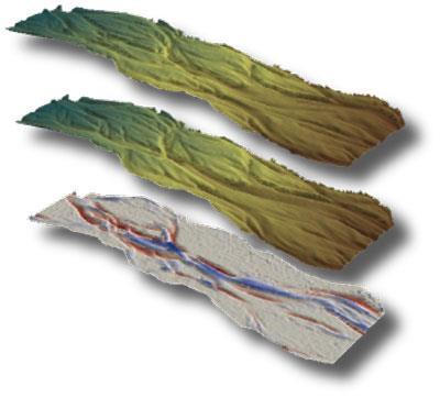
GEOMORPHIC CHANGE DETECTION
|
|
|
- Marion Chase
- 5 years ago
- Views:
Transcription


1 GEOMORPHIC CHANGE DETECTION I. THRESHOLDING ALTERNATIVES IN GCD April 30 th to May 1 st, 2014 Sponsored by:

2 WORKSHOP PLAN DAY 1 (AFTERNOON) E. Essential Best Practices to Support GCD F. Traditional Approaches to Change Detection G. Change Detection in Raster Calculator vs. GCD H. Getting to know GCD Software I. Thresholding Alternatives4:00 to 4:45 J. Recap & Preview of Day 2 A Plan.. Not a Contract 1:00 to 1:45 1:45 to 2:15 2:15 to 3:00 3:00 to 3:15 BREAK 3:15 to 4:00 4:45 to 5:00
3 DETAIL PLAN H. H. THRESHOLDING ALTERNATIVES FOR GCD 1. Three Types in GCD 6 2. Recall minlod 3. Error Propagation 4. Probabilistic Thresholding 5. Tutorial 6. Thresholding by Subtraction vs. Exclusion vs. Weighting
4 GCD 6 THRESHOLDING Simple defined min LoD Propagated Errors Probabilistic Confidence Interval
5 DETAIL PLAN H. H. THRESHOLDING ALTERNATIVES FOR GCD 1. Three Types in GCD 5 2. Recall minlod 3. Error Propagation 4. Probabilistic Thresholding 5. Tutorial 6. Thresholding by Subtraction vs. Exclusion vs. Weighting
6 APPLICATION OF A MIN LoD You take original DoD, and remove all changes <= min LoD For example +/- 20 cm

7 VARYING min LoD THRESHOLDS z, zf z DEM old DE new 2 zz 2 z DEM old DEM new Wheaton 2008
8 DETAIL PLAN H. H. THRESHOLDING ALTERNATIVES FOR GCD 1. Three Types in GCD 5 2. Recall minlod 3. Error Propagation 4. Probabilistic Thresholding 5. Tutorial 6. Thresholding by Subtraction vs. Exclusion vs. Weighting
9 MINLoD USING ERROR PROPAGATION Distinguish those changes that are real from noise Use standard Error Propagation DEM Errors can vary temporally and spatially Elevation (Time 1) DEM old z Elevation (Time 2) DEM new z 10cm 20cm z z DEM old 2 z 2 DEM new e.g. z cm 8.8 in See Brasington et al (2000): ESPL Lane et al (2003): ESPL Brasington et al (2003): Geomorphology

10 ERROR PROPAGATION GETS APPLIED SAME WAY AS MIN LoD Does not matter whether the min LoD is specified, or calculated from error propagation Just on a cell-by-cell basis! In background a perror grid is produced

11 WHAT ARE TYPICAL ERRORS? Remotely Sensed or Aerial Surveys LiDaR : +/- 12 to 25 cm Aerial Photogrammetry : +/- 10 to 15 cm Ground-Based Surveys Total Station Surveys : +/- 2 to 10 cm GPS: : +/- 3 to 12 cm Terrestrial Laser Scanning: +/- 0.5 to 4 cm
12 SO WHAT WOULD PROPAGATED ERRORS BE? Remotely Sensed or Aerial Surveys LiDaR : +/- 12 to 25 cm (17 to 36 cm minlod) Aerial Photogrammetry : +/- 10 to 15 cm(14 to 22 cm min LoD) Ground-Based Surveys Total Station Surveys : +/- 2 to 10 cm (3 to 14 cm min LoD) GPS: : +/- 3 to 12 cm (4 to 17 cm min LoD) Terrestrial Laser Scanning: +/- 0.5 to 4 cm (0.7 to 6 cm min LoD)
13 DETAIL PLAN H. H. THRESHOLDING ALTERNATIVES FOR GCD 1. Three Types in GCD 5 2. Recall minlod 3. Error Propagation 4. Probabilistic Thresholding 5. Tutorial 6. Thresholding by Subtraction vs. Exclusion vs. Weighting
14 HOW COULD I REPRESENT AS PROBABILITY? Using inferential statistics, we ll calculate a t-score σ DoD is the characteristic uncertainty In this case σ DoD = minlod t z DEM new z DEM old DoD Just the ratio of actual change to min LoD change Assuming two-tailed test, t is significant at: 68% confidence limit when t= 1 95% confidence limit when t=1.96

15 PROBABILITY THAT CHANGE IS REAL Even when min LoD is spatially constant, probability varies in space why? Wheaton (2008)

16 SENSITVITY OF THRESHOLD?
17 DETAIL PLAN H. H. THRESHOLDING ALTERNATIVES FOR GCD 1. Three Types in GCD 5 2. Recall minlod 3. Error Propagation 4. Probabilistic Thresholding 5. Tutorial 6. Thresholding by Subtraction vs. Exclusion vs. Weighting

18 WHERE DOES THIS FIT? Choosing the Threshold Method
19 GCD 6 THRESHOLDING - TUTORIAL Simple defined min LoD Propagated Errors Probabilistic Confidence Interval
20 DETAIL PLAN H. H. THRESHOLDING ALTERNATIVES FOR GCD 1. Three Types in GCD 5 2. Recall minlod 3. Error Propagation 4. Probabilistic Thresholding 5. Tutorial 6. Thresholding by Subtraction vs. Exclusion vs. Weighting
21 CONCEPT: EXCLUSION OR SUBTRACTION? LoD raster must be applied independently to cut raster and fill raster to preserve signage. Is it better to exclude points whose LoD > DoD or subtract LoD from DoD? Slide from Greg Pasternack (2012) USBoR Lecture


22 COMPARISON OF EXCLUSION VS. SUBTRACTION Exclusion raster Subtraction raster Raw DoD Net Change 33,456 yds 3 Net Change 17,555 yds 3 Blue is deposition; grey is within 1 ; others are erosion Subtraction is always a more conservative estimate Slide from Greg Pasternack (2012) USBoR Lecture
23 WEIGHTING BELOW THE THESHOLD Instead of subtraction or exclusion, values below the threshold can be weighted based on their probabilities For example, if the probability that change is real is 80%, for a vertical change of + 10 cm, the value used could be 8 cm. See Lane SN, Westaway RM and Hicks DM (2003). DOI: /esp.483.
24 DETAIL PLAN H. H. THRESHOLDING ALTERNATIVES FOR GCD 1. Three Types in GCD 5 2. Recall minlod 3. Error Propagation 4. Probabilistic Thresholding 5. Tutorial 6. Thresholding by Subtraction vs. Exclusion vs. Weighting
Watershed Sciences 4930 & 6920 ADVANCED GIS
 Watershed Sciences 4930 & 6920 ADVANCED GIS TERRESTRIAL LASER SCANNING (AKA GROUND BASED LIDAR) Joe Wheaton PURPOSE OF TODAY S DEMONSTRATION Introduce you to TLS Demystify TLS & LiDaR TODAY S PLAN I. What
Lecture 23 - LiDAR. GEOL 452/552 - GIS for Geoscientists I. Scanning Lidar. 30 m DEM. Lidar representations:
 GEOL 452/552 - GIS for Geoscientists I Lecture 23 - LiDAR LiDAR - some background (thanks to Chris Kahle, DNR) Converting Lidar point data to a raster Look at online lidar data for Iowa (1m hillshaded)
Improvement of the Edge-based Morphological (EM) method for lidar data filtering
 method for lidar data filtering") International Journal of Remote Sensing Vol. 30, No. 4, 20 February 2009, 1069 1074 Letter Improvement of the Edge-based Morphological (EM) method for lidar data filtering QI CHEN* Department of Geography,
International Journal of Remote Sensing Vol. 30, No. 4, 20 February 2009, 1069 1074 Letter Improvement of the Edge-based Morphological (EM) method for lidar data filtering QI CHEN* Department of Geography,
UAS for Surveyors. An emerging technology for the Geospatial Industry. Ian Murgatroyd : Technical Sales Rep. Trimble
 UAS for Surveyors An emerging technology for the Geospatial Industry Ian Murgatroyd : Technical Sales Rep. Trimble Project Overview Voyager Quarry, located near Perth Australia Typical of hard rock mines,
LORI COLLINS, RESEARCH ASSOCIATE PROFESSOR CONTRIBUTIONS BY: RICHARD MCKENZIE AND GARRETT SPEED, DHHC USF L IBRARIES
 LORI COLLINS, RESEARCH ASSOCIATE PROFESSOR CONTRIBUTIONS BY: RICHARD MCKENZIE AND GARRETT SPEED, DHHC USF L IBRARIES AERIAL AND TERRESTRIAL SURVEY WORKFLOWS Workflow from project planning applications
Contents of Lecture. Surface (Terrain) Data Models. Terrain Surface Representation. Sampling in Surface Model DEM
 Data Models. Terrain Surface Representation. Sampling in Surface Model DEM") Lecture 13: Advanced Data Models: Terrain mapping and Analysis Contents of Lecture Surface Data Models DEM GRID Model TIN Model Visibility Analysis Geography 373 Spring, 2006 Changjoo Kim 11/29/2006 1
Lecture 13: Advanced Data Models: Terrain mapping and Analysis Contents of Lecture Surface Data Models DEM GRID Model TIN Model Visibility Analysis Geography 373 Spring, 2006 Changjoo Kim 11/29/2006 1
Exercise 4: Extracting Information from DEMs in ArcMap
 Exercise 4: Extracting Information from DEMs in ArcMap Introduction This exercise covers sample activities for extracting information from DEMs in ArcMap. Topics include point and profile queries and surface
Watershed Sciences 4930 & 6920 GEOGRAPHIC INFORMATION SYSTEMS
 HOUSEKEEPING Watershed Sciences 4930 & 6920 GEOGRAPHIC INFORMATION SYSTEMS Quizzes Lab 8? WEEK EIGHT Lecture INTERPOLATION & SPATIAL ESTIMATION Joe Wheaton READING FOR TODAY WHAT CAN WE COLLECT AT POINTS?
An Introduction to Lidar & Forestry May 2013
 An Introduction to Lidar & Forestry May 2013 Introduction to Lidar & Forestry Lidar technology Derivatives from point clouds Applied to forestry Publish & Share Futures Lidar Light Detection And Ranging
GIS Data Collection. This chapter reviews the main methods of GIS data capture and transfer and introduces key practical management issues.
 9 GIS Data Collection OVERVIEW This chapter reviews the main methods of GIS data capture and transfer and introduces key practical management issues. It distinguishes between primary (direct measurement)
Airborne discrete return LiDAR data was collected on September 3-4, 2007 by
 SUPPLEMENTAL MATERIAL 2 LiDAR Specifications Airborne discrete return LiDAR data was collected on September 3-4, 2007 by Watershed Sciences, Inc. (Corvallis, Oregon USA). LiDAR was collected approximately
LiDAR Derived Contours
 LiDAR Derived Contours Final Delivery June 10, 2009 Prepared for: Prepared by: Metro 600 NE Grand Avenue Portland, OR 97232 Watershed Sciences, Inc. 529 SW Third Avenue, Suite 300 Portland, OR 97204 Metro
A COMPARISON OF STANDARD FIXED-WING VS MULTIROTOR DRONE PHOTOGRAMMETRY SURVEYS
 A COMPARISON OF STANDARD FIXED-WING VS MULTIROTOR DRONE PHOTOGRAMMETRY SURVEYS Dr Steve Harwin, UAV Operations, Tas KEY QUESTIONS What detail, scale and accuracy are needed? For change analysis the data
High-Precision Positioning Unit 2.2 Student Exercise: Calculating Topographic Change
 High-Precision Positioning Unit 2.2 Student Exercise: Calculating Topographic Change Ian Lauer and Ben Crosby (Idaho State University) Change is an inevitable part of our natural world and varies as a
Esri International User Conference. July San Diego Convention Center. Lidar Solutions. Clayton Crawford
 Esri International User Conference July 23 27 San Diego Convention Center Lidar Solutions Clayton Crawford Outline Data structures, tools, and workflows Assessing lidar point coverage and sample density
Development of Methodology to Identify the Areas where Buildings are Broken down by Earthquake using Airborne Laser Technology
 Development of Methodology to Identify the Areas where Buildings are Broken down by Earthquake using Airborne Laser Technology by Hiromichi Maruyama 1, Masuo Taguchi 1, Masanori Sugiyama 1 and Yoshinori
Topic 5: Raster and Vector Data Models
 Geography 38/42:286 GIS 1 Topic 5: Raster and Vector Data Models Chapters 3 & 4: Chang (Chapter 4: DeMers) 1 The Nature of Geographic Data Most features or phenomena occur as either: discrete entities
LiDAR for Urban Change Detection. Keith W. Cunningham, PhD Alaska Satellite Facility November 13, 2009
 LiDAR for Urban Change Detection Keith W. Cunningham, PhD Alaska Satellite Facility November 13, 2009 LiDAR LiDAR Light Detection and Ranging Building Footprints GIS outlines (planimetrics) GIS Geographic
BUILDING DETECTION AND STRUCTURE LINE EXTRACTION FROM AIRBORNE LIDAR DATA
 BUILDING DETECTION AND STRUCTURE LINE EXTRACTION FROM AIRBORNE LIDAR DATA C. K. Wang a,, P.H. Hsu a, * a Dept. of Geomatics, National Cheng Kung University, No.1, University Road, Tainan 701, Taiwan. China-
Accuracy Assessment of Ames Stereo Pipeline Derived DEMs Using a Weighted Spatial Dependence Model
 Accuracy Assessment of Ames Stereo Pipeline Derived DEMs Using a Weighted Spatial Dependence Model Intro Problem Statement A successful lunar mission requires accurate, high resolution data products to
Light Detection and Ranging (LiDAR)
") Light Detection and Ranging (LiDAR) http://code.google.com/creative/radiohead/ Types of aerial sensors passive active 1 Active sensors for mapping terrain Radar transmits microwaves in pulses determines
Light Detection and Ranging (LiDAR) http://code.google.com/creative/radiohead/ Types of aerial sensors passive active 1 Active sensors for mapping terrain Radar transmits microwaves in pulses determines
Files Used in this Tutorial
 Generate Point Clouds and DSM Tutorial This tutorial shows how to generate point clouds and a digital surface model (DSM) from IKONOS satellite stereo imagery. You will view the resulting point clouds
Airborne Laser Scanning: Remote Sensing with LiDAR
 Airborne Laser Scanning: Remote Sensing with LiDAR ALS / LIDAR OUTLINE Laser remote sensing background Basic components of an ALS/LIDAR system Two distinct families of ALS systems Waveform Discrete Return
UAS to GIS Utilizing a low-cost Unmanned Aerial System (UAS) for Coastal Erosion Monitoring
 for Coastal Erosion Monitoring") UAS to GIS Utilizing a low-cost Unmanned Aerial System (UAS) for Coastal Erosion Monitoring A New Window on the World Personal Mapping for Micro-Geographies Accurate High Quality Simple Low-Cost Drone2Map
UAS to GIS Utilizing a low-cost Unmanned Aerial System (UAS) for Coastal Erosion Monitoring A New Window on the World Personal Mapping for Micro-Geographies Accurate High Quality Simple Low-Cost Drone2Map
Generate Digital Elevation Models Using Laser Altimetry (LIDAR) Data
 Data") Generate Digital Elevation Models Using Laser Altimetry (LIDAR) Data Literature Survey Christopher Weed October 2000 Abstract Laser altimetry (LIDAR) data must be processed to generate a digital elevation
Generate Digital Elevation Models Using Laser Altimetry (LIDAR) Data Literature Survey Christopher Weed October 2000 Abstract Laser altimetry (LIDAR) data must be processed to generate a digital elevation
FOOTPRINTS EXTRACTION
 Building Footprints Extraction of Dense Residential Areas from LiDAR data KyoHyouk Kim and Jie Shan Purdue University School of Civil Engineering 550 Stadium Mall Drive West Lafayette, IN 47907, USA {kim458,
Extracting Elevation from Air Photos
 Extracting Elevation from Air Photos TUTORIAL A digital elevation model (DEM) is a digital raster surface representing the elevations of a terrain for all spatial ground positions in the image. Traditionally
Investigation of Sampling and Interpolation Techniques for DEMs Derived from Different Data Sources
 Investigation of Sampling and Interpolation Techniques for DEMs Derived from Different Data Sources FARRAG ALI FARRAG 1 and RAGAB KHALIL 2 1: Assistant professor at Civil Engineering Department, Faculty
Advanced Highway Maintenance and Construction Technology Research Center
 Advanced Highway Maintenance and Construction Technology Research Center Department of Mechanical and Aerospace Engineering University of California at Davis Creating Standards and Specifications for the
8 Geographers Tools: Automated Mapping. Digitizing a Map IMPORTANT 2/19/19. v Tues., Feb. 26, 2019.
 Next Class: FIRST EXAM v Tues., Feb. 26, 2019. Combination of multiple choice questions and map interpretation. Bring a #2 pencil with eraser. Based on class lectures supplementing Chapter 1. Review lectures
Digital Elevation Models
 Digital Elevation Models National Elevation Dataset 1 Data Sets US DEM series 7.5, 30, 1 o for conterminous US 7.5, 15 for Alaska US National Elevation Data (NED) GTOPO30 Global Land One-kilometer Base
Understanding Geospatial Data Models
 Understanding Geospatial Data Models 1 A geospatial data model is a formal means of representing spatially referenced information. It is a simplified view of physical entities and a conceptualization of
Watershed Sciences 4930 & 6920 GEOGRAPHIC INFORMATION SYSTEMS
 HOUSEKEEPING Watershed Sciences 4930 & 6920 GEOGRAPHIC INFORMATION SYSTEMS CONTOURS! Self-Paced Lab Due Friday! WEEK SIX Lecture RASTER ANALYSES Joe Wheaton YOUR EXCERCISE Integer Elevations Rounded up
Local Elevation Surface Modeling using GPS Derived Point Clouds. John G. Whitman, Jr.
 Local Elevation Surface Modeling using GPS Derived Point Clouds WhitmanJ2@myfairpoint.net Study Area Overview Topographic Background NAIP with Roads and Streams Public DEM Models of Study Area National
Drone2Map for ArcGIS: Bring Drone Imagery into ArcGIS. Will
 Drone2Map for ArcGIS: Bring Drone Imagery into ArcGIS Will Meyers @MeyersMaps A New Window on the World Personal Mapping for Micro-Geographies Accurate High Quality Simple Low-Cost Drone2Map for ArcGIS
Lecture 21 - Chapter 8 (Raster Analysis, part2)
") GEOL 452/552 - GIS for Geoscientists I Lecture 21 - Chapter 8 (Raster Analysis, part2) Today: Digital Elevation Models (DEMs), Topographic functions (surface analysis): slope, aspect hillshade, viewshed,
GEOL 452/552 - GIS for Geoscientists I Lecture 21 - Chapter 8 (Raster Analysis, part2) Today: Digital Elevation Models (DEMs), Topographic functions (surface analysis): slope, aspect hillshade, viewshed,
8 Geographers Tools: Automated Mapping. Digitizing a Map 2/19/19 IMPORTANT. Revising a Digitized Map. The Digitized Map. vtues., Feb. 26, 2019.
 Next Class: FIRST EXAM 8 Geographers Tools: Automated Mapping vtues., Feb. 26, 2019. Combination of multiple choice questions and map interpretation. Bring a #2 pencil with eraser. Based on class lectures
Generate Digital Elevation Models Using Laser Altimetry (LIDAR) Data. Christopher Weed
 Data. Christopher Weed") Generate Digital Elevation Models Using Laser Altimetry (LIDAR) Data Christopher Weed Final Report EE 381K Multidimensional Digital Signal Processing December 11, 2000 Abstract A Laser Altimetry (LIDAR)
Generate Digital Elevation Models Using Laser Altimetry (LIDAR) Data Christopher Weed Final Report EE 381K Multidimensional Digital Signal Processing December 11, 2000 Abstract A Laser Altimetry (LIDAR)
GIS Tools for Hydrology and Hydraulics
 1 OUTLINE GIS Tools for Hydrology and Hydraulics INTRODUCTION Good afternoon! Welcome and thanks for coming. I once heard GIS described as a high-end Swiss Army knife: lots of tools in one little package
APPENDIX E2. Vernal Pool Watershed Mapping
 APPENDIX E2 Vernal Pool Watershed Mapping MEMORANDUM To: U.S. Fish and Wildlife Service From: Tyler Friesen, Dudek Subject: SSHCP Vernal Pool Watershed Analysis Using LIDAR Data Date: February 6, 2014
The Reference Library Generating Low Confidence Polygons
 GeoCue Support Team In the new ASPRS Positional Accuracy Standards for Digital Geospatial Data, low confidence areas within LIDAR data are defined to be where the bare earth model might not meet the overall
Spatial Density Distribution
 GeoCue Group Support Team 5/28/2015 Quality control and quality assurance checks for LIDAR data continue to evolve as the industry identifies new ways to help ensure that data collections meet desired
2010 LiDAR Project. GIS User Group Meeting June 30, 2010
 2010 LiDAR Project GIS User Group Meeting June 30, 2010 LiDAR = Light Detection and Ranging Technology that utilizes lasers to determine the distance to an object or surface Measures the time delay between
DECONFLICTION AND SURFACE GENERATION FROM BATHYMETRY DATA USING LR B- SPLINES
 DECONFLICTION AND SURFACE GENERATION FROM BATHYMETRY DATA USING LR B- SPLINES IQMULUS WORKSHOP BERGEN, SEPTEMBER 21, 2016 Vibeke Skytt, SINTEF Jennifer Herbert, HR Wallingford The research leading to these
Final project: Lecture 21 - Chapter 8 (Raster Analysis, part2) GEOL 452/552 - GIS for Geoscientists I
 GEOL 452/552 - GIS for Geoscientists I") GEOL 452/552 - GIS for Geoscientists I Lecture 21 - Chapter 8 (Raster Analysis, part2) Talk about class project (copy follow_along_data\ch8a_class_ex into U:\ArcGIS\ if needed) Catch up with lecture 20
GEOL 452/552 - GIS for Geoscientists I Lecture 21 - Chapter 8 (Raster Analysis, part2) Talk about class project (copy follow_along_data\ch8a_class_ex into U:\ArcGIS\ if needed) Catch up with lecture 20
Validation of Aerial LiDAR Products For Transportation Applications
 Creating Value Delivering Solutions Validation of Aerial LiDAR Products For Transportation Applications Dr. Srini Dharmapuri, CP, PMP Michael Baker Jr., Inc. Lauren Little, PE Alaska DOT Public Facility
Alaska Department of Transportation Roads to Resources Project LiDAR & Imagery Quality Assurance Report Juneau Access South Corridor
 Alaska Department of Transportation Roads to Resources Project LiDAR & Imagery Quality Assurance Report Juneau Access South Corridor Written by Rick Guritz Alaska Satellite Facility Nov. 24, 2015 Contents
L7 Raster Algorithms
 L7 Raster Algorithms NGEN6(TEK23) Algorithms in Geographical Information Systems by: Abdulghani Hasan, updated Nov 216 by Per-Ola Olsson Background Store and analyze the geographic information: Raster
FREE TUTORING. Digitizing a Map. 8 Geographers Tools: Automated Mapping. The Digitized Map. Revising a Digitized Map 9/28/2018. Next class: First Exam
 Next class: First Exam Tuesday, October 2, 2018. Combination of multiple choice questions and map interpretation. Bring a #2 pencil with eraser. Based on class lectures supplementing Chapter 1. Review
Lecture 11. LiDAR, RADAR
 NRMT 2270, Photogrammetry/Remote Sensing Lecture 11 Calculating the Number of Photos and Flight Lines in a Photo Project LiDAR, RADAR Tomislav Sapic GIS Technologist Faculty of Natural Resources Management
GEOGRAPHIC INFORMATION SYSTEMS Lecture 24: Spatial Analyst Continued
 GEOGRAPHIC INFORMATION SYSTEMS Lecture 24: Spatial Analyst Continued Spatial Analyst - Spatial Analyst is an ArcGIS extension designed to work with raster data - in lecture I went through a series of demonstrations
Representing Geography
 Data models and axioms Chapters 3 and 7 Representing Geography Road map Representing the real world Conceptual models: objects vs fields Implementation models: vector vs raster Vector topological model
Vegetation height maps derived from digital elevation models the next innovation in the production of orienteering maps?
 Vegetation height maps derived from digital elevation models the next innovation in the production of orienteering maps? Development of Orienteering Maps. 1. Revolution 20 years ago: Digital Cartography
New Features in TerraScan. Arttu Soininen Software developer Terrasolid Ltd
 New Features in TerraScan Arttu Soininen Software developer Terrasolid Ltd MicroStation During week starting 23.02.2009 : Release of ver 009.001 of applications for V8 Release of ver 009.001 of applications
Surface and Terrain Models
 Advanced Matching Techniques for High Precision Surface and Terrain Models Introduction Comeback of image matching for DTM & DSM generation Very few professional tools for DSM generation from image matching
UAV Surveying II. Precision. Accuracy. Reliability
 UAV Surveying II Precision. Accuracy. Reliability Part One: Project Lifecycle Deliverables Part Two: Evaluation of UAV Data Accuracy and Examples of Error Part Three: AGENDA Review of Results Examples
Lecture 14. Lidar Data Inversion and Sensitivity Analysis
 Lecture 14. Lidar Data Inversion and Sensitivity Analysis Data inversion process Nonlinearity of PMT and discriminator More considerations for Na Doppler lidar Definition of sensitivity Summary Office
MAPPING WITHOUT GROUND CONTROL POINTS: DOES IT WORK?
 MAPPING WITHOUT GROUND CONTROL POINTS: DOES IT WORK? BACKGROUND The economic advantages of Structure from Motion (SfM) mapping without any ground control points have motivated us to investigate an approach
Overview. 1. Aerial LiDAR in Wisconsin (20 minutes) 2. Demonstration of data in CAD (30 minutes) 3. High Density LiDAR (20 minutes)
 2. Demonstration of data in CAD (30 minutes) 3. High Density LiDAR (20 minutes)") Overview 1. Aerial LiDAR in Wisconsin (20 minutes) 2. Demonstration of data in CAD (30 minutes) 3. High Density LiDAR (20 minutes) 4. Aerial lidar technology advancements (15 minutes) 5. Q & A 1. Aerial
Overview 1. Aerial LiDAR in Wisconsin (20 minutes) 2. Demonstration of data in CAD (30 minutes) 3. High Density LiDAR (20 minutes) 4. Aerial lidar technology advancements (15 minutes) 5. Q & A 1. Aerial
Probabilistic Surfel Fusion for Dense LiDAR Mapping Chanoh Park, Soohwan Kim, Peyman Moghadam, Clinton Fookes, Sridha Sridharan
 Probabilistic Surfel Fusion for Dense LiDAR Mapping Chanoh Park, Soohwan Kim, Peyman Moghadam, Clinton Fookes, Sridha Sridharan ICCV workshop 2017 www.data61.csiro.au Introduction Narrow FoV Short sensing
CS4670: Computer Vision
 CS4670: Computer Vision Noah Snavely Lecture 6: Feature matching and alignment Szeliski: Chapter 6.1 Reading Last time: Corners and blobs Scale-space blob detector: Example Feature descriptors We know
[Youn *, 5(11): November 2018] ISSN DOI /zenodo Impact Factor
![[Youn *, 5(11): November 2018] ISSN DOI /zenodo Impact Factor](/thumbs/91/105079225.jpg "[Youn *, 5(11): November 2018] ISSN DOI /zenodo Impact Factor") GLOBAL JOURNAL OF ENGINEERING SCIENCE AND RESEARCHES AUTOMATIC EXTRACTING DEM FROM DSM WITH CONSECUTIVE MORPHOLOGICAL FILTERING Junhee Youn *1 & Tae-Hoon Kim 2 *1,2 Korea Institute of Civil Engineering
GLOBAL JOURNAL OF ENGINEERING SCIENCE AND RESEARCHES AUTOMATIC EXTRACTING DEM FROM DSM WITH CONSECUTIVE MORPHOLOGICAL FILTERING Junhee Youn *1 & Tae-Hoon Kim 2 *1,2 Korea Institute of Civil Engineering
N.J.P.L.S. An Introduction to LiDAR Concepts and Applications
 N.J.P.L.S. An Introduction to LiDAR Concepts and Applications Presentation Outline LIDAR Data Capture Advantages of Lidar Technology Basics Intensity and Multiple Returns Lidar Accuracy Airborne Laser
MODELLING FOREST CANOPY USING AIRBORNE LIDAR DATA
 MODELLING FOREST CANOPY USING AIRBORNE LIDAR DATA Jihn-Fa JAN (Taiwan) Associate Professor, Department of Land Economics National Chengchi University 64, Sec. 2, Chih-Nan Road, Taipei 116, Taiwan Telephone:
High Resolution Laserscanning, not only for 3D-City Models
 Lohr 133 High Resolution Laserscanning, not only for 3D-City Models UWE LOHR, Ravensburg ABSTRACT The TopoSys laserscanner system is designed to produce digital elevation models (DEMs) of the environment
From Multi-sensor Data to 3D Reconstruction of Earth Surface: Innovative, Powerful Methods for Geoscience and Other Applications
 From Multi-sensor Data to 3D Reconstruction of Earth Surface: Innovative, Powerful Methods for Geoscience and Other Applications Bea Csatho, Toni Schenk*, Taehun Yoon* and Michael Sheridan, Department
Practical Considerations of UAS Operations on Data Quality
 Practical Considerations of UAS Operations on Data Quality Precision. Accuracy. Reliability OVERVIEW Project Planning and Execution Ground Control Data Processing and Delivery 1 OVERVIEW Get Legal: Section
Assessment of digital elevation models using RTK GPS
 Assessment of digital elevation models using RTK GPS Hsing-Chung Chang 1, Linlin Ge 2, Chris Rizos 3 School of Surveying and Spatial Information Systems University of New South Wales, Sydney, Australia
Windstorm Simulation & Modeling Project
 Windstorm Simulation & Modeling Project Airborne LIDAR Data and Digital Elevation Models in Broward County, Florida Data Quality Report and Description of Deliverable Datasets Prepared for: The Broward
Hands-on practice: LIDAR data quality analysis and fine-georeferencing
 EUFAR - EUropean Facility for Airborne Research Hands-on practice: LIDAR data quality analysis and fine-georeferencing Christian Briese cb@ipf.tuwien.ac.at 1 Institute of Photogrammetry and Remote Sensing
POINT CLOUDS AND DERIVATIVES FOR NATIONWIDE GEOSPATIAL INFORMATION GEORGE VOSSELMAN
 POINT CLOUDS AND DERIVATIVES FOR NATIONWIDE GEOSPATIAL INFORMATION GEORGE VOSSELMAN OVERVIEW Point cloud generation and quality control New lidar technologies Dense matching Updating nationwide point clouds
LIDAR and Terrain Models: In 3D!
 LIDAR and Terrain Models: In 3D! Stuart.green@teagasc.ie http://www.esri.com/library/whitepapers/pdfs/lidar-analysis-forestry.pdf http://www.csc.noaa.gov/digitalcoast/_/pdf/refinement_of_topographic_lidar_to_create_a_bare_e
Terrafirma: a Pan-European Terrain motion hazard information service.
 Terrafirma: a Pan-European Terrain motion hazard information service www.terrafirma.eu.com The Future of Terrafirma - Wide Area Product Nico Adam and Alessandro Parizzi DLR Oberpfaffenhofen Terrafirma
A 4D Filtering and Calibration Technique for Small-Scale Point Cloud Change Detection with a Terrestrial Laser Scanner
 Remote Sens. 2015, 7, 13029-13052; doi:10.3390/rs71013029 Article OPEN ACCESS remote sensing ISSN 2072-4292 www.mdpi.com/journal/remotesensing A 4D Filtering and Calibration Technique for Small-Scale Point
Big Spatial Data Performance With Oracle Database 12c. Daniel Geringer Spatial Solutions Architect
 Big Spatial Data Performance With Oracle Database 12c Daniel Geringer Spatial Solutions Architect Oracle Exadata Database Machine Engineered System 2 What Is the Oracle Exadata Database Machine? Oracle
Photo based Terrain Data Acquisition & 3D Modeling
 Photo based Terrain Data Acquisition & 3D Modeling June 7, 2013 Howard Hahn Kansas State University Partial funding by: KSU Office of Research and Sponsored Programs Introduction: Need Application 1 Monitoring
Aerial and Mobile LiDAR Data Fusion
 Creating Value Delivering Solutions Aerial and Mobile LiDAR Data Fusion Dr. Srini Dharmapuri, CP, PMP What You Will Learn About LiDAR Fusion Mobile and Aerial LiDAR Technology Components & Parameters Project
2. POINT CLOUD DATA PROCESSING
 Point Cloud Generation from suas-mounted iphone Imagery: Performance Analysis A. D. Ladai, J. Miller Towill, Inc., 2300 Clayton Road, Suite 1200, Concord, CA 94520-2176, USA - (andras.ladai, jeffrey.miller)@towill.com
City-Modeling. Detecting and Reconstructing Buildings from Aerial Images and LIDAR Data
 City-Modeling Detecting and Reconstructing Buildings from Aerial Images and LIDAR Data Department of Photogrammetrie Institute for Geodesy and Geoinformation Bonn 300000 inhabitants At river Rhine University
International Journal of Civil Engineering and Geo-Environment. Close-Range Photogrammetry For Landslide Monitoring
 International Journal of Civil Engineering and Geo-Environment Journal homepage:http://ijceg.ump.edu.my ISSN:21802742 Close-Range Photogrammetry For Landslide Monitoring Munirah Bt Radin Mohd Mokhtar,
Performance Evaluation of Optech's ALTM 3100: Study on Geo-Referencing Accuracy
 Performance Evaluation of Optech's ALTM 3100: Study on Geo-Referencing Accuracy R. Valerie Ussyshkin, Brent Smith, Artur Fidera, Optech Incorporated BIOGRAPHIES Dr. R. Valerie Ussyshkin obtained a Ph.D.
3D Data Acquisition in Tunnels Optimizing Track Time Using Terrestrial Mobile LiDAR. Scanning. Michael R. Frecks, PLS.
 3D Data Acquisition in Tunnels Optimizing Track Time Using Terrestrial Mobile LiDAR Scanning Michael R. Frecks, PLS President/CEO AREMA 2013 1207 Understanding mobile 3D LiDAR? light detection and ranging
Marc Crombaghs, Sander Oude Elberink, Regine Brügelmann, Erik de Min
 $66(66,*+(,*+735(&,6,)/$6(5$/7,0(75
9. GIS Data Collection
 9. GIS Data Collection Geographic Information Systems and Science SECOND EDITION Paul A. Longley, Michael F. Goodchild, David J. Maguire, David W. Rhind 2005 John Wiley and Sons, Ltd Overview Introduction
Using LiDAR (Light Distancing And Ranging) data to more accurately describe avalanche terrain
 data to more accurately describe avalanche terrain") International Snow Science Workshop, Davos 009, Proceedings Using LiDAR (Light Distancing And Ranging) data to more accurately describe avalanche terrain Christopher M. McCollister, and Robert H. Comey,
International Snow Science Workshop, Davos 009, Proceedings Using LiDAR (Light Distancing And Ranging) data to more accurately describe avalanche terrain Christopher M. McCollister, and Robert H. Comey,
Introduction Photogrammetry Photos light Gramma drawing Metron measure Basic Definition The art and science of obtaining reliable measurements by mean
 Photogrammetry Review Neil King King and Associates Testing is an art Introduction Read the question Re-Read Read The question What is being asked Answer what is being asked Be in the know Exercise the
Conservation Applications of LiDAR. Terrain Analysis. Workshop Exercises
 Conservation Applications of LiDAR Terrain Analysis Workshop Exercises 2012 These exercises are part of the Conservation Applications of LiDAR project a series of hands on workshops designed to help Minnesota
Automated Extraction of Buildings from Aerial LiDAR Point Cloud and Digital Imaging Datasets for 3D Cadastre - Preliminary Results
 Automated Extraction of Buildings from Aerial LiDAR Point Cloud and Digital Imaging Datasets for 3D Pankaj Kumar 1*, Alias Abdul Rahman 1 and Gurcan Buyuksalih 2 ¹Department of Geoinformation Universiti
Presented at the FIG Congress 2018, May 6-11, 2018 in Istanbul, Turkey
 Presented at the FIG Congress 2018, May 6-11, 2018 in Istanbul, Turkey Evangelos MALTEZOS, Charalabos IOANNIDIS, Anastasios DOULAMIS and Nikolaos DOULAMIS Laboratory of Photogrammetry, School of Rural
Training in Mapping Changes on an Archaeological Site
 Training in Mapping Changes on an Archaeological Site Presented at the FIG Congress 2018, May 6-11, 2018 in Istanbul, Turkey Pierre-Yves Gilliéron Bertrand Merminod Jérôme Zufferey EPFL Presentation 04.2015
GeoEarthScope NoCAL San Andreas System LiDAR pre computed DEM tutorial
 GeoEarthScope NoCAL San Andreas System LiDAR pre computed DEM tutorial J Ramón Arrowsmith Chris Crosby School of Earth and Space Exploration Arizona State University ramon.arrowsmith@asu.edu http://lidar.asu.edu
LiDAR Data Processing:
 LiDAR Data Processing: Concepts and Methods for LEFI Production Gordon W. Frazer GWF LiDAR Analytics Outline of Presentation Data pre-processing Data quality checking and options for repair Data post-processing
Airborne Laser Survey Systems: Technology and Applications
 Abstract Airborne Laser Survey Systems: Technology and Applications Guangping HE Lambda Tech International, Inc. 2323B Blue Mound RD., Waukesha, WI-53186, USA Email: he@lambdatech.com As mapping products
Revealing the. Stonehenge. In a major project for English Heritage, Through 3D Digital Modelling. By Neil McLeod
 Revealing the Secrets of Stonehenge Through 3D Digital Modelling In a major project for English Heritage, survey specialists Greenhatch Group used laser scanning, digital photogrammetry and Geomagic Studio
Applied Cartography and Introduction to GIS GEOG 2017 EL. Lecture-7 Chapters 13 and 14
 Applied Cartography and Introduction to GIS GEOG 2017 EL Lecture-7 Chapters 13 and 14 Data for Terrain Mapping and Analysis DEM (digital elevation model) and TIN (triangulated irregular network) are two
First Exam Thurs., Sept 28
 First Exam Thurs., Sept 28 Combination of multiple choice questions and map interpretation. Bring a #2 pencil with eraser. Based on class lectures supplementing chapter. Review lecture presentations 9.
POINT CLOUD ANALYSIS FOR ROAD PAVEMENTS IN BAD CONDITIONS INTRODUCTION
 POINT CLOUD ANALYSIS FOR ROAD PAVEMENTS IN BAD CONDITIONS Yoshiyuki Yamamoto, Associate Professor Yasuhiro Shimizu, Doctoral Student Eiji Nakamura, Professor Masayuki Okugawa, Associate Professor Aichi
3D Convolutional Neural Networks for Landing Zone Detection from LiDAR
 3D Convolutional Neural Networks for Landing Zone Detection from LiDAR Daniel Mataruna and Sebastian Scherer Presented by: Sabin Kafle Outline Introduction Preliminaries Approach Volumetric Density Mapping
Exploring GIS Data. I) GIS Data Models-Definitions II) Database Management System III) Data Source & Collection IV) Data Quality
 GIS Data Models-Definitions II) Database Management System III) Data Source & Collection IV) Data Quality") Exploring GIS Data I) GIS Data Models-Definitions II) Database Management System III) Data Source & Collection IV) Data Quality 1 Geographic data Model Definitions: Data : A collection of related facts
Exploring GIS Data I) GIS Data Models-Definitions II) Database Management System III) Data Source & Collection IV) Data Quality 1 Geographic data Model Definitions: Data : A collection of related facts
Terrain categorization using LIDAR and multi-spectral data
 Terrain categorization using LIDAR and multi-spectral data Angela M. Puetz, R. C. Olsen, Michael A. Helt U.S. Naval Postgraduate School, 833 Dyer Road, Monterey, CA 93943 ampuetz@nps.edu, olsen@nps.edu