WelcometotheJungle ofdigitalimagehandlingplatforms anddataproperties
|
|
|
- Primrose Warner
- 5 years ago
- Views:
Transcription

1 WelcometotheJungle ofdigitalimagehandlingplatforms anddataproperties A general overview with room for discussion and lots of questions By, Jesper Cairo Westergaard, Research IT Coordinator, University of Copenhagen
2 digital image handling platforms and data properties Digital Image Handling Platform Data Properties The PlotCut 3 platform In its early stages Build with QGIS/PostGIS
 in a computer.")

, or point clouds")
.")
3 DEFINITIONS Digital: Image: Stored and handled as numbers (digits) in a computer. Ones and zeros A representation of something from the real world or artificially created that we can see with our eyes. For us only pixels (currently), or point clouds (e.g. LiDAR; pixels with space in between), but can be voxels too (think LEGO). Can also be vector-based (infinite zoom; think letters on the screen)
4
5 DEFINITIONS Handling: All the steps that need to be taken. In our case, UAV imaging, a (simplified) workflow like this: Planning the flight Image acquisition: The flight Mosaic creation Plot extraction Plot analysis Platform: Where and how those steps are performed An example from our world: Planning the flight Image acquisition: The flight Mosaic creation Plot extraction Plot analysis
6 DEFINITIONS An image, as an example: Data: The primary image information itself, i.e. the pixels And, the information about the recording of the image. The META data. The image properties Properties Examples of an image s properties Represents a spatial location


7 All colors or greyscale? The quality of that color Size: width*height What glass in front of the sensor? Where on our planet? How fast did we capture that part of our world? UNKNOWNS Example properties of an image

8 The plot s data properties Static Geography etc. Where in the world is the plot (similar to where was the camera Slant of the soil surface > DEM (digital elevation model) What crop is it? What variety? Maybe quality of seed sown Temporal Climate profile: The weather that plot experienced Plant morphology: The shapes it went through; crop height Stress: Pathogens, drought etc Variability within the plot The imaging of that single plot Each image, each mosaic contains a mapping of theses static and temporal/dynamic properties Image quality? Resemblance to reality? Mosaic vs original single image from the UAV


9 The trial field s data properties Again, geography. The DEM (digital elevation model) Any damage? Soil map etc Variation within the field?
10 The UAV mission s data properties Static Geography etc. Slant of the whole surface covered in the flight DEM (digital elevation model) Temporal The weather during the flight Did it rain earlier today? Wet soil, crop? Changing cloud cover during the flight?

 Color (changing")
11 The orthomosaic s data properties Quality of the data? Structure (stitching artefacts) Color (changing light, cloud cover)
12 A quick recap: Our properties We have properties of: Images from the drone The circumstances of the flight/uav mission (campaign) The whole trial field All the individual plots The resulting orthomosaic Aaaaaaand Maybe a lot of soft data properties in the annotations. Might only be quantifiable later. It feels like It might be that Maybe this is the case
13 Why should you, as a breeder, care about data properties? All the properties you already rate and use The modelling 2D We extract pixel information Maybe 3D (height, better head counts etc) Maybe used as input/parameters for machine learning, deep learning

 A")
14 Examples of platforms On your own computer One a computer somewhere else (server; in The Cloud ) A mix of the two
15 Example of platform mixes Planning the flight Image acquisition: The flight Mosaic creation Plot extraction Plot analysis Example 1: Images recorded with a drone by person A (maybe another company) Pix4D initial processing in the cloud (initiated by person A and/or B) then down to the local PC for more advanced mosaic processing in Pix4D then person B does plot info extraction in e.g. PlotCut 2 maybe onwards to person C for statistics and decision support Example 2: Images recorded with a drone by person A local complete processing of UAV images into a mosaic by person A Local data handling and plot extraction in PlotCut 2 by person A Local statistics and decision support also handled by person A
 analytics: Use their app, Atlas Flight for flight planning and execution Process the images in Pix4D Upload the images to the Atlas analysis server/cloud")
16 Another example of platform mix Example 3: When things change with a service provider MicaSense: Had mosaic processing in their cloud platform (Atlas) Then they changed their mind So now they suggest this, to get from drone images to (their) analytics: Use their app, Atlas Flight for flight planning and execution Process the images in Pix4D Upload the images to the Atlas analysis server/cloud Analyze your data in Atlas

17 A simple and free approach * Take plot pictures with your phone s camera Cut out each plot from the images Maybe even on the cell phone Upload to a free service, like the one Jesper Rasmussen has created at There you go: Fraction of image that is crop/plant Use the results * Requires only a smartphone, a pc and an Internet connection
18 More platforms
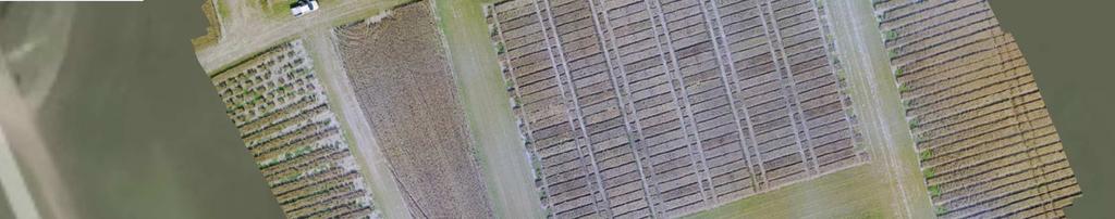
19 Three online approaches Three picked DroneDeploy PrecisionMapper Solvi Their focus (currently): Specific agronomy focus: Solvi Wide focus: PrecisionMapper and DroneDeploy Agriculture, mining, construction, forestry, roofing, solar, inspection (buildings, windmills, bridges), insurance, mapping infrastructures

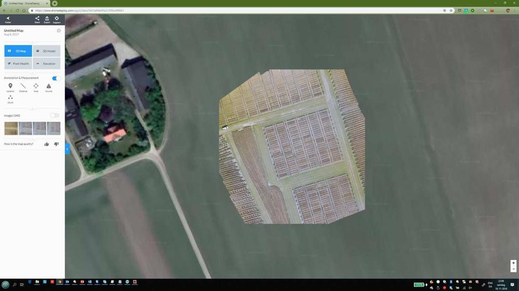
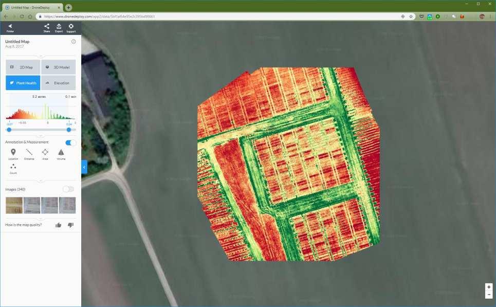
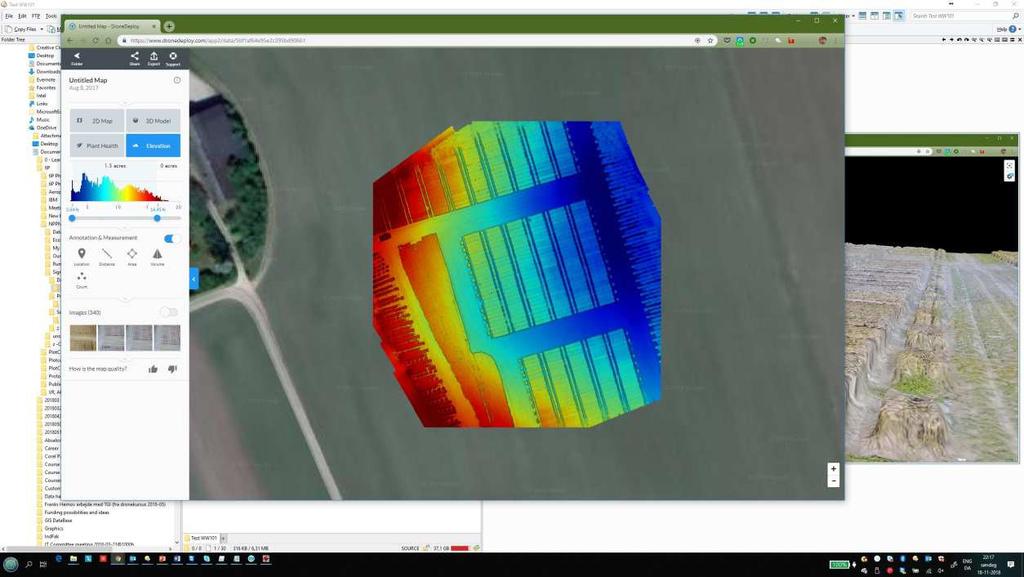
20 The DroneDeploy Platform
21 The DroneDeploy Platform Features: Volume (but not crops yet, only for mining etc) View elevation data Plant health assessment Temporal changes: Crop development Orthomosaics: Both 2D and 3D Output formats: JPG, TIFF, OBJ, LAS, SHP, DXF App/add-on marketplace; make your own apps GCPs (costs extra)
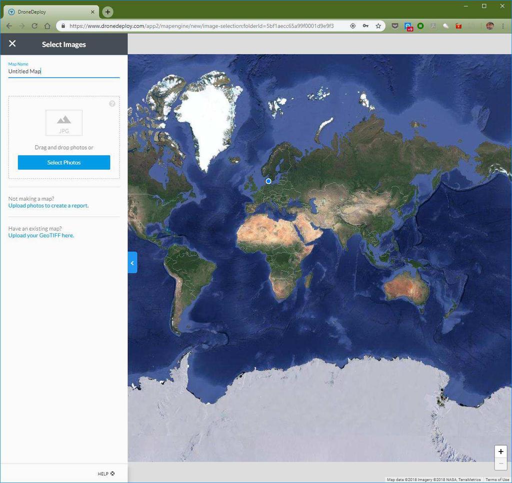
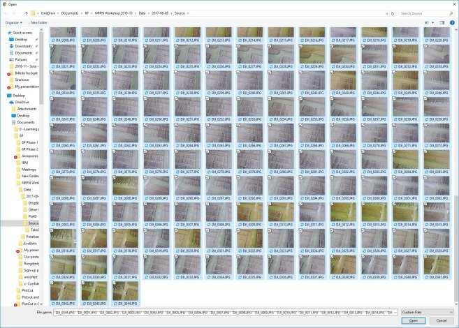
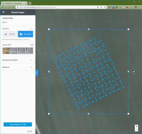
22 The DroneDeploy Platform Processing: Easy


23 The DroneDeploy Platform Marketplace example: The Side-by-side app
24 The DroneDeploy Platform Example: The Side-by-side app
25 What is a GCP? Ground Control Point A specific measurement in the real world Very precise circa 1 cm precision The standard drone/camera itself normally has +/-some meters precision Time consuming work with ground-based gear Buy or rent May soon be easier with better drone navigation RTK drones. You will have one in a few years
26 Next platform
27 The PrecisionMapper Platform
28 The PrecisionMapper Platform Features: Basic features are very much like DroneDeploy Apps/add-ons differ Volume (not crops yet, only mining etc) View elevation data Plant health assessment Temporal changes: Crop development Orthomosaics: Both 2D and 3D Output formats: JPG, TIFF, OBJ, LAS, SHP, DXF App/add-on marketplace; make your own apps Use GCPs (requires desktop software install)
29 The PrecisionMapper Platform Processing: As simple as DroneDeploy

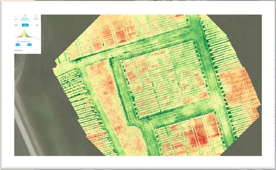
30 The PrecisionMapper Platform Free app: Green Leaf Index Can be applied to: Standard RGB mosaic Supported Resolution: cm/px or less Estimated Processing: Less than 4 hours GLI designed to adjust for greenness and yellowness in crops. Can be used in all growth stages.
31 The PrecisionMapper Platform Free app: Visual NDVI Can be applied to a standard RGB mosaic Visual NDVI, NGRDI. Indicator surface greenness, detect live green plant canopies. Can be used in all growth stages.
32 Next platform


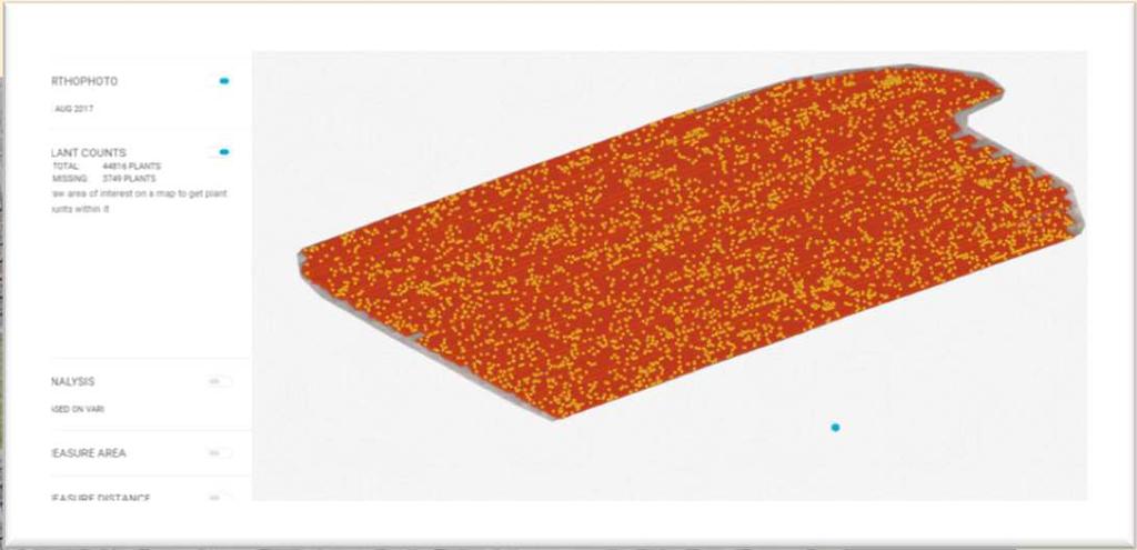
33 The Solvi Platform
34 The Solvi Platform Features: Plant Health analytics Predefined or custom Vegetation indices Elevation maps used to correlate to crop health Temporal changes: Crop development Plant Counts Whole field or custom areas Asses missing plants (pattern continuity) No app/add-on marketplace. No creating own apps/add-ons Export (some of) your data Prescription files Share a web view
35 The Solvi Platform Processing: As simple as the other two

36 The Solvi Platform
37 Next platform

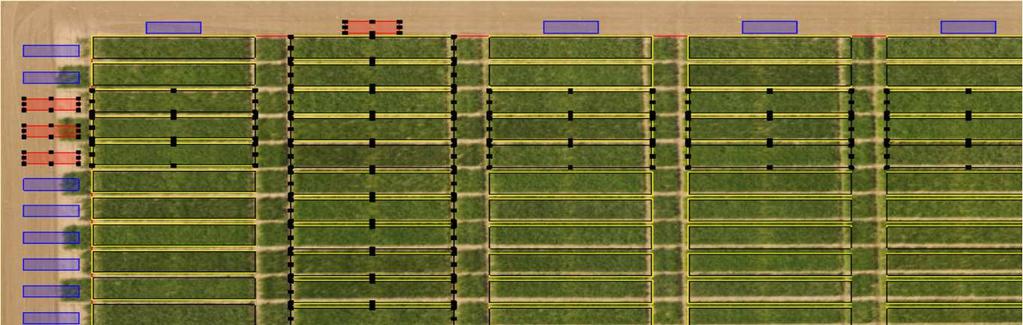
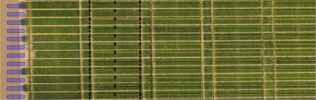
38 The PlotCut 2 Platform, from 6P
39 The PlotCut 2 Platform Features: Very precise manipulation of plot extraction ares A field trial is a project Easy re-use of extraction grid through temporal instances Detailed output (plot and pixel level) for further analysis Individual image slices Annotation (also in some of the online platforms) Lacks: Georeferencing Using your own apps/add-ons
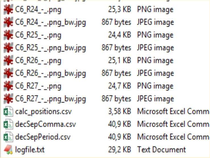
40 PlotCut 2 Processing: No mosaic processing just plot extraction
41 Input support in the platforms * Images, as bitmaps Compressed, some quality loss: JPEG Compressed, no quality loss: PNG, TIFF RGB Single greyscale color (multispectral, thermal) Uncompressed: RAW extra processing possible before mosaic Videos: e.g. MPEG (extracting some of the images for use) Models Point clouds (LAZ, LAS) Delineations/boundaries, as vectors SHP and other formats * Not all the platforms accept the same input
42 Advanced input support Geo accuracy improving input: GCPs (Ground Control Points) Models Point clouds (LAZ, LAS)


43 Now wait a moment! Some platforms can more than just process images and analyze mosaics Flight planning DroneDeploy s PrecisionHawk s Flight (pro)
44 What does it cost? All prices in converted to euros ( ) Monthly / Yearly (notice: Any full year rebates are included) Pay as you go Extras Pix4D Mapper 260 / Pix4D Fields 190 / Agisoft Photoscan 3100 for keeps DroneDeploy: Pro Business PrecisionMapper: Free Professional / / 2630 (5 RGB a month) - / App market GCPs 45 per map - App market Solvi 300 / 1900 e.g. 5*mosaic 50 Plant count 100 PlotCut 2 Free for 6P R&I - - PlotCut 2 light Free for NPPN - - PlotCut 3 (QGIS, PostGIS etc)? - -
45 Discussion What do you as breeders need, to better work with drone data in a good workflow? For image analysis? For subsequent data analysis?

46 PlotCut 3... The next PlotCut Based on using QGIS Free, open source software Will be a plugin to QGIS Will be a lot more advanced than PlotCut 2 Geostatistical tools; spatial variability Temporal variability/dynamics E.g. remove the soil components Include R scripts from Signe (and others9 Lots of knowledge layers Soil maps Climate input Incorporate machine learning (The Orfeo Toolbox) Will also be a lot more complex (at least with the potential) Possibility for other plugins along the way; workflow logic etc

47 QGIS and PostGIS What is PostGIS Why in a database? You the 6P2 breeders can get the data continuously The database can be locally on the same computer as the QGIS installation OR accessible from e.g. both Store Heddinge and Kentucky and New Zeeland You can set up your own system. After all. It s free and open source Relatively easy to find people/companies that can build a connection to your data structure.

48 QGIS and PostGIS


49 Credits: Thank you to The Drone Team at Taastrup Campus Jesper, Signe, Jesper, Saiful, Jon The 6P project leader and administration Svend, Mira, Lene, Birgitte Our 6P partners that dare to try new hard-and software DLF, Danespo, Graminor, Lantmännen, Secobra, Sejet, SLU
Simply powerful. Pix4Dmapper features the raycloud. Read more on Next generation aerial image processing software
 Next generation aerial image processing software Simply powerful Pix4D is your solution to convert thousands of aerial images taken by lightweight UAV or aircraft into georeferenced 2D mosaics and 3D surface
Intelligent photogrammetry. Agisoft
 Intelligent photogrammetry Agisoft Agisoft Metashape is a cutting edge software solution, with its engine core driving photogrammetry to its ultimate limits, while the whole system is designed to deliver
Mosaicking Software: A comparison of various software suites. Geosystems Research Institute Report 5071
 Mosaicking Software: A comparison of various software suites Geosystems Research Institute Report 5071 Lee Hathcock (Mississippi State University) Ryan MacNeille (Altavian, Inc.) 3-24-2016 Mosaicking software
Getting Started with Pix4D for Agriculture 3.3
 Getting Started with Pix4D for Agriculture 3.3 Sign-up 3 Redeem 4 Hardware - Computer 4 Software Download and Installation 5 Download 5 Installation 5 Update 8 Hardware - Cameras 8 Inputs 9 Outputs 9 Image
PhotoScan. Fully automated professional photogrammetric kit
 PhotoScan Fully automated professional photogrammetric kit Agisoft PhotoScan is a stand-alone photogrammetric software solution for automatic generation of dense point clouds, textured polygonal models,
Surveying like never before
 CAD functionalities GCP Mapping and Aerial Image Processing Software for Land Surveying Specialists Surveying like never before www.3dsurvey.si Modri Planet d.o.o., Distributors: info@3dsurvey.si +386
Our Experiences with UAVs in Coastal Monitoring at Gator Lake. Capt. Joe Morrow MRD Associates, Inc. Destin, Florida
 Our Experiences with UAVs in Coastal Monitoring at Gator Lake Capt. Joe Morrow MRD Associates, Inc. Destin, Florida FSBPA 2018 National Conference on Beach Preservation Technology February 9, 2018 OVERVIEW
PhotoScan. Fully automated professional photogrammetric kit
 PhotoScan Fully automated professional photogrammetric kit Agisoft PhotoScan is a stand-alone photogrammetric software solution for automatic generation of dense point clouds, textured polygonal models,
Feature Extraction from Imagery & Lidar. Kurt Schwoppe, Esri Mark Romero, Esri Gregory Bacon, Fairfax County
 Feature Extraction from & Lidar Kurt Schwoppe, Esri Mark Romero, Esri Gregory Bacon, Fairfax County Today s Speakers Image Processing Experts and Good Colleagues Kurt Schwoppe Industry Lead Esri Mark Romero
Feel4U TerrEye. Tactical decision-support solutions for land management (for a better and cost-efficiency & environmental friendly land stewardship)
") Feel4U TerrEye Tactical decision-support solutions for land management (for a better and cost-efficiency & environmental friendly land stewardship) Guillaume Janssens Agro-Environment Consultant info@terreye.com
Feel4U TerrEye Tactical decision-support solutions for land management (for a better and cost-efficiency & environmental friendly land stewardship) Guillaume Janssens Agro-Environment Consultant info@terreye.com
USING UNMANNED AERIAL VEHICLE (DRONE/FLYCAM) TECHNOLOGY IN SURVEY WORK OF PORTCOAST
 TECHNOLOGY IN SURVEY WORK OF PORTCOAST") USING UNMANNED AERIAL VEHICLE (DRONE/FLYCAM) TECHNOLOGY IN SURVEY WORK OF PORTCOAST 1. Capturing aerial images by using Drone Taking images by drones is currently applied in many fields especially in topographic
USING UNMANNED AERIAL VEHICLE (DRONE/FLYCAM) TECHNOLOGY IN SURVEY WORK OF PORTCOAST 1. Capturing aerial images by using Drone Taking images by drones is currently applied in many fields especially in topographic
FOUR-BAND THERMAL MOSAICKING: A NEW METHOD TO PROCESS THERMAL IMAGERY FROM UAV FLIGHT YICHEN YANG YALE SCHOOL OF FORESTRY AND ENVIRONMENTAL STUDIES
 FOUR-BAND THERMAL MOSAICKING: A NEW METHOD TO PROCESS THERMAL IMAGERY FROM UAV FLIGHT YICHEN YANG YALE SCHOOL OF FORESTRY AND ENVIRONMENTAL STUDIES OUTLINE Background Objectives Methodology Results Calibration
Tutorial (Beginner level): Orthomosaic and DEM Generation with Agisoft PhotoScan Pro 1.3 (with Ground Control Points)
: Orthomosaic and DEM Generation with Agisoft PhotoScan Pro 1.3 (with Ground Control Points)") Tutorial (Beginner level): Orthomosaic and DEM Generation with Agisoft PhotoScan Pro 1.3 (with Ground Control Points) Overview Agisoft PhotoScan Professional allows to generate georeferenced dense point
Tutorial (Beginner level): Orthomosaic and DEM Generation with Agisoft PhotoScan Pro 1.3 (with Ground Control Points) Overview Agisoft PhotoScan Professional allows to generate georeferenced dense point
The Use of UAS in modern field work
 The Use of UAS in modern field work SplitRS 2015, Thessaloniki, GREECE 22/05/2015 1 ebee by sensefly Swiss-made UAV Fully autonomous flight Suitable for: Mapping, GIS, Surveying Precision Agriculture Environmental
Tutorial (Beginner level): Orthomosaic and DEM Generation with Agisoft PhotoScan Pro 1.3 (without Ground Control Points)
: Orthomosaic and DEM Generation with Agisoft PhotoScan Pro 1.3 (without Ground Control Points)") Tutorial (Beginner level): Orthomosaic and DEM Generation with Agisoft PhotoScan Pro 1.3 (without Ground Control Points) Overview Agisoft PhotoScan Professional allows to generate georeferenced dense point
Tutorial (Beginner level): Orthomosaic and DEM Generation with Agisoft PhotoScan Pro 1.3 (without Ground Control Points) Overview Agisoft PhotoScan Professional allows to generate georeferenced dense point
AIRPHEN. The Multispectral camera from HIPHEN
 AIRPHEN The Multispectral camera from HIPHEN AIRPHEN is a multispectral scientific camera developed by agronomists and photonics engineers to match plant measurements needs and constraints. Its high flexibility,
LiForest Software White paper. TRGS, 3070 M St., Merced, 93610, Phone , LiForest
 0 LiForest LiForest is a platform to manipulate large LiDAR point clouds and extract useful information specifically for forest applications. It integrates a variety of advanced LiDAR processing algorithms
Virtual and remote inspection methods
 Virtual and remote inspection methods Rasmus Lindeneg Johansen, RLJ@cowi.dk 1 How do we inspect "today"? 2 Inspection "today" Manual inspections From the ground From lift/platform By rope Data was collected
Harnessing GIS and Imagery for Power Transmission Inspection. ESRI European Users Conference October 15, 2015
 Harnessing GIS and Imagery for Power Transmission Inspection ESRI European Users Conference October 15, 2015 About Us Airborne/Threod Designer, manufacturer & service provider for multi-rotor & fixed wing
P H A S E O N E I N D U S T R I A L. T h e w o r l d l e a d e r i n h i g h r e s o l u t i o n i m a g i n g
 P H A S E O N E I N D U S T R I A L T h e w o r l d l e a d e r i n h i g h r e s o l u t i o n i m a g i n g 1 WE ARE A WORLD LEADING PROVIDER of medium format digital imaging systems and solutions for
Development of Unmanned Aircraft System (UAS) for Agricultural Applications. Quarterly Progress Report
 for Agricultural Applications. Quarterly Progress Report") Development of Unmanned Aircraft System (UAS) for Agricultural Applications Quarterly Progress Report Reporting Period: October December 2016 January 30, 2017 Prepared by: Lynn Fenstermaker and Jayson
Development of Unmanned Aircraft System (UAS) for Agricultural Applications Quarterly Progress Report Reporting Period: October December 2016 January 30, 2017 Prepared by: Lynn Fenstermaker and Jayson
Crop Counting and Metrics Tutorial
 Crop Counting and Metrics Tutorial The ENVI Crop Science platform contains remote sensing analytic tools for precision agriculture and agronomy. In this tutorial you will go through a typical workflow
UAV s in Surveying: Integration/processes/deliverables A-Z. 3Dsurvey.si
 UAV s in Surveying: Integration/processes/deliverables A-Z Info@eGPS.net TODAY S PROGRAM Introduction to photogrammetry and 3Dsurvey Theoretical facts about the technology and basics of 3dsurvey Introduction
Ingesting, Managing, and Using UAV (Drone) Imagery in the ArcGIS Platform
 Imagery in the ArcGIS Platform") Ingesting, Managing, and Using UAV (Drone) Imagery in the ArcGIS Platform Cody A. Benkelman Technical Product Manager Imagery Esri cbenkelman@esri.com Version 2 17 November 2015 This in an Esri draft document
Ingesting, Managing, and Using UAV (Drone) Imagery in the ArcGIS Platform Cody A. Benkelman Technical Product Manager Imagery Esri cbenkelman@esri.com Version 2 17 November 2015 This in an Esri draft document
Aerial Mapping using UAS. Jeff Campbell
 Aerial Mapping using UAS Jeff Campbell 1 Agenda 1. Introduction 2. UAS Mapping Explained 3. Use Cases / Outputs 4. Technologies 5. Training Methods 6. Implementation Strategies 7. Emerging Technologies
DRONE MAPPING FOR CONSTRUCTION
 DRONE MAPPING FOR CONSTRUCTION POWERFUL SOLUTIONS FOR AS-BUILT SURVEYS AND SITE DOCUMENTATION - AUTOMATED FLEXIBLE PROCESSING - REPEATABLE RELIABLE ACCURACY - APPLICABLE RESULTS WE CAPTURE IMAGES FROM
Drone2Map for ArcGIS: Bring Drone Imagery into ArcGIS
 Drone2Map for ArcGIS: Bring Drone Imagery into ArcGIS Mike Sweeney 1 Drone2Map for ArcGIS Turn Drones into Enterprise Productivity Tools ArcGIS Drone2Map for ArcGIS Create 2D and 3D products from raw drone
COMBINING UAV AND FAST DATA ANALYSIS TO IDENTIFY VEGETATION THREATS TO POWER LINES
 COMBINING UAV AND FAST DATA ANALYSIS TO IDENTIFY VEGETATION THREATS TO POWER LINES 1 UAV TO BUSINESS DECISIONS 100 People 100 Countries $25M raised 2 BVLOS SINCE 2012 BVLOS flights in 30+ countries MINI
UAS for Surveyors. An emerging technology for the Geospatial Industry. Ian Murgatroyd : Technical Sales Rep. Trimble
 UAS for Surveyors An emerging technology for the Geospatial Industry Ian Murgatroyd : Technical Sales Rep. Trimble Project Overview Voyager Quarry, located near Perth Australia Typical of hard rock mines,
Welcome to IMAGIN. June 18, 2018
 Welcome to IMAGIN June 18, 2018 Battle Royale: Pix4D vs Drone2Map A Comparison of Drone Processing Softwares as applied to GIS and a Fly-Through of UAV/GIS workflows 2 Presentation Flight Plan 1. Introductions
MiniGIS 2. Exact plot planning for precise and efficient realization. Your Partner in Precision Agriculture.
 MiniGIS 2 Exact plot planning for precise and efficient realization. 2 MINIGIS 2 PLOT PLANNING SIMPLE AND QUICK AT THE PC MiniGIS is a geographic information system for parcel trail planning at the PC
GIS in agriculture scale farm level - used in agricultural applications - managing crop yields, monitoring crop rotation techniques, and estimate
 Types of Input GIS in agriculture scale farm level - used in agricultural applications - managing crop yields, monitoring crop rotation techniques, and estimate soil loss from individual farms or agricultural
ALL-IN-ONE DRONE SOLUTION FOR 3D MODELING
 ALL-IN-ONE DRONE SOLUTION FOR 3D MODELING Powered by PHOTO & VIDEO FULL HD 1080P - 14MPX 3-AXIS STABILIZATION AUGMENTED POWER 30MIN FLIGHT TIME 32GB INTERNAL MEMORY INCLUDES 3D MODELING SOFTWARE SAFE VIEW
2. POINT CLOUD DATA PROCESSING
 Point Cloud Generation from suas-mounted iphone Imagery: Performance Analysis A. D. Ladai, J. Miller Towill, Inc., 2300 Clayton Road, Suite 1200, Concord, CA 94520-2176, USA - (andras.ladai, jeffrey.miller)@towill.com
Drone2Map: an Introduction. October 2017
 Drone2Map: an Introduction October 2017 Drone2Map: An Introduction Topics: - Introduction to Drone Mapping - Coordinate Systems - Overview of Drone2Map - Basic Drone2Map Workflow - 2D Data Processing -
Visualizing 2D Data in a 3D World
 Visualizing 2D Data in a 3D World Karl Kliparchuk, M.Sc., GISP, and Brendan Walashek, B.Sc. McElhanney Consulting Services Ltd. Email: kkliparchuk@mcelhanney.com and bwalashek@mcelhanney.com Agenda A Quick
What s New in ecognition 9.0. Christian Weise
 What s New in ecognition 9.0 Christian Weise Presenting ecognition 9 Release Date: March 2014 Who s eligible? All user with a valid ecognition maintenance contract Presenting ecognition 9 ecognition version
The Use and Applications of Unmanned- Aerial Systems (UAS) In Agriculture
 In Agriculture") The Use and Applications of Unmanned- Aerial Systems (UAS) In Agriculture R O B E R T A U S T I N, D E P A R T M E N T O F S O I L S C I E N C E N C S T A T E U N I V E R S I T Y DJI Inspire Photo Credit:
The Use and Applications of Unmanned- Aerial Systems (UAS) In Agriculture R O B E R T A U S T I N, D E P A R T M E N T O F S O I L S C I E N C E N C S T A T E U N I V E R S I T Y DJI Inspire Photo Credit:
Drone2Map for ArcGIS: Bring Drone Imagery into ArcGIS. Will
 Drone2Map for ArcGIS: Bring Drone Imagery into ArcGIS Will Meyers @MeyersMaps A New Window on the World Personal Mapping for Micro-Geographies Accurate High Quality Simple Low-Cost Drone2Map for ArcGIS
Tools, Tips, and Workflows Automatic Ground Classification of Dense Point Clouds in LP360
 Automatic Ground Classification of Dense Point Clouds LP360, versions 2014.1 and above Lewis Graham Revision 1.0 The density of point clouds (usually expressed as points per square meter) is increasing
Best Practices for Managing Processed Ortho Imagery
 Best Practices for Managing Processed Ortho Imagery Cody Benkelman DRAFT slides (June 2017) Characteristics of Processed Ortho Imagery Typically 8 bit (sometimes 16) Typically 3 spectral bands (sometimes
Image Management in ArcGIS. Vinay Viswambharan
 Image Management in ArcGIS Vinay Viswambharan Topics covered Primary Imagery Management Information Model - Mosaic Dataset Sharing Imagery using mosaic datasets/image services. Image Services and Cloud
Case Study for Long- Range Beyond Visual Line of Sight Project. March 15, 2018 RMEL Transmission and Planning Conference
 Case Study for Long- Range Beyond Visual Line of Sight Project March 15, 2018 RMEL Transmission and Planning Conference 2014 HDR Architecture, 2016 2014 HDR, Inc., all all rights reserved. Helicopters
Applications of Mobile LiDAR and UAV Sourced Photogrammetry
 Applications of Mobile LiDAR and UAV Sourced Photogrammetry Thomas J. Pingel and Earle W. Isibue Northern Illinois University 2017 Illinois GIS Association (ILGISA) Annual Meeting October 2-4, 2017 tpingel.org
Managing Imagery And Raster Data Using Mosaic Dataset. Peter Becker & Cody Benkelman
 Managing Imagery And Raster Data Using Mosaic Dataset Peter Becker & Cody Benkelman ArcGIS is a Comprehensive Imagery Platform Imagery is integral to the ArcGIS Platform System of Engagement System of
Reality Modeling Webinar
 Reality Modeling Webinar Leveraging 3D Reality Meshes for Real-Time Asset Management and Monitoring What is Reality Modeling? Images & video? What is Reality Modeling? Images & video As-built drawings
Forest Planning with UAVs and other Emerging Technologies. Jonathan Lok, RFT
 Forest Planning with UAVs and other Emerging Technologies Jonathan Lok, RFT Core Concepts of Planning Plan the Work Work the Plan Qualified professionals Best available data Applied knowledge and experience
UAS Campus Survey Project
 ARTICLE STUDENTS CAPTURING SPATIAL INFORMATION NEEDS UAS Campus Survey Project Texas A&M University- Corpus Christi, home to the largest geomatics undergraduate programme in Texas, USA, is currently undergoing
What s New in ecognition 9.0
 What s New in ecognition 9.0 Dr. Waldemar Krebs tranforming data into GIS ready information Trends in Earth Observation Increasing need for detailed, up-to-date information as a basis for planning and
The intelligent mapping & inspection drone
 The intelligent mapping & inspection drone 3 reasons to choose exom 1 flight, 3 types of imagery With exom you can switch between capturing video, still and thermal imagery during the same flight, without
Practical Considerations of UAS Operations on Data Quality
 Practical Considerations of UAS Operations on Data Quality Precision. Accuracy. Reliability OVERVIEW Project Planning and Execution Ground Control Data Processing and Delivery 1 OVERVIEW Get Legal: Section
CONTENTS. Quick Start Guide V1.0
 Quick Start Guide CONTENTS 1 Introduction... 2 2 What s in the box?... 3 3 Using your buzzard multispectral sensor... 4 3.1 Overview... 4 3.2 Connecting the power / remote trigger cable... 5 3.3 Attaching
Unmanned Aerial Systems: A Look Into UAS at ODOT
 Ohio Department of Transportation John R. Kasich, Governor Jerry Wray, Director Unmanned Aerial Systems: Tim Burkholder, PS Mapping Manager Division of Engineering Office of CADD and Mapping Services Kyle
E3De. E3De Discover the Next Dimension of Your Data.
 International Support Exelis Visual Information Solutions is a global company with direct offices in North America, Europe, and Asia. Combined with our extensive, worldwide distributor network, we can
Photogrammetric Performance of an Ultra Light Weight Swinglet UAV
 Photogrammetric Performance of an Ultra Light Weight Swinglet UAV J. Vallet, F. Panissod, C. Strecha, M. Tracol UAV-g 2011 - Unmanned Aerial Vehicle in Geomatics September 14-16, 2011ETH Zurich Summary
3DCity: Create 3D city features
 3DCity: Create 3D city features Workflow: 3D City Creation Version: 1.0 Date: September 12, 2012 Map templates and workflows are ArcGIS resources that can be used to help create 2D / 3D maps and web map
CREATING CUSTOMIZED SPATIAL MODELS WITH POINT CLOUDS USING SPATIAL MODELER OPERATORS TO PROCESS POINT CLOUDS IN IMAGINE 2014
 CREATING CUSTOMIZED SPATIAL MODELS WITH POINT CLOUDS USING SPATIAL MODELER OPERATORS TO PROCESS POINT CLOUDS IN IMAGINE 2014 White Paper December 22, 2016 Contents 1. Introduction... 3 2. ERDAS IMAGINE
UAV Flight Operations for Mapping. Precision. Accuracy. Reliability
 UAV Flight Operations for Mapping Precision. Accuracy. Reliability Part One: Why is Mapping different? Part Two: What about accuracy and precision? Part Three: What is the Workflow? Part Four: AGENDA What
Photogrammetry for forest inventory.
 Photogrammetry for forest inventory. Marc Pierrot Deseilligny. IGN/ENSG, France. Jonathan Lisein. Ulg Gembloux Agro-Bio Tech, Belgium. 1- Photogrammetry 2- Application to forestry 3- Tools and proposed
Leica Geosystems UAS Airborne Sensors. MAPPS Summer Conference July 2014 Alistair Stuart
 Leica Geosystems UAS Airborne Sensors MAPPS Summer Conference July 2014 Alistair Stuart 1 Sensors for UAS! Promise of UAS is to expand aerial data acquisition capabilities for traditional and non-traditional
SimActive and PhaseOne Workflow case study. By François Riendeau and Dr. Yuri Raizman Revision 1.0
 SimActive and PhaseOne Workflow case study By François Riendeau and Dr. Yuri Raizman Revision 1.0 Contents 1. Introduction... 2 1.1. Simactive... 2 1.2. PhaseOne Industrial... 2 2. Testing Procedure...
Roberto Cardoso Ilacqua. QGis Handbook for Supervised Classification of Areas. Santo André
 Roberto Cardoso Ilacqua QGis Handbook for Supervised Classification of Areas Santo André 2017 Roberto Cardoso Ilacqua QGis Handbook for Supervised Classification of Areas This manual was designed to assist
Valley. Scheduling. Client User Manual _ Valmont Industries, Inc., Valley, NE USA. All rights reserved.
 Valley Scheduling Client User Manual 09805_0 09 Valmont Industries, Inc., Valley, NE 6806 USA. All rights reserved. www.valleyirrigation.com Valley Scheduling This page was left blank intentionally Table
Automating Data Alignment from Multiple Collects Author: David Janssen Optech Incorporated,Senior Technical Engineer
 Automating Data Alignment from Multiple Collects Author: David Janssen Optech Incorporated,Senior Technical Engineer Stand in Presenter: David Collison Optech Incorporated, Regional Sales Manager Introduction
LORI COLLINS, RESEARCH ASSOCIATE PROFESSOR CONTRIBUTIONS BY: RICHARD MCKENZIE AND GARRETT SPEED, DHHC USF L IBRARIES
 LORI COLLINS, RESEARCH ASSOCIATE PROFESSOR CONTRIBUTIONS BY: RICHARD MCKENZIE AND GARRETT SPEED, DHHC USF L IBRARIES AERIAL AND TERRESTRIAL SURVEY WORKFLOWS Workflow from project planning applications
TRAINING MATERIAL HOW TO OPTIMIZE ACCURACY WITH CORRELATOR3D
 TRAINING MATERIAL WITH CORRELATOR3D Page2 Contents 1. UNDERSTANDING INPUT DATA REQUIREMENTS... 4 1.1 What is Aerial Triangulation?... 4 1.2 Recommended Flight Configuration... 4 1.3 Data Requirements for
GIS-Generated Street Tree Inventory Pilot Study
 GIS-Generated Street Tree Inventory Pilot Study Prepared for: MSGIC Meeting Prepared by: Beth Schrayshuen, PE Marla Johnson, GISP 21 July 2017 Agenda 2 Purpose of Street Tree Inventory Pilot Study Evaluation
UAV Surveying II. Precision. Accuracy. Reliability
 UAV Surveying II Precision. Accuracy. Reliability Part One: Project Lifecycle Deliverables Part Two: Evaluation of UAV Data Accuracy and Examples of Error Part Three: AGENDA Review of Results Examples
Sensors and applications for drone based remote sensing
 Sensors and applications for drone based remote sensing Dr. Ilkka Pölönen Dr. Eija Honkavaara, NLS Dr. Heikki Saari, VTT Dr. Sakari Tuominen, Mr. Jere Kaivosoja, Luke Laboratory Joint research with Finnish
What's New in ecognition 9
 Christian Weise Product Manager APRIL 2016 What's New in ecognition 9 Introduction Background ecognition Suite Advanced analysis software and development environment available for geospatial applications
Tutorial (Intermediate level): Dense Cloud Classification and DTM generation with Agisoft PhotoScan Pro 1.1
: Dense Cloud Classification and DTM generation with Agisoft PhotoScan Pro 1.1") Tutorial (Intermediate level): Dense Cloud Classification and DTM generation with Agisoft PhotoScan Pro 1.1 This tutorial illustrates how to perform dense point cloud classification in manual and automatic
Tutorial (Intermediate level): Dense Cloud Classification and DTM generation with Agisoft PhotoScan Pro 1.1 This tutorial illustrates how to perform dense point cloud classification in manual and automatic
Solo 4.6 Release Notes
 June9, 2017 (Updated to include Solo 4.6.4 changes) Solo 4.6 Release Notes This release contains a number of new features, as well as enhancements to the user interface and overall performance. Together
Multi-temporal LIDAR data for forestry an approach to investigate timber yield changes
 Multi-temporal LIDAR data for forestry an approach to investigate timber yield changes UniSA Stefan Peters, Jixue Liu, David Bruce, Jiuyong Li ForestrySA Jim O Hehir, Mary-Anne Larkin, Anthony Hay 1 Why
The Most Comprehensive Solution for Indoor Mapping Applications
 The Most Comprehensive Solution for Indoor Mapping Applications TRIMBLE INDOOR MOBILE MAPPING SOLUTION TRIMBLE INDOOR MOBILE MAPPING SOLUTION (TIMMS): HIGH EFFICIENCY, MAXIMUM FLEXIBILITY, ALL-IN-ONE PACKAGE
ArcGIS Pro and CityEngine: A Deep Dive. Deepinder Deol Eric Wittner
 ArcGIS Pro and CityEngine: A Deep Dive Deepinder Deol Eric Wittner When to use ArcGIS Pro? When to use CityEngine? Procedural Geometry ArcGIS Pro CityEngine 2D to 3D procedural engine Yes Yes Interactive
UNBEATABLE ACCURACY IN MOBILE 3D LASERSCANNING
 UNBEATABLE ACCURACY IN MOBILE 3D LASERSCANNING COMPANY PROFILE THINK 3D etablished in 2007 Marketleader 3D laserscanning in Belgium Markets: oil&gas, pharmaceutical, food industry, infrastructure, Services:
Quality Accuracy Professionalism
 GeoWing - who are we? Mapping Data Service Provider Lidar Multispectral Topographic and Planimetric Maps Elevation Models Point Clouds / 3D Models Orthophotography FAA-Authorized UAS Operators WOSB / DBE
Datasheet. Revision number: 2.1
 Datasheet Revision number: 2.1 Workswell WIRIS 2nd Generation Introduction Workswell s.r.o. is pleased to introduce you a brand new thermal imaging system Workswell WIRIS 2 nd Generation for unmanned air
Development of a Photogrammetric Processing Workflow for UAV-based Multispectral Imagery
 Development of a Photogrammetric Processing Workflow for UAV-based Multispectral Imagery Student Research Colloquium 2017 Forest Information Technology (M.Sc.) 4th Semester Max Kampen 07.05.2017 1 General
GEOSYSTEMS... 2 UAV Workflow ERDAS IMAGINE UAV Feature Overview Section ERDAS IMAGINE UAV Feature... 2
 Contents GEOSYSTEMS... 2 UAV Workflow... 2 ERDAS IMAGINE UAV Feature Overview... 2 Section 1... 2 ERDAS IMAGINE UAV Feature... 2 Processing Workflow Concept... 2 IMAGINE UAV Menu... 3 IMAGINE UAV Layout...
Frequently Asked Questions for GeoMedia 3D Customers
 Frequently Asked Questions for GeoMedia 3D Customers Version 2, January 4, 2011 1. Q: What is Intergraph GeoMedia 3D? A: Intergraph s GeoMedia 3D provides 3D enablement for the GeoMedia desktop. However,
REMOTE SENSING LiDAR & PHOTOGRAMMETRY 19 May 2017
 REMOTE SENSING LiDAR & PHOTOGRAMMETRY 19 May 2017 SERVICES Visual Inspections Digital Terrain Models Aerial Imagery Volume Computations Thermal Inspections Photo maps Aerial Video Training & Consultancy
Introduction to LiDAR
 Introduction to LiDAR Our goals here are to introduce you to LiDAR data. LiDAR data is becoming common, provides ground, building, and vegetation heights at high accuracy and detail, and is available statewide.
Introduction. Acute3D S.A.S. WTC Valbonne Sophia Antipolis. 120 route des Macarons.
 Introduction This benchmark compares the performances of the three main photo-based 3Dmodeling software. Five projects related to different kind of applications were led on the same machine and this document
The ArcGIS Platform for Managing, Processing, and Sharing UAV Data
 The ArcGIS Platform for Managing, Processing, and Sharing UAV Data Cody Benkelman, Technical Product Manager - Imagery David Gadsden, Nonprofit Program Manager Esri Advancing GIS Strong and Growing..Serving
ArcGIS for Server Imagery Update. Cody A. Benkelman Technical Product Manager, Imagery
 ArcGIS for Server Imagery Update Cody A. Benkelman Technical Product Manager, Imagery Outline Mosaic dataset Management and dissemination of imagery - Dynamic image services, Tiled Cache Visualization
This document will cover some of the key features available only in SMS Advanced, including:
 Key Differences between SMS Basic and SMS Advanced SMS Advanced includes all of the same functionality as the SMS Basic Software as well as adding numerous tools that provide management solutions for multiple
2/9/2016. Session Agenda: Implementing new Geospatial Technologies for more efficient data capture
 Implementing new Geospatial Technologies for more efficient data capture Jay Haskamp Applied Geospatial Engineer Steve Richter VP Sales Session Agenda: Today s changing technologies and what lies ahead
Assessing hydraulic and morphological conditions using UAS
 Assessing hydraulic and morphological conditions using UAS Christian Haas Philipp Thumser Dr. Jeffrey Tuhtan Outline Introduction Hardware UAS Sensors Applications Summary Outlook 2 Current Monitoring
Breeding Guide. Customer Services PHENOME-NETWORKS 4Ben Gurion Street, 74032, Nes-Ziona, Israel
 Breeding Guide Customer Services PHENOME-NETWORKS 4Ben Gurion Street, 74032, Nes-Ziona, Israel www.phenome-netwoks.com Contents PHENOME ONE - INTRODUCTION... 3 THE PHENOME ONE LAYOUT... 4 THE JOBS ICON...
EnsoMOSAIC. Kopterit metsäninventointidatan keruualustoina
 EnsoMOSAIC Kopterit metsäninventointidatan keruualustoina 20.4.2017 Company introduction MosaicMill founded in 2009 EnsoMOSAIC technology since 1994 Main businesses EnsoMOSAIC forestry solutions EnsoMOSAIC
ArcGIS Pro and CityEngine. Eric Wittner
 ArcGIS Pro and CityEngine Eric Wittner Procedural Modeling Provides a Flexible 3D Design Environment Supporting a Rapid and Repeatable Process Steps Author Rules (or use Library) Generate Multiple Design
TrueOrtho with 3D Feature Extraction
 TrueOrtho with 3D Feature Extraction PCI Geomatics has entered into a partnership with IAVO to distribute its 3D Feature Extraction (3DFE) software. This software package compliments the TrueOrtho workflow
Airborne LiDAR Data Acquisition for Forestry Applications. Mischa Hey WSI (Corvallis, OR)
") Airborne LiDAR Data Acquisition for Forestry Applications Mischa Hey WSI (Corvallis, OR) WSI Services Corvallis, OR Airborne Mapping: Light Detection and Ranging (LiDAR) Thermal Infrared Imagery 4-Band
Airborne LiDAR Data Acquisition for Forestry Applications Mischa Hey WSI (Corvallis, OR) WSI Services Corvallis, OR Airborne Mapping: Light Detection and Ranging (LiDAR) Thermal Infrared Imagery 4-Band
Object Based Image Analysis: Introduction to ecognition
 Object Based Image Analysis: Introduction to ecognition ecognition Developer 9.0 Description: We will be using ecognition and a simple image to introduce students to the concepts of Object Based Image
Forest Technology: Apps, Maps, Phones, and Drones
 Forest Technology: Apps, Maps, Phones, and Drones TFA Annual Meeting 2018 Darian Yawn LandMark Spatial Solutions, LLC Forest Technology Company Sales, Training, Support GIS Consulting, Repairs, Rentals
a Geo-Odyssey of UAS LiDAR Mapping Henno Morkel UAS Segment Specialist DroneCon 17 May 2018
 a Geo-Odyssey of UAS LiDAR Mapping Henno Morkel UAS Segment Specialist DroneCon 17 May 2018 Abbreviations UAS Unmanned Aerial Systems LiDAR Light Detection and Ranging UAV Unmanned Aerial Vehicle RTK Real-time
InSAR Operational and Processing Steps for DEM Generation
 InSAR Operational and Processing Steps for DEM Generation By F. I. Okeke Department of Geoinformatics and Surveying, University of Nigeria, Enugu Campus Tel: 2-80-5627286 Email:francisokeke@yahoo.com Promoting
Reality Modeling Drone Capture Guide
 Reality Modeling Drone Capture Guide Discover the best practices for photo acquisition-leveraging drones to create 3D reality models with ContextCapture, Bentley s reality modeling software. Learn the
UTILIZACIÓN DE DATOS LIDAR Y SU INTEGRACIÓN CON SISTEMAS DE INFORMACIÓN GEOGRÁFICA
 UTILIZACIÓN DE DATOS LIDAR Y SU INTEGRACIÓN CON SISTEMAS DE INFORMACIÓN GEOGRÁFICA Aurelio Castro Cesar Piovanetti Geographic Mapping Technologies Corp. (GMT) Consultores en GIS info@gmtgis.com Geographic