Automated large area tree species mapping and disease detection using airborne hyperspectral remote sensing
|
|
|
- Nathaniel Cameron
- 6 years ago
- Views:
Transcription

1 Automated large area tree species mapping and disease detection using airborne hyperspectral remote sensing William Oxford Neil Fuller, James Caudery, Steve Case, Michael Gajdus, Martin Black
2 Outline About 2Excel Aviation, BioSystems Context Case Study 1: Tree Species Identification Data Sources Methods Results Conclusions and Future Research Case Study 2: Tree Disease Detection Data Sources Methods Results Conclusions and Future Research

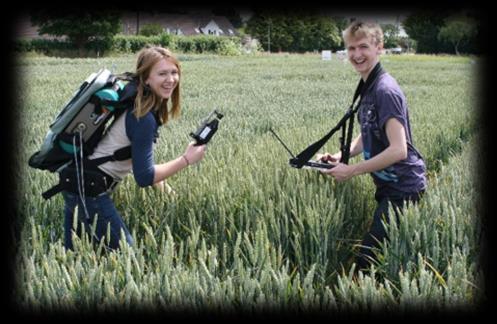

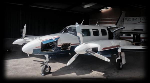

3 About Us
4 Context Knowledge on tree species is relevant for biomass estimation, habitat quality assessment and bio diversity characterization Tree health assessment is relevant to monitor spread of disease and to inform management intervention Hyperspectral data has been proven to have a high potential for the mapping of tree species composition This presentation will address the following: How do techniques, proven in Defence and Security, compare with published approaches for tree species mapping? Do these techniques have application to detect Ash die back?
5 Reflectance Reflectance Reflectance Hyperspectral data acquisition and interpretation Data acquisition Rate of data capture relates to operational altitude, forward speed and Field of View. Data cube Each pixel generates data from every band width relative to spectral resolution Hyperspectral signature Each pixel shown as intensity against wavelength 1000 m Vegetation Raw Data Ha per hour Calibrated Data Soil Reflectance Data Spatial resolution Number of pixels in the Instantaneous Field of View 1600 for VNIR 384 for SWIR Pixel grid spectrograph Water Reflectance Mosaic Derived Products Spectral resolution Number of bands or band width within the spectrograph
6 Case Study 1 Tree Species Identification


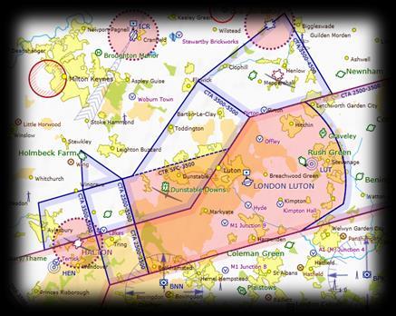
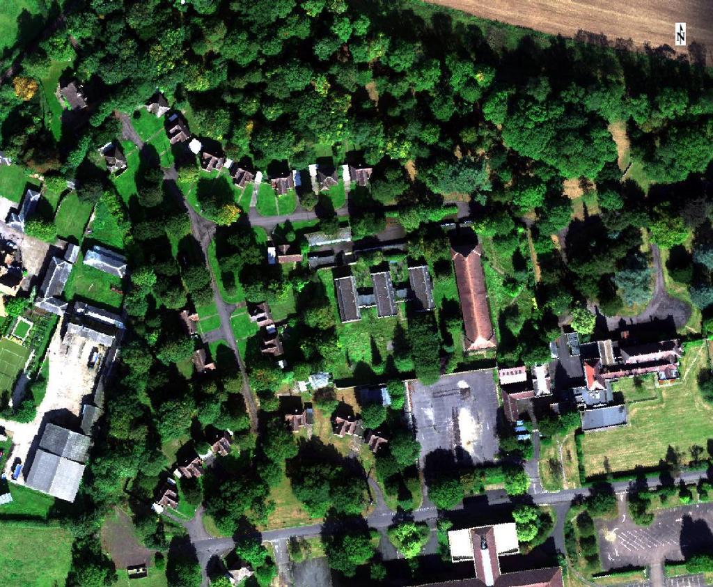
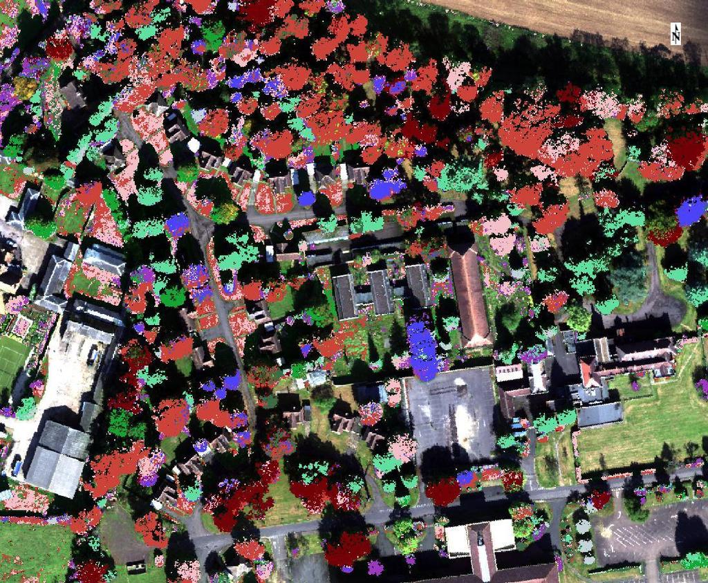
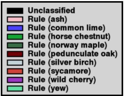
7 Data and study area Hyperspectral data collected 24SEPT15 over BRAMPTON, 5 lines 0.3m GSD VNIR, 0.6m GSD SWIR, 192 bands MOD Tree Survey Hand selected 9 common species, 56 trees Ash Common Lime Horse Chestnut Norway Maple Pedunculate Oak Silver Birch Sycamore Wild Cherry Yew


 Rule Images")
8 1 Automatic Forest Area Extraction From Imaging Spectroscopy Data Using An Extended NDVI Fabian Faßnacht, et.al. Method 2 CORRECTION OF SHADOWING IN IMAGING SPECTROSCOPY DATA BY QUANTIFICATION OF THE PROPORTION OF DIFFUSE ILLUMINATION Daniel Schläpfer et.al. 3 Comparison of Feature Reduction Algorithms for Classifying Tree Species With Hyperspectral Data on Three Central European Test Sites Fabian E. Fassnacht et.al. Confusion matrix Reflectance cube Validation pixels Tree index 1 Tree & Shadow mask 2 Common MNF transform 3 SVM (RBF) Rule Images Class map Standard PCA transform Training pixels Spectral libraries Target detection
9 Results Support Vector Machine Target detection results very poor, not shown SVM shows excellent overall classification (98%) using pixels from all five images However, performance falls significantly (species dependent) using training pixels drawn from only one image Observe that this is not purely due to number of training pixels Ash Common Lime Horse Chestnut Norway Maple Pedunculate Oak Silver Birch Sycamore Wild Cherry Yew Training pixels derived from All images Image 02 Image 04 Image 05 Overall accuracy Ash Common lime 0.97 Horse Chestnut Norway Maple 0.99 Pedunculate Oak Silver Birch 1.00 Sycamore Wild Cherry Yew Details of SVM; radial basis function kernel, samples divided into training (2/3, max samples) and test (1/3), parameters optimised using k-5 fold cross-validation on training data
10 Conclusions and Future Research Target detection was not successful; potential that the mean spectrum is not discriminatory (in high dimensions) SVM classification results are similar to published results Transfer of training data across strips is not robust, even when imagery is of consistent quality Is tree phenomenology robust over scale? Implications for operational production Future directions, drive towards automation, include: Improved tree mask Explore target detection performance Sensitivity to training samples/species/resolution Thresholds for empty classes

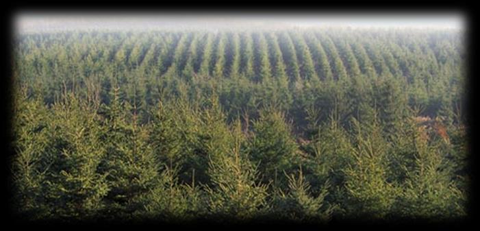
11 Tree Species Mapping
12 Case Study 2 Tree Disease Detection


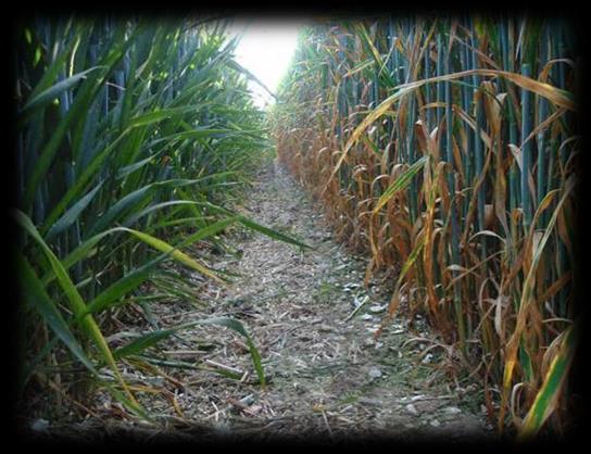
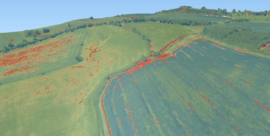
13 Data and study area Hyperspectral data collected 08AUG15 over LOWICK, single line 0.3m GSD VNIR, 0.6m GSD SWIR, 198 bands Observations of ASH tree disease % of total canopy that displays the "angst twig" symptomology induced by the anamorphic stage Hand selected 45 trees, pixel samples


14 1 Automatic Forest Area Extraction From Imaging Spectroscopy Data Using An Extended NDVI Fabian Faßnacht, et.al. Method 2 CORRECTION OF SHADOWING IN IMAGING SPECTROSCOPY DATA BY QUANTIFICATION OF THE PROPORTION OF DIFFUSE ILLUMINATION Daniel Schläpfer et.al. 3 Comparison of Feature Reduction Algorithms for Classifying Tree Species With Hyperspectral Data on Three Central European Test Sites Fabian E. Fassnacht et.al. Reflectance cube Vegetation indices Plots v disease Validation pixels Tree index1 Tree & Shadow mask 2 MNF transform 3 Linear Regression Rule Images Standard PCA transform Training pixels Spectral libraries (high disease) Target detection
15 Results Scatterplots Indices as defined in ENVI 8.5 Target detection scatterplot using ACE detection, 95% disease signature from IMNF image
16 Results Scatterplots Indices as defined in ENVI 8.5 Target detection scatterplot using ACE detection, 95% disease signature from IMNF image

 data, 100 runs All 198 bands cannot be selected due to potential to over-fit the")
17 Results Regression Results shown left were from normalised IMNF image restricted to 30 bands relevant to plant spectral phenomenology Details of regression; stratified sampling into 10 bins, pixels randomly divided into training (~800 samples) and validation (~500 samples) data, 100 runs All 198 bands cannot be selected due to potential to over-fit the data
18 Conclusions and Future Research Within crown pixel scatter creates difficulty in data mining for a disease signature Target detection was not successful; the mean spectrum is not diagnostic (in high dimensions) Linear band combinations show promise to predict disease amongst a known ash population Future directions include: Explore target detection performance, reducing spatial resolution Improve disease assessment protocols Alternative machine learning techniques (e.g. SVM-R)
19 Conclusions How do techniques, proven in Defence and Security, compare with published approaches for tree species mapping? Do these techniques have application to detect Ash die back? Results do not support use of target detection techniques for either application Speculate that the signature is variable so is neither diagnostic nor robust feature selection and/or reduced resolution may assist
20 Thank you
21
Integration of airborne LiDAR and hyperspectral remote sensing data to support the Vegetation Resources Inventory and sustainable forest management
 Integration of airborne LiDAR and hyperspectral remote sensing data to support the Vegetation Resources Inventory and sustainable forest management Executive Summary This project has addressed a number
IMPROVED TARGET DETECTION IN URBAN AREA USING COMBINED LIDAR AND APEX DATA
 IMPROVED TARGET DETECTION IN URBAN AREA USING COMBINED LIDAR AND APEX DATA Michal Shimoni 1 and Koen Meuleman 2 1 Signal and Image Centre, Dept. of Electrical Engineering (SIC-RMA), Belgium; 2 Flemish
Sensors and applications for drone based remote sensing
 Sensors and applications for drone based remote sensing Dr. Ilkka Pölönen Dr. Eija Honkavaara, NLS Dr. Heikki Saari, VTT Dr. Sakari Tuominen, Mr. Jere Kaivosoja, Luke Laboratory Joint research with Finnish
Land Cover Classification Techniques
 Land Cover Classification Techniques supervised classification and random forests Developed by remote sensing specialists at the USFS Geospatial Technology and Applications Center (GTAC), located in Salt
2010 LiDAR Project. GIS User Group Meeting June 30, 2010
 2010 LiDAR Project GIS User Group Meeting June 30, 2010 LiDAR = Light Detection and Ranging Technology that utilizes lasers to determine the distance to an object or surface Measures the time delay between
Computational color Lecture 1. Ville Heikkinen
 Computational color Lecture 1 Ville Heikkinen 1. Introduction - Course context - Application examples (UEF research) 2 Course Standard lecture course: - 2 lectures per week (see schedule from Weboodi)
The 2014 IEEE GRSS Data Fusion Contest
 The 2014 IEEE GRSS Data Fusion Contest Description of the datasets Presented to Image Analysis and Data Fusion Technical Committee IEEE Geoscience and Remote Sensing Society (GRSS) February 17 th, 2014
Terrain categorization using LIDAR and multi-spectral data
 Terrain categorization using LIDAR and multi-spectral data Angela M. Puetz, R. C. Olsen, Michael A. Helt U.S. Naval Postgraduate School, 833 Dyer Road, Monterey, CA 93943 ampuetz@nps.edu, olsen@nps.edu
Oakville, Ontario. Hyperspectral Imagery Analysis for EAB Management. Ian Hanou AMEC Earth & Environmental
 Oakville, Ontario Hyperspectral Imagery Analysis for EAB Management Ian Hanou Ian.hanou@amec.com (303) 503-4846 Agenda - Project Overview - Technology Overview - Field Data Collection and Imagery - Ash
Derivation of Structural Forest Parameters from the Fusion of Airborne Hyperspectral and Laserscanning Data
 Derivation of Structural Forest Parameters from the Fusion of Airborne Hyperspectral and Laserscanning Data - Implications for Seamless Modeling of Terrestrial Ecosystems 24 26 September 2014, St.Oswald,
Hyperspectral Image Acquisition and Analysis
 Hyperspectral Image Acquisition and Analysis PECORA 15 Workshop 7 Airborne Remote Sensing: A Fast-track Approach to NEPA Streamlining for Transportation Jen Aitken, ITRES Research Limited CASI Hyperspectral
AISASYSTEMS PRODUCE MORE WITH LESS
 AISASYSTEMS PRODUCE MORE WITH LESS AISASYSTEMS SPECIM s AISA systems are state-of-the-art airborne hyperspectral imaging solutions covering the VNIR, NIR, SWIR and LWIR spectral ranges. The sensors unbeatable
10/2/2012 Corporate Headquarters 9390 Gateway Dr, Ste 100 Reno, NV p: f:
 SRS Project Report 1538 R.I.T. 10/2/2012 Corporate Headquarters 9390 Gateway Dr, Ste 100 Reno, NV 89521 p: 775.329.6660 f: 775.329.6668 Table of Contents 1 Overview 2 Acquisition Summary 3 4 2.1 Collection
HYPERSPECTRAL DATA FOR FOREST INVENTORIES. Henning Aberle, M.Sc. Bogor & Jakarta, Indonesia March 2014
 T HE E C O L O G I C A L A N D E C O N O M I C C H A L L E N G E S OF M A N A G I N G F O R E S T E D L A N D S C A P E S IN A G L O B A L C O N T E X T - F O C U S : A S I A HYPERSPECTRAL DATA FOR FOREST
ENVI. Get the Information You Need from Imagery.
 Visual Information Solutions ENVI. Get the Information You Need from Imagery. ENVI is the premier software solution to quickly, easily, and accurately extract information from geospatial imagery. Easy
Quality assessment of RS data. Remote Sensing (GRS-20306)
") Quality assessment of RS data Remote Sensing (GRS-20306) Quality assessment General definition for quality assessment (Wikipedia) includes evaluation, grading and measurement process to assess design,
Quality assessment of RS data Remote Sensing (GRS-20306) Quality assessment General definition for quality assessment (Wikipedia) includes evaluation, grading and measurement process to assess design,
Presented at the FIG Congress 2018, May 6-11, 2018 in Istanbul, Turkey
 Presented at the FIG Congress 2018, May 6-11, 2018 in Istanbul, Turkey Evangelos MALTEZOS, Charalabos IOANNIDIS, Anastasios DOULAMIS and Nikolaos DOULAMIS Laboratory of Photogrammetry, School of Rural
Effect of Hyperspectral image denoising with PCA and total variation on tree species mapping using Apex Data
 Effect of Hyperspectral image denoising with PCA and total variation on tree species mapping using Apex Data Frieke Van Coillie a,*, Wenzhi Liao b, Flore Devriendt a, Sidharta Gautama b, Robert De Wulf
Hyperspectral Remote Sensing
 Hyperspectral Remote Sensing Multi-spectral: Several comparatively wide spectral bands Hyperspectral: Many (could be hundreds) very narrow spectral bands GEOG 4110/5100 30 AVIRIS: Airborne Visible/Infrared
Prof. Vidya Manian Dept. of Electrical l and Comptuer Engineering. INEL6007(Spring 2010) ECE, UPRM
 ECE, UPRM") Inel 6007 Introduction to Remote Sensing Chapter 5 Spectral Transforms Prof. Vidya Manian Dept. of Electrical l and Comptuer Engineering Chapter 5-1 MSI Representation Image Space: Spatial information
Inel 6007 Introduction to Remote Sensing Chapter 5 Spectral Transforms Prof. Vidya Manian Dept. of Electrical l and Comptuer Engineering Chapter 5-1 MSI Representation Image Space: Spatial information
Lecture 7. Spectral Unmixing. Summary. Mixtures in Remote Sensing
 Lecture 7 Spectral Unmixing Summary This lecture will introduce you to the concepts of linear spectral mixing. This methods is sometimes also called: Spectral Mixture Analysis (SMA: Wessman et al 1997)
Leveraging UAS and Hyperspectral Technology for Advanced Remote Sensing
 Leveraging UAS and Hyperspectral Technology for Advanced Remote Sensing Tom Breen, Director of Global Sales Slide 1 Abstract The convergence of hyperspectral imaging aboard UASs is occurring at a very
Airborne LiDAR Data Acquisition for Forestry Applications. Mischa Hey WSI (Corvallis, OR)
") Airborne LiDAR Data Acquisition for Forestry Applications Mischa Hey WSI (Corvallis, OR) WSI Services Corvallis, OR Airborne Mapping: Light Detection and Ranging (LiDAR) Thermal Infrared Imagery 4-Band
Airborne LiDAR Data Acquisition for Forestry Applications Mischa Hey WSI (Corvallis, OR) WSI Services Corvallis, OR Airborne Mapping: Light Detection and Ranging (LiDAR) Thermal Infrared Imagery 4-Band
COSC160: Detection and Classification. Jeremy Bolton, PhD Assistant Teaching Professor
 COSC160: Detection and Classification Jeremy Bolton, PhD Assistant Teaching Professor Outline I. Problem I. Strategies II. Features for training III. Using spatial information? IV. Reducing dimensionality
Introduction to digital image classification
 Introduction to digital image classification Dr. Norman Kerle, Wan Bakx MSc a.o. INTERNATIONAL INSTITUTE FOR GEO-INFORMATION SCIENCE AND EARTH OBSERVATION Purpose of lecture Main lecture topics Review
Hyperspectral Chemical Imaging: principles and Chemometrics.
 Hyperspectral Chemical Imaging: principles and Chemometrics aoife.gowen@ucd.ie University College Dublin University College Dublin 1,596 PhD students 6,17 international students 8,54 graduate students
Weeds-wheat discrimination using hyperspectral imagery
 Abstract Weeds-wheat discrimination using hyperspectral imagery Xavier Hadoux 1 *, Nathalie Gorretta 1, Gilles Rabatel 1 1 Irstea UMR ITAP, 361 rue J-F Breton BP 5095, 34196 Montpellier Cedex 5, France
Linking sun-induced fluorescence and photosynthesis in a forest ecosystem
 Linking sun-induced fluorescence and photosynthesis in a forest ecosystem COST ES1309 Tagliabue G, Panigada C, Dechant B, Celesti M, Cogliati S, Colombo R, Julitta T, Meroni M, Schickling A, Schuettemeyer
Figure 1: Workflow of object-based classification
 Technical Specifications Object Analyst Object Analyst is an add-on package for Geomatica that provides tools for segmentation, classification, and feature extraction. Object Analyst includes an all-in-one
Fast Anomaly Detection Algorithms For Hyperspectral Images
 Vol. Issue 9, September - 05 Fast Anomaly Detection Algorithms For Hyperspectral Images J. Zhou Google, Inc. ountain View, California, USA C. Kwan Signal Processing, Inc. Rockville, aryland, USA chiman.kwan@signalpro.net
Analisi di immagini iperspettrali satellitari multitemporali: metodi ed applicazioni
 Analisi di immagini iperspettrali satellitari multitemporali: metodi ed applicazioni E-mail: bovolo@fbk.eu Web page: http://rsde.fbk.eu Outline 1 Multitemporal image analysis 2 Multitemporal images pre-processing
THE USE OF AIRBORNE HYPERSPECTRAL REFLECTANCE DATA TO CHARACTERIZE FOREST SPECIES DISTRIBUTION PATTERNS
 THE USE OF AIRBORNE HYPERSPECTRAL REFLECTANCE DATA TO CHARACTERIZE FOREST SPECIES DISTRIBUTION PATTERNS Weihs, P., Huber K. Institute of Meteorology, Department of Water, Atmosphere and Environment, BOKU
Classify Multi-Spectral Data Classify Geologic Terrains on Venus Apply Multi-Variate Statistics
 Classify Multi-Spectral Data Classify Geologic Terrains on Venus Apply Multi-Variate Statistics Operations What Do I Need? Classify Merge Combine Cross Scan Score Warp Respace Cover Subscene Rotate Translators
Multisensoral UAV-Based Reference Measurements for Forestry Applications
 Multisensoral UAV-Based Reference Measurements for Forestry Applications Research Manager D.Sc. Anttoni Jaakkola Centre of Excellence in Laser Scanning Research 2 Outline UAV applications Reference level
SAM and ANN classification of hyperspectral data of seminatural agriculture used areas
 Proceedings of the 28th EARSeL Symposium: Remote Sensing for a Changing Europe, Istambul, Turkey, June 2-5 2008. Millpress Science Publishers Zagajewski B., Olesiuk D., 2008. SAM and ANN classification
Investigating the Structural Condition of Individual Trees using LiDAR Metrics
 Investigating the Structural Condition of Individual Trees using LiDAR Metrics Jon Murray 1, George Alan Blackburn 1, Duncan Whyatt 1, Christopher Edwards 2. 1 Lancaster Environment Centre, Lancaster University,
Hydrocarbon Index an algorithm for hyperspectral detection of hydrocarbons
 INT. J. REMOTE SENSING, 20 JUNE, 2004, VOL. 25, NO. 12, 2467 2473 Hydrocarbon Index an algorithm for hyperspectral detection of hydrocarbons F. KÜHN*, K. OPPERMANN and B. HÖRIG Federal Institute for Geosciences
Copyright 2005 Society of Photo-Optical Instrumentation Engineers.
 Copyright 2005 Society of Photo-Optical Instrumentation Engineers. This paper was published in the Proceedings, SPIE Symposium on Defense & Security, 28 March 1 April, 2005, Orlando, FL, Conference 5806
LiDAR Data Processing:
 LiDAR Data Processing: Concepts and Methods for LEFI Production Gordon W. Frazer GWF LiDAR Analytics Outline of Presentation Data pre-processing Data quality checking and options for repair Data post-processing
Lab 9. Julia Janicki. Introduction
 Lab 9 Julia Janicki Introduction My goal for this project is to map a general land cover in the area of Alexandria in Egypt using supervised classification, specifically the Maximum Likelihood and Support
Spectral Classification
 Spectral Classification Spectral Classification Supervised versus Unsupervised Classification n Unsupervised Classes are determined by the computer. Also referred to as clustering n Supervised Classes
EVALUATION OF CONVENTIONAL DIGITAL CAMERA SCENES FOR THEMATIC INFORMATION EXTRACTION ABSTRACT
 EVALUATION OF CONVENTIONAL DIGITAL CAMERA SCENES FOR THEMATIC INFORMATION EXTRACTION H. S. Lim, M. Z. MatJafri and K. Abdullah School of Physics Universiti Sains Malaysia, 11800 Penang ABSTRACT A study
Small-footprint full-waveform airborne LiDAR for habitat assessment in the ChangeHabitats2 project
 Small-footprint full-waveform airborne LiDAR for habitat assessment in the ChangeHabitats2 project Werner Mücke, András Zlinszky, Sharif Hasan, Martin Pfennigbauer, Hermann Heilmeier and Norbert Pfeifer
End-to-End Simulation of Sentinel-2 Data with Emphasis on Atmospheric Correction Methods
 End-to-End Simulation of Sentinel-2 Data with Emphasis on Atmospheric Correction Methods Luis Guanter 1, Karl Segl 2, Hermann Kaufmann 2 (1) Institute for Space Sciences, Freie Universität Berlin, Germany
CHRIS Proba Workshop 2005 II
 CHRIS Proba Workshop 25 Analyses of hyperspectral and directional data for agricultural monitoring using the canopy reflectance model SLC Progress in the Upper Rhine Valley and Baasdorf test-sites Dr.
CHAPTER 4 DETECTION OF DISEASES IN PLANT LEAF USING IMAGE SEGMENTATION
 CHAPTER 4 DETECTION OF DISEASES IN PLANT LEAF USING IMAGE SEGMENTATION 4.1. Introduction Indian economy is highly dependent of agricultural productivity. Therefore, in field of agriculture, detection of
Available online at ScienceDirect. Procedia Computer Science 93 (2016 )
") Available online at www.sciencedirect.com ScienceDirect Procedia Computer Science 93 (2016 ) 396 402 6th International Conference On Advances In Computing & Communications, ICACC 2016, 6-8 September 2016,
Available online at www.sciencedirect.com ScienceDirect Procedia Computer Science 93 (2016 ) 396 402 6th International Conference On Advances In Computing & Communications, ICACC 2016, 6-8 September 2016,
ENVI Classic Tutorial: Multispectral Analysis of MASTER HDF Data 2
 ENVI Classic Tutorial: Multispectral Analysis of MASTER HDF Data Multispectral Analysis of MASTER HDF Data 2 Files Used in This Tutorial 2 Background 2 Shortwave Infrared (SWIR) Analysis 3 Opening the
Modeling reflectance and transmittance of leaves in the µm domain: PROSPECT-VISIR
 Modeling reflectance and transmittance of leaves in the 0.4-5.7 µm domain: PROSPECT-VISIR F. Gerber 1,2, R. Marion 1, S. Jacquemoud 2, A. Olioso 3 et S. Fabre 4 1 CEA/DASE/Télédétection, Surveillance,
Improved classification accuracy of powdery mildew infection levels of wine grapes by spatial spectral analysis of hyperspectral images
 DOI 10.1186/s13007-017-0198-y Plant Methods METHODOLOGY Open Access Improved classification accuracy of powdery mildew infection levels of wine grapes by spatial spectral analysis of hyperspectral images
Design based validation of the MODIS Global Burned Area Product
 Design based validation of the MODIS Global Burned Area Product Luigi Boschetti1, David Roy2, Chris Justice3, Steve Stehman4 1 University of Idaho, Department of Forest, Rangeland and Fire Sciences 2 South
Uttam Kumar and Ramachandra T.V. Energy & Wetlands Research Group, Centre for Ecological Sciences, Indian Institute of Science, Bangalore
 Remote Sensing and GIS for Monitoring Urban Dynamics Uttam Kumar and Ramachandra T.V. Energy & Wetlands Research Group, Centre for Ecological Sciences, Indian Institute of Science, Bangalore 560 012. Remote
An Algorithm to Determine the Chromaticity Under Non-uniform Illuminant
 An Algorithm to Determine the Chromaticity Under Non-uniform Illuminant Sivalogeswaran Ratnasingam and Steve Collins Department of Engineering Science, University of Oxford, OX1 3PJ, Oxford, United Kingdom
Hyperspectral Remote Sensing in Acquisition of Geospatial Information for the Modern Warfare. Dr M R Bhutiyani,
 Hyperspectral Remote Sensing in Acquisition of Geospatial Information for the Modern Warfare Dr M R Bhutiyani, Ex-Director, DTRL, New Delhi Chairman, ISRS, Delhi Chapter Air photo-interpretation Multi-spectral
REMOTE SENSING OF BENTHIC HABITATS IN SOUTHWESTERN PUERTO RICO
 REMOTE SENSING OF BENTHIC HABITATS IN SOUTHWESTERN PUERTO RICO Fernando Gilbes Santaella Dep. of Geology Roy Armstrong Dep. of Marine Sciences University of Puerto Rico at Mayagüez fernando.gilbes@upr.edu
Non-destructive techniques in seed quality determination
 Non-destructive techniques in seed quality determination Merete Halkjær Olesen Aarhus University Science & Technology Department of Agroecology TATION presen Outline Seed anatomy and the importance of
HYPERSPECTRAL REMOTE SENSING
 HYPERSPECTRAL REMOTE SENSING By Samuel Rosario Overview The Electromagnetic Spectrum Radiation Types MSI vs HIS Sensors Applications Image Analysis Software Feature Extraction Information Extraction 1
ENVI Tutorial: Basic Hyperspectral Analysis
 ENVI Tutorial: Basic Hyperspectral Analysis Table of Contents OVERVIEW OF THIS TUTORIAL...2 DEFINE ROIS...3 Load AVIRIS Data...3 Create and Restore ROIs...3 Extract Mean Spectra from ROIs...4 DISCRIMINATE
Color and Shading. Color. Shapiro and Stockman, Chapter 6. Color and Machine Vision. Color and Perception
 Color and Shading Color Shapiro and Stockman, Chapter 6 Color is an important factor for for human perception for object and material identification, even time of day. Color perception depends upon both
Using Lidar and ArcGIS to Predict Forest Inventory Variables
 Using Lidar and ArcGIS to Predict Forest Inventory Variables Dr. Kevin S. Lim kevin@limgeomatics.com P.O. Box 45089, 680 Eagleson Road Ottawa, Ontario, K2M 2G0, Canada Tel.: 613-686-5735 Fax: 613-822-5145
Retrieval of Surface Reflectance and LAI Mapping with Data from ALI, Hyperion and AVIRIS
 Retrieval of Surface Reflectance and LAI Mapping with Data from ALI, Hyperion and AVIRIS P. Gong 1, G. Biging 1, R. Pu 1, and M. R. Larrieu 2 1 Center for Assessment and Monitoring of Forest and Environmental
ENVI Tutorial: Vegetation Hyperspectral Analysis
 ENVI Tutorial: Vegetation Hyperspectral Analysis Table of Contents OVERVIEW OF THIS TUTORIAL...1 HyMap Processing Flow...4 VEGETATION HYPERSPECTRAL ANALYSIS...4 Examine the Jasper Ridge HyMap Radiance
Airborne Laser Scanning: Remote Sensing with LiDAR
 Airborne Laser Scanning: Remote Sensing with LiDAR ALS / LIDAR OUTLINE Laser remote sensing background Basic components of an ALS/LIDAR system Two distinct families of ALS systems Waveform Discrete Return
Image Classification. RS Image Classification. Present by: Dr.Weerakaset Suanpaga
 Image Classification Present by: Dr.Weerakaset Suanpaga D.Eng(RS&GIS) 6.1 Concept of Classification Objectives of Classification Advantages of Multi-Spectral data for Classification Variation of Multi-Spectra
Testing Hyperspectral Remote Sensing Monitoring Techniques for Geological CO 2 Storage at Natural Seeps
 Testing Hyperspectral Remote Sensing Monitoring Techniques for Geological CO 2 Storage at Natural Seeps Luke Bateson Clare Fleming Jonathan Pearce British Geological Survey In what ways can EO help with
Crop Types Classification By Hyperion Data And Unmixing Algorithm
 Crop Types Classification By Hyperion Data And Unmixing Algorithm H. FAHIMNEJAD 1, S.R. SOOFBAF 2, A. ALIMOHAMMADI 3, M. J. VALADAN ZOEJ 4 Geodesy and Geomatic Faculty, K.N.Toosi University of Technology,
MRO CRISM TRR3 Hyperspectral Data Filtering
 MRO CRISM TRR3 Hyperspectral Data Filtering CRISM Data User's Workshop 03/18/12 F. Seelos, CRISM SOC CRISM PDS-Delivered VNIR TRR3 I/F 3-Panel Plot False Color RGB Composite Composite band distribution
APPLICATION OF SOFTMAX REGRESSION AND ITS VALIDATION FOR SPECTRAL-BASED LAND COVER MAPPING
 APPLICATION OF SOFTMAX REGRESSION AND ITS VALIDATION FOR SPECTRAL-BASED LAND COVER MAPPING J. Wolfe a, X. Jin a, T. Bahr b, N. Holzer b, * a Harris Corporation, Broomfield, Colorado, U.S.A. (jwolfe05,
ENVI Classic Tutorial: Basic Hyperspectral Analysis
 ENVI Classic Tutorial: Basic Hyperspectral Analysis Basic Hyperspectral Analysis 2 Files Used in this Tutorial 2 Define ROIs 3 Load AVIRIS Data 3 Create and Restore ROIs 3 Extract Mean Spectra from ROIs
Dr. Larry J. Paxton Johns Hopkins University Applied Physics Laboratory Laurel, MD (301) (301) fax
 (301) fax") Dr. Larry J. Paxton Johns Hopkins University Applied Physics Laboratory Laurel, MD 20723 (301) 953-6871 (301) 953-6670 fax Understand the instrument. Be able to convert measured counts/pixel on-orbit into
Dr. Larry J. Paxton Johns Hopkins University Applied Physics Laboratory Laurel, MD 20723 (301) 953-6871 (301) 953-6670 fax Understand the instrument. Be able to convert measured counts/pixel on-orbit into
Analysis of Process and biological data using support vector machines
 Analysis of Process and biological data using support vector machines Sankar Mahadevan, PhD student Supervisor : Dr. Sirish Shah Department of Chemical and Materials Engineering University of Alberta Outline
CORRELATION BETWEEN NDVI AND SURFACE TEMPERATURES USING LANDSAT ETM IMAGERY FOR SAN ANTONIO AREA. Remote Sensing Project By Newfel Mazari Fall 2005
 CORRELATION BETWEEN NDVI AND SURFACE TEMPERATURES USING LANDSAT ETM IMAGERY FOR SAN ANTONIO AREA Remote Sensing Project By Newfel Mazari Fall 2005 Procedure Introduction and Objectives Site Date Acquisition
Data: a collection of numbers or facts that require further processing before they are meaningful
 Digital Image Classification Data vs. Information Data: a collection of numbers or facts that require further processing before they are meaningful Information: Derived knowledge from raw data. Something
Classification (or thematic) accuracy assessment. Lecture 8 March 11, 2005
 accuracy assessment. Lecture 8 March 11, 2005") Classification (or thematic) accuracy assessment Lecture 8 March 11, 2005 Why and how Remote sensing-derived thematic information are becoming increasingly important. Unfortunately, they contain errors.
Classification (or thematic) accuracy assessment Lecture 8 March 11, 2005 Why and how Remote sensing-derived thematic information are becoming increasingly important. Unfortunately, they contain errors.
TOA RADIANCE SIMULATOR FOR THE NEW HYPERSPECTRAL MISSIONS: STORE (SIMULATOR OF TOA RADIANCE)
") TOA RADIANCE SIMULATOR FOR THE NEW HYPERSPECTRAL MISSIONS: STORE (SIMULATOR OF TOA RADIANCE) Malvina Silvestri Istituto Nazionale di Geofisica e Vulcanologia In the frame of the Italian Space Agency (ASI)
TOA RADIANCE SIMULATOR FOR THE NEW HYPERSPECTRAL MISSIONS: STORE (SIMULATOR OF TOA RADIANCE) Malvina Silvestri Istituto Nazionale di Geofisica e Vulcanologia In the frame of the Italian Space Agency (ASI)
- Q807/ J.p 7y qj7 7 w SfiAJ D--q8-0?dSC. CSNf. Interferometric S A R Coherence ClassificationUtility Assessment
 19980529 072 J.p 7y qj7 7 w SfiAJ D--q8-0?dSC \---@ 2 CSNf - Q807/ Interferometric S A R Coherence ClassificationUtility Assessment - 4 D. A. Yocky Sandia National Laboratories P.O. Box 5800, MS1207 Albuquerque,
Remote Sensing Introduction to the course
 Remote Sensing Introduction to the course Remote Sensing (Prof. L. Biagi) Exploitation of remotely assessed data for information retrieval Data: Digital images of the Earth, obtained by sensors recording
Locating the Shadow Regions in LiDAR Data: Results on the SHARE 2012 Dataset
 Locating the Shadow Regions in LiDAR Data: Results on the SHARE 22 Dataset Mustafa BOYACI, Seniha Esen YUKSEL* Hacettepe University, Department of Electrical and Electronics Engineering Beytepe, Ankara,
CLASSIFICATION OF NONPHOTOGRAPHIC REMOTE SENSORS
 CLASSIFICATION OF NONPHOTOGRAPHIC REMOTE SENSORS PASSIVE ACTIVE DIGITAL CAMERA THERMAL (e.g. TIMS) VIDEO CAMERA MULTI- SPECTRAL SCANNERS VISIBLE & NIR MICROWAVE HYPERSPECTRAL (e.g. AVIRIS) SLAR Real Aperture
Final Report: Kaggle Soil Property Prediction Challenge
 Final Report: Kaggle Soil Property Prediction Challenge Saurabh Verma (verma076@umn.edu, (612)598-1893) 1 Project Goal Low cost and rapid analysis of soil samples using infrared spectroscopy provide new
Outlier and Target Detection in Aerial Hyperspectral Imagery: A Comparison of Traditional and Percentage Occupancy Hit or Miss Transform Techniques
 Outlier and Target Detection in Aerial Hyperspectral Imagery: A Comparison of Traditional and Percentage Occupancy Hit or Miss Transform Techniques Andrew Young a, Stephen Marshall a, and Alison Gray b
HYLIGHT: Integration of airborne hyperspectral imagery and laser scanning data to improve image processing and interpretation
 EUFAR2 - EUropean Facility for Airborne Research HYLIGHT: Integration of airborne hyperspectral imagery and laser scanning data to improve image processing and interpretation Ils Reusen VITO ils.reusen@vito.be
Land managers need increased temporal and spatial
 Society for Range Management Image Interpreter Tool: An ArcGIS Tool for Estimating Vegetation Cover From High-Resolution Imagery By T. Scott Schrader and Michael C. Duniway Land managers need increased
Motivation. Aerosol Retrieval Over Urban Areas with High Resolution Hyperspectral Sensors
 Motivation Aerosol etrieval Over Urban Areas with High esolution Hyperspectral Sensors Barry Gross (CCNY) Oluwatosin Ogunwuyi (Ugrad CCNY) Brian Cairns (NASA-GISS) Istvan Laszlo (NOAA-NESDIS) Aerosols
CLASSIFICATION OF HYPERSPECTRAL DATA OF SEMINATURAL ECOSYSTEMS
 CLASSIFICATION OF HYPERSPECTRAL DATA OF SEMINATURAL ECOSYSTEMS B. Zagajewski, D. Olesiuk Dept. of Geoinformatics and Remote Sensing, Faculty of Geography and Regional Studies, University of Warsaw, Krakowskie
Tutorials Case studies
 1. Subject Three curves for the evaluation of supervised learning methods. Evaluation of classifiers is an important step of the supervised learning process. We want to measure the performance of the classifier.
Machine Learning and Sensor Fusion for Precision Farming. Solmaz Hajmohammadi, Christopher Schardt, Noah Fahlgren, Arash Abbasi, Stefan Paulus
 Machine Learning and Sensor Fusion for Precision Farming Solmaz Hajmohammadi, Christopher Schardt, Noah Fahlgren, Arash Abbasi, Stefan Paulus Food Insecurity Increase in population 2.8 Billion more people
DESIGN AND EVALUATION OF MACHINE LEARNING MODELS WITH STATISTICAL FEATURES
 EXPERIMENTAL WORK PART I CHAPTER 6 DESIGN AND EVALUATION OF MACHINE LEARNING MODELS WITH STATISTICAL FEATURES The evaluation of models built using statistical in conjunction with various feature subset
DIGITAL IMAGE ANALYSIS. Image Classification: Object-based Classification
 DIGITAL IMAGE ANALYSIS Image Classification: Object-based Classification Image classification Quantitative analysis used to automate the identification of features Spectral pattern recognition Unsupervised
Potential of Sentinel-2 for retrieval of biophysical and biochemical vegetation parameters
 Insert the title of your slide Potential of Sentinel-2 for retrieval of biophysical and biochemical vegetation parameters D. Scheffler, T. Kuester, K. Segl, D. Spengler and H. Kaufmann Motivation Insert
Automated Building Change Detection using multi-level filter in High Resolution Images ZHEN LIU
 Automated uilding Change Detection using multi-level filter in High Resolution Images ZHEN LIU Center of Information & Network Technology, eiing Normal University,00875, zliu@bnu.edu.cn Abstract: The Knowledge
A Review on Plant Disease Detection using Image Processing
 A Review on Plant Disease Detection using Image Processing Tejashri jadhav 1, Neha Chavan 2, Shital jadhav 3, Vishakha Dubhele 4 1,2,3,4BE Student, Dept. of Electronic & Telecommunication Engineering,
UAS based laser scanning for forest inventory and precision farming
 UAS based laser scanning for forest inventory and precision farming M. Pfennigbauer, U. Riegl, P. Rieger, P. Amon RIEGL Laser Measurement Systems GmbH, 3580 Horn, Austria Email: mpfennigbauer@riegl.com,
- IMPROVING CLASS SEPARABILITY - A COMPARATIVE STUDY OF TRANSFORMATION METHODS FOR THE HYPERSPECTRAL FEATURE SPACE
 - IMPROVING CLASS SEPARABILITY - A COMPARATIVE STUDY OF TRANSFORMATION METHODS FOR THE HYPERSPECTRAL FEATURE SPACE Mathias Bochow GeoForschungsZentrum Potsdam, Section 1.4 Remote Sensing, Potsdam, Germany;
Analysis Ready Data For Land
 Analysis Ready Data For Land Product Family Specification Optical Surface Reflectance (CARD4L-OSR) Document status For Adoption as: Product Family Specification, Surface Reflectance, Working Draft (2017)
ENVI Tutorial: Geologic Hyperspectral Analysis
 ENVI Tutorial: Geologic Hyperspectral Analysis Table of Contents OVERVIEW OF THIS TUTORIAL...2 Objectives...2 s Used in This Tutorial...2 PROCESSING FLOW...3 GEOLOGIC HYPERSPECTRAL ANALYSIS...4 Overview
Frame based kernel methods for hyperspectral imagery data
 Frame based kernel methods for hyperspectral imagery data Norbert Wiener Center Department of Mathematics University of Maryland, College Park Recent Advances in Harmonic Analysis and Elliptic Partial
AUTOMATED UPDATING OF BUILDING DATA BASES FROM DIGITAL SURFACE MODELS AND MULTI-SPECTRAL IMAGES: POTENTIAL AND LIMITATIONS
 AUTOMATED UPDATING OF BUILDING DATA BASES FROM DIGITAL SURFACE MODELS AND MULTI-SPECTRAL IMAGES: POTENTIAL AND LIMITATIONS Franz Rottensteiner Cooperative Research Centre for Spatial Information, Dept.
Defining Remote Sensing
 Defining Remote Sensing Remote Sensing is a technology for sampling electromagnetic radiation to acquire and interpret non-immediate geospatial data from which to extract information about features, objects,
ArcGIS Pro: Image Segmentation, Classification, and Machine Learning. Jeff Liedtke and Han Hu
 ArcGIS Pro: Image Segmentation, Classification, and Machine Learning Jeff Liedtke and Han Hu Overview of Image Classification in ArcGIS Pro Overview of the classification workflow Classification tools