Hamilton County Enhances GIS Base Mapping with 1-foot Contours
|
|
|
- Robert Stevenson
- 6 years ago
- Views:
Transcription

1 Hamilton County Enhances GIS Base Mapping with 1-foot Contours Presented by Larry Stout, Hamilton County GIS Manager Brad Fugate, Woolpert Inc. Today s Presentation Hamilton County s 2004 Base Mapping Project Why LiDAR? What is LiDAR? Performing QA/QC: LiDAR Imagery: Color vs. Black and White Contours: 1 foot vs. 2-foot How the 2004 Base Mapping data can be used to enhance the County s GIS 1

2 Hamilton County GIS Policy Committee Barry McNulty Health Department Administrator BJ Casali - Information System Services Director Christine Altman Commissioner Chuck Kiphart - Plan Commission Director Debbie Folkerts Assessor Doug Carter Sheriff Jim Neal - Highway Engineer Judy Levine Councilor Kent Ward - Surveyor Robin Mills Auditor 1996 to 2001 Base Mapping Projects County Wide Black and White Digital Orthophotos 1 = 100 scale at 0.5 foot pixel resolution County Wide Digital Terrain Model (DTM) 2-foot contours County Wide Planimetrics Roads, Hydro, Building Footprints 2

 o 1-foot Contour Generation Planimetric Features o Update Building Foot Prints o New 3-D hydro Water modeling Complete")
3 Project Needs Assessment for 2004 Auditor Tax Mapping County & Township Assessors Property Assessment Health Department Well, Septic, and Vector Control Highway Engineer - Road, Bridge, and ROW Planning Commission - Community Development Sheriff E911 Addressing Surveyor - Drainage responsibilities GIS - Data Design, Maintenance, and Distribution Determined the need for new Color digital orthophotography and DTM with an increased accuracy Base Mapping Project New Color Digital Orthophotos o 1 = 100 scale County wide at 0.5 foot pixel resolution New County Wide Digital Terrain Model (DTM) o 1-foot Contour Generation Planimetric Features o Update Building Foot Prints o New 3-D hydro Water modeling Complete Connectivity Direction of flow Accurate elevations 3


4 How can we improve base mapping accuracy, and speed delivery while maintaining our budget? New advancements in technology since 2001 should provide a solution. Aerial Photography - Large Format Digital Cameras will provide an advantage, however they have just become available and beginning to be implemented. Digital Orthophotography Technology - has not seen dramatic improvement since 1996, however color imagery cost have become more affordable. DTM Acquisition - LiDAR a recent technology, claiming to produce an accurate surface model at a significant cost savings over traditional methods. LiDAR Research GIS, Photogrammetry, and Surveying publications had recently featured LiDAR GIS conferences and Seminars where presenting LiDAR workshops and presentations Many GIS vendors where providing LiDAR services Checked references of public and private organizations who obtained LiDAR After many inquiries, the county decided to use LiDAR to create our DTM. However, with all new technology you need confirmation that it can fulfill its promises: o Produce an accurate surface model o Provide a significant cost savings over traditional methods o Faster than traditional methods 4
")

5 What is LiDAR? Light Detection and Ranging Laser Scanner Mounted Vertically in Aircraft Integrated with Airborne GPS Captures Digital Terrain Model (DTM) Captures an extremely accurate DTM in almost any field condition Not only captures a 3-D model of the surface, but of vertical structures as well, such as, vegetation, buildings, and other structures What Equipment is Needed? Aircraft with Airborne GPS LiDAR unit with IMU (Inertial measurement unit) GPS base stations Data Acquisition hardware and software Post processing hardware and software And a lot of computer storage space 5


6 What is the Process? Cessna 404 Gathering Data Factors to consider How will the data be used? Contour generation,water modeling-flood plane, engineering,volumetric computations Accuracy Vertical accuracy of 1.0 Terrain Type Low, medium, high vertical relief and land use Woodland, cropland, wetland, urban, suburban Schedule How quickly can we deliver the orthophotos? 6


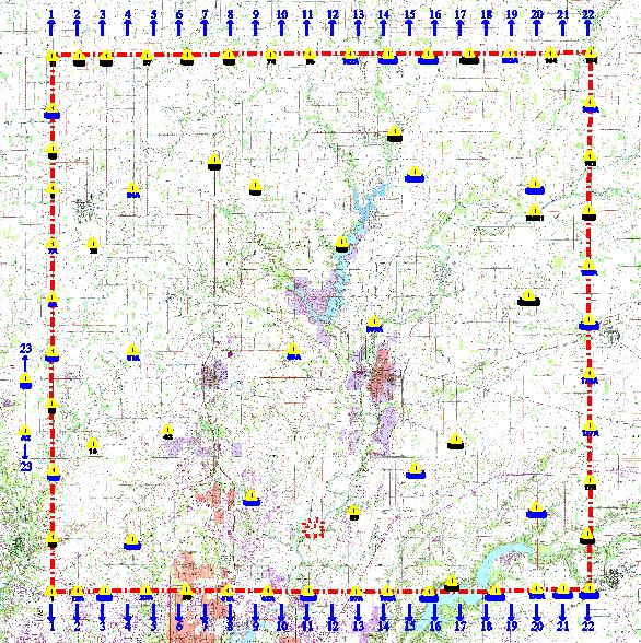
7 Hamilton County, Indiana Region - Central Indiana Size 400 Sq. Miles Terrain Type 3/4 low vertical relief 1/4 medium vertical relief Land Use 1/2 crop land, 1/4 woodland and 1/4 urban Major Cities Noblesville, Carmel, Fishers Several major lakes, rivers, and tributaries Hamilton County, Indiana 7
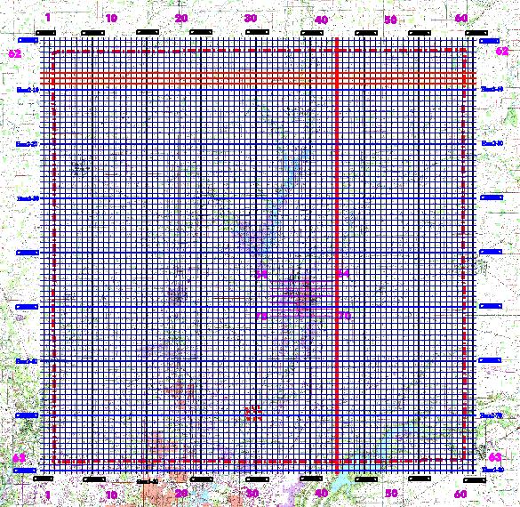
8 Aerial Photography LiDAR Flight Plan 8


9 LiDAR Supported Compilation Set Stereo model LiDAR Supported Compilation Compile Planimetric Data 9

10 LiDAR Supported Compilation Input LiDAR Data Perform QA/QC Compile limited breaklines LiDAR Compilation Generate Contours 10


11 LiDAR/DTM/Contours Deliverables Raw LiDAR Data Bare earth model Vertical Canopy model Stereo compiled DTM data QA/QC d LiDAR mass points Breaklines Contours and Spot Elevations 1-foot cartographic contours and labels Published Spot Elevations Quality Control and Quality Assurance Using a systematic approach to perform Quality Control to the LiDAR/DTM/Contour data 11

12 Field Survey Test Points Follow FEMA guidelines for Field Testing. Direct Point Comparison Provide a minimum of 20 test points for the following Land Use Classifications o Bare Earth and Low Grass o High Grass, weeds, and crops o Brush Lands and low trees o Urban Areas o Forested Bare Earth and Low Grass 12


13 Point Comparison Results LiDAR vs. Field Survey Points +/- 0.4 Deviation High Grass,Weeds, and Crops 13


14 Point Comparison Results LiDAR vs. Field Survey Points +/- 0.4 Deviation Brush Lands and Low Trees 14


15 Point Comparison Results LiDAR vs. Field Survey Points +/- 0.5 Deviation Urban 15


16 Point Comparison Results LiDAR vs. Field Survey Points +/ Deviation Forested 16


17 Point Comparison Results LiDAR vs. Field Survey Points +/- 0.4 Deviation Point Comparison Results LiDAR vs. Field Points +/ Deviation 17

18 LiDAR Data DTM Data 18

19 LiDAR Contours vs. DTM Contours LiDAR/DTM/Contour QA/QC Results Field Test Points vs. LiDAR Field Test Points vs.dtm/breaklines Field Test Points vs. Contours/Spots +/ at 90% confidence level 19

20 2 Foot Contours 1 Foot Contours 20


21 1 Foot vs. 2 Foot Contours B/W vs. Color Imagery 21
22 Black and 0.5 foot pixel 0.5-foot pixel 22


23 Planimetrics: 3-D Hydrology Water Modeling Complete Connectivity Direction of flow Accurate Elevations How the data will be used GIS - accurate base map for county GIS applications, such as parcel mapping, addressing/911, incident mapping, etc. Engineering - produce a surface model capable of contour generation for engineering applications, such as design and construction. 23


24 How the data will be used Planning - use orthophotography as base map instead of using traditional renderings. Orthos bring accuracy to the concept - and the image itself enhances visualization of the concept. Augment this by bringing in captured vertical heights and you have 3-D planning in a spatially correct environment. Transportation - use digital imagery as a base map for route selection, feasibility studies and design. Need to generate contours for grading plans, cut and fill calculations, and infrastructure plan and profile sheets. How the data will be used Water Management - use the new surface model for water modeling and watershed analysis. Reduce the need for field surveyors to manually collect cross-sections on rivers, streams and tributaries. New surface model to determine the floodplain, flood hazards, and impact zones. Airport Facilities need ground and the non-ground model to obtain heights on vertical obstructions. This is essential for determining the slope mapping for approach and departure zones. 24
25 LiDAR Shaded by Elevation Orthophoto Draped On LiDAR 25

26 Questions? 26
2010 LiDAR Project. GIS User Group Meeting June 30, 2010
 2010 LiDAR Project GIS User Group Meeting June 30, 2010 LiDAR = Light Detection and Ranging Technology that utilizes lasers to determine the distance to an object or surface Measures the time delay between
LIDAR MAPPING FACT SHEET
 1. LIDAR THEORY What is lidar? Lidar is an acronym for light detection and ranging. In the mapping industry, this term is used to describe an airborne laser profiling system that produces location and
N.J.P.L.S. An Introduction to LiDAR Concepts and Applications
 N.J.P.L.S. An Introduction to LiDAR Concepts and Applications Presentation Outline LIDAR Data Capture Advantages of Lidar Technology Basics Intensity and Multiple Returns Lidar Accuracy Airborne Laser
Technical Considerations and Best Practices in Imagery and LiDAR Project Procurement
 Technical Considerations and Best Practices in Imagery and LiDAR Project Procurement Presented to the 2014 WV GIS Conference By Brad Arshat, CP, EIT Date: June 4, 2014 Project Accuracy A critical decision
Fusing LiDAR and Imagery: Providing Effective Solutions for Ohio s s Transportation Infrastructure
 Fusing LiDAR and Imagery: Providing Effective Solutions for Ohio s s Transportation Infrastructure Dave Blackstone GIS Manager Ohio Department of Transportation Brian Stevens, CP Project Manager Woolpert
Using ArcGIS Server Data to Assist in Planimetric Update Process. Jim Stout - IMAGIS Rick Hammond Woolpert
 Using ArcGIS Server Data to Assist in Planimetric Update Process Jim Stout - IMAGIS Rick Hammond Woolpert Using ArcGIS Server Data to Assist in Planimetric Update Process Jim Stout - IMAGIS Rick Hammond
An Introduction to Lidar & Forestry May 2013
 An Introduction to Lidar & Forestry May 2013 Introduction to Lidar & Forestry Lidar technology Derivatives from point clouds Applied to forestry Publish & Share Futures Lidar Light Detection And Ranging
Alaska Department of Transportation Roads to Resources Project LiDAR & Imagery Quality Assurance Report Juneau Access South Corridor
 Alaska Department of Transportation Roads to Resources Project LiDAR & Imagery Quality Assurance Report Juneau Access South Corridor Written by Rick Guritz Alaska Satellite Facility Nov. 24, 2015 Contents
Should Contours Be Generated from Lidar Data, and Are Breaklines Required? Lidar data provides the most
 Should Contours Be Generated from Lidar Data, and Are Breaklines Required? Lidar data provides the most accurate and reliable representation of the topography of the earth. As lidar technology advances
Overview. 1. Aerial LiDAR in Wisconsin (20 minutes) 2. Demonstration of data in CAD (30 minutes) 3. High Density LiDAR (20 minutes)
 2. Demonstration of data in CAD (30 minutes) 3. High Density LiDAR (20 minutes)") Overview 1. Aerial LiDAR in Wisconsin (20 minutes) 2. Demonstration of data in CAD (30 minutes) 3. High Density LiDAR (20 minutes) 4. Aerial lidar technology advancements (15 minutes) 5. Q & A 1. Aerial
Overview 1. Aerial LiDAR in Wisconsin (20 minutes) 2. Demonstration of data in CAD (30 minutes) 3. High Density LiDAR (20 minutes) 4. Aerial lidar technology advancements (15 minutes) 5. Q & A 1. Aerial
Mobile Mapping Solutions for Ohio s Integrated Transportation Network. Brian Foster, CP
 Mobile Mapping Solutions for Ohio s Integrated Transportation Network Brian Foster, CP About Woolpert Established in 1911 Over 600 Professionals 25 Offices $12,000,000 invested in new technology in last
Reality Check: Processing LiDAR Data. A story of data, more data and some more data
 Reality Check: Processing LiDAR Data A story of data, more data and some more data Red River of the North Red River of the North Red River of the North Red River of the North Introduction and Background
Terrain Modeling and Mapping for Telecom Network Installation Using Scanning Technology. Maziana Muhamad
 Terrain Modeling and Mapping for Telecom Network Installation Using Scanning Technology Maziana Muhamad Summarising LiDAR (Airborne Laser Scanning) LiDAR is a reliable survey technique, capable of: acquiring
Aerial and Mobile LiDAR Data Fusion
 Creating Value Delivering Solutions Aerial and Mobile LiDAR Data Fusion Dr. Srini Dharmapuri, CP, PMP What You Will Learn About LiDAR Fusion Mobile and Aerial LiDAR Technology Components & Parameters Project
Workshops funded by the Minnesota Environment and Natural Resources Trust Fund
 Workshops funded by the Minnesota Environment and Natural Resources Trust Fund Conservation Applications of LiDAR Data Workshops funded by: Minnesota Environment and Natural Resources Trust Fund Presented
LIDAR 101 & 2014 MO/AR LIDAR PARTNERS PROJECT. NEMO GIS Workshop
 LIDAR 101 & 2014 MO/AR LIDAR PARTNERS PROJECT NEMO GIS Workshop May 22, 2014 PRESENTER Tim Donze Business Development Surdex Corporation PRESENTATION TOPICS What is LiDAR? Why is LiDAR Valuable? Missouri
PUBLIC WORKS. 1oo. DiEital Fee Schedules. Effective January 1, 2008
 PUBLIC WORKS Geographic Information Systems DiEital Fee Schedules Effective January 1, 2008 Date Advertised 12103/07 In (Publication) Daily Business Journal Public Hearing Date Approved as to form: David
APPENDIX E2. Vernal Pool Watershed Mapping
 APPENDIX E2 Vernal Pool Watershed Mapping MEMORANDUM To: U.S. Fish and Wildlife Service From: Tyler Friesen, Dudek Subject: SSHCP Vernal Pool Watershed Analysis Using LIDAR Data Date: February 6, 2014
Airborne and Mobile LiDAR for Transport Corridor Survey Dr. Bharat Lohani Director, Geokno India Pvt. Ltd. & Professor, Geoinformatics IIT Kanpur
 www.geokno.com Airborne and Mobile LiDAR for Transport Corridor Survey Dr. Bharat Lohani Director, Geokno India Pvt. Ltd. & Professor, Geoinformatics IIT Kanpur Geokno has executed and is executing multiple
UAV Surveying II. Precision. Accuracy. Reliability
 UAV Surveying II Precision. Accuracy. Reliability Part One: Project Lifecycle Deliverables Part Two: Evaluation of UAV Data Accuracy and Examples of Error Part Three: AGENDA Review of Results Examples
Merging LiDAR Data with Softcopy Photogrammetry Data
 Merging LiDAR Data with Softcopy Photogrammetry Data Cindy McCallum WisDOT\Bureau of Technical Services Surveying & Mapping Section Photogrammetry Unit Overview Terms and processes Why use data from LiDAR
LiDAR QA/QC - Quantitative and Qualitative Assessment report -
 LiDAR QA/QC - Quantitative and Qualitative Assessment report - CT T0009_LiDAR September 14, 2007 Submitted to: Roald Haested Inc. Prepared by: Fairfax, VA EXECUTIVE SUMMARY This LiDAR project covered approximately
UAV Flight Operations for Mapping. Precision. Accuracy. Reliability
 UAV Flight Operations for Mapping Precision. Accuracy. Reliability Part One: Why is Mapping different? Part Two: What about accuracy and precision? Part Three: What is the Workflow? Part Four: AGENDA What
Volumetric Calculations. Sample Data
 Volumetric Calculations Sample Data Stockpiles of industrial materials are often difficult to measure accurately. LiDAR offers a fast and extremely accurate solution for taking periodical inventory of
QUESTIONS & ANSWERS FOR. ORTHOPHOTO & LiDAR AOT
 QUESTIONS & ANSWERS FOR ORTHOPHOTO & LiDAR AOT Question# 1. Section 3.2 Will the imagery be clipped to the 1000m boundary? If so, what color will be used for null valued pixels? Yes, the imagery will be
Lidar Talking Points Status of lidar collection in Pennsylvania Estimated cost and timeline
 Lidar Talking Points Pennsylvania has an immediate need for new lidar (topographic) data coverage. Some uses of the data are enumerated later in this document. USGS has calculated an average return on
LiDAR & Orthophoto Data Report
 LiDAR & Orthophoto Data Report Tofino Flood Plain Mapping Data collected and prepared for: District of Tofino, BC 121 3 rd Street Tofino, BC V0R 2Z0 Eagle Mapping Ltd. #201 2071 Kingsway Ave Port Coquitlam,
High resolution survey and orthophoto project of the Dosso-Gaya region in the Republic of Niger. by Tim Leary, Woolpert Inc.
 High resolution survey and orthophoto project of the Dosso-Gaya region in the Republic of Niger by Tim Leary, Woolpert Inc. Geospatial Solutions Photogrammetry & Remote Sensing LiDAR Professional Surveying
Existing Elevation Data Sets. Quality Level 2 (QL2) Lidar Data Sets. Better Land Characterization More Accurate Results!
 Lidar Data Sets. Better Land Characterization More Accurate Results!") Existing Elevation Data Sets Out of Date: Most > 40 yrs old Data range from 15 yrs old to > 70 yrs old Spatial Resolution: 33 ft (10 m) or coarser Vertical Accuracy: 3.3 ft 6.6 ft (1 2 m) or worse Quality
Existing Elevation Data Sets Out of Date: Most > 40 yrs old Data range from 15 yrs old to > 70 yrs old Spatial Resolution: 33 ft (10 m) or coarser Vertical Accuracy: 3.3 ft 6.6 ft (1 2 m) or worse Quality
Connecticut Association of Assessing Officers CT Statewide GIS Data Acquisition & Services. June 22, :00 am
 Connecticut Association of Assessing Officers 2016 CT Statewide GIS Data Acquisition & Services June 22, 2016 9:00 am Presented by: Shawn Benham, PMP Project Manager ---------------------------- Brad Arshat,
LiDAR-Maps. and More for. Engineers. TechTime New Mapping Tools for Transportation Engineering. Airborne LiDAR. Digital Cameras
 LiDAR-Maps Airborne LiDAR and More for Digital Cameras Engineers and Their Applications Presenter: Azadeh Koohzare, Ph.D., P.Eng. Project Manager, Geodesy and Geomatics AKoohzare@mcelhanney.com 604-683-8521
LiDAR Engineering and Design Applications. Sample Data
 LiDAR Engineering and Design Applications Sample Data High density LiDAR will return points on any visible part of a structure. Modeling of Existing Structures 2 The distance between any two positions
Course Outline (1) #6 Data Acquisition for Built Environment. Fumio YAMAZAKI
 #6 Data Acquisition for Built Environment. Fumio YAMAZAKI") AT09.98 Applied GIS and Remote Sensing for Disaster Mitigation #6 Data Acquisition for Built Environment 9 October, 2002 Fumio YAMAZAKI yamazaki@ait.ac.th http://www.star.ait.ac.th/~yamazaki/ Course Outline
AT09.98 Applied GIS and Remote Sensing for Disaster Mitigation #6 Data Acquisition for Built Environment 9 October, 2002 Fumio YAMAZAKI yamazaki@ait.ac.th http://www.star.ait.ac.th/~yamazaki/ Course Outline
Airborne LiDAR Data Acquisition for Forestry Applications. Mischa Hey WSI (Corvallis, OR)
") Airborne LiDAR Data Acquisition for Forestry Applications Mischa Hey WSI (Corvallis, OR) WSI Services Corvallis, OR Airborne Mapping: Light Detection and Ranging (LiDAR) Thermal Infrared Imagery 4-Band
Airborne LiDAR Data Acquisition for Forestry Applications Mischa Hey WSI (Corvallis, OR) WSI Services Corvallis, OR Airborne Mapping: Light Detection and Ranging (LiDAR) Thermal Infrared Imagery 4-Band
Municipal Projects in Cambridge Using a LiDAR Dataset. NEURISA Day 2012 Sturbridge, MA
 Municipal Projects in Cambridge Using a LiDAR Dataset NEURISA Day 2012 Sturbridge, MA October 15, 2012 Jeff Amero, GIS Manager, City of Cambridge Presentation Overview Background on the LiDAR dataset Solar
Automated Feature Extraction from Aerial Imagery for Forestry Projects
 Automated Feature Extraction from Aerial Imagery for Forestry Projects Esri UC 2015 UC706 Tuesday July 21 Bart Matthews - Photogrammetrist US Forest Service Southwestern Region Brad Weigle Sr. Program
UTILIZACIÓN DE DATOS LIDAR Y SU INTEGRACIÓN CON SISTEMAS DE INFORMACIÓN GEOGRÁFICA
 UTILIZACIÓN DE DATOS LIDAR Y SU INTEGRACIÓN CON SISTEMAS DE INFORMACIÓN GEOGRÁFICA Aurelio Castro Cesar Piovanetti Geographic Mapping Technologies Corp. (GMT) Consultores en GIS info@gmtgis.com Geographic
Bringing Singapore to life in 3D
 Bringing Singapore to life in 3D Dr Victor Khoo, Deputy Director Singapore Land Authority Bringing Singapore to life in 3D ESRI Singapore UC 2016 Dr. Victor Khoo Singapore Land Authority SLA 2016 RESTRICTED
Geomatic & Information Technologies for Ports and Navigable Waterways. Expanding Our Global Opportunities
 Geomatic & Information Technologies for Ports and Navigable Waterways Airborne Remote Sensing Susan Jackson Tetra Tech Geomatics BD Director Hydrographic Surveying Robert Feldpausch Tetra Tech Principal
GIS Tools for Hydrology and Hydraulics
 1 OUTLINE GIS Tools for Hydrology and Hydraulics INTRODUCTION Good afternoon! Welcome and thanks for coming. I once heard GIS described as a high-end Swiss Army knife: lots of tools in one little package
Lidar Standards. Chatham County, Georgia. Jason Lee, Noel Perkins and Vincent Grevemberg
 1 Lidar Standards Chatham County, Georgia Jason Lee, Noel Perkins and Vincent Grevemberg 2 SAGIS Lidar Standards Table of Contents Introduction...1 Objective...1.1 Data Description...2 Spatial and Temporal
New Requirements for the Relief in the Topographic Databases of the Institut Cartogràfic de Catalunya
 New Requirements for the Relief in the Topographic Databases of the Institut Cartogràfic de Catalunya Blanca Baella, Maria Pla Institut Cartogràfic de Catalunya, Barcelona, Spain Abstract Since 1983 the
CLASSIFICATION OF NONPHOTOGRAPHIC REMOTE SENSORS
 CLASSIFICATION OF NONPHOTOGRAPHIC REMOTE SENSORS PASSIVE ACTIVE DIGITAL CAMERA THERMAL (e.g. TIMS) VIDEO CAMERA MULTI- SPECTRAL SCANNERS VISIBLE & NIR MICROWAVE HYPERSPECTRAL (e.g. AVIRIS) SLAR Real Aperture
Assimilation of Break line and LiDAR Data within ESRI s Terrain Data Structure (TDS) for creating a Multi-Resolution Terrain Model
 for creating a Multi-Resolution Terrain Model") Assimilation of Break line and LiDAR Data within ESRI s Terrain Data Structure (TDS) for creating a Multi-Resolution Terrain Model Tarig A. Ali Department of Civil Engineering American University of Sharjah,
Assimilation of Break line and LiDAR Data within ESRI s Terrain Data Structure (TDS) for creating a Multi-Resolution Terrain Model Tarig A. Ali Department of Civil Engineering American University of Sharjah,
LIDAR ESSENTIALS: Module 4
 LIDAR ESSENTIALS: Module 4 Alan Lulloff Association of State Floodplain Managers 575 D'Onofrio Drive, Suite 200 Madison, WI 53719 608-828-3000 alan@floods.org www.floods.org Lewis Graham GeoCue Corporation
Trends in Digital Aerial Acquisition Systems
 Trends in Digital Aerial Acquisition Systems Ernest Yap Regional Sales Manager, Airborne-Americas eyap@applanix.com 1 Medium Format Digital Cameras Medium Format Digital Cameras Where does the Medium
Orthophotography and LiDAR Terrain Data Collection Rogue River, Oregon Final Report
 Orthophotography and LiDAR Terrain Data Collection Rogue River, Oregon Final Report Prepared by Sky Research, Inc. 445 Dead Indian Memorial Road Ashland, OR 97520 Prepared for Rogue Valley Council of Governments
2-4 April 2019 Taets Art and Event Park, Amsterdam CLICK TO KNOW MORE
 Co-Host Host 2-4 April 2019 Taets Art and Event Park, Amsterdam CLICK TO KNOW MORE Presentation Outline review modern survey methodologies available to support railway requirements measuring everything
BRIEF EXAMPLES OF PRACTICAL USES OF LIDAR
 BRIEF EXAMPLES OF PRACTICAL USES OF LIDAR PURDUE ROAD SCHOOL - 3/9/2016 CHRIS MORSE USDA-NRCS, STATE GIS COORDINATOR LIDAR/DEM SOURCE DATES LiDAR and its derivatives (DEMs) have a collection date for data
Airborne Laser Survey Systems: Technology and Applications
 Abstract Airborne Laser Survey Systems: Technology and Applications Guangping HE Lambda Tech International, Inc. 2323B Blue Mound RD., Waukesha, WI-53186, USA Email: he@lambdatech.com As mapping products
Quinnipiac Post Flight Aerial Acquisition Report
 Quinnipiac Post Flight Aerial Acquisition Report August 2011 Post-Flight Aerial Acquisition and Calibration Report FEMA REGION 1 Quinnipiac Watershed, Connecticut, Massachusesetts FEDERAL EMERGENCY MANAGEMENT
QUALITY CONTROL METHOD FOR FILTERING IN AERIAL LIDAR SURVEY
 QUALITY CONTROL METHOD FOR FILTERING IN AERIAL LIDAR SURVEY Y. Yokoo a, *, T. Ooishi a, a Kokusai Kogyo CO., LTD.,Base Information Group, 2-24-1 Harumicho Fuchu-shi, Tokyo, 183-0057, JAPAN - (yasuhiro_yokoo,
High Resolution Laserscanning, not only for 3D-City Models
 Lohr 133 High Resolution Laserscanning, not only for 3D-City Models UWE LOHR, Ravensburg ABSTRACT The TopoSys laserscanner system is designed to produce digital elevation models (DEMs) of the environment
Iowa Department of Transportation Office of Design. Photogrammetric Mapping Specifications
 Iowa Department of Transportation Office of Design Photogrammetric Mapping Specifications March 2015 1 Purpose of Manual These Specifications for Photogrammetric Mapping define the standards and general
TRIMBLE BUSINESS CENTER PHOTOGRAMMETRY MODULE
 TRIMBLE BUSINESS CENTER PHOTOGRAMMETRY MODULE WHITE PAPER TRIMBLE GEOSPATIAL DIVISION WESTMINSTER, COLORADO, USA July 2013 ABSTRACT The newly released Trimble Business Center Photogrammetry Module is compatible
Data Acquisition; Maintenance, and Dissemination
 Data Acquisition; Maintenance, and Dissemination Amar Nayegandhi, CP, CMS(RS), GISP Director of Remote Sensing Dewberry December 4, 2014 About MAPPS + MAPPS is the only national association of private
Airborne LiDAR Surveys and Data Delivery in the Pipeline Industry
 Airborne LiDAR Surveys and Data Delivery in the Pipeline Industry Carlos Femmer Faron Olivier October 25, 2011 October 25, 2011 GITA GIS for Oil and Gas Pipeline 2011 Organization Fugro is a decentralized
Mobile LiDAR for Ground Applications. Spar 2006, March Paul Mrstik, Terrapoint Canada Inc. Craig Glennie, Terrapoint USA LLC
 Mobile LiDAR for Ground Applications Spar 2006, March 27 2006 Paul Mrstik, Terrapoint Canada Inc. Craig Glennie, Terrapoint USA LLC Agenda Introduction to Terrapoint What is mobile LiDAR? Advantages of
U.S. Geological Survey (USGS) - National Geospatial Program (NGP) and the American Society for Photogrammetry and Remote Sensing (ASPRS)
 - National Geospatial Program (NGP) and the American Society for Photogrammetry and Remote Sensing (ASPRS)") U.S. Geological Survey (USGS) - National Geospatial Program (NGP) and the American Society for Photogrammetry and Remote Sensing (ASPRS) Summary of Research and Development Efforts Necessary for Assuring
U.S. Geological Survey (USGS) - National Geospatial Program (NGP) and the American Society for Photogrammetry and Remote Sensing (ASPRS) Summary of Research and Development Efforts Necessary for Assuring
Trimble Geospatial Division Integrated Solutions for Geomatics professions. Volker Zirn Regional Sales Representative
 Trimble Geospatial Division Integrated Solutions for Geomatics professions Volker Zirn Regional Sales Representative 1 Agenda Trimble GeoSpatial Division Airborne System Solutions Trimble Inpho Software
PROJECT REPORT. Allegany County Acquisition and Classification for FEMA Region 3 FY 12 VA LiDAR. USGS Contract: G12PD00040.
 PROJECT REPORT For the Allegany County Acquisition and Classification for FEMA Region 3 FY 12 VA LiDAR USGS Contract: G12PD00040 Prepared for: United States Geological Survey & Federal Emergency Management
SLR, Climate Change, Infrastructure Solutions, Adaption and GIS
 Presenters: Francisco D Elia B.S., M.Sc. Geographic Information Systems Franciscodelia@miamibeachfl.gov Nestor Navarro, GISP, MCSA GIS Manager Nestornavarro@miamibeachfl.gov Data Acquisition, Integration
2/9/2016. Session Agenda: Implementing new Geospatial Technologies for more efficient data capture
 Implementing new Geospatial Technologies for more efficient data capture Jay Haskamp Applied Geospatial Engineer Steve Richter VP Sales Session Agenda: Today s changing technologies and what lies ahead
Lewis County Public Works Department (County) GIS Mapping Division 350 N. Market Blvd. Chehalis, WA Phone: Fax:
 GIS Mapping Division 350 N. Market Blvd. Chehalis, WA Phone: Fax:") March 31, 2005 Project Report Lewis County, WA Contract #2262-H Report Presented to: Lewis County Public Works Department (County) GIS Mapping Division 350 N. Market Blvd. Chehalis, WA 98532-2626 Phone:
March 31, 2005 Project Report Lewis County, WA Contract #2262-H Report Presented to: Lewis County Public Works Department (County) GIS Mapping Division 350 N. Market Blvd. Chehalis, WA 98532-2626 Phone:
Project Report Nooksack South Fork Lummi Indian Nation. Report Presented to:
 June 5, 2005 Project Report Nooksack South Fork Lummi Indian Nation Contract #2291-H Report Presented to: Lummi Indian Nation Natural Resources Department 2616 Kwina Road Bellingham, WA 98226 Point of
Microwave. Infrared. Preprogrammed Chip
 Advanced Technology for Design Mapping and Construction Layout AACE A.A.C.E. Meeting August 5, 2009 Daniel K. Mardock RBF Consulting Survey Manager Registered Land Surveyor Certified Federal Surveyor Arizona
AN INTEGRATED SENSOR ORIENTATION SYSTEM FOR AIRBORNE PHOTOGRAMMETRIC APPLICATIONS
 AN INTEGRATED SENSOR ORIENTATION SYSTEM FOR AIRBORNE PHOTOGRAMMETRIC APPLICATIONS M. J. Smith a, *, N. Kokkas a, D.W.G. Park b a Faculty of Engineering, The University of Nottingham, Innovation Park, Triumph
A COMPARISON OF LIDAR TERRAIN DATA WITH AUTOCORRELATED DSM EXTRACTED FROM DIGITALLY ACQUIRED HIGH OVERLAP PHOTOGRAPHY BACKGROUND
 A COMPARISON OF LIDAR TERRAIN DATA WITH AUTOCORRELATED DSM EXTRACTED FROM DIGITALLY ACQUIRED HIGH OVERLAP PHOTOGRAPHY Devin Kelley, Project Manager, Certified Photogrammetrist (ASPRS) Thomas Loecherbach,
LIDAR and Terrain Models: In 3D!
 LIDAR and Terrain Models: In 3D! Stuart.green@teagasc.ie http://www.esri.com/library/whitepapers/pdfs/lidar-analysis-forestry.pdf http://www.csc.noaa.gov/digitalcoast/_/pdf/refinement_of_topographic_lidar_to_create_a_bare_e
LiDAR data overview. Dr. Keiko Saito Global Facility for Disaster Reduction and Recovery (GFDRR)
") LiDAR data overview Dr. Keiko Saito Global Facility for Disaster Reduction and Recovery (GFDRR) LiDAR (Light Detecting And Ranging) 3D height profile Laser emitted from sensor onboard aircraft to measure
LiDAR data overview Dr. Keiko Saito Global Facility for Disaster Reduction and Recovery (GFDRR) LiDAR (Light Detecting And Ranging) 3D height profile Laser emitted from sensor onboard aircraft to measure
Terrestrial Laser Scanning: Applications in Civil Engineering Pauline Miller
 Terrestrial Laser Scanning: Applications in Civil Engineering Pauline Miller School of Civil Engineering & Geosciences Newcastle University Overview Laser scanning overview Research applications geometric
2. POINT CLOUD DATA PROCESSING
 Point Cloud Generation from suas-mounted iphone Imagery: Performance Analysis A. D. Ladai, J. Miller Towill, Inc., 2300 Clayton Road, Suite 1200, Concord, CA 94520-2176, USA - (andras.ladai, jeffrey.miller)@towill.com
Applications of LiDAR in seismic acquisition and processing Mark Wagaman and Ron Sfara, Veritas DGC
 Applications of LiDAR in seismic acquisition and processing Mark Wagaman and Ron Sfara, Veritas DGC Abstract With its ability to provide accurate land surface elevations, the LiDAR (Light Detection And
LiDAR Technical Report NE Washington LiDAR Production 2017
 LiDAR Technical Report NE Washington LiDAR Production 2017 Presented to: Washington DNR 1111 Washington Street SE Olympia, Washington 98504 Submitted by: 860 McKinley St Eugene, OR 97402 July 26, 2017
COMPUTING SOLAR ENERGY POTENTIAL OF URBAN AREAS USING AIRBORNE LIDAR AND ORTHOIMAGERY
 COMPUTING SOLAR ENERGY POTENTIAL OF URBAN AREAS USING AIRBORNE LIDAR AND ORTHOIMAGERY Ryan Hippenstiel The Pennsylvania State University John A. Dutton e-education Institute 2217 Earth & Engineering Sciences
Lecture 4: Digital Elevation Models
 Lecture 4: Digital Elevation Models GEOG413/613 Dr. Anthony Jjumba 1 Digital Terrain Modeling Terms: DEM, DTM, DTEM, DSM, DHM not synonyms. The concepts they illustrate are different Digital Terrain Modeling
Practical Considerations of UAS Operations on Data Quality
 Practical Considerations of UAS Operations on Data Quality Precision. Accuracy. Reliability OVERVIEW Project Planning and Execution Ground Control Data Processing and Delivery 1 OVERVIEW Get Legal: Section
Project Report Snohomish County Floodplains LiDAR Survey. Report Presented to:
 August 22, 2005 Project Report Snohomish County Floodplains LiDAR Survey Contract #2295-H Report Presented to: David Evans and Associates, Inc. (DEA) 1620 W. Marine View Drive, Suite 200 Everett, WA 98201
IGIC Helping Coordinate GIS Initiatives for Indiana
 IGIC Helping Coordinate GIS Initiatives for Indiana GIS Day at Purdue University 2014 Phil Worrall, Executive Director Indiana Geographic Information Council, Inc. (IGIC) IGIC Helping Coordinate GIS Initiatives
Development of Geospatial Smart Cities and Management
 Presented at the FIG Congress 2018, May 6-11, 2018 in Istanbul, Turkey Development of Geospatial Smart Cities and Management (E. Yılmaz, F. Kartal, E. Uçar, K. Eren) FIG2018 - Istanbul, 8 th May 2018 1
Creating Value. Delivering Solutions
 Creating Value Delivering Solutions LIDAR...Light Detection and Ranging Technology from the military (1960 s) Rapid, highly accurate DEM coverage of large to medium sized project areas Feature extraction
GIS in agriculture scale farm level - used in agricultural applications - managing crop yields, monitoring crop rotation techniques, and estimate
 Types of Input GIS in agriculture scale farm level - used in agricultural applications - managing crop yields, monitoring crop rotation techniques, and estimate soil loss from individual farms or agricultural
LiDAR Remote Sensing Data Collection: Yaquina and Elk Creek Watershed, Leaf-On Acquisition
 LiDAR Remote Sensing Data Collection: Yaquina and Elk Creek Watershed, Leaf-On Acquisition Submitted by: 4605 NE Fremont, Suite 211 Portland, Oregon 97213 April, 2006 Table of Contents LIGHT DETECTION
CHAPTER 10. Digital Mapping and Earthwork
 CHAPTER 10 Digital Mapping and Earthwork www.terrainmap.com/rm22.html CE 316 March 2012 348 10.1 Introduction 349 10.2 Single Images 10.2.1 Rectified Photograph With a single photograph, X,Y data can be
Photo based Terrain Data Acquisition & 3D Modeling
 Photo based Terrain Data Acquisition & 3D Modeling June 7, 2013 Howard Hahn Kansas State University Partial funding by: KSU Office of Research and Sponsored Programs Introduction: Need Application 1 Monitoring
MODERNIZING THE MODEL FOR STREAMBANK, WATERSHED, STORMWATER MANAGEMENT, AND FLOODPLAIN PLANNING AND RESTORATION
 MODERNIZING THE MODEL FOR STREAMBANK, WATERSHED, STORMWATER MANAGEMENT, AND FLOODPLAIN PLANNING AND RESTORATION April M. Barkasi, PE, CEO, CEDARVILLE Engineering Group LLC, Pottstown, PA PURPOSE The purpose
SPAR, ELMF 2013, Amsterdam. Laser Scanning on the UK Highways Agency Network. Hamish Grierson Blom Uk
 SPAR, ELMF 2013, Amsterdam Laser Scanning on the UK Highways Agency Network Hamish Grierson Blom Uk www.blomasa.com www.blom-uk.co.uk Blom UK Part of the Blom Group Blom Group - Europe s largest aerial
Adrian Cosmin Ghimbaşan 1 Cornel Cristian Tereşneu 1 Iosif Vorovencii 1
 Adrian Cosmin Ghimbaşan 1 Cornel Cristian Tereşneu 1 Iosif Vorovencii 1 1 Forest Management Planning and Terrestrial Measurements Department, Faculty of Silviculture and Forest Engineering, Transilvania
ANALYSIS OF MIDDLE PULSE DATA BY LIDAR IN THE FOREST
 ANALYSIS OF MIDDLE PULSE DATA BY LIDAR IN THE FOREST Katsutoshi. OKAZAKI a, *, Noritsuna. FUJII a a Asia Air Survey Co.Ltd,, 1-2-2, Manpukuji, Asao-ku, Kawasaki, Kanagawa, Japan - (kts.okazaki, nor.fujii)@ajiko.co.jp
Light Detection and Ranging (LiDAR)
") Light Detection and Ranging (LiDAR) http://code.google.com/creative/radiohead/ Types of aerial sensors passive active 1 Active sensors for mapping terrain Radar transmits microwaves in pulses determines
Light Detection and Ranging (LiDAR) http://code.google.com/creative/radiohead/ Types of aerial sensors passive active 1 Active sensors for mapping terrain Radar transmits microwaves in pulses determines
Baseline Specifications for Orthophotography and LiDAR Florida GIS
 Florida GIS Baseline Specifications for Orthophotography and LiDAR Revision History Baseline Specifications for Orthophotography and LiDAR Version Date Description 0.9 10/17/06 Draft released 0.9.1 04/04/07
AIRBORNE LIDAR TECHNOLOGY FOR UTILITY MAPPING
 GROUND DATA SOLUTIONS R&D SDN BHD Co. No-710842-H AIRBORNE LASER MAPPING REMOTE SENSING GEOGRAPHIC INFORMATION SYSTEM (GIS) ENGINEERING SURVEY AIRBORNE LIDAR TECHNOLOGY FOR UTILITY MAPPING PRESENTATION
Digital Defence LiDAR based Smart 3D Geospatial Intelligence for Smart Defence
 www. geokno.com Digital Defence LiDAR based Smart 3D Geospatial Intelligence for Smart Defence Presentation Agenda About Geokno About LiDAR Technology LiDAR Products for Security Forces Development uses
Terrestrial GPS setup Fundamentals of Airborne LiDAR Systems, Collection and Calibration. JAMIE YOUNG Senior Manager LiDAR Solutions
 Terrestrial GPS setup Fundamentals of Airborne LiDAR Systems, Collection and Calibration JAMIE YOUNG Senior Manager LiDAR Solutions Topics Terrestrial GPS reference Planning and Collection Considerations
a Geo-Odyssey of UAS LiDAR Mapping Henno Morkel UAS Segment Specialist DroneCon 17 May 2018
 a Geo-Odyssey of UAS LiDAR Mapping Henno Morkel UAS Segment Specialist DroneCon 17 May 2018 Abbreviations UAS Unmanned Aerial Systems LiDAR Light Detection and Ranging UAV Unmanned Aerial Vehicle RTK Real-time
Peace Project Water Use Plan. Williston Air Photos and DEM. Reference: GMSWORKS-14. Williston Air Photos and DEM
 Peace Project Water Use Plan Williston Air Photos and DEM Reference: GMSWORKS-14 Williston Air Photos and DEM 2009-2010 Study Period: May 2009 to November 2010 Les Giles Transmission Engineering, Photogrammetry
Surveying like never before
 CAD functionalities GCP Mapping and Aerial Image Processing Software for Land Surveying Specialists Surveying like never before www.3dsurvey.si Modri Planet d.o.o., Distributors: info@3dsurvey.si +386
Cooperating Technical Partners Information Exchange. LIDAR QA/QC and Extracting Building Footprints
 Cooperating Technical Partners Information Exchange LIDAR QA/QC and Extracting Building Footprints Audio and Web Settings Participation Open and hide your control panel using the orange arrow button at
Exercise 1: Introduction to ILWIS with the Riskcity dataset
 Exercise 1: Introduction to ILWIS with the Riskcity dataset Expected time: 2.5 hour Data: data from subdirectory: CENN_DVD\ILWIS_ExerciseData\IntroRiskCity Objectives: After this exercise you will be able
Chapters 1 7: Overview
 Chapters 1 7: Overview Photogrammetric mapping: introduction, applications, and tools GNSS/INS-assisted photogrammetric and LiDAR mapping LiDAR mapping: principles, applications, mathematical model, and