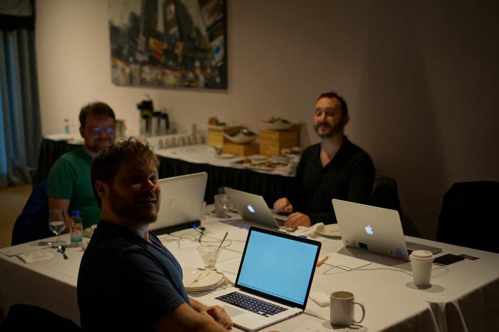
State of JTS. Presented by: James, Jody, Rob, (Martin)
|
|
|
- Alvin Hunt
- 6 years ago
- Views:
Transcription

")
1 State of JTS Presented by: James, Jody, Rob, (Martin)


2 Welcome Martin Davis James Hughes Jody Garnett Rob Emanuele Vivid Solutions CCRi Boundless Azavea 2
3 Introducing JTS Topology Suite udig Introduction 3
4 What is JTS Topology Suite? Java API for working with 2D Geometries 4


5 JTS is EVERYWHERE Sptial4J JTS GeoTrellis Net Topology Suite GeoMesa GeoWave GEOS JSTS 5
6 JTS Project History JTS


7 JTS Topology Suite Reprentations: OGC Simple Features Point LineString LinearRing Polygon MultiPoint MultiLineString MultiPolygon GeometryCollection 7

8 JTS Topology Suite Predicates (DE-9IM) Equals Disjoin Intersects Touches Crosses Within Contains Overlaps Covers CoveredBy 8

9 JTS Topology Suite Overlays Intersection Union Difference SymDifference 9

10 JTS Topology Suite Measurements Length Area Distance 10

11 JTS Topology Suite IO: WKT WKB GeoJSON KML 11


12 JTS Topology Suite Algorithms Convex Hull Buffer Validation Dissolve Polygonization Simplification Triangulation Voronoi Linear Referencing and more... 12

13 JTS Topology Suite Applications TestBuilder TestRunner 13
14 JTS 1.14
15 JTS 1.14 Released January 2016 LineDissolver edgegraph package Visvalingam-Whyatt simplification Improvements: Improved thread-safety Fixed Java 7 compatibility Added Spatialite WKB CoordinateSequence many bug fixes and performance improvements JTS I/O Visvalingam-Whyatt vs Douglas-Peucker KML Writer GeoJsonReader/Writer Oracle SDO Performance 15
16 JTS 1.14 with Maven JTS 1.14 <dependency> <groupid>com.vividsolutions</groupid> <artifactid>jts-core</artifactid> <version>1.14.0</version> Published Official release on SF Install into local repo </dependency> On Maven Central We do not know who did this! 16
17 JTS 1.15
18 JTS 1.15 Focus on codebase organization and packaging Some functionality improvements K Nearest Neighbor search for STR-Tree Improve handling of Quadtree queries with null Envelope Intersects now supports GeometryCollection JTSTestRunnerCmd command-line app


19 Sourceforge GitHub Moving from SVN to GIT 19

20 Why choose GitHub? High Visibility Great tools Git tools Issue tracking Pull Requests Continuous Integration Website Easier for contributions Where the action is! 20
21 GitHub: JTS Project Activity Pull Requests 76 accepted, 8 open Issues 7 closed, 25 open 21
22 Mavenization Build chain now uses Maven instead of Ant Easier to build and use Easy Eclipse IDE configuration Unit tests run by Maven build including XML tests Better release story Code artifacts will be hosted on Maven Central Apps built as fat-jars (TestBuilder, TestRunner) To Do Work on packaging a distro with source, scripts, etc... 22
23 Modular Codebase Codebase organized into modules jts-core - geometry implementation for use jts-tests - extensive testing for correctness and stability jts-io - read and write geometry jts-example - examples of using the jts api jts-lab - experimental playground use at your own risk jts-app - test builder application for defining tests better clarity of internal dependencies 23
24 JTS Joins LocationTech LocationTech offers project infrastructure project visibility stability, governance Immediate benefits More team members Synergy with other LocationTech projects In-depth legal review for IP (Intellectual Property) cleanliness Initial Work Project Application License Change LocationTech Incubation Long term hopes Additional Contributors Funding for JTS 2.0 Build Infrastructure Official Maven Deployment 24
25 LocationTech Incubation A new License Eclipse Public License Eclipse Distribution License (BSD-3 Clause License) Challenges: A new home: Project Website Mailing List Build Server GitHub repo Contact assorted contributors (because we did not have a CLA) changing package names Opportunity to work together Maintaining codebase history 25

26 LocationTech Project Site 26
27 JTS 1.15-SNAPSHOT Packaging org.locationtech.jts GitHub repo Snapshots Available via LT Nexus 27
28 Using JTS 1.15 with Maven JTS 1.14 <dependency> <groupid>com.vividsolutions</groupid> <artifactid>jts-core</artifactid> <version>1.14.0</version> </dependency> JTS SNAPSHOT <dependency> <groupid>org.locationtech.jts</groupid> <artifactid>jts-core</artifactid> <version> snapshot</version> </dependency>. <repositories> <repository> <id>locationtech-snapshots</id> <url> <snapshots> <enabled>true</enabled> </snapshots> </repository> </repositories> 28
29 Migration to JTS 1.15 New module structure jts-core jts-io-common - GeoJSON jts-io-ora - Oracle support jts-io-sde - SDE support jts-tests - XML Tests & TestRunner Change package names org.locationtech.jts.* Change Maven reference To be determined
30 Team Code Sprints Dates January 25-27, 2016 November 3-4, 2016 Achievements Sourceforge GitHub Mavenization New Committers Addressed IP review questions


31 31
32 JTS 1.15 Coming Soon! Coming soon to a repo near you! Incubation is nearly complete LocationTech Release process Final IP issues being resolved (checking in new icons for the test builder application) Two week release review Deploy to Maven Central (and LocationTech repo) 32
33 Roadmap / Wishlist udig Introduction 33
34 Algorithm Improvements Goal: improve some key JTS algorithms Overlay Spatial Predicate improvements Snap-rounding (no more TopologyExceptions!) Support PreparedGeometry for caching Fast & robust Clip to Rectangle Streaming / Lazy evaluation with short-circuiting User-defined precision model Less sensitive to valid geometry (e.g. Intersects) Distance Support cached PreparedGeometry 34


35 New Algorithms Concave Hull Polygon Triangulation Polygon Cleaning ( MakeValid ) Split Geometry by Line Polygon Coverage Simplification Concave Hull Polygon Triangulation 35
36 New API - JTS 2.0 Concept for a redesign of JTS Key Goals Interface-based Geometry access Immutable Geometry objects Geodetic (WGS84) support, with some basic algorithms Pluggable/discoverable Geometry operation framework Coordinate extensions (XY, XY+M) Non-goals Backwards compatibility Improving geometry algorithms 36
37 Join JTS Topology Suite Shape the Future
38 Contributing to JTS Register as a Contributor Sign the Eclipse Contributor Agreement Develop a patch, making sure to include Javadoc Unit Tests - JUnit and/or JTS XML tests Make a Pull Request on GitHub Acknowledge code is IP clean by signing-off each Git commit Make sure the Travis CI validation tests pass See also 38
39 Questions? udig Introduction 39
40 Project Resources Source Code repo Issue Tracker Mailing List Project website Javadoc 40

41 Thank you from the JTS Team
42 What is JTS Topology Suite Java API for 2D Geometry - linear vector geometry - representing and processing Featuring: - Validation, Polygonization, Simplification, Linear Referencing, etc. Apps - TestRunner - TestBuilder - OGC Simple Features for SQL - full geometry specification: - Geometry: - Points, Linestring, Polygons - Collections Metrics: - Length, Area, Distance Predicates: - intersects, contains, etc.; relate for DE-9IM Overlay: - intersection, union, difference, symdifference Algorithms: - Convex Hull, Buffer


 Simba - Spatial In-Memory Big")
43 JTS in LT projects (and others) LocationTech projects using JTS GeoMesa - geoanalytics for big data GeoTrellis - geoprocessing for big data Spatial4J - geodetic geometry API Also by some interesting research projects GeoSpark ( Simba - Spatial In-Memory Big data Analytics (
44 What is JTS Topology Suite? Java API for 2D Geometries 44
45 What is JTS Topology Suite? Java API for 2D Geometries 45
46 What is JTS Topology Suite? Java API for 2D Geometries 46
47 What is JTS Topology Suite Java API for 2D Geometry - linear vector geometry - representing and processing Featuring: - Validation, Polygonization, Simplification, Linear Referencing, etc. Apps - TestRunner - TestBuilder - OGC Simple Features for SQL - full geometry specification: - Geometry: - Points, Linestring, Polygons - Collections Metrics: - Length, Area, Distance Predicates: - intersects, contains, etc.; relate for DE-9IM Overlay: - intersection, union, difference, symdifference Algorithms: - Convex Hull, Buffer
State of JTS. Presented by: James, Jody, Rob, (Martin)
") State of JTS Presented by: James, Jody, Rob, (Martin) Welcome Martin Davis James Hughes Jody Garnett Rob Emanuele Vivid Solutions CCRi Boundless Azavea 2 Introducing JTS Topology Suite udig Introduction
State of JTS Presented by: James, Jody, Rob, (Martin) Welcome Martin Davis James Hughes Jody Garnett Rob Emanuele Vivid Solutions CCRi Boundless Azavea 2 Introducing JTS Topology Suite udig Introduction
Secrets of the JTS Topology Suite
 Secrets of the JTS Topology Suite Martin Davis Refractions Research Inc. Overview of presentation Survey of JTS functions and components Tips for using JTS as an engine for processing Geometry Tips for
Beyond PostGIS. New developments in Open Source Spatial Databases. Karsten Vennemann. Seattle
 New developments in Open Source Spatial Databases Karsten Vennemann Seattle Talk Overview Intro Relational Databases PostGIS JASPA INGRES Geospatial MySQL Spatial Support HatBox a user space extension
Advanced Standard Basic Notes
 9.3 Functionality Matrix Data Management Scalable Geodatabase Access Full Geodatabase Support Create Geodatabases Load Spatial Data into Geodatabases Manage Geodatabases One-Way Replication Two-Way Replication
Announcements. Data Sources a list of data files and their sources, an example of what I am looking for:
 Data Announcements Data Sources a list of data files and their sources, an example of what I am looking for: Source Map of Bangor MEGIS NG911 road file for Bangor MEGIS Tax maps for Bangor City Hall, may
Geometric Computation: Introduction
 : Introduction Piotr Indyk Welcome to 6.838! Overview and goals Course Information Syllabus 2D Convex hull Signup sheet Geometric computation occurs everywhere: Geographic Information Systems (GIS): nearest
Technology Background Development environment, Skeleton and Libraries
 Technology Background Development environment, Skeleton and Libraries Christian Kroiß (based on slides by Dr. Andreas Schroeder) 18.04.2013 Christian Kroiß Outline Lecture 1 I. Eclipse II. Redmine, Jenkins,
Selenium Testing Course Content
 Selenium Testing Course Content Introduction What is automation testing? What is the use of automation testing? What we need to Automate? What is Selenium? Advantages of Selenium What is the difference
Azure DevOps. Randy Pagels Intelligent Cloud Technical Specialist Great Lakes Region
 Azure DevOps Randy Pagels Intelligent Cloud Technical Specialist Great Lakes Region What is DevOps? People. Process. Products. Build & Test Deploy DevOps is the union of people, process, and products to
Call for Discussion: Project Skara Investigating source code management options for the JDK sources
 Call for Discussion: Project Skara Investigating source code management options for the JDK sources Joseph D. Darcy (darcy, @jddarcy) and Erik Duveblad (ehelin) Java Platform Group, Oracle Committers Workshop
Repository Management and Sonatype Nexus. Repository Management and Sonatype Nexus
 Repository Management and Sonatype Nexus i Repository Management and Sonatype Nexus Repository Management and Sonatype Nexus ii Contents 1 Objectives 1 2 Development Today 1 3 But What Is A Component?
Vector-Based GIS Data Processing. Chapter 6
 Vector-Based GIS Data Processing Chapter 6 Vector Data Model Feature Classes points lines polygons Layers limited to one class of data Figure p. 186 Vector Data Model Shapefiles ArcView non-topological
Introduction to the Dimensionally Extended 9 Intersection Model (DE-9IM) in PostgreSQL/PostGIS Tutorial
 in PostgreSQL/PostGIS Tutorial") Introduction to the Dimensionally Extended 9 Intersection Model (DE-9IM) in PostgreSQL/PostGIS Tutorial Germán Carrillo gcarrillo@uni-muenster.de geotux_tuxman@linuxmail.org Objectives Following this tutorial
Introduction to the Dimensionally Extended 9 Intersection Model (DE-9IM) in PostgreSQL/PostGIS Tutorial Germán Carrillo gcarrillo@uni-muenster.de geotux_tuxman@linuxmail.org Objectives Following this tutorial
Stian Soiland-Reyes mygrid team University of Manchester
 Stian Soiland-Reyes mygrid team University of Manchester http://orcid.org/0000-0001-9842-9718 This work is licensed under a Creative Commons Attribution 4.0 International License. ... or at least according
SkylineGlobe 6.5 s New Developments
 SkylineGlobe 6.5 s New Developments The SkylineGlobe Enterprise suite of applications was created to provide all of the necessary software tools for an organization to implement their own private, 3D virtual
The Eclipse Development Process for Committers
 The Eclipse Development Process for Committers The Eclipse Development Process eclipse.org/projects/dev_process Copyright 2012, 2018 The Eclipse Foundation. Made available under the terms of the EPL 1
An introduction to ArcGIS Runtime
 2013 Europe, Middle East, and Africa User Conference October 23-25 Munich, Germany An introduction to ArcGIS Runtime Christine Brunner Lars Schmitz Welcome! Christine Brunner, Germany - Software Developer
The More We Get Together... The Islandora Community
 The More We Get Together... The Islandora Community Islandora Community 100+ public sites, 1073 listserv members, 104 GitHub members, 19 Committers, 30+ Committer Call attendees, 21 Contributed Modules,
TM DevOps Use Case. 2017TechMinfy All Rights Reserved
 Document Details Use Case Name TMDevOps Use Case03 First Draft 01 st Dec 2017 Author Reviewed By Prabhakar D Pradeep Narayanaswamy Contents Scope... 4 About Customer... 4 Use Case Description... 4 Primary
PostGIS: future developments
 PostGIS: future developments What is PostGIS GPL PostgreSQL extension for Geographic Objects Types Operators Functions Indexes Standard interfaces Extension API Current features OpenGIS Simple Features
Eclipse Lyo Overview. Michael Fiedler, Eclipse Lyo committer IBM Corporation
 Eclipse Lyo Overview http://eclipse.org/lyo Michael Fiedler, Eclipse Lyo committer 1 Agenda Eclipse Lyo background Content and Plans Test Suites OSLC4J Samples Next Steps 2 OSLC Specifications OSLC Core
ArcGIS GeoEvent Server: Real-Time GIS
 ArcGIS GeoEvent Server: Real-Time GIS Anthony Myers Local Government Solutions Engineer Kevin Armstrong Public Safety Solutions Engineer E M E R A L D S A P P H I R E T H A N K Y O U T O O UR SPONSORS
The Actual Real World at EclipseCon/ALM
 Tycho The Actual Real World at EclipseCon/ALM Raise your Hand if you are Sure Addressing the Issues Real World: Tycho Issues World Wide Distributed Teams India, China, Europe, Argentina, United States
ArcGIS Enterprise: An Introduction. Philip Heede
 Enterprise: An Introduction Philip Heede Online Enterprise Hosted by Esri (SaaS) - Upgraded automatically (by Esri) - Esri controls SLA Core Web GIS functionality (Apps, visualization, smart mapping, analysis
Copyright 2012, Oracle and/or its affiliates. All rights reserved. Insert Information Protection Policy Classification from Slide 13
 1 Copyright 2012, Oracle and/or its affiliates. All rights reserved. Insert Information Protection Policy Classification from Slide 13 The following is intended to outline our general product direction.
Developers Road Map to ArcGIS Desktop and ArcGIS Engine
 Developers Road Map to ArcGIS Desktop and ArcGIS Engine Core ArcObjects Desktop Team ESRI Developer Summit 2008 1 Agenda Dev Summit ArcGIS Developer Opportunities Desktop 9.3 SDK Engine 9.3 SDK Explorer
Seven Habits of Highly Effective Jenkins Users. Andrew Bayer Cloudera OSCON Java 2011
 Seven Habits of Highly Effective Jenkins Users Andrew Bayer Cloudera OSCON Java 2011 Introduction Who am I? I'm a build guy, with a focus on Java builds. I've been using and working on Jenkins since early
An Integrated Approach to Managing Windchill Customizations. Todd Baltes Lead PLM Technical Architect SRAM
 An Integrated Approach to Managing Windchill Customizations Todd Baltes Lead PLM Technical Architect SRAM Event hashtag is #PTCUSER10 Join the conversation! Topics What is an Integrated Approach to Windchill
Content. Development Tools 2(57)
") Development Tools Content Project management and build, Maven Unit testing, Arquillian Code coverage, JaCoCo Profiling, NetBeans Static Analyzer, NetBeans Continuous integration, Hudson Development Tools
Development Tools Content Project management and build, Maven Unit testing, Arquillian Code coverage, JaCoCo Profiling, NetBeans Static Analyzer, NetBeans Continuous integration, Hudson Development Tools
How to become an Eclipse committer in 20 minutes and to fork the Eclipse IDE
 How to become an Eclipse committer in 20 minutes and to fork the Eclipse IDE Markus A. Kuppe Eclipse committer (ECF, RT-PMC) Lars Vogel Eclipse committer (Platform, e4) r e t it m m co a E D e I m o e
Learning What s New in ArcGIS 10.1 for Server: Administration
 Esri Mid-Atlantic User Conference December 11-12th, 2012 Baltimore, MD Learning What s New in ArcGIS 10.1 for Server: Administration Derek Law Product Manager Esri - Redlands ArcGIS for Server Delivering
Understanding and Using Geometry, Projections, and Spatial Reference Systems in ArcGIS. Rob Juergens, Melita Kennedy, Annette Locke
 Understanding and Using Geometry, Projections, and Spatial Reference Systems in ArcGIS Rob Juergens, Melita Kennedy, Annette Locke Introduction We want to give you a basic understanding of geometry and
Dali JPA Tools Project Graduation Review
 Dali JPA Tools Project Graduation Review February 28, 2007 Neil Hauge Project Lead Oracle 2007 by Neil Hauge; made available under the EPL v1.0 2007-02-28 Review Topics Project Overview What is the Dali
4/7/2009. Model: Abstraction of reality following formal rules e.g. Euclidean space for physical space
 Model: Abstraction of reality following formal rules e.g. Euclidean space for physical space At different levels: mathematical model (Euclidean space) conceptual design model (ER model) data model (design)
Seven Habits of Highly Effective Jenkins Users
 Seven Habits of Highly Effective Jenkins Users What is this talk about? Lessons learned: Maintaining multiple large Jenkins instances. Working on Jenkins itself, and many of its plugins. Seeing customer
Azure Day Application Development. Randy Pagels Sr. Developer Technology Specialist US DX Developer Tools - Central Region
 Azure Day Application Development Randy Pagels Sr. Developer Technology Specialist US DX Developer Tools - Central Region Azure App Service.NET, Java, Node.js, PHP, Python Auto patching Auto scale Integration
GeoTools Steering Document
 GeoTools Steering Document Author: Jody Garnett Review/Revise: Andrea, Justin, Simone, Martin, Paul Background: The GeoTools library is going through a transition, from a project centered around the research
1 Copyright 2011, Oracle and/or its affiliates. All rights reserved.
 1 Copyright 2011, Oracle and/or its affiliates. All rights The forthcoming is intended to outline our general product direction. It is intended for information purposes only, and may not be incorporated
Javaentwicklung in der Oracle Cloud
 Javaentwicklung in der Oracle Cloud Sören Halter Principal Sales Consultant 2016-11-17 Safe Harbor Statement The following is intended to outline our general product direction. It is intended for information
DITA Gradle and Git. DITA-OT day Rotterdam
 DITA Gradle and Git DITA-OT day 2018 - Rotterdam The company - L-Acoustics French company based near Paris. Leader in professional audio solutions. Lorde Melodrama tour Hollywood bowl Paris fashion week
Topics covered. Introduction to Maven Maven for Dependency Management Maven Lifecycles and Plugins Hands on session. Maven 2
 Maven Maven 1 Topics covered Introduction to Maven Maven for Dependency Management Maven Lifecycles and Plugins Hands on session Maven 2 Introduction to Maven Maven 3 What is Maven? A Java project management
GAVIN KING RED HAT CEYLON SWARM
 GAVIN KING RED HAT CEYLON SWARM CEYLON PROJECT A relatively new programming language which features: a powerful and extremely elegant static type system built-in modularity support for multiple virtual
Why switch exist-db from Ant to Maven?
 exist-db Developers Meetup Monday, 29 th March 2011 @ Prague Why switch exist-db from Ant to Maven? adam@exist-db.org www.existsolutions.com Why move away from Ant? The Current Situation Lots of pain associated
Standardized Geoprocessing with 52 North Open Source Software
 Standardized Geoprocessing with 52 North Open Source Software - Web Processing Service Tutorial - 2009-01-09 Bastian Schaeffer schaeffer@52north.org This tutorial will guide you through the process of
Understanding and Working with the OGC Geopackage. Keith Ryden Lance Shipman
 Understanding and Working with the OGC Geopackage Keith Ryden Lance Shipman Introduction - Introduction to Simple Features - What is the GeoPackage? - Esri Support - Looking ahead Geographic Things 3 Why
a brief introduction to creating quality software continuously Copyright 2011 Davisbase, LLC
 a brief introduction to creating quality software continuously Andy Painter Agile Coach/Trainer/Consultant CSM, CSP, CSD Instructor andy@davisbase.org (704) 835-0194 Interests: Cloud Computing, Agile Development
Bring Location Intelligence To Big Data Applications on Hadoop, Spark, and NoSQL
 Bring Location Intelligence To Big Data Applications on Hadoop, Spark, and NoSQL Siva Ravada Senior Director of Development Copyright 2015, Oracle and/or its affiliates. All rights reserved. Program Agenda
MongoDB An Overview. 21-Oct Socrates
 MongoDB An Overview 21-Oct-2016 Socrates Agenda What is NoSQL DB? Types of NoSQL DBs DBMS and MongoDB Comparison Why MongoDB? MongoDB Architecture Storage Engines Data Model Query Language Security Data
Continuous Integration and Delivery with Spinnaker
 White Paper Continuous Integration and Delivery with Spinnaker The field of software functional testing is undergoing a major transformation. What used to be an onerous manual process took a big step forward
Introduction: Manual Testing :
 : What is Automation Testing? Use of Automation. Where do we use. Tools that Do Automation. Web Applications vs Standalone Applications. What is selenium? How selenium works. Manual Testing : HTML: Detailed
SpatiaLite: 3D and compressed geometries. Addendum
 SpatiaLite: 3D and compressed geometries Addendum Starting since version 2.4.0 SpatiaLite supports 3D geometries as well. The present addendum is intended to quickly explain the most relevant implementation
Oracle Big Data Spatial and Graph: Spatial Features
 Oracle Big Data Spatial and Graph: Spatial Features January 28 th, 2016 Siva Ravada Senior Director of Development Copyright 2015, Oracle and/or its affiliates. All rights reserved. Program Agenda 1 2
Analytical and Computer Cartography Winter Lecture 9: Geometric Map Transformations
 Analytical and Computer Cartography Winter 2017 Lecture 9: Geometric Map Transformations Cartographic Transformations Attribute Data (e.g. classification) Locational properties (e.g. projection) Graphics
Leveraging OGC Services in ArcGIS Server. Satish Sankaran, Esri Yingqi Tang, Esri
 Leveraging OGC Services in ArcGIS Server Satish Sankaran, Esri Yingqi Tang, Esri GIS Creating and Managing Geo Information Products - Proprietary - Open Specifications - Standards Dissemination of Geo
KTH Royal Institute of Technology SEMINAR 2-29 March Simone Stefani -
 KTH Royal Institute of Technology SEMINAR 2-29 March 2017 Simone Stefani - sstefani@kth.se WHAT IS THIS SEMINAR ABOUT Branching Merging and rebasing Git team workflows Pull requests and forks WHAT IS THIS
Implementing the Twelve-Factor App Methodology for Developing Cloud- Native Applications
 Implementing the Twelve-Factor App Methodology for Developing Cloud- Native Applications By, Janakiram MSV Executive Summary Application development has gone through a fundamental shift in the recent past.
Index. BigBadGuiTools (BBGT), 186 Business logic and data layer, 32 Business requirements
, 186 Business logic and data layer, 32 Business requirements") Index A ADO.NET, SQL driver documentation, 171 dr.read() method, 173 ExecuteNonQuery method, 173 IDbDataParameter interface, 174 Interface variables, 173 MySqlDataReader, 173 MySql reference, 170 placeholders,
Index A ADO.NET, SQL driver documentation, 171 dr.read() method, 173 ExecuteNonQuery method, 173 IDbDataParameter interface, 174 Interface variables, 173 MySqlDataReader, 173 MySql reference, 170 placeholders,
Creating a 3D Model for Environmental Noise Simulation at the German Federal Railways Agency. Disy Informationssysteme GmbH
 Creating a 3D Model for Environmental Noise Simulation at the German Federal Railways Agency Disy Informationssysteme GmbH Creating a 3D Model for Noise Simulation at the German Federal Railways Agency
1 Copyright 2011, Oracle and/or its affiliates. All rights reserved.
 1 Copyright 2011, Oracle and/or its affiliates. All rights reserved. ORACLE PRODUCT LOGO S15402 Google Maps, ESRI, Traffic, ipad: Bring it all Together With Oracle Spatial LJ Qian Jayant Sharma Sr. Mgr.,
Überraschend mehr Möglichkeiten. Orcas: Continuous Delivery for Databases. A Framework for Continuous Delivery in Database Environments.
 Überraschend mehr Möglichkeiten A Framework for Continuous Delivery in Database Environments Whitepaper OPITZ CONSULTING Deutschland GmbH 2018 WHITEPAPER A Framework for Continuous Delivery in Database
GIS features in MariaDB and MySQL
 GIS features in MariaDB and MySQL What has happened in recent years? Hartmut Holzgraefe Principal Support Engineer at MariaDB Inc. hartmut@mariadb.com August 20, 2016 Hartmut Holzgraefe (MariaDB Inc.)
Oracle Spatial Technologies: An Update. Xavier Lopez Director, Spatial Technologies Oracle Corporation
 Oracle Spatial Technologies: An Update Xavier Lopez Director, Spatial Technologies Oracle Corporation Overview Oracle Approach to Market Specialist v. Generalist Solutions New Developments: Oracle Database
CS314 Software Engineering Sprint 5 - Release!
 CS314 Software Engineering Sprint 5 - Release! Dave Matthews Sprint 5 Summary Use Level 2 and 3 software engineering processes/tools Clean Code, Coverage, White Box Testing, Code Climate Learn about Inspections
Utility Network Management in ArcGIS: Migrating Your Data to the Utility Network. John Alsup & John Long
 Utility Network Management in ArcGIS: Migrating Your Data to the Utility Network John Alsup & John Long Presentation Outline Utility Network Preparation - Migration Patterns - Understanding the Asset Package
Zenful Maps with SQL. Matthew Basanta Paul Vidal
 Zenful Maps with SQL Matthew Basanta Paul Vidal Get out your smartphone http://goo.gl/lvnql Just go to the website, don't do anything yet Introductions Matthew Basanta Paul Vidal Overview Designing for
JavaFX.Next. Kevin Rushforth Oracle Johan Vos Gluon October Copyright 2018, Oracle and/or its affiliates. All rights reserved.
 JavaFX.Next Kevin Rushforth Oracle Johan Vos Gluon October 2018 Safe Harbor Statement The following is intended to outline our general product direction. It is intended for information purposes only, and
What s New in ArcGIS 10.3 for Server. Tom Shippee Esri Training Services
 What s New in ArcGIS 10.3 for Server Tom Shippee Esri Training Services Today s Agenda What is ArcGIS for Server at 10.3 - ArcGIS Platform story - Expanding ArcGIS for Server paradigm What s new in ArcGIS
Application Development in Web Mapping 1.
 University of West Hungary, Faculty of Geoinformatics László Kottyán Application Development in Web Mapping 1. module ADW1 Web Technologies and Geospatial Standards SZÉKESFEHÉRVÁR 2010 The right to this
GEOSPATIAL ENGINEERING COMPETENCIES. Geographic Information Science
 GEOSPATIAL ENGINEERING COMPETENCIES Geographic Information Science The character and structure of spatial information, its methods of capture, organisation, classification, qualification, analysis, management,
The OpenStack Project Continuous Integration System. Elizabeth K.
 The OpenStack Project Continuous Integration System Elizabeth K. Joseph @pleia2 Elizabeth K. Joseph Core/root member of the OpenStack Infrastructure Team Author of Common OpenStack Deployments (along with
Continuous Integration (CI) with Jenkins
 with Jenkins") TDDC88 Lab 5 Continuous Integration (CI) with Jenkins This lab will give you some handson experience in using continuous integration tools to automate the integration periodically and/or when members of
TDDC88 Lab 5 Continuous Integration (CI) with Jenkins This lab will give you some handson experience in using continuous integration tools to automate the integration periodically and/or when members of
ArcGIS for Server Michele Lundeen
 ArcGIS for Server 10.1 Michele Lundeen Summary Vision Installation and Configuration Architecture Publishing Functional Enhancements Cloud Migration and Best Practices Powerful GIS capabilities Delivered
Git Workflows. Sylvain Bouveret, Grégory Mounié, Matthieu Moy
 s Sylvain Bouveret, Grégory Mounié, Matthieu Moy 2017 [first].[last]@imag.fr http://recherche.noiraudes.net/resources/git/git-workflow-slides.pdf 1 / 16 Goals of the presentation Global history: multiple
New Contributor Tutorial and Best Practices
 New Contributor Tutorial and Best Practices Vicențiu Ciorbaru Software Engineer @ MariaDB Foundation * 2018 MariaDB Foundation * Goal of this session Most attendees here are highly experienced devs Let's
Monitoring Your Operations David Jacob
 Monitoring Your Operations David Jacob Jeff Shaner Real-time data Vessels Vehicles Sensors Weather People Challenge of Real-time data How do I visualize real-time data? How can I process and analyze it?
Geoapplications development Control work 1 (2017, Fall)
") Page 1 Geoapplications development Control work 1 (2017, Fall) Author: Antonio Rodriges, Oct. 2017 http://rgeo.wikience.org/ Surname, name, patronymic: Group: Date: Signature: Select all correct statements.
Page 1 Geoapplications development Control work 1 (2017, Fall) Author: Antonio Rodriges, Oct. 2017 http://rgeo.wikience.org/ Surname, name, patronymic: Group: Date: Signature: Select all correct statements.
OSGeo Web Mapping Typification: GeoMajas, Mapbender, MapFish and OpenLayers. Christoph Baudson Arnulf Christl FOSS4G 2010 Barcelona
 OSGeo Web Mapping Typification: GeoMajas, Mapbender, MapFish and OpenLayers Christoph Baudson Arnulf Christl FOSS4G 2010 Barcelona Disclaimer All information contained in this presentation has been compiled
Review Version Control Concepts
 Review Version Control Concepts SWEN-261 Introduction to Software Engineering Department of Software Engineering Rochester Institute of Technology Managing change is a constant aspect of software development.
Auto-Cascading Security Updates Through Docker Images
 Auto-Cascading Security Updates Through Docker Images Andrey Falko Salesforce Infrastructure Forward-Looking Statements Statement under the Private Securities Litigation Reform Act of 1995: This presentation
Building Java Apps with ArcGIS Runtime SDK
 Building Java Apps with ArcGIS Runtime SDK Mark Baird and Vijay Gandhi A step back in time Map making 50 years ago - http://www.nls.uk/exhibitions/bartholomew/maps-engraver - http://www.nls.uk/exhibitions/bartholomew/printing
How to Build an Appium Continuous Testing Pipeline
 How to Build an Appium Continuous Testing Pipeline Step-by-Step Tutorial November, 2017 Today s speakers Guy Arieli, CTO, Experitest Ruth Zamir Marketing Director Experitest 01 Why do we need continuous
Building Microservices with the 12 Factor App Pattern
 Building Microservices with the 12 Factor App Pattern Context This documentation will help introduce Developers to implementing MICROSERVICES by applying the TWELVE- FACTOR PRINCIPLES, a set of best practices
Turbo boost your digital app test automation with Jenkins
 Turbo boost your digital app test automation with Jenkins Step-by-Step Tutorial May, 2018 Speakers Sheli Ashkenazi Sr. Product Manager Experitest Jonathan Aharon Sr. Sales Engineer Experitest 2 01 The
CPSC 491. Lecture 19 & 20: Source Code Version Control. VCS = Version Control Software SCM = Source Code Management
 CPSC 491 Lecture 19 & 20: Source Code Version Control VCS = Version Control Software SCM = Source Code Management Exercise: Source Code (Version) Control 1. Pretend like you don t have a version control
OGC Simple Features (for SQL and XML/GML)
") Daniel Wirz, Department of Geography - GIS Division, University of Zurich mailto:wirz@geo.unizh.ch January 2004 What,...? Introduction Develop publicly available geoprocessing specifications. Open interfaces
Daniel Wirz, Department of Geography - GIS Division, University of Zurich mailto:wirz@geo.unizh.ch January 2004 What,...? Introduction Develop publicly available geoprocessing specifications. Open interfaces
SVENSK STANDARD SS-ISO :2004. Geografisk information Hantering av enklare objekt Del 1: Arkitektur (ISO :2004, IDT)
") SVENSK STANDARD Fastställd 2004-09-24 Utgåva 1 Geografisk information Hantering av enklare objekt Del 1: Arkitektur (ISO 19125-1:2004, IDT) Geographic information Simple feature access Part 1: Common architecture
SVENSK STANDARD Fastställd 2004-09-24 Utgåva 1 Geografisk information Hantering av enklare objekt Del 1: Arkitektur (ISO 19125-1:2004, IDT) Geographic information Simple feature access Part 1: Common architecture
ONAP Developer Typical Setup 2017 July ONAP Virtual Developers Event
 ONAP Developer Typical Setup 2017 July 24-26 ONAP Virtual Developers Event Gary Wu Daniel Rose Victor Morales Getting Started with ONAP
Page 1. Area-Subdivision Algorithms z-buffer Algorithm List Priority Algorithms BSP (Binary Space Partitioning Tree) Scan-line Algorithms
 Scan-line Algorithms") Visible Surface Determination Visibility Culling Area-Subdivision Algorithms z-buffer Algorithm List Priority Algorithms BSP (Binary Space Partitioning Tree) Scan-line Algorithms Divide-and-conquer strategy:
Visible Surface Determination Visibility Culling Area-Subdivision Algorithms z-buffer Algorithm List Priority Algorithms BSP (Binary Space Partitioning Tree) Scan-line Algorithms Divide-and-conquer strategy:
Info Error Deploying Artifact Failed To Transfer File Return Code Is 401
 Info Error Deploying Artifact Failed To Transfer File Return Code Is 401 Here is my pom.xml, note that it is also the attached file. (ERROR) Failed to execute goal Return code is: 401, ReasonPhrase: Unauthorized.
GeoEvent Server: An Introduction. Adam Ziegler, Solution Engineer
 GeoEvent Server: An Introduction Adam Ziegler, Solution Engineer Agenda 1 2 3 4 5 What is Real-Time GIS? Working with Real-Time Data Applying Real-Time Analytics Visualizing Real-Time Data Wrap-up 1 What
Working in Teams CS 520 Theory and Practice of Software Engineering Fall 2018
 Working in Teams CS 520 Theory and Practice of Software Engineering Fall 2018 Version Control September 18, 2018 Thursday (September 20) First in-class exercise On using git (today is a prelude with useful
Sonatype CLM Enforcement Points - Nexus. Sonatype CLM Enforcement Points - Nexus
 Sonatype CLM Enforcement Points - Nexus i Sonatype CLM Enforcement Points - Nexus Sonatype CLM Enforcement Points - Nexus ii Contents 1 Introduction 1 2 Sonatype CLM for Repository Managers 2 3 Nexus Pro
What s New in ArcGIS Server 10
 What s New in ArcGIS Server 10 Derek Law ArcGIS Server Product Management What s s new in ArcGIS Server 10? Agenda Highlights: Enhanced Web mapping More powerful server-based analysis Geo-collaboration
Package geoops. March 19, 2018
 Type Package Package geoops March 19, 2018 Title 'GeoJSON' Topology Calculations and Operations Tools for doing calculations and manipulations on 'GeoJSON', a 'geospatial' data interchange format ().
What is Maven? Apache Maven is a software project management and comprehension tool (build, test, packaging, reporting, site, deploy).
.") Plan What is Maven? Links : mvn command line tool POM : 1 pom.xml = 1 artifact POM POM Inheritance Standard Directory Layout Demo on JMMC projects Plugins Conclusion What is Maven? Apache Maven is a software
Plan What is Maven? Links : mvn command line tool POM : 1 pom.xml = 1 artifact POM POM Inheritance Standard Directory Layout Demo on JMMC projects Plugins Conclusion What is Maven? Apache Maven is a software
UTM Geo Map APP Quick Start (Version 1.2)
") UTM Geo Map APP Quick Start (Version 1.2) Measure Points (Marker) You can measure points of coordinate base on GPS or position on the Maps and save marker into database for unlimited number using Real-time
UTM Geo Map APP Quick Start (Version 1.2) Measure Points (Marker) You can measure points of coordinate base on GPS or position on the Maps and save marker into database for unlimited number using Real-time
J, K F, G, H. Library/framework, 168 LIKE() predicate, 142 Load-balancing server (LBS), 120 Lock on check out (LOCO), 1
 predicate, 142 Load-balancing server (LBS), 120 Lock on check out (LOCO), 1") Index A ADO.NET driver coding implementation, 153 154 dr.read() method, 155 finally block, 155 IDataReader, 155 interface variables, 155 loose-coupling, 153 MySql assembly, 153 try-catch blocks, 155 using
Index A ADO.NET driver coding implementation, 153 154 dr.read() method, 155 finally block, 155 IDataReader, 155 interface variables, 155 loose-coupling, 153 MySql assembly, 153 try-catch blocks, 155 using
ArcGIS Runtime SDK for Java: Building Apps. Mark Baird
 ArcGIS Runtime SDK for Java: Building Apps Mark Baird Agenda Getting started with 100.4 JavaFX Base maps, layers and lambdas Graphics overlays Offline data Licensing and deployment What is happening in
Vector Data. James Frew ESM 263 Winter
 Vector Data 1 Why Vector Data? Recall: features vs fields features: discrete enffes with specific locafons fields: confnuous funcfons of (x, y) Vector is GIS-speak for feature representafons dimensionality:
JIRA Studio Use Cases and Tutorial basis
 JIRA Studio Use Cases and Tutorial basis Analysis of usefulness of JIRA Studio Eclipse tool-chain Tolga Tuncbilek, Elisa Kallio, Shiyuan Wang, Viktor Porvaznik Table of Contents 1 Introduction... 3 2 Data