IMAGINE EXPANSION PACK Extend the Power of ERDAS IMAGINE
|
|
|
- Jennifer Randall
- 6 years ago
- Views:
Transcription

1 IMAGINE EXPANSION PACK Extend the Power of ERDAS IMAGINE
2

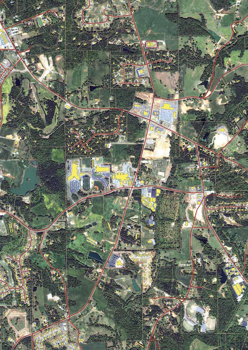
3 IMAGINE EXPANSION PACK IMAGINE Expansion Pack is a collection of functionality to extend the utility of ERDAS IMAGINE. It includes 3D visualization and analysis, expanded support for NITF, stereo feature collection, automated image to image registration, advanced change detection, radar orthorectification, and DEM extraction from radar imagery. 3

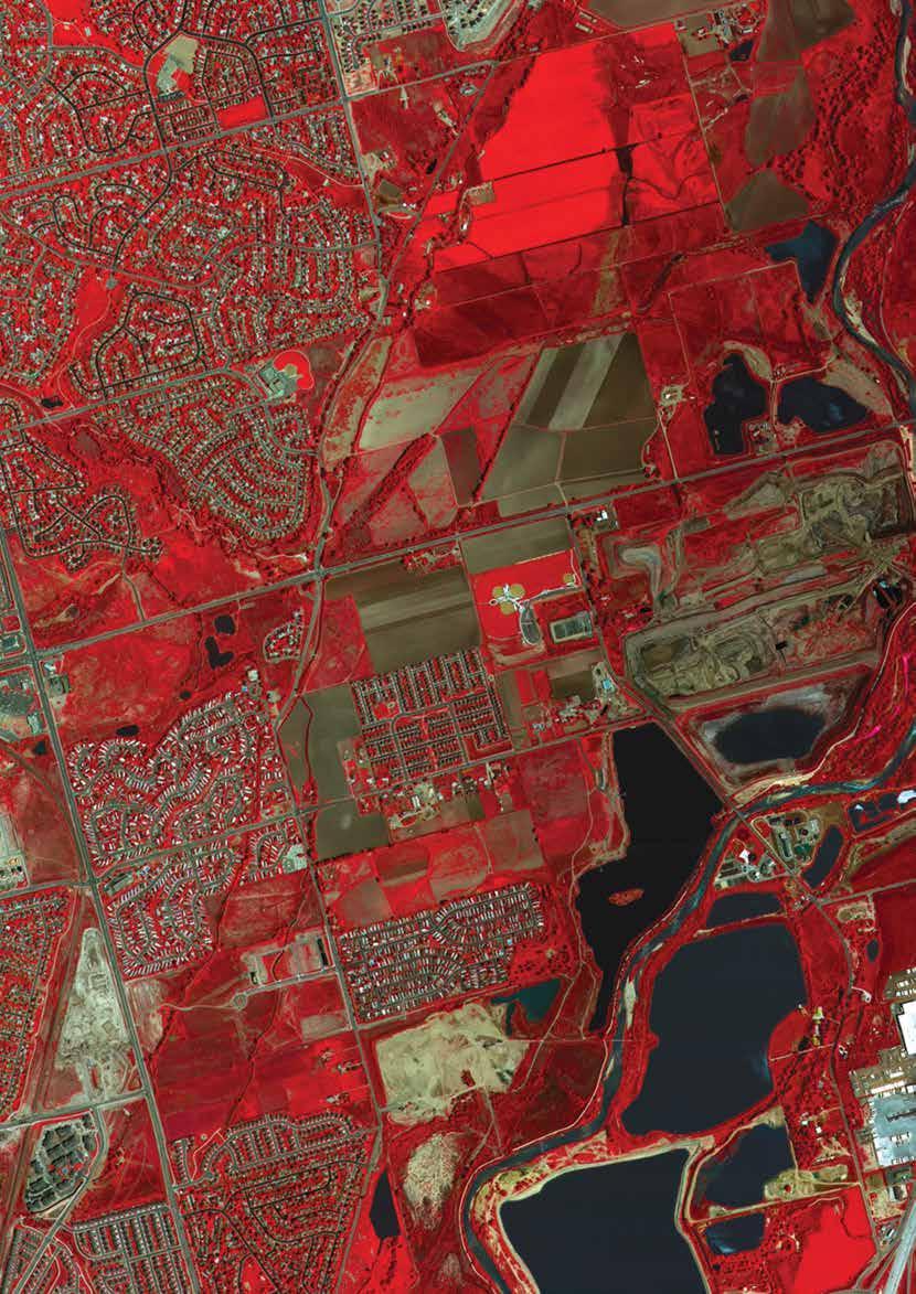
4 3D VISUALIZATION With simple drag-and-drop file selection, you can quickly and easily create realistic 3D environments. Go far beyond simple 3D renderings and basic fly-throughs by draping maps, aerial photography, satellite imagery, or analytical results onto an elevation layer derived from LiDAR, interferometry or photogrammetry. Continue to enhance the scene with annotation, GIS layers, symbols, billboards, intervisibility domes and 3D models. Add to the realism with sky, moving volume-based clouds, water layers, mist, and a sun flare with almanac-based location. Finally, create 1st and 3rd person animations with 3D flight paths with fine control of all aspects of the motion. Present your data in stereo, linked to your 2D view or in a movie with your logo, or simply navigate your scene in real-time with a joystick, mouse or digital dashboard. Example applications for this tool include the following: Visualize how the surrounding views and community may be affected by a new landfill placement Determine the visual impact of logging on a tourist area Plan an incursion or extraction into a hostile environment Understand where you can see and be seen by modeling line of sight, generating threat domes from known direct firing positions, model the cover and concealment, extraction points, and more Use 3D visualization to help managers and lay people better understand a new wilderness park, the path of a new highway or pipeline, or where to place cameras to get the most coverage AUTOMATED IMAGE-TO-IMAGE REGISTRATION AND EDGE MATCHING The ability to quickly and precisely register two images is critical in any pan-sharpening or change detection workflow. The IMAGINE Expansion Pack provides a powerful 3D viewer with quick and easy realism effects, like sun glint, reflections, and weather conditions as well as intervisibility, animations, and more. The IMAGINE Expansion Pack provides the ability to generate highly accurate geometric models from two or more images even images of dissimilar type, such as data from different sensors or with different spatial resolutions. This tool can be used to improve the registration between already georeferenced data sets, or to correlate new raw imagery to an existing georeferenced base image. Automatically generate thousands of tie points to establish the relationship between output images and the initial reference image. The Edge Matching workflow solves the problem of road alignment along the border of 2 images by applying a localized model to the overlapping region of image pairs. Using a process similar to image-to-image registration, it generates tie points in the region of overlap to pull misaligned features into alignment. Choose between using the Workstation mode or have the friendly Wizards walk you through project setup. Check the residuals, automatically select and remove bad points, and then check the alignment with swipe and blend tools. The Edge Matching workflow solves the problem of road alignment along the border of 2 images by applying a localized model to the overlapping region of image pairs. 4


5 responders and defense analysts can easily focus their attention on activity. The wizard helps the user determine the best combination of algorithms and filters to differentiate interesting change from background change while the interactive change viewer provides the user with finegrained control of the results and all of the tools to analyze these significant changes. The IMAGINE Expansion pack provides a tool for co-registering imagery for tasks such as change detection and pan sharpening. ADVANCED CHANGE DETECTION Once your data is properly aligned, you can perform change detection with confidence. Synoptic views of the earth s surface at a variety of spatial and temporal scales provide dramatic evidence of the dynamic processes of interest to a wide variety of users. Detecting and analyzing the meaningful differences between multi date imagery is a complicated task that requires a broad assortment of image processing tools, and it can be overwhelming for even the most advanced users. The IMAGINE Expansion pack enhances the change detection capabilities in ERDAS IMAGINE by providing tools needed to simplify even the most complex change detection processes, allowing users to move rapidly from image to information to results. Using project-based workflows, users can do the necessary preprocessing, change detection, change filtering and interpretation. Flexible and interactive tools enable the user to target specific kinds of changes that are of interest to them while ignoring seasonal differences, shadows, and even slight misalignments. EXTENDED NITF SUPPORT The National Imagery Transmission Format (NITF) is a data format that is the standard for digital imagery and imagery-related products for the United States intelligence community, International Standards Organization (ISO), American National Standards Institute (ISO/ANSI), and North Atlantic Treaty Organization (NATO). While ERDAS IMAGINE natively supports the use of NITF data, with the IMAGINE Expansion Pack you can import and export NITF version 2.1 imagery and map compositions (JITC level 7 and NATO s MIL STD 2500B/ STANAG 4545 certified). As files in the NITF format may contain multiple images, annotation, and Shapefiles, the IMAGINE Expansion Pack allows you to import the entire file into a map composition to manipulate independent components, and then export to a NITF. In addition, you can use the chipping feature to distribute a portion of an image containing the area of interest, rather than the entire image. When importing a NITF file into a map composition, you can update the components of the file independent of the image. When you export the file, it contains the original image with the updated annotation. We support image files up to 10 GB and file sizes up to 1 TB. The IMAGINE Expansion Pack builds on the change detection workflows available in ERDAS IMAGINE and the co-registration step above by providing an adaptable suite of processing procedures to detect change in multi-date imagery. A specialized wizard and viewer specially designed for change detection allow the user to produce output in a variety of formats appropriate for integration into GIS and other databases. Change detection plays an important role in the feature lifecycle because it enables you to quickly identify the location of new features. Critical information on storm damage can quickly be created and provided to first Find new developments using dedicated change detection tools.
6


7 Stereo data capture and visualization STEREO FEATURE COLLECTION IN ERDAS IMAGINE Do you need to update your GIS database with 3D features or to simply visualize stereo imagery? The IMAGINE Expansion pack provides a practical tool for stereo feature collection and interpretation. Transform your 2D GIS into real-world perspectives by collecting 3D features directly from imagery. Textures can be automatically extracted from imagery and applied to the models. In addition, the Texel Mapper allows you to map real or stock facades onto buildings. ORTHORECTIFY AND EXTRACT TERRAIN FROM RADAR DATA The IMAGINE Expansion Pack also includes tools to orthorectify and extract terrain from RADAR data. Users can perform precision georeferencing and orthorectification of SAR images using SAR sensor models, satellite orbit models, and digital elevation models (DEMs). The analyst has the option to ortho-calibrate the image, leaving it in original pixel space, or to resample and create a new ortho-corrected image. The resulting ortho-corrected images are highly accurate and free from the significant distortions inherent in radar imagery. After ortho-calibration or ortho-resampling, the radar images can be used to map ground features. The ERDAS IMAGINE viewer uses sensor information to display radar images as up is up (shadow is down) for rapid image interpretation. In addition users can extract terrain height information from stereo pairs of RADARSAT-1 and moderate resolution RADARSAT-2 to generate accurate DEMs. These DEM s can be exploited in a variety of workflows ranging from orthorectification to watershed analysis. 7
8 ABOUT GEOSYSTEMS GEOSYSTEM is a software vendor and service partner with outstanding expertise in remote sensing, photogrammetry, GIS and geospatial data management. As Hexagon Geospatial premium partner in Germany, Austria, and Switzerland, GEOSYSTEMS offers the Power Portfolio, a worldwide leading software for visualization, analysis, deployment, and distribution of geographic data. Based on those products, GEOSYSTEMS develops customer specific solutions and implements tailor-made workflows. Services at GEOSYSTEMS covers workflow streamlining, process orientated consulting, software development, system integration, support, training, updates and maintenance. GEOSYSTEMS is internationally successful for more than 25 years. GEOSYSTEMS is located in Germering near Munich, Germany. For more information, please call , or visit Hexagon Geospatial helps you make sense of the dynamically changing world. Known globally as a maker of leading-edge technology, we enable our customers to easily transform their data into actionable information, shortening the lifecycle from the moment of change to action. Hexagon Geospatial provides the software products and platforms to a large variety of customers through direct sales, channel partners, and Hexagon businesses, including the underlying geospatial technology to drive Intergraph Security, Government & Infrastructure (SG&I) industry solutions. Hexagon Geospatial is a division of Intergraph Corporation. For more information, visit Contact us at marketing@hexagongeospatial.com. Intergraph Corporation is part of Hexagon (Nordic exchange: HEXA B). Hexagon is a leading global provider of design, measurement and visualisation technologies that enable customers to design, measure and position objects, and process and present data. Learn more at Intergraph Corporation. All rights reserved. Hexagon Geospatial is part of Intergraph Corporation. Hexagon, Intergraph and related logos are registered trademarks of Hexagon AB or its subsidiaries. All other trademarks or servicemarks used herein are property of their respective owners. The information in this publication is subject to change without notice. GEO-US-0244B-ENG 11/14
CREATING CUSTOMIZED SPATIAL MODELS WITH POINT CLOUDS USING SPATIAL MODELER OPERATORS TO PROCESS POINT CLOUDS IN IMAGINE 2014
 CREATING CUSTOMIZED SPATIAL MODELS WITH POINT CLOUDS USING SPATIAL MODELER OPERATORS TO PROCESS POINT CLOUDS IN IMAGINE 2014 White Paper December 22, 2016 Contents 1. Introduction... 3 2. ERDAS IMAGINE
ERDAS IMAGINE THE WORLD S MOST WIDELY-USED REMOTE SENSING SOFTWARE PACKAGE
 PRODUCT BROCHURE ERDAS IMAGINE THE WORLD S MOST WIDELY-USED REMOTE SENSING SOFTWARE PACKAGE 1 ERDAS IMAGINE The world s most widely-used remote sensing software package 2 ERDAS IMAGINE The world s most
ERDAS IMAGINE THE WORLD S MOST WIDELY-USED REMOTE SENSING SOFTWARE PACKAGE
 PRODUCT BROCHURE ERDAS IMAGINE THE WORLD S MOST WIDELY-USED REMOTE SENSING SOFTWARE PACKAGE 1 ERDAS IMAGINE The world s most widely-used remote sensing software package 2 ERDAS IMAGINE The Theworld s world
GEOMEDIA MOTION VIDEO ANALYSIS PROFESSIONAL
 GEOMEDIA MOTION VIDEO ANALYSIS PROFESSIONAL GEOMEDIA MOTION VIDEO ANALYSIS PROFESSIONAL Hexagon Geospatial s GeoMedia Motion Video Analysis Professional provides a high-productivity environment for analysis
ERDAS APOLLO Managing and Serving Geospatial Information
 ERDAS APOLLO Managing and Serving Geospatial Information ERDAS APOLLO Do you have large volumes of geospatial information, regularly updated data stores, and a distributed user base? Do you need a single,
PRODUCT BROCHURE IMAGESTATION HIGH VOLUME PHOTOGRAMMETRY AND PRODUCTION MAPPING
 PRODUCT BROCHURE IMAGESTATION HIGH VOLUME PHOTOGRAMMETRY AND PRODUCTION MAPPING UNPARALLELED PROCESSING, ACCURATE RESULTS FOR CAD AND GIS-BASED WORKFLOWS The ImageStation software suite enables digital
W H I T E ERDAS ENGINE A SIMPLE AND COST-EFFECTIVE WAY TO INCREASE PROCESSING CAPACITY
 W H I T E ERDAS ENGINE A SIMPLE AND COST-EFFECTIVE WAY TO INCREASE PROCESSING CAPACITY White Paper August 21, 2015 Introduction As geospatial analysts process the extremely large imagery datasets that
Exelis Visual Information Software Solutions for TERRAIN ANALYSIS. Defense & Intelligence SOLUTIONS GUIDE.
 Exelis Visual Information for TERRAIN ANALYSIS Defense & Intelligence SOLUTIONS GUIDE www.exelisvis.com MISSION SUCCESS The U.S. Armed Forces has long acknowledged the connection between battlefield terrain
GEOSPATIAL. lps. A Complete Suite of Photogrammetric Production Tools
 GEOSPATIAL lps A Complete Suite of Photogrammetric Production Tools 2 Today, photogrammetry and production mapping experts are under pressure to produce more in less time while maintaining a high degree
PRODUCT BROCHURE ERDAS APOLLO MANAGING AND SERVING GEOSPATIAL INFORMATION
 PRODUCT BROCHURE ERDAS APOLLO MANAGING AND SERVING GEOSPATIAL INFORMATION ERDAS APOLLO Do you have large volumes of geospatial information, regularly updated data stores, and a distributed user base? Do
ENVI. Get the Information You Need from Imagery.
 Visual Information Solutions ENVI. Get the Information You Need from Imagery. ENVI is the premier software solution to quickly, easily, and accurately extract information from geospatial imagery. Easy
PRODUCT DESCRIPTION PRODUCT DESCRIPTION
 IMAGESTATION PRODUCT DESCRIPTION PRODUCT DESCRIPTION IMAGESTATION FAMILY OF PRODUCTS ImageStation includes applications for your entire production workflow including project creation, orientation and triangulation,
What s New in Imagery in ArcGIS. Presented by: Christopher Patterson Date: October 18, 2017
 What s New in Imagery in ArcGIS Presented by: Christopher Patterson Date: October 18, 2017 Imagery in ArcGIS Advancing 2010 Stretch, Extract Bands Clip, Mask Reproject, Orthorectify, Pan Sharpen Vegetation
IMAGERY FOR ARCGIS. Manage and Understand Your Imagery. Credit: Image courtesy of DigitalGlobe
 IMAGERY FOR ARCGIS Manage and Understand Your Imagery Credit: Image courtesy of DigitalGlobe 2 ARCGIS IS AN IMAGERY PLATFORM Empowering you to make informed decisions from imagery and remotely sensed data
ENVI Automated Image Registration Solutions
 ENVI Automated Image Registration Solutions Xiaoying Jin Harris Corporation Table of Contents Introduction... 3 Overview... 4 Image Registration Engine... 6 Image Registration Workflow... 8 Technical Guide...
The Feature Analyst Extension for ERDAS IMAGINE
 The Feature Analyst Extension for ERDAS IMAGINE Automated Feature Extraction Software for GIS Database Maintenance We put the information in GIS SM A Visual Learning Systems, Inc. White Paper September
ERDAS APOLLO PERFORMANCE BENCHMARK ECW DELIVERY PERFORMANCE OF ERDAS APOLLO VERSUS ESRI ARCGIS FOR SERVER
 ERDAS APOLLO PERFORMANCE BENCHMARK ECW DELIVERY PERFORMANCE OF ERDAS APOLLO VERSUS ESRI ARCGIS FOR SERVER White Paper April 14, 2014 Contents Introduction... 3 Sample Dataset... 4 Test Hardware... 5 Summary...
IMAGINE OrthoRadar. Accuracy Evaluation. age 1 of 9
 IMAGINE OrthoRadar Accuracy Evaluation age 1 of 9 IMAGINE OrthoRadar Product Description IMAGINE OrthoRadar is part of the IMAGINE Radar Mapping Suite and performs precision geocoding and orthorectification
Orthorectifying ALOS PALSAR. Quick Guide
 Orthorectifying ALOS PALSAR Quick Guide Copyright Notice This publication is a copyrighted work owned by: PCI Geomatics 50 West Wilmot Street Richmond Hill, Ontario Canada L4B 1M5 www.pcigeomatics.com
TrueOrtho with 3D Feature Extraction
 TrueOrtho with 3D Feature Extraction PCI Geomatics has entered into a partnership with IAVO to distribute its 3D Feature Extraction (3DFE) software. This software package compliments the TrueOrtho workflow
Slide 1. Bentley Descartes V8i. Presented by: Inga Morozoff, Bentley
 Slide 1 Bentley Descartes V8i Presented by: Inga Morozoff, Bentley Slide 2 Agenda What is Bentley Descartes? Where is it used? Features Benefits Live demo Questions and Answers 2 WWW.BENTLEY.COM Slide
GEOMEDIA SMART CLIENT 2015 PRODUCT FEATURES AND COMPARISONS
 GEOMEDIA SMART CLIENT 2015 PRODUCT FEATURES AND COMPARISONS GeoMedia Smart Client enables the entire organization to access and utilize rich geospatial data in their business processes. It delivers an
ENVI THE PREMIER SOFTWARE FOR EXTRACTING INFORMATION FROM GEOSPATIAL DATA
 ENVI THE PREMIER SOFTWARE FOR EXTRACTING INFORMATION FROM GEOSPATIAL DATA HarrisGeospatial.com BENEFITS Use one solution to work with all your data types Access a complete suite of analysis tools Customize
Producing Ortho Imagery In ArcGIS. Hong Xu, Mingzhen Chen, Ringu Nalankal
 Producing Ortho Imagery In ArcGIS Hong Xu, Mingzhen Chen, Ringu Nalankal Agenda Ortho imagery in GIS ArcGIS ortho mapping solution Workflows - Satellite imagery - Digital aerial imagery - Scanned imagery
Frequently Asked Questions for GeoMedia 3D Customers
 Frequently Asked Questions for GeoMedia 3D Customers Version 2, January 4, 2011 1. Q: What is Intergraph GeoMedia 3D? A: Intergraph s GeoMedia 3D provides 3D enablement for the GeoMedia desktop. However,
Iowa Department of Transportation Office of Design. Photogrammetric Mapping Specifications
 Iowa Department of Transportation Office of Design Photogrammetric Mapping Specifications March 2015 1 Purpose of Manual These Specifications for Photogrammetric Mapping define the standards and general
ENVI ANALYTICS ANSWERS YOU CAN TRUST
 ENVI ANALYTICS ANSWERS YOU CAN TRUST HarrisGeospatial.com Since its launch in 1991, ENVI has enabled users to leverage remotely sensed data to better understand our complex world. Over the years, Harris
Managing Image Data on the ArcGIS Platform Options and Recommended Approaches
 Managing Image Data on the ArcGIS Platform Options and Recommended Approaches Peter Becker Petroleum requirements for imagery and raster Traditional solutions and issues Overview of ArcGIS imaging capabilities
SOCET GXP. extreme Analysis ELECTRONICS & INTEGRATED SOLUTIONS
 SOCET GXP extreme Analysis ELECTRONICS & INTEGRATED SOLUTIONS extreme Analysis Experience the power of one intuitive software package for advanced image analysis, mapping, geospatial production/photogrammetry,
Using Imagery for Intelligence Analysis
 2013 Esri International User Conference July 8 12, 2013 San Diego, California Technical Workshop Using Imagery for Intelligence Analysis Renee Bernstein Natalie Campos Esri UC2013. Technical Workshop.
IApioneer v3.0.3 Technical Specifications. Powered by the GeoSPHERIC v3.0 Common Code Foundation
 IApioneer v3.0.3 Technical Specifications Powered by the GeoSPHERIC v3.0 Common Code Foundation TABLE OF CONTENTS Introduction...1 IApioneer Environment...1 Backstage... 1 Session Panel... 2 Help Panel...
Imagery and Raster Data in ArcGIS. Abhilash and Abhijit
 Imagery and Raster Data in ArcGIS Abhilash and Abhijit Agenda Imagery in ArcGIS Mosaic datasets Raster processing ArcGIS is a Comprehensive Imagery System Integrating All Types, Sources, and Sensor Models
SMARTERDECISIONS. Geospatial Portal 2013 Open Interoperable GIS/Imagery Services with ERDAS Apollo 2013 and ERDAS Imagine 2013
 Geospatial Portal 2013 Open Interoperable GIS/Imagery Services with ERDAS Apollo 2013 and ERDAS Imagine 2013 Carahsoft Intergraph Government Solutions SMARTERDECISIONS Geospatial Portal 2013 Geospatial
LPS Project Manager User s Guide. November 2009
 LPS Project Manager User s Guide November 2009 Copyright 2009 ERDAS, Inc. All rights reserved. Printed in the United States of America. The information contained in this document is the exclusive property
Intelligent photogrammetry. Agisoft
 Intelligent photogrammetry Agisoft Agisoft Metashape is a cutting edge software solution, with its engine core driving photogrammetry to its ultimate limits, while the whole system is designed to deliver
Drone2Map: an Introduction. October 2017
 Drone2Map: an Introduction October 2017 Drone2Map: An Introduction Topics: - Introduction to Drone Mapping - Coordinate Systems - Overview of Drone2Map - Basic Drone2Map Workflow - 2D Data Processing -
STARTING WITH DRONES. Data Collection and Remote Sensing with UAVs, etc. Dr. Bill Hazelton LS
 STARTING WITH DRONES Data Collection and Remote Sensing with UAVs, etc. Dr. Bill Hazelton LS What this Talk is About UAV-based data acquisition: What you need to get involved Processes in getting spatial
New! Analysis Ready Data Tools Add-on package for image preprocessing for multi-temporal analysis. Example of satellite imagery time series of Canada
 Highlights New! Analysis Ready Data Tools Add-on package for image preprocessing for multi-temporal analysis Rigorous scientific preprocessing Example of satellite imagery time series of Canada A new industry
Feature Extraction from Imagery & Lidar. Kurt Schwoppe, Esri Mark Romero, Esri Gregory Bacon, Fairfax County
 Feature Extraction from & Lidar Kurt Schwoppe, Esri Mark Romero, Esri Gregory Bacon, Fairfax County Today s Speakers Image Processing Experts and Good Colleagues Kurt Schwoppe Industry Lead Esri Mark Romero
Geomatica Focus Quick Start Geomatica 2015 Tutorial
 Geomatica Focus Quick Start Geomatica 2015 Tutorial Introduction The purpose of this tutorial is to familiarize you with the Geomatica Toolbar, along with visualization of data while using Geomatica Focus.
LIDAR MAPPING FACT SHEET
 1. LIDAR THEORY What is lidar? Lidar is an acronym for light detection and ranging. In the mapping industry, this term is used to describe an airborne laser profiling system that produces location and
+50,000 Archived GCPs. The Most Comprehensive Ground Control Points Solution. Make Geospatial Data More Accurate
 The Most Comprehensive Ground Control Points Solution Make Geospatial Data More Accurate +50,000 Archived GCPs www.compassdatainc.com +1 (303) 627-4058 solutions@compassdatainc.com HOW GCPs Are Created?
Image Management and Dissemination. Peter Becker
 Image Management and Dissemination Peter Becker OUTLINE Requirements Intro to Mosaic Datasets Workflows & Demo Dynamic Mosaicking, On-the-fly processing Properties Differentiator Raster Catalog, ISDef,
New Features in SOCET SET Stewart Walker, San Diego, USA
 New Features in SOCET SET Stewart Walker, San Diego, USA 2610083107A EXPORT CONTROL DATA. This presentation is approved for export as of 31 August 2007. The actual product and its technical information
Terrain correction. Backward geocoding. Terrain correction and ortho-rectification. Why geometric terrain correction? Rüdiger Gens
 Terrain correction and ortho-rectification Terrain correction Rüdiger Gens Why geometric terrain correction? Backward geocoding remove effects of side looking geometry of SAR images necessary step to allow
TRAINING COURSE CATALOG
 GEOSPATIAL EXPLOITATION PRODUCTS (GXP ) TRAINING COURSE CATALOG Revised: May 08, 2014 www.baesystems.com/gxp ALL SCHEDULED TRAINING COURSES HELD IN OUR REGIONAL TRAINING CENTERS ARE FREE FOR CURRENT GXP
GEOSPATIAL ERDAS APOLLO. Your Geospatial Business System for Managing and Serving Information
 GEOSPATIAL ERDAS APOLLO Your Geospatial Business System for Managing and Serving Information ERDAS APOLLO Do you have large volumes of data, a geographicallydistributed user base and rapidly changing
E3De. E3De Discover the Next Dimension of Your Data.
 International Support Exelis Visual Information Solutions is a global company with direct offices in North America, Europe, and Asia. Combined with our extensive, worldwide distributor network, we can
ENVI 5 & E3De. The Next Generation of Image Analysis
 ENVI 5 & E3De The Next Generation of Image Analysis The information contained in this document pertains to software products and services that are subject to the controls of the Export Administration Regulations
Tutorial files are available from the Exelis VIS website or on the ENVI Resource DVD in the image_reg directory.
 Image Registration Tutorial In this tutorial, you will use the Image Registration workflow in different scenarios to geometrically align two overlapping images with different viewing geometry and different
2/9/2016. Session Agenda: Implementing new Geospatial Technologies for more efficient data capture
 Implementing new Geospatial Technologies for more efficient data capture Jay Haskamp Applied Geospatial Engineer Steve Richter VP Sales Session Agenda: Today s changing technologies and what lies ahead
ABSTRACT 1. INTRODUCTION
 Published in SPIE Proceedings, Vol.3084, 1997, p 336-343 Computer 3-d site model generation based on aerial images Sergei Y. Zheltov, Yuri B. Blokhinov, Alexander A. Stepanov, Sergei V. Skryabin, Alexander
IMAGINE AutoSync User s Guide. September 2008
 IMAGINE AutoSync User s Guide September 2008 Copyright 2008 ERDAS, Inc. All rights reserved. Printed in the United States of America. The information contained in this document is the exclusive property
What s New in Imagery in ArcGIS. Presented by: Christopher Patterson Date: September 12, 2017
 What s New in Imagery in ArcGIS Presented by: Christopher Patterson Date: September 12, 2017 Agenda Ortho Mapping Elevation extraction Drone2Map Raster Analytics ArcGIS is a Comprehensive Imagery System
V-Sentinel: A Novel Framework for Situational Awareness and Surveillance
 V-Sentinel: A Novel Framework for Situational Awareness and Surveillance Suya You Integrated Media Systems Center Computer Science Department University of Southern California March 2005 1 Objective Developing
EVOLUTION OF POINT CLOUD
 Figure 1: Left and right images of a stereo pair and the disparity map (right) showing the differences of each pixel in the right and left image. (source: https://stackoverflow.com/questions/17607312/difference-between-disparity-map-and-disparity-image-in-stereo-matching)
Trends in Digital Aerial Acquisition Systems
 Trends in Digital Aerial Acquisition Systems Ernest Yap Regional Sales Manager, Airborne-Americas eyap@applanix.com 1 Medium Format Digital Cameras Medium Format Digital Cameras Where does the Medium
Orthorectification and DEM Extraction of CARTOSAT-1 Imagery
 Orthorectification and DEM Extraction of CARTOSAT-1 Imagery TUTORIAL CARTOSAT-1 is the eleventh satellite to be built in the Indian Remote Sensing (IRS) series. This sunsynchronous satellite was launched
Stereo Analyst User s Guide
 User s Guide Copyright 2006 Leica Geosystems Geospatial Imaging, LLC All rights reserved. Printed in the United States of America. The information contained in this document is the exclusive property of
Surface Contents Author Index
 Surface Contents Author Index Younian WANG, Xinghe YANG, Mladen Stojic & Brad Skelton A NEW DIGITAL PHOTOGRAMMETRIC SYSTEM FOR GIS PROFESSIONALS Younian WANG, Xinghe YANG, Mladen Stojic, Brad Skelton Leica
Getting Started / xix
 These paragraphs lead you to other areas of this book or other ERDAS manuals for additional information. NOTE: Notes give additional instruction. Shaded Boxes Shaded boxes contain supplemental information
Outline of Presentation. Introduction to Overwatch Geospatial Software Feature Analyst and LIDAR Analyst Software
 Outline of Presentation Automated Feature Extraction from Terrestrial and Airborne LIDAR Presented By: Stuart Blundell Overwatch Geospatial - VLS Ops Co-Author: David W. Opitz Overwatch Geospatial - VLS
THE GEOMEDIA ARCHITECTURE ADVANTAGE
 THE GEOMEDIA ARCHITECTURE ADVANTAGE White Paper April 04, 2014 Contents 1. Introduction... 3 2. GeoMedia Overview... 3 3. The GeoMedia Architecture Advantage... 3 3.1 GeoMedia Data Servers... 4 3.2 Geographic
TerraExplorer Quick Start Guide
 TerraExplorer Quick Start Guide Basic Concepts Opening, Creating, and Saving.. 1 Navigating in the 3D Window... 1 Using the Project Tree... 2 System Requirements... 2 Project Settings Controlling Date
Creating, balancing and mosaicing Orthophotos
 Creating, balancing and mosaicing Orthophotos Wizards Map production 3D presentations Annotation Orthophoto Surface gridding Contouring Image mosaicing Data compression Geocoding Spatial analysis Raster
Files Used in this Tutorial
 RPC Orthorectification Tutorial In this tutorial, you will use ground control points (GCPs), an orthorectified reference image, and a digital elevation model (DEM) to orthorectify an OrbView-3 scene that
3D Data Modelling at Esri. Paul Hardy Business Development Consultant Esri Europe
 3D Data Modelling at Esri Paul Hardy phardy@esri.com Business Development Consultant Esri Europe Users of 3D GIS Local government Facilities management Civil engineering 3D GIS Defense / Public Safety
By Colin Childs, ESRI Education Services. Catalog
 s resolve many traditional raster management issues By Colin Childs, ESRI Education Services Source images ArcGIS 10 introduces Catalog Mosaicked images Sources, mosaic methods, and functions are used
ACCURACY COMPARISON OF VHR SYSTEMATIC-ORTHO SATELLITE IMAGERIES AGAINST VHR ORTHORECTIFIED IMAGERIES USING GCP
 ACCURACY COMPARISON OF VHR SYSTEMATIC-ORTHO SATELLITE IMAGERIES AGAINST VHR ORTHORECTIFIED IMAGERIES USING GCP E. Widyaningrum a, M. Fajari a, J. Octariady a * a Geospatial Information Agency (BIG), Cibinong,
DIGITAL IMAGE ANALYSIS. Image Classification: Object-based Classification
 DIGITAL IMAGE ANALYSIS Image Classification: Object-based Classification Image classification Quantitative analysis used to automate the identification of features Spectral pattern recognition Unsupervised
Training i Course Remote Sensing Basic Theory & Image Processing Methods September 2011
 Training i Course Remote Sensing Basic Theory & Image Processing Methods 19 23 September 2011 Geometric Operations Michiel Damen (September 2011) damen@itc.nl ITC FACULTY OF GEO-INFORMATION SCIENCE AND
Geomatica OrthoEngine Orthorectifying VEXCEL UltraCam Data
 Geomatica OrthoEngine Orthorectifying VEXCEL UltraCam Data Vexcel s UltraCam digital camera system has a focal distance of approximately 100mm and offers a base panchromatic (black and white) resolution
Leica High-Definition Surveying Systems. Leica HDS3000. The Industry Standard for High-Definition Surveying
 Leica High-Definition Surveying Systems Leica HDS3000 The Industry Standard for High-Definition Surveying HDS High-Definition Surveying TM : Laser Scanning Redefined High-Definition Surveying, or HDS,
The Leica HDS Family. The Right Tool for the Job HDS3000 HDS2500 HDS4500. Cyclone & CloudWorx. Press the QuickScan button to define the field-of-view.
 HDS2500 High accuracy scanner, ideal for fixed or raised installations when leveled tripod mounting is not practical, or areas with less stringent field-of-view requirements. The Leica HDS Family Time-of-flight
UTILIZACIÓN DE DATOS LIDAR Y SU INTEGRACIÓN CON SISTEMAS DE INFORMACIÓN GEOGRÁFICA
 UTILIZACIÓN DE DATOS LIDAR Y SU INTEGRACIÓN CON SISTEMAS DE INFORMACIÓN GEOGRÁFICA Aurelio Castro Cesar Piovanetti Geographic Mapping Technologies Corp. (GMT) Consultores en GIS info@gmtgis.com Geographic
Trimble Geospatial Division Integrated Solutions for Geomatics professions. Volker Zirn Regional Sales Representative
 Trimble Geospatial Division Integrated Solutions for Geomatics professions Volker Zirn Regional Sales Representative 1 Agenda Trimble GeoSpatial Division Airborne System Solutions Trimble Inpho Software
Semi-Automated and Interactive Construction of 3D Urban Terrains
 Semi-Automated and Interactive Construction of 3D Urban Terrains Tony Wasilewski *, Nickolas Faust, and William Ribarsky Center for GIS and Spatial Analysis Technologies Graphics, Visualization, and Usability
IP-S2 HD. High Definition 3D Mobile Mapping System
 IP-S2 HD High Definition 3D Mobile Mapping System Integrated, turnkey solution Georeferenced, Time-Stamped, Point Clouds and Imagery High Density, Long Range LiDAR sensor for ultimate in visual detail
GIS Data Collection. This chapter reviews the main methods of GIS data capture and transfer and introduces key practical management issues.
 9 GIS Data Collection OVERVIEW This chapter reviews the main methods of GIS data capture and transfer and introduces key practical management issues. It distinguishes between primary (direct measurement)
GEOMEDIA SMART CLIENT 2016
 PRODUCT DESCRIPTION GEOMEDIA SMART CLIENT 2016 PRODUCT FEATURES AND COMPARISONS GeoMedia Smart Client enables the entire organization to access and utilize rich geospatial data in their business processes.
Leica Photogrammetry Suite Automatic Terrain Extraction
 Leica Photogrammetry Suite Automatic Terrain Extraction Copyright 2006 Leica Geosystems Geospatial Imaging, LLC All rights reserved. Printed in the United States of America. The information contained in
TRAINING MATERIAL HOW TO OPTIMIZE ACCURACY WITH CORRELATOR3D
 TRAINING MATERIAL WITH CORRELATOR3D Page2 Contents 1. UNDERSTANDING INPUT DATA REQUIREMENTS... 4 1.1 What is Aerial Triangulation?... 4 1.2 Recommended Flight Configuration... 4 1.3 Data Requirements for
Scalability for Large Photogrammetry Projects
 Scalability for Large Photogrammetry Projects Dr. Philippe Simard President SimActive Inc. IMAGE About SimActive Founded in 2003, SimActive is the developer of Correlator3D software, a patented end-to-end
Files Used in this Tutorial
 RPC Orthorectification Tutorial In this tutorial, you will use ground control points (GCPs), an orthorectified reference image, and a digital elevation model (DEM) to orthorectify an OrbView-3 scene that
The Radar Ortho Suite is an add-on to Geomatica. It requires Geomatica Core or Geomatica Prime as a pre-requisite.
 RADAR ORTHO SUITE The Radar Ortho Suite includes rigorous and rational function models developed to compensate for distortions and produce orthorectified radar images. Distortions caused by the platform
InSAR Operational and Processing Steps for DEM Generation
 InSAR Operational and Processing Steps for DEM Generation By F. I. Okeke Department of Geoinformatics and Surveying, University of Nigeria, Enugu Campus Tel: 2-80-5627286 Email:francisokeke@yahoo.com Promoting
Version 6 Release Notes
 Version 6 Release Notes Information contained in this document is subject to change without notice and does not represent a commitment on behalf of Skyline Software Systems Inc. No part of this document
Geomatica OrthoEngine Course exercises
 Course exercises Geomatica Version 2017 SP4 Course exercises 2017 PCI Geomatics Enterprises, Inc. All rights reserved. COPYRIGHT NOTICE Software copyrighted by PCI Geomatics Enterprises, Inc., 90 Allstate
AUTOMATED UAV-BASED VIDEO EXPLOITATION FOR MAPPING AND SURVEILLANCE
 AUTOMATED UAV-BASED VIDEO EXPLOITATION FOR MAPPING AND SURVEILLANCE Stephen Se a, *, Pezhman Firoozfam a, Norman Goldstein a, Melanie Dutkiewicz a, Paul Pace b a MDA Systems Ltd., 13800 Commerce Parkway,
What s New in ecognition 9.0. Christian Weise
 What s New in ecognition 9.0 Christian Weise Presenting ecognition 9 Release Date: March 2014 Who s eligible? All user with a valid ecognition maintenance contract Presenting ecognition 9 ecognition version
UAV s in Surveying: Integration/processes/deliverables A-Z. 3Dsurvey.si
 UAV s in Surveying: Integration/processes/deliverables A-Z Info@eGPS.net TODAY S PROGRAM Introduction to photogrammetry and 3Dsurvey Theoretical facts about the technology and basics of 3dsurvey Introduction
APPLANIX DIRECT GEOREFERENCING FOR AIRBORNE MAPPING. and FLIGHT MANAGEMENT SYSTEMS. The Better Way to Reduce the Cost of Airborne Mapping
 APPLANIX DIRECT GEOREFERENCING and FLIGHT MANAGEMENT SYSTEMS FOR AIRBORNE MAPPING The Better Way to Reduce the Cost of Airborne Mapping capture everything. precisely. Applanix Direct Georeferencing and
The ArcGIS Platform for Managing, Processing, and Sharing UAV Data
 The ArcGIS Platform for Managing, Processing, and Sharing UAV Data Cody Benkelman, Technical Product Manager - Imagery David Gadsden, Nonprofit Program Manager Esri Advancing GIS Strong and Growing..Serving
In addition, the image registration and geocoding functionality is also available as a separate GEO package.
 GAMMA Software information: GAMMA Software supports the entire processing from SAR raw data to products such as digital elevation models, displacement maps and landuse maps. The software is grouped into
Revolutionize your workflows with Geomatica 2014
 Revolutionize your workflows with Geomatica 2014 This release of Geomatica continues the trend that was started with Geomatica 2012 and continued through Geomatica 2013. Those releases placed the product
Files Used in this Tutorial
 Generate Point Clouds and DSM Tutorial This tutorial shows how to generate point clouds and a digital surface model (DSM) from IKONOS satellite stereo imagery. You will view the resulting point clouds
SOCET GXP v4.1. Release enhancements
 SOCET GXP v4.1 Release enhancements Key enhancements are in the areas of infrastructure, video analysis, expanded connectivity, enriched product generation, and automation SOCET GXP v4.0 and now v4.1 eclipse
Light Detection and Ranging (LiDAR)
") Light Detection and Ranging (LiDAR) http://code.google.com/creative/radiohead/ Types of aerial sensors passive active 1 Active sensors for mapping terrain Radar transmits microwaves in pulses determines
Light Detection and Ranging (LiDAR) http://code.google.com/creative/radiohead/ Types of aerial sensors passive active 1 Active sensors for mapping terrain Radar transmits microwaves in pulses determines
Technical Considerations and Best Practices in Imagery and LiDAR Project Procurement
 Technical Considerations and Best Practices in Imagery and LiDAR Project Procurement Presented to the 2014 WV GIS Conference By Brad Arshat, CP, EIT Date: June 4, 2014 Project Accuracy A critical decision
POSITIONING A PIXEL IN A COORDINATE SYSTEM
 GEOREFERENCING AND GEOCODING EARTH OBSERVATION IMAGES GABRIEL PARODI STUDY MATERIAL: PRINCIPLES OF REMOTE SENSING AN INTRODUCTORY TEXTBOOK CHAPTER 6 POSITIONING A PIXEL IN A COORDINATE SYSTEM The essential