STARTING WITH DRONES. Data Collection and Remote Sensing with UAVs, etc. Dr. Bill Hazelton LS
|
|
|
- Pearl Morgan
- 6 years ago
- Views:
Transcription

1 STARTING WITH DRONES Data Collection and Remote Sensing with UAVs, etc. Dr. Bill Hazelton LS
2 What this Talk is About UAV-based data acquisition: What you need to get involved Processes in getting spatial information from the field to the client Airborne LiDAR and imagery (conventional aircraft): What s happening there and why drones are different A bit about the expansion of image-based data acquisition systems in terrestrial applications: Terrestrial LiDAR scanners, imaging total stations, digital cameras everywhere, Internet linking everything together What to think about when getting started, so no sales pitches!
3 About Bill Hazelton Surveyor (B.Surv. degree) for 39 years Licensed for 33 years Educator and Researcher for 30 years (PhD in 1992) Worked as a surveyor on three continents Surveying experience in: Cadastral Construction Business Management Geodetic Topographic Training and Education Photogrammetric Forensic Remote Sensing GIS/LIS Deformation Navigation


4 1. UAVs vs Regular Aircraft
5 UAVs / Drones A lot of hype about UAVs Unmanned Aerial Vehicles But UAVs are merely another platform to carry sensors: Satellites, aircraft, UAVs, regular instruments, instruments carried around The sensors are often scaled-down versions of conventional sensors: Cameras (visible and infra-red), video, scanners, LiDAR Geophysical sensors becoming available: Magnetic, electromagnetic, radar, gamma ray sensors So what s all the hype about? What do you need to know to get into this type of surveying?
6 UAV Advantages Low cost of acquisition and operation Able to be used in hazardous situation where aircraft and helicopters can t go Low-altitude surveys High-resolution and high-precision surveys Small, detailed and quick surveys where the cost of aircraft is not justified Some sensors can be tilted to allow oblique data collection Can collect imagery of the sides of building and steep-sloping terrain Can fly very close to objects to be measured Work beneath clouds in most cases
7 UAV Advantages Small-area surveys mean that ground control can be done quickly and cheaply: GPS RTK using a base station while the flights are being done Rapid deployment of equipment to the site Rapid changes of payload for multiple passes with different sensors Digital photogrammetric processing can produce a DEM in minutes Many systems can do flight planning and management with basic parameters entered by the operator quick and easy flight planning
8 UAV Disadvantages Small sensor systems Short range and endurance Limited payloads (this is improving rapidly) Multiple flights and recharges to accomplish project Affected by adverse weather, especially high winds Need to understand photogrammetry and remote sensing / image processing

9 Building the Project Does the client understand their own needs? If not, they cannot design the project, and so the RFP That may not stop them You may need to work with them to determine their actual needs Be connected to the decisionmaking process from start to finish
10 Planning This is something like traditional photogrammetric mapping: Look at specifications and link them to the capabilities of the equipment: This means you need to have tested your gear first Calibrate your equipment regularly, if possible with each job You can and should create and use a self-calibration range Many UAV mapping software packages will design the data collection flights to achieve the appropriate coverage: You need to have decided on the flying height to meet precision specifications before your software designs its flight pattern Need to know about planning for mapping, error analysis, decision support
11 Control Most UAV GNSS is not survey-grade, but it is getting better: Combined with an inertial measurement unit, it can get between 0.05 m and 0.3 m in location, in roll and pitch, in heading For many jobs, you will need ground control points However, you have to visit the site with the UAV anyway, so you can pre-mark some control points in high-visibility locations and determine their 3-D positions with RTK positioning, especially if the UAV can use RTK Because the UAV is close to the ground, your pre-marking can be fairly small and you can collect it afterwards and take it with you Design your control layout to minimize your error parameters
12 Calibration You have to calibrate the sensors you will fly on a job And this is not just cameras You may need to calibrate your sensors radiometrically as well as spatially Multi-spectral scanners need high-resolution color (frequency) calibration You can use colored boards and known ground conditions and check them with a handheld device Spatial calibration can be done with a test range More on calibration later: it s important! Need to know about error analysis
13 Flight Planning On-board software in a good survey UAV will deal with the details of getting the UAV to the right place and orientation for each image You still need to know how long the UAV can fly between recharges, and how much it can cover in that time This allows you to determine times, spare battery packs needed, and possibly the number of UAVs that need to be deployed to cover the job efficiently You will also need to figure out how many chargers to have, e.g., 30 minutes (max) flight duration, but 60 mins to recharge batteries fully, and two charging units to charge all 4 batteries (e.g., Riegl RiCopter) Knowledge of the terrain will allow you plan how long it will take to deploy, measure and retrieve control
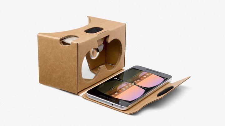
14 Data Collection Do you have enough data storage? Plan for more data than you expect, to allow for repeat coverage A good laptop should hold everything in the field, but is there space? Back up everything, including to more permanent storage UAV-based LiDAR can get 350,000+ points per second Internal storage in the Riegl VUX-1UAV is a 240 Gb SSD (0.25 Tb) Add imagery and it gets quite large If you do a lot of this work, you may need a large data storage system and high-speed network in your office
15 Processing For UAV-collected data, processing depends upon the sensor Frame-based imagery (digital cameras) is processed using traditional analytical photogrammetric methods Scanned imagery is usually collected a line at a time (pushbroom scanner), and is processed one line at a time, if high precision is required LiDAR is processed almost a point at a time, but also warped along flight lines to match ground control and cross-lines Video is usually not processed for spatial uses, but frames may be Geophysical data needs to be processed and managed according to its needs Spatial control for imagery is usually sufficient for geophysical data
16 Processing Traditional photogrammetry, as well as more recent Shape/Structure from Motion (SfM) methods, match clusters of pixels in different images and deduce the location of the object in the object space (real world) Traditional photogrammetry does it by analytical geometry SfM does it slightly differently under the hood The results are similar There is free photogrammetric software available: (103 entries) There are also many proprietary systems
17 Processing For processing, you will need to understand how the photogrammetric restitution process works While software does a lot of the work for you, you still need to understand the processes involved Begin with registering the images with the camera calibration data: This allows the correct distortion parameters to be included in the processing from the start The second stage is identifying common points between overlapping images Software can do some of this, but human eyes and brains can deal with difficult cases
18 Processing With a large number of common points identified between images, the images are resampled to convert them to epipolar images This is the equivalent of relative orientation and allows relative tilts between images to be determined and corrected for Epipolar images allow rapid searching of the images to find common points, and so create the 3-D representation (model) of the object space Noting the control points in the images allows the resulting 3-D representation to be brought into the same reference system as the control points The final 3-D basic representation of the object space can now be created
19 Processing From this basic 3-D representation, a range of products can be derived: For example, contour plots, surface plots, 3-D renderings The imagery can be draped over the surface, creating an orthophoto Fly-thoughs and various video presentations can be created Note that these products are fairly traditional and largely visual These are the more usual mapping products However, you have this representation in a digital format Digital data lends itself to further processing and analysis Need to understand processing data
20 Analysis You rarely need to map an area just to make a map There is usually a need to learn more and to support a decision This requires analysis and usually mixing with other data A GIS is one approach for this, CAD is another, depending on the problem The critical points in the analysis, together with the critical decision points, shape the data needs, and so need to be considered at the earliest planning stages A major advantage of UAVs is their low cost, allowing a job to be re-flown if the data are not helpful to the decision process Need to understand decision processes and how data errors affect them
21 Visualization Mapping is one thing, but you need to present the results to the client Traditionally, we produced maps and plots, both paper and digital Clients may now want outputs visualized in different ways Consider the growth of Virtual Reality (VR) capabilities as a means of exploring multi-dimensional data ($20 headset, software, your smartphone) Some photogrammetric software can provide enhanced 3-D visualization Can you provide a 3-D representation with live connections to a database about the objects appearing in the visualization? Can you provide field visualization on mobile devices?

22
23 Follow-through How well did the client understand the problem? This dictates how well the solution meets their needs Many clients are thinking of the technology of years ago and ask for far less than can be delivered for the same price Many of the client s ideas may not answer their problem Consider developing expertise in problem analysis This can allow you to develop very tight specifications for the project, because you know what are the critical decision points, and so exactly what to measure, how well to measure it, and where and when it needs to be measured to support the decision that has to be made
24 Rinse. Repeat. For a complex problem, you may need to map the problem first, so you know what the critical parameters are UAVs allow quick mapping in reconnaissance mode, which can be done fairly cheaply, e.g., fly transects to sample the region This allows you to decide where the denser data collection needs to be done, and which areas can be covered thinly Expensive with conventional aircraft, cheap with UAVs UAVs allow this iterative approach, which may be novel for a client, but can make certain projects far more efficient and effective
25 What You Need to Know for Projects The theoretical and technical photogrammetry concepts, for frame imagery Equivalent foundation for other types of data collected Error analysis and propagation Decision support concepts and processes Mission planning for each data sensor and process Analysis potential for your collected data Visualization and representation of your data and results Connections between these and the other things that may done to your data
26 2. CALIBRATION
27 Calibration Cameras and other imaging devices can produce results that are good to ridiculously fine tolerances Cameras can also throw substantial errors into the derived data through various forms of distortion, without images appearing distorted Calibration is essential to determine that the measurements are realistic Stability of calibration is also critical Avoid cameras with moving parts in the lens system Metric and non-metric cameras what s the difference? While self-calibration is critical for cameras and other sensors, radiometric calibration can also be critical for certain sensors
28 Radiometric Calibration Test if the frequency (color) recorded by the sensor matches the source Important for multi-spectral scanners, but not particularly for cameras Tends not to drift over time, but a correction table may need to be provided Test by comparing the signal from the sensor agrees with what is tested by an independent device There are handheld devices to obtain that data Other sensors may need other types of calibration, e.g., geophysical sensors
29 Geometric Calibration Geometric capabilities of the sensor, especially cameras, need to be calibrated For a frame camera, an array of known points that cover the field of view reasonably well is required These points should be in a location that represents where the UAV will operate, and be able to be imaged from a regular flight Could be close to the office for easy flight testing Control points should be visible, flat and easily imaged from a wide range of angles Marking in a way that allows the control points to be seen in images is important
30 Geometric Calibration Calibration of scanners is more difficult, but a test range is a possibility Pushbroom scanners can be calibrated over a test range For multi-spectral scanners, alignment of the different bands is important, but changes little over time Radiometric calibration is more important Calibration of LiDAR requires a test range of known points with targets, but for UAV LiDAR a series of well-placed small reflectors provide very bright returns LiDAR calibration also needs to deal with the GNSS/IMU, as this also provides part of the location

31 AIRBORNE LIDAR AND IMAGING DEVELOPMENTS
32 Meanwhile, back in the air While there has been a rush to miniaturize sensors for UAV deployment, the conventional aerial side of the house has been hard at work The miniaturization has allowed more to be packed into existing packages While there are some fairly basic pushbroom scanners for UAVs, there are very advanced system for aircraft The Leica ADS100 is designed largely to replace aerial cameras It is not that it provides greater precision, but it cuts a large amount of time from post-flight processing LiDAR is also becoming more advanced, being able to be flow higher and faster, provide multiple returns and use far weaker return signals
33
34 Aerial Systems The decreased weight of scanners and LiDAR has allowed the addition of more sensors A recent Reigl sensor has two LiDAR heads and two digital cameras built into a single camera port, providing greater coverage More systems can be flown on the one aircraft, allowing denser data collection More varied systems can be run at once, e.g., geophysical sensors Still not enough miniaturization for SAR and IfSAR in UAVs IfSAR still requires considerable power and space in conventional aircraft
35 TERRESTRIAL SYSTEMS
36 Terrestrial Developments For terrestrial systems, there are progressively more imaging systems being incorporated Total stations are becoming support platforms for a range of other sensors GPS/INS are evolving to support imaging systems, and are in the earliest stages in smartphones The key development is moving more and more data collection to dumb 3-D points, rather than more traditional individual point collection We add the meaning and intelligence in post-processing
37 THANK YOU!
James Van Rens CEO Riegl USA, Inc. Mining Industry and UAV s combined with LIDAR Commercial UAV Las Vegas October 2015 James Van Rens CEO Riegl USA
 James Van Rens CEO Riegl USA, Inc. Mining Industry and UAV s combined with LIDAR Commercial UAV Las Vegas October 2015 James Van Rens CEO Riegl USA COST EFFECIENCY CONTINUUM LIDAR and IMU Partnership Technology
The Applanix Approach to GPS/INS Integration
 Lithopoulos 53 The Applanix Approach to GPS/INS Integration ERIK LITHOPOULOS, Markham ABSTRACT The Position and Orientation System for Direct Georeferencing (POS/DG) is an off-the-shelf integrated GPS/inertial
UAV s in Surveying: Integration/processes/deliverables A-Z. 3Dsurvey.si
 UAV s in Surveying: Integration/processes/deliverables A-Z Info@eGPS.net TODAY S PROGRAM Introduction to photogrammetry and 3Dsurvey Theoretical facts about the technology and basics of 3dsurvey Introduction
Integrated Multi-Source LiDAR and Imagery
 Figure 1: AirDaC aerial scanning system Integrated Multi-Source LiDAR and Imagery The derived benefits of LiDAR scanning in the fields of engineering, surveying, and planning are well documented. It has
Mayden VP of Business Development Surdex Corporation
 Making Sense of Sensors Randy Mayden, Mayden VP of Business Development Surdex Corporation randym@surdex.com EARLYAERIAL PHOTOGRAPHY 2 FIRSTAERIAL CAMERA 3 AERIAL CAMERA SYSTEM DEVELOPMENT Aerial Camera
Course Outline (1) #6 Data Acquisition for Built Environment. Fumio YAMAZAKI
 #6 Data Acquisition for Built Environment. Fumio YAMAZAKI") AT09.98 Applied GIS and Remote Sensing for Disaster Mitigation #6 Data Acquisition for Built Environment 9 October, 2002 Fumio YAMAZAKI yamazaki@ait.ac.th http://www.star.ait.ac.th/~yamazaki/ Course Outline
AT09.98 Applied GIS and Remote Sensing for Disaster Mitigation #6 Data Acquisition for Built Environment 9 October, 2002 Fumio YAMAZAKI yamazaki@ait.ac.th http://www.star.ait.ac.th/~yamazaki/ Course Outline
Exterior Orientation Parameters
 Exterior Orientation Parameters PERS 12/2001 pp 1321-1332 Karsten Jacobsen, Institute for Photogrammetry and GeoInformation, University of Hannover, Germany The georeference of any photogrammetric product
a Geo-Odyssey of UAS LiDAR Mapping Henno Morkel UAS Segment Specialist DroneCon 17 May 2018
 a Geo-Odyssey of UAS LiDAR Mapping Henno Morkel UAS Segment Specialist DroneCon 17 May 2018 Abbreviations UAS Unmanned Aerial Systems LiDAR Light Detection and Ranging UAV Unmanned Aerial Vehicle RTK Real-time
Light Detection and Ranging (LiDAR)
") Light Detection and Ranging (LiDAR) http://code.google.com/creative/radiohead/ Types of aerial sensors passive active 1 Active sensors for mapping terrain Radar transmits microwaves in pulses determines
Light Detection and Ranging (LiDAR) http://code.google.com/creative/radiohead/ Types of aerial sensors passive active 1 Active sensors for mapping terrain Radar transmits microwaves in pulses determines
Leica Systems Overview
 RC30 AERIAL CAMERA SYSTEM Leica Systems Overview The Leica RC30 aerial film camera is the culmination of decades of development, started with Wild's first aerial camera in the 1920s. Beautifully engineered
An Introduction to Lidar & Forestry May 2013
 An Introduction to Lidar & Forestry May 2013 Introduction to Lidar & Forestry Lidar technology Derivatives from point clouds Applied to forestry Publish & Share Futures Lidar Light Detection And Ranging
Photogrammetry: DTM Extraction & Editing
 Photogrammetry: DTM Extraction & Editing How can one determine the x, y, and z of a location? Approaches to DTM Extraction Ground surveying Digitized topographic maps Traditional photogrammetry Hardcopy
LIDAR MAPPING FACT SHEET
 1. LIDAR THEORY What is lidar? Lidar is an acronym for light detection and ranging. In the mapping industry, this term is used to describe an airborne laser profiling system that produces location and
Case Study for Long- Range Beyond Visual Line of Sight Project. March 15, 2018 RMEL Transmission and Planning Conference
 Case Study for Long- Range Beyond Visual Line of Sight Project March 15, 2018 RMEL Transmission and Planning Conference 2014 HDR Architecture, 2016 2014 HDR, Inc., all all rights reserved. Helicopters
TERRESTRIAL AND NUMERICAL PHOTOGRAMMETRY 1. MID -TERM EXAM Question 4
 TERRESTRIAL AND NUMERICAL PHOTOGRAMMETRY 1. MID -TERM EXAM Question 4 23 November 2001 Two-camera stations are located at the ends of a base, which are 191.46m long, measured horizontally. Photographs
LiDAR & Orthophoto Data Report
 LiDAR & Orthophoto Data Report Tofino Flood Plain Mapping Data collected and prepared for: District of Tofino, BC 121 3 rd Street Tofino, BC V0R 2Z0 Eagle Mapping Ltd. #201 2071 Kingsway Ave Port Coquitlam,
Chapters 1 9: Overview
 Chapters 1 9: Overview Chapter 1: Introduction Chapters 2 4: Data acquisition Chapters 5 9: Data manipulation Chapter 5: Vertical imagery Chapter 6: Image coordinate measurements and refinements Chapters
Overview of the Trimble TX5 Laser Scanner
 Overview of the Trimble TX5 Laser Scanner Trimble TX5 Revolutionary and versatile scanning solution Compact / Lightweight Efficient Economical Ease of Use Small and Compact Smallest and most compact 3D
Applications of Mobile LiDAR and UAV Sourced Photogrammetry
 Applications of Mobile LiDAR and UAV Sourced Photogrammetry Thomas J. Pingel and Earle W. Isibue Northern Illinois University 2017 Illinois GIS Association (ILGISA) Annual Meeting October 2-4, 2017 tpingel.org
Sensor Integration and Image Georeferencing for Airborne 3D Mapping Applications
 Sensor Integration and Image Georeferencing for Airborne 3D Mapping Applications By Sameh Nassar and Naser El-Sheimy University of Calgary, Canada Contents Background INS/GPS Integration & Direct Georeferencing
Open Pit Mines. Terrestrial LiDAR and UAV Aerial Triangulation for. Figure 1: ILRIS at work
 Terrestrial LiDAR and UAV Aerial Triangulation for Open Pit Mines Figure 1: ILRIS at work Figure 2: Geo-Copter X-8000 taking off ay what you will about the past few years, it has produced some useful tools
Trends in Digital Aerial Acquisition Systems
 Trends in Digital Aerial Acquisition Systems Ernest Yap Regional Sales Manager, Airborne-Americas eyap@applanix.com 1 Medium Format Digital Cameras Medium Format Digital Cameras Where does the Medium
Aerial and Mobile LiDAR Data Fusion
 Creating Value Delivering Solutions Aerial and Mobile LiDAR Data Fusion Dr. Srini Dharmapuri, CP, PMP What You Will Learn About LiDAR Fusion Mobile and Aerial LiDAR Technology Components & Parameters Project
Terrestrial GPS setup Fundamentals of Airborne LiDAR Systems, Collection and Calibration. JAMIE YOUNG Senior Manager LiDAR Solutions
 Terrestrial GPS setup Fundamentals of Airborne LiDAR Systems, Collection and Calibration JAMIE YOUNG Senior Manager LiDAR Solutions Topics Terrestrial GPS reference Planning and Collection Considerations
(Subsea) Keith Vickery Zupt LLC
 Keith Vickery Zupt LLC") (Subsea) Keith Vickery Zupt LLC kv@zupt.com Offshore subsea infrastructure surveys (pipeline inspection, well, XT, and manifold inspections) are required to ensure compliance with both internal operator,
(Subsea) Keith Vickery Zupt LLC kv@zupt.com Offshore subsea infrastructure surveys (pipeline inspection, well, XT, and manifold inspections) are required to ensure compliance with both internal operator,
Commercial suas The Right Tool for the Right Job
 Commercial suas The Right Tool for the Right Job Presentation Objectives Overview of current data collection technologies UAS Systems Overview Surveyor 2.0 Project Case Study Mobile LiDAR & suas How Do
APPLANIX DIRECT GEOREFERENCING FOR AIRBORNE MAPPING. and FLIGHT MANAGEMENT SYSTEMS. The Better Way to Reduce the Cost of Airborne Mapping
 APPLANIX DIRECT GEOREFERENCING and FLIGHT MANAGEMENT SYSTEMS FOR AIRBORNE MAPPING The Better Way to Reduce the Cost of Airborne Mapping capture everything. precisely. Applanix Direct Georeferencing and
Sasanka Madawalagama Geoinformatics Center Asian Institute of Technology Thailand
 Sasanka Madawalagama Geoinformatics Center Asian Institute of Technology Thailand This learning material was not prepared by ADB. The views expressed in this document are the views of the author/s and
An Overview of Applanix.
 An Overview of Applanix The Company The Industry Leader in Developing Aided Inertial Technology Founded on Canadian Aerospace and Defense Industry Expertise Providing Precise Position and Orientation Systems
Airborne Laser Survey Systems: Technology and Applications
 Abstract Airborne Laser Survey Systems: Technology and Applications Guangping HE Lambda Tech International, Inc. 2323B Blue Mound RD., Waukesha, WI-53186, USA Email: he@lambdatech.com As mapping products
TRIMBLE BUSINESS CENTER PHOTOGRAMMETRY MODULE
 TRIMBLE BUSINESS CENTER PHOTOGRAMMETRY MODULE WHITE PAPER TRIMBLE GEOSPATIAL DIVISION WESTMINSTER, COLORADO, USA July 2013 ABSTRACT The newly released Trimble Business Center Photogrammetry Module is compatible
Introduction Photogrammetry Photos light Gramma drawing Metron measure Basic Definition The art and science of obtaining reliable measurements by mean
 Photogrammetry Review Neil King King and Associates Testing is an art Introduction Read the question Re-Read Read The question What is being asked Answer what is being asked Be in the know Exercise the
Assessing 3D Point Cloud Fidelity of UAS SfM Software Solutions Over Varying Terrain
 Assessing 3D Point Cloud Fidelity of UAS SfM Software Solutions Over Varying Terrain Michael Schwind, Michael J. Starek (Presenter) 18th Annual JALBTCX Airborne Coastal Mapping and Charting Technical Workshop,
GPS-Aided Inertial Navigation Systems (INS) for Remote Sensing
 for Remote Sensing") GPS-Aided Inertial Navigation Systems (INS) for Remote Sensing www.inertiallabs.com 1 EVOLUTION OF REMOTE SENSING The latest progress in Remote sensing emerged more than 150 years ago, as balloonists took
GPS-Aided Inertial Navigation Systems (INS) for Remote Sensing www.inertiallabs.com 1 EVOLUTION OF REMOTE SENSING The latest progress in Remote sensing emerged more than 150 years ago, as balloonists took
SimActive and PhaseOne Workflow case study. By François Riendeau and Dr. Yuri Raizman Revision 1.0
 SimActive and PhaseOne Workflow case study By François Riendeau and Dr. Yuri Raizman Revision 1.0 Contents 1. Introduction... 2 1.1. Simactive... 2 1.2. PhaseOne Industrial... 2 2. Testing Procedure...
Quality Accuracy Professionalism
 GeoWing - who are we? Mapping Data Service Provider Lidar Multispectral Topographic and Planimetric Maps Elevation Models Point Clouds / 3D Models Orthophotography FAA-Authorized UAS Operators WOSB / DBE
Reality Modeling Drone Capture Guide
 Reality Modeling Drone Capture Guide Discover the best practices for photo acquisition-leveraging drones to create 3D reality models with ContextCapture, Bentley s reality modeling software. Learn the
UNIT 22. Remote Sensing and Photogrammetry. Start-up. Reading. In class discuss the following questions:
 UNIT 22 Remote Sensing and Photogrammetry Start-up In class discuss the following questions: A. What do you know about remote sensing? B. What does photogrammetry do? C. Is there a connection between the
Drones for research - Observing the world in 3D from a LiDAR-UAV
 Drones for research - Observing the world in 3D from a LiDAR-UAV Program lunch seminar: Lammert Kooistra: The Unmanned Aerial Remote Sensing Facility goes 3D: Unmanned Aerial Laser Scanning Sander Mücher:
Surveying like never before
 CAD functionalities GCP Mapping and Aerial Image Processing Software for Land Surveying Specialists Surveying like never before www.3dsurvey.si Modri Planet d.o.o., Distributors: info@3dsurvey.si +386
REMOTE SENSING LiDAR & PHOTOGRAMMETRY 19 May 2017
 REMOTE SENSING LiDAR & PHOTOGRAMMETRY 19 May 2017 SERVICES Visual Inspections Digital Terrain Models Aerial Imagery Volume Computations Thermal Inspections Photo maps Aerial Video Training & Consultancy
Leica - Airborne Digital Sensors (ADS80, ALS60) Update / News in the context of Remote Sensing applications
 Update / News in the context of Remote Sensing applications") Luzern, Switzerland, acquired with GSD=5 cm, 2008. Leica - Airborne Digital Sensors (ADS80, ALS60) Update / News in the context of Remote Sensing applications Arthur Rohrbach, Sensor Sales Dir Europe,
Luzern, Switzerland, acquired with GSD=5 cm, 2008. Leica - Airborne Digital Sensors (ADS80, ALS60) Update / News in the context of Remote Sensing applications Arthur Rohrbach, Sensor Sales Dir Europe,
Trimble VISION Positions from Pictures
 Trimble VISION Positions from Pictures This session will cover What Is Trimble VISION? Trimble VISION Portfolio What Do you Need? How Does It Work & How Accurate Is It? Applications Resources Trimble VISION
High resolution survey and orthophoto project of the Dosso-Gaya region in the Republic of Niger. by Tim Leary, Woolpert Inc.
 High resolution survey and orthophoto project of the Dosso-Gaya region in the Republic of Niger by Tim Leary, Woolpert Inc. Geospatial Solutions Photogrammetry & Remote Sensing LiDAR Professional Surveying
Leica ALS70. Airborne Laser Scanners Performance for diverse Applications
 Leica ALS70 Airborne Laser Scanners Performance for diverse Applications Three Models, One Result. Highest Productivity in all Applications. Imagine an affordable 500 khz pulse rate city-mapping LIDAR
INTEGRATING TERRESTRIAL LIDAR WITH POINT CLOUDS CREATED FROM UNMANNED AERIAL VEHICLE IMAGERY
 INTEGRATING TERRESTRIAL LIDAR WITH POINT CLOUDS CREATED FROM UNMANNED AERIAL VEHICLE IMAGERY Michael Leslar a * a Teledyne-Optech, 300 Interchange Way, Vaughan, Ontario, Canada, L4K 5Z8, Mike.Leslar@teledyneoptech.com
2/9/2016. Session Agenda: Implementing new Geospatial Technologies for more efficient data capture
 Implementing new Geospatial Technologies for more efficient data capture Jay Haskamp Applied Geospatial Engineer Steve Richter VP Sales Session Agenda: Today s changing technologies and what lies ahead
UAS based laser scanning for forest inventory and precision farming
 UAS based laser scanning for forest inventory and precision farming M. Pfennigbauer, U. Riegl, P. Rieger, P. Amon RIEGL Laser Measurement Systems GmbH, 3580 Horn, Austria Email: mpfennigbauer@riegl.com,
UAS Campus Survey Project
 ARTICLE STUDENTS CAPTURING SPATIAL INFORMATION NEEDS UAS Campus Survey Project Texas A&M University- Corpus Christi, home to the largest geomatics undergraduate programme in Texas, USA, is currently undergoing
THREE DIMENSIONAL CURVE HALL RECONSTRUCTION USING SEMI-AUTOMATIC UAV
 THREE DIMENSIONAL CURVE HALL RECONSTRUCTION USING SEMI-AUTOMATIC UAV Muhammad Norazam Zulgafli 1 and Khairul Nizam Tahar 1,2 1 Centre of Studies for Surveying Science and Geomatics, Faculty of Architecture
Photogrammetry: A Modern Tool for Crash Scene Mapping
 Photogrammetry: A Modern Tool for Crash Scene Mapping Background A police accident investigator (AI) has many tasks when arriving at a crash scene. The officer s highest priority is public safety; the
TRAINING MATERIAL HOW TO OPTIMIZE ACCURACY WITH CORRELATOR3D
 TRAINING MATERIAL WITH CORRELATOR3D Page2 Contents 1. UNDERSTANDING INPUT DATA REQUIREMENTS... 4 1.1 What is Aerial Triangulation?... 4 1.2 Recommended Flight Configuration... 4 1.3 Data Requirements for
USE OF DRONE TECHNOLOGY AND PHOTOGRAMMETRY FOR BEACH MORPHODYNAMICS AND BREAKWATER MONITORING.
 Proceedings of the 6 th International Conference on the Application of Physical Modelling in Coastal and Port Engineering and Science (Coastlab16) Ottawa, Canada, May 10-13, 2016 Copyright : Creative Commons
Rectification Algorithm for Linear Pushbroom Image of UAV
 Rectification Algorithm for Linear Pushbroom Image of UAV Ruoming SHI and Ling ZHU INTRODUCTION In recent years, unmanned aerial vehicle (UAV) has become a strong supplement and an important complement
Mapping Road surface condition using Unmanned Aerial Vehicle- Based Imaging System. Ahmed F. Elaksher St. Cloud State University
 Mapping Road surface condition using Unmanned Aerial Vehicle- Based Imaging System Ahmed F. Elaksher St. Cloud State University 1 Outline Introduction & Motivation Methodology Experimental Results & Analysis
DIGITAL SURFACE MODELS OF CITY AREAS BY VERY HIGH RESOLUTION SPACE IMAGERY
 DIGITAL SURFACE MODELS OF CITY AREAS BY VERY HIGH RESOLUTION SPACE IMAGERY Jacobsen, K. University of Hannover, Institute of Photogrammetry and Geoinformation, Nienburger Str.1, D30167 Hannover phone +49
Unmanned Aerial Systems: A Look Into UAS at ODOT
 Ohio Department of Transportation John R. Kasich, Governor Jerry Wray, Director Unmanned Aerial Systems: Tim Burkholder, PS Mapping Manager Division of Engineering Office of CADD and Mapping Services Kyle
Practical Considerations of UAS Operations on Data Quality
 Practical Considerations of UAS Operations on Data Quality Precision. Accuracy. Reliability OVERVIEW Project Planning and Execution Ground Control Data Processing and Delivery 1 OVERVIEW Get Legal: Section
TAKING FLIGHT JULY/AUGUST 2015 COMMERCIAL UAS ADVANCEMENT BALLOONS THE POOR MAN S UAV? SINGLE PHOTON SENSOR REVIEW VOLUME 5 ISSUE 5
 VOLUME 5 ISSUE 5 JULY/AUGUST 2015 TAKING FLIGHT 14 COMMERCIAL UAS ADVANCEMENT 24 BALLOONS THE POOR MAN S UAV? 30 SINGLE PHOTON SENSOR REVIEW Closing in on 500 authorizations the FAA has expedited the exemption
GMAT9300 Aerial and Satellite Imaging Systems
 GMAT9300 Aerial and Satellite Imaging Systems Semester 2, COURSE DETAILS Units of Credit 6 Contact hours 5 Class Tuesday 12.00 to 15.00 BUS232 Workshop Wednesday 12.00 to 14.00 MAT308 and CivEng Lab 201
TopoDrone Photogrammetric Mapping Reliable, Accurate, Safe
 TopoDrone Photogrammetric Mapping Reliable, Accurate, Safe A complete solution for accurate airborne data capture and photogrammetric mapping using an unmanned aerial vehicle COST EFFICIENT SOLUTION TO
Remote Sensing Sensor Integration
 Remote Sensing Sensor Integration Erica Tharp LiDAR Supervisor Table of Contents About 3001 International Inc Remote Sensing Platforms Why Sensor Integration? Technical Aspects of Sensor Integration Limitations
A COMPARISON OF STANDARD FIXED-WING VS MULTIROTOR DRONE PHOTOGRAMMETRY SURVEYS
 A COMPARISON OF STANDARD FIXED-WING VS MULTIROTOR DRONE PHOTOGRAMMETRY SURVEYS Dr Steve Harwin, UAV Operations, Tas KEY QUESTIONS What detail, scale and accuracy are needed? For change analysis the data
ifp Universität Stuttgart Performance of IGI AEROcontrol-IId GPS/Inertial System Final Report
 Universität Stuttgart Performance of IGI AEROcontrol-IId GPS/Inertial System Final Report Institute for Photogrammetry (ifp) University of Stuttgart ifp Geschwister-Scholl-Str. 24 D M. Cramer: Final report
A New Protocol of CSI For The Royal Canadian Mounted Police
 A New Protocol of CSI For The Royal Canadian Mounted Police I. Introduction The Royal Canadian Mounted Police started using Unmanned Aerial Vehicles to help them with their work on collision and crime
2. POINT CLOUD DATA PROCESSING
 Point Cloud Generation from suas-mounted iphone Imagery: Performance Analysis A. D. Ladai, J. Miller Towill, Inc., 2300 Clayton Road, Suite 1200, Concord, CA 94520-2176, USA - (andras.ladai, jeffrey.miller)@towill.com
ROAD-SCANNER COMPACT APPLICATION FIELDS MAIN FEATURES
 ROAD-SCANNER COMPACT Mobile Mapping System by GEXCEL & SITECO collaboration A smaller mobile system for asset management and cartography suited for ZOLLER & FRÖHLICH PROFILER 9012 laser scanner. 2 + 3
The Use of UAV s for Gathering Spatial Information. James Van Rens CEO MAPPS Winter Conference January, 2015
 The Use of UAV s for Gathering Spatial Information James Van Rens CEO MAPPS Winter Conference January, 2015 1 UAV Technological Timeline 1980 s RPV (Remotely Piloted Vehicle) Operator on ground, almost
2010 LiDAR Project. GIS User Group Meeting June 30, 2010
 2010 LiDAR Project GIS User Group Meeting June 30, 2010 LiDAR = Light Detection and Ranging Technology that utilizes lasers to determine the distance to an object or surface Measures the time delay between
The YellowScan Surveyor: 5cm Accuracy Demonstrated
 The YellowScan Surveyor: 5cm Accuracy Demonstrated Pierre Chaponnière1 and Tristan Allouis2 1 Application Engineer, YellowScan 2 CTO, YellowScan Introduction YellowScan Surveyor, the very latest lightweight
EVOLUTION OF POINT CLOUD
 Figure 1: Left and right images of a stereo pair and the disparity map (right) showing the differences of each pixel in the right and left image. (source: https://stackoverflow.com/questions/17607312/difference-between-disparity-map-and-disparity-image-in-stereo-matching)
IMAGINE EXPANSION PACK Extend the Power of ERDAS IMAGINE
 IMAGINE EXPANSION PACK Extend the Power of ERDAS IMAGINE IMAGINE EXPANSION PACK IMAGINE Expansion Pack is a collection of functionality to extend the utility of ERDAS IMAGINE. It includes 3D visualization
Bringing Singapore to life in 3D
 Bringing Singapore to life in 3D Dr Victor Khoo, Deputy Director Singapore Land Authority Bringing Singapore to life in 3D ESRI Singapore UC 2016 Dr. Victor Khoo Singapore Land Authority SLA 2016 RESTRICTED
Chapter 1: Overview. Photogrammetry: Introduction & Applications Photogrammetric tools:
 Chapter 1: Overview Photogrammetry: Introduction & Applications Photogrammetric tools: Rotation matrices Photogrammetric point positioning Photogrammetric bundle adjustment This chapter will cover the
Hardware 3D Mapping Systems
 Hardware 3D Mapping Systems About Us GreenValley International GreenValley International provides 3D mapping solutions that include mobile & aerial LiDAR acquisition hardware, post-processing software
CLASSIFICATION OF NONPHOTOGRAPHIC REMOTE SENSORS
 CLASSIFICATION OF NONPHOTOGRAPHIC REMOTE SENSORS PASSIVE ACTIVE DIGITAL CAMERA THERMAL (e.g. TIMS) VIDEO CAMERA MULTI- SPECTRAL SCANNERS VISIBLE & NIR MICROWAVE HYPERSPECTRAL (e.g. AVIRIS) SLAR Real Aperture
ALS40 Airborne Laser Scanner
 ALS40 Airborne Laser Scanner Airborne LIDAR for Professionals High Performance Laser Scanning Direct Measurement of Ground Surface from the Air The ALS40 Airborne Laser Scanner measures the topography
ADDING MICROSENSORS AND TRIMBLE SUREPOINT TECHNOLOGY TO SURVEY ROVERS FOR ENHANCED ACCURACY AND PRODUCTIVITY
 BEYOND GNSS ADDING MICROSENSORS AND TRIMBLE SUREPOINT TECHNOLOGY TO SURVEY ROVERS FOR ENHANCED ACCURACY AND PRODUCTIVITY WHITE PAPER BEYOND GNSS: ADDING MICROSENSORS AND TRIMBLE SUREPOINT TECHNOLOGY TO
USING UNMANNED AERIAL VEHICLE (DRONE/FLYCAM) TECHNOLOGY IN SURVEY WORK OF PORTCOAST
 TECHNOLOGY IN SURVEY WORK OF PORTCOAST") USING UNMANNED AERIAL VEHICLE (DRONE/FLYCAM) TECHNOLOGY IN SURVEY WORK OF PORTCOAST 1. Capturing aerial images by using Drone Taking images by drones is currently applied in many fields especially in topographic
USING UNMANNED AERIAL VEHICLE (DRONE/FLYCAM) TECHNOLOGY IN SURVEY WORK OF PORTCOAST 1. Capturing aerial images by using Drone Taking images by drones is currently applied in many fields especially in topographic
GIS Data Collection. This chapter reviews the main methods of GIS data capture and transfer and introduces key practical management issues.
 9 GIS Data Collection OVERVIEW This chapter reviews the main methods of GIS data capture and transfer and introduces key practical management issues. It distinguishes between primary (direct measurement)
Leica Geosystems UAS Airborne Sensors. MAPPS Summer Conference July 2014 Alistair Stuart
 Leica Geosystems UAS Airborne Sensors MAPPS Summer Conference July 2014 Alistair Stuart 1 Sensors for UAS! Promise of UAS is to expand aerial data acquisition capabilities for traditional and non-traditional
9/14/2011. Contents. Lecture 3: Spatial Data Acquisition in GIS. Dr. Bo Wu Learning Outcomes. Data Input Stream in GIS
 Contents Lecture 3: Spatial Data Acquisition in GIS Dr. Bo Wu lsbowu@polyu.edu.hk 1. Learning outcomes. Data acquisition: Manual digitization 3. Data acquisition: Field survey 4. Data acquisition: Remote
Payloads. Which one(s) are right for your organization?
 are right for your organization?") Payloads Which one(s) are right for your organization? What is a payload anyway? Not as simple as it may sound and critically important. Integrated and fixed? Interchangeable? Field changeable? Impact
Payloads Which one(s) are right for your organization? What is a payload anyway? Not as simple as it may sound and critically important. Integrated and fixed? Interchangeable? Field changeable? Impact
Photo based Terrain Data Acquisition & 3D Modeling
 Photo based Terrain Data Acquisition & 3D Modeling June 7, 2013 Howard Hahn Kansas State University Partial funding by: KSU Office of Research and Sponsored Programs Introduction: Need Application 1 Monitoring
Journal Online Jaringan COT POLIPD (JOJAPS) Accuracy Assessment of Height Coordinate Using Unmanned Aerial Vehicle Images Based On Leveling Height
 Accuracy Assessment of Height Coordinate Using Unmanned Aerial Vehicle Images Based On Leveling Height") JOJAPS eissn 2504-8457 Abstract Journal Online Jaringan COT POLIPD (JOJAPS) Accuracy Assessment of Height Coordinate Using Unmanned Aerial Vehicle Images Based On Leveling Height Syamsul Anuar Bin Abu
JOJAPS eissn 2504-8457 Abstract Journal Online Jaringan COT POLIPD (JOJAPS) Accuracy Assessment of Height Coordinate Using Unmanned Aerial Vehicle Images Based On Leveling Height Syamsul Anuar Bin Abu
3D recording of archaeological excavation
 5 th International Conference Remote Sensing in Archaeology The Age of Sensing 13-15 October 2014 - Duke University 3D recording of archaeological excavation Stefano Campana UNIVERSITY of CAMBRIDGE Faculty
Development of Unmanned Aircraft System (UAS) for Agricultural Applications. Quarterly Progress Report
 for Agricultural Applications. Quarterly Progress Report") Development of Unmanned Aircraft System (UAS) for Agricultural Applications Quarterly Progress Report Reporting Period: October December 2016 January 30, 2017 Prepared by: Lynn Fenstermaker and Jayson
Development of Unmanned Aircraft System (UAS) for Agricultural Applications Quarterly Progress Report Reporting Period: October December 2016 January 30, 2017 Prepared by: Lynn Fenstermaker and Jayson
MIDAS 5 Camera System. (Multi-camera Integrated Digital Acquisition System)
") MIDAS 5 Camera System (Multi-camera Integrated Digital Acquisition System) MIDAS 5 in Puppet Air STP-400 Mount The MIDAS Solution The MIDAS 5 system is a complete turn-key oblique Imaging solution for
MIDAS 5 Camera System (Multi-camera Integrated Digital Acquisition System) MIDAS 5 in Puppet Air STP-400 Mount The MIDAS Solution The MIDAS 5 system is a complete turn-key oblique Imaging solution for
PHOTOGRAMMETRIC SOLUTIONS OF NON-STANDARD PHOTOGRAMMETRIC BLOCKS INTRODUCTION
 PHOTOGRAMMETRIC SOLUTIONS OF NON-STANDARD PHOTOGRAMMETRIC BLOCKS Dor Yalon Co-Founder & CTO Icaros, Inc. ABSTRACT The use of small and medium format sensors for traditional photogrammetry presents a number
Video Georegistration: Key Challenges. Steve Blask Harris Corporation GCSD Melbourne, FL 32934
 Video Georegistration: Key Challenges Steve Blask sblask@harris.com Harris Corporation GCSD Melbourne, FL 32934 Definitions Registration: image to image alignment Find pixel-to-pixel correspondences between
2/19/2018. Who are we? Who am I? What is Scanning? How does scanning work? How does scanning work? Scanning for Today s Surveyors
 2/19/2018 Who are we? Scanning for Today s Surveyors Survey, GIS, and Construction dealer Founded in 1988 Employee Owned Headquartered in Bismarck, ND States covered: ND, SD, MN, MT, WY, CO, UT, ID, WA,
ENY-C2005 Geoinformation in Environmental Modeling Lecture 4b: Laser scanning
 1 ENY-C2005 Geoinformation in Environmental Modeling Lecture 4b: Laser scanning Petri Rönnholm Aalto University 2 Learning objectives To recognize applications of laser scanning To understand principles
Digital Defence LiDAR based Smart 3D Geospatial Intelligence for Smart Defence
 www. geokno.com Digital Defence LiDAR based Smart 3D Geospatial Intelligence for Smart Defence Presentation Agenda About Geokno About LiDAR Technology LiDAR Products for Security Forces Development uses
Photogrammetric Procedures for Digital Terrain Model Determination
 Photogrammetric Procedures for Digital Terrain Model Determination Hartmut ZIEMANN and Daniel GROHMANN 1 Introduction Photogrammetric procedures for digital terrain model (DTM) data determination fall
SPAR, ELMF 2013, Amsterdam. Laser Scanning on the UK Highways Agency Network. Hamish Grierson Blom Uk
 SPAR, ELMF 2013, Amsterdam Laser Scanning on the UK Highways Agency Network Hamish Grierson Blom Uk www.blomasa.com www.blom-uk.co.uk Blom UK Part of the Blom Group Blom Group - Europe s largest aerial
UAV Hyperspectral system for remote sensing application
 UAV Hyperspectral system for remote sensing application The system consists airborne imaging spectrophotometer placed on a frame suitable for use aircraft, a UAV helicopter and all components needed for
Lidar Sensors, Today & Tomorrow. Christian Sevcik RIEGL Laser Measurement Systems
 Lidar Sensors, Today & Tomorrow Christian Sevcik RIEGL Laser Measurement Systems o o o o Online Waveform technology Stand alone operation no field computer required Remote control through wireless network
Airborne LiDAR Data Acquisition for Forestry Applications. Mischa Hey WSI (Corvallis, OR)
") Airborne LiDAR Data Acquisition for Forestry Applications Mischa Hey WSI (Corvallis, OR) WSI Services Corvallis, OR Airborne Mapping: Light Detection and Ranging (LiDAR) Thermal Infrared Imagery 4-Band
Airborne LiDAR Data Acquisition for Forestry Applications Mischa Hey WSI (Corvallis, OR) WSI Services Corvallis, OR Airborne Mapping: Light Detection and Ranging (LiDAR) Thermal Infrared Imagery 4-Band
GMAT9300 Aerial and Satellite Imaging Systems
 GMAT9300 Aerial and Satellite Imaging Systems Semester 2, 2016 COURSE DETAILS Units of Credit 6 Contact hours 5 Class Mon 10.00 to 13.00 BUS130 Workshop Tuesday 15.00 to 17.00 QUAD047 and CivEng Lab 201
DENSE 3D POINT CLOUD GENERATION FROM UAV IMAGES FROM IMAGE MATCHING AND GLOBAL OPTIMAZATION
 DENSE 3D POINT CLOUD GENERATION FROM UAV IMAGES FROM IMAGE MATCHING AND GLOBAL OPTIMAZATION S. Rhee a, T. Kim b * a 3DLabs Co. Ltd., 100 Inharo, Namgu, Incheon, Korea ahmkun@3dlabs.co.kr b Dept. of Geoinformatic