Automated Enforcement of High Resolution Terrain Models April 21, Brian K. Gelder, PhD Associate Scientist Iowa State University
|
|
|
- Gerald Waters
- 6 years ago
- Views:
Transcription
1 Automated Enforcement of High Resolution Terrain Models April 21, 2015 Brian K. Gelder, PhD Associate Scientist Iowa State University
2 Problem Statement High resolution digital elevation models (DEMs) should improve peak flow return estimates by better measuring basin characteristics However, high resolution elevation models capture flow impeding features such as roadways and removing them is a time consuming process of manual editing Can this process be automated?
3 Project Goals Goals for IIHR and Iowa DOT Stream centerline enforcement needed for update of Iowa FEMA floodplain maps Enable improvement of watershed boundaries base on LiDAR Enable classification of depression drainage status for improved StreamStats regression Goals for Iowa Daily Erosion Project 2.0 Continuous flowpaths within agricultural fields
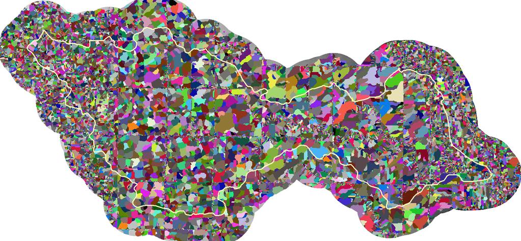
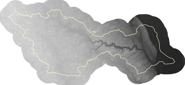
4 Trial Area Walnut Creek (South Skunk River) HUC 12 in north central Iowa acres 19 square miles 60 meters of relief Prairie pothole depressions throughout Roads, abandoned railroads, bridges, culverts, lagoons, rivers, trees, small town Some low quality, pocky LiDAR Within USGS Spec!


5 Trial Area DEM & Hillshade

6 Trial Area Watersheds
7 Process Overview 1. DEM generation and initial filtering 2. Hole punching for Major fill regions 3. Fill region Characterization 4. Thin fill region removal 5. Fill region removal by cutting DEM 6. Analyze enforcements for retention
8 Major Accomplishments Classification of likely drained depressions Slopes >5% at local watershed boundary Embankment that created depression is roughly symmetrical Sounds like a road/railroad/runway right? Removal of embankment reduces depth of impeded flow
9 Major Accomplishments Automating enforcement process that accommodates data issues Irregular LiDAR return spacing Irregular TIN spacing Regular DEM spacing Resulting in Many depressions don't easily flow based on search criteria Elevation estimates are not always in channels
10 Major Accomplishments Developed an automated enforcement process that accommodates data issues Maximum effective depth 3 rd minimum elevation in a 3x3 kernel Max breaching distance is 3 x minimum distance from points at 80% of maximum effective depth to watershed boundary Multiple cutting attempts Upstream -> downstream (twice) Downstream -> upstream

11 Fill Depth at 3 m Resolution
12 Raw DEM

13 Fill Depth at 3 m Resolution
14 Fill Regions at 3 m Resolution (1 st Fill Step)
15 Fill Regions at 3 m Resolution (2 nd Fill Step)
16 Fill Regions at 3 m Resolution (From All 5 Fill Steps)

17 Fill Regions at 3 m Resolution
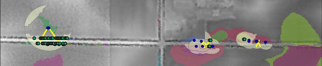
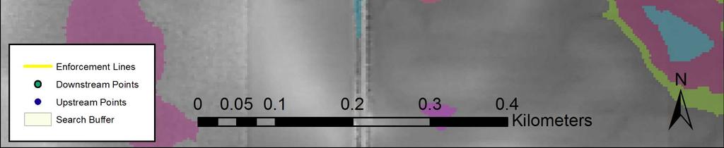
18 Upstream Points & Search Buffer
19 Eligible Downstream Points
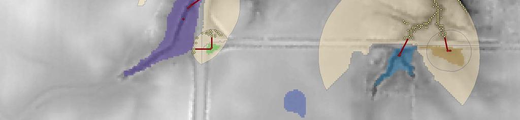
20 Best Connection(s)

21 Preliminary Enforced DEM

22 Classification Accuracy Depression Enforcement Accuracy Depressions Correctly Classified as Undrained Depressions Enforced That Should Not Be Drained Depressions Enforced Correctly - 88 Drained Depressions That Were Not Enforced - 4
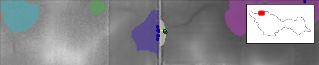
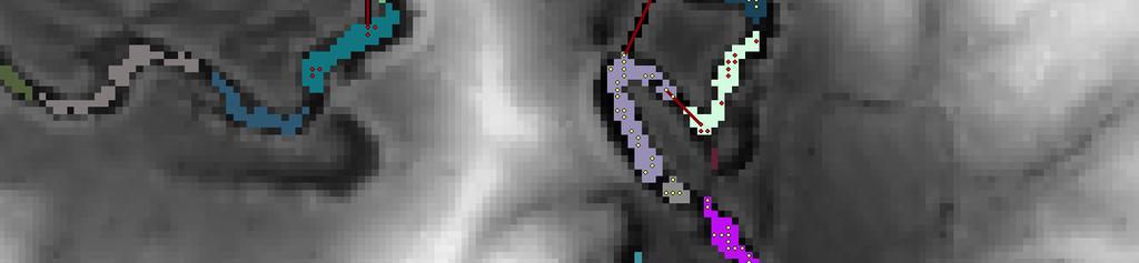
23 Classification Errors

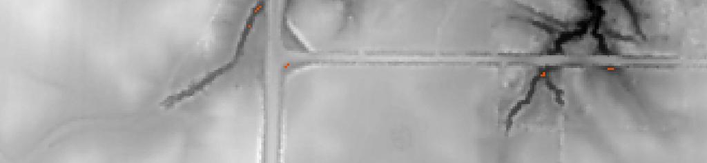
24 Remaining Fill Depth

25 New HUC12 Boundary
26 Continuing Work Iowa Department of Natural Resources will now use enforced DEMs to Improve watershed boundary accuracy Improve National Hydrographic Dataset 'blue lines' Iowa Institute for Hydraulic Research/Iowa Flood Center is continuing with statewide floodplain risk analysis
27 Further Research Test if enforced LiDAR DEMs can improve USGS Streamstats regressions Most likely in Des Moines Lobe where regressions are least accurate There are 17 small watershed streamgages suitable for testing
28 Further Research Test if calculating statistics based on 'effective' watershed area can improve regressions versus entire watershed area Effective watershed area is the subset of the total area that contributes flow during a design storm of a given Annual Exceedance Probability (AEP) Only valid for Des Moines Lobe
29 Further Research Test if quantitative channelization metrics improve regressions over qualitative NHD 'blue lines' 'Blue line' locations vary by analyst Quantitative channelization metrics include Terrain Position Index Aspect change Profile curvature Other metrics
30 Questions?
31 Current Process 2. Fill Region Delineation (Hole Punching) Iterative process to define unique areas where depression is deep or large Set deepest point in each area to null in DEM Null values are holes in DEMs for water to flow out After hole punching determine if deepest depression is still deeper than minimum Code each area uniquely

32 Oxbow Cutoffs

33 Deepest Cells
34 Enforced Filled Flowpaths GT 160 acres

35 Trial Area DEM & Hillshade

36 Potential Channel Map

37 All Fill Regions
38 After Thin Fill Region Removal
39 Current Process 1. DEM Generation and Initial Filtering DEM Generation Create DEM using Mean Mild 18 This setting uses tiling to remove some of the pits when creating the terrain Initial Filtering Pit Filling Removes outliers in elevation One cell sinks» Reassign to fill elevation Most needed in pocky areas watersheds in HUC 12
40 Current Process 2. Fill Region Delineation (Hole Punching) Filled DEM Original DEM = Difference Same as difference grid depressions of Poppenga et al Retain all fill regions greater than depth or area criteria Minimum Basin Depth Currently using 18 cm, RMSE spec is 18 cm Minimum Basin Area Currently 100 m watersheds in HUC 12
41 Current Process 3. Fill Region Characterization Thickness of fill region Maximum depth and depth range around sink Deepest 3 points in a 5x5 kernel around sink Are deepest points in an area of aspect change, low elevation, and high profile curvature? i.e. In a channel? Distance from deepest points to edge of fill region Convert raster representing deepest cells to deepest points for later processing
42 Current Process 4. Remove Channelized Fill Regions Remove fill regions from DEM that are: Fully in channelized areas AND Less than 1 meter in depth Removed fill regions are then tested to see if the overflow path is channelized If not, do not remove this fill region Protects small culverts in road ditches from being removed in this step Simplifies analysis for next steps
43 Current Process 5. Depression Removal by Cutting DEM Define fill regions to attempt to cut Deep points near edge of fill region Set constraints for downstream connections Within allowable search distance What is the distance to edge of fill region?» Multiply by 5x» Minimum of 30 meters Does the fill region abut a wide transportation feature (interstate highway, railyard, runway)?» Add distance to cross feature Must be at lower elevation than fill region
44 Current Process 5. Depression Removal by Cutting DEM Buffer points by search distance and find cells at lower elevation Thin by in channel status Evaluate all connections for distance, slope within greater of 15m or 50% of minimum match distance within greater of 1% or ½ of maximum match slope Enforce all eligible connections Thin to one connection later
45 Current Process 6. Analyze Enforcements for Retention Reduce connections to one per fill region First priority easiest connection by cut/fill Evaluate flowpath out of fill region before and after enforcement If enforcement cuts off an oxbow reject enforcement If enforcement does not reduce fill region storage reject enforcement Other issues in multi-pixel wide channels
2D Large Scale Automated Engineering for FEMA Floodplain Development in South Dakota. Eli Gruber, PE Brooke Conner, PE
 2D Large Scale Automated Engineering for FEMA Floodplain Development in South Dakota Eli Gruber, PE Brooke Conner, PE Project Acknowledgments FEMA Region 8 Staff: Brooke Conner, PE Casey Zuzak, GISP Ryan
WMS 10.0 Tutorial Hydraulics and Floodplain Modeling HY-8 Modeling Wizard Learn how to model a culvert using HY-8 and WMS
 v. 10.0 WMS 10.0 Tutorial Hydraulics and Floodplain Modeling HY-8 Modeling Wizard Learn how to model a culvert using HY-8 and WMS Objectives Define a conceptual schematic of the roadway, invert, and downstream
2D Model Implementation for Complex Floodplain Studies. Sam Crampton, P.E., CFM Dewberry
 2D Model Implementation for Complex Floodplain Studies Sam Crampton, P.E., CFM Dewberry 2D Case Studies Case Study 1 Rain-on-Grid 2D floodplain simulation for unconfined flat topography in coastal plain
Using GeoNet 2.0 for feature identification in an urban environment Anna Kladzyk
 Using GeoNet 2.0 for feature identification in an urban environment by Anna Kladzyk CE397 Flood Forecasting Term Project The University of Texas at Austin May 2015 TABLE OF CONTENTS Introduction... 3 Data...
Hydraulics and Floodplain Modeling Modeling with the Hydraulic Toolbox
 v. 9.1 WMS 9.1 Tutorial Hydraulics and Floodplain Modeling Modeling with the Hydraulic Toolbox Learn how to design inlet grates, detention basins, channels, and riprap using the FHWA Hydraulic Toolbox
Geographic Surfaces. David Tenenbaum EEOS 383 UMass Boston
 Geographic Surfaces Up to this point, we have talked about spatial data models that operate in two dimensions How about the rd dimension? Surface the continuous variation in space of a third dimension
Watershed Modeling With DEMs: The Rest of the Story
 Watershed Modeling With DEMs: The Rest of the Story Lesson 7 7-1 DEM Delineation: The Rest of the Story DEM Fill for some cases when merging DEMs Delineate Basins Wizard Smoothing boundaries Representing
Stream network delineation and scaling issues with high resolution data
 Stream network delineation and scaling issues with high resolution data Roman DiBiase, Arizona State University, May 1, 2008 Abstract: In this tutorial, we will go through the process of extracting a stream
UNDERSTAND HOW TO SET UP AND RUN A HYDRAULIC MODEL IN HEC-RAS CREATE A FLOOD INUNDATION MAP IN ARCGIS.
 CE 412/512, Spring 2017 HW9: Introduction to HEC-RAS and Floodplain Mapping Due: end of class, print and hand in. HEC-RAS is a Hydrologic Modeling System that is designed to describe the physical properties
Stream Network and Watershed Delineation using Spatial Analyst Hydrology Tools
 Stream Network and Watershed Delineation using Spatial Analyst Hydrology Tools Prepared by Venkatesh Merwade School of Civil Engineering, Purdue University vmerwade@purdue.edu January 2018 Objective The
GIS Tools for Hydrology and Hydraulics
 1 OUTLINE GIS Tools for Hydrology and Hydraulics INTRODUCTION Good afternoon! Welcome and thanks for coming. I once heard GIS described as a high-end Swiss Army knife: lots of tools in one little package
Channel Conditions in the Onion Creek Watershed. Integrating High Resolution Elevation Data in Flood Forecasting
 Channel Conditions in the Onion Creek Watershed Integrating High Resolution Elevation Data in Flood Forecasting Lukas Godbout GIS in Water Resources CE394K Fall 2016 Introduction Motivation Flooding is
Harris County Flood Control District HEC-RAS 2D Modeling Guidelines (Standardizing HEC-RAS 2D Models for Submittal Within Harris County)
") Harris County Flood Control District HEC-RAS 2D Modeling Guidelines (Standardizing HEC-RAS 2D Models for Submittal Within Harris County) Presented by: April 27, 2017 Matthew Zeve, P.E., CFM Harris County
Harris County Flood Control District HEC-RAS 2D Modeling Guidelines (Standardizing HEC-RAS 2D Models for Submittal Within Harris County) Presented by: April 27, 2017 Matthew Zeve, P.E., CFM Harris County
Field-Scale Watershed Analysis
 Conservation Applications of LiDAR Field-Scale Watershed Analysis A Supplemental Exercise for the Hydrologic Applications Module Andy Jenks, University of Minnesota Department of Forest Resources 2013
WORKSHOP MANUAL: CREATING ELEVATION PRODUCTS AND PTMAPP-DESKTOP INPUTS
 May 2017 WORKSHOP MANUAL: CREATING ELEVATION PRODUCTS AND PTMAPP-DESKTOP INPUTS An innovative solution by: This manual was amended from materials provided in a Sauk River Watershed District workshop in
Appendix E. HEC-RAS and HEC-Ecosystem Functions Models
 Appendix E HEC-RAS and HEC-Ecosystem Functions Models 1 Appendix E: Modeled Reaches for the Connecticut River Watershed application of HEC-RAS Separate from the report for the Decision Support System of
Surface Analysis. Data for Surface Analysis. What are Surfaces 4/22/2010
 Surface Analysis Cornell University Data for Surface Analysis Vector Triangulated Irregular Networks (TIN) a surface layer where space is partitioned into a set of non-overlapping triangles Attribute and
J.Welhan 5/07. Watershed Delineation Procedure
 Watershed Delineation Procedure 1. Prepare the DEM: - all grids should be in the same projection; if not, then reproject (or define and project); if in UTM, all grids must be in the same zone (if not,
Reality Check: Processing LiDAR Data. A story of data, more data and some more data
 Reality Check: Processing LiDAR Data A story of data, more data and some more data Red River of the North Red River of the North Red River of the North Red River of the North Introduction and Background
Lidar Talking Points Status of lidar collection in Pennsylvania Estimated cost and timeline
 Lidar Talking Points Pennsylvania has an immediate need for new lidar (topographic) data coverage. Some uses of the data are enumerated later in this document. USGS has calculated an average return on
Developing an Interactive GIS Tool for Stream Classification in Northeast Puerto Rico
 Developing an Interactive GIS Tool for Stream Classification in Northeast Puerto Rico Lauren Stachowiak Advanced Topics in GIS Spring 2012 1 Table of Contents: Project Introduction-------------------------------------
Introducion to Hydrologic Engineering Centers River Analysis System (HEC- RAS) Neena Isaac Scientist D CWPRS, Pune -24
 Neena Isaac Scientist D CWPRS, Pune -24") Introducion to Hydrologic Engineering Centers River Analysis System (HEC- RAS) Neena Isaac Scientist D CWPRS, Pune -24 One dimensional river models (1-D models) Assumptions Flow is one dimensional Streamline
Introducion to Hydrologic Engineering Centers River Analysis System (HEC- RAS) Neena Isaac Scientist D CWPRS, Pune -24 One dimensional river models (1-D models) Assumptions Flow is one dimensional Streamline
Watershed Modeling Advanced DEM Delineation
 v. 10.1 WMS 10.1 Tutorial Watershed Modeling Advanced DEM Delineation Techniques Model manmade and natural drainage features Objectives Learn to manipulate the default watershed boundaries by assigning
Disaster Mitigation Projects in Polis. December 14, 2016
 1 Disaster Mitigation Projects in Polis December 14, 2016 Briefing Agenda 2 About Polis Multi s Mitigation Planning Flood s s Disaster Mitigation Platforms Consultancies Training Discussion 3 About us
WMS 9.0 Tutorial Hydraulics and Floodplain Modeling HEC-RAS Analysis Learn how to setup a basic HEC-RAS analysis using WMS
 v. 9.0 WMS 9.0 Tutorial Hydraulics and Floodplain Modeling HEC-RAS Analysis Learn how to setup a basic HEC-RAS analysis using WMS Objectives Learn how to build cross sections, stream centerlines, and bank
The 3D Analyst extension extends ArcGIS to support surface modeling and 3- dimensional visualization. 3D Shape Files
 NRM 435 Spring 2016 ArcGIS 3D Analyst Page#1 of 9 0B3D Analyst Extension The 3D Analyst extension extends ArcGIS to support surface modeling and 3- dimensional visualization. 3D Shape Files Analogous to
Day 1. HEC-RAS 1-D Training. Rob Keller and Mark Forest. Break (9:45 am to 10:00 am) Lunch (12:00 pm to 1:00 pm)
 Lunch (12:00 pm to 1:00 pm)") Day 1 HEC-RAS 1-D Training Rob Keller and Mark Forest Introductions and Course Objectives (8:00 am to 8:15 am) Introductions: Class and Content Module 1 Open Channel Hydraulics (8:15 am to 9:45 am) Lecture
Day 1 HEC-RAS 1-D Training Rob Keller and Mark Forest Introductions and Course Objectives (8:00 am to 8:15 am) Introductions: Class and Content Module 1 Open Channel Hydraulics (8:15 am to 9:45 am) Lecture
George Mason University Department of Civil, Environmental and Infrastructure Engineering
 George Mason University Department of Civil, Environmental and Infrastructure Engineering Dr. Celso Ferreira Prepared by Lora Baumgartner December 2015 Revised by Brian Ross July 2016 Exercise Topic: Getting
Lab 11: Terrain Analyses
 Lab 11: Terrain Analyses What You ll Learn: Basic terrain analysis functions, including watershed, viewshed, and profile processing. There is a mix of old and new functions used in this lab. We ll explain
Delineating the Stream Network and Watersheds of the Guadalupe Basin
 Delineating the Stream Network and Watersheds of the Guadalupe Basin Francisco Olivera Department of Civil Engineering Texas A&M University Srikanth Koka Department of Civil Engineering Texas A&M University
Getting Started with Spatial Analyst. Steve Kopp Elizabeth Graham
 Getting Started with Spatial Analyst Steve Kopp Elizabeth Graham Spatial Analyst Overview Over 100 geoprocessing tools plus raster functions Raster and vector analysis Construct workflows with ModelBuilder,
BRIEF EXAMPLES OF PRACTICAL USES OF LIDAR
 BRIEF EXAMPLES OF PRACTICAL USES OF LIDAR PURDUE ROAD SCHOOL - 3/9/2016 CHRIS MORSE USDA-NRCS, STATE GIS COORDINATOR LIDAR/DEM SOURCE DATES LiDAR and its derivatives (DEMs) have a collection date for data
Getting Started with Spatial Analyst. Steve Kopp Elizabeth Graham
 Getting Started with Spatial Analyst Steve Kopp Elizabeth Graham Workshop Overview Fundamentals of using Spatial Analyst What analysis capabilities exist and where to find them How to build a simple site
Should Contours Be Generated from Lidar Data, and Are Breaklines Required? Lidar data provides the most
 Should Contours Be Generated from Lidar Data, and Are Breaklines Required? Lidar data provides the most accurate and reliable representation of the topography of the earth. As lidar technology advances
v Introduction to WMS WMS 11.0 Tutorial Become familiar with the WMS interface Prerequisite Tutorials None Required Components Data Map
 s v. 11.0 WMS 11.0 Tutorial Become familiar with the WMS interface Objectives Import files into WMS and change modules and display options to become familiar with the WMS interface. Prerequisite Tutorials
v Prerequisite Tutorials GSSHA Modeling Basics Stream Flow GSSHA WMS Basics Creating Feature Objects and Mapping their Attributes to the 2D Grid
 v. 10.1 WMS 10.1 Tutorial GSSHA Modeling Basics Developing a GSSHA Model Using the Hydrologic Modeling Wizard in WMS Learn how to setup a basic GSSHA model using the hydrologic modeling wizard Objectives
Improved Applications with SAMB Derived 3 meter DTMs
 Improved Applications with SAMB Derived 3 meter DTMs Evan J Fedorko West Virginia GIS Technical Center 20 April 2005 This report sums up the processes used to create several products from the Lorado 7
Applied Cartography and Introduction to GIS GEOG 2017 EL. Lecture-7 Chapters 13 and 14
 Applied Cartography and Introduction to GIS GEOG 2017 EL Lecture-7 Chapters 13 and 14 Data for Terrain Mapping and Analysis DEM (digital elevation model) and TIN (triangulated irregular network) are two
2014 AWRA Annual Water Resources Conference November 5, 2014 Tysons Corner, VA
 2014 AWRA Annual Water Resources Conference November 5, 2014 Tysons Corner, VA HEC-RAS Overview, History, & Future How HEC-RAS Works Model Development Standard FEMA Assumptions Building A Model FEMA Levels
WMS 10.1 Tutorial Hydraulics and Floodplain Modeling HEC-RAS Analysis Learn how to setup a basic HEC-RAS analysis using WMS
 v. 10.1 WMS 10.1 Tutorial Hydraulics and Floodplain Modeling HEC-RAS Analysis Learn how to setup a basic HEC-RAS analysis using WMS Objectives Learn how to build cross sections, stream centerlines, and
Benefits of 2D Modeling for Urban Stormwater Master Planning Niles, Illinois
 Benefits of 2D Modeling for Urban Stormwater Master Planning Niles, Illinois Patrick Lach, P.E., CFM, Hey and Associates, Inc. Steve Vinezeano, ICMA CM, LEED AP Assistant Village Manager Three Geographic
TUFLOW 1D/2D SURFACE WATER MODELING SYSTEM. 1 Introduction. 2 Background Data
 SURFACE WATER MODELING SYSTEM TUFLOW 1D/2D 1 Introduction This tutorial describes the generation of a 1D TUFLOW project using the SMS interface. It is recommended that the TUFLOW 2D tutorial be done before
George Mason University Department of Civil, Environmental and Infrastructure Engineering. Dr. Celso Ferreira
 George Mason University Department of Civil, Environmental and Infrastructure Engineering Dr. Celso Ferreira Exercise Topic: HEC GeoRAS Post-Processing Objectives: This tutorial is designed to walk you
Raster Analysis. Overview Neighborhood Analysis Overlay Cost Surfaces. Arthur J. Lembo, Jr. Salisbury University
 Raster Analysis Overview Neighborhood Analysis Overlay Cost Surfaces Exam results Mean: 74% STDEV: 15% High: 92 Breakdown: A: 1 B: 2 C: 2 D: 1 F: 2 We will review the exam next Tuesday. Start thinking
Using HEC-RAS and HEC-GeoRAS for River Modeling Adapted by E. Maurer, using an exercise by V. Merwade, Purdue Univ.
 Introduction Using HEC-RAS and HEC-GeoRAS for River Modeling Adapted by E. Maurer, using an exercise by V. Merwade, Purdue Univ. This tutorial uses the output from HEC_GeoRAS from a prior exercise as input
Lecture 21 - Chapter 8 (Raster Analysis, part2)
") GEOL 452/552 - GIS for Geoscientists I Lecture 21 - Chapter 8 (Raster Analysis, part2) Today: Digital Elevation Models (DEMs), Topographic functions (surface analysis): slope, aspect hillshade, viewshed,
GEOL 452/552 - GIS for Geoscientists I Lecture 21 - Chapter 8 (Raster Analysis, part2) Today: Digital Elevation Models (DEMs), Topographic functions (surface analysis): slope, aspect hillshade, viewshed,
2-D Hydraulic Modeling Theory & Practice
 2-D Hydraulic Modeling Theory & Practice Author: Maged A. Aboelata, PhD, PE, CFM Presenter: Heather Zhao, PE, CFM October 2017 Presentation Outline * 1-D vs. 2-D modeling * Theory of 2-D simulation * Commonly
Efficiency and Accuracy of Importing HEC RAS Datafiles into PCSWMM and SWMM5
 5 Efficiency and Accuracy of Importing HEC RAS Datafiles into PCSWMM and SWMM5 Karen Finney, Rob James, William James and Tiehong Xiao An advantage of USEPA s SWMM5 is its capability to dynamically model
Lab 11: Terrain Analyses
 Lab 11: Terrain Analyses What You ll Learn: Basic terrain analysis functions, including watershed, viewshed, and profile processing. There is a mix of old and new functions used in this lab. We ll explain
George Mason University Department of Civil, Environmental and Infrastructure Engineering. Dr. Celso Ferreira Prepared by Lora Baumgartner
 George Mason University Department of Civil, Environmental and Infrastructure Engineering Dr. Celso Ferreira Prepared by Lora Baumgartner Exercise Topic: Getting started with HEC GeoRAS Objective: Create
Import, view, edit, convert, and digitize triangulated irregular networks
 v. 10.1 WMS 10.1 Tutorial Import, view, edit, convert, and digitize triangulated irregular networks Objectives Import survey data in an XYZ format. Digitize elevation points using contour imagery. Edit
Using LIDAR to Design Embankments in ArcGIS. Written by Scott Ralston U.S. Fish & Wildlife Service Windom Wetland Management District
 Using LIDAR to Design Embankments in ArcGIS Written by Scott Ralston U.S. Fish & Wildlife Service Windom Wetland Management District This tutorial covers the basics of how to design a dike, embankment
Watershed Analysis and A Look Ahead
 Watershed Analysis and A Look Ahead 1 2 Specific Storm Flow to Grate What data do you need? Watershed boundaries for each storm sewer Net flow generated from each point across the landscape Elevation Fill
Q&A Session for Hydro Seminar Series Session 8
 Q&A Session for Hydro Seminar Series Session 8 Date: Thursday, May 19, 2016 1. Will hydro enforced DEM become a standard requirement and a standard product for 3DEP projects in the near future? 2. Can
ARC HYDRO TOOLS CONFIGURATION DOCUMENT #3 GLOBAL DELINEATION WITH EDNA DATA
 ARC HYDRO TOOLS CONFIGURATION DOCUMENT #3 GLOBAL DELINEATION WITH EDNA DATA Environmental Systems Research Institute, Inc. (Esri) 380 New York Street Redlands, California 92373-8100 Phone: (909) 793-2853
Lab 10: Raster Analyses
 Lab 10: Raster Analyses What You ll Learn: Spatial analysis and modeling with raster data. You will estimate the access costs for all points on a landscape, based on slope and distance to roads. You ll
Report: Comparison of Methods to Produce Digital Terrain Models
 Report: Comparison of Methods to Produce Digital Terrain Models Evan J Fedorko West Virginia GIS Technical Center 27 April 2005 Introduction This report compares Digital Terrain Models (DTM) created through
The effect of LiDAR digital elevation model resolution on stream network prediction and computational requirements
 The effect of LiDAR digital elevation model resolution on stream network prediction and computational requirements Current Stream Layer Inaccuracy LiDAR Hillshade I Inaccuracy DNR Hydro Layer Problem Increased
WMS 9.1 Tutorial Watershed Modeling DEM Delineation Learn how to delineate a watershed using the hydrologic modeling wizard
 v. 9.1 WMS 9.1 Tutorial Learn how to delineate a watershed using the hydrologic modeling wizard Objectives Read a digital elevation model, compute flow directions, and delineate a watershed and sub-basins
HECRAS 2D: Are you ready for the revolution in the world of hydraulic modeling?
 HECRAS 2D: Are you ready for the revolution in the world of hydraulic modeling? Rishab Mahajan, Emily Campbell and Matt Bardol March 8, 2017 Outline Reasons for hydraulic modeling 1D Modeling 2D Modeling-
CHAPTER 7 FLOOD HYDRAULICS & HYDROLOGIC VIVEK VERMA
 CHAPTER 7 FLOOD HYDRAULICS & HYDROLOGIC VIVEK VERMA CONTENTS 1. Flow Classification 2. Chezy s and Manning Equation 3. Specific Energy 4. Surface Water Profiles 5. Hydraulic Jump 6. HEC-RAS 7. HEC-HMS
Alaska Department of Transportation Roads to Resources Project LiDAR & Imagery Quality Assurance Report Juneau Access South Corridor
 Alaska Department of Transportation Roads to Resources Project LiDAR & Imagery Quality Assurance Report Juneau Access South Corridor Written by Rick Guritz Alaska Satellite Facility Nov. 24, 2015 Contents
WMS 10.1 Tutorial Hydraulics and Floodplain Modeling Simplified Dam Break Learn how to run a dam break simulation and delineate its floodplain
 v. 10.1 WMS 10.1 Tutorial Hydraulics and Floodplain Modeling Simplified Dam Break Learn how to run a dam break simulation and delineate its floodplain Objectives Setup a conceptual model of stream centerlines
RiparianZone = buffer( River, 100 Feet )
") GIS Analysts perform spatial analysis when they need to derive new data from existing data. In GIS I, for example, you used the vector approach to derive a riparian buffer feature (output polygon) around
GIS Analysts perform spatial analysis when they need to derive new data from existing data. In GIS I, for example, you used the vector approach to derive a riparian buffer feature (output polygon) around
Delineating Watersheds from a Digital Elevation Model (DEM)
") Delineating Watersheds from a Digital Elevation Model (DEM) (Using example from the ESRI virtual campus found at http://training.esri.com/courses/natres/index.cfm?c=153) Download locations for additional
Delineating Watersheds from a Digital Elevation Model (DEM) (Using example from the ESRI virtual campus found at http://training.esri.com/courses/natres/index.cfm?c=153) Download locations for additional
Watershed Delineation
 Watershed Delineation Using SAGA GIS Tutorial ID: IGET_SA_003 This tutorial has been developed by BVIEER as part of the IGET web portal intended to provide easy access to geospatial education. This tutorial
PRACTICAL UNIT 1 exercise task
 Practical Unit 1 1 1 PRACTICAL UNIT 1 exercise task Developing a hydraulic model with HEC RAS using schematic river geometry data In the course of practical unit 1 we prepare the input for the execution
Exercise 5. Height above Nearest Drainage Flood Inundation Analysis
 Exercise 5. Height above Nearest Drainage Flood Inundation Analysis GIS in Water Resources, Fall 2018 Prepared by David G Tarboton Purpose The purpose of this exercise is to learn how to calculation the
Raster Analysis. Overview Neighborhood Analysis Overlay Cost Surfaces. Arthur J. Lembo, Jr. Salisbury University
 Raster Analysis Overview Neighborhood Analysis Overlay Cost Surfaces Why we use Raster GIS In our previous discussion of data models, we indicated that Raster GIS is often used because: Raster is better
Learn how to delineate a watershed using the hydrologic modeling wizard
 v. 10.1 WMS 10.1 Tutorial Learn how to delineate a watershed using the hydrologic modeling wizard Objectives Import a digital elevation model, compute flow directions, and delineate a watershed and sub-basins
Linear Routing: Floodrouting. HEC-RAS Introduction. Brays Bayou. Uniform Open Channel Flow. v = 1 n R2/3. S S.I. units
 Linear Routing: Floodrouting HEC-RAS Introduction Shirley Clark Penn State Harrisburg Robert Pitt University of Alabama April 26, 2004 Two (2) types of floodrouting of a hydrograph Linear Muskingum Reservoir
WMS 9.1 Tutorial Hydraulics and Floodplain Modeling Floodplain Delineation Learn how to us the WMS floodplain delineation tools
 v. 9.1 WMS 9.1 Tutorial Hydraulics and Floodplain Modeling Floodplain Delineation Learn how to us the WMS floodplain delineation tools Objectives Experiment with the various floodplain delineation options
Watershed Modeling Using Arc Hydro Tools. Geo HMS, and HEC-HMS
 South Dakota State University Open PRAIRIE: Open Public Research Access Institutional Repository and Information Exchange Civil and Environmental Engineering Faculty Publications Department of Civil and
v TUFLOW-2D Hydrodynamics SMS Tutorials Time minutes Prerequisites Overview Tutorial
 v. 12.2 SMS 12.2 Tutorial TUFLOW-2D Hydrodynamics Objectives This tutorial describes the generation of a TUFLOW project using the SMS interface. This project utilizes only the two dimensional flow calculation
v TUFLOW 1D/2D SMS 11.2 Tutorial Time minutes Prerequisites TUFLOW 2D Tutorial
 v. 11.2 SMS 11.2 Tutorial Objectives This tutorial describes the generation of a 1D TUFLOW project using the SMS interface. It is strongly recommended that the TUFLOW 2D tutorial be completed before doing
Lab 7: Bedrock rivers and the relief structure of mountain ranges
 Lab 7: Bedrock rivers and the relief structure of mountain ranges Objectives In this lab, you will analyze the relief structure of the San Gabriel Mountains in southern California and how it relates to
FEMA Floodplain Mapping
 FEMA Floodplain Mapping By Luke Sturtevant Introduction The National Flood Insurance Program (NFIP) has compiled massive databases containing information and maps of floodplains for the entire United States.
Use of LIDAR-based Elevation Data for Highway Drainage Analysis: A Qualitative Assessment
 Use of LIDAR-based Elevation Data for Highway Drainage Analysis: A Qualitative Assessment APPLICATION OF ADVANCED REMOTE SENSING TECHNOLOGY TO ASSET MANAGEMENT Final Report October 2003 Sponsored by the
MEMORANDUM. Corona Subdivision XP Storm Evaluation. Date: March 5, Curt Bates, City of Petaluma. David S. Smith, P.E., WEST Consultants, Inc.
 MEMORANDUM Project: Corona Subdivision XP Storm Evaluation Subject: Results Summary Date: March 5, 2013 To: Curt Bates, City of Petaluma No. C056132 EXP. 12/31/14 From: David S. Smith, P.E., WEST Consultants,
Learn how to delineate a watershed using the hydrologic modeling wizard
 v. 11.0 WMS 11.0 Tutorial Learn how to delineate a watershed using the hydrologic modeling wizard Objectives Import a digital elevation model, compute flow directions, and delineate a watershed and sub-basins
St. Johns River Water Management District. Tim Cera, P.E.
 Tim Cera, P.E. North Florida/Southeast Georgia HSPF Models Needed watershed delineation for what ended up being 71 Hydrological Simulation Program FORTRAN (HSPF) Establish recharge and maximum saturated
Floodplain Mapping & Hydraulic Analysis with HEC-GeoRAS and ArcGIS 9.1
 Floodplain Mapping & Hydraulic Analysis with HEC-GeoRAS 4.1.1 and ArcGIS 9.1 Prepared by Sarah Meyer 1 and Francisco Olivera 2, Ph.D., P.E. May 2007 Contents: 1. Goals of Exercise & Additional Resources
WMS 9.1 Tutorial GSSHA Modeling Basics Stream Flow Integrate stream flow with your GSSHA overland flow model
 v. 9.1 WMS 9.1 Tutorial Integrate stream flow with your GSSHA overland flow model Objectives Learn how to add hydraulic channel routing to your GSSHA model and how to define channel properties. Learn how
Documentation for Velocity Method Segment Generator Glenn E. Moglen February 2005 (Revised March 2005)
") Documentation for Velocity Method Segment Generator Glenn E. Moglen February 2005 (Revised March 2005) The purpose of this document is to provide guidance on the use of a new dialog box recently added
Documentation for Velocity Method Segment Generator Glenn E. Moglen February 2005 (Revised March 2005) The purpose of this document is to provide guidance on the use of a new dialog box recently added
Geological Society, London, Special Publications
 Geological Society, London, Special Publications LiDAR basics for natural resource mapping applications James D. Giglierano Geological Society, London, Special Publications 2010; v. 345; p. 103-115 doi:
Module 9. Lecture 3: Major hydrologic models-hspf, HEC and MIKE
 Lecture 3: Major hydrologic models-hspf, HEC and MIKE Major Hydrologic Models HSPF (SWM) HEC MIKE Hydrological Simulation Program-Fortran (HSPF) Commercial successor of the Stanford Watershed Model (SWM-IV)
WMS 8.4 Tutorial Hydraulics and Floodplain Modeling Simplified Dam Break Learn how to run a dam break simulation and delineate its floodplain
 v. 8.4 WMS 8.4 Tutorial Hydraulics and Floodplain Modeling Simplified Dam Break Learn how to run a dam break simulation and delineate its floodplain Objectives Setup a conceptual model of stream centerlines
Terrain Analysis. Using QGIS and SAGA
 Terrain Analysis Using QGIS and SAGA Tutorial ID: IGET_RS_010 This tutorial has been developed by BVIEER as part of the IGET web portal intended to provide easy access to geospatial education. This tutorial
Registering new custom watershed models or other polygonal themes
 Technical manual 55 Registering new custom watershed models or other polygonal themes Add new watershed model The Add New Watershed Model... option on the AWRD Modules menu allows users to register new
NEXTMap World 10 Digital Elevation Model
 NEXTMap Digital Elevation Model Intermap Technologies, Inc. 8310 South Valley Highway, Suite 400 Englewood, CO 80112 10012015 NEXTMap (top) provides an improvement in vertical accuracy and brings out greater
A Method to Create a Single Photon LiDAR based Hydro-flattened DEM
 A Method to Create a Single Photon LiDAR based Hydro-flattened DEM Sagar Deshpande 1 and Alper Yilmaz 2 1 Surveying Engineering, Ferris State University 2 Department of Civil, Environmental, and Geodetic
v. 9.1 WMS 9.1 Tutorial Watershed Modeling HEC-1 Interface Learn how to setup a basic HEC-1 model using WMS
 v. 9.1 WMS 9.1 Tutorial Learn how to setup a basic HEC-1 model using WMS Objectives Build a basic HEC-1 model from scratch using a DEM, land use, and soil data. Compute the geometric and hydrologic parameters
Geographical Information System (Dam and Watershed Analysis)
") Geographical Information System (Dam and Watershed Analysis) Kumar Digvijay Singh 02D05012 Under Guidance of Prof. Milind Sohoni Outline o Watershed delineation o Sinks, flat areas, flow direction, delineation
Geographical Information System (Dam and Watershed Analysis) Kumar Digvijay Singh 02D05012 Under Guidance of Prof. Milind Sohoni Outline o Watershed delineation o Sinks, flat areas, flow direction, delineation
GEOGRAPHIC INFORMATION SYSTEMS Lecture 24: Spatial Analyst Continued
 GEOGRAPHIC INFORMATION SYSTEMS Lecture 24: Spatial Analyst Continued Spatial Analyst - Spatial Analyst is an ArcGIS extension designed to work with raster data - in lecture I went through a series of demonstrations
LiDAR QA/QC - Quantitative and Qualitative Assessment report -
 LiDAR QA/QC - Quantitative and Qualitative Assessment report - CT T0009_LiDAR September 14, 2007 Submitted to: Roald Haested Inc. Prepared by: Fairfax, VA EXECUTIVE SUMMARY This LiDAR project covered approximately
LiDAR Derived Contours
 LiDAR Derived Contours Final Delivery June 10, 2009 Prepared for: Prepared by: Metro 600 NE Grand Avenue Portland, OR 97232 Watershed Sciences, Inc. 529 SW Third Avenue, Suite 300 Portland, OR 97204 Metro
SMS v Culvert Structures with HY-8. Prerequisites. Requirements. Time. Objectives
 SMS v. 12.1 SRH-2D Tutorial Culvert Structures with HY-8 Objectives This tutorial demonstrates the process of modeling culverts in SRH-2D coupled with the Federal Highway Administrations HY-8 culvert analysis
5. Application. 5.1 User Instructions
 5. Application The Hydrologic Data Development System has been developed as a prototype package of spatial data and reference data which can be processed within an interactive menu system to determine
Existing Elevation Data Sets. Quality Level 2 (QL2) Lidar Data Sets. Better Land Characterization More Accurate Results!
 Lidar Data Sets. Better Land Characterization More Accurate Results!") Existing Elevation Data Sets Out of Date: Most > 40 yrs old Data range from 15 yrs old to > 70 yrs old Spatial Resolution: 33 ft (10 m) or coarser Vertical Accuracy: 3.3 ft 6.6 ft (1 2 m) or worse Quality
Existing Elevation Data Sets Out of Date: Most > 40 yrs old Data range from 15 yrs old to > 70 yrs old Spatial Resolution: 33 ft (10 m) or coarser Vertical Accuracy: 3.3 ft 6.6 ft (1 2 m) or worse Quality
Fusing LiDAR and Imagery: Providing Effective Solutions for Ohio s s Transportation Infrastructure
 Fusing LiDAR and Imagery: Providing Effective Solutions for Ohio s s Transportation Infrastructure Dave Blackstone GIS Manager Ohio Department of Transportation Brian Stevens, CP Project Manager Woolpert