Photogrammetry: DTM Extraction & Editing
|
|
|
- Elmer Little
- 5 years ago
- Views:
Transcription

1 Photogrammetry: DTM Extraction & Editing
2 Review of terms Vertical aerial photograph Perspective center Exposure station Fiducial marks Principle point Air base (Exposure Station)
3 Digital Photogrammetry: Softcopy Photogrammetric Systems Scanned stereopair photos Interior and exterior orientations (Aerial Triangulation) Camera & photo parameters Flight parameters GCPs Tie points (image matching algorithms) Generate DEM and orthophotos
4 What DPI should I use? Dots per inch (DPI) e.g., 200 DPI = 200 dots/inch = 200 dots/2.54 cm = 2.54/200 cm/dot = cm/dot = 127 microns/dot e.g., scan a 1:4000 photo at 200 DPI 127 microns/dot (map) = 127 x 4000 microns/dot (ground) = microns/dot = 50.8 cm/dot = 0.5 meters/dot
5 Coordinate Systems in Digital Photogrammetry Pixel coordinates (rc) Image coordinates (xy) Image space coordinates (xyz) Ground space coordinates (XYZ)
6 Interior Orientation Interior orientation defines the internal geometry of a camera or sensor as it existed at the time of data capture. It defines image space coordinates based on pixel and image coordinates and camera parameters (e.g., f and lens distortion model). Principal point & fiducial marks Focal length & lens distortion No GCPs
7 Exterior Orientation Exterior orientation defines the position and angular orientation associated with the camera to achieve collinearity condition. It defines ground space coordinates based on image space coordinates and flight information (e.g., flying altitude and attitude).

8 Manual Interior and Exterior Orientation

9 Manual Interior and Exterior Orientation Image source: See more examples at: or Google Map Street view.
10 Collinearity Condition & Equations Collinearity condition: a condition, expressed as a mathematic model, when the perspective center, an image point, and its corresponding ground point are on a straight line for all points on the image. If collinearity condition is achieved on both photos in a stereopair then the ground X, Y, Z can be computed from x and y within the image coordinate system on both photos. Six exterior orientation parameters Angular orientation: ( ω, φ, κ) Perspective origin: (Xo, Yo, Zo) Collinearity equations can be derived using GCPs and tie points. Inertial Measurement Unit (IMU)
11 Collinearity Condition & Equations x, y: coordinates of a point on image space X A, Y A, Z A : ground space coordinates of the point X S, Y S, Z S : coordinates of the perspective center (lens) f: focal length
12 Redundancy (DF) of Forming Collinearity Eqs. Degree of Freedom (DF) = # Observation Eqs - # Unknown 1 GCP provides 2 obser. eqs. on one image 1 tie point provides 2 obser. eqs. on one image 1 photo has 6 unknown (X, Y, Z, ω, ρ, κ) 1 tie point has 3 unknown (X, Y, Z)
13 What is the DF when Case #1 A stereo pair two photos with 3 shared GCPs Case #2 A stereo pair two photos with 3 shared GCPs and 4 tie points
14 Bundle Block Triangulation
15 GCPs: How many do you need? 3 for single frame. 2 on every third image of a strip 1 on every third image of a block
16 Photogrammetry vs. Conventional Geometric Correction Block Triangulation Photogrammetry Bundle block adjustment (Relies on image models, GCPs, and block triangulation) A minimum of 3 GCPs to achieve high accuracy. GCPs can be shared by the entire block of photos. Minimizes errors for the entire block of photos. Ideal for photo-mosaicking. Single Frame Orthorectification (Reverse) Photogrammetry Single frame orthorectification (relies on DEM, GCPs, and image models) A minimum of 3 GCPs to achieve high accuracy Single photo resection - minimizes GCP errors within a single photo. Geometric Correction Single photo adjustment (Relies on GCPs and polynomial equations) More GCPs are required to achieve satisfactory accuracy. GCPS are not shared. Minimizes errors within a single photo. Allows the correction of relief displacement and the generation of DEM when stereopairs are used. Requires DEM to generate orthophotos Unable to do orthorectification
17 RPC Rational Polynomial Coefficient A mathematical (polynomial) model that link the pixel coordinate of an image to the ground space coordinate (without requiring a physical camera model). Orthophoto? RPC only (not ortho-rectified) RPC + DEM (e.g., RLIS 6 inches orthophotos) RPC + DEM + GCP
Photogrammetry: DTM Extraction & Editing
 Photogrammetry: DTM Extraction & Editing How can one determine the x, y, and z of a location? Approaches to DTM Extraction Ground surveying Digitized topographic maps Traditional photogrammetry Hardcopy
Chapters 1 7: Overview
 Chapters 1 7: Overview Chapter 1: Introduction Chapters 2 4: Data acquisition Chapters 5 7: Data manipulation Chapter 5: Vertical imagery Chapter 6: Image coordinate measurements and refinements Chapter
Low-Cost Orthophoto Production Using OrthoMapper Software
 Low-Cost Orthophoto Production Using OrthoMapper Software Rick Day Penn State Cooperative Extension, Geospatial Technology Program, RGIS-Chesapeake Air Photos Historical air photos are available from a
MONO-IMAGE INTERSECTION FOR ORTHOIMAGE REVISION
 MONO-IMAGE INTERSECTION FOR ORTHOIMAGE REVISION Mohamed Ibrahim Zahran Associate Professor of Surveying and Photogrammetry Faculty of Engineering at Shoubra, Benha University ABSTRACT This research addresses
POSITIONING A PIXEL IN A COORDINATE SYSTEM
 GEOREFERENCING AND GEOCODING EARTH OBSERVATION IMAGES GABRIEL PARODI STUDY MATERIAL: PRINCIPLES OF REMOTE SENSING AN INTRODUCTORY TEXTBOOK CHAPTER 6 POSITIONING A PIXEL IN A COORDINATE SYSTEM The essential
Training i Course Remote Sensing Basic Theory & Image Processing Methods September 2011
 Training i Course Remote Sensing Basic Theory & Image Processing Methods 19 23 September 2011 Geometric Operations Michiel Damen (September 2011) damen@itc.nl ITC FACULTY OF GEO-INFORMATION SCIENCE AND
LPS Project Manager User s Guide. November 2009
 LPS Project Manager User s Guide November 2009 Copyright 2009 ERDAS, Inc. All rights reserved. Printed in the United States of America. The information contained in this document is the exclusive property
Exterior Orientation Parameters
 Exterior Orientation Parameters PERS 12/2001 pp 1321-1332 Karsten Jacobsen, Institute for Photogrammetry and GeoInformation, University of Hannover, Germany The georeference of any photogrammetric product
Lecture 5. Relief displacement. Parallax. Monoscopic and stereoscopic height measurement. Photo Project. Soft-copy Photogrammetry.
 NRMT 2270, Photogrammetry/Remote Sensing Lecture 5 Relief displacement. Parallax. Monoscopic and stereoscopic height measurement. Photo Project. Soft-copy Photogrammetry. Tomislav Sapic GIS Technologist
Geometry of Aerial photogrammetry. Panu Srestasathiern, PhD. Researcher Geo-Informatics and Space Technology Development Agency (Public Organization)
") Geometry of Aerial photogrammetry Panu Srestasathiern, PhD. Researcher Geo-Informatics and Space Technology Development Agency (Public Organization) Image formation - Recap The geometry of imaging system
Geometry of Aerial photogrammetry Panu Srestasathiern, PhD. Researcher Geo-Informatics and Space Technology Development Agency (Public Organization) Image formation - Recap The geometry of imaging system
DIGITAL ORTHOPHOTO GENERATION
 DIGITAL ORTHOPHOTO GENERATION Manuel JAUREGUI, José VÍLCHE, Leira CHACÓN. Universit of Los Andes, Venezuela Engineering Facult, Photogramdemr Institute, Email leirac@ing.ula.ven Working Group IV/2 KEY
Introduction Photogrammetry Photos light Gramma drawing Metron measure Basic Definition The art and science of obtaining reliable measurements by mean
 Photogrammetry Review Neil King King and Associates Testing is an art Introduction Read the question Re-Read Read The question What is being asked Answer what is being asked Be in the know Exercise the
TRAINING MATERIAL HOW TO OPTIMIZE ACCURACY WITH CORRELATOR3D
 TRAINING MATERIAL WITH CORRELATOR3D Page2 Contents 1. UNDERSTANDING INPUT DATA REQUIREMENTS... 4 1.1 What is Aerial Triangulation?... 4 1.2 Recommended Flight Configuration... 4 1.3 Data Requirements for
Chapters 1 9: Overview
 Chapters 1 9: Overview Chapter 1: Introduction Chapters 2 4: Data acquisition Chapters 5 9: Data manipulation Chapter 5: Vertical imagery Chapter 6: Image coordinate measurements and refinements Chapters
Chapter 1: Overview. Photogrammetry: Introduction & Applications Photogrammetric tools:
 Chapter 1: Overview Photogrammetry: Introduction & Applications Photogrammetric tools: Rotation matrices Photogrammetric point positioning Photogrammetric bundle adjustment This chapter will cover the
TO Ka Yi, Lizzy 6 May
 TO Ka Yi, Lizzy 6 May 2017 1 Contents Basic concepts Practical Issues Examples 2 Data Acquisition Source of Energy Data Products Interpretation & Analysis Digital Propagation through the atmosphere Data
ADS40 Calibration & Verification Process. Udo Tempelmann*, Ludger Hinsken**, Utz Recke*
 ADS40 Calibration & Verification Process Udo Tempelmann*, Ludger Hinsken**, Utz Recke* *Leica Geosystems GIS & Mapping GmbH, Switzerland **Ludger Hinsken, Author of ORIMA, Konstanz, Germany Keywords: ADS40,
Phototriangulation Introduction
 Introduction Photogrammetry aims to the reconstruction of the 3D object-space from the 2D image-space, thus leading to the computation of reliable, indirect measurements of 3D coordinates in the object-space
Elements of Analytical Photogrammetry
 Chapter 5 Elements of Analytical hotogrammetry 5.1 Introduction, Concept of Image and Object Space hotogrammetry is the science of obtaining reliable information about objects and of measuring and interpreting
Stereoscopic Models and Plotting
 Stereoscopic Models and Plotting Stereoscopic Viewing Stereoscopic viewing is the way the depth perception of the objects through BINOCULAR vision with much greater accuracy. رؤيه البعد الثالث و االحساس
TERRESTRIAL AND NUMERICAL PHOTOGRAMMETRY 1. MID -TERM EXAM Question 4
 TERRESTRIAL AND NUMERICAL PHOTOGRAMMETRY 1. MID -TERM EXAM Question 4 23 November 2001 Two-camera stations are located at the ends of a base, which are 191.46m long, measured horizontally. Photographs
Chapters 1-4: Summary
 Chapters 1-4: Summary So far, we have been investigating the image acquisition process. Chapter 1: General introduction Chapter 2: Radiation source and properties Chapter 3: Radiation interaction with
The Applanix Approach to GPS/INS Integration
 Lithopoulos 53 The Applanix Approach to GPS/INS Integration ERIK LITHOPOULOS, Markham ABSTRACT The Position and Orientation System for Direct Georeferencing (POS/DG) is an off-the-shelf integrated GPS/inertial
Chapters 1 5. Photogrammetry: Definition, introduction, and applications. Electro-magnetic radiation Optics Film development and digital cameras
 Chapters 1 5 Chapter 1: Photogrammetry: Definition, introduction, and applications Chapters 2 4: Electro-magnetic radiation Optics Film development and digital cameras Chapter 5: Vertical imagery: Definitions,
Extracting Elevation from Air Photos
 Extracting Elevation from Air Photos TUTORIAL A digital elevation model (DEM) is a digital raster surface representing the elevations of a terrain for all spatial ground positions in the image. Traditionally
GEO-REFERENCING CASI IMAGERY USING DIRECT MEASUREMENT OF POSITION AND ATTITUDE
 GEO-REFERENCING CASI IMAGERY USING DIRECT MEASUREMENT OF POSITION AND ATTITUDE Rakesh K. SHUKLA *, Martin J. SMITH Institute of Engineering Surveying and Space Geodesy The University of Nottingham University
Rectification Algorithm for Linear Pushbroom Image of UAV
 Rectification Algorithm for Linear Pushbroom Image of UAV Ruoming SHI and Ling ZHU INTRODUCTION In recent years, unmanned aerial vehicle (UAV) has become a strong supplement and an important complement
Geomatica OrthoEngine Orthorectifying VEXCEL UltraCam Data
 Geomatica OrthoEngine Orthorectifying VEXCEL UltraCam Data Vexcel s UltraCam digital camera system has a focal distance of approximately 100mm and offers a base panchromatic (black and white) resolution
Geomatica OrthoEngine Course exercises
 Course exercises Geomatica Version 2017 SP4 Course exercises 2017 PCI Geomatics Enterprises, Inc. All rights reserved. COPYRIGHT NOTICE Software copyrighted by PCI Geomatics Enterprises, Inc., 90 Allstate
AUTOMATIC IMAGE ORIENTATION BY USING GIS DATA
 AUTOMATIC IMAGE ORIENTATION BY USING GIS DATA Jeffrey J. SHAN Geomatics Engineering, School of Civil Engineering Purdue University IN 47907-1284, West Lafayette, U.S.A. jshan@ecn.purdue.edu Working Group
KEY WORDS: IKONOS, Orthophotos, Relief Displacement, Affine Transformation
 GRATIO OF DIGITAL ORTHOPHOTOS FROM IKOOS GO IMAGS Liang-Chien Chen and Chiu-Yueh Lo Center for Space and Remote Sensing Research. ational Central University Tel: 886-3-47151 xt.76 Fax: 886-3-455535 lcchen@csrsr.ncu.edu.tw
Chapters 1 5. Photogrammetry: Definition, introduction, and applications. Electro-magnetic radiation Optics Film development and digital cameras
 Chapters 1 5 Chapter 1: Photogrammetry: Definition, introduction, and applications Chapters 2 4: Electro-magnetic radiation Optics Film development and digital cameras Chapter 5: Vertical imagery: Definitions,
MATCH-AT: Recent Developments and Performance
 'Photogrammetric Week 01' D. Fritsch & R. Spiller, Eds. Wichmann Verlag, Heidelberg 2001. Sigle, Heuchel 189 MATCH-AT: Recent Developments and Performance MANFRED SIGLE, TOBIAS HEUCHEL, Stuttgart ABSTRACT
٥...: (Picture element) Pixel ٧...:
 Pixel ٧...:") ( RS ) : : / : : - ٣... : ٣...: ٤...: ٥...: (Picture element) Pixel ٥...: ٧...: ١٠... : Geo Tiff ١٨... : ١٩... : DEM ٢٨...: ٢ :.. " " RS. :.. Kosmos Land Sat. : : RS :. : (Land Use) :( Change detection
( RS ) : : / : : - ٣... : ٣...: ٤...: ٥...: (Picture element) Pixel ٥...: ٧...: ١٠... : Geo Tiff ١٨... : ١٩... : DEM ٢٨...: ٢ :.. " " RS. :.. Kosmos Land Sat. : : RS :. : (Land Use) :( Change detection
Accuracy Assessment of POS AVX 210 integrated with the Phase One ixu150
 White Paper 3/17/2016 Accuracy Assessment of POS AVX 210 integrated with the Phase One ixu150 Omer Mian, Joe Hutton, Greg Lipa, James Lutes, Damir Gumerov, Srdjan Sobol Applanix, William Chan - GeoPixel
PREPARATIONS FOR THE ON-ORBIT GEOMETRIC CALIBRATION OF THE ORBVIEW 3 AND 4 SATELLITES
 PREPARATIONS FOR THE ON-ORBIT GEOMETRIC CALIBRATION OF THE ORBVIEW 3 AND 4 SATELLITES David Mulawa, Ph.D. ORBIMAGE mulawa.david@orbimage.com KEY WORDS: Geometric, Camera, Calibration, and Satellite ABSTRACT
Centre for Digital Image Measurement and Analysis, School of Engineering, City University, Northampton Square, London, ECIV OHB
 HIGH ACCURACY 3-D MEASUREMENT USING MULTIPLE CAMERA VIEWS T.A. Clarke, T.J. Ellis, & S. Robson. High accuracy measurement of industrially produced objects is becoming increasingly important. The techniques
SimActive and PhaseOne Workflow case study. By François Riendeau and Dr. Yuri Raizman Revision 1.0
 SimActive and PhaseOne Workflow case study By François Riendeau and Dr. Yuri Raizman Revision 1.0 Contents 1. Introduction... 2 1.1. Simactive... 2 1.2. PhaseOne Industrial... 2 2. Testing Procedure...
ifp Universität Stuttgart Performance of IGI AEROcontrol-IId GPS/Inertial System Final Report
 Universität Stuttgart Performance of IGI AEROcontrol-IId GPS/Inertial System Final Report Institute for Photogrammetry (ifp) University of Stuttgart ifp Geschwister-Scholl-Str. 24 D M. Cramer: Final report
Automated Air Photo Orthorectification and Mosaicking Geomatica 2015 Tutorial
 In Geomatica, you can use the integration capabilities between Focus and Modeler to create custom models and combine tasks using batch processing. This tutorial shows you how to create a model to import,
Producing Ortho Imagery In ArcGIS. Hong Xu, Mingzhen Chen, Ringu Nalankal
 Producing Ortho Imagery In ArcGIS Hong Xu, Mingzhen Chen, Ringu Nalankal Agenda Ortho imagery in GIS ArcGIS ortho mapping solution Workflows - Satellite imagery - Digital aerial imagery - Scanned imagery
SOFTCOPY AERIAL TRIANGULATION
 SOFTCOPY AERIAL TRIANGULATION LABORATORY MANUAL INSTRUCTOR DR. HOWARD TURNER P.L.S. MAPPING SCIENCES CENTER OF EXCELLENCE CALIFORNIA STATE POLYTECHNIC UNIVERSITY, POMONA 3801 W. TEMPLE AVENUE POMONA CA
Digital Photogrammetric System. Version 6.3 USER MANUAL. Aerial triangulation
 Digital Photogrammetric System Version 6.3 USER MANUAL Table of Contents 1. Purpose of the document... 5 2. data... 5 2.1. The Orientation menu... 5 2.2. Source data... 7 2.3. workflow... 8 2.4. Data quality
PERFORMANCE ANALYSIS OF FAST AT FOR CORRIDOR AERIAL MAPPING
 PERFORMANCE ANALYSIS OF FAST AT FOR CORRIDOR AERIAL MAPPING M. Blázquez, I. Colomina Institute of Geomatics, Av. Carl Friedrich Gauss 11, Parc Mediterrani de la Tecnologia, Castelldefels, Spain marta.blazquez@ideg.es
ICC experiences on Inertial / GPS sensor orientation. A. Baron, W.Kornus, J.Talaya Institut Cartogràfic de Catalunya, ICC
 ICC experiences on Inertial / GPS sensor orientation A. Baron, W.Kornus, J.Talaya Institut Cartogràfic de Catalunya, ICC Keywords: GPS/INS orientation, robustness Abstract In the last few years the photogrammetric
AN INVESTIGATION INTO IMAGE ORIENTATION USING LINEAR FEATURES
 AN INVESTIGATION INTO IMAGE ORIENTATION USING LINEAR FEATURES P. G. Vipula Abeyratne a, *, Michael Hahn b a. Department of Surveying & Geodesy, Faculty of Geomatics, Sabaragamuwa University of Sri Lanka,
Digital Photogrammetric System. Version 5.3 USER GUIDE. Processing of UAV data
 Digital Photogrammetric System Version 5.3 USER GUIDE Table of Contents 1. Workflow of UAV data processing in the system... 3 2. Create project... 3 3. Block forming... 5 4. Interior orientation... 6 5.
Sasanka Madawalagama Geoinformatics Center Asian Institute of Technology Thailand
 Sasanka Madawalagama Geoinformatics Center Asian Institute of Technology Thailand This learning material was not prepared by ADB. The views expressed in this document are the views of the author/s and
REMOTE SENSING LiDAR & PHOTOGRAMMETRY 19 May 2017
 REMOTE SENSING LiDAR & PHOTOGRAMMETRY 19 May 2017 SERVICES Visual Inspections Digital Terrain Models Aerial Imagery Volume Computations Thermal Inspections Photo maps Aerial Video Training & Consultancy
COORDINATE TRANSFORMATION. Lecture 6
 COORDINATE TRANSFORMATION Lecture 6 SGU 1053 SURVEY COMPUTATION 1 Introduction Geomatic professional are mostly confronted in their work with transformations from one two/three-dimensional coordinate system
A MODIFIED METHOD FOR IMAGE TRIANGULATION USING INCLINED ANGLES
 A MODIFIED METHOD FOR IMAGE TRIANGULATION USING INCLINED ANGLES Bashar Alsadik CycloMedia Technology B.V. The Netherlands - BAlsadik@cyclomedia.com Commission III, WG III/3 Commission III/1 KEYWORDS: image
Introduction. imput data, accordingly, and;
 Introduction The exterior Orientation is the process through which a set of control points measured on the ground and in an image are used to calculate the exterior orientation parameters of an aerial
MATLAB and photogrammetric applications
 MALAB and photogrammetric applications Markéta Potůčková Department of applied geoinformatics and cartography Faculty of cience, Charles University in Prague Abstract Many automated processes in digital
PHOTOGRAMMETRIC SOLUTIONS OF NON-STANDARD PHOTOGRAMMETRIC BLOCKS INTRODUCTION
 PHOTOGRAMMETRIC SOLUTIONS OF NON-STANDARD PHOTOGRAMMETRIC BLOCKS Dor Yalon Co-Founder & CTO Icaros, Inc. ABSTRACT The use of small and medium format sensors for traditional photogrammetry presents a number
AUTOMATIC PHOTO ORIENTATION VIA MATCHING WITH CONTROL PATCHES
 AUTOMATIC PHOTO ORIENTATION VIA MATCHING WITH CONTROL PATCHES J. J. Jaw a *, Y. S. Wu b Dept. of Civil Engineering, National Taiwan University, Taipei,10617, Taiwan, ROC a jejaw@ce.ntu.edu.tw b r90521128@ms90.ntu.edu.tw
Measurement and Precision Analysis of Exterior Orientation Element Based on Landmark Point Auxiliary Orientation
 2016 rd International Conference on Engineering Technology and Application (ICETA 2016) ISBN: 978-1-60595-8-0 Measurement and Precision Analysis of Exterior Orientation Element Based on Landmark Point
ACCURACY ANALYSIS FOR NEW CLOSE-RANGE PHOTOGRAMMETRIC SYSTEMS
 ACCURACY ANALYSIS FOR NEW CLOSE-RANGE PHOTOGRAMMETRIC SYSTEMS Dr. Mahmoud El-Nokrashy O. ALI Prof. of Photogrammetry, Civil Eng. Al Azhar University, Cairo, Egypt m_ali@starnet.com.eg Dr. Mohamed Ashraf
DIRECT GEOREFERENCING USING GPS/INERTIAL EXTERIOR ORIENTATIONS FOR PHOTOGRAMMETRIC APPLICATIONS
 DIRECT GEOREFERENCING USING GPS/INERTIAL EXTERIOR ORIENTATIONS FOR PHOTOGRAMMETRIC APPLICATIONS Michael Cramer, Dirk Stallmann and Norbert Haala Institute for Photogrammetry (ifp) University of Stuttgart,
GUIDELINES FOR THE IN SITU GEOMETRIC CALIBRATION OF THE AERIAL CAMERA SYSTEM
 GUIDELINES FOR THE IN SITU GEOMETRIC CALIBRATION OF THE AERIAL CAMERA SYSTEM These guidelines have been developed by the Primary Data Acquisition Division and the Camera Calibration Committee, and have
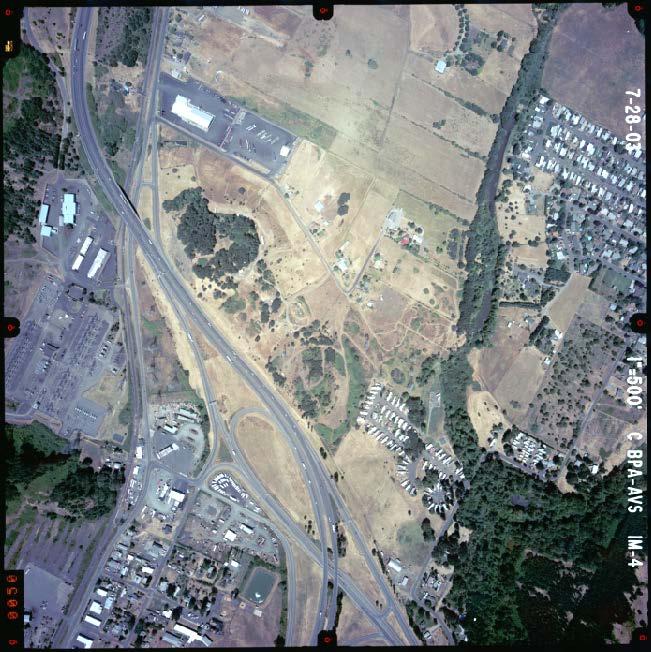
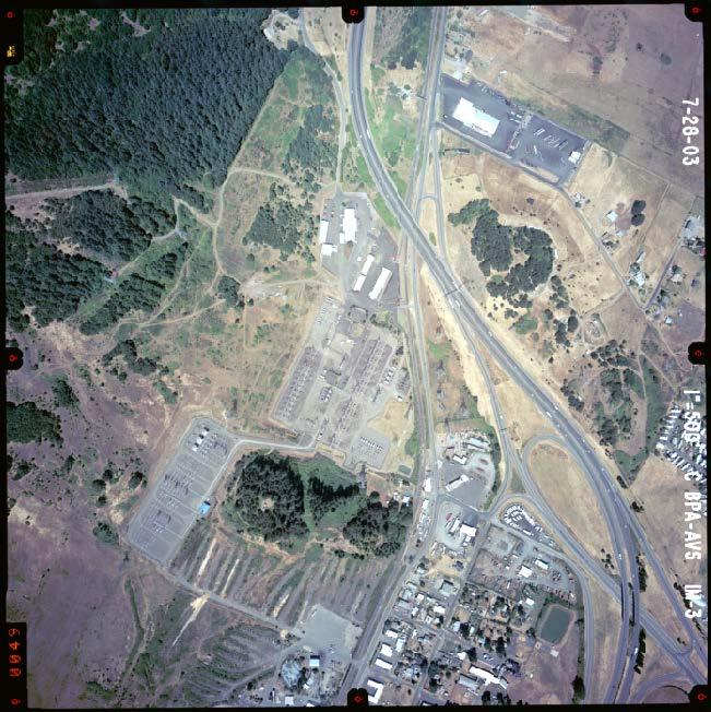
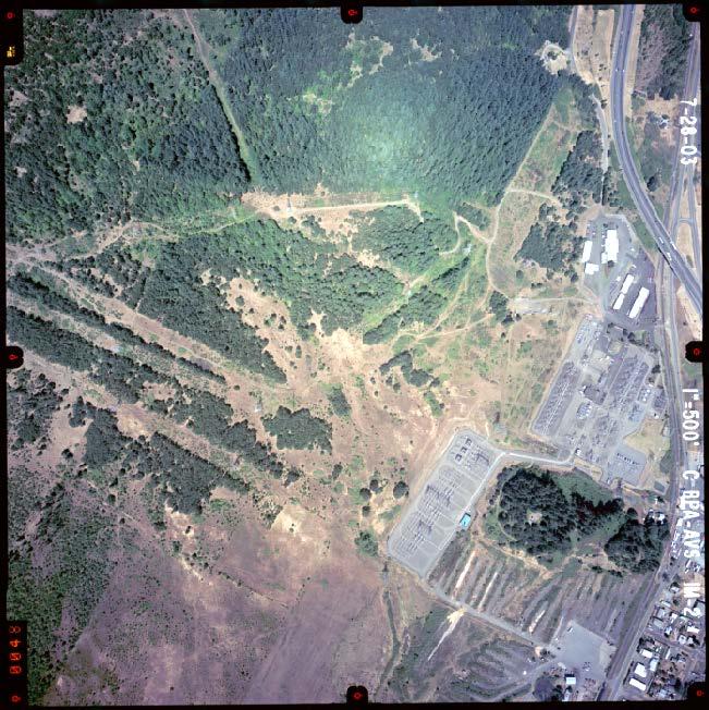
Index Mosaic of 1999 Purdue Block: 80% Forward Overlap and 60% Side Overlap (usual is 60/30!) Many trees show that October is not best time.
 Many trees show that October is not best time.") Index Mosaic of 1999 Purdue Block: 80% Forward Overlap and 60% Side Overlap (usual is 60/30!) Many trees show that October is not best time. HYMAP Data, Summer 1999 Tying Block to Reference Coordinate
Index Mosaic of 1999 Purdue Block: 80% Forward Overlap and 60% Side Overlap (usual is 60/30!) Many trees show that October is not best time. HYMAP Data, Summer 1999 Tying Block to Reference Coordinate
Multiray Photogrammetry and Dense Image. Photogrammetric Week Matching. Dense Image Matching - Application of SGM
 Norbert Haala Institut für Photogrammetrie Multiray Photogrammetry and Dense Image Photogrammetric Week 2011 Matching Dense Image Matching - Application of SGM p q d Base image Match image Parallax image
PLS - EXAMINATION PREPARATION PHOTOGRAMMETRY 101. A paper on the principles of photogrammetric mapping
 Photogrammetric Consultants PLS - EXAMINATION PREPARATION PHOTOGRAMMETRY 101 A paper on the principles of photogrammetric mapping Photogrammetry is the art and science of obtaining reliable measurements
COMPARATIVE CHARACTERISTICS OF DEM OBTAINED FROM SATELLITE IMAGES SPOT-5 AND TK-350
 COMPARATIVE CHARACTERISTICS OF DEM OBTAINED FROM SATELLITE IMAGES SPOT-5 AND TK-350 Dr. V. F. Chekalin a*, M. M. Fomtchenko a* a Sovinformsputnik, 47, Leningradsky Pr., 125167 Moscow, Russia common@sovinformsputnik.com
EVOLUTION OF POINT CLOUD
 Figure 1: Left and right images of a stereo pair and the disparity map (right) showing the differences of each pixel in the right and left image. (source: https://stackoverflow.com/questions/17607312/difference-between-disparity-map-and-disparity-image-in-stereo-matching)
PRODUCTION AND PRECISION ANALYSIS OF A DIGITAL ORTOPHOTO FROM 1:35000 SCALED AIRPHOTO AS A GIS COVERAGE
 PRODUCTION AND PRECISION ANALYSIS OF A DIGITAL ORTOPHOTO FROM 1:35000 SCALED AIRPHOTO AS A GIS COVERAGE Sitki KULUR *, Ozan DIVAN** * Istanbul Technical University, Department of Geodesy and Photogrammetry
Basic Principles of Photogrammetry
 Basic Principles of Photogrammetry Annual Conference of PSLS January 13 16, 2019 Hershey, PA Frank Derby, PhD Penn State University Lehman, PA 18627 Workshop Content General Principles of Photogrammetry
Measurement of Direction: Bearing vs. Azimuth
 Week 5 Monday Measurement of Direction: Bearing vs. Azimuth Bearing Is an angle of 90 o or less Measured from either North or South in easterly & westerly directions. North 22 o West, South 89 o West,
THE INTERIOR AND EXTERIOR CALIBRATION FOR ULTRACAM D
 THE INTERIOR AND EXTERIOR CALIBRATION FOR ULTRACAM D K. S. Qtaishat, M. J. Smith, D. W. G. Park Civil and Environment Engineering Department, Mu ta, University, Mu ta, Karak, Jordan, 61710 khaldoun_q@hotamil.com
ACCURACY ANALYSIS OF DIGITAL ORTHOPHOTOS FROM VERY HIGH RESOLUTION IMAGERY
 ACCURACY ANALYSIS OF DIGITAL ORTHOPHOTOS FROM VERY HIGH RESOLUTION IMAGERY Ricardo Passini *, Karsten Jacobsen ** * BAE SYSTEMS ADR, Mount Laurel, NJ, USA ** University of Hannover, Germany *rpassini@adrinccom
A Study on Ortho-rectification of SPOT6 Image Guo-dong YANG, Xiu-wen XIN and Qiong WU*
 2017 International Conference on Mechanical and Mechatronics Engineering (ICMME 2017) ISBN: 978-1-60595-440-0 A Study on Ortho-rectification of SPOT6 Image Guo-dong YANG, Xiu-wen XIN and Qiong WU* School
Research on the applicability of E-Foto Open Source Software To Server Teaching and Researching in Universities of Viet Nam
 Research on the applicability of E-Foto Open Source Software To Server Teaching and Researching in Universities of Viet Nam DUY Nguyen Ba 1, a, GIANG Tran Thi Huong 2,b HAU Ninh Hoa 3, NGOC Tran Thi Bich
PHOTOGRAMMETRIC SOFTWARE FOR THE LH SYSTEMS ADS40 AIRBORNE DIGITAL SENSOR
 PHOTOGRAMMETRIC SOFTWARE FOR THE LH SYSTEMS ADS40 AIRBORNE DIGITAL SENSOR Udo TEMPELMANN 1, Anko BÖRNER 2, Bruce CHAPLIN 3, Ludger HINSKEN 4, Borys MYKHALEVYCH 2, Scott MILLER 3, Utz RECKE 1, Ralf REULKE
RECTIFICATION METHODS ON DISTORTION OF DIGITAL AIRBORNE IMAGES
 RECTIFICATION METHODS ON DISTORTION OF DIGITAL AIRBORNE IMAGES Tao Jun School of Mathematics and Computer Science Jianghan University, Wuhan, Hubei, China martintao2006@163.com Abstract. This paper mainly
Overview. Image Geometric Correction. LA502 Special Studies Remote Sensing. Why Geometric Correction?
 LA502 Special Studies Remote Sensing Image Geometric Correction Department of Landscape Architecture Faculty of Environmental Design King AbdulAziz University Room 103 Overview Image rectification Geometric
Some Aspects On Developing a Truly Low-Cost Mapping System Using Handheld GPS and Camcorder
 Some Aspects On Developing a Truly Low-Cost Mapping System Using Handheld GPS and Camcorder ABSTRACT There are some characteristics for the mapping systems that need to be developing which are low-cost,
PHOTOGRAMMETRIC PROCESSING OF LOW ALTITUDE IMAGE SEQUENCES BY UNMANNED AIRSHIP
 PHOTOGRAMMETRIC PROCESSING OF LOW ALTITUDE IMAGE SEQUENCES BY UNMANNED AIRSHIP Yongjun Zhang School of Remote Sensing and Information Engineering, Wuhan University, Wuhan, Hubei, 430079, P.R. China - zhangyj@whu.edu.cn
Rectification Algorithm for Linear Pushbroom Image of UAV
 Ruoming SHI and Ling ZHU, China Key words: Rectification, Linear Pushbroom, GCP, UAV. 2 SUMMARY This research presents a method of rectification for the image flow acquired by UAV. The sensor on the UAV
Technical Considerations and Best Practices in Imagery and LiDAR Project Procurement
 Technical Considerations and Best Practices in Imagery and LiDAR Project Procurement Presented to the 2014 WV GIS Conference By Brad Arshat, CP, EIT Date: June 4, 2014 Project Accuracy A critical decision
Creating an Event Theme from X, Y Data
 Creating an Event Theme from X, Y Data In Universal Transverse Mercator (UTM) Coordinates Eastings (measured in meters) typically have 6 digits left of the decimal. Northings (also in meters) typically
GEOMETRIC ASPECTS CONCERNING THE PHOTOGRAMMETRIC WORKFLOW OF THE DIGITAL AERIAL CAMERA ULTRACAM X
 GEOMETRIC ASPECTS CONCERNING THE PHOTOGRAMMETRIC WORKFLOW OF THE DIGITAL AERIAL CAMERA ULTRACAM X Richard Ladstädter a, Michael Gruber b a Institute of Remote Sensing and Photogrammetry, Graz University
RESAMPLING DIGITAL IMAGERY TO EPIPOLAR GEOMETRY
 RESAMPLING DIGITAL IMAGERY TO EPIPOLAR GEOMETRY Woosug Cho Toni Schenk Department of Geodetic Science and Surveying The Ohio State University, Columbus, Ohio 43210-1247 USA Mustafa Madani Intergraph Corporation,
Bachelor thesis True orthophoto generation
 Bachelor thesis True orthophoto generation Rupert Wimmer March 25th, 2010 Abstract Throughout this Bachelor thesis methods for generating true orthophoto imagery from aerial and satellite imagery based
Leica Systems Overview
 RC30 AERIAL CAMERA SYSTEM Leica Systems Overview The Leica RC30 aerial film camera is the culmination of decades of development, started with Wild's first aerial camera in the 1920s. Beautifully engineered
Introduction to 3D Machine Vision
 Introduction to 3D Machine Vision 1 Many methods for 3D machine vision Use Triangulation (Geometry) to Determine the Depth of an Object By Different Methods: Single Line Laser Scan Stereo Triangulation
COMPARATIVE ANALYSIS OF ALTERNATIVE IN-DOOR CALIBRATION TECHNIQUES FOR OFF-THE-SHELF DIGITAL CAMERAS INTRODUCTION
 COMPARATIVE ANALYSIS OF ALTERNATIVE IN-DOOR CALIBRATION TECHNIQUES FOR OFF-THE-SHELF DIGITAL CAMERAS Ivan Detchev, Axel Ebeling, Ayman Habib Department of Geomatics Engineering, University of Calgary,
PART A Three-Dimensional Measurement with iwitness
 PART A Three-Dimensional Measurement with iwitness A1. The Basic Process The iwitness software system enables a user to convert two-dimensional (2D) coordinate (x,y) information of feature points on an
Photogrammetric Performance of an Ultra Light Weight Swinglet UAV
 Photogrammetric Performance of an Ultra Light Weight Swinglet UAV J. Vallet, F. Panissod, C. Strecha, M. Tracol UAV-g 2011 - Unmanned Aerial Vehicle in Geomatics September 14-16, 2011ETH Zurich Summary
Keywords: smartphone, 3D model, calibration, GNSS, bundle adjustment
 Photogrammetry and Remote Sensing CAPABILITIES OF A SMARTPHONE FOR GEOREFERENCED 3D MODEL CREATION: AN EVALUATION Krzysztof Bakuła 1 Adrian Flasiński 1 1 Warsaw University of Technology, Faculty of Geodesy
Surface Contents Author Index
 Surface Contents Author Index Younian WANG, Xinghe YANG, Mladen Stojic & Brad Skelton A NEW DIGITAL PHOTOGRAMMETRIC SYSTEM FOR GIS PROFESSIONALS Younian WANG, Xinghe YANG, Mladen Stojic, Brad Skelton Leica
LINEAR FEATURES IN PHOTOGRAMMETRIC ACTIVITIES
 LINEAR FEATURES IN PHOTOGRAMMETRIC ACTIVITIES A. Habib, M. Morgan, E.M. Kim, R. Cheng Department of Geomatics Engineering, University of Calgary, Calgary, 500 University Drive NW, Calgary, AB, TN N4, Canada
BUNDLE BLOCK ADJUSTMENT WITH HIGH RESOLUTION ULTRACAMD IMAGES
 BUNDLE BLOCK ADJUSTMENT WITH HIGH RESOLUTION ULTRACAMD IMAGES I. Baz*, G. Buyuksalih*, K. Jacobsen** * BIMTAS, Tophanelioglu Cad. ISKI Hizmet Binasi No:62 K.3-4 34460 Altunizade-Istanbul, Turkey gb@bimtas.com.tr
CCNS and AEROcontrol: Products for Efficient Photogrammetric Data Collection
 'Photogrammetric Week 01' D. Fritsch & R. Spiller, Eds. Wichmann Verlag, Heidelberg 2001. Kremer 85 CCNS and AEROcontrol: Products for Efficient Photogrammetric Data Collection JENS KREMER, Kreuztal ABSTRACT
Photogrammetric Procedures for Digital Terrain Model Determination
 Photogrammetric Procedures for Digital Terrain Model Determination Hartmut ZIEMANN and Daniel GROHMANN 1 Introduction Photogrammetric procedures for digital terrain model (DTM) data determination fall
Representative Fraction (RF) is a numerical statement of the scale relationship. e.g., 1:24,000 or 1/24,000
 is a numerical statement of the scale relationship. e.g., 1:24,000 or 1/24,000") Scale and Measurement Scale can be deined as a statement o the relationship between the distance o a map or image in relation to the distance on the Earth surace. This association may be displayed using
Scale and Measurement Scale can be deined as a statement o the relationship between the distance o a map or image in relation to the distance on the Earth surace. This association may be displayed using
DEVELOPMENT OF CAMERA MODEL AND GEOMETRIC CALIBRATION/VALIDATION OF XSAT IRIS IMAGERY
 DEVELOPMENT OF CAMERA MODEL AND GEOMETRIC CALIBRATION/VALIDATION OF XSAT IRIS IMAGERY Leong Keong Kwoh, Xiaojing Huang, Wee Juan Tan Centre for Remote, Imaging Sensing and Processing (CRISP), National
ON THE USE OF MULTISPECTRAL AND STEREO DATA FROM AIRBORNE SCANNING SYSTEMS FOR DTM GENERATION AND LANDUSE CLASSIFICATION
 ON THE USE OF MULTISPECTRAL AND STEREO DATA FROM AIRBORNE SCANNING SYSTEMS FOR DTM GENERATION AND LANDUSE CLASSIFICATION Norbert Haala, Dirk Stallmann and Christian Stätter Institute for Photogrammetry
Calibration of IRS-1C PAN-camera
 Calibration of IRS-1C PAN-camera Karsten Jacobsen Institute for Photogrammetry and Engineering Surveys University of Hannover Germany Tel 0049 511 762 2485 Fax -2483 Email karsten@ipi.uni-hannover.de 1.
EXTERIOR ORIENTATION OF LINE-ARRAY CCD IMAGES BASED ON QUATERNION SPHERICAL LINEAR INTERPOLATION
 EXTERIOR ORIENTATION OF LINE-ARRAY CCD IMAGES BASED ON QUATERNION SPHERICAL LINEAR INTERPOLATION G. Jiang, T. Jiang *, H. Gong, X. Wang Zhengzhou Institute of Surveying and Mapping, Information Engineering
AN INTEGRATED SENSOR ORIENTATION SYSTEM FOR AIRBORNE PHOTOGRAMMETRIC APPLICATIONS
 AN INTEGRATED SENSOR ORIENTATION SYSTEM FOR AIRBORNE PHOTOGRAMMETRIC APPLICATIONS M. J. Smith a, *, N. Kokkas a, D.W.G. Park b a Faculty of Engineering, The University of Nottingham, Innovation Park, Triumph
AN OPERATIONAL SYSTEM FOR SENSOR MODELING AND DEM GENERATION OF SATELLITE PUSHBROOM SENSOR IMAGES
 AN OERATIONAL SYSTEM FOR SENSOR MODELING AND DEM GENERATION OF SATELLITE USHBROOM SENSOR IMAGES Y. Wang*, X. Yang, F. Xu, A. Leason, S. Megenta ERDAS, Inc., 55 eachtree Corners Circle, Suite, Norcross,