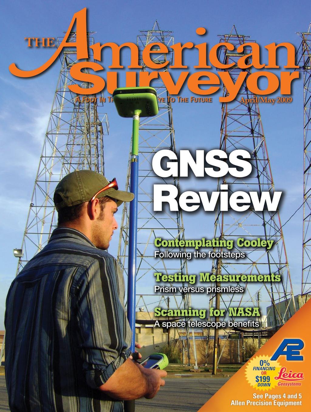
Displayed with permission The American Surveyor April/May Copyright 2009 Cheves Media
|
|
|
- Harry Wilkerson
- 5 years ago
- Views:
Transcription
1


2 NASA s Environmental Simulation Chamber A at the Johnson Space Center in Houston will require upgrades to accommodate testing of components for the new space telescopes. Laser scanning with the FARO LS 880 and 3D modeling were used to capture the existing conditions of the chamber and its surroundings.

, after a former Administrator of NASA.")


3 A Model Home For NASA s New Space Telescope ASA commissioned construction of an environmental simulation test chamber which was completed in 1964 at Johnson Space Center (JSC) in Houston, Texas. The facility, Chamber A, was invaluable for testing spacecraft and satellites before deployment to space. By testing spacecraft in an environment similar to the one they would be functioning in, potential problems could be addressed before launch. A new addition to NASA s observatory inventory is called the James Webb Space Telescope (JWST), after a former Administrator of NASA. The new telescope will have seven times the mirror area of the Hubble, with a target destination approximately one million miles from earth. Scheduled for launch in 2013, the JWST will allow scientists the ability to see, for the first time, the first galaxies that formed in the early Universe. Pre-launch testing of JWST must be performed in environments that approximate its final target space environment as closely as possible. The Commission JSC s Chamber A will require modifications to accommodate testing of the JWST. Some of these changes involve upgrades to cryogenic, vacuum pumping, and structural elements. To accomplish this, JSC presented a need for a 3-D model of the chamber and the surrounding area in its current state. This effort will provide engineers an accurate facility representation to be used in identifying >> By Rito Morales


4 Conventionally, engineers would gather the necessary data by using tape measures, photographs, and written notes to generate 2-D drawings. This would have been quite time consuming, obtrusive and open to error. There would have always been the risk of overlooking something, Kearns stated. The chamber has an outside diameter of over 60 feet and a height of almost 120 feet. The payload door shown alone measures over 30 feet in diameter. and correcting any conflicts in upgrade design and installation. To accomplish such a feat, NASA looked to Houston engineering firm, Taylor and Hill, Inc., who has been providing engineering services to the oil, gas, chemicals and power industries since The firm qualified as a category finalist in the Houston Business Roundtable award for Outstanding Safety Performance for 2003 and 2004 and received previous awards for outstanding safety leadership from BP South Houston in 1996, 1997, and The project scope entailed scanning and modeling all eight levels, two large staging areas, two mechanical rooms and liquid nitrogen piping and storage tanks comprising the chamber and the area surrounding it. We were hired to identify the major obstructions, clearances and open areas surrounding the test chamber, noted Glen Kearns, Taylor & Hill s Laser Scanning Department Manager and Project Manager over this job. The information would be used to facilitate the planning of new piping, electrical conduit runs, cable trays and equipment upgrades for the 118ft. tall chamber. Obstacles The project was marked high priority status by NASA, and therefore the measurements had to be completed in a timely manner. Construction and maintenance had already begun, which meant Taylor & Hill would be operating within a confined workspace. Technology Suited for the Job Taylor & Hill employed a method known as Laser Scanning Metrology (LSM) to gather all the necessary measurements. LSM involves using high-speed computer-aided laser scanners to generate high-accuracy measurements that are digitally recorded for 2-D and 3-D modeling, inspection, visualization or reverse engineering. The practice has been useful for a variety of applications, ranging from documenting as-is conditions for accident reconstruction or building renovations to reverse engineering boat hulls to virtual asset management of power facilities. Using the Laser Scanner LS from FARO Technologies, and a combination of modeling and CAD softwares, Rito Morales and Don Meyer of Taylor & Hill produced the requested deliverables ahead of schedule. FARO s Laser Scanner LS operates via phase shift technology by emitting a beam from the instrument s laser sensor to a vertical mirror. The beam is then deflected onto the object or environment being scanned. This includes full horizontal 360 degree coverage and vertical 320 degree coverage within a distance of 76m (249ft.). Finally, the beam is diverted back to the laser scanner and the distance coordinates are digitally recorded via angular encoders that measure the rotation of the vertical mirror and horizontal axis of the laser scanner. These X, Y Z coordinates are computed at a rate of nearly 120,000 points per second. A scan at minimal resolution can be completed in less than a minute. The speed at which the data was collected with FARO s phase-based scanner is a major consideration, Kearns observed. Traditional methods would have taken several weeks or months to collect the data we gathered in about ten days of scanning. The resulting points produce a high resolution picture-quality image with a major advantage the data is represented in 3-D. The image, also known as a point cloud, contains all the scanned coordinates. This allows operators not


5 Point cloud data captured from the FARO LS 880 laser scanner. The photo-like image shown here was captured in FARO Cloud s Planar View. The point cloud is seen as a wrap around planar projection image. INOVx 3-D PlantLINx showing objects outside of the chamber: floors, columns, major equipment and large diameter piping. They also furnished a detailed model of the steel that makes up the roof structure. The 3-D model was then exported into AutoCAD where final presentation visuals were added. Surface finishes were applied and rendered images were generated complete with lights and shadows. Contractors responsible for the upgrades are now aware of the obstacles that may impede their plans, stated Kearns. Inovx PlantLINx software was used to model the major 3D elements of the chamber, structure, and surrounding spatial claims. The point clouds serve as an accurate guide which the modeling is placed over. only to have an accurate representation of the physical appearances of the scanned items, but also to obtain useful measurements for inspection, analysis and modeling. Taylor & Hill produced more than 170 point clouds from the data collected throughout the 10 days on the job site. Off-site, all laser scans were registered using FARO Scene point cloud software to a building coordinate system established through dimensional control. From the registered point clouds, 3-D solid models were developed through Software Focus FARO Scene is a high-performance and practical 3-D point cloud software tool designed for viewing, administrating and working on 3-D scan points from high-resolution 3-D laser scanners. This tool allows the user to manipulate raw 3-D scan points and acquire with analysis functions initial point-cloud data comprehension. Through data analysis and manipulation, scan points may be prepared for export into the user s operating platform as targets (.cor), scan points (.dxf, VRML,.igs,.pts,.ptx,.ptc), CAD objects (.igs,.dxf) or scan pictures (.jpg). FARO Scene features: Measures distances between objects Completes point cloud filtering, compression, noise reduction and registration


6 Once the 3D modeling was completed in PlantLINX, the data were exported to AutoCAD. Presentation effects such as lighting, texture, shadows, and transparency were added to improve the visual imagery. Analyzes CAD models against point clouds to recognize collisions and deviations Models basic graphical objects such as planes, spheres, and cylinders from point clouds 3-D PlantLINx converts the output of laser scanning and survey data into accurate 3-D models of existing plants. This is achieved through the creation of physical databases consisting of analysis of laser scans, stereo photos and survey points captured during field data collection utilizing automated surface modeling or assisted primitive modeling. Based on the level of detail required for a specific project, 3-D PlantLINx databases can be composed of conceptual, single revamp, major revamp or intelligent models. 3-D PlantLINx features: Processes laser images from most major laser scanning systems Rapid access to logical and complete regions of points Ability to customize or use industry standardized specifications for selected piping, structural steel and electrical elements User Defined customizable catalogs for complex assemblies, such as pumps, vessels, platforms, portable equipment, etc. Assisted 3-D modeling enables rapid creation of complete and accurate CAD geometry, including entire piping systems Structures 3-D models into userdefined conventions such as P&ID Roll based with optional concurrent user database access for increased modeling and QA/QC efficiency Rito Morales is the CAD Support and Laser Scanning Specialist for Taylor & Hill, Inc. based in Houston, Texas. He has seven years of field experience with laser data collection in the petrochemical industry.
3D Industrial plants. Documentation
 3D Industrial plants Documentation Published by: FARO Europe GmbH & Co. KG, Lingwiesenstrasse 11/2, D-70825 Korntal-Münchingen, Tel: +49 7150 9797-0, Fax: +49 7150 9797-44, info@faroeurope.com, www.faro.com
With FARO PointSense for Revit. Jörg Braunes Platform Owner Software Chris Palmer Sales Engineer 1
 From Point Clouds to BIM Models With FARO PointSense for Revit Jörg Braunes Platform Owner Software Chris Palmer Sales Engineer 1 Agenda Scan to BIM with Revit PointClouds in Revit Advanced Workflow with
Three-Dimensional Laser Scanner. Field Evaluation Specifications
 Stanford University June 27, 2004 Stanford Linear Accelerator Center P.O. Box 20450 Stanford, California 94309, USA Three-Dimensional Laser Scanner Field Evaluation Specifications Metrology Department
Real World to Virtual World. With Geomagic Design X
 Real World to Virtual World With Geomagic Design X About OR3D OR3D based in UK with offices in Wrexham (Wales) and Bristol (England) Cover the UK and Internationally UK s largest supplier of Geomagic software
Laser Scanning. 3D Model is not existing and is required for: studies revamping maintenance HSE integration in another 3D model archiving
 Laser Scanning Laser Scanning Laser scanning is used whenever: 3D Model is not existing and is required for: studies revamping maintenance HSE integration in another 3D model archiving 2 Object acquisition
technical notes trimble realworks software
 technical notes trimble realworks software A POWERFUL 3D LASER SCANNING OFFICE SOFTWARE SUITE Designed for today s multifaceted scanning professional, Trimble RealWorks is a powerful office software that
Trimble Realworks Software
 TECHNICAL NOTES Trimble Realworks Software A Powerful 3D Laser Scanning Office Software Suite DESIGNED FOR TODAY S MULTIFACETED SCANNING PROFESSIONAL, TRIMBLE REALWORKS IS A POWERFUL OFFICE SOFTWARE THAT
3D BUILDINGS MODELLING BASED ON A COMBINATION OF TECHNIQUES AND METHODOLOGIES
 3D BUILDINGS MODELLING BASED ON A COMBINATION OF TECHNIQUES AND METHODOLOGIES Georgeta Pop (Manea), Alexander Bucksch, Ben Gorte Delft Technical University, Department of Earth Observation and Space Systems,
Realworks Software. A Powerful 3D Laser Scanning Office Software Suite
 TECHNICAL NOTES Realworks Software A Powerful 3D Laser Scanning Office Software Suite Trimble RealWorks is a powerful office software that imports rich data from your 3D laser scanning instrument and transforms
RealWorks Software. A Powerful 3D Laser Scanning Office Software Suite
 TECHNICAL NOTES RealWorks Software A Powerful 3D Laser Scanning Office Software Suite Trimble RealWorks is a powerful office software that imports rich data from your 3D laser scanning instrument and transforms
FARO As-Built for AutoCAD Software Versatile Reality to CAD Solutions
 FARO As-Built for AutoCAD Software Versatile Reality to CAD Solutions FARO As-Built for Autodesk Revit Creating Efficiencies in Scan Data Extraction for BIM FARO As-Built for AutoCAD Software TM Versatile
Using Python with Smoke and JWST Mirrors. Warren Hack, Perry Greenfield, Babak Saif, Bente Eegholm Space Telescope Science Institute
 Using Python with Smoke and JWST Mirrors Warren Hack, Perry Greenfield, Babak Saif, Bente Eegholm Space Telescope Science Institute The James Webb Space Telescope (JWST) will be the next NASA Great Observatory
Tebodin Peters Engineering GmbH
 Plant Design using Laserscan www.peters.bilfinger.com WE DESIGN THE FUTURE www.bilfinger.com Planning in existing Plants In revamp and expansion projects for existing plants, an accurate measurement is
A Sweet Success in Plant Documentation for Michigan Sugar Company
 A Sweet Success in Plant Documentation for Michigan Sugar Company COMPANY LOCATION 3D Imaging Services Flint, MI TOOLS USED Leica ScanStation P40 (solutionshardware-p40.html) Leica Cyclone Software (solutionssoftware-cyclone.html)
 www.lfm-software.com LFM Software Overview Realise the true value of your laser scan data. Outside the EPC environment, Owner Operators are now also recognising the benefits of 3D laser scanning. Laser
Company overview. PolyWorks 3D metrology software helps oil field equipment manufacturer cut motor component inspection time in half
 Company overview PolyWorks 3D metrology software helps oil field equipment manufacturer cut motor component inspection time in half Weatherford International Ltd. (NYSE: WFT) is one of the world s largest
OBJECT MANAGER PACKAGE USER S GUIDE
 OBJECT MANAGER PACKAGE USER S GUIDE 1 CONTENT I. Introduction... 3 II. Installation... 3 III. Using the plugins... 4 a- General... 4 b- Object properties manager... 4 c- Pipe manager... 6 d- Plane manager...
The Most Comprehensive Solution for Indoor Mapping Applications
 The Most Comprehensive Solution for Indoor Mapping Applications TRIMBLE INDOOR MOBILE MAPPING SOLUTION TRIMBLE INDOOR MOBILE MAPPING SOLUTION (TIMMS): HIGH EFFICIENCY, MAXIMUM FLEXIBILITY, ALL-IN-ONE PACKAGE
OPEN. INTELLIGENT. Laser Scanning Software Solutions
 OPEN. INTELLIGENT. Laser Scanning Software Solutions www.lfm-software.com The Future of Laser Scanning Safe and efficient operation of complex engineering assets, and the efficient management of their
Terrestrial Laser Scanning assignment
 Terrestrial Laser Scanning assignment Objective: Underground 3D survey using terrestrial laser scanning Location: Otaniemi campus, Innopoli 3 Business Area Equipment: Faro Focus 3D Methodology: Multiple
Simplicity is the new black: The BLK360 story
 Simplicity is the new black: The BLK360 story Vanda KADLECIKOVA Leica Geosystems Heerbrugg, Switzerland E-mail: vanda.kadlecikova@leica-geosystems.com Abstract Meet the game changer. The new Leica BLK360
Microwave. Infrared. Preprogrammed Chip
 Advanced Technology for Design Mapping and Construction Layout AACE A.A.C.E. Meeting August 5, 2009 Daniel K. Mardock RBF Consulting Survey Manager Registered Land Surveyor Certified Federal Surveyor Arizona
Extracting Plant Deliverables from AutoCAD Point Clouds
 Extracting Plant Deliverables from AutoCAD Point Clouds The webinar will begin shortly. You will hear silence until the webinar begins. Please note that this webinar is being recorded and all registrants
Most as-built information is still manually collected. Today s Design Market
 Agenda 1. Overview of 3D laser scanning 2. HDS 3D Laser scanning applications Leica ScanStation2 True Color Scan 3. Demonstration of HDS & Trueview 4. Questions and Answers The advanced 3D Laser Scanning
Scan-to-BIM. NEWBIM ApS, Galina Slavova CEO, BIM Specialist
 Scan-to-BIM NEWBIM ApS, Galina Slavova CEO, BIM Specialist Agenda What is Building Information Modeling (BIM) About NEWBIM ApS 3D Laser Scanning Integration Case Study Demonstration Building Information
Terrestrial LiDAR. Patrick Crawford. Harnessing the Power of Big Data for Asset and Facility Management WHITE PAPER SHAFER, KLINE & WARREN
 WHITE PAPER Terrestrial LiDAR Harnessing the Power of Big Data for Asset and Facility Management Patrick Crawford Team Leader, Geospatial Systems SHAFER, KLINE & WARREN Executive Summary Terrestrial LiDAR
EXPERT TIPS & TRICKS MAR/APR 2017
 VOLUME 7 ISSUE 2 MAR/APR 2017 EXPERT TIPS & TRICKS 21 27 30 DRONE-BASED LIDAR STUDY To evaluate the effectiveness of drone-based LIDAR tech Juniper Unmanned conducted a unique empirical study OIL AND GAS
Suite en It Up with Autodesk ReCap
 Chad Studer ADSK Solutions RC3165 Static and mobile laser scanning technologies capture millions of points and provide photorealistic interactive virtual sites known as point clouds. With Autodesk ReCap
INVESTIGATION ON LASER SCANNERS *
 IWAA2004, CERN, Geneva, 4-7 October 2004 INVESTIGATION ON LASER SCANNERS * Brian Fuss, Catherine Le Cocq, Robert Ruland Stanford Linear Accelerator Center, Stanford, CA, USA Rudolf Staiger Essen University,
2011 Bentley Systems, Incorporated. Bentley Descartes V8i Advancing Information Modeling For Intelligent Infrastructure
 Bentley Descartes V8i Advancing Information Modeling For Intelligent Infrastructure Agenda Why would you need Bentley Descartes? What is Bentley Descartes? Advanced Point Cloud Workflows Advanced Terrain
ARECATECH SDN BHD CAPTURE THE REALITY IN TOUCH WITH TOMORROW
 CAPTURE THE REALITY IN TOUCH WITH TOMORROW ARECATECH SDN BHD 3D Laser Scanning Integrity and Management Services Detail Engineering Design Support & COMOS Intelligent P & ID Services SmartPlant - PDMS
ROAD SURFACE STRUCTURE MONITORING AND ANALYSIS USING HIGH PRECISION GPS MOBILE MEASUREMENT SYSTEMS (MMS)
") ROAD SURFACE STRUCTURE MONITORING AND ANALYSIS USING HIGH PRECISION GPS MOBILE MEASUREMENT SYSTEMS (MMS) Bonifacio R. Prieto PASCO Philippines Corporation, Pasig City, 1605, Philippines Email: bonifacio_prieto@pascoph.com
ROAD SURFACE STRUCTURE MONITORING AND ANALYSIS USING HIGH PRECISION GPS MOBILE MEASUREMENT SYSTEMS (MMS) Bonifacio R. Prieto PASCO Philippines Corporation, Pasig City, 1605, Philippines Email: bonifacio_prieto@pascoph.com
USING A TRACKING LASER INTERFEROMETER TO CHARACTERIZE THE PLANARITY OF A PLANAR NEAR-FIELD SCANNER
 USING A TRACKING LASER INTERFEROMETER TO CHARACTERIZE THE PLANARITY OF A PLANAR NEAR-FIELD SCANNER Paul R. Rousseau, William C. Wysock, and Carlos M. Turano The Aerospace Corporation P.O. Box 92957, Mail
US foundry Bradken implements optical measuring technology
 Application Note US foundry Bradken implements optical measuring technology Location / country: Tacoma / Washington, USA GOM systems: ATOS Triple Scan, TRITOP GOM software: ATOS Professional Sector: Power
3D SCANNING SERVICES FOR PUBLIC & PRIVATE CLIENTS
 Services provided include: 3D Scanning of Existing Structures & Equipment 3D Modeling for Current or Future Planning What can be scanned? Any 3-Dimensional Space Industrial Facilities Transshipment and
Integrating the Generations, FIG Working Week 2008,Stockholm, Sweden June 2008
 H. Murat Yilmaz, Aksaray University,Turkey Omer Mutluoglu, Selçuk University, Turkey Murat Yakar, Selçuk University,Turkey Cutting and filling volume calculation are important issues in many engineering
Coke Drum Laser Profiling
 International Workshop on SMART MATERIALS, STRUCTURES NDT in Canada 2013Conference & NDT for the Energy Industry October 7-10, 2013 Calgary, Alberta, CANADA Coke Drum Laser Profiling Mike Bazzi 1, Gilbert
Trimble RealWorks. What s new in version 9.0
 Trimble RealWorks What s new in version 9.0 Trimble RealWorks v9.0 What s new Over 40 new features and enhancements Navigation and visualization improvements SketchUp interoperability Additional 3 rd party
Leveraging Point Clouds to Produce Accurate As-Built Models. Sonia Delgadillo
 Leveraging Point Clouds to Produce Accurate As-Built Models Sonia Delgadillo Time What is CADWorx fieldpipe? Easy customization Comprehensive specs Short learning curve AutoCAD -based CADWorx Plant Design
Explore Laser Scanning in As-Built Survey. Vijay Chowdhary SE: BIM/CIM
 Explore Laser Scanning in As-Built Survey Vijay Chowdhary SE: BIM/CIM About FARO The world leader in portable 3-D measurement and imaging technology EMEA Headquarters Korntal-Münchingen, Germany APAC Headquarters
COMPLEX 3D BIM OCT/NOV PORTABLE NUKE INSPECTIONS Might a backpack and ultra-portable LIDAR technology make the world a safer place?
 VOLUME 5 ISSUE 7 OCT/NOV 2015 COMPLEX 24 40 50 PORTABLE NUKE INSPECTIONS Might a backpack and ultra-portable LIDAR technology make the world a safer place? APPLYING FOR A 333 EXEMPTION Vertical Information
Storage Tank Solutions TRANSFORMING THE WAY THE WORLD WORKS
 Storage Tank Solutions Trimble TX8 Scanner: A Revolution in 3D Scanning TRUE PERFORMANCE IN A REAL WORLD The Trimble TX8 laser scanner sets new standards for performance and ease of use in high-speed collection
Digital Preservation of the Aurelius Church and the Hirsau Museum Complex by Means of HDS and Photogrammetric Texture Mapping
 Master Thesis Ruxandra MOROSAN Ruxandra MOROSAN Digital Preservation of the Aurelius Church and the Hirsau Museum Complex by Means of HDS and Photogrammetric Texture Mapping Duration of the Thesis: 6 months
USE THE 3D LASER SCANNING FOR DOCUMENTATION THE RIGA CATHEDRAL IN LATVIA
 USE THE 3D LASER SCANNING FOR DOCUMENTATION THE RIGA CATHEDRAL IN LATVIA Maris Kalinka, Elina Rutkovska, Department of Geomatic, Riga Technical University, Azenes 16-109, Riga, Latvia, geomatika@geomatika.lv
3D IN GIS. 1. Presentation of the results of the scientific and technical contents
 G. Nagy, A. Szepes 3D in GIS 3D IN GIS NAGY Gábor, assistant professor, University of West Hungary, Faculty of Geoinformatics, Department of GIS, ng@geo.info.hu SZEPES András, associate professor, University
JANUARY 2017 WATER S END. Mobile Mapping. Station to Station. Decided Guidance Indoor application. Implementing BIM. A fixed boundary R E YEARS
 JANUARY 2017 WATER S END Mobile Mapping Station to Station Decided Guidance Indoor application Implementing BIM A fixed boundary R LEB ATING E C 30 YEARS Indoor Mobile Mapping A unique approach to interior
ON THE ROAD JULY/AUGUST MAP PROJECTIONS The importance of horizontal and vertical datums in GIS mapping
 VOLUME 4 ISSUE 5 JULY/AUGUST 2014 ON THE ROAD 30 40 62 MAP PROJECTIONS The importance of horizontal and vertical datums in GIS mapping FOLLOW THE LEDDAR A special purpose sensor that does several 3D measurement
Leica DISTO X3 Designed for tough, rugged conditions
 Leica DISTO X3 Designed for tough, rugged conditions The rugged Leica DISTO X-series combines innovative measuring technologies with a site-proof design and simple user interface. Together with the Leica
2/9/2016. Session Agenda: Implementing new Geospatial Technologies for more efficient data capture
 Implementing new Geospatial Technologies for more efficient data capture Jay Haskamp Applied Geospatial Engineer Steve Richter VP Sales Session Agenda: Today s changing technologies and what lies ahead
Geospatial Engineering Problems & Solutions Associated With NDP Roads, Tunnelling & Civil Engineering Projects Use of HDS Leica Laser Scanners
 Geospatial Engineering Problems & Solutions Associated With NDP Roads, Tunnelling & Civil Engineering Projects Use of HDS Leica Laser Scanners Laser Scanning Laser Scanning is a method of collecting large
High Definition Modeling of Calw, Badstrasse and its Google Earth Integration
 Master Thesis Yuanting LI High Definition Modeling of Calw, Badstrasse and its Google Earth Integration Duration of the Thesis: 6 months Completion: July, 2014 Supervisors: Prof.Dr.-Ing.Dieter Fritsch
Overview of the Trimble TX5 Laser Scanner
 Overview of the Trimble TX5 Laser Scanner Trimble TX5 Revolutionary and versatile scanning solution Compact / Lightweight Efficient Economical Ease of Use Small and Compact Smallest and most compact 3D
New Approach in Non- Contact 3D Free Form Scanning
 New Approach in Non- Contact 3D Free Form Scanning Contents Abstract Industry Trends The solution A smart laser scanning system Implementation of the laser scanning probe in parts inspection Conclusion
3D-Laser Scanning and Surveying Collide. >> By H. Tate Jones, LS
 An architectural firm called on LandAir Surveying surveyors to scan downtown Cobb County in the area of a proposed courthouse, create a 3D model and then incorporate the new courthouse design into the
BIM for infrastructure make easy with Laser Scanner. 17 October Beng Chieh Quah Head of Marketing Asia Pacific
 BIM for infrastructure make easy with Laser Scanner 17 October 2016 Beng Chieh Quah Head of Marketing Asia Pacific who is? founded in 1981 NASDAQ since 1997 Global technology company Offering a range of
Mapping Environments Project 4 Modern Maps
 880106 Mapping Environments Project 4 Modern Maps Week 08-09: When Engineering Design Labs & University Campus: Where Group of 4: Who 15%: Worth 1 Aim: The overarching aim of this project is to introduce
Leica Cyclone 5.4 Technical Specifications
 Leica Cyclone 5.4 Technical Specifications HDS Scanner control and operation Scan Scan Scan Register Model Survey Viewer Acquire and display image Acquire image at specified resolution (high, medium, low)
POINT CLOUD based REVERSE ENGINEERING. Young-Ho Chai, Ph.D
 POINT CLOUD based REVERSE ENGINEERING Young-Ho Chai, Ph.D 3D Spatial Survey Workflow Hardware Requirements Phase Based Laser Scanner: -Leica ScanStation P20 x 1EA -Usage: Short-range, ~80m Time of Flight
Laser Scanning Brings New Asset to Accident Investigations
 Figure 1. Point cloud data of an under construction seven-story building with a 100-foot by 250-foot footprint that collapsed when it had been built up to five stories. Laser Scanning Brings New Asset
Aerial and Mobile LiDAR Data Fusion
 Creating Value Delivering Solutions Aerial and Mobile LiDAR Data Fusion Dr. Srini Dharmapuri, CP, PMP What You Will Learn About LiDAR Fusion Mobile and Aerial LiDAR Technology Components & Parameters Project
Laser Scanning & Creation of 3D Models For BIM and Process Facilities
 Specialised Surveying Solutions Presented to: ICES UAE Region Abu Dhabi November 2009 Land and Engineering Surveying Services 3D Laser Scanning & Modeling Laser Scanning Technology Zoller+Fröhlich Phase
BEFORE YOU BUY: SEVEN CRITICAL QUESTIONS TO ASK ABOUT LASER SCANNERS. Robert Gardiner
 BEFORE YOU BUY: SEVEN CRITICAL QUESTIONS TO ASK ABOUT LASER SCANNERS Robert Gardiner Table of Contents Introduction... 3 Horizontal and Vertical Angular Accuracies... 4 Movement Tracking... 6 Range Limitations...
UNIT IV - Laser and advances in Metrology 2 MARKS
 UNIT IV - Laser and advances in Metrology 2 MARKS 81. What is interferometer? Interferometer is optical instruments used for measuring flatness and determining the lengths of slip gauges by direct reference
Ch 22 Inspection Technologies
 Ch 22 Inspection Technologies Sections: 1. Inspection Metrology 2. Contact vs. Noncontact Inspection Techniques 3. Conventional Measuring and Gaging Techniques 4. Coordinate Measuring Machines 5. Surface
Trimble MX2 mobile mapping
 Trimble MX2 mobile mapping user applications Point clouds within your reach The Trimble MX2 is a vehicle-mounted spatial imaging system which combines high resolution laser scanning and panoramic cameras
Proceedings of Western Dredging Association and Texas A&M University Center for Dredging Studies' "Dredging Summit and Expo 2015"
 Proceedings of Western Dredging Association and Texas A&M University Center for Dredging Studies' DYNAMIC UNDERWATER 3D SURVEY AND MONITORING DURING RECENT PLATFORM DREDGING OPERATION: REDUCING RISK AND
TLS Parameters, Workflows and Field Methods
 TLS Parameters, Workflows and Field Methods Marianne Okal, UNAVCO June 20 th, 2014 How a Lidar instrument works (Recap) Transmits laser signals and measures the reflected light to create 3D point clouds.
CHANGE SERVICE REQUESTED The California Surveyor P.O. Box 9098 Santa Rosa, CA
 CHANGE SERVICE REQUESTED The California Surveyor P.O. Box 9098 Santa Rosa, CA 95405-9990 By: Dave Reinhart, PLS and Dave Woolley, PLS Laser Scanners A Working Guy s Experience Many of us have been witness
Reverse Engineering: Mechanical. Dr. Tarek A. Tutunji
 Reverse Engineering: Mechanical Dr. Tarek A. Tutunji Mechanical RE References: 1. RE (reverse engineering) as necessary phase by rapid product development by Sokovic and Kopac 2. A Practical Appreciation
Range Imaging Through Triangulation. Range Imaging Through Triangulation. Range Imaging Through Triangulation. Range Imaging Through Triangulation
 Obviously, this is a very slow process and not suitable for dynamic scenes. To speed things up, we can use a laser that projects a vertical line of light onto the scene. This laser rotates around its vertical
Point Cloud Processing and Large Scalable Terrain Model Extraction Inga Morozoff
 Point Cloud Processing and Large Scalable Terrain Model Extraction Inga Morozoff 1 Point cloud data is a new data type that s being driven by the need for accurate 3D as-built information. Point cloud
The FaroArm. The world s best-selling measurement arm
 The FaroArm The world s best-selling measurement arm The FaroArm One step closer to perfection Versatile Three models: Quantum, Platinum and Fusion. FARO offers diverse mounting options and accessories
Convergent Modeling and Reverse Engineering
 Convergent Modeling and Reverse Engineering 25 October 2017 Realize innovation. Tod Parrella NX Design Product Management Product Engineering Solutions tod.parrella@siemens.com Realize innovation. Siemens
All In the Family: Creating Parametric Components In Autodesk Revit
 All In the Family: Creating Parametric Components In Autodesk Revit Matt Dillon D C CADD AB4013 The key to mastering Autodesk Revit Architecture, Revit MEP, or Revit Structure is the ability to create
COMPUTER AIDED ARCHITECTURAL GRAPHICS FFD 201/Fall 2013 HAND OUT 1 : INTRODUCTION TO 3D
 COMPUTER AIDED ARCHITECTURAL GRAPHICS FFD 201/Fall 2013 INSTRUCTORS E-MAIL ADDRESS OFFICE HOURS Özgür Genca ozgurgenca@gmail.com part time Tuba Doğu tubadogu@gmail.com part time Şebnem Yanç Demirkan sebnem.demirkan@gmail.com
Rapid generation of 3D GIS content from reality capture data sources. Keir Keightley, HDR
 Rapid generation of 3D GIS content from reality capture data sources Keir Keightley, HDR Purpose Why do we want 3D GIS content? A picture is worth a thousand words, and more, if you can navigate it in
Hope in Solutions of Special Projects
 2017 ACE Awards Category 2 Meeting the Challenge of a Difficult Job Specialty Contractor Specialty Contractor: Ludvik Electric Co. Project Name: University of Colorado Boulder CASA Hope in 2021 Established
Handheld Augmented Reality. Reto Lindegger
 Handheld Augmented Reality Reto Lindegger lreto@ethz.ch 1 AUGMENTED REALITY 2 A Definition Three important characteristics: Combines real and virtual environment Interactive in real-time Registered in
TIMMS : FAST, ACCURATE & COST-EFFECTIVE INDOOR MAPPING
 TIMMS : FAST, ACCURATE & COST-EFFECTIVE INDOOR MAPPING Designed for ease-of-use and maneuverability, TIMMS is a high-productivity tool for accurately measuring, georeferencing and modeling interior spaces
Trimble VISION Positions from Pictures
 Trimble VISION Positions from Pictures This session will cover What Is Trimble VISION? Trimble VISION Portfolio What Do you Need? How Does It Work & How Accurate Is It? Applications Resources Trimble VISION
A New Way to Control Mobile LiDAR Data
 A New Way to Control Mobile LiDAR Data Survey control has always been a critically important issue when conducting mobile LiDAR surveys. While the accuracies currently being achieved with the most capable
Leica DISTO X4 Designed for bright, outdoor environments
 Leica DISTO X4 Designed for bright, outdoor environments Pointfinder camera The DISTO X4 is equipped with a Pointfinder camera allowing you to easily target distant objects in bright sunlight. Even if
About LIDAR Data. What Are LIDAR Data? How LIDAR Data Are Collected
 1 of 6 10/7/2006 3:24 PM Project Overview Data Description GIS Tutorials Applications Coastal County Maps Data Tools Data Sets & Metadata Other Links About this CD-ROM Partners About LIDAR Data What Are
MODERN DIMENSIONAL MEASURING TECHNIQUES BASED ON OPTICAL PRINCIPLES
 MODERN DIMENSIONAL MEASURING TECHNIQUES BASED ON OPTICAL PRINCIPLES J. Reichweger 1, J. Enzendorfer 1 and E. Müller 2 1 Steyr Daimler Puch Engineering Center Steyr GmbH Schönauerstrasse 5, A-4400 Steyr,
Manhattan-World Assumption for As-built Modeling Industrial Plant
 Manhattan-World Assumption for As-built Modeling Industrial Plant Tomohiro Mizoguchi 1, Tomokazu Kuma 2, Yoshikazu Kobayashi 3 and Kenji Shirai 4 Department of Computer Science, College of Engineering,
IMPROVEMENT OF AIRCRAFT MECHANICAL DAMAGE INSPECTION WITH ADVANCED 3D IMAGING TECHNOLOGIES
 IMPROVEMENT OF AIRCRAFT MECHANICAL DAMAGE INSPECTION WITH ADVANCED 3D IMAGING TECHNOLOGIES MARK MAIZONNASSE 60TH A4A NDT FORUM SEPTEMBER 2017, FORT LAUDERDALE, FL, USA BRIDGING PHYSICAL AND DIGITAL WORLDS
TOPOGRAPHY - a LIDAR Simulation
 Title TOPOGRAPHY - a LIDAR Simulation Grade Level(s): 9-12 Estimated Time: 1.5 hours Discussion of Technology: Appendix A Construction Details: Appendix B MSDE Indicator(s) Goal 1: Skills and Processes
Ontology Modelling of Industry Standards for Large Model Visualization and Design Review using Protégé
 Ontology Modelling of Industry Standards for Large Model Visualization and Design Review using Protégé Jorge Posada, Carlos Toro, Stefan Wundrak, André Stork 8th Intl. Protégé Conference - July 18-21,
3D Terrestrial Laser Scanner Innovative Applications for 3D Documentation
 3D Terrestrial Laser Scanner Innovative Applications for 3D Documentation Rodney Chaffee Head of Sales, FARO Asia Pacific 3D Laser Scaning Market 2017 2.3 Billion $ 2012 1.3 Billion $ CAGR : > 12% Source:
Using Computer Graphics for Descriptive Geometry-style Problems in a Freshman Graphics Course
 Session 2238 Using Computer Graphics for Descriptive Geometry-style Problems in a Freshman Graphics Course Dennis R. Stevenson, P. E. University of Wisconsin-Parkside Abstract This is a report on a project
Interactive Collision Detection for Engineering Plants based on Large-Scale Point-Clouds
 1 Interactive Collision Detection for Engineering Plants based on Large-Scale Point-Clouds Takeru Niwa 1 and Hiroshi Masuda 2 1 The University of Electro-Communications, takeru.niwa@uec.ac.jp 2 The University
Leica High-Definition Surveying Systems. Leica HDS3000. The Industry Standard for High-Definition Surveying
 Leica High-Definition Surveying Systems Leica HDS3000 The Industry Standard for High-Definition Surveying HDS High-Definition Surveying TM : Laser Scanning Redefined High-Definition Surveying, or HDS,
The Leica HDS Family. The Right Tool for the Job HDS3000 HDS2500 HDS4500. Cyclone & CloudWorx. Press the QuickScan button to define the field-of-view.
 HDS2500 High accuracy scanner, ideal for fixed or raised installations when leveled tripod mounting is not practical, or areas with less stringent field-of-view requirements. The Leica HDS Family Time-of-flight
User s guide. November LSE S.r.l. All rights reserved
 User s guide November 2015 2015 LSE S.r.l. All rights reserved WARNING In writing this manual every care has been taken to offer the most updated, correct and clear information possible; however unwanted
Visualisation : Lecture 1. So what is visualisation? Visualisation
 So what is visualisation? UG4 / M.Sc. Course 2006 toby.breckon@ed.ac.uk Computer Vision Lab. Institute for Perception, Action & Behaviour Introducing 1 Application of interactive 3D computer graphics to
Unwrapping of Urban Surface Models
 Unwrapping of Urban Surface Models Generation of virtual city models using laser altimetry and 2D GIS Abstract In this paper we present an approach for the geometric reconstruction of urban areas. It is
Mobile Mapping and Navigation. Brad Kohlmeyer NAVTEQ Research
 Mobile Mapping and Navigation Brad Kohlmeyer NAVTEQ Research Mobile Mapping & Navigation Markets Automotive Enterprise Internet & Wireless Mobile Devices 2 Local Knowledge & Presence Used to Create Most
Eric P. Smith Program Deputy Director Program Scientist Briefing to CAA March 7, 2013 As of January 25,
 Eric P. Smith Program Deputy Director Program Scientist Briefing to CAA March 7, 2013 As of January 25, 2013 1 1 Background 6 ft (1.8m) Curiosity Rover 2 Telescope Architecture Secondary Mirror Mount Aft
Video Endoscopic Metrology for Pipeline Welding
 SINCE2013 Singapore International NDT Conference & Exhibition 2013, 19-20 July 2013 Video Endoscopic Metrology for Pipeline Welding Alfred Ng GE Measurement & Control, Inspection Technologies, a.ng@ge.com
Calibration of IRS-1C PAN-camera
 Calibration of IRS-1C PAN-camera Karsten Jacobsen Institute for Photogrammetry and Engineering Surveys University of Hannover Germany Tel 0049 511 762 2485 Fax -2483 Email karsten@ipi.uni-hannover.de 1.