BIM for Existing Buildings. (A Study of Terrestrial Laser Scanning and Conventional Measurement Technique)
|
|
|
- Jonas Palmer
- 5 years ago
- Views:
Transcription
 Master Thesis International Master of Science in Construction and Real Estate")

1 BIM for Existing Buildings (A Study of Terrestrial Laser Scanning and Conventional Measurement Technique) Master Thesis International Master of Science in Construction and Real Estate Management Joint Study Programme of Metropolia UAS and HTW Berlin Submitted on Musa Raza S First Supervisor: Prof. Dr.-Ing. Nicole, Riediger. Second Supervisor: Dipl.-Ing. Armin, Kess
2 II Acknowledgement There are number of individuals who have contributed directly and indirectly to this Master s work. The author would like to acknowledge the efforts of all such people involved in making this research work possible. First, I would like to thank Prof. Dr.-Ing. Nicole Riediger for listening, guiding and supporting me and making this work better as well as all my professors and teachers of HTW Berlin & Helsinki Metropolia. My sincere gratitude to Mr. Armin Kess for providing me an opportunity to work on this real-time project and his valuable time for scanning and guidance regarding the project site. Many thanks to Zsuzsa Besenyoi for guidance regarding the workflow and information regarding the case studies. Nauman Kahloon, the biggest support throughout this Master s and thesis writing especially the committed support in further modelling of the project. My sincere thanks to Noora Kettunen for your time investment and patience through the proof reading and corrections. I m also very grateful to the support of Cisco for making time available for us to scan the building despite the fact of doing all this during working hours. Special thanks to my mother Mrs. Jaffery and to all my family for their continuous financial support and motivation to complete this Master s work since the very start. A dedication to Manzer Jaffery who lived and died in dream of seeing me achieving this milestone for development for my own future. Final thanks to all the researchers or individuals who did a lot of valuable work in this field and enabled me to educate and learn from their precious work.
3 Conceptual formulation III
4 IV Abstract Creating a BIM model of an existing architectural structure such as a building can be a time consuming and difficult undertaking. Issues such as precision, line of sight, time, and financial constraints can pose problems when creating such a model. Such issues can be dealt with terrestrial laser scanning. The traditional approach being practiced cannot be considered efficient enough in the modern era of technology and tools due to longer exposure. There is no definite framework and standardized routes to be followed. The opted or selected framework would contribute to the precision and feasibility of its use for a certain project. Conventional measurement techniques allow us to obtain the required information for the existing buildings but the use of technology is lacking in terms of its integration with the current design framework in the Architecture, Engineering and Construction industry (AEC), namely Building Information Modelling (BIM), as well as its limited application for renovation projects. The biggest demerit of using conventional methods for measurements and BIM model creation is a huge human effort associated with data collection, processing, storage and recording as the human beings are prone to safety hazards while measuring. A rational approach was used to address this concern by producing frameworks for traditional and TLS technology which would fit its use for the AEC users. The chosen methodology to perform this comparative study is based on the Case study and literature review. A case study was introduced to investigate the financial, time and practicality attached with both the TLS and conventional measurement technique for creating BIM model. Two different cases were used to make comparison for the TLS cost and time consumption to validate the results. The results show that there is 35% of increased budget required for the production of BIM model of an existing facility where the architectural components of the building were considered. The higher cost as compared to traditional measurement approach can be understood well knowing the capital costs involved for the interested industrial users. The case study comparative results showed that the time consumption for human exposure on to the project site is reduced to half using TLS for existing buildings BIM model as compared to traditional measurement tool. The cost for the BIM model was connected with the area of the building. Bigger area for BIM modelling resulted in lower costs using TLS.
5 V This piece of research contributes to the knowledge of TLS by presenting a real-time example of how BIM and TLS be integrated for the existing buildings for any required purpose. This provides a development idea and model for the future users and researchers to undertake the process improvement by using this example as a practical guide for understanding the feasibility of TLS and BIM for different existing buildings.
6 VI Table of Contents Acknowledgement... II Conceptual formulation... III Abstract... IV Table of Contents... VI Table of Figures... X List of Tabulations... XII List of Abbreviations... XIII 1. Introduction Overview Problem Background Aim of Research Research Methodology Structure of Report Building Information Modeling Overview Definition Background & Development BIM & Existing Buildings Overview Definition BIM for existing buildings... 19
7 VII 3.4 Potential Benefits of BIM for existing buildings BIM with conventional measurement technique Framework for Conventional BIM model approach D Laser Scanning, Applications & the Construction Industry Overview History of the technology Applications Applications of Laser Scanning in AEC Challenges & Limitations of TLS in AEC Chapter Summary Integration of BIM & Laser Scanning Overview Integrated BIM & 3D Laser Scanning Industrial Development Scan-to-BIM automation Manual BIM Framework for Manual Scan to BIM Process Distribution Phases of BIM modelling Semi-Automated Scan to BIM approach Framework for Semi-Automated Scan to BIM approach Benefits observed for semi-automated scan to BIM Challenges managing point cloud data Scan to BIM Case studies for Cost & Time Comparison Overview... 52
8 VIII 6.2 Industrial Challenges in adoptability Case Study EUREF Campus Scan Preparations Site Preparation Description of the Project Scan Station Planning Survey Equipment & Scan level of detail Data Capturing and Processing Time Expenditure Analysis Time estimation for Post Scanning processing Post scanning approach Case A Case B Estimation of EUREF campus with Analysis of Case A & Case B Cost Estimation Assumptions Case A Case B EUREF Campus Cost Estimation Using Traditional Approach Results & Discussion Data Collection Results Results of time consumption: Result of cost estimation... 79
9 IX 8. Conclusions Declaration of Authorship References Appendixes Appendix A Case Study drawings EUREF Campus Appendix B Case study drawing for Case B... 95
10 X Table of Figures Figure 1-MEP arrangement and complexity in taking measurements for furnished existing buildings... 6 Figure 2 - Widely used terms related to BIM Figure 3 - Common connotations of multiple BIM terms Figure 4 - Conventional and future s information/data centric model Figure 5 - Building frameworks effecting BIM applications Figure 6 - BIM creation and life cycle of the building Figure 7 - Selection parameters for the BIM model generation technique Figure 8 - Possible cases of BIM for existing buildings Figure 9 - Framework for BIM development of existing buildings using traditional measurements approach Figure 10 - The earliest surveying equipment Figure 11-3D scanning uses in processes in production industry Figure 12 - Improvement of Archicad & Graphisoft over the span of last 3 years Figure 13 - Categorized examples of Software for point capable of point cloud data import Figure 14 - Framework diagram for manual Scan-to-BIM Figure 15 - Framework for automated Scan to BIM approach Figure 16 -Scan plan for external face of site Torgauer strasse Figure 17 - Trimble TX8 scanning of interior of building in progress Figure 18 - Time consumption for each floor for the project site Figure 19 - Time consumption across phases Figure 20 - Exterior scan plan of Case B project... 64
11 XI Figure 21 Number of hours spent for one project using TLS Figure 22 - Time consumption across phases of BIM model generation for project EUREF campus Figure 23 - Time expenditure for BIM model of EUREF campus using traditional measurement approach Figure 24 - Manual measurement sketch of a room... 74
12 XII List of Tabulations Table 1- Technical features in different levels of the Trimble TX8 Scanner Table 2 -Time expenditure for scanning of project site Table 3- Scan per floor for the Case B Table 4 - Features comparison of Case A, Case B & result of the EUREF campus project Table 5 - Costs of TLS & software involved for standard project Table 6 - Cost calculation using traditional approach for Case A & B Table 7 - Cost comparison for Case A, Case B & EUREF... 76
13 XIII List of Abbreviations AEC BIM CAD CAM FM HDS HBIM IFC LOD MEP MVD TLS TOF 3DIS Architecture, Engineering & Construction industry Building Information Modelling Computer Aided Drawings Computer Aided Manufacturing Facility Management High Definition Survey Historic Building Information Modelling Industry Foundation Class Level of Detail Mechanical, Electrical & Plumbing Model View Definition Terrestrial Laser Scanner Time of Flight 3-Dimensional Information Systems
14 1 1. Introduction This chapter discusses the problems identified and selected for investigation as well as intends to explain the way in which this research project will contribute to addressing the issue. The thorough explanation of how the structure follows throughout of this report is explained to provide the reader an ease for understanding the topic and results achieved. In the initial part of this research work a broader research area is presented for the facts of highlighting the significance of the research area and the needs of the topic s further investigation as well as understanding for the future needs. Later in the section problem is discussed with the background information for clear understanding of the reader. In the further part the questions to be answered and research methodology used is discussed in detail followed by a summary of the chapter. The summary of the chapter is provided to enable the reader to drop down to the precise information about chapter.
15 2 1.1 Overview In the current era, there are a lot of existing buildings which have been built for more than 50 years ago. These buildings are perhaps going to survive for more time if they are properly maintained and renovated. The biggest problem with the existing and old buildings is the lack of information, drawings, components manufacturing installation and structural details which result in improper living conditions for inhabitants, expensive renovations, struggles in facility management and such other problems. Resource limitation, sustainability challenges and higher requirements for recycling and resource efficiency in buildings motivate the Architecture, Engineering, Construction, Facility Management (FM) and Deconstruction communities to manage resources efficiently 1 and have been accordingly acknowledged by researchers 2. In the recent few decades, there has been a growing interest of the construction sector being observed in using Building Information Models (BIM) 3 due to many benefits and resource savings during design, planning, and construction of new buildings 4. The development of 3D modeling started in the 1970s, based on the Computer Aided Drawings (CAD) efforts in several industries 5. The construction industry has recently been shifting the use of BIM for newer buildings to the earlier life cycle stages of the maintenance, refurbishment & demolition of the existing buildings. With the automation of the construction industry as opting to use BIM there are several solutions which are sustainable, useful, precise and safe as compared to traditional solutions. Such is one solution of using Terrestrial Laser Scanning (TLS) for the BIM modelling of existing buildings. TLS has been improved over the years and its use is now extending for the Architecture & Construction Industry (AEC) where the benefits of having a 3D scanned model could be used for 1 (EU Parliament and the Council, 2011) 2 (Akbarnezhad, et al., 2012) 3 (Akbarnezhad, et al., 2012) 4 (Leite, et al., 2011) 5 (Volk, et al., 2013)
16 3 the BIM model of a building. Using the point cloud data as a source for BIM and replacement of the ambiguous, unsafe and error prone methods of conventional measurement could give a new life for existing buildings Problem Considering the fact that the construction industry and building science are moving towards more digitalized world there is a need to understand how this digitalization could be used influentially for the users. There have been a huge number of buildings around the world which subsequently do not have enough information in form of drawings, dimensions and have built constraints. 3D laser technology is one of the biggest inventions of recent times and this fact allows us to precisely and quickly find out the missing information about a building and produce the information in 2D and 3D forms with a lot of ease and accuracy as compared to conventional techniques. The discussion about the financial aspect of using the 3D laser scanning for producing the information and 3D models in comparison to the conventional measurement techniques is an extensive subject. The costs of labor and surveyors vary drastically through the different regions: in developed countries the cost for hiring someone for the measurement (in this case 3D-modelling) of a multistory building might be quite high as compared to the 3D laser scanning method, and coming to the developing countries where the manpower is cheap, probably it would be appropriate to use the conventional measurement techniques. The missing or incomplete information of the buildings has been a challenge and hurdle for determining the maintenance requirements and the renovations to be made for the users and investors. Sometimes the information available is based on the old measurement and assessment techniques which are verified on ground for the purpose of maintenance and renovation or even facility management. Due to the inaccuracy in the measurements there is possibility of increase in the cost planned to spend and thus becomes an ambiguous financial risk for the contractors, clients or users. The missing information might cause an extra effort while going through a renovation project with increased number of man-hours to verify the dimensions, thus resulting in increased cost.
17 4 As of time there have been some useful developments which have allowed the 3D laser scanning to be used directly for modelling into the BIM software s to produce a 3D model with all the required information and level of details. This scan to BIM has many challenges as well in regard of file formats, point cloud data analysis and techniques to do. Thus, the understanding of the use of this technology to produce the missing information and extent of usability of the 3D laser scanning & BIM model for old buildings is considered to be of vital importance to be researched and discussed Background High Definition Survey (HDS) or Laser scanning is a technology which was first introduced as a measurement tool to help surveyors to take measurements of the buildings inaccurate, reliable, and time efficient way by These laser scanners have gone through a number of changes through the years: now we are able to have such scanners which rotate in 360 degree 6. M. Murphy explained this as Historic (existing) Building Information Modelling (HBIM) is a novel solution whereby interactive parametric objects representing architectural elements are constructed from historic data, these elements (including detail behind the scan surface) are accurately mapped onto a point cloud or image based survey 7. The rotation in 360 degree enables the scanner to complete dome around. This technology works on basic principles of physics and science where a laser is emitted from the device which hits the objects and bounces back with all the objects placed in surrounding up to its limit. This bounced back laser thus generates a laser pulse to the scanner and the objects are recorded. The scanners are capable of recording thousands of points in one second and every point recorded has its own position, height, intelligence and coordinates 8. These recorded points later become the origin for the point clouds where all the points are integrated in the same local coordinates to obtain the point 6 (Klimoski, 2012) 7 (M Murphy 2017) 8 (Klimoski, 2012)
18 5 cloud. The point clouds received are what forms or represents the building or object being scanned in the 3D space. There is huge appreciation from the architects, archeologists, curators and preservationists for this technology in use of preservation, restoration, maintenance of the building. However, a greater understanding is needed to use the practicality of laser scanning prior to its usage. In order to achieve this milestone of understanding the education and awareness for the use of application of laser scanning and its ability to incorporate design process from initialization to the working drawings is required. 9 When using laser scanning error is expected to be very minor as compared to the conventional surveying or measurement techniques: majority of the scanners available have the ability to have error free results within the range of meters. This feature of the technology enables the users to even scan the areas where the access is a matter of question, hence there are increasing opportunities being explored by engineers and archeologists. The ability of the laser scanning to produce point cloud provides the surveyor or architect to visualize the site right away on the scanning machine screen while being on the site. There is a certain level of details which can be used while scanning however as detailed level is selected the data of the point cloud increases which later can result in trouble dealing further with CAD soft wares. 3d laser scanner has the ability to scan surroundings from a distance which doesn t expose the surveyor directly to the site. Human safety is of main concern whereas this technique allows the performer to not directly access or involve him in the process. An example observed in Figure 1 during the scanning of the site in EUREF Campus Haus 3 (CISCO building) the access to the ceiling of the building in one cafeteria room was very difficult considering the network of cables and Mechanical, Electrical and Plumbing (MEP) connections. However, thinking of doing it manually would bring considerable safety requirements and risks whereas laser scanner was able to scan the location with accuracy and precision without being involved physically within no time or extra arrangements. 9 (Eleftherios Tournas 2016)

19 6 Figure 1-MEP arrangement and complexity in taking measurements for furnished existing buildings 10 It is clearly evident that designers, architects and engineers need updated precise and detailed information about the site to be able to design and make plans for the projects they have. 3D models of the buildings have huge value of importance for the contractors, clients or investors as it allows the visualization available for everyone without being going to site with accurate and detailed information. Site conditions and measurements are the prime things which dictate the renovations and maintenance of the building, however using Scan to BIM allows the generation of accurate site plans which can result in realistic planning and design. 10 Taken by author (Raza, 2017)
20 7 1.2 Aim of Research The aim of this master s work is to integrate and analyze the use of Laser scanning & BIM for the old existing building for whom the data is unavailable. There are so many buildings around the world which don t have much information available in terms of dimensions, accessibility and usability. Exploring the use of laser scanning by applying the most modern technique to understand the limitations and the benefits one can achieve by using this in comparison to the conventional techniques would create a better understanding for the perspective users. In order to address the issue of documenting the information regarding existing buildings with minimal or not enough information available using the laser scanning technique in line with BIM could be a benchmark to be compared with the conventional measurement technique. This comparison is to be used as basis of the results or conclusions to be made from the research. There is constant change coming in construction world due to the technological advancements so there is clearly a huge need to understand the matters of precision and error free results for the users. The industrial users now expect results to be error free due to availability of the digital instruments and visualization means in the construction world. This trend cannot be just limited to the construction of new buildings since managing and operating the existing buildings have been a major challenge for the societies for a long time. For the sake of planning a renovation or administration of already constructed building there is a need to have updated information. Such information should be easily accessible, understandable and useable. This is where the BIM comes into action and gives us a solution to view, manage and plan the building purposes and usages by having an opportunity to visualize. Apart from the opportunity to visualize, BIM has a huge potential to serve many purposes such as planning, scheduling, lean & sustainable construction. Considering the 3d laser scanning to be the one of the highly precise and time efficient tool, the aim of the author is to research this technology s peer techniques such as manual measurement method where laser meter or meter tape is used to measure whole building. As said before, it is clearly evident that the conventional measurements tend to be time consuming as measuring a building s specification using the human efforts needs more time along with higher chances of error as compared to digitalized means. 3D laser scanning is an infant technique, which currently isn t abundantly used in the construction and building management world. Using 3D laser
21 8 technology, a three-dimensional model of the building can be generated using the point cloud data obtained from the laser scanner. In further chapters of the research work, a step to step guide from the initialization of work to the BIM based model is explained and discussed and later compared with the theoretical information obtained from the literature review of conventional measurement techniques. This master s work is based on the scanning and production of a BIM model for a real project, which is taken as a case study. A building at EUREF campus Schoenberg is scanned using the 3D laser scanner. 1.3 Research Methodology The opted research methodology is based on the analytical review of the literature available and the efficient use of 2 cases of similar type to conclude the main case study which forms the basis of the two research questions results. The case study research technique was used where understanding the problem, defining the problem in forms of questions, selecting appropriate cases available, analyzing and evaluating the results. The case study was done in the following phases: Determination of the problem Identification of research questions Cases selection as reference to main case investigation Preparation for data collection On field data collection Evaluation & analysis of all cases Statistical averaging of the results Results discussion Using case study as a method to respond to the research questions was decided based on the benefit of having cause-effect relationship. Several questions of this report were solved using the available research data and speculating the results obtained from case study. Two different case studies were selected based on the similarity and information availability. The results of those two cases were
22 9 later compared with the EUREF campus case prepared to analyze the results. The results of the cases are later discussed in end of report. 1.4 Structure of Report The thesis report follows the given below structure. Chapter 2 discusses the definitions of the BIM related to this research. The background of BIM and the developments in the recent times, which enables in answering the research questions and concept development. Chapter 3 describes the relationship of the BIM with existing buildings, the definition of existing buildings as referred in this piece of work and the framework designed for making a BIM model of an existing facility. Chapter 4 reviews the application of the terrestrial laser scanning technology and how it has been developed over time. It also responds to some research questions such as technological challenges and its use in AEC and other industries. Chapter 5 consists of the developed frameworks for using TLS as a measurement tool for existing buildings. This chapter discusses and explains the process and phases created for Scan-to-BIM and auto/semi-auto approach analysis. This part consists of the key work of the master s thesis. Chapters 6 & 7 are comprised of case study used to investigate the finance and time aspect of the TLS and conventional measurement technique with explanation regarding the process and technique used to reach the results. Chapter 8 discusses the conclusions made from the research and the recommendations for future needs in the area to sum up the work done.
23 10 2. Building Information Modeling In recent years the AEC industry has observed an exclusive technological and managerial shift towards BIM. It is hereby important to understand the definition of BIM being used in context of the research project. BIM is what has revolutionized the AEC in many aspects such as improved planning, reduction in costs and lean management. It is of keen value to understand the developments in the BIM occurring over time and its alignment with other tools such as point cloud data handling. There are several inbuilt features offered by many BIM softwares which now allow to work within BIM interface with the point cloud data.
24 Overview BIM as defined by NBIMS is a digital representation of physical and functional characteristics of a facility and a shared knowledge resource for information 11.This definition is a result of how BIM is perceived due to the fact that the workflow is based on the 3D representation. The fact is that this 3D representation of the object should present the descriptive and the numerical information (such as dimensions, names). The detailed explanation of the definitions of BIM below enables one to understand the aspects this technology brings in for the users and the potential of its widespread usage. 2.2 Definition BIM can be defined as a range of synergic processes, technologies and communication which generates a methodology. A precise definition could be Methodology to manage the essential building design and project data in digital format throughout the building's life-cycle 12. BIM as defined by Bilal Succar an emerging technological and procedural shift within the Architecture, Engineering, Construction and Operations (AECO) industry helps to understand that BIM is not just a name of technology but more of a process of change within the construction industry. The definition of the term BIM has been differentiated in regard to its use. The change in the use of terms is caused by the widely used terms in both research and industry literature. The figure 2 developed by Dr. Bilal Succar describes the way how the terms have been used. In extensive terms the BIM can be explained as a technology with precise ability of designing, recording, assessing and managing a project during its whole lifecycle with an opportunity to store and share the data among all different users for their usage. 11 (NBIMS, 2015) 12 (Penttilä 2006)


25 12 Figure 2 - Widely used terms related to BIM 13 Figure 3 - Common connotations of multiple BIM terms 14 Such definitions enable the readers to equip themselves with the different dimensions BIM has to offer, this makes a clear understanding how vastly BIM can be used. BIM is also defined as an activity, not an object 15. It is taken as a verb or an adjective phrase to define the tools, the technologies and the process that are facilitated by the digital documentation about building. This includes the platform for the planning as well as the performance check during and after the construction. All these definitions are correct in their own understanding, the description as BIM is an activity suits this research idea more because it defines BIM as a process. 13 (Succar, 2008) 14 (Succar, 2008) 15 (Chuck Eastman, 2008)
26 13 In author s understanding the critical impact BIM is having on the industry is to improve the necessary collaboration in between the different departments (Structural, Architectural, MEP, Planning etc.). In such BIM context, all disciplines can produce their data and information on a centralized platform on a centralized location which can be accessed by the other project members which makes the project users clearer about the problems and ensures higher transparency in comparison to traditional methods. However, the fact that the traditional mindset of the AEC industry users becomes a hurdle in improving this and has been figured out by several researchers. Multidisciplinary working leads to a better design and helps in resolving the issues from a number of different angles 16. The use of BIM for the renovation or existing buildings is still at an infancy stage and it hasn t been acknowledged by the industrial users, the primary use of BIM to the current date is for the planning of new buildings 17.There are certainly many reasons limiting the usage of BIM for existing buildings such as software parametric geometry 18 and accurate presentation of the objects of the existing buildings. 19 BIM is a centralized platform which provides the opaque information regarding a building project to all of the involved stakeholders and their needs to streamline processes which helps in dealing with clashes and contradictions. BIM is not just a beneficial product for a certain industry user; it brings equal opportunities for all types of users such as clients, contractors, developers, consultants, facility managers and architects. However, the requirements of the details and purpose of the BIM model could vary according to the intended use and the needs of the project. BIM is not just a 3D modeling tool as of the 2D applications available. BIM provides the platform where an interdisciplinary management and project process interfaces can be managed effectively unlike the conventional management tools. 16 (Sunil Suwal, 2016) 17 (Rebekka VOLK, 2013) 18 (Bazjanac, 2008) 19 (D.Oreni, 2013)
27 Background & Development The comparison of the conventional CAD approach with BIM shows that the BIM has significantly improved since its inception and is capable of describing an activity rather than an object 20. Building industry is changing the way the things were being performed after the introduction of BIM, such as the current task automation of project and paper-centric processes towards an integrated and interoperable workflow 21. BIM has thus caused a great optimization of calculation abilities, communication and data integration in organization. BIM can be described as a process which can effectively bring improvements to the interdisciplinary collaboration within the different stakeholder s interest such as consistency in the data and clash or conflict detection, which further results in the increased facility management and sustainable analysis in the whole life-cycle of a project. Following are some of the improvements which BIM offers. Components of the building are not just structured with lines as in conventional CAD applications but have a symbolized digital representation which is 3D visualized. The objects can be visualized and seen in different prospects using different soft-wares available in the market such as Revit Structures, Archicad and Tekla structures. One process offers different aspects such as precise geometry, time control, budget control, energy-analysis, structural details, 3D visualization and collaboration within the different departments. Infusion of the specifications, energy calculations, cost estimation and quantity take-off are typically used features of BIM. Such information is available during the whole process which makes it quite easier and in an organized way for the user to dig out the required data. Analysis options of the structural and architectural models together at same platform using IFC format which allows to find out the inconsistency and clashes among the different 20 (C.Eastman 2009) 21 (Li 2015)

28 15 models such as using Solibri model checker and many other such soft-wares with different tools. BIM models a building model and stores the data linked to the model. The stored data can always be stored and restored for the use of different teams and makes the communication easier within the process of design. The idea of the BIM is the data which is made available and coordinated by different stakeholders. The main feature of the BIM can be named as Coordinate and Compute 22. There is a clear difference between how the information was used to be exchanged using conventional construction structure and how it can be done in BIM. The figure 4 below shows the difference between the traditional and modern BIM based information exchanging models. 23 Figure 4 - Conventional and future s information/data centric model (Li, 2015) 23 (M.A.T. Lê, 2006) 24 In conformity with (M.A.T. Lê, 2006)
29 16 The Figure 4 clearly represents the ambiguous model of conventional information or data exchange. In traditional techniques, it is highly complex to record and manage the information which includes highly complex interfaces, wherever with the help of BIM, a shared model can be generated which allows all the users to communicate through and record the information within. The potential of the BIM is huge, and its use has been limited. The fact that this has just been used as a tool for architectural modelling by architects as biggest users. The BIM and laser scanning allows to reproduce all the information for the existing buildings to help planning, redesigning any renovations, maintenance or facility management. Considering an existing building with a very limited or no information available the communication model would be more complex than the one in figure 3, due to the fact that the information is not updated or precisely available. Since the introduction of the BIM in the construction there have been various problems resolved such as shared designing information between architects, structural engineers and MEP engineer to avoid clashes and technical problems. There have been some serious discussions and regulations being implemented in different countries across the world to adopt BIM for construction projects; countries such has Singapore, Norway, Denmark, UK and Finland have developed themselves in BIM and have made it mandatory to use BIM for the public projects while many other countries are in process of developing their BIM implementations plans. However, Germany is in process of developing its standards for the BIM to make it mandatory to use in public projects by Such shift to usage of BIM is observed for the fact that it offers better coordination, detailed visualized models and cost reduction. Nonetheless, just in case of Germany most of the construction industry consists of small or medium sized organizations which apparently are hesitant to adopt BIM. Apart from adaptability crisis the fact remains that there are certain areas in BIM where the progress is to be made yet. For instance, the cost of the software and hardware, trainings for the users, transition of moving to modelling from the conventional drafting and above all the compatibility issues between the different software platforms. These are some areas which restrict its use; yet there have been considerable inflated results for the use of BIM by architectural professionals. However, the situation seems to be better before and there have been many discussions and work being done on the governmental level in many developed countries to introduce BIM in the public projects which would be the first step in response to the hesitations from the private sector.
30 17 3. BIM & Existing Buildings In the previous chapter, it was established how BIM is understood as part of this research and its integration with different tools to improve the efficiency of the model generated. The definition of the BIM described and the exploration of its functions is the basis of this chapter which intends to discuss the BIM in the existing buildings. It has been previously discussed and used as a solution for the new buildings whereas this chapter allows the reader to get insight into the BIM effectiveness, accuracy and efficiency for the new buildings. Based on this acquired knowledge, a workflow concept was developed to reduce the manual effort required. The framework later becomes the comparative subject for the TLS & traditional measurement techniques. The following chapter presents this concept, describes the basis for performing the later part of the case study for the research and defines the scope of the research done in order to achieve appropriate results.
31 Overview There are considerable numbers of existing buildings in the world which are being used as a habitant for generations and generations but the several problems do exist when it comes to renovation, periodical maintenance, and operation of facility management. Such problems mainly arise due to the lack of information availability regarding the building structure, dimensions, drawings, equipment manufacturers & installed utilities. Even during the period of renovations made most of the time the record is not made to understand the changes a building has gone since it was built. The term existing building involves a lot of understandings and meanings of its own. Existing buildings could be the one newly built or already existing ones for decades as well as heritage buildings. The discussion in this section refers to buildings which have been built in not so recent times and do lack the appropriate information which becomes a hurdle in their operation, renovation or management. The BIM is considered to have a potential solution for the problems related to existing buildings by producing the 3D models of such buildings. Including the BIM in such part of existing buildings lifecycle could result affirmatively. The use of BIM for the existing buildings could result in up-to-date documentation, quality control, space and energy management and retrofitting plans or even redevelopment or demolition. How to categorize the buildings, how detailed BIM model is required and what conditions are valuable for the users and owners to know. Conditions associated with the building s inception to current date development would dictate the framework required to produce a BIM model which is designed and discussed later in this chapter. 3.2 Definition Defining a building as an old building is a very subjective term by all means. Somehow there are different construction and measuring standards involved which would be able to define a building as an old building. In this piece of writing an old building refers to a building which does not have enough construction history, details or information available in terms of drawings, details and materials used. Renovating and doing the maintenance of such building could be highly difficult. No previous data of the changes made or the initial design details availability could somehow result in failure or cost overrun of any renovations made or planned.
32 19 Even the measurements or the information available based on older techniques might not fit in planning something in this digitalized era. There are many terms that are relative in marking a building as old, such as the obsoleted construction materials, change in design criteria, and changes in environmental and social needs. Buildings have a certain lifecycle, which somehow is calculated based on some empirical formulas whereas there is no limit as such to describe that a building has died. The buildings could be used for a longer period of time as thought by proper periodical maintenance and necessary renovations. Buildings could be considered not of use anymore based on factors such as social, economic or technical changes. However, once a building has existed and it has been deteriorated it would be considered to be an old building and has to go under a process of renovation or maintenance. If this renovation or maintenance has to be done it is of very much importance to find out all the necessary information for planning. A century ago the construction industry was much different as of today, now that we have softwares and tools to record and preserve everything precisely for the future. Certainly, many buildings in many parts of the world built in early s didn t have a system of producing and preserving those drawings, details and information. When those buildings have to undergo the process of renovation today the necessary information is not available or is not exactly the same as on documents are showing at times. Thus, initializing the process of recalculating, analyzing and measuring all the required information would be costly, ambiguous, and time consuming. 3.3 BIM for existing buildings Buildings vary in many aspects such as type, age, use and ownership thus frameworks do vary accordingly. Due to differences in buildings these frameworks effect the BIM application. In this research, the intention is to explore how BIM affects the existing structures. The effect of the building frameworks for the application of BIM on an existing property are key aspects, as shown in the Figure 5 the typology of the building would define its need for the BIM level of detail. For instance, the level of details and required information from BIM model would vary for the residential and commercial properties and so forth for heritage or existing building with no heritage value.
33 20 Usage Age Ownership Residential New Private Municipal Heritage Public Infrastructure Existing Authorities Commercial Housing associations Figure 5 - Building frameworks effecting BIM applications 25 The term existing structure here can be referred as the buildings which already do exist but not the ones built recently. Such differences dictate the level of details required from BIM and all supporting functionalities such as design, construction, demolition and maintenance 26. BIM can be applied and benefitted from in different areas such as: Facility management Renovation plans Periodical maintenance plans Redevelopments plans Energy rehabilitation Despite the fact of having generic information of the building there are many other things which are required to perform above activities for the existing buildings. Information like vendor, manufacturers details, geometric location of objects, composure, physical features, and 25 In conformity with (Volk, et al., 2014) 26 (Volk, et al., 2014)
34 21 maintenance and renovation history throughout the lifecycle of the building are vital to plan and perform. Through the lifecycle of the building all the stakeholders such as contractors, subcontractors, users, facility manager, architects and engineers are involved and the information is not recorded at times. Many existing buildings which have been built and have gone through the renovations or periodical maintenance don t have any record or data available for future needs. BIM is not just a tool which is efficient for the design and planning of a new building but a tool which provides the complete information of the building lifecycle. Hence this makes BIM more appropriate to support data of maintenance and deconstruction processes 27 of an existing building. The Figure 6 below describes the process needed for the creation of a BIM model for existing and new buildings and their involvement in the lifecycle of the building. For existing older buildings there are normally no BIM models available because of the introduction of BIM in AEC industry as a new development. For such case where the BIM model is not available the selection of finding appropriate BIM model could be something to consider for the users, developers or facility managers. 27 (Cheng & Ma, 2012)
35 22 Figure 6 - BIM creation and life cycle of the building 28 The location of the building in any region of the world and the level of details required and the purpose the model has to fulfill would result in making a decision for choosing the right approach and framework for its selection as shown in Figure (Raza, 2017)
36 23 Figure 7 - Selection parameters for the BIM model generation technique (Raza, 2017)
37 Potential Benefits of BIM for existing buildings Many researchers have acknowledged the benefits of BIM implementation for the existing buildings 30. BIM is not just a managed solution for the new buildings but has equal potential in terms of benefits for the existing buildings, such as Retrofit planning 31 As-built documentation Quality control Assessment and monitoring 32 Energy & space management Maintenance of warranty and service information Emergency management Apart from the benefits mentioned above the BIM could be equally helpful for the dismantling or demolition of any structure which has completed its life or that has to undergo deconstruction phase 33. The deconstruction involved the understanding regarding the materials used and what equipment or resources might be required. Using BIM all such information can be obtained for the efficient planning such as cost estimation, scheduling, sequence of activities, wastage plan and data management. 30 (Arayici, 2008) 31 (Mill, et al., 2013) 32 (Becerik-Gerber, et al., 2012) 33 (Volk, et al., 2014)
38 BIM with conventional measurement technique The discussion above makes it evident that the growing trend in the adoption of BIM for the new buildings construction, management, and planning and facility management is has been observed. The use of BIM for the existing building is still not developed and no such frameworks have been defined. The term conventional measurement here refers to the measurement using the traditional tools such as meter tape, laser meter etc. This approach has been chosen because in this is something which is most abundantly used around the world. In developed countries where the construction market is more stable and relies on the up to date equipment and machinery use it is easier to use other techniques for measurements. While in the developing countries the construction and management process is still based on more human resources and conventional tools due to several reasons. In such places it is not probably possible and feasible to use the laser scanning, photogrammetry and such techniques. Figure 8 demonstrates the cases which could be found in existing buildings. The production of BIM model can be based on the measurements or information availability. If the information is available the process can be taken to next stage where BIM model can be developed. In case B the measurements are to be taken as done in this research project.
39 26 Figure 8 - Possible cases of BIM for existing buildings 34 To generate a BIM model for a building one needs all the necessary information and performing it with the help of the manual measurement technique is apparently not an easy and efficient way in today s digitalized AEC world. For an existing building, all the information is to be required in the form of the 2D sketches or previously produced drawings. The information plays an important role and in case of the old buildings usually the old drawings available are not up to date because of the fact that buildings have gone through many maintenance and renovation phases. The process to produce BIM in such case would be to take all the measurements of the building, such as façade, room dimensions, uncovered area, size of windows and doors, heating system, pipes and electrical equipment. All such measurements if taken from the laser meter or meter tape would consume time 34 (Raza, 2017)
40 27 and are prone to more human error considering the fact that one needs to measure distance from each wall to wall, beams, columns in between, the sizes of columns, windows, doors and all the objects that are placed in or are part of the building. There is always a considerable change of having an error when using the meter tape of the laser meter to measure the distance. The efforts and time expenditure required for the publishing of BIM using traditional approach is discussed in later section Framework for Conventional BIM model approach The conventional BIM approach here describes the conventional meanings of measurements. In order to keep performing functionally the existing buildings have to go through a renovation or redevelopment at a certain point in its life. The existing buildings in 1970 s and before do not have enough information available which makes it a challenge for the planning of maintenance, energy rehabilitation and facility management. The aim of this chapter is to create a proper way through to create a BIM model for an existing building. A framework has been designed in order to provide an efficient organized work flow. The work is simply divided into 3 phases: Data collection (On site measurement) Data processing (Sketch, 2D drawings) Design Management (BIM model)
41 28 Figure 9 shows the developed framework to be used for the conventional measurement approach for the BIM modelling. The construction of 2D drawings can be considered omitted depending on the project requirements as it can reduce the cost of the project if the modelling is done directly into the BIM. Figure 9 - Framework for BIM development of existing buildings using traditional measurements approach (Raza, 2017)
42 D Laser Scanning, Applications & the Construction Industry The primary objective of this chapter is, firstly, to create a comprehensive understanding of the research topic and to explain the issues involved. Secondly, it is to establish the context in which the research project sets within academia and industry, observing similar efforts being made towards common goals. The solutions proposed are ensured by gaining an insight into the endeavors of others in the field, learning from their outcomes in form of successes and failures, and designing new developments, based on the acquired knowledge. Finally, this chapter discusses the 3D laser scanning technology, its basic features and potential usage for different industries. The understanding of the broad usage of this laser scanning technology and its usage for the construction industry would help understanding the core of the research work which would follow below.

43 Overview 3D laser scanning technology has improved itself over the period of years and has revolutionized many industries such as AEC. The technology is considered to be as old as 50 years for now and have developed itself across many areas which have enabled the efficient results, accuracy and ease in design, art, healthcare & archeology. To understand the potential of the overall laser scanning and how it has revolutionized the construction industry along with other industries it is to be discussed. 4.2 History of the technology The laser scanning technology was first introduced and invented back in 1960 s following some thick research work from the physicians. The word laser is a later invention while the word being used in the history of its origin is maser. The scientists after the World War II started working on the radar technology in microwave equipments; hence this led to the creation of the first maser by Charles H. Townes (1954). 36 Figure 10 - The earliest surveying equipment 37 The early scanners were using the light, camera, and projector to fulfil the intended purposes; hence there were many limitations due to exploration of physics thus it took a huge amount of time and 36 (Essortment- your source of knowldge, 2008) 37 (artescan, 2012)
44 31 effort to scan objects accurately unlike today 38. The application of the laser scanning technique technically broke into the engineering around the late 1990 s. One of the first scanners was produced by Cyra Technologies for the usage of engineers and surveyors 39. These scanners have gone through a lot of improvements every decade since its invention where now we see the most accurate, precise and reliable instruments. The growth in the surveying industry has affected the precision and the approach of the construction industry. The growth of laser technology was effected because of the dependency on the solutions for the bandwidth and the hard drive storages. The data that is usually available with the scans is quite large and still to date is stored in the external devices. The 3D Laser scanning is an emerging technology which has been spreading its use throughout the different markets such as archeology, health science, art & design & AEC. 4.3 Applications A broad area is being covered and benefitted from using the 3D scanning. If there is something physical available to initiate with and the object has no virtual limitations in regard to its position or size the use of 3D scanner can provide the detailed precise measurements as well as geometry of the object to be used for the intended purposes. This is why the use of the 3D scanning has extended its use over the years in different sectors of life. To create an understanding regarding the applications and use of 3D laser scanning, some of the applications are discussed below briefly. In the development of any product there are a lot of problems one might face such as unusual product design, complex geometry and measurements of the objects which are not physically accessible easily. The automating manufacturing workflow can also result in quite number of days or weeks required. 3D technology now allows us to do these applications in an improved manner. There are all different types of 3D scanners available in the market; these scanners allow one to 38 (artescan, 2012) 39 (floridalaserscanning, 2014)


45 32 capture any object from a small bolt fixed in an MEP system of a building to the whole building with high accuracy and a point cloud data for 3D visualization. All of these results obtained can later be used for the product design, modification, and performance improvement by using different CAD or CAM programs. Reverse Engineering Quality Control Quick Prototype Figure 11-3D scanning uses in processes in production industry 40 In health care industry 3D laser scanning is used to produce digital models of the body parts or organs to be able to make perfectly fitting prosthetics and dentures. The fact that the designing of the orthotic or prosthetic instruments require a lot of accuracy and close view of the person s anatomy. The scan produces perfect scans even if the patient or bodies are not completely stationary considering the human s physical limitations. These scanners are considered not to put the user under any health issues due to the scanning. This is being used by the dentists, orthopedics, plastic surgeons, and forensics as well as for producing customized wheelchairs. Similar to the applications of the 3D scanning in the other industries the art and design industry is using this technology for the best outcomes. It enables to create the 3D scanned information to be used for the production of real time art crafts, preservation of the historical art work and 3D 40 In conformity with (Artec3d, n.d.)
46 33 printing. 3D scanning brings in the unlimited opportunities for the artists where they can translate their idea into the reality. 41 Archeologists have started using this digital platform for the storage and preserving or investigating historical archeological sites. It enables to scan the places where accessibility is highly challenging and risky for the archeologists without investing too many physical and financial efforts. The places or objects can be scanned and modeled with accuracy to learn whether further investigation according to the interest is required or not. In recent times, there has been development in using drones for the scanning of the suspected archeological sites and then modelling and storing the information to analyze further course of action in accordance to the probability of finding something. This has helped archeologists to not involve themselves to physically unsafe challenging places along with probable less time and cost effects depending on the projects. Apart from the briefly explained application, the use of the 3D scanning adopted by the academics, researchers have also improved and made things easier. Researchers have been using and exploring the uses of the 3D scans and have made it less time consuming to find a solution for the investigation. This has somehow made students or researchers to study the artifacts in greater details than before without the risk of damaging them. The 3D scanned object allows the user to understand it better, to test the information obtained and to provide a framework or develop feasibility for the improvement of conventional processes being used by several industries. 4.4 Applications of Laser Scanning in AEC There are many applications of this technology which allow us to improve accuracy, time consumption and safety when it comes to the surveying. It is not a matter of ease to create a line between the surveying, construction, engineering and architecture when discussing the laser scanning. The main provision of using the 3D laser scanning is to scan a building or a road for instance and to obtain the measurements and information regarding the objects or building. This information later could be used for the structural redesign, architectural redesign, dimensions 41 (Artec3d, n.d.)
47 34 verification or preparation of the model for the maintenance of the structure or building and so forth. Architects and designers can use this scanned data for avoiding spatial conflicts 42. Scanning the existing structure and then analyzing it in 3D to have as built up-to-date information for the sake of remodeling or redesigning or the modifications to be made. The laser scanning can benefit Building Retrofit, factory layout, road design, as built verification, progress monitoring and infrastructure visualization. This is also categorized as Scan to BIM which refers to the fact that the site or the building is scanned and then transferred for the 3D modelling or producing information using the BIM platform. All of the above-mentioned applications are somehow linked to the construction industry. The retrofitting, layout, design, all are the areas where an architect or engineer has to come into action to translate the demands of the clients. The Scan to BIM offers a reliable, precise and time efficient solution for such needs with a physically viewable model from which all information can be taken off smoothly. The use of TLS cannot be restricted to the AEC use in the buildings but it is involved in construction industry or existing buildings science. Following are the industries in relation to construction operation where 3D laser scanning is being explored and utilized: Mining Quarries Roads Construction/Survey Archeology Industrial/Plant The scanned data or the point cloud data has several usages and this becomes basis of the further development or needs of the project. Even if there isn t any need to produce the BIM model for a certain project the point cloud data helps analyzing and planning the facility management of the 42 (Shuppert, 2015)
48 35 property and basis for the renovations of the changes to be made. The conceptual design for any changes which one might want to make in an existing building can be made using the point cloud information, as the point cloud information allows going through the building, placement of objects and possibilities for the redesign or development. In a certain project if information was missing the site visits have to be made several times to check or measure, but with a point cloud information all the objects places in the building are captured hence there won t be any need to turn to the site for every missing information which makes it easier and more efficient in terms of time. During the architectural or structural design phase, even if the basic site information is available, many times the real on-site situation or the surroundings do play a vital role in decision making, so the point cloud provides a platform where there is clearly everything visible in 3D to make the decisions for a smooth design. 4.5 Challenges & Limitations of TLS in AEC Currently the updated research studies intend to use laser scanners for the construction purposes apart from its usage for the existing building such as for as-built creation 43. Another area of exploration for 3D scan to BIM is the utilization of the point cloud data (scanning & processing) for measuring the construction progress of any new building or renovation projects. There have been certainly some problems with TLS which are still under the process of development and have been discussed and recommended by researchers for further investigation. The major problems are: All the geometric information (surfaces, lines) cannot be easily extracted from the huge lot of point data of different objects 44. The data received by 3D laser scanning of a building is substantial, and leads to unpredictable storage growth rates which later cause trouble in scaling and provisioning (Michael Dix, 2011) 44 (Arayici, 2007) 45 (Xiong, et al., 2013)
49 36 Data requirements increase with the scan density and higher density leads to bigger data which is difficult to manage and later results in upgradation of hardware. This upgradation of hardware makes it difficult to have the lean strategy applied. A limited number of scanners such as TLS are suitable for BIM 46, and the state-of-the-art technologies have not been investigated fully 47. The 3D scan may need a more precise scan plan to enable the capturing of all prospects of objects placed in sight of the scanner which is difficult to achieve in certain cases. 4.6 Chapter Summary The chapter above served as a basis to answer the research question regarding the potential of the laser scanning technique. 3D laser scanning has turned out to be a competent accurate and apparently time efficient method across different industries. The potential of the 3D scanning is still under exploration in all industries, such as the data obtained from the scanned point cloud data is being tested to provide a platform for automatic BIM model generation. The precision and accuracy of the BIM models have helped the researchers to acknowledge the reliability and reduced human effort for efficient results across the different fields. Discussion in this chapter has been done to explore that the potential of this technology but not explored completely and there are many such things which can be better understood and explained but are considered to be irrelevant to current research scope. The challenges which point cloud data brings for its users are briefly discussed in the end of the section. 46 (Xiong, et al., 2013) 47 (Sepasgozara, et al., 2017)
50 37 5. Integration of BIM & Laser Scanning The current improvement in the surveying industry has turned out to be a resort of opportunities for the construction and management world. From old surveying instruments and techniques such as theodolite, total station, photogrammetry to the current highly précised and valued 3D laser scanner, the needs and requirements in the market has changed as well. The advancement in this area has led to development of ease and accuracy equally for the facility managers, engineers, architect, contractors and clients. The discussion in the earlier chapters sets as ground to understand the workability of the BIM & laser scanning. The potential of both the techniques has been discussed earlier since there are a lot of areas being worked on for the improvement in TLS. The integration of the BIM-laser scanning has led to a quick and physically viewable, accurate generation of the building information that could be used as per user s requirements. This chapter describes the process from scan to BIM, framework, constraints and the limitations of the process and technology which serves as one of the core work of this research project.
51 Overview The selection of how the work is to be carried out and should be structured became the motivation for producing the framework of scan to BIM tech for this research work. As defined earlier, building information modelling is a process which helps in analyzing, viewing and managing the information related to building and hence has a lot of tools to do so for different industry users including the integration of point cloud. Integration of point cloud data with BIM has evolved as a development in this area in the recent past. This development has however favored the BIM modelling improvement of existing buildings for the AEC. The production of BIM model of an existing building is a matter of choosing a right approach. The work structure and the phases of the work involved are critical organs for a technically, economically and successful use of Scan to BIM approach. There are growing trends and improved tools available to improve the efficiency using point cloud for BIM such as semiautomated softwares which allow an ease while modelling in BIM. 5.2 Integrated BIM & 3D Laser Scanning The growth in the refurbishment market provided Scan-to-BIM more coverage in the industry. As a result of the needs of the market almost all the CAD software developers have started working on supporting the point cloud data with their base system and now almost all of the products in the market are providing this feature. The conventional measurements techniques were consuming more time and humanly effort to measure the building and then creating sketches/drawings to produce BIM models of the building. The other methods were the standard data collection techniques such as using the total station and then using the AutoCAD to produce the drawings. Later taking these files in the Revit, Archicad or such softwares for the architectural modelling serves as a reference to prepare the 3D model of the building in the BIM tools. Even though the conventional techniques lack the completeness and time efficiency as compared to the Scan to BIM in most cases the question of the cost is dependent on many other factors such as level of detail, usage, area and location of the project. Steve Bury describes laser scanners
52 39 as a blunderbuss they [that] just get everything 48 as if compared to the total station or manual measurement techniques where we can simply calculate the length, width, height and location of the parts of the building. The point cloud data provides the details of every single object placed available for visualization. The process is a little ambiguous in terms of certain factors such as the DATA files are huge and it is hard to manage such big data files obtained in the form of cloud data. Software used for the visualization of the scan data such as Real Works provide a platform to begin with where the different scans obtained are registered and then cleaned. Some softwares available in the market allow the automated detection of certain parts of the buildings and elevations which are used to build the basic structure from the point cloud. Such initially structured model is usually later imported into the modelling software as Revit or Archicad to produce a symmetrically accurate model thus all the information including 2D drawings can be retrieved. Data deliverables are of keen importance when it comes to scan to BIM use for the projects. There seems to be real lack of understanding among the users such as contractors, architects, engineers and facility managers regarding the point cloud data that it can be imported directly to any CAD system 49. The data obtained from scanning can go up to 20GB depending on the level of the scanning density. This amount of data is huge and is really a big challenge to deal with since the same data obtained from the point cloud has to be converted into the other formats to work on such as for the automatic detection. Then for the Revit architecture of the other modelling BIM software then data is once again to be converted. Hence the deliverables are huge in terms of provision it is not simple to just provide the point cloud and that could later be used by the client/users into any other CAD system. The number of the deliverables due to file formats does increase and a lot of data is produced by the end of the project such as a point cloud data, Edgewise file & Revit Model. The process seems apparently very simple but the fact of the data size, file formats, modelling standards and the needs of the clients in regard to accuracy will dictate the feasibility of its use. 48 (AECMAGAZINE, 2012) 49 (AECMAGAZINE, 2012)
53 Industrial Development There are certain software modules which have progressed and integrated themselves to cope up with the upgraded needs of surveying and the AEC industry. These developments have resulted in the improved data management tools and performance. These software companies have bridged up the gap and evolved to improve the interaction among each other which resulted in the healthy handling of reality based models with all the information. The following Figure 12 shows how BIM has aligned itself with the evolving needs of the TLS to manage the point cloud data. Data management and the formats are still a challenge since the point cloud data is quite big in size and brings in ambiguity during the modelling phase. Figure 12 - Improvement of Archicad & Graphisoft over the span of last 3 years (C. Tommasi, 2016)

54 41 Apparently as per figure all the areas have improved to a certain level enabling managing point cloud data modelling more convenient. Raster data is where the data is found in a matrix distributed form and the information is in the form of pixels in images or scanned maps combined. Each matrix cell represents the value. However, the vectorial data is a representation of the data in forms of lines, points and polygons and is used where we have to deal with discreet boundaries. The modelling principle in further discussion will explain its role in the Scan-to-BIM approach. Such software modules were divided into four categories which allowed data handling within the BIM and point cloud context. This discussion is made to produce a framework for using both the techniques and to compare them on the basis of their merits and demerits for the industry and research users. As categorized and appreciated by C. Tommasi 51 the development and progress made by Graphisoft Archicad & Autodesk Revit (BIM) has enabled us with integrated plugins to manage the point cloud data, the information and progress made have been discussed over the years categorically in Figure 13. View/Editing Realworks Recap Pointfuse CAD Autocad Microstation Modelling Softwares Revit Arch Archicad BIM Rhino 3Ds Studio Max Figure 13 - Categorized examples of Software for point capable of point cloud data import (C. Tommasi, 2016) 52 In conformity with (C. Tommasi, 2016)
55 Scan-to-BIM automation Scan to BIM automation process is a process which is still under the development phase. There is no such thing as where the whole scanned object can automatically be obtained as in the form of the model. Such applications or softwares do only provide the basic geometrical detection from the cloud point data and objects extraction. According to the previous theoretical learning in last chapter it is evident that the laser scanning is the latest choice for the data capturing in the current situation for recording the building condition such as dimensions, aesthetics, surroundings, furniture and technical objects. BIM is clearly being used as one of the most efficient way for managing the building data. This information and data is being used via the BIM platform among the different disciplines according to their needs. Even though considering the fact that there have been mutual platform solutions available in form of software to connect point cloud files with the BIM there is a lack of semantic information 53. The documents obtained from the BIM regardless of 2D or 3D formats lacks a lot of semantic information regarding the context of the building of structure model. The lack of information such as material properties, legal information, infrastructural, environmental, ownership and vendor information can cause miss-interpretation of the information. Recently many types of software have been on the market which allowed point cloud data being supported by BIM authoring software but the challenge of the exporting the semantic information is still an area in its beginning. There are only a few methods for the point cloud integration and the BIM for producing BIM models as the area is still in phase of development to find out a definite standard procedure. There are no such clear frameworks available for the scan-to-bim due to the fact that the needs and level of details are not standardized and the development towards the automated Scan to BIM is still in the growing phase. 53 (Shaw, 2016)
56 43 There are two clear main methods for producing the BIM models with the help of point cloud. These are Manual BIM Semi-automated Scan-to-BIM Both of these approaches towards the integrated Scan to BIM technique have their own purposes and they are being used by the professionals. The selection of the chosen method to follow a standardized process could only be identified once the clear requirements and purpose is known. 5.5 Manual BIM This method named as Manual BIM depicts the manual efforts which are required to be exhausted from the available point cloud data to the BIM model. The word point cloud is being used abundantly by the researchers and surveyors but apparently the confusion still lies regarding its understanding. To understand the discussion further it is vital to be familiar, thus as defined by Tommasi, Point cloud is a direct data coming from the range based (Laser) or image based (photogrammetry) survey techniques, which is taken as the initial point for building the 3D model of the object 54. Scan-to-BIM involves a three-step generic process excluding tools for semi-automated approach. In such approach, the job would be carried out in 4 major steps: Initialization (Purpose, site analysis, pre-scanning arrangements) Scanning Registering point cloud Data Modelling The addition of one more step as initialization would contribute to reduction in time consumption of the overall process. The identification of the site constraints and appropriate scanning plan would contribute to the reduction of cost and time. 54 (C. Tommasi, 2016)
57 Framework for Manual Scan to BIM The Figure 13 describes the workflow diagram for the scan to BIM approach, presenting how the process is to be carried out. The workflow suits best in context of the research aim and can vary depending on the requirements and purpose of the use. This workflow has been developed for the architectural modelling using manual Scan to BIM approach. The process has can be divided into three phases such as: Phase I (Scanning Plan & Data Management) Phase II (View/Editing of point cloud) Phase III (Design Management) Figure 14 - Framework diagram for manual Scan-to-BIM (Raza, 2017)
58 Process Distribution Phases of BIM modelling Phase I In the first phase it is vital to understand the needs of the project to fully plan the further process such as the level of details required in BIM modelling, requirement of point cloud data, usage of point cloud data for facility management purposes or usage of BIM for renovations and so forth. Further in the phase of identification of the goals and requirements of the project it is important to physically visit the site to see the carefully the conditions for scanning such as location of the site, accessibility to use the equipment (3D scanner), surroundings availability for the scanning of exterior face and roof of building. How many scans would be required clearly depends on the site condition; if the objects are not clearly visible more scans might be required which will take more time. Once the site analysis has been done it is easier to mark the stations and number of scans required for scanning. Number of scan stations are quite important as there has to have enough points to overlap each other for later combining the point cloud data for each scan. If there are not enough points overlapping in each scan, the data registration becomes more ambiguous and time consuming. Visibility of certain parts of a building is a challenge hence in such situation the scan stations are to be selected on the basis that there are other enough visible points which could serve as a reference for later process of registering and modelling. Next step in the process workflow is to make a decision regarding the level of scanning to be done since there are different scanning levels varying in the number of points, point spacing and scan duration. Table 1 shows the time required in accordance to the parameters. After the identification of the scanning details and the scan station plan the scanning is to be carried out as per plan. As a result of the scanning the data will be stored in the storage device inside the laser scanning machine which is to be transferred to computer. All the point cloud data obtained must be copied twice. It is beneficial to have original data stored since it could be corrupted or modified during the point cloud data processing in the next phase and result in loss of data.

59 46 Table 1- Technical features in different levels of the Trimble TX8 Scanner 56 Phase II This phase comprises of the point cloud data processing in the software tools. Obtained point cloud data is further to be opened in point cloud processing tools such as Trimble Real works. In this phase, the point cloud data is filtered, registered and cleaned and the segmentation is being done. Registration is a process of aligning the different 3D points cloud data views obtained from scanning at different stations. Figuring out the relative position and orientation of an object in the separately acquired views (through different scan stations) within the coordinate system to ensure that the area of intersection is satisfactorily overlapped. This is a critical step as the point cloud data obtained should have been taken in a way that there are enough clearly visible points to be overlapped while station selection in phase I. Once the registration is completed the complete object or building is visible in the point cloud processing software. Depending on the project needs the unnecessary objects scanned should be deleted from the view. This process is called Cleaning of noises. Once the cleaning is done the segmentation of the building is to be done to ensure smooth modelling. Segmentation allows one object to be created and separated from the whole point cloud data. However, the segmentation is done to make is useful for later scanning, if all the point cloud is imported into BIM module then the rich point cloud data troubles the users by hanging of system, crashing of data. Once the 56 (Trimble, 2015)
60 47 segmentation in accordance to the interest has been done the file is exported in format such as E57 for further designing in the BIM. Phase III The last phase towards the generation of BIM model using this approach is to import the point cloud software processed file into Revit architecture or other such BIM tools that use the point cloud data as a base to vectorialize the profiles required for the 3D. The modelling time in this approach depends on how complex the object is and how many sections are to be vectorialized which results in more time consumption regarding the other phases Tracing out the point cloud and modelling the building components result in the 3D model of the scanned building. All the 2D and 3D drawings and information can be published and utilized according to needs and requirements of the project. 5.6 Semi-Automated Scan to BIM approach Frame work for Semi automated Scan to BIM approach can be described as an additional phase within the Design Management phase of the manual scan to BIM method. The term semiautomated refers to the fact that there are no such tools or software solutions available which would automatically produce a BIM model from the point cloud data to current date. There are certain software tools available in the market for the automatic feature detection from the point cloud data within the BIM modules such as Revit and Archicad. This developed framework is based on the learning and understanding of the author with the software tools such as Trimble Realworks, Revit architecture and Edgewise building. The semi-automated method allows us to use the tools such as Edgewise to run the algorithms for the detection of objects such as planes, walls, windows, pipes and cables which are available in Revit (BIM) inventory. The automatic detection is a time efficient tool which results in effort reduction during the modelling phase in Revit Architecture. In manual Scan to BIM approach all the point cloud data is used and traced as a source for the modelling whereas using such tools in-between the work process makes many objects available prior to design phase.
61 Framework for Semi-Automated Scan to BIM approach The developed framework as shown in Figure 15 presents the integration of automatic feature detection use in the Scan to BIM approach. The idea of addition of automatic object detection as part of Design Management is based on the earlier processing of building components in the 3D. Figure 15 - Framework for automated Scan to BIM approach (Raza 2017)
62 49 The process workflow shows the steps involved in the features extraction, initial part after importing the point cloud data into the Edgewise building is to create the planes using the point cloud information. Once the planes are created and detected throughout the different floors the levels are clear. Next step involves the extraction of the walls by automated approach based on the levels. The walls can further be improved and cleaned before further processing of the model into the Revit Architecture. The file format which is produced for Revit is C3RVT. After importing the file into the Revit, further detection of the doors, windows and repetitive objects is done using the Edgewise (Feature detection tool) plugin. Windows or doors are selected and then the command is run for identification of the windows, there are chances that all the objects would not be identified which needs later modelling using the point cloud. Additional feature of this tool is that allows the quality check where the automatic plumb and fitting can be done within the Revit using the plugin. For understanding and testing the tool for the development of the workflow following inabilities were noticed Benefits observed for semi-automated scan to BIM Considering the fact that there is not any such existing thing where on one click the BIM model can be obtained and above discussion was made and developed to clear the reader s understanding in this regard. Following are the positive aspects of using semi-automated approach in modelling with the point cloud data: The process of building information modelling starts with the registered scan files rather than the point cloud of.rcp files of the project. This software solution exterminates workspace chaos by allowing turning on 1 or 2 point clouds. Properly assigned Revit family objects from edgewise model. During modelling in Revit, point cloud comes in with the import and it s easy to turn it onto the model one is working e.g. in case of a wall the point cloud related to that wall turns on so that windows, doors, trim and fixtures can be traced onto the Revit model. The case studies on the subject for the project of Chicago Federal Center Restoration published by Clear edge3d discusses the time reduction for the modelling in Revit achieved through the use of
63 50 Edgewise. Building allowed designer to eliminate the duplicate modeling effort by automatically creating polygon models that could be used directly within Revit. This gave the Revit design team more efficient data access and minimized the overall modeling effort significantly reducing scanto-model costs. 58 Another case study shows considerable reduction during the as built model production for the Kettering University Science Building as explained 3DIS was able to eliminate the modeling step in AutoCAD and reduce the time from scanning to-revit-model by 55% Challenges managing point cloud data Scan to BIM While we discuss the Scan to BIM there are certainly some challenges which impact the adoptability such as: Complex data elaboration phase Huge size of point cloud files Lack of interoperability between the point cloud tool and the modelling software However, the effectiveness and benefits of BIM with point clouds for existing structures modelling cannot be neglected but the challenges as mentioned above have restricted its use. The big data files are hard to manage and need hi-tech computers, the interoperability between all these softwares used for different phases (as produced above) are another problem. The development and research in these areas are in process and are expected to improve over the time though this serves as a hurdle for the current users. 58 (Clear Edge3D, n.d.) 59 (Clear Edge3D, n.d.)
64 51 6. Case studies for Cost & Time Comparison This chapter is a subjective work of trying to calculate and analyze the costs and the time spent on the 3 different scanning projects done by HTW-Berlin. Cost estimation here is based on the time spent from the start of the process until the production of BIM-model in Revit structures through both methods. The time spent in the projects has been used as a reference. This cost estimation is based on the information obtained from the experts 60 who have been using this technology for the purpose of research. The costs are highly variable in case of the industrial use depending on the structure, the size of the organization and many such factors. The intention is to compare the difference between the conventional and the 3D laser scanning to understand its feasibility and areas of concerns in context of finance. 60 HTW research staff & employees ( Mr. Armin Kess, Mr. Navid Sistani, Miss Zsuzsa)
65 Overview With the changing era the construction trends and their feasibility in terms of finance and needs are changing as well. The need for having a 3D model to be able to manage a facility or to retrofit or redevelop is becoming more and more common. As the technology improves itself over the time the use of conventional or traditional techniques becomes ineffective and prone to errors thus causing more financial and managerial burdens for the users, developers or owners of the software. The intention is to take an insight through a comparative approach for the upgradation of existing buildings.
66 Industrial Challenges in adoptability The industrial adoption of both the technologies (BIM & TLS) highly depends on the cost efficiency along with human effort. The cost or money involved dictates its adoption chances in the future AEC markets. There have been several researches 61 made and acknowledge by the industrial and academic professionals that the ease and precision in terms of data management and improved time efficient workflow is obtained from the latest technological advancements such as BIM & 3D Laser Scanning. The question of cost efficiency is still under the infancy stage. The hesitance for the users is mainly caused due to the initial cost using such platform brings, following are the main costs observed which are required for the BIM and 3D laser scanning. Cost of hi-tech computers compatible with the software Cost of BIM software involved Cost of 3D laser scanning machine & equipment Cost of Point cloud data management software Cost of training staff for usage of software (BIM tools, Realworks, Edgewise) High costs for the experienced professionals It is clearly visible on viewing the market that the capital costs for any company would be higher when introducing BIM-Scan for the required purpose. The costs apparently seem to be high due to the fact that this is a new idea and there is a lot of improvement required which involves higher amount of money. In today's world most of the work in construction has been digitalized since digitalization has its own benefits such as reduction in waste, better information storage, easy viewing, easy sharing of information and highly improved management procedures. However, all this needs different upto-date tools and to operate these tools one needs to have a stable computer in line with the needs of the software developers. Softwares such as BIM or point cloud data handling produce a huge 61 ( Volk, et al., 2013)
67 54 number of data which can only be processed using the high class computer which are higher in costs. Another area of concern in this subject is lack of professionals available in the market, since this is a new technology so there are not enough experts in the market available, so time spent on training and equipping the engineering, architects or users brings up additional costs for the company. Since there is lack of BIM experienced professionals the organizations have to pay higher wages to the professional users and hence these all above mentioned factors sums up to bring increased initial costs. The fact that the initial costs are a hurdle for the industrial users to adopt 3D laser scanning and BIM for the generation of existing buildings modelling is also because the progress of the construction industry in improving itself for technological advancements is slow. Most of the AEC industry is highly dependent on the experts and individuals with several years of work experience, and such experts and individuals are hesitant to use and learn a new tool, against their own experience of using conventional techniques over the years. This is one of considerable reasons along with the financial difficulty in application of TLS and BIM in today s construction industry. 6.3 Case Study EUREF Campus As it is has been discussed in the previous 4 and 5 the terrestrial Laser Scanning (TLS) is gaining more and more acceptance as industry standard for geometric data capturing of buildings and infrastructure AEC projects. The ability of recording and processing millions of spatial points in real time reduces the manual effort that has traditionally been associated with conducting measurements and surveys of existing buildings. However, this has resulted in highly detailed information rich datasets called as a point cloud. Point clouds have many applications in the AEC industry such as documenting historic monuments, monitoring deflection of civil infrastructure or creating virtual environments for educational purposes (Shaw, 2016)
68 55 To understand the specific application of BIM in this project, a 3D TLS has been used to obtain geometric data about the test site (EUREF Campus) with some important information such as orientation, location and sizes of the rooms. The survey was conducted under the instruction of Mr. Armin Kess, project manager for the EUREF campus project from HTW-Berlin. Following is the flow of the work carried out for the case studies Scan Preparations Information was provided by Mr. Armin Kess & Prof. Dr.-Ing. Nicole Reidiger such as the age of the building and the 2D drawings available. They subsequently advised on how to prepare the site for best results on scanning day and the process briefing to obtain useful results from the scanning of the site. Scan preparation was done with analysis of the drawings and information provided to arrange the scanning plan. Time management and working hours for scanning were decided with the occupant of the building. The communication for the scanning day, equipment arrangement and transportation were made to avoid delays and scanning in lowest possible time. The drawings used for the scan plans are attached in Appendix A (pages 95-96) Site Preparation Site preparations were done during the scanning to enable the desired results from the scans for further processing of point cloud data. TLS is a method of obtaining data sets where the time of flight (ToF) which requires the direct line of sight is used 63. In this situation and the workability of the TLS all the objects which are placed in the line of sight would be recorded such as furniture and MEP equipment. During the site visit the objects were moved in order to make a clear scan and to avoid the undesired objects to be recorded. Many objects in place were not moveable due to the fact that during the scanning the building was in function and only process was to clear the noises in the registration phase. 63 laser scanning is synonym of x-ray where all the objects placed in line are recorded in datasets.
69 Description of the Project The building site is located at Torgauer Strasse EUREF-Campus, Berlin. The building is an office building with 3 floors. Each floor area is 507sqm with a typical office setup and is occupied by a CISCO. Building is approximately 100 years old and only the plan drawings were obtained from the user. Plan drawings did not have enough information about the distance from each point. The 3D modelling to be generated is considered to have the architectural details of the building without the information regarding MEP & electrical instruments and furnishing Scan Station Planning The scan station plan was of key importance considering the post scan results for registration of point cloud data. In this situation to enable individual scans to be automatically combined following the survey the scan with overlap from other scan position (station) was considered, an approximately 30% area of each scan was considered to be useful enough for scanning the building with minimum number of possible scans. Pre-marking of the scan stations on plan drawings was done which was later revised considering the site situation and furniture. Almost 12 scans were marked for the scanning of the exterior face (outside) of the building to cover whole of it, as shown in Figure 16. The preparation of such scan plans allows ease at decision making and optimum results with saving in the valuable time which would result in cost effectiveness.

70 57 Figure 16 -Scan plan for external face of site Torgauer strasse Survey Equipment & Scan level of detail A Trimble Scanner TX8 was used for performing the laser scan and photography. Trimble scanner mounted on the adjustable tripod stand was used to provide triangulation referencing among the scan position and targeted objects. The project site is in use so it was not feasible to scan the place various times along with the time constraints for performing the job hence it was important to choose the level of details for the scans. The level of detail chosen was reason to know how much time one scan would take to understand the time required to scan the whole building. The levels are explained in the Table 1 on page 49 whereas LOD 2 was chosen to be most appropriate considering the site conditions and project requirements 64.The average time of scan is three minutes at one location which does not include the dismantling and installation (levelling, adjustment) of scanner at next position or scan station Technical features in different levels of the Trimble TX8 Scanner
71 Data Capturing and Processing This part describes the onsite scanning process opted to perform this survey using the TLS. The intention of going through step by step working process is to provide the understanding of the TLS based survey approach and the conventional surveying method. It also explains the technical information involved and the settings and procedure for this particular project. Project information was entered into the touch screen of the Trimble scanner (see Figure 17) including location, project name and the name of the first scan station as Scan 01 was entered starting from the exterior scan. Field of view (360 ) was automatically set. The scanner was steadied manually by adjusting the tripod legs and locking them in place. Internal digital levelling is then completed by the on-board dual-axis compensator for final precision. The scanner was then set to run, collecting xyz points as intensity values at a rate of 138Mpts as per selected LOD. Completion of the laser scan would result as the spinning head stops spinning. Scans were observed using the fish eye feature to see if the scans have covered all the area intended to be scanned and further moving to the next scan station. The Trimble scanner was then moved to the next position and same steps were repeated except the very first step. Scans were set up where possible within line of sight to a minimum of two registration targets. This method combined with the scanner s on-board dual-axis level compensator facilitates automatic data processing during the registration step 65. At certain places such as rooms where there was no space available or scanning was not possible due to the scanners limitation of such distance requirement, the measurements were taken manually and the points were registered manually. 65 (Shaw, 2016)

72 59 Figure 17 - Trimble TX8 scanning of interior of building in progress Time Expenditure Analysis In accordance to the scan plan and some onsite scan stations alterations, total 104 scans were required for the building with covered an area of 1522 m2. The scanning was done during three site visits and the number of hours with respect to the number of scans was distributed to each section (see figure 18). Table 2 shows the total amount of time required for which was approximately hours for total of 104 scans. The average time for 66 Taken by author (Raza, 2017)
73 60 scanning of one station is calculated here to be 7mins approx. including the time to move the equipment from one station to another and levelling of scanner at next station. Location No of Scans Time Spent (mins) Outside Ground Floor First Floor & Roof Second Floor Total Table 2 -Time expenditure for scanning of project site 67 Some scans were performed with LOD 1 on SF and the time was considered accordingly
74 61 Time expenditure for scan Second Floor 23% First Floor & Roof 32% Outside 11% Ground Floor 34% Outside Ground Floor First Floor & Roof Second Floor Figure 18 - Time consumption for each floor for the project site Time estimation for Post Scanning processing The time estimation for the work followed by the scanning is explained in this section. The process has been explained in the earlier chapter with a developed framework. The opted workflow varies according to the needs and size of the project. However, a generalized approach has been used where automated feature such as Edgewise has been excluded for the estimation because of lack of experience and information available to conclude appropriate results Post scanning approach Post scanning approach here refers to the calculation of the time required to process the point cloud data and then modelling into the Revit or other BIM tools. The approach here used is to estimate the time based on two different projects done by HTW as a reference and all the information provided by the researchers by the HTW staff is being referred. 68 (Raza, 2017)
75 Case A This case is a research work performed as Master s thesis work of a student of HTW in year 2016 where the workflow using TLS has been explained with all steps involved in producing a BIM model. The site is a HTW building campus where a building is selected by the Author Mr. Albani and a model is generated. Area of the building is approximately 1400 m2. Figure 19 above shows the amount of time consumed for the modelling of an existing building phase wise from the scanning until the 3D model generation. Scanning 5% Registering Data & Filtering 17% Cleaning 12% Modelling 66% Total Scan stations 53 Numbers of hours spent in scanning Average time per scan 8 hours 9 mins

76 63 Figure 19 - Time consumption across phases 69 Level of Detail (LOD) used for the scanning of the building is similar to the research project being investigated including the floor area to be similar whereas the building age, structural type and construction vary. Such facts are considered not to contribute too much difference in results as the estimate for time consumption has to be made. This information for the project would be later discussed in the cost estimation of the EUREF campus building. 6.5 Case B This case is considered to be another parameter to understand the time expenditure on another project performed in Berlin by HTW Berlin. The information serves as the basis for the further calculation and estimation of average time expenditure to understand the profitability involved in using TLS in all regards. 69 (Albani, 2016)
77 64 Figure 20 - Exterior scan plan of Case B project 70 This project consists of a warehouse building with 2 floors. The approximate floor area of the building is 432 sq. LOD was used for this project as well which allows the time analysis to be comparative. The complete drawings for this case can be found attached in Appendix B (pages 97 99). Location No of Scans Outside 8 Ground Floor & Roof 15 First Floor 4 Total 27 Table 3- Scan per floor for the Case B 70 Obtained from HTW-Berlin project archives


78 65 The time spent for the scanning of this project was approx. 3 hours which results in a 6.7 mins per scan. Figure 21 was created by author in conformity of the information provided by the researcher. It shows the BIM modelling to be the major part of the process as compared to the measurements and data processing. Time expenditure Scanning 6% Registering-Filtering 10% Cleaning- Segmentation 9% Modelling in Revit 75% Scanning Registering-Filtering Cleaning-Segmentation Modelling in Revit Figure 21 Number of hours spent for one project using TLS All the information regarding the time expenditure estimation is obtained from Miss. Zsuzsa Besenyoi of HTW-Berlin for the said project. 72 (Raza, 2017)
79 Estimation of EUREF campus with Analysis of Case A & Case B In this section, the comparison of the Case A and Case B would be done and the time expenditure for the EUREF project be calculated. Table 4 has been developed based on the above discussed information of Cases A and B to calculate the time consumption for the modelling and cleaning and segmentation of the project. The time consumption of the scanning and registering is calculated on real on site values and statistical averaging. Description Case A Case B EUREF CAMPUS Area 1400 m2 432 m m2 Scan stations 53 No's 27 No's 109 No's Scanning time 8 h 3 h 12.6 h Registering 20 h 4.7 h 27.3 h Cleaning 30 h 4.3 h 23.1 h Modelling 115 h 39 h 147 h Table 4 - Features comparison of Case A, Case B & result of the EUREF campus project (Raza, 2017)


80 67 Time expenditure for phases 6% 13% 11% 70% Scanning Registering Cleaning Modelling Figure 22 - Time consumption across phases of BIM model generation for project EUREF campus Cost Estimation In this section, the cost estimation is being to be done based on the above derived number of hours required to perform the job. The estimation is based on the number of hours required to complete the project and hence the result (costs) may vary in different locations across the country or even around the world. The intention of this section is to provide an approximate idea of costs that might incur for BIM model generation of an existing building. 74 (Raza, 2017)
81 Assumptions Some assumptions were made in order to analyze the expense which will incur during the BIM model production of an existing building using the 3D laser scanning: The life span of the Trimble TX8 is estimated to be 6 years. The cost of the equipment is divided for 20 projects each year. Equal cost of the equipment price would be charged for each year for every project. Tool Purpose/Usage Life Total Cost Cost per Cost per span (Euros) year Project (Year) (Euros) (Euros) Trimble TX8 3D scanning of Scanner building/objects Revit Architecture BIM Modelling Edgewise Automated BIM solution Trimble Realworks Point cloud data management Total 1380 Table 5 - Costs of TLS & software involved for standard project Price obtained for the manufacturer and attached in annexures for reference. 76 (Raza, 2017)
82 69 The equipment is owned by HTW-Berlin and the software has been bought for the academic purposes so the costs for the software and tools involved were taken as per the market for industrial users. The cost of the manpower required is based on average wage in Berlin and subject to vary as well from place to place and organization to organization. The aim is to provide a basis for the understanding of its adoptability in the market for the potential clients and service providers Case A 1. Scanning Cost 77 = (No of hours Cost of Surveying Engineer) + (No of hours Cost of Assistant) Scanning Cost = (8 20) + (8 15) Scanning Cost = Data Processing & Modelling Costs 78 = (No of hours Cost per hour of BIM engineer) Data Processing & Modelling Costs = = Software & Equipment costs 79 = Sum of all the costs = Costs of the surveying professional and assistant are based on per hour salary in the city of Berlin for year Costs of the data processing and BIM modelling professionals are based on the online information obtained and discussed with professionals and are based on the wages of city of Berlin in year All the costs are based on the assumptions discussed in the chapter earlier as well as in Table 5 - Costs of TLS & software involved for standard project
83 70 The total expenditure for producing a BIM model (With architectural & structural information) would costs 5710 for an area of 1400 m2. Result: The cost for one square meter is approx Case B 1. Scanning Cost 80 = (No of hours Cost of Surveying Engineer) + (No of hours Cost of Assistant) Scanning Cost = (3 20) + (3 15) Scanning Cost = Data Processing & Modelling Costs 81 = (No of hours Cost per hour of BIM engineer) Data Processing & Modelling Costs = = Software & Equipment costs 82 = Sum of all the costs = 2625 The total expenditure for producing a BIM model (With architectural & structural information) would costs 2550 for an area of 430 m2. 80 Costs of the surveying professional and assistant are based on per hour salary in the city of berlin for year Costs of the data processing and BIM modelling professionals are based on the online information obtained and discussed with professionals and are based on the wages of city of berlin in year All the costs are based on the assumptions discussed in the chapter earlier as well as in Table 5 - Costs of TLS & software involved for standard project
84 71 Result: The cost for one square meter is approx EUREF Campus 1. Scanning Cost 83 = (No of hours Cost of Surveying Engineer) + (No of hours Cost of Assistant) Scanning Cost =( ) + ( ) Scanning Cost = Data Processing & Modelling Costs 84 = (No of hours Cost per hour of BIM engineer) Data Processing & Modelling Costs = = Software & Equipment costs 85 = Sum of all the costs = Costs of the surveying professional and assistant are based on per hour salary in the city of berlin for year Costs of the data processing and BIM modelling professionals are based on the online information obtained and discussed with professionals and are based on the wages of city of berlin in year All the costs are based on the assumptions discussed in the chapter earlier as well as in Table 5 - Costs of TLS & software involved for standard project
85 72 The total expenditure for producing a BIM model (With architectural & structural information) would costs 6745 for an area of 1522 m2. Result: The cost for one square meter is approx Cost Estimation Using Traditional Approach Traditional approach in this section refers to the manual measurement of the building and 2D drawings production before modelling. The framework 86 for this has been discussed in Chapter 3. The approach of cost estimation in this part is the same as the approach used earlier for the TLS based BIM model for EUREF campus Haus 3 where the time for the completion of the model is recorded and costs are calculated. Measurement method Manual measurements for this building were taken using the laser meter and wooden meter wherever required. On-site sketch was developed for the recording of the measurements for further processing in AutoCAD. Process Basis and time estimation for measurement 2 Rooms of the building were selected for taking the measurements manually on the basis of complexity. One room with two windows and of size of 4. 9m 3.9m was measured. The room consisted of two doors, 2 windows and a glass curtain wall as shown in Figure Figure 9 - Framework for BIM development of existing buildings using traditional measurements approach


86 73 Accordingly, another room was measured to estimate the time required for the measurements if done manually. The measurement time may vary based on the factors as accessibility, competencies of the performer etc. however considering the academic background of the author s in construction industry the time could be considered as legitimate. The time for the measurement and sketching of the two rooms with total area of 43 m2 was approx. 44 mins with one person involved. The average time if considered using the whole building area which is 1522 m2, would result in 1577 mins (26 hours). Time expenditure for traditional approach 13% 87% Data Acquistion Modelling Figure 23 - Time expenditure for BIM model of EUREF campus using traditional measurement approach (Raza, 2017)

87 74 Figure 24 - Manual measurement sketch of a room 88 Time Estimation for modelling The time estimation for modelling however would be increased % of the modelling time used in the TLS technique since no reference is available to draw over. In usual cases the on scale site drawings or sketches cannot be made as they may result in increased costs. So here the increase of 15% in time for modelling has been considered which results in 170 hours. 88 (Raza, 2017)
88 75 Cost Calculation: Measurement Costs Cost of Surveyor per hour 89 Number of hours spent for measurement = 390 Modelling Costs Cost of BIM engineer Number of hours spent for measurement = 4250 Equipment & Accessories costs 90 Modelling software 91 =90 Laser meter, tools = 60 Total Costs = Measurement Costs + Modelling Costs + Equipment & Accessories costs Total Costs= 4790 The costs calculated for the case would result in 3.14 /m2 for the EUREF Project. 89 Costs of the surveying professional are based on per hour salary in the city of berlin for year Equipment costs include measuring tools such as meter tape, drawing tools and laser meter. 91 Cost of Revit structure per month for 1 year s subscription
89 76 Cost Type Measurement Measurement Modelling Modelling Eqp & Total Costs/hour ( ) No. of h Cost/hour( ) No. of h Misc. Cost( ) costs ( ) Case A Case B Table 6 - Cost calculation using traditional approach for Case A & B Case TLS Total TLS / m2 Traditional Traditional Description Cost ( ) Total Cost ( ) ( )/m2 Case A Case B EUREF Table 7 - Cost comparison for Case A, Case B & EUREF
90 77 7. Results & Discussion The aim of the research was to compare a TLS based workflow with manual measurement based workflow for understanding the financial aspects of both the techniques for the existing buildings based workflow shows considerable less effort and more precision as compared to the manual measurement technique as discussed above. Research initiated with exploring the appropriate research questions and moving to the literature and real-time case study to answer those questions. With this attained knowledge of the subject and understanding of the state of the art, a workflow concept was designed capitalizing on the efficiency provided by available technology. 7.1 Data Collection Results Data collection procedure for the use of TLS & manual measurement techniques were demonstrated in chapter 4 with the help of developed workflows. Laser Scanning the project EUREF site resulted in highly automated and accurate data collection, significantly reducing the manual effort associated with traditional measurement methods where every dimension of the building is to be measured humanly. The manual effort is prone to more hazards as of the fact that certain places are highly risky to access for measuring such as confined spaces, height of ceiling and roof change in a certain room and top of the windows. Many other measurements such as thickness of the walls were found to be a challenge while measuring with the traditional technique because of the fully equipped and occupied building with the furnishing. In case of existing buildings and especially non-standardized details of the structure in the old buildings are quite common. The unusual changes in the size of the structural elements and makeover can result in compromised information regarding buildings structural elements whereas the usability of the laser scanner provided the point cloud that provides the precise point of every object placed in its sight. During usage of TLS most of the data collection was done in an automated way other than the setting up and leveling of the instrument at each station. However, the results and time relies on the competency of the operator. In current times, there have been some state based recommendations from the city governments to promote the use of BIM in the renovation projects
91 78 such as in the UK, in Finland and in Singapore. In review of the literature it was disclosed that the high-resolution point cloud data would become an industry standard at some point for the reality capturing soon as the reliability and safety aspects along with efficiency are higher than traditional approach. It is hereby considered by the author that more appreciated use of TLS in mainstream AEC projects for existing buildings would result in safe and reduced humanly errored results for the stakeholders. 7.2 Results of time consumption: The three cases used to understand and estimate possibly correct time consumption calculation resulted in the averaged results for the individual steps time requirement for TLS. In Case A, Case B and in Case EUREF campus higher time was consumed by the modelling step in the BIM tools such are Revit or Archicad which in average is % of project time. The reduction or increase in the modelling time is dependent on the level of details required from the BIM model. Here the level of detail for BIM is set to have the architectural model of the building with all the required information such as room dimensions, height of ceilings, beams, and wall thickness. Modelling for the MEP is not considered in this research since that might result in highly different figures. The time for the point cloud processing sums up to 20-25% of project time on average. The process of the point cloud data involves few steps which have been explained earlier in Chapter 5. However, the % of the time expenditure highly depends on the factors such as scan station plans if scanning is not appropriately done more time would be consumed in registering or combining the point cloud data and so is the case for the noise cleaning. The unwanted objects placed in the sight of the scanner are recorded and hence should be cleaned or removed. If the building which has been scanned is fully furnished and equipped more noises would likely to be cleaned which may result in increased time for the cleaning phase. The time for scanning of the building on average has been about 5-6% for all the three cases explored and discussed. This information gives a detail analysis of the expenditure of the time for any project where the architectural model of an existing building has to be produced using BIM. The results obtained from the manual measurement as in
92 79 Figure 23 on page 55 represents that the maximum of time as in TLS is consumed by the modelling which is 67% whereas the time required for the humanly on-site measurements is more than the double i.e. 13% of TLS (point cloud). The building sites are usually prone to more risks and measuring a building using conventional measuring technique might result in higher risks to access different building parts and recording. With investigation and hands-on experiment the author is convinced that the TLS is more appropriate in reducing humanly exposure to the site hence the adaptability of construction industry for automation and digitalization is considerably slow which might result in reliability on conventional techniques for coming years. 7.3 Result of cost estimation The cost estimation calculated in the Chapter 6 is to provide an idea to the readers, users, and professionals interested in knowing the financial aspect and cost variation in using TLS and conventional measuring technique. The amount of money involved in any project is the key factor for any AEC project and dictates the quality and the need of the project within the financial brackets. As discussed in the earlier literature there are several costs involved in setting up a TLS based system for the BIM model which might have caused the reduced interest from the service providers in adoption. The intention of this research was to find out the costs for one project to provide an overview and the estimation is subject to change because of change in the location of the project, stakeholders interest and the type of the service provider, governmental regulations and subsidies. These calculations do not derive any organizational background and is being done on the basis of academic research which cannot be useful for accurate cost estimation of any project by the service provider hence the calculated costs may provide an interested client an idea regarding the benefits and usability of TLS. To calculate the costs for interested service providers the information regarding the size of the organization, projects done every year, current state of the technology used and the capital available would be needed to figure out feasibility. The costs such as administrative costs, mobilization costs and communication costs are not covered in this research due to the fact that these do vary considerably and unreliable information to make approximations. However, summing up these costs with the costs incurring per square meter might result in an interested figure for the service providers.
93 80 Reviewing the results for these three different cases with scanning approach results in on average 4.80 per m2. The costs for the Case B as depicted in the Chapter 6 are as high as 6.00 which is the result of less covered area (432m2) than the other two projects (1400m2 & 1522m2) is because of the fact that the costs for the equipment and software is considered to be same for all type of projects regardless of the size of project. However, these results allow concluding that laser scanning approach could be more useful for projects with higher area of buildings or floor size. The difference in costs would increase and could be as close to traditional building if the size of building is bigger or geometry of building needs more time for measurement using traditional method. The costs obtained for the EUREF campus using traditional approach resulted in 3.15 per m2 which is 35 % less than the cost of BIM model for the building using TLS.
94 81 8. Conclusions In response to the questions and problems related to the management and useability of existing buildings, a solution in terms of framework was proposed which aims to reduce manual effort and chances of error while producing a BIM model for existing buildings. The approach has been found to be grounded in the hypothesis that the financial constraint and recent development is not enough to consider the feasibility of the TLS for current AEC projects. The research questions helped analysis and critical review of the existing available literatures whereas the case study formed the basis of the validation of the results obtained. The framework development for using BIM with traditional measuring approach has been presented in Figure 9. The earlier steps show the involvement of the BIM in the lifecycle of an existing building which helps understanding the need and applications of BIM and what process has to be followed in order to achieve the require BIM model. This framework later helps dictating the analysis of the time and human efforts invested in traditional measurement method. The major factor involved in decision making for the laser scanning or traditional measurement technique is to learn the needs and the objectives of the project. In certain cases, it could be efficient enough to use point cloud data for the management of a facility, in other case if a conservator is involved in a project it would be important for him to learn the changes in feature whereas an engineer might be interested in structure dimensions and materials. Scanning also improve the accessibility of the object, to aid expert understanding, or improve engagement with the general public. Laser scanning might have a use at any stage of a project. Tasks that might be considered as potentially suitable for the application of laser scanning, such as contributing to a record before renovation of an existing building, which would help in the design process as well as contribute to the archive record and upgradation. The suitability of the approach selected from traditional or TLS is completely dependent on the requirements and or expectations. This report has answered major questions during the previous discussion in the chapters whereas a summarized view of some of the questions which are based on derived information are answered
95 82 here. Report will be concluded by addressing all such remaining questions, which have been exposed in the conceptual formulation, the answers to those questions emerged during the case study analysis and the framework design phase of this research. The questions were answered according to the flow of the study and not as per the order in conceptual formulation and so will be in this section. How the manual efforts exhausted for generation of BIM be eased using TLS? Currently available technologies were tested during this research project, as a part of case study as well as those identified in the literature, have been shown to be capable of significantly reducing the manual effort typically required for BIM model of an existing facility. The case study result shows the reduction in time up to 53% using TLS as compared to traditional laser meter measurement as shown in cost calculations section. The safety aspect is a key factor when considering AEC projects. The reduced amount of time spent being exposed to the site definitely results in less safety risks for the performers. Manual measurement of any existing facility will expose the measurer to the risks of accessing the different locations which as compared to TLS are not a concerned at all. This however serves as basis for this question s answer as the manual efforts would be reduced to half at least which provides more safety for the site people. What features of the process can be automated, what are the limitations for the further automation in scan to BIM? Certain features in the Scan to BIM approach are still in the development phase which will in future perhaps allow more ease via the scanning for BIM model generation. Current tools available are not sufficiently reliable or automated enough to reduce the cost or time of the project based on the limited allowance such as automatic level detection, doors and windows. Such features by the software developers can be automated in near future, and the integration of them into the BIM could result in more definite and accurate 3D BIM models. The process of point cloud registration and cleaning could be automated to reduce the time consumption, this could be reduced by proper scan planning, cleaning of site before scanning, registration of data automatically using target based approach as experienced during the test case. The automation process of the scan to BIM approach is highly dependent on the point cloud data management and the algorithms which will allow identifications of objects. This automation would need close cooperation with the BIM tools to
96 83 provide appropriate opportunity for the auto detection feature to detect the objects in the BIM inventory module and model them accordingly. Such features can be automated and might result in better future of scan to BIM approach. Why adoptability of TLS is a challenge as compared to the conventional measurement method a challenge? In case of existing buildings specifically it is highly challenging to convince the users to transit to the use of TLS from traditional measurement tools. The trend in the construction industry to opt the new technological advancements is very slow as compared to other industries. The reason for this challenge considered here is that the construction industry relies on the experience whereas the experienced people are hesitant to use the new inventions which results in slow progress. Another challenge in adopting the TLS is the higher capital costs and the costs for operations such as computers, expensive manpower & software costs. Apart from this trend the costs involved and the upgradation of the whole organization infrastructure serves as a barrier in adoption of 3D laser scanning. The lack of education regarding benefits of 3D scanning for existing buildings and the limited number of professionals available has made it costlier to operate which makes its adoption critical. The factors such as trends of the AEC leading organizations, interest of client, benefits & safety of users and performers were understood to be posing adoptability crisis for TLS as demonstrated in section As per result s section the costs for using TLS is 35% higher on average than using manual measurement technique. The higher costs which are apparent form case study results serve as a hurdle to understand & learn the benefits of using TLS. However proper education and profitability analysis as well as effectiveness of point cloud data without BIM model has not been understood. The point cloud generated 3D view can serve as a proper tool for the facility management, redevelopment, thermal rehab of an existing building which could further provide a cheaper platform for basic building management and planning. What should be the consideration when establishing a project of this type? When considering such project, it is important to know that, there is an inherent degree of uncertainty from the outset. The use of an appropriate methodology for investigation of the topic
97 84 as well as validation of results with comparable examples or projects would bring results close to realistic figures. A project of such type where the feasibility analysis of two methods or techniques has to be done, the needs and requirements of the project are to be defined. The identification of the appropriate method is to be chosen, in certain cases the cost of using traditional measurement could pass that 35% 92 difference. Some existing buildings are difficult to access or to be manually measured for the reasons such as age, damages, accessibility, and size of the building, level of detail required or a complex MEP system. This would result in the increased cost as compared to the TLS. Such considerations such as site analysis, the location and needs are to be identified before establishing a method to achieve optimum affirmative results as demonstrated in section 3.3. TLS is one of the greatest innovations of the recent times which have allowed huge ease and accuracy in AEC world. The results obtained from the case study and the literature review can be summarized as. The benefit of using BIM for existing buildings is not limited to document upgradation but for facility management, renovation plans, periodical maintenance plans, redevelopments plans, energy rehabilitation, condition assessment of the structure & demolition plans of existing structure. The framework developed and demonstrated in section 5.6 for semi-automatic BIM approach presents that using the automatic feature detection tool allows expediting work by starting the BIM modelling process one step earlier where the planes and certain features are extracted directly from point cloud data into the feature detection tools. This step is done before design management phase but includes the basic details regarding the building using software such as Edgewise. The feasibility of the project to be done using TLS or laser meter depends on the location of the building, level of detail and awareness of BIM. The costs are expected to be higher than the traditional measurement technique due to the cheaper equipment and operation costs as compared to TLS. Most of the work in both the approaches Result of cost estimation
98 85 comprises of modelling in software which results in higher costs whereas the additional processing software required for point cloud processing contributes to higher costs for TLS. Point cloud data after registering and cleaning can serve as an independent information source to manage, plan the facility though this depends on the type of the existing building and its function. The scanned model could also provide condition assessment, progress during the renovation, changes made by comparing the after-work scans with the initial ones. The time and costs could subsequently be reduced with proper pre-scan planning and identification of scan stations. Improper scan stations result in more manual registration of point cloud data hence more time is required. The scanning on each station needs 7 mins whereas if the registration has some problems the duration is expected to be higher with chances of rescanning for some additional reference points. Rescanning for a building which is in use might be more expensive so it is important to have a well thought scanning plan to optimize the financial benefits. Using traditional measurement approach investing time in producing CAD based drawings initially would result in higher costs. If the 2D sketching is done in an improved way, the direct modelling could be done in the BIM which result in reduced work hours and cost. Higher the area of the building is the lower the costs are for the TLS, it can be useful at this time when the technology is expensive to use it for bigger projects. The cost reduced around 10 % from the case A where the area is lowest as compared to the other two.
99 86 Recommendations Location of the project being done is a critical factor for the cost estimation, the use of TLS for BIM modelling could be more economically feasible if the partial process is done in developing countries. The costs per hour for the manpower to process the point cloud and BIM is quite higher within Europe which makes it not feasible for use thus causing the 30-40% increase as compared to traditional approach. This technology is based on point cloud data which could be shared virtually across the world for the modelling purposes. It is recommended that the point cloud data processing & BIM modelling is done in the countries or locations where the costs for this are lower so the use of TLS could be optimized. Such practice would provide cheaper and better BIM solutions across the AEC industry. It is advisable to try to ensure that it can be used in many different ways, so as to provide best value from its commissioning. Laser scanning is a cost-effective route to producing plans and elevations due to the reduced time on site as compared with conventional survey methods. For a large organization, the savings could fairly quickly compensate for the high initial capital outlay. Author would also recommend testing the possibility of the MEP modelling for an existing building to analyze the cost and time expenditure of TLS. The results are expected to be varying from this research where only the architectural details and modelling was intended to explore because the MEP measurements need more onsite time and sketching.
100 87 Declaration of Authorship I hereby certify that this thesis for the award of the Master Degree in Construction and Real Estate Management, is entirely my own work and is not the work of others and the sources are mentioned throughout the work. Any references referred to herein, are cited and acknowledged. Signature: Date Musa Raza 25 th August 2017
101 88 References AECMAGAZINE, Scan-to-BIM: a reality check. [Online] Available at: [Accessed ]. Akbarnezhad, A., Chye Gary Ong, K., Chandra, L. R. & Lin, Z., Economic and Environmental Assessment of Deconstruction Strategies Using Building Information Modeling. West Layfette, ASCE, pp Albani, T., Schnittstellenuntersuchung zum Einsatz von 3D-Laserscanning im Rahmen der Bestandsdokumentation mit Hilfe von Building Information Modeling. Berlin(Berlin): HTW- Berlin. Arayici, Y., An Approach for Real World Data Modelling with the 3D Terrestrial Laser Scanner for Built Environment. Automation in Construction, ( ). Arayici, Y., Towards building information modelling for existing structures. International Journal of Building Pathology and Adaptation, 26(3), pp Artec3d, n.d. Industrial design and manufacturing. [Online] Available at: [Accessed ]. artescan, D LASER SCANNING HISTORY. [Online] Available at: [Accessed ]. Bazjanac, V., IFC BIM-Based Methodology for Semi-Automated Building Energy Performance Simulation. s.l., University of California. Becerik-Gerber, B., Jazizadeh, F., Li, N. & Calis, G., Application Areas and Data Requirements for BIM-Enabled Facilities Management. Journal of Construction Engineering and Management, 138(3), pp
102 89 C. Tommasi, C. A.,. F. F., FROM POINT CLOUD TO BIM: A MODELLING CHALLENGE IN THE CULTURAL HERITAGE FIELD. The International Archives of the Photogrammetry, Remote Sensing and Spatial Information Sciences, Volume XLI-B5, 2016, 07.Volume XLI-B5. C.Eastman, J.-m. L. Y.-s. J. J.-k. L., Automatic rule-based checking of building design. Automation in Construction. Automation in Construction (Elsevier), 30 7, 18(8), pp Cheng, J. C. P. & Ma, L. Y., A BIM-based system for demolition and renovation waste quantification and planning. Moscow, Chuck Eastman, P. T. R. S. K. L., A Guide to Building Information Modeling for Owners, Managers, Designers, Engineers and Contractors. New Jersey: wiley. Clear Edge3D, n.d. Case Study: Chicago Federal Center Restoration. [Online] Available at: Federal-Building-EWB.pdf [Accessed ]. Clear Edge3D, n.d. Case Study: University Science Building As-Built Revit Mode. [Online] Available at: Science-Bldg-EWB.pdf [Accessed ]. D.Oreni, R. B.,. A. G. B. C., HBIM FOR CONSERVATION AND MANAGEMENT OF BUILT HERITAGE: TOWARDS A LIBRARY OF VAULTS AND WOODEN BEAN FLOORS. ISPRS Annals of the Photogrammetry, Remote Sensing and Spatial Information Sciences, Volume II-5/W1. Eleftherios Tournas, M. T., THE USE OF TERRESTRIAL LASER SCANNING IN THE RENOVATION OF HISTORIC BUILDINGS. National Technical University of Athens, School of Rural and Surveying Engineering, Essortment- your source of knowldge, A Technical History Of The Laser. [Online] Available at: [Accessed ].
103 90 EU Parliament and the Council, laying down harmonised conditions for the marketing of construction products and repealing Council Directive 89/106/EEC, s.l.: EU Parliament and the Council Directive 89/106/EEC. floridalaserscanning, History of Laser Scanning. [Online] Available at: [Accessed ]. Klimoski, S., Using 3D Terrestrial Laser Scanning to Model the Interior of an Abandoned Theater for Renovation Purposes. s.l.:department of Resource Analysis, Saint Mary's University of Minnesota. Leite, F. et al., Analysis of modeling effort and impact of different levels of detail in building information models. Automation in construction, August, 20(5), pp Li, Y., Automated Code-checking of BIM models, porto: Universidade do porto. M Murphy, E. M. S. P., HISTORIC BUILDING INFORMATION MODELLING - ADDING INTELLIGENCE TO LASER AND IMAGE BASED SURVEYS. International Archives of the Photogrammetry, Remote Sensing and Spatial Information Sciences, M.A.T. Lê, F. M. O. K. K. &. M. L., The HITOS project- a full scale IFC test. Michael Dix, A. A.-E. B. D. L. N. J., Accuracy Evaluation of Terrestrial LIDAR and Multibeam Sonar Systems Mounted on a Survey Vessel. Journal of Surveying Engineering, (138). Mill, T., Alt, A. & Liias, R., Combined 3D building surveying techniques terrestrial laser scanning (TLS) and total station surveying for BIM data management purposes. Journal of Civil Engineering and Management, 24 10, 19(Supplement), pp NBIMS, National BIM Standard. [Online] Available at: [Accessed ].
104 91 Penttilä, H., Describing the changes in architectural information technology to understand design complexity and free-form architectural expression. Journal of Information Technology in Construction, 06, Volume 11, pp Sepasgozara, S. M., Wanga, C. (. & Shirowzhanb, S., Challenges and Opportunities for Implementation of Laser Scanners in Building Construction. International High- Performance Built Environment Conference A Sustainable Built Environment Conference 2016 Series (SBE16), ihbe 2016, Volume 180. Shaw, C., Towards automated building energy performance simulation for BIM based renovation projects, Berlin: HTW-Berlin. Shuppert, S., Uses for 3D Scanning and Types of 3D Scanners. [Online] Available at: [Accessed ]. Succar, B., Building information modelling framework: A research and delivery foundation for industry stakeholders. Automation in Construction(Elsevier), 10 10, 18(3), pp Sunil Suwal, V. S. C. S., Towards a Framework to Understand Multidisciplinarity in BIM Context - Education to Teamwork. Tampere, TUT Tampere University of Technology, pp Trimble, Data sheet TX8. [Online] Available at: [Accessed ]. Volk, R., Stengel, J. & Schultmann, F., Building Information Modeling ( BIM ) for existing buildings Literature review and future needs. Automation in Construction, Volk, R., Stengel, J. & Schultmann, F., Building Information Modeling (BIM) for existing buildings-literature review and future needs. Automation in construction, March.pp Xiong, X., Adan, A., Akinci, B. & Huber, D., AUTOMATIC CREATION OF SEMANTICALLY RICH 3D BUILDING MODELS FROM LASER SCANNER DATA. Automation in construction, May, Volume 31, pp
105 92 Appendixes Appendix A Case Study drawings EUREF Campus
106 93
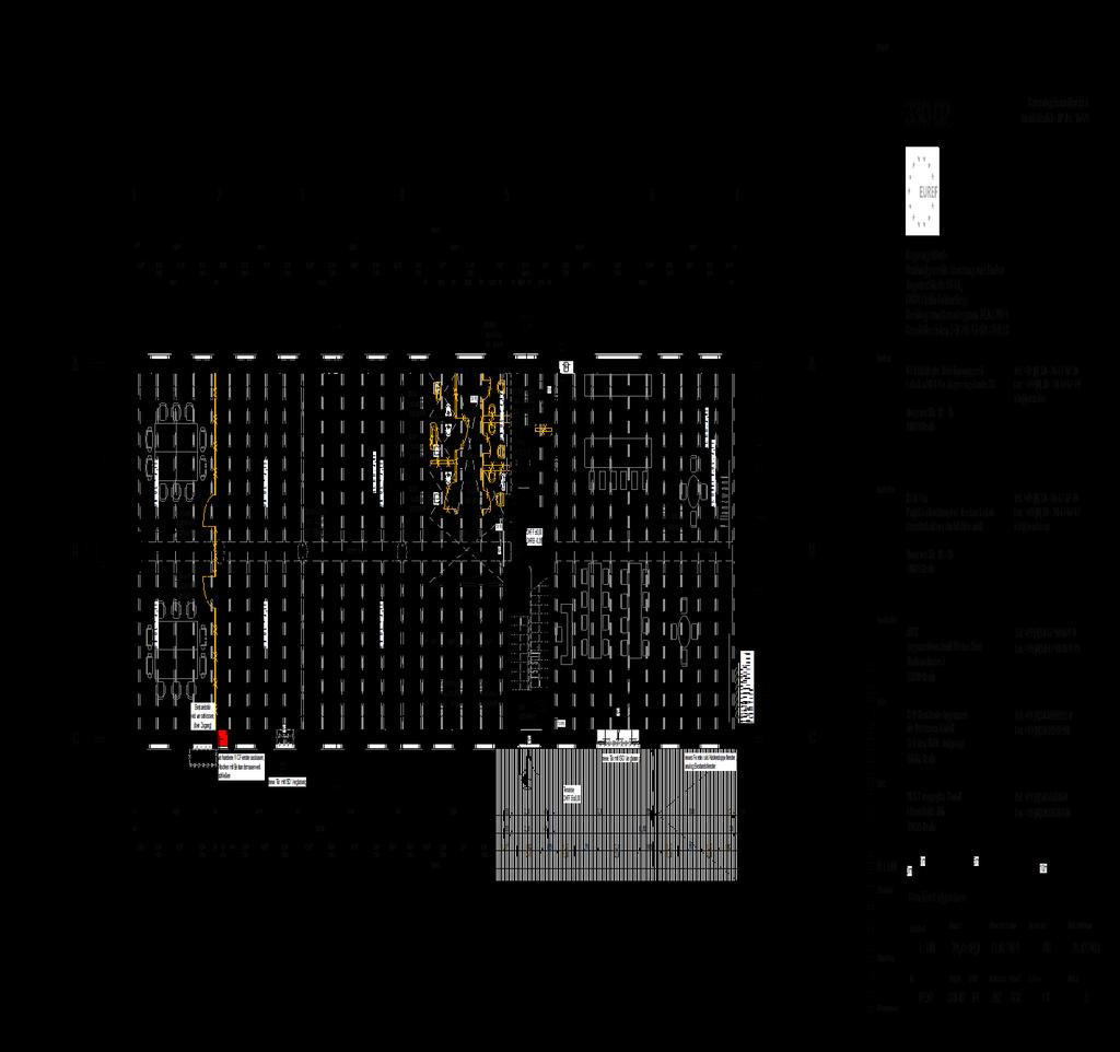
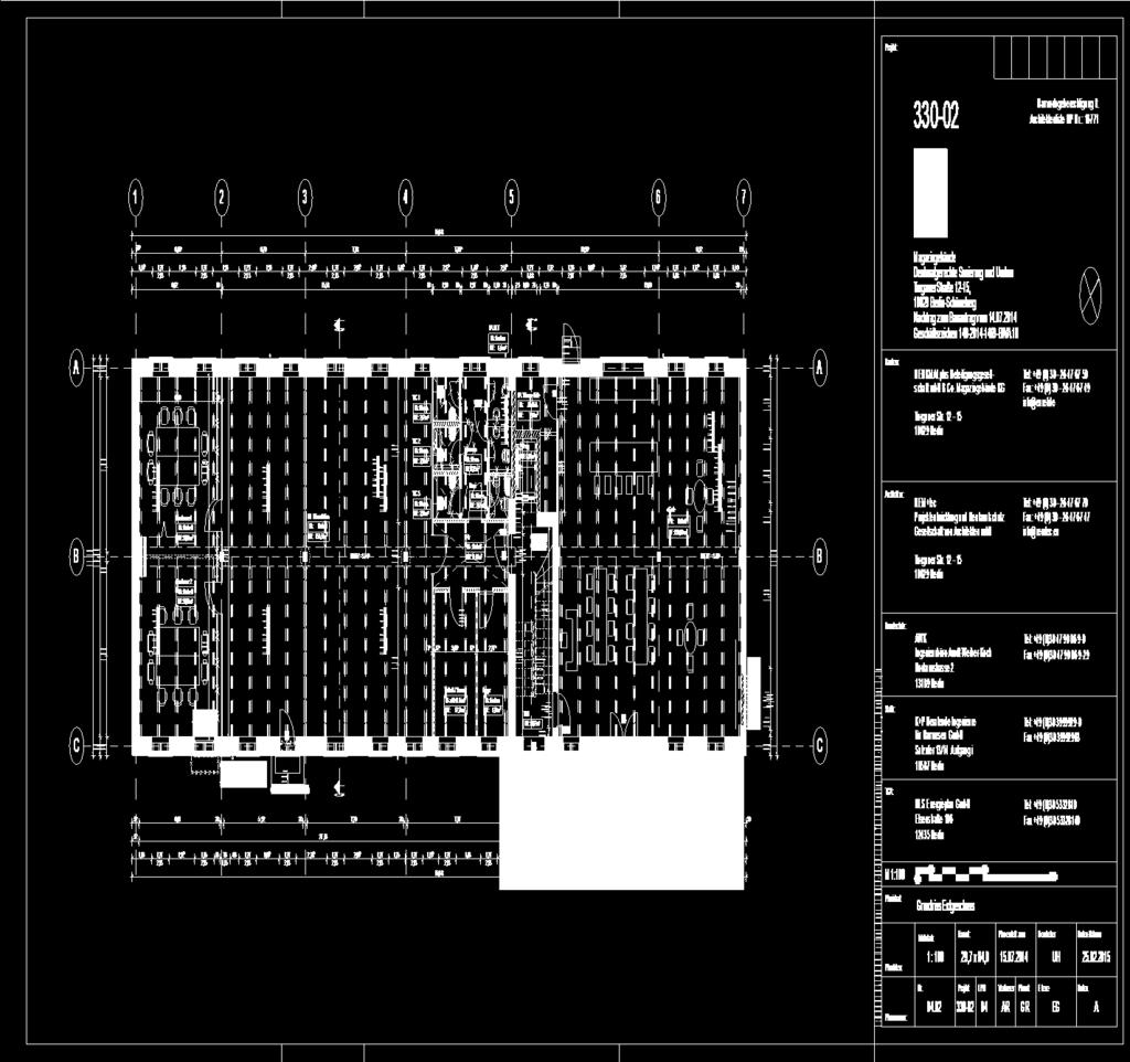
107 94
Scan-to-BIM. NEWBIM ApS, Galina Slavova CEO, BIM Specialist
 Scan-to-BIM NEWBIM ApS, Galina Slavova CEO, BIM Specialist Agenda What is Building Information Modeling (BIM) About NEWBIM ApS 3D Laser Scanning Integration Case Study Demonstration Building Information
Presentation title. Presenters name
 Presentation title Presenters name Andrew Bellerby, Managing Director, Solibri UK Ltd Four segments Nemetschek covers the complete value chain in AEC + Multimedia Facts and figures > 50 years of innovation,
AS10473 Design Workflow from Concept to Construction Documents Design Workflow from Concept to Construction Documents
 Design Workflow from Concept to Construction Documents Laura Kay Smith Kasian Architecture Interior Design and Planning LTD. Learning Objectives Learn how to effectively create a process leading from design
CURRICULUM The Architectural Technology and Construction. programme
 CURRICULUM The Architectural Technology and Construction Management programme CONTENT 1 PROGRAMME STRUCTURE 5 2 CURRICULUM COMMON PART 7 2.1 Core areas in the study programme 7 2.1.1 General 7 2.1.2 Company
Microsoft HoloLens Joe Hines
 Microsoft HoloLens Joe Hines In recent years, the push to utilize technology has been advancing from one job to the next in the construction industry. The main benefits of technology have been increased
MODERN DESCRIPTIVE GEOMETRY SUPPORTED BY 3D COMPUTER MODELLING
 International Conference on Mathematics Textbook Research and Development 2014 () 29-31 July 2014, University of Southampton, UK MODERN DESCRIPTIVE GEOMETRY SUPPORTED BY 3D COMPUTER MODELLING Petra Surynková
Building Information Modeling
 Chapter Building Information Modeling 1 Building information modeling (BIM) is an integrated workflow built on coordinated, reliable information about a project from design through construction and into
Point clouds in BIM. IOP Conference Series: Earth and Environmental Science PAPER OPEN ACCESS
 IOP Conference Series: Earth and Environmental Science PAPER OPEN ACCESS Point clouds in BIM To cite this article: Gergana Antova et al 2016 IOP Conf. Ser.: Earth Environ. Sci. 44 042034 View the article
Move Beyond Primitive Drawing Tools with SAP Sybase PowerDesigner Create and Manage Business Change in Your Enterprise Architecture
 SAP Sybase PowerDesigner Move Beyond Primitive Drawing Tools with SAP Sybase PowerDesigner Create and Manage Business Change in Your Enterprise Architecture Table of Contents 3 Add Intelligence to the
Reality Capture. Customer Case
 Reality Capture Customer Case Reality Capture customer case: MP-Map Oy Surveying company using FARO laser scanners MP-Map Oy is a construction surveying company with over 30 years of surveying experience
Semi-Automatic Techniques for Generating BIM Façade Models of Historic Buildings
 Semi-Automatic Techniques for Generating BIM Façade Models of Historic Buildings C. Dore, M. Murphy School of Surveying & Construction Management Dublin Institute of Technology Bolton Street Campus, Dublin
3D Laser Scanning Approaches and Business Models for implementing BIM in Facility Management
 3D Laser Scanning Approaches and Business Models for implementing BIM in Facility Management M.Sc. Zsuzsa Besenyői, HTW Berlin Prof. Dr.-Ing. Markus Krämer, HTW Berlin Dipl.-Ing. (FH) Frank Lindner, G2Plus
The data quality trends report
 Report The 2015 email data quality trends report How organizations today are managing and using email Table of contents: Summary...1 Research methodology...1 Key findings...2 Email collection and database
Innovation. lidarnews.com. volume 3 issue 5. Points clouds and terrain models support rail project. Structured light scanning for human head modeling
 volume 3 issue 5 LIDAR lidarnews.com SCALABILITY Points clouds and terrain models support rail project EXPRESSION Structured light scanning for human head modeling FLUCTUATION Scanning moving objects using
CYBERCRIME AS A NEW FORM OF CONTEMPORARY CRIME
 FACULTY OF LAW DEPARTEMENT: CIVIL LAW MASTER STUDY THEME: CYBERCRIME AS A NEW FORM OF CONTEMPORARY CRIME Mentor: Prof. Ass. Dr. Xhemajl Ademaj Candidate: Abdurrahim Gashi Pristinë, 2015 Key words List
BIM Goes to School AUTODESK REVIT BUILDING INFORMATION MODELING. BIM in the Architectural Curriculum. Savannah College of Art and Design, USA
 AUTODESK REVIT BUILDING INFORMATION MODELING As BIM adoption grows in the building industry, so does the use of BIM in educational curricula. This white paper focuses on how BIM is being leveraged within
Digital Preservation of the Aurelius Church and the Hirsau Museum Complex by Means of HDS and Photogrammetric Texture Mapping
 Master Thesis Ruxandra MOROSAN Ruxandra MOROSAN Digital Preservation of the Aurelius Church and the Hirsau Museum Complex by Means of HDS and Photogrammetric Texture Mapping Duration of the Thesis: 6 months
2 The IBM Data Governance Unified Process
 2 The IBM Data Governance Unified Process The benefits of a commitment to a comprehensive enterprise Data Governance initiative are many and varied, and so are the challenges to achieving strong Data Governance.
RED HAT ENTERPRISE LINUX. STANDARDIZE & SAVE.
 RED HAT ENTERPRISE LINUX. STANDARDIZE & SAVE. Is putting Contact us INTRODUCTION You know the headaches of managing an infrastructure that is stretched to its limit. Too little staff. Too many users. Not
Building Information Modeling
 Chapter Building Information Modeling 1 Building information modeling (BIM) is an integrated workflow built on coordinated, reliable information about a project from design through construction and into
BIM for infrastructure make easy with Laser Scanner. 17 October Beng Chieh Quah Head of Marketing Asia Pacific
 BIM for infrastructure make easy with Laser Scanner 17 October 2016 Beng Chieh Quah Head of Marketing Asia Pacific who is? founded in 1981 NASDAQ since 1997 Global technology company Offering a range of
Using Autodesk Ecotect Analysis and Building Information Modeling
 Autodesk Ecotect Analysis 2010 Using Autodesk Ecotect Analysis and Building Information Modeling This document helps you to get the most from Autodesk Ecotect Analysis software and building information
The power of BIM for structural engineering. Autodesk Revit. Structure
 The power of BIM for structural engineering. Autodesk Revit Structure Improve Efficiency, Accuracy, and Coordination Concurrent modeling for structural design, analysis, and coordinated documentation Building
Parametric Maps for Performance-Based Urban Design
 Parametric Maps for Performance-Based Urban Design A lateral method for 3D urban design Jernej Vidmar University of Ljubljana, Faculty of Architecture, Slovenia http://www.modelur.com jernej.vidmar@modelur.com
Innovative Integrations Boost Designing with BIM
 Hong Kong Housing Authority Project: Bridging the Gaps with our Core Values Successful Transformation of Revit Model to Enable Civil 3D/GIS/Revit Integration and Lighting Simulation & Rendering Location:
Autodesk Revit. Structure
 The power of BIM for structural engineering. Autodesk Revit S L N E TW R K Structure Improve Efficiency, Accuracy, and Coordination Concurrent modeling for structural design, analysis, and coordinated
Evolution of D-Studio Middleware technology for BIM integration
 Evolution of D-Studio Middleware technology for BIM integration Stefan Boeykens, Koenraad Nys D-Studio bvba Abstract: In the evolution towards BIM Level 3 and beyond, D-Studio is developing middleware
NEW PERSPECTIVE SEPTEMBER 2017
 VOLUME 7 ISSUE 6 SEPTEMBER 2017 NEW PERSPECTIVE 18 26 38 POLARIS SHOWS THE WAY The terrestrial laser scanning market continues to evolve, providing today s practitioner with an abundance of options LITTLE
The State of Data Center Health Management Strategy 2017
 Strategic Alliance Partner Health Management Strategy The State of Data Center Health Management Strategy 2017 Fall 2017 Introduction Data has become one of the most valuable assets for 21st century businesses.
Draper Aden VIRTUAL CONSTRUCTION DOCUMENT, DESIGN, AND BUILD IN 3D
 VIRTUAL CONSTRUCTION VIRTUAL CONSTRUCTION The design and construction environment has changed. While the goals of completing a project on time, within budget, and at the expected level of quality remain
SOLUTION BRIEF RSA ARCHER IT & SECURITY RISK MANAGEMENT
 RSA ARCHER IT & SECURITY RISK MANAGEMENT INTRODUCTION Organizations battle growing security challenges by building layer upon layer of defenses: firewalls, antivirus, intrusion prevention systems, intrusion
Why Enterprises Need to Optimize Their Data Centers
 White Paper Why Enterprises Need to Optimize Their Data Centers Introduction IT executives have always faced challenges when it comes to delivering the IT services needed to support changing business goals
Simplicity is the new black: The BLK360 story
 Simplicity is the new black: The BLK360 story Vanda KADLECIKOVA Leica Geosystems Heerbrugg, Switzerland E-mail: vanda.kadlecikova@leica-geosystems.com Abstract Meet the game changer. The new Leica BLK360
Cross-Discipline Coordination in Autodesk s Revit Platform
 Cross-Discipline Coordination in Autodesk s Revit Platform Matt Dillon The DC CADD Company, Inc. AB214-4 The Revit platform offers many opportunities and tools for coordination that have not been possible
The Most Comprehensive Solution for Indoor Mapping Applications
 The Most Comprehensive Solution for Indoor Mapping Applications TRIMBLE INDOOR MOBILE MAPPING SOLUTION TRIMBLE INDOOR MOBILE MAPPING SOLUTION (TIMMS): HIGH EFFICIENCY, MAXIMUM FLEXIBILITY, ALL-IN-ONE PACKAGE
BIM STUDENT EXPERIMENT WITH WALKING PATHS APPLICATION. Portal Twente VERSION: 2 DATE: 06/12/2012. NAME: Frederick M.C. van Amstel
 2012 STUDENT EXPERIMENT WITH WALKING PATHS APPLICATION VERSION: 2 DATE: 06/12/2012 NAME: Frederick M.C. van Amstel Contents 1 Purpose of this document... 3 2 Experiment goals... 3 3 Problem... 3 4 Experiment
SAPtips. Journal. Creating a Well-Developed Master Data Management Solution in BW. August/September 2005 Volume III Issue 4. SAPtips.
 Page 1 Creating a Well-Developed Master Data Management Solution in BW By Arthur Pat Pesa, arthurpesa, inc Editor Note: Pat Pesa delivers another one-two-three punch with his discussion of developing,
The foundation of BIM for structural engineering. Autodesk Revit. Structure 2010
 The foundation of BIM for structural engineering. Autodesk Revit Structure 2010 Building Information Modeling for Structural Engineering Integrated tools for modeling, coordination, analysis, design documentation,
3D Modeling and Energy Analysis of a Residential Building using BIM Tools
 3D Modeling and Energy Analysis of a Residential Building using BIM Tools A. S. Shivsharan 1, Mrs. D. R. Vaidya 2, Prof. R. D. Shinde 3 1P. G. Student: Construction Management, Civil Engineering Department,
Call for expression of interest in leadership roles for the Supergen Energy Networks Hub
 Call for expression of interest in leadership roles for the Supergen Energy Networks Hub Call announced: 4 th September 2017 Deadline for applications: Midday 29 th September 2017 Provisional decision
Information Infrastructure and Security. The value of smart manufacturing begins with a secure and reliable infrastructure
 Information Infrastructure and Security The value of smart manufacturing begins with a secure and reliable infrastructure The Case for Connection To be competitive, you must be connected. That is why industrial
BS1192:2007. Collaborative production of architectural, engineering and construction information Code of practice. Barrie Sharp
 BS1192:2007 Collaborative production of architectural, engineering and construction information Code of practice Barrie Sharp Why? It s a standard not MY Standard Everyone can get on board; It s not company
PLAYBOOK. How Do You Plan to Grow? Evaluating Your Critical Infrastructure Can Help Uncover the Right Strategy
 PLAYBOOK F O R C H A N G E How Do You Plan to Grow? Evaluating Your Critical Infrastructure Can Help Uncover the Right Strategy The world is becoming more digital every day. The demand for feature-rich,
Reality Capture: From Point Cloud To Design To Visualisation. by Shuaib Yunos, Baker Baynes
 Reality Capture: From Point Cloud To Design To Visualisation by Shuaib Yunos, Baker Baynes Perspective: Design & Construction Designers are conceiving buildings differently. Building owners expect a lot
BROCHURE. A data center for all needs
 BROCHURE A data center for all needs Access to data is a crucial factor Access to data is a crucial factor in all areas of life today, for companies, authorities and public services. There is simply no
The 7 Habits of Highly Effective API and Service Management
 7 Habits of Highly Effective API and Service Management: Introduction The 7 Habits of Highly Effective API and Service Management... A New Enterprise challenge has emerged. With the number of APIs growing
Implementing ITIL v3 Service Lifecycle
 Implementing ITIL v3 Lifecycle WHITE PAPER introduction GSS INFOTECH IT services have become an integral means for conducting business for all sizes of businesses, private and public organizations, educational
PTC Employs Its Own Arbortext Software to Improve Delivery of PTC University Learning Content Materials
 PTC Employs Its Own Arbortext Software to Improve Delivery of PTC University Learning Content Materials Produces Higher Quality Courseware, Faster Development Cycles for Global Training Content Produces
Discover the Hidden Cost Savings of Cloud Computing
 WHITEPAPER Discover the Hidden Cost Savings of Cloud Computing Transform your entire institution with Jenzabar Cloud Services. By Gus Ortiz Managed Services Program Manager, Principal Consultant Cloud
ISO/IEC/ IEEE INTERNATIONAL STANDARD. Systems and software engineering Architecture description
 INTERNATIONAL STANDARD ISO/IEC/ IEEE 42010 First edition 2011-12-01 Systems and software engineering Architecture description Ingénierie des systèmes et des logiciels Description de l'architecture Reference
Service Delivery Platform
 Solution Brief Service Delivery Platform Enabling the transition to high-value and more differentiated network services with new consumption models for deploying VNFs. Keeping Up With Cloud Expectations
ICAEW REPRESENTATION 68/16
 ICAEW REPRESENTATION 68/16 Improving the Structure of the Code of Ethics for Professional Accountants - Phase 1 ICAEW welcomes the opportunity to comment on the Improving the Structure of the Code of Ethics
Balancing energy and environmental demands
 Balancing energy and environmental demands Solutions that optimise the safety and performance of conventional power plants and power station systems. TÜV SÜD South Asia Meet global energy demands As demand
Industry Sector. Zug (Switzerland), July 4, Security in an IT world
, July 4, Security in an IT world") Technical Article Industry Sector Building Technologies Division Zug (Switzerland), July 4, 2011 Security in an IT world There is a move towards more integrated solutions in security, with security management
Technical Article Industry Sector Building Technologies Division Zug (Switzerland), July 4, 2011 Security in an IT world There is a move towards more integrated solutions in security, with security management
13.f Toronto Catholic District School Board's IT Strategic Review - Draft Executive Summary (Refer 8b)
") AGENDA ADDENDU TE REGULAR EETING OF TE AUDIT COITTEE COITTEE PUBLIC SESSION Tuesday, June 6, 2017 6:30 P.. Pages 13. Staff Reports 13.f Toronto Catholic District School Board's IT Strategic Review - Draft
AGENDA ADDENDU TE REGULAR EETING OF TE AUDIT COITTEE COITTEE PUBLIC SESSION Tuesday, June 6, 2017 6:30 P.. Pages 13. Staff Reports 13.f Toronto Catholic District School Board's IT Strategic Review - Draft
Virtualization. Q&A with an industry leader. Virtualization is rapidly becoming a fact of life for agency executives,
 Virtualization Q&A with an industry leader Virtualization is rapidly becoming a fact of life for agency executives, as the basis for data center consolidation and cloud computing and, increasingly, as
REVIT MODELING INDIA. Best Practices of Revit Family. Creation. Author: Premal Kayasth BIM Evangelist.
 REVIT MODELING INDIA Best Practices of Revit Family Creation Author: Premal Kayasth BIM Evangelist Introduction: The white paper aims at defining best practices and procedures to be considered at the time
Paul Shillcock Transport for London, UK
 Building Information Modeling for Infrastructure Paul Shillcock Transport for London, UK CI3836 The United Kingdom (UK) is experiencing an exponential demand for rail travel, combined with demands from
The Case for Virtualizing Your Oracle Database Deployment
 June 2012 The Case for Virtualizing Your Oracle Database Deployment Much has been written about the benefits of virtualization over the last few years. Hypervisor software promises to revolutionize the
THE STATE OF IT TRANSFORMATION FOR RETAIL
 THE STATE OF IT TRANSFORMATION FOR RETAIL An Analysis by Dell EMC and VMware Dell EMC and VMware are helping IT groups at retail organizations transform to business-focused service providers. The State
Three Key Challenges Facing ISPs and Their Enterprise Clients
 Three Key Challenges Facing ISPs and Their Enterprise Clients GRC, enterprise services, and ever-evolving hybrid infrastructures are all dynamic and significant challenges to the ISP s enterprise clients.
BIM Diploma content ( included courses) : Training course Course Levels Duration Outputs Revi t Architecture
 : Training course Course Levels Duration Outputs Revi t Architecture") What is BIM? Autodesk BIM is an intelligent model-based process that helps owners and service providers achieve business results by enabling more accurate, accessible, and actionable insight throughout
What is BIM? Autodesk BIM is an intelligent model-based process that helps owners and service providers achieve business results by enabling more accurate, accessible, and actionable insight throughout
Serviceable Luminaires in a Circular Economy - White Paper -
 Serviceable Luminaires in a Circular Economy - White Paper - LIGHTINGEUROPE 1. Introduction scope and objective of this White Paper LightingEurope members have a long experience in dealing with aspects
Most as-built information is still manually collected. Today s Design Market
 Agenda 1. Overview of 3D laser scanning 2. HDS 3D Laser scanning applications Leica ScanStation2 True Color Scan 3. Demonstration of HDS & Trueview 4. Questions and Answers The advanced 3D Laser Scanning
Digital Marketing Manager, Marketing Manager, Agency Owner. Bachelors in Marketing, Advertising, Communications, or equivalent experience
 Persona name Amanda Industry, geographic or other segments B2B Roles Digital Marketing Manager, Marketing Manager, Agency Owner Reports to VP Marketing or Agency Owner Education Bachelors in Marketing,
Beyond the Limits: Using Autodesk Revit and Navisworks Manage for Design Collaboration on Large-Scale Projects
 Beyond the Limits: Using Autodesk Revit and Navisworks Manage for Design Collaboration on Large-Scale Projects Joseph Huang MWH Global Luther Lampkin MWH Global SE4259 This class covers best practices
DRS Policy Guide. Management of DRS operations is the responsibility of staff in Library Technology Services (LTS).
.") Harvard University Library Office for Information Systems DRS Policy Guide This Guide defines the policies associated with the Harvard Library Digital Repository Service (DRS) and is intended for Harvard
Harvard University Library Office for Information Systems DRS Policy Guide This Guide defines the policies associated with the Harvard Library Digital Repository Service (DRS) and is intended for Harvard
IPv6 Migration Framework Case of Institutions in Ethiopia
 IPv6 Migration Framework Case of Institutions in Ethiopia Kidist Mekonnen Zemen Bank, Addis Ababa, Ethiopia kidistmt@yahoo.com Taye Abdulkadir HiLCoE School of Computer Science and Technology, Addis Ababa,
Total Cost of Ownership: Benefits of the OpenText Cloud
 Total Cost of Ownership: Benefits of the OpenText Cloud OpenText Managed Services in the Cloud delivers on the promise of a digital-first world for businesses of all sizes. This paper examines how organizations
Verizon Perspectives on Smart Infrastructure. Anthony J. (Tony) DiMaso Advanced Energy Conference November 19, 2009
 DiMaso Advanced Energy Conference November 19, 2009") Verizon Perspectives on Smart Infrastructure Anthony J. (Tony) DiMaso Advanced Energy Conference November 19, 2009 Verizon Corporate Profile Annual Revenues > $100B Employees > 200K Verizon Telecom Capital
Verizon Perspectives on Smart Infrastructure Anthony J. (Tony) DiMaso Advanced Energy Conference November 19, 2009 Verizon Corporate Profile Annual Revenues > $100B Employees > 200K Verizon Telecom Capital
Placing you at the heart of your operations. Vijeo Citect
 Placing you at the heart of your operations Vijeo Citect 10 things you should know about SCADA 1 Safety of workers and equipment are ensured through predefined processes managed by a SCADA system. 2 Engineering
Well Lifecycle: Workflow Automation
 2017 Well Lifecycle: Workflow Automation STEVE COOPER, PRESIDENT This document is the property of EnergyIQ and may not be distributed either in part or in whole without the prior written consent of EnergyIQ.
Industry 4.0 revolutionizing BIM and AEC
 CONFERÊNCIA CONSTRUÇÃO 4.0 O DESAFIO DA DIGITALIZAÇÃO DA CONSTRUÇÃO E A ENGENHARIA CIVIL NO CONTEXTO DA INDÚSTRIA 4.0 Industry 4.0 revolutionizing BIM and AEC Vakis P. Kokorelis Construsoft Portugal 22
Strategy & Planning: Data Governance & Data Quality
 Strategy & Planning: Data Governance & Data Quality April 30, 2017 In the era of big data and data science, most commercial and nonprofit organizations realize the potential power of data in accelerating
Total Cost of Ownership: Benefits of ECM in the OpenText Cloud
 Total Cost of Ownership: Benefits of ECM in the OpenText Cloud OpenText Managed Services brings together the power of an enterprise cloud platform with the technical skills and business experience required
Moving from a Paper to Paperless validation effort and how to get the most efficient mix of Manual vs. Automated testing.
 Moving from a Paper to Paperless validation effort and how to get the most efficient mix of Manual vs. Automated testing. Overview The desire to use tools to increase validation productivity with the consequent
The power management skills gap
 The power management skills gap Do you have the knowledge and expertise to keep energy flowing around your datacentre environment? A recent survey by Freeform Dynamics of 320 senior data centre professionals
MDCSystems. MICHAEL A. BAKER, P.E., M.S.E.M. Consulting Engineer
 MDCSystems Providing Expert Solutions for Projects Worldwide MICHAEL A. BAKER, P.E., M.S.E.M. Consulting Engineer Education Drexel University, M.S., Engineering Management, Technology Assessment Brown
BUILDINGS AND FACILITIES
 EB-00-0 Exhibit C Tab Schedule Page of BUILDINGS AND FACILITIES FACILITIES AND ASSET MANAGEMENT OVERALL STRATEGY THESL s buildings and facilities (the facilities ) include operating centers (00 Commissioners,
Building Strategies & Sustainability
 Building Strategies & Sustainability ENERGY-EFFICIENT SOLUTIONS FOR NEW CONSTRUCTION & RETROFITS 03 Rate Card & Planner Building Strategies & Sustainability is an industry leading publication tackling
Switching from AutoCAD Architecture to Revit Architecture: The Right Attitude is Everything AB2885
 Switching from AutoCAD Architecture to Revit Architecture: Thomas (Tom) Tobin TTobin Consulting Jim Stoneberger (Co-presenter) Crabtree, Rohrbaugh & Associates - Architects AB2885 Are you considering a
STRATEGIC PLAN
 STRATEGIC PLAN 2013-2018 In an era of growing demand for IT services, it is imperative that strong guiding principles are followed that will allow for the fulfillment of the Division of Information Technology
CDW LLC 200 North Milwaukee Avenue, Vernon Hills, IL
 Coordinating Conferencing and Collaboration Vital unified communications capabilities offer a solid foundation for an integrated view of the collaborative environment. To make the most of the opportunities
Establishing the Vision
 BIM & Beyond: USCG Case Studies from Mission to Management Establishing the Vision June 23, 2007 Dana K. Deke Smith, AIA Executive Director, buildingsmart Alliance Setting the Vision $3 Trillion industry
Balancing energy and environmental demands
 Balancing energy and environmental demands Solutions that optimise the safety and performance of conventional power plants and power station systems. TÜV SÜD South Asia Meet global energy demands As demand
STRUCTURED SYSTEM ANALYSIS AND DESIGN. System Concept and Environment
 STRUCTURED SYSTEM ANALYSIS AND DESIGN Definition: - System Concept and Environment A system is an orderly grouping of independent components linked together according to plan to achieve a specific objective.
The ResiStand Project
 INCREASING DISASTER RESILIENCE BY ESTABLISHING A SUSTAINABLE PROCESS TO SUPPORT STANDARDISATION OF TECHNOLOGIES AND SERVICES The ResiStand Project IMPROVER / ERNCIP 2 nd Joint Operators Workshop 11-12
Go Cloud. VMware vcloud Datacenter Services by BIOS
 Go Cloud VMware vcloud Datacenter Services by BIOS Is your IT infrastructure always in tune with your business? If a market opportunity suddenly arises, can your business respond in time? Or is the opportunity
Know What You Want: How to Start a Successful Scan-to-BIM Project MARGARITA LEONOVA
 Know What You Want: How to Start a Successful Scan-to-BIM Project MARGARITA LEONOVA Scan-to-BIM Scan the Building Get a Point Cloud Generate Building Information Model Scan-to-BIM Why convert a point cloud
Revit MEP. Autodesk Navisworks
 What is BIM? Autodesk BIM is an intelligent model-based process that helps owners and service providers achieve business results by enabling more accurate, accessible, and actionable insight throughout
REPRESENTATION REQUIREMENTS OF AS-IS BUILDING INFORMATION MODELS GENERATED FROM LASER SCANNED POINT CLOUD DATA
 REPRESENTATION REQUIREMENTS OF AS-IS BUILDING INFORMATION MODELS GENERATED FROM LASER SCANNED POINT CLOUD DATA Engin Burak Anil 1 *, Burcu Akinci 1, and Daniel Huber 2 1 Department of Civil and Environmental
Joint Application Design & Function Point Analysis the Perfect Match By Sherry Ferrell & Roger Heller
 Joint Application Design & Function Point Analysis the Perfect Match By Sherry Ferrell & Roger Heller Introduction The old adage It s not what you know but when you know it that counts is certainly true
HOW WELL DO YOU KNOW YOUR IT NETWORK? BRIEFING DOCUMENT
 HOW WELL DO YOU KNOW YOUR IT NETWORK? BRIEFING DOCUMENT ARE YOU REALLY READY TO EXECUTE A GLOBAL IOT STRATEGY? Increased demand driven by long-term trends of the Internet of Things, WLAN, connected LED
Small Cells as a Service rethinking the mobile operator business
 Small Cells as a Service rethinking the mobile operator business Mats Eriksson, CEO Arctos Labs Scandinavia AB -02-18 1 Executive summary Mobile operators (MNOs) face a huge challenge in meeting the data
Retro-Commissioning of Data Centers
 Retro-Commissioning of Data Centers Agenda Unique traits of Data Centers (DCs) Benefits of Retro-Cx DCs Suitable candidates for Retro-Cx Phases of Retro-Cx Additional considerations for DCs 2 Unique Traits
Making the case for SD-WAN
 Making the case for SD-WAN A practical guide to getting buy-in for your new network New challenges require a new network It isn t just that enterprise IT is changing rapidly it s that it s changing in
Fundamental Shift: A LOOK INSIDE THE RISING ROLE OF IT IN PHYSICAL ACCESS CONTROL
 Fundamental Shift: A LOOK INSIDE THE RISING ROLE OF IT IN PHYSICAL ACCESS CONTROL Shifting budgets and responsibilities require IT and physical security teams to consider fundamental change in day-to-day
5 Challenges to Government IT Modernization: In Brief. Quick tips & facts about IT modernization across federal, state and local governments
 5 Challenges to Government IT Modernization: In Brief Quick tips & facts about IT modernization across federal, state and local governments Executive Summary Information technology (IT) modernization can
BPS Suite and the OCEG Capability Model. Mapping the OCEG Capability Model to the BPS Suite s product capability.
 BPS Suite and the OCEG Capability Model Mapping the OCEG Capability Model to the BPS Suite s product capability. BPS Contents Introduction... 2 GRC activities... 2 BPS and the Capability Model for GRC...
Datacenter Care HEWLETT PACKARD ENTERPRISE. Key drivers of an exceptional NPS score
 Datacenter Care The things I love about Datacenter Care is the a la carte nature of the offering. The contract is really flexible and the services delivered correspond exactly to what we bought. The contract