Airborne LiDAR Data Acquisition for Forestry Applications. Mischa Hey WSI (Corvallis, OR)
|
|
|
- Priscilla Boone
- 5 years ago
- Views:
Transcription


1 Airborne LiDAR Data Acquisition for Forestry Applications Mischa Hey WSI (Corvallis, OR)


2 WSI Services Corvallis, OR Airborne Mapping: Light Detection and Ranging (LiDAR) Thermal Infrared Imagery 4-Band Multi-Spectral Imagery Bathymetric/Sonar Geodetic Survey Analysis: Forest Inventory and Vegetation Analysis Automated Feature Extraction. Water Quality Modeling. Fish & Wildlife Habitat Assessments.


3 Forest Research Affiliations Oregon State University USFS PNW, Forest Sciences Laboratory, Corvallis. University of Washington Precision Forestry Cooperative. USFS Rocky Mountain Research Station Moscow, ID. US Forest Service Research Lab, Portland and Seattle. Panther Creek LiDAR Research (BLM, EPA, Private Industry)


4 Presentation Outline LiDAR Concepts Forest Applications - Timber inventory, terrain mapping, roads, stream networks. Flight timing Acquisition specifications Processing needs Product development
 Lat/Long/EL (from GPS) Pitch")
 Scan Angle Range and")
5 Airborne Light Detection and Ranging (LiDAR) Lat/Long/EL (from GPS) Pitch (from IMU) Roll (from IMU) Heading (from IMU) Scan Angle Range and Intensity GPS Base

6 Airborne LiDAR Terms Laser Wavelength Field-of-View (FOV) Pulse Density- - Emitted pulses from sensor per unit area Return Density- - Pulses returning to sensor per unit area Discrete Return- - Individual return from emitted pulse Full Waveform- - Digitized entire wave returning to sensor Back-Scatter Intensity - Reflected energy from pulse
 - IMU")


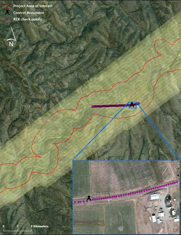
7 Acquisition Control Airborne instrumentation - GPS accuracy (PDOP, constellations) - IMU accuracy (drift, line length) - Base length < 13miles Ground control network - Monument occupation - Control point distribution - Considerations: access, security, sky visibility

8 Relative Accuracy (Line-to-Line Calibration) Individual flight-line swaths are spatially integrated. Good relative accuracy is essential for vegetation analysis. Relative accuracy is good QC measure.

9 Absolute Accuracy


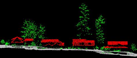
10 Point classification Calibrated Points Automated algorithms Manual interpretation Ground Classified Points Full Feature Classification Accurate classification is essential for model development.

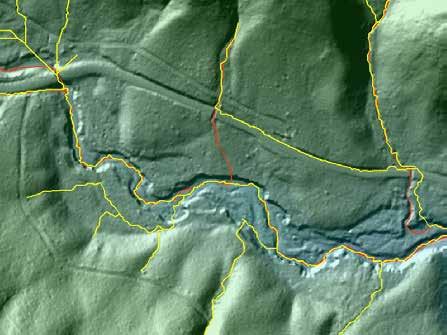
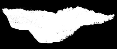
11 False vegetation from offset
12 Acquisition Timing When to go and why


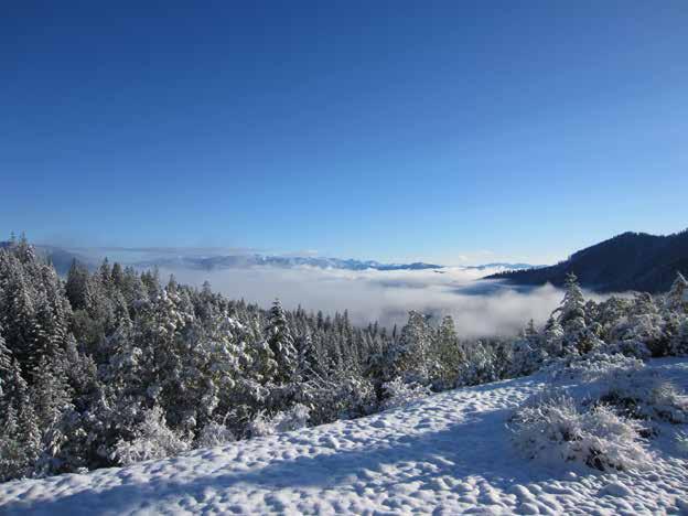
13 Timing Considerations Leaf-on vs Leaf-off - Leaf-on => better canopy surface, spectral info from intensity - Leaf-off => increased canopy penetration, better ground model, hardwood/conifer distinction Climate and Other Factors - Snow, clouds, fog, smoke - Think broad patterns not specific days Find the balance: Leaf off, low flow, over 2,500 ft in PNW is tricky.

14 Acquisition Specifications The important numbers
 - Ground return density can be 1/10 th the native density a heavily forested")
15 Acquisition Specifications Side-lap and FOV - Decreases shadowing - Consistent point distribution Flight Line 2 Flight Line 1 Point density - Dictates resolution of information available - Higher density => increased ground returns, increased canopy detail (8 pts/sqm) - Ground return density can be 1/10 th the native density a heavily forested environment.


16 Point Density: More Points are Better 40pts/sqm 20pts/sqm 10pts/sqm 4pts/sqm 2pt/sqm
17 Real world examples Contracted LiDAR Survey Settings & Specifications Sensor Survey Altitude (AGL) Target Pulse Rate Sensor Configuration Laser Pulse Diameter Field of View GPS Baselines Leica ALS m 106 khz Single Pulse in Air (SPiA) 19 cm 28⁰ 13 nm GPS PDOP 3.0 GPS Satellite Constellation 6 Maximum Returns 4 Intensity ALS 60 LiDAR sensor install 8-bit Resolution/Density Average 8 pulses/m 2 Accuracy RMSE Z 15 cm Delivered Absolute Accuracy Relative Accuracy Sample 1,301 points 86 surfaces Average m m Median mt m RMSE m m Classification 1σ m ft 2σ m m Point Density First-Return points/m 2 Ground Classified 6.03 points/m 2
18 Processing Considerations Treating the data right

19 Processing Considerations LiDAR classification - Ground, vegetation, building, utilities - High, medium, low vegetation - Water surface, bridges/culverts
 Laser power emission variations Atmospheric")

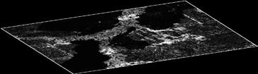
20 Intensity Normalization Receiver auto-gain-control (AGC) Laser power emission variations Atmospheric transmissivity Laser Angle of incidence Line to Line Inconsistency Streaking is Occurring Throughout Image
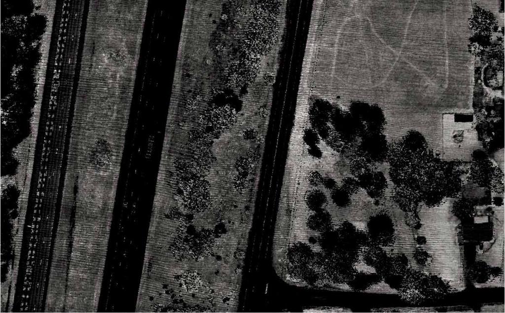
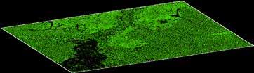
21 Raw Intensities
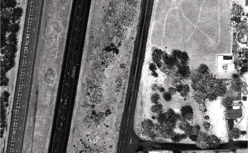
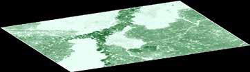
22 Normalized Intensity


23 Products What should you buy


 Report and")
24 Products - Basic Point Cloud - Classified and Calibrated Points (LAS) Surface models - Bare earth DEM, Canopy DSM, Canopy height ndsm - Contours (requires smoothing tolerance) Intensity Image (normalized) Report and Metadata!


25 Products - Advanced Feature extraction - Road networks - Stream networks - Hydro breaklines - Building footprints Feature analysis - Stand delineation and characterization - Individual tree inventory and attribution

26 Network extraction


27 The Future Mapping yesterday s tomorrow today

28 Full Waveform Discrete Return: Capture only the exact time of the peaks of independently-recognized return pulses. Most current systems record up to 4 returns. However, new systems are starting to have more dynamic return recording. Full Waveform (FWF): the entire return signal is measured, allowing capture of subtle deviations in the shape of the reflected as compared to the shape of the outbound laser pulse
29 Full Waveform Green LiDAR point cloud highlighting 7 returns digitized from 1 outgoing pulse using Riegl s online waveform processing

30 Full-Waveform Considerations Advantages Detection of pulse stretching (return pulse wider than laser pulse) indicating: Low vegetation on ground, indicating need to adjust point elevation downward Improved classification by using combination of return pulse width and spatial context Indication of biomass by evaluating area contained under the pulse shape. Discrete Returns Considerations Massive storage requirements often require subsampling or switching drives during flight. More difficult to perform accurate geocorrection of the continuous wave-form. Limited software tools.


31 Multi-wavelength LiDAR Applications: o Forestry: Potential for species delineation using return intensity information. o Stream/Riparian: shallow water bathymetric data for surface water modeling, wetlands, and habitat assessment. Green laser NIR laser Green laser NIR laser
32

33 Summary Not all LiDAR is created equal. - High density, high accuracy are paramount. Consider all desired applications. - Get the most from your data. Talk to your vendors and outside experts. - Find a trusted source and be specific about your goals Cost and quality are tightly correlated. - Cheaper data is cheaper for a reason LiDAR 8 pulses/sq m 2005 LiDAR 2-3 pulses/sq m


34 Mischa Hey WSI- Corvallis, OR
CLASSIFICATION OF NONPHOTOGRAPHIC REMOTE SENSORS
 CLASSIFICATION OF NONPHOTOGRAPHIC REMOTE SENSORS PASSIVE ACTIVE DIGITAL CAMERA THERMAL (e.g. TIMS) VIDEO CAMERA MULTI- SPECTRAL SCANNERS VISIBLE & NIR MICROWAVE HYPERSPECTRAL (e.g. AVIRIS) SLAR Real Aperture
An Introduction to Lidar & Forestry May 2013
 An Introduction to Lidar & Forestry May 2013 Introduction to Lidar & Forestry Lidar technology Derivatives from point clouds Applied to forestry Publish & Share Futures Lidar Light Detection And Ranging
LiDAR Remote Sensing Data Collection: Yaquina and Elk Creek Watershed, Leaf-On Acquisition
 LiDAR Remote Sensing Data Collection: Yaquina and Elk Creek Watershed, Leaf-On Acquisition Submitted by: 4605 NE Fremont, Suite 211 Portland, Oregon 97213 April, 2006 Table of Contents LIGHT DETECTION
Lidar Sensors, Today & Tomorrow. Christian Sevcik RIEGL Laser Measurement Systems
 Lidar Sensors, Today & Tomorrow Christian Sevcik RIEGL Laser Measurement Systems o o o o Online Waveform technology Stand alone operation no field computer required Remote control through wireless network
LIDAR MAPPING FACT SHEET
 1. LIDAR THEORY What is lidar? Lidar is an acronym for light detection and ranging. In the mapping industry, this term is used to describe an airborne laser profiling system that produces location and
2010 LiDAR Project. GIS User Group Meeting June 30, 2010
 2010 LiDAR Project GIS User Group Meeting June 30, 2010 LiDAR = Light Detection and Ranging Technology that utilizes lasers to determine the distance to an object or surface Measures the time delay between
Coeur d Alene Puget Sound LiDAR Consortium
 May 29, 2015 Coeur d Alene Puget Sound LiDAR Consortium Technical Data Report Puget Sound LiDAR Consortium (PSLC) Attn: Christy Lam 1011 Western Ave., Suite 500 Seattle, WA 98104 QSI Environmental 517
LiDAR REMOTE SENSING DATA COLLECTION BISCUIT FIRE STUDY AREA, OREGON
 LiDAR REMOTE SENSING DATA COLLECTION BISCUIT FIRE STUDY AREA, OREGON Oblique view in the Biscuit Fire Study Area: Above Ground ESRI Grid (1-meter resolution) derived from all LiDAR points Submitted to:
PSLC King County LiDAR. July 18, Technical Data Report.
 July 18, 2016 PSLC King County LiDAR Technical Data Report Andy Norton Puget Sound LiDAR Consortium 1011 Western Avenue, Suite 500 Seattle, WA 98104 PH: 206-971-3283 QSI Corvallis 517 SW 2 nd St., Suite
Whittier, Alaska LiDAR
 January 17, 2013 Whittier, Alaska LiDAR Technical Data Report Revision 3 Rod Combellick Alaska DNR Division of Geological & Geophysical Surveys 3354 College Road Fairbanks, Alaska 99709 Phone 907-451-5007
PSLC King County LiDAR
 June 23, 2017 PSLC King County 2016-2017 LiDAR Final Technical Data Report Andy Norton Puget Sound LiDAR Consortium 1011 Western Avenue, Suite 500 Seattle, WA 98104 PH: 206-971-3283 QSI Corvallis 517 SW
Airborne Laser Scanning: Remote Sensing with LiDAR
 Airborne Laser Scanning: Remote Sensing with LiDAR ALS / LIDAR OUTLINE Laser remote sensing background Basic components of an ALS/LIDAR system Two distinct families of ALS systems Waveform Discrete Return
Teanaway Streams Topobathymetric LiDAR
 November 23, 2015 Teanaway Streams Topobathymetric LiDAR Technical Data Report Andrew Norton Puget Sound LiDAR Consortium 1011 Western Avenue, Suite 500 Seattle, WA 98104 PH: 206-971-3283 QSI Corvallis
Light Detection and Ranging (LiDAR)
") Light Detection and Ranging (LiDAR) http://code.google.com/creative/radiohead/ Types of aerial sensors passive active 1 Active sensors for mapping terrain Radar transmits microwaves in pulses determines
Light Detection and Ranging (LiDAR) http://code.google.com/creative/radiohead/ Types of aerial sensors passive active 1 Active sensors for mapping terrain Radar transmits microwaves in pulses determines
LiDAR Remote Sensing Data Collection: Salmon River Study Area, Oregon
 LiDAR Remote Sensing Data Collection: Salmon River Study Area, Oregon Submitted to: Barbara Ellis-Sugai USDA Forest Service Siuslaw National Forest 4077 SW Research Way Corvallis, Oregon 541.750.7056 Submitted
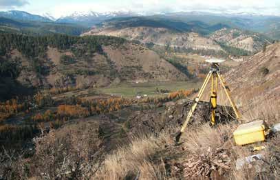
Terrestrial GPS setup Fundamentals of Airborne LiDAR Systems, Collection and Calibration. JAMIE YOUNG Senior Manager LiDAR Solutions
 Terrestrial GPS setup Fundamentals of Airborne LiDAR Systems, Collection and Calibration JAMIE YOUNG Senior Manager LiDAR Solutions Topics Terrestrial GPS reference Planning and Collection Considerations
Nooksack River Basin LiDAR
 July 26, 2013 Nooksack River Basin LiDAR Technical Data Report Delivery 2 Treva Coe Nooksack Indian Tribe P.O. Box 157 5016 Deming Rd. Demming, WA 98244 PH: 360.592.5176 Diana Martinez PSRC 1011 Western
PSLC King County Delivery 1 LiDAR
 May 27, 2016 PSLC King County Delivery 1 LiDAR Technical Data Report Andy Norton Puget Sound LiDAR Consortium 1011 Western Avenue, Suite 500 Seattle, WA 98104 PH: 206-971-3283 QSI Corvallis 517 SW 2 nd
Saddle Mountain LiDAR. March 25, Technical Data Report.
 March 25, 2014 Saddle Mountain LiDAR Technical Data Report Diana Martinez 1011 Western Avenue, Suite 500 Seattle, WA 98104 PH: 206-971-3052 QSI Corvallis Office 517 SW 2 nd St., Suite 400 Corvallis, OR
PSLC Walla Walla, Washington LiDAR
 May 22, 2017 PSLC Walla Walla, Washington LiDAR Technical Data Report Andy Norton Puget Sound LiDAR Consortium 1011 Western Avenue, Suite 500 Seattle, WA 98104 PH: 206-971-3283 QSI Corvallis 517 SW 2 nd
Lidar Technical Report
 Lidar Technical Report Oregon Department of Forestry Sites Presented to: Oregon Department of Forestry 2600 State Street, Building E Salem, OR 97310 Submitted by: 3410 West 11st Ave. Eugene, OR 97402 April
LIDAR REMOTE SENSING DATA COLLECTION: DOGAMI, CAMP CREEK PROJECT AREA
 LIDAR REMOTE SENSING DATA COLLECTION DEPARTMENT OF GEOLOGY AND MINERAL INDUSTRIES CAMP CREEK, OREGON NOVEMBER 26, 2008 Submitted to: Department of Geology and Mineral Industries 800 NE Oregon Street, Suite
N.J.P.L.S. An Introduction to LiDAR Concepts and Applications
 N.J.P.L.S. An Introduction to LiDAR Concepts and Applications Presentation Outline LIDAR Data Capture Advantages of Lidar Technology Basics Intensity and Multiple Returns Lidar Accuracy Airborne Laser
Table of Contents. 1. Overview... 1
 LIDAR REMOTE SENSING DATA COLLECTION: Diiabllo Canyon,, CA Prreparred by: : Prreparred fforr: : WSII Corrval lliss Offffi ice 5117 SW 2 nndd Stt,, Suitte 400 Corrval lliss,, OR 97333 Updaatteed Maayy 33,,,
OLC Wasco County: Delivery One.
 OLC Wasco County: Delivery One www.quantumspatial.com January 2, 2014 Trimble R7 Receiver set up over GPS monument WASCO_02. Data collected for: Oregon Department of Geology and Mineral Industries 800
Quinnipiac Post Flight Aerial Acquisition Report
 Quinnipiac Post Flight Aerial Acquisition Report August 2011 Post-Flight Aerial Acquisition and Calibration Report FEMA REGION 1 Quinnipiac Watershed, Connecticut, Massachusesetts FEDERAL EMERGENCY MANAGEMENT
UAS based laser scanning for forest inventory and precision farming
 UAS based laser scanning for forest inventory and precision farming M. Pfennigbauer, U. Riegl, P. Rieger, P. Amon RIEGL Laser Measurement Systems GmbH, 3580 Horn, Austria Email: mpfennigbauer@riegl.com,
W D-0049/004 EN
 September 21, 2011 Contact Ground Survey Report, Lidar Accuracy Report, & Project Report New Madrid Seismic Zone Northeast of Memphis, Tennessee Contract Number: W91278-09D-0049/004 EN Project: C-10-026
Light Detection and Ranging (LiDAR) Radiohead House of Cards
 Radiohead House of Cards") Light Detection and Ranging (LiDAR) Radiohead House of Cards http://the-moni-blog.blogspot.com/2009/03/lidar-is-going-mainstream-mtv-baby.html h =? Laser Vision GPS + IMU θ H X a h Types of aerial sensors
Light Detection and Ranging (LiDAR) Radiohead House of Cards http://the-moni-blog.blogspot.com/2009/03/lidar-is-going-mainstream-mtv-baby.html h =? Laser Vision GPS + IMU θ H X a h Types of aerial sensors
LIDAR an Introduction and Overview
 LIDAR an Introduction and Overview Rooster Rock State Park & Crown Point. Oregon DOGAMI Lidar Project Presented by Keith Marcoe GEOG581, Fall 2007. Portland State University. Light Detection And Ranging
Municipal Projects in Cambridge Using a LiDAR Dataset. NEURISA Day 2012 Sturbridge, MA
 Municipal Projects in Cambridge Using a LiDAR Dataset NEURISA Day 2012 Sturbridge, MA October 15, 2012 Jeff Amero, GIS Manager, City of Cambridge Presentation Overview Background on the LiDAR dataset Solar
Central Coast LIDAR Project, 2011 Delivery 1 QC Analysis LIDAR QC Report February 17 th, 2012
 O R E G O N D E P A R T M E N T O F G E O L O G Y A N D M I N E R A L I N D U S T R I E S OLC Central Coast Delivery 1 Acceptance Report. Department of Geology & Mineral Industries 800 NE Oregon St, Suite
2017 OLC Silver Creek
 2017 OLC Silver Creek December 15, 2017 www.quantumspatial.com Data collected for: Oregon Department of Geology and Mineral Industries 800 NE Oregon Street Suite 965 Portland, OR 97232 Prepared by: Quantum
LiDAR Data Processing:
 LiDAR Data Processing: Concepts and Methods for LEFI Production Gordon W. Frazer GWF LiDAR Analytics Outline of Presentation Data pre-processing Data quality checking and options for repair Data post-processing
Terrain Modeling and Mapping for Telecom Network Installation Using Scanning Technology. Maziana Muhamad
 Terrain Modeling and Mapping for Telecom Network Installation Using Scanning Technology Maziana Muhamad Summarising LiDAR (Airborne Laser Scanning) LiDAR is a reliable survey technique, capable of: acquiring
LiDAR data pre-processing for Ghanaian forests biomass estimation. Arbonaut, REDD+ Unit, Joensuu, Finland
 LiDAR data pre-processing for Ghanaian forests biomass estimation Arbonaut, REDD+ Unit, Joensuu, Finland Airborne Laser Scanning principle Objectives of the research Prepare the laser scanning data for
ENY-C2005 Geoinformation in Environmental Modeling Lecture 4b: Laser scanning
 1 ENY-C2005 Geoinformation in Environmental Modeling Lecture 4b: Laser scanning Petri Rönnholm Aalto University 2 Learning objectives To recognize applications of laser scanning To understand principles
Aerial and Mobile LiDAR Data Fusion
 Creating Value Delivering Solutions Aerial and Mobile LiDAR Data Fusion Dr. Srini Dharmapuri, CP, PMP What You Will Learn About LiDAR Fusion Mobile and Aerial LiDAR Technology Components & Parameters Project
Leica ALS70. Airborne Laser Scanners Performance for diverse Applications
 Leica ALS70 Airborne Laser Scanners Performance for diverse Applications Three Models, One Result. Highest Productivity in all Applications. Imagine an affordable 500 khz pulse rate city-mapping LIDAR
Sandy River, OR Bathymetric Lidar Project, 2012 Delivery QC Analysis Lidar QC Report March 26 th, 2013
 O R E G O N D E P A R T M E N T O F G E O L O G Y A N D M I N E R A L I N D U S T R I E S OLC Sandy River, OR Bathymetric Lidar Project Delivery Acceptance Report. Department of Geology & Mineral Industries
A Method to Create a Single Photon LiDAR based Hydro-flattened DEM
 A Method to Create a Single Photon LiDAR based Hydro-flattened DEM Sagar Deshpande 1 and Alper Yilmaz 2 1 Surveying Engineering, Ferris State University 2 Department of Civil, Environmental, and Geodetic
APPENDIX E2. Vernal Pool Watershed Mapping
 APPENDIX E2 Vernal Pool Watershed Mapping MEMORANDUM To: U.S. Fish and Wildlife Service From: Tyler Friesen, Dudek Subject: SSHCP Vernal Pool Watershed Analysis Using LIDAR Data Date: February 6, 2014
RIEGL LMS-Q780. The Versatile, High Altitude Airborne LIDAR Sensor
 RIEGL LMS-Q780 4700m 400kHz The full waveform airborne laser scanner offers great versatility, accuracy, and data quality. The scanner enables you to successfully deliver your projects with industry leading
Lecture 11. LiDAR, RADAR
 NRMT 2270, Photogrammetry/Remote Sensing Lecture 11 Calculating the Number of Photos and Flight Lines in a Photo Project LiDAR, RADAR Tomislav Sapic GIS Technologist Faculty of Natural Resources Management
LiDAR & Orthophoto Data Report
 LiDAR & Orthophoto Data Report Tofino Flood Plain Mapping Data collected and prepared for: District of Tofino, BC 121 3 rd Street Tofino, BC V0R 2Z0 Eagle Mapping Ltd. #201 2071 Kingsway Ave Port Coquitlam,
TABLE OF CONTENTS. 1. Overview Acquisition... 2
 LiDAR Remote Sensing Data Collection: Wenas Valley, WA Delivery 2 st O Occttoobbeerr 11st,, 22001100 SSuubbm miitttteedd ttoo:: SSuubbm miitttteedd bbyy:: DDiiaannaa M Maarrttiinneezz PPuuggeett SSoouunndd
Workshops funded by the Minnesota Environment and Natural Resources Trust Fund
 Workshops funded by the Minnesota Environment and Natural Resources Trust Fund Conservation Applications of LiDAR Data Workshops funded by: Minnesota Environment and Natural Resources Trust Fund Presented
RIEGL LMS-Q780. The Versatile, High Altitude Airborne LIDAR Sensor
 RIEGL LMS-Q780 3050m 400kHz The full waveform airborne laser scanner offers great versatility, accuracy, and data quality. The scanner enables you to successfully deliver your projects with industry leading
2017 OLC Siskiyou. September 27,
 2017 OLC Siskiyou September 27, 2017 www.quantumspatial.com Data collected for: Oregon Department of Geology and Mineral Industries 800 NE Oregon Street Suite 965 Portland, OR 97232 Prepared by: Quantum
Learning Objectives LIGHT DETECTION AND RANGING. Sensing. Blacksburg, VA July 24 th 30 th, 2010 LiDAR: Mapping the world in 3-D Page 1
 LiDAR: Mapping the world in 3-D Val Thomas Department of Forest Resources & Environmental Conservation July 29, 2010 Learning Objectives Part 1: Lidar theory What is lidar? How does lidar work? What are
BLM Fire Project, 2013 QC Analysis Lidar and Orthophoto QC Report November 25th, 2013
 O R E G O N D E P A R T M E N T O F G E O L O G Y 1937 A N D M I N E R A L I N D U S T R I E S Department of Geology & Mineral Industries 800 NE Oregon St, Suite 965 Portland, OR 97232 BLM Fire Project,
Rogue River LIDAR Project, 2012 Delivery 1 QC Analysis LIDAR QC Report September 6 th, 2012
 O R E G O N D E P A R T M E N T O F G E O L O G Y A N D M I N E R A L I N D U S T R I E S OLC Rogue River Delivery 1 Acceptance Report. Department of Geology & Mineral Industries 800 NE Oregon St, Suite
Overview. 1. Aerial LiDAR in Wisconsin (20 minutes) 2. Demonstration of data in CAD (30 minutes) 3. High Density LiDAR (20 minutes)
 2. Demonstration of data in CAD (30 minutes) 3. High Density LiDAR (20 minutes)") Overview 1. Aerial LiDAR in Wisconsin (20 minutes) 2. Demonstration of data in CAD (30 minutes) 3. High Density LiDAR (20 minutes) 4. Aerial lidar technology advancements (15 minutes) 5. Q & A 1. Aerial
Overview 1. Aerial LiDAR in Wisconsin (20 minutes) 2. Demonstration of data in CAD (30 minutes) 3. High Density LiDAR (20 minutes) 4. Aerial lidar technology advancements (15 minutes) 5. Q & A 1. Aerial
Integration of airborne LiDAR and hyperspectral remote sensing data to support the Vegetation Resources Inventory and sustainable forest management
 Integration of airborne LiDAR and hyperspectral remote sensing data to support the Vegetation Resources Inventory and sustainable forest management Executive Summary This project has addressed a number
SIMULATED LIDAR WAVEFORMS FOR THE ANALYSIS OF LIGHT PROPAGATION THROUGH A TREE CANOPY
 SIMULATED LIDAR WAVEFORMS FOR THE ANALYSIS OF LIGHT PROPAGATION THROUGH A TREE CANOPY Angela M. Kim and Richard C. Olsen Remote Sensing Center Naval Postgraduate School 1 University Circle Monterey, CA
UTILIZACIÓN DE DATOS LIDAR Y SU INTEGRACIÓN CON SISTEMAS DE INFORMACIÓN GEOGRÁFICA
 UTILIZACIÓN DE DATOS LIDAR Y SU INTEGRACIÓN CON SISTEMAS DE INFORMACIÓN GEOGRÁFICA Aurelio Castro Cesar Piovanetti Geographic Mapping Technologies Corp. (GMT) Consultores en GIS info@gmtgis.com Geographic
Small-footprint full-waveform airborne LiDAR for habitat assessment in the ChangeHabitats2 project
 Small-footprint full-waveform airborne LiDAR for habitat assessment in the ChangeHabitats2 project Werner Mücke, András Zlinszky, Sharif Hasan, Martin Pfennigbauer, Hermann Heilmeier and Norbert Pfeifer
High resolution survey and orthophoto project of the Dosso-Gaya region in the Republic of Niger. by Tim Leary, Woolpert Inc.
 High resolution survey and orthophoto project of the Dosso-Gaya region in the Republic of Niger by Tim Leary, Woolpert Inc. Geospatial Solutions Photogrammetry & Remote Sensing LiDAR Professional Surveying
An Introduction to Using Lidar with ArcGIS and 3D Analyst
 FedGIS Conference February 24 25, 2016 Washington, DC An Introduction to Using Lidar with ArcGIS and 3D Analyst Jim Michel Outline Lidar Intro Lidar Management Las files Laz, zlas, conversion tools Las
Third Rock from the Sun
 Geodesy 101 AHD LiDAR Best Practice The Mystery of LiDAR Best Practice Glenn Jones SSSi GIS in the Coastal Environment Batemans Bay November 9, 2010 Light Detection and Ranging (LiDAR) Basic principles
LIDAR Workshop IPSRS Commission 1
 LIDAR Workshop IPSRS Commission 1 2-Jul-2007, Ljubliana, Slovenia Arthur Rohrbach, Leica Geosystems, Switzerland Presentation topics 1. Basics of Airborne LIDAR Sensing Technology 2. Typical Applications
Hamilton County Enhances GIS Base Mapping with 1-foot Contours
 Hamilton County Enhances GIS Base Mapping with 1-foot Contours Presented by Larry Stout, Hamilton County GIS Manager Brad Fugate, Woolpert Inc. Today s Presentation Hamilton County s 2004 Base Mapping
LiDAR Technical Report NE Washington LiDAR Production 2017
 LiDAR Technical Report NE Washington LiDAR Production 2017 Presented to: Washington DNR 1111 Washington Street SE Olympia, Washington 98504 Submitted by: 860 McKinley St Eugene, OR 97402 July 26, 2017
Terrain categorization using LIDAR and multi-spectral data
 Terrain categorization using LIDAR and multi-spectral data Angela M. Puetz, R. C. Olsen, Michael A. Helt U.S. Naval Postgraduate School, 833 Dyer Road, Monterey, CA 93943 ampuetz@nps.edu, olsen@nps.edu
LiForest Software White paper. TRGS, 3070 M St., Merced, 93610, Phone , LiForest
 0 LiForest LiForest is a platform to manipulate large LiDAR point clouds and extract useful information specifically for forest applications. It integrates a variety of advanced LiDAR processing algorithms
EXTRACTING SURFACE FEATURES OF THE NUECES RIVER DELTA USING LIDAR POINTS INTRODUCTION
 EXTRACTING SURFACE FEATURES OF THE NUECES RIVER DELTA USING LIDAR POINTS Lihong Su, Post-Doctoral Research Associate James Gibeaut, Associate Research Professor Harte Research Institute for Gulf of Mexico
FOR 274: Surfaces from Lidar. Lidar DEMs: Understanding the Returns. Lidar DEMs: Understanding the Returns
 FOR 274: Surfaces from Lidar LiDAR for DEMs The Main Principal Common Methods Limitations Readings: See Website Lidar DEMs: Understanding the Returns The laser pulse travel can travel through trees before
GEO 6895: Airborne laser scanning - workflow, applications, value. Christian Hoffmann
 GEO 6895: Airborne laser scanning - workflow, applications, value. Christian Hoffmann Agenda Why LiDAR? The value of an end-to-end workflow The Trimble AX-Series Data processing & modelling Information
Leica - Airborne Digital Sensors (ADS80, ALS60) Update / News in the context of Remote Sensing applications
 Update / News in the context of Remote Sensing applications") Luzern, Switzerland, acquired with GSD=5 cm, 2008. Leica - Airborne Digital Sensors (ADS80, ALS60) Update / News in the context of Remote Sensing applications Arthur Rohrbach, Sensor Sales Dir Europe,
Luzern, Switzerland, acquired with GSD=5 cm, 2008. Leica - Airborne Digital Sensors (ADS80, ALS60) Update / News in the context of Remote Sensing applications Arthur Rohrbach, Sensor Sales Dir Europe,
MULTISPECTRAL MAPPING
 VOLUME 5 ISSUE 1 JAN/FEB 2015 MULTISPECTRAL MAPPING 8 DRONE TECH REVOLUTION Forthcoming order of magnitude reduction in the price of close-range aerial scanning 16 HANDHELD SCANNING TECH 32 MAX MATERIAL,
BRIEF EXAMPLES OF PRACTICAL USES OF LIDAR
 BRIEF EXAMPLES OF PRACTICAL USES OF LIDAR PURDUE ROAD SCHOOL - 3/9/2016 CHRIS MORSE USDA-NRCS, STATE GIS COORDINATOR LIDAR/DEM SOURCE DATES LiDAR and its derivatives (DEMs) have a collection date for data
GeoLas Consulting All rights reserved. LiDAR GeocodeWF Rev. 03/2012 Specifications subject to change without notice.
 GeocodeWF is the tool for converting the raw waveform data collected by Riegl LMS-Q560 and LMS-Q680 laserscanner-based lidar systems into geocoded points in a projected coordinate system. GeocodeWF is
LIDAR and Terrain Models: In 3D!
 LIDAR and Terrain Models: In 3D! Stuart.green@teagasc.ie http://www.esri.com/library/whitepapers/pdfs/lidar-analysis-forestry.pdf http://www.csc.noaa.gov/digitalcoast/_/pdf/refinement_of_topographic_lidar_to_create_a_bare_e
Mayden VP of Business Development Surdex Corporation
 Making Sense of Sensors Randy Mayden, Mayden VP of Business Development Surdex Corporation randym@surdex.com EARLYAERIAL PHOTOGRAPHY 2 FIRSTAERIAL CAMERA 3 AERIAL CAMERA SYSTEM DEVELOPMENT Aerial Camera
MODELLING FOREST CANOPY USING AIRBORNE LIDAR DATA
 MODELLING FOREST CANOPY USING AIRBORNE LIDAR DATA Jihn-Fa JAN (Taiwan) Associate Professor, Department of Land Economics National Chengchi University 64, Sec. 2, Chih-Nan Road, Taipei 116, Taiwan Telephone:
Data Acquisition; Maintenance, and Dissemination
 Data Acquisition; Maintenance, and Dissemination Amar Nayegandhi, CP, CMS(RS), GISP Director of Remote Sensing Dewberry December 4, 2014 About MAPPS + MAPPS is the only national association of private
Technical Considerations and Best Practices in Imagery and LiDAR Project Procurement
 Technical Considerations and Best Practices in Imagery and LiDAR Project Procurement Presented to the 2014 WV GIS Conference By Brad Arshat, CP, EIT Date: June 4, 2014 Project Accuracy A critical decision
3-d rendering of LiDAR points with RGB color assigned from ortho-photos, view of Lostine River looking south
 LIDAR AND TRUE-COLOR ORTHOPHOTOGRAPHS AIRBORNE DATA ACQUISITION AND PROCESSING: GRANDE RONDE AND LEMHI RIVER BASINS Submitted to: Lanie Paquin; Susan Fraser U.S. Bureau of Reclamation 1150 N. Curtis Road
AIRBORNE LIDAR TASK ORDER REPORT SHELBY COUNTY TN 1M NPS LIDAR/FEATURE EXTRACT TASK ORDER UNITED STATES GEOLOGICAL SURVEY (USGS)
") AIRBORNE LIDAR TASK ORDER REPORT SHELBY COUNTY TN 1M NPS LIDAR/FEATURE EXTRACT TASK ORDER UNITED STATES GEOLOGICAL SURVEY (USGS) CONTRACT NUMBER: G10PC00057 TASK ORDER NUMBER: G12PD00127 Woolpert Project
AIRBORNE LIDAR TASK ORDER REPORT SHELBY COUNTY TN 1M NPS LIDAR/FEATURE EXTRACT TASK ORDER UNITED STATES GEOLOGICAL SURVEY (USGS) CONTRACT NUMBER: G10PC00057 TASK ORDER NUMBER: G12PD00127 Woolpert Project
SPAR, ELMF 2013, Amsterdam. Laser Scanning on the UK Highways Agency Network. Hamish Grierson Blom Uk
 SPAR, ELMF 2013, Amsterdam Laser Scanning on the UK Highways Agency Network Hamish Grierson Blom Uk www.blomasa.com www.blom-uk.co.uk Blom UK Part of the Blom Group Blom Group - Europe s largest aerial
COMPUTING SOLAR ENERGY POTENTIAL OF URBAN AREAS USING AIRBORNE LIDAR AND ORTHOIMAGERY
 COMPUTING SOLAR ENERGY POTENTIAL OF URBAN AREAS USING AIRBORNE LIDAR AND ORTHOIMAGERY Ryan Hippenstiel The Pennsylvania State University John A. Dutton e-education Institute 2217 Earth & Engineering Sciences
AIRBORNE GEIGER MODE LIDAR - LATEST ADVANCEMENTS IN REMOTE SENSING APPLICATIONS RANDY RHOADS
 Place image here (10 x 3.5 ) AIRBORNE GEIGER MODE LIDAR - LATEST ADVANCEMENTS IN REMOTE SENSING APPLICATIONS RANDY RHOADS Geospatial Industry Manager HARRIS.COM #HARRISCORP Harris Company Information SECURITY
Course Outline (1) #6 Data Acquisition for Built Environment. Fumio YAMAZAKI
 #6 Data Acquisition for Built Environment. Fumio YAMAZAKI") AT09.98 Applied GIS and Remote Sensing for Disaster Mitigation #6 Data Acquisition for Built Environment 9 October, 2002 Fumio YAMAZAKI yamazaki@ait.ac.th http://www.star.ait.ac.th/~yamazaki/ Course Outline
AT09.98 Applied GIS and Remote Sensing for Disaster Mitigation #6 Data Acquisition for Built Environment 9 October, 2002 Fumio YAMAZAKI yamazaki@ait.ac.th http://www.star.ait.ac.th/~yamazaki/ Course Outline
Existing Elevation Data Sets. Quality Level 2 (QL2) Lidar Data Sets. Better Land Characterization More Accurate Results!
 Lidar Data Sets. Better Land Characterization More Accurate Results!") Existing Elevation Data Sets Out of Date: Most > 40 yrs old Data range from 15 yrs old to > 70 yrs old Spatial Resolution: 33 ft (10 m) or coarser Vertical Accuracy: 3.3 ft 6.6 ft (1 2 m) or worse Quality
Existing Elevation Data Sets Out of Date: Most > 40 yrs old Data range from 15 yrs old to > 70 yrs old Spatial Resolution: 33 ft (10 m) or coarser Vertical Accuracy: 3.3 ft 6.6 ft (1 2 m) or worse Quality
Alberta's LiDAR Experience Lessons Learned Cosmin Tansanu
 Alberta's LiDAR Experience Lessons Learned Cosmin Tansanu Analysis Forester Alberta Environment and Sustainable Resource Development We are mandated to provide environmental leadership. We need to push
1. LiDAR System Description and Specifications
 High Point Density LiDAR Survey of Mayapan, MX PI: Timothy S. Hare, Ph.D. Timothy S. Hare, Ph.D. Associate Professor of Anthropology Institute for Regional Analysis and Public Policy Morehead State University
NATIONWIDE POINT CLOUDS AND 3D GEO- INFORMATION: CREATION AND MAINTENANCE GEORGE VOSSELMAN
 NATIONWIDE POINT CLOUDS AND 3D GEO- INFORMATION: CREATION AND MAINTENANCE GEORGE VOSSELMAN OVERVIEW National point clouds Airborne laser scanning in the Netherlands Quality control Developments in lidar
TLS Parameters, Workflows and Field Methods
 TLS Parameters, Workflows and Field Methods Marianne Okal, UNAVCO GSA, October 20 th, 2017 How a Lidar instrument works (Recap) Transmits laser signals and measures the reflected light to create 3D point
Burns, OR LIDAR Project, 2011 Delivery QC Analysis LIDAR QC Report February 13th, 2012
 O R E G O N D E P A R T M E N T O F G E O L O G Y A N D M I N E R A L I N D U S T R I E S OLC Burns, OR Delivery Acceptance Report. Department of Geology & Mineral Industries 800 NE Oregon St, Suite 965
Reality Check: Processing LiDAR Data. A story of data, more data and some more data
 Reality Check: Processing LiDAR Data A story of data, more data and some more data Red River of the North Red River of the North Red River of the North Red River of the North Introduction and Background
Alaska Department of Transportation Roads to Resources Project LiDAR & Imagery Quality Assurance Report Juneau Access South Corridor
 Alaska Department of Transportation Roads to Resources Project LiDAR & Imagery Quality Assurance Report Juneau Access South Corridor Written by Rick Guritz Alaska Satellite Facility Nov. 24, 2015 Contents
Orthophotography and LiDAR Terrain Data Collection Rogue River, Oregon Final Report
 Orthophotography and LiDAR Terrain Data Collection Rogue River, Oregon Final Report Prepared by Sky Research, Inc. 445 Dead Indian Memorial Road Ashland, OR 97520 Prepared for Rogue Valley Council of Governments
UAV Surveying II. Precision. Accuracy. Reliability
 UAV Surveying II Precision. Accuracy. Reliability Part One: Project Lifecycle Deliverables Part Two: Evaluation of UAV Data Accuracy and Examples of Error Part Three: AGENDA Review of Results Examples
REMOTE SENSING LiDAR & PHOTOGRAMMETRY 19 May 2017
 REMOTE SENSING LiDAR & PHOTOGRAMMETRY 19 May 2017 SERVICES Visual Inspections Digital Terrain Models Aerial Imagery Volume Computations Thermal Inspections Photo maps Aerial Video Training & Consultancy
Adrian Cosmin Ghimbaşan 1 Cornel Cristian Tereşneu 1 Iosif Vorovencii 1
 Adrian Cosmin Ghimbaşan 1 Cornel Cristian Tereşneu 1 Iosif Vorovencii 1 1 Forest Management Planning and Terrestrial Measurements Department, Faculty of Silviculture and Forest Engineering, Transilvania
Remote Sensing Sensor Integration
 Remote Sensing Sensor Integration Erica Tharp LiDAR Supervisor Table of Contents About 3001 International Inc Remote Sensing Platforms Why Sensor Integration? Technical Aspects of Sensor Integration Limitations
Project Report Nooksack South Fork Lummi Indian Nation. Report Presented to:
 June 5, 2005 Project Report Nooksack South Fork Lummi Indian Nation Contract #2291-H Report Presented to: Lummi Indian Nation Natural Resources Department 2616 Kwina Road Bellingham, WA 98226 Point of
LiDAR Engineering and Design Applications. Sample Data
 LiDAR Engineering and Design Applications Sample Data High density LiDAR will return points on any visible part of a structure. Modeling of Existing Structures 2 The distance between any two positions
Laser scanners with echo digitization for full waveform analysis
 Laser scanners with echo digitization for full waveform analysis Peter Rieger, Andreas Ullrich, Rainer Reichert RIEGL Laser Measurement Systems GmbH DI Peter Rieger Project Management RIEGL LMS GmbH A-3580
Mapping Project Report Table of Contents
 LiDAR Estimation of Forest Leaf Structure, Terrain, and Hydrophysiology Airborne Mapping Project Report Principal Investigator: Katherine Windfeldt University of Minnesota-Twin cities 115 Green Hall 1530