3D Milling. Tom Abell
|
|
|
- Stella Lindsey
- 5 years ago
- Views:
Transcription

1 3D Milling Tom Abell


2 Trimble & 3D Milling as Part of the Resurfacing Process Design Measure Resurfacing From initial survey to finish surface Mill Compact Pave
3 Content Data acquisition Creating data models Trimble PCS900 Paving Control System v2.1 for Milling Machines Milling operations Accuracy aspects Benefits of 3D milling
4 Advantages of 3D Milling 1. Increased production and lower cost Only mill what needs to be milled 2. Increased smoothness Smoothness harder to achieve at the paving stage 3. Decreased material usage No filling of low spots 4. Mill complex designs
5 Data Acquisition / Data Model


6 Data Aquisition of Existing Surface Wavy Road Universal Total Station (UTS)/ rover rod Compactor with UTS 3D scanning


7 Static 3D Scanning Example 3D Data Collection 3D Design


8 Mobile Scanning with 25mph - MX8 Simultaneous collection of laser point cloud and digital images 2 x laser scanners 4 x 5 MP digital cameras Applanix integrated GNSS + IMU Signal point measurements with total station, GNSS and precise leveling Trimble Trident

9 New Optimized Road Design New horizontal / vertical alignment and cross-section profiles based on: Meeting road design specification parameters Minimum cutting / filling Visualization of cut and fill areas

10 Create Design and Corridor in Business Center - HCE Import roading design points or alignment data Create corridor Same design for Trimble SCS900 Site Controller Software and GCS900 How to check if a design is smooth 3D view and design drive through IRI calculation in Business Center - HCE!
11 PCS900 v2.1 for Milling Machines

12 PCS900 - Control System Overview PCS900 Full 3D position Relative to design Up/Down Left/Right Corrections Contact Sensors Sonic Sensors Wire Rope Sensors 2D position only 2D OEM Control System Machine Hydraulics (Leg Control)


13 Portable Kitting Option New installation box Radio PM400 Main harness Access holes for Target/GS420 cable Display cable Remote antenna cable And more

14 System Architecture - Wirtgen

15 UTS - Management Single screen for UTS activities Provides all pertinent information Available for asphalt and slipform pavers also


16 Dual Elevation Control With a single target, we allow the user to make adjustments on the slope side as an elevation Much easier to make adjustments based on grade checker feedback 2D system is configured for dual 3D elevation Mill-only feature
, hot weather < 130m (425 ) Avoid shots")

17 UTS Operational Tips 3D mill speed up to 15m/min and more Try to do several parallel lanes with 1 UTS Refraction Limit shot distances to m ( ), hot weather < 130m (425 ) Avoid shots close over hot surfaces You hunt mm s with a 40 ton machine! Need best surveying practices UTS calibration before any mill job Grade check accuracy to be in mm s Make sure your tools are wright

18 Masts Manual extendable masts Fixed (dozer) masts

19 Dual Mast Setup Allows measure-up of left and right masts Still only using one side for machine control Makes switching over from one side to another fast Same feature that exists on asphalt pavers
20 Project Results

 Road elevation compared to design after 3D milling In")
 Road elevation compared to design after 3D milling and 2D paving")
 In Tolerance +- 1cm (99.")
21 Review of Accuracy Result of 250m Study Section - CZ State before reconstruction Road elevation compared to design before 3D milling In tolerance + 1cm (60%) Out of tolerance + 1 cm (16%) Out of tolerance - 1 cm (24%) Road elevation compared to design after 3D milling In Tolerance +- 1cm (98.4%) Road elevation compared to design after 3D milling and 2D paving Outside Tolerance +1cm (0.2 %) Outside Tolerance -1cm (1.4%) In Tolerance +- 1cm (99.6%) Legend: Elevation difference actual versus design (m) Outside Tolerance +1cm (0,1%) Outside Tolerance -1cm (0,3%)
22 Benefits of 3D Milling
23 Advantages of 3D Milling 1. Increased production and lower cost Only mill what needs to be milled 2. Increased smoothness Smoothness harder to achieve at the paving stage 3. Decreased material usage No filling of low spots 4. Mill complex designs


24 Advantages of 3D Milling Increased smoothness + material savings The issue of differential compaction when paving Previous 3D milling takes away the issue:
25 Advantages of 3D Milling Mill Complex Designs Variable depth and slope milling enables milling of: Transitions Super-elevated curves Variable drainage slopes Longitudinal waves in the road Guide Policy for Geometric Design of Freeways and Expressways - NAASRA 1976
26 3D Milling Job Study

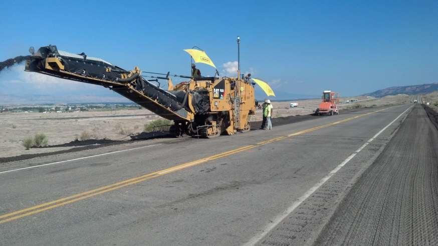
27 The Job Milling For a white topping overlay 4.5 miles of Interstate 70 Near Mack, Colorado Milled in half-mile stretches, averaging about three inches, across the entire 4.5 mile stretch of Interstate-70
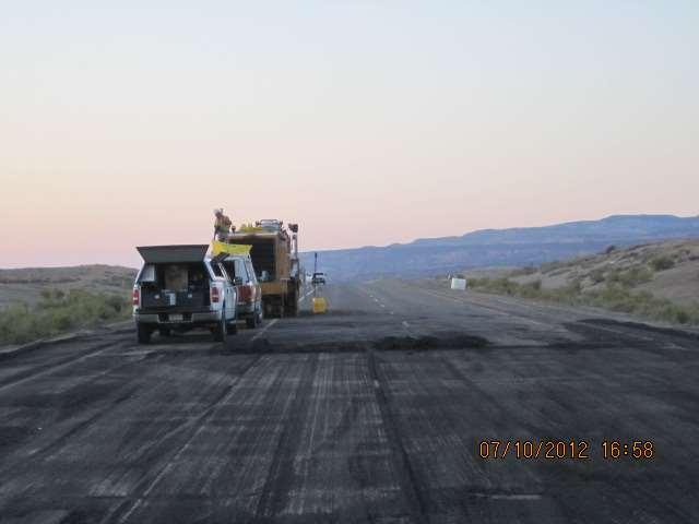
28
29 Scope of Job Began in June, 2013 Survey crew was hired to take a topographic profile of the existing road An intended profile was then determined from the topography Worked with SITECH Rocky Mountain on the operation of the PCS900 system as well as setting up control points at 700 spacing
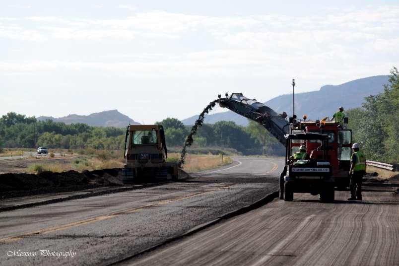
30
31 Scope of Job Operators completed one pass on the outside edge, then turned and came back on the opposite edge of the roadway Milled in a round robin fashion to cover the 38 wide roadway with no tracking in reverse Utilized a multiple UTS setup to cover 2000 segments at a time. Grade checks were performed throughout the milling to ensure proper tolerance
32
33 Why Trimble? Needed to eliminate overrun of concrete and provide an exact profile for the white topping Determined that the advantages of the PCS900 for Milling Machines was a musthave. Highly accurate milling at variable depth and slope Owners of the road wanted it to be milled to an exact profile No stringlines!
34 Results, Achievements, Recognition Successfully milled the entire stretch of roadway in 18 days, nine days per side. Shaved 3 days off the project timeline and delivered significant manpower savings over the scope of the project More competitive bidding for future road mill projects with Trimble Grade Control 3D Milling helped meet ride incentives from CDOT and others that provide extra compensation for completed roadways with extremely smooth rides
35 QUESTIONS?

36 THANK YOU
Advanced Use of Automatic Grade Controls. Jeroen Snoeck Segment Manager Paving Trimble Navigation Ltd.
 Advanced Use of Automatic Grade Controls Jeroen Snoeck Segment Manager Paving Trimble Navigation Ltd. Contents Industry trends driving technology in Heavy & Highway Construction Traditional Grade Control
OCTOBER OTEC Session 75 Stringless 3D Paving
 OCTOBER 03 2018 OTEC Session 75 Stringless 3D Paving Introductions Brian E Girouard, Trimble Inc Sales Engineer Paving Specialist Manager brian_girouard@trimble.com Brad Cunningham, SITECH Ohio SITECH
FEBRUARY Trimble PCS900 3D Milling & 3D Paving
 FEBRUARY 2018 Trimble PCS900 3D Milling & 3D Paving Presenter Kevin Ackley Sitech Michigan Why use 3D Milling and 3D Paving? To build better pavement Structures!!! Sample Engineering Specifications 2D
Kevin Garcia and Brian Girouard February Machine Control Technology in Milling and Paving
 Kevin Garcia and Brian Girouard February 2017 Machine Control Technology in Milling and Paving Brian E Girouard, Milling Paving Compaction Specialist Civil Engineering & Construction Americas Trimble Navigation
Trimble 2D Paving Control System for Pavers
 Trimble 2D Paving for Pavers PCS400 2D Paving Key Advantages The only large 2D paving display is easy to learn operate Split screen option allows one operator to easily monitor both sides of the screed
TRIMBLE PAVING SOLUTIONS MILL FILL
 TRIMBLE PAVING SOLUTIONS MILL FILL better from the ground up Today s road projects require contractors to work faster, with better accuracy, and with tighter control on costs. For the paving contractor,
Pave the Way to Better Profits. Trimble. Paving Solutions TRANSFORMING THE WAY THE WORLD WORKS
 Pave the Way to Better Profits Trimble Paving Solutions TRANSFORMING THE WAY THE WORLD WORKS Solutions for the Complete Paving Job Site Productive, integrated and innovative solutions to keep you on track
TRIMBLE ASPHALT PAVING SOLUTIONS
 TRIMBLE ASPHALT PAVING SOLUTIONS Mill Fill better from the ground up Today s road projects require contractors to work faster, with better accuracy, and with tighter control on costs. For the paving contractor,
3D System. 2D & 3D Systems. Compact Attachments
 3D System 2D & 3D Systems 1 2D System 2D System Systems work off a single plain Flat Single slope Dual Slope Bobcat laser system is 2D 2 Sonic 3 3D System 3D System Works off elevation coordinates setup
Presentation Overview
 Stringless Concrete Paving STRINGLESS CONCRETE PAVING ACPA BUS TOUR AUGUST 5, 2015 Presentation Overview 1) Manufactures 2) Components needed for Stringless Paving 3) Conventional Methods VS Stringless
3D Technology in the Construction Continuum. Alabama DOT Pre-Construction Conference Montgomery AL May 03, 2016
 3D Technology in the Construction Continuum Alabama DOT Pre-Construction Conference Montgomery AL May 03, 2016 Brian E Girouard, Sales Engineer, Milling-Paving-Compaction Specialist Civil Engineering &
ACAF Paving Electronics (Today and Future) TOPCON POSITIONING SYSTEMS / LENGEMANN CORPORATION TRIMBLE NAVIGATION / SITECH NORTH, CENTRAL FLORIDA
 TOPCON POSITIONING SYSTEMS / LENGEMANN CORPORATION TRIMBLE NAVIGATION / SITECH NORTH, CENTRAL FLORIDA") ACAF 2016 ROGER CROFT GREG HASTY TOPCON POSITIONING SYSTEMS / LENGEMANN CORPORATION TRIMBLE NAVIGATION / SITECH NORTH, CENTRAL FLORIDA 2D & 3D Machine Control ROGER CROFT TOPCON POSITIONING SYSTEMS / LENGEMANN
ACAF 2016 ROGER CROFT GREG HASTY TOPCON POSITIONING SYSTEMS / LENGEMANN CORPORATION TRIMBLE NAVIGATION / SITECH NORTH, CENTRAL FLORIDA 2D & 3D Machine Control ROGER CROFT TOPCON POSITIONING SYSTEMS / LENGEMANN
3-D MODELING FOR MACHINE CONTROL
 SHELLY & SANDS JOHN DOWALTER, PE, PS 3-D MODELING FOR MACHINE CONTROL Dale Carnegie Public Speaking Training Ben Stein s Public Speaking Training SHELLY & SANDS JOHN DOWALTER, PE, PS S&S Survey Manager
OPTIMIZING 3D SURFACE CHARACTERISTICS DATA COLLECTION BY RE-USING THE DATA FOR PROJECT LEVEL ROAD DESIGN
 OPTIMIZING 3D SURFACE CHARACTERISTICS DATA COLLECTION BY RE-USING THE DATA FOR PROJECT LEVEL ROAD DESIGN Benoit Petitclerc, P.E. John Laurent, M. Sc Richard Habel, M. Sc., Pavemetrics Systems Inc., Canada
2D CONSTRUCTION SOLUTIONS
 2D CONSTRUCTION SOLUTIONS 2D CONSTRUCTION SOLUTIONS Keep your projects on time and under budget. We have the leadingedge hardware, software, and mobile solutions you need to increase efficiency, improve
Trimble Productivity: Finish Faster with Fewer Machines. TRIMBLE GCS900 GRADE CONTROL SYSTEMS
 Trimble Productivity: Finish Faster with Fewer Machines. TRIMBLE GCS900 GRADE CONTROL SYSTEMS TAKE ThE GUESSWORK OUT OF EARThWORKS. ONLY FROM ThE LEADER. TRIMbLE. The Connected Construction Site An interesting
Automatic 3D control system for SP 15 / SP 15 i / SP 25 / SP 25 i. AutoPilot 2.0
 Automatic 3D control system for SP 15 / SP 15 i / SP 25 / SP 25 i. AutoPilot 2.0 02 03 AutoPilot 2.0 the innovative 3D control system The use of standard 3D machine control systems for the production of
Trimble VISION Positions from Pictures
 Trimble VISION Positions from Pictures This session will cover What Is Trimble VISION? Trimble VISION Portfolio What Do you Need? How Does It Work & How Accurate Is It? Applications Resources Trimble VISION
Mobile LiDAR in Road Surface Quality Control and Renovation - Latest Development of Terrasolid Software
 Geodesy, Mine Survey and Aerial Topography. At the turn of the centuries. Moscow 14 15 February 2013 Mobile LiDAR in Road Surface Quality Control and Renovation - Latest Development of Terrasolid Software
Control System International a.s., Papírenská 114/5, Praha 6, Czech Republic Web site: www. controlsystem.cz,
 129 Consequences of a complex using of 3D approach in the implementation of the road reconstruction - usage of TLS stop&go and usage of paving control system for milling machines Přikryl, M. and Kutil,
James Schneider Advanced Materials and Technology
 (CEC-90153) Minnesota DOT Deploy GCS900, Business Center HCE and VisionLink with the DOTs GEOPAK software to automatically monitor large scale excavation in Carver County James Schneider Advanced Materials
2D CONSTRUCTION SOLUTIONS
 2D CONSTRUCTION SOLUTIONS 2D CONSTRUCTION SOLUTIONS Keep your projects on time and under budget. We have the leadingedge hardware, software, and mobile solutions you need to increase efficiency, improve
GCS900 GRADE CONTROL SySTEmS LK Bu RADE G FINISH
 GCS900 GRADE CONTROL Systems BulK Grade take the guesswork out of earthworks Trimble sets the standard for construction technology by developing highly productive, integrated and innovative solutions for
Release Notes TRIMBLE BUSINESS CENTER. Version 2.50
 Release Notes TRIMBLE BUSINESS CENTER Version 2.50 Corporate office: Trimble Navigation Limited Engineering and Construction Division 5475 Kellenburger Road Dayton, Ohio 45424-1099 USA Phone: +1-937-233-8921
2/19/2018. Who are we? Who am I? What is Scanning? How does scanning work? How does scanning work? Scanning for Today s Surveyors
 2/19/2018 Who are we? Scanning for Today s Surveyors Survey, GIS, and Construction dealer Founded in 1988 Employee Owned Headquartered in Bismarck, ND States covered: ND, SD, MN, MT, WY, CO, UT, ID, WA,
Leica icon grade Intelligent grading systems NEW. igd4 SP System. i n telligent COnstruction
 Leica icon grade Intelligent grading systems NEW igd4 SP System i n telligent COnstruction Leica icon grade Maximize productivity, speed & flexibility The Leica icon grade solutions can revolutionize your
Trimble Business Center Software, v3.30
 Trimble Business Center Software, v3.30 We are pleased to announce a new version of the Trimble Business Center software, version 3.30. This new version includes over 30 new features and enhancements increasing
Innovative solutions from VÖGELE for working with 3D systems
 A WIRTGEN GROUP COMPANY 3D Machine Control Systems Innovative solutions from VÖGELE for working with 3D systems 3D Machine control systems: More than just sensors 3D in action VÖGELE 3D control systems
Detecting and Correcting Localized Roughness Features
 0 0 Detecting and Correcting Localized Features Gary J. Higgins Earth Engineering Consultants, LLC Greenfield Drive Windsor, Colorado 00 Tel: 0--0; Fax: 0--0; Email: garyh@earth-engineering.com Word count:,
SITECH INTERMOUNTAIN YOUR CONSTRUCTION TECHNOLOGY PROVIDER
 SITECH INTERMOUNTAIN YOUR CONSTRUCTION TECHNOLOGY PROVIDER SITECH Intermountain is established in Utah and Nevada as well as in several adjacent counties in Wyoming, Arizona and California and joins the
TRIMBLE WESTMINSTER BUILDING PROJECT / 2013
 TRIMBLE WESTMINSTER BUILDING PROJECT - 2012 / 2013 OVERVIEW Outgrowing its current office facility in Westminster, Colorado, Trimble decided to build a larger campus across the street from their current
New Technologies for Pavement Evaluation
 New Technologies for Pavement Evaluation TxDOT 3-D Pavement Survey Technology For 86 th Annual Transportation Short Course at Texas A&M University, 2012 Dr. Yaxiong (Robin) Huang, Robin.Huang@txdot.gov
Trimble Site EASY-TO-USE RELIABLE ACCURATE
 Trimble Site Positioning Systems ACCURATE RELIABLE EASY-TO-USE more tools for more jobs Estimators Bid Team Site Surveyor Data Manager Site Engineer/Grade Checker Site Foreman/Supervisor Project Manager
Trimble GCSFlex Grade Control System For Excavators
 The Trimble GCSFlex Grade Control System is an easy-to-use, reliable, and affordable machine control system to improve excavator productivity and be more competitive. The system provides real-time grade
Federica Zampa Sineco SpA V. le Isonzo, 14/1, Milan, 20135, Italy
 LYNX MOBILE MAPPER TM : THE NEW SURVEY TECHNOLOGY Federica Zampa Sineco SpA V. le Isonzo, 14/1, Milan, 20135, Italy federica.zampa@sineco.co.it Dario Conforti Optech Incorporated 300 Interchange Way, Vaughan,
Pattern Recognition for Autonomous. Pattern Recognition for Autonomous. Driving. Freie Universität t Berlin. Raul Rojas
 Pattern Recognition for Autonomous Pattern Recognition for Autonomous Driving Raul Rojas Freie Universität t Berlin FU Berlin Berlin 3d model from Berlin Partner Freie Universitaet Berlin Outline of the
GeoSmart Asia Locate 18
 MOBILE MAPPING GeoSmart Asia Locate 18 ESP Associates, P.A. ESP Associates, P.A. ABOUT ESP Founded in 1986 (28 Years of Experience with DOT s) ESP has 14 offices throughout the US 37 States, Canada, and
A Precise Finish Grade in a Fraction of the time
 A Precise Finish Grade in a Fraction of the time INSIDE FRONT www.lasergrader.co.uk A Precise Finish Grade in a Fraction of the time Specification Overall Length (to front blade) 3.81m Overall Width
Trimble Grade Control Systems GCS900 2D for Dozers
 GCS900 2D for Dozers Trimble offers the heavy and highway contractor the broadest range of Grade Control Systems in the industry. From 2D depth, slope, and elevation based to 3D GNSS or Total Station based,
A New Way to Control Mobile LiDAR Data
 A New Way to Control Mobile LiDAR Data Survey control has always been a critically important issue when conducting mobile LiDAR surveys. While the accuracies currently being achieved with the most capable
Trimble SCS900 Site Controller Software for Beginners. Jordan Lawver HCC-6339
 Trimble SCS900 Site Controller Software for Beginners Jordan Lawver HCC-6339 Agenda What is Trimble SCS900 Site Controller Software? Who uses SCS900 Trimble Site Positioning System software portfolio Applications
AUTOCAD CIVIL 2009 AND AUTOCAD CIVIL 3D Road Rehabilitation and Reconstruction with AutoCAD Civil and AutoCAD. Civil 3D
 AUTOCAD CIVIL 2009 AND AUTOCAD CIVIL 3D 2009 Road Rehabilitation and Reconstruction with AutoCAD Civil and AutoCAD Civil 3D 1 Contents Introduction... 3 Introduction to Corridor Targets... 3 Surface Targets...
Civil 3-D PROFILE CREATION
 Civil 3-D PROFILE CREATION 1 Alignment Overview: As in previous CAD versions, an alignment is a line that describes where you intend the centerline of your planned work to be. That s all. But, in Civil
3DMC Reference Guide
 P O S I T I O N I N G S Y S T E M S 3DMC Reference Guide Part Number 7010-0911 Rev. C Copyright Topcon Positioning Systems, Inc. September, 2010 All contents in this manual are copyrighted by Topcon. All
Stringless Paving, Where we are today
 Stringless Paving, Where we are today Anthony Cerisano Vice President Flores Automation & Machine Control 949.923.8966 / acerisano@floresautomation-mc.com February 11, 2016 Presentation Outline 1. Flores
3-D Modeling Implementation
 3-D Modeling Implementation Presented January 31, 2013 Douglas Townes FHWA Resource Center WORKFLOW FOR ELECTRONIC DATA TRANSFER WHEN USING AMG IN CONSTRUCTION Charles Jahren, PhD Iowa State University
ROAD-SCANNER COMPACT APPLICATION FIELDS MAIN FEATURES
 ROAD-SCANNER COMPACT Mobile Mapping System by GEXCEL & SITECO collaboration A smaller mobile system for asset management and cartography suited for ZOLLER & FRÖHLICH PROFILER 9012 laser scanner. 2 + 3
Grade Control. GRADE CONTROL SYSTEMS Topcon. MOTOR GRADER 3D-GPS+, mmgps Plug-and-Play. HYDRAULIC EXCAVATOR X63 3D-GPS+ Plug-and-Play
 GRADE CONTROL SYSTEMS Topcon Grade Control CRAWLER DOZER 3D-MC 2 Plug-and-Play HYDRAULIC EXCAVATOR X63 3D-GPS+ Plug-and-Play MOTOR GRADER 3D-GPS+, mmgps Plug-and-Play PHOTOS MAY INCLUDE OPTIONAL EQUIPMENT
Terrestrial GPS setup Fundamentals of Airborne LiDAR Systems, Collection and Calibration. JAMIE YOUNG Senior Manager LiDAR Solutions
 Terrestrial GPS setup Fundamentals of Airborne LiDAR Systems, Collection and Calibration JAMIE YOUNG Senior Manager LiDAR Solutions Topics Terrestrial GPS reference Planning and Collection Considerations
Leica PowerGrade Intelligent Grading Systems
 Leica PowerGrade Intelligent Grading Systems Leica PowerGrade Leica PowerGrade, the next-generation grade control systems from Leica Geosystems can revolutionise your construction process. It not only
3DMC Reference Guide
 P O S I T I O N I N G S Y S T E M S 3DMC Reference Guide Part Number 7010-0911 Rev. B Copyright Topcon Positioning Systems, Inc. April, 2010 All contents in this manual are copyrighted by Topcon. All rights
Trimble Grade Control Systems GCS900 2D for Motor Graders
 GCS900 2D for Motor Trimble offers the heavy and highway contractor the broadest range of Grade Control in the industry. From 2D laser or sonic based to 3D GNSS or Total Station based, Trimble systems
Aerial and Mobile LiDAR Data Fusion
 Creating Value Delivering Solutions Aerial and Mobile LiDAR Data Fusion Dr. Srini Dharmapuri, CP, PMP What You Will Learn About LiDAR Fusion Mobile and Aerial LiDAR Technology Components & Parameters Project
PE Exam Review - Surveying Demonstration Problem Solutions
 PE Exam Review - Surveying Demonstration Problem Solutions I. Demonstration Problem Solutions... 1. Circular Curves Part A.... Circular Curves Part B... 9 3. Vertical Curves Part A... 18 4. Vertical Curves
Jeffrey A. Schepers P.S. EIT Geospatial Services Holland Engineering Inc. 220 Hoover Blvd, Suite 2, Holland, MI Desk
 Jeffrey A. Schepers P.S. EIT Geospatial Services Holland Engineering Inc. 220 Hoover Blvd, Suite 2, Holland, MI 49423 616-594-5127 Desk 616-322-1724 Cell 616-392-5938 Office Mobile LiDAR - Laser Scanning
Using Mobile LiDAR To Efficiently Collect Roadway Asset and Condition Data. Pierre-Paul Grondin, B.Sc. Surveying
 Using Mobile LiDAR To Efficiently Collect Roadway Asset and Condition Data Pierre-Paul Grondin, B.Sc. Surveying LIDAR (Light Detection and Ranging) The prevalent method to determine distance to an object
Profilograph. Changes in Profiling Technology
 Profilograph Changes in Profiling Technology Lightweight Profiler High Speed Profiler 1 How Does It Work? Lightweight Profiler Laser Sensor 2 The Laser Sensor! Laser samples the pavement 16,000/sec! Samples
Overview of the Trimble TX5 Laser Scanner
 Overview of the Trimble TX5 Laser Scanner Trimble TX5 Revolutionary and versatile scanning solution Compact / Lightweight Efficient Economical Ease of Use Small and Compact Smallest and most compact 3D
Methods to survey, process, and georeference terrestrial LIDAR data to map regional seacliff erosion with uncertainty analysis
 Methods to survey, process, and georeference terrestrial LIDAR data to map regional seacliff erosion with uncertainty analysis Michael Olsen, Liz Johnstone, Adam Young, Scott Ashford, Neal Driscoll, and
Critical Assessment of Automatic Traffic Sign Detection Using 3D LiDAR Point Cloud Data
 1 2 3 4 5 6 7 8 9 10 11 12 13 14 15 16 17 18 19 Critical Assessment of Automatic Traffic Sign Detection Using 3D LiDAR Point Cloud Data Chengbo Ai PhD Student School of Civil and Environmental Engineering
SPAR, ELMF 2013, Amsterdam. Laser Scanning on the UK Highways Agency Network. Hamish Grierson Blom Uk
 SPAR, ELMF 2013, Amsterdam Laser Scanning on the UK Highways Agency Network Hamish Grierson Blom Uk www.blomasa.com www.blom-uk.co.uk Blom UK Part of the Blom Group Blom Group - Europe s largest aerial
Quality Assurance and Quality Control Procedures for Survey-Grade Mobile Mapping Systems
 Quality Assurance and Quality Control Procedures for Survey-Grade Mobile Mapping Systems Latin America Geospatial Forum November, 2015 Agenda 1. Who is Teledyne Optech 2. The Lynx Mobile Mapper 3. Mobile
5/19/16 Starts at 9am
 Toggle full screen mode with this button above Use Chat box to ask Questions Audio also available via phone: 866-823-7699 For assistance, call: 814-865-5355 5/19/16 Starts at 9am http://metrocount.com
ADDING MICROSENSORS AND TRIMBLE SUREPOINT TECHNOLOGY TO SURVEY ROVERS FOR ENHANCED ACCURACY AND PRODUCTIVITY
 BEYOND GNSS ADDING MICROSENSORS AND TRIMBLE SUREPOINT TECHNOLOGY TO SURVEY ROVERS FOR ENHANCED ACCURACY AND PRODUCTIVITY WHITE PAPER BEYOND GNSS: ADDING MICROSENSORS AND TRIMBLE SUREPOINT TECHNOLOGY TO
CHAPTER 01 Basics of Surveying
 CHAPTER 01 Basics of Surveying 1.1 How do plane surveys and geodetic surveys differ? Plane surveying assumes all horizontal measurements are taken on a single plane and all vertical measurements are relative
3D Data Acquisition in Tunnels Optimizing Track Time Using Terrestrial Mobile LiDAR. Scanning. Michael R. Frecks, PLS.
 3D Data Acquisition in Tunnels Optimizing Track Time Using Terrestrial Mobile LiDAR Scanning Michael R. Frecks, PLS President/CEO AREMA 2013 1207 Understanding mobile 3D LiDAR? light detection and ranging
Trimble Grade Control Systems GCS900 2D for Motor Graders
 GCS900 2D for Motor Graders Trimble offers the heavy and highway contractor the broadest range of Grade Control Systems in the industry. From 2D laser or sonic based to 3D GNSS or Total Station based,
PLAN PREPARATION GUIDE
 PLAN PREPARATION GUIDE CHAPTER 5 EXISTING TOPOGRAPHY & PROFILE PRESENT RIGHT-OF-WAY PROJECT PREPARATION GUIDELINES AND CRITERIA SECTION DESCRIPTION PAGE 1 Existing Topography, Profile, and Cross Sections
Road Surface Texture Evaluation with 3-D Laser Data
 Road Surface Texture Evaluation with -D Laser Data Shuvo Islam 1, Mustaque Hossain, and Humaira Zahir ( 1 Kansas State University, Manhattan, KS, USA, sislam@ksu.edu) ( Kansas State University, Manhattan,
3DMC / 3DXi Create a network equipment configuration. 2. Enter IP address & NTRIP information.
 3DMC / 3DXi 6.11.03 1. Added Network & Modem Support Added support for Wavecom and SmallTouch modems. Added RTCM 3.0 support Improvements made connecting to GPS networks. Network setup example: 1. Create
Form DOT F (8-72) Technical Report Documentation Page 2. Government Accession No. 3. Recipient's Catalog No.
 Technical Report Documentation Page 2. Government Accession No. 3. Recipient's Catalog No.") 1. Report No. FHWA/TX-09/5-4577-03-P1 4. Title and Subtitle PAVE-IR OPERATOR S MANUAL VERSION 1.3 Technical Report Documentation Page 2. Government Accession No. 3. Recipient's Catalog No. 5. Report Date
1. Report No. FHWA/TX-09/5-4577-03-P1 4. Title and Subtitle PAVE-IR OPERATOR S MANUAL VERSION 1.3 Technical Report Documentation Page 2. Government Accession No. 3. Recipient's Catalog No. 5. Report Date
T-SCAN 3 3D DIGITIZING
 T-SCAN 3 3D DIGITIZING 2 T-SCAN 3: THE HANDHELD LASER SCANNER Launching the innovative concept of an intuitive-to-use high-precision laser scanner a few years ago, Steinbichler Optotechnik, as the first
Commercial suas The Right Tool for the Right Job
 Commercial suas The Right Tool for the Right Job Presentation Objectives Overview of current data collection technologies UAS Systems Overview Surveyor 2.0 Project Case Study Mobile LiDAR & suas How Do
Site calibration improvements for GPS operations. Stakeout line changes. Call API toll free (888)
") Welcome to the Q4 Edition of the API Newsletter. This newsletter is being presented as an information tool to present new product information. If there are any questions regarding any products or services
Welcome to the Q4 Edition of the API Newsletter. This newsletter is being presented as an information tool to present new product information. If there are any questions regarding any products or services
LiDAR & Orthophoto Data Report
 LiDAR & Orthophoto Data Report Tofino Flood Plain Mapping Data collected and prepared for: District of Tofino, BC 121 3 rd Street Tofino, BC V0R 2Z0 Eagle Mapping Ltd. #201 2071 Kingsway Ave Port Coquitlam,
Leica icon grade Intelligent grading solutions
 Leica icon grade Intelligent grading solutions intelligent CONstruction leica-geosystems.com Leica icon grade igd2 and igd3 Complete 2D and 3D solutions for all large earth moving projects igd2, icon grade
Indoor. Heritage Preservation CAD versus Cloud. inside. Applanix and CSIRO. Grows with LiDAR. Vol. 2 Issue 4 ABOVE & BEYOND. ipad & Tablet Ready!
 inside Indoor Mapping Applanix and CSIRO SMALL BUSINESS Grows with LiDAR Heritage Preservation CAD versus Cloud Vol. 2 Issue 4 ABOVE & BEYOND ipad & Tablet Ready! RE-MODELING THE MIXMASTER From Mobile
Real Time Multi-Sensor Data Acquisition and Processing for a Road Mapping System
 Real Time Multi-Sensor Data Acquisition and Processing for a Road Mapping System by Xiang Luo A thesis submitted for the degree of Master of Engineering (Research) Faculty of Engineering and Information
Leica High-Definition Surveying Systems. Leica HDS3000. The Industry Standard for High-Definition Surveying
 Leica High-Definition Surveying Systems Leica HDS3000 The Industry Standard for High-Definition Surveying HDS High-Definition Surveying TM : Laser Scanning Redefined High-Definition Surveying, or HDS,
The Leica HDS Family. The Right Tool for the Job HDS3000 HDS2500 HDS4500. Cyclone & CloudWorx. Press the QuickScan button to define the field-of-view.
 HDS2500 High accuracy scanner, ideal for fixed or raised installations when leveled tripod mounting is not practical, or areas with less stringent field-of-view requirements. The Leica HDS Family Time-of-flight
Trimble s RoadLink Utility Tutorials
 Trimble s RoadLink utility is an interface between third-party road definitions and Trimble survey devices. It lets you import or key in road definitions, view them graphically, edit them if required,
LaserGuard LG300 area alarm system. 3D laser radar alarm system for motion control and alarm applications. Instruction manual
 LaserGuard LG300 area alarm system 3D laser radar alarm system for motion control and alarm applications Instruction manual LaserGuard The LaserGuard program is the user interface for the 3D laser scanner
Sight Distance on Vertical Curves
 Iowa Department of Transportation Office of Design Sight Distance on Vertical Curves 6D-5 Design Manual Chapter 6 Geometric Design Originally Issued: 01-04-0 Stopping sight distance is an important factor
Creating Value. Delivering Solutions
 Creating Value Delivering Solutions LIDAR...Light Detection and Ranging Technology from the military (1960 s) Rapid, highly accurate DEM coverage of large to medium sized project areas Feature extraction
2/9/2016. Session Agenda: Implementing new Geospatial Technologies for more efficient data capture
 Implementing new Geospatial Technologies for more efficient data capture Jay Haskamp Applied Geospatial Engineer Steve Richter VP Sales Session Agenda: Today s changing technologies and what lies ahead
TECHNICAL NOTES TRIMBLE SURVEY CONTROLLER SOFTWARE
 TRIMBLE SURVEY CONTROLLER SOFTWARE TECHNICAL NOTES The Trimble Survey Controller software is the data collection solution that will make your survey work faster, easier, and more productive than ever before.
3D Mapping of Pavements: Geometry and DTM
 BUDAPEST, HUNGARY 2015 3D Mapping of Pavements: Geometry and DTM John Laurent, Pavemetrics inc. www.pavemetrics.com The Sensor Technology Most Relied-on by DOTs worldwide Collect Your Own, or Contract-out
Cross Slope Verification Using Mobile Scanning on SCDOT Highways. Final Report. Prepared by:
 Cross Slope Verification Using Mobile Scanning on SCDOT Highways Final Report Prepared by: Dr. Wayne A. Sarasua, Dr. Jennifer H. Ogle Department of Civil Engineering Clemson University Dr. William J. Davis
Displayed with permission The American Surveyor September Copyright 2009 Cheves Media
 All photos by Rich Oleksy Project Design Consultants used the Trimble RMT (Remote Measuring Target) 600 SLR (Super Long Range) Prism as a backsight. The prism is shown set up near the cliff edge along
SHALLOW SOUNDING BATHYMETRIC USING MULTIBEAM ECHOSOUNDER AND TOPOGRAPHIC LASER SCANNER
 SHALLOW SOUNDING BATHYMETRIC USING MULTIBEAM ECHOSOUNDER AND TOPOGRAPHIC LASER SCANNER BY : NURSUGI, TRI PATMASARI & KHAFID GEOSPASIAL INFORMATION AGENCY AMSTERDAM, 11-14 NOVEMBER 2014 Indonesia coastline
Mobile Mapping Solutions for Ohio s Integrated Transportation Network. Brian Foster, CP
 Mobile Mapping Solutions for Ohio s Integrated Transportation Network Brian Foster, CP About Woolpert Established in 1911 Over 600 Professionals 25 Offices $12,000,000 invested in new technology in last
Trimble Mobile Mapping Portfolio
 Jörg Amend Sales Account Manager SEPTEMBER 20 2017 Trimble Mobile Mapping Portfolio Current challenges and trends Multible Sensors connecting to one Echosystem Trimble RealWorks Trimble Edgewise TBC Pathfinder
IP-S2 HD. High Definition 3D Mobile Mapping System
 IP-S2 HD High Definition 3D Mobile Mapping System Integrated, turnkey solution Georeferenced, Time-Stamped, Point Clouds and Imagery High Density, Long Range LiDAR sensor for ultimate in visual detail
Title: Improving Your InRoads DTM. Mats Dahlberg Consultant Civil
 Title: Improving Your InRoads DTM Mats Dahlberg Consultant Civil Improving Your InRoads Digital Terrain Model (DTM) Digital Terrain Model A digital representation of a surface topography or terrain composed
The YellowScan Surveyor: 5cm Accuracy Demonstrated
 The YellowScan Surveyor: 5cm Accuracy Demonstrated Pierre Chaponnière1 and Tristan Allouis2 1 Application Engineer, YellowScan 2 CTO, YellowScan Introduction YellowScan Surveyor, the very latest lightweight
Increasing Productivity/Quality through Better Utilization of Dimensional Data
 Increasing Productivity/Quality through Better Utilization of Dimensional Data By John Reed www.accurexmeasure.com Dimensional measurement is accepted as standard operating procedure Geometric Dimensioning
DPS900 SOFTWARE QUICK REFERENCE CARD FOR PILING OPERATORS
 DPS900 SOFTWARE QUICK REFERENCE CARD FOR PILING OPERATORS This document contains information for piling operators on how to use the Trimble DPS900 software. For information for supervisors, please refer
Pathway Services Inc. Technology Presentation
 Lauren Tran Budapest, Hungary 2015 Largest Vendor of this kind in the U.S. Largest Fleet of Full Service Vehicles in U.S. (26) More Than 5 Million Kilometers Collected Using Our Equipment Nearly 50% of
Product Leica Infinity. Date July 13 t, From Kevin Hanson
 Product Leica Infinity Date July 13 t, 2018 From Kevin Hanson Leica Geosystems AG Heinrich-Wild-Strasse CH-9435 Heerbrugg Switzerland www.leica-geosystems.com Table of Contents 1 About Infinity v3.0.1...
Evaluating the Performance of a Vehicle Pose Measurement System
 Evaluating the Performance of a Vehicle Pose Measurement System Harry Scott Sandor Szabo National Institute of Standards and Technology Abstract A method is presented for evaluating the performance of