Georeferencing West Virginia DOT s Roadside Assets: An Asset Inventory Case Study. Geoff Dew April 13,
|
|
|
- Clyde Shields
- 5 years ago
- Views:
Transcription
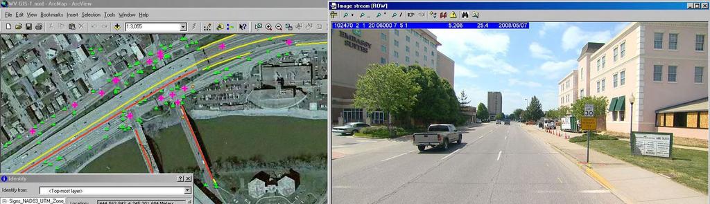
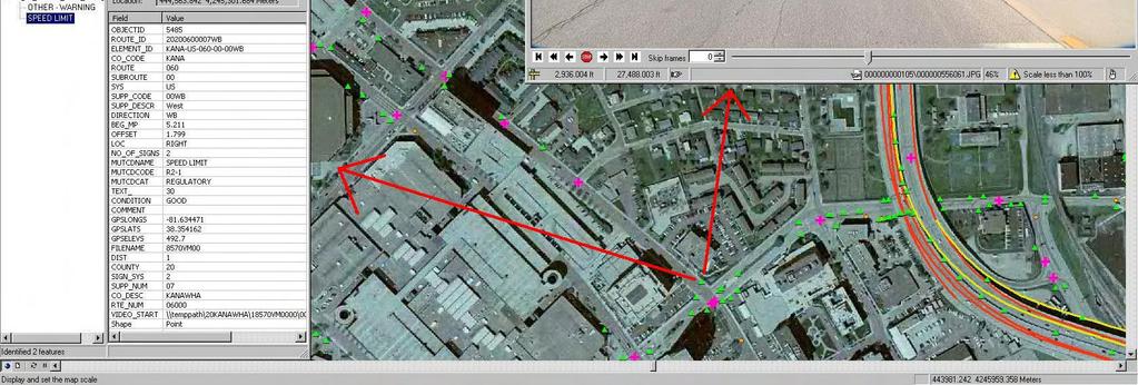
1 : An Asset Inventory Case Study Geoff Dew April 13, 2010
2 General Project Scope 17,817 miles collected across all systems. System Type Delivered Miles 1 Interstates US Routes WV Routes County Routes State Park & Forest Routes Federal Aid Non-State HARP Total 17, Pavement Distress including Roughness, Rutting, Faulting, Pavement Cracking, Road Geometry, GPS Data and Pavement Images. Roadside Asset Inventory
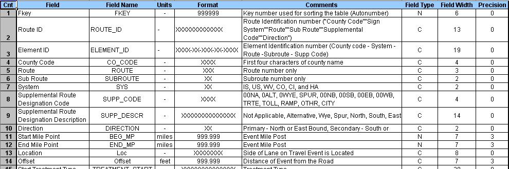
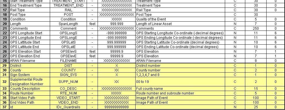
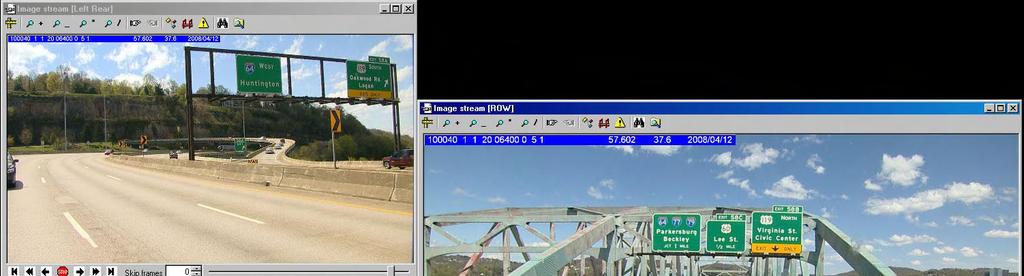
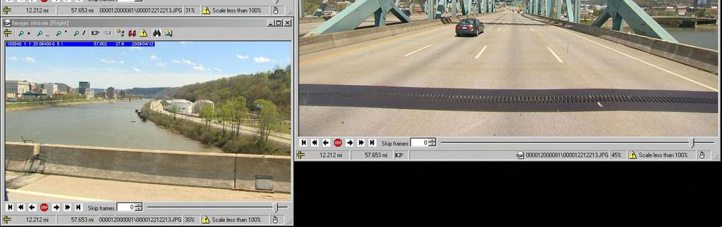
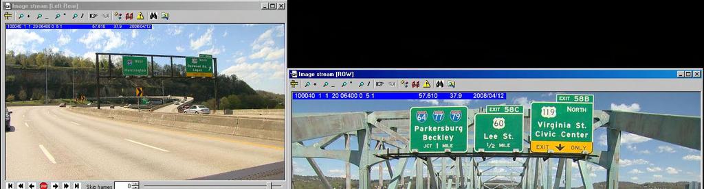
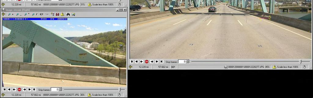
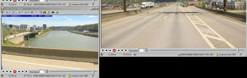
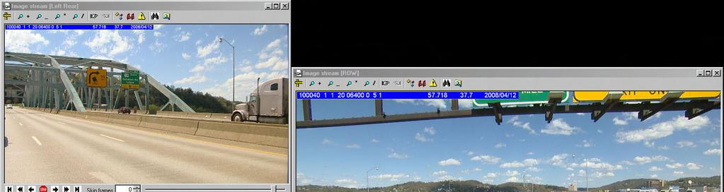
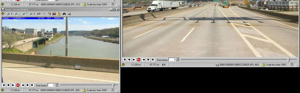
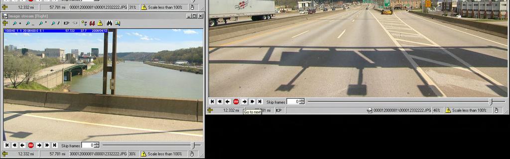
3 Roadside Asset Project Details Right of Way Images 3 HD camera setup facing (Forward 90 o, Right 53 o & Left Rear 53 o ) providing georeferenced images at a foot interval which translates to over 4.45 million images delivered for this project. Assets to be inventory include; Bridges, Guardrails, Intersections, Lane Widths, and Signs (standard & non-standard MUTCD signs; no private signs inventoried). Attributes to Collect Bridges Guardrails Intersections Lane Widths Signs Start & End Location Start & End Location Location Location Location Length Offset Intersection Type Width Offset Start & End Treatment Type Rail Type Post Type Condition Length # of Signs on Support MUTCD Name MUTCD Code MUTCD Category Sign Text Condition
4
5 Data Collection
6 Distance Measuring Instrument (DMI) DMI utilizes a precision optical shaft encoder that is mounted on the left rear driving wheel. The DMI records 2,000 pulses per revolution. Accuracy is ±0.02% of the linear distance traveled. Ensures accurate low speed roughness measurements down to 20 km/h (12.5 mph).
7 GPS Data Trimble System Applanix POS LV (Position and Orientation System) GPS Data for every second of collection is stored on the ARAN Two antennas provide the vehicle heading

8 GPS Data Real Time GPS Data Collection to ensure proper collection and referencing. Inertial referencing system allows for fill in of lost GPS data. Post-processing of GPS can fill in to the of a second
9 Issues Weather / Late winter collection affecting small percentage of overall project total miles Remote collection on some one lane mountainous county routes GPS in remote areas Solutions Additional ARAN assignments, some re-scheduling and a little patience. Accepting a lower collection run rate on the County routes (ARAN can usually collect in the neighborhood of 60 miles per day, on this project they were in the range. ARAN subsystems and post processing greatly reduced these issues.

10 Asset Extraction
11
12
13
14
15
16
17
18
19
20

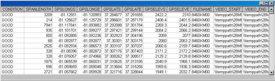
21 Guardrail Delivery Table
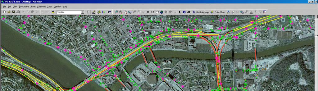
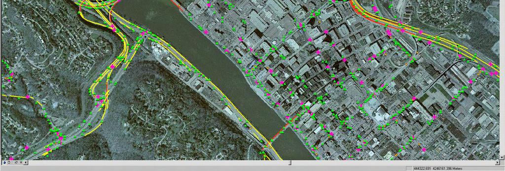
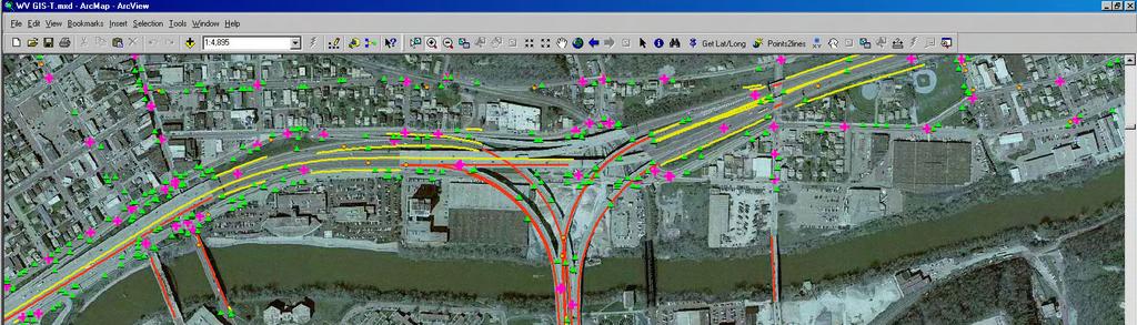
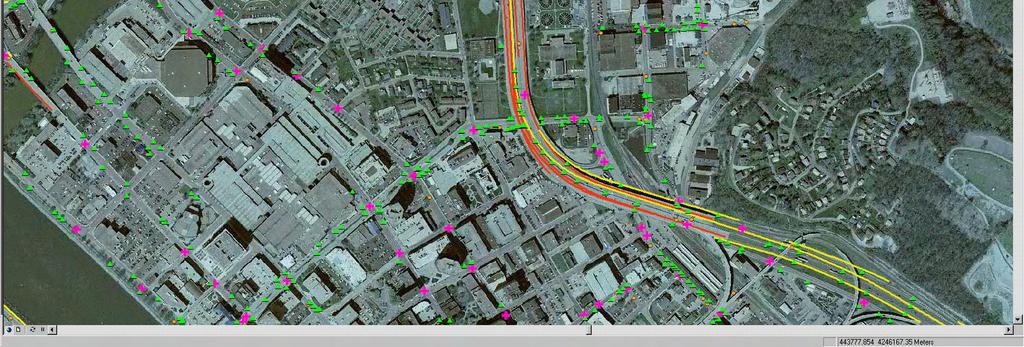
22 State of West Virginia Ortho Imagery
23 Georeferencing West Virginia DOT s Roadside Assets 4,232 Bridges 40,063 Guardrails
24 33,638 Intersections 63,102 Lane Widths
25 222,823 Signs
26 363,858 Total Assets Delivered Assets Per Mile
27
28
29
30 Net Results of Project Over 350,000 individual roadside assets delivered without having to risk the safety of any road crews being out in the field. Almost 18,000 miles processed in a small fraction of the time it would take manually. Can add or edit additional data fields such as updated asset images, conditions & attribute changes or even future work orders. Spatially delivered data, that is easy to use and can be imported into your various GIS or Asset Management Systems that provides the perfect base to your inventory. A great starting point to work from as you move forward managing and tracking these roadside assets.
31 Thank You! Stop by our booth for a further look or additional information.
Pathway Services Inc. Technology Presentation
 Lauren Tran Budapest, Hungary 2015 Largest Vendor of this kind in the U.S. Largest Fleet of Full Service Vehicles in U.S. (26) More Than 5 Million Kilometers Collected Using Our Equipment Nearly 50% of
New Technologies for Pavement Evaluation
 New Technologies for Pavement Evaluation TxDOT 3-D Pavement Survey Technology For 86 th Annual Transportation Short Course at Texas A&M University, 2012 Dr. Yaxiong (Robin) Huang, Robin.Huang@txdot.gov
GeoSmart Asia Locate 18
 MOBILE MAPPING GeoSmart Asia Locate 18 ESP Associates, P.A. ESP Associates, P.A. ABOUT ESP Founded in 1986 (28 Years of Experience with DOT s) ESP has 14 offices throughout the US 37 States, Canada, and
Using Mobile LiDAR To Efficiently Collect Roadway Asset and Condition Data. Pierre-Paul Grondin, B.Sc. Surveying
 Using Mobile LiDAR To Efficiently Collect Roadway Asset and Condition Data Pierre-Paul Grondin, B.Sc. Surveying LIDAR (Light Detection and Ranging) The prevalent method to determine distance to an object
Aerial and Mobile LiDAR Data Fusion
 Creating Value Delivering Solutions Aerial and Mobile LiDAR Data Fusion Dr. Srini Dharmapuri, CP, PMP What You Will Learn About LiDAR Fusion Mobile and Aerial LiDAR Technology Components & Parameters Project
IP-S2 HD. High Definition 3D Mobile Mapping System
 IP-S2 HD High Definition 3D Mobile Mapping System Integrated, turnkey solution Georeferenced, Time-Stamped, Point Clouds and Imagery High Density, Long Range LiDAR sensor for ultimate in visual detail
Critical Assessment of Automatic Traffic Sign Detection Using 3D LiDAR Point Cloud Data
 1 2 3 4 5 6 7 8 9 10 11 12 13 14 15 16 17 18 19 Critical Assessment of Automatic Traffic Sign Detection Using 3D LiDAR Point Cloud Data Chengbo Ai PhD Student School of Civil and Environmental Engineering
Mobile Mapping Solutions for Ohio s Integrated Transportation Network. Brian Foster, CP
 Mobile Mapping Solutions for Ohio s Integrated Transportation Network Brian Foster, CP About Woolpert Established in 1911 Over 600 Professionals 25 Offices $12,000,000 invested in new technology in last
A New Direction in GIS Data Collection or Why Are You Still in the Field?
 GeoAutomation The Mobile Mapping System Survey-Enabled Imagery A New Direction in GIS Data Collection or Why Are You Still in the Field? Presentation to: URISA BC GIS Technology Showcase January 19, 2011
ROAD SURFACE STRUCTURE MONITORING AND ANALYSIS USING HIGH PRECISION GPS MOBILE MEASUREMENT SYSTEMS (MMS)
") ROAD SURFACE STRUCTURE MONITORING AND ANALYSIS USING HIGH PRECISION GPS MOBILE MEASUREMENT SYSTEMS (MMS) Bonifacio R. Prieto PASCO Philippines Corporation, Pasig City, 1605, Philippines Email: bonifacio_prieto@pascoph.com
ROAD SURFACE STRUCTURE MONITORING AND ANALYSIS USING HIGH PRECISION GPS MOBILE MEASUREMENT SYSTEMS (MMS) Bonifacio R. Prieto PASCO Philippines Corporation, Pasig City, 1605, Philippines Email: bonifacio_prieto@pascoph.com
Federica Zampa Sineco SpA V. le Isonzo, 14/1, Milan, 20135, Italy
 LYNX MOBILE MAPPER TM : THE NEW SURVEY TECHNOLOGY Federica Zampa Sineco SpA V. le Isonzo, 14/1, Milan, 20135, Italy federica.zampa@sineco.co.it Dario Conforti Optech Incorporated 300 Interchange Way, Vaughan,
OPTIMIZING 3D SURFACE CHARACTERISTICS DATA COLLECTION BY RE-USING THE DATA FOR PROJECT LEVEL ROAD DESIGN
 OPTIMIZING 3D SURFACE CHARACTERISTICS DATA COLLECTION BY RE-USING THE DATA FOR PROJECT LEVEL ROAD DESIGN Benoit Petitclerc, P.E. John Laurent, M. Sc Richard Habel, M. Sc., Pavemetrics Systems Inc., Canada
Jeffrey A. Schepers P.S. EIT Geospatial Services Holland Engineering Inc. 220 Hoover Blvd, Suite 2, Holland, MI Desk
 Jeffrey A. Schepers P.S. EIT Geospatial Services Holland Engineering Inc. 220 Hoover Blvd, Suite 2, Holland, MI 49423 616-594-5127 Desk 616-322-1724 Cell 616-392-5938 Office Mobile LiDAR - Laser Scanning
IP-S2 HD HD IP-S2. 3D Mobile Mapping System. 3D Mobile Mapping System
 HD HD 3D Mobile Mapping System 3D Mobile Mapping System Capture Geo-referenced, Time-Stamped Point Clouds and Imagery 3D Scanning of Roadside Features 360º Camera for Spherical Image Capture Dual Frequency
An Overview of Applanix.
 An Overview of Applanix The Company The Industry Leader in Developing Aided Inertial Technology Founded on Canadian Aerospace and Defense Industry Expertise Providing Precise Position and Orientation Systems
Recent Innovations in the Management of Irish National Roads
 Recent Innovations in the Management of Irish National Roads Dr. Kieran Feighan PMS Ray McGowan PMS Tom Casey NRA (Ireland) Andrew O Sullivan NRA (Ireland) NRA Pavement Management System dtims version
Cross Slope Collection using Mobile Lidar
 Cross Slope Collection using Mobile Lidar ACEC/SCDOT Annual Meeting December 2, 2015 Introduction Adequate cross slopes on South Carolina Interstates result in: Proper drainage Enhance driver safety by
Essentials for professional use
 Road Surveys using smartphones Essentials for professional use June 2016 - App version 2.1.8- This guide gives a short introduction and briefly describes how to: 1. Collect road roughness data + auto photos
Machine Learning Powered Roadside Asset Extraction using LiDAR. Reza Malehmir, Ph.D., Project Engineer, Tetra Tech Canada
 Machine Learning Powered Roadside Asset Extraction using LiDAR Reza Malehmir, Ph.D., Project Engineer, Tetra Tech Canada Christopher Coram, M.Sc. Project Scientist, Tetra Tech Canada David Firbank, AScT,
Trimble Mobile Mapping Portfolio
 Jörg Amend Sales Account Manager SEPTEMBER 20 2017 Trimble Mobile Mapping Portfolio Current challenges and trends Multible Sensors connecting to one Echosystem Trimble RealWorks Trimble Edgewise TBC Pathfinder
COMMISSION POLICY POLICY #9.16
 COMMISSION POLICY POLICY #9.16 SUBJECT: Public Right-of-Way Encroachments and Regulations for Mailboxes and Newspaper Delivery Boxes DATE ADOPTED PAGE (BCC MINUTES) February 19, 2008 Page 26 OBSOLETE VERSIONS
3D Mapping of Pavements: Geometry and DTM
 BUDAPEST, HUNGARY 2015 3D Mapping of Pavements: Geometry and DTM John Laurent, Pavemetrics inc. www.pavemetrics.com The Sensor Technology Most Relied-on by DOTs worldwide Collect Your Own, or Contract-out
Multi-Speed Deflectometer. An innovative tool for local authority network asset management
 Multi-Speed Deflectometer An innovative tool for local authority network asset management What is the MSD? Falling Weight Deflectometer The Multi-Speed Deflectometer (MSD) is a new, innovative technique
Minnesota Department of Transportation Metro Barrier Extraction and LiDAR Project
 Minnesota Department of Transportation Metro Barrier Extraction and LiDAR Project Trisha Stefanksi, Primary Author Minnesota Department of Transportation June 2014 Research Project Final Report 2014-22
Mobile Mapping and Navigation. Brad Kohlmeyer NAVTEQ Research
 Mobile Mapping and Navigation Brad Kohlmeyer NAVTEQ Research Mobile Mapping & Navigation Markets Automotive Enterprise Internet & Wireless Mobile Devices 2 Local Knowledge & Presence Used to Create Most
VISTA OPENGEO TRACK GEOMETRY SYSTEM COMPARATIVE ADVANTAGES
 VISTA OPENGEO TRACK GEOMETRY SYSTEM COMPARATIVE ADVANTAGES Vista Instrumentation LLC 6025 Marthas Glen Road Columbia, South Carolina 29209 USA Phone: +1 (803) 429 8203 Email: info@vistainstrumentation.com
RPMA - Roadway Project Mapping Application
 RPMA - Roadway Project Mapping Application RPMA Training Documentation Version: 1/9/2018 Title of Report 1 Table of Contents Table of Contents...2 Background Info on Roadway Project Mapping Application...3
Trimble Indoor Mobile Mapping Solution
 Kevin Perkins Applanix Corp. NATIONAL SURVEYING, MAPPING & GEOSPATIAL CONFERENCE - MARCH 13-17, 2017 Trimble Indoor Mobile Mapping Solution Why Indoor Mapping? The need: As-built maps/models of indoor
Aided-inertial for Long-term, Self-contained GPS-denied Navigation and Mapping
 Aided-inertial for Long-term, Self-contained GPS-denied Navigation and Mapping Erik Lithopoulos, Louis Lalumiere, Ron Beyeler Applanix Corporation Greg Spurlock, LTC Bruce Williams Defense Threat Reduction
ROAD-SCANNER COMPACT APPLICATION FIELDS MAIN FEATURES
 ROAD-SCANNER COMPACT Mobile Mapping System by GEXCEL & SITECO collaboration A smaller mobile system for asset management and cartography suited for ZOLLER & FRÖHLICH PROFILER 9012 laser scanner. 2 + 3
Overview of the Trimble TX5 Laser Scanner
 Overview of the Trimble TX5 Laser Scanner Trimble TX5 Revolutionary and versatile scanning solution Compact / Lightweight Efficient Economical Ease of Use Small and Compact Smallest and most compact 3D
2-4 April 2019 Taets Art and Event Park, Amsterdam CLICK TO KNOW MORE
 Co-Host Host 2-4 April 2019 Taets Art and Event Park, Amsterdam CLICK TO KNOW MORE Presentation Outline review modern survey methodologies available to support railway requirements measuring everything
City of San Antonio Utilizing Advanced Technologies for Stormwater System Mapping and Condition Assessments
 City of San Antonio Utilizing Advanced Technologies for Stormwater System Mapping and Condition Assessments Prepared for: Prepared by Noelle Gaspard, PE, GISP, CFM Agenda Purpose Project Overview Challenges
Pavement Preservation and the Role of Bituminous Surface Treatments A Washington State View. Minnesota Pavement Conference February 14, 2008
 Pavement Preservation and the Role of Bituminous Surface Treatments A Washington State View Minnesota Pavement Conference February 14, 2008 1 The Situation 2 WSDOT policy, in essence, mandated use of BSTs
3D laser road profiling for the automated measurement of road surface conditions and geometry.
 3D laser road profiling for the automated measurement of road surface conditions and geometry. John Laurent 1, Jean François Hébert 1, Daniel Lefebvre 2, Yves Savard 3 1 Pavemetrics Systems inc., Canada
Chapters 1 9: Overview
 Chapters 1 9: Overview Chapter 1: Introduction Chapters 2 4: Data acquisition Chapters 5 9: Data manipulation Chapter 5: Vertical imagery Chapter 6: Image coordinate measurements and refinements Chapters
Aided-inertial for GPS-denied Navigation and Mapping
 Aided-inertial for GPS-denied Navigation and Mapping Erik Lithopoulos Applanix Corporation 85 Leek Crescent, Richmond Ontario, Canada L4B 3B3 elithopoulos@applanix.com ABSTRACT This paper describes the
Vehicle Localization. Hannah Rae Kerner 21 April 2015
 Vehicle Localization Hannah Rae Kerner 21 April 2015 Spotted in Mtn View: Google Car Why precision localization? in order for a robot to follow a road, it needs to know where the road is to stay in a particular
Airborne and Mobile LiDAR for Transport Corridor Survey Dr. Bharat Lohani Director, Geokno India Pvt. Ltd. & Professor, Geoinformatics IIT Kanpur
 www.geokno.com Airborne and Mobile LiDAR for Transport Corridor Survey Dr. Bharat Lohani Director, Geokno India Pvt. Ltd. & Professor, Geoinformatics IIT Kanpur Geokno has executed and is executing multiple
DELAWARE COUNTY SECONDARY ROAD DEPARTMENT POLICY AND PROCEDURE MEMORANDUM
 DELAWARE COUNTY SECONDARY ROAD DEPARTMENT POLICY AND PROCEDURE MEMORANDUM PPM #17, 2003 SUBJECT: Mailbox Installation in County Rights of Way Problem: Highway and roadside safety is the primary reason
Detecting and Correcting Localized Roughness Features
 0 0 Detecting and Correcting Localized Features Gary J. Higgins Earth Engineering Consultants, LLC Greenfield Drive Windsor, Colorado 00 Tel: 0--0; Fax: 0--0; Email: garyh@earth-engineering.com Word count:,
CONNECTED VEHICLE COMMUNICATIONS IN A RURAL SETTING
 www.inl.gov CONNECTED VEHICLE COMMUNICATIONS IN A RURAL SETTING Ira Pray, Fleet Manager Idaho National Laboratory NRITS October 2016 Chattanooga, TN Topics Background Project Needs and Objectives Dedicated
TRANSPORTATION DEPARTMENT Business Plan
 TRANSPORTATION DEPARTMENT 2018 Business Plan Today s Agenda Mission Department Overview Planning Initiatives Commission Priorities and 2018 Budget Requests Five-year Plan Department of Transportation Mission
Pattern Recognition for Autonomous. Pattern Recognition for Autonomous. Driving. Freie Universität t Berlin. Raul Rojas
 Pattern Recognition for Autonomous Pattern Recognition for Autonomous Driving Raul Rojas Freie Universität t Berlin FU Berlin Berlin 3d model from Berlin Partner Freie Universitaet Berlin Outline of the
Paul DiGiacobbe, PE, DBIA MASER Consulting Ryan Putt, PE HNTB Corporation Kevin Poad, PE HNTB Corporation
 Paul DiGiacobbe, PE, DBIA MASER Consulting Ryan Putt, PE HNTB Corporation Kevin Poad, PE HNTB Corporation Introduction Using LiDAR to Manage Safety Assets SPEED the acquisition phase is being performed
Mailbox Installation and Damage Replacement Policy
 Mailbox Installation and Damage Replacement Policy Mailboxes represent obstructions within road right-of-way and hazards to the traveling public and the Lawrence County Engineer encourages mailbox installations
JANUARY 2017 WATER S END. Mobile Mapping. Station to Station. Decided Guidance Indoor application. Implementing BIM. A fixed boundary R E YEARS
 JANUARY 2017 WATER S END Mobile Mapping Station to Station Decided Guidance Indoor application Implementing BIM A fixed boundary R LEB ATING E C 30 YEARS Indoor Mobile Mapping A unique approach to interior
Trimble VISION Positions from Pictures
 Trimble VISION Positions from Pictures This session will cover What Is Trimble VISION? Trimble VISION Portfolio What Do you Need? How Does It Work & How Accurate Is It? Applications Resources Trimble VISION
inspiring innovative Infratech Jyväskylä infra3d unique simplify 12 May 2017 Manuel Dätwyler Product Management infra3d
 inspiring Infratech Jyväskylä infra3d 12 May 2017 Manuel Dätwyler Product Management infra3d simplify unique innovative What s the issue? «cost-intensive infrastructure management» 2 What are yours subjects
A New Rutting Measurement Method Using Emerging 3D Line-Laser-Imaging System
 Technical Paper ISSN 1997-1400 Int. J. Pavement Res. Technol. 6(5):667-672 Copyright @ Chinese Society of Pavement Engineering A New Rutting Measurement Method Using Emerging 3D Line-Laser-Imaging System
Continuous Road Surface Distress Detection
 Continuous Road Surface Distress Detection PI: Christoph Mertz, The Robotics Institute, Carnegie Mellon University Research team: Martial Hebert, Sobhagya Jose, Karan Sharma, Srivatsan Varadharajan, Lars
(Subsea) Keith Vickery Zupt LLC
 Keith Vickery Zupt LLC") (Subsea) Keith Vickery Zupt LLC kv@zupt.com Offshore subsea infrastructure surveys (pipeline inspection, well, XT, and manifold inspections) are required to ensure compliance with both internal operator,
(Subsea) Keith Vickery Zupt LLC kv@zupt.com Offshore subsea infrastructure surveys (pipeline inspection, well, XT, and manifold inspections) are required to ensure compliance with both internal operator,
3D Laser Imaging for Pavement Survey at 60 mph and True 1mm Resolution
 3D Laser Imaging for Pavement Survey at 60 mph and True 1mm Resolution Kelvin C. P. Wang Oklahoma State University & WayLink kelvin.wang@okstate.edu 2013 Arizona Pavements/Materials Conference ASU MU,
Appendix A Existing Surface Utilities
 Appendix A Existing Surface Utilities PRELIMINARY INFRASTRUCTURE STUDY PROPOSED DUSEL SITE GILES COUNTY, VIRGINIA Prepared for: Kimballton Deep Underground Science and Engineering Laboratory Kimballton
Trimble MX2 mobile mapping
 Trimble MX2 mobile mapping user applications Point clouds within your reach The Trimble MX2 is a vehicle-mounted spatial imaging system which combines high resolution laser scanning and panoramic cameras
APPLICATION OF AERIAL VIDEO FOR TRAFFIC FLOW MONITORING AND MANAGEMENT
 Pitu Mirchandani, Professor, Department of Systems and Industrial Engineering Mark Hickman, Assistant Professor, Department of Civil Engineering Alejandro Angel, Graduate Researcher Dinesh Chandnani, Graduate
Precision Roadway Feature Mapping Jay A. Farrell, University of California-Riverside James A. Arnold, Department of Transportation
 Precision Roadway Feature Mapping Jay A. Farrell, University of California-Riverside James A. Arnold, Department of Transportation February 26, 2013 ESRA Fed. GIS Outline: Big picture: Positioning and
INPUT DATA PROCEDURES
 79 SECTION 7 INPUT DATA PROCEDURES This section describes the forms and message boxes used to enter input data for an RSRAP optimization problem. These forms and message boxes implement Steps 1 through
Mobile Laser Scanning Technology for Surveying Application: From Data Collection to End-Products
 Mobile Laser Scanning Technology for Surveying Application: From Data Collection to End-Products Valerie USSYSHKIN, Canada Key words: laser scanning, remote sensing, professional practice, mobile lidar;
Emergency Response: How dedicated short range communication will help in the future. Matthew Henchey and Tejswaroop Geetla, University at Buffalo
 Emergency Response: How dedicated short range communication will help in the future. 1.0 Introduction Matthew Henchey and Tejswaroop Geetla, University at Buffalo Dedicated short range communication (DSRC)
Surface Contents Author Index
 Surface Contents Author Index Guangping HE DESIGN AND APPLICATION OF THE GPSVISION MOBILE MAPPING SYSTEM Guangping HE Lambda Tech International, Inc. 2323B Bluemound Rd, Waukesha, WI-53186, USA he@lambdatech.com
2/9/2016. Session Agenda: Implementing new Geospatial Technologies for more efficient data capture
 Implementing new Geospatial Technologies for more efficient data capture Jay Haskamp Applied Geospatial Engineer Steve Richter VP Sales Session Agenda: Today s changing technologies and what lies ahead
THIS SLIDE NOT PART OF PRESENTATION.
 THIS SLIDE NOT PART OF PRESENTATION. Abstract: The Ohio Department of Transportation initiated the Roadway Information Management System (RIMS) as a multiphase project to upgrade the architecture, software,
RAC Geo II User s Manual
 i RAC Geo II User s Manual WARNING Use of the RAC Geo II while driving could cause an accident, resulting in serious injury or death. As with any in-vehicle instrumentation, the information provided by
ARC-IT V8 Workshop ARCHITECTURE OVERVIEW
 ARC-IT V8 Workshop ARCHITECTURE OVERVIEW ARC-IT Scope ARC-IT National ITS Architecture CVRIA ARC-IT combines services of National ITS Arch with connected vehicle content of CVRIA 2 ARC-IT Scope ARC-IT
Montana Department of Transportation (MDT) Location/Linear Referencing System (LLRS) Design Process
 Location/Linear Referencing System (LLRS) Design Process") Montana Department of Transportation (MDT) Location/Linear Referencing System (LLRS) Design Process Marlin Sander, MDT and Bill Schuman, GeoDecisions Session Outline Current MDT s transportation inventory
Montana Department of Transportation (MDT) Location/Linear Referencing System (LLRS) Design Process Marlin Sander, MDT and Bill Schuman, GeoDecisions Session Outline Current MDT s transportation inventory
Bentley OpenRoads Workshop 2017 FLUG Fall Training Event
 Bentley OpenRoads Workshop 2017 FLUG Fall Training Event F-1E - QuickStart using OpenRoads ConceptStation Bentley Systems, Incorporated 685 Stockton Drive Exton, PA 19341 www.bentley.com Practice Workbook
Coordinated Highways Action Response Team
 Coordinated Highways Action Response Team PANEL 3: EVENT RESPONSE TOOLS YOU CAN USE AT YOUR AGENCY Richard R. Dye CHART Systems Administrator Maryland State Highway Administration I-95 CORRIDOR COALITION
Bentley ConceptStation Workshop 2017 FLUG Spring Training Event
 Bentley ConceptStation Workshop 2017 FLUG Spring Training Event 430 - QuickStart using OpenRoads ConceptStation Bentley Systems, Incorporated 685 Stockton Drive Exton, PA 19341 www.bentley.com Practice
GRID. Geospatial Roadway Inventory Database. Michael Chamberlain, TxDOT. TPP Planning Conference Houston, TX
 GRID Geospatial Roadway Inventory Database Michael Chamberlain, TxDOT TPP Planning Conference - 2016 Houston, TX Topics 1 2 3 4 5 6 7 8 History (pre GRID) 3-6 GIS Resources 7-8 The Project 9-11 Assets
THE SOUTHERN GATEWAY MANAGED LANES PROJECT. Public Meetings Summer 2015 June 23, June 25, July 7, July 9
 THE SOUTHERN GATEWAY MANAGED LANES PROJECT Public Meetings Summer 2015 June 23, June 25, July 7, July 9 History & Background Began in 2001 as a Major Investment Study (MIS), Schematic, and Environmental
AgGPS Autopilot Automated Steering System Quick Reference Card
 GETTING STARTED This figure shows how to connect the Trimble AgGPS Autopilot automated steering system to the AgGPS EZ-Guide Plus lightbar guidance system. Optional antenna Navigation controller Sonalert
THE SOUTHERN GATEWAY MANAGED LANES PROJECT. Public Meetings Summer 2015 June 23, June 25, July 7, July 9
 THE SOUTHERN GATEWAY MANAGED LANES PROJECT Public Meetings Summer 2015 June 23, June 25, July 7, July 9 History & Background Began in 2001 as a Major Investment Study (MIS), Schematic, and Environmental
Iowa s Statewide Road Centerline Cooperative Program. Bill Schuman, GIS Coordinator Iowa Department of Transportation
 Iowa s Statewide Road Centerline Cooperative Program Bill Schuman, GIS Coordinator Iowa Department of Transportation Session Outline Current goals of Statewide Road Centerline Project Project challenges
3D TECHNOLOGY FOR PAVEMENT PRESERVATION
 3D TECHNOLOGY FOR PAVEMENT PRESERVATION Technical Discussion for WASHTO 2015 Magdy Mikhail, P.E. Robin Huang Todd Copenhaver Footer Text March 23, 2015 Date Capabilities of 3D Technology for Pavement Preservation
RAC Geo II JAMAR. User s Manual JAMAR. Distance Measuring with GPS. Technologies, Inc. Technologies,
 RAC Geo II User s Manual Distance Measuring with GPS JAMAR JAMAR Technologies, Inc. Technologies, Inc. i RAC Geo II User s Manual WARNING Use of the RAC Geo II while driving could cause an accident, resulting
Development and Maintenance of a Critical Application Geodatabase For DOT Use.
 Development and Maintenance of a Critical Application Geodatabase For DOT. Executive Summary This paper presents a description of the development and maintenance of a state-level database used by the Louisiana
The Practical Side of Cell Phones as Traffic Probes
 The Practical Side of Cell Phones as Traffic Probes The information contained in this document is considered proprietary, and may not be reproduced or redistributed without the consent of Delcan Inc. Cell
Software and Hardware improvements using 1mm x 1mm resolution 3D road surface data
 Software and Hardware improvements using 1mm x 1mm resolution 3D road surface data By John Laurent Pavemetrics Systems inc. www.pavemetrics.com 30 years on the Road To Progressively Better Data Pavemetrics:
The Most Comprehensive Solution for Indoor Mapping Applications
 The Most Comprehensive Solution for Indoor Mapping Applications TRIMBLE INDOOR MOBILE MAPPING SOLUTION TRIMBLE INDOOR MOBILE MAPPING SOLUTION (TIMMS): HIGH EFFICIENCY, MAXIMUM FLEXIBILITY, ALL-IN-ONE PACKAGE
Customizing Survey123 Customization & Submission URL. Kelly Fisher, Project/GIS Manager GeoDecisions
 Customizing Survey123 Customization & Submission URL Kelly Fisher, Project/GIS Manager GeoDecisions Topics/Discussions Desktop Web Device PennDOT STAMPP Review Current STAMPP Application Why Change Current
Iwane Laboratories, Ltd.
 2011 Iwane Laboratories, Ltd. Introduction of a highly accurate threedimensional map making system termed as Map on 3D based on the IMS3 Dual Cam Map on 3D can detect three-dimensional shape of the road
Construction Survey GIS. Doug Kotnik, GISP
 Construction Survey GIS Doug Kotnik, GISP Construction Survey GIS Sales Service Rentals Training Support Products & Services Authorized Dealer Trimble, Spectra Precision, Nikon, & Ashtech Authorized Warranty
Creating Value. Delivering Solutions
 Creating Value Delivering Solutions LIDAR...Light Detection and Ranging Technology from the military (1960 s) Rapid, highly accurate DEM coverage of large to medium sized project areas Feature extraction
Mountain Corridor Incident Management Program
 Mountain Corridor Incident Management Program Colorado Department of Transportation Background The I- Incident Management study was initiated in response to CDOT s I- MIS. The resulting program was the
Iwane Mobile Mapping System
 Iwane Mobile Mapping System Geo-Imaging Mobile Mapping Solution Iwane Mobile Mapping System (IMMS) is high-efficient, easyto-use, end-to-end solution that provides tremendous flexibility in collecting,
SPECIAL PROVISION PROJECT # F-I80-1(61)24 PIN # SECTION 01554M TRAFFIC CONTROL. D. Portable Variable Speed Limit (PVSL) System and Equipment.
24 PIN # SECTION 01554M TRAFFIC CONTROL. D. Portable Variable Speed Limit (PVSL) System and Equipment.") SPECIAL PROVISION December 20, 2017 Add Article 1.1, Paragraph D: PROJECT # F-I80-1(61)24 PIN # 15284 SECTION 01554M TRAFFIC CONTROL D. Portable Variable Speed Limit (PVSL) System and Equipment. Add the
SPECIAL PROVISION December 20, 2017 Add Article 1.1, Paragraph D: PROJECT # F-I80-1(61)24 PIN # 15284 SECTION 01554M TRAFFIC CONTROL D. Portable Variable Speed Limit (PVSL) System and Equipment. Add the
SPAR, ELMF 2013, Amsterdam. Laser Scanning on the UK Highways Agency Network. Hamish Grierson Blom Uk
 SPAR, ELMF 2013, Amsterdam Laser Scanning on the UK Highways Agency Network Hamish Grierson Blom Uk www.blomasa.com www.blom-uk.co.uk Blom UK Part of the Blom Group Blom Group - Europe s largest aerial
Baseline Bridge Crossing. Priorities Committee Meeting
 Baseline Bridge Crossing Priorities Committee Meeting June 14, 2016 1 Unparalleled Asset Footprint Largest Energy Infrastructure Company in North America Over 12,000 employees in Canada and the U.S. $18.2
POINT CLOUD ANALYSIS FOR ROAD PAVEMENTS IN BAD CONDITIONS INTRODUCTION
 POINT CLOUD ANALYSIS FOR ROAD PAVEMENTS IN BAD CONDITIONS Yoshiyuki Yamamoto, Associate Professor Yasuhiro Shimizu, Doctoral Student Eiji Nakamura, Professor Masayuki Okugawa, Associate Professor Aichi
Experiences of integrated GPR and Laser Scanner analysis We should not only look down but also around
 NGM 2016 Reykjavik Proceedings of the 17 th Nordic Geotechnical Meeting Challenges in Nordic Geotechnic 25 th 28 th of May Experiences of integrated GPR and Laser Scanner analysis We should not only look
Modeling Road Centerlines and Predicting Lengths in 3-D Using LIDAR Point Cloud Data and Planimetric Road Centerline Data
 Modeling Road Centerlines and Predicting Lengths in 3-D Using LIDAR Point Cloud Data and Planimetric Road Centerline Data Hubo Cai, PhD Western Michigan University Department of Civil and Construction
USER GUIDE. ios Mobile App. QUÉBEC 511 USER GUIDE ios MOBILE APP 1
 USER GUIDE ios Mobile App QUÉBEC 511 USER GUIDE ios MOBILE APP 1 TABLE OF CONTENTS > Introduction > P 2 > Installing the app > P 3 > Contents of the app > P 4 > Viewing information > P 5 > Customizing
Geometric validation of a mobile laser scanning system for urban applications
 Geometric validation of a mobile laser scanning system for urban applications Haiyan Guan 1, Jonathan Li 1,2, Yongtao Yu 2, Yan Liu 2 1 GeoSTARS Lab, Faculty of Environment, University of Waterloo, 200
Android USER GUIDE. Android Mobile App QUÉBEC 511 USER GUIDE ANDROID MOBILE APP 1
 USER GUIDE Android Mobile App QUÉBEC 511 USER GUIDE ANDROID MOBILE APP 1 TABLE OF CONTENTS > Introduction > P 2 > Installing the app > P 3 > Contents of the app > P 4 > Viewing information > P 5 > Customizing
How Iowa DOT is using its Linear Referencing System. Eric Abrams Spatial Coordinator Iowa DOT Gis.iowadot.gov
 How Iowa DOT is using its Linear Referencing System Eric Abrams Spatial Coordinator Iowa DOT Gis.iowadot.gov Eric.abrams@dot.iowa.gov Linear Referencing System A set of procedures and methods for specifying
Evaluation of Data Capture in the Field Using Portable Hand- Held Devices
 November 18, 2014 Chris Wheaton StreamNet Evaluation of Data Capture in the Field Using Portable Hand- Held Devices Survey Results Survey Respondents 52 Total responses, 47 indicated affiliations Responses
RTMS Solutions. Detection solutions to fit your city s needs.
 RTMS Solutions Detection solutions to fit your city s needs. Keeping your daily commute free of congestion - and maintenance. Behind the scenes in cities all over the world, RTMS radar detection solutions
Expediting Nevada DOT s Crash Analysis through a Multilevel Linear Referencing System Session 6.3 Crashes
 Expediting Nevada DOT s Crash Analysis through a Multilevel Linear Referencing System Session 6.3 Crashes Grahame Ross, Nevada Department of Transportation Wednesday, April 18, 2012 Insert Company Logo
Traverse City Asset Management Plan
 Utilities and Public Services Larry LaCross, GISP, Asset Management/GIS Analyst Traverse City Department of Public Services Introduction About Traverse City (TC) TC Assets Department of Public Services