Next Generation 911. Bill Johnson State of New York
|
|
|
- Brittney O’Connor’
- 5 years ago
- Views:
Transcription

1 Next Generation 911 Bill Johnson State of New York
2 NG911 Outline Game changers 2. How location lookup works 3. New standards 4. Address workgroup 5. Address point examples 6. State-wide address point build 7. What you can expect from us
3 9-1-1 Game Changers More than voice (audio) Text Image Video Systems are IP based (think Internet) IP Security Phones move Geographic Information System (GIS) at the core
 Add Emergency Service Zone Master Street Address Guide (MSAG) Look up Police, Fire, EMS Emergency Service Provider Lookup Table")
4 Phone Number Automatic Number Identification (ANI) Current Land Line Tabular look-up Add Street Address Automatic Location Identifier (ALI) Add Emergency Service Zone Master Street Address Guide (MSAG) Look up Police, Fire, EMS Emergency Service Provider Lookup Table
")


5 Phone Number or , text, video and X, Y (no Address) Next Generation Mobile Phone Device Add Street Address NYS Address Point File OCS Point in Polygon Police, Fire, EMS GIS Service Zones
6 FCC Location of Mobile Calls Issued in 2007 by Sep 11, 2012 Network-base technology (no GPS) meters 95% of calls meter 67% of calls GPS base technology meters 95% of calls meter 67% of calls Issued in 2010 Accuracy percentages within PSAP (call center) areas- (think County) 15% of PSAP area can be exempted
7
8
9 Call Location

10 No GPS 95% of calls Meters
11 No GPS 67% of calls Meters
12 With GPS 95% of calls Meters

13 With GPS 67% of calls Meters
14 Federal Geographic Data Committee (FGDC) Address Data Standard United States Thoroughfare, Landmark and Postal Address Data Standard FGDC endorsed on February 9, 2011 Jointly developed by URISA & NENA Available at: or
15 Parsing Examples 105 Old North Main Street FGDC NENA AddressNumberPrefix AddressNumber AddressNumberSuffix PreModifier Old Old PreDirectional North N PreType SeparatorElement StreetName Main Main PostType Street St PostDirectional PostModifier
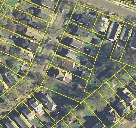
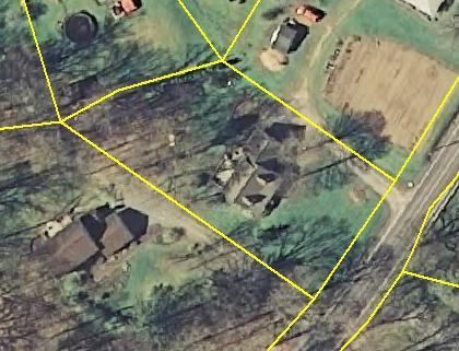
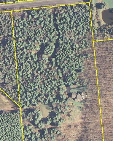
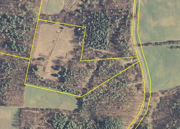
16 Workgroup Create specifications for a statewide authoritative address point database to support next-generation and other purposes
17
18
19
20 600
21 Sub-address Representation 123 Main Street, Apartment 101 U.S. Dept. of Agriculture Building, Floor 7, Room West Mountain Road, Building 6, Suite 450 Suburban Office Park, Building 12, Mezzanine, Suite 200 Five-Star Hotel, East Tower, Penthouse General Hospital, Cardiac Wing, Room 224 Metro Airport, Terminal A, Gate C27 Batavia Downs, Barn 12

22 Duplex 10A Limerick Ave & 10B Limerick Ave

23 Historic Home Split into Apartments 56 Union Ave & 56-Side, 56-Rear


24 Apartment Building 64 Robert Dr Apt 1, Apt 2, Apt 3, etc.

25 Apartment Building Complex 70 Mc Carty Ave Building 1, Apt 1; Building 2, Apt 4; etc.

26 Trailer Park 2941 Amsterdam Rd, Lot 1, Lot2, Lot 3, etc.

27 Dairy Farm 220 County Road 67, Building 22; etc.

28 Office Building 90 State Street, Floor 3, Suite 6; Floor 1, Suite 1; etc.
29 State-wide Address Point Build OCS has addresses in every county OCS will continue to host, maintain and serve address points authorities Provide better address points if they exist Add missing points Refine locations Establish sub-addresses Feed changes
30 What you can expect from us GIS Mapping expertise GIS Standards Geocoding GIS coordination Data Sharing Cooperative GIS Clearinghouse GIS Help Desk Orthoimagery CIRIS Web services Streets & Address Point data Help maintaining address points
31 What you can expect from us Cyber Security Advisories White papers & webcasts Templates for policies & procedures Technical assistance Web defacement monitoring Managed security services (for a fee) Training End user training video Business Manager training video Computer based training modules
32 Funding GIS data development Local share priority project funding Census interested in putting resources into a pilot
The Proposed Road Centerline Standard for Minnesota Overview and Frequently Asked Questions
 The Proposed Road Centerline Standard for Minnesota Overview and Frequently Asked Questions Introduction. Road Centerlines are a foundational geospatial dataset for Minnesota. They are a foundational data
The Address Point Data Standard for Minnesota Overview and Frequently Asked Questions
 The Address Point Data Standard for Minnesota Overview and Frequently Asked Questions Introduction. Address points are a core geospatial infrastructure dataset for Minnesota. They are a foundational data
5. Part 5: Address Data Exchange
 5. Part 5: Address Data Exchange 5.1 Introduction The purpose of this section is three-fold: to provide a template for the XML documents and metadata that will move addresses from place to place, to provide
Next Generation The Kansas Story
 Next Generation 9-1-1 The Kansas Story NG9-1-1 The Kansas Story Strategy Implementation Chief Dick Heitschmidt Jay Coverdale 3 The Kansas Story Part 1 Chief Dick Heitschmidt 9-1-1 Coordinating Council,
E911 Presentation FAQ Pierce County Council Public Safety, Human Service and Budget Committee April 23, 2018
 E911 Presentation FAQ Pierce County Council Public Safety, Human Service and Budget Committee April 23, 2018 Q-1 What do all those acronyms stand for? A-1 *See comprehensive glossary at the bottom of this
NG9-1-1 Call Flow. Handout Roundtable April 2, Figure 1- Call Flow Diagram
 NG9-1-1 Call Flow Handout Roundtable April 2, 2012 Figure 1- Call Flow Diagram The Standard NG9-1-1 Network has the same Functional Elements (FEs) in each Data Centers for redundancy. The acronyms are
MSAG and Map Clean-Up Projects
 MSAG and Map Clean-Up Projects Master Street Address Guide (MSAG) The MSAG is a tabular listing of all streets with the low and high address ranges that fall within a specified community and a unique ESN
Address Point Data Standard
 Minnesota Geospatial Advisory Council Address Point Data Standard Version 1.2 Published 11/19/2018 Approved by the Minnesota Geospatial Advisory Council on 3/28/2018 1 Table of Contents About the GAC...
Update on the National Emergency Address Database (NEAD)
") Update on the National Emergency Address Database (NEAD) NEAD, LLC was established by CTIA-The Wireless Association (representing NENA, APCO, and 4x Tier 1 Carriers) design / implement the NEAD. Smaller
Update on the National Emergency Address Database (NEAD) NEAD, LLC was established by CTIA-The Wireless Association (representing NENA, APCO, and 4x Tier 1 Carriers) design / implement the NEAD. Smaller
ESINets and Map Based Location Technology Use
 WHITE PAPER DEFENDING WORLD SECURITY Emergency Services IP NetworkS ESINets and Map Based Location Technology Use Page 1 The reproduction, distribution and use of this document as well as the communication
Overview of ALI Formatting Tool
 CHAPTER 1 The Automatic Location Information Formatting Tool (AFT) enables you to modify the automatic location information (ALI) records that you create in Cisco Emergency Responder to a format that is
Minnesota Geospatial Advisory Council Standards Committee, Metro Address Work Group & NextGen9-1-1 Work Group
 Minnesota Geospatial Advisory Council Standards Committee, Metro Address Work Group & NextGen9-1-1 Work Group Proposed ADDRESS POINT STANDARD Alignment Document DRAFT Alignment of comments received during
NG9-1-1 Deployments in U.S.A.
 NG9-1-1 Deployments in U.S.A. Presented to EU Emergency Services Workshop April 16, 2013 Byron L. Smith, Consultant Skype: Byron L Smith (psapman) Email: byron@psapservice.com Mobile: +1-574-286-4265 Disclaimers
Cowley County, Kansas. Cowley County Emergency 911 Address Issuance and GIS Layer Maintenance Policy Manual
 Cowley County, Kansas Cowley County Emergency 911 Address Issuance and GIS Layer Maintenance Policy Manual Ver. 4.01; June 2017 Ver.4.01 Rev: December 2017 Purpose The primary purpose of this policy manual
L-1. Free Metro Ride. Free Metro Ride. Light Rail. Light Rail. 16th Street Mall / Free Mall Ride. Skyline Park. Site.
 Skyline Park Free Metro Ride Light Rail Light Rail Site Free Metro Ride 16th Street Mall / Free Mall Ride Convention Center Vicinity Map PROJECT NO. 17501.00.000 L-1 D-TD, UO-1 D-C, UO-1 California Street
Florida 911 Coordinator s Spring 2015 Meeting
 NENA i3 and Next Generation 9-1-1 Florida 911 Coordinator s Spring 2015 Meeting May - 2015 Mike Nelson Intrado, Senior Technical Officer Intrado Proprietary Selective Routers were designed In the 70 s
Using Esri's Address Data Management Tools to Prepare for Next Generation 911
 Using Esri's Address Data Management Tools to Prepare for Next Generation 911 Chad Brothers, Client Services Manager State of Tennessee TeleCommunication Systems, Inc. James Wood, Public Safety Industry
Georeferencing. Georeferencing: = linking a layer or dataset with spatial coordinates. Registration: = lining up layers with each other
 Georeferencing How do we make sure all our data layers line up? Georeferencing: = linking a layer or dataset with spatial coordinates Registration: = lining up layers with each other Rectification: The
GIS Data Requirements. For Enhanced and Next Generation 9-1-1
 GIS Data Requirements For Enhanced and Next Generation 9-1-1 Version 1 June 2nd 2015 TABLE OF CONTENTS Introduction... 3 Who Is This Document For?... 3 Conventions Used in This Book... 3 Terminology &
Building a National Address Database. Presented by Steve Lewis, Department of Transportation Mark Lange, Census Bureau July 13, 2017
 Building a National Address Database Presented by Steve Lewis, Department of Transportation Mark Lange, Census Bureau July 13, 2017 Topics Building the NAD FGDC Address Theme 2 Building the NAD 3 First
Partnering with the Community to Bring Mobile Data to the PSAP. MA Communication Supervisors Association
 Partnering with the 9-1-1 Community to Bring Mobile Data to the PSAP MA Communication Supervisors Association May 2016 Agenda for today Background & Introduction RapidSOS Haven app Launch plan & Next steps
The LLDP feature available on the ME 1200 Web GUI allows you to configure the LLDP parameters, LLDP
 The LLDP feature available on the ME 1200 Web GUI allows you to configure the LLDP parameters, LLDP port, and LLDP Media. LLDP Configuration, page 1 LLDP Media Configuration, page 3 LLDP Media Configuration
Match and Location Codes
 Centrus GeoStan Match and Location Codes Version 28.00 For Windows, UNIX/Linux, z/os April 2015 2015 Pitney Bowes Software Inc. All rights reserved. Pitney Bowes Software Inc. is a wholly-owned subsidiary
SIP Emergency Calling
 hgs/sip2001 Emergency 1 SIP Emergency Calling Henning Schulzrinne Dept. of Computer Science Columbia University New York, New York (sip:)schulzrinne@cs.columbia.edu Conference International SIP Paris,
Direct VoIP Provisioning Center Data Management Guide
 Direct VoIP Provisioning Center Data Management Guide VoIP ALI Data Provisioning Processes Version 2018.02.28 Notice Direct VoIP Provisioning Center Data Management Guide and Documentation 2008-2018 by
STATEWIDE CENTERLINE INITIATIVE EDITED: MAY 17, 2013
 STATEWIDE CENTERLINE INITIATIVE EDITED: MAY 17, 2013 WHAT IS THE CENTERLINE INITIATIVE? The Centerline Initiative is a joint effort between the Minnesota Department of Transportation (MnDOT), Minnesota
GIS Change Requests: Web Base change requests will replace MSAG Update paper form.
 GIS Change Requests: Web Base change requests will replace MSAG Update paper form. Types of edits that will need to be reported Individual address edits (move, delete, add or change) Road edits (add, delete,
for the reporting interval ending January 31, 2014 INdigital telecom
 Q-1 Indiana 9-1-1 Board Report for the reporting interval ending January 31, 2014 from INdigital telecom Executive Summary This report is for the year to date first quarter of 2014 as an update to the
Recommendations for Implementing NG9-1-1 Components
 Recommendations for Implementing NG9-1-1 Components June 4, 2010 Author: Todd Poremba Product Marketing Manager for NG9-1-1 Contents Abbreviations and Acronyms... ii Introduction... 1 Models for NG9-1-1
NEW Emergency Call Services Testing Innovative test methods for mission critical services such as: VoLTE 911 / 112 and EU ecall
 NEW Emergency Call Services Testing Innovative test methods for mission critical services such as: VoLTE 911 / 112 and EU ecall Chester Calma Technical Sales Manager, Americas SIGOS Entire Solutions for
Emergency Routing Service (ERS) Customer Administrator Guide Subscriber Guide
 Customer Administrator Guide Subscriber Guide") Emergency Routing Service (ERS) Customer Administrator Guide Subscriber Guide Rev B August 15, 2016 1 CUSTOMER ADMINISTRATOR GUIDE... 2 Introduction... 3 Getting Familiar with the terminology... 3 ERS
Emergency Routing Service (ERS) Customer Administrator Guide Subscriber Guide Rev B August 15, 2016 1 CUSTOMER ADMINISTRATOR GUIDE... 2 Introduction... 3 Getting Familiar with the terminology... 3 ERS
Iowa s Statewide Road Centerline Cooperative Program. Bill Schuman, GIS Coordinator Iowa Department of Transportation
 Iowa s Statewide Road Centerline Cooperative Program Bill Schuman, GIS Coordinator Iowa Department of Transportation Session Outline Current goals of Statewide Road Centerline Project Project challenges
Pueblo City-County Addressing Standards May 2010
 Pueblo City-County Addressing Standards May 2010 I. Definitions & Descriptions There can be up to four address types in the various databases within the County. They include situs, building, establishment
Is Your Data Ready For NG9-1-1?
 Is Your Data Ready For NG9-1-1? Jim Shepard Vice President of Product Evolution 911 Datamaster August 18, 2013 Needs Are Hierarchical "A Theory of Human Motivation, Abraham Maslow (1943) Can t move to
Delaware s Premier Suburban Office Park
 IRON IRON HILL HILL CORPORATE CORPORATE CENTER CENTER Delaware s Premier Suburban Office Park WHITE WING 700 RED WING 750 BLUE WING 800 www.cbre.us/ironhill PROJECT SUMMARY White Wing Red Wing Blue Wing
Delaware s Premier Suburban Office Park
 IRON IRON HILL HILL CORPORATE CORPORATE CENTER CENTER Delaware s Premier Suburban Office Park WHITE WING 700 RED WING 750 www.cbre.us/ironhill PROJECT SUMMARY White Wing Red Wing Blue Wing Parking Garage
AT&T ESInet Customer Presentation
 AT&T ESInet Customer Presentation TM The best of today built for tomorrow. Table of Contents Introduction AT&T Emergency Services IP Network (AT&T ESInet TM ) Overview National Emergency Number Association
ARLINGTON COUNTY, VIRGINIA
 ARLINGTON COUNTY, VIRGINIA County Board Agenda Item Meeting of July 19, 2008 DATE: July 11, 2008 SUBJECT: SP#125 SITE PLAN AMENDMENT for proposed conversion of retail and conference space to cable television
FEMA Data Standard: Declaration String. Proposal for Adoption by the FEMA Data Governance Council
 FEMA Data Standard: Declaration String Proposal for Adoption by the FEMA Data Governance Council The Office of Management and Budget (OMB) has directed Federal departments and agencies to follow data standards
YAddress SQL Client API Manual
 YAddress SQL Client API Manual Yuri Software, Inc. Sept 2017 Table of Contents YADDRESS... 3 ARCHITECTURE... 3 Project Setup... Error! Bookmark not defined. PROGRAMMING REFERENCE... 4 YADDRESSCLIENT CLASS...
PUBLIC WORKS. 1oo. DiEital Fee Schedules. Effective January 1, 2008
 PUBLIC WORKS Geographic Information Systems DiEital Fee Schedules Effective January 1, 2008 Date Advertised 12103/07 In (Publication) Daily Business Journal Public Hearing Date Approved as to form: David
APTS05 Transit Security Private Bus Operators and AMTRAK
 APTS05 Transit Security Private Bus Operators and AMTRAK Transit AMTRAK Operations Private Commuter Bus Operators Private Long- Distance Bus Operators Systems transit emergency data status NYPD 911 Communications
Worksheet for minimally-compliant FGDC metadata
 Metadata Worksheet P. 1 of 8 Worksheet for minimally-compliant FGDC metadata The purpose of this worksheet is to provide an outline for high level geospatial metadata information gathering. It should help
Clark County Property Taxes Overview
 Clark County Property Taxes Overview Joint Meeting of the Senate Committee on Revenue and Economic Development and the Assembly Committee on Taxation Tuesday, February 14, 2017 Property Tax Abatement Impact
The Evolution on the Horizon for 911, E911, and NG911 Utilizing High-Speed Broadband
 The Evolution on the Horizon for 911, E911, and NG911 Utilizing High-Speed Broadband 1989.2000..2011.. 2015 8/17/2015 2 Information Technology 2 3 3 So What is Next Generation 911? 4 5 8/17/2015 6 Information
Minnesota Geospatial Advisory Council
 Minnesota Geospatial Advisory Council Parcel Data Standard Version 1.1 Published on March 8, 2019 Version 1.1 approved by Minnesota Geospatial Advisory Council on 3/6/2019 Version 1.0 approved by Minnesota
Center for Internet Security Confidence in the Connected World
 Center for Internet Security Confidence in the Connected World Northeast Headquarters 31 Tech Valley Dr., East Greenbush, NY 12061 Mid-Atlantic Headquarters 1700 North Moore St., Suite 2100, Arlington,
New Mexico s RGIS Program: State Geospatial Data Clearinghouse
 New Mexico s RGIS Program: State Geospatial Data Clearinghouse Laura Gleasner Su Zhang November 10, 2016 New Mexico RGIS: The State Digital Geospatial Data Clearinghouse The Resource Geographic Information
Purpose: To explore the raster grid and vector map element concepts in GIS.
 GIS INTRODUCTION TO RASTER GRIDS AND VECTOR MAP ELEMENTS c:wou:nssi:vecrasex.wpd Purpose: To explore the raster grid and vector map element concepts in GIS. PART A. RASTER GRID NETWORKS Task A- Examine
PROJECT BRIEFINGS: Statewide 2008 Orthoimagery LiDAR Elevation Data Program MN Geospatial Information Office. Chris Cialek
 PROJECT BRIEFINGS: Statewide 2008 Orthoimagery LiDAR Elevation Data Program MN Geospatial Information Office Chris Cialek MN Land Management Information Center (LMIC) chris.cialek@state.mn.us Mid-West
KCP&L SmartGrid Demonstration
 KCP&L SmartGrid Demonstration Kansas House Energy & Environment Committee Bill Menge Director, SmartGrid February 7, 2013 Topeka, KS What is SmartGrid? SmartGrid is basically the integration of digital
LOCATION ACCURACY QUICK REFERENCE GUIDE: USING VESTA AND THE RAPIDSOS NG911 CLEARINGHOUSE
 LOCATION ACCURACY QUICK REFERENCE GUIDE: USING VESTA AND THE RAPIDSOS NG911 CLEARINGHOUSE What if you could get instant, accurate caller location and enhanced data for your 9-1-1 calls? SAVE MORE LIVES
Metadata or "data about data" describe the content, quality, condition, and other characteristics of data. The Federal Geographic Data Committee
 Metadata or "data about data" describe the content, quality, condition, and other characteristics of data. The Federal Geographic Data Committee (http://www.fgdc.gov/) approved the Content Standard for
Craig J. Nichols, Secretary
 Craig J. Nichols, Secretary Gainesville, FL Nov. 5, 2014 Interim Solution Text-to-911 Text messaging using Short Message Service (SMS) is the common technology method On Dec. 6, 2012 AT&T, Verizon, Sprint
Transportation for the Nation (TFTN) GIS-T Symposium
 GIS-T Symposium") Strategic Plan for Transportation for the Nation (TFTN) GIS-T Symposium Steve Lewis Geospatial Information Officer, USDOT Director, Office of Geospatial Information Systems, USDOT/RITA/BTS March, 2011
Strategic Plan for Transportation for the Nation (TFTN) GIS-T Symposium Steve Lewis Geospatial Information Officer, USDOT Director, Office of Geospatial Information Systems, USDOT/RITA/BTS March, 2011
NENA Procedures for Notification of ERDB and VPC Operators of ESN Changes by Administrator Operations Information Document
 NENA Procedures for Notification of ERDB and VPC Operators of ESN Changes by 9-1-1 Operations Information Document NENA Procedures for Notification NENA 57-503, Version 1 Prepared by: National Emergency
and The Technical Assist Database Presented to the Regional GIS Council October 8, 2008
 and The Technical Assist Database Presented to the Regional GIS Council October 8, 2008 After the catastrophic wildfires of October 2003, the San Diego Regional Fire Prevention and Emergency Preparedness
Missouri Spatial Data Information Service 1st Period Bi-Annual Report February 2015 July 2015
 Missouri Spatial Data Information Service 1st Period Bi-Annual Report February 2015 July 2015 Build or implement a survey to identify gaps in the statewide data inventory. Strategy: Watch the development
Acronym Definitions. ACD Automatic Call Distribution, Automatic Call Distributor. ACN Automatic Collision Notification
 Acronym Definitions ACD Automatic Call Distribution, Automatic Call Distributor ACN Automatic Collision Notification AIP Access Infrastructure Provider ALI Automatic Location Identification ALI DB Automatic
Room Scheduling Users Guide. Parking, Transportation, and Event Services
 Room Scheduling Users Guide Parking, Transportation, and Event Services All conference room scheduling requests are processed through our online system. FOAPAL coding must be provided at the time of the
Analysis of Submitted Aggregate Entities
 1 000001 Analysis of Submitted Entities Basic or MinMaxConst. n/a. 2 000002 type 6 000003 title. 9 000004 15 000005 address 0..1 R 1..* title. 0..* address. 0..* for ) type on an individual, a group or
for the report interval ending August 29, 2012 {Q3} (and including prior periods of 2012) INdigital telecom
 INdigital telecom") Q-3 report for the report interval ending August 29, 2012 {Q3} (and including prior periods of 2012) to the Indiana 9-1-1 Board from INdigital telecom Executive Summary This report is for the year to date
Q-3 report for the report interval ending August 29, 2012 {Q3} (and including prior periods of 2012) to the Indiana 9-1-1 Board from INdigital telecom Executive Summary This report is for the year to date
AGENDA ITEM # 10A. AGENDA ITEM EXECUTIVE SUMMARY Village Board Meeting April 9, Confirm Master Services Agreement Comcast Enterprise
 AGENDA ITEM # 10A AGENDA ITEM EXECUTIVE SUMMARY Village Board Meeting April 9, 2018 Item Services Staff Contact: Confirm Master Services Agreement Comcast Enterprise Jason M. Bielawski, Assistant Village
Service Impact Messaging By Address (SIMBA) How City of Charlotte Masters Data Quality Dr. Leonard J. Huggins
 How City of Charlotte Masters Data Quality Dr. Leonard J. Huggins") Improving Service Delivery with Trusted City-Wide Address Data: Service Impact Messaging By Address (SIMBA) How City of Charlotte Masters Data Quality Dr. Leonard J. Huggins Outline Overview Address Management
Improving Service Delivery with Trusted City-Wide Address Data: Service Impact Messaging By Address (SIMBA) How City of Charlotte Masters Data Quality Dr. Leonard J. Huggins Outline Overview Address Management
Using the AFT for Specific Service Providers
 APPENDIXG These topics describe how to use the ALI Formatting Tool (AFT) for specific service providers: Using the ALI Formatting Tool for Bell-Canada, page G-1 Using the ALI Formatting Tool for SBC-Ameritech,
Direct Telephone Service Provider Data Management Guide Wireline ALI Data Provisioning Processes Version
 Direct Telephone Service Provider Data Management Guide Wireline ALI Data Provisioning Processes Version 2018.02.28 Notice West Direct Telephone Service Provider Data Management Guide and Documentation
State of Minnesota Enterprise GIS Opportunity Assessment 1 Introduction & Context 2 Minnesota Enterprise GIS Requirements & Activities
 State of Minnesota Enterprise GIS Opportunity Assessment September, 2008 1 Introduction & Context The following presents a high-level overview of the opportunities that exist to deploy GIS services and
Providing E911 support for branch offices and teleworkers. Compliance with state and local E911 regulations
 A Division of Connexon epygi Manufactured in the USA E911 Call Routing Solution for Epygi IP Telephony Solution Brief Epygi provides organizations with powerful IP telephony capabilities that deliver cost
ATMS08 Traffic Incident Management System TRANSCOM (1 of 3)
") ATMS08 Traffic Incident System (1 of 3) AMTRAK MTA Police / Municipal/County EOCs Municipal/County Public Safety NYS Police incident status resource request incident resource deployment status road network
ATMS08 Traffic Incident System (1 of 3) AMTRAK MTA Police / Municipal/County EOCs Municipal/County Public Safety NYS Police incident status resource request incident resource deployment status road network
Vehicle Network Application. based on BeiDou/GPS
 Vehicle Network Application based on BeiDou/GPS NavInfo Co., Ltd. President Dr. Sun Yuguo Nov. 2012 Content The current statues of vehicle network industry Cloud platform of vehicle network service Conclusion
Government of Alberta. Find Your Farm. Alberta Soil Information Viewer. Alberta Agriculture and Forestry [Date]
![Government of Alberta. Find Your Farm. Alberta Soil Information Viewer. Alberta Agriculture and Forestry [Date]](/thumbs/83/87435202.jpg "Government of Alberta. Find Your Farm. Alberta Soil Information Viewer. Alberta Agriculture and Forestry [Date]") Government of Alberta Find Your Farm Alberta Soil Information Viewer Alberta Agriculture and Forestry [Date] Contents Definitions... 1 Getting Started... 2 Area of Interest... 3 Search and Zoom... 4 By
Government of Alberta Find Your Farm Alberta Soil Information Viewer Alberta Agriculture and Forestry [Date] Contents Definitions... 1 Getting Started... 2 Area of Interest... 3 Search and Zoom... 4 By
Shopping Center + Two Lots in Lutz, Fl $ 4,750,000
 NEW LISTING 100% FULL 700 ON FLORIDA AVE SHOPPING CENTER W/2 OUTPARCELS For Restaurant, Retail, Office, Medical Use Shopping Center + Two Lots in Lutz, Fl 33549 $ 4,750,000 Property Overview Property Address
Cedar Rapids ITS Deployment Project
 Cedar Rapids ITS Deployment Project Concept of Operations July 29, 2011 Table of Contents Section 1 Introduction Purpose Goal of ITS Deployments Section 2 Needs Assessment General Background Stakeholders
26 th Street North and Old Dominion Drive Master Planning Task Force
 26 th Street North and Old Dominion Drive Master Planning Task Force Presentation to Arlington Joint Facilities Advisory Commission October 24, 2018 Site Master Planning Task Force On September 2018, the
Mail and Parcel Services Section 6.31
 Business Hours 8:00 a.m. to 3:15 p.m. Office Extension X5475 Delivery Schedules Mail arrival on campus: 8:00 a.m. and 10:00 a.m. United Parcel Service outgoing: 2:00 p.m. Internal Mail Delivery/Pickup:
STUDY REPORT #1 ADDENDUM
 STUDY REPORT #1 ADDENDUM 1.0 PURPOSE OF ADDENDUM This document is an addendum to Study Report #1: Sub-System Planning Alternatives. The purpose of this addendum is to bridge the gap between the initial
CLASS A MANUFACTURING FACILITY
 4151 South Pipkin Road, Lakeland, Florida Tampa Lakeland Orlando 863-682-6147 David@hauger-bunch.com PROPERTY HIGHLIGHTS LEEDS Certified, 27,600 SF Manufacturing Facility & Office Tiltwall Concrete Built
California GIS Enterprise Strategy
 California GIS Enterprise Strategy David Harris Geospatial Information Officer California Natural Resources Agency December 3, 2009 Outline OCIO / GIO Background California GIS Task Force Report California
Development and Maintenance of a Critical Application Geodatabase For DOT Use.
 Development and Maintenance of a Critical Application Geodatabase For DOT. Executive Summary This paper presents a description of the development and maintenance of a state-level database used by the Louisiana
Invitation to Participate
 Invitation to Participate 2009 For the lead agency participation in New York State Quality Rating and Improvement System -- QUALITYstarsNY field test Page 1 of 7 101 West 31 st Street, 7th Floor New York,
Information for Bulk Users
 2011 Census: Customer Support Information for Bulk Users December 2012 You could use this area to talk about services from Census Customer Services, and any other guides or instructions available. If you
BLUE RIBBON Facilities
 BLUE RIBBON 2015 Facilities FACILITY PRIORITIES Police Administration Addition $4,484,864 Relocation of Fire Station 3 $4,829,683 (Does not include land purchase) City Hall Basement/Conference/Training/Emergency
County Commissioners Association of Ohio
 County Commissioners Association of Ohio 209 East State Street Columbus, Ohio Wednesday, July 11, 2012 1 Shared services is a collaborative strategy that is fundamentally about optimizing staff, equipment
Moving Forward with Transit Oriented Communities
 Moving Forward with Transit Oriented Communities Planning & Development Committee October 7, 2014 Packet Pg. 33 History of TOD at RTD Mid 1990s - Local jurisdictions start planning for TOD 2000 RTD hires
City Implements Disaster Recovery Plan to Keep Citizens Connected
 City Implements Disaster Recovery Plan to Keep Citizens Connected City of Hayward connects public safety and emergency operations via Cisco 802.11 wireless bridging and microwave channels Business Challenge
Planning: Administrative Permits Instructions
 Building and Development Services Department 1112 Manatee Ave West, Suite 408 Bradenton, FL 34205 Phone: (941) 749-3012 ManateeBADSOnline@mymanatee.org www.mymanatee.org Planning: Administrative Permits
Full Search Map Tab Overview
 FlexMLS Map Server Full Search Map Tab Overview The Full Search Map tab is a need to know module. It is accessible when you use Full Search under Search in the Main Menu tree of FlexMLS. This map can
PSAP Link Service Guide. Version
 PSAP Link Service Guide Version 2018.04.06 Contents 1. Introduction... 1 2. Services Overview... 1 2.1. Services Components... 1 2.2. Connectivity... 2 2.3. Maintenance and Support... 2 2.4. Other... 2
LIST OF AMENDMENTS TO ZONING BYLAW NO. 801, 1999
 LIST OF AMENDMENTS TO ZONING BYLAW NO. 801, 1999 Bylaw Amendment 826 Lot B, DL. 31, Plan 26227 257 Hwy. 97 South Add craft & souvenir sales including fabric sales & business office as a principal permitted
Address Verification, Correction and ZIP+4 API User s Guide
 Address Verification, Correction and ZIP+4 API User s Guide The Software Company, Inc. www.softwarecompany.com Introduction NetZipCode for.net allows you to quickly and easily build ZIP Code lookup, address
ARLINGTON COUNTY, VIRGINIA
 ARLINGTON COUNTY, VIRGINIA County Board Agenda Item Meeting of May 20, 2017 DATE: May 10, 2017 SUBJECT: SP-339-U-17-2 USE PERMIT ASSOCIATED WITH A SITE PLAN for a telecommunications facility at Clarendon
MAPLOGIC CORPORATION. GIS Software Solutions. Getting Started. With MapLogic Layout Manager
 MAPLOGIC CORPORATION GIS Software Solutions Getting Started With MapLogic Layout Manager Getting Started with MapLogic Layout Manager 2011 MapLogic Corporation All Rights Reserved 330 West Canton Ave.,
Key Terms. Attribute join Target table Join table Spatial join
 Key Terms Attribute join Target table Join table Spatial join Lect 10A Building Geodatabase Create a new file geodatabase Map x,y data Convert shape files to geodatabase feature classes Spatial Data Formats
WELCOME TO A SILVER JACKETS WEBINAR ON:
 WELCOME TO A SILVER JACKETS WEBINAR ON: Flood Vulnerability Assessment for Critical Facilities For audio, call 877-336-1839 Access code: 8165946 Security Code: 4567 MOLLY WOLOSZYN Extension Climate Specialist
The Data Journalist Chapter 7 tutorial Geocoding in ArcGIS Desktop
 The Data Journalist Chapter 7 tutorial Geocoding in ArcGIS Desktop Summary: In many cases, online geocoding services are all you will need to convert addresses and other location data into geographic data.
2017 Capital Improvement Budget Police Department
 2017 Capital Improvement Budget Police Department (in thousands) Projects Bonds State Federal Other Total APD Headquarters Campus Perimeter Security Project 500 - - - 500 APD Investigation Interview Room
Enhanced 911 Fundamentals
 ATTENTION Clicking on a PDF hyperlink takes you to the appropriate page If necessary, scroll up or down the page to see the beginning of the referenced section NN42020-132 Document status: Standard Document
LAKE CHAPMAN PLAZA, N Florida Ave, TWO BUILDABLE OUTPARCELS, 16333&16347 N Florida Ave For Restaurant, Retail, Office, Medical Use
 LAKE CHAPMAN PLAZA, 16301-16321 N Florida Ave, TWO BUILDABLE OUTPARCELS, 16333&16347 N Florida Ave For Restaurant, Retail, Office, Medical Use CARWASH, 16418 N Florida Ave Portfolio of 4 Commercial Properties
IGIC Helping Coordinate GIS Initiatives for Indiana
 IGIC Helping Coordinate GIS Initiatives for Indiana GIS Day at Purdue University 2014 Phil Worrall, Executive Director Indiana Geographic Information Council, Inc. (IGIC) IGIC Helping Coordinate GIS Initiatives