Observation trends: Expectations from European Comission regarding data exchange and interoperability
|
|
|
- Charles Horn
- 5 years ago
- Views:
Transcription
1 Observation trends: Expectations from European Comission regarding data exchange and interoperability Marcin Wichorowski (IO PAN), Sławomir Sagan (IO PAN), Declan Dunne (UCC MaREI), John Barton (UCC-TYNDALL) COMMON SENSE FINAL MEETING Barcelona, Spain, 27th January 2017

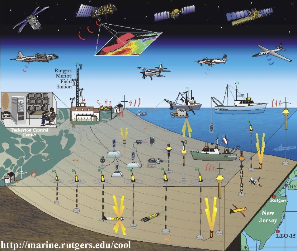
2 Context: An ocean of data
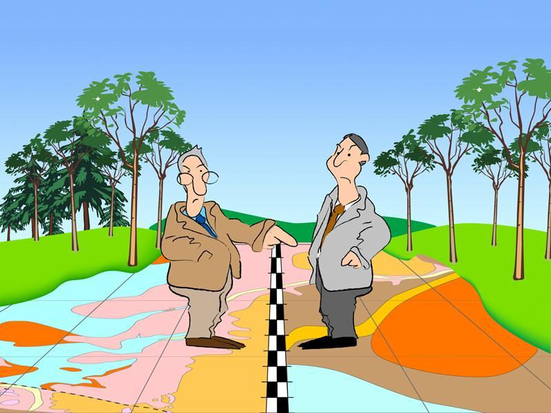
3 Interoperability?
4 Interoperability?
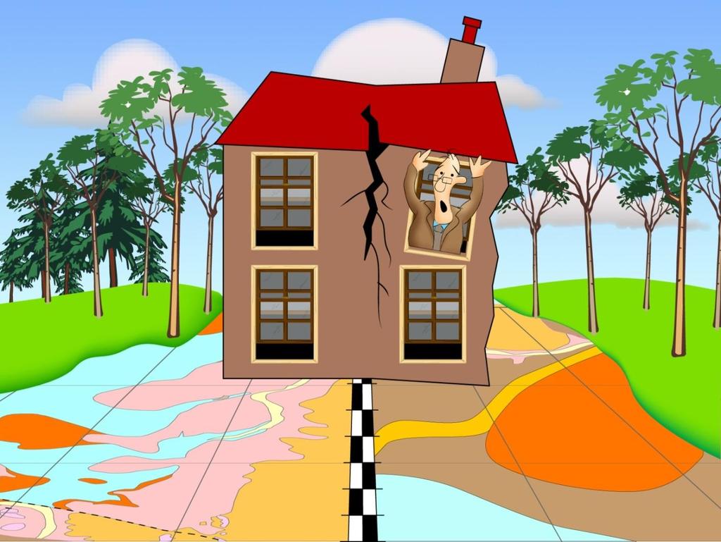
5 Data Integration and Interoperability problem


6 Approach 1: Standardisation

7 Approach 2: Mediation (Adaptor)

8 Interoperability Interoperability: What, Why, How? What? Why? Ability of two or more systems to communicate and interact or be used together despite their differences Facilitates exchange and sharing of information Increases the availability, access, integration of data Facilitates the understanding and usage of data Solves heterogeneity (differences) How Standards enable interoperability: standards for data, metadata, services Semantic interoperability: ontology, controlled vocabulary

9 Guidelines on Open Access to Scientific Publications and Research Data in Horizon 2020 define Open access as the practice of providing on-line access to scientific information that is free of charge to the end-user and that is re-usable. H Data Integration and Interoperability In the context of research and innovation, 'scientific information' can refer to peerreviewed scientific research articles (published in scholarly journals) or research data (data underlying publications, curated data and/or raw data). Source: Data Curation Centre

10 INSPIRE Directive Architecture
11 D5: Eutrophication D8: Contaminants D10: Marine litter D11: Underwater noise European Commission legal framework Marine Strategy Framework Directive x x x x Water Framework Directive x x x Bathing Directive x x x RoHS restricting the use of hazardous substances in electrical and electronic equipment x x
12 D5: Eutrophication D8: Contaminants D10: Marine litter HELCOM x x x x OSPAR x x x Barcelona Convention x x x x Aberdeen Declaration x x HELCOM x x x x Spain x x x x Poland x x x x Ireland x x x x SHOAL x x Eurofleets 2 x x x SeaDataNet 2 x x ODIP x x x x D11: Underwater noise
 Schematic (i.e. differences in conceptual schemas such as street may be defined as a class or as a value of an attribute of a road class) Semantic (i.")
13 Heterogeneity Interoperability & Heterogeneity Heterogeneity is a major barrier to interoperability Heterogeneity at different levels System (i.e. interaction between computers of different OS and databases of different DBMS) Syntactic (i.e. differences between formats such as a GML document and a Shapefile) Schematic (i.e. differences in conceptual schemas such as street may be defined as a class or as a value of an attribute of a road class) Semantic (i.e. difference of meaning, e.g. temperature, is it sea temperature or air temperature; coastline vs shoreline )
14 Interoperability Stack - solutions Semantics Schematics Syntax Systems Community specific vocabularies and concepts, ontology (share concepts) Domain specific markup languages, data schema, community profiles File format (shp, dxf), languages (sql, xml, gml, sensorml, O&M, rdf, owl, json, NetCDF) Transfer protocol (FTP, HTTP) and services (WMS, WFS, WCS, CS-W, SOS, WSDL, etc.)


15 Ontologies and controlled vocabularies Use a controlled vocabulary web service to define concepts (e.g. NERC) Coastline Shoreline Ligne de côte Atlas X
16 Open Geospatial Consortium Sensor Web Enablement The OGC's Sensor Web Enablement (SWE) standards enable developers to make all types of sensors, transducers and sensor data repositories discoverable, accessible and useable via the Web Open interfaces for sensor web applications "Hooks" for IEEE 1451, TML (TransducerML), CAP (Common Alerting Protocol), WS-N (Web Services Notification), ASAP (Asynchronous Service Access Protocol) Imaging device interface support Opportunity to participate in an open process to shape standards Sensor location tied to geospatial standards Fusion of sensor data with other spatial data Ties to IEEE and other standards organizations
17 OGC s Sensor Web Enablement SWE Common Data Model Defines low-level data models for exchanging sensor related data between nodes of the OGC Sensor Web Enablement (SWE) framework. Observations & Measurements (O&M) The general models and XML encodings for observations and measurements. Sensor Model Language (SensorML) Standard models and XML Schema for describing the processes within sensor and observation processing systems. Sensor Observation Service (SOS) Open interface for a web service to obtain observations and sensor and platform descriptions from one or more sensors. PUCK Protocol Standard Defines a protocol to retrieve a SensorML description, sensor "driver" code, and other information from the device itself, thus enabling automatic sensor installation, configuration and operation Sensor Planning Service (SPS) An open interface for a web service by which client can determine the feasibility of collecting data from one or more sensors or models, and submit collection requests. SWE Service Model Defines data types for common use across OGC Sensor Web Enablement (SWE) services. Five of these packages define operation request and response types.

18 Sensor Model Language <-> Harmonization of data at EUROFLEETS source: J. Sorribas, EUROFLEETS2 - General Assembly n 3, 25th March, 2015

19 Sensor Observation Service <-> SeaDataNet CDI service source: R. Casas, SeaDataNet II Final Plenary Meeting September 2015, Brest
20 T,P, ph/pco2 Heavy Metals N μplastic unoise Country Programme Denmark Finland France France Germany Greece Ireland Ireland The Netherlands Norway Norway Sweden UK Nation-wide aquatic monitoring programme - monitoring of coastal and open marine waters Monitoring programmes National sea water quality monitoring network - RNO French seashore phytoplankton monitoring - REPHY Bund/Länder Messprogramm für die Nordsee MED POL in the Aegean and Ionian Sea and the Saronic Gulf General Quality of Estuarine and Coastal Receiving Waters Bathing waters National surface water monitoring programme Monitoring of marine waters Trend monitoring of the Norwegian coastal areas Arctic Monitoring and Assessment (AMAP)the Barents Sea & northern fjords Nation-wide pelagic frequent monitoring UK National Marine Monitoring Plan
21 Conclusions Common Sense Interoperability with other projects in marine domain System interoperability (YES) use of SOS Syntax interoperability (YES) use of SensorML and O&M data formats Schematic interoperability (partialy) different SensorML and O&M profiles (differences in structure) Semantic interoperability (no) lack of common controlled vocabulary (differences in areas)
22 Thank you for your Attention project.eu
Semantically enhancing SensorML with controlled vocabularies in the marine domain
 Semantically enhancing SensorML with controlled vocabularies in the marine domain KOKKINAKI ALEXANDRA, BUCK JUSTIN, DARROCH LOUISE, JIRKA SIMON AND THE MARINE PROFILES FOR OGC SENSOR WEB ENABLEMENT STANDARDS
Pan-European infrastructure for management of marine and ocean geological and geophysical data Geo-Seas portal Data Discovery and Access Service
 Pan-European infrastructure for management of marine and ocean geological and geophysical data Geo-Seas Data Discovery and Access Service By Kathrin Manolis BGR and Dick M.A. Schaap Geo-Seas Technical
Geo Seas A pan European infrastructure for the management of marine geological and geophysical data
 Geo Seas A pan European infrastructure for the management of marine geological and geophysical data Colin Graham (BGS), Dick Schaap (MARIS), Paolo Diviacco (OGS) & Helen Glaves (BGS) Integrated Infrastructure
INSPIRE Conference 2018 (18 21 September, Antwerp)
") INSPIRE Conference 2018 (18 21 September, Antwerp) Introduction The Marine Strategy Framework Directive (MSFD) of the European Commission defines some obligations for the implementation of strategies for
INSPIRE Conference 2018 (18 21 September, Antwerp) Introduction The Marine Strategy Framework Directive (MSFD) of the European Commission defines some obligations for the implementation of strategies for
This document is a preview generated by EVS
 TECHNICAL REPORT RAPPORT TECHNIQUE TECHNISCHER BERICHT CEN/TR 15449-5 April 2015 ICS 07.040; 35.240.70 English Version Geographic information - Spatial data infrastructures - Part 5: Validation and testing
Basic Principles of MedWIS - WISE interoperability
 Co-ordination committee seminar of the national focal points Basic Principles of MedWIS - WISE interoperability Eduardo García ADASA Sistemas Nice - France Agenda WISE vs MedWIS WISE WISE DS WISE vs WISE
INSPIRE Download Service
 The OGC SOS as INSPIRE Download Service for (meteorological) l) Observation Data Simon Jirka (52 North) 29 th October 2014 5th Workshop on the use of GIS/OGC standards in meteorology Offenbach (Germany)
This document is a preview generated by EVS
 TECHNICAL SPECIFICATION SPÉCIFICATION TECHNIQUE TECHNISCHE SPEZIFIKATION CEN ISO/TS 19139 November 2009 ICS 35.240.70 English Version Geographic information - Metadata - XML schema implementation (ISO/TS
SeaDataNet, Pan-European infrastructure for ocean and marine data management & EMODNET Preparatory Actions Hydrographic Lot
 SeaDataNet, Pan-European infrastructure for ocean and marine data management & EMODNET Preparatory Actions Hydrographic Lot By Dick M.A. Schaap MARIS Brest, Sept 2009, GEBCO Science Day Supported by the
Introduction to INSPIRE. Network Services
 Introduction to INSPIRE. Network Services European Commission Joint Research Centre Institute for Environment and Sustainability Digital Earth and Reference Data Unit www.jrc.ec.europa.eu Serving society
Towards a pan-european infrastructure for marine and ocean data management + Importance of standards
 Towards a pan-european infrastructure for marine and ocean data management + Importance of standards By Dick M.A. Schaap Technical Coordinator SeaDataNet & Coordinator EMODnet Bathymetry Hydrography Day,
Sensor Data Management
 Wright State University CORE Scholar Kno.e.sis Publications The Ohio Center of Excellence in Knowledge- Enabled Computing (Kno.e.sis) 8-14-2007 Sensor Data Management Cory Andrew Henson Wright State University
The GeoPortal Cookbook Tutorial
 The GeoPortal Cookbook Tutorial Wim Hugo SAEON/ SAEOS SCOPE OF DISCUSSION Background and Additional Resources Context and Concepts The Main Components of a GeoPortal Architecture Implementation Options
Semantic web based Sensor Planning Services (SPS) for Sensor Web Enablement (SWE)
 for Sensor Web Enablement (SWE)") Semantic web based Sensor Planning Services (SPS) for Sensor Web Enablement (SWE) P.Udayakumar 1, M.Indhumathi 2 1 Teaching Fellow,Department of Computer Technology, MIT Campus, Anna University Chennai,
Semantic web based Sensor Planning Services (SPS) for Sensor Web Enablement (SWE) P.Udayakumar 1, M.Indhumathi 2 1 Teaching Fellow,Department of Computer Technology, MIT Campus, Anna University Chennai,
Towards a pan-european infrastructure for marine and ocean data management + Importance of standards
 Towards a pan-european infrastructure for marine and ocean data management + Importance of standards By Dick M.A. Schaap MARIS Technical Coordinator SeaDataNet & ODIP Coordinator EMODnet Bathymetry Münster
European Marine Data Exchange
 European Marine Data Exchange By Dick M.A. Schaap MARIS (NL) EU SeaDataNet Technical Coordinator EU EMODnet Ingestion Coordinator Noordzeedagen 2018 - October 2018 Acquisition of ocean and marine data
SeaDataNet, Pan-European infrastructure for marine ands ocean data management + EMODNET Preparatory Action Hydrographic and Seabed Mapping
 SeaDataNet, Pan-European infrastructure for marine ands ocean data management + EMODNET Preparatory Action Hydrographic and Seabed Mapping By Dick M.A. Schaap Technical Coordinator SeaDataNet & Coordinator
The UK Marine Environmental Data and Information Network MEDIN
 The UK Marine Environmental Data and Information Network MEDIN M. Charlesworth, R. Lowry, H. Freeman, J. Rapaport, B Seeley Content MEDIN - a brief overview for context Discovery Metadata Standard and
Interoperability in Science Data: Stories from the Trenches
 Interoperability in Science Data: Stories from the Trenches Karen Stocks University of California San Diego Open Data for Open Science Data Interoperability Microsoft escience Workshop 2012 Interoperability
SAFER the GIGAS Effect
 SAFER the GIGAS Effect How INSPIRE, GMES and GEOSS are influencing EC projects Arnaud Cauchy 23/06/2010 Agenda GIGAS Project Summary SAFER Project Summary SAFER Original Approach GIGAS Influences SAFER
GENeric European Sustainable Information Space for Environment.
 GENeric European Sustainable Information Space for Environment http://www.genesis-fp7.eu/ Outline Introduction The GENESIS FP7 project The GENESIS solution s architecture GENESIS experience with INSPIRE
Semantic Infrastructure and Platforms for Geospatial Services: A report from European Projects 4 th International Workshop on Semantic and
 Semantic Infrastructure and Platforms for Geospatial Services: A report from European Projects 4 th International Workshop on Semantic and Conceptual Issues in GIS (SeCoGIS 2010) Vancouver, Canada November
Monitoring the Environment with Sensor Web Services
 EnviroInfo 2009 (Berlin) Environmental Informatics and Industrial Environmental Protection: Concepts, Methods and Tools Monitoring the Environment with Sensor Web Services Simon Jirka 1, Dr. Albert Remke
THE ENVIRONMENTAL OBSERVATION WEB AND ITS SERVICE APPLICATIONS WITHIN THE FUTURE INTERNET Project introduction and technical foundations (I)
") ENVIROfying the Future Internet THE ENVIRONMENTAL OBSERVATION WEB AND ITS SERVICE APPLICATIONS WITHIN THE FUTURE INTERNET Project introduction and technical foundations (I) INSPIRE Conference Firenze,
ENVIROfying the Future Internet THE ENVIRONMENTAL OBSERVATION WEB AND ITS SERVICE APPLICATIONS WITHIN THE FUTURE INTERNET Project introduction and technical foundations (I) INSPIRE Conference Firenze,
EMODnet Bathymetry. By Dick M.A. Schaap Coordinator. 20 th April 2016, EGU 2016, Vienna - Austria
 EMODnet Bathymetry By Dick M.A. Schaap Coordinator 20 th April 2016, EGU 2016, Vienna - Austria EMODNet Bathymetry Ongoing in 3 consecutive projects since 2009 with expanding consortium (at present >30
ARCHITECTURE OF SPATIAL DATA INFRASTRUCTURE (SDI) (DRAFT)
 (DRAFT)") ARCHITECTURE OF SPATIAL DATA INFRASTRUCTURE (SDI) (DRAFT) Author: Carlo Cipolloni September 20, 2018 Version 1.0 A SDI platform to support the SEIS in the ENP South region Introduction Based on the Contribution
ARCHITECTURE OF SPATIAL DATA INFRASTRUCTURE (SDI) (DRAFT) Author: Carlo Cipolloni September 20, 2018 Version 1.0 A SDI platform to support the SEIS in the ENP South region Introduction Based on the Contribution
OGC Collaborative Platform Undercover
 OGC Collaborative Platform Undercover AGU Fall Meeting 2012 Dec 7, 2012 Greg Buehler; David Arctur; Luis E. Bermudez Open Geospatial Consortium 475 volunteer organizations 4307 Users 60 Standards 2 OGC
Enrichment of Sensor Descriptions and Measurements Using Semantic Technologies. Student: Alexandra Moraru Mentor: Prof. Dr.
 Enrichment of Sensor Descriptions and Measurements Using Semantic Technologies Student: Alexandra Moraru Mentor: Prof. Dr. Dunja Mladenić Environmental Monitoring automation Traffic Monitoring integration
Standards, standardisation & INSPIRE Status, issues, opportunities
 Standards, standardisation & INSPIRE Status, issues, opportunities INSPIRE Coordination Team 6 th MIG meeting, 13-14 June 2017 Joint Research Centre The European Commission's science and knowledge service
Web Service Interface. Dr. Simon Jirka
 1 Web Service Interface Standards Dr. Simon Jirka Overview 2 Providing Access to Observation Data OGC Sensor Observation Service Controlling Sensors OGC Sensor Planning Service Event Notification SOS 3
ISA Action 1.17: A Reusable INSPIRE Reference Platform (ARE3NA)
") ISA Action 1.17: A Reusable INSPIRE Reference Platform (ARE3NA) Expert contract supporting the Study on RDF and PIDs for INSPIRE Deliverable D.EC.3.2 RDF in INSPIRE Open issues, tools, and implications
ISA Action 1.17: A Reusable INSPIRE Reference Platform (ARE3NA) Expert contract supporting the Study on RDF and PIDs for INSPIRE Deliverable D.EC.3.2 RDF in INSPIRE Open issues, tools, and implications
Using the OGC SOS as INSPIRE Download Service for Observation Data
 Using the OGC SOS as INSPIRE Download Service for Observation Data Simon Jirka (52 North) Alexander Kotsev (JRC) Michael Lutz (JRC) Matthes Rieke (52 North) Robin Smith (JRC) Paul Smits (JRC) 18 th June
Reducing Consumer Uncertainty
 Spatial Analytics Reducing Consumer Uncertainty Towards an Ontology for Geospatial User-centric Metadata Introduction Cooperative Research Centre for Spatial Information (CRCSI) in Australia Communicate
HANDLING PUBLICLY GENERATED AIR QUALITY DATA PETE TENEBRUSO & MIKE MATSKO MARCH 8 TH, 2017
 HANDLING PUBLICLY GENERATED AIR QUALITY DATA PETE TENEBRUSO & MIKE MATSKO MARCH 8 TH, 2017 EXAMPLES OF DEP DATA AND CROWDSOURCING Storm Readiness Beach Assessments Park Closings Emergency Management Social
The Semantic Sensor Network Ontology A Generic Language to Describe Sensor Assets
 Ben Ridge Road Weather Station, South Esk River Catchment, Tasmania The Semantic Sensor Network Ontology A Generic Language to Describe Sensor Assets Holger Neuhaus Michael Compton Commonwealth Scientific
XML related Data Exchange from the Test Machine into the Web-enabled Alloys-DB. Nagy M, Over HH, Smith A
 XML related Data Exchange from the Test Machine into the Web-enabled Alloys-DB Nagy M, Over HH, Smith A Joint Research Centre of the European Commission Institute for Energy, Petten, The Netherlands {miklos.nagy@jrc.nl
This document is a preview generated by EVS
 CEN WORKSHOP CWA 15770 February 2008 AGREEMENT ICS 43.180 English version Modelling for Automotive Repair Information Applications This CEN Workshop Agreement has been drafted and approved by a Workshop
Consolidation Team INSPIRE Annex I data specifications testing Call for Participation
 INSPIRE Infrastructure for Spatial Information in Europe Technical documents Consolidation Team INSPIRE Annex I data specifications testing Call for Participation Title INSPIRE Annex I data specifications
SafeSeaNet Data Quality report First quarterly (April, May and June 09)
") Lisbon, 15 July 2009 Ref: C.2.2/QR1/2009 SafeSeaNet Data Quality report First quarterly (April, May and June 09) 1. Introduction The purpose of the new quarterly report is to present specific measurable
Lisbon, 15 July 2009 Ref: C.2.2/QR1/2009 SafeSeaNet Data Quality report First quarterly (April, May and June 09) 1. Introduction The purpose of the new quarterly report is to present specific measurable
Horizon 2020 Open Research Data Pilot: What is required? Sarah Jones Digital Curation Centre
 Horizon 2020 Open Research Data Pilot: What is required? Sarah Jones Digital Curation Centre sarah.jones@glasgow.ac.uk Twitter: @sjdcc Why open access and open data? The European Commission's vision is
INSPIRE: The ESRI Vision. Tina Hahn, GIS Consultant, ESRI(UK) Miguel Paredes, GIS Consultant, ESRI(UK)
 Miguel Paredes, GIS Consultant, ESRI(UK)") INSPIRE: The ESRI Vision Tina Hahn, GIS Consultant, ESRI(UK) Miguel Paredes, GIS Consultant, ESRI(UK) Overview Who are we? Introduction to ESRI Inc. and ESRI(UK) Presenters ArcGIS The ESRI Solution to
INSPIRE: The ESRI Vision Tina Hahn, GIS Consultant, ESRI(UK) Miguel Paredes, GIS Consultant, ESRI(UK) Overview Who are we? Introduction to ESRI Inc. and ESRI(UK) Presenters ArcGIS The ESRI Solution to
Heterogeneous Missions Accessibility: Interoperability for Earth Observation
 Heterogeneous Missions Accessibility: Interoperability for Earth Observation Pier Giorgio Marchetti - European Space Agency pier.giorgio.marchetti@esa.int Slide 1 EO missions Earth Explorer Global Challenges
The Common Framework for Earth Observation Data. US Group on Earth Observations Data Management Working Group
 The Common Framework for Earth Observation Data US Group on Earth Observations Data Management Working Group Agenda USGEO and BEDI background Concise summary of recommended CFEOD standards today Full document
Capturing ICAN end-user requirements for NETMAR
 Capturing ICAN end-user requirements for NETMAR Declan Dunne, CMRC d.dunne@ucc.ie ICAN Workshop 5, Oostende, 31 August - 2 September 2011 Outline! User Feedback! Geo-processing services! Cookbooks 2 User
Extension of INSPIRE Download Services TG for Observation Data
 Extension of INSPIRE Download Services TG for Observation Data Simon Jirka (52 North) 14 th June 2014, MIG Workshop on WCS-based INSPIRE Download Services Agenda Motivation Sensor Web Proposed Update for
The European Commission s science and knowledge service. Joint Research Centre
 The European Commission s science and knowledge service Joint Research Centre GeoDCAT-AP The story so far Andrea Perego, Antonio Rotundo, Lieven Raes GeoDCAT-AP Webinar 6 June 2018 What is GeoDCAT-AP Geospatial
Toward Horizon 2020: INSPIRE, PSI and other EU policies on data sharing and standardization
 Toward Horizon 2020: INSPIRE, PSI and other EU policies on data sharing and standardization www.jrc.ec.europa.eu Serving society Stimulating innovation Supporting legislation The Mission of the Joint Research
The cadastral data and standards based on XML in Poland
 The cadastral data and standards based on XML in Poland Jarosław Bydłosz, Piotr Parzych AGH University of Science and Technology Cracow, Poland 1 XML XML Extensible Markup Language Extensible Markup Language
A Review for Semantic Sensor Web Research and Applications
 , pp.31-36 http://dx.doi.org/10.14257/astl.2014.48.06 A Review for Semantic Sensor Web Research and Applications Chaoqun Ji, Jin Liu, Xiaofeng Wang College of Information Engineering, Shanghai Maritime
A GML SCHEMA MAPPING APPROACH TO OVERCOME SEMANTIC HETEROGENEITY IN GIS
 A GML SCHEMA MAPPING APPROACH TO OVERCOME SEMANTIC HETEROGENEITY IN GIS Manoj Paul, S. K. Ghosh School of Information Technology, Indian Institute of Technology, Kharagpur 721302, India - (mpaul, skg)@sit.iitkgp.ernet.in
INSPIRE overview and possible applications for IED and E-PRTR e- Reporting Alexander Kotsev
 INSPIRE overview and possible applications for IED and E-PRTR e- Reporting Alexander Kotsev www.jrc.ec.europa.eu Serving society Stimulating innovation Supporting legislation The European data puzzle 24
The geospatial metadata catalogue. FOSS4G Barcelona. Jeroen Ticheler. Founder and chair. Director
 The geospatial metadata catalogue FOSS4G2010 - Barcelona Jeroen Ticheler Director Founder and chair GeoNetwork opensource Dutch National Geo Registry FAO GeoNetwork SwissTopo geocat.ch GeoNetwork history
Metadata for Data Discovery: The NERC Data Catalogue Service. Steve Donegan
 Metadata for Data Discovery: The NERC Data Catalogue Service Steve Donegan Introduction NERC, Science and Data Centres NERC Discovery Metadata The Data Catalogue Service NERC Data Services Case study:
Spatial Data on the Web
 Spatial Data on the Web Tools and guidance for data providers The European Commission s science and knowledge service W3C Data on the Web Best Practices 35 W3C/OGC Spatial Data on the Web Best Practices
Jeffery S. Horsburgh. Utah Water Research Laboratory Utah State University
 Advancing a Services Oriented Architecture for Sharing Hydrologic Data Jeffery S. Horsburgh Utah Water Research Laboratory Utah State University D.G. Tarboton, D.R. Maidment, I. Zaslavsky, D.P. Ames, J.L.
INTEGRATION OF DISASTER EVENT DATA INTO SPATIAL DATA INFRASTRUCTURES
 INTEGRATION OF DISASTER EVENT DATA INTO SPATIAL DATA INFRASTRUCTURES B. Stollberg a, *, T. De Groeve a, A. Hirner a, L. Vernaccini a, S. Paris a a Joint Research Centre of the European Commission, Institute
Promoting semantic interoperability between public administrations in Europe
 ISA solutions, Brussels, 23 September 2014 Vassilios.Peristeras@ec.europa.eu Promoting semantic interoperability between public administrations in Europe What semantics is about? ISA work in semantics
Open Archives Forum - Technical Validation -
 Open Archives Forum - Technical Validation - Birgit Matthaei Humboldt University Berlin, Germany Computer and Media Service, Electronic Publishing Group birgit.matthaei@cms.hu-berlin.de Creating Information
GeoDCAT-AP Representing geographic metadata by using the "DCAT application profile for data portals in Europe"
 GeoDCAT-AP Representing geographic metadata by using the "DCAT application profile for data portals in Europe" Andrea Perego, Vlado Cetl, Anders Friis-Christensen, Michael Lutz, Lorena Hernandez Joint
Third SafeSeaNet Data Quality quarterly report (October, November and December 2009)
") Third SafeSeaNet Data Quality quarterly report (October, November and December 2009) Lisbon, 25 January 2010 Ref: C.2.2/QR3/2010 1. Introduction The purpose of the quarterly report is to present measurable
Third SafeSeaNet Data Quality quarterly report (October, November and December 2009) Lisbon, 25 January 2010 Ref: C.2.2/QR3/2010 1. Introduction The purpose of the quarterly report is to present measurable
FDO Data Access Technology at a Glance
 Autodesk Geospatial FDO Data Access Technology at a Glance Work seamlessly with your geospatial data whatever the format 1 The Challenge The growing need for openness and interoperability between traditional
Leveraging OGC Services in ArcGIS Server. Satish Sankaran, Esri Yingqi Tang, Esri
 Leveraging OGC Services in ArcGIS Server Satish Sankaran, Esri Yingqi Tang, Esri GIS Creating and Managing Geo Information Products - Proprietary - Open Specifications - Standards Dissemination of Geo
SDI Workshop ESDIN Best Practices INSPIRE conference, Edinburgh. Arnulf Christl, Metaspatial
 SDI Workshop ESDIN Best Practices 2011-06-28 INSPIRE conference, Edinburgh Arnulf Christl, Metaspatial Download this slide set as ODP or PDF at http://arnulf.us/publications Arnulf Christl Geospatially
INSPIRE & Environment Data in the EU
 INSPIRE & Environment Data in the EU Andrea Perego Research Data infrastructures for Environmental related Societal Challenges Workshop @ pre-rda P6 Workshops, Paris 22 September 2015 INSPIRE in a nutshell
SeaDataNet, Pan-European infrastructure for marine and ocean data management + EMODNET Bathymetry
 SeaDataNet, Pan-European infrastructure for marine and ocean data management + EMODNET Bathymetry By Dick M.A. Schaap Technical Coordinator SeaDataNet & Coordinator EMODNet Bathymetry Limassol Cyprus,
ehaction Joint Action to Support the ehealth Network
 Stakeholder Engagement - Consultation (22 August 2017) ehaction Joint Action to Support the ehealth Network 3 rd Joint Action to Support the ehealth Network Open Consultation 1 Participants of the 3 rd
Building a missing item in INSPIRE: The Re3gistry
 Building a missing item in INSPIRE: The Re3gistry www.jrc.ec.europa.eu Serving society Stimulating innovation Supporting legislation Key pillars of data interoperability Conceptual data models Encoding
Multi-Community, Multi-Sensor Maritime Earth Observation DC
 Multi-Community, Multi-Sensor Maritime Earth Observation DC How do you eat the elephant? Gianluca Luraschi EO Project Manager and Application Architect Gianluca.luraschi@emsa.europa.eu SafeSeaNet Ecosystem
Serving Large-Scale Coverages - How to Tame an Elephant
 Serving Large-Scale s - How to Tame an Elephant OGC Workshop 2 INSPIRE Conference Edinburgh, 29-jun-2011 Peter Baumann Jacobs University rasdaman GmbH OGC WCS.SWG chair OGC spec editor Sensor & Image Data
This document is a preview generated by EVS
 TECHNICAL SPECIFICATION SPÉCIFICATION TECHNIQUE TECHNISCHE SPEZIFIKATION CEN/TS 16986 October 2016 ICS 35.240.60 English Version Electronic Fee Collection - Interoperable application profiles for information
SCOTT Methodology for Building Blocks and Use Cases
 SCOTT - Jan2018 SCOTT Methodology for Building Blocks and Use Cases Josef Noll, Maghsoud Morshedi, Toktam Ramezani secure connected trustable things SCOTT has received funding from the Electronic Component
The MEG Metadata Schemas Registry Schemas and Ontologies: building a Semantic Infrastructure for GRIDs and digital libraries Edinburgh, 16 May 2003
 The MEG Metadata Schemas Registry Schemas and Ontologies: building a Semantic Infrastructure for GRIDs and digital libraries Edinburgh, 16 May 2003 Pete Johnston UKOLN, University of Bath Bath, BA2 7AY
Friedrich Smaxwil CEN President. CEN European Committee for Standardization
 Friedrich Smaxwil CEN President CEN European Committee for Standardization www.cen.eu www.cencenelec.eu Friedrich Smaxwil, CEN President 1. Standards & standardization 2. CEN s role in European Standardization
WORLD METEOROLOGICAL ORGANIZATION AFRICAN CONFERENCE ON METEOROLOGY FOR AVIATION (ACMA -2018)
") Hello Bonjour WORLD METEOROLOGICAL ORGANIZATION AFRICAN CONFERENCE ON METEOROLOGY FOR AVIATION (ACMA -2018) 28 to 30 November 2018 Dakar, Senegal ENHANCING QUALITY AND COST EFFICIENCY OF SERVICES THROUGH
Hello Bonjour WORLD METEOROLOGICAL ORGANIZATION AFRICAN CONFERENCE ON METEOROLOGY FOR AVIATION (ACMA -2018) 28 to 30 November 2018 Dakar, Senegal ENHANCING QUALITY AND COST EFFICIENCY OF SERVICES THROUGH
EU policy and the way forward for smart meters and smart grids
 Transmission & Distribution SMART GRIDS Europe 2012 Amsterdam 9-11 October 2012 EU policy and the way forward for smart meters and smart grids Manuel Sánchez, PhD Smart Grid Team Leader European Commission,
SEIS. (Shared Environmental Information System) From concept to information services
 From concept to information services") SEIS (Shared Environmental Information System) From concept to information services Stefan Jensen EEA supported by Sheila Cryan and Jon Maidens GSDI 11, Rotterdam 19.6.2009 What is SEIS is about... Sharing
SEIS (Shared Environmental Information System) From concept to information services Stefan Jensen EEA supported by Sheila Cryan and Jon Maidens GSDI 11, Rotterdam 19.6.2009 What is SEIS is about... Sharing
 Arne.J.Berre@sintef.no CITI-SENSE Development of sensor-based Citizens Observatory Community for improving quality of life in cities Citizens observatories communities that share technological solutions,
IT Innovation Centre, University of Southampton, UK. Deutsches Geo-Forschungs-Zentrum - GFZ, Germany. Fraunhofer IOSB, Germany
 Collaborative, Complex and Critical Decision-Support in Evolving Crisis Multi-disciplinary approaches to intelligently sharing largevolumes of real-time sensor data during natural disasters Stuart E. Middleton
Linked data implementations who, what, why?
 Semantic Web in Libraries (SWIB18), Bonn, Germany 28 November 2018 Linked data implementations who, what, why? Karen Smith-Yoshimura OCLC Research Linking Open Data cloud diagram 2017, by Andrejs Abele,
The Directive on waste electrical and electronic equipment (WEEE) Background and Overview. Conference on Metal Recycling Tokyo, 28 October 2009
 Background and Overview. Conference on Metal Recycling Tokyo, 28 October 2009") The Directive on waste electrical and electronic equipment (WEEE) Background and Overview Conference on Metal Recycling Tokyo, 28 October 2009 Thorsten Brunzema European Commission DG Environment INDEX
The Directive on waste electrical and electronic equipment (WEEE) Background and Overview Conference on Metal Recycling Tokyo, 28 October 2009 Thorsten Brunzema European Commission DG Environment INDEX
Extending SOA Infrastructure for Semantic Interoperability
 Extending SOA Infrastructure for Semantic Interoperability Wen Zhu wzhu@alionscience.com ITEA System of Systems Conference 26 Jan 2006 www.alionscience.com/semantic Agenda Background Semantic Mediation
Validating services and data in an SDI
 Validating services and data in an SDI Presentation to: By: Date: INSPIRE Conference Clemens Portele, Jon Herrmann, Roy Mellum 30 September 2016 4 October, 2016 ELF is the response from the European Mapping
4th EU-India Environment Forum - Dealing with e-waste: Key elements of the European WEEE Directive. New Delhi, 21 October 2010
 4th EU-India Environment Forum - Dealing with e-waste: Key elements of the European WEEE Directive New Delhi, 21 October 2010 Thorsten Brunzema European Commission DG Environment INDEX Why a specific Directive
Metadata Issues in Long-term Management of Data and Metadata
 Issues in Long-term Management of Data and S. Sugimoto Faculty of Library, Information and Media Science, University of Tsukuba Japan sugimoto@slis.tsukuba.ac.jp C.Q. Li Graduate School of Library, Information
ESRI & Interoperability. David Danko ISO TC 211 Metadata Project Leader OGC Metadata WG Chair ESRI Senior Consultant GIS Standards
 ESRI & Interoperability David Danko ISO TC 211 Metadata Project Leader OGC Metadata WG Chair ESRI Senior Consultant GIS Standards ddanko@esri.com GIS has always required Interoperability Social Factors
1 Introduction. 2 National Data Exchange Layer
 Spatial Services in the egovernment: Delivering WFS and WMS Queries through the Data Exchange Layer of the Finnish National Architecture for Digital Services Pekka Latvala, Lassi Lehto Finnish Geospatial
CEN MetaLex. Facilitating Interchange in E- Government. Alexander Boer
 CEN MetaLex Facilitating Interchange in E- Government Alexander Boer aboer@uva.nl MetaLex Initiative taken by us in 2002 Workshop on an open XML interchange format for legal and legislative resources www.metalex.eu
Semantic Sensor Networks XG Semantic Markup Laurent Lefort, CSIRO ICT Centre
 Semantic Sensor Networks XG Semantic Markup Laurent Lefort, CSIRO ICT Centre SSN XG Meeting 3 March 2010 Contents Review of semantic annotation techniques Types of annotations Compatibility of existing
SeaDataNet, Pan-European infrastructure for marine and ocean data management + EMODNET
 SeaDataNet, Pan-European infrastructure for marine and ocean data management + EMODNET By Dick M.A. Schaap Technical Coordinator SeaDataNet & Coordinator EMODNet Bathymetry San Francisco USA, 13 December
Introduction to SDIs (Spatial Data Infrastructure)
") www.grid.unep.ch Regional training workshop on geographical information system for energy planning Introduction to SDIs (Spatial Data Infrastructure) Dakar, 12 August 2014 Gregory Giuliani Andrea de Bono,
www.grid.unep.ch Regional training workshop on geographical information system for energy planning Introduction to SDIs (Spatial Data Infrastructure) Dakar, 12 August 2014 Gregory Giuliani Andrea de Bono,
Lesson 5 Web Service Interface Definition (Part II)
") Lesson 5 Web Service Interface Definition (Part II) Service Oriented Architectures Security Module 1 - Basic technologies Unit 3 WSDL Ernesto Damiani Università di Milano Controlling the style (1) The
Lesson 5 Web Service Interface Definition (Part II) Service Oriented Architectures Security Module 1 - Basic technologies Unit 3 WSDL Ernesto Damiani Università di Milano Controlling the style (1) The
case study The Asset Description Metadata Schema (ADMS) A common vocabulary to publish semantic interoperability assets on the Web July 2011
 A common vocabulary to publish semantic interoperability assets on the Web July 2011") case study July 2011 The Asset Description Metadata Schema (ADMS) A common vocabulary to publish semantic interoperability assets on the Web DISCLAIMER The views expressed in this document are purely those
case study July 2011 The Asset Description Metadata Schema (ADMS) A common vocabulary to publish semantic interoperability assets on the Web DISCLAIMER The views expressed in this document are purely those
Detailed analysis + Integration plan
 Outline Integration methodology Detailed analysis + Integration plan Conclusions 2 Outline Integration methodology Detailed analysis + Integration plan Conclusions 3 EULF-ISA Integration: methodology Phase
The challenges of the ECMWF graphics packages
 The challenges of the ECMWF graphics packages Sylvie Lamy-Thépaut Graphics Section ECMWF Slide 1 1 Outline Who are we? - ECMWF - The Graphics Section What are our Missions? - Magics - Metview - Wrep :
WORKSHOP ON ALL WEEE FLOWS 14/02/17 Alberto Canni Ferrari ERP Italy Country General Manager
 WORKSHOP ON ALL WEEE FLOWS 14/02/17 Alberto Canni Ferrari ERP Italy Country General Manager ENGINEERING CIRCULAR ECONOMY www.landbell-group.com WORKSHOP ON ALL WEEE FLOWS ERP ITALY & THE LANDBELL GROUP
Introduction of SeaDataNet and EMODNET Working towards a harmonised data infrastructure for marine data. Peter Thijsse MARIS
 Introduction of SeaDataNet and EMODNET Working towards a harmonised data infrastructure for marine data Peter Thijsse MARIS CLIPC & IS-ENES 2 workshop, KNMI, November 2014 Outline 1. Introduction to marine
Long-term preservation for INSPIRE: a metadata framework and geo-portal implementation
 Long-term preservation for INSPIRE: a metadata framework and geo-portal implementation INSPIRE 2010, KRAKOW Dr. Arif Shaon, Dr. Andrew Woolf (e-science, Science and Technology Facilities Council, UK) 3
Sensor Web when sensor networks meet the World-Wide Web
 Sensor Web when sensor networks meet the World-Wide Web Dr. Steve Liang Assistant Professor Department of Geomatics Engineering Schulich School of Engineering University of Calgary steve.liang@ucalgary.ca
CREATING SMART TRANSPORT SERVICES BY FACILITATING THE RE-USE OF OPEN GIS DATA
 OPEN TRANSPORT NET TOMAS MILDORF 16 JUNE 2014 INSPIRE CONFERENCE 2014, AALBORG, DENMARK CREATING SMART TRANSPORT SERVICES BY FACILITATING THE RE-USE OF OPEN GIS DATA 2 1 OTN AT A GLANCE Full title OpenTransportNet
Cataloguing GI Functions provided by Non Web Services Software Resources Within IGN
 Cataloguing GI Functions provided by Non Web Services Software Resources Within IGN Yann Abd-el-Kader, Bénédicte Bucher Laboratoire COGIT Institut Géographique National 2 av Pasteur 94 165 Saint Mandé