New Trends in Database Systems
|
|
|
- Arnold Casey
- 6 years ago
- Views:
Transcription
1 New Trends in Database Systems Ahmed Eldawy 9/29/2016 1
2 Spatial and Spatio-temporal data 9/29/2016 2


3 What is spatial data Geographical data Medical images 9/29/2016 Astronomical data Trajectories 3
 Identifying local events/groups Disaster recovery/eviction plans Routing")
4 Application of spatial data Tracking of infectious disease Geo-targeted advertising Geographic Information Systems (GIS) Identifying local events/groups Disaster recovery/eviction plans Routing 9/29/2016 4
5 Query processing Point selection Range selection Nearest neighbor Spatial join 9/29/2016 5


6 Indexing A better organization of records to speed up the query processing R-tree Why do we need new indexes? 9/29/2016 Quad-tree 6


7 Selectivity estimation Estimates the size of the answer without having to run the query Useful for query optimization e.g., range selection queries Cost model for spatial join on big data 9/29/2016 7

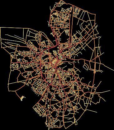
8 Road networks Road intersections as graph vertices Road segments as (weighted) edges Planar graphs Adds topology semantics to queries e.g., nearest neighbor and clustering Build and visualize a 3D road network 9/29/2016 8
9 Big Spatial Data Four V s of big data Volume Partitioning and distributed query processing Velocity In-memory indexes Flushing policy Variety Combine vector and raster data Veracity Inherent errors in location data 9/29/2016 9
10 Project ideas for BSD A benchmark for BSD systems Real data is available A mix of range and spatial join queries Run on a few systems Implement a new query on a BSD system spatial join in AsterixDB KNN join on SpatialHadoop Aggregated visualization of BSD e.g., color code cities by number of tweets Integrate AsterixDB with a visualization server 9/29/

11 Volunteered Geographic Information (VGI) Collection of geographic data by volunteers OpenStreetMap How to take user locations into account? Identifying experts 9/29/

12 Ridesharing Uber Matching drivers and passengers Tracking vehicles 9/29/2016 Figure from 12
13 Spatial keyword queries Keywords are assigned to each record Restaurant, cheap, kids Expand queries to incorporate keywords Range queries: Find all *restaurants* for *kids* within 10 miles Nearest neighbor queries: Find the nearest *gas station* that accepts *credit card* Join queries: Find *excellent* *schools* and *2br* *houses* that are within a distance of five miles 9/29/

14 Indoor Environment Motivated by new technologies WiFi and Bluetooth localization RFID NFC Challenges 3D localization Indoor maps Indoor routing 9/29/


15 Geo-image browser 9/29/


16 Geo-image browser 9/29/


17 Geo-image browser 9/29/
18 Emerging Applications 9/29/
19 Traditional Applications Relational data schema Tables, columns, and rows Normalization Relational operations Select, project, join, group and aggregate Descriptive query language SQL ACID transaction guarantees 9/29/
20 New Requirements Schema-less Hierarchical formats New operations Closures Similarities Scientific language R, Matlab Weak or no transaction guarantees 9/29/
21 Social Networks Eventual consistency High volume + High velocity 9/29/
22 Graph processing Social networks Web graphs Call Detail Records (CDR) Road networks Brain simulation data Knowledge base and RDF data A benchmark for big graph systems, e.g., GraphX, Giraph, and Pregelix 9/29/
23 Data cleaning Name Affiliation ZIP code Mark UC Riverside Anthony UC Riverside Name Affiliation Area code Phone Mark UCR Tony UC Irvine How many errors can you spot? Can you fix any of them? Data cleaning of big data on Spark 9/29/
24 Crowd sourcing Outsource *hard* problems to people e.g., Select all pictures with a waterfall Do these two pictures show the same person? Which query result is more relevant? Challenges Minimize cost Achieve a high accuracy Task allocation 9/29/


25 Visualization Explore big data through visualization Challenge: Make these visualizations scalable and interactive 9/29/


26 Privacy/Security Challenge: Keep data safe while providing scalable computing 9/29/
27 Summary Spatial and spatio-temporal data Query processing Big spatial data Indexing Road networks Emerging applications Social networks Graph processing Visualization Data cleaning 9/29/
28 Thank You! 9/29/
DS504/CS586: Big Data Analytics Data Management Prof. Yanhua Li
 Welcome to DS504/CS586: Big Data Analytics Data Management Prof. Yanhua Li Time: 6:00pm 8:50pm R Location: KH 116 Fall 2017 First Grading for Reading Assignment Weka v 6 weeks v https://weka.waikato.ac.nz/dataminingwithweka/preview
Data Model and Management
 Data Model and Management Ye Zhao and Farah Kamw Outline Urban Data and Availability Urban Trajectory Data Types Data Preprocessing and Data Registration Urban Trajectory Data and Query Model Spatial Database
TrajAnalytics: A software system for visual analysis of urban trajectory data
 TrajAnalytics: A software system for visual analysis of urban trajectory data Ye Zhao Computer Science, Kent State University Xinyue Ye Geography, Kent State University Jing Yang Computer Science, University
DS595/CS525: Urban Network Analysis --Urban Mobility Prof. Yanhua Li
 Welcome to DS595/CS525: Urban Network Analysis --Urban Mobility Prof. Yanhua Li Time: 6:00pm 8:50pm Wednesday Location: Fuller 320 Spring 2017 2 Team assignment Finalized. (Great!) Guest Speaker 2/22 A
A Novel Method for Activity Place Sensing Based on Behavior Pattern Mining Using Crowdsourcing Trajectory Data
 A Novel Method for Activity Place Sensing Based on Behavior Pattern Mining Using Crowdsourcing Trajectory Data Wei Yang 1, Tinghua Ai 1, Wei Lu 1, Tong Zhang 2 1 School of Resource and Environment Sciences,
Efficient Orienteering-Route Search over Uncertain Spatial Datasets
 Efficient Orienteering-Route Search over Uncertain Spatial Datasets Mr. Nir DOLEV, Israel Dr. Yaron KANZA, Israel Prof. Yerach DOYTSHER, Israel 1 Route Search A standard search engine on the WWW returns
Copyright 2016 Ramez Elmasri and Shamkant B. Navathe
 CHAPTER 26 Enhanced Data Models: Introduction to Active, Temporal, Spatial, Multimedia, and Deductive Databases 26.1 Active Database Concepts and Triggers Database systems implement rules that specify
Towards Linked Data and ontology development for the semantic enrichment of volunteered geo-information
 AGILE Link-VGI workshop, Helsinki 14 June 2016 Towards Linked Data and ontology development for the semantic enrichment of volunteered geo-information Rob Lemmens University of Twente, Faculty of Geo-Information
Land Administration and Management: Big Data, Fast Data, Semantics, Graph Databases, Security, Collaboration, Open Source, Shareable Information
 Land Administration and Management: Big Data, Fast Data, Semantics, Graph Databases, Security, Collaboration, Open Source, Shareable Information Platform Steven Hagan, Vice President, Engineering 1 Copyright
Oracle Big Data Spatial and Graph: Spatial Features Roberto Infante 11/11/2015 Latin America Geospatial Forum
 Oracle Big Data Spatial and Graph: Spatial Features Roberto Infante 11/11/2015 Latin America Geospatial Forum Overview of Spatial features Vector Data Processing Support spatial processing of data stored
Copyright The McGraw-Hill Companies, Inc. Permission required for reproduction or display.
 Chapter 17. PATH ANALYSIS AND NETWORK APPLICATIONS 17.1 Path Analysis 17.1.1 Source Raster 17.1.2 Cost Raster Box 17.1 Cost Raster for a Site Analysis of Pipelines 17.1.3 Cost Distance Measures 17.1.4
Webinar Series TMIP VISION
 Webinar Series TMIP VISION TMIP provides technical support and promotes knowledge and information exchange in the transportation planning and modeling community. Today s Goals To Consider: Parallel Processing
Copyright 2012, Oracle and/or its affiliates. All rights reserved.
 1 Real Life Applications of Location Analytics Dan Geringer, Senior Software Development Manager, Oracle Jayant Sharma, Director Prod Mgmt, Oracle 2 The following is intended to outline our general product
The Era of Big Spatial Data: A Survey
 The Era of Big Spatial Data: A Survey Ahmed ELDAWY Mohamed F. MOKBEL The recent explosion in the amount of spatial data calls for specialized systems to handle big spatial data. In this paper, we survey
Oracle NoSQL Database Overview Marie-Anne Neimat, VP Development
 Oracle NoSQL Database Overview Marie-Anne Neimat, VP Development June14, 2012 1 Copyright 2012, Oracle and/or its affiliates. All rights Agenda Big Data Overview Oracle NoSQL Database Architecture Technical
White Paper: Next generation disaster data infrastructure CODATA LODGD Task Group 2017
 White Paper: Next generation disaster data infrastructure CODATA LODGD Task Group 2017 Call for Authors This call for authors seeks contributions from academics and scientists who are in the fields of
CrowdPath: A Framework for Next Generation Routing Services using Volunteered Geographic Information
 CrowdPath: A Framework for Next Generation Routing Services using Volunteered Geographic Information Abdeltawab M. Hendawi, Eugene Sturm, Dev Oliver, Shashi Shekhar hendawi@cs.umn.edu, sturm049@umn.edu,
1. Inroduction to Data Mininig
 1. Inroduction to Data Mininig 1.1 Introduction Universe of Data Information Technology has grown in various directions in the recent years. One natural evolutionary path has been the development of the
Simba: Efficient In-Memory Spatial Analytics.
 Simba: Efficient In-Memory Spatial Analytics. Dong Xie, Feifei Li, Bin Yao, Gefei Li, Liang Zhou and Minyi Guo SIGMOD 16. Andres Calderon November 10, 2016 Simba November 10, 2016 1 / 52 Introduction Introduction
Combining Government and Linked Open Data in Emergency Management
 Combining Government and Linked Open Data in Emergency Management Axel Schulz 1,2 and Heiko Paulheim 3 1 SAP Research 2 Technische Universität Darmstadt Telecooperation Group axel.schulz@sap.com 3 Technische
A data-driven framework for archiving and exploring social media data
 A data-driven framework for archiving and exploring social media data Qunying Huang and Chen Xu Yongqi An, 20599957 Oct 18, 2016 Introduction Social media applications are widely deployed in various platforms
Chapter 1, Introduction
 CSI 4352, Introduction to Data Mining Chapter 1, Introduction Young-Rae Cho Associate Professor Department of Computer Science Baylor University What is Data Mining? Definition Knowledge Discovery from
Jure Leskovec Including joint work with Y. Perez, R. Sosič, A. Banarjee, M. Raison, R. Puttagunta, P. Shah
 Jure Leskovec (@jure) Including joint work with Y. Perez, R. Sosič, A. Banarjee, M. Raison, R. Puttagunta, P. Shah 2 My research group at Stanford: Mining and modeling large social and information networks
Database and Knowledge-Base Systems: Data Mining. Martin Ester
 Database and Knowledge-Base Systems: Data Mining Martin Ester Simon Fraser University School of Computing Science Graduate Course Spring 2006 CMPT 843, SFU, Martin Ester, 1-06 1 Introduction [Fayyad, Piatetsky-Shapiro
Visual Traffic Jam Analysis based on Trajectory Data
 Visualization Workshop 13 Visual Traffic Jam Analysis based on Trajectory Data Zuchao Wang 1, Min Lu 1, Xiaoru Yuan 1, 2, Junping Zhang 3, Huub van de Wetering 4 1) Key Laboratory of Machine Perception
3 Data, Data Mining. Chengkai Li
 CSE4334/5334 Data Mining 3 Data, Data Mining Chengkai Li Department of Computer Science and Engineering University of Texas at Arlington Fall 2018 (Slides partly courtesy of Pang-Ning Tan, Michael Steinbach
Generating Traffic Data
 Generating Traffic Data Thomas Brinkhoff Institute for Applied Photogrammetry and Geoinformatics FH Oldenburg/Ostfriesland/Wilhelmshaven (University of Applied Sciences) Ofener Str. 16/19, D-26121 Oldenburg,
Visualisation of Abstract Information
 Visualisation of Abstract Information Visualisation Lecture 17 Institute for Perception, Action & Behaviour School of Informatics Abstract Information 1 Information Visualisation Previously data with inherent
Spatiotemporal Access to Moving Objects. Hao LIU, Xu GENG 17/04/2018
 Spatiotemporal Access to Moving Objects Hao LIU, Xu GENG 17/04/2018 Contents Overview & applications Spatiotemporal queries Movingobjects modeling Sampled locations Linear function of time Indexing structure
Nearest Neighbor Queries
 Nearest Neighbor Queries Nick Roussopoulos Stephen Kelley Frederic Vincent University of Maryland May 1995 Problem / Motivation Given a point in space, find the k NN classic NN queries (find the nearest
Chapter 24 NOSQL Databases and Big Data Storage Systems
 Chapter 24 NOSQL Databases and Big Data Storage Systems - Large amounts of data such as social media, Web links, user profiles, marketing and sales, posts and tweets, road maps, spatial data, email - NOSQL
Dr. John Snow s London Cholera Map (1854) Very early example of data science
 Very early example of data science") Dr. John Snow s London Cholera Map (1854) data collection data assimilation statistical testing visualization computational analysis (brain) domain knowledge Very early example of data science Predict
Dr. John Snow s London Cholera Map (1854) data collection data assimilation statistical testing visualization computational analysis (brain) domain knowledge Very early example of data science Predict
Multidimensional Data and Modelling - DBMS
 Multidimensional Data and Modelling - DBMS 1 DBMS-centric approach Summary: l Spatial data is considered as another type of data beside conventional data in a DBMS. l Enabling advantages of DBMS (data
Design Considerations on Implementing an Indoor Moving Objects Management System
 , pp.60-64 http://dx.doi.org/10.14257/astl.2014.45.12 Design Considerations on Implementing an s Management System Qian Wang, Qianyuan Li, Na Wang, Peiquan Jin School of Computer Science and Technology,
Apache Spark 2.0. Matei
 Apache Spark 2.0 Matei Zaharia @matei_zaharia What is Apache Spark? Open source data processing engine for clusters Generalizes MapReduce model Rich set of APIs and libraries In Scala, Java, Python and
Latent Space Model for Road Networks to Predict Time-Varying Traffic. Presented by: Rob Fitzgerald Spring 2017
 Latent Space Model for Road Networks to Predict Time-Varying Traffic Presented by: Rob Fitzgerald Spring 2017 Definition of Latent https://en.oxforddictionaries.com/definition/latent Latent Space Model?
Training courses. Course Overview Details Audience Duration. Applying GIS
 Training courses (Last update: December 2017) Remarks: As part of a course a certificate is issued for each attendee. All software used during the courses is Open Source Software. Contact: allspatial Geospatial
SnapSite Online Quick Start Guide
 This quick start guide focuses on the free Census 2010 version of. and databases are available. Additional features The interface is simple and, to most users of Google Maps, familiar. The opening screen,
BSC Smart Cities Initiative
 www.bsc.es BSC Smart Cities Initiative José Mª Cela CASE Director josem.cela@bsc.es CITY DATA ACCESS 2 City Data Access 1. Standardize data access (City Semantics) Define a software layer to keep independent
MySQL Cluster Web Scalability, % Availability. Andrew
 MySQL Cluster Web Scalability, 99.999% Availability Andrew Morgan @andrewmorgan www.clusterdb.com Safe Harbour Statement The following is intended to outline our general product direction. It is intended
MobiEyes: Distributed Architecture for Location-based Services
 MobiEyes: Distributed Architecture for Location-based Services Ling Liu Georgia Institute of Technology Jointly with Buğra Gedik, Kipp Jones, Anand Murugappan, Bhuvan Bamba Outline of the Talk Motivation
Multidimensional (spatial) Data and Modelling (2)
 Data and Modelling (2)") Multidimensional (spatial) Data and Modelling (2) 1 Representative operations on maps l l l l l are operations on layers used in maps (all 2-d). Synonyms f. map: layer, spatial partition Def. properties:
Multidimensional (spatial) Data and Modelling (2) 1 Representative operations on maps l l l l l are operations on layers used in maps (all 2-d). Synonyms f. map: layer, spatial partition Def. properties:
Geospatial Analytics at Scale
 Geospatial Analytics at Scale Milos Milovanovic CoFounder & Data Engineer milos@thingsolver.com Things Solver ENLIGHTEN YOUR DATA What we do? Advanced Analytics company based in Belgrade, Serbia. We are
SCALING A DISTRIBUTED SPATIAL CACHE OVERLAY. Alexander Gessler Simon Hanna Ashley Marie Smith
 SCALING A DISTRIBUTED SPATIAL CACHE OVERLAY Alexander Gessler Simon Hanna Ashley Marie Smith MOTIVATION Location-based services utilize time and geographic behavior of user geotagging photos recommendations
THINK RESILIENCY 2.0 WITH VIZONOMY
 VIZONOMY // 01 ABOUT US The greatest advances in climate risk awareness will be those that merge, harness, and properly communicate big data sources to drive meaningful action and response. Vizonomy s
Elysium Technologies Private Limited::IEEE Final year Project
 Elysium Technologies Private Limited::IEEE Final year Project - o n t e n t s Data mining Transactions Rule Representation, Interchange, and Reasoning in Distributed, Heterogeneous Environments Defeasible
Unit 10 Databases. Computer Concepts Unit Contents. 10 Operational and Analytical Databases. 10 Section A: Database Basics
 Unit 10 Databases Computer Concepts 2016 ENHANCED EDITION 10 Unit Contents Section A: Database Basics Section B: Database Tools Section C: Database Design Section D: SQL Section E: Big Data Unit 10: Databases
Introduction to Spatial Database Systems. Outline
 Introduction to Spatial Database Systems by Cyrus Shahabi from Ralf Hart Hartmut Guting s VLDB Journal v3, n4, October 1994 1 Outline Introduction & definition Modeling Querying Data structures and algorithms
Oracle NoSQL Database Enterprise Edition, Version 18.1
 Oracle NoSQL Database Enterprise Edition, Version 18.1 Oracle NoSQL Database is a scalable, distributed NoSQL database, designed to provide highly reliable, flexible and available data management across
CSE 344 Final Review. August 16 th
 CSE 344 Final Review August 16 th Final In class on Friday One sheet of notes, front and back cost formulas also provided Practice exam on web site Good luck! Primary Topics Parallel DBs parallel join
Advanced Data Types and New Applications
 Advanced Data Types and New Applications These slides are a modified version of the slides of the book Database System Concepts (Chapter 24), 5th Ed., McGraw-Hill, by Silberschatz, Korth and Sudarshan.
Oracle Spatial Summit 2015 Best Practices for Developing Geospatial Apps for the Cloud
 Oracle Spatial Summit 2015 Best Practices for Developing Geospatial Apps for the Cloud Nick Salem, Distinguished Engineer Neustar Neustar ElementOne OVERVIEW Comprehensive cloud based GIS analytics platform
Oracle Spatial A Unifying Framework at the Utah Department Of Transportation
 Oracle Spatial A Unifying Framework at the Utah Department Of Transportation Dan Paske Utah Department of Transportation Oracle DBA Jeff Saunders Farallon Geographics, Inc. Senior Geodatabase Developer
Course Modules for MCSA: SQL Server 2016 Database Development Training & Certification Course:
 Course Modules for MCSA: SQL Server 2016 Database Development Training & Certification Course: 20762C Developing SQL 2016 Databases Module 1: An Introduction to Database Development Introduction to the
Principles of Data Management. Lecture #14 (Spatial Data Management)
") Principles of Data Management Lecture #14 (Spatial Data Management) Instructor: Mike Carey mjcarey@ics.uci.edu Database Management Systems 3ed, R. Ramakrishnan and J. Gehrke 1 Today s Notable News v Project
Principles of Data Management Lecture #14 (Spatial Data Management) Instructor: Mike Carey mjcarey@ics.uci.edu Database Management Systems 3ed, R. Ramakrishnan and J. Gehrke 1 Today s Notable News v Project
BIG DATA TECHNOLOGIES: WHAT EVERY MANAGER NEEDS TO KNOW ANALYTICS AND FINANCIAL INNOVATION CONFERENCE JUNE 26-29,
 BIG DATA TECHNOLOGIES: WHAT EVERY MANAGER NEEDS TO KNOW ANALYTICS AND FINANCIAL INNOVATION CONFERENCE JUNE 26-29, 2016 1 OBJECTIVES ANALYTICS AND FINANCIAL INNOVATION CONFERENCE JUNE 26-29, 2016 2 WHAT
Efficient, Scalable, and Provenance-Aware Management of Linked Data
 Efficient, Scalable, and Provenance-Aware Management of Linked Data Marcin Wylot 1 Motivation and objectives of the research The proliferation of heterogeneous Linked Data on the Web requires data management
CIB Session 12th NoSQL Databases Structures
 CIB Session 12th NoSQL Databases Structures By: Shahab Safaee & Morteza Zahedi Software Engineering PhD Email: safaee.shx@gmail.com, morteza.zahedi.a@gmail.com cibtrc.ir cibtrc cibtrc 2 Agenda What is
SLIPO. Scalable Linking and Integration of Big POI data. Giorgos Giannopoulos IMIS/Athena RC
 SLIPO Scalable Linking and Integration of Big POI data I n f o r m a ti o n a n d N e t w o r ki n g D a y s o n H o ri z o n 2 0 2 0 B i g Da ta Public-Priva te Partnership To p i c : I C T 14 B i g D
IEEE 2013 JAVA PROJECTS Contact No: KNOWLEDGE AND DATA ENGINEERING
 IEEE 2013 JAVA PROJECTS www.chennaisunday.com Contact No: 9566137117 KNOWLEDGE AND DATA ENGINEERING (DATA MINING) 1. A Fast Clustering-Based Feature Subset Selection Algorithm for High Dimensional Data
Northern India Engineering College, New Delhi Question Bank Database Management System. B. Tech. Mechanical & Automation Engineering V Semester
 1. List four significant differences between a file-processing system and a DBMS. 2. Explain the difference between physical and logical data independence. 3. What are five main functions of a database
Nowcasting. D B M G Data Base and Data Mining Group of Politecnico di Torino. Big Data: Hype or Hallelujah? Big data hype?
 Big data hype? Big Data: Hype or Hallelujah? Data Base and Data Mining Group of 2 Google Flu trends On the Internet February 2010 detected flu outbreak two weeks ahead of CDC data Nowcasting http://www.internetlivestats.com/
Traces. The main idea: Use traceroutes to create a graph model of the network, use graph traversal algorithms to determine proximity of nodes
 proximity service Main idea provide glue between experiments and sonar topology mainly map sonars to storages and vice versa determine existing tools/technologies that can be used 3 approaches Site-based
[DEMO INTRO TO CAERUS GEO] American Red Cross International Services
![[DEMO INTRO TO CAERUS GEO] American Red Cross International Services](/thumbs/74/70261247.jpg "[DEMO INTRO TO CAERUS GEO] American Red Cross International Services") [DEMO INTRO TO CAERUS GEO] American Red Cross International Services http://americanredcross.github.io Table of Contents Introduction... 1 Overview... 1 What is CaerusGeo?... 1 Using CaerusGeo... 1 Create
[DEMO INTRO TO CAERUS GEO] American Red Cross International Services http://americanredcross.github.io Table of Contents Introduction... 1 Overview... 1 What is CaerusGeo?... 1 Using CaerusGeo... 1 Create
QUERY PROCESSING AND OPTIMIZATION FOR PICTORIAL QUERY TREES HANAN SAMET
 qt0 QUERY PROCESSING AND OPTIMIZATION FOR PICTORIAL QUERY TREES HANAN SAMET COMPUTER SCIENCE DEPARTMENT AND CENTER FOR AUTOMATION RESEARCH AND INSTITUTE FOR ADVANCED COMPUTER STUDIES UNIVERSITY OF MARYLAND
Visualisation of Abstract Information
 Visualisation of Abstract Information Visualisation Lecture 17 Institute for Perception, Action & Behaviour School of Informatics Abstract Information 1 Information Visualisation Previously data with inherent
An Introduction to Spatial Databases
 An Introduction to Spatial Databases R. H. Guting VLDB Journal v3, n4, October 1994 Speaker: Giovanni Conforti Outline: a rather old (but quite complete) survey on Spatial DBMS Introduction & definition
Verarbeitung von Vektor- und Rasterdaten auf der Hadoop Plattform DOAG Spatial and Geodata Day 2016
 Verarbeitung von Vektor- und Rasterdaten auf der Hadoop Plattform DOAG Spatial and Geodata Day 2016 Hans Viehmann Product Manager EMEA ORACLE Corporation 12. Mai 2016 Safe Harbor Statement The following
Spatial Analysis (Vector) II
 II") Spatial Analysis (Vector) II GEOG 300, Lecture 9 Dr. Anthony Jjumba 1 A Spatial Network is a set of geographic locations interconnected in a system by a number of routes is a system of linear features
Spatial Analysis (Vector) II GEOG 300, Lecture 9 Dr. Anthony Jjumba 1 A Spatial Network is a set of geographic locations interconnected in a system by a number of routes is a system of linear features
Lecture 6: GIS Spatial Analysis. GE 118: INTRODUCTION TO GIS Engr. Meriam M. Santillan Caraga State University
 Lecture 6: GIS Spatial Analysis GE 118: INTRODUCTION TO GIS Engr. Meriam M. Santillan Caraga State University 1 Spatial Data It can be most simply defined as information that describes the distribution
Big Data Architect.
 Big Data Architect www.austech.edu.au WHAT IS BIG DATA ARCHITECT? A big data architecture is designed to handle the ingestion, processing, and analysis of data that is too large or complex for traditional
Representing Geography
 Data models and axioms Chapters 3 and 7 Representing Geography Road map Representing the real world Conceptual models: objects vs fields Implementation models: vector vs raster Vector topological model
Chapter 1: Introduction to Spatial Databases
 Chapter 1: Introduction to Spatial Databases 1.1 Overview 1.2 Application domains 1.3 Compare a SDBMS with a GIS 1.4 Categories of Users 1.5 An example of an SDBMS application 1.6 A Stroll though a spatial
Analysis of Big Data using GeoMesa
 Analysis of Big Data using GeoMesa Saiyed Atufaali 1 Mr.Prashant Chauhan 2 Dr. M. B. Potdar 3 1 Student, GTU PG School-Ahmedabad,Gujarat,India 2 Project Scientist, Bhaskaracharya Institute for Space Applications
Quadrant-Based MBR-Tree Indexing Technique for Range Query Over HBase
 Quadrant-Based MBR-Tree Indexing Technique for Range Query Over HBase Bumjoon Jo and Sungwon Jung (&) Department of Computer Science and Engineering, Sogang University, 35 Baekbeom-ro, Mapo-gu, Seoul 04107,
relational Key-value Graph Object Document
 NoSQL Databases Earlier We have spent most of our time with the relational DB model so far. There are other models: Key-value: a hash table Graph: stores graph-like structures efficiently Object: good
CrateDB for Time Series. How CrateDB compares to specialized time series data stores
 CrateDB for Time Series How CrateDB compares to specialized time series data stores July 2017 The Time Series Data Workload IoT, digital business, cyber security, and other IT trends are increasing the
Introduction to Geodatabase and Spatial Management in ArcGIS. Craig Gillgrass Esri
 Introduction to Geodatabase and Spatial Management in ArcGIS Craig Gillgrass Esri Session Path The Geodatabase - What is it? - Why use it? - What types are there? - What can I do with it? Query Layers
Graph Data Management
 Graph Data Management Analysis and Optimization of Graph Data Frameworks presented by Fynn Leitow Overview 1) Introduction a) Motivation b) Application for big data 2) Choice of algorithms 3) Choice of
Intelligent Traffic System: Road Networks with Time-Weighted Graphs
 Intelligent Traffic System: Road Networks with Time-Weighted Graphs Hatem F. Halaoui Haigazian University, Lebanon Abstract Driving direction traffic Systems are becoming needed systems among many Geographical
Network Analyst: Performing Network Analysis
 Esri International User Conference San Diego, California Technical Workshops July 24, 2012 Network Analyst: Performing Network Analysis Jay Sandhu Deelesh Mandloi Goals We assume you have some familiarity
Spatial Keyword Search. Presented by KWOK Chung Hin, WONG Kam Kwai
 Spatial Keyword Search Presented by KWOK Chung Hin, WONG Kam Kwai Outline Background/ Motivations Spatial Keyword Search Applications Two types of spatial keyword query Individual Object Object Sets Background
New Developments in Spark
 New Developments in Spark And Rethinking APIs for Big Data Matei Zaharia and many others What is Spark? Unified computing engine for big data apps > Batch, streaming and interactive Collection of high-level
Spatial data and QGIS
 Spatial data and QGIS Xue Jingbo IT Center 2017.08.07 A GIS consists of: Spatial Data. Computer Hardware. Computer Software. Longitude Latitude Disease Date 26.870436-31.909519 Mumps 13/12/2008 26.868682-31.909259
DS504/CS586: Big Data Analytics Data Pre-processing and Cleaning Prof. Yanhua Li
 Welcome to DS504/CS586: Big Data Analytics Data Pre-processing and Cleaning Prof. Yanhua Li Time: 6:00pm 8:50pm R Location: AK 232 Fall 2016 The Data Equation Oceans of Data Ocean Biodiversity Informatics,
Convergence and Collaboration: Transforming Business Process and Workflows
 Convergence and Collaboration: Transforming Business Process and Workflows Steven Hagan, Vice President, Server Technologies 1 Copyright 2011, Oracle and/or its affiliates. All rights Convergence & Collaboration:
Georeferencing. Georeferencing: = linking a layer or dataset with spatial coordinates. Registration: = lining up layers with each other
 Georeferencing How do we make sure all our data layers line up? Georeferencing: = linking a layer or dataset with spatial coordinates Registration: = lining up layers with each other Rectification: The
Cloud Computing 2. CSCI 4850/5850 High-Performance Computing Spring 2018
 Cloud Computing 2 CSCI 4850/5850 High-Performance Computing Spring 2018 Tae-Hyuk (Ted) Ahn Department of Computer Science Program of Bioinformatics and Computational Biology Saint Louis University Learning
Web GIS: Principles and Applications. Pinde Fu, Ph.D. Project Lead / Senior Developer Professional Services Division
 Web GIS: Principles and Applications Pinde Fu, Ph.D. pfu@esri.com Project Lead / Senior Developer Professional Services Division 2 Web GIS: Principles and Applications Pinde Fu & Jiulin Sun Web GIS course
Void main Technologies
 Sno Title Domain 1. A Cross Tenant Access Control (CTAC) Model for Cloud Computing: Formal Specification and Verification 2. A Lightweight Secure Data Sharing Scheme for Mobile Cloud Computing 3. A Modified
Distributed Graph Storage. Veronika Molnár, UZH
 Distributed Graph Storage Veronika Molnár, UZH Overview Graphs and Social Networks Criteria for Graph Processing Systems Current Systems Storage Computation Large scale systems Comparison / Best systems
IST 210. Introduction to Spatial Databases
 Introduction to Spatial Databases Evolution of acronym GIS Geographic Information Systems (1980s) Geographic Information Science (1990s) Geographic Information Services (2000s) GISystems GIServices GIScience
A Conceptual Design Towards Semantic Geospatial Data Access
 A Conceptual Design Towards Semantic Geospatial Data Access Mingzhen Wei 1, Tian Zhao 2, Dalia Varanka 1, E. Lynn Usery 1 1 U.S. Geological Survey, Rolla, MO, 65401, USA, {mwei, dvaranka, usery}@usgs.gov
CREATING VIRTUAL SEMANTIC GRAPHS ON TOP OF BIG DATA FROM SPACE. Konstantina Bereta and Manolis Koubarakis
 CREATING VIRTUAL SEMANTIC GRAPHS ON TOP OF BIG DATA FROM SPACE Konstantina Bereta and Manolis Koubarakis National and Kapodistrian University of Athens ABSTRACT We present the system Ontop-spatial for
So, we want to perform the following query:
 Abstract This paper has two parts. The first part presents the join indexes.it covers the most two join indexing, which are foreign column join index and multitable join index. The second part introduces
Instructor: Dr. Hanna A. Kirolous RFID Automated Library Management System
 Instructor: Dr. Hanna A. Kirolous e-mail: kirolous@aucegypt.edu RFID Automated Library Management System Radio Frequency Identification (RFID) is a new generation of Auto Identification and Data collection
Taking Benefit from the User Density in Large Cities for Delivering SMS
 Taking Benefit from the User Density in Large Cities for Delivering SMS Yannick Léo Equipe Dante, ENS de Lyon, INRIA - FRANCE 12-13/01/2016 RESCOM, Lille Collaboration with... Carlos SARRAUTE Grandata
Spatio-Temporal Routing Algorithms Panel on Space-Time Research in GIScience Intl. Conference on Geographic Information Science 2012
 Spatio-Temporal Routing Algorithms Panel on Space-Time Research in GIScience Intl. Conference on Geographic Information Science 0 Shashi Shekhar McKnight Distinguished University Professor Department of
Location Aware Social Networks User Profiling Using Big Data Analytics
 Received: August 29, 2017 242 Location Aware Social Networks User Profiling Using Big Data Analytics Venu Gopalachari Mukkamula 1 * Lavanya Nangunuri 1 1 Department of Computer Science and Engineering,
LECTURE 2 SPATIAL DATA MODELS
 LECTURE 2 SPATIAL DATA MODELS Computers and GIS cannot directly be applied to the real world: a data gathering step comes first. Digital computers operate in numbers and characters held internally as binary