Addressing Geospatial Big Data Management and Distribution Challenges ERDAS APOLLO & ECW
|
|
|
- Kory Jones
- 5 years ago
- Views:
Transcription
 Enterprise Solutions")
1 Addressing Geospatial Big Data Management and Distribution Challenges ERDAS APOLLO & ECW Nouman Ahmed GeoSystems-Me (Hexagon Geospatial / ERDAS Regional Partner) Enterprise Solutions Architect


2 Hexagon Family Hexagon is dedicated to delivering actionable information through design, measurement, and visualization technologies. Learn more at hexagon.com. 2


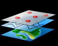


3 Dynamic GIS: Measuring Our Changing Earth Geospatial Information Value Chain 3 Capture Process Share Deliver
4 VOLUME


5 Data deluge Imagery data volumes are growing at an ever increasing rate. Faster than processing and storage costs are falling 3 PetaBytes/ year or 8 TerraBytes / day forseen for Copernicus 5

6 Data Deluge Greater Resolution, Greater Coverage, Greater Frequency 6

7 Data Deluge New Data Sources beside traditional airborne and satellite platforms 7


8 Rocketing User Demand Every day, new users are demanding imagery, across all applications, on all devices Not just some imagery, but the latest, highest resolution imagery available They want the entire historical archive accessible 8
9 Big Data Made Small the most common purpose of Big Data is to produce Small Data DataInformed 10 Sept # Pixels in a Single ECW File 9
10 Big Data Made Small 14 terapixels the most common purpose of Big Data is to produce Small Data DataInformed 10 Sept terapixels 1.7 terapixels # Pixels in a Single ECW File 10


11 Big Data Made Small The World s Largest Geospatial Image? A single aerial image covering 20cm GSD 3,210,000 px by 4,340,000px Big Data Made Small 38,000gb Uncompressed 50,000gb with image pyramids 875gb ECW Compressed 370,000 source files 1 ECW file 11

12 38Tb image Germany 12


13 ECW & JPEG2000 Compression Technology ENCODING SPEED REDUCED DATA MANAGEMENT DECODING SPEED IMAGE QUALITY The Power of ECW & JP2K Compressio n technology ENHANCED USER PERFORMANCE REDUCED STORAGE COSTS FILE SIZE TIME SAVED 13
14 COMPRESS Uncompressed Original & Pyramids 1300 Gb Uncompressed Original 1000 Gb JPEG 2000 Numerically Lossless Compression 400 Gb ECW Visually Lossless Compression ECW image compression: Instant storage savings Faster performance Full visual quality JPG2000: Strongly reduce size Keep data integrity 50Gb 14
15 ECW - COMPRESS and SIMPLIFY Intergraph ECW Raw Imagery +1 ECW mosaic file Conventional Approach Raw Imagery +Image Tiles +Tile Pyramids Efficient processing and simple data structure: Easier to manage Time effective Provides a single source of truth One format to serve all software clients. +Mosaic Overviews 15 +Tile Cache

16 Imagery & Tile Cache Storage Non-scalable solutions Duplicates data Complicates data publishing Restricts users to specific projections Restricts users to specific resolutions/scales Tile caching places decoding speed above all other needs 16
 71Tb level 19 cache 38Tb + 116 level 18 cache ECW 0.")
17 Uncompressed With Pyramids With tile-cache to level 17 With tile-cache to level 18 With tile-cache to level 19 Tile cache Worked example (Storage) 71Tb level 19 cache 38Tb level 18 cache ECW 0.85Tb level 17 cache Pyramids +29 ECW Imagery Size Days needed to generate
18 Original with pyramids plus tile-cache 17 levels plus tile-cache 19 levels Storage Costs - Tile-cache & Pyramid vs. ECW $ 4,600 $ 4,700 $ 6,200 Amazon S3 Cloud storage Costs comparison example 98% lower costs using ECW >$4.6k monthly saving Up to $73k annual saving ECW $ $ cost per month Data generated using the Amazon S3 Cloud Calculator
19 VELOCITY ERDAS APOLLO Big Data Management - Managing and Delivering Geospatial Information Across the Enterprise Imagery, Raster, LIDAR, CAD and Business Data Management; Cataloguing, Processing, Analysis & Delivery across the Enterprise Extremely High Performance Imagery Streaming & Data Delivery.

20 ERDAS APOLLO - Geospatial Data Portal 20
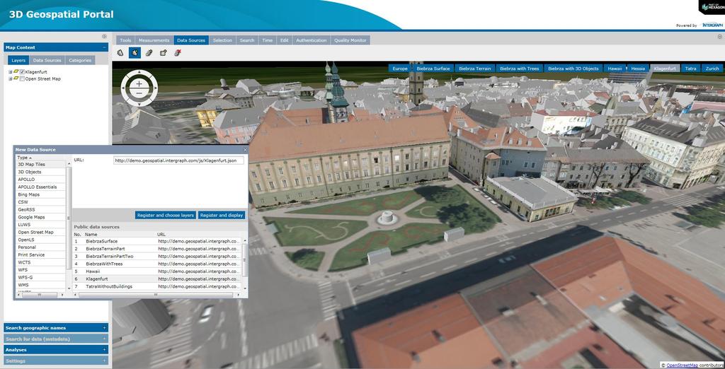


21 3D Geospatial Portal 21
 - Fast tile-based delivery of tiled data 4000+ tiles a second 10,000 users simultaneously Supports common industry standards for deployment Easily integrates data from")
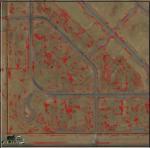
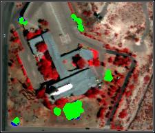
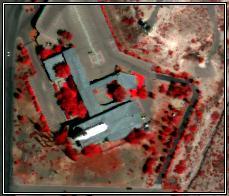
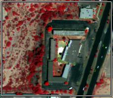
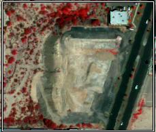
22 ERDAS APOLLO Essentials Fastest geospatial imagery server in the world, period Deliver terabytes of image data to thousands of people ECWP high-speed streaming imagery 5,000 users simultaneously Optimized Tile Delivery (OTDF) - Fast tile-based delivery of tiled data tiles a second 10,000 users simultaneously Supports common industry standards for deployment Easily integrates data from existing GIS Highly cost-effective Requires only standard server hardware 22
23 Supports massive imagery - Deliver terabytes of image data with a single server ECWP Streaming protocol: scales efficiently to support thousands of concurrent users on a dual processor system. OGC-compliant Web Map Service (WMS) and Web Map Tiling Service (WMTS) protocols but also ESRI GeoServices REST. Integrates into your GIS directly of via Plug-ins ArcGIS, ArcView, MapInfo TM, AutoCAD, Bentley 23
24 24


25 APOLLO Advantage Generated Crawling APOLLO Advantage Manage Catalog Capture Process Deliver 25
26 CRAWLING The Geospatial Information crawlers are scheduled server jobs for continuous discovery of Geospatial data at user specified dataset store locations. The crawlers : Run asynchronously on the Server: Set it and forget it! Run on a repeated scheduled basis to enable the catalog auto update Auto-discover imagery and terrain data Drop box concept Auto-harvest imagery/sensor metadata like LANDSAT, QUICKBIRD, SPOT, DIMAP, ISO 19115/19139, etc Auto-provision data for optimized end user consumption (pyramids, thumbnails and metadata generation, footprint computation and security configuration) API available 26

27 Hierarchical Data Model (Variety, Value) Hierarchical classification of Data Data gathered by collection, theme, type, domain Ascendant metadata aggregation through hierarchy metadata aggregation 27 27
28 Advanced Data Management remotely crawl, provision, manage and secure geospatial imagery, Lidar, Vector, terrain and non-spatial business data. Catalog Data Model Define complex hierarchical data models of heterogenous disparate grided data. Advanced Security Secure your Geospatial Information Centrally. Data and Metadata Delivery the most comprehensive gridded data delivery protocols available on the market in a single server. Web Client Interface Geospatial Data Portal to search, discover, view and download data online from a web broswer. 28
29 Online Processing
30 APOLLO Professional APOLLO Professional Publish Manage Catalog Online processing Processes 30


31 ERDAS APOLLO Professional Clip, Zip and Ship LAS-formatted Point Cloud data Geoprocessing Extract value-added information products OGC Web Processing Service (WPS) Integrates ERDAS IMAGINE Spatial Modeler Engine 31

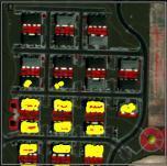
32 Valtus Data and APOLLO Processing 5 Band Data Produces very clean change detection B-1 B-2 B-3 32


33 Results 33
34 Conclusion APOLLO provides tools to adress Big Data challenge Volume: Big Data to Small Data Hexagon ECW and JPG2000 compression very efficient Easy and fast data dissemination Streaming: ECWP/JPIP WMS, WMS-T, WMTS SDK available to integrate that technology in your own system Velocity : Dynamic data management: Data crawling Metadata aggregation Automatic medata parsers for different Satellite products (Landsat, Spot, etc) Variaty of interfaces to consume data including OGC Download: WCS (from Level0 ), Clip Zip and Ship View : WMS, WMTS, WMS-T Processing : WPS Discovery 34
35 QUESTIONS?
ERDAS APOLLO v2013. What s New. SMARTERDECISIONS
 ERDAS APOLLO v2013 What s New. SMARTERDECISIONS 1 ERDAS APOLLO v2013 ERDAS APOLLO Professional: includes all the functionality of ERDAS APOLLO Advantage. In addition, it provides server side geoprocessing
PRODUCT BROCHURE ERDAS APOLLO MANAGING AND SERVING GEOSPATIAL INFORMATION
 PRODUCT BROCHURE ERDAS APOLLO MANAGING AND SERVING GEOSPATIAL INFORMATION ERDAS APOLLO Do you have large volumes of geospatial information, regularly updated data stores, and a distributed user base? Do
ERDAS APOLLO Managing and Serving Geospatial Information
 ERDAS APOLLO Managing and Serving Geospatial Information ERDAS APOLLO Do you have large volumes of geospatial information, regularly updated data stores, and a distributed user base? Do you need a single,
GEOSPATIAL ERDAS APOLLO. Your Geospatial Business System for Managing and Serving Information
 GEOSPATIAL ERDAS APOLLO Your Geospatial Business System for Managing and Serving Information ERDAS APOLLO Do you have large volumes of data, a geographicallydistributed user base and rapidly changing
SMARTERDECISIONS. Geospatial Portal 2013 Open Interoperable GIS/Imagery Services with ERDAS Apollo 2013 and ERDAS Imagine 2013
 Geospatial Portal 2013 Open Interoperable GIS/Imagery Services with ERDAS Apollo 2013 and ERDAS Imagine 2013 Carahsoft Intergraph Government Solutions SMARTERDECISIONS Geospatial Portal 2013 Geospatial
PRODUCT DESCRIPTION. ERDAS APOLLO 2014 Product Features and Comparisons
 PRODUCT DESCRIPTION ERDAS APOLLO 2014 Product Features and Comparisons ERDAS APOLLO is an enterprise-class, comprehensive data management, analysis, and delivery system enabling an organization to catalog,
PRODUCT DESCRIPTION ERDAS APOLLO 2018 PRODUCT FEATURES AND COMPARISONS
 PRODUCT DESCRIPTION ERDAS APOLLO 2018 PRODUCT FEATURES AND COMPARISONS ERDAS APOLLO ERDAS APOLLO is an enterprise-class, comprehensive data management, analysis, and delivery system enabling an organization
ERDAS Image Web Server Datasheet
 ERDAS Image Web Server Datasheet age 1 of 10 ERDAS Image Web Server Image serving protocols Multi-protocol support Expose images with different protocols. ERDAS Compressed Wavelet Protocol (ECWP) image
ERDAS IMAGINE THE WORLD S MOST WIDELY-USED REMOTE SENSING SOFTWARE PACKAGE
 PRODUCT BROCHURE ERDAS IMAGINE THE WORLD S MOST WIDELY-USED REMOTE SENSING SOFTWARE PACKAGE 1 ERDAS IMAGINE The world s most widely-used remote sensing software package 2 ERDAS IMAGINE The world s most
Managing Imagery and Raster Data using Mosaic Datasets
 Esri European User Conference October 15-17, 2012 Oslo, Norway Hosted by Esri Official Distributor Managing Imagery and Raster Data using Mosaic Datasets Peter Becker ArcGIS is a Comprehensive Imagery
ArcGIS for Server Imagery Update. Cody A. Benkelman Technical Product Manager, Imagery
 ArcGIS for Server Imagery Update Cody A. Benkelman Technical Product Manager, Imagery Outline Mosaic dataset Management and dissemination of imagery - Dynamic image services, Tiled Cache Visualization
ERDAS IMAGINE THE WORLD S MOST WIDELY-USED REMOTE SENSING SOFTWARE PACKAGE
 PRODUCT BROCHURE ERDAS IMAGINE THE WORLD S MOST WIDELY-USED REMOTE SENSING SOFTWARE PACKAGE 1 ERDAS IMAGINE The world s most widely-used remote sensing software package 2 ERDAS IMAGINE The Theworld s world
Imagery and Raster Data in ArcGIS. Abhilash and Abhijit
 Imagery and Raster Data in ArcGIS Abhilash and Abhijit Agenda Imagery in ArcGIS Mosaic datasets Raster processing ArcGIS is a Comprehensive Imagery System Integrating All Types, Sources, and Sensor Models
IMAGERY FOR ARCGIS. Manage and Understand Your Imagery. Credit: Image courtesy of DigitalGlobe
 IMAGERY FOR ARCGIS Manage and Understand Your Imagery Credit: Image courtesy of DigitalGlobe 2 ARCGIS IS AN IMAGERY PLATFORM Empowering you to make informed decisions from imagery and remotely sensed data
Managing Image Data on the ArcGIS Platform Options and Recommended Approaches
 Managing Image Data on the ArcGIS Platform Options and Recommended Approaches Peter Becker Petroleum requirements for imagery and raster Traditional solutions and issues Overview of ArcGIS imaging capabilities
Publishing image services in ArcGIS
 Esri International User Conference San Diego, California Technical Workshops July 26, 2012 Publishing image services in ArcGIS Wenxue Ju & Melanie Harlow What is an image service? A way to make image and
Managing Imagery And Raster Data Using Mosaic Dataset. Peter Becker & Cody Benkelman
 Managing Imagery And Raster Data Using Mosaic Dataset Peter Becker & Cody Benkelman ArcGIS is a Comprehensive Imagery Platform Imagery is integral to the ArcGIS Platform System of Engagement System of
Leveraging OGC Services in ArcGIS Server. Satish Sankaran, Esri Yingqi Tang, Esri
 Leveraging OGC Services in ArcGIS Server Satish Sankaran, Esri Yingqi Tang, Esri GIS Creating and Managing Geo Information Products - Proprietary - Open Specifications - Standards Dissemination of Geo
ArcGIS Enterprise: An Introduction. Philip Heede
 Enterprise: An Introduction Philip Heede Online Enterprise Hosted by Esri (SaaS) - Upgraded automatically (by Esri) - Esri controls SLA Core Web GIS functionality (Apps, visualization, smart mapping, analysis
_ LUCIADFUSION V PRODUCT DATA SHEET _ LUCIADFUSION PRODUCT DATA SHEET
 _ LUCIADFUSION PRODUCT DATA SHEET V2016 LuciadFusion is the solution for efficient and effective use of geospatial data. It allows you to organize your data so that each user has one-click access to a
ERDAS APOLLO PERFORMANCE BENCHMARK ECW DELIVERY PERFORMANCE OF ERDAS APOLLO VERSUS ESRI ARCGIS FOR SERVER
 ERDAS APOLLO PERFORMANCE BENCHMARK ECW DELIVERY PERFORMANCE OF ERDAS APOLLO VERSUS ESRI ARCGIS FOR SERVER White Paper April 14, 2014 Contents Introduction... 3 Sample Dataset... 4 Test Hardware... 5 Summary...
New Mexico s RGIS Program: State Geospatial Data Clearinghouse
 New Mexico s RGIS Program: State Geospatial Data Clearinghouse Laura Gleasner Su Zhang November 10, 2016 New Mexico RGIS: The State Digital Geospatial Data Clearinghouse The Resource Geographic Information
Serving Imagery with ArcGIS Server 10.1
 Serving Imagery with ArcGIS Server 10.1 Presented by: André Piasta apiasta@esri.ca Esri Canada Users Conference Calgary, AB 28 May 2013 Today s Agenda ArcGIS server and image services Publishing of imagery
Lidar Working with LAS Datasets
 2013 Esri International User Conference July 8 12, 2013 San Diego, California Technical Workshop Lidar Working with LAS Datasets Raghav Vemula (3D Team) Esri UC2013. Technical Workshop. Agenda Las Dataset
Drone2Map for ArcGIS: Bring Drone Imagery into ArcGIS. Will
 Drone2Map for ArcGIS: Bring Drone Imagery into ArcGIS Will Meyers @MeyersMaps A New Window on the World Personal Mapping for Micro-Geographies Accurate High Quality Simple Low-Cost Drone2Map for ArcGIS
Part 1 ERDAS Imagine 2010 Part 2 - Web Services, OGC and ERDAS APOLLO
 Part 1 ERDAS Imagine 2010 Part 2 - Web Services, OGC and ERDAS APOLLO Phil Cooper Symetri Geo, Infoterra Ltd phil.cooper@symetrigeo.co.uk 1 www.erdas-uk.com now www.symetrigeo.co.uk 2 Annual Conference
Image Services for Elevation Data
 Image Services for Elevation Data Peter Becker Need for Elevation Using Image Services for Elevation Data sources Creating Elevation Service Requirement: GIS and Imagery, Integrated and Accessible Field
The ArcGIS Platform for Managing, Processing, and Sharing UAV Data
 The ArcGIS Platform for Managing, Processing, and Sharing UAV Data Cody Benkelman, Technical Product Manager - Imagery David Gadsden, Nonprofit Program Manager Esri Advancing GIS Strong and Growing..Serving
Leveraging OGC Services in ArcGIS Server. Satish Sankaran Yingqi Tang
 Leveraging OGC Services in ArcGIS Server Satish Sankaran ssankaran@esri.com Yingqi Tang ytang@esri.com Agenda Interoperability Enablers OGC and esri OGC Web Services ArcGIS and OGC Web Services - @ version
Image Management in ArcGIS. Vinay Viswambharan
 Image Management in ArcGIS Vinay Viswambharan Topics covered Primary Imagery Management Information Model - Mosaic Dataset Sharing Imagery using mosaic datasets/image services. Image Services and Cloud
Providing Interoperability Using the Open GeoServices REST Specification
 2013 Esri International User Conference July 8 12, 2013 San Diego, California Technical Workshop Providing Interoperability Using the Open GeoServices REST Specification Satish Sankaran Kevin Sigwart What
Scientific and Multidimensional Raster Support in ArcGIS
 Scientific and Multidimensional Raster Support in ArcGIS Sudhir Raj Shrestha sshrestha@esri.com Brief breakdown Scientific Multidimensional data Ingesting Scientific MultiDim Data in ArcGIS Ingesting and
Image Management and Dissemination. Peter Becker
 Image Management and Dissemination Peter Becker OUTLINE Requirements Intro to Mosaic Datasets Workflows & Demo Dynamic Mosaicking, On-the-fly processing Properties Differentiator Raster Catalog, ISDef,
Using Imagery for Intelligence Analysis
 2013 Esri International User Conference July 8 12, 2013 San Diego, California Technical Workshop Using Imagery for Intelligence Analysis Renee Bernstein Natalie Campos Esri UC2013. Technical Workshop.
Oracle Spatial Users Conference
 April 27, 2006 Tampa Convention Center Tampa, Florida, USA Stephen Smith GIS Solutions Manager Large Image Archive Management Solutions Using Oracle 10g Spatial & IONIC RedSpider Image Archive Outline
Leveraging OGC Standards on ArcGIS Server
 Leveraging OGC Standards on ArcGIS Server Satish Sankaran Interoperability and Standards Team James Michel III ESRI Intel Team ArcGIS Server Complete Interoperable Server-Based GIS Desktop Explorer Web
An Introduction to Using Lidar with ArcGIS and 3D Analyst
 FedGIS Conference February 24 25, 2016 Washington, DC An Introduction to Using Lidar with ArcGIS and 3D Analyst Jim Michel Outline Lidar Intro Lidar Management Las files Laz, zlas, conversion tools Las
MrSID Plug-in for 3D Analyst
 LizardTech MrSID Plug-in for 3D Analyst User Manual Copyrights Copyright 2009 2010 LizardTech. All rights reserved. Information in this document is subject to change without notice. The software described
Managing Lidar and Photogrammetric Point Clouds. Lindsay Weitz Cody Benkelman
 and Photogrammetric Point Clouds Lindsay Weitz Cody Benkelman Presentation Context What is lidar, and how does it work? Not this presentation! What can you do with lidar in ArcGIS? What does Esri recommend
ERDAS APOLLO Essentials Image Web Server
 Essentials Image Web Server Release Notes v11 November 2010 Copyright 2010, Inc. All rights reserved. Printed in the United States of America. The information contained in this document is the exclusive
MRR (Multi Resolution Raster) Revolutionizing Raster
 Revolutionizing Raster") MRR (Multi Resolution Raster) Revolutionizing Raster Praveen Gupta Praveen.Gupta@pb.com Pitney Bowes, Noida, India T +91 120 4026000 M +91 9810 659 350 Pitney Bowes, pitneybowes.com/in 5 th Floor, Tower
MRR (Multi Resolution Raster) Revolutionizing Raster Praveen Gupta Praveen.Gupta@pb.com Pitney Bowes, Noida, India T +91 120 4026000 M +91 9810 659 350 Pitney Bowes, pitneybowes.com/in 5 th Floor, Tower
What s New in ArcGIS Server 10
 What s New in ArcGIS Server 10 Derek Law ArcGIS Server Product Management What s s new in ArcGIS Server 10? Agenda Highlights: Enhanced Web mapping More powerful server-based analysis Geo-collaboration
Integrating Imagery into ArcGIS Runtime Application. Jie Zhang, Zhiguang Han San Jacinto, 5:30 pm 6:30 pm
 Integrating Imagery into ArcGIS Runtime Application Jie Zhang, Zhiguang Han San Jacinto, 5:30 pm 6:30 pm Overviews Imagery is an essential component of ArcGIS - Visualization, Processing and Analysis -
Introduction to ArcGIS Server Architecture and Services. Amr Wahba
 Introduction to ArcGIS Server 10.1 - Architecture and Services Amr Wahba awahba@esri.com Agenda Architecture Features Publishing Security Cloud Powerful GIS capabilities Delivered as Web services To help
Geospatial Portal User Guide
 Geospatial Portal User Guide December 2013 Copyright Copyright 2013-2014 Intergraph Corporation. All Rights Reserved. Intergraph is part of Hexagon. Including software, file formats, and audiovisual displays;
What s New in Imagery in ArcGIS. Presented by: Christopher Patterson Date: October 18, 2017
 What s New in Imagery in ArcGIS Presented by: Christopher Patterson Date: October 18, 2017 Imagery in ArcGIS Advancing 2010 Stretch, Extract Bands Clip, Mask Reproject, Orthorectify, Pan Sharpen Vegetation
Managing Imagery and Raster Data Using Mosaic Datasets
 2013 Esri International User Conference July 8 12, 2013 San Diego, California Technical Workshop Managing Imagery and Raster Data Using Mosaic Datasets Hong Xu, Prashant Mangtani Esri UC2013. Technical
Raster Analysis and Image Processing in ArcGIS Enterprise
 Raster Analysis and Image Processing in ArcGIS Enterprise Vinay Viswambharan, Jie Zhang Overview Patterns of use - Introduction to image processing and analysis in ArcGIS - Client/Server side processing
Raster Analytics in Image Server: An Introduction. Mike Muller
 Raster Analytics in Image Server: An Introduction Mike Muller Introduction and Context The ArcGIS Platform and ArcGIS Image Server enable access to imagery and analysis through a wide range of integrated
Leveraging OGC Services in ArcGIS Server
 Esri International User Conference San Diego, CA Technical Workshops Jul.14 th 2011 Leveraging OGC Services in ArcGIS Server Satish Sankaran Yingqi Tang Agenda Interoperability
SkylineGlobe - Products Overview
 SkylineGlobe - Products Overview Skyline Software Systems, Inc. is a leading provider of 3D earth visualization software and services. The company offers a comprehensive platform of applications, tools
Extend GIS. The Reach. Of Your GIS. Chris Cappelli Nathan Bennett
 Extend The Reach GIS Of Your GIS Chris Cappelli Nathan Bennett Where do your co-workers, managers, customers, and citizens go when they want to find or make a map? GIS is a practical system for problem
Making the Most of Raster Analysis with Living Atlas Data. Aileen Buckley, PhD, Research Cartographer Esri - Redlands
 Making the Most of Raster Analysis with Living Atlas Data Aileen Buckley, PhD, Research Cartographer Esri - Redlands Spatial Analysis with Online Data Your Desktop Web Device Never scrounge for or download
3D in the ArcGIS Platform. Chris Andrews
 3D in the ArcGIS Platform Chris Andrews Geospatial 3D is already all around us 3D is expanding the GIS community s opportunity to provide value 3D City & Infrastructure Models Generated 3D features Photogrammetrc
SDI SOLUTIONS FOR INSPIRE: TECHNOLOGIES SUPPORTING A FRAMEWORK OF COOPERATION
 SDI SOLUTIONS FOR INSPIRE: TECHNOLOGIES SUPPORTING A FRAMEWORK OF COOPERATION Roberto Lucchi 1, Marten Hogeweg 1, Guenther Pichler 2 1 Esri, Redlands, CA, USA 2 Esri Kranzberg, Germany 1 Vision INSPIRE
Multi-Community, Multi-Sensor Maritime Earth Observation DC
 Multi-Community, Multi-Sensor Maritime Earth Observation DC How do you eat the elephant? Gianluca Luraschi EO Project Manager and Application Architect Gianluca.luraschi@emsa.europa.eu SafeSeaNet Ecosystem
Esri Support for Geospatial Standards
 APRIL 2017 ArcGIS Is Open and Interoperable Esri Support for Geospatial Standards Copyright 2017 Esri All rights reserved. Printed in the United States of America. The information contained in this document
Distributed Image Analysis Using the ArcGIS API for Python
 Distributed Image Analysis Using the ArcGIS API for Python Jie Zhang, Elizabeth Graham The ArcGIS Platform Is a Comprehensive Imagery Platform System of Engagement System of Insight Professional Imagery
Creating Mosaic Datasets and Publishing Image Services using Python
 Creating Mosaic Datasets and Publishing Image Services using Python Jie Zhang, Jamie Drisdelle Session Offering ID: 305 Overview Introduction to mosaic dataset Raster product for sensor imagery Automatic
An Introduction to GIS for developers
 An Introduction to GIS for developers Part 4: GIS Sharing Canserina Kurnia & Tom Shippee Agenda Web GIS ArcGIS Online Cloud-based ArcGIS Server ArcGIS Server on-premises ArcGIS a complete platform discover,
ArcGIS Enterprise: Architecting Your Deployment
 ArcGIS Enterprise: Architecting Your Deployment ArcGIS Enterprise ESRI USER CONFERENCE 2017 1 Assumptions and Prerequisites This document assumes you are a system architect or an IT administrator (or work
GEOMEDIA SMART CLIENT 2015 PRODUCT FEATURES AND COMPARISONS
 GEOMEDIA SMART CLIENT 2015 PRODUCT FEATURES AND COMPARISONS GeoMedia Smart Client enables the entire organization to access and utilize rich geospatial data in their business processes. It delivers an
Automating Distributed Raster Analysis using the Image Server REST API. Jie Zhang Zikang Zhou Demo Theater 2 - Oasis 1
 Automating Distributed Raster Analysis using the Image Server REST API Jie Zhang Zikang Zhou Demo Theater 2 - Oasis 1 What is Distributed Raster Analysis? From 10.5, ArcGIS has a new way to create and
BlomURBEX. Whitepaper. BLOM ASA partners and developers. BlomURBEX WhitePaper v5.0r1.0a
 BlomURBEX Whitepaper Audience: BLOM ASA partners and developers BlomURBEX WhitePaper v5.0r1.0a Table of Contents 1 What is BlomURBEX TM... 1 1.1 The BlomURBEX TM platform... 1 2 BlomURBEX TM datasets...
Your cloud solution for EO Data access and processing
 powered by Your cloud solution for EO Data access and processing Stanisław Dałek VP - CloudFerro 2 About CREODIAS The platform In 2017 European Space Agency, acting on behalf of the European Commission,
Outline of Presentation. Introduction to Overwatch Geospatial Software Feature Analyst and LIDAR Analyst Software
 Outline of Presentation Automated Feature Extraction from Terrestrial and Airborne LIDAR Presented By: Stuart Blundell Overwatch Geospatial - VLS Ops Co-Author: David W. Opitz Overwatch Geospatial - VLS
Managing and Serving Elevation and Lidar Data. Cody Benkelman UC 2018
 Managing and Serving Elevation and Lidar Data Cody Benkelman UC 2018 Outline Usage Modes Data Management - Architecture - Workflow Automation for Repeatability & Scalability A few options Usage Modes of
GEOMEDIA SMART CLIENT 2016
 PRODUCT DESCRIPTION GEOMEDIA SMART CLIENT 2016 PRODUCT FEATURES AND COMPARISONS GeoMedia Smart Client enables the entire organization to access and utilize rich geospatial data in their business processes.
Interoperability and Standards Supports in ArcGIS
 Esri International User Conference San Diego, California Technical Workshops July 26, 2012 Interoperability and Standards Supports in ArcGIS Satish Sankaran, Esri Yingqi Tang, Esri Agenda Esri s participation
IT Infrastructure for BIM and GIS 3D Data, Semantics, and Workflows
 IT Infrastructure for BIM and GIS 3D Data, Semantics, and Workflows Hans Viehmann Product Manager EMEA ORACLE Corporation November 23, 2017 @SpatialHannes Safe Harbor Statement The following is intended
Using Automated Processing of Aerial Imagery for Municipal Mapping Updates
 Using Automated Processing of Aerial Imagery for Municipal Mapping Updates Stephen Perkins Senior Project Photogrammetrist, City of Ottawa Brad Schmidt Business Development Intergraph Canada Monday June
Oracle Spatial Technologies: An Update. Xavier Lopez Director, Spatial Technologies Oracle Corporation
 Oracle Spatial Technologies: An Update Xavier Lopez Director, Spatial Technologies Oracle Corporation Overview Oracle Approach to Market Specialist v. Generalist Solutions New Developments: Oracle Database
Leveraging metadata standards in ArcGIS to support Interoperability. Aleta Vienneau and Marten Hogeweg
 Leveraging metadata standards in ArcGIS to support Interoperability Aleta Vienneau and Marten Hogeweg Leveraging metadata standards in ArcGIS to support Interoperability Overview of metadata standards
What s New in Imagery in ArcGIS. Presented by: Christopher Patterson Date: September 12, 2017
 What s New in Imagery in ArcGIS Presented by: Christopher Patterson Date: September 12, 2017 Agenda Ortho Mapping Elevation extraction Drone2Map Raster Analytics ArcGIS is a Comprehensive Imagery System
Using ESRI data in Autodesk ISD Products
 GI13-3 Using ESRI data in Autodesk ISD Products 1.5 hr. Class 02-Dec-03 3:30pm - 5:00pm Session Description: We will focus on using data in a variety of ESRI formats within the Autodesk GIS product line,
EarthCube and Cyberinfrastructure for the Earth Sciences: Lessons and Perspective from OpenTopography
 EarthCube and Cyberinfrastructure for the Earth Sciences: Lessons and Perspective from OpenTopography Christopher Crosby, San Diego Supercomputer Center J Ramon Arrowsmith, Arizona State University Chaitan
International Organization for Standardization Technical Committee 211 (ISO/TC211)
") Esri Support for Geospatial Standards: Open Geospatial Consortium (OGC) International Organization for Standardization Technical Committee 211 (ISO/TC211) An Esri White Paper April 2015 Copyright 2015
Esri Support for Geospatial Standards: Open Geospatial Consortium (OGC) International Organization for Standardization Technical Committee 211 (ISO/TC211) An Esri White Paper April 2015 Copyright 2015
ArcGIS Enterprise: An Introduction. David Thom Solution Engineer State Government
 ArcGIS Enterprise: An Introduction David Thom Solution Engineer State Government What is ArcGIS Enterprise? ArcGIS Enterprise is server software that allows you to use infrastructure you manage to implement
Project Deliverable. Report on 4 D models in World Wide Web of all test areas
 Project Deliverable Number D4.2 Title Month Report on 4 D models in World Wide Web of all test areas M33 Language English Revisions record Rev. N. Author Notes Date 0 Gabriele Guidi Document framework
DATA SHARING AND DISCOVERY WITH ARCGIS SERVER GEOPORTAL EXTENSION. Clive Reece, Ph.D. ESRI Geoportal/SDI Solutions Team
 DATA SHARING AND DISCOVERY WITH ARCGIS SERVER GEOPORTAL EXTENSION Clive Reece, Ph.D. ESRI Geoportal/SDI Solutions Team Geoportal Extension for ArcGIS Server Context within an Enterprise Spatial Data Infrastructure
Top Trends in DBMS & DW
 Oracle Top Trends in DBMS & DW Noel Yuhanna Principal Analyst Forrester Research Trend #1: Proliferation of data Data doubles every 18-24 months for critical Apps, for some its every 6 months Terabyte
Lecture 06. Raster and Vector Data Models. Part (1) Common Data Models. Raster. Vector. Points. Points. ( x,y ) Area. Area Line.
 Common Data Models. Raster. Vector. Points. Points. ( x,y ) Area. Area Line.") Lecture 06 Raster and Vector Data Models Part (1) 1 Common Data Models Vector Raster Y Points Points ( x,y ) Line Area Line Area 2 X 1 3 Raster uses a grid cell structure Vector is more like a drawn map
Lecture 06 Raster and Vector Data Models Part (1) 1 Common Data Models Vector Raster Y Points Points ( x,y ) Line Area Line Area 2 X 1 3 Raster uses a grid cell structure Vector is more like a drawn map
What s New in Desktop 10.1
 What s New in Desktop 10.1 Damian Spangrud Esri Redlands Trip Down Memory Lane ArcGIS A Complete System for Geographic Information Cloud Web Online Mobile Enterprise Desktop Sharing Information sharing
Achieving Interoperability Using Open Standards
 FedGIS Conference February 24 25, 2016 Washington, DC Achieving Interoperability Using Open Standards Satish Sankaran Marten Hogeweg Agenda Understanding Interoperability What, Why and How? ArcGIS Platform
Raster Serving with ArcGIS
 Raster Serving with ArcGIS Agenda Introduction to server technology Workflow considerations ESRI raster serving technology ArcGIS Server Basic (ArcSDE) ArcGIS Server Standard/Advanced Web Services ArcGIS
IndianaMap Release 3. Rick Hill, Paul Rohwer,, Chris Dintaman, Becky Meyer, and Denver Harper
 IndianaMap Release 3 Rick Hill, Paul Rohwer,, Chris Dintaman, Becky Meyer, and Denver Harper IndianaMap Agenda Session 1 & 2 Overview Tentative rollout schedule Old versus New Design and construction of
DAP Administrator Manual
 DAP Administrator 12.1 Manual The software described in this manual is furnished under license and may only be used or copied in accordance with the terms of the license. Manual release date: 18/04/2012.
Visualizing 2D Data in a 3D World
 Visualizing 2D Data in a 3D World Karl Kliparchuk, M.Sc., GISP, and Brendan Walashek, B.Sc. McElhanney Consulting Services Ltd. Email: kkliparchuk@mcelhanney.com and bwalashek@mcelhanney.com Agenda A Quick
Harvard Hypermap: An Open Source Framework for Making the World's Geospatial Information more Accessible
 American Association of Geographers Boston, Massachusetts April, 2017 Harvard Hypermap: An Open Source Framework for Making the World's Geospatial Information more Accessible Benjamin Lewis, Paolo Corti,
Best Practices for Managing Processed Ortho Imagery
 Best Practices for Managing Processed Ortho Imagery Cody Benkelman DRAFT slides (June 2017) Characteristics of Processed Ortho Imagery Typically 8 bit (sometimes 16) Typically 3 spectral bands (sometimes
The EOC Geoservice: Standardized Access to Earth Observation Data Sets and Value Added Products ABSTRACT
 The EOC Geoservice: Standardized Access to Earth Observation Data Sets and Value Added Products K. Dengler, T. Heinen, A. Huber, K. Molch, E. Mikusch German Aerospace Center (DLR) German Remote Sensing
RASTER ANALYSIS GIS Analysis Winter 2016
 RASTER ANALYSIS GIS Analysis Winter 2016 Raster Data The Basics Raster Data Format Matrix of cells (pixels) organized into rows and columns (grid); each cell contains a value representing information.
PRODUCT DESCRIPTION PRODUCT DESCRIPTION
 IMAGESTATION PRODUCT DESCRIPTION PRODUCT DESCRIPTION IMAGESTATION FAMILY OF PRODUCTS ImageStation includes applications for your entire production workflow including project creation, orientation and triangulation,
ArcGIS Enterprise: Sharing Imagery. Zikang Zhou Imagery and Raster team
 ArcGIS Enterprise: Sharing Imagery Zikang Zhou Imagery and Raster team ArcGIS Enterprise: Sharing Imagery PowerPoint slides will be available online. Send me an E-mail if you need it faster: zzhou@esri.com
Achieving Interoperability using the ArcGIS Platform. Satish Sankaran Roberto Lucchi
 Achieving Interoperability using the ArcGIS Platform Satish Sankaran Roberto Lucchi Thank you Please fill out the session survey in your mobile app Select [Achieving Interoperability using the ArcGIS Platform]
Web Map Caching and Tiling. Overview David M. Horwood June 2011
 Web Map Caching and Tiling Overview David M. Horwood dhorwood@esricanada.com June 2011 Web Mapping Traditional Geographic projection Select / Refresh workflow Slow, non-interactive (refresh delay) http://www.geographynetwork.ca/website/obm/viewer.htm
Drone2Map for ArcGIS: Bring Drone Imagery into ArcGIS
 Drone2Map for ArcGIS: Bring Drone Imagery into ArcGIS Mike Sweeney 1 Drone2Map for ArcGIS Turn Drones into Enterprise Productivity Tools ArcGIS Drone2Map for ArcGIS Create 2D and 3D products from raw drone
The Oracle Enterprise Geodatabase (EGDB) Charlie Crocker Farallon Geographics, Inc.
 Charlie Crocker Farallon Geographics, Inc.") The Oracle Enterprise Geodatabase (EGDB) Charlie Crocker Farallon Geographics, Inc. www.fargeo.com Norcal URISA Chapter Meeting 2/9/2005 Todays Goals Enterprise geodatabase defined Roles Oracle can play
The Oracle Enterprise Geodatabase (EGDB) Charlie Crocker Farallon Geographics, Inc. www.fargeo.com Norcal URISA Chapter Meeting 2/9/2005 Todays Goals Enterprise geodatabase defined Roles Oracle can play
Working with Scientific Data in ArcGIS Platform
 Working with Scientific Data in ArcGIS Platform Sudhir Raj Shrestha sshrestha@esri.com Hong Xu hxu@esri.com Esri User Conference, San Diego, CA. July 11, 2017 What we will cover today Scientific Multidimensional
Programming Image Services using the Silverlight Web API. Wenxue Ju, Hong Xu
 Programming Image Services using the Silverlight Web API Wenxue Ju, Hong Xu Presentation Outline Introduction of image service Image service capabilities Developing image service web application - Discuss