Web Editing in ArcGIS for Server. Gary MacDougall Ismael Chivite
|
|
|
- Christiana Holland
- 6 years ago
- Views:
Transcription
1 Web Editing in ArcGIS for Server Gary MacDougall Ismael Chivite
2 Agenda The basics of Web Editing in ArcGIS Server Web Editing scenarios Typical Server Configurations Q&A


3 Feature Services in ArcGIS From simple sketching to sophisticated web editing Web Browsers Desktop iphone Handhelds And Tablets Feature Service

4 What is a Feature Service? Added in ArcGIS 10 Designed for web editing - Push changes into the geodatabase over the internet Also excellent for querying - Fetch geometries and attributes - Client renders features (Thematic mapping, maptips ) Stateless, quick, RESTful service 2 3 Geometry Attributes Client renders features Query Add Delete Update Feature Service 1 4 Geodatabase How Feature Services work? (Simplified)


5 What are Feature Templates? A shortcut to the things that people edit Feature Template defines: - Symbol - Editable and read-only attributes - Default values - Preferred drawing mode Authored in ArcMap, used by all clients Structured data collection with an intuitive user experience


6 The Services Directory view of your Feature Service Your Map Service It s Feature Service Templates

7 How to create a web editing application? Prepare your data and templates Create Feature Service Use\Create Application


8 Feature Service Basics Demo Authoring the Map and Editing Templates Publishing the service Using it
9 Agenda The basics of Web Editing in ArcGIS Server Web Editing scenarios Typical Server Configurations Q&A
10 Web Editing Scenarios Attachments Editor tracking Ownership Based Data Access Handling complex symbology/geometries Disable geometry edits Editing versions Sophisticated Web Editing
11 Web Editing Scenarios Attachments Editor tracking Ownership Based Data Access Handling complex symbology/geometries Disable geometry edits Editing versions Sophisticated Web Editing
12 Web Editing Scenarios Attachments Editor tracking Ownership Based Data Access Handling complex symbology/geometries Disable geometry edits Editing versions Sophisticated Web Editing
13 Feature Service usage web editing patterns I Render features in the client (Feature Layer) 3 Client renders features Fetch all at once (Snaphsot mode) Or as needed (On demand mode) 2 Geometry Attributes Query Delete Add Update 1 Subset of ArcGIS symbology No more than a few hundred features in display* Careful with large polys/polylines Feature Service Take advantage of maptips (popups) Geodatabase * Be smart about using scale dependencies, generalize, filter Render features client-side
14 Feature Service usage web editing patterns II Rendering features server-side Render features in the server (Map service) Refresh map after every update 1 Get Map Features being edited displayed in client Through FeatureLayer Selection mode 4 Get Map Again Get Feature to be updated & render Commit change 3 2 Full symbology Many and complex features Use MSDs whenever possible Map Service Feature Service Geodatabase Render features server-side
15 Web Editing Scenarios Attachments Editor tracking Ownership Based Data Access Handling complex symbology/geometries Disable geometry edits Editing versions Sophisticated Web Editing

16 Web Editing Scenarios Attachments Editor tracking Ownership Based Data Access Handling complex symbology/geometries Disable geometry edits Editing versions Sophisticated Web Editing


17 Editing Widgets in ArcGIS Web Mapping APIs Utility objects for speeding up custom editing apps Template picker and edit toolbar Template Picker Attachment editor and Attribute Inspector
18 Sophisticated Web Editing
19 What is the Geometry Service? An ArcGIS Server service for geometry manipulation Web Browser Enhanced in ArcGIS 10 & 10.1: Offset, Trim/Extend, Reshape, Auto- Complete Cut, Difference, Intersect, Union REST interface only Use in combination with Feature Service To aid in editing workflows Cut, Reshape Also validating business rules! Geometry Service Geodatabase Feature Service
20 What are Server Object Extensions? Web Browser That s how you extend ArcGIS Server With new web services To access fine grained ArcObjects Implement business logic on your server Accessible via REST and SOAP Multiple applications for editing Validating topology Rebuilding network datasets Implementing validation rules Your Service Feature Service Geodatabase
21 The challenge is the user experience Adding many tools is an easy and often unnecessary part Build focused editing apps The necessary tools, no more The workflow drives the design, not the opposite! Start by selecting the right client Do not reinvent the wheel Do not push the technology beyond its comfort level Or your users! Develop if needed

22 Internet Editing for ArcGIS Desktop tool For sophisticated editing or disconnected scenarios A Map Service that you can edit from Desktop Enterprise Geodatabase Check-in/Check-out Geodatabase Replication ArcGIS Desktop
23 Summary ArcGIS Server 10 features built-in web editing capabilities Enabling many exciting applications - Crowd sourcing, geocollaboration, web editing New Feature Service Out of the box editing clients - ArcGIS.com Viewer - ArcGIS Viewer for Flex ArcGIS Web Mapping APIs Geometry Service and Server Object Extensions


24
What is coming in. ArcGIS Server 10. Ismael Chivite ArcGIS Server Product Manager James Cardona Technical Marketing
 What is coming in ArcGIS Server 10 Ismael Chivite ArcGIS Server Product Manager James Cardona Technical Marketing ArcGIS Server is a complete server based GIS Delivering GIS with powerful services and
What s New in ArcGIS Server 10
 What s New in ArcGIS Server 10 Derek Law ArcGIS Server Product Management What s s new in ArcGIS Server 10? Agenda Highlights: Enhanced Web mapping More powerful server-based analysis Geo-collaboration
Working with Feature Layers. Russell Brennan Gary MacDougall
 Working with Feature Layers Russell Brennan Gary MacDougall Working with Feature Layers Session will focus on feature access and editing Highlight new features added over the last few releases Agenda Introduction
Chapter 10: Editing Data
 Chapter 10: Editing Data Simple feature editing is supported by the AGIS API for JavaScript when working against data stored in an enterprise geodatabase format. What this means is that your data needs
Getting Started with ArcGIS for Server. Charmel Menzel and Ken Gorton
 Getting Started with ArcGIS for Server Charmel Menzel and Ken Gorton Agenda What is ArcGIS for Server? Types of Web services Publishing resources onto the Web Clients to ArcGIS for Server Editions and
ESRI Technology Update. Joe Holubar Larry Young
 ESRI Technology Update Joe Holubar Larry Young Continued Improvement Improving Quality and Extending and Refining Functionality First Half of 2009: Minor Update Release (ArcGIS 9.3.1) ArcGIS Explorer Fall
ICIT. Brian Hiller ESRI Account Manger. What s new in ArcGIS 10
 ICIT Brian Hiller ESRI Account Manger What s new in ArcGIS 10 ArcGIS 10 Fast Easy Powerful Everywhere late June 2010 ArcGIS System for Geographic Information Desktop Server Mobile Online A System A Complete
ArcGIS Pro Editing. Jennifer Cadkin & Phil Sanchez
 ArcGIS Pro Editing Jennifer Cadkin & Phil Sanchez ArcGIS Pro Editing Overview Provides tools that allow you to maintain, update, and create new data - Modifying geometry, drawing new features - Entering
ArcGIS Runtime SDK for WPF
 Esri Developer Summit in Europe November 9 th Rotterdam ArcGIS Runtime SDK for WPF Mike Branscomb Mark Baird Agenda Introduction SDK Building the Map Query Spatial Analysis Editing and Geometry Programming
ArcMap Editing Tips and Tricks. Sean Jones
 ArcMap Editing Tips and Tricks Sean Jones Overview Topics - Tuning your editing map - Creating features - Editing features and attributes - Aligning and editing coincident features - Addins Format - Software
Serving Imagery with ArcGIS Server 10.1
 Serving Imagery with ArcGIS Server 10.1 Presented by: André Piasta apiasta@esri.ca Esri Canada Users Conference Calgary, AB 28 May 2013 Today s Agenda ArcGIS server and image services Publishing of imagery
Best Practices for Designing Effective Map Services
 2013 Esri International User Conference July 8 12, 2013 San Diego, California Technical Workshop Best Practices for Designing Effective Map Services Ty Fitzpatrick Tanu Hoque What s in this session Map
Building Apps with the ArcGIS Runtime SDK for ios
 Building Apps with the ArcGIS Runtime SDK for ios Nick Furness @geeknixta ArcGIS Runtime SDKs 10.2 Released! Runtime platforms OS X Desktop Desktop Client Windows Store QT ios.net JavaSE Mobile Android
Developer's Guide to Geodata Access in ArcGIS. Craig Gillgrass Brent Pierce Colin Zwicker Russell Brennan Gary MacDougall
 Developer's Guide to Geodata Access in ArcGIS Craig Gillgrass Brent Pierce Colin Zwicker Russell Brennan Gary MacDougall Presentation Outline Introduction Databases and Geodatabases SQL ArcObjects Plug
ArcGIS Online. The Road Ahead Geoff Mortson
 ArcGIS Online The Road Ahead Geoff Mortson gmortson@esricanada.com ArcGIS Online Easily create and share maps Delivered as intelligent maps Access on virtually any device anyone, anywhere Compliments and
ArcGIS Pro Editing: An Introduction. Jennifer Cadkin & Phil Sanchez
 ArcGIS Pro Editing: An Introduction Jennifer Cadkin & Phil Sanchez See Us Here WORKSHOP ArcGIS Pro Editing: An Introduction LOCATION SDCC - Ballroom 20 D TIME FRAME Thursday 10:00 11:00 ArcGIS Pro: 3D
Creating Web Mapping Applications. Nikki Golding
 Creating Web Mapping Applications Nikki Golding Agenda Web Mapping and Map Services Fundamentals ArcGIS Web Mapping Applications - ArcGIS.com Viewer - ArcGIS Explorer Online - ArcGIS Viewer for Flex -
Extending ArcGIS for Server. Jon Satchwell, Esri Switzerland Cédric Despierre Corporon, Esri France
 Extending ArcGIS for Server Jon Satchwell, Esri Switzerland Cédric Despierre Corporon, Esri France Agenda Introduction Server Object Extensions Server Object Interceptors THE BIG WEBGIS PICTURE Introduction
Introduction to Geodatabase and Spatial Management in ArcGIS. Craig Gillgrass Esri
 Introduction to Geodatabase and Spatial Management in ArcGIS Craig Gillgrass Esri Session Path The Geodatabase - What is it? - Why use it? - What types are there? - What can I do with it? Query Layers
Accessing OGC Services To access OGC WMS and WFS open the service in the directory that you want to consume, and click on either WMS or WFS.
 Using Web Services Web Services Overview This user guide contains instructions on how to consume a range of services through a range of both web based and desktop GIS applications. Web services are a live
Building Java Apps with ArcGIS Runtime SDK
 Building Java Apps with ArcGIS Runtime SDK Mark Baird and Vijay Gandhi A step back in time Map making 50 years ago - http://www.nls.uk/exhibitions/bartholomew/maps-engraver - http://www.nls.uk/exhibitions/bartholomew/printing
EUCOM/AFRICOM DEFENSE USER GROUP MEETING MARCH 2010 STUTTGART WELCOME!
 EUCOM/AFRICOM DEFENSE USER GROUP MEETING 23-25 MARCH 2010 STUTTGART WELCOME! AGENDA March 23, Tuesday 0800-0900 Registration 0900-0915 Welcome and Introductions 0915-1000 Getting Started with ArcGIS Server
Collector for ArcGIS Preparing for and Working in a disconnected environment
 Collector for ArcGIS Preparing for and Working in a disconnected environment Peter Nasuti, Dan Moore, Nicholas Davis Topics Covered With demonstrations throughout each step 1) What is Collector? What can
Web Mapping Applications with ArcGIS. Bernie Szukalski Derek Law
 Web Mapping Applications with ArcGIS Bernie Szukalski Derek Law Agenda Web Mapping and Map Services Fundamentals ArcGIS Web Mapping Applications - Hosted online - Hosted on-premise Summary Web Application
Using ArcGIS for Server. Javier Abadía, Esri España Peter McDaid, Esri UK
 Using ArcGIS for Server Javier Abadía, Esri España Peter McDaid, Esri UK 1. Intro 2. ArcGIS for Server = Geospatial Apps Server 3. Map Services Publishing Flow Apps 4. Spatial Functionality Services Publishing
Streamlining Editing Workflows. Amber Bethell
 Streamlining Editing Workflows Amber Bethell Workflow for solving geographic problems Ask a question Create or acquire data Validate and update data Analyze data Create cartographic product Act upon knowledge
Moving Desktop Applications to ArcGIS Server
 Moving Desktop Applications to ArcGIS Server Kelly Hutchins Jian Huang ESRI Developer Summit 2008 1 Schedule 75 minute session 60 65 minute lecture 10 15 minutes Q & A following the lecture Cell phones
Programming and Design Patterns for the ArcGIS Mobile SDK
 Programming and Design Patterns for the ArcGIS Mobile SDK Best Practices Jay Chen and Mike Shaw Developer Summit 2008 1 Agenda Overview Positioning ArcGIS Mobile Mobile Architecture ArcGIS Mobile Workflow
Collector for ArcGIS
 Collector for ArcGIS Field GIS Taking GIS Beyond the Office Collecting Data Reporting Observations Managing Work Connecting the Field with the Enterprise Field Mobility Solutions Improve accuracy and currency
Best Practices for Creating Web Maps. Brian Chong Justin Fan
 Best Practices for Creating Web Maps Brian Chong Justin Fan Agenda Overview of web maps Designing maps for the web Develop effective web maps What is a Web Map? Contains one or more GIS services Integrated
Building Applications with the ArcGIS Runtime SDK for WPF
 Esri International User Conference San Diego, California Technical Workshops 24 th July 2012 Building Applications with the ArcGIS Runtime SDK for WPF Euan Cameron & Paul Pilkington Agenda Introduction
ESRI Mobile GIS Solutions Overview. Justin Fan
 ESRI Mobile GIS Solutions Overview Justin Fan Agenda Mobile GIS challenges ESRI Mobile GIS solutions ArcPad ArcGIS Mobile ArcGIS Engine Selecting a mobile GIS solution Q & A Objective To help you select
Creating Mosaic Datasets and Publishing Image Services using Python
 Creating Mosaic Datasets and Publishing Image Services using Python Jie Zhang, Jamie Drisdelle Session Offering ID: 305 Overview Introduction to mosaic dataset Raster product for sensor imagery Automatic
Implementing ArcGIS Mobile Applications for the Enterprise
 Implementing ArcGIS Mobile Applications for the Enterprise Myles Sutherland Glenn Meister ESRI Developer Summit 2008 1 Schedule 75 minute session 60 65 minute lecture 10 15 minutes Q & A following the
ArcGIS Runtime SDK for ios and macos: Building Apps. Suganya Baskaran, Gagandeep Singh
 ArcGIS Runtime SDK for ios and macos: Building Apps Suganya Baskaran, Gagandeep Singh Get Started Core Components Agenda - Display Map Content - Search for Content - Perform Analysis - Edit Content Summary
Editing In Arcgis Desktop 10 Manual READ ONLINE
 Editing In Arcgis Desktop 10 Manual READ ONLINE Feature Service Editing using ArcGIS Desktop - Feature Service Editing using ArcGIS Desktop. In this video, ArcGIS Server product manager Ismael Chivite
ArcGIS for Server: What s New. Philip Heede, Jay Theodore
 ArcGIS for Server: What s New Philip Heede, Jay Theodore Agenda GIS server Web GIS: Portal for ArcGIS ArcGIS for Server Extensions - GeoEvent Extension - Production Mapping Primary target for new functionality
Military Symbology in ArcGIS. Joe Bayles Kerry Robinson Lyle Wright
 Military Symbology in ArcGIS Joe Bayles Kerry Robinson Lyle Wright Introductions Who we are and what we care about Joe Bayles - Military Symbology Geek Military Symbology Standards (and why you should
ArcGIS for Developers: An Introduction. Moey Min Ken
 ArcGIS for Developers: An Introduction Moey Min Ken AGENDA Is development right for me? Building Apps on the ArcGIS platform Rest API & Web API Native SDKs Configurable Apps and Builders Extending the
ArcGIS Viewer for Microsoft Silverlight An Introduction
 Esri International User Conference San Diego, CA Technical Workshops July 12, 2011 ArcGIS Viewer for Microsoft Silverlight An Introduction Art Haddad, Rich Zwaap, and Derek Law Agenda Background Product
Mobile Solutions. Christopher Grasteit CA/NV/HI Technical Marketing ESRI
 Mobile Solutions Christopher Grasteit CA/NV/HI Technical Marketing ESRI Agenda GIS in the field or office? Considerations ArcPad 7.1 Overview ArcPad 7.1 Highlights Wrap up ArcGIS Engine Applications ArcGIS
ArcGIS Apps for the Mobile Worker. Presented by: Sue Enyedy-Goldner
 ArcGIS Apps for the Mobile Worker Presented by: Sue Enyedy-Goldner Agenda 1. Overview of ArcGIS apps for mobile workflows 2. Considerations for configuring the best app for your workflow 3. Configuration
ArcGIS Apps for the Mobile Worker. Presented by: Sue Enyedy-Goldner
 ArcGIS Apps for the Mobile Worker Presented by: Sue Enyedy-Goldner Agenda 1. Overview of ArcGIS apps for mobile workflows 2. Considerations for configuring the best app for your workflow 3. Configuration
ArcGIS Online: Managing Data. Jeremy Bartley Sentha Sivabalan
 ArcGIS Online: Managing Data Jeremy Bartley (jbartley@esri.com) Sentha Sivabalan (ssivabalan@esri.com) Agenda Creating and managing content like Apps, Maps, Scenes and Layers in ArcGIS Today s Topics:
ArcGIS Runtime: Working with Maps Online and Offline. Will Crick Justin Colville [Euan Cameron]
![ArcGIS Runtime: Working with Maps Online and Offline. Will Crick Justin Colville [Euan Cameron]](/thumbs/72/66940731.jpg "ArcGIS Runtime: Working with Maps Online and Offline. Will Crick Justin Colville [Euan Cameron]") ArcGIS Runtime: Working with Maps Online and Offline Will Crick Justin Colville [Euan Cameron] ArcGIS Runtime session tracks at Dev Summit 2017 ArcGIS Runtime SDKs share a common core, architecture and
ArcGIS Runtime: Working with Maps Online and Offline Will Crick Justin Colville [Euan Cameron] ArcGIS Runtime session tracks at Dev Summit 2017 ArcGIS Runtime SDKs share a common core, architecture and
Web App Builder: Code-free Development. Adam Ziegler, Esri-Northeast, Local Government Team
 Web App Builder: Code-free Development Adam Ziegler, aziegler@esri.com Esri-Northeast, Local Government Team Agenda Product overview Web AppBuilder for ArcGIS tour Adding Custom Widgets Community and Resources
ArcGIS for Server Michele Lundeen
 ArcGIS for Server 10.1 Michele Lundeen Summary Vision Installation and Configuration Architecture Publishing Functional Enhancements Cloud Migration and Best Practices Powerful GIS capabilities Delivered
ArcGIS API for Flex An Introduction
 Esri International User Conference San Diego, California Technical Workshops July 25, 2012 ArcGIS API for Flex An Introduction Lloyd Heberlie Heather Gonzago Before we begin Who are we? - Heather Gonzago
Desktop Mapping: Creating Vector Tiles. Craig Williams
 Desktop Mapping: Creating Vector Tiles Craig Williams Edie Punt @williamscraigm @epunt Overview Why vector tiles? Vector tiles in ArcGIS ArcGIS vector tile basemaps Consuming and styling vector tiles Overview
Building Mashups Using the ArcGIS APIs for FLEX and JavaScript. Shannon Brown Lee Bock
 Building Mashups Using the ArcGIS APIs for FLEX and JavaScript Shannon Brown Lee Bock Agenda Introduction Mashups State of the Web Client ArcGIS Javascript API ArcGIS API for FLEX What is a mashup? What
Building WPF Apps with the new ArcGIS Runtime SDK for.net. Antti Kajanus Mike Branscomb
 Building WPF Apps with the new ArcGIS Runtime SDK for.net Antti Kajanus Mike Branscomb Agenda ArcGIS Runtime SDK for.net Windows Desktop API Build a map Edit Search Geocoding and Routing Perform analysis
Developing Imagery Apps Using the ArcGIS API for JavaScript and WebApp Builder. Naila Khan, Chayanika Khatua
 Developing Imagery Apps Using the ArcGIS API for JavaScript and WebApp Builder Naila Khan, Chayanika Khatua What are we talking about today Custom applications Map Viewer Web AppBuilder ArcGIS API for
Configuring, Tuning and Managing ArcGIS Server. Dan O Leary James Cardona Owen Evans
 Configuring, Tuning and Managing ArcGIS Server Dan O Leary James Cardona Owen Evans Introductions and Overview Welcome and Thanks for Attending Approach of this Session Share Best Practices and Techniques
Getting Started with the ArcGIS API for JavaScript. Julie Powell, Paul Hann
 Getting Started with the ArcGIS API for JavaScript Julie Powell, Paul Hann Esri Developer Summit Berlin November 19 2012 Getting Started with the ArcGIS API for JavaScript ArcGIS for Server Is a Platform
Real-Time GIS: Leveraging Stream Services
 Real-Time GIS: Leveraging Stream Services Mark Bramer Senior Technical Analyst Esri Professional Services mbramer@esri.com RJ Sunderman Product Engineer GeoEvent Extension Product Team rsunderman@esri.com
ArcGIS. for Desktop. Tips and Shortcuts 10.1
 ArcGIS 10.1 for Desktop Tips and Shortcuts Map Navigation Refresh and redraw the display. F5 Suspend the map s drawing. F9 Zoom in and out. Center map. Roll the mouse wheel backward and forward. Hold down
Working with the ArcGIS Viewer for Flex Application Builder
 Working with the ArcGIS Viewer for Flex Application Builder Esri Canada User Conference St. John s November 15, 2012 Presented By: Greg Yetman gyetman@esri.ca Agenda This seminar is designed to help you
ArcGIS Runtime SDK for.net Getting Started. Jo Fraley
 ArcGIS Runtime SDK for.net Getting Started Jo Fraley Agenda What is the ArcGIS Runtime? What s new for ArcGIS developers? ArcGIS Runtime SDK 10.2 for WPF ArcGIS Runtime SDK for.net Building Windows Store
ArcGIS Enterprise Extending Services. Bill Major
 ArcGIS Enterprise Extending Services Bill Major Agenda Introduction Geoprocessing tools Server Object Extensions Server Object Interceptors Demo APPS Desktop Web Device SHARING SERVICES Portal API DATA
ArcGIS for Server: Publishing and Using Map Services
 ArcGIS for Server: Publishing and Using Map Services Matthias Schenker Gerhard Trichtl m.schenker@esri.ch g.trichtl@mysynergis.com Agenda Platform overview Publishing services - Demo: Publishing hosted
Introductions Who are we? Who are you? Development D l t experience i with ith ArcObjects A Obj t Development experience with ASP.NET Basic understand
 Moving Desktop Applications to ArcGIS Server Kelly Hutchins Alagiri Venkatachalapathy Introductions Who are we? Who are you? Development D l t experience i with ith ArcObjects A Obj t Development experience
ArcGIS Runtime SDKs Building Offline Apps. Nick Furness
 ArcGIS Runtime SDKs Building Offline Apps Nick Furness Agenda The basics - Considerations - Building blocks - Service types New! Offline maps New! Preplanned workflow What we are covering and what not
Migrating your WPF Apps to the New ArcGIS Runtime SDK for.net. Mike Branscomb Antti Kajanus
 Migrating your WPF Apps to the New ArcGIS Runtime SDK for.net Mike Branscomb Antti Kajanus Agenda Comparison of WPF SDK and.net SDK Windows Desktop API Do you need to migrate? Preparing to migrate Migrating
Dynamic Situational Awareness. Through Developer Applications
 Dynamic Situational Awareness Through Developer Applications Mission Focused Applications Building Apps to support operations Agile Simple High-Performance Defense Developers GIS Simplifies Working With
No Programming Required Create web apps rapidly with Web AppBuilder for ArcGIS
 No Programming Required Create web apps rapidly with Web AppBuilder for ArcGIS By Derek Law, Esri Product Manager, ArcGIS for Server Do you want to build web mapping applications you can run on desktop,
Developing Real-Time Web Mapping Applications
 Developing Real-Time Web Mapping Applications Adam Mollenkopf, Solutions Product Manager Morakot Pilouk, Senior Software Consultant Hanoch Kalmanovich, Tracking Development Lead Agenda Real-Time Web Mapping
Publishing image services in ArcGIS
 Esri International User Conference San Diego, California Technical Workshops July 26, 2012 Publishing image services in ArcGIS Wenxue Ju & Melanie Harlow What is an image service? A way to make image and
Bringing your Data to Life in the ArcGIS API for JavaScript: Vector Tiles. Craig Williams &
 Bringing your Data to Life in the ArcGIS API for JavaScript: Vector Tiles Craig Williams & Rene Rubalcava @williamscraigm @odoenet Overview Why vector tiles? Vector tiles in ArcGIS ArcGIS vector tile basemaps
Using Collector for ArcGIS and Operations Dashboard for ArcGIS. Mike Sweeney Esri-Charlotte
 Using Collector for ArcGIS and Operations Dashboard for ArcGIS Mike Sweeney Esri-Charlotte Agenda The ArcGIS Platform Desktop Web Device Portal Cloud Server Online Content and Services On-Premises Available
Developing Mobile Apps with the ArcGIS Runtime SDK for.net
 Developing Mobile Apps with the ArcGIS Runtime SDK for.net Rich Zwaap Morten Nielsen Esri UC 2014 Technical Workshop Agenda The ArcGIS Runtime Getting started with.net Mapping Editing Going offline Geocoding
Introduction to ArcGIS Server 10.1
 Introduction to ArcGIS Server 10.1 E-Learning for the GIS Professional Any Time, Any Place! geospatialtraining.com Module Outline What is ArcGIS Server? GIS Resources and Services ArcGIS Server Components
Web AppBuilder Presented by
 Web AppBuilder Presented by Agenda Product overview Web AppBuilder for ArcGIS tour What s new in the ArcGIS Online June 2016 update Customization Community and Resources Summary The ArcGIS Platform enables
Building Android Apps Runtime SDK for Android
 Building Android Apps Runtime SDK for Android Dan O Neill & Alan Lucas Introductions What do you do What do we do - Android Development Team - Edinburgh Alan Lucas - https://github.com/alan-edi - Alaska
ArcGIS Desktop The Road Ahead. Amadea Azerki
 ArcGIS Desktop The Road Ahead Amadea Azerki Agenda An Overview of ArcGIS 10 Desktop Enhancements User Interface Mapping Editing Analysis Sharing Q & A ArcGIS 10 Overview Focuses on Usability and Productivity
ArcPad An Introduction
 ArcPad An Introduction Chris LeSueur, Marika Vertzonis, Hannah Ferrier ArcPad Sessions at the UC Demo Theatre - Preparing and Deploying Data to ArcPad - Using ArcPad in the Field - Customizing ArcPad without
Introduction to ArcGIS API for Flex. Bjorn Svensson Lloyd Heberlie
 Introduction to ArcGIS API for Flex Bjorn Svensson Lloyd Heberlie Agenda API Introduction Getting started API concepts and examples Getting more information API Introduction ArcGIS 10 A Complete System
Desktop. ArcGIS Server. ArcGIS
 Getting Started with ArcGIS Server Nakul Bhatia and David Crosby ESRI Charlotte 1 Agenda g Overview of ArcGIS Server 9.3.1 Working with GIS Services Using g Web GIS Service Clients ArcGIS Online Map Caching
Building Powerful, Integrated Mobile Applications with ArcGIS Mobile
 Building Powerful, Integrated Mobile Applications with ArcGIS Mobile Jeff Baranyi Corporate Technical Marketing Denver, CO Michael Miller ESRI Technical Sales Philadelphia, PA Federal User Conference 2008
Developers Road Map to ArcGIS Desktop and ArcGIS Engine
 Developers Road Map to ArcGIS Desktop and ArcGIS Engine Core ArcObjects Desktop Team ESRI Developer Summit 2008 1 Agenda Dev Summit ArcGIS Developer Opportunities Desktop 9.3 SDK Engine 9.3 SDK Explorer
Understanding ArcGIS Online - why organizations should embrace the cloud now
 Understanding ArcGIS Online - why organizations should embrace the cloud now Presented to: GeoAlberta - workshop Presented by: David Parry September 25, 2013 Today s Agenda Introduction - Why the Cloud?
Collector for ArcGIS. Paul Barker and Russ Roberts
 Collector for ArcGIS Paul Barker and Russ Roberts Agenda A quick look at the mobile landscape ArcGIS the platform Looking at the problem What is Collector for ArcGIS Demo Quick tips What s next? Questions
Developing Add-Ins for ArcGIS Pro (.NET) Toronto Esri Canada UC Presented by: Gandhar Wazalwar & Kern Ranjitsingh October 11, 2018
 Toronto Esri Canada UC Presented by: Gandhar Wazalwar & Kern Ranjitsingh October 11, 2018") Developing Add-Ins for ArcGIS Pro (.NET) Toronto Esri Canada UC Presented by: Gandhar Wazalwar & Kern Ranjitsingh October 11, 2018 Esri Canada Professional Services Project services Implementation services
Developing Add-Ins for ArcGIS Pro (.NET) Toronto Esri Canada UC Presented by: Gandhar Wazalwar & Kern Ranjitsingh October 11, 2018 Esri Canada Professional Services Project services Implementation services
ArcGIS SDK for Windows Phone and ArcGIS for SharePoint. Jo Fraley Nikki Golding
 ArcGIS SDK for Windows Phone and ArcGIS for SharePoint Jo Fraley Nikki Golding ArcGIS for SharePoint Agenda Welcome / Introductions ArcGIS for SharePoint Demo - Working with the product Road map ArcGIS
ArcGIS Apps: An Overview
 Federal GIS Conference February 9 10, 2015 Washington, DC ArcGIS Apps: An Overview Chris LeSueur Product Manager Marisa Cowdry NCMEC Agenda Apps Introduction Rugged Device Apps Essential Mapping Apps -
Implementing Security for ArcGIS Server Java Solutions
 Implementing Security for ArcGIS Server Java Solutions Shreyas Shinde Jay Theodore ESRI Developer Summit 2008 1 Schedule 75 minute session 60 65 minute lecture 10 15 minutes Q & A following the lecture
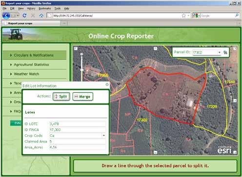
ArcGIS Online Lab Editable Feature Services as an outreach and user engagement tool
 ArcGIS Online Lab Editable Feature Services as an outreach and user engagement tool The objective of this exercise is to create a service that will to allow mobile and online users to contribute to a common
Imagery in a WebGIS. Wenxue Ju & Naila Khan
 Imagery in a WebGIS Wenxue Ju & Naila Khan What s in store for today s session Introduction to ArcGIS Image Services Capabilities of Image Services in ArcGIS Online and Portal for ArcGIS Imagery support
Feature Analyst Quick Start Guide
 Feature Analyst Quick Start Guide River Extraction River extractions are much like road extractions, in that you are trying to identify a continuous object running through other features within your image.
USING WEB APPBUILDER TO TRACK TEMPORARY WATER METER DEPLOYMENTS. Olivia DeSimone, GISP GIS Analyst City of Altamonte Springs
 USING WEB APPBUILDER TO TRACK TEMPORARY WATER METER DEPLOYMENTS Olivia DeSimone, GISP GIS Analyst City of Altamonte Springs CITY OF ALTAMONTE SPRINGS Located in Seminole County (Central Florida) Seminole
Developing Advanced Web Applications Which Utilize Image Services and the JS API. Naila Khan, Wenxue Ju
 Developing Advanced Web Applications Which Utilize Image Services and the JS API Naila Khan, Wenxue Ju What are we talking about today ArcGIS Online and Portal for ArcGIS ArcGIS API for JavaScript Web
ArcGIS Runtime SDK for Qt: Building Apps. Koushik Hajra and Lucas Danzinger
 ArcGIS Runtime SDK for Qt: Building Apps Koushik Hajra and Lucas Danzinger Cross-platform apps Agenda for today Intro to Qt Framework and ArcGIS Runtime SDK for Qt App design patterns with this SDK SDK
An Introduction to GIS for developers
 An Introduction to GIS for developers Part 4: GIS Sharing Canserina Kurnia & Tom Shippee Agenda Web GIS ArcGIS Online Cloud-based ArcGIS Server ArcGIS Server on-premises ArcGIS a complete platform discover,
Designing and Using Cached Map Services
 Esri International User Conference San Diego, California Technical Workshops July 2012 Designing and Using Cached Map Services Sterling Quinn Eric Rodenberg What we will cover Session Topics - Map cache
Trimble GeoCollector for ArcGIS: An Introduction. Morgan Zhang (Esri), Matthew Morris (Trimble)
, Matthew Morris (Trimble)") Trimble GeoCollector for ArcGIS: An Introduction Morgan Zhang (Esri), Matthew Morris (Trimble) Overview Introduction to mobile GIS Overview of ArcGIS for Windows Mobile Overview of Trimble Positions software
Trimble GeoCollector for ArcGIS: An Introduction Morgan Zhang (Esri), Matthew Morris (Trimble) Overview Introduction to mobile GIS Overview of ArcGIS for Windows Mobile Overview of Trimble Positions software
ArcGIS for Mobile Devices: An Overview. Jeff Shaner Bonnie Stayer
 ArcGIS for Mobile Devices: An Overview Jeff Shaner Bonnie Stayer Agenda Esri Positioning and Key Benefits Your Mobility Strategy Q & A Positioning and Benefits Key Benefits of Mobile Solutions Leverage
ESRI Software Evolution
 ArcGIS Jan Šlahař About ESRI ESRI - Environmental Systems Research Institute Founded in 1969, Redlands, California In 2002 Esri had approximately a 36 percent share of the GIS software market worldwide
TRAINING GUIDE. GIS Session Preview (New Features) 2017 and 2017r2
 2017 and 2017r2") TRAINING GUIDE GIS Session Preview (New Features) 2017 and 2017r2 GIS Session Preview (New Features) 2017 and 2017r2 In this session, we ll provide an overview of GIS changes since ACT 2016 and a sneak
TRAINING GUIDE GIS Session Preview (New Features) 2017 and 2017r2 GIS Session Preview (New Features) 2017 and 2017r2 In this session, we ll provide an overview of GIS changes since ACT 2016 and a sneak
Designing and Using Basemaps. Jennifer Hughey
 Designing and Using Basemaps Jennifer Hughey Agenda The ArcGIS System Basemaps are a key component of your system Cartographic design considerations Using basemap layers in ArcMap Best practices for designing
Building Basemaps: MapCaches and VectorTiles. Matthias Schenker Gerhard Trichtl
 Building Basemaps: MapCaches and VectorTiles Matthias Schenker Gerhard Trichtl What are Basemaps for Basemaps provide a optimal background and orientation for displaying your data on top Should be - Fast
ArcGIS for Developers. Kevin Deege Educational Services Washington DC
 ArcGIS for Developers Kevin Deege Educational Services Washington DC Introductions Who am I? Who are you? ESRI Product Development Experience? What development languages are you using? What types of applications