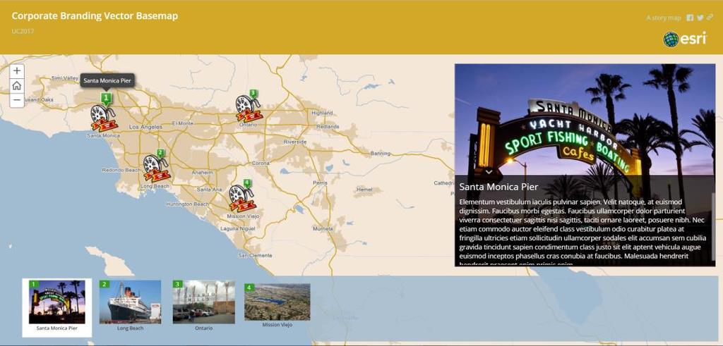
Corporate Brand Your Vector Basemap. ANDREW GREEN
|
|
|
- Clarence Sharp
- 6 years ago
- Views:
Transcription

1 Corporate Brand Your Vector Basemap ANDREW GREEN


2 Goal - Efficiently and effectively make basic changes to the Esri vector basemap based on your organization s brand (i.e. color palette) Experience Level - Entry Level First in a series of three Demos
3 What this Demo is NOT - Advanced JSON editing - Sprite changes - VTPK (Vector Tile Package related) Other Demos in this Theater, on this topic - Creative Vector Basemaps - Tuesday, July 11, 3:30pm - 4:15pm - Tips and Tricks for Vector Basemap Customization - Wednesday, July 12, 2:30pm - 3:15pm


4 What you need - Custom color palette - converted to Hexidecimal value - ArcGIS.com log in - Esri Vector Basemap Tile Layer Where to find the Esri Vector Basemap Tile Layer - Living Atlas of the World - Vector Basemap Group - Basemap Gallery - ArcGIS.com Search
5 Select a Basemap to start - Basemap levels of complexity - What is the map s purpose - Understand the map s spatial reach Copy and Save Vector Tile Layer in your ArcGIS.com account - or create copy through Vector Style Editor Esri Vector Basemap Reference Document
6 Biggest bang for the buck - Water - Land - Urban Areas - Roads Additional content to change at larger scales - Parks & Land Use - Buildings - Label Colors & Fonts Have a plan of attack Keep an original copy & save often
7 Three* paths for doing the map branding Styling Vector Basemaps JSON editing - (Adobe Brackets) JSON style editor BETA Vector style editor BETA
8 JSON editing (Adobe Brackets) - Minimal editing - Understand root.json file - Fully customizable - Update ArcGIS.com item
9 Vector Style JSON Editor (beta) - Minimal editing - Understanding of root.json - Fully customizable - On screen map display - Make changes - See changes - Save changes
10 Vector Basemap Style Editor (beta) - Understanding of basemap layers - More feature editing - Change by color - On screen map display - Make changes - See changes - Save changes

11 Copying a Vector Tile Layer to your Content for JSON editing - Sign in to ArcGIS.com - New Map - Add > Browse Living Atlas Layers - Show Esri Layers Only - Category > Esri Basemaps - Search: vector


12 Copying a Vector Tile Layer to your Content for JSON editing - Copy - Save Layer - Name - Add from My Content

13 Copying a Vector Tile Layer to your Content for JSON editing - On Tile Layer item page - Download style - root.json - Make edits - Update

14 Vector Style JSON Editor (beta) Corporate Brand Your Vector Basemap

15 Vector Style JSON Editor (beta) - Sign-in prompt - Select vector basemap tile layer - Copied to My Content - JSON Map windows - Make changes to JSON - Apply and view - Save
")
16 Vector Style JSON Editor (beta) - Edit JSON - Select color (picker)

17 Vector Style JSON Editor (beta) - Apply Style - Save - to My Content

18 Vector Basemap Style Editor (beta) Corporate Brand Your Vector Basemap


19 Vector Basemap Style Editor (beta) - Sign-in prompt - Read beta warning - Select vector basemap tile layer - Copied to My Content - OR copy Esri Basemap
 - Map window - Layer")
20 Vector Basemap Style Editor (beta) - Map window - Layer panel
21 Vector Basemap Style Editor (beta) - Attributes to re-style by Layers - OR Find by Color
22 Vector Basemap Style Editor (beta) - Select color - Isolates layers - Replace all - e.g. Water
23 Vector Basemap Style Editor (beta) - Select color - Isolates layers - Replace all - e.g. Water

24 Vector Basemap Style Editor (beta) - Select color - Isolates layers - Replace all - e.g. Land

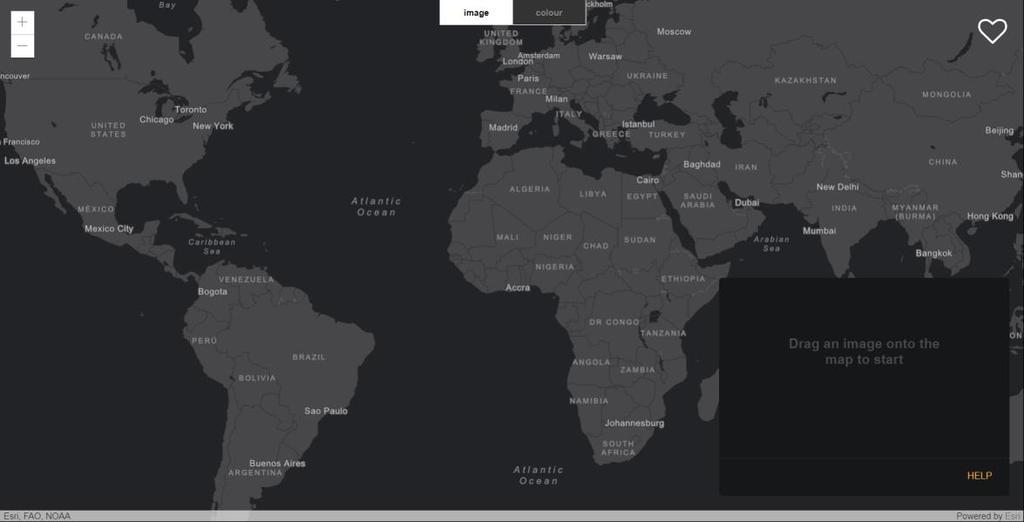
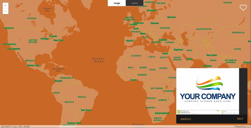
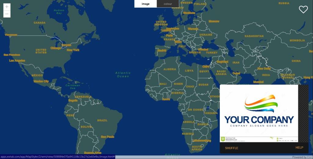
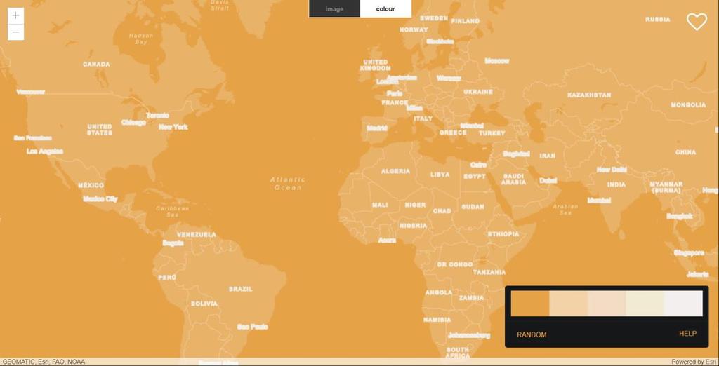
25 Vector Basemap Style Editor (beta) - Style Layers - Find Layer - Change attributes - Zoom in - Urban area
 - Color Selector -")
26 Vector Basemap Style Editor (beta) - Color Selector - Options
27 Vector Basemap Style Editor (beta) - Urban area

28 Vector Basemap Style Editor (beta) - Update Item - Saves tile layer in your Content


29 Purpose of the map - Small scale changes - Large scale changes

30 Rich and Adventurous

31 Waimea Waters

32 Green and Gold
33

34 New mapstyler from Esri UK Drop image to apply colors - Uses Dark Gray Canvas Shuffle color arrangements Update your copy on ArcGIS.com In development more to come
35
36
37
38
39
40 Bring your color palette What are the scales & content being mapped Decide on starting basemap Change feature colors and save - Vector Style JSON editing - Vector Basemap Style Editor Integrate into app, web site, etc.


41 Please Take Our Survey on the Esri Events App! Corporate Brand Your Vector Basemap Download the Esri Events app and find your event Select the session you attended Scroll down to find the survey Complete Answers and Select Submit


42
VECTOR TILES: STYLING YOUR OWN BASE MAPS. Andrew Green René Rubalcava Andy Skinner
 VECTOR TILES: STYLING YOUR OWN BASE MAPS Andrew Green René Rubalcava Andy Skinner Introducing Vector Tiles Andrew Green What are Esri Vector Tile Basemaps? Introduction Basemaps cached and delivered as
From Raster to Vector and Beyond: The Next Generation of Basemaps
 From Raster to Vector and Beyond: The Next Generation of Basemaps Presented to: Esri Canada UC - Toronto Presented by: Zara Matheson, Paul Heersink October 11, 2018 Outline Esri s current basemap options
Bringing your Data to Life in the ArcGIS API for JavaScript: Vector Tiles. Craig Williams &
 Bringing your Data to Life in the ArcGIS API for JavaScript: Vector Tiles Craig Williams & Rene Rubalcava @williamscraigm @odoenet Overview Why vector tiles? Vector tiles in ArcGIS ArcGIS vector tile basemaps
Desktop Mapping: Creating Vector Tiles. Craig Williams
 Desktop Mapping: Creating Vector Tiles Craig Williams Edie Punt @williamscraigm @epunt Overview Why vector tiles? Vector tiles in ArcGIS ArcGIS vector tile basemaps Consuming and styling vector tiles Overview
ArcGIS Enterprise Security: Advanced. Gregory Ponto & Jeff Smith
 Enterprise Security: Advanced Gregory Ponto & Jeff Smith Agenda Focus: Security best practices for Enterprise Server Portal for 10.5.x Features Strongly Recommend: Knowledge of Server and Portal for Security
Web AppBuilder Presented by
 Web AppBuilder Presented by Agenda Product overview Web AppBuilder for ArcGIS tour What s new in the ArcGIS Online June 2016 update Customization Community and Resources Summary The ArcGIS Platform enables
Creating Geoprocessing Services and Web Tools. Darren Baird, PE, Esri
 Creating Geoprocessing Services and Web Tools Darren Baird, PE, Esri Introduction Both ArcMap and ArcGIS Pro are covered Terms Geoprocessing Services and Web Tools are the same - ArcMap publishes geoprocessing
Desktop Mapping: Creating Vector Tiles. Craig Williams &
 Desktop Mapping: Creating Vector Tiles Craig Williams & Edie Punt @williamscraigm @epunt Overview Why vector tiles? Vector tiles in ArcGIS ArcGIS vector tile basemaps Consuming and styling vector tiles
ArcGIS Enterprise Security: An Introduction. Gregory Ponto & Jeff Smith
 ArcGIS Enterprise Security: An Introduction Gregory Ponto & Jeff Smith Agenda ArcGIS Enterprise Security Model Portal for ArcGIS Authentication Authorization Building the Enterprise Encryption Collaboration
What Makes a good content item GREAT?
 What Makes a good content item GREAT? Keith VanGraafeiland Tuesday - 4:30 PM - 5:15 PM SDCC - Demo Theater 04 - Living Atlas Overview Subhead Here Content items in ArcGIS Online Difficult to find what
ArcGIS Online: Three-and-a-Half Ways to Create Tile Layers. Eric Anderson & Adam Eversole Esri Support Services
 ArcGIS Online: Three-and-a-Half Ways to Create Tile Layers Eric Anderson & Adam Eversole Esri Support Services Agenda 1. Introduction 2. What is a tile layer 3. How a tile layer works 4. The 3 ½ ways to
Building Basemaps: MapCaches and VectorTiles. Matthias Schenker Gerhard Trichtl
 Building Basemaps: MapCaches and VectorTiles Matthias Schenker Gerhard Trichtl What are Basemaps for Basemaps provide a optimal background and orientation for displaying your data on top Should be - Fast
BEST PRACTICES FOR MAP DESIGN: ADVANCED
 FedGIS Conference February 13-14, 2017 Washington, DC BEST PRACTICES FOR MAP DESIGN: ADVANCED CREATING A BASEMAP FOR AN ORGANIZATION'S PURPOSE, PLACES AND PEOPLE Billie Leff, Esri bleff@esri.com David
Designing and Using Cached Map Services
 Esri International User Conference San Diego, California Technical Workshops July 2012 Designing and Using Cached Map Services Sterling Quinn Eric Rodenberg What we will cover Session Topics - Map cache
ArcGIS Online: Item Administration and Group Sharing. Brendan O Neill Caitlin Hillis
 ArcGIS Online: Item Administration and Group Sharing Brendan O Neill Caitlin Hillis Overwhelmed? You re in the right place. Overview ArcGIS Online sharing model Best practices for item administration
Advanced Parcel Editing. Amy Andis Tim Hodson
 Advanced Parcel Editing Amy Andis Tim Hodson Overview What to expect in this technical workshop Review of the Parcel Fabric Data Model Advanced Tips and tricks for Parcel entry Assessing Quality of Parcel
You'll begin your map by signing in and navigating to your area of interest: Houston, Texas.
 Geoinformation and Sectoral Statistics Section (GiSS) Create a Webmap In this lesson, you'll create a map that shows hurricane evacuation routes in Houston, Texas. First, you'll begin a new map in ArcGIS
Introduction to ArcGIS API for Flex. Bjorn Svensson Lloyd Heberlie
 Introduction to ArcGIS API for Flex Bjorn Svensson Lloyd Heberlie Agenda API Introduction Getting started API concepts and examples Getting more information API Introduction ArcGIS 10 A Complete System
Collector for ArcGIS: What s New. Chris LeSueur & James Tedrick
 Collector for ArcGIS: What s New Chris LeSueur & James Tedrick Outline Product overview Workflows Preparing data for Collector for ArcGIS What s new in Collector for ArcGIS v18.1.0 (Aurora) Advanced topics
From Data to Map in 30 Minutes. Aileen Buckley, PhD
 From Data to Map in 30 Minutes Aileen Buckley, PhD This session Crater Lake online map From NPS: https://www.nps.gov/carto/hfc/carto/media/crlamap1.pdf Download Crater Lake map packages here: ArcGIS Pro
ArcGIS Runtime SDK for Qt: Building Apps. Koushik Hajra and Lucas Danzinger
 ArcGIS Runtime SDK for Qt: Building Apps Koushik Hajra and Lucas Danzinger Cross-platform apps Agenda for today Intro to Qt Framework and ArcGIS Runtime SDK for Qt App design patterns with this SDK SDK
Configuring ArcGIS Enterprise in Disconnected Environments
 Configuring ArcGIS Enterprise in Disconnected Environments BILL MAJOR Disconnected Environments Not everyone has internet access? How many of you run disconnected today, i.e. no internet access? Many customers
Introducing Survey123 For ArcGIS
 FedGIS Conference February 24 25, 2016 Washington, DC Introducing Survey123 For ArcGIS James Tedrick, Esri Jawameer Kakakhan, UN OCHA Configurable Solutions That Work Together Vizualize Collect Navigator
Architect your deployment using Chef
 ArcGIS Enterprise Architect your deployment using Chef Cherry Lin and Scott MacDonald ArcGIS Enterprise base deployment Why automate your ArcGIS Enterprise deployment? Efficiency Get up and running faster
Introduction to Your First ArcGIS Enterprise Deployment. Thomas Edghill & Jonathan Quinn
 Introduction to Your First ArcGIS Enterprise Deployment Thomas Edghill & Jonathan Quinn Overview Web GIS options with Esri Building a Base ArcGIS Enterprise Deployment - Overview of Base ArcGIS Enterprise
Developing Qt Apps with the Runtime SDK
 Developing Qt Apps with the Runtime SDK Thomas Dunn and Michael Tims Esri UC 2014 Technical Workshop Agenda Getting Started Creating the Map Geocoding and Routing Geoprocessing Message Processing Work
Telling Stories with Map Templates
 Esri International User Conference San Diego, California Technical Workshops July 25, 2012 Telling Stories with Map Templates Allen Carroll, Andrew Skinner, and Rupert Essinger What We ll Discuss Today
ArcGIS Online: Best Practices for High-Demand Web Applications. Kelly Gerrow-Wilcox Bonnie Stayer Beth Romero
 ArcGIS Online: Best Practices for High-Demand Web Applications Kelly Gerrow-Wilcox Bonnie Stayer Beth Romero Agenda Communicating with Maps Who do you build your apps for? Layer Types Scalability and Response
Geo-enable your.net apps with ArcGIS Online and Runtime. Antti Kajanus Thad Tilton
 Geo-enable your.net apps with ArcGIS Online and Runtime Antti Kajanus Thad Tilton Topics ArcGIS Online overview Creating an ArcGIS Online developer's account Licensing and credits Uploading data and hosting
Understanding and using Metadata across the ArcGIS Platform. Aleta Vienneau Marten Hogeweg
 Understanding and using Metadata across the ArcGIS Platform Aleta Vienneau Marten Hogeweg Understanding and using Metadata across the ArcGIS Platform Metadata fundamentals ArcGIS platform Road ahead Metadata
Administering Your ArcGIS Enterprise Portal Bill Major Craig Cleveland
 Administering Your ArcGIS Enterprise Portal Bill Major Craig Cleveland Agenda Welcome & Introduction to ArcGIS Enterprise Portal for ArcGIS Administration - Basic Configuration - Advanced Configuration
Sharing Web Layers and Services in the ArcGIS Platform. Melanie Summers and Ty Fitzpatrick
 Sharing Web Layers and Services in the Platform Melanie Summers and Ty Fitzpatrick Agenda Platform overview - Web GIS information model - Two deployment options Pro Sharing - User experience and workflows
Volume USING ARCGIS COLLECTOR FOR WEED MAPPING. NetMaps University of Idaho. Android OS. Step by Step Guide
 Volume 1 USING ARCGIS COLLECTOR FOR WEED MAPPING NetMaps University of Idaho Android OS Step by Step Guide N E T M A P S S U S C E P T I B I L I T Y M O D E L S Using ArcGIS Collector MIA Consulting 316
Creating and Maintaining Your 3D Basemap. Brian Sims Dan Hedges Gert van Maren
 Creating and Maintaining Your 3D Basemap Brian Sims Dan Hedges Gert van Maren Complementary Resource Email (no marketing) A copy of the presentation Links to today s web demos Links to training materials
ArcGIS Enterprise: Performance and Scalability Best Practices. Darren Baird, PE, Esri
 ArcGIS Enterprise: Performance and Scalability Best Practices Darren Baird, PE, Esri dbaird@esri.com What is ArcGIS Enterprise What s Included with ArcGIS Enterprise ArcGIS Server the core web services
ArcGIS Enterprise: Portal Administration BILL MAJOR CRAIG CLEVELAND
 ArcGIS Enterprise: Portal Administration BILL MAJOR CRAIG CLEVELAND Agenda Welcome & Introduction to ArcGIS Enterprise Portal for ArcGIS - Basic Configuration - Advanced Configuration - Deploying Apps
ArcGIS Runtime SDKs Building Offline Apps. Nick Furness
 ArcGIS Runtime SDKs Building Offline Apps Nick Furness Agenda The basics - Considerations - Building blocks - Service types New! Offline maps New! Preplanned workflow What we are covering and what not
ArcGIS Viewer for Microsoft Silverlight An Introduction
 Esri International User Conference San Diego, CA Technical Workshops July 12, 2011 ArcGIS Viewer for Microsoft Silverlight An Introduction Art Haddad, Rich Zwaap, and Derek Law Agenda Background Product
ArcGIS Enterprise Security: An Introduction. Randall Williams Esri PSIRT
 ArcGIS Enterprise Security: An Introduction Randall Williams Esri PSIRT Agenda ArcGIS Enterprise Security for *BEGINNING to INTERMIDIATE* users ArcGIS Enterprise Security Model Portal for ArcGIS Authentication
Operations Dashboard for ArcGIS Monitoring GIS Operations. Michele Lundeen Esri
 Operations Dashboard for ArcGIS Monitoring GIS Operations Michele Lundeen Esri mlundeen@esri.com What is a dashboard? Conceptual term, can mean different things to different audiences Dashboards provide
ArcGIS Viewer for Silverlight Advanced Topics
 Esri International User Conference San Diego, California Technical Workshops July 26, 2012 ArcGIS Viewer for Silverlight Advanced Topics Rich Zwaap Agenda Add-ins overview Tools Behaviors Controls Layouts
Data Store Management Best Practices. Bill Major Laurence Clinton
 Data Store Management Best Practices Bill Major Laurence Clinton Session Agenda 1. Overview 2. Installation and Configuration 3. Backing up the data store 4. Restoring the data store 5. Moving data store
Building Java Apps with ArcGIS Runtime SDK
 Building Java Apps with ArcGIS Runtime SDK Mark Baird and Vijay Gandhi A step back in time Map making 50 years ago - http://www.nls.uk/exhibitions/bartholomew/maps-engraver - http://www.nls.uk/exhibitions/bartholomew/printing
Scientific and Multidimensional Raster Support in ArcGIS
 Scientific and Multidimensional Raster Support in ArcGIS Sudhir Raj Shrestha sshrestha@esri.com Brief breakdown Scientific Multidimensional data Ingesting Scientific MultiDim Data in ArcGIS Ingesting and
ICAP - Intelligence Configuration for ArcGIS Pro. Natalie Feuerstein Dan Barnes Joe Bayles
 ICAP - Intelligence Configuration for ArcGIS Pro Natalie Feuerstein Dan Barnes Joe Bayles Overview Intelligence Analyst supporting Operations ArcGIS Pro SDK Intelligence Configuration for ArcGIS Pro -
Esri Story Maps let you combine authoritative maps with narrative text, images, and multimedia
 Geoinformation and Sectoral Statistics Section (GiSS) Story Maps Esri Story Maps let you combine authoritative maps with narrative text, images, and multimedia content. They make it easy to harness the
Survey123 for ArcGIS: An Introduction. James Tedrick Erin Densford
 Survey123 for ArcGIS: An Introduction James Tedrick Erin Densford Smart Forms for ArcGIS Easily convert paper forms into Digital Smart ArcGIS Forms Why Smart Forms in ArcGIS? Reduce Errors During Data
Introduction to Web AppBuilder for ArcGIS: JavaScript Apps Made Easy
 Introduction to Web AppBuilder for ArcGIS: JavaScript Apps Made Easy Jianxia Song & Derek Law July 21, 2015 Agenda Product overview Web AppBuilder for ArcGIS tour What s New July 2015 ArcGIS Online update
ArcMap Editing Tips and Tricks. Sean Jones
 ArcMap Editing Tips and Tricks Sean Jones Overview Topics - Tuning your editing map - Creating features - Editing features and attributes - Aligning and editing coincident features - Addins Format - Software
Application of GIS to Cybersecurity. Brian Biesecker Ken Mitchell
 Application of GIS to Cybersecurity Brian Biesecker Ken Mitchell Fundamental Problems that GIS can help you solve What are the impacts to your mission, operations, business activities, critical systems,
IndianaMap Release 3. Rick Hill, Paul Rohwer,, Chris Dintaman, Becky Meyer, and Denver Harper
 IndianaMap Release 3 Rick Hill, Paul Rohwer,, Chris Dintaman, Becky Meyer, and Denver Harper IndianaMap Agenda Session 1 & 2 Overview Tentative rollout schedule Old versus New Design and construction of
How To Configure & Use Insights for ArcGIS ARAVIND SIVASAILAM MATT THOMAS
 How To Configure & Use Insights for ArcGIS ARAVIND SIVASAILAM MATT THOMAS Who is this for? ArcGIS Enterprise Publishers & Administrators ArcGIS Enterprise Users (Little to No Experience with Insights)
ArcGIS Pro Tasks: Tips and Tricks. Jason Camerano
 ArcGIS Pro Tasks: Tips and Tricks Jason Camerano Who has used Tasks in ArcGIS Pro? Show of hands What You Will Learn From This Session Spoiler: A Lot! As a User: - Helpful tricks to run Tasks efficiently
Photos (Step by Step Pictures, Adobe Photoshop, Digital Photography, Graphic Design) PDF
 PDF") BEST PHOTOSHOP: Absolute Beginners Guide To Mastering Photoshop And Creating World Class Photos (Step by Step Pictures, Adobe Photoshop, Digital Photography, Graphic Design) PDF PDF File: BEST PHOTOSHOP:
BEST PHOTOSHOP: Absolute Beginners Guide To Mastering Photoshop And Creating World Class Photos (Step by Step Pictures, Adobe Photoshop, Digital Photography, Graphic Design) PDF PDF File: BEST PHOTOSHOP:
Expand Your Audience through ArcGIS Online Workshop 2018 IMAGIN Conference
 Workshop 2018 IMAGIN Conference Park Place Hotel and Conference Center June 19, 2018 Welcome Introductions Logistics Bathrooms Schedule (10 am-1 pm) What is ArcGIS Online? Organizational Settings Break
ArcGIS for Server: Publishing and Using Map Services
 ArcGIS for Server: Publishing and Using Map Services Matthias Schenker Gerhard Trichtl m.schenker@esri.ch g.trichtl@mysynergis.com Agenda Platform overview Publishing services - Demo: Publishing hosted
Understanding and Using Metadata in ArcGIS. Adam Martin Marten Hogeweg Aleta Vienneau
 Understanding and Using Metadata in ArcGIS Adam Martin Marten Hogeweg Aleta Vienneau Adam Martin National Government Account Management R&D Open Data Marten Hogeweg National Government Professional Services
ArcGIS Pro Terminology Guide
 ArcGIS Pro Terminology Guide Essential Terminology or Functionality That s New to ArcGIS Pro ArcGIS Pro Project Map Scene Ribbon Tab on the ribbon View Active view Pane Gallery Task Quick Access Toolbar
ArcGIS Pro Terminology Guide
 ArcGIS Pro Terminology Guide Sharing Terminology and User Interface Cross-Reference Share content Project package (.ppkx) Map package (.mpkx) Layer package (.lpkx) Share or publish a web layer Share Web
Esri Maps for SharePoint
 Esri International User Conference San Diego, California Technical Workshops July, 2012 Esri Maps for SharePoint Art Haddad Nathan Bennett Agenda Location Analytics - Esri Maps for SharePoint - Overview
ArcPad An Introduction
 2013 Esri International User Conference July 8 12, 2013 San Diego, California Technical Workshop ArcPad An Introduction Chris LeSeuer, Marika Vertzonis, Hannah Ferrier Esri UC2013. Technical Workshop.
ArcGIS Pro Tasks: An Introduction. Jason Camerano Amir Bar-Maor
 ArcGIS Pro Tasks: An Introduction Jason Camerano Amir Bar-Maor Live Call With Esri Technical Support Esri Technical support: Jason Customer: Amir Warning: there is a test in the end of the presentation
Working with Feature Layers. Russell Brennan Gary MacDougall
 Working with Feature Layers Russell Brennan Gary MacDougall Working with Feature Layers Session will focus on feature access and editing Highlight new features added over the last few releases Agenda Introduction
ArcGIS Pro Editing: An Introduction. Jennifer Cadkin & Phil Sanchez
 ArcGIS Pro Editing: An Introduction Jennifer Cadkin & Phil Sanchez See Us Here WORKSHOP ArcGIS Pro Editing: An Introduction LOCATION SDCC - Ballroom 20 D TIME FRAME Thursday 10:00 11:00 ArcGIS Pro: 3D
Getting Started with ArcGIS Runtime SDK for the Microsoft.NET Framework. Morten Nielsen Mike Branscomb Antti Kajanus Rex Hansen
 Getting Started with ArcGIS Runtime SDK for the Microsoft.NET Framework Morten Nielsen Mike Branscomb Antti Kajanus Rex Hansen Agenda What is the ArcGIS Runtime? ArcGIS Runtime SDK for.net - Platform -
Configuring the ArcGIS for Local Government Solution
 Configuring the ArcGIS for Local Government Solution Lindsay Thomas Steve Grise Scott Oppmann Esri UC 2015 Technical Workshop Agenda Introduction Configuration Patterns Implementation Approaches Your Feedback
Integrating Imagery into ArcGIS Runtime Application. Jie Zhang, Zhiguang Han San Jacinto, 5:30 pm 6:30 pm
 Integrating Imagery into ArcGIS Runtime Application Jie Zhang, Zhiguang Han San Jacinto, 5:30 pm 6:30 pm Overviews Imagery is an essential component of ArcGIS - Visualization, Processing and Analysis -
User Guide To CRITFC s Interactive Mappers
 User Guide To CRITFC s Interactive Mappers CRITFC is using ESRI products to build online interactive mapping applications for the display of general spatial and tabular data or for specific projects. The
ArcGIS Enterprise: Architecture & Deployment. Anthony Myers
 ArcGIS Enterprise: Architecture & Deployment Anthony Myers 1 2 3 4 5 Web GIS Overview of ArcGIS Enterprise Federation & Hosted Server Deployment Patterns Implementation 1 Web GIS ArcGIS Enabling GIS for
Building Maps for the Public. Allen Carroll, David Asbury, and Jim Herries
 Building Maps for the Public Allen Carroll, David Asbury, and Jim Herries Traditional GIS Decision support Asset management Planning and analysis Field mobility Situational awareness Public awareness The
Does Your Data Have Harmony. Dan Stone
 Does Your Data Have Harmony Dan Stone Agenda Introduction Configuration Patterns Implementation Approaches Your Feedback ArcGIS for Local Government Esri solutions for local government customers Series
Chapter 9: Integrating Widgets
 Chapter 9: Integrating Widgets The API for JavaScript comes with several out of the box widgets that you can drop into your application for enhanced productivity. Included are the BasemapGallery, Legend,
Survey123 Deep Dive. Presented by: Sue Enyedy-Goldner Fall 2018
 Survey123 Deep Dive Presented by: Sue Enyedy-Goldner Fall 2018 Today s Agenda 1. Overview of Survey123 - getting stared with Web Designer 2. Create smarter surveys - using Survey123 Connect 3. Examine
TRAINING GUIDE. Lucity GIS. Web Administration
 TRAINING GUIDE Lucity GIS Web Administration Lucity GIS Web Administration Contents Portal Config and SSO... 2 Registering with Portal... 2 Behind the Scenes... 4 Resetting Portal Integration... 5 Single
A Developers Guide To Mobile GIS. David Cardella, Jeff Shaner
 A Developers Guide To Mobile GIS David Cardella, Jeff Shaner What is mobile GIS? Extends the reach of ArcGIS from the office to the field With a mobile GIS solution you can: - Carry your maps to the field
GEOG 487 Lesson 2: Step-by-Step Activity
 GEOG 487 Lesson 2: Step-by-Step Activity In Lesson 2, we are going to create a website that contains interactive maps with datasets related to our project scenario described in the Introduction. We will
GEOG 487 Lesson 2: Step-by-Step Activity
 GEOG 487 Lesson 2: Step-by-Step Activity In Lesson 2, we are going to create a website that contains interactive maps with datasets related to our project scenario described in the Introduction. We will
Implementing a Hybrid Approach to ArcGIS. Philip McNeilly and Margaret Jen
 Implementing a Hybrid Approach to ArcGIS Philip McNeilly and Margaret Jen Difficulty Level: Intermediate Overview What you will learn: - How to successfully integrate and work with services from ArcGIS
Collector for ArcGIS: Using Relationships with your Inspection Workflows. Morgan Zhang Kevin Burke
 Collector for ArcGIS: Using Relationships with your Inspection Workflows Morgan Zhang Kevin Burke What we will cover today Relationship overview Demo of feature to feature relationships Demo of feature
Introduction to ArcGIS Online and Story Maps
 Introduction to ArcGIS Online and Story Maps Presented by the University of Connecticut s Center for Land Use Education and Research (CLEAR) CLEAR 1 Welcome! Instructor Introductions Course logistics Student
ArcGIS Runtime: Building 3D Apps. Rex Hansen Adrien Meriaux
 ArcGIS Runtime: Building 3D Apps Rex Hansen Adrien Meriaux Agenda 3D across the ArcGIS Platform 3D in ArcGIS Runtime Road ahead ArcGIS 3D helps customers Create and Manage Design and Simulate Visualize
Introduction to Geodatabase and Spatial Management in ArcGIS. Craig Gillgrass Esri
 Introduction to Geodatabase and Spatial Management in ArcGIS Craig Gillgrass Esri Session Path The Geodatabase - What is it? - Why use it? - What types are there? - What can I do with it? Query Layers
ArcGIS API for JavaScript Advanced Topics
 Esri International User Conference San Diego, CA Technical Workshops ArcGIS API for JavaScript Advanced Topics Jeremy Bartley, Kelly Hutchins, and Derek Swingley Agenda Map Enhancements InfoWindow ArcGIS.com
ArcGIS Runtime: Styling Maps. Ralf Gottschalk, Daniel Lee, Lucas Danzinger
 ArcGIS Runtime: Styling Maps Ralf Gottschalk, Daniel Lee, Lucas Danzinger Map Styling What is this session about? Creating beautiful functional maps for your Runtime Apps - Not about cartography It is
Working with Scientific Data in ArcGIS Platform
 Working with Scientific Data in ArcGIS Platform Sudhir Raj Shrestha sshrestha@esri.com Hong Xu hxu@esri.com Esri User Conference, San Diego, CA. July 11, 2017 What we will cover today Scientific Multidimensional
Data Interoperability An Introduction
 Data Interoperability An Introduction Bruce Harold Dale Lutz - Esri Inc - Safe Software What is the Data Interoperability Extension? Moving data from app to app ETL in industry jargon If you are not the
Introduction to JavaScript. Evan Caldwell & James Tedrick
 Introduction to JavaScript Evan Caldwell & James Tedrick Agenda Getting Started - Meet the Esri API for JavaScript! - Meet Dojo! - Tools of the trade My First App JS API fundamentals How JS apps work Where
Geo Apps: Modern Day GIS
 Geo Apps: Modern Day GIS Exercise 1: Create a customer service request app Estimated time: 20 minutes Exercise 2: Create a story map Estimated time: 30 minutes Exercise 3: Use Web AppBuilder for ArcGIS
ArcGIS Enterprise: Configuring Backups, Disaster Recovery, and Replication. Harrold Sompotan and Patrick Jackson
 ArcGIS Enterprise: Configuring Backups, Disaster Recovery, and Replication Harrold Sompotan and Patrick Jackson Agenda Brief History of WebGIS DR Tool Who, Why, What, When, How and Where Considerations
Best Practices for Designing Effective Map Services
 2013 Esri International User Conference July 8 12, 2013 San Diego, California Technical Workshop Best Practices for Designing Effective Map Services Ty Fitzpatrick Tanu Hoque What s in this session Map
Software. Full Stack Web Development Intensive, Fall Lecture Topics. Class Sessions. Grading
 Full Stack Web Development Intensive, Fall 2017 There are two main objectives to this course. The first is learning how to build websites / web applications and the assets that compose them. The second
ArcGIS Runtime SDKs: Building a Routing Application. Frank Kish Konstantin Kutsner
 ArcGIS Runtime SDKs: Building a Routing Application Frank Kish Konstantin Kutsner Overview What goes into a routing application Data connected \ disconnected Demo creating mmpk API Demo code Other Resources
Indexed 3D Scene (I3S) Layers Specification
 Layers Specification") Indexed 3D Scene (I3S) Layers Specification Javier Gutierrez Product Engineer Lead Esri Özgür Ertac 3D Product Engineer Esri Germany Thank You to Our Generous Sponsor Agenda ArcGIS 3D Platform Authoring
Indexed 3D Scene (I3S) Layers Specification Javier Gutierrez Product Engineer Lead Esri Özgür Ertac 3D Product Engineer Esri Germany Thank You to Our Generous Sponsor Agenda ArcGIS 3D Platform Authoring
Downloading Census Data from American Factfinder2 for use in ArcGIS
 Downloading Census Data from American Factfinder2 for use in ArcGIS Written by Barbara Parmenter, revised November 18, 2011 OBTAINING DATA FROM AMERICAN FACTFINDER2... 1 PREPARING AMERICAN FACTFINDER DATA
A new clients guide to: Activating a new Studio 3.0 Account Creating a Photo Album Starting a Project Submitting a Project Publishing Tips
 Getting Started With Heritage Makers A Guide to the Heritage Studio 3.0 Drag and Drop Publishing System presented by Heritage Makers A new clients guide to: Activating a new Studio 3.0 Account Creating
Making the Most of Raster Analysis with Living Atlas Data. Aileen Buckley, PhD, Research Cartographer Esri - Redlands
 Making the Most of Raster Analysis with Living Atlas Data Aileen Buckley, PhD, Research Cartographer Esri - Redlands Spatial Analysis with Online Data Your Desktop Web Device Never scrounge for or download
ArcGIS GeoEvent Server: Leveraging Stream Services. Ken Gorton RJ Sunderman
 ArcGIS GeoEvent Server: Leveraging Stream Services Ken Gorton RJ Sunderman Agenda 1 2 3 4 5 Overview of Stream Services & Stream Layers Publishing Stream Services Visualization of real-time data Sample
ArcGIS API for Flex An Introduction
 Esri International User Conference San Diego, California Technical Workshops July 25, 2012 ArcGIS API for Flex An Introduction Lloyd Heberlie Heather Gonzago Before we begin Who are we? - Heather Gonzago
ArcGIS Runtime SDK for ios and macos: Building Apps. Suganya Baskaran, Gagandeep Singh
 ArcGIS Runtime SDK for ios and macos: Building Apps Suganya Baskaran, Gagandeep Singh Get Started Core Components Agenda - Display Map Content - Search for Content - Perform Analysis - Edit Content Summary
Customizing the Operations Dashboard for ArcGIS
 2013 Esri International User Conference July 8 12, 2013 San Diego, California Technical Workshop Customizing the Operations Dashboard for ArcGIS Kylie Donia and Tif Pun Esri UC2013. Technical Workshop.