George Mason University Department of Civil, Environmental and Infrastructure Engineering. Dr. Celso Ferreira Prepared by Lora Baumgartner
|
|
|
- Stewart Sparks
- 6 years ago
- Views:
Transcription
1 George Mason University Department of Civil, Environmental and Infrastructure Engineering Dr. Celso Ferreira Prepared by Lora Baumgartner Exercise Topic: Getting started with HEC GeoRAS Objective: Create a HEC-RAS model of the George Mason University watershed using the GeoRAS toolbar in ArcMap. **Refer to the HEC-GeoRAS User Manual for definitions and context of the steps and tools in this tutorial, found in the Help Menu of the GeoRAS toolbar.** Tutorial DEM obtained from GMU Campus Lidar file (provided) Versions used for this tutorial: HEC-GeoRAS 10.1, ArcMap (Student), ArcCatalog , HEC-RAS


2 Create New Project 1. Open a blank project. Add the GMU LIDAR DEM and a basemap for visual reference. Under the Customize > Toolbars menu, enable the HEC-GeoRAS toolbar. *Save the new project before moving to layer creation. 2. In the GeoRas toolbar, select All from the RAS Geometry > Create RAS Layers drop-down menu. 2

3 3. Note the auto-generated names that are assigned to each layer. *It is recommended that the user does not change the autogenerated names for this exercise. While names may be customized, this action will add additional work in later steps. 4. Click OK. 3


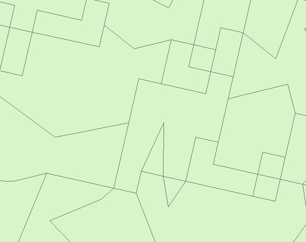
4 Draw Reaches and Assign Attributes 1. Zoom in on the DEM layer to a scale that allows for visual inspection of the stream beds. *A scale of 1:400 was used for the sample pictures at right. 2. Right-click on the River layer in the table of contents. Select Start Editing from the Edit Features menu. 4

5 3. Locate the Create Feature window, usually opened to the right of the screen. To open it manually, click the associated icon on the Editor toolbar. *If the window does not appear, try closing other windows in the right sidebar which may be covering the Create Feature window. 4. Select the River Layer. 5. Select the Line drawing tool. 5

 and Sandy Creek Way (east reach). 7.")
6 6. Click once at the upstream end of the left (west) reach of the GMU stream system. Continue clicking once at points along the reach. *For simplicity, the reaches are started at the point downstream of Mason Pond outflow culvert (west reach) and Sandy Creek Way (east reach). 7. To move the map during drawing, click on the hand icon. Drag the map to expose the next section of the reach. 6


7 8. Re-select the River layer in the Create Feature (drawing) window. 9. Re-select the Line drawing tool in the Create Feature window. 10. Continue drawing the stream bed until reaching the junction of the east and west GMU reaches. Double click to finish the drawing. 7


 reaches.")
8 11. Select Save Edits and Stop Editing from the Editor dropdown menu. 12. Select the River ID icon from the GeoRAS toolbar. Click on the newly-drawn reach. 13. Enter the preferred River and Reach names. 14. Click OK. 15. Repeat steps 2 through 14 to draw and name the right-hand (east) and bottom (south) reaches. *To auto-connect the ends of each reach as they are drawn, enable the Snapping toolbar from the Customize > Toolbars menu. Select the End Snapping icon. 8


9 16. Select Layer Setup from the RAS Geometry drop-down menu. 17. From the Required Surface tab, select GRID and then 18. Select the GMU LIDAR DEM from the Terrain drop-down menu. 19. Click OK. 20. Select Topology from the RAS Geometry > Stream Centerline Attributes menu. 21. Click OK. 9

10 22. Select Lengths/Stations from the RAS Geometry > Stream Centerline Attributes menu. 23. Click OK. 10


11 Draw Banks and Assign Attributes Prep: Start editing on the Banks layer. 1. Start with the left bank, from the perspective of looking in the downstream direction. Click once to start the bank line. Follow the estimated line of the bank as shown by the DEM. 2. Double-click to end the bank line as close to the end of the river reach line as possible. 11


12 3. Repeat steps 1 and 2 to draw the right bank of the same reach. 4. Repeat steps 1 through 3 to draw the banks for the west and south river reaches. Save edits and stop editing. 12


13 Create Flowpaths 1. Select Flow Path Centerlines from the RAS Geometry > Create RAS Layers menu. 2. Click Yes to assign the stream centerline. 3. Check auto-generated layer names and click OK. 4. Click OK. 5. Start editing the Flowpaths layer. 13

. 7.")

14 6. Click to start the left flowpath of the first river reach. Continue drawing the flowpath by following the general shape of the stream centerline (River). 7. Double-click to end the left flowpath line. 8. Repeat steps 6 and 7 to draw the flowpaths for the east and south river reaches. Save edits and stop editing. 14


15 9. Select the Assign Flowpath icon on the HEC-GeoRAS toolbar. Click on the left flowpath of one of the reaches, from the perspective of looking in the downstream direction. 10. Select Left from the Line Type drop-down menu. 11. Click OK. 12. Click on the right flowpath of the same river reach. Select Right from the Line Type drop-down menu. 13. Click OK. 15


16 Draw Cross Section Lines and Assign Attributes Prep: Start Editing on the XSCutLines layer. 1. *Working from left to right, from the perspective of looking downstream*, draw a cross section cut line which extends to across the estimated floodplain. *The cut line should intersect the Stream Centerline (River) at a 90 degree angle. 2. Continuing to work from left bank to right bank, create approximately 15 cut lines that indicate the general curves of the river reach. *Cut lines cannot overlap. Multiple clicks can be used to allow both perpendicular crossing of the river and coverage of the floodplain. *For simplicity, do not create a cut line on a bridge, culvert, or other structure along the reach. 16


17 3. Repeat steps 1 and 2 for the remaining river reaches. *Cross sections may not cross each other. See insert for detail. *A cross section may not intersect the flowpath line(s) of more than one reach. *Note special cross sections in preparation for bridge geometry. This is required for HEC-RAS. 17


18 4. Select All from the RAS Geometry > XS Cut Line Attributes menu. 5. Confirm that the auto-filled layers are correct and click OK. 6. Click OK. 18
19 7. Check a sample cross section by clicking on the Plot Cross Section icon on the Editor toolbar. Click on a cut line and observe the graph of the cross section. 19


20 Convert NLDC to Temporary N Values; Convert to Polygon Feature 1. In the File > Add Data menu, select the National Land Cover Database.tif file provided. 2. Click Add. 3. View the attribute table for the NLCD layer. Note the column shown in the picture to the right. These values represent land cover types in the grid. 4. Select Reclassify from the ArcToolbox > Spatial Analyst > Reclass menu. 20
21 5. Select the land cover.tif grid. 6. Confirm that Value is selected as the attribute to reclassify. 7. Click the folder for the Output Raster field. *Step 8 will clear any work done in the Old Value/New Value table above it. 8. Assign the folder location and file name for the new layer. 9. Click Save. *DO NOT save the new layer to the geodatabase. Recommend saving to the same folder as the original NLCD layer. 21


22 10. Select Unique. 11. Assign the Manning s N values that correspond to each NLCD value. **An integer value is required at this point. Multiply the N Values by Click OK. 13. Click Close after Reclassification is complete. 22


23 14. Select Raster to Polygon from the ArcToolbox > Conversion Tools > From Raster menu. 15. Click Environments. 16. Select the Processing Extent drop-down menu. 17. Select the original GMU DEM layer as the Extent. 18. Click OK. 23
24 19. Confirm that the new (Reclassified) layer is selected for input. 20. Confirm that the Value field is selected. 21. Click the folder for the Output Raster field. 22. Assign the folder location for the new layer. 23. Assign the file name for the new layer. 24. Click Save. *DO NOT save the new layer to the geodatabase. Recommend saving to the same folder as the original NLCD layer. 24

25 25. Click OK. 25


26 Convert to Real N Values; Assign New Coordinate System 1. Open the Attribute Table for the new Polygon NLCD-NValue layer. 2. Select Add Field from the Table Options menu. 3. Assign the name for the new field for actual N_Value. 4. Select Float type from the drop-down menu. 5. Click OK. 6. Right-click on the new field and select Field Calculator. 26


27 7. Accept the Field Calculator notice. 8. Double-click the field name for the column that currently contains the n-values* Enter /1000 to indicate division in the calculator. 10. Click OK. 11. Note the new values in the field which now correspond to real N Values. 27

28 12. Right-click the layer current polygon layer. Select Source tab and note that the Coordinate System is not equivalent to the rest of the ArcMap project. *In graphics at right, the layer properties for the Polygon-NLCD and the XSCutLines is shown for comparison. 28


29 13. Select Project from the ArcToolbox > Data Management Tools > Projections and Transformations menu. 14. Select the newest Polygon NLCD- NValue layer. 15. Click Add. 16. Note the name of the future output file. 17. Click the folder for the Output Raster field. 29


30 18. Assign the folder location for the new layer. 19. Assign the file name for the new layer. 20. Click Save. *DO NOT save the new layer to the geodatabase. Recommend saving to the same folder as the original NLCD layer. 21. Click the folder for the Output Coordinate System. 22. Select the Projected Coordinate System that matches the XSCutlines PCS (WGS 1984 UTM Zone 18N). 23. Click OK. 30


31 Extract N Values To Table 1. Select Extract N Values from the GeoRas Toolbar > RAS Geometry > Manning s menu. 2. Select the Projected Polygon NLCD-NValue layer. 3. Select the N Value field. 4. Confirm that the proper XSCutlines layer is selected and note the table name to be created. 5. Click OK. 6. Click OK when N Values are successfully extracted. 7. To view the results, open the newly-created Manning table and confirm that N Values have been assigned to multiple points per cutline. *All N Values may not be extracted on the first attempt. Re-run Steps 1 through 7 to correct. 31


32 Draw Bridge and Assign Attributes Prep: Start editing on the Bridge layer. 1. Draw a line across the bridge at Nottoway River Lane. 2. Select All from the RAS Geometry > Bridges/Culverts menu. 3. Confirm that the auto-filled layers are correct and click OK. 4. Click OK. 32


33 Draw Obstruction and Assign Attributes Prep: Start Editing on the Blocked Obstructions layer. 1. Enable the basemap layer. Comparing it to the DEM layer, select a building located within an estimated floodplain. *The Aquatic building at the intersection of Nottoway River Lane and Patriot Circle is selected in the sample at right. 2. Draw a polygon around the footprint of the building. 3. Select Positions from the RAS Geometry > Blocked Obstructions menu. 4. Confirm that the auto-filled layers are correct and click OK. 5. Click OK. 33


34 Draw Ineffective Flow Area and Assign Attributes Prep: Start Editing on the Ineffective Areas layer. 1. Draw polygon areas directly upstream of the bridge abutments. Save edits and stop editing. 2. Select Positions from the RAS Geometry > Ineffective Flow Areas menu. 3. Confirm that the auto-filled layers are correct and click OK. 4. Click OK. 34


35 Export RAS Data 1. Select Export RAS Data from the RAS Geometry menu. 2. Confirm that the file location is correct and click OK. 3. Note the process log and click OK. 35


36 Open RAS Data in HEC-RAS 1. Open HEC-RAS. Select New Project from the File menu. 2. Assign a project name. 3. Click OK. 4. Click OK. 36

37 5. Click on the icon for Edit/Enter Geometric Data on the main toolbar. 6. Select GIS Format from the File > Import Geometry Data menu. 7. Select the file that was generated in GeoRAS. 8. Click OK. 37

38 9. Confirm that the data will be read in and that the units are set to US Customary. Click Finished Import Data. The river reaches and cross section cut lines are rendered in the HEC-RAS model. 38
George Mason University Department of Civil, Environmental and Infrastructure Engineering. Dr. Celso Ferreira
 George Mason University Department of Civil, Environmental and Infrastructure Engineering Dr. Celso Ferreira Exercise Topic: HEC GeoRAS Post-Processing Objectives: This tutorial is designed to walk you
George Mason University Department of Civil, Environmental and Infrastructure Engineering. Dr. Celso Ferreira Prepared by Lora Baumgartner
 George Mason University Department of Civil, Environmental and Infrastructure Engineering Dr. Celso Ferreira Prepared by Lora Baumgartner Exercise Topic: Getting started with HEC RAS Objective: Create
George Mason University Department of Civil, Environmental and Infrastructure Engineering
 George Mason University Department of Civil, Environmental and Infrastructure Engineering Dr. Celso Ferreira Prepared by Lora Baumgartner December 2015 Revised by Brian Ross July 2016 Exercise Topic: GIS
George Mason University Department of Civil, Environmental and Infrastructure Engineering
 George Mason University Department of Civil, Environmental and Infrastructure Engineering Dr. Celso Ferreira Prepared by Lora Baumgartner December 2015 Revised by Brian Ross July 2016 Exercise Topic: Getting
UNDERSTAND HOW TO SET UP AND RUN A HYDRAULIC MODEL IN HEC-RAS CREATE A FLOOD INUNDATION MAP IN ARCGIS.
 CE 412/512, Spring 2017 HW9: Introduction to HEC-RAS and Floodplain Mapping Due: end of class, print and hand in. HEC-RAS is a Hydrologic Modeling System that is designed to describe the physical properties
Tutorial on using HEC-GeoRAS with ArcGIS 9.3
 Introduction Tutorial on using HEC-GeoRAS with ArcGIS 9.3 Prepared by Venkatesh Merwade School of Civil Engineering, Purdue University vmerwade@purdue.edu November 2009 This tutorial is designed to expose
Floodplain Mapping & Hydraulic Analysis with HEC-GeoRAS and ArcGIS 9.1
 Floodplain Mapping & Hydraulic Analysis with HEC-GeoRAS 4.1.1 and ArcGIS 9.1 Prepared by Sarah Meyer 1 and Francisco Olivera 2, Ph.D., P.E. May 2007 Contents: 1. Goals of Exercise & Additional Resources
Using HEC-RAS and HEC-GeoRAS for River Modeling Adapted by E. Maurer, using an exercise by V. Merwade, Purdue Univ.
 Introduction Using HEC-RAS and HEC-GeoRAS for River Modeling Adapted by E. Maurer, using an exercise by V. Merwade, Purdue Univ. This tutorial uses the output from HEC_GeoRAS from a prior exercise as input
WMS 9.0 Tutorial Hydraulics and Floodplain Modeling HEC-RAS Analysis Learn how to setup a basic HEC-RAS analysis using WMS
 v. 9.0 WMS 9.0 Tutorial Hydraulics and Floodplain Modeling HEC-RAS Analysis Learn how to setup a basic HEC-RAS analysis using WMS Objectives Learn how to build cross sections, stream centerlines, and bank
WMS 10.1 Tutorial Hydraulics and Floodplain Modeling HEC-RAS Analysis Learn how to setup a basic HEC-RAS analysis using WMS
 v. 10.1 WMS 10.1 Tutorial Hydraulics and Floodplain Modeling HEC-RAS Analysis Learn how to setup a basic HEC-RAS analysis using WMS Objectives Learn how to build cross sections, stream centerlines, and
HEC-GeoRAS GIS Tools for Support of HEC-RAS using ArcGIS
 US Army Corps of Engineers Hydrologic Engineering Center HEC-GeoRAS GIS Tools for Support of HEC-RAS using ArcGIS User's Manual Version 4.2 September 2009 Approved for Public Release. Distribution Unlimited.
SMS v D Summary Table. SRH-2D Tutorial. Prerequisites. Requirements. Time. Objectives
 SMS v. 12.3 SRH-2D Tutorial Objectives Learn the process of making a summary table to compare the 2D hydraulic model results with 1D hydraulic model results. This tutorial introduces a method of presenting
Field-Scale Watershed Analysis
 Conservation Applications of LiDAR Field-Scale Watershed Analysis A Supplemental Exercise for the Hydrologic Applications Module Andy Jenks, University of Minnesota Department of Forest Resources 2013
Updated on November 10, 2017
 CIVE 7397 Unsteady flows in Rivers and Pipe Networks/Stormwater Management and Modeling / Optimization in Water Resources Engineering Updated on November 10, 2017 Tutorial on using HEC-GeoRAS 10.1 (or
Name: Date: June 27th, 2011 GIS Boot Camps For Educators Lecture_3
 Name: Date: June 27th, 2011 GIS Boot Camps For Educators Lecture_3 Practical: Creating and Editing Shapefiles Using Straight, AutoComplete and Cut Polygon Tools Use ArcCatalog to copy data files from:
WMS 9.1 Tutorial Hydraulics and Floodplain Modeling Floodplain Delineation Learn how to us the WMS floodplain delineation tools
 v. 9.1 WMS 9.1 Tutorial Hydraulics and Floodplain Modeling Floodplain Delineation Learn how to us the WMS floodplain delineation tools Objectives Experiment with the various floodplain delineation options
Lesson 8 : How to Create a Distance from a Water Layer
 Created By: Lane Carter Advisor: Paul Evangelista Date: July 2011 Software: ArcGIS 10 Lesson 8 : How to Create a Distance from a Water Layer Background This tutorial will cover the basic processes involved
Using GIS To Estimate Changes in Runoff and Urban Surface Cover In Part of the Waller Creek Watershed Austin, Texas
 Using GIS To Estimate Changes in Runoff and Urban Surface Cover In Part of the Waller Creek Watershed Austin, Texas Jordan Thomas 12-6-2009 Introduction The goal of this project is to understand runoff
Combine Yield Data From Combine to Contour Map Ag Leader
 Combine Yield Data From Combine to Contour Map Ag Leader Exporting the Yield Data Using SMS Program 1. Data format On Hard Drive. 2. Start program SMS Basic. a. In the File menu choose Open. b. Click on
STUDENT PAGES GIS Tutorial Treasure in the Treasure State
 STUDENT PAGES GIS Tutorial Treasure in the Treasure State Copyright 2015 Bear Trust International GIS Tutorial 1 Exercise 1: Make a Hand Drawn Map of the School Yard and Playground Your teacher will provide
Lab 18c: Spatial Analysis III: Clip a raster file using a Polygon Shapefile
 Environmental GIS Prepared by Dr. Zhi Wang, CSUF EES Department Lab 18c: Spatial Analysis III: Clip a raster file using a Polygon Shapefile These instructions enable you to clip a raster layer in ArcMap
HEC-RAS 3.0 January, 2001 Release Notes
 HEC-RAS 3.0 January, 2001 Release Notes A new version of HEC-RAS (3.0) has been released with significant new features over the previous version (2.21). Version 3.0 includes unsteady flow routing capabilities,
Introduction to GIS 2011
 Introduction to GIS 2011 Digital Elevation Models CREATING A TIN SURFACE FROM CONTOUR LINES 1. Start ArcCatalog from either Desktop or Start Menu. 2. In ArcCatalog, create a new folder dem under your c:\introgis_2011
Workshop #1: Set Up Project File and RAS Mapper
 Workshop #1: Set Up Project File and RAS Mapper 1 In this workshop, you will: Install and open HEC-RAS 5.0.3 Create a project file Obtain terrain and projection data Import terrain data into RAS Mapper
Making Yield Contour Maps Using John Deere Data
 Making Yield Contour Maps Using John Deere Data Exporting the Yield Data Using JDOffice 1. Data Format On Hard Drive 2. Start program JD Office. a. From the PC Card menu on the left of the screen choose
Appendix E. HEC-RAS and HEC-Ecosystem Functions Models
 Appendix E HEC-RAS and HEC-Ecosystem Functions Models 1 Appendix E: Modeled Reaches for the Connecticut River Watershed application of HEC-RAS Separate from the report for the Decision Support System of
Steps for Modeling a Proposed New Reservoir in GIS
 Steps for Modeling a Proposed New Reservoir in GIS Requirements: ArcGIS ArcMap, ArcScene, Spatial Analyst, and 3D Analyst There s a new reservoir proposed for Right Hand Fork in Logan Canyon. I wanted
Geographical Information Systems Institute. Center for Geographic Analysis, Harvard University. LAB EXERCISE 1: Basic Mapping in ArcMap
 Harvard University Introduction to ArcMap Geographical Information Systems Institute Center for Geographic Analysis, Harvard University LAB EXERCISE 1: Basic Mapping in ArcMap Individual files (lab instructions,
Basics of Using LiDAR Data
 Conservation Applications of LiDAR Basics of Using LiDAR Data Exercise #2: Raster Processing 2013 Joel Nelson, University of Minnesota Department of Soil, Water, and Climate This exercise was developed
v. 9.1 WMS 9.1 Tutorial Watershed Modeling HEC-1 Interface Learn how to setup a basic HEC-1 model using WMS
 v. 9.1 WMS 9.1 Tutorial Learn how to setup a basic HEC-1 model using WMS Objectives Build a basic HEC-1 model from scratch using a DEM, land use, and soil data. Compute the geometric and hydrologic parameters
Spatial Analysis with Raster Datasets
 Spatial Analysis with Raster Datasets Francisco Olivera, Ph.D., P.E. Srikanth Koka Lauren Walker Aishwarya Vijaykumar Keri Clary Department of Civil Engineering April 21, 2014 Contents Brief Overview of
Lab 11: Terrain Analyses
 Lab 11: Terrain Analyses What You ll Learn: Basic terrain analysis functions, including watershed, viewshed, and profile processing. There is a mix of old and new functions used in this lab. We ll explain
Basic Tasks in ArcGIS 10.3.x
 Basic Tasks in ArcGIS 10.3.x This guide provides instructions for performing a few basic tasks in ArcGIS 10.3.1, such as adding data to a map document, viewing and changing coordinate system information,
Working with Elevation Data URPL 969 Applied GIS Workshop: Rethinking New Orleans After Hurricane Katrina Spring 2006
 Working with Elevation Data URPL 969 Applied GIS Workshop: Rethinking New Orleans After Hurricane Katrina Spring 2006 This GIS lab exercise will explore Light Detection And Ranging (LiDAR) data for New
Explore some of the new functionality in ArcMap 10
 Explore some of the new functionality in ArcMap 10 Scenario In this exercise, imagine you are a GIS analyst working for Old Dominion University. Construction will begin shortly on renovation of the new
Delineating Watersheds from a Digital Elevation Model (DEM)
") Delineating Watersheds from a Digital Elevation Model (DEM) (Using example from the ESRI virtual campus found at http://training.esri.com/courses/natres/index.cfm?c=153) Download locations for additional
Delineating Watersheds from a Digital Elevation Model (DEM) (Using example from the ESRI virtual campus found at http://training.esri.com/courses/natres/index.cfm?c=153) Download locations for additional
Lab 11: Terrain Analyses
 Lab 11: Terrain Analyses What You ll Learn: Basic terrain analysis functions, including watershed, viewshed, and profile processing. There is a mix of old and new functions used in this lab. We ll explain
Using LIDAR to Design Embankments in ArcGIS. Written by Scott Ralston U.S. Fish & Wildlife Service Windom Wetland Management District
 Using LIDAR to Design Embankments in ArcGIS Written by Scott Ralston U.S. Fish & Wildlife Service Windom Wetland Management District This tutorial covers the basics of how to design a dike, embankment
GEO 465/565 - Lab 7 Working with GTOPO30 Data in ArcGIS 9
 GEO 465/565 - Lab 7 Working with GTOPO30 Data in ArcGIS 9 This lab explains how work with a Global 30-Arc-Second (GTOPO30) digital elevation model (DEM) from the U.S. Geological Survey. This dataset can
WMS 10.1 Tutorial Hydraulics and Floodplain Modeling Simplified Dam Break Learn how to run a dam break simulation and delineate its floodplain
 v. 10.1 WMS 10.1 Tutorial Hydraulics and Floodplain Modeling Simplified Dam Break Learn how to run a dam break simulation and delineate its floodplain Objectives Setup a conceptual model of stream centerlines
HEC-RAS 2D Flood Modelling Tutorial
 HEC-RAS 2D Flood Modelling Tutorial Civil Site Design and HECRAS 2D Flood Modelling HECRAS version 5 and later includes functionality to analyse water flows moving across a surface. this is known as 2D
WMS 8.4 Tutorial Hydraulics and Floodplain Modeling Simplified Dam Break Learn how to run a dam break simulation and delineate its floodplain
 v. 8.4 WMS 8.4 Tutorial Hydraulics and Floodplain Modeling Simplified Dam Break Learn how to run a dam break simulation and delineate its floodplain Objectives Setup a conceptual model of stream centerlines
This tutorial introduces the HEC-RAS model and how it can be used to generate files for use with the HEC-RAS software.
 v. 12.3 SMS 12.3 Tutorial Objectives This tutorial introduces the model and how it can be used to generate files for use with the software. Prerequisites Overview Tutorial Requirements 5.0 Mesh Module
Cross Sections, Profiles, and Rating Curves. Viewing Results From The River System Schematic. Viewing Data Contained in an HEC-DSS File
 C H A P T E R 9 Viewing Results After the model has finished the steady or unsteady flow computations the user can begin to view the output. Output is available in a graphical and tabular format. The current
v Introduction to WMS WMS 11.0 Tutorial Become familiar with the WMS interface Prerequisite Tutorials None Required Components Data Map
 s v. 11.0 WMS 11.0 Tutorial Become familiar with the WMS interface Objectives Import files into WMS and change modules and display options to become familiar with the WMS interface. Prerequisite Tutorials
HEC-RAS 5.0 Training New Zealand Workshop Guide
 HEC-RAS 5.0 Training New Zealand Workshop Guide Prepared by: Krey Price Surface Water Solutions 57 Bromfield Drive Kelmscott WA 6111 Australia Tel. +61 400 367 542 e-mail: info@surfacewater.biz website:
GEO 465/565 Lab 6: Modeling Landslide Susceptibility
 1 GEO 465/565 Lab 6: Modeling Landslide Susceptibility This lab will give you more practice in understanding and building a GIS analysis model. Recall from class lecture that a GIS analysis model is a
WMS 10.0 Tutorial Hydraulics and Floodplain Modeling HY-8 Modeling Wizard Learn how to model a culvert using HY-8 and WMS
 v. 10.0 WMS 10.0 Tutorial Hydraulics and Floodplain Modeling HY-8 Modeling Wizard Learn how to model a culvert using HY-8 and WMS Objectives Define a conceptual schematic of the roadway, invert, and downstream
Using GIS to Site Minimal Excavation Helicopter Landings
 Using GIS to Site Minimal Excavation Helicopter Landings The objective of this analysis is to develop a suitability map for aid in locating helicopter landings in mountainous terrain. The tutorial uses
BAEN 673 Biological and Agricultural Engineering Department Texas A&M University ArcSWAT / ArcGIS 10.1 Example 2
 Before you Get Started BAEN 673 Biological and Agricultural Engineering Department Texas A&M University ArcSWAT / ArcGIS 10.1 Example 2 1. Open ArcCatalog Connect to folder button on tool bar navigate
HEC-RAS. A Tutorial (Model Development of a Small Flume)
") HEC-RAS A Tutorial (Model Development of a Small Flume) HEC-RAS Hydraulic Engineering Center:River Analysis System 1-D step backwater model Utilizes energy equation to compute water surface elevation for
HEC-RAS A Tutorial (Model Development of a Small Flume) HEC-RAS Hydraulic Engineering Center:River Analysis System 1-D step backwater model Utilizes energy equation to compute water surface elevation for
In this exercise, you will convert labels into geodatabase annotation so you can edit the text features.
 Instructions: Use the provided data stored in a USB. For the report: 1. Start a new word document. 2. Follow an exercise step as given below. 3. Describe what you did in that step in the word document
NV CCS USER S GUIDE V1.1 ADDENDUM
 NV CCS USER S GUIDE V1.1 ADDENDUM PAGE 1 FOR CREDIT PROJECTS THAT PROPOSE TO MODIFY CONIFER COVER Released 5/19/2016 This addendum provides instructions for evaluating credit projects that propose to treat
GIS Workbook #1. GIS Basics and the ArcGIS Environment. Helen Goodchild
 GIS Basics and the ArcGIS Environment Helen Goodchild Overview of Geographic Information Systems Geographical Information Systems (GIS) are used to display, manipulate and analyse spatial data (data that
Module 7 Raster operations
 Introduction Geo-Information Science Practical Manual Module 7 Raster operations 7. INTRODUCTION 7-1 LOCAL OPERATIONS 7-2 Mathematical functions and operators 7-5 Raster overlay 7-7 FOCAL OPERATIONS 7-8
ArcCatalog or the ArcCatalog tab in ArcMap ArcCatalog or the ArcCatalog tab in ArcMap ArcCatalog or the ArcCatalog tab in ArcMap
 ArcGIS Procedures NUMBER OPERATION APPLICATION: TOOLBAR 1 Import interchange file to coverage 2 Create a new 3 Create a new feature dataset 4 Import Rasters into a 5 Import tables into a PROCEDURE Coverage
TUFLOW 1D/2D SURFACE WATER MODELING SYSTEM. 1 Introduction. 2 Background Data
 SURFACE WATER MODELING SYSTEM TUFLOW 1D/2D 1 Introduction This tutorial describes the generation of a 1D TUFLOW project using the SMS interface. It is recommended that the TUFLOW 2D tutorial be done before
ii. From the Tools menu choose Multi-Extract
 Created By: Grant J. Firl Advisors: Paul Evangelista, Jim Graham Date: November 2010 Software: ArcGIS v9.2, TUGZip v3.5 Lesson 8: Mosaicking and Clipping Landsat Data The purpose of this tutorial is to
GIS LAB 8. Raster Data Applications Watershed Delineation
 GIS LAB 8 Raster Data Applications Watershed Delineation This lab will require you to further your familiarity with raster data structures and the Spatial Analyst. The data for this lab are drawn from
Watershed Modeling Using Online Spatial Data to Create an HEC-HMS Model
 v. 10.1 WMS 10.1 Tutorial Watershed Modeling Using Online Spatial Data to Create an HEC-HMS Model Learn how to setup an HEC-HMS model using WMS online spatial data Objectives This tutorial shows how to
Tutorial 1: Downloading elevation data
 Tutorial 1: Downloading elevation data Objectives In this exercise you will learn how to acquire elevation data from the website OpenTopography.org, project the dataset into a UTM coordinate system, and
Creating Contours using ArcMap
 Creating Contours with ArcMap and ArcScene Digital elevation models (DEMs) are geospatial datasets that contain elevation values sampled according to a regularly spaced rectangular grid. They can be used
v SMS 11.1 Tutorial SRH-2D Prerequisites None Time minutes Requirements Map Module Mesh Module Scatter Module Generic Model SRH-2D
 v. 11.1 SMS 11.1 Tutorial SRH-2D Objectives This lesson will teach you how to prepare an unstructured mesh, run the SRH-2D numerical engine and view the results all within SMS. You will start by reading
4. If you are prompted to enable hardware acceleration to improve performance, click
 Exercise 1a: Creating new points ArcGIS 10 Complexity: Beginner Data Requirement: ArcGIS Tutorial Data Setup About creating new points In this exercise, you will use an aerial photograph to create a new
Flood Inundation Mapping using HEC-RAS
 Flood Inundation Mapping using HEC-RAS Goodell, C. 1 ; Warren, C. 2 WEST Consultants, 2601 25 th St SE, Suite 450, Salem, OR 97302. Abstract Flood inundation mapping is an important tool for municipal
Data Assembly, Part II. GIS Cyberinfrastructure Module Day 4
 Data Assembly, Part II GIS Cyberinfrastructure Module Day 4 Objectives Continuation of effective troubleshooting Create shapefiles for analysis with buffers, union, and dissolve functions Calculate polygon
Creating a Smaller Data Set from a Larger Data Set Vector Data
 Creating a Smaller Data Set from a Larger Data Set Vector Data Written by Barbara Parmenter, revised by Carolyn Talmadge January 16, 2015 USING THE SELECTION METHOD QUICK METHOD BY CREATING A LAYER FILE...
RASTER ANALYSIS S H A W N L. P E N M A N E A R T H D A T A A N A LY S I S C E N T E R U N I V E R S I T Y O F N E W M E X I C O
 RASTER ANALYSIS S H A W N L. P E N M A N E A R T H D A T A A N A LY S I S C E N T E R U N I V E R S I T Y O F N E W M E X I C O TOPICS COVERED Spatial Analyst basics Raster / Vector conversion Raster data
Stream Network and Watershed Delineation using Spatial Analyst Hydrology Tools
 Stream Network and Watershed Delineation using Spatial Analyst Hydrology Tools Prepared by Venkatesh Merwade School of Civil Engineering, Purdue University vmerwade@purdue.edu January 2018 Objective The
Making ArcGIS Work for You. Elizabeth Cook USDA-NRCS GIS Specialist Columbia, MO
 Making ArcGIS Work for You Elizabeth Cook USDA-NRCS GIS Specialist Columbia, MO 1 Topics Using ArcMap beyond the Toolkit buttons GIS data formats Attributes and what you can do with them Calculating Acres
THE HONG KONG POLYTECHNIC UNIVERSITY DEPARTMENT OF LAND SURVEYING & GEO-INFORMATICS LSGI521 PRINCIPLES OF GIS
 THE HONG KONG POLYTECHNIC UNIVERSITY DEPARTMENT OF LAND SURVEYING & GEO-INFORMATICS LSGI521 PRINCIPLES OF GIS Student name: Student ID: Table of Content Working with files, folders, various software and
RVR MEANDER USER S MANUAL
 RVR MEANDER USER S MANUAL ArcGIS VERSION Roberto Fernández 1, Davide Motta 2, Jorge D. Abad 3, Eddy J. Langendoen 4, Nils Oberg 5, Marcelo H. Garcia 6 August 29, 2011 ABSTRACT This document illustrates
Schematics in ArcMap Tutorial
 Schematics in ArcMap Tutorial Copyright 1995-2010 Esri All rights reserved. Table of Contents Introducing Schematics in ArcMap Tutorial........................ 3 Exercise 1: Getting familiar with Schematics
Working with Attribute Data and Clipping Spatial Data. Determining Land Use and Ownership Patterns associated with Streams.
 GIS LAB 3 Working with Attribute Data and Clipping Spatial Data. Determining Land Use and Ownership Patterns associated with Streams. One of the primary goals of this course is to give you some hands-on
I.1. Digitize landslide region and micro-topography using satellite image
 I. Data Preparation At this part, it will be shown the stages of process on preparing all types of data which required in making of landslide potential and banjir bandang hazard map. I.1. Digitize landslide
Welcome to NR402 GIS Applications in Natural Resources. This course consists of 9 lessons, including Power point presentations, demonstrations,
 Welcome to NR402 GIS Applications in Natural Resources. This course consists of 9 lessons, including Power point presentations, demonstrations, readings, and hands on GIS lab exercises. Following the last
Lecture 7 Digitizing. Dr. Zhang Spring, 2017
 Lecture 7 Digitizing Dr. Zhang Spring, 2017 Model of the course Using and making maps Navigating GIS maps Map design Working with spatial data Geoprocessing Spatial data infrastructure Digitizing File
Making flow direction data
 Step 4. Making flow direction data Training Module 1) The first step in hydrology analysis is making flow direction data. On Arc Toolbox window, click symbol + on Spatial Analyst Tools Hydrology, double
Lab 3: Digitizing in ArcGIS Pro
 Lab 3: Digitizing in ArcGIS Pro What You ll Learn: In this Lab you ll be introduced to basic digitizing techniques using ArcGIS Pro. You should read Chapter 4 in the GIS Fundamentals textbook before starting
GIS Basics for Urban Studies
 GIS Basics for Urban Studies Date: March 21, 2018 Contacts: Mehdi Aminipouri, Graduate Peer GIS Faciliator, SFU Library (maminipo@sfu.ca) Keshav Mukunda, GIS & Map Librarian Librarian for Geography (kmukunda@sfu.ca)
Search & Rescue Map Specifications and Production Workflows
 Search & Rescue Map Specifications and Production Workflows About The Search & Rescue map product and production procedures discussed in this document can be utilized to support search, rescue, and relief
v SMS Tutorials Working with Rasters Prerequisites Requirements Time Objectives
 v. 12.2 SMS 12.2 Tutorial Objectives Learn how to import a Raster, view elevations at individual points, change display options for multiple views of the data, show the 2D profile plots, and interpolate
ArcGIS Pro Editing. Jennifer Cadkin & Phil Sanchez
 ArcGIS Pro Editing Jennifer Cadkin & Phil Sanchez ArcGIS Pro Editing Overview Provides tools that allow you to maintain, update, and create new data - Modifying geometry, drawing new features - Entering
PRACTICAL UNIT 1 exercise task
 Practical Unit 1 1 1 PRACTICAL UNIT 1 exercise task Developing a hydraulic model with HEC RAS using schematic river geometry data In the course of practical unit 1 we prepare the input for the execution
Delineating the Stream Network and Watersheds of the Guadalupe Basin
 Delineating the Stream Network and Watersheds of the Guadalupe Basin Francisco Olivera Department of Civil Engineering Texas A&M University Srikanth Koka Department of Civil Engineering Texas A&M University
v Working with Rasters SMS 12.1 Tutorial Requirements Raster Module Map Module Mesh Module Time minutes Prerequisites Overview Tutorial
 v. 12.1 SMS 12.1 Tutorial Objectives This tutorial teaches how to import a Raster, view elevations at individual points, change display options for multiple views of the data, show the 2D profile plots,
Lab 3: Digitizing in ArcMap
 Lab 3: Digitizing in ArcMap What You ll Learn: In this Lab you ll be introduced to basic digitizing techniques using ArcMap. You should read Chapter 4 in the GIS Fundamentals textbook before starting this
v Modeling Orange County Unit Hydrograph GIS Learn how to define a unit hydrograph model for Orange County (California) from GIS data
 from GIS data") v. 10.1 WMS 10.1 Tutorial Modeling Orange County Unit Hydrograph GIS Learn how to define a unit hydrograph model for Orange County (California) from GIS data Objectives This tutorial shows how to define
v. 10.1 WMS 10.1 Tutorial Modeling Orange County Unit Hydrograph GIS Learn how to define a unit hydrograph model for Orange County (California) from GIS data Objectives This tutorial shows how to define
_Tutorials. Arcmap. Linking additional files outside from Geodata
 _Tutorials Arcmap Linking additional files outside from Geodata 2017 Sourcing the Data (Option 1): Extracting Data from Auckland Council GIS P1 First you want to get onto the Auckland Council GIS website
for ArcSketch Version 1.1 ArcSketch is a sample extension to ArcGIS. It works with ArcGIS 9.1
 ArcSketch User Guide for ArcSketch Version 1.1 ArcSketch is a sample extension to ArcGIS. It works with ArcGIS 9.1 ArcSketch allows the user to quickly create, or sketch, features in ArcMap using easy-to-use
ARC HYDRO GROUNDWATER TUTORIALS
 ARC HYDRO GROUNDWATER TUTORIALS details to cross sections Arc Hydro Groundwater (AHGW) is a geodatabase design for representing groundwater datasets within ArcGIS. The data model helps to archive, display,
J.Welhan 5/07. Watershed Delineation Procedure
 Watershed Delineation Procedure 1. Prepare the DEM: - all grids should be in the same projection; if not, then reproject (or define and project); if in UTM, all grids must be in the same zone (if not,
Raster Data Model & Analysis
 Topics: 1. Understanding Raster Data 2. Adding and displaying raster data in ArcMap 3. Converting between floating-point raster and integer raster 4. Converting Vector data to Raster 5. Querying Raster
Watershed Modeling HEC-HMS Interface
 v. 10.1 WMS 10.1 Tutorial Learn how to set up a basic HEC-HMS model using WMS Objectives Build a basic HEC-HMS model from scratch using a DEM, land use, and soil data. Compute the geometric and hydrologic
2) Make sure that the georeferencing extension is on by right-clicking in the task bar area and selecting Georeferencing
 Make sure that the georeferencing extension is on by right-clicking in the task bar area and selecting Georeferencing") HGIS Workshop Module 1 Georeferencing Large Scale Scanned Historical Maps Objective: Learn the Principles of Georeferencing 1) In ArcMap, open the project 01 data\arcdata_10_1\arcdata\toronto\georeference.mxd
HGIS Workshop Module 1 Georeferencing Large Scale Scanned Historical Maps Objective: Learn the Principles of Georeferencing 1) In ArcMap, open the project 01 data\arcdata_10_1\arcdata\toronto\georeference.mxd
SMS v Culvert Structures with HY-8. Prerequisites. Requirements. Time. Objectives
 SMS v. 12.1 SRH-2D Tutorial Culvert Structures with HY-8 Objectives This tutorial demonstrates the process of modeling culverts in SRH-2D coupled with the Federal Highway Administrations HY-8 culvert analysis
v TUFLOW-2D Hydrodynamics SMS Tutorials Time minutes Prerequisites Overview Tutorial
 v. 12.2 SMS 12.2 Tutorial TUFLOW-2D Hydrodynamics Objectives This tutorial describes the generation of a TUFLOW project using the SMS interface. This project utilizes only the two dimensional flow calculation
Lecture 20 - Chapter 8 (Raster Analysis, part1)
") GEOL 452/552 - GIS for Geoscientists I Lecture 20 - Chapter 8 (Raster Analysis, part) 4 lectures on rasters - but won t cover everything (Raster GIS course: Geol 588: GIS II (Spring 20) Today: Raster data,
GEOL 452/552 - GIS for Geoscientists I Lecture 20 - Chapter 8 (Raster Analysis, part) 4 lectures on rasters - but won t cover everything (Raster GIS course: Geol 588: GIS II (Spring 20) Today: Raster data,
Objectives Divide a single watershed into multiple sub-basins, and define routing between sub-basins.
 v. 11.0 HEC-HMS WMS 11.0 Tutorial HEC-HMS Learn how to create multiple sub-basins using HEC-HMS Objectives Divide a single watershed into multiple sub-basins, and define routing between sub-basins. Prerequisite
GIS Fundamentals: Supplementary Lessons with ArcGIS Pro
 Station Analysis (parts 1 & 2) What You ll Learn: - Practice various skills using ArcMap. - Combining parcels, land use, impervious surface, and elevation data to calculate suitabilities for various uses