Operations Dashboard for ArcGIS Monitoring GIS Operations. Michele Lundeen Esri
|
|
|
- Stanley Knight
- 6 years ago
- Views:
Transcription


1 Operations Dashboard for ArcGIS Monitoring GIS Operations Michele Lundeen Esri


2 What is a dashboard? Conceptual term, can mean different things to different audiences Dashboards provide at-a-glance views of key performance indicators (KPIs) for a subject or business process - Similar to the idea of a report - Snapshot of performance Data typically on a single display or screen Can support real-time data feeds A


3 Key Usage Patterns Monitor and manage operations/assets - IoT (e.g., sensor feeds) - Provide common operational picture Event Management - Situational awareness, emergency management - Visualize assets, personnel, activities, weather Executive summaries - Visualize and compare business data - Reporting dashboard A


4 Dashboards in the ArcGIS Platform Data display typically includes a map or spatial context Several different options to create a dashboard (the concept) in ArcGIS Dashboard display capabilities Web map Web AppBuilder for ArcGIS Operations Dashboard for ArcGIS A


5 Other ArcGIS Apps Insights for ArcGIS - Designed for spatial and non-spatial data analysis - Results are maps, charts, and tables which can be interpreted to be a dashboard, but not in the traditional sense ArcGIS Maps for Power BI - Add-in for Microsoft Power BI - Meant to provide mapping capabilities for Power BI users - Dashboards built within Power BI


6 Operations Dashboard for ArcGIS Software status New Web-browser-based App - Closely integrated with ArcGIS Online - ArcGIS Enterprise 10.6 (in Portal for ArcGIS) - Uses Dashboard item - Completely re-engineered app - Released: Dec attendees in this workshop have used Legacy App - Windows Desktop + Web browser-based - Uses Operation View item - Author in desktop app, view in web app - No longer promoted; mature support - 20 attendees in this workshop have used, 40 WAB


7 Dashboard Item Brings data together in a single display - Determines how content is displayed in app Composed of elements - E.g., map, list, chart, etc. Works with many ArcGIS data sources - Online content and web services - Field collection data - Sensor data, social media, GPS locations, etc. - Real-time data Level 2 user to author * Operation views cannot be upgraded to a dashboard

 - Download separate app installer from MyEsri site, install into Portal for ArcGIS")
8 Operations Dashboard for ArcGIS Getting the App ArcGIS Online - App is included with your ArcGIS organization - Available since Dec 2017 update - Will be updated when ArcGIS Online updates ArcGIS Enterprise - Available at 10.6 release (Jan 2018) - Download separate app installer from MyEsri site, install into Portal for ArcGIS machine - Future releases: will be included with Portal - Will not have a separate installer
9 Getting Started


10 Getting Started with Operations Dashboard 1 Several ways to open the app 1. App Launcher 2. Map Viewer - Share > Create app > Operations Dashboard 3. Content page - Create > App > Operations Dashboard 4. Web Map item page - Create Web App > Using Operations Dashboard A
11 Dashboard Home Page Create and manage dashboard items - View and edit Search and sort dashboards in your organization
12 Dashboards Can be broadly categorized into 2 general types 1. Interactive End user interacts with the dashboard to obtain more info - Can apply actions and selectors for an interactive UE - E.g., Click one element, affects changes in other element(s) 2. Unattended display Designed to provide updates, no interactivity with end user - Typically consume data sources that update, elements would reflect updates - E.g., Real-time data, IoT


13 Dashboard Elements Header Left Panel Map and Map Legend Serial chart Pie chart Indicator Gauge List Details Rich text
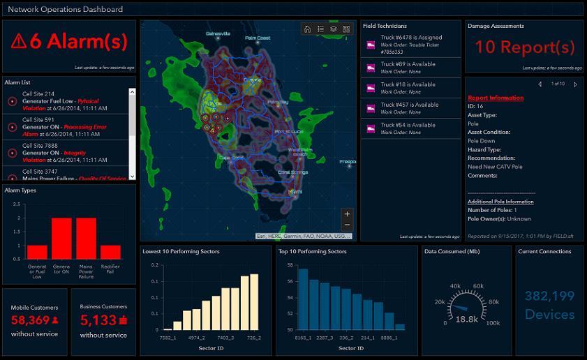
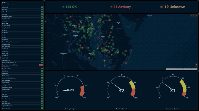
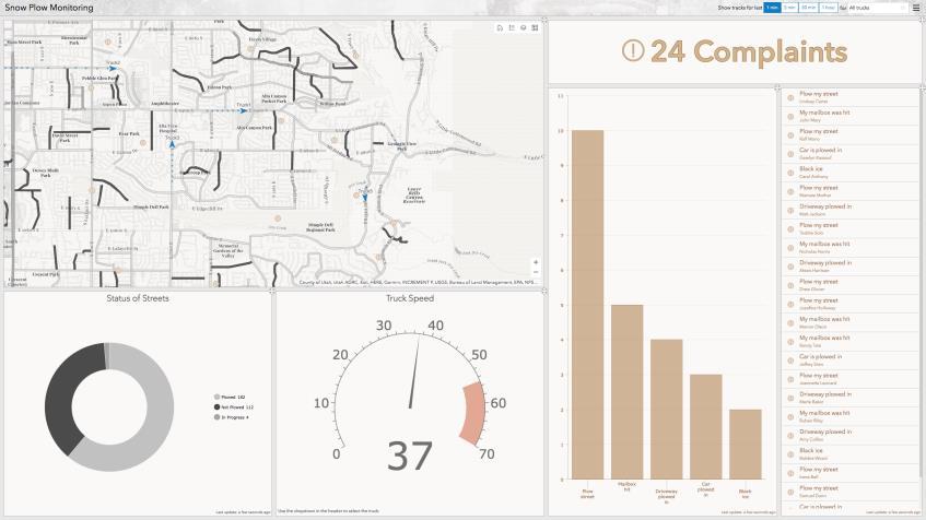
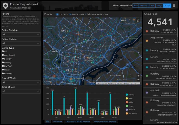
14 Dashboard Examples Look for the elements present in each example.

15 2018 SE UC Attendee Registration

16 Esri Demo Dashboards


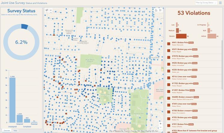
17 City of Miami Public Works Operations


18 City of Miami Public Works Operations
19 Getting Started with Operations Dashboard 1 Several ways to open the app 1. App Launcher 2. Map Viewer - Share > Create app > Operations Dashboard 3. Content page - Create > App > Operations Dashboard 4. Web Map item page - Create Web App > Using Operations Dashboard A

20 Dashboard Home Page Create and manage dashboard items - View and edit Search and sort dashboards in your organization
21 Demo Building a useful Dashboard in 10 minutes or less
22 Dashboard Elements - Details This is a bonus section with some additional details not presented during our 1 hour Southeast User Conference technical session.

23 Header and Left Panel Elements Header - Provides a title, subtitle, logo and background for branding; 3 sizes - Options - Selectors for interactivity - Hyperlinks - Sign Out link Left Panel - Used to contain selectors for interactivity - Title, description - Optional: retract in display Their layout locations do not change Dashboard A
24 Serial Chart Element Visualizes one or more series of data points on a x/y graph They can be used to show one or more datasets Bar, line, and smooth line charts are supported

25 Map Element Map tools Displays geographic and spatial data Composed of web map - Web layers can be used by other elements Properties - Select web map; define title and description - Can enable pop-ups - Optional map tools - Default spatial extent and bookmarks - Legend, layer visibility, basemap and zoom in/out A dashboard can have multiple map elements

26 Map Legend Element Provides a legend for a map element Contents determine by map layers - Ordered determined by web map Respects layer visibility and scale ranges Properties - Title and description


27 Serial Chart Types Bar charts Display data with discrete categories (e.g., types of crime) Line and smooth line charts Display data with continuous categories (e.g., dates) - Can also be rendered as area charts A


28 Serial Chart Types Multi-series charts Display multiple datasets, used to compare different datasets - Grouped - Stacked - 100% stacked A

29 Anatomy of a Serial Chart Common components - All are configurable properties of the element 1. Scrollbar 2. Hover text 3. Grid lines 4. Guides 5. Legend 6. Label 7. Axis title 8. Axis Properties A
30 Serial Chart Properties Properties - Title and description - Format chart - Text color, font, orientation - Title, axis, scrollbar - Labels: placement and size - Guides - Grid lines - Legend (for series data) - Data: Can apply filters, categorize - Apply statistics - Format dates - Sort data

31 Serial Chart Data Format Options Specify data source: map and feature layers supported - Apply filter(s) - Define category based on 1. Grouped values Each unique value in a field 2. Features Every feature in a field 3. Fields One or more numeric fields are selected - Parse dates - Statistics - Count, Avg, Min, Max, Sum, & Standard deviation - Sorting Can preview the data A

32 Categories: Grouped Values Display all unique values in a field E.g., all water body types A
33 Categories: Grouped Values Optional: split-by field Enables data to be split into multiple data series (for each unique value in the split-by field) E.g., all water body types; split-by county A

34 Categories: Features Display all records in a field, then select series field E.g., all sample stations, then compare rainfall A

35 Categories: Fields Used for comparison of data in multiple fields (same units) - Examples: demographic data, different measures E.g., two temperature measures A

36 Pie Chart Element Circular chart divided into sections; each section is proportional to the quantity it represents Displays a single series of data points Used to show part-to-whole relationships or data composition Not meant to show comparisons between sections Option: donut chart representation


37 Pie Chart Properties Properties - Title and description - Format chart - Text color, hover text, labels, label offset - Inner radius, legend placement - Pie slices (categories) - Data: Can apply filters, categorize - Apply statistics - Format dates - Sort data

38 Indicator Element Card that can display - Feature count - Summary statistic sum, avg, min, or max - Compare a computed value to a reference value - Based on a threshold Can apply filters Option to set conditional formatting - Appearance changes based on a condition Option to only display icon
 - Custom icons supported, use scalable vector graphics (SVGs) Top Middle")
39 Anatomy of an Indicator Each area is optional and can have text displayed HTML code is supported Middle section has icons (right or left) - Custom icons supported, use scalable vector graphics (SVGs) Top Middle Bottom


40 Gauge Element Show the value of a single metric; defined by minimum and maximum values - Value can be fixed or dynamic 2 styles: 1. Progress gauge - Convey a parameter is moving forward or backward - Can define thresholds to show progression - Rendered as circle, horseshoe, or half donut 2. Meter gauge - Display the amount, level, or contents of a parameter - Rendered as horseshoe or half donut

41 List Element Displays a collection of features or rows from a layer Field and formatting is based on the layer s pop-up configuration Can limit the number of features displayed Can apply filters and sorting

42 Details Element Displays item specifics about features or rows from a layer Information based on the layer s pop-up information - Title, content, media, and attachments Supports filtering and sorting Can limit the number of features displayed Useful for interactive dashboards - Target element for actions - Set media refresh interval if images are updated

43 Rich Text Element Enables text content to display in the dashboard - Can help provide additional context Supports rich text elements - Text, web links, images, and videos HTML editor, WYSIWYG user experience


44 Dashboard Layout Options Elements can be positioned in any combination in a dashboard - Exceptions Header and Left Panel group Elements can be stacked or grouped - Stack elements - Position elements in same location, tab to switch between them stack - Group elements - Aggregate into a single unit - Hold shift key to enable grouping A
45 Additional Considerations

46 Web Maps for Dashboards Best Practices Set appropriate refresh intervals Exclude irrelevant data from operational layers Toggle operational layer visibility Set visible range Adjust pop-ups Use bookmarks Style your data Include labels for map layers Choose appropriate colors
47 Operations Dashboard Format Numbers Ops Dashboard attempts to display numbers in a locale-sensitive manner - Based on ArcGIS Online user profile language setting - If anonymous, uses web browser setting E.g., The number one million with two decimal places - 1,000, for Canadian and American users ,00 for French users ,00 for German users If the default is not adequate, override with the Pattern setting property in the element - Help topic: Format numbers Element configuration May want to format numbers in charts to ensure data is shown properly

48 Format Numbers Example E.g., Serial Chart > Value Axis


49 Operations Dashboard Unit Prefixing Another option to format large numbers in dashboard, make them easier to interpret Used in Indicator elements Ops Dashboard uses standard metric prefix symbols
50 Operations Dashboard Format Dates Time series data - Recommend use date field type, but string and numeric are also supported - Ops Dashboard can apply date patterns to format your data for visualization - Help topic: Format dates

51 Operations Dashboard Parse Dates For time data stored as string or numeric field types, Ops Dashboard enables you to select the time unit value to display Parse data is a property available in the Serial Chart element > Data tab Help topic: Parse dates
52 Dashboard Interactivity
53 Dashboard Interactivity Enables deeper dive with dashboard data Dashboard elements can be associated with one another Interact with one element, triggers a response in another element(s) Element 1 event Element 2 action Source element Target element Many different interactions possible, support different workflows A

54 Interactivity Example 1 An event can trigger an action Ex: Select and highlight features in the map serial chart is filtered to selection set Element 1 Element 2 event action

55 Interactivity Example 2 An event can trigger multiple actions Ex: Click a selector (in left panel) to filter data list and gauge are filtered to selected feature Element 5 event Element 2 action i action ii Element 4

56 Dashboard Interactivity 2 Concepts 1. Action When an event is applied to a source element, a target element responds - Possible actions: Filter, Flash, Pan, Zoom, and Set spatial extent 2. Selector User interface (UI) control on the Header or Left Panel that triggers an action A
57 Dashboard Interactivity Events & Actions Element 1 event Element 2 action Source element Target element Source elements - Map - Map extent change - Selection in map layers - Header, Left Panel - List - Selectors - Selection Possible actions - Filter data - Flash a location - Zoom to a feature - Pan to a feature - Set spatial extent - In cases with a 2 nd map in dashboard
58 Dashboard Interactivity Events & Actions Possible configurations


59 Workflow: Configure Action Hover over element > Configure Action Add Action Select target element Set additional properties if required A
60 Map Element Interactivity It is possible to enable interactivity when - Map extent changes - Selection in map layer(s)
61 Category Selector Its values can be from a list of values, features, or summary statistics Can be rendered as: - Dropdown, button bar, list of radio buttons, and checkboxes Single or multiple selection options
62 Numeric Selector Its values can be a single fixed value or numeric range Can be rendered as: - Input box, spinner, and slider For spinner and slider displays, upper and lower limits required - Can also set increment value
63 Date Selector Its values can be configured to show pre-defined data & time, a date & time picker, or both For pre-defined date & time can be rendered as: - Dropdown, button bar, and list of radio buttons For date & time picker, single or multiple selection options - Also support default values Relative date & times are supported - Help topic: Date-based filter conditions
64 End Notes

65 Designing Dashboards Consider the audience for the information product Dashboard should help enable at-a-glance decision making Interactive or unattended display Design and implement visualizations cautiously - Avoid the kitchen sink approach - Built specific focused apps Share with others
66 Best Practices Set appropriate refresh intervals Exclude irrelevant data Configure layer visibility Style your data - Leverage the latest webmap capabilities: heat map, stream layers, vector basemaps, Arcade expressions Adjust pop-up fields Bookmark areas of interest Choose appropriate colors

67 What s New in Operations Dashboard (April 2018) Selection on pie and serial charts: Select single of multi-data points to trigger actions on other elements


68 What s New in Operations Dashboard (April 2018) Search map tool: New search capability to find locations or features Embedded Content - Static: Documents, Images, Video (URL) - Features: Each Feature s attribute information can be used to dynamically construct at runtime For Ex. Target of a Map Selection action to display content from cameras
69 What s New in Operations Dashboard (April 2018) No Data Label: Provide text to fill empty space New SVG icons: Additional icons and supported on Header element Scalebar: Add to Map element


70 ArcGIS Online Assistant Separate application that works with ArcGIS Online and Portal accounts to: - Inspect View the underlying JSON for any item in your portal - Update modify URLs for web maps and web apps - Copy copy content from one account to another
71 How to Copy Operations Dashboards? 1. Sign in to your ArcGIS Online/Portal account and go to the Operations Dashboard Launcher ( 2. Click the Create Dashboard button 3. Copy the item ID of the dashboard you d like to save a copy of 4. For example: 68ed 5. Add the?id=itemid to the Create Dashboard URL and press ENTER The page will load with the Title, Tags, and Summary already filled out 6. Click Create Dashboard

72 How to Copy Operations Dashboards?
73 How to prevent copying of your Operations Dashboards? 1. Go to the Item Details page in ArcGIS Online 2. Click the Settings tab 3. Uncheck Allow others to save a copy of this item

74 Additional Resources Operations Dashboard help documentation GeoNet forum: Operations Dashboard for ArcGIS Blogs - Some Example Operations Dashboard for ArcGIS Apps & Resources - Esri UK blog - Learn about: Operations Dashboard Esri Training webinar - Real-Time Decision Making with Operations Dashboard for ArcGIS


75
Operations Dashboard for ArcGIS: A Reintroduction. Andrew King & Guest Presenter, Rick Vera from the USACE Galveston District
 Operations Dashboard for ArcGIS: A Reintroduction Andrew King & Guest Presenter, Rick Vera from the USACE Galveston District Overview Operations Dashboard Overview Authoring dashboards Interactive dashboards
No Programming Required Create web apps rapidly with Web AppBuilder for ArcGIS
 No Programming Required Create web apps rapidly with Web AppBuilder for ArcGIS By Derek Law, Esri Product Manager, ArcGIS for Server Do you want to build web mapping applications you can run on desktop,
Introduction to Web AppBuilder for ArcGIS: JavaScript Apps Made Easy
 Introduction to Web AppBuilder for ArcGIS: JavaScript Apps Made Easy Jianxia Song & Derek Law July 21, 2015 Agenda Product overview Web AppBuilder for ArcGIS tour What s New July 2015 ArcGIS Online update
Desktop Studio: Charts
 Desktop Studio: Charts Intellicus Enterprise Reporting and BI Platform Intellicus Technologies info@intellicus.com www.intellicus.com Working with Charts i Copyright 2011 Intellicus Technologies This document
Desktop Studio: Charts. Version: 7.3
 Desktop Studio: Charts Version: 7.3 Copyright 2015 Intellicus Technologies This document and its content is copyrighted material of Intellicus Technologies. The content may not be copied or derived from,
Web AppBuilder Presented by
 Web AppBuilder Presented by Agenda Product overview Web AppBuilder for ArcGIS tour What s new in the ArcGIS Online June 2016 update Customization Community and Resources Summary The ArcGIS Platform enables
MAP ASPEN Training Manual. Navigate back to City of Aspen Home, GIS Home, Map Aspen Home or the Data Catalog from any page in the site.
 Home Page Features: Top Navigation Bar MAP ASPEN Training Manual Navigate back to City of Aspen Home, GIS Home, Map Aspen Home or the Data Catalog from any page in the site. Search Bar Search for all content
Web App Builder: Code-free Development. Adam Ziegler, Esri-Northeast, Local Government Team
 Web App Builder: Code-free Development Adam Ziegler, aziegler@esri.com Esri-Northeast, Local Government Team Agenda Product overview Web AppBuilder for ArcGIS tour Adding Custom Widgets Community and Resources
Visual Customizations
 Overview, on page 1 Create a Grid View, on page 1 Create a Chart View, on page 2 Group By, on page 5 Report Thresholds, on page 6 Overview Stock reports are the reports that are pre-bundled and supported
Intro to GIS (requirements: basic Windows computer skills and a flash drive)
") Introduction to GIS Intro to GIS (requirements: basic Windows computer skills and a flash drive) Part 1. What is GIS. 1. System: hardware (computers, devices), software (proprietary or free), people. 2.
Introduction to GIS Intro to GIS (requirements: basic Windows computer skills and a flash drive) Part 1. What is GIS. 1. System: hardware (computers, devices), software (proprietary or free), people. 2.
2015 Entrinsik, Inc.
 2015 Entrinsik, Inc. Table of Contents Chapter 1: Creating a Dashboard... 3 Creating a New Dashboard... 4 Choosing a Data Provider... 5 Scheduling Background Refresh... 10 Chapter 2: Adding Graphs and
Working with the ArcGIS Viewer for Flex Application Builder
 Working with the ArcGIS Viewer for Flex Application Builder Esri Canada User Conference St. John s November 15, 2012 Presented By: Greg Yetman gyetman@esri.ca Agenda This seminar is designed to help you
Leveraging Esri Web AppBuilder s Free Widgets in Your Web GIS
 Leveraging Esri Web AppBuilder s Free Widgets in Your Web GIS Dan Loegel, GISP Implementation Specialist GeoNexus Technologies June 18, 2018 Agenda 1. What is Web AppBuilder 2. The Basics 3. Widgets 4.
Juniata County, Pennsylvania
 GIS Parcel Viewer Web Mapping Application Functional Documentation June 21, 2017 Juniata County, Pennsylvania Presented by www.worldviewsolutions.com (804) 767-1870 (phone) (804) 545-0792 (fax) 115 South
ArcGIS GeoEvent Server: Leveraging Stream Services. Ken Gorton RJ Sunderman
 ArcGIS GeoEvent Server: Leveraging Stream Services Ken Gorton RJ Sunderman Agenda 1 2 3 4 5 Overview of Stream Services & Stream Layers Publishing Stream Services Visualization of real-time data Sample
VERINT EFM 8.0 Release Overview
 VERINT EFM 8.0 Release Overview In January of 2015 Verint will release version 8.0 of the Enterprise Feedback Management (EFM) solution. Verint hosted SaaS customers will receive this update as part of
Book 5. Chapter 1: Slides with SmartArt & Pictures... 1 Working with SmartArt Formatting Pictures Adjust Group Buttons Picture Styles Group Buttons
 Chapter 1: Slides with SmartArt & Pictures... 1 Working with SmartArt Formatting Pictures Adjust Group Buttons Picture Styles Group Buttons Chapter 2: Slides with Charts & Shapes... 12 Working with Charts
Geographical Information Systems Institute. Center for Geographic Analysis, Harvard University. LAB EXERCISE 1: Basic Mapping in ArcMap
 Harvard University Introduction to ArcMap Geographical Information Systems Institute Center for Geographic Analysis, Harvard University LAB EXERCISE 1: Basic Mapping in ArcMap Individual files (lab instructions,
Rich Web UI made simple Building Data Dashboards without Code
 Rich Web UI made simple Building Data Dashboards without Code Dana Singleterry http://blogs.oracle.com/dana Product Manager Oracle JDeveloper and Oracle ADF 2 Copyright 2012, Oracle and/or its affiliates.
Enabling High-Quality Printing in Web Applications. Tanu Hoque & Jeff Moulds
 Enabling High-Quality Printing in Web Applications Tanu Hoque & Jeff Moulds Print Service Technical Session Outline What s new in 10.6x What is Print Service Out of the box print solutions Print service
User Manual. ici-configuration App. ICI-Configuration App. User Manual SAP AG ici_ ConfigApp_User_Manual_ docx
 ICI-Configuration App User Manual Table of Content 1 Introduction 3 1.1 Objective 3 2 Navigation 4 2.1 Views 5 2.1.1 Define Dashboard 5 2.1.2 Define Input Measures 9 2.1.3 Maintenance completed 11 3 Configuration
iii Map Intelligence Client User Manual
 Map Intelligence Client User Manual iii TM Map Intelligence Client User Manual ii CONTENTS INTRODUCTION... 5 Purpose... 5 Audience... 5 Conventions... 6 Prerequisites... 6 CONCEPTS... 7 What is Map Intelligence?...
RAPIDMAP Geocortex HTML5 Viewer Manual
 RAPIDMAP Geocortex HTML5 Viewer Manual This site was developed using the evolving HTML5 web standard and should work in most modern browsers including IE, Safari, Chrome and Firefox. Even though it was
ArcGIS Viewer for Flex An Introduction
 2013 Esri International User Conference July 8 12, 2013 San Diego, California Technical Workshop ArcGIS Viewer for Flex An Introduction Bjorn Svensson and Heather Gonzago @Bjorn_Svensson @hgonzago Esri
ArcGIS Viewer for Microsoft Silverlight An Introduction
 Esri International User Conference San Diego, CA Technical Workshops July 12, 2011 ArcGIS Viewer for Microsoft Silverlight An Introduction Art Haddad, Rich Zwaap, and Derek Law Agenda Background Product
REDI 5.0 User Manual
 REDI 5.0 User Manual OBJECTIVE: REDI (Regional Economic Development Information System) provides a quick, convenient and easy way of accessing the City of San Diego Business Incentive Zones (BIZ) information.
Geo Apps: Modern Day GIS
 Geo Apps: Modern Day GIS Exercise 1: Create a customer service request app Estimated time: 20 minutes Exercise 2: Create a story map Estimated time: 30 minutes Exercise 3: Use Web AppBuilder for ArcGIS
OnCOR Silverlight Viewer Guide
 Getting Around There are many ways to move around the map! The simplest option is to use your mouse in the map area. If you hold the left button down, then click and drag, you can pan the map to a new
TRAINING GUIDE. GIS Session Preview (New Features) 2017 and 2017r2
 2017 and 2017r2") TRAINING GUIDE GIS Session Preview (New Features) 2017 and 2017r2 GIS Session Preview (New Features) 2017 and 2017r2 In this session, we ll provide an overview of GIS changes since ACT 2016 and a sneak
TRAINING GUIDE GIS Session Preview (New Features) 2017 and 2017r2 GIS Session Preview (New Features) 2017 and 2017r2 In this session, we ll provide an overview of GIS changes since ACT 2016 and a sneak
Creating Apps Using ArcGIS Online Templates. Matt Kennedy
 Creating Apps Using ArcGIS Online Templates Matt Kennedy Topics we will cover The publishing process Before you publish Where apps live Breakdown of apps Publishing web app templates The steps for publishing
Chapter 6. Building Maps with ArcGIS Online
 Chapter 6 Building Maps with ArcGIS Online Summary: ArcGIS Online is an on-line mapping software that allows you to upload tables with latitude and longitude geographic coordinates to create map layers
Expand Your Audience through ArcGIS Online Workshop 2018 IMAGIN Conference
 Workshop 2018 IMAGIN Conference Park Place Hotel and Conference Center June 19, 2018 Welcome Introductions Logistics Bathrooms Schedule (10 am-1 pm) What is ArcGIS Online? Organizational Settings Break
Real-Time GIS: Leveraging Stream Services
 Real-Time GIS: Leveraging Stream Services Mark Bramer Senior Technical Analyst Esri Professional Services mbramer@esri.com RJ Sunderman Product Engineer GeoEvent Extension Product Team rsunderman@esri.com
Build a Basic ThingWorx Mashup
 Build a Basic ThingWorx Mashup Project Introduction Overview In this project you will create a simple mashup in ThingWorx, PTC s industry leading IoT platform. The project introduces basic skills in modeling
MicroStrategy Academic Program
 MicroStrategy Academic Program Creating a center of excellence for enterprise analytics and mobility. GEOSPATIAL ANALYTICS: HOW TO VISUALIZE GEOSPATIAL DATA ON MAPS AND CUSTOM SHAPE FILES APPROXIMATE TIME
Esri Story Maps let you combine authoritative maps with narrative text, images, and multimedia
 Geoinformation and Sectoral Statistics Section (GiSS) Story Maps Esri Story Maps let you combine authoritative maps with narrative text, images, and multimedia content. They make it easy to harness the
TRAINING GUIDE. ArcGIS Online and Lucity
 TRAINING GUIDE ArcGIS Online and Lucity ArcGIS Online and Lucity This covers some basic functionality we feel you will need to be successful with Lucity with ArcGIS Online or Portal for ArcGIS Enterprise.
Add to the ArcMap layout the Census dataset which are located in your Census folder.
 Building Your Map To begin building your map, open ArcMap. Add to the ArcMap layout the Census dataset which are located in your Census folder. Right Click on the Labour_Occupation_Education shapefile
Optimizing Field Operations. Jeff Shaner
 Optimizing Field Operations Jeff Shaner Field GIS Taking GIS Beyond the Office Collecting Data Reporting Observations Managing Work Connecting the Field with the Enterprise Workforce for ArcGIS Field workforce
Creating Web Mapping Applications. Nikki Golding
 Creating Web Mapping Applications Nikki Golding Agenda Web Mapping and Map Services Fundamentals ArcGIS Web Mapping Applications - ArcGIS.com Viewer - ArcGIS Explorer Online - ArcGIS Viewer for Flex -
Reports. Overview. Stock Reports
 Overview, on page 1 Report Actions, on page 2 Add Template Help, on page 4 Report Types, on page 5 Manage, on page 8 Run Report, on page 19 Import, on page 22 Export, Report Definitions, and Folders, on
Visual Customizations
 Create a Grid View, on page 1 Create a Gauge View, on page 2 Create a Chart View, on page 3 Grouping, on page 5 Set Threshold Indicators for Fields, on page 6 Create a Grid View Grids are tabular presentations
Web AppBuilder for ArcGIS: JavaScript Apps Made Easy
 Web AppBuilder for ArcGIS: JavaScript Apps Made Easy Ryan Sellman @rcsellman Agenda Product overview Web AppBuilder for ArcGIS tour Customization Community and Resources Summary The ArcGIS Platform enables
PEGACUIS71V1 pegasystems
 PEGACUIS71V1 pegasystems Number: PEGACUIS71V1 Passing Score: 800 Time Limit: 120 min Exam A QUESTION 1 Which of the following rule types does the Localization wizard translate? (Choose Two) A. Field Value
Overview. Principal Product Manager Oracle JDeveloper & Oracle ADF
 Rich Web UI made simple an ADF Faces Overview Dana Singleterry Dana Singleterry Principal Product Manager Oracle JDeveloper & Oracle ADF Agenda Comparison: New vs. Old JDeveloper Provides JSF Overview
Numbers Basics Website:
 Website: http://etc.usf.edu/te/ Numbers is Apple's new spreadsheet application. It is installed as part of the iwork suite, which also includes the word processing program Pages and the presentation program
Management Reports Centre. User Guide. Emmanuel Amekuedi
 Management Reports Centre User Guide Emmanuel Amekuedi Table of Contents Introduction... 3 Overview... 3 Key features... 4 Authentication methods... 4 System requirements... 5 Deployment options... 5 Getting
QuintusVisuals 1.2 for TIBCO Spotfire User's Manual
 QuintusVisuals 1.2 for TIBCO Spotfire User's Manual Author: Quintus consultants b.v. Version: 1.2 Date: 11 January 2012 Quintus consultants b.v. provides and implements IT solutions. Quintus is specialized
Creating Pentaho Dashboards
 Creating Pentaho Dashboards This document is copyright 2011 Pentaho Corporation. No part may be reprinted without written permission from Pentaho Corporation. All trademarks are the property of their respective
TRAINING GUIDE. Mobile for Administrators Part 3 - GIS
 TRAINING GUIDE Mobile for Administrators Part 3 - GIS Mobile for Administrators - GIS One of the critical components of mobile is GIS, and it can also be the most complex. The mobile GIS maps are designed
SAFMC Habitat and Ecosystem Viewer
 SOUTH ATLANTIC FISHERY MANAGEMENT COUNCIL SAFMC Habitat and Ecosystem Viewer Integrating Management Resources This document provides an overview of the SAFMC Habitat and Ecosystem Viewer data sources and
The walkthrough is available at /
 The walkthrough is available at https://downloads.openmicroscopy.org/presentations/2018/gbi-sydney / Description We will demonstrate a number of features of the OMERO platform using an OMERO server based
TRAINING GUIDE. Tablet: Cradle to Mobile GIS
 TRAINING GUIDE Tablet: Cradle to Mobile GIS Tablet Cradle to Mobile One of the critical components of mobile is the GIS piece, and also can be the most complex. The mobile GIS maps are designed to consume
PI Integrator for Esri ArcGIS: A Journey Through Time and Space
 PI Integrator for Esri ArcGIS: A Journey Through Time and Space Presented by Vadim Fedorov, Sr. Systems Engineer Elizabeth Ammarell, Product Manager The Past: Where We Started 2 Two companies, one vision
ArcGIS Online workshop Shane Clarke John Sharrard. Central Oregon GIS User Group Meeting Bend, OR January 23, 2013
 ArcGIS Online workshop Shane Clarke John Sharrard Central Oregon GIS User Group Meeting Bend, OR January 23, 2013 Introduction i. What is ArcGIS Online? ii. Exploring ArcGIS Online Transform your Organization
Data Explorer: User Guide 1. Data Explorer User Guide
 Data Explorer: User Guide 1 Data Explorer User Guide Data Explorer: User Guide 2 Contents About this User Guide.. 4 System Requirements. 4 Browser Requirements... 4 Important Terminology.. 5 Getting Started
Fusion. CBR Fusion MLS Level 1 Core Functions. Class Handout
 Fusion 1 CBR Fusion MLS Level 1 Core Functions Class Handout GETTING STARTED IN FUSION Logging On and Off To log on to Fusion MLS: 1. Type your user name in the User ID box. 2. Type your password in the
IBM TRIRIGA Application Platform Version 3.3. Graphics User Guide. Copyright IBM Corp i
 IBM TRIRIGA Application Platform Version 3.3 Graphics User Guide Copyright IBM Corp. 2011 i Note Before using this information and the product it supports, read the information in Notices on page 33. This
Designing Adhoc Reports
 Designing Adhoc Reports Intellicus Enterprise Reporting and BI Platform Intellicus Technologies info@intellicus.com www.intellicus.com Copyright 2010 Intellicus Technologies This document and its content
MicroStrategy Academic Program
 MicroStrategy Academic Program Creating a center of excellence for enterprise analytics and mobility. DATA PREPARATION: HOW TO WRANGLE, ENRICH, AND PROFILE DATA APPROXIMATE TIME NEEDED: 1 HOUR TABLE OF
Creating Dashboard Widgets. Version: 16.0
 Creating Dashboard Widgets Version: 16.0 Copyright 2017 Intellicus Technologies This document and its content is copyrighted material of Intellicus Technologies. The content may not be copied or derived
Using Operations Dashboard for ArcGIS: An Introduction
 FedGIS Conference February 24 25, 2016 Washington, DC Using Operations Dashboard for ArcGIS: An Introduction Ken Gorton Carmella A. Burdi, GISP Solution Engineer Esri National Government Team kgorton@esri.com
Chapter 1 : Getting Started with Integrity... Chapter 2 : Interface Layout... Chapter 3 : Navigation... Chapter 4 : Printing...
 .0 User s Manual Table of Contents Chapter : Getting Started with Integrity... Chapter : Interface Layout... Chapter : Navigation... Chapter : Printing... Chapter : Quick Search and Results Pane... Results
Getting Started with Performance Manager
 Getting Started with Performance Manager BusinessObjects Performance Manager Windows Copyright 2008 Business Objects, an SAP company. All rights reserved. Business Objects owns the following U.S. patents,
US Geo-Explorer User s Guide. Web:
 US Geo-Explorer User s Guide Web: http://usgeoexplorer.org Updated on October 26, 2016 TABLE OF CONTENTS Introduction... 3 1. System Interface... 5 2. Administrative Unit... 7 2.1 Region Selection... 7
Lesson 2 - Analyzing Census Data Using USA Demographics for Schools
 Lesson 2 - Analyzing Census Data Using USA Overview: Students will learn how to navigate USA Demographics for Schools. Students will apply their learning to develop a demographic profile of their community.
SAS Report Viewer 8.3 Documentation
 SAS Report Viewer 8.3 Documentation About SAS Report Viewer Introduction to SAS Report Viewer SAS Report Viewer (the report viewer) enables users who are not report designers to view a report using a web
TRAINING GUIDE. Lucity Webmap 2017r2
 TRAINING GUIDE Lucity Webmap 2017r2 Web Map The Lucity Web Map provides a way for users to see and work with their asset and work data. This allows them to see relationships between objects and plan work
Web Viewer Guide. HiPER LOOK Version Copyright 2016 PIXIA Corp. All Rights Reserved.
 Web Viewer Guide 2016 HiPER LOOK Version 1.4.16.0 Copyright 2016 PIXIA Corp. All Rights Reserved. Table of Contents 1 System Requirements... 5 1.1 Prerequisites... 5 1.2 Web Browser... 5 2 HiPER LOOK Web
iii Map Intelligence Client User Manual
 Map Intelligence Client User Manual iii Map Intelligence Client User Manual ii CONTENTS INTRODUCTION... 5 Purpose... 5 Audience... 5 Conventions... 6 Prerequisites... 6 CONCEPTS... 7 What is Map Intelligence?...
Working with Smart View. Version: 16.0
 Working with Smart View Version: 16.0 Copyright 2017 Intellicus Technologies This document and its content is copyrighted material of Intellicus Technologies. The content may not be copied or derived from,
TIBCO LiveView Web New and Noteworthy
 TIBCO LiveView Web New and Noteworthy Introduction TIBCO LiveView Web is an HTML5 and WebSockets powered client application for visualizing data from TIBCO Live Datamart 2.1 servers. In LiveView Web (hereafter,
SmartView. User Guide - Analysis. Version 2.0
 SmartView User Guide - Analysis Version 2.0 Table of Contents Page i Table of Contents Table Of Contents I Introduction 1 Dashboard Layouts 2 Dashboard Mode 2 Story Mode 3 Dashboard Controls 4 Dashboards
ArcMap Editing Tips and Tricks. Sean Jones
 ArcMap Editing Tips and Tricks Sean Jones Overview Topics - Tuning your editing map - Creating features - Editing features and attributes - Aligning and editing coincident features - Addins Format - Software
Designing Ad hoc Reports. Version: 16.0
 Designing Ad hoc Reports Version: 16.0 Copyright 2017 Intellicus Technologies This document and its content is copyrighted material of Intellicus Technologies. The content may not be copied or derived
SAS Visual Analytics 8.2: Getting Started with Reports
 SAS Visual Analytics 8.2: Getting Started with Reports Introduction Reporting The SAS Visual Analytics tools give you everything you need to produce and distribute clear and compelling reports. SAS Visual
DESIGN TRANSFORMATIONAL IPAD APPS
 DESIGN TRANSFORMATIONAL IPAD APPS Thank you for participating in a workshop at MicroStrategy World 2019. If you missed or did not finish an exercise and want to complete it after the conference, use this
SAS Visual Analytics 8.2: Working with Report Content
 SAS Visual Analytics 8.2: Working with Report Content About Objects After selecting your data source and data items, add one or more objects to display the results. SAS Visual Analytics provides objects
ETC WEBCHAT USER GUIDE
 ETC WEBCHAT USER GUIDE CONTENTS Overview... 2 Agent and User Experience... 2 Agent Extention Window... 3 Etc WebChat Admin Portal... 4 Agent Groups... 5 Create, Edit, Delete A Group... 5 Create, Edit,
Collaborate in Qlik Sense. Qlik Sense April 2018 Copyright QlikTech International AB. All rights reserved.
 Collaborate in Qlik Sense Qlik Sense April 2018 Copyright 1993-2018 QlikTech International AB. All rights reserved. Copyright 1993-2018 QlikTech International AB. All rights reserved. Qlik, QlikTech, Qlik
SAS BI Dashboard 3.1. User s Guide Second Edition
 SAS BI Dashboard 3.1 User s Guide Second Edition The correct bibliographic citation for this manual is as follows: SAS Institute Inc. 2007. SAS BI Dashboard 3.1: User s Guide, Second Edition. Cary, NC:
User Guide for Explorer Users
 User Guide for Explorer Users Version 2015.1 Hubble Suite (Edition 2) Document Information....................................................... 1 Notices.........................................................................
Classroom Course Description. Course Outline. Tableau Intermediate & Advance. Audience
 Classroom Course Description Tableau Intermediate & Advance Audience Tableau Fundamentals & Advance serves the beginner to intermediate Tableau user, targeted towards anyone who works with data regardless
Vovici 6.1. Release Overview
 Vovici 6.1 Release Overview On April 30, 2011, Vovici released 6.1 which includes several new features and enhancements for the Vovici application. Please note that some features introduced in this release
DESIGN MOBILE APPS FOR ANDROID DEVICES
 DESIGN MOBILE APPS FOR ANDROID DEVICES Thank you for participating in a workshop at MicroStrategy World 2019. If you missed or did not finish an exercise and want to complete it after the conference,
Intellicus Enterprise Reporting and BI Platform
 Configuring Ad hoc Reporting Intellicus Enterprise Reporting and BI Platform Intellicus Technologies info@intellicus.com www.intellicus.com Copyright 2012 Intellicus Technologies This document and its
Web Mapping Applications with ArcGIS. Bernie Szukalski Derek Law
 Web Mapping Applications with ArcGIS Bernie Szukalski Derek Law Agenda Web Mapping and Map Services Fundamentals ArcGIS Web Mapping Applications - Hosted online - Hosted on-premise Summary Web Application
Welcome to the Investor Experience
 Welcome to the Investor Experience Welcome to the Black Diamond Investor Experience, a platform that allows advisors to customize how they present information to their clients. This document provides important
Web Dashboard User Guide
 Web Dashboard User Guide Version 10.6 The software supplied with this document is the property of RadView Software and is furnished under a licensing agreement. Neither the software nor this document may
Release Notes (Build )
") Release Notes (Build 6.0.4660) New to this build (6.0.4660) New in build 6.0.4490 New in build 6.0.4434 OneWeb CMS 6 features Additional enhancements Changes Fixed Known Issues New to this build (6.0.4660)
Release Notes (Build 6.0.4660) New to this build (6.0.4660) New in build 6.0.4490 New in build 6.0.4434 OneWeb CMS 6 features Additional enhancements Changes Fixed Known Issues New to this build (6.0.4660)
IBM TRIRIGA Application Platform Version 3.2. Graphics User Guide. Copyright IBM Corp i
 IBM TRIRIGA Application Platform Version 3.2 Graphics User Guide Copyright IBM Corp. 2011 i Note Before using this information and the product it supports, read the information in Notices on page 31. This
Map Direct Lite. Quick Start Guide: Map Layers 5/14/2018
 Map Direct Lite Quick Start Guide: Map Layers 5/14/2018 Contents Quick Start Guide: Map Layers... 1 Map Layers in Map Direct Lite.... 3 What is a Basemap Layer?... 4 Change the Basemap Using the Basemap
MicroStrategy Analytics Desktop
 MicroStrategy Analytics Desktop Quick Start Guide MicroStrategy Analytics Desktop is designed to enable business professionals like you to explore data, simply and without needing direct support from IT.
Oracle Utilities Analytics for Oracle Utilities Extractors and Schema and Oracle Utilities Analytics Dashboards
 Oracle Utilities Analytics for Oracle Utilities Extractors and Schema and Oracle Utilities Analytics Dashboards User s Guide Release 2.5.0 E48997-01 December 2013 Oracle Utilities Analytics for Oracle
Crop Counting and Metrics Tutorial
 Crop Counting and Metrics Tutorial The ENVI Crop Science platform contains remote sensing analytic tools for precision agriculture and agronomy. In this tutorial you will go through a typical workflow
Working with Charts Stratum.Viewer 6
 Working with Charts Stratum.Viewer 6 Getting Started Tasks Additional Information Access to Charts Introduction to Charts Overview of Chart Types Quick Start - Adding a Chart to a View Create a Chart with
HCA ArcGIS. Online Tool - How To Guide V1.0 2/15/2016 HAWAII CONSERVATION ALLIANCE AGOL
 HCA ArcGIS 2/15/2016 Online Tool - How To Guide V1.0 HAWAII CONSERVATION ALLIANCE AGOL Table of Contents What is ArcGIS Online?... 1 Getting Started... 1 Getting a Login... 1 Logging In... 2 Searching
ArcGIS 9. Using ArcReader
 ArcGIS 9 Using ArcReader Copyright 2003 2004 ESRI. All Rights Reserved. Printed in the United States of America. The information contained in this document is the exclusive property of ESRI. This work
Intellicus Enterprise Reporting and BI Platform
 Designing Adhoc Reports Intellicus Enterprise Reporting and BI Platform Intellicus Technologies info@intellicus.com www.intellicus.com Designing Adhoc Reports i Copyright 2012 Intellicus Technologies This
Collector for ArcGIS: What s New. Chris LeSueur & James Tedrick
 Collector for ArcGIS: What s New Chris LeSueur & James Tedrick Outline Product overview Workflows Preparing data for Collector for ArcGIS What s new in Collector for ArcGIS v18.1.0 (Aurora) Advanced topics