CACHE ESRI MAPS TO MOBILE DEVICES
|
|
|
- Michael Brown
- 6 years ago
- Views:
Transcription


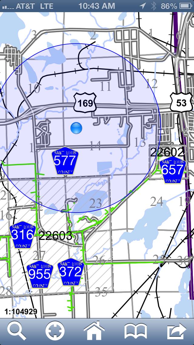
1 CACHE ESRI MAPS TO MOBILE DEVICES Company Overview & History Lake Country Power is a Touchstone Energy Cooperative serving parts of eight counties in Aitkin, Carlton, Cass, Itasca, Koochiching, Lake, Pine and St. Louis. We provide electricity and other energy related services to nearly 43,000 plus members in the rural parts of northern Minnesota. We maintain more than 8,000 miles of distribution lines within 10,872 square miles of service territory. Geographically, we are Minnesota s largest electric cooperative. Our service centers are located in Grand Rapids, Kettle River and Mountain Iron. We also have five outpost facilities strategically located throughout our service area in Cook, Ely, McGregor, Remer and Saginaw.
2 Goals for adopting a Cached Map Integrate with current ESRI ArcGIS mapping system Currently using V Distribute to multiple mobile devices Apple ios Android devices Computers (laptops and desktops) Security Control access to maps Password protection Time limits to access/view data Support and Maintenance Think long term Scalable and Customizable End Users Maintenance


3 Goals for adopting a Cached Map Cost of ownership Initial Support Licensing Upgrades Is it Per Seat or Per User or Per Processor? The cost of software is determined in many ways. The two most popular ways are Per Seat or Per Concurrent User. Per Seat is determined by how many seats in your business will be using the software at any given time. On the other hand, Per Concurrent User is based on a set amount of users that can access the software at one time. (Example: 5 concurrent users means a program can be installed on 20 machines but only a maximum of 5 people can use the system at once.) Per Processor is calculated on how many machines (PC s or servers) the software will be running on. Many larger enterprise software applications use this method to determine their prices.
4 Solution Data East, LLC, a leading Russian company, providing GIS (Geographic Information Systems) development, engineering and consulting services was founded in 2001 on the basis of the research laboratory within the United Institute of Geology, Geophysics and Mineralogy of Siberian Branch of Russian Academy of Sciences Providing services on ESRI, Inc. software products enhancement, custombuilt software development, spatial data preparation and processing, testing, vectorization, remote sensing data processing.
5 Overview Data East, LLC has capabilities in creating innovative systems based on Geographic Information Systems and Spatial Database Management Systems. Data East team plays a significant role in developing and supporting a number of ESRI key products and technologies. CarryMap is a unique solution for reproducing your ArcGIS maps as self sufficient distributable electronic map applications for desktop computers, Windows mobile, Apple ios, and Android devices (CarryMap application for ios and Android devices is available at: App Store and Google Play Market
6 Overview Reproduce your ArcGIS map document or part of it as a searchable exe-file for unlimited distribution available for wide range of users. You can send it, burn to a CD or put up to your web site for download. The output maps data can be imported back to ArcGIS. Output map applications can be run on any Windows computer, Windows Mobile, ios or Android.

7 Overview Compressed and protected spatial data, friendly user interface, advanced search capabilities accompanied with GPS navigation - you can have it all in just one executable file. Managing the access to the electronic map with passwords and time limits you have capabilities to safely distribute your spatial data. Make your mobile maps more usable and interactive with the possibility of adding hyperlinks in the Identify dialog. Create your maps using different skin colors or add your own company logo to the map. This way the maps you create can be designed in a unified corporate style.
8 Support If you have any questions or comments with regard to using CarryMap, we are always ready to support you. Questions and comments on using CarryMap can be also addressed to Download CarryMap help file to learn about its tools and features in more detail. Visit CarryMap release history page to learn what's new in the most recent CarryMap version. Download CarryMap 14-days trial to evaluate its capabilities of making your ArcGIS maps mobile.
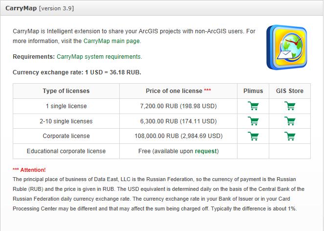
9 Cost
10 License
11 Requirements: Requirements: Extension to ArcGIS for Desktop: Disk space: 45 Mb Operating system: Microsoft Windows 2000/XP/Vista/7/8 Requisite software: ArcGIS for Desktop 9.3.x/10.0/10.1/10.2 (Basic, Standard or Advanced level) Desktop Win32 maps: Microsoft Windows 2000/XP/Vista/7/8 Windows Mobile maps: Windows Mobile 6.0/6.1/6.5 CarryMap Observer for Apple ios (app for ios devices is available in the App Store): ios 4 and higher CarryMap Observer for Android (app for Android devices is available in Google Play Market): Android 2.3 and higher
12 Key Features CarryMap Key Features: Producing distributable mobile maps for wide range of users Mobile maps can be used on Windows Desktop, Windows mobile, Apple ios and Android devices Protecting maps with passwords and time limits No other software required Ease of use Advanced searching capabilities GPS support Backward map data import to ArcGIS Pushpins with custom notes in the output maps
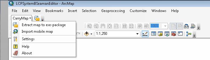
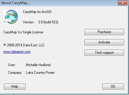
13 Settings/About Settings About
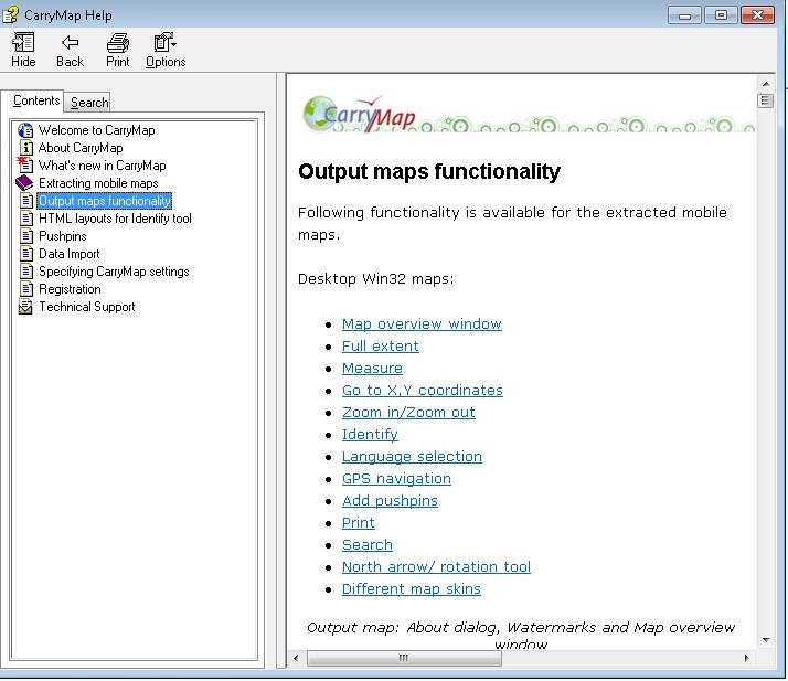
14 Help Help

15 Settings Settings

16 Map Description Default Parameters
 Map availability end date - output map will expire after the specified date Password protection - output map")
17 Default Parameters Map Protection: Mobile maps can be protected from the unauthorized access in one or all of the following ways: Map availability time limit in days - output map will be available only for the specified period of time (number of days starting from the first map run) Map availability end date - output map will expire after the specified date Password protection - output map will ask for a password when you open it Allow import data to ArcGIS - you may allow importing the data of your output map to ArcGIS and specify the password to limit this possibility (admin password).

18 Default Parameters Raster Properties If you have raster data in your map, you will be able to choose raster compression ratio at the following step.

19 Default Parameters Watermarks: It is also possible to add watermarks to the mobile map. You can choose watermark font, angle and transparency here and type the text you need.

20 Default Parameters Map skin and logo: You can select a skin for the mobile map and also insert your custom logo replacing the default CarryMap logo. In the current version there are five skins provided: Blue glass, Green glass, Red glass, Yellow glass and Gray glass. Your own logo will appear in the About dialog of your output map, if specified. Note that bigger or smaller logo images are not resized, they appear in their actual size instead so you may wish to prepare your logo in the required size for a better look: 280 x 88 size images in png, bmp, gif or jpg formats.

21 Extract Map Wizard type: Express mode Express wizard mode applies simple scheme with minimum details specified. Express mode can be used for quick map extraction. The following map extraction parameters from Default CarryMap settings are used in the express mode: - Map description for the output maps - Protection properties - Raster properties - Watermarks properties - Map skin and logo

22 Extract Map Wizard type: Advanced mode Advanced wizard mode applies detailed scheme with all possible parameters included. Advanced mode can be used if you wish to select extraction boundaries, describe output map and search parameters in more details and specify map protection properties.
 in layer - extracts map area by the selected polygon feature(s) in the chosen")
23 Extract Map Extraction boundaries: By current extent - extracts the current area of a map in the ArcMap Data View By selected graphics - extracts map area by selected graphics in the map, at that you can choose to keep selected graphics in the output map By selected feature(s) in layer - extracts map area by the selected polygon feature(s) in the chosen layer

24 Map properties: Note the defaults Extract Map

25 Map protection: Extract Map

26 Map skin and logo: Note default settings Extract Map

27 Custom Search: Extract Map

28 Watermarks: Extract Map

29 Output properties: Extract Map

30 Output map types: Extract Map

31 Extraction: Extract Map
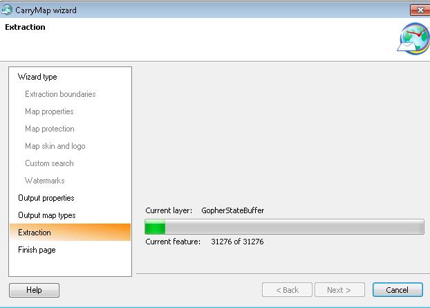
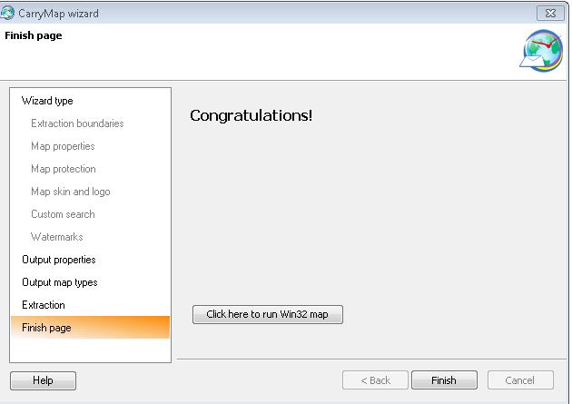
32 Extraction: Extract Map
33 Screenshots Home Screen: Search GPS Home Screen Bookmark Menu

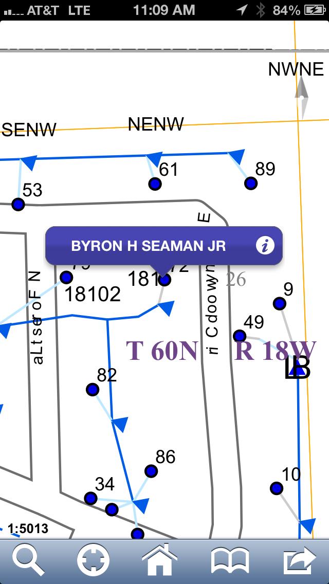
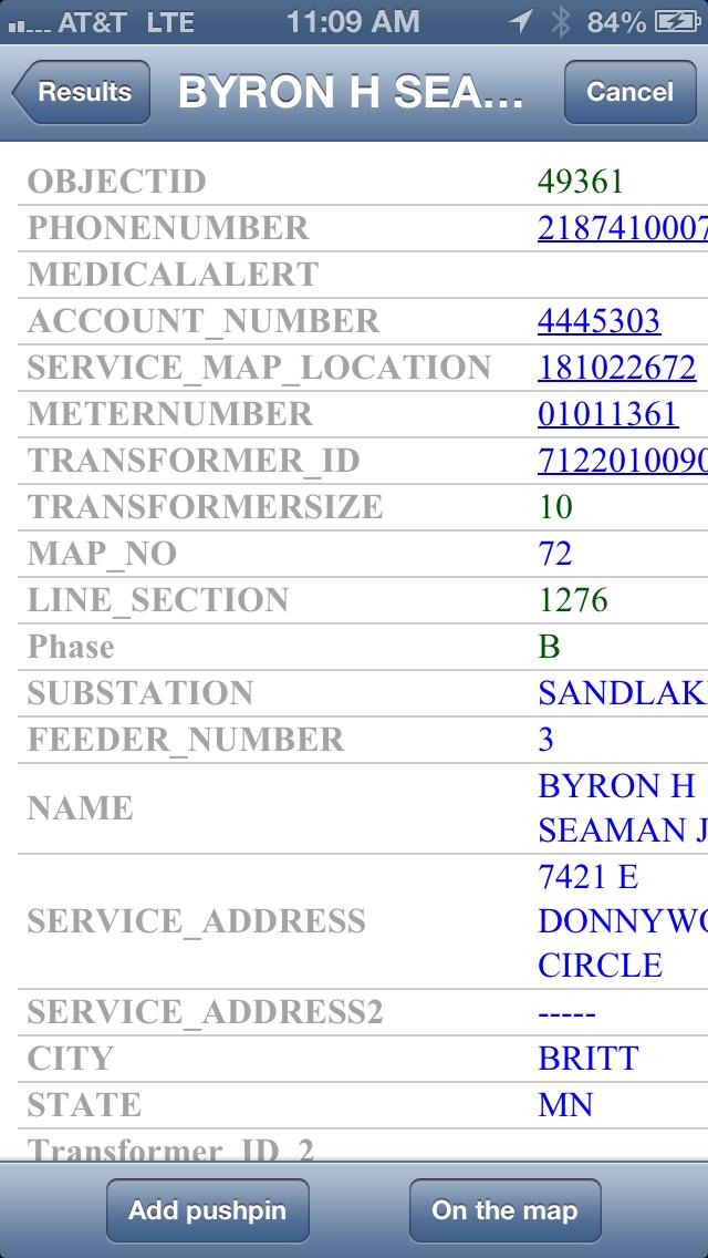
34 Search: Screenshots

35 GPS: Screenshots

36 Menu: Screenshots
Mobile ArcGIS maps, offline. CarryMap for ArcGIS Version: Data East, LLC
 Mobile ArcGIS maps, offline. CarryMap for ArcGIS Version: 3.13 2008-2016 Data East, LLC About CarryMap Data East CarryMap is an extension to ArcGIS for Desktop provided for creating mobile offline maps
Exercise 1: Getting to know ArcGIS
 The Scenario You are working for the California Visitor s Commission. You have been asked to prepare a map of California for several dignitaries from out of the country. Your map will need to include enough
Designing and Using Basemaps. Jennifer Hughey
 Designing and Using Basemaps Jennifer Hughey Agenda The ArcGIS System Basemaps are a key component of your system Cartographic design considerations Using basemap layers in ArcMap Best practices for designing
Using ArcGIS 9.x: Quickstart Tutorial
 Centre de recherche géographique Walter Hitschfeld Geographic Information Centre Using ArcGIS 9.x: Quickstart Tutorial ArcGIS is a program which allows the user to view and manipulate spatial data. It
Technical Brief Veritas Technical Education Services
 Veritas Desktop and Laptop Option 9.2 The Desktop and Laptop Option is a network share-based protection and synchronization solution for Windows and Mac that enhances your current IT desktop and laptop
Data East, LLC. Using CarryMap mobile maps on ios devices (iphones, ipads, ipods touch)
") Data East, LLC Using CarryMap mobile maps on ios devices (iphones, ipads, ipods touch) TABLE OF CONTENTS 1. Downloading map files to mobile device... 3 1.1 Copy.cmf file to CarryMap Observer mobile application
Data East, LLC Using CarryMap mobile maps on ios devices (iphones, ipads, ipods touch) TABLE OF CONTENTS 1. Downloading map files to mobile device... 3 1.1 Copy.cmf file to CarryMap Observer mobile application
Functionality of CarryMap 5.2 application for Android devices
 Data East, LLC Functionality of CarryMap 5.2 application for Android devices Content Overview of buttons located on map window... 3 Creating new object... 3 Adding photo to object... 7 Measuring distance
Getting Started With LP360
 Getting Started With LP360 12/22/2015 1 Contents What is LP360?... 3 System Requirements... 3 Installing LP360... 4 How to Enable the LP360 Extension... 4 How to Display the LP360 Toolbar... 4 How to Import
Juniata County, Pennsylvania
 GIS Parcel Viewer Web Mapping Application Functional Documentation June 21, 2017 Juniata County, Pennsylvania Presented by www.worldviewsolutions.com (804) 767-1870 (phone) (804) 545-0792 (fax) 115 South
Electrical Standards Plus Quick Start User Guide
 Electrical Standards Plus Quick Start User Guide Welcome to the Electrical Standards Plus Quick Start User Guide which contains all essential information for users to make full use of the platform, ensuring
What s New in Desktop 10.1
 What s New in Desktop 10.1 Damian Spangrud Esri Redlands Trip Down Memory Lane ArcGIS A Complete System for Geographic Information Cloud Web Online Mobile Enterprise Desktop Sharing Information sharing
Geographical Information Systems Institute. Center for Geographic Analysis, Harvard University. LAB EXERCISE 1: Basic Mapping in ArcMap
 Harvard University Introduction to ArcMap Geographical Information Systems Institute Center for Geographic Analysis, Harvard University LAB EXERCISE 1: Basic Mapping in ArcMap Individual files (lab instructions,
Exercise 1: An Overview of ArcMap and ArcCatalog
 Exercise 1: An Overview of ArcMap and ArcCatalog Introduction: ArcGIS is an integrated collection of GIS software products for building a complete GIS. ArcGIS enables users to deploy GIS functionality
Creating 2D Map Caches with
 Creating 2D Map Caches with ArcGIS Server 9.2 Presented by: The multi-threaded, threaded, over-clocked, dual core Diplo Matt Still AND the fast, the furious, the fully cached, Jonathan Fisk ArcGIS Server
Lesson 2 - Analyzing Census Data Using USA Demographics for Schools
 Lesson 2 - Analyzing Census Data Using USA Overview: Students will learn how to navigate USA Demographics for Schools. Students will apply their learning to develop a demographic profile of their community.
Lab Assignment 4 Basics of ArcGIS Server. Due Date: 01/19/2012
 Lab Assignment 4 Basics of ArcGIS Server Due Date: 01/19/2012 Overview This lab assignment is designed to help you develop a good understanding about the basics of ArcGIS Server and how it works. You will
TRAINING GUIDE. Mobile for Administrators Part 3 - GIS
 TRAINING GUIDE Mobile for Administrators Part 3 - GIS Mobile for Administrators - GIS One of the critical components of mobile is GIS, and it can also be the most complex. The mobile GIS maps are designed
Technical Brief Veritas Technical Education Services
 Veritas Desktop and Laptop Option 9.3.1 Veritas Desktop and Laptop Option is a user centric backup solution that provides flexible implementation and centralized administration for backup and recovery
Architecting ArcGIS Server Solutions for Performance and Scalability
 Architecting ArcGIS Server Solutions for Performance and Scalability Dave Wrazien Eric Miller ESRI Developer Summit 2008 1 Schedule 75 minute session 60 65 minute lecture 10 15 minutes Q & A following
Key Terms. Attribute join Target table Join table Spatial join
 Key Terms Attribute join Target table Join table Spatial join Lect 10A Building Geodatabase Create a new file geodatabase Map x,y data Convert shape files to geodatabase feature classes Spatial Data Formats
Visualization with ArcGlobe. Brady Hoak
 Visualization with ArcGlobe Brady Hoak Contents What is ArcGlobe? 3D Mapping and ArcGlobe Displaying data in ArcGlobe ArcGlobe tools Tips for constructing ArcGlobe documents New at ArcGIS 9.3 ArcGIS integration
With the X35 there is the ability to use the new remote support feature on the monitor to request assistance. You can add the Horizon support app for
 Remote Support With the X35 there is the ability to use the new remote support feature on the monitor to request assistance. You can add the Horizon support app for Android or Apple devises and also download
Tricks and Tips of Creating a Layered, Geo-Enabled Adobe PDF Map
 Tricks and Tips of Creating a Layered, Geo-Enabled Adobe PDF Map John M. Bocan GIS Programmer/Analyst West Virginia Geological and Economic Survey (WVGES) Digital Mapping Techniques Williamsburg, VA. May
ArcGIS Desktop: Introduction to Geoprocessing with ModelBuilder Kevin Armstrong ESRI
 ArcGIS Desktop: Introduction to Geoprocessing with ModelBuilder Kevin Armstrong ESRI SERUG 2008 1 What is ModelBuilder? A user-friendly way to automate a series of tools Part of the ArcGIS geoprocessing
ESRI Mobile GIS Solutions Overview. Justin Fan
 ESRI Mobile GIS Solutions Overview Justin Fan Agenda Mobile GIS challenges ESRI Mobile GIS solutions ArcPad ArcGIS Mobile ArcGIS Engine Selecting a mobile GIS solution Q & A Objective To help you select
Starting the QGIS Program. Exercise 1: Exploring QGIS
 Exercise 1: Exploring QGIS In this exercise you will learn how to open maps, manipulate layers, add spatial data, change symbols, and navigate within QGIS. You will also learn to repair broken data links.
Installing and Configuring hopto Work. System Requirements Be sure you have these system requirements to install and use hopto Work.
 Installing and Configuring hopto Work To configure and install hopto Work on your Microsoft Windows server, you ll need to have Administrator status. Note: The recommended setup is that Active Directory
Technical Brief Veritas Technical Education Services
 Veritas Desktop and Laptop Option 9.3 The Veritas Desktop and Laptop Option provides automated file protection for Desktops and laptops. Protection is provided regardless of whether the computer is connected
3D in the Browser with WebGL. Chris Andrews 3D Product Manager Javier Gutierrez 3D Product Engineer
 3D in the Browser with WebGL Chris Andrews 3D Product Manager Javier Gutierrez 3D Product Engineer Just sayin This is not a programming class Goal is to help you learn about a technology area that impacts
BooneMap LT User Guide
 BooneMap LT 2016 User Guide Boone County Planning Commission GIS Services Division 2950 Washington St, Room 317 P.O. Box 958 Burlington, Kentucky 41005 Phone: 859.334.2196 Fax: 859.334.2264 Email: bcgis@boonecountyky.org
Interactive Maps Purpose: Login to the System: Interactive Maps ONTINUE AGREE
 Interactive Maps Purpose: The purpose of this application is to provide the facility to the citizen to navigate to a Property through an On-line Free Web Application in real time. The application uses
Many Files, One Simple Solution Use Acrobat 7.0 Professional to combine multiple file formats in one easily accessible document
 Page 1 of 5 A custom advertising newsletter from Cadalyst and Adobe Cadalyst Adobe AEC Adobe Acrobat 7.0 Professional Acrobat Insider Archives Subscribe Discover a new dimension of communication with Acrobat
SERVER GIS: HIGH PERFORMANCE DELIVERED!
 SERVER GIS: HIGH PERFORMANCE DELIVERED! Jayateerth Deshpande & Sanjay Shrivastava Reliance Industries Ltd. Abstract: In the current era of using web technologies for sharing information, WebGIS is becoming
How to Authorise ArcGIS for Desktop 10.2 Single Use
 Welcome to ArcGIS How to Authorise ArcGIS for Desktop 10.2 Single Use This document will help you authorise your Desktop product and any extensions you have purchased for Single Use. You can perform this
Mid-West ESRI Utility User s Group Conference. March 26, 2014
 Mid-West ESRI Utility User s Group Conference March 26, 2014 Presented by: Hillary Bjorstrom, GIS Analyst STAR Energy Services LLC 1 What are Data Driven Pages? Data Driven Pages Workflow Creating an Index
From Data to Map in 30 Minutes. Aileen Buckley, PhD
 From Data to Map in 30 Minutes Aileen Buckley, PhD This session Crater Lake online map From NPS: https://www.nps.gov/carto/hfc/carto/media/crlamap1.pdf Download Crater Lake map packages here: ArcGIS Pro
No Programming Required Create web apps rapidly with Web AppBuilder for ArcGIS
 No Programming Required Create web apps rapidly with Web AppBuilder for ArcGIS By Derek Law, Esri Product Manager, ArcGIS for Server Do you want to build web mapping applications you can run on desktop,
Implementing and Optimizing ArcGIS Server Map Caches
 Implementing and Optimizing ArcGIS Server Map Caches Sterling Quinn Jeremy Bartley David Wilcox ESRI Developer Summit 2008 1 Schedule 75 minute session 60 65 minute lecture 10 15 minutes Q & A following
Converting AutoCAD Map 2002 Projects to ArcGIS
 Introduction This document outlines the procedures necessary for converting an AutoCAD Map drawing containing topologies to ArcGIS version 9.x and higher. This includes the export of polygon and network
TRAINING GUIDE. Tablet: Cradle to Mobile GIS
 TRAINING GUIDE Tablet: Cradle to Mobile GIS Tablet Cradle to Mobile One of the critical components of mobile is the GIS piece, and also can be the most complex. The mobile GIS maps are designed to consume
TRAINING GUIDE. Tablet Cradle to Mobile GIS
 TRAINING GUIDE Tablet Cradle to Mobile GIS Tablet Cradle to Mobile One of the critical components of mobile is the GIS piece, and also can be the most complex. The mobile GIS maps are designed to consume
FREEWAY SIGNAGE series 9. user manual
 FREEWAY SIGNAGE series 9 user manual FREEWAY SIGNAGE series 9 Page 2 Table of Contents Overview...3 What is Digital Signage?...3 So what is FREEWAY SIGNAGE Series 9?...4 What can I display through my channel?...4
Getting Started Guide. Chapter 11 Graphics, the Gallery, and Fontwork
 Getting Started Guide Chapter 11 Graphics, the Gallery, and Fontwork Copyright This document is Copyright 2005 2008 by its contributors as listed in the section titled Authors. You may distribute it and/or
STUDENT PAGES GIS Tutorial Treasure in the Treasure State
 STUDENT PAGES GIS Tutorial Treasure in the Treasure State Copyright 2015 Bear Trust International GIS Tutorial 1 Exercise 1: Make a Hand Drawn Map of the School Yard and Playground Your teacher will provide
Expand Your Audience through ArcGIS Online Workshop 2018 IMAGIN Conference
 Workshop 2018 IMAGIN Conference Park Place Hotel and Conference Center June 19, 2018 Welcome Introductions Logistics Bathrooms Schedule (10 am-1 pm) What is ArcGIS Online? Organizational Settings Break
ENERGY WEB ATLAS WEB APPLICATION USER GUIDE. ENERGY WEB ATLAS All materials subject to strictly enforced copyright laws Gulf Publishing Company 1
 ENERGY WEB ATLAS WEB APPLICATION USER GUIDE ENERGY WEB ATLAS All materials subject to strictly enforced copyright laws Gulf Publishing Company 1 WELCOME Welcome to the Energy Web Atlas User Guide. Choose
SAGIS Property Map Viewer Instruction Manual Instructions for using the SAGIS Property Map Viewer. Published December 21, 2018.
 SAGIS Property Map Viewer Instruction Manual www.sagis.org/map Instructions for using the SAGIS Property Map Viewer. Published December 21, 2018. 1 Instructional Videos Click on a link to watch a video
Tutorial 1 Exploring ArcGIS
 Tutorial 1 Exploring ArcGIS Before beginning this tutorial, you should make sure your GIS network folder is mapped on the computer you are using. Please refer to the How to map your GIS server folder as
Advanced Map Labeling using Maplex. Wendy Harrison & Samuel Troth
 Advanced Map Labeling using Maplex Wendy Harrison & Samuel Troth Presentation Overview We ll be using ArcGIS Pro Introduction - Different types of text in ArcGIS - role of the Maplex Label Engine labeling
Intelligent Enterprise meets Science of Where. Anand Raisinghani Head Platform & Data Management SAP India 10 September, 2018
 Intelligent Enterprise meets Science of Where Anand Raisinghani Head Platform & Data Management SAP India 10 September, 2018 Value The Esri & SAP journey Customer Impact Innovation Track Record Customer
DNNGo LayerSlider3D. User Manual
 DNNGo LayerSlider3D User Manual Description This is a powerful 2D&3D transition module, you can set up the transition effect through various options for each element. It allows you to set up the amount
HCA ArcGIS. Online Tool - How To Guide V1.0 2/15/2016 HAWAII CONSERVATION ALLIANCE AGOL
 HCA ArcGIS 2/15/2016 Online Tool - How To Guide V1.0 HAWAII CONSERVATION ALLIANCE AGOL Table of Contents What is ArcGIS Online?... 1 Getting Started... 1 Getting a Login... 1 Logging In... 2 Searching
Guide to Mapping Website (Public) December 2016 GC_236594
 December 2016 GC_236594") Guide to Mapping Website (Public) December 2016 GC_236594 Table of Contents Guide to Mapping Website (Public)... 1 December 2016... 1 Quick Start... 3 Map Layers... 4 How do I?... 5 Draw on the Map...
Guide to Mapping Website (Public) December 2016 GC_236594 Table of Contents Guide to Mapping Website (Public)... 1 December 2016... 1 Quick Start... 3 Map Layers... 4 How do I?... 5 Draw on the Map...
ENERGY WEB ATLAS WEB APPLICATION USER GUIDE. ENERGY WEB ATLAS All materials subject to strictly enforced copyright laws Gulf Publishing Company 1
 ENERGY WEB ATLAS WEB APPLICATION USER GUIDE ENERGY WEB ATLAS All materials subject to strictly enforced copyright laws Gulf Publishing Company 1 WELCOME Welcome to the Energy Web Atlas User Guide. Choose
VECTOR TILES: STYLING YOUR OWN BASE MAPS. Andrew Green René Rubalcava Andy Skinner
 VECTOR TILES: STYLING YOUR OWN BASE MAPS Andrew Green René Rubalcava Andy Skinner Introducing Vector Tiles Andrew Green What are Esri Vector Tile Basemaps? Introduction Basemaps cached and delivered as
What should y you expect in this session? Basic to advanced topics Outline What is map caching? Why should I cache? Caching workflow How to create a c
 Designing, Deploying, and Using Cached Map Services David Crosby & Craig Mesimer What should y you expect in this session? Basic to advanced topics Outline What is map caching? Why should I cache? Caching
Mobile Faves for Android User's Manual Version 3 Release 2.1 and Higher
 Mobile Faves for Android User's Manual Version 3 Release 2.1 and Higher April 20, 2018 Active Technologies, EDA, EDA/SQL, FIDEL, FOCUS, Information Builders, the Information Builders logo, iway, iway Software,
1. Start ArcMap by going to the Start menu > All Programs > ArcGIS > ArcMap.
 Learning ArcGIS: Introduction to ArcMap 10.1 The Map Document Feature Manipulation Navigating ArcMap Map Documents, Layers, and Features Shapes, Location, and Attribute Data Symbology Zoom, Pan and Map
ArcGIS 10.1 for Desktop Artie Robinson
 ArcGIS 10.1 for Desktop Artie Robinson ArcGIS A Complete System for Geographic Information Cloud Web Online Mobile Enterprise Desktop Name Change Name Prior to 10.1 ArcGIS Desktop ArcInfo ArcEditor ArcView
ICIT. Brian Hiller ESRI Account Manger. What s new in ArcGIS 10
 ICIT Brian Hiller ESRI Account Manger What s new in ArcGIS 10 ArcGIS 10 Fast Easy Powerful Everywhere late June 2010 ArcGIS System for Geographic Information Desktop Server Mobile Online A System A Complete
LAB 1: Introduction to ArcGIS 8
 LAB 1: Introduction to ArcGIS 8 Outline Introduction Purpose Lab Basics o About the Computers o About the software o Additional information Data ArcGIS Applications o Starting ArcGIS o o o Conclusion To
SuperGIS Server 3.2 Value Edition Specification
 SuperGIS Server 3.2 Value Edition Specification 20140826 Specification 1. All of the services support SOAP (Simple Object Access Protocol). 2. Use map file created by SuperGIS Desktop as map services SuperGIS
ispring Pro Content Planning Guide
 ispring Pro Content Planning Guide Summer 2014 Table of Contents Using ispring on Your OnPoint Learning Platform... 2 What are the Advantages and Disadvantages of ispring?... 2 Use Cases for ispring Where
ABBYY FineReader 14 YOUR DOCUMENTS IN ACTION
 YOUR DOCUMENTS IN ACTION Combining powerful OCR with essential PDF capabilities, FineReader provides a single solution for working with PDFs and scanned paper documents. Content Your Single Solution for
Please refer to for specifics and limitations with these operating systems.
 Appendix B ArcReader User Guide For the Southeast Ocean Based Renewable Energy Project INTRODUCTION The purpose of this document is to provide guidance and assistance to users with ArcReader, so that they
Best Practices for Designing Effective Map Services
 2013 Esri International User Conference July 8 12, 2013 San Diego, California Technical Workshop Best Practices for Designing Effective Map Services Ty Fitzpatrick Tanu Hoque What s in this session Map
ACTIVE Event App Configuration Guide
 ACTIVE Event App Configuration Guide ACTIVE Network, LLC 2017 Active Network, LLC, and/or its affiliates and licensors. All rights reserved. No part of this publication may be reproduced, transmitted,
Overview of ArcGIS Online Applications. Champaign County
 Overview of ArcGIS Online Applications Champaign County Champaign County GIS Consortium Updated: April 2017 Table of Contents ArcGIS Online Application Overview... 3 Map Interface Symbology and Terminology...
To the GeoView System Overview Online Training Course
 Welcome! To the GeoView System Overview Online Training Course The Alberta Department of Energy provides GeoView as a mapping system to enable users to find geographic information in Alberta. GeoView retrieves
Geography 281 Mapmaking with GIS Project One: Exploring the ArcMap Environment
 Geography 281 Mapmaking with GIS Project One: Exploring the ArcMap Environment This activity is designed to introduce you to the Geography Lab and to the ArcMap software within the lab environment. Before
Colligo Briefcase 3.0
 3.0 Enterprise, Pro, and Lite Editions User Guide ipad TABLE OF CONTENTS Introduction... 4 Key Features... 4 Benefits... 4 Devices Supported... 5 SharePoint Platforms Supported... 5 Colligo Briefcase Lite...
And program Office to FlipBook Pro is powerful enough to convert your DOCs to such kind of ebooks with ease.
 Note: This product is distributed on a try-before-you-buy basis. All features described in this documentation are enabled. The unregistered version will be added a demo watermark. About Office to FlipBook
A Practical Guide to Using QGIS
 A Practical Guide to Using QGIS 1.1 INTRODUCTION Quantum GIS (QGIS) is a useful mapping software that enables the compilation and displaying of spatial data in the form of a map. Gaining experience in
Map Functions August 3, 2015 Triangle Homes Group
 Map Functions August 3, 2015 Triangle Homes Group Preston Neighborhoods and Property Map The Map is an interactive web based using ArcGIS Online by ESRI ESRI is the world s largest Geographic Information
PassKey Manager Guide
 PassKey Manager Guide Blackboard Web Community Manager Trademark Notice Blackboard, the Blackboard logos, and the unique trade dress of Blackboard are the trademarks, service marks, trade dress and logos
GIS IN ECOLOGY: CREATING RESEARCH MAPS
 GIS IN ECOLOGY: CREATING RESEARCH MAPS Contents Introduction... 2 Elements of Cartography... 2 Course Data Sources... 3 Tasks... 3 Establishing the Map Document... 3 Laying Out the Map... 5 Exporting Your
Tutorial 2: Modifying the Data Displayed in ArcGIS
 Tutorial 2: Modifying the Data Displayed in ArcGIS For this tutorial, download the facilities listed in the Toxic Release Inventory from TOXMAP and the New Jersey county boundaries from the New Jersey
Geography 281 Mapmaking with GIS Project One: Exploring the ArcMap Environment
 Geography 281 Mapmaking with GIS Project One: Exploring the ArcMap Environment This activity is designed to introduce you to the Geography Lab and to the ArcMap software within the lab environment. Please
Questions on designing mobile applications? Please contact: the corporate design team [1]
![Questions on designing mobile applications? Please contact: the corporate design team [1]](/thumbs/95/123321151.jpg "Questions on designing mobile applications? Please contact: the corporate design team [1]") Contents At a glance: Corporate design guidelines: Application Icon Splash Screen Interface Technical standards of various operating systems ios/iphone Android DB has been successfully harnessing the growing
Contents At a glance: Corporate design guidelines: Application Icon Splash Screen Interface Technical standards of various operating systems ios/iphone Android DB has been successfully harnessing the growing
User Manual. Photo Café WebServer
 User Manual Photo Café WebServer Status: draft, version 1.2 (4) Date : 17 October 2016 By : Ivo Renkema Introduction Customers or visitor easily print photos from their mobile device with Sinfonia Photo
1Integrate for ArcGIS Installation Guide. Server Edition
 1Integrate for ArcGIS Installation Guide Server Edition Product version: v 2.1 Document version: v 1.9 Document date: 03/08/2018 Copyright 2018 1Spatial plc and its affiliates. All rights reserved. Other
USING GIS TO TRANSFORM YOUR ORGANIZATION. Reengineering a GIS Department. TRA Adopts a Business Solution Approach ESRI UC 2017
 USING GIS TO TRANSFORM YOUR ORGANIZATION Reengineering a GIS Department TRA Adopts a Business Solution Approach ESRI UC 2017 Glenn Clingenpeel, Bob Ayensu Outline 1. History of TRA 2. Overview 3. Approach
Veritas Backup Exec Quick Installation Guide
 Veritas Backup Exec Quick Installation Guide Legal Notice Copyright 2017 Veritas Technologies LLC. All rights reserved. Veritas and the Veritas Logo are trademarks or registered trademarks of Veritas Technologies
Wowza Cloud Preview. Quick Start Guide. Copyright by Wowza Media Systems, LLC. All rights reserved.
 Wowza Cloud Preview Quick Start Guide This document is for informational purposes only and in no way shall be interpreted or construed to create warranties of any kind, either express or implied, regarding
Encoded URLs in hyperlinks. TerraGo Publisher for ArcGIS TerraGo Publisher for ArcGIS Server TerraGo Arc2Edge Version 7.3.
 TerraGo Publisher for ArcGIS TerraGo Publisher for ArcGIS Server TerraGo Arc2Edge Version 7.3.1, December 2017 What is TerraGo Publisher for ArcGIS? What is TerraGo Arc2Edge? What s new in this release?
Peoria County Front Desk Map Application
 Peoria County Front Desk Map Application Quick Guide, 2017 At a First Glance This guide will tell users all they need to know about the Peoria County Front Desk application which can be found on the Peoria
Easy Data Access Easy Data Access, LLC. All Rights Reserved.
 Copyright @ 2006 Easy Data Access, LLC. All Rights Reserved. No part of this manual, including the software described in it, may be reproduced, transmitted, transcribed, stored in a retrieval system, or
ArcGIS for Geoscientists
 School of Geosciences ArcGIS for Geoscientists R. Armit & T. Carmichael GIS A geographic information system (GIS) is a system designed to capture, store, manipulate, analyze, manage, and present all types
Georeferencing Soil Maps in ArcMap 10.x: Basic procedures to download, open, manipulate and print spatial data
 Georeferencing Soil Maps in ArcMap 10.x: Basic procedures to download, open, manipulate and print spatial data These procedures outline: A. Obtaining soil maps. B. Downloading boundary files. C. Uncompressing
FLIP BOOK MAKER FOR EPUB. Flip Book Maker for epub Create Amazing Page-flipping ebooks with EPUB. User Documentation
 WWW.FLIPBOOKMAKER.COM FLIP BOOK MAKER FOR EPUB Page 1 of 33 Create your flipping book from EPUB files Note: This product is distributed on a try-before-you-buy basis. All features described in this documentation
Basic Tasks in ArcGIS 10.3.x
 Basic Tasks in ArcGIS 10.3.x This guide provides instructions for performing a few basic tasks in ArcGIS 10.3.1, such as adding data to a map document, viewing and changing coordinate system information,
Your Adoption Kit for Citrix Workspace Standard
 Your Adoption Kit for Citrix Workspace Standard Thank you for choosing Citrix as your workspace and secure SaaS partner. We put together this kit of promotional materials to help you prepare and onboard
Getting Started with the new GIS Map Service Overview:
 Getting Started with the new GIS Map Service Overview: 1. Layer List Widget Shows all available layers. This widget will be open by default. 2. Legend Widget Gives symbology information for all visible
ARTWORK REQUIREMENTS Artwork Submission
 Artwork Submission GRAPHICS APPLICATIONS AND ACCEPTED FILE TYPES Submitting your artwork as a print ready PDF file is preferred (MAC or PC). We will also accept files created in Adobe Illustrator, Photoshop,
Moderators Report. January Certificate in Digital Applications DA201
 Moderators Report January 2014 Certificate in Digital Applications DA201 Edexcel and BTEC Qualifications Edexcel and BTEC qualifications are awarded by Pearson, the UK s largest awarding body. We provide
Visual Studies Exercise.Topic08 (Architectural Paleontology) Geographic Information Systems (GIS), Part I
 Geographic Information Systems (GIS), Part I") ARCH1291 Visual Studies II Week 8, Spring 2013 Assignment 7 GIS I Prof. Alihan Polat Visual Studies Exercise.Topic08 (Architectural Paleontology) Geographic Information Systems (GIS), Part I Medium: GIS
ARCH1291 Visual Studies II Week 8, Spring 2013 Assignment 7 GIS I Prof. Alihan Polat Visual Studies Exercise.Topic08 (Architectural Paleontology) Geographic Information Systems (GIS), Part I Medium: GIS
ELM Server Exchange Edition ArchiveWeb version 5.5
 ELM Server Exchange Edition ArchiveWeb version 5.5 Copyright 2016 Lexmark. All rights reserved. Lexmark is a trademark of Lexmark International, Inc., registered in the U.S. and/or other countries. All
ArcGIS Enterprise: Architecture & Deployment. Anthony Myers
 ArcGIS Enterprise: Architecture & Deployment Anthony Myers 1 2 3 4 5 Web GIS Overview of ArcGIS Enterprise Federation & Hosted Server Deployment Patterns Implementation 1 Web GIS ArcGIS Enabling GIS for
Mobile Culture and Urban Spaces / 1st Presentation / Wikihood / Matias Garcia / WS1213. Wikihood
 Wikihood Description Wikihood is a guide/ wiki app available for Ipod, Iphone and Ipad. Its goal is to display all the information stored in the Wikipedia, being it able to show in every moment, with the
VersaReports ReportServer Installation Guide
 VersaReports ReportServer Installation Guide Johns Creek, GA (USA) www.versareports.com Copyright Notice Copyright 2010-2016 VersaReports, LLC. All Rights, including the right to copy, disseminate, or