Leica Cyclone 5.4 Technical Specifications
|
|
|
- Maud Harris
- 5 years ago
- Views:
Transcription


1 Leica Cyclone 5.4 Technical Specifications
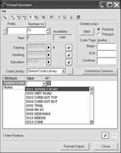
2 HDS Scanner control and operation Scan Scan Scan Register Model Survey Viewer Acquire and display image Acquire image at specified resolution (high, medium, low) Panoramic viewing of multiple images Panoramic viewing of point clouds User-customizable latitude/longitude grid lines Remote operation Selection of area to be scanned via scribed: Rectangle Polygon Independent vertical and horizontal selection of scan density Scan filters (rectangular target area, range, return intensity) Realtime, 3D navigation, even while scanning Script management for automatic sequencing of scans Automated rechecking (re-acquisition) of targets Automated rechecking (re-acquisition) of targets via Scripting Semi-automatic target acquisition Target identification via available Target IDs Set target height for use in Registration Approximate geo-referencing to coordinate system Automatic linking of scans & images with scanner Color scanned points from images Set atmospheric correction parameters Check Calibration Visualization, Modeling & Query Tools Scan Scan Scan Register Model Survey Viewer 3D navigation of point clouds, meshes and 3D models Point cloud Level of Detail (LOD) for fast visualization 3D model Level of Detail (LOD) for fast visualization Decimation of point clouds (every nth point) View point clouds with intensity mapping, image color mapping, elevation based color mapping Map external digital photo to point clouds (Texture map) View texture mapped colors on point clouds Limit Box for efficient viewing and interaction of selected regions Limit Box Manager to organize multiple limit boxes Global registration of multiple scans Geo-referencing Cloud-to-cloud registration Automated registration using HDS targets Automated registration using point clouds Editing Target labels/names View scanner locations Unify point clouds Basic conceptual design & 2D drawing tools Insertion of objects Replication and editing of objects * * * * * 1 Enabled when connected to HDS system. *As delivered in database, cannot modify
3 Visualization, Modeling & Query Tools (cont d) Scan Scan Scan Register Model Survey Viewer Planar patch editing Make Square or Rectangular Create/Fill Hole User-defined quality-of-fit checks Region growing Plane Cylinder Sphere Smooth surface to segment extraneous data Automated Pipe Run with elbows Virtual Surveyor to assign survey feature codes to points Mesh Creation (basic, complex, TIN) Intelligent decimation Decimation based on user-specified grid spacing Polyline and breakline support Delete and add faces Fill in holes Generate contours from meshes Surface Deviation Cut/fill contours Table output on user-specified grid Points on user-specified grid Cut/fill volume Generate cross-sections through point clouds along an alignment Sections Manager Create Lines at Station Create profiles, plans and sections Station Notation display relative to an alignment Fit edge template for curve extraction (e.g. curbs, flowlines) Measure & dimension point clouds and models Slope distance X, Y, Z distances Volume Surface area Horizontal and Vertical Clearances Back angle Fit cylinders, structural steel from catalogs Insert piping components from catalogs (reducer, elbow, branch, flange, valve) Piping Mode to add insulation thickness, Line ID, specification, Symbol Key (SKEY) Piping takeoff query Automated visual interference checking *
4 Visualization, Modeling & Query Tools (cont d) Scan Scan Scan Register Model Survey Viewer Set object creation parameters Create and manage object annotation Output feature codes and annotated vertices, spheres, to ASCII Generate 2D drawings from 3D models 3D redlining Scanner simulation Multiple coordinate system support Assign colors & materials to objects Create and manage layers Save/restore viewpoints Save screen image as image file Object Grouping Geometry types that can be created: HDS flat targets HDS spherical targets 2 Black/White targets Patch (plane) 2 Extruded patch Box 23 Corner 2 Steel shape 2 3 (e.g. I-beam) Cylinder 23 Sphere 23 Vertex Line Elbow 2 3, Reducing Elbow Cone 23 Torus 3 Reducer (Eccentric, Concentric) 3 Flange 3 Valve 3 Polyline, Polygon Rectangle, Square Arc, Circle Ellipse Cubic spline Environmental lighting Create fly-throughs and output sequence of image files or.avi (Audio Video Interleave) file 2 These types can be created using best-fit methods. 3 These types can use catalog tables. *As delivered in database, cannot modify
5 Data Import Scan Scan Scan Register Model Survey Viewer ASCII (XYZ, SVY, PTS, PTX, TXT, Customized format) RIEGL.3DD Cyclone Object Exchange (COE) format (from AutoCAD, MicroStation, via COE Data Transfer) CGP BMP, TIFF, JPEG LandXML Data Export Scan Scan Scan Register Model Survey Viewer AutoCAD DXF R12 Cyclone Object Exchange (COE) format (to AutoCAD, MicroStation via COE Data Transfer) ASCII (XYZ, SVY, PTS, PTX, TXT, Customized format) BMP, TIFF, JPEG SDNF 3.0 (Intergraph Steel Detailing Neutral File) PCF (Alias Piping Component File) Leica System 1200 LandXML Other general Features Metric or imperial units of measure Simultaneous view of video image and scanned data image Customizable, exchangeable user interface: hotkeys, toolbars 64-bit large number support 64-bit graphics support Continuous auto-save Undo/Redo Client/server object database foundation Multi-threading to take advantage of multiple processors Hierarchical project layout Flexible license support Incremental, intelligent loading of 3D models Parametric objects Online help System Requirements Operating System: Microsoft Windows XP (SP1 or higher), Windows 2000 (SP2 or higher) Processor: 2 GHz Pentium 4 or higher/ Pentium M Processor 1.7 GHz or higher RAM: 512 MB (1 GB or more recommended) Network card: Ethernet network card, for licensing *As delivered in database, cannot modify
6 Whether you re designing a modification to a complex refinery piping system, fully checking the clearance of a new tunnel or meticulously rehabilitating a historic building, you need reliable measurements. The specialized 3D laser scanning systems and software by Leica Geosystems provide you with exact data of what s there. When your as-built information has to be right, rely on Leica Geosystems, the company that professionals trust for their scanning solutions. Leica Geosystems is best known for pioneering scanning technology with trustworthy, total solutions: versatile, accurate laser scanners, industry standard point cloud software, and a full complement of accessories, training and support. Precision, quality and service from Leica Geosystems. When it has to be right. Cyrax and HDS are registered trademarks and Cyclone and CloudWorx are trademarks of Leica Geosystems LLC. All other trademarks or registered trademarks are property of their respective owners. Illustrations, descriptions and technical specifications are not binding and may change. Printed in Switzerland Copyright Leica Geosystems AG, enUS II.06 INT Leica Geosystems AG Heerbrugg, Switzerland
Leica Cyclone 8.1 Leica CloudWorx Technical Specifications
 Leica 8.1 Leica CloudWorx Technical Specifications Leica 8.1 Technical Specifications HDS SCANNER CONTROL AND OPERATION & REGISTRATION Acquire and display image ^ ^ ^ Acquire image at specified resolution
REGISTRATION, VISUALISATION, MODELLING & QUERY TOOLS
 REGISTRATION, VISUALISATION, MODELLING & QUERY TOOLS BASIC 3D navigation, Pan, Zoom, Rotate 3D mouse support Panoramic view mode Align to surface view mode Cloud Level of Detail for fast visualisation
Leica Cyclone 9.1 and Leica CloudWorx Technical Specifications
 Leica 9.1 and Leica CloudWorx Technical Specifications Leica 9.1 Technical Specifications REGISTRATION, VISUALIZATION, MODELING & QUERY TOOLS 3D navigation Panoramic view mode Cloud Level of Detail for
Leica Cyclone 9.1 and Leica CloudWorx Technical Specifications
 Leica 9.1 and Leica CloudWorx Technical Specifications Leica 9.1 Technical Specifications REGISTRATION, VISUALISATION, MODELLING & QUERY TOOLS 3D navigation, including 3D mouse support Panoramic view mode
Leica Cyclone and Leica CloudWorx Technical Specifications
 Leica Cyclone and Leica CloudWorx Technical Specifications Valid as of December 2017 leica-geosystems.com REGISTRATION, VISUALISATION, MODELLING & QUERY TOOLS 3D navigation, Pan, Zoom, Rotate / 3D mouse
Leica Cyclone and Leica CloudWorx Technical Specifications
 Leica Cyclone and Leica CloudWorx Technical Specifications Valid as of August 2018 leica-geosystems.com Key 1 These types can be created using best-fit methods 2 As delivered in database, cannot modify
Leica Cyclone 7.0 Leica CloudWorx 4.0 and 2.0 Technical Specifications
 Leica Cyclone 7.0 Leica CloudWorx 4.0 and 2.0 Technical Specifications Leica Cyclone 7.0 Technical Specifications HDS Scanner Control and Operation Acquire and display image Acquire image at specified
Table Of Contents. Introduction Installation Included Materials System Requirements Quick Start... 9
 Cyclone 5.8 Table Of Contents Introduction... 3 Cyclone Software Introduction... 3 Installation... 5 Included Materials... 5 System Requirements... 5 Installing Cyclone... 6 Obtaining your Cyclone License...
Leica Cyclone Basic User Manual November 2015
 Leica Cyclone Basic User Manual November 2015 C.R.Kennedy & Company Page 1 Contents Copying Raw Files from the C10/P20 Scanner to the PC... 6 Copy Raw files from the USB stick to the PC... 6 Opening Cyclone...
Leica FlexField plus & Leica FlexOffice A Perfect Match
 Leica FlexField & Leica FlexOffice A Perfect Match FlexField Onboard Software General File Management Data Import Data Export Status icon bar Instrument Protection with PIN Stake Out beep Map Select Programs
Leica High-Definition Surveying Systems. Leica HDS3000. The Industry Standard for High-Definition Surveying
 Leica High-Definition Surveying Systems Leica HDS3000 The Industry Standard for High-Definition Surveying HDS High-Definition Surveying TM : Laser Scanning Redefined High-Definition Surveying, or HDS,
The Leica HDS Family. The Right Tool for the Job HDS3000 HDS2500 HDS4500. Cyclone & CloudWorx. Press the QuickScan button to define the field-of-view.
 HDS2500 High accuracy scanner, ideal for fixed or raised installations when leveled tripod mounting is not practical, or areas with less stringent field-of-view requirements. The Leica HDS Family Time-of-flight
RealWorks Software. A Powerful 3D Laser Scanning Office Software Suite
 TECHNICAL NOTES RealWorks Software A Powerful 3D Laser Scanning Office Software Suite Trimble RealWorks is a powerful office software that imports rich data from your 3D laser scanning instrument and transforms
FARO As-Built for AutoCAD Software Versatile Reality to CAD Solutions
 FARO As-Built for AutoCAD Software Versatile Reality to CAD Solutions FARO As-Built for Autodesk Revit Creating Efficiencies in Scan Data Extraction for BIM FARO As-Built for AutoCAD Software TM Versatile
Realworks Software. A Powerful 3D Laser Scanning Office Software Suite
 TECHNICAL NOTES Realworks Software A Powerful 3D Laser Scanning Office Software Suite Trimble RealWorks is a powerful office software that imports rich data from your 3D laser scanning instrument and transforms
Trimble Realworks Software
 TECHNICAL NOTES Trimble Realworks Software A Powerful 3D Laser Scanning Office Software Suite DESIGNED FOR TODAY S MULTIFACETED SCANNING PROFESSIONAL, TRIMBLE REALWORKS IS A POWERFUL OFFICE SOFTWARE THAT
technical notes trimble realworks software
 technical notes trimble realworks software A POWERFUL 3D LASER SCANNING OFFICE SOFTWARE SUITE Designed for today s multifaceted scanning professional, Trimble RealWorks is a powerful office software that
Leica ScanStation C10 The All-in-One Laser Scanner for Any Application
 The All-in-One Laser Scanner for Any Application Versatility, Productivity, Value Many organizations interested in laser scanning to diversify and/or improve current business have been waiting for a scanner
Leica ScanStation C10 Equipment List
 Leica ScanStation C10 Equipment List Table of Contents ScanStation C10 3 1 Scanner Set 3 Accessories for ScanStation C10 4 2 Accessory Set 4 3 Power Supply 4 3.1 Internal Power Supply 4 3.2 External Power
Leica ScanStation C5 Scalable Laser Scanner
 Leica ScanStation C5 Scalable Laser Scanner Leica ScanStation C5 Scalable from the Start Companies entering into laser scanning are often faced with inflexible and complex situations and would like a scalable
TcpMDT. Digital Terrain Model Version 7.5. TcpMDT
 Digital Terrain Model Version 7.5 Versions and Modules PROFESSIONAL STANDARD IMAGES SURVEYING POINT CLOUD Product Features STANDARD Surveying Points Management Digital Terrain Model Contours Terrain Cross
Most as-built information is still manually collected. Today s Design Market
 Agenda 1. Overview of 3D laser scanning 2. HDS 3D Laser scanning applications Leica ScanStation2 True Color Scan 3. Demonstration of HDS & Trueview 4. Questions and Answers The advanced 3D Laser Scanning
Viewer, Editor & Meter (Beta) User manual Department of Cartographic Engineering, Geodesy and Photogrammetry
 User manual Department of Cartographic Engineering, Geodesy and Photogrammetry") Viewer, Editor & Meter (Beta) User manual July 27, 2013 Department of Cartographic Engineering, Geodesy and Photogrammetry Index 1. Presentation... 2 2. Installing software... 2 3. Main window... 2 3.1.
Viewer, Editor & Meter (Beta) User manual July 27, 2013 Department of Cartographic Engineering, Geodesy and Photogrammetry Index 1. Presentation... 2 2. Installing software... 2 3. Main window... 2 3.1.
Solid Modeling: Part 1
 Solid Modeling: Part 1 Basics of Revolving, Extruding, and Boolean Operations Revolving Exercise: Stepped Shaft Start AutoCAD and use the solid.dwt template file to create a new drawing. Create the top
Digital Terrain Model V 6.5
 TCP MDT Digital Terrain Model V 6.5 Professional Version Introduction The Professional Version is designed to assist users in all the phases of carrying out a Surveying or Civil Engineering project. Its
S206E Lecture 3, 5/15/2017, Rhino 2D drawing an overview
 Copyright 2017, Chiu-Shui Chan. All Rights Reserved. S206E057 Spring 2017 Rhino 2D drawing is very much the same as it is developed in AutoCAD. There are a lot of similarities in interface and in executing
General GPS TPS ROB X POLE VOL RDN RPL Jobs management System settings (units, precision, parameters, etc.)
") XPAD Survey Modules XPAD Survey GPS TPS XPOLE General GPS TPS ROB XPOLE VOL RDN RPL Jobs management System settings (units, precision, parameters, etc.) Instruments GPS GPS TPS ROB XPOLE VOL RDN RPL Instrument
XPAD Survey Modules XPAD Survey GPS TPS XPOLE General GPS TPS ROB XPOLE VOL RDN RPL Jobs management System settings (units, precision, parameters, etc.) Instruments GPS GPS TPS ROB XPOLE VOL RDN RPL Instrument
Trimble RealWorks. What s new in version 9.0
 Trimble RealWorks What s new in version 9.0 Trimble RealWorks v9.0 What s new Over 40 new features and enhancements Navigation and visualization improvements SketchUp interoperability Additional 3 rd party
User s guide. November LSE S.r.l. All rights reserved
 User s guide November 2015 2015 LSE S.r.l. All rights reserved WARNING In writing this manual every care has been taken to offer the most updated, correct and clear information possible; however unwanted
COMPUTER AIDED ARCHITECTURAL GRAPHICS FFD 201/Fall 2013 HAND OUT 1 : INTRODUCTION TO 3D
 COMPUTER AIDED ARCHITECTURAL GRAPHICS FFD 201/Fall 2013 INSTRUCTORS E-MAIL ADDRESS OFFICE HOURS Özgür Genca ozgurgenca@gmail.com part time Tuba Doğu tubadogu@gmail.com part time Şebnem Yanç Demirkan sebnem.demirkan@gmail.com
Figure 1: Mobile mapping project location in New York City.
 Using Mobile LiDAR to Deliver Survey Accurate Data This presentation will take the attendees though the process of controlling and delivering survey grade LiDAR data for use in CADD, Modeling, and GIS
TerraScan Tool Guide
 TerraScan Main Toolbox General Toolbar Draw Toolbar Groups Toolbar Vectorize Towers Toolbar Road Toolbar Buildings Toolbar Building Edges Toolbar View Laser Toolbar Model Toolbar Vectorize Wires Toolbar
Laser Scanning. 3D Model is not existing and is required for: studies revamping maintenance HSE integration in another 3D model archiving
 Laser Scanning Laser Scanning Laser scanning is used whenever: 3D Model is not existing and is required for: studies revamping maintenance HSE integration in another 3D model archiving 2 Object acquisition
3DReshaper Help DReshaper Beginner's Guide. Surveying
 3DReshaper Beginner's Guide Surveying 1 of 29 Cross sections Exercise: Tunnel analysis Surface analysis Exercise: Complete analysis of a concrete floor Surveying extraction Exercise: Automatic extraction
Cyclone Tips and Tricks. Hexagon Geosystems Track June 2012
 Cyclone Tips and Tricks Hexagon Geosystems Track June 2012 Built-in Hotkeys Enhanced Working Format Open GL Modes There are some very powerful built-in viewing hotkeys in Cyclone. Here are some of them:
3D ModelingChapter1: Chapter. Objectives
 Chapter 1 3D ModelingChapter1: The lessons covered in this chapter familiarize you with 3D modeling and how you view your designs as you create them. You also learn the coordinate system and how you can
Terrestrial 3D laser scanning Practical aspects
 Terrestrial 3D laser scanning Practical aspects ISPRS WG VI/5&SC Summer School 2007 by Gregor Bilban 3D laser scanning Benefits Lower data collection costs Reduction or elimination of re-visits More accurate
Point Cloud Classification
 Point Cloud Classification Introduction VRMesh provides a powerful point cloud classification and feature extraction solution. It automatically classifies vegetation, building roofs, and ground points.
Product Leica Infinity. Date Nov 30 th, From Kevin Hanson
 Product Leica Infinity Date Nov 30 th, 2017 From Kevin Hanson Leica Geosystems AG Heinrich-Wild-Strasse CH-9435 Heerbrugg Switzerland www.leica-geosystems.com Table of Contents 1 About this Release...
TCP MDT Digital Terrain Model - V7.5
 TCP MDT Digital Terrain Model - V7.5 Standard Version Introduction The Standard Version is suitable for carrying out all kinds of topographical survey projects, terrain profiles, volume calculations etc.
USING A LASER SCANNER FOR THE CONTROL OF ACCELERATOR INFRASTRUCTURE DURING THE MACHINE INTEGRATION
 IWAA2004, CERN, Geneva, 4-7 October 2004 USING A LASER SCANNER FOR THE CONTROL OF ACCELERATOR INFRASTRUCTURE DURING THE MACHINE INTEGRATION Tobias Dobers, Mark Jones, Yvon Muttoni, CERN, 1211 Geneva 23,
Strategy. Using Strategy 1
 Strategy Using Strategy 1 Scan Path / Strategy It is important to visualize the scan path you want for a feature before you begin taking points on your part. You want to try to place your points in a way
3D MODELING OF CLOSE-RANGE OBJECTS: PHOTOGRAMMETRY OR LASER SCANNING?
 3D MODELING OF CLOSE-RANGE OBJECTS: PHOTOGRAMMETRY OR LASER SCANNING? F. Remondino 1 A. Guarnieri 2 A. Vettore 2 1 Institute of Geodesy and Photogrammetry ETH Hönggerberg - Zurich, Switzerland e-mail:
icon office release of version
 Product: icon office Date: 17.12.2019 From: Torgny Israelsson icon office release of version 2019.1.11.20 We are pleased to announce the release of icon office 2019. icon office is now available as 64-bit
RELEASE NOTES TRIMBLE REALWORKS SOFTWARE VERSION System requirements New Features and Changes
 RELEASE NOTES TRIMBLE REALWORKS SOFTWARE VERSION 9.0.1.313 System requirements New Features and Changes Trimble Navigation Ltd, 10368 Westmoor Drive, Westminster, CO 80021, USA 2014, Trimble Navigation
MODERN TECHNOLOGY FOR LAND LEVELLING, BASED ON A 3D SCANNER
 MODERN TECHNOLOGY FOR LAND LEVELLING, BASED ON A 3D SCANNER Abstract: Soil levelling becomes of high importance, in modern and intensive agriculture conditions. Its effects are found in providing optimal
Engineering Drawing II
 Instructional Unit Basic Shading and Rendering -Basic Shading -Students will be able -Demonstrate the ability Class Discussions 3.1.12.B, -Basic Rendering to shade a 3D model to apply shading to a 3D 3.2.12.C,
RELEASE NOTES TRIMBLE REALWORKS SOFTWARE VERSION 9.0. System requirements New Features and Changes
 RELEASE NOTES TRIMBLE REALWORKS SOFTWARE VERSION 9.0 System requirements New s and Changes Trimble Navigation Ltd, 10368 Westmoor Drive, Westminster, CO 80021, USA 2014, Trimble Navigation Limited. All
SURVEY 3.0. Innovative field solutions for Surveyors X PAD. works when you do
 Innovative field solutions for Surveyors works when you do X PAD INNOVATIVE FIELD SOLUTION FOR SURVEYORS The software for survey, stakeout and control, ensuring productivity and flexibility in the field,
MANUAL NO. OPS647-UM-151 USER S MANUAL
 MANUAL NO. OPS647-UM-151 USER S MANUAL Software Usage Agreement Graphtec Corporation ( Graphtec ) hereby grants the purchaser and authorized User (the User ) the right to use the software (the Software
Release Notes SPECTRA PRECISION SURVEY OFFICE. Version
 Release Notes SPECTRA PRECISION SURVEY OFFICE Version 3.90.1 Corporate office: Spectra Precision 10368 Westmoor Drive Westminster, CO 80021 USA www.spectraprecision.com Copyright and trademarks: 2005-2017,
Module 7 Defining Coordinate Systems
 Module 7 Defining Coordinate Systems Introduction Objectives Outline of Topics Covered The use of coordinate systems is very important in managing 3D spatial data including point clouds. In this module
OBJECT MANAGER PACKAGE USER S GUIDE
 OBJECT MANAGER PACKAGE USER S GUIDE 1 CONTENT I. Introduction... 3 II. Installation... 3 III. Using the plugins... 4 a- General... 4 b- Object properties manager... 4 c- Pipe manager... 6 d- Plane manager...
ROAD-SCANNER COMPACT APPLICATION FIELDS MAIN FEATURES
 ROAD-SCANNER COMPACT Mobile Mapping System by GEXCEL & SITECO collaboration A smaller mobile system for asset management and cartography suited for ZOLLER & FRÖHLICH PROFILER 9012 laser scanner. 2 + 3
GETTING STARTED TABLE OF CONTENTS
 Sketchup Tutorial GETTING STARTED Sketchup is a 3D modeling program that can be used to create 3D objects in a 2D environment. Whether you plan to model for 3D printing or for other purposes, Sketchup
Rhino Interface. Menus Command History Command Prompt. Toolbars. Viewport Title. Viewports. Common Shortcuts. Object Snaps.
 Rhino Interface Menus Command History Command Prompt Toolbars Viewport Title LMB: activate viewport without losing selection Double Click: maximise viewport RMB: show viewport options: wireframe, shaded,
Customized Pre/post-processor for DIANA. FX for DIANA
 Customized Pre/post-processor for DIANA FX for DIANA About FX4D for DIANA FX4D is a general purpose pre/post-processor for CAE simulation. FX4D has been specialized for civil/architectural applications.
Extracting Plant Deliverables from AutoCAD Point Clouds
 Extracting Plant Deliverables from AutoCAD Point Clouds The webinar will begin shortly. You will hear silence until the webinar begins. Please note that this webinar is being recorded and all registrants
Leica No Date From To. software for. We are pleased to. point cloud. system. Grid and intelligen. Orientati. Then you. view.
 No Date From To 27-2013 BU Terrestrial Laser Scanning 29 th October 2013 Bill Wallace All representatives Leica CloudWorx for AutoCAD 5.0 Product Release Announcement We are pleased to announce the release
TABLE OF CONTENTS PRODUCT DESCRIPTION VISUALIZATION OPTIONS MEASUREMENT OPTIONS SINGLE MEASUREMENT / TIME SERIES BEAM STABILITY POINTING STABILITY
 TABLE OF CONTENTS PRODUCT DESCRIPTION VISUALIZATION OPTIONS MEASUREMENT OPTIONS SINGLE MEASUREMENT / TIME SERIES BEAM STABILITY POINTING STABILITY BEAM QUALITY M 2 BEAM WIDTH METHODS SHORT VERSION OVERVIEW
Leveraging Point Clouds to Produce Accurate As-Built Models. Sonia Delgadillo
 Leveraging Point Clouds to Produce Accurate As-Built Models Sonia Delgadillo Time What is CADWorx fieldpipe? Easy customization Comprehensive specs Short learning curve AutoCAD -based CADWorx Plant Design
INVESTIGATION ON LASER SCANNERS *
 IWAA2004, CERN, Geneva, 4-7 October 2004 INVESTIGATION ON LASER SCANNERS * Brian Fuss, Catherine Le Cocq, Robert Ruland Stanford Linear Accelerator Center, Stanford, CA, USA Rudolf Staiger Essen University,
TBC v License Matrix - Rev 0
 Command Name Viewer (Unlicensed) Base Intermediate Advanced Advanced Drafting Aerial Photogrammetry Data Prep GIS Scanning Tunneling Category 3D Preset Views x x x x General Software 3D View Projection
AutoCAD DWG Drawing Limitations in SAP 3D Visual Enterprise 9.0 FP03
 AutoCAD DWG Drawing Limitations in SAP 3D Visual Enterprise 9.0 FP03 AutoCAD Import Limitations The following is a list of AutoCAD features that will not give an expected viewable when using SAP 3D Visual
RELEASE NOTES TRIMBLE REALWORKS SOFTWARE VERSION System requirements New Features and Changes
 RELEASE NOTES TRIMBLE REALWORKS SOFTWARE VERSION 10.2 System requirements s and Changes Trimble Inc., 10368 Westmoor Drive, Westminster, CO 80021, USA 2016, Trimble Inc. All rights reserved. Trimble, the
With FARO PointSense for Revit. Jörg Braunes Platform Owner Software Chris Palmer Sales Engineer 1
 From Point Clouds to BIM Models With FARO PointSense for Revit Jörg Braunes Platform Owner Software Chris Palmer Sales Engineer 1 Agenda Scan to BIM with Revit PointClouds in Revit Advanced Workflow with
BuildIT Release Notes
 BuildIT 2016.5 Release Notes Installation Notes In order to install all the associated drivers properly, right-click on the setup file and select Run as administrator. This installation does not overwrite
Three-Dimensional Laser Scanner. Field Evaluation Specifications
 Stanford University June 27, 2004 Stanford Linear Accelerator Center P.O. Box 20450 Stanford, California 94309, USA Three-Dimensional Laser Scanner Field Evaluation Specifications Metrology Department
Italian pavilion in 3D, project for EXPO 2015, Milan (Italy) JRC 3D RECONSTRUCTOR POWERFUL. ADVANCED. PROFESSIONAL
 JRC 3D RECONSTRUCTOR POWERFUL. ADVANCED. PROFESSIONAL") Italian pavilion in 3D, project for EXPO 2015, Milan (Italy) JRC 3D RECONSTRUCTOR POWERFUL. ADVANCED. PROFESSIONAL OVERVIEW JRC 3D Reconstructor is the well known multi-platform and multi-resolution software
Italian pavilion in 3D, project for EXPO 2015, Milan (Italy) JRC 3D RECONSTRUCTOR POWERFUL. ADVANCED. PROFESSIONAL OVERVIEW JRC 3D Reconstructor is the well known multi-platform and multi-resolution software
3D ponttechnológia használata napjainkban október. 10. Tatabány, Mérnöki továbbképzés Zeke Zsolt Mérnök üzletkötő
 3D ponttechnológia használata napjainkban 2018. október. 10. Tatabány, Mérnöki továbbképzés Zeke Zsolt Mérnök üzletkötő Leica BLK3D NEW based on photogrametry Leica HDS Termékportfólió BLK360 RTC360 P40/50
Leica Viva Imaging Enrich your Surveying Workflow
 Leica Viva Imaging Enrich your Surveying Workflow Your Vision: Images that Welcome to Leica Viva Imaging Enrich your Surveving Workflow Leica Viva Imaging enriches your surveying workflow with visual documentation
TerraScan New Features
 www.terrasolid.com TerraScan New Features Arttu Soininen 23.01.2018 Import Scanner Positions for Trajectories File / Import scanner positions menu command in Manage Trajectories reads scanner positions
Image Measuring Instrument
 EASY QUICK ACCURATE SAVE Time & Cost Improved efficiency & accuracy L26 All new Image Measuring Instrument Top Series come with new innovative design in structural quality, functionality, and accuracy,
Reference Manual. Version 1.1
 Version 1.1 TABLE OF CONTENTS 1. INSTALLATION... 1 Requirements... 1 Installation process... 1 After installation... 3 2. USER INTERFACE... 4 Introduction... 4 Main window... 5 Project management window...
Freeform / Freeform PLUS
 Freeform / Freeform PLUS WORKING WITH FREEFORM Work from Coarse Clay to Fine When creating new models from scratch, it is best to first create a rough shape using a coarse clay setting such as Rough Shape
Grading and Volumes CHAPTER INTRODUCTION OBJECTIVES
 CHAPTER 10 Grading and Volumes INTRODUCTION AutoCAD Civil 3D uses surface breaklines, cogo points, contours, feature lines, and grading objects to create a surface design. There are numerous ways to grade
GDL Toolbox 2 Reference Manual
 Reference Manual Archi-data Ltd. Copyright 2002. New Features Reference Manual New Save GDL command Selected GDL Toolbox elements can be exported into simple GDL scripts. During the export process, the
Lesson 1: Creating T- Spline Forms. In Samples section of your Data Panel, browse to: Fusion 101 Training > 03 Sculpt > 03_Sculpting_Introduction.
 3.1: Sculpting Sculpting in Fusion 360 allows for the intuitive freeform creation of organic solid bodies and surfaces by leveraging the T- Splines technology. In the Sculpt Workspace, you can rapidly
USE THE 3D LASER SCANNING FOR DOCUMENTATION THE RIGA CATHEDRAL IN LATVIA
 USE THE 3D LASER SCANNING FOR DOCUMENTATION THE RIGA CATHEDRAL IN LATVIA Maris Kalinka, Elina Rutkovska, Department of Geomatic, Riga Technical University, Azenes 16-109, Riga, Latvia, geomatika@geomatika.lv
X-PAD Ultimate. The Ultimate solution in the field. Works when you do
 Works when you do X-PAD Ultimate The Ultimate solution in the field X-PAD Ultimate is a tailored, flexible, modular, ideal, customised software for high end topographic tasks, such as measure, stake-out,
AutoCAD Civil 3D 2011 ESSENTIALS
 AutoCAD Civil 3D 2011 ESSENTIALS SDC PUBLICATIONS www.sdcpublications.com Schroff Development Corporation Table of Contents Table of Contents Preface...ix Module 1 The AutoCAD Civil 3D Interface... 1-1
Leica System 1200 Software Integrated Software for GPS1200 and TPS1200
 Leica System 1200 Software Integrated Software for GPS1200 and TPS1200 Leica System 1200 Software System 1200 software includes SmartWorx the onboard TPS, GPS and RX1250 software and the Leica Geo Office
Product documents Features pcon.planner 7.6
 Product documents Features pcon.planner 7.6 Persistency Loading and saving of DWG- and DWT-files Conversion and support of older DWG formats Extended template support including standard templates Import
Improvements for Carlson Office 2019
 Highlights 3D Viewer Speed Surface Objects Solid Modeling Angled Drillholes 3D Timing Viewer Pressure Pipes Point Cloud Basic module IntelliCAD 9.0: CUI, DGN Improvements for Carlson Office 2019 General
Leica Captivate. Software Release Notes. Field Controllers: CS20, CS35 Total Stations: TS16, TS60, MS60. Release date 1 st December 2017
 Leica Captivate v3.00 Software Release Notes Product Leica Captivate Field Controllers: CS20, CS35 Total Stations: TS16, TS60, MS60 Release date 1 st December 2017 Maintenance date 1 st December 2017 Available
BIM & Digital Transformation Scotland Live 2018 Capturing 3D Reality at the push of a button
 BIM & Digital Transformation Scotland Live 2018 Capturing 3D Reality at the push of a button Gary Kelly Country Manager Scotland Leica Geosystems @LeicaScot Capturing 3D Reality at the push of a button
The YellowScan Surveyor: 5cm Accuracy Demonstrated
 The YellowScan Surveyor: 5cm Accuracy Demonstrated Pierre Chaponnière1 and Tristan Allouis2 1 Application Engineer, YellowScan 2 CTO, YellowScan Introduction YellowScan Surveyor, the very latest lightweight
Autodesk Inventor 2019 and Engineering Graphics
 Autodesk Inventor 2019 and Engineering Graphics An Integrated Approach Randy H. Shih SDC PUBLICATIONS Better Textbooks. Lower Prices. www.sdcpublications.com Powered by TCPDF (www.tcpdf.org) Visit the
USER S MANUAL Software Usage Agreement Registered Trademarks Notes on this Manual Disclaimer
 USER S MANUAL Software Usage Agreement Registered Trademarks Notes on this Manual Disclaimer 1 1.1 1.2 2 3 Introduction 2.1 2.2 Features System Requirements Installing Xyron Wishblade Software 3.1 3.2
Protect by Leica Geosystems A Lifetime Guarantee
 Protect by Leica Geosystems A Lifetime Guarantee Protect by Leica Geosystems We always protect your success PROTECT by Leica Geosystems Lifetime Warranty No Cost Period Certified Quality Swiss Technology
The complete design environment for road planning & construction ANADELTA TESSERA.
 The complete design environment for road planning & construction Short Description Short Description ANADELTA TESSERA Tessera is the professional, standards-based road design solution helping civil engineers
Boosting the Efficiency of Wind Power Plants. Stringent Demands for Boosting the Efficiency of Wind Power Plants
 Case Study Boosting the Efficiency of Wind Power Plants By Steffen Schenk and Wolfgang Steindorf Three-dimensional measurement and analysis of rotor blades and their production facility are highly complex
AutoCAD Civil 3D 2014 for Surveyors
 AutoCAD Civil 3D 2014 for Surveyors SDC P U B L I C AT I O N S Better Textbooks. Lower Prices. www.sdcpublications.com Powered by TCPDF (www.tcpdf.org) Visit the following websites to learn more about
v Overview SMS Tutorials Prerequisites Requirements Time Objectives
 v. 12.2 SMS 12.2 Tutorial Overview Objectives This tutorial describes the major components of the SMS interface and gives a brief introduction to the different SMS modules. Ideally, this tutorial should
Autodesk 123D Beta5 Overview
 Autodesk 123D Beta5 Overview Welcome. This overview document for Autodesk 123D will assist you in developing your understanding of the software and how you can use it to create your design ideas. Designing
Leica Geosystems QuickStart Guide
 Leica Geosystems QuickStart Guide Product Leica Cyclone REGISTER 360 1.4.1 Date 3 January 2018 From HDS Software Product Management Contents Introduction... 2 Installation... 3 Licensing Setup... 4 Basic
TcpMDT Version 7.0 Summary of Differences with Version 6.5
 Sumatra, 9 E-29190 Málaga (Spain) www.aplitop.com Tel.: +34 95 2439771 Fax: +34 95 2431371 TcpMDT Version 7.0 Summary of Differences with Version 6.5 CAD Versions supported TcpMDT 7 works with several
Tools, Tips, and Workflows Exporting Final Product LP360
 LP360 Support Revision 1.0 l Final products can be exported from LIDAR data using either LP360 command line executables or the LP360 Export Wizard. Some export functions and resulting products include,
D, 8400 E 8400 F
 PRODUCT DATA BK Connect Structural Dynamics Correlation Analysis Type 8421 Finite Element Interface Types 8400 D, 8400 E and 8400 F BK Connect Correlation Analysis is an easy to use postprocessing application
Release Notes TRIMBLE BUSINESS CENTER. Version 2.50
 Release Notes TRIMBLE BUSINESS CENTER Version 2.50 Corporate office: Trimble Navigation Limited Engineering and Construction Division 5475 Kellenburger Road Dayton, Ohio 45424-1099 USA Phone: +1-937-233-8921