geobrowser3d.com The Power of 3D GIS Tools in your Browser
|
|
|
- Leslie Hill
- 5 years ago
- Views:
Transcription


1 geobrowser3d.com 1 The Power of 3D GIS Tools in your Browser
2 Overview Introduction Modules Success Stories Build your own


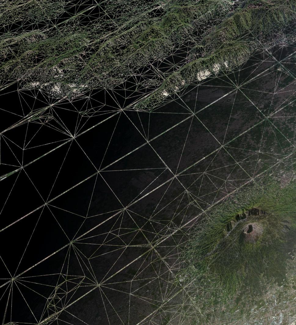
3 What is GeoBrowser3D Interactive 3D visualization system Modular platform OGC compliant solution Decision making environment with computational and visual technologies Powered by WebGL and state of the art visualization technologies

4 What is GeoBrowser3D The final GIS tool for your needs


 KML/KMZ Load and show KML/KMZ Google")


5 Features 3D GIS Navigation Real-time interactive world browsing, different view modes and support for ellipsoid and bird eye cameras Vector data Visualize and manage vector cartographic data (Shapefiles, WFS, WFS-T) KML/KMZ Load and show KML/KMZ Google Earth datasets. Advanced Data Management Manage large sets of multidimensional GIS and satellite data from different service providers Terrain data Load and visualize terrain data from DSM and DTM at multiple resolution. 3D Buildings Visualize large urban areas based on the CityGML in 3D


6 Features Raster data Visualize and manage raster information from web mapping and tiling services Real-time data Access data in real-time sensor network using Sensor Observation Service (SOS) Planning and collaborative tools Measure distances and areas, profile the terrain, track moving objects and use other advanced tools for what-if analysis Massive rendering Load and show hundreds of thousands of 3D objects on your map TIN Support Create and visualize multiresolution elevation data as triangulated irregular network OGC Compliance WMS, WFS, WFS-T, OpenLS, SOS, CityGML.


7 Features Special Visual Effects Add new engaging effects to your visualization system with dynamic particle effects and custom shaders Fly-through Recording Import, create and record smooth cinematic fly-through camera sequences with full path control from your GPX tracks Binary gltf Support Efficiently stream and show 3D scenes and models using the new binary GL Transmission Format Custom Layers Visualization Load and naturally adjust geographic layers from external images or PDFs to render on top of the map Line of Sight Compute an accurate line of sight at any location in the world Game Engine Support Improve your Unreal/Unity3D level design creating game maps based on real terrain data

8 Features Point Cloud Visualization Render and navigate through 3D Point clouds


9 A Modular Solution Energy Tourism Environment Data Collection Open Data INSPIRE GeoBrowser3D Client GeoBrowser3D Server
10 Energy Package


11 Energy Package Automatic HD large scale solar irradiation maps computation User friendly solar potential assessment tools Smart monitoring 3D building reconstruction


12 Energy Package Automatic computation of large scale energy consumption ecomaps Urban monitoring Smart Metering and Remote Control
13 Tourism Package

14 Tourism Package Points of Interest Visualization and Management Routing Apps Augmented Reality Apps Data Collection Apps
 Photorealistic")
15 Tourism Package Cinematic functions (GPX support and Flythrough) Real-time tracking Multimodal Tour Planning and Routing (Hiking/Bike/Ski-Alps ) Photorealistic rendering
16 Environment Package

17 Environment Package Environmental data processing Forest planning tools Experience with parks and ministry

18 Data Collection Package


19 Data Collection Package On-the-field data collection apps Geo-Blog Data collection planning and monitoring
20 Open Data Package
21 Open Data Package Open Data Collection Open Data Transformation Open Data Visualization

22 INSPIRE Package
23 INSPIRE Package Data Collection (Mobile App) Data Harmonization Data Validation Data Enrichment INSPIRE compliant GML Data Publishing: View (WMS), Download (WFS)
24 GeoBrowser3D Server

25 GeoBrowser3D Server Merge and efficiently stream your multiresolution DSM/DTM to clients Input: GeoTIFF, ASCII Grids, etc. Output: Regular and Irregular grids of points (BIL, TMS, Quantized Mesh) Efficient cloud infrastructure

26 Success Stories

27 Italian Ministry of Environment GeoBrowser3D: the technology behind the Italian national geographic visualization system

28 itrentino A 3D Web visualization system to explore and enjoy journeys across Trentino Region

29 SLOPE An advanced 3D monitoring and planning tool for forest production in mountain areas

30 STATUS Territorial Atlas for urban planning in South East Europe territories

31 SUNSHINE A toolkit with 3 services: building energy assessment, energy consumption optimization, public lightning, power optimization

32 i-scope An open smartcity service platform based on interoperable 3D city models (CityGML)


33 eenvplus Crowdsourcing service to view and acquire collections of observations about species distributions or natural events

34 Build Your Own GeoBrowser3D Define your needs Start with the client Need a server? Add packages Choose the functionalities Contact us!


35 Contacts Via alla Cascata 56/C Trento (TN) - Italy Phone: Fax: info@graphitech.it info@pec.graphitech.it
Advances in GIS help create Smarter Communities
 Advances in GIS help create Smarter Communities POP(ovich) Quiz Who is a Desktop User? Who is an ArcGIS Online User? Who is a ArcGIS Server Admin? Who is a Programmer? Who works with or for a government
3D in the Browser with WebGL. Chris Andrews 3D Product Manager Javier Gutierrez 3D Product Engineer
 3D in the Browser with WebGL Chris Andrews 3D Product Manager Javier Gutierrez 3D Product Engineer Just sayin This is not a programming class Goal is to help you learn about a technology area that impacts
3D in the ArcGIS Platform. Chris Andrews
 3D in the ArcGIS Platform Chris Andrews Geospatial 3D is already all around us 3D is expanding the GIS community s opportunity to provide value 3D City & Infrastructure Models Generated 3D features Photogrammetrc
SkylineGlobe - Products Overview
 SkylineGlobe - Products Overview Skyline Software Systems, Inc. is a leading provider of 3D earth visualization software and services. The company offers a comprehensive platform of applications, tools
3D webservices - where do we stand? Emmanuel Belo
 3D webservices - where do we stand? Emmanuel Belo +41 21 619 10 25 emmanuel.belo@camptocamp.com Camptocamp Open Source Service Provider Staff 49 Switzerland, France & Austria Since 2001 Wien Lausanne Chambéry
E3De. E3De Discover the Next Dimension of Your Data.
 International Support Exelis Visual Information Solutions is a global company with direct offices in North America, Europe, and Asia. Combined with our extensive, worldwide distributor network, we can
Web Services for Geospatial Mobile AR
 Web Services for Geospatial Mobile AR Introduction Christine Perey PEREY Research & Consulting cperey@perey.com Many popular mobile applications already use the smartphone s built-in sensors and receivers
Terrain Modeling and Mapping for Telecom Network Installation Using Scanning Technology. Maziana Muhamad
 Terrain Modeling and Mapping for Telecom Network Installation Using Scanning Technology Maziana Muhamad Summarising LiDAR (Airborne Laser Scanning) LiDAR is a reliable survey technique, capable of: acquiring
RELEASE NOTES FOR TERRAEXPLORER 7.0.1
 s RELEASE NOTES FOR TERRAEXPLORER 7.0.1 New Features in Release 7.0.1 Raster layer enhancements Load raster layers from Google Earth Enterprise Server - TerraExplorer 7.0.1 extends imagery and elevation
BROWSER. LuciadRIA DATA SHEET
 BROWSER LuciadRIA DATA SHEET V2017 V2017.0 DATA SHEET LuciadRIA is the answer to today s demands for powerful, lightweight applications in the browser. Driven by today s most advanced web technologies,
Esri Support for Geospatial Standards
 APRIL 2017 ArcGIS Is Open and Interoperable Esri Support for Geospatial Standards Copyright 2017 Esri All rights reserved. Printed in the United States of America. The information contained in this document
TerrainOnDemand ArcGIS
 TM TerrainOnDemand ArcGIS Connect to Intermap Technologies NEXTMap data within: ArcGIS Desktop 9.3.1 and Above AGDQS0312 TerrainOnDemand ArcGIS 2 TerrainOnDemand ArcGIS Table of Contents 1. Introduction...1
Scientific and Multidimensional Raster Support in ArcGIS
 Scientific and Multidimensional Raster Support in ArcGIS Sudhir Raj Shrestha sshrestha@esri.com Brief breakdown Scientific Multidimensional data Ingesting Scientific MultiDim Data in ArcGIS Ingesting and
ArcGIS Runtime: Building 3D Apps. Rex Hansen Adrien Meriaux
 ArcGIS Runtime: Building 3D Apps Rex Hansen Adrien Meriaux Agenda 3D across the ArcGIS Platform 3D in ArcGIS Runtime Road ahead ArcGIS 3D helps customers Create and Manage Design and Simulate Visualize
Dynamic 3D representation of information using low cost Cloud ready Technologies
 National Technical University Of Athens School of Rural and Surveying Engineering Laboratory of Photogrammetry Dynamic 3D representation of information using low cost Cloud ready Technologies George MOURAFETIS,
High resolution survey and orthophoto project of the Dosso-Gaya region in the Republic of Niger. by Tim Leary, Woolpert Inc.
 High resolution survey and orthophoto project of the Dosso-Gaya region in the Republic of Niger by Tim Leary, Woolpert Inc. Geospatial Solutions Photogrammetry & Remote Sensing LiDAR Professional Surveying
Webservice-energy.org GEO Community Portal & Spatial Data Infrastructure for Energy
 Webservice-energy.org GEO Community Portal & Spatial Data Infrastructure for Energy Lionel Menard / Oct. 23 2017 Centre Observation, Impacts, Energy Research activities: Use of Earth observation data (Models,
Using rasters for interpolation and visualization in GMS
 v. 10.3 GMS 10.3 Tutorial Using rasters for interpolation and visualization in GMS Objectives This tutorial teaches how GMS uses rasters to support all kinds of digital elevation models and how rasters
Leveraging OGC Services in ArcGIS Server. Satish Sankaran, Esri Yingqi Tang, Esri
 Leveraging OGC Services in ArcGIS Server Satish Sankaran, Esri Yingqi Tang, Esri GIS Creating and Managing Geo Information Products - Proprietary - Open Specifications - Standards Dissemination of Geo
gvsig: towards 4D GIS
 gvsig: towards 4D GIS Salvador Bayarri IVER Salvador.Bayarri@iver.es www.gvsig.gva.es Contents gvsig's background & updates 3D visualization in gvsig Time and Animation in gvsig Implementation plan Demo
Sharing Environmental Information In Action. Chris Steenmans European Environment Agency
 Sharing Environmental Information In Action Chris Steenmans INSPIRE Conference 2012, Istanbul 26.06.2012 Sharing environmental information in action Outline What is SEIS? Implementation Content Cooperation
Dynamic Situational Awareness. Through Developer Applications
 Dynamic Situational Awareness Through Developer Applications Mission Focused Applications Building Apps to support operations Agile Simple High-Performance Defense Developers GIS Simplifies Working With
Drone2Map for ArcGIS: Bring Drone Imagery into ArcGIS
 Drone2Map for ArcGIS: Bring Drone Imagery into ArcGIS Mike Sweeney 1 Drone2Map for ArcGIS Turn Drones into Enterprise Productivity Tools ArcGIS Drone2Map for ArcGIS Create 2D and 3D products from raw drone
HUMBOLDT Application Scenario: Protected Areas
 CC by Erlend Schei Copyright by Kecko Copyright by Michael Bezzina CC by Gunnar Ries Copyright by Michael Bezzina Copyright by Michael Bezzina Copyright by Michael Bezzina CC by fs999 CC by Jordan Nielsen
SkylineGlobe s New Developments
 SkylineGlobe 6.6.1 s New Developments The SkylineGlobe 6.6.1 release highlights PhotoMesh v6.6.1, an all-new Skyline product developed from the ground up, based on the latest state-of-the-art technologies.
ERDAS APOLLO Managing and Serving Geospatial Information
 ERDAS APOLLO Managing and Serving Geospatial Information ERDAS APOLLO Do you have large volumes of geospatial information, regularly updated data stores, and a distributed user base? Do you need a single,
Intelligent photogrammetry. Agisoft
 Intelligent photogrammetry Agisoft Agisoft Metashape is a cutting edge software solution, with its engine core driving photogrammetry to its ultimate limits, while the whole system is designed to deliver
SMARTERDECISIONS. Geospatial Portal 2013 Open Interoperable GIS/Imagery Services with ERDAS Apollo 2013 and ERDAS Imagine 2013
 Geospatial Portal 2013 Open Interoperable GIS/Imagery Services with ERDAS Apollo 2013 and ERDAS Imagine 2013 Carahsoft Intergraph Government Solutions SMARTERDECISIONS Geospatial Portal 2013 Geospatial
ADVANCING REALITY MODELING WITH CONTEXTCAPTURE
 ADVANCING REALITY MODELING WITH CONTEXTCAPTURE Knowing the existing conditions of a project is a key asset in any decision process. Governments need to better know their territories, through mapping operations,
Lecture 4: Digital Elevation Models
 Lecture 4: Digital Elevation Models GEOG413/613 Dr. Anthony Jjumba 1 Digital Terrain Modeling Terms: DEM, DTM, DTEM, DSM, DHM not synonyms. The concepts they illustrate are different Digital Terrain Modeling
Lidar and GIS: Applications and Examples. Dan Hedges Clayton Crawford
 Lidar and GIS: Applications and Examples Dan Hedges Clayton Crawford Outline Data structures, tools, and workflows Assessing lidar point coverage and sample density Creating raster DEMs and DSMs Data area
TERRA VISTA CONTENT CREATION MAP. ROUTE. GENERATE
 CONTENT CREATION MAP. ROUTE. GENERATE Terra Vista is a terrain generation software that converts imagery, elevation, vectors, and other geospatial data into optimized 3D simulation-ready virtual environments.
IMAGERY FOR ARCGIS. Manage and Understand Your Imagery. Credit: Image courtesy of DigitalGlobe
 IMAGERY FOR ARCGIS Manage and Understand Your Imagery Credit: Image courtesy of DigitalGlobe 2 ARCGIS IS AN IMAGERY PLATFORM Empowering you to make informed decisions from imagery and remotely sensed data
An Introduction to Using Lidar with ArcGIS and 3D Analyst
 FedGIS Conference February 24 25, 2016 Washington, DC An Introduction to Using Lidar with ArcGIS and 3D Analyst Jim Michel Outline Lidar Intro Lidar Management Las files Laz, zlas, conversion tools Las
PRODUCT BROCHURE ERDAS APOLLO MANAGING AND SERVING GEOSPATIAL INFORMATION
 PRODUCT BROCHURE ERDAS APOLLO MANAGING AND SERVING GEOSPATIAL INFORMATION ERDAS APOLLO Do you have large volumes of geospatial information, regularly updated data stores, and a distributed user base? Do
Managing and Serving Elevation and Lidar Data. Cody Benkelman UC 2018
 Managing and Serving Elevation and Lidar Data Cody Benkelman UC 2018 Outline Usage Modes Data Management - Architecture - Workflow Automation for Repeatability & Scalability A few options Usage Modes of
GIS Visualization, 3D Visualization and Animation. Tomislav Sapic GIS Technologist Faculty of Natural Resources Management Lakehead University
 GIS Visualization, 3D Visualization and Animation Tomislav Sapic GIS Technologist Faculty of Natural Resources Management Lakehead University Definitions 3D Visualization: Presenting or observing spatial,
COMPONENTS. The web interface includes user administration tools, which allow companies to efficiently distribute data to internal or external users.
 COMPONENTS LASERDATA LIS is a software suite for LiDAR data (TLS / MLS / ALS) management and analysis. The software is built on top of a GIS and supports both point and raster data. The following software
PhotoScan. Fully automated professional photogrammetric kit
 PhotoScan Fully automated professional photogrammetric kit Agisoft PhotoScan is a stand-alone photogrammetric software solution for automatic generation of dense point clouds, textured polygonal models,
Visualization/dissemination of 3D Cadastral Information
 Presented at the FIG Congress 2018, May 6-11, 2018 in Istanbul, Turkey Visualization/dissemination of 3D Cadastral Information 9-5-2018 Barbara Cemellini, Rod Thompson, Marian de Vries, Peter van Oosterom
Enhancing resilience of communities and territories through smart technologies. A SunShine perspective
 All truths are easy to understand once they are discovered; the point is to discover them. Enhancing resilience of communities and territories through smart technologies. A SunShine perspective Dr. Eng.
_ LUCIADRIA V PRODUCT DATA SHEET _ LUCIADRIA PRODUCT DATA SHEET
 _ LUCIADRIA PRODUCT DATA SHEET V2016 LuciadRIA offers browser-based geospatial situational awareness with the fluidity and speed of a desktop application. The software components of LuciadRIA have been
IT Infrastructure for BIM and GIS 3D Data, Semantics, and Workflows
 IT Infrastructure for BIM and GIS 3D Data, Semantics, and Workflows Hans Viehmann Product Manager EMEA ORACLE Corporation November 23, 2017 @SpatialHannes Safe Harbor Statement The following is intended
TERRA VISTA CONTENT CREATION
 CONTENT CREATION TERRA VISTA MAP. ROUTE. GENERATE Terra Vista is a terrain generation software that converts imagery, elevation, vectors, and other GIS data into optimized 3D simulation-ready virtual environments.
Introduction to INSPIRE. Network Services
 Introduction to INSPIRE. Network Services European Commission Joint Research Centre Institute for Environment and Sustainability Digital Earth and Reference Data Unit www.jrc.ec.europa.eu Serving society
Objectives Learn how GMS uses rasters to support all kinds of digital elevation models and how rasters can be used for interpolation in GMS.
 v. 9.1 GMS 9.1 Tutorial Using rasters for interpolation and visualization in GMS Objectives Learn how GMS uses rasters to support all kinds of digital elevation models and how rasters can be used for interpolation
Tutorial (Intermediate level): Dense Cloud Classification and DTM generation with Agisoft PhotoScan Pro 1.1
: Dense Cloud Classification and DTM generation with Agisoft PhotoScan Pro 1.1") Tutorial (Intermediate level): Dense Cloud Classification and DTM generation with Agisoft PhotoScan Pro 1.1 This tutorial illustrates how to perform dense point cloud classification in manual and automatic
Tutorial (Intermediate level): Dense Cloud Classification and DTM generation with Agisoft PhotoScan Pro 1.1 This tutorial illustrates how to perform dense point cloud classification in manual and automatic
 http://ipafloods.mydewetra.org 1 My Dewetra IPA FLOODS FLOOD RISK Information System Support the Approximation of EU Floods Directive Compliancy with International standards (INSPIRE, OGC) and protocols
ArcGIS Enterprise: An Introduction. Philip Heede
 Enterprise: An Introduction Philip Heede Online Enterprise Hosted by Esri (SaaS) - Upgraded automatically (by Esri) - Esri controls SLA Core Web GIS functionality (Apps, visualization, smart mapping, analysis
UTILIZACIÓN DE DATOS LIDAR Y SU INTEGRACIÓN CON SISTEMAS DE INFORMACIÓN GEOGRÁFICA
 UTILIZACIÓN DE DATOS LIDAR Y SU INTEGRACIÓN CON SISTEMAS DE INFORMACIÓN GEOGRÁFICA Aurelio Castro Cesar Piovanetti Geographic Mapping Technologies Corp. (GMT) Consultores en GIS info@gmtgis.com Geographic
NEW FEATURES IN RELEASE 7.0
 Native 64bit Application NEW FEATURES IN RELEASE 7.0 TerraExplorer 7.0 has been redesigned as a native 64 bit application, enabling TerraExplorer to take advantage of available memory for resource-intensive
Implementation of Flight Simulator using 3-Dimensional Terrain Modeling
 Implementation of Flight Simulator using 3-Dimensional Terrain Modeling 1 1, First Author School of Computer Engineering, Hanshin University, Osan City, S. Korea, stryoo@hs.ac.kr Abstract During the last
GEOSPATIAL ENGINEERING COMPETENCIES. Geographic Information Science
 GEOSPATIAL ENGINEERING COMPETENCIES Geographic Information Science The character and structure of spatial information, its methods of capture, organisation, classification, qualification, analysis, management,
Digital photogrammetry project with very high-resolution stereo pairs acquired by DigitalGlobe, Inc. satellite Worldview-2
 White PAPER Greater area of the City of La Paz, Bolivia Digital photogrammetry project with very high-resolution stereo pairs acquired by DigitalGlobe, Inc. satellite Worldview-2 By: Engineers Nelson Mattie,
GIS Workshop Spring 2016
 1/ 14 GIS Geographic Information System. An integrated collection of computer software and data used to view and manage information about geographic places, analyze spatial relationships, and model spatial
OpenData and INSPIRE with GeoServer, GeoNetwork and MapStore: lessons learned from real-world use cases
 OpenData and INSPIRE with GeoServer, GeoNetwork and MapStore: lessons learned from real-world use cases Ing. Simone Giannecchini, GeoSolutions Silvana Griffa, CSI Piemonte Giovanni Menduni, City of Florence
Introduction. Contour Lines Generation
 Introduction Over the years the e-foto project has been developed and the need for integration with other Geographic Information Systems software became more evident. From this need several improvements
3D data extraction techniques and validation methods, prior to the
 WWW.ABACOGROUP.EU ISO 9001:2008 Certified Quality System ABACO srl C.so Umberto I, 43-46100 Mantova, Italy tel. +39 (0)376 222181 fax +39 (0)376 222182 3D data extraction techniques and validation methods,
For those of you not familiar, Cesium is an open source JS library for creating 3D globes and 2D maps. The library is published under the Apache 2.
 1 2 For those of you not familiar, Cesium is an open source JS library for creating 3D globes and 2D maps. The library is published under the Apache 2.0 license, and it runs in your favorite modern browser
Development of Java Plug-In for Geoserver to Read GeoRaster Data. 1. Baskar Dhanapal CoreLogic Global Services Private Limited, Bangalore
 Development of Java Plug-In for Geoserver to Read GeoRaster Data 1. Baskar Dhanapal CoreLogic Global Services Private Limited, Bangalore 2. Bruce Thelen CoreLogic Spatial Solutions, Austin, USA 3. Perumal
LASERDATA LIS build your own bundle! LIS Pro 3D LIS 3.0 NEW! BETA AVAILABLE! LIS Road Modeller. LIS Orientation. LIS Geology.
 LIS 3.0...build your own bundle! NEW! LIS Geology LIS Terrain Analysis LIS Forestry LIS Orientation BETA AVAILABLE! LIS Road Modeller LIS Editor LIS City Modeller colors visualization I / O tools arithmetic
_ LUCIADFUSION V PRODUCT DATA SHEET _ LUCIADFUSION PRODUCT DATA SHEET
 _ LUCIADFUSION PRODUCT DATA SHEET V2016 LuciadFusion is the solution for efficient and effective use of geospatial data. It allows you to organize your data so that each user has one-click access to a
Sivan Design listens to its customers, and in 2016 important improvements were made, such as:
 C i v i l C A D 2 0 1 6 N e w s l e t t e r Dear customers, Sivan Design listens to its customers, and in 2016 important improvements were made, such as: G e n e r a l Supporting Windows 10 Operating System
OGRS Perugia, Italy October 2016
 OGRS Perugia, Italy 12-14 October 2016 NASA WorldWind: virtual globe for an open smart city Maria Antonia Brovelli 1, Candan Eylül Kilsedar 1, Patrick Hogan 2, Gabriele Prestifilippo 1, Giorgio Zamboni
Achieving Interoperability using the ArcGIS Platform. Satish Sankaran Roberto Lucchi
 Achieving Interoperability using the ArcGIS Platform Satish Sankaran Roberto Lucchi Thank you Please fill out the session survey in your mobile app Select [Achieving Interoperability using the ArcGIS Platform]
Alaska Department of Transportation Roads to Resources Project LiDAR & Imagery Quality Assurance Report Juneau Access South Corridor
 Alaska Department of Transportation Roads to Resources Project LiDAR & Imagery Quality Assurance Report Juneau Access South Corridor Written by Rick Guritz Alaska Satellite Facility Nov. 24, 2015 Contents
Interactive Simulation and Visualization of Realistic Flooding Scenarios. Challenge the future
 Interactive Simulation and Visualization of Realistic Flooding Scenarios 1 Overview Background Project Goals Large-Scale Point Cloud Rendering Interactive and Adaptive Flooding Simulation Geo-Information
Municipal Projects in Cambridge Using a LiDAR Dataset. NEURISA Day 2012 Sturbridge, MA
 Municipal Projects in Cambridge Using a LiDAR Dataset NEURISA Day 2012 Sturbridge, MA October 15, 2012 Jeff Amero, GIS Manager, City of Cambridge Presentation Overview Background on the LiDAR dataset Solar
SEXTANT 1. Purpose of the Application
 SEXTANT 1. Purpose of the Application Sextant has been used in the domains of Earth Observation and Environment by presenting its browsing and visualization capabilities using a number of link geospatial
SkylineGlobe 6.5 s New Developments
 SkylineGlobe 6.5 s New Developments The SkylineGlobe Enterprise suite of applications was created to provide all of the necessary software tools for an organization to implement their own private, 3D virtual
ArcGIS Online. The Road Ahead Geoff Mortson
 ArcGIS Online The Road Ahead Geoff Mortson gmortson@esricanada.com ArcGIS Online Easily create and share maps Delivered as intelligent maps Access on virtually any device anyone, anywhere Compliments and
Getting Started with TerraExplorer for Web
 Getting Started with TerraExplorer for Web Version 7.0.0 Skyline Software Systems Inc. Information contained in this document is subject to change without notice and does not represent a commitment on
Carmenta Server Product Description
 White paper Carmenta Server Product Description Carmenta AB, Tel +46-31-775 57 00, www.carmenta.com P315 121RD, 2010 Carmenta reserves the right to change the specifications at any time and without notice.
Capturing Reality with Point Clouds: Applications, Challenges and Solutions
 Capturing Reality with Point Clouds: Applications, Challenges and Solutions Rico Richter 1 st February 2017 Oracle Spatial Summit at BIWA 2017 Hasso Plattner Institute Point Cloud Analytics and Visualization
GeoSmartCity. open geo-data for innovative services and user applications towards Smart Cities
 GeoSmartCity open geo-data for innovative services and user applications towards Smart Cities CIP ICT-PSP Project n. 621150 Start date 01-03-2014, duration 36 months 1 Open geo-data for innovative services
Training Framework LINKVIT
 Geographical Infomation Systems International Group Training Framework LINKVIT G. Saio GISIG g.saio@gisig.it 1 www.linkvit.eu Project aims 2 LINKVIT deals with Digital Competence as defined in the Key
QUESTIONS & ANSWERS FOR. ORTHOPHOTO & LiDAR AOT
 QUESTIONS & ANSWERS FOR ORTHOPHOTO & LiDAR AOT Question# 1. Section 3.2 Will the imagery be clipped to the 1000m boundary? If so, what color will be used for null valued pixels? Yes, the imagery will be
InfraGML. Linking pin between Geo and BIM. 4 november 2014
 InfraGML Linking pin between Geo and BIM Marcel Reuvers (Geonovum) 4 november 2014 GIS Roads DTM GIS scope: Scale 1:500 1:25:000 Coordinates system CRS Features Topology networks Themes Cables and pipes
Serving Large-Scale Coverages - How to Tame an Elephant
 Serving Large-Scale s - How to Tame an Elephant OGC Workshop 2 INSPIRE Conference Edinburgh, 29-jun-2011 Peter Baumann Jacobs University rasdaman GmbH OGC WCS.SWG chair OGC spec editor Sensor & Image Data
Web apps for INSPIRE: the ELISE Energy pilot example
 Web apps for INSPIRE: the ELISE Energy pilot example 6 September 2017 Authors: Daniele Francioli Giacomo Martirano Maria Teresa Borzacchiello Francesco Pignatelli Outline Overview of the ELISE Energy Pilot
Paul Hardy. We Live in a Rapidly Changing World. Mobile Mapping: Collect, Manage, Produce, Share. MMT Krakow, Many Forces Are Converging
 Mobile Mapping: Collect, Manage, Produce, Share MMT Krakow, 2011 Paul Hardy We Live in a Rapidly Changing World Increasingly Driven by Population Growth & Human Action Impacting Environment Society Economy
3D GAMING AND CARTOGRAPHY - DESIGN CONSIDERATIONS FOR GAME-BASED GENERATION OF VIRTUAL TERRAIN ENVIRONMENTS
 3D GAMING AND CARTOGRAPHY - DESIGN CONSIDERATIONS FOR GAME-BASED GENERATION OF VIRTUAL TERRAIN ENVIRONMENTS Abstract Oleggini L. oleggini@karto.baug.ethz.ch Nova S. nova@karto.baug.ethz.ch Hurni L. hurni@karto.baug.ethz.ch
Bringing Singapore to life in 3D
 Bringing Singapore to life in 3D Dr Victor Khoo, Deputy Director Singapore Land Authority Bringing Singapore to life in 3D ESRI Singapore UC 2016 Dr. Victor Khoo Singapore Land Authority SLA 2016 RESTRICTED
MOBILE MAPPING AND ADVANCED VISUALIZATION
 MOBILE MAPPING AND ADVANCED VISUALIZATION Author: Umberto Di Staso, Alessio Giori (Fondazione Graphitech) Sources: none This work is licensed under a Creative Commons Attribution-ShareAlike 3.0 Unported
Mobile, Smartphones, Wi-Fi, and Apps
 Mobile, Smartphones, Wi-Fi, and Apps What Are We Talking About Today? 1. Mobile 2. Different Needs 3. Geolocation & Georeference 4. Mobile-Friendliness 5. Location-Based Services 6. Wi-Fi 7. Apps vs. Websites
GeoSmartCity open geo data for innovative services and user applications towards Smart Cities
 GeoSmartCity open geo data for innovative services and user applications towards Smart Cities CIP ICT PSP Project n. 621150 Start date 01 03 2014, duration 36 months 1 Open geo data for innovative services
Intelligent Enterprise meets Science of Where. Anand Raisinghani Head Platform & Data Management SAP India 10 September, 2018
 Intelligent Enterprise meets Science of Where Anand Raisinghani Head Platform & Data Management SAP India 10 September, 2018 Value The Esri & SAP journey Customer Impact Innovation Track Record Customer
GEOGRAPHIC INFORMATION SYSTEMS Lecture 25: 3D Analyst
 GEOGRAPHIC INFORMATION SYSTEMS Lecture 25: 3D Analyst 3D Analyst - 3D Analyst is an ArcGIS extension designed to work with TIN data (triangulated irregular network) - many of the tools in 3D Analyst also
Leveraging OGC Services in ArcGIS Server. Satish Sankaran Yingqi Tang
 Leveraging OGC Services in ArcGIS Server Satish Sankaran ssankaran@esri.com Yingqi Tang ytang@esri.com Agenda Interoperability Enablers OGC and esri OGC Web Services ArcGIS and OGC Web Services - @ version
SPATIAL DATA MODELS Introduction to GIS Winter 2015
 SPATIAL DATA MODELS Introduction to GIS Winter 2015 GIS Data Organization The basics Data can be organized in a variety of ways Spatial location, content (attributes), frequency of use Come up with a system
ERDAS IMAGINE THE WORLD S MOST WIDELY-USED REMOTE SENSING SOFTWARE PACKAGE
 PRODUCT BROCHURE ERDAS IMAGINE THE WORLD S MOST WIDELY-USED REMOTE SENSING SOFTWARE PACKAGE 1 ERDAS IMAGINE The world s most widely-used remote sensing software package 2 ERDAS IMAGINE The world s most
LiDAR for Urban Change Detection. Keith W. Cunningham, PhD Alaska Satellite Facility November 13, 2009
 LiDAR for Urban Change Detection Keith W. Cunningham, PhD Alaska Satellite Facility November 13, 2009 LiDAR LiDAR Light Detection and Ranging Building Footprints GIS outlines (planimetrics) GIS Geographic
Visualizing 2D Data in a 3D World
 Visualizing 2D Data in a 3D World Karl Kliparchuk, M.Sc., GISP, and Brendan Walashek, B.Sc. McElhanney Consulting Services Ltd. Email: kkliparchuk@mcelhanney.com and bwalashek@mcelhanney.com Agenda A Quick
PlaceMap for the Exploration and Mining Industry
 PlaceMap Slide 1 PlaceMap for the Exploration and Mining Industry Using the power of Google Earth to store and display all of your spatial data in a much more dynamic way Google Earth is a free software
Surrey City Centre Digital 3D Building Model
 Surrey City Centre Digital 3D Building Model Process Adding to the Existing City Centre Digital 3D Model Developer submits either a CAD or Sketchup digital 3D building model Includes 3D shapefile and Personal
GeoSmartCity open geo data for innovative services and user applications towards Smart Cities
 GeoSmartCity open geo data for innovative services and user applications towards Smart Cities CIP ICT PSP Project n. 621150 Start date 01 03 2014, duration 36 months 1 Objectives of the Association Geographical
International Organization for Standardization Technical Committee 211 (ISO/TC211)
") Esri Support for Geospatial Standards: Open Geospatial Consortium (OGC) International Organization for Standardization Technical Committee 211 (ISO/TC211) An Esri White Paper April 2015 Copyright 2015
Esri Support for Geospatial Standards: Open Geospatial Consortium (OGC) International Organization for Standardization Technical Committee 211 (ISO/TC211) An Esri White Paper April 2015 Copyright 2015
Project Deliverable. Report on 4 D models in World Wide Web of all test areas
 Project Deliverable Number D4.2 Title Month Report on 4 D models in World Wide Web of all test areas M33 Language English Revisions record Rev. N. Author Notes Date 0 Gabriele Guidi Document framework
Extend GIS. The Reach. Of Your GIS. Chris Cappelli Nathan Bennett
 Extend The Reach GIS Of Your GIS Chris Cappelli Nathan Bennett Where do your co-workers, managers, customers, and citizens go when they want to find or make a map? GIS is a practical system for problem
High Resolution Digital Elevation Model (HRDEM) CanElevation Series Product Specifications. Edition
 CanElevation Series Product Specifications. Edition") High Resolution Digital Elevation Model (HRDEM) CanElevation Series Product Specifications Edition 1.1 2017-08-17 Government of Canada Natural Resources Canada Telephone: +01-819-564-4857 / 1-800-661-2638
High Resolution Digital Elevation Model (HRDEM) CanElevation Series Product Specifications Edition 1.1 2017-08-17 Government of Canada Natural Resources Canada Telephone: +01-819-564-4857 / 1-800-661-2638