Advanced Highway Maintenance and Construction Technology Research Center
|
|
|
- Robert Bond
- 5 years ago
- Views:
Transcription
1 Advanced Highway Maintenance and Construction Technology Research Center Department of Mechanical and Aerospace Engineering University of California at Davis Creating Standards and Specifications for the Use of Laser Scanning (Ground-Based LIDAR) in Caltrans Projects Professor Bahram Ravani, Principal Investigator Ty A. Lasky, Kin S. Yen, Jagannath Hiremagalur Report Number: AHMCT Research Report: UCD-ARR Interim Report of Contract: 65A0368 and 65A0416, Task ID 2517 April 26, 2013 California Department of Transportation Division of Research and Innovation

2 Creating Standards and Specifications for the Use of Laser Scanning (Ground-Based LIDAR) in Caltrans Projects PI: Professor Bahram Ravani Co-PI: Dr. Ty A. Lasky Lead Engineer: Kin S. Yen Development Engineer: Jagannath Hiremagalur Caltrans Project Manager: Triet Bui, Division of Research & Innovation Primary Caltrans Advisor: Kevin Akin, Office of Land Surveys Advanced Highway Maintenance and Construction Technology (AHMCT) Research Center University of California - Davis
3 Outline Project objectives Test results and conclusions Recommendations Scanner selection guidelines Software selection guidelines Work-flow & QA/QC Data exchange & archival format Contractor deliverables Remaining work AHMCT LIDAR Standards & Specifications for Caltrans 2
4 Motivation Difficulty in directly comparing vendor specs, e.g.: Accuracy: Vendor 1: Position: 6 mm, at 1 50 m, one sigma Vendor 2: Single-point: 12 mm at 100 m Range: Vendor 1: Range: %, % albedo Vendor 1: Range: %, 350 m (w. OverScan) Relating specs to highway applications, surveys Establish independent, controlled, standardized test methodology, testbed, and fixtures AHMCT LIDAR Standards & Specifications for Caltrans 3
5 Project Goals Coordinated set of standards and specifications for the use of 3D laser scanning for Caltrans and its contractors Enable / promote increased use of 3D laser scanning in surveys to improve efficiency and safety Laser scanner hardware and software evaluations Hard-surface accuracy requirement: 10 mm (0.03 ft) H x 7 mm (0.02 ft) V Earth surface accuracy requirement: 30 mm (0.1 ft) H x 30 mm (0.1 ft) V Clarify common limitations of 3D laser scanners and recommend methods for their mitigation AHMCT LIDAR Standards & Specifications for Caltrans 4
6 Literature Review 1. Schulz, T., Ingensand, H., Steiner, M., Laser Scanning and Noise Reduction applied to 3D Road Surface Analysis, Schulz, t., Ingensand, H., Influencing Variable, Precision and Accuracy of Terrestrial Laser Scanners, Proceedings of the FIG working week, W. Boehler, M. Bordas Vicent, and A. Marbs, "Investigating Laser Scanner Accuracy, Updated 2004, i3mainz, Institute for Spatial Information and Surveying Technology 4. G. Jacobs, "Understanding the "Useful Range" of Laser Scanners," Professional Surveyor Magazine, E.J. Jaselskis, Z. Gao, A. Welch, and D. O Brien, "Pilot Study on Laser Scanning Technology for Transportation Projects," in Mid-Continent Transportation Research Symposium, Ames, Iowa, August, W. Boehler and A. Marbs, "3D Scanning Instruments," in The International Archives of Photogrammetry, Remote Sensing and Spatial Information Sciences, Corfu, Greece, W. Boehler, G. Heinz, and A. Marbs, "The Potential of Non-Contact Close Range Laser Scanners for Cultural Heritage Recording," in CIPA International Symposium, Potsdam, Germany, AHMCT LIDAR Standards & Specifications for Caltrans 5
7 NIST/ASTM Committee E57 Development of standards for 3D imaging systems, which include, but are not limited to laser scanners (also known as LADAR or laser radars) and optical range cameras (also known as flash LADAR or 3D range camera). AHMCT LIDAR Standards & Specifications for Caltrans 6
8 What previous studies lack Long-range test data (on and off pavement) Data on latest scanners DOT, surveys, and engineering perspectives Software evaluation Work-flow analysis Best data exchange methods Best practices on geo-reference target setup AHMCT LIDAR Standards & Specifications for Caltrans 7


9 Four Vendors Participated Intelisum Riegl Z-210i & Z-420i Optech ILRIS-3D Leica ScanStation Trimble GX
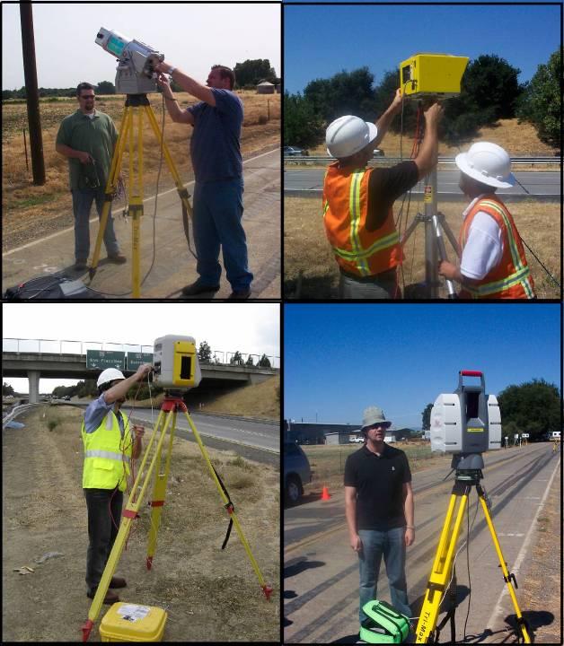
10
11 Repeatable Test for useful range Control Test Depends on return signal strength, which depends on range, surface reflectivity, and laser incident angle Resolution Range Precision Angular precision Target recognition accuracy Compare to data measured by conventional means AHMCT LIDAR Standards & Specifications for Caltrans 10

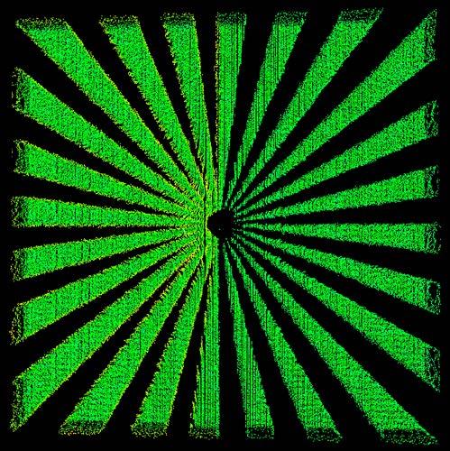
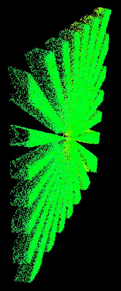
12 AHMCT LIDAR Standards & Specifications for Caltrans 11


13 Control Tests Control Test Scan Area Old Hutch Rd, 500m of asphalt road surface Angular Accuracy Surface Precision/ Noise Resolution Range Accuracy Incidence & Coverage Angle AHMCT LIDAR Standards & Specifications for Caltrans 12

14 Control Tests Range Accuracy Test Fixture at 25, 50, 75, and 100 m. Also scanning black asphalt pavement up to 120 m Range Accuracy Test Fixture AHMCT LIDAR Standards & Specifications for Caltrans 13
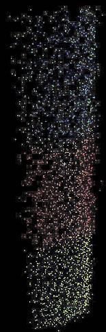
15 Range Accuracy RMS 95% Confidence Interval Range Accuracy: Root Mean Square of Residual Errors (mm) 3D Laser Scanner Manufacturer Reflectivity Color 25 m 50 m 75 m 100 m Leica White Grey Black Trimble White Grey Black Optech White Grey Black AHMCT LIDAR Standards & Specifications for Caltrans 14

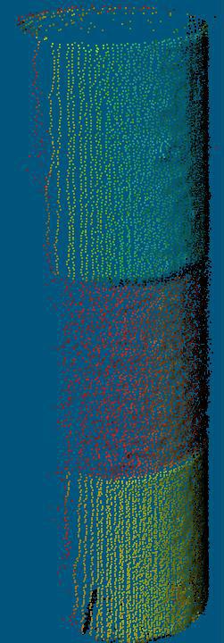
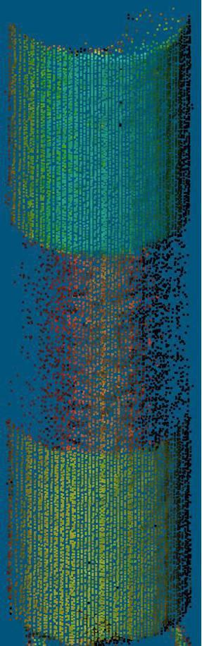
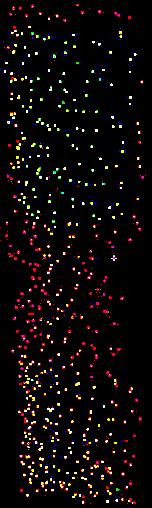
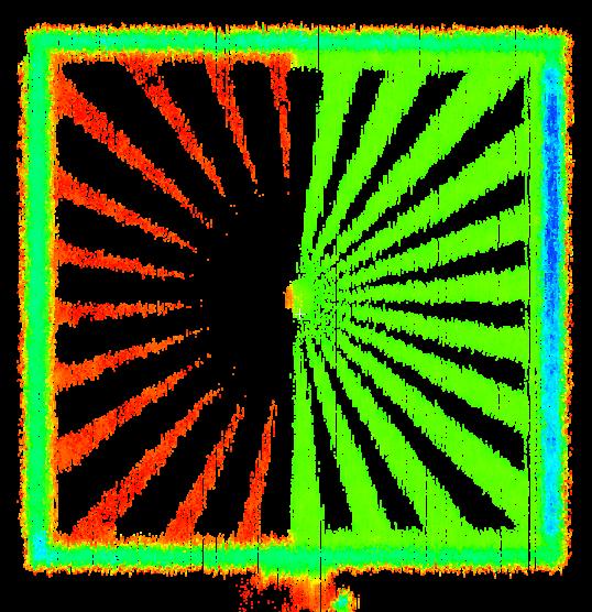
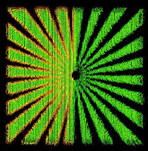
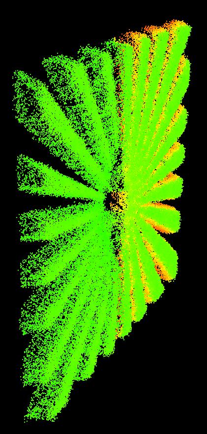
16 Range Errors plotted with interpolated surface and laser point cloud

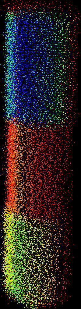
17 Optech Optech White Optech Black Optech Grey Trimble Trimble Black Leica Trimble Grey Leica Black Leica Grey Leica White Trimble White

18 Control Tests Incidence & Coverage Angle Test Fixture at 25, 50, 75, and 100 m. Three surface reflectivity levels Incidence Angle Test Fixture Angle of Incidence Coverage Angle Zenith Angle = Angle of Incidence AHMCT LIDAR Standards & Specifications for Caltrans 17


19 25 m Trimble Optech Trimble 50 m Optech Leica Leica


20 Trimble 75 m Trimble 100 m Optech Optech Leica Leica
21 Zenith Angle at various Distances & Reflectivity Levels (surface color) Zenith Angle at Various Distances and Reflectivity Level Zenith Angle (Degree) Optech Leica Trimble Optech Grey Optech Black Leica Black Trimble Black Leica 'White' Leica 'Black' Leica 'Grey' Trimble 'White' Trimble 'Black' Trimble 'Grey' Optech 'White' Optech 'Black' Optech 'Grey' Leica Grey Leica White Distance (m), p Trimble Grey Trimble White Optech White
22 Coverage Angle at various Distances & Reflectivity Levels (surface color) Coverage Angle (Degree) Leica White Leica Grey Optech Coverage Angle at Various Distances and Reflectivity Level Leica Trimble Optech Black Optech Grey Optech White Trimble White Trimble Grey Leica 'White' Leica 'Black' Leica 'Grey' Trimble 'White' Trimble 'Black' Trimble 'Grey' Optech 'White' Optech 'Black' Optech 'Grey' Trimble Black Leica Black Distance (m), p

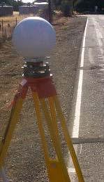
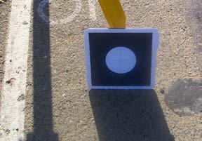
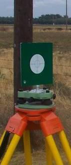
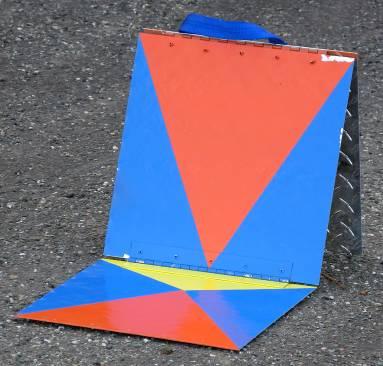
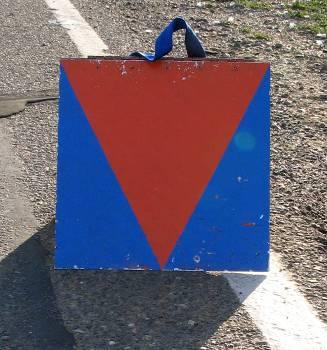
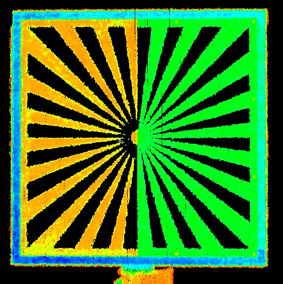
23 Control Tests Angular Accuracy Test Fixture at 25 and 75 m. Vendor-specific target as available. Angular Accuracy Test Fixture AHMCT LIDAR Standards & Specifications for Caltrans 22
 -0.71 0.92 Copyright 6\" 2013, Sphere AHMCT Research Center, (Translation UC Davis 2) -0.72 1.")
24 Leica Angular Accuracy Results Error m Leica Target (Translation 1) Leica Target (Translation 2) " Sphere (Translation 1) Copyright 6" 2013, Sphere AHMCT Research Center, (Translation UC Davis 2) AHMCT LIDAR Standards & Specifications for Caltrans 23
 -0.51 1.73 6\" Copyright Sphere 2013, AHMCT Research(Translation Center, UC Davis 2) -0.28 1.")
25 Trimble Angular Accuracy Results Error m Trimble Target (Translation 1) Trimble Target (Translation 2) " Sphere (Translation 1) " Copyright Sphere 2013, AHMCT Research(Translation Center, UC Davis 2) AHMCT LIDAR Standards & Specifications for Caltrans 24

26 AHMCT LIDAR Standards & Specifications for Caltrans 25


27 75 m Optech C Da 26


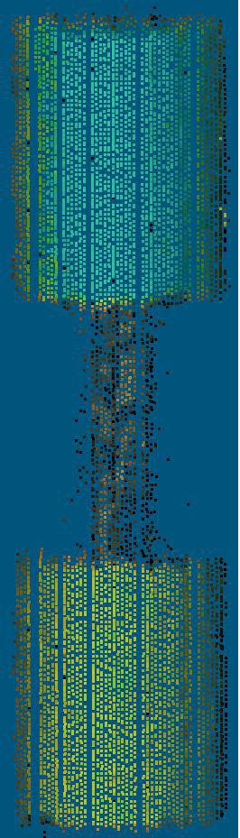
28 Control Tests Surface Precision Test Fixture at 25, 50, 75, and 100 m. Two reflectivity levels. Line of sight of 3D Laser Scanner for edge effects Point Accuracy / Surface Precision & Noise Test Fixture 27
29 @ 25 m Leica m

30 Trimble m AHMCT LIDAR Standards & Specifications for Caltrans 29


31 m AHMCT LIDAR Standards & Specifications for Caltrans 30

32 Control Tests Resolution Test Fixture at 25, 50, 75, 100, and 120 m. Measure resolution at selected ranges. Two surface reflectivity levels Resolution Test Fixture AHMCT LIDAR Standards & Specifications for Caltrans 31

33 Leica, at 50 meters

34 Leica, at 100 meters

35 Leica, Air Temperature ~ 75 o F 95% RMSE 90 m range = 7.2 mm AHMCT LIDAR Standards & Specifications for Caltrans 34

36 Leica, Air Temperature ~ 108 o F 95% RMSE 90 m range = 7.0 mm AHMCT LIDAR Standards & Specifications for Caltrans 35

37 Trimble, Air Temperature ~ 108 o F 95% RMSE 90 m range = 10.7 mm AHMCT LIDAR Standards & Specifications for Caltrans 36

38 Optech, Air Temperature ~ 108 o F 95% RMSE 90 m range = 12.0 mm AHMCT LIDAR Standards & Specifications for Caltrans 37


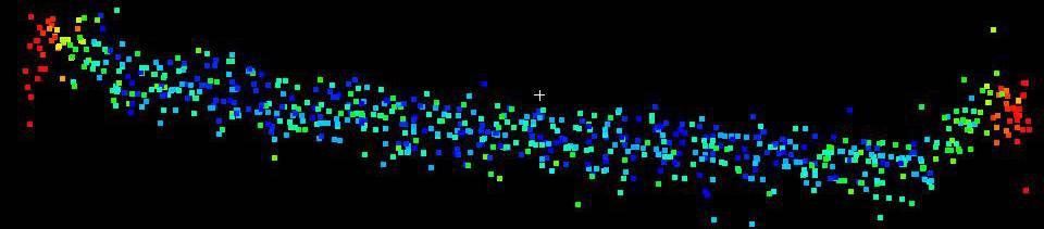
39 3D Scan of section of Highway 113 at Hutchison Rd Pilot Study Test Site Pilot study goals: Evaluate pavement survey workflow Compare data measured by conventional means Provide realistic data set for software evaluation Combine two point clouds Collect a 360 degree scan from each scan location Generate a Digital Terrain Model (DTM), Generate contour lines depicting the low-lying areas Pilot Test Scan Area Bridge with clover-leaf ramps and specific geo-reference points at 25 m, 50 m and 100 m on either side 38

40 Topographic map of State Highway 113 at Hutchison Drive Generated by Leica
41 Test Result Conclusions Scanner accuracy Scanner useful range Importance of accurate geo-referencing: Methods Redundant targets Human error Compare to Total Station With standard prism (2 mm + 2 ppm) Reflectorless mode AHMCT LIDAR Standards & Specifications for Caltrans 40
CA Application of Mobile Laser Scanning for Lean and Rapid Highway Maintenance and Construction
 STATE OF CALIFORNIA DEPARTMENT OF TRANSPORTATION TECHNICAL REPORT DOCUMENTATION PAGE TR0003 (REV 10/98) ADA Notice For individuals with sensory disabilities, this document is available in alternate formats.
2/9/2016. Session Agenda: Implementing new Geospatial Technologies for more efficient data capture
 Implementing new Geospatial Technologies for more efficient data capture Jay Haskamp Applied Geospatial Engineer Steve Richter VP Sales Session Agenda: Today s changing technologies and what lies ahead
Geometric Accuracy Investigations of the Latest Terrestrial Laser Scanning Systems
 Thomas Kersten, Klaus Mechelke, Maren Lindstaedt, Harald Sternberg Geometric Accuracy Investigations of the Latest Terrestrial Laser Scanning Systems Outline of presentation Introduction Laser scanning
Gregory Walsh, Ph.D. San Ramon, CA January 25, 2011
 Leica ScanStation:: Calibration and QA Gregory Walsh, Ph.D. San Ramon, CA January 25, 2011 1. Summary Leica Geosystems, in creating the Leica Scanstation family of products, has designed and conducted
Aerial and Mobile LiDAR Data Fusion
 Creating Value Delivering Solutions Aerial and Mobile LiDAR Data Fusion Dr. Srini Dharmapuri, CP, PMP What You Will Learn About LiDAR Fusion Mobile and Aerial LiDAR Technology Components & Parameters Project
Trimble VISION Positions from Pictures
 Trimble VISION Positions from Pictures This session will cover What Is Trimble VISION? Trimble VISION Portfolio What Do you Need? How Does It Work & How Accurate Is It? Applications Resources Trimble VISION
Watershed Sciences 4930 & 6920 ADVANCED GIS
 Watershed Sciences 4930 & 6920 ADVANCED GIS TERRESTRIAL LASER SCANNING (AKA GROUND BASED LIDAR) Joe Wheaton PURPOSE OF TODAY S DEMONSTRATION Introduce you to TLS Demystify TLS & LiDaR TODAY S PLAN I. What
Overview. 1. Aerial LiDAR in Wisconsin (20 minutes) 2. Demonstration of data in CAD (30 minutes) 3. High Density LiDAR (20 minutes)
 2. Demonstration of data in CAD (30 minutes) 3. High Density LiDAR (20 minutes)") Overview 1. Aerial LiDAR in Wisconsin (20 minutes) 2. Demonstration of data in CAD (30 minutes) 3. High Density LiDAR (20 minutes) 4. Aerial lidar technology advancements (15 minutes) 5. Q & A 1. Aerial
Overview 1. Aerial LiDAR in Wisconsin (20 minutes) 2. Demonstration of data in CAD (30 minutes) 3. High Density LiDAR (20 minutes) 4. Aerial lidar technology advancements (15 minutes) 5. Q & A 1. Aerial
COMPARISON OF TERRESTRIAL LASER SCANNER WITH DIGITAL AERIAL PHOTOGRAMMETRY FOR EXTRACTING RIDGES IN THE RICE PADDIES
 Survey Review, 41, 313 pp. 253-267 (July 2009) COMPARISON OF TERRESTRIAL LASER SCANNER WITH DIGITAL AERIAL PHOTOGRAMMETRY FOR EXTRACTING RIDGES IN THE RICE PADDIES I. S. Lee 1, J. O. Lee 2 and L. Ge 3
Terrestrial GPS setup Fundamentals of Airborne LiDAR Systems, Collection and Calibration. JAMIE YOUNG Senior Manager LiDAR Solutions
 Terrestrial GPS setup Fundamentals of Airborne LiDAR Systems, Collection and Calibration JAMIE YOUNG Senior Manager LiDAR Solutions Topics Terrestrial GPS reference Planning and Collection Considerations
A Procedure for accuracy Investigation of Terrestrial Laser Scanners
 A Procedure for accuracy Investigation of Terrestrial Laser Scanners Sinisa Delcev, Marko Pejic, Jelena Gucevic, Vukan Ogizovic, Serbia, Faculty of Civil Engineering University of Belgrade, Belgrade Keywords:
Trimble S6. General. The Trimble S6 Total Station provides the power and flexibility required by today\'s surveying professionals.
 Trimble S6 General Product Description Product Brochure The Trimble S6 Total Station provides the power and flexibility required by today\'s surveying professionals. /upload/165-868-5836.pdf Demonstration
A new geodetic methodology for the accurate Documentation and Monitoring of inaccessible surfaces.
 A new geodetic methodology for the accurate Documentation and Monitoring of inaccessible surfaces. Ε. Lambrou, G. Pantazis Lecturers at NTUA School of Rural and Surveying Engineering National Technical
Microwave. Infrared. Preprogrammed Chip
 Advanced Technology for Design Mapping and Construction Layout AACE A.A.C.E. Meeting August 5, 2009 Daniel K. Mardock RBF Consulting Survey Manager Registered Land Surveyor Certified Federal Surveyor Arizona
An Introduction to Lidar & Forestry May 2013
 An Introduction to Lidar & Forestry May 2013 Introduction to Lidar & Forestry Lidar technology Derivatives from point clouds Applied to forestry Publish & Share Futures Lidar Light Detection And Ranging
Intensity Augmented ICP for Registration of Laser Scanner Point Clouds
 Intensity Augmented ICP for Registration of Laser Scanner Point Clouds Bharat Lohani* and Sandeep Sashidharan *Department of Civil Engineering, IIT Kanpur Email: blohani@iitk.ac.in. Abstract While using
A Comparison of Laser Scanners for Mobile Mapping Applications
 A Comparison of Laser Scanners for Mobile Mapping Applications Craig Glennie 1, Jerry Dueitt 2 1 Department of Civil & Environmental Engineering The University of Houston 3605 Cullen Boulevard, Room 2008
Should Contours Be Generated from Lidar Data, and Are Breaklines Required? Lidar data provides the most
 Should Contours Be Generated from Lidar Data, and Are Breaklines Required? Lidar data provides the most accurate and reliable representation of the topography of the earth. As lidar technology advances
Terrestrial Laser Scanning: Applications in Civil Engineering Pauline Miller
 Terrestrial Laser Scanning: Applications in Civil Engineering Pauline Miller School of Civil Engineering & Geosciences Newcastle University Overview Laser scanning overview Research applications geometric
Hamilton County Enhances GIS Base Mapping with 1-foot Contours
 Hamilton County Enhances GIS Base Mapping with 1-foot Contours Presented by Larry Stout, Hamilton County GIS Manager Brad Fugate, Woolpert Inc. Today s Presentation Hamilton County s 2004 Base Mapping
Assimilation of Break line and LiDAR Data within ESRI s Terrain Data Structure (TDS) for creating a Multi-Resolution Terrain Model
 for creating a Multi-Resolution Terrain Model") Assimilation of Break line and LiDAR Data within ESRI s Terrain Data Structure (TDS) for creating a Multi-Resolution Terrain Model Tarig A. Ali Department of Civil Engineering American University of Sharjah,
Assimilation of Break line and LiDAR Data within ESRI s Terrain Data Structure (TDS) for creating a Multi-Resolution Terrain Model Tarig A. Ali Department of Civil Engineering American University of Sharjah,
SPAR, ELMF 2013, Amsterdam. Laser Scanning on the UK Highways Agency Network. Hamish Grierson Blom Uk
 SPAR, ELMF 2013, Amsterdam Laser Scanning on the UK Highways Agency Network Hamish Grierson Blom Uk www.blomasa.com www.blom-uk.co.uk Blom UK Part of the Blom Group Blom Group - Europe s largest aerial
City of San Antonio Utilizing Advanced Technologies for Stormwater System Mapping and Condition Assessments
 City of San Antonio Utilizing Advanced Technologies for Stormwater System Mapping and Condition Assessments Prepared for: Prepared by Noelle Gaspard, PE, GISP, CFM Agenda Purpose Project Overview Challenges
TERRESTRIAL LASER SCANNER TECHNIC AS A METHOD FOR IDENTIFICATION AREAS OF SLOPS
 77 TERRESTRIAL LASER SCANNER TECHNIC AS A METHOD FOR IDENTIFICATION AREAS OF SLOPS Bartłomiej Ćmielewski, Bernard Kontny Institute of Geodesy and Geoinformatics, Wroclaw University of Environmental and
Trimble Indoor Mobile Mapping Solution
 Kevin Perkins Applanix Corp. NATIONAL SURVEYING, MAPPING & GEOSPATIAL CONFERENCE - MARCH 13-17, 2017 Trimble Indoor Mobile Mapping Solution Why Indoor Mapping? The need: As-built maps/models of indoor
NEW MONITORING TECHNIQUES ON THE DETERMINATION OF STRUCTURE DEFORMATIONS
 Proceedings, 11 th FIG Symposium on Deformation Measurements, Santorini, Greece, 003. NEW MONITORING TECHNIQUES ON THE DETERMINATION OF STRUCTURE DEFORMATIONS D.Stathas, O.Arabatzi, S.Dogouris, G.Piniotis,
Terrestrial 3D laser scanning Practical aspects
 Terrestrial 3D laser scanning Practical aspects ISPRS WG VI/5&SC Summer School 2007 by Gregor Bilban 3D laser scanning Benefits Lower data collection costs Reduction or elimination of re-visits More accurate
Advanced Highway Maintenance and Construction Technology Research Center
 Advanced Highway Maintenance and Construction Technology Research Center Department of Mechanical and Aerospace Engineering University of California at Davis LiDAR for Data Efficiency Kin S. Yen, Bahram
Bringing Singapore to life in 3D
 Bringing Singapore to life in 3D Dr Victor Khoo, Deputy Director Singapore Land Authority Bringing Singapore to life in 3D ESRI Singapore UC 2016 Dr. Victor Khoo Singapore Land Authority SLA 2016 RESTRICTED
Mobile Mapping Solutions for Ohio s Integrated Transportation Network. Brian Foster, CP
 Mobile Mapping Solutions for Ohio s Integrated Transportation Network Brian Foster, CP About Woolpert Established in 1911 Over 600 Professionals 25 Offices $12,000,000 invested in new technology in last
Open Pit Mines. Terrestrial LiDAR and UAV Aerial Triangulation for. Figure 1: ILRIS at work
 Terrestrial LiDAR and UAV Aerial Triangulation for Open Pit Mines Figure 1: ILRIS at work Figure 2: Geo-Copter X-8000 taking off ay what you will about the past few years, it has produced some useful tools
Advanced Data Procurement From A Contractors Perspective
 Advanced Data Procurement From a Contractors Perspective Advanced Data Procurement From A Contractors Perspective Brian K. Smith & Travis Rauscher, PE 1 Session Summary Laser scanning and UAV data procurement
DEVELOPMENT OF ORIENTATION AND DEM/ORTHOIMAGE GENERATION PROGRAM FOR ALOS PRISM
 DEVELOPMENT OF ORIENTATION AND DEM/ORTHOIMAGE GENERATION PROGRAM FOR ALOS PRISM Izumi KAMIYA Geographical Survey Institute 1, Kitasato, Tsukuba 305-0811 Japan Tel: (81)-29-864-5944 Fax: (81)-29-864-2655
Performance Evaluation of Optech's ALTM 3100: Study on Geo-Referencing Accuracy
 Performance Evaluation of Optech's ALTM 3100: Study on Geo-Referencing Accuracy R. Valerie Ussyshkin, Brent Smith, Artur Fidera, Optech Incorporated BIOGRAPHIES Dr. R. Valerie Ussyshkin obtained a Ph.D.
INTEGRATING TERRESTRIAL LIDAR WITH POINT CLOUDS CREATED FROM UNMANNED AERIAL VEHICLE IMAGERY
 INTEGRATING TERRESTRIAL LIDAR WITH POINT CLOUDS CREATED FROM UNMANNED AERIAL VEHICLE IMAGERY Michael Leslar a * a Teledyne-Optech, 300 Interchange Way, Vaughan, Ontario, Canada, L4K 5Z8, Mike.Leslar@teledyneoptech.com
Commercial suas The Right Tool for the Right Job
 Commercial suas The Right Tool for the Right Job Presentation Objectives Overview of current data collection technologies UAS Systems Overview Surveyor 2.0 Project Case Study Mobile LiDAR & suas How Do
3D Data Acquisition in Tunnels Optimizing Track Time Using Terrestrial Mobile LiDAR. Scanning. Michael R. Frecks, PLS.
 3D Data Acquisition in Tunnels Optimizing Track Time Using Terrestrial Mobile LiDAR Scanning Michael R. Frecks, PLS President/CEO AREMA 2013 1207 Understanding mobile 3D LiDAR? light detection and ranging
Trimble Engineering & Construction Group, 5475 Kellenburger Road, Dayton, OH , USA
 Trimble VISION Ken Joyce Martin Koehler Michael Vogel Trimble Engineering and Construction Group Westminster, Colorado, USA April 2012 Trimble Engineering & Construction Group, 5475 Kellenburger Road,
ENY-C2005 Geoinformation in Environmental Modeling Lecture 4b: Laser scanning
 1 ENY-C2005 Geoinformation in Environmental Modeling Lecture 4b: Laser scanning Petri Rönnholm Aalto University 2 Learning objectives To recognize applications of laser scanning To understand principles
Deformation Monitoring and Analysis of Structures Using Laser Scanners
 Deformation Monitoring and Analysis of Structures Using Laser Scanners Gethin ROBERTS and Laura HIRST, United Kingdom Keywords: deformation monitoring, laser scanner SUMMARY Laser Scanners are relatively
Chapters 1 7: Overview
 Chapters 1 7: Overview Photogrammetric mapping: introduction, applications, and tools GNSS/INS-assisted photogrammetric and LiDAR mapping LiDAR mapping: principles, applications, mathematical model, and
Ability of Terrestrial Laser Scanner Trimble TX5 in Cracks Monitoring at Different Ambient Conditions
 World Applied Sciences Journal 34 (12): 1748-1753, 2016 ISSN 1818-4952 IDOSI Publications, 2016 DOI: 10.5829/idosi.wasj.2016.1748.1753 Ability of Terrestrial Laser Scanner Trimble TX5 in Cracks Monitoring
MODULE 3. FACTORS AFFECTING 3D LASER SCANNING
 MODULE 3. FACTORS AFFECTING 3D LASER SCANNING Learning Outcomes: This module discusses factors affecting 3D laser scanner performance. Students should be able to explain the impact of various factors on
Section G. POSITIONAL ACCURACY DEFINITIONS AND PROCEDURES Approved 3/12/02
 Section G POSITIONAL ACCURACY DEFINITIONS AND PROCEDURES Approved 3/12/02 1. INTRODUCTION Modern surveying standards use the concept of positional accuracy instead of error of closure. Although the concepts
Trimble MX2 mobile mapping
 Trimble MX2 mobile mapping user applications Point clouds within your reach The Trimble MX2 is a vehicle-mounted spatial imaging system which combines high resolution laser scanning and panoramic cameras
CE 59700: LASER SCANNING
 Digital Photogrammetry Research Group Lyles School of Civil Engineering Purdue University, USA Webpage: http://purdue.edu/ce/ Email: ahabib@purdue.edu CE 59700: LASER SCANNING 1 Contact Information Instructor:
BUILDING DETECTION AND STRUCTURE LINE EXTRACTION FROM AIRBORNE LIDAR DATA
 BUILDING DETECTION AND STRUCTURE LINE EXTRACTION FROM AIRBORNE LIDAR DATA C. K. Wang a,, P.H. Hsu a, * a Dept. of Geomatics, National Cheng Kung University, No.1, University Road, Tainan 701, Taiwan. China-
Light Detection and Ranging (LiDAR)
") Light Detection and Ranging (LiDAR) http://code.google.com/creative/radiohead/ Types of aerial sensors passive active 1 Active sensors for mapping terrain Radar transmits microwaves in pulses determines
Light Detection and Ranging (LiDAR) http://code.google.com/creative/radiohead/ Types of aerial sensors passive active 1 Active sensors for mapping terrain Radar transmits microwaves in pulses determines
RECENT TECHNIQUES IN DOCUMENTING HISTORIC PLACES
 RECENT TECHNIQUES IN DOCUMENTING HISTORIC PLACES Dr. Eng. Ahmed Abdelhafiz Civil Engineering Department, Faculty of Engineering, Assuit University, Egypt Email: a.abdelhafiz@yahoo.com ABSTRACT: Three dimensional
RIEGL LMS-Q780. The Versatile, High Altitude Airborne LIDAR Sensor
 RIEGL LMS-Q780 3050m 400kHz The full waveform airborne laser scanner offers great versatility, accuracy, and data quality. The scanner enables you to successfully deliver your projects with industry leading
LIDAR MAPPING FACT SHEET
 1. LIDAR THEORY What is lidar? Lidar is an acronym for light detection and ranging. In the mapping industry, this term is used to describe an airborne laser profiling system that produces location and
Analysis of error sources in Terrestrial Laser Scanning
 C. COŞARCĂ, A. JOCEA, A. SAVU Associate professor, eng. Constantin COŞARCĂ, Ph.D., Faculty of Geodesy, Technical University of Civil Engineering, Bucharest, e-mail: constantin_cosarca@yahoo.com Teacher
The Processing of Laser Scan Data for the Analysis of Historic Structures in Ireland
 The 7th International Symposium on Virtual Reality, Archaeology and Cultural Heritage VAST (2006) M. Ioannides, D. Arnold, F. Niccolucci, K. Mania (Editors) The Processing of Laser Scan Data for the Analysis
ACCURACY OF MEASUREMENTS MADE WITH A CYRAX 2500 LASER SCANNER AGAINST SURFACES OF KNOWN COLOUR
 ACCURACY OF MEASUREMENTS MADE WITH A CYRAX 5 LASER SCANNER AGAINST SURFACES OF KNOWN COLOUR J. Clark and S. Robson (jclark@ge.ucl.ac.uk, srobson@ge.ucl.ac.uk) Department of Geomatic Engineering, University
Airborne Laser Survey Systems: Technology and Applications
 Abstract Airborne Laser Survey Systems: Technology and Applications Guangping HE Lambda Tech International, Inc. 2323B Blue Mound RD., Waukesha, WI-53186, USA Email: he@lambdatech.com As mapping products
EXTRACTION OF GEOMETRIC INFORMATION ON HIGHWAY USING TERRESTRIAL LASER SCANNING TECHNOLOGY
 EXTRACTION OF GEOMETRIC INFORMATION ON HIGHWAY USING TERRESTRIAL LASER SCANNING TECHNOLOGY Jin-Soo Kim a, *, Jong-Chool Lee a, In-Joon Kang b, Sung-Yeoul Cha c, Hyun Choi d, Tack-Gon Lee e a Division of
Geometric Accuracy Evaluation, DEM Generation and Validation for SPOT-5 Level 1B Stereo Scene
 Geometric Accuracy Evaluation, DEM Generation and Validation for SPOT-5 Level 1B Stereo Scene Buyuksalih, G.*, Oruc, M.*, Topan, H.*,.*, Jacobsen, K.** * Karaelmas University Zonguldak, Turkey **University
Developing a Method Using Field Surveying Techniques and Instruments to Create 3D Terrain Models. Faheem Muhammad
 Developing a Method Using Field Surveying Techniques and Instruments to Create 3D Terrain Models Faheem Muhammad Office of Science, Science Undergraduate Laboratory Internship (SULI) Savannah State University
Trimble Geospatial Division Integrated Solutions for Geomatics professions. Volker Zirn Regional Sales Representative
 Trimble Geospatial Division Integrated Solutions for Geomatics professions Volker Zirn Regional Sales Representative 1 Agenda Trimble GeoSpatial Division Airborne System Solutions Trimble Inpho Software
Validation of Aerial LiDAR Products For Transportation Applications
 Creating Value Delivering Solutions Validation of Aerial LiDAR Products For Transportation Applications Dr. Srini Dharmapuri, CP, PMP Michael Baker Jr., Inc. Lauren Little, PE Alaska DOT Public Facility
RIEGL LMS-Q780. The Versatile, High Altitude Airborne LIDAR Sensor
 RIEGL LMS-Q780 4700m 400kHz The full waveform airborne laser scanner offers great versatility, accuracy, and data quality. The scanner enables you to successfully deliver your projects with industry leading
Re: Developing Requirements for Mobile LiDAR Data (#1015)
") TM Tech Notes Certainty 3D April 10, 2012 To: General Release From: Ted Knaak Certainty 3D, Inc. Re: Developing Requirements for Mobile LiDAR Data (#1015) Introduction Recent discussions within the industry
TM Tech Notes Certainty 3D April 10, 2012 To: General Release From: Ted Knaak Certainty 3D, Inc. Re: Developing Requirements for Mobile LiDAR Data (#1015) Introduction Recent discussions within the industry
Case Study for Long- Range Beyond Visual Line of Sight Project. March 15, 2018 RMEL Transmission and Planning Conference
 Case Study for Long- Range Beyond Visual Line of Sight Project March 15, 2018 RMEL Transmission and Planning Conference 2014 HDR Architecture, 2016 2014 HDR, Inc., all all rights reserved. Helicopters
In Earthwork And Topographical Surveys
 University of Southern Queensland Faculty of Engineering and Surveying 3D Terrestrial Laser Scanning For Application In Earthwork And Topographical Surveys A dissertation submitted by Heng Fook Hai In
Virtually Real: Terrestrial Laser Scanning
 Check. They re Chartered. Geomatics Client Guides Virtually Real: Terrestrial Laser Scanning Understanding an evolving survey technology Summary This guide gives you an overview of the technique, some
Iowa Department of Transportation Office of Design. Photogrammetric Mapping Specifications
 Iowa Department of Transportation Office of Design Photogrammetric Mapping Specifications March 2015 1 Purpose of Manual These Specifications for Photogrammetric Mapping define the standards and general
Terrain Modeling and Mapping for Telecom Network Installation Using Scanning Technology. Maziana Muhamad
 Terrain Modeling and Mapping for Telecom Network Installation Using Scanning Technology Maziana Muhamad Summarising LiDAR (Airborne Laser Scanning) LiDAR is a reliable survey technique, capable of: acquiring
GIS Data Collection. This chapter reviews the main methods of GIS data capture and transfer and introduces key practical management issues.
 9 GIS Data Collection OVERVIEW This chapter reviews the main methods of GIS data capture and transfer and introduces key practical management issues. It distinguishes between primary (direct measurement)
The development of a high precision terrestrial laser scanner calibration range at USQ
 University of Southern Queensland Faculty of Engineering and Surveying The development of a high precision terrestrial laser scanner calibration range at USQ A Dissertation Submitted by Allen Grant Ledger
Italian pavilion in 3D, project for EXPO 2015, Milan (Italy) JRC 3D RECONSTRUCTOR POWERFUL. ADVANCED. PROFESSIONAL
 JRC 3D RECONSTRUCTOR POWERFUL. ADVANCED. PROFESSIONAL") Italian pavilion in 3D, project for EXPO 2015, Milan (Italy) JRC 3D RECONSTRUCTOR POWERFUL. ADVANCED. PROFESSIONAL OVERVIEW JRC 3D Reconstructor is the well known multi-platform and multi-resolution software
Italian pavilion in 3D, project for EXPO 2015, Milan (Italy) JRC 3D RECONSTRUCTOR POWERFUL. ADVANCED. PROFESSIONAL OVERVIEW JRC 3D Reconstructor is the well known multi-platform and multi-resolution software
Creating Value. Delivering Solutions
 Creating Value Delivering Solutions LIDAR...Light Detection and Ranging Technology from the military (1960 s) Rapid, highly accurate DEM coverage of large to medium sized project areas Feature extraction
INFLUENCE OF ATMOSPHERIC CONDITIONS ON THE RANGE DISTANCE AND NUMBER OF RETURNED POINTS IN LEICA SCANSTATION 2 POINT CLOUDS
 INFLUENCE OF ATMOSPHERIC CONDITIONS ON THE RANGE DISTANCE AND NUMBER OF RETURNED POINTS IN LEICA SCANSTATION 2 POINT CLOUDS K.Hejbudzka a,*, R.Lindenbergh b, S. Soudarissanane b, A.Humme c a Institute
technical notes trimble realworks software
 technical notes trimble realworks software A POWERFUL 3D LASER SCANNING OFFICE SOFTWARE SUITE Designed for today s multifaceted scanning professional, Trimble RealWorks is a powerful office software that
The potential of the terrestrial laser scanning for geometrical building facades inspection
 Rakenteiden Mekaniikka (Journal of Structural Mechanics) Vol. 4, No 4, 009, pp. 35-45 The potential of the terrestrial laser scanning for geometrical building facades inspection Fahim Al-Neshawy, Jukka
Trimble Realworks Software
 TECHNICAL NOTES Trimble Realworks Software A Powerful 3D Laser Scanning Office Software Suite DESIGNED FOR TODAY S MULTIFACETED SCANNING PROFESSIONAL, TRIMBLE REALWORKS IS A POWERFUL OFFICE SOFTWARE THAT
Municipal Projects in Cambridge Using a LiDAR Dataset. NEURISA Day 2012 Sturbridge, MA
 Municipal Projects in Cambridge Using a LiDAR Dataset NEURISA Day 2012 Sturbridge, MA October 15, 2012 Jeff Amero, GIS Manager, City of Cambridge Presentation Overview Background on the LiDAR dataset Solar
Integrating the Generations, FIG Working Week 2008,Stockholm, Sweden June 2008
 H. Murat Yilmaz, Aksaray University,Turkey Omer Mutluoglu, Selçuk University, Turkey Murat Yakar, Selçuk University,Turkey Cutting and filling volume calculation are important issues in many engineering
FIRST EXPERIENCES WITH THE TRIMBLE GX SCANNER
 FIRST EXPERIENCES WITH THE TRIMBLE GX SCANNER K. Hanke a, P. Grussenmeyer b, A. Grimm-Pitzinger a, Th. Weinold a a Surveying and Geoinformation Unit, University of Innsbruck Technikerstrasse 13, A 6020
UAV Flight Operations for Mapping. Precision. Accuracy. Reliability
 UAV Flight Operations for Mapping Precision. Accuracy. Reliability Part One: Why is Mapping different? Part Two: What about accuracy and precision? Part Three: What is the Workflow? Part Four: AGENDA What
THE COLORED COMPARISON OF THE WALL SCULPTURE WITH 3D LASER SCANNER AND ORTHOPHOTO
 THE COLORED COMPARISON OF THE WALL SCULPTURE WITH 3D LASER SCANNER AND ORTHOPHOTO Hirotoshi KURASHIGE, Jun KATO, Shozo NISHIMURA Creative Department, Keisoku Research Consultant Co, 1-665-1 Fukuda, Higashi-ku,
SENSOR FUSION: GENERATING 3D BY COMBINING AIRBORNE AND TRIPOD- MOUNTED LIDAR DATA
 International Archives of the Photogrammetry, Remote Sensing and Spatial Information Sciences, Vol. XXXIV-5/W10 SENSOR FUSION: GENERATING 3D BY COMBINING AIRBORNE AND TRIPOD- MOUNTED LIDAR DATA A. Iavarone
BEFORE YOU BUY: SEVEN CRITICAL QUESTIONS TO ASK ABOUT LASER SCANNERS. Robert Gardiner
 BEFORE YOU BUY: SEVEN CRITICAL QUESTIONS TO ASK ABOUT LASER SCANNERS Robert Gardiner Table of Contents Introduction... 3 Horizontal and Vertical Angular Accuracies... 4 Movement Tracking... 6 Range Limitations...
2/19/2018. Who are we? Who am I? What is Scanning? How does scanning work? How does scanning work? Scanning for Today s Surveyors
 2/19/2018 Who are we? Scanning for Today s Surveyors Survey, GIS, and Construction dealer Founded in 1988 Employee Owned Headquartered in Bismarck, ND States covered: ND, SD, MN, MT, WY, CO, UT, ID, WA,
DIGITAL ROAD PROFILE USING KINEMATIC GPS
 ARTIFICIAL SATELLITES, Vol. 44, No. 3 2009 DOI: 10.2478/v10018-009-0023-6 DIGITAL ROAD PROFILE USING KINEMATIC GPS Ashraf Farah Assistant Professor, Aswan-Faculty of Engineering, South Valley University,
Realworks Software. A Powerful 3D Laser Scanning Office Software Suite
 TECHNICAL NOTES Realworks Software A Powerful 3D Laser Scanning Office Software Suite Trimble RealWorks is a powerful office software that imports rich data from your 3D laser scanning instrument and transforms
Product Bulletin WORKING WITH POINT CLOUDS IN TRIMBLE BUSINESS CENTER
 Product Bulletin GEOSPATIAL NOVEMBER 2017 WORKING WITH POINT CLOUDS IN TRIMBLE BUSINESS CENTER This bulletin explains the differences between working with s in Trimble Business Center and Trimble RealWorks
UAS based laser scanning for forest inventory and precision farming
 UAS based laser scanning for forest inventory and precision farming M. Pfennigbauer, U. Riegl, P. Rieger, P. Amon RIEGL Laser Measurement Systems GmbH, 3580 Horn, Austria Email: mpfennigbauer@riegl.com,
RealWorks Software. A Powerful 3D Laser Scanning Office Software Suite
 TECHNICAL NOTES RealWorks Software A Powerful 3D Laser Scanning Office Software Suite Trimble RealWorks is a powerful office software that imports rich data from your 3D laser scanning instrument and transforms
Leica s Pinpoint EDM Technology with Modified Signal Processing and Novel Optomechanical Features
 Leica s Pinpoint EDM Technology with Modified Signal Processing and Novel Optomechanical Features Fadi A Bayoud Ph.D. Geomatics Engineering Contents Leica s Total Stations and Telescope ATR PS Leica s
QUESTIONS & ANSWERS FOR. ORTHOPHOTO & LiDAR AOT
 QUESTIONS & ANSWERS FOR ORTHOPHOTO & LiDAR AOT Question# 1. Section 3.2 Will the imagery be clipped to the 1000m boundary? If so, what color will be used for null valued pixels? Yes, the imagery will be
Geospatial database for heritage building conservation
 IOP Conf. Series: Earth and Environmental Science 18 (2014) 012087 doi:10.1088/1755-1315/18/1/012087 Geospatial database for heritage building conservation W N F W A Basir1,3, H Setan1, Z M ajid1, A Chong2
THE USE OF TERRESTRIAL LASER SCANNING FOR MEASUREMENTS IN SHALLOW-WATER: CORRECTION OF THE 3D COORDINATES OF THE POINT CLOUD
 Photogrammetry and Remote Sensing Published as: Deruyter, G., Vanhaelst, M., Stal, C., Glas, H., De Wulf, A. (2015). The use of terrestrial laser scanning for measurements in shallow-water: correction
USING TERRESTRIAL LASER SCANNING FOR DYNAMIC BRIDGE DEFLECTION MEASUREMENT
 USING TERRESTRIAL LASER SCANNING FOR DYNAMIC BRIDGE DEFLECTION MEASUREMENT Linh Truong-Hong 1 and Debra F. Laefer 2 ABSTRACT Heavy vehicular traffic and aggressive environmental conditions can cause unexpected
TLS DEFORMATION MEASUREMENT USING LS3D SURFACE AND CURVE MATCHING
 TLS DEFORMATION MEASUREMENT USING LS3D SURFACE AND CURVE MATCHING O. Monserrat, M. Crosetto, B. Pucci Institute of Geomatics, Castelldefels, Barcelona, Spain, (oriol.monserrat, michele.crosetto, barbara.pucci)@ideg.es
Control System International a.s., Papírenská 114/5, Praha 6, Czech Republic Web site: www. controlsystem.cz,
 129 Consequences of a complex using of 3D approach in the implementation of the road reconstruction - usage of TLS stop&go and usage of paving control system for milling machines Přikryl, M. and Kutil,
Unmanned Aerial Systems: A Look Into UAS at ODOT
 Ohio Department of Transportation John R. Kasich, Governor Jerry Wray, Director Unmanned Aerial Systems: Tim Burkholder, PS Mapping Manager Division of Engineering Office of CADD and Mapping Services Kyle
RealWorld RealCity RealTerrain Airborne Reality Capture The Integral World of Leica Airborne Solutions
 RealWorld RealCity RealTerrain Airborne Reality Capture The Integral World of Leica Airborne Solutions Photogrammetric Week, September 11, 2017 Dr. Hartmut Rosengarten, Director Airborne Solutions EMEA,
Quinnipiac Post Flight Aerial Acquisition Report
 Quinnipiac Post Flight Aerial Acquisition Report August 2011 Post-Flight Aerial Acquisition and Calibration Report FEMA REGION 1 Quinnipiac Watershed, Connecticut, Massachusesetts FEDERAL EMERGENCY MANAGEMENT
2. POINT CLOUD DATA PROCESSING
 Point Cloud Generation from suas-mounted iphone Imagery: Performance Analysis A. D. Ladai, J. Miller Towill, Inc., 2300 Clayton Road, Suite 1200, Concord, CA 94520-2176, USA - (andras.ladai, jeffrey.miller)@towill.com
Windstorm Simulation & Modeling Project
 Windstorm Simulation & Modeling Project Airborne LIDAR Data and Digital Elevation Models in Broward County, Florida Data Quality Report and Description of Deliverable Datasets Prepared for: The Broward