NATIONWIDE POINT CLOUDS AND 3D GEO- INFORMATION: CREATION AND MAINTENANCE GEORGE VOSSELMAN
|
|
|
- Ernest Simon
- 5 years ago
- Views:
Transcription
1 NATIONWIDE POINT CLOUDS AND 3D GEO- INFORMATION: CREATION AND MAINTENANCE GEORGE VOSSELMAN

2 OVERVIEW National point clouds Airborne laser scanning in the Netherlands Quality control Developments in lidar technology Dense matching Maintenance National 3D geo-information LOD1 LOD2
3 LASER PROFILING first flights in Europe in 1988 inhomogeneous point density expensive flights

4 SPECIFICATIONS OF THE DUTCH NATIONAL ELEVATION MODEL AHN AHN-1 ( ) 1 point / 16 m 2 15 cm noise 10 cm systematic error 2.5 billion points AHN-2 ( ) 8-10 points / m 2 5 cm noise 5 cm systematic error 640 billion points
5 QUALITY CONTROL Data completeness Point density Height accuracy Planimetric accuracy Filtering quality


6 DATA COMPLETENESS Binning per strip Binary coverage image per strip Add strip images

7 POINT DENSITY ANALYSIS Local variation in point density > 6 points/m points/m 2 < 5 points/m 2

8 POINT DENSITY ANALYSIS Variation due to helicopter flight behaviour > 6 points/m points/m 2 < 5 points/m 2


9 GEOMETRIC ACCURACY EVALUATION Relative accuracy Comparisons in overlaps between strips Abundant checks on smooth surfaces or edges Absolute accuracy Needed to guarantee quality Requires high quality reference data

10 COLOUR CODED HEIGHT DIFFERENCES < 17 cm < 24 cm < 31 cm > 31 cm

11 HEIGHT OFFSETS BETWEEN STRIPS (Survey Department Rijkswaterstaat)

12 SCANNER ARTEFACTS

13 ABSOLUTE HEIGHT ERRORS Comparison of point cloud heights against levelled manholes
14 ANALYSIS OF PLANIMETRIC ACCURACY Requirement: An object of 2x2 m can be outlined in the point cloud with a maximum error of 50 cm. Mapping accuracy determined by Point spacing Platform positioning noise Systematic errors
15 ANALYSIS OF PLANIMETRIC ACCURACY Companies are allowed to set the point density for their survey. Companies need to demonstrate that the chosen point density, point distribution and their positioning accuracy have been achieved and lead to the desired planimetric accuracy.
16 ANALYSIS OF PLANIMETRIC ACCURACY Outlining uncertainty in a perfect point cloud Assumption: homogeneous point distribution Point density: n points / m 2 Point spacing: Maximum error: 1 m n pd = 2 1 n m
17 ANALYSIS OF PLANIMETRIC ACCURACY Maximum outlining error due to point spacing pd = 2 1 n m Systematic offset 2 x + y 2 Standard deviation, including noise and non-constant deformations σ x Planimetric accuracy requirement pd + x 2 + y 2 + 3σ x 50 cm

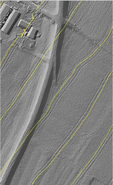
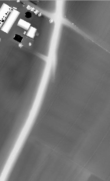
18 ANALYSIS OF PLANIMETRIC ACCURACY Relative check by measuring distances between ridge lines in strip overlaps

19 ANALYSIS OF PLANIMETRIC ACCURACY Analysis per strip overlap based on > 20,000 ridge lines Within specifications Just outside specifications Outside specifications No evaluation possible

20 ESTIMATED PLANIMETRIC STRIP OFFSETS Number of strips Strip offset
21 ESTIMATED PLANIMETRIC POSITIONING NOISE Number of strips Positioning precision (1 sigma)
22 ESTIMATED HEIGHT ACCURACY Number of strips


23 QUALITY OF FILTERING Visual inspection

24 KEEPING YOUR NATIONAL POINT CLOUD UP TO DATE Currently: revision cycle of 5 year Expensive Not frequent enough Alternatives for traditional laser scanning? Planning
 26-92 cm vegetated (USGS requires 29.6 cm) (Harris Corporation)")
25 GEIGER MODE LIDAR Harris Corporation Photo diode array with 4096 detectors 200 million points per second 8 points/m 2 at 9 km flight altitude > 1000 km 2 per hour Height accuracy evaluated by USGS cm non-vegetated (USGS requires 19.6 cm) cm vegetated (USGS requires 29.6 cm) (Harris Corporation)
 Horizontal accuracy 15 cm (1 sigma) Height accuracy evaluated by USGS 14-17 cm non-vegetated")
26 SINGLE PHOTON LIDAR Sigma Space Corporation Operation altitude km 20 points/m 2 at 4 km flight altitude Specs: Vertical accuracy 10 cm (1 sigma) Horizontal accuracy 15 cm (1 sigma) Height accuracy evaluated by USGS cm non-vegetated (USGS requires 19.6 cm) cm vegetated (USGS requires 29.6 cm) Green lidar water penetration (Sigma Space)
")

27 DENSE MATCHING OF AERIAL IMAGERY Large advances in image matching (Hirschmüller, 2007) Available in various commercial and open source implementations Better results with large image overlaps

28 DENSE MATCHING OF AERIAL IMAGERY Use annual aerial photographs for point cloud generation? Default 60% / 30% overlap insufficient Experiment with 80% / 30% Pixel size 10 cm Hard to get 5 cm height accuracy No penetration in vegetated areas
 Update in case of change, but mark low quality updates Decide on linear lidar flights depending on amount of low quality")
29 UPDATING STRATEGY Only update point cloud in areas with change Detect change with point clouds from Geiger or Single photon lidar or dense matching Assess new point cloud quality (depends on surface type) Update in case of change, but mark low quality updates Decide on linear lidar flights depending on amount of low quality updates
30 CONCLUSIONS ON POINT CLOUDS Airborne laser scanning can well meet high demands on point cloud accuracy (5 cm noise + 5 cm systematic error) Relative accuracy checking is very effective, but doesn t replace reference measurements New technologies increase efficiency in point cloud generation, but at a lower accuracy level

31 3D PILOT NL Initiated in 2010 by Kadaster Dutch Geodetic Commission Geonovum Ministry of Infrastructure and the Environment Goal: Stimulate applications of 3D geo-information by Establishing a standard for 3D geo-information Cooperate on use cases with 3D data in a test area Exchange knowledge, technology and needs 31

32 3D PATCH WORK Various initiatives at city level Different LODs Different definitions of building outlines Regional applications hampered by Incomplete coverage Different models 32
33 3D NATIONAL LANDSCAPE MODEL Can we fuse the national topographic database TOP10NL with the national elevation data AHN-2? 33
34 TOP10NL TOPOGRAPHIC DATABASE Object based 15,000,000 objects 1:10,000 scale 1-2 m accuracy Slightly generalised Land use, water, and road provide complete partitioning Open data 34


35 AHN-2 ELEVATION DATA Captured by airborne laser scanning Minimum of 8-10 points / m 2 640,000,000,000 points 5-10 cm accuracy Classified terrain / non-terrain Open data 35
36 MODEL SPECIFICATIONS 3D surface model without gaps Modelling of bridges and multi-level road crossings Focus on areal objects (no point or line objects) Buildings modelled at LOD1 (flat roofs) 36
37 MODELLING APPROACH Based on earlier work (Oude Elberink and Vosselman, 2009) 2D map Densification of map points 3D boundaries Add hidden road Add new terrain pieces Add height to surface 37
38 MODELLING APPROACH Object class dependent modelling For object surfaces Water : Horizontal plane Road : Smooth surface, only triangulate road side points Terrain : Reduce point set and triangulate remaining points For object boundaries Water Terrain : Use water height Road Terrain : Use road height Road Building : Keep both heights, generate walls 38

39 3D MODELLING Utilisation of knowledge Water surfaces are horizontal Road surfaces are smooth Road heights more accurate then shoulder heights


40 3D ROAD MODELLING Complex cases No laser data in map segment Incorrect heights in map segment Multiple heights in map segment

41 MODELLING APPROACH FOR TILE-BASED PROCESSING Need for tiling Memory requirements Parallel processing Tile-wise modelling Tile boundaries not visible in 3D landscape model Repeated reconstruction around tile boundaries Only store TIN mesh in tile model if mesh centre is inside tile bounds 41

42 IMPLEMENTATION AND COMPUTATION Data and software preparation National point cloud split into 30,000 tiles of 1 km 2 For each tile: select TOP10NL polygons that overlap with tile Software installation on a SARA supercomputer Computation 2.5 hours processing per tile 8.5 years for 30,000 tiles on a single CPU Job done in one month on 100 cores 42

43 3D TOP10NL 43

44 3D TOP10NL 44

45 3D TOP10NL 45

46 3D TOP10NL 46

47 BUGS, LEAKS, CRASHES, AND OTHER PROBLEMS Initially 90% complete Now at 97% 64 bit implementation needed Missing parts Modelling errors Bumps in terrain caused by points on walls Peaks in forest surfaces 47

48 3D TOP10NL NOW AVAILABLE AS OPEN DATA 48

49 FEASIBILITY OF NATIONWIDE LOD2 BUILDING MODELLING Various approaches (data-driven, model-driven) Roof topology graphs and target graph libraries Point cloud Segmentation Decomposition Building model Roof topology graph Target graphs 49


50 3D BUILDING MODELLING Graph matching for building reconstruction Point cloud segmentation Selection of roof segments Analysis of intersection lines and height jump edges Roof topology graph

51 3D BUILDING MODELLING Target shapes Target graphs


52 3D BUILDING MODELLING After matching join intersection lines determine outer bounds of roof faces extend intersection lines

 Target shape not in")
53 3D BUILDING MODELLING Results for suburban areas with 729 buildings 81% correct Problems Segment not detected (7%) Intersection line not detected (4%) Target shape not in database (2%)

54 ERRORS IN ROOF TOPOLOGY GRAPHS Missing Wrong Wrong Missing segment segment intersection line intersection line 54


55 CORRECTING ERRORS IN ROOF TOPOLOGY GRAPHS Interactive editing of roof topology graphs Recognition of error type reapplication of earlier graph edits Analyse model quality of roof faces and edges 55

56 ERROR RECOGNITION WITH AN ERROR LIBRARY 56

57 RECONSTRUCTION PROCESS Automated reconstruction with target graph library Iterate Analysis of model quality Automated improvement of errors by matching against entries of error library Interactive editing of remaining errors 58


58 LOD2 MODELLING RESULTS 95% buildings correctly modelled 59
59 FEASIBILITY OF NATIONWIDE LOD2 BUILDING MODELLING 9366 building models reconstructed in Enschede 45 minutes CPU time for automated reconstruction 1 working day for interactive editing of building models Scaling up to nationwide LOD2 modelling (4 million building models) 13 days CPU time for automated reconstruction 2 years for interactive editing of building models 60
60 CONCLUDING REMARKS Nationwide LOD1 modelling nearly complete With some bug fixes, 100% coverage seems feasible Improve modelling of forests and complex road junctions Updating strategy point clouds from dense matching, but for now assuming up-to-date 2D map. Nationwide LOD2 modelling Editing is still time consuming Further editing experience may improve automated corrections Updating strategy - point clouds from dense matching will require larger image overlaps 61

61 CLASSIFICATION OF POINT CLOUDS
POINT CLOUDS AND DERIVATIVES FOR NATIONWIDE GEOSPATIAL INFORMATION GEORGE VOSSELMAN
 POINT CLOUDS AND DERIVATIVES FOR NATIONWIDE GEOSPATIAL INFORMATION GEORGE VOSSELMAN OVERVIEW Point cloud generation and quality control New lidar technologies Dense matching Updating nationwide point clouds
Advanced point cloud processing
 Advanced point cloud processing George Vosselman ITC Enschede, the Netherlands INTERNATIONAL INSTITUTE FOR GEO-INFORMATION SCIENCE AND EARTH OBSERVATION Laser scanning platforms Airborne systems mounted
A Method to Create a Single Photon LiDAR based Hydro-flattened DEM
 A Method to Create a Single Photon LiDAR based Hydro-flattened DEM Sagar Deshpande 1 and Alper Yilmaz 2 1 Surveying Engineering, Ferris State University 2 Department of Civil, Environmental, and Geodetic
GSD-Elevation data, Grid 2+
 Date: Document version: 2016-12-01 2.3 Product description: GSD-Elevation data, Grid 2+ LANTMÄTERIET 2016-12-01 2 (12) List of contents 1 General description... 3 1.1 Contents... 3 1.2 Geographic coverage...
Aalborg Universitet. Published in: Accuracy Publication date: Document Version Early version, also known as pre-print
 Aalborg Universitet A method for checking the planimetric accuracy of Digital Elevation Models derived by Airborne Laser Scanning Høhle, Joachim; Øster Pedersen, Christian Published in: Accuracy 2010 Publication
Terrain Modeling and Mapping for Telecom Network Installation Using Scanning Technology. Maziana Muhamad
 Terrain Modeling and Mapping for Telecom Network Installation Using Scanning Technology Maziana Muhamad Summarising LiDAR (Airborne Laser Scanning) LiDAR is a reliable survey technique, capable of: acquiring
AUTOMATED RECONSTRUCTION OF WALLS FROM AIRBORNE LIDAR DATA FOR COMPLETE 3D BUILDING MODELLING
 AUTOMATED RECONSTRUCTION OF WALLS FROM AIRBORNE LIDAR DATA FOR COMPLETE 3D BUILDING MODELLING Yuxiang He*, Chunsun Zhang, Mohammad Awrangjeb, Clive S. Fraser Cooperative Research Centre for Spatial Information,
Chapters 1 7: Overview
 Chapters 1 7: Overview Photogrammetric mapping: introduction, applications, and tools GNSS/INS-assisted photogrammetric and LiDAR mapping LiDAR mapping: principles, applications, mathematical model, and
THE USE OF ANISOTROPIC HEIGHT TEXTURE MEASURES FOR THE SEGMENTATION OF AIRBORNE LASER SCANNER DATA
 THE USE OF ANISOTROPIC HEIGHT TEXTURE MEASURES FOR THE SEGMENTATION OF AIRBORNE LASER SCANNER DATA Sander Oude Elberink* and Hans-Gerd Maas** *Faculty of Civil Engineering and Geosciences Department of
LiDAR Derived Contours
 LiDAR Derived Contours Final Delivery June 10, 2009 Prepared for: Prepared by: Metro 600 NE Grand Avenue Portland, OR 97232 Watershed Sciences, Inc. 529 SW Third Avenue, Suite 300 Portland, OR 97204 Metro
Automatic DTM Extraction from Dense Raw LIDAR Data in Urban Areas
 Automatic DTM Extraction from Dense Raw LIDAR Data in Urban Areas Nizar ABO AKEL, Ofer ZILBERSTEIN and Yerach DOYTSHER, Israel Key words: LIDAR, DSM, urban areas, DTM extraction. SUMMARY Although LIDAR
An Introduction to Lidar & Forestry May 2013
 An Introduction to Lidar & Forestry May 2013 Introduction to Lidar & Forestry Lidar technology Derivatives from point clouds Applied to forestry Publish & Share Futures Lidar Light Detection And Ranging
Marc Crombaghs, Sander Oude Elberink, Regine Brügelmann, Erik de Min
 $66(66,*+(,*+735(&,6,)/$6(5$/7,0(75
QUALITY CONTROL METHOD FOR FILTERING IN AERIAL LIDAR SURVEY
 QUALITY CONTROL METHOD FOR FILTERING IN AERIAL LIDAR SURVEY Y. Yokoo a, *, T. Ooishi a, a Kokusai Kogyo CO., LTD.,Base Information Group, 2-24-1 Harumicho Fuchu-shi, Tokyo, 183-0057, JAPAN - (yasuhiro_yokoo,
AUTOMATIC EXTRACTION OF BUILDING FEATURES FROM TERRESTRIAL LASER SCANNING
 AUTOMATIC EXTRACTION OF BUILDING FEATURES FROM TERRESTRIAL LASER SCANNING Shi Pu and George Vosselman International Institute for Geo-information Science and Earth Observation (ITC) spu@itc.nl, vosselman@itc.nl
N.J.P.L.S. An Introduction to LiDAR Concepts and Applications
 N.J.P.L.S. An Introduction to LiDAR Concepts and Applications Presentation Outline LIDAR Data Capture Advantages of Lidar Technology Basics Intensity and Multiple Returns Lidar Accuracy Airborne Laser
Multi-ray photogrammetry: A rich dataset for the extraction of roof geometry for 3D reconstruction
 Multi-ray photogrammetry: A rich dataset for the extraction of roof geometry for 3D reconstruction Andrew McClune, Pauline Miller, Jon Mills Newcastle University David Holland Ordnance Survey Background
AUTOMATIC GENERATION OF DIGITAL BUILDING MODELS FOR COMPLEX STRUCTURES FROM LIDAR DATA
 AUTOMATIC GENERATION OF DIGITAL BUILDING MODELS FOR COMPLEX STRUCTURES FROM LIDAR DATA Changjae Kim a, Ayman Habib a, *, Yu-Chuan Chang a a Geomatics Engineering, University of Calgary, Canada - habib@geomatics.ucalgary.ca,
AIRBORNE GEIGER MODE LIDAR - LATEST ADVANCEMENTS IN REMOTE SENSING APPLICATIONS RANDY RHOADS
 Place image here (10 x 3.5 ) AIRBORNE GEIGER MODE LIDAR - LATEST ADVANCEMENTS IN REMOTE SENSING APPLICATIONS RANDY RHOADS Geospatial Industry Manager HARRIS.COM #HARRISCORP Harris Company Information SECURITY
DECONFLICTION AND SURFACE GENERATION FROM BATHYMETRY DATA USING LR B- SPLINES
 DECONFLICTION AND SURFACE GENERATION FROM BATHYMETRY DATA USING LR B- SPLINES IQMULUS WORKSHOP BERGEN, SEPTEMBER 21, 2016 Vibeke Skytt, SINTEF Jennifer Herbert, HR Wallingford The research leading to these
Subdivision Of Triangular Terrain Mesh Breckon, Chenney, Hobbs, Hoppe, Watts
 Subdivision Of Triangular Terrain Mesh Breckon, Chenney, Hobbs, Hoppe, Watts MSc Computer Games and Entertainment Maths & Graphics II 2013 Lecturer(s): FFL (with Gareth Edwards) Fractal Terrain Based on
A QUALITY ASSESSMENT OF AIRBORNE LASER SCANNER DATA
 A QUALITY ASSESSMENT OF AIRBORNE LASER SCANNER DATA E. Ahokas, H. Kaartinen, J. Hyyppä Finnish Geodetic Institute, Geodeetinrinne 2, 243 Masala, Finland Eero.Ahokas@fgi.fi KEYWORDS: LIDAR, accuracy, quality,
LiDAR Data Processing:
 LiDAR Data Processing: Concepts and Methods for LEFI Production Gordon W. Frazer GWF LiDAR Analytics Outline of Presentation Data pre-processing Data quality checking and options for repair Data post-processing
Drones for research - Observing the world in 3D from a LiDAR-UAV
 Drones for research - Observing the world in 3D from a LiDAR-UAV Program lunch seminar: Lammert Kooistra: The Unmanned Aerial Remote Sensing Facility goes 3D: Unmanned Aerial Laser Scanning Sander Mücher:
Overview. 1. Aerial LiDAR in Wisconsin (20 minutes) 2. Demonstration of data in CAD (30 minutes) 3. High Density LiDAR (20 minutes)
 2. Demonstration of data in CAD (30 minutes) 3. High Density LiDAR (20 minutes)") Overview 1. Aerial LiDAR in Wisconsin (20 minutes) 2. Demonstration of data in CAD (30 minutes) 3. High Density LiDAR (20 minutes) 4. Aerial lidar technology advancements (15 minutes) 5. Q & A 1. Aerial
Overview 1. Aerial LiDAR in Wisconsin (20 minutes) 2. Demonstration of data in CAD (30 minutes) 3. High Density LiDAR (20 minutes) 4. Aerial lidar technology advancements (15 minutes) 5. Q & A 1. Aerial
New Requirements for the Relief in the Topographic Databases of the Institut Cartogràfic de Catalunya
 New Requirements for the Relief in the Topographic Databases of the Institut Cartogràfic de Catalunya Blanca Baella, Maria Pla Institut Cartogràfic de Catalunya, Barcelona, Spain Abstract Since 1983 the
MODULE 1 BASIC LIDAR TECHNIQUES
 MODULE SCENARIO One of the first tasks a geographic information systems (GIS) department using lidar data should perform is to check the quality of the data delivered by the data provider. The department
Automated Extraction of Buildings from Aerial LiDAR Point Cloud and Digital Imaging Datasets for 3D Cadastre - Preliminary Results
 Automated Extraction of Buildings from Aerial LiDAR Point Cloud and Digital Imaging Datasets for 3D Pankaj Kumar 1*, Alias Abdul Rahman 1 and Gurcan Buyuksalih 2 ¹Department of Geoinformation Universiti
Capturing Reality with Point Clouds: Applications, Challenges and Solutions
 Capturing Reality with Point Clouds: Applications, Challenges and Solutions Rico Richter 1 st February 2017 Oracle Spatial Summit at BIWA 2017 Hasso Plattner Institute Point Cloud Analytics and Visualization
GENERATING BUILDING OUTLINES FROM TERRESTRIAL LASER SCANNING
 GENERATING BUILDING OUTLINES FROM TERRESTRIAL LASER SCANNING Shi Pu International Institute for Geo-information Science and Earth Observation (ITC), Hengelosestraat 99, P.O. Box 6, 7500 AA Enschede, The
Lidar and GIS: Applications and Examples. Dan Hedges Clayton Crawford
 Lidar and GIS: Applications and Examples Dan Hedges Clayton Crawford Outline Data structures, tools, and workflows Assessing lidar point coverage and sample density Creating raster DEMs and DSMs Data area
CONSTRUCTION OF THE 3DTOP10 INTEGRATION OF COUNTRYWIDE PLANIMETRIC DATA AND LASERALTIMETRY DATA TO SUPPORT 3D-VISUALISATION AND ANALYSES
 CONSTRUCTION OF THE 3DTOP10 INTEGRATION OF COUNTRYWIDE PLANIMETRIC DATA AND LASERALTIMETRY DATA TO SUPPORT 3D-VISUALISATION AND ANALYSES Merlijn SIMONSE*, Edward VERBREE*, Paul van ASPEREN**, Jan-Willem
LIDAR MAPPING FACT SHEET
 1. LIDAR THEORY What is lidar? Lidar is an acronym for light detection and ranging. In the mapping industry, this term is used to describe an airborne laser profiling system that produces location and
Unwrapping of Urban Surface Models
 Unwrapping of Urban Surface Models Generation of virtual city models using laser altimetry and 2D GIS Abstract In this paper we present an approach for the geometric reconstruction of urban areas. It is
Aerial and Mobile LiDAR Data Fusion
 Creating Value Delivering Solutions Aerial and Mobile LiDAR Data Fusion Dr. Srini Dharmapuri, CP, PMP What You Will Learn About LiDAR Fusion Mobile and Aerial LiDAR Technology Components & Parameters Project
Segmentation of point clouds
 Segmentation of point clouds George Vosselman INTERNATIONAL INSTITUTE FOR GEO-INFORMATION SCIENCE AND EARTH OBSERVATION Extraction of information from point clouds 1 Segmentation algorithms Extraction
SimActive and PhaseOne Workflow case study. By François Riendeau and Dr. Yuri Raizman Revision 1.0
 SimActive and PhaseOne Workflow case study By François Riendeau and Dr. Yuri Raizman Revision 1.0 Contents 1. Introduction... 2 1.1. Simactive... 2 1.2. PhaseOne Industrial... 2 2. Testing Procedure...
Mobile LiDAR for Ground Applications. Spar 2006, March Paul Mrstik, Terrapoint Canada Inc. Craig Glennie, Terrapoint USA LLC
 Mobile LiDAR for Ground Applications Spar 2006, March 27 2006 Paul Mrstik, Terrapoint Canada Inc. Craig Glennie, Terrapoint USA LLC Agenda Introduction to Terrapoint What is mobile LiDAR? Advantages of
2. POINT CLOUD DATA PROCESSING
 Point Cloud Generation from suas-mounted iphone Imagery: Performance Analysis A. D. Ladai, J. Miller Towill, Inc., 2300 Clayton Road, Suite 1200, Concord, CA 94520-2176, USA - (andras.ladai, jeffrey.miller)@towill.com
Airborne LiDAR Data Acquisition for Forestry Applications. Mischa Hey WSI (Corvallis, OR)
") Airborne LiDAR Data Acquisition for Forestry Applications Mischa Hey WSI (Corvallis, OR) WSI Services Corvallis, OR Airborne Mapping: Light Detection and Ranging (LiDAR) Thermal Infrared Imagery 4-Band
Airborne LiDAR Data Acquisition for Forestry Applications Mischa Hey WSI (Corvallis, OR) WSI Services Corvallis, OR Airborne Mapping: Light Detection and Ranging (LiDAR) Thermal Infrared Imagery 4-Band
A DATA DRIVEN METHOD FOR FLAT ROOF BUILDING RECONSTRUCTION FROM LiDAR POINT CLOUDS
 A DATA DRIVEN METHOD FOR FLAT ROOF BUILDING RECONSTRUCTION FROM LiDAR POINT CLOUDS A. Mahphood, H. Arefi *, School of Surveying and Geospatial Engineering, College of Engineering, University of Tehran,
New Features in TerraScan. Arttu Soininen Software developer Terrasolid Ltd
 New Features in TerraScan Arttu Soininen Software developer Terrasolid Ltd Default Coordinate Setup Default coordinate setup category added to Settings Defines coordinate setup to use if you open a design
AUTOMATIC EXTRACTION OF LARGE COMPLEX BUILDINGS USING LIDAR DATA AND DIGITAL MAPS
 AUTOMATIC EXTRACTION OF LARGE COMPLEX BUILDINGS USING LIDAR DATA AND DIGITAL MAPS Jihye Park a, Impyeong Lee a, *, Yunsoo Choi a, Young Jin Lee b a Dept. of Geoinformatics, The University of Seoul, 90
RECOGNISING STRUCTURE IN LASER SCANNER POINT CLOUDS 1
 RECOGNISING STRUCTURE IN LASER SCANNER POINT CLOUDS 1 G. Vosselman a, B.G.H. Gorte b, G. Sithole b, T. Rabbani b a International Institute of Geo-Information Science and Earth Observation (ITC) P.O. Box
REGISTRATION OF AIRBORNE LASER DATA TO SURFACES GENERATED BY PHOTOGRAMMETRIC MEANS. Y. Postolov, A. Krupnik, K. McIntosh
 REGISTRATION OF AIRBORNE LASER DATA TO SURFACES GENERATED BY PHOTOGRAMMETRIC MEANS Y. Postolov, A. Krupnik, K. McIntosh Department of Civil Engineering, Technion Israel Institute of Technology, Haifa,
DIGITAL SURFACE MODELS OF CITY AREAS BY VERY HIGH RESOLUTION SPACE IMAGERY
 DIGITAL SURFACE MODELS OF CITY AREAS BY VERY HIGH RESOLUTION SPACE IMAGERY Jacobsen, K. University of Hannover, Institute of Photogrammetry and Geoinformation, Nienburger Str.1, D30167 Hannover phone +49
1. Introduction. A CASE STUDY Dense Image Matching Using Oblique Imagery Towards All-in- One Photogrammetry
 Submitted to GIM International FEATURE A CASE STUDY Dense Image Matching Using Oblique Imagery Towards All-in- One Photogrammetry Dieter Fritsch 1, Jens Kremer 2, Albrecht Grimm 2, Mathias Rothermel 1
Development of Geospatial Smart Cities and Management
 Presented at the FIG Congress 2018, May 6-11, 2018 in Istanbul, Turkey Development of Geospatial Smart Cities and Management (E. Yılmaz, F. Kartal, E. Uçar, K. Eren) FIG2018 - Istanbul, 8 th May 2018 1
LASERDATA LIS build your own bundle! LIS Pro 3D LIS 3.0 NEW! BETA AVAILABLE! LIS Road Modeller. LIS Orientation. LIS Geology.
 LIS 3.0...build your own bundle! NEW! LIS Geology LIS Terrain Analysis LIS Forestry LIS Orientation BETA AVAILABLE! LIS Road Modeller LIS Editor LIS City Modeller colors visualization I / O tools arithmetic
3D BUILDING MODEL GENERATION FROM AIRBORNE LASERSCANNER DATA BY STRAIGHT LINE DETECTION IN SPECIFIC ORTHOGONAL PROJECTIONS
 3D BUILDING MODEL GENERATION FROM AIRBORNE LASERSCANNER DATA BY STRAIGHT LINE DETECTION IN SPECIFIC ORTHOGONAL PROJECTIONS Ellen Schwalbe Institute of Photogrammetry and Remote Sensing Dresden University
Semi-Automatic Approach for Building Reconstruction Using SPLIT-MERGE-SHAPE Method
 Semi-Automatic Approach for Building Reconstruction Using SPLIT-MERGE-SHAPE Method Jiann-Yeou RAU, Liang-Chien CHEN Tel: 886-3-4227151 Ext. 7651,7627,7622 Fax: 886-3-4255535 {jyrau, lcchen} @csrsr.ncu.edu.tw
AN INTEGRATED SENSOR ORIENTATION SYSTEM FOR AIRBORNE PHOTOGRAMMETRIC APPLICATIONS
 AN INTEGRATED SENSOR ORIENTATION SYSTEM FOR AIRBORNE PHOTOGRAMMETRIC APPLICATIONS M. J. Smith a, *, N. Kokkas a, D.W.G. Park b a Faculty of Engineering, The University of Nottingham, Innovation Park, Triumph
Aerial photography: Principles. Visual interpretation of aerial imagery
 Aerial photography: Principles Visual interpretation of aerial imagery Overview Introduction Benefits of aerial imagery Image interpretation Elements Tasks Strategies Keys Accuracy assessment Benefits
ACQUISITION OF 3D TOPOGRAPHY AUTOMATED 3D ROAD AND BUILDING RECONSTRUCTION USING AIRBORNE LASER SCANNER DATA AND TOPOGRAPHIC MAPS
 ACQUISITION OF 3D TOPOGRAPHY AUTOMATED 3D ROAD AND BUILDING RECONSTRUCTION USING AIRBORNE LASER SCANNER DATA AND TOPOGRAPHIC MAPS Sander Oude Elberink March 2010 International Institute for Geo-information
Tutorial (Intermediate level): Dense Cloud Classification and DTM generation with Agisoft PhotoScan Pro 1.1
: Dense Cloud Classification and DTM generation with Agisoft PhotoScan Pro 1.1") Tutorial (Intermediate level): Dense Cloud Classification and DTM generation with Agisoft PhotoScan Pro 1.1 This tutorial illustrates how to perform dense point cloud classification in manual and automatic
Tutorial (Intermediate level): Dense Cloud Classification and DTM generation with Agisoft PhotoScan Pro 1.1 This tutorial illustrates how to perform dense point cloud classification in manual and automatic
Presented at the FIG Congress 2018, May 6-11, 2018 in Istanbul, Turkey
 Presented at the FIG Congress 2018, May 6-11, 2018 in Istanbul, Turkey Evangelos MALTEZOS, Charalabos IOANNIDIS, Anastasios DOULAMIS and Nikolaos DOULAMIS Laboratory of Photogrammetry, School of Rural
TERRESTRIAL LASER SCANNER DATA PROCESSING
 TERRESTRIAL LASER SCANNER DATA PROCESSING L. Bornaz (*), F. Rinaudo (*) (*) Politecnico di Torino - Dipartimento di Georisorse e Territorio C.so Duca degli Abruzzi, 24 10129 Torino Tel. +39.011.564.7687
UAS Campus Survey Project
 ARTICLE STUDENTS CAPTURING SPATIAL INFORMATION NEEDS UAS Campus Survey Project Texas A&M University- Corpus Christi, home to the largest geomatics undergraduate programme in Texas, USA, is currently undergoing
Municipal Projects in Cambridge Using a LiDAR Dataset. NEURISA Day 2012 Sturbridge, MA
 Municipal Projects in Cambridge Using a LiDAR Dataset NEURISA Day 2012 Sturbridge, MA October 15, 2012 Jeff Amero, GIS Manager, City of Cambridge Presentation Overview Background on the LiDAR dataset Solar
Use of aerial survey and laser scanning for production of national data base of surface water hydrology. Vasja Bric Geodetic Institute of Slovenia
 Use of aerial survey and laser scanning for production of national data base of surface water hydrology Vasja Bric Geodetic Institute of Slovenia Tønsberg, 12 January 2016 Floods and other weather events
BUILDING DETECTION AND STRUCTURE LINE EXTRACTION FROM AIRBORNE LIDAR DATA
 BUILDING DETECTION AND STRUCTURE LINE EXTRACTION FROM AIRBORNE LIDAR DATA C. K. Wang a,, P.H. Hsu a, * a Dept. of Geomatics, National Cheng Kung University, No.1, University Road, Tainan 701, Taiwan. China-
INTEGRATION OF MOBILE LASER SCANNING DATA WITH UAV IMAGERY FOR VERY HIGH RESOLUTION 3D CITY MODELING
 INTEGRATION OF MOBILE LASER SCANNING DATA WITH UAV IMAGERY FOR VERY HIGH RESOLUTION 3D CITY MODELING Xianfeng Huang 1,2 Armin Gruen 1, Rongjun Qin 1 Tangwu Du 1, Wei Fang 1 1 Singapore-ETH Center, Future
Point Cloud Classification
 Point Cloud Classification Introduction VRMesh provides a powerful point cloud classification and feature extraction solution. It automatically classifies vegetation, building roofs, and ground points.
Processing of airborne laser scanning data
 GIS-E1020 From measurements to maps Lecture 8 Processing of airborne laser scanning data Petri Rönnholm Aalto University 1 Learning objectives To realize error sources of Airborne laser scanning To understand
UAS based laser scanning for forest inventory and precision farming
 UAS based laser scanning for forest inventory and precision farming M. Pfennigbauer, U. Riegl, P. Rieger, P. Amon RIEGL Laser Measurement Systems GmbH, 3580 Horn, Austria Email: mpfennigbauer@riegl.com,
QUALITY ASSURANCE and POTENTIAL APPLICATIONS of a HIGH DENSITY LiDAR DATA SET for the CITY of NEW YORK
 QUALITY ASSURANCE and POTENTIAL APPLICATIONS of a HIGH DENSITY LiDAR DATA SET for the CITY of NEW YORK Sean C. Ahearn, Director and Professor Hyo Jin Ahn, Ph.D. Center for Analysis and Research of Spatial
Outline of Presentation. Introduction to Overwatch Geospatial Software Feature Analyst and LIDAR Analyst Software
 Outline of Presentation Automated Feature Extraction from Terrestrial and Airborne LIDAR Presented By: Stuart Blundell Overwatch Geospatial - VLS Ops Co-Author: David W. Opitz Overwatch Geospatial - VLS
Introduction to LiDAR
 Introduction to LiDAR Our goals here are to introduce you to LiDAR data. LiDAR data is becoming common, provides ground, building, and vegetation heights at high accuracy and detail, and is available statewide.
ifp Universität Stuttgart Performance of IGI AEROcontrol-IId GPS/Inertial System Final Report
 Universität Stuttgart Performance of IGI AEROcontrol-IId GPS/Inertial System Final Report Institute for Photogrammetry (ifp) University of Stuttgart ifp Geschwister-Scholl-Str. 24 D M. Cramer: Final report
Final Report Technical Specifications for the Construction of 3D IMGeo-CityGML
 Final Report Technical Specifications for the Construction of 3D IMGeo-CityGML Authors: Jan Blaauboer, Bentley Joris Goos, Rotterdam Council Hugo Ledoux, TU Delft Friso Penninga, Den Haag Council Marcel
SPAR, ELMF 2013, Amsterdam. Laser Scanning on the UK Highways Agency Network. Hamish Grierson Blom Uk
 SPAR, ELMF 2013, Amsterdam Laser Scanning on the UK Highways Agency Network Hamish Grierson Blom Uk www.blomasa.com www.blom-uk.co.uk Blom UK Part of the Blom Group Blom Group - Europe s largest aerial
Tree height measurements and tree growth estimation in a mire environment using digital surface models
 Tree height measurements and tree growth estimation in a mire environment using digital surface models E. Baltsavias 1, A. Gruen 1, M. Küchler 2, P.Thee 2, L.T. Waser 2, L. Zhang 1 1 Institute of Geodesy
Technical Considerations and Best Practices in Imagery and LiDAR Project Procurement
 Technical Considerations and Best Practices in Imagery and LiDAR Project Procurement Presented to the 2014 WV GIS Conference By Brad Arshat, CP, EIT Date: June 4, 2014 Project Accuracy A critical decision
Advanced Processing Techniques and Classification of Full-waveform Airborne Laser...
 f j y = f( x) = f ( x) n j= 1 j Advanced Processing Techniques and Classification of Full-waveform Airborne Laser... 89 A summary of the proposed methods is presented below: Stilla et al. propose a method
Open Pit Mines. Terrestrial LiDAR and UAV Aerial Triangulation for. Figure 1: ILRIS at work
 Terrestrial LiDAR and UAV Aerial Triangulation for Open Pit Mines Figure 1: ILRIS at work Figure 2: Geo-Copter X-8000 taking off ay what you will about the past few years, it has produced some useful tools
Geometry of Aerial photogrammetry. Panu Srestasathiern, PhD. Researcher Geo-Informatics and Space Technology Development Agency (Public Organization)
") Geometry of Aerial photogrammetry Panu Srestasathiern, PhD. Researcher Geo-Informatics and Space Technology Development Agency (Public Organization) Image formation - Recap The geometry of imaging system
Geometry of Aerial photogrammetry Panu Srestasathiern, PhD. Researcher Geo-Informatics and Space Technology Development Agency (Public Organization) Image formation - Recap The geometry of imaging system
TerraMatch. Introduction
 TerraMatch Introduction Error sources Interior in LRF Why TerraMatch? Errors in laser distance measurement Scanning mirror errors Exterior in trajectories Errors in position (GPS) Errors in orientation
Terrestrial GPS setup Fundamentals of Airborne LiDAR Systems, Collection and Calibration. JAMIE YOUNG Senior Manager LiDAR Solutions
 Terrestrial GPS setup Fundamentals of Airborne LiDAR Systems, Collection and Calibration JAMIE YOUNG Senior Manager LiDAR Solutions Topics Terrestrial GPS reference Planning and Collection Considerations
APPENDIX E2. Vernal Pool Watershed Mapping
 APPENDIX E2 Vernal Pool Watershed Mapping MEMORANDUM To: U.S. Fish and Wildlife Service From: Tyler Friesen, Dudek Subject: SSHCP Vernal Pool Watershed Analysis Using LIDAR Data Date: February 6, 2014
VALIDATION OF A NEW 30 METER GROUND SAMPLED GLOBAL DEM USING ICESAT LIDARA ELEVATION REFERENCE DATA
 VALIDATION OF A NEW 30 METER GROUND SAMPLED GLOBAL DEM USING ICESAT LIDARA ELEVATION REFERENCE DATA M. Lorraine Tighe Director, Geospatial Solutions Intermap Session: Photogrammetry & Image Processing
Extraction of façades with window information from oblique view airborne laser scanning point clouds
 Extraction of façades with window information from oblique view airborne laser scanning point clouds Sebastian Tuttas, Uwe Stilla Photogrammetry and Remote Sensing, Technische Universität München, 80290
Alaska Department of Transportation Roads to Resources Project LiDAR & Imagery Quality Assurance Report Juneau Access South Corridor
 Alaska Department of Transportation Roads to Resources Project LiDAR & Imagery Quality Assurance Report Juneau Access South Corridor Written by Rick Guritz Alaska Satellite Facility Nov. 24, 2015 Contents
SPOT-1 stereo images taken from different orbits with one month difference
 DSM Generation Almost all HR sensors are stereo capable. Some can produce even triplettes within the same strip (facilitating multi-image matching). Mostly SPOT (1-5) used for stereo and Ikonos (in spite
CELL DECOMPOSITION FOR THE GENERATION OF BUILDING MODELS AT MULTIPLE SCALES
 CELL DECOMPOSITION FOR THE GENERATION OF BUILDING MODELS AT MULTIPLE SCALES Norbert Haala, Susanne Becker, Martin Kada Institute for Photogrammetry, Universitaet Stuttgart Geschwister-Scholl-Str. 24D,
Adrian Cosmin Ghimbaşan 1 Cornel Cristian Tereşneu 1 Iosif Vorovencii 1
 Adrian Cosmin Ghimbaşan 1 Cornel Cristian Tereşneu 1 Iosif Vorovencii 1 1 Forest Management Planning and Terrestrial Measurements Department, Faculty of Silviculture and Forest Engineering, Transilvania
BUILDING MODEL RECONSTRUCTION FROM DATA INTEGRATION INTRODUCTION
 BUILDING MODEL RECONSTRUCTION FROM DATA INTEGRATION Ruijin Ma Department Of Civil Engineering Technology SUNY-Alfred Alfred, NY 14802 mar@alfredstate.edu ABSTRACT Building model reconstruction has been
CLASSIFICATION OF NONPHOTOGRAPHIC REMOTE SENSORS
 CLASSIFICATION OF NONPHOTOGRAPHIC REMOTE SENSORS PASSIVE ACTIVE DIGITAL CAMERA THERMAL (e.g. TIMS) VIDEO CAMERA MULTI- SPECTRAL SCANNERS VISIBLE & NIR MICROWAVE HYPERSPECTRAL (e.g. AVIRIS) SLAR Real Aperture
PROBLEMS AND LIMITATIONS OF SATELLITE IMAGE ORIENTATION FOR DETERMINATION OF HEIGHT MODELS
 PROBLEMS AND LIMITATIONS OF SATELLITE IMAGE ORIENTATION FOR DETERMINATION OF HEIGHT MODELS K. Jacobsen Institute of Photogrammetry and GeoInformation, Leibniz University Hannover, Germany jacobsen@ipi.uni-hannover.de
Airborne Laser Scanning: Remote Sensing with LiDAR
 Airborne Laser Scanning: Remote Sensing with LiDAR ALS / LIDAR OUTLINE Laser remote sensing background Basic components of an ALS/LIDAR system Two distinct families of ALS systems Waveform Discrete Return
Algorithms for GIS csci3225
 Algorithms for GIS csci3225 Laura Toma Bowdoin College LiDAR data in GIS LiDAR (Light Detection and Ranging) Each point records: its geographic location x,y its height z the number of returns in its pulse
REFINEMENT OF FILTERED LIDAR DATA USING LOCAL SURFACE PROPERTIES INTRODUCTION
 REFINEMENT OF FILTERED LIDAR DATA USING LOCAL SURFACE PROPERTIES Suyoung Seo, Senior Research Associate Charles G. O Hara, Associate Research Professor GeoResources Institute Mississippi State University
DIGITAL TERRAIN MODELS
 DIGITAL TERRAIN MODELS 1 Digital Terrain Models Dr. Mohsen Mostafa Hassan Badawy Remote Sensing Center GENERAL: A Digital Terrain Models (DTM) is defined as the digital representation of the spatial distribution
HEURISTIC FILTERING AND 3D FEATURE EXTRACTION FROM LIDAR DATA
 HEURISTIC FILTERING AND 3D FEATURE EXTRACTION FROM LIDAR DATA Abdullatif Alharthy, James Bethel School of Civil Engineering, Purdue University, 1284 Civil Engineering Building, West Lafayette, IN 47907
AUTOMATIC EXTRACTION OF BUILDING ROOFS FROM PICTOMETRY S ORTHOGONAL AND OBLIQUE IMAGES
 AUTOMATIC EXTRACTION OF BUILDING ROOFS FROM PICTOMETRY S ORTHOGONAL AND OBLIQUE IMAGES Yandong Wang Pictometry International Corp. Suite A, 100 Town Centre Dr., Rochester, NY14623, the United States yandong.wang@pictometry.com
Generate Digital Elevation Models Using Laser Altimetry (LIDAR) Data
 Data") Generate Digital Elevation Models Using Laser Altimetry (LIDAR) Data Literature Survey Christopher Weed October 2000 Abstract Laser altimetry (LIDAR) data must be processed to generate a digital elevation
Generate Digital Elevation Models Using Laser Altimetry (LIDAR) Data Literature Survey Christopher Weed October 2000 Abstract Laser altimetry (LIDAR) data must be processed to generate a digital elevation
A step by step introduction to TopoFlight
 November 20, 2014 TopoFlight_First_Steps.docx 2004057./KB/04 A step by step introduction to TopoFlight Content 1 Introduction...2 2 Creating the area of interest with GoogleEarth...2 3 Creating the TopoFlight
Reality Check: Processing LiDAR Data. A story of data, more data and some more data
 Reality Check: Processing LiDAR Data A story of data, more data and some more data Red River of the North Red River of the North Red River of the North Red River of the North Introduction and Background
Hamilton County Enhances GIS Base Mapping with 1-foot Contours
 Hamilton County Enhances GIS Base Mapping with 1-foot Contours Presented by Larry Stout, Hamilton County GIS Manager Brad Fugate, Woolpert Inc. Today s Presentation Hamilton County s 2004 Base Mapping
ENY-C2005 Geoinformation in Environmental Modeling Lecture 4b: Laser scanning
 1 ENY-C2005 Geoinformation in Environmental Modeling Lecture 4b: Laser scanning Petri Rönnholm Aalto University 2 Learning objectives To recognize applications of laser scanning To understand principles
FOOTPRINT MAP PARTITIONING USING AIRBORNE LASER SCANNING DATA
 FOOTPRINT MAP PARTITIONING USING AIRBORNE LASER SCANNING DATA B. Xiong a,, S. Oude Elberink a, G. Vosselman a a ITC, University of Twente, the Netherlands - (b.xiong, s.j.oudeelberink, george.vosselman)@utwente.nl