|
|
|
- Susanna Pope
- 5 years ago
- Views:
Transcription
1 1
2 My Dewetra IPA FLOODS FLOOD RISK Information System Support the Approximation of EU Floods Directive Compliancy with International standards (INSPIRE, OGC) and protocols for interoperability on sharing data and harmonization from multiple sources Web platform based on a CLOUD architecture and developed with opensource software One single access many APPLICATIONS 2


3 My Dewetra IPA FLOODS: applications Administrator Geospatial Navigator Metadata Archive Catalog of Historical Floods Layer Configurator Library Web publisher Wiki Manual Blog Profile manager 3

4 My Dewetra IPA FLOODS Static GeoData Navigator (IPA FLOODS customization) CATALOGUE for historical floods GeoData web publisher ESRI Geoportal Server metadata publisher On-line manual based on wiki approach Configurator for Dewetra Layers Administrator- Profile manager Blog Documentation on DRR see.kms is a project of the UN Office for Disaster Risk Reduction (UNISDR) hosted by Disaster Preparedness and Prevention Initiative SEE 4
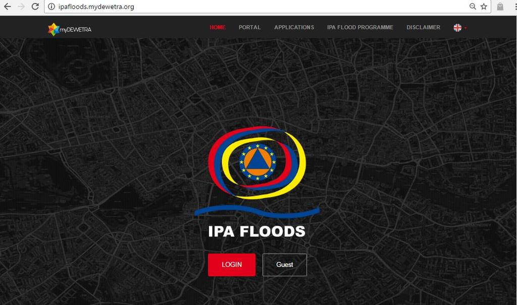
5 My Dewetra IPA FLOODS


6 IPAFLOODS mydewetra Administrator- Profile manager 16 Institutional profiles At present, increasing 6

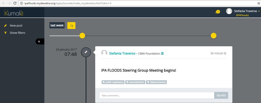
7 IPAFLOODS mydewetra Dashboard 7
 c/o Prime")
8 Dewetra 2.0 is the evolution of the former integrated system Dewetra developed by CIMA Foundation, operational at the Central Functional Centre of the National Civil Protection Department (DPC) c/o Prime Minister's Office since 2008, for the forecasting, monitoring and real-time surveillance of all the environmental risks. The application in its complete version can provide, through a graphical interface, high-resolution and continuously updated information, allowing the user to monitor weather events, to build detailed risk scenarios and evaluate the potential impact of phenomena on communities and infrastructure. Dewetra 2.0 allows each computer connected to the Internet the use of the integrated data, regardless the provider. The application manages, in fact, both the data provided by the National System of Functional Centres and the territorial and geospatial ones published as WMS services by other platforms. Dewetra 2.0 is able to load and display geo-referenced static and dynamic layers, and offers interactive tools and features for the analysis of ongoing and past events. IN IPA FLOODS only the static layer navigator component has been implemented. 8

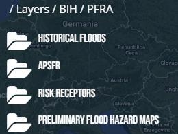
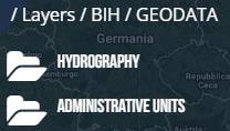
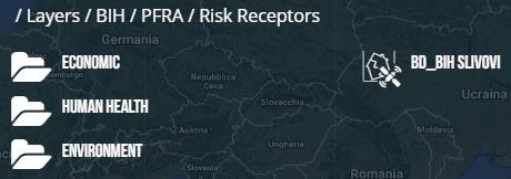
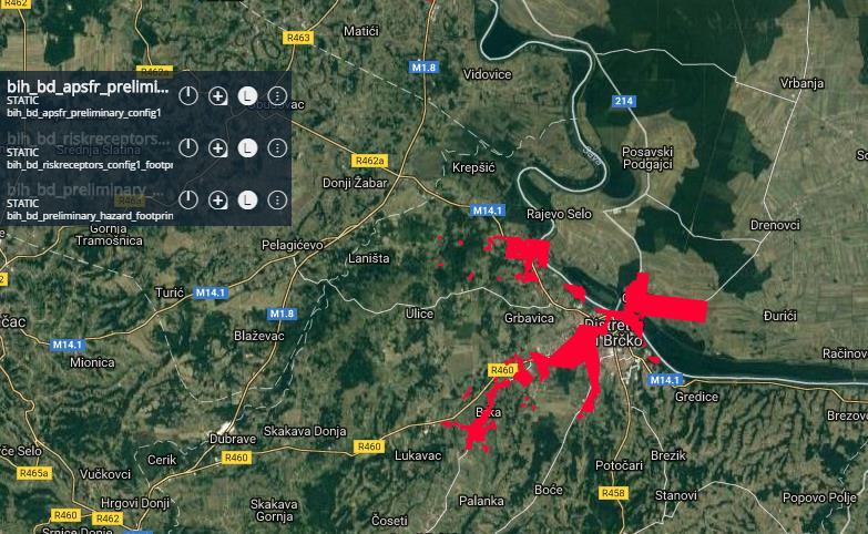
9 Dewetra - Static Layers The static layers can be choosen and loaded selecting between two different modes By default the system proposes the tag mode that has been organized following the INSPIRE themes Specifications/2892 9

10 Dewetra - Static Layers Folder mode proposes a classification for each Beneficiary, following the categories of the EUFD 10


11 Dewetra - Static Layers example 11


12 Dewetra - Static Layers example 12


13 Dewetra - Static Layers example 13

14 Dewetra - Static Layers 14


15 Dewetra - Static Layers EXTERNAL SOURCES example 15

16 Dewetra - Static Layers EXTERNAL SOURCES 16

17 Dewetra - Static Layers EXTERNAL SOURCES 17

18 Dewetra - Static Layers State of the art for REMOTE ASSISTANCE GIS data analyses and calculations 18
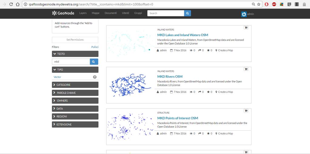
19 The Italian government has established by law (a Directive of the President of the Council of Ministries, Dir.P.C.M. 49/2015) that the Civil Protection Department makes available to Regions and River Basin Authorities (FD Competent Authorities) a web-gis platform, named FloodCat, that fulfills the function of catalogue of flood events and, therefore, should be used to address the mentioned requirements of the FD. Therefore, in Italy FloodCat is the official technological platform for reporting historical and potential future floods according to the EU Floods Directive. Based on its specific architecture and in accordance to the Floods Reporting Guidance, for each significant flood the following data and information should be recorded: location (name of locality, river basin, sub-basin and/or coastal area or other areas associated with past floods); category of flood (past flood or potential future flood); type of flood; extent (area of land inundated, or length of river stretches or coasts); probability of flood event (frequency, recurrence); date of commencement and duration (days) for each flood; type and degree of adverse consequences for: 1. human health; 2. environment; 3. cultural heritage; 4. economic activity plus other relevant information. 19

20 FloodCat - example 20

21 FloodCat - example 21

22 FloodCat - example 22
23 23
24 24
25 25

26 Once you log in, you access the list of layers and you can upload new resources 26

27 You can create a metadata form for registering already exhisting services in your catalog METADATA manager 27

28 OR you can create a metadata form for registering in the catalog a resource already provided of its own medata file 28


29 OR you can create a metadata form for registering in the catalog a new resource, with a proper standard 29

30 You fill each part of the form with the necessary information: you can save as draft or directly save and close the form, the new form you filled will be present as new element in the catalogue 30
31 31
32 WIKI on-line guide 32


33
MY DEWETRA IPAFLOODS REPORT
 Grant Contract N. ECHO/SUB/2014/692292 Programme for Prevention, Preparedness and Response to Floods in the Western Balkans and Turkey IPA FLOODS Capacity Building Activities 2016 MY DEWETRA IPAFLOODS
INSPIRE: ready for landing?
 INSPIRE: ready for landing? Prof. Bernardo De Bernardinis President ISPRA Italian National Institute for Environmental Protection and Research INSPIRE 2013 Conference Opening Plenary, 25 th June 2013 Network
Metadata for Data Discovery: The NERC Data Catalogue Service. Steve Donegan
 Metadata for Data Discovery: The NERC Data Catalogue Service Steve Donegan Introduction NERC, Science and Data Centres NERC Discovery Metadata The Data Catalogue Service NERC Data Services Case study:
DATA MODELS FOR MACHU. Legislation CONCEPT
 DATA MODELS FOR MACHU Legislation CONCEPT 1 November 2016 Content 1. WHY USE MACHU DATA MODELS?... 3 2. FORMAT CHARACTERISTICS... 4 3. DATA MODEL DESCRIPTION OF THE LEGISLATION LAYER... 5 4 METADATA FORMATS...
Disaster Risk Management Unit 2015
 Disaster Risk Management Unit 2015 Earthquakes Tsunami Floods Landslides Forest Fires Wars and armed conflicts Explosions Major Hazards that Threaten Lebanon Needs Assessment The UNDP / Presidency of Council
INFORMATION NOTE. United Nations/Germany International Conference
 INFORMATION NOTE United Nations/Germany International Conference Earth Observation: Global solutions for the challenges of sustainable development in societies at risk Organized by The United Nations Office
Basic Principles of MedWIS - WISE interoperability
 Co-ordination committee seminar of the national focal points Basic Principles of MedWIS - WISE interoperability Eduardo García ADASA Sistemas Nice - France Agenda WISE vs MedWIS WISE WISE DS WISE vs WISE
The Science and Technology Roadmap to Support the Implementation of the Sendai Framework for Disaster Risk Reduction
 29 February 2016 The Science and Technology Roadmap to Support the Implementation of the Sendai Framework for Disaster Risk Reduction 2015-2030 The Sendai Framework for Disaster Risk Reduction 2015-2030
SII Law Organization Coordination activities Examples of good practices Education Technical matters Success stories Challenges
 SII Law Organization Coordination activities Examples of good practices Education Technical matters Success stories Challenges INSPIRE transposed by the legal act on Spatial Information Infrastructure
UNISDR Gulf Cooperation Council (GCC) Training workshop on Reducing and Managing Disaster Risk and implementing the Hyogo Framework for Action
 Training workshop on Reducing and Managing Disaster Risk and implementing the Hyogo Framework for Action") Enhancing capacities and strengthening national coordination for disaster risk reduction Experience of Italian Civil Protection Outlines GENERAL FRAMEWORK DRR ACTIVITIES COORDINATION MECHANISM NPDRR Italy:
Enhancing capacities and strengthening national coordination for disaster risk reduction Experience of Italian Civil Protection Outlines GENERAL FRAMEWORK DRR ACTIVITIES COORDINATION MECHANISM NPDRR Italy:
Compass INSPIRE Services. Compass INSPIRE Services. White Paper Compass Informatics Limited Block 8, Blackrock Business
 Compass INSPIRE Services White Paper 2010 Compass INSPIRE Services Compass Informatics Limited Block 8, Blackrock Business Park, Carysfort Avenue, Blackrock, County Dublin, Ireland Contact Us: +353 1 2104580
Integrating the UK Location Information Infrastructure and data.gov.uk
 Integrating the UK Location Information Infrastructure and data.gov.uk Rod Kedge - UK Location Programme 1 July 20011 This presentation The issue: How to derive the benefits of INSPIRE Background UKLII
NATIONAL DISASTER PREPAREDNESS IN TURKEY
 NATIONAL DISASTER PREPAREDNESS IN TURKEY Demet ŞAHİN Department of Planning and Mitigation Risk Assesment and Strategy WG Turkey is prone to mainly three types of natural disasters Earthquakes; 70% of
Rui Reis, Maria José Vale, Marcelo Ribeiro, Bruno Meneses Geospatial World Forum 2016, May 2016, Rotterdam
 LC change detection and planning indicators Rui Reis, Maria José Vale, Marcelo Ribeiro, Bruno Meneses Summary 1. 2. 3. 4. 5. 6. 7. 8. Introduction Pilot overview Data description Inspire data harmonization
1 st Technical Meeting of the CIS WGF Sub-Group on Reporting: Update of Reporting Tools for the Floods Directive proposed methodology, work plan and
 1 st Technical Meeting of the CIS WGF Sub-Group on Reporting: Update of Reporting Tools for the Floods Directive proposed methodology, work plan and deliverables Project Team Overview of Approach Task
Berlin 3 December Aarhus Convention: Key trends in the implementation of information pillar
 Berlin 3 December 2018 Aarhus Convention: Key trends in the implementation of information pillar Is this moorland in good enough condition to effectively capture rain and prevent flooding? What would the
Country Report : Bhutan. Organization: Disaster Management Division, Ministry of Home and Cultural Affairs. Minister. Secretary
 I. Name: Karma Doma Tshering Country Report : Bhutan II. III. IV. Organization: Disaster Management Division, Ministry of Home and Cultural Affairs Professional Status: Sr. Program Officer Organization
BACKGROUND PAPER. Sub-Regional Platform on Disaster Risk Reduction
 BACKGROUND PAPER Sub-Regional Platform on Disaster Risk Reduction Niamey, Niger 11-14 November 2013 1 BACKGROUND The ECOWAS Policy on Disaster Risk Reduction adopted by West African Heads of State and
Setting up the Ihlet Social Cadastre
 Setting up the Ihlet Social Cadastre Ihlet KHT Dr. Attila Molnár, GI consultant Bela Jarolics Rome, Italy TOPICS Goal of the project Architecture Database Solution Standards, communication Metadata Security
The EOC Geoservice: Standardized Access to Earth Observation Data Sets and Value Added Products ABSTRACT
 The EOC Geoservice: Standardized Access to Earth Observation Data Sets and Value Added Products K. Dengler, T. Heinen, A. Huber, K. Molch, E. Mikusch German Aerospace Center (DLR) German Remote Sensing
Initial Operating Capability & The INSPIRE Community Geoportal
 INSPIRE Conference, Rotterdam, 15 19 June 2009 1 Infrastructure for Spatial Information in the European Community Initial Operating Capability & The INSPIRE Community Geoportal EC INSPIRE GEOPORTAL TEAM
Introduction to INSPIRE. Network Services
 Introduction to INSPIRE. Network Services European Commission Joint Research Centre Institute for Environment and Sustainability Digital Earth and Reference Data Unit www.jrc.ec.europa.eu Serving society
Training Workshop on Multi Hazard Early Warning Systems
 Training Workshop on Multi Hazard Early Warning Systems with focus on Institutional Coordination and Cooperation Website: http://www.wmo.int/pages/prog/drr/events/pula/index_en.html 1 3 October 2009 Pula,
EU Civil Protection Mechanism
 EU Civil Protection Mechanism Risk & Emergency Information Management Marieta Koleva DG Humanitarian Aid and Civil Protection European Commission EU Civil Protection Mechanism Framework for cooperation
DanubeGIS User Manual Document number: Version: 1 Date: 11-Nov-2016
 DanubeGIS User Manual Document number: Version: 1 Date: 11-Nov-2016 Imprint Published by: ICPDR International Commission for the Protection of the Danube River ICPDR 2016 Contact ICPDR Secretariat Vienna
Rachel Nibbs, General Manager Resilience and Recovery
 Rachel Nibbs, General Manager Resilience and Recovery Our Vision To build a more disaster resilient Queensland by facilitating, supporting and working collaboratively with governments, industries and community
National Disaster Risk Management Plan Disaster Management Centre Ministry of Disaster Management
 National Disaster Risk Management Plan 2018-2030 Disaster Management Centre Ministry of Disaster Management 1 CHAPTER CONTENT VOLUME I Chapter 1 Chapter 2 Chapter 3 Chapter 4 Chapter 5 Chapter 6 Chapter
DIGITAL AGENDA FOR EUROPE
 DIGITAL AGENDA FOR EUROPE Talk overview Background Institutional framework Administrative capacities Electronic Communications Strategy, Information Society Strategy Current and future activities. Background
Disaster in Sri Lanka & The Disaster Management Capacity Enhancement Project Adaptable to Climate Change (DiMCEP) JICA Expert H.
 JICA Expert H.") Disaster in Sri Lanka & The Disaster Management Capacity Enhancement Project Adaptable to Climate Change (DiMCEP) JICA Expert H.NAMIKI TSUNAMI 2004 1 Initiatives taken by the Government after Tsunami A
Disaster in Sri Lanka & The Disaster Management Capacity Enhancement Project Adaptable to Climate Change (DiMCEP) JICA Expert H.NAMIKI TSUNAMI 2004 1 Initiatives taken by the Government after Tsunami A
Earth observation in implementing Sendai Framework for Disaster Risk Reduction: UN-SPIDER Efforts
 UN-SPIDER Conference, Beijing, 14-16 September 2015 Earth observation in implementing Sendai Framework for Disaster Risk Reduction: 2015-2030 UN-SPIDER Efforts Shirish Ravan Head, UN-SPIDER Beijing Office
/// INTEROPERABILITY BETWEEN METADATA STANDARDS: A REFERENCE IMPLEMENTATION FOR METADATA CATALOGUES
 /// Position Paper /// INTEROPERABILITY BETWEEN METADATA STANDARDS: A REFERENCE IMPLEMENTATION FOR METADATA CATALOGUES /// Keywords: Public administration, Metadata, Geographical Information, Geospatial
DATA SHARING AND DISCOVERY WITH ARCGIS SERVER GEOPORTAL EXTENSION. Clive Reece, Ph.D. ESRI Geoportal/SDI Solutions Team
 DATA SHARING AND DISCOVERY WITH ARCGIS SERVER GEOPORTAL EXTENSION Clive Reece, Ph.D. ESRI Geoportal/SDI Solutions Team Geoportal Extension for ArcGIS Server Context within an Enterprise Spatial Data Infrastructure
Benefits of CORDA platform features
 Benefits of CORDA platform features Functionalities, main tools and the benefits of using CORDA platform Copernicus service providers (land monitoring and emergency services) require reference data for
COUNTRY PRESENTATION : MALAYSIA
 RISK MANAGEMENT INFORMATION SYSTEM FOR SOUTH-EAST AND EAST ASIA AND THE PACIFIC 20-23 February 2013 Kingdom of Thailand MALAYSIA S Geo-DRM : EMERGENCY COMMAND CENTER PRESENTER S PROFILE MR KHAIRIL HILMI
Long-term preservation for INSPIRE: a metadata framework and geo-portal implementation
 Long-term preservation for INSPIRE: a metadata framework and geo-portal implementation INSPIRE 2010, KRAKOW Dr. Arif Shaon, Dr. Andrew Woolf (e-science, Science and Technology Facilities Council, UK) 3
Landslide Damage on Chemin de Fer de la Mure near Grenoble,
 Contents 1 What is the INSPIRE directive, and why is it important?... 3 1.1 What is the aim of this document?... 4 1.2 Who will this document be useful to?... 4 2 An overview of INSPIRE specifications...
geobrowser3d.com The Power of 3D GIS Tools in your Browser
 geobrowser3d.com 1 The Power of 3D GIS Tools in your Browser Overview Introduction Modules Success Stories Build your own What is GeoBrowser3D Interactive 3D visualization system Modular platform OGC compliant
HFA Implementation Review Simplified Version for ACDR2010
 HFA Implementation Review Simplified Version for ACDR2010 Country: Republic of Korea Date of data filled out: Nov. 25, 2009 Name of the respondent: Dugkeun Park 1 Priority for action 1: Ensure that disaster
Building the Disaster Resilience of the NSW Community. Disaster Ready Councils Regional Forum October-November 2017
 Building the Disaster Resilience of the NSW Community Disaster Ready Councils Regional Forum October-November 2017 Office of Emergency Management Support and assist the Minister for Emergency Services,
INSPIRE: The ESRI Vision. Tina Hahn, GIS Consultant, ESRI(UK) Miguel Paredes, GIS Consultant, ESRI(UK)
 Miguel Paredes, GIS Consultant, ESRI(UK)") INSPIRE: The ESRI Vision Tina Hahn, GIS Consultant, ESRI(UK) Miguel Paredes, GIS Consultant, ESRI(UK) Overview Who are we? Introduction to ESRI Inc. and ESRI(UK) Presenters ArcGIS The ESRI Solution to
INSPIRE: The ESRI Vision Tina Hahn, GIS Consultant, ESRI(UK) Miguel Paredes, GIS Consultant, ESRI(UK) Overview Who are we? Introduction to ESRI Inc. and ESRI(UK) Presenters ArcGIS The ESRI Solution to
The French Geoportal : linking discovery and view network services. INSPIRE Conference Krakow
 The French Geoportal : linking discovery and view network services ( BRGM ) D.Richard (IGN) F. Robida Context of the French Geoportal The governance mechanism Transversal organisation based on the Ministry
1. Introduction. 4. Way Forward
 1. Introduction 2. National Security Council Directive No.20 2.1 4 Phases of Disaster Management Cycle Under NSC Directive No.20 2.2 Disaster Management Mechanism 2.3 Role & Responsibilities 3. Recovery
Semantic Interoperability of Basic Data in the Italian Public Sector Giorgia Lodi
 Semantic Interoperability of Basic Data in the Italian Public Sector Giorgia Lodi SEMIC conference 2013 21 June 2013 Dublin (AgID) Created last year, AgID is a public body that merged three different existing
Belize s Climate Resilient Investment Plan. Prioritised Investment Plan for Climate Readiness
 Belize s Climate Resilient Investment Plan Prioritised Investment Plan for Climate Readiness Belize in its regional context 2 Background Long Low-lying coastline Over a thousand small islands Largest barrier
INSPIRE overview and possible applications for IED and E-PRTR e- Reporting Alexander Kotsev
 INSPIRE overview and possible applications for IED and E-PRTR e- Reporting Alexander Kotsev www.jrc.ec.europa.eu Serving society Stimulating innovation Supporting legislation The European data puzzle 24
Enabling Efficient Discovery of and Access to Spatial Data Services. CHARVAT, Karel, et al. Abstract
 Article Enabling Efficient Discovery of and Access to Spatial Data Services CHARVAT, Karel, et al. Abstract Spatial data represent valuable information and a basis for decision making processes in society.
HUMBOLDT Application Scenario: Protected Areas
 CC by Erlend Schei Copyright by Kecko Copyright by Michael Bezzina CC by Gunnar Ries Copyright by Michael Bezzina Copyright by Michael Bezzina Copyright by Michael Bezzina CC by fs999 CC by Jordan Nielsen
Australia-Indonesia Facility for
 The Tenth ASEAN Regional Forum Inter-Sessional Meeting on Disaster Relief Australia-Indonesia Facility for Disaster Reduction Bangkok, 2-3 September, 2010 The Australia-Indonesia Who is the Facility Facility
Welcome. to Pre-bid meeting. Karnataka State Spatial Data Infrastructure (KSSDI) Project, KSCST, Bangalore.
 Project, KSCST, Bangalore.") Welcome to Pre-bid meeting Karnataka State Spatial Data Infrastructure (KSSDI) Project, KSCST, Bangalore. DEVELOPMENT OF KARNATAKA STATE SPATIAL DATA INFRASTRUCTURE (KSSDI) PROJECT Objective: To develop
Welcome to Pre-bid meeting Karnataka State Spatial Data Infrastructure (KSSDI) Project, KSCST, Bangalore. DEVELOPMENT OF KARNATAKA STATE SPATIAL DATA INFRASTRUCTURE (KSSDI) PROJECT Objective: To develop
Land Administration and Management: Big Data, Fast Data, Semantics, Graph Databases, Security, Collaboration, Open Source, Shareable Information
 Land Administration and Management: Big Data, Fast Data, Semantics, Graph Databases, Security, Collaboration, Open Source, Shareable Information Platform Steven Hagan, Vice President, Engineering 1 Copyright
Experience federating the metadata catalogue of IGN in the Spanish Open Data Portal
 Experience federating the metadata catalogue of IGN in the Spanish Open Data Portal Paloma Abad E. López, A.F. Rodríguez, A. Sánchez, S. Castro, S. Soriano, J.I Sánchez 1 Summary IGN Metadata Catalogue
ISDR National Platforms for DRR - Guidelines
 1 ISDR National Platforms for DRR - Guidelines Multi-stakeholder meeting on Disaster Risk Reduction Bishkek 27 July 2009 Lars Bernd, Programme Officer National Platforms, UNISDR secretariat Geneva, bernd@un.org
Description. Speaker Patrizia Monteduro (International Consultant, FAO) TRAINING GEONETWORK OPENSOURCE Islamabad, Pakistan, Jan 29-31, 2014
 TRAINING GEONETWORK OPENSOURCE Islamabad, Pakistan, Jan 29-31, 2014") BUILDING PROVINCIAL CAPACITY IN PAKISTAN FOR CROP ESTIMATION, FORECASTING, AND REPORTING BASED ON THE INTEGRATED USE OF REMOTELY SENSED DATA (GCP/PAK/125/USA) Description Speaker Patrizia Monteduro (International
BUILDING PROVINCIAL CAPACITY IN PAKISTAN FOR CROP ESTIMATION, FORECASTING, AND REPORTING BASED ON THE INTEGRATED USE OF REMOTELY SENSED DATA (GCP/PAK/125/USA) Description Speaker Patrizia Monteduro (International
RoMA: Resilience enhancement Of a Metropolitan Area
 RoMA: Resilience enhancement Of a Metropolitan Area Alberto Tofani- ENEA CRITIS 2017 Project Dissemination Lucca, 10/10/2017 RoMA Project RoMA is an Italian project Funded by MIUR (Ministry of Education,
Ada L. Benavides, Deputy Chief South Pacific Division Regional Integration Team. May 5, US Army Corps of Engineers BUILDING STRONG
 Building Strong Collaborative Relationships for a Sustainable Water Resources Future The Federal Support Toolbox for Integrated Water Resources Management Ada L. Benavides, Deputy Chief South Pacific Division
Historical Disaster Data Grid for Natural Disaster Events
 Historical Disaster Data Grid for Natural Disaster Events Prof. Guoqing Li CEODE, CAS 11 March, 2010 Presented to 4th GEO-AP Symposium, Bali, Indonesia Why we need Historical Disaster Data? Global distribution
INSPIRE and Open Data Recent Developments and Best Practices
 INSPIRE and Open Data Recent Developments and Best Practices These documents are only complete, when used in connection with the verbal paper; any isolated use may lead to misunderstandings. Michael Müller
Title: Author(s)/Organisation(s): Working Group: References: Quality Assurance: A5.2-D3 [3.7] Information Grounding Service Component Specification
![Title: Author(s)/Organisation(s): Working Group: References: Quality Assurance: A5.2-D3 [3.7] Information Grounding Service Component Specification](/thumbs/80/81830659.jpg "Title: Author(s)/Organisation(s): Working Group: References: Quality Assurance: A5.2-D3 [3.7] Information Grounding Service Component Specification") Title: A5.2-D3 [3.7] Information Grounding Service Component Specification Author(s)/Organisation(s): Ana Belén Antón/ETRA Working Group: Architecture Team/WP05 References: A1.8-D5 User Involvement Document,
Title: A5.2-D3 [3.7] Information Grounding Service Component Specification Author(s)/Organisation(s): Ana Belén Antón/ETRA Working Group: Architecture Team/WP05 References: A1.8-D5 User Involvement Document,
On Urban Risk Reduction
 Asia Regional Task Force On Urban Risk Reduction Yuki Matsuoka UNISDR Hyogo Office RTF-URR Coordinator At Special Event on Urban Risk Reduction by RTF-URR 17 June 2009 1 The Asia Regional Task Force on
Sensor Web Technology for Sharing Hydrological Measurement Data
 Sensor Web Technology for Sharing Hydrological Measurement Data IHW-netwerkdag 2017 Simon Jirka (jirka@52north.org) Sharing Hydrological Measurement Data Sensors capture a multitude of in-situ data relevant
Flagship Programme for Disaster Risk Management as proposed by the Nepal Risk Reduction. Outcomes
 Flagship Programme for Disaster Risk Management as proposed by the Nepal Risk Reduction Consortium: a Concepts, Outlines & Expected Outcomes Prepared by UNDP DRM Unit on behalf of the Nepal Risk Reduction
UPU UNIVERSAL POSTAL UNION. CA C 4 SDPG AHG DRM Doc 3. Original: English COUNCIL OF ADMINISTRATION. Committee 4 Development Cooperation
 UPU UNIVERSAL POSTAL UNION CA C 4 SDPG AHG DRM 2014.1-Doc 3 Original: English COUNCIL OF ADMINISTRATION Committee 4 Development Cooperation Sustainable Development Project Group Ad hoc group on Disaster
Private sector s engagement in the implementation of the Sendai Framework
 Private sector s engagement in the implementation of the Sendai Framework Palais des Nations, Geneva, 2 May 2017 Oz Ozturk, PricewaterhouseCoopers Content: Introduction Key messages Sendai Framework and
Identification of regional Disaster Risk Reduction Priorities
 Identification of regional Disaster Risk Reduction Priorities One of the objectives of the workshop Annual Achievements and Priorities in Disaster Risk Reduction (DRR) in the Caribbean which will take
CRS4 and Joint Innovation Center 5.0. Lidia Leoni CRS4 Strategic Partnership Director Scientific Responsible for Joint Innovation Center
 CRS4 and Joint Innovation Center 5.0 Lidia Leoni CRS4 Strategic Partnership Director Scientific Responsible for Joint Innovation Center CENTER FOR ADVANCED STUDIES, RESEARCH AND DEVELOPMENT IN SARDINIA
Making Open Data work for Europe
 Making Open Data work for Europe Daniele Rizzi European Commission DG Communications Networks, Content and Technology daniele.rizzi@ec.europa.eu Nikolaos Loutas PwC EU Services nikolaos.loutas@be.pwc.com
Managing & Analyzing High Volume of Data? It's Simpler Than You Think!
 Managing & Analyzing High Volume of Data? It's Simpler Than You Think! Suman Biswas NiyamIT Inc. IT Solution Architect Andrew Ditmore IBM Program Manager Risk MAP CDS ASFPM 2016 The Usual Challenge In
EXTRA Examples of OGC standards in support of health applications
 EXTRA Examples of OGC standards in support of health applications Some prior / existing initiatives using OGC Standards EU INSPIRE (health and safety working group) GEOSS AIP, EO2Heaven project: EO2HEAVEN
JAXA's Activities on Disaster Management field. April 2012 JAXA Space Applications and Promotion Center Disaster Management Support Systems Office
 JAXA's Activities on Disaster Management field April 2012 JAXA Space Applications and Promotion Center Disaster Management Support Systems Office Contents 1. Status of satellite data utilization 2. Space
Plan of action for Implementation of the Sendai Framework for Disaster Risk Reduction in Central Asia and South Caucasus Region
 Plan of action for Implementation of the Sendai Framework for Disaster Risk Reduction 2015-2030 in Central Asia and South Caucasus Region I. Background All governments in the Central Asia and South Caucasus
C3S Data Portal: Setting the scene
 C3S Data Portal: Setting the scene Baudouin Raoult Baudouin.raoult@ecmwf.int Funded by the European Union Implemented by Evaluation & QC function from European commission e.g.,fp7 Space call Selected set
The geospatial metadata catalogue. FOSS4G Barcelona. Jeroen Ticheler. Founder and chair. Director
 The geospatial metadata catalogue FOSS4G2010 - Barcelona Jeroen Ticheler Director Founder and chair GeoNetwork opensource Dutch National Geo Registry FAO GeoNetwork SwissTopo geocat.ch GeoNetwork history
Global Infrastructure Hub Update. G20 Infrastructure Working Group, January 2019
 Global Infrastructure Hub Update G20 Infrastructure Working Group, January 2019 IWG Update Introduction Dear IWG members, After a successful 2018, we start 2019 with great enthusiasm, ready to deliver
Risk Habitat Megacity
 Contact Internet: Coordination: Data management: www.risk-habitat-megacity.ufz.de Dr. Dirk Heinrichs [dirk.heinrichs@ufz.de] Dr. Kerstin Krellenberg [kerstin.krellenberg@ufz.de] Christian Gadge [christian.gadge@ufz.de]
ArcGIS Server: publishing geospatial data to the web using the EEA infrastructure
 ArcGIS Server: publishing geospatial data to the web using the EEA infrastructure *IMPORTANT: Map Services should be published using the EEA Map Services Tick Sheet for guidance. Contact Sebastien Petit
Development and Implementation of International and Regional Flash Flood Guidance (FFG) and Early Warning Systems. Project Brief
 and Early Warning Systems. Project Brief") Development and Implementation of International and Regional Flash Flood Guidance (FFG) and Early Warning Systems Project Brief 1 SUMMARY The purpose of this project is the development and implementation
Development and Implementation of International and Regional Flash Flood Guidance (FFG) and Early Warning Systems Project Brief 1 SUMMARY The purpose of this project is the development and implementation
Windsor Essex Environmental Metadata System (WEEMS)
") Windsor Essex Environmental Metadata System (WEEMS) Utilizing Open Source Geospatial Metadata Technologies For Making g Research Based Data Available for Collaboration Grgicak-Mannion, A 1., Ciborowski,
Windsor Essex Environmental Metadata System (WEEMS) Utilizing Open Source Geospatial Metadata Technologies For Making g Research Based Data Available for Collaboration Grgicak-Mannion, A 1., Ciborowski,
Monitoring the Environment with Sensor Web Services
 EnviroInfo 2009 (Berlin) Environmental Informatics and Industrial Environmental Protection: Concepts, Methods and Tools Monitoring the Environment with Sensor Web Services Simon Jirka 1, Dr. Albert Remke
UN International Conference on Space-based Technologies for DM 14 to 16 September 2015, Beijing, China
 UN International Conference on Space-based Technologies for DM 14 to 16 September 2015, Beijing, China Jigme Chogyal Sr. Program Officer Ministry of Home and Cultural Affairs Bhutan http://www.ddm.gov.bt
5 th Meeting of the European Heritage Legal Forum. Wolfgang Karl Göhner
 5 th Meeting of the European Heritage Legal Forum Influences of EHLF activities on national developments on energy efficiency and construction products: Test case Germany by http://w-goehner.de Tel: ++49
Deliverable D3.12. Contract number: OJEU 2010/S Deliverable: D3.12 Author: Igor Antolovic Date: Version: Final
 Deliverable D3.12 Final and public version of the implemented web site with full functionality that hosts all relevant information on the Climate Atlas of the Carpathian Region, including a public download
BUILDING E-RESILIENCE T H E R O L E O F I C T S I N D R M I N T H E P H I L I P P I N E S
 BUILDING E-RESILIENCE T H E R O L E O F I C T S I N D R M I N T H E P H I L I P P I N E S Prepared for DOST-ICTO by: E. Alampay, A. Panao, and R. Rye 22 April 2015 OUTLINE Legal and policy Context Evolution
early warning system for italian civil protection
 WORLD METEOROLOGICAL ORGANIZATION COMMON ALERTING PROTOCOL (CAP) IMPLEMENTATION WORKSHOP ROME, ITALY, 23-24 SEPTEMBER 2015 early warning system for italian civil protection Angela Corina, Department of
Training Framework LINKVIT
 Geographical Infomation Systems International Group Training Framework LINKVIT G. Saio GISIG g.saio@gisig.it 1 www.linkvit.eu Project aims 2 LINKVIT deals with Digital Competence as defined in the Key
Disaster Communication in Mongolia
 Disaster Communication in Mongolia by by Ms, Ms, Gombodorj Enkhzul Information and and communication technology authority -- the the government of of Mongolia Email: Email: enkhzul@icta.gov.mn ITU/ESCAP
Stockholm Innovation Summit 21 st february 2018
 Stockholm Innovation Summit 21 st february 2018 International collaboration experience of the IPAADRIATIC Programme among the Adriatic Regions. New areas of development and implementation of synergy models
Leveraging metadata standards in ArcGIS to support Interoperability. Aleta Vienneau and Marten Hogeweg
 Leveraging metadata standards in ArcGIS to support Interoperability Aleta Vienneau and Marten Hogeweg Leveraging metadata standards in ArcGIS to support Interoperability Overview of metadata standards
Annotating Web Archives structure, provenance, and context through archival cataloguing
 Annotating Web Archives structure, provenance, and context through archival cataloguing Paul WU Horng-Jyh, PhD Nanyang Technological University hjwu@ntu.edu.sg Paul Wu NDL 19/02/2010 Agenda Background:
Emergency Response through Collaborative Crisis Management
 Emergency Response through Collaborative Crisis Management Bojan Cestnik Temida d.o.o. Ljubljana Slovenia Artur Rocha INESC Porto Porto Portugal Martin Endig IFF Magdeburg Germany 30.3.2005 1 Contents
The NextGEOSS Project
 NextGEOSS GEOSS Interoperability workshop 28 August 2017 The NextGEOSS Project Marie-Francoise Voidrot, Bart De Lathouwer Open Geospatial Consortium Europe Nuno Catarino DEIMOS Head of Data Systems NextGEOSS
State Planning Organization Information Society Department
 Information Society Department - October TR. Information Society Department Information Society Strategy Duration / Pro- Post- 1 Formulating the Information Society Strategy All Public Institutions Universities
MSB s roles, responsibilities, and interaction
 MSB s roles, responsibilities, and interaction Janet Edwards Risk and Vulnerability Reduction Department and Åsa Fritzon Research Department Making Cities Resilient International Exchange with City of
GEOSPATIAL ENGINEERING COMPETENCIES. Geographic Information Science
 GEOSPATIAL ENGINEERING COMPETENCIES Geographic Information Science The character and structure of spatial information, its methods of capture, organisation, classification, qualification, analysis, management,
BIWEEKLY SALARY SCHEDULE U UNREPRESENTED/MISCELLANEOUS EMPLOYEES
 BIWEEKLY SALARY SCHEDULE U UNREPRESENTED/MISCELLANEOUS EMPLOYEES (3% cost of living increase per Resolution 18-12) U 001 1234.82 1296.56 1361.39 1429.46 1500.93 U 002 1269.45 1332.92 1399.57 1469.55 1543.02
Shaping of Public Environmental Policy: User Community Impact. Samuel P. Williamson Federal Coordinator for Meteorology
 Shaping of Public Environmental Policy: User Community Impact Samuel P. Williamson Federal Coordinator for Meteorology Office of the Federal Coordinator for Meteorological Services and Supporting Research
TURNING STRATEGIES INTO ACTION DISASTER MANAGEMENT BUREAU STRATEGIC PLAN
 DISASTER MANAGEMENT BUREAU STRATEGIC PLAN 2005-2006 PREFACE Historical statistics would suggest that Bangladesh is one of the most disaster prone countries in the world with the greatest negative consequences
The European Soil Data Centre, the European Soil Bureau Network and INSPIRE Data Specifications for Soil
 The European Soil Data Centre, the European Soil Bureau Network and INSPIRE Data Specifications for Soil Marc Van Liedekerke, Panos Panagos, Luca Montanarella Land Management and Natural Harzards Unit
Building Resilience to Disasters for Sustainable Development: Visakhapatnam Declaration and Plan of Action
 Building Resilience to Disasters for Sustainable Development: Visakhapatnam Declaration and Plan of Action Adopted at the Third World Congress on Disaster Management Visakhapatnam, Andhra Pradesh, India
PROJECT S.T.A.R. Spatial Territorial Augmented Reality
 1 PROJECTWorld S.T.A.R. INSPIRE Forum INSPIRE Geospatial Geospatial World Forum 2015 2015 25 25 -- 29 29 May May 2015 2015 Lisbon Congress Centre, Lisbon Congress Centre, Portugal Portugal Salvatore Salvatore
Geo-spatial technology enables & enhances the objectives of Safe City - Smart City
 Geo-spatial technology enables & enhances the objectives of Safe City - Smart City Presented By: Mr. Shishir Verma Vice President MapmyIndia (CE Info Systems Pvt. Ltd.) About Us Making Our World Better