A ONE-STOP SERVICE HUB INTEGRATING ESSENTIAL WEATHER AND GEOPHYSICAL INFORMATION ON A GIS PLATFORM. Hong Kong Observatory
|
|
|
- Jacob Lawrence
- 6 years ago
- Views:
Transcription
1 A ONE-STOP SERVICE HUB INTEGRATING ESSENTIAL WEATHER AND GEOPHYSICAL INFORMATION ON A GIS PLATFORM Hong Kong Observatory

2 Mission HONG KONG OBSERVATORY To provide people-oriented quality services in meteorology and related fields; To enhance the society's capability in natural disaster prevention and response, through science, innovation and partnership.

3 HONG KONG OBSERVATORY The Hong Kong Observatory is responsible for forecasting weather and issuing warnings on weather-related hazards. monitoring and assessing radiation levels in Hong Kong. providing other meteorological and geophysical services, to meet the needs of the public and the shipping, aviation, industrial and engineering sectors.

4 Weather analysis

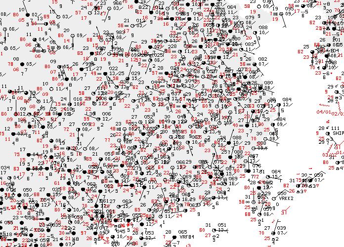
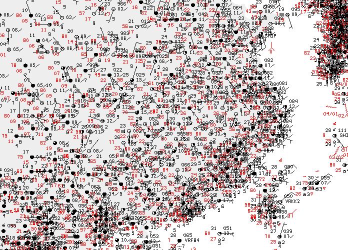
5 Different types of weather information

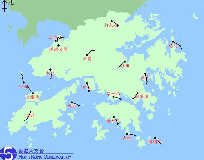
6 Geospatial and Temporal Weather Information

7 Geographic Information System (GIS) A computer-based tool for holding, displaying, and manipulating huge amounts of spatial data.


8 Geographic Information System (GIS) From data display to analysis/decision-making From internal application to service delivery From generalized to location-specific service
9 FIRST STEP

10 Use of GIS The first time using GIS technology in presenting meteorological data in the webpage. Rainfall Nowcast for the Pearl River Delta Region Use KML and geospatial information display software With geospatial information display software, zooming, panoramic view operations to view rainfall distribution in the region.
11 Proximity Analysis Two or more data layers can be overlaid GIS creates buffers around features on a particular layer This allows analyses such as flood zone delineation and features near a route.

12 Query and Overlay Analyses Location-specific Lightning Alert Webpage

13 GIS for Public Weather Service
14 FURTHER DEVELOPMENT
15 Use of GIS Open source GIS technology is developing rapidly Development of the meteorological analysis system becomes more convenient Display a wide variety of real-time meteorological data, including automatic weather station data, radar images, satellite images, upper-air sounding data, lightning location information and numerical weather predication (NWP) model products on same platform.


16 Common GIS work flow System Design DB / Files Mapping Software Cache HTTP Server Web Client HKO GIS work flow Raster / Vector Files Convertor KML/JSON Files HTTP Server Web Browser KML supports Time, Raster and Vector Pre-generated at server to minimize overall processing time


17 Like these System Design IDV Data IN JSON OUT Folders KML web
 IN Tray")


")
18 Data Provider (A) Data Provider (B) IN Tray Data bank / File Repository Contains KML, JSON, Image Tiles Files GIS Products Daemon server csv2kml IDV formatter csv2json image2tiles OUT Tray Server (Data Processor) Data Filing Daemon Web User Interface

 tiles (256*256px images, in png) Data")
19 Work Flow csv2json json json csv csv2kml kmls kmls kml Grib IDV kml image Predefined Data image2tiles Prerendered tile images (usually by other sources) tiles (256*256px images, in png) Input Repository Filing (copy to right place) tiles (256*256px images, in png) Data Bank


20 LAYERS: BASE MAP & OVERLAY Overlay Images, icons, shapes, markers Base map
21 Components Client-side: HTML + JavaScript + CSS + jquery + HTML5 OpenLayers: Web-based GIS API OpenStreetMap: Basemap Source jquery UI: Webpage component Server-side: IDV: Transfer meteorological data (csv or grib) to images Data converter : Transfer CSV/DB data to KML/JSON data
22 OpenLayers Web-based GIS API Free and Open Source JavaScript Google Maps APIs Web-based GIS API Free, external and publicly available web and mobile implementations Pay for uplifts above usage limits Licenses for internal implementations

23 OpenLayers vs Google Map JavaScript API OpenLayers JavaScript API for overlays No base map provided Define your own layer as base map Support Google Map, Bing, XYZ (e.g. OpenStreetMap), WMS (e.g. MapServer) Host the JS API code in your own server Google Map JavaScript API for overlays Google map as Base map 4 options: Roadmap, Satellite, Hybrid, Terrain Rely on JS API code in Google s server License issue


24 Image : Vector vs Raster Vector Raster
25 Vector Image KML A plain text file type, extends from XML It specifies a set of features for displaying in maps. Browser build-in XML parser JsonDraw In-house developed method for layer drawing Data are saved in Json format (a lightweight datainterchange form) Browser with HTML5 support

26 KML KML files in web server

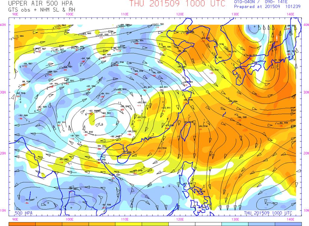
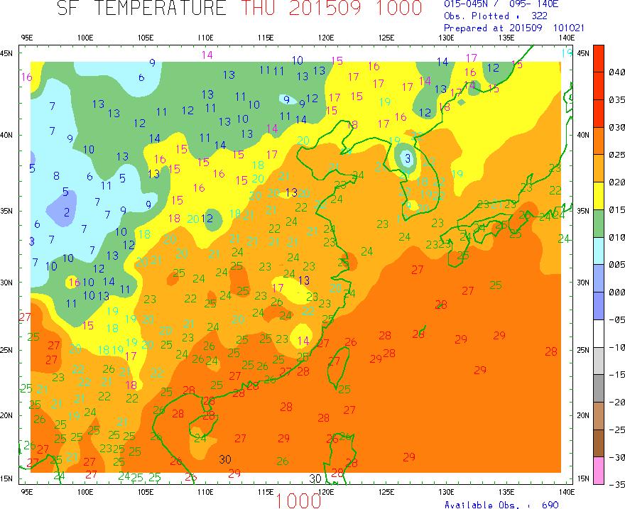
27 KML Display KML


28 JsonDraw csv csv2json json JsonDraw web Vector Image
29 Raster Layer Types Image vs. Image Tiles Different zoom level require different resolution of the same image. When the zoom level is too large, a single image will be too large or blur, and slow response. Hence, use image tiles to target different zoom level and different space. Load the need tiles only.


30 Mercator Projection and Map Tiles After testing, 256px*256px seems optimal in our case. Hence, Google Projection Codename EPSG: in OpenLayers. The world is as a square. Map Tiles It is always 256px*256px. It is a square bitmap graphics displayed in a grid arrangement to show a map.
31 Map Ratio zoom level 0, 1, 2, 3... At zoomlevel 0, the equator of the earth is 256 pixels long. Each successive zoom level is magnified by a factor of 2. Zoom level 0 = The world in a map tile (256px*256px). Every zoom level is double (2 ) of its previous size. The larger zoom level, the more detail, but cover less actual area in a map tile (256px*256px) Tile in zoom level 2 = ¼ of tile in zoom level 1, but still in 256px*256px Area size in zoom level 1 = 2 2 area size in zoom level Zoom N Tiles in 1 side N No. of Tiles 1 1 =1 World coverage per tiles 2 2 =4 4 4 = =64 2 N 2 N =2 N 2 1 1/4 1/16 1/64 1/2 N 2


32 Data Density Control Data Density: original (x1) Data Density: x4 Data Density: x16 Data Density: all data


33 Data Density Control OpenLayers.Strategy.Cluster Strategy for vector feature clustering Key Property distance pixel distance between features x1: distance x4: distance / 2 x16: distance / 4 ALL: no distance De-collision First-Come, First-Serve Loop over the nearest 9 boxes
34 WHAT CAN GIS DO?
35 Weather Information scattered over webpages GIS
36 Internal Applications


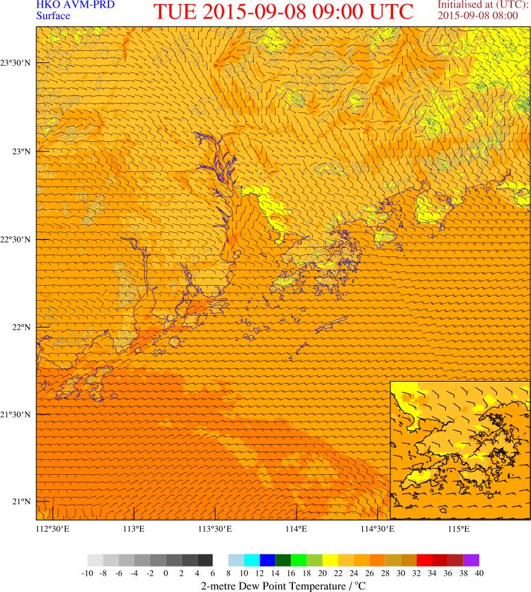
37 Internal Applications Surface winds field and temperature distribution, help forecaster to analyze the temperature advection effect. Illustrate the relationship between geopotential height at upper level and changes in surface pressure, it helps forecaster to appreciate the effect on surface pressure bring along with weather system at upper level.

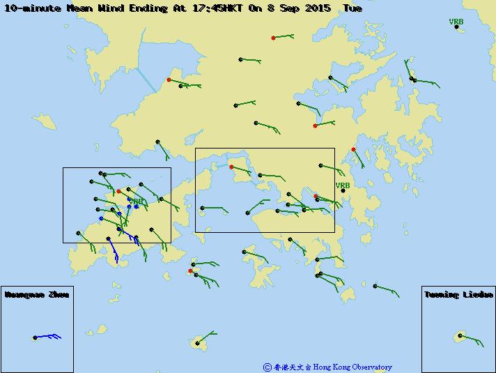
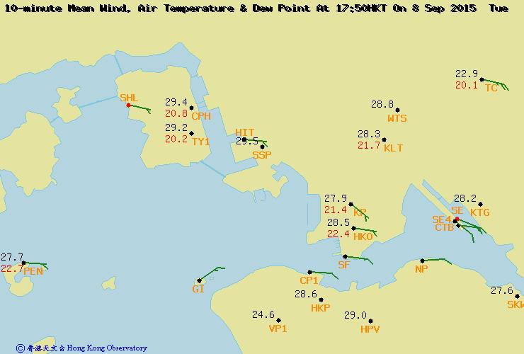
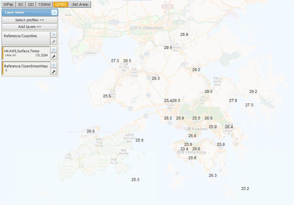
38 Internet Web Page ( Regional Weather in Hong Kong ) User can select weather elements on map different type of weather observation Radar Images Lightning Location Information Corresponding station observation data can also be displayed once user pointing the station location mark
 http://www.hko.gov.")
39 Internet Web Page (Rainfall Nowcast for the Pearl River Delta Region)
40 IN FUTURE
 HKO Internet Website A")


41 Geographic Information System (GIS) HKO Internet Website A variety of weather and geophysical information in graphical format Scattering over different webpages Inconvenience in getting the required information


42 Regional Weather in Hong Kong Display different weather observations taken at various weather stations over Hong Kong Including radar imageries and cloud-to-ground lightning locations etc. Tailor make for smartphone tablet users


43 One-stop Service Hub Portal Integrating weather observations and essential weather elements around the world Worldwide earthquake reports User can select any combination of the weather elements and areas for display on map
44 THANKS
MAP SCRIPTING 101. AH Example-Driven Guide to Building Interactive MapA with Sing, Yahoo!, and Google MapA. by Adam DuVander.
 MAP SCRIPTING 101 AH Example-Driven Guide to Building Interactive MapA with Sing, Yahoo!, and Google MapA by Adam DuVander no starch press San Francisco CONTENTS IN DETAIL ACKNOWLEDGMENTS INTRODUCTION
SEXTANT 1. Purpose of the Application
 SEXTANT 1. Purpose of the Application Sextant has been used in the domains of Earth Observation and Environment by presenting its browsing and visualization capabilities using a number of link geospatial
BROWSER. LuciadRIA DATA SHEET
 BROWSER LuciadRIA DATA SHEET V2017 V2017.0 DATA SHEET LuciadRIA is the answer to today s demands for powerful, lightweight applications in the browser. Driven by today s most advanced web technologies,
Fundisa Web Map Applications
 Fundisa Web Map Applications 2013-01-09 Prepared by SANSA Earth Observation 1 Using the SANSA Fundisa Web Map Applications The Fundisa web map applications were created to aid students in their search
Open Source Cloud Map User Guide
 Open Source Cloud Map User Guide Table of Contents Map Page... 1 Static Mercator Map... 1 Customizable Map... 1 Title Bar... 2 Toolbar... 2 Non Toolbar Navigation... 3 Map Window... 3 Layers / Legend Window...
International Civil Aviation Organization THE SECOND MEETING OF SYSTEM WIDE INFORMATION MANAGEMENT TASK FORCE (SWIM TF/2)
") SWIM TF/2 IP/09 Agenda Item 4 09-12/04/18 International Civil Aviation Organization THE SECOND MEETING OF SYSTEM WIDE INFORMATION MANAGEMENT TASK FORCE (SWIM TF/2) Bangkok, Thailand, 09 12 April 2018 Agenda
SWIM TF/2 IP/09 Agenda Item 4 09-12/04/18 International Civil Aviation Organization THE SECOND MEETING OF SYSTEM WIDE INFORMATION MANAGEMENT TASK FORCE (SWIM TF/2) Bangkok, Thailand, 09 12 April 2018 Agenda
CHAPTER 2 GEOREFERENCING AND SHAPEFILE CREATION
 CHAPTER 2 GEOREFERENCING AND SHAPEFILE CREATION Georeferencing is the process of assigning real-world coordinates to each pixel of the raster. These coordinates are obtained by doing field surveys - collecting
CHAPTER 5 DIGITAL ELEVATION MODEL AND 3D VISUALIZATION
 CHAPTER 5 DIGITAL ELEVATION MODEL AND 3D VISUALIZATION A digital elevation model (DEM) is a digital model or 3D representation of a terrain's surface. A DEM can be represented as a raster (a grid of squares,
Well Unknown ID AKA EPSG: 3857
 Well Unknown ID AKA EPSG: 3857 Pamela Kanu November 2016 WGS 1984 WEB MERCATOR ALIASES: AUXILIARY SPHERE, WKID: 3857, WKID: 102100, WKID: 102113, SHERICAL MERCATOR, WGS 84/PSEUDO-MERCATOR, OPEN LAYERS:
From Synergie and Oppidum to Synopsis
 From Synergie and Oppidum to Synopsis M.-F. VOIDROT & A. LASSERRE-BIGORRY EGOWS Meeting ECMWF, June 2010 2 Overview Synergie and Oppidum : Two operational tools for forecasting at Meteo-France (and web
Tileset Concepts and Terminology
 Tileset Concepts and Terminology Bing Maps Your Geodata raster Bing Maps vector shape CAD Google Maps Google Maps NASA World Wind Google Earth Google Earth MicroImages, Inc. 11th Floor - Sharp Tower 206
Web Map Servers. Mark de Blois. Septembre 2016
 Web Map Servers Mark de Blois Septembre 2016 Learning Objectives After this lecture you will be able to understand web map servers as used in Web-GIS applications Introduction A Web Map Server is a computer
Release Notes. MapInfo Stratus Version 44. Contents: This document contains information about Pitney Bowes MapInfo Stratus Release 44.
 Location Intelligence MapInfo Stratus Version 44 This document contains information about Pitney Bowes MapInfo Stratus Release 44. Contents: What s new in MapInfo Stratus? What s new in Mobile Ready User
Getting Started with the ArcGIS Server JavaScript API
 Getting Started with the ArcGIS Server JavaScript API Agenda Introduction ArcGIS Server services and mashups REST API Services Directory JavaScript API ArcGIS Server Resource Center Dojo Maps, layers,
Introduction to INSPIRE. Network Services
 Introduction to INSPIRE. Network Services European Commission Joint Research Centre Institute for Environment and Sustainability Digital Earth and Reference Data Unit www.jrc.ec.europa.eu Serving society
New Features in TNTmips 2010
 61st Release February 2010 New Features in TNTmips 2010 A tileset is a collection of small image files called tiles in a predefined file size, format, and directory structure. It is designed for efficient
Web Map Caching and Tiling. Overview David M. Horwood June 2011
 Web Map Caching and Tiling Overview David M. Horwood dhorwood@esricanada.com June 2011 Web Mapping Traditional Geographic projection Select / Refresh workflow Slow, non-interactive (refresh delay) http://www.geographynetwork.ca/website/obm/viewer.htm
Intelligent Geospatial Feature Discovery System (igfds) User Guide
 User Guide") Supported by: DOE DE-NA0001123 Developed, operated, and maintained by: CSISS at GMU Intelligent Geospatial Feature Discovery System (igfds) User Guide Version 1.0 Center for Spatial Information Science
Supported by: DOE DE-NA0001123 Developed, operated, and maintained by: CSISS at GMU Intelligent Geospatial Feature Discovery System (igfds) User Guide Version 1.0 Center for Spatial Information Science
Spatial Analyst. Spectrum. Version Administration Guide
 Spectrum Version 12.1 Spatial Analyst Table of Contents 1 - Introduction Spectrum Spatial Analyst Components 5 Users and Roles used by Spectrum Spatial Analyst 7 Configuring Shared Properties 10 Configuring
Implementing Web GIS Solutions
 Implementing Web GIS Solutions using open source software Karsten Vennemann Seattle Talk Overview Talk Overview Why and What What is Open Source (GIS)? Why use it? Application Components Overview of Web
Getting Started with the ArcGIS API for JavaScript. Julie Powell, Paul Hann
 Getting Started with the ArcGIS API for JavaScript Julie Powell, Paul Hann Esri Developer Summit Berlin November 19 2012 Getting Started with the ArcGIS API for JavaScript ArcGIS for Server Is a Platform
Introduction to ArcGIS Server 10.1
 Introduction to ArcGIS Server 10.1 E-Learning for the GIS Professional Any Time, Any Place! geospatialtraining.com Module Outline What is ArcGIS Server? GIS Resources and Services ArcGIS Server Components
Building OSM based web app from scratch
 Building OSM based web app from scratch How to find the way through the open source jungle? Nils Vierus, Berlin osm-maps.eu What is my technical background? First programming language: ALGOL 60 (late 70
Project Title REPRESENTATION OF ELECTRICAL NETWORK USING GOOGLE MAP API. Submitted by: Submitted to: SEMANTA RAJ NEUPANE, Research Assistant,
 - 1 - Project Title REPRESENTATION OF ELECTRICAL NETWORK USING GOOGLE MAP API Submitted by: SEMANTA RAJ NEUPANE, Research Assistant, Department of Electrical Energy Engineering, Tampere University of Technology
RELEASE NOTES FOR TERRAEXPLORER 7.0.1
 s RELEASE NOTES FOR TERRAEXPLORER 7.0.1 New Features in Release 7.0.1 Raster layer enhancements Load raster layers from Google Earth Enterprise Server - TerraExplorer 7.0.1 extends imagery and elevation
ERDAS Image Web Server Datasheet
 ERDAS Image Web Server Datasheet age 1 of 10 ERDAS Image Web Server Image serving protocols Multi-protocol support Expose images with different protocols. ERDAS Compressed Wavelet Protocol (ECWP) image
Server Usage & Third-Party Viewers
 Server Usage & Third-Party Viewers October 2016 HiPER LOOK Version 1.4.16.0 Copyright 2015 PIXIA Corp. All Rights Reserved. Table of Contents HiPER LOOK Server Introduction... 2 Google Earth... 2 Installation...2
MapInfo Stratus. Version 41. MapInfo Stratus Administration Guide
 MapInfo Stratus Version 41 MapInfo Stratus Administration Guide Contents Chapter 1: Getting Started...7 Signing In and Out...8 Home...8 Version Number and Build Number...9 Using MapInfo Stratus Administration
County of Los Angeles. Chief Information Office Preferred Technologies for Geographic Information Systems (GIS) Version 2 May 2015
 Version 2 May 2015") County of Los Angeles Chief Information Office Preferred Technologies for Geographic Information Systems (GIS) Version 2 May 2015 CIO Preferred Technologies for GIS This document lists the preferred Geographic
County of Los Angeles Chief Information Office Preferred Technologies for Geographic Information Systems (GIS) Version 2 May 2015 CIO Preferred Technologies for GIS This document lists the preferred Geographic
1 Copyright 2011, Oracle and/or its affiliates. All rights reserved.
 1 Copyright 2011, Oracle and/or its affiliates. All rights reserved. ORACLE PRODUCT LOGO S15402 Google Maps, ESRI, Traffic, ipad: Bring it all Together With Oracle Spatial LJ Qian Jayant Sharma Sr. Mgr.,
Viewer Features. DataBC Mashup Framework (DMF)
") Viewer Features DataBC Mashup Framework (DMF) Copyright 2014 Ministry of Labour, Citizens' Services and Open Government All Rights Reserved. Printed in Canada The information contained in this document
Viewer Features DataBC Mashup Framework (DMF) Copyright 2014 Ministry of Labour, Citizens' Services and Open Government All Rights Reserved. Printed in Canada The information contained in this document
Geographic Information System and its Application in Hydro-Meteorology Exercises using SavGIS
 Geographic Information System and its Application in Hydro-Meteorology Exercises using SavGIS Jothiganesh Shanmugasundaram Decision Support Tool Development Specialist COPY DATABASE FOLDER BHUTAN in to
Release Enhancements GXP Xplorer GXP WebView
 Release Enhancements GXP Xplorer GXP WebView GXP InMotionTM v2.3.5 An unrivaled capacity for discovery, exploitation, and dissemination of mission critical geospatial and temporal data The v2.3.5 release
Road maps. Introduction. Structure
 Road maps Introduction This service let you embed interactive maps in your website (à la Google maps). You can customize map by displaying data in overlays You can create your own overlays. Structure To
Interactive Web Mapping: Overview
 Interactive Web Mapping: Overview Overview of how geospatial data is formatted requested supplied consumed by/for web technologies 2 Definitions Analysis exploring and modeling geospatial phenomena Mapping
Release Notes. Spectrum Spatial Analyst Version 8.0. Contents:
 Location Intelligence Spectrum Spatial Analyst Version 8.0 This document contains information about Pitney Bowes Spectrum Spatial Analyst Release 8.0. Contents: What s new in Spectrum Spatial Analyst?
Lecture 6: GIS Spatial Analysis. GE 118: INTRODUCTION TO GIS Engr. Meriam M. Santillan Caraga State University
 Lecture 6: GIS Spatial Analysis GE 118: INTRODUCTION TO GIS Engr. Meriam M. Santillan Caraga State University 1 Spatial Data It can be most simply defined as information that describes the distribution
[ ]..,ru. GeoServer Beginner's Guide. open source^ software server. Share and edit geospatial data with this open source.
![[ ]..,ru. GeoServer Beginner's Guide. open source^ software server. Share and edit geospatial data with this open source.](/thumbs/80/80955530.jpg "[ ]..,ru. GeoServer Beginner's Guide. open source^ software server. Share and edit geospatial data with this open source.") GeoServer Beginner's Guide Share and edit geospatial data with this open source software server Stefano lacovella Brian Youngblood [ ]..,ru open source^ PUBLISHING community experience distilled BIRMINGHAMMUMBAI
GeoServer Beginner's Guide Share and edit geospatial data with this open source software server Stefano lacovella Brian Youngblood [ ]..,ru open source^ PUBLISHING community experience distilled BIRMINGHAMMUMBAI
Lecture note on the history and principles of geo-webservices
 A SHORT INTRODUCTION TO GEO-WEBSERVICES Lecture note on the history and principles of geo-webservices Barend Köbben Version 1.0 February 24, 2010 Contents 1 From monolithic to distributed GIS architectures
Desarrollo de una herramienta de visualización de datos oceanográficos: Modelos y Observaciones
 Desarrollo de una herramienta de visualización de datos oceanográficos: Modelos y Observaciones J. Fernandez, J. Lopez, I. Carlos, F. Jerez, F. Hermosilla, M. Espino SIMO, LIM-UPC, CIIRC FIELD_AC 7 th
New Features in TNTmips 2010
 61st Release February 2010 New Features in TNTmips 2010 A tileset is a collection of small image files called tiles in a predefined file size, format, and directory structure. It is designed for efficient
_ LUCIADRIA V PRODUCT DATA SHEET _ LUCIADRIA PRODUCT DATA SHEET
 _ LUCIADRIA PRODUCT DATA SHEET V2016 LuciadRIA offers browser-based geospatial situational awareness with the fluidity and speed of a desktop application. The software components of LuciadRIA have been
IMAGERY FOR ARCGIS. Manage and Understand Your Imagery. Credit: Image courtesy of DigitalGlobe
 IMAGERY FOR ARCGIS Manage and Understand Your Imagery Credit: Image courtesy of DigitalGlobe 2 ARCGIS IS AN IMAGERY PLATFORM Empowering you to make informed decisions from imagery and remotely sensed data
May 22, 2013 Ronald Reagan Building and International Trade Center Washington, DC USA
 May 22, 2013 Ronald Reagan Building and International Trade Center Washington, DC USA 1 Introduction to MapViewer & Tools for Your Business Apps and Mobile Devices Albert Godfrind Oracle Spatial Architect
Introduction to using QGIS for Archaeology and History Workshop by the Empirical Reasoning Center
 Introduction to using QGIS for Archaeology and History Workshop by the Empirical Reasoning Center In this workshop, we will cover the basics of working with spatial data, as well as its main uses for archaeology.
Reservoir Mapping Tool User Guide
 Reservoir Mapping Tool User Guide This tool delineates estimated inundation area and calculates the area given a location of dam points and estimated dam height data within Irrawaddy, Salween, Mekong,
D4.5 Public Information System. FORCIP+: Forest Roads for Civil Protection
 D4.5 Public Information System FORCIP+: Forest Roads for Civil Protection Project title Call identifier Project acronym Forest Roads for Civil Protection (FORCIP+) Call for proposals 2015 for prevention
EDINA Workshop: Creating a Campus Map and Displaying it in OpenLayers
 Contents Introduction... 2 What steps are involved?... 3 Before you start... 4 Create your campus map... 5 1. Load the basemap data into ArcMap... 5 2. Set up Symbology and Labels of Layers... 6 Improve
LECTURE 2 SPATIAL DATA MODELS
 LECTURE 2 SPATIAL DATA MODELS Computers and GIS cannot directly be applied to the real world: a data gathering step comes first. Digital computers operate in numbers and characters held internally as binary
Data Acquisition using Mashup and 3-D Technology. Matt Rahr College of Agriculture and Life Sciences University of Arizona
 Data Acquisition using Mashup and 3-D Technology Matt Rahr College of Agriculture and Life Sciences University of Arizona Let s Do It! What is a Mashup? + Your Data A hybrid website or web application
GPGPU Applications. for Hydrological and Atmospheric Simulations. and Visualizations on the Web. Ibrahim Demir
 GPGPU Applications for Hydrological and Atmospheric Simulations and Visualizations on the Web Ibrahim Demir Big Data We are collecting and generating data on a petabyte scale (1Pb = 1,000 Tb = 1M Gb) Data
OPEN SOURCE SOLUTIONS FOR SURVEYORS
 2 nd Sabah International Surveyors Congress 11 th 12 th March 2014 OPEN SOURCE SOLUTIONS FOR SURVEYORS Presented By : Sr Alexander Chong Director, Jurukur Antarabangsa The Benefits Of Closed Proprietary
TerrainOnDemand ArcGIS
 TM TerrainOnDemand ArcGIS Connect to Intermap Technologies NEXTMap data within: ArcGIS Desktop 9.3.1 and Above AGDQS0312 TerrainOnDemand ArcGIS 2 TerrainOnDemand ArcGIS Table of Contents 1. Introduction...1
[DEMO INTRO TO CAERUS GEO] American Red Cross International Services
![[DEMO INTRO TO CAERUS GEO] American Red Cross International Services](/thumbs/74/70261247.jpg "[DEMO INTRO TO CAERUS GEO] American Red Cross International Services") [DEMO INTRO TO CAERUS GEO] American Red Cross International Services http://americanredcross.github.io Table of Contents Introduction... 1 Overview... 1 What is CaerusGeo?... 1 Using CaerusGeo... 1 Create
[DEMO INTRO TO CAERUS GEO] American Red Cross International Services http://americanredcross.github.io Table of Contents Introduction... 1 Overview... 1 What is CaerusGeo?... 1 Using CaerusGeo... 1 Create
Introduction THE OPENGEO ARCHITECTURE
 Introduction Putting maps on the web used to be very very difficult. It required specialized software, and more important, specialized knowledge about the kinds of data and processes used to create cartographic
IMS CLDB and EnviDB. Universal & Reliable Climate Database Management System. IMS CLDB and EnviDB Climatological and Integrated Environmental Database
 Scalable solution: cost effective LITE version full-featured CDMS* with variety of optional modules available cloud solution High Availability Option Manual or Automatic Data Sources Highly Configurable
Help Documentation. Copyright 2007 WebAssist.com Corporation All rights reserved.
 Help Documentation Copyright 2007 WebAssist.com Corporation All rights reserved. Using Pro Maps for Google This wizard adds a Pro Map for Google to your web page, allowing you to configure and specify
Terratype Umbraco Multi map provider
 Terratype Umbraco Multi map provider Installation Installing via Nuget This Umbraco package can be installed via Nuget The first part is the Terratype framework, which coordinates the different map providers,
New Mexico s RGIS Program: State Geospatial Data Clearinghouse
 New Mexico s RGIS Program: State Geospatial Data Clearinghouse Laura Gleasner Su Zhang November 10, 2016 New Mexico RGIS: The State Digital Geospatial Data Clearinghouse The Resource Geographic Information
Extend GIS. The Reach. Of Your GIS. Chris Cappelli Nathan Bennett
 Extend The Reach GIS Of Your GIS Chris Cappelli Nathan Bennett Where do your co-workers, managers, customers, and citizens go when they want to find or make a map? GIS is a practical system for problem
Leveraging the HTML5 Canvas/Javascript for web and mobile maps with CartoVista
 Leveraging the HTML5 Canvas/Javascript for web and mobile maps with CartoVista Dany Bouchard, DBx GEOMATICS inc. ABSTRACT. Developing cross-browser mapping applications is a challenge that requires good
ARCTIC BASEMAPS IN GOOGLE MAPS
 ARCTIC BASEMAPS IN GOOGLE MAPS J. Muggah 1, D. Mioc 2* 1 Department of Geodesy and Geomatics Engineering, University of New Brunswick, Fredericton, NB, Canada, X3625unb.ca 2 Technical University of Denmark,
The Logical Data Store
 Tenth ECMWF Workshop on Meteorological Operational Systems 14-18 November 2005, Reading The Logical Data Store Bruce Wright, John Ward & Malcolm Field Crown copyright 2005 Page 1 Contents The presentation
Flexible and LEAN Ads
 Flexible and LEAN Ads The IAB New Ad Portfolio emphasizes LEAN (Light, Encrypted, AdChoices supported, and Non-invasive) ad experience and flexible size ad specifications. LEAN ad experience for digital
Introduction to QGIS: Student Workbook
 2016 Introduction to QGIS: Student Workbook Created by: MARK DE BLOIS, CEO / FOUNDER, UPANDE LIMITED WITH SUPPORT FROM THE WORLD BANK AND THE UK DEPARTMENT FOR INTERNATIONAL DEVELOPMENT (DFID) Module 3:
Getting Started with ArcGIS for Server. Charmel Menzel and Ken Gorton
 Getting Started with ArcGIS for Server Charmel Menzel and Ken Gorton Agenda What is ArcGIS for Server? Types of Web services Publishing resources onto the Web Clients to ArcGIS for Server Editions and
An Overview of FMW MapViewer
 An Overview of FMW MapViewer Agenda What is MapViewer Select Features Getting Started Additional Resources 2 Copyright 2013, Oracle and/or its affiliates. All rights reserved. Oracle
Release Notes. Spectrum Spatial Analyst Version 7.0. Contents:
 Location Intelligence Spectrum Spatial Analyst Version 7.0 This document contains information about Pitney Bowes Spectrum Spatial Analyst Release 7.0. Contents: What s new in Spectrum Spatial Analyst?
The challenges of the ECMWF graphics packages
 The challenges of the ECMWF graphics packages Sylvie Lamy-Thépaut Graphics Section ECMWF Slide 1 1 Outline Who are we? - ECMWF - The Graphics Section What are our Missions? - Magics - Metview - Wrep :
3D in the Browser with WebGL. Chris Andrews 3D Product Manager Javier Gutierrez 3D Product Engineer
 3D in the Browser with WebGL Chris Andrews 3D Product Manager Javier Gutierrez 3D Product Engineer Just sayin This is not a programming class Goal is to help you learn about a technology area that impacts
Table of contents. DMXzone Google Maps Manual DMXzone.com
 Table of contents Table of contents... 1 About DMXzone Google Maps... 2 Features in Detail... 3 The Basics: Insterting DMXzone Google Maps on a Page... 16 Advanced: Creating Dynamic DMXzone Google Maps...
Best Practices for Designing Effective Map Services
 2013 Esri International User Conference July 8 12, 2013 San Diego, California Technical Workshop Best Practices for Designing Effective Map Services Ty Fitzpatrick Tanu Hoque What s in this session Map
Prototyping WCS 2.0 extension for meteorological grid handling
 www.iblsoft.com Prototyping WCS 2.0 extension for meteorological grid handling Michal Weis IBL Pavol Novotný, PhD Prototype developer, IBL Jozef Matula IBL 5 th Workshop on the use of GIS/OGC standards
Dynamic 3D representation of information using low cost Cloud ready Technologies
 National Technical University Of Athens School of Rural and Surveying Engineering Laboratory of Photogrammetry Dynamic 3D representation of information using low cost Cloud ready Technologies George MOURAFETIS,
Caching Tile Cache Creation & Management
 Exploring Options for Map Caching Tile Cache Creation & Management Presented By: Todd Wascher, Business Development Manager 04.21.2011 We Visualize Your World Whachutalkinbout? What we ll cover with this
Author. Publish. Use
 Building Mashups Using the ArcGIS Web APIs Heather Gonzago Garima Vyas Agenda g Overview: Web Maps Overview: ArcGIS API for REST ArcGIS API for JavaScript p Google Maps Extension Bing Maps Extension ArcGIS
Providing Interoperability Using the Open GeoServices REST Specification
 2013 Esri International User Conference July 8 12, 2013 San Diego, California Technical Workshop Providing Interoperability Using the Open GeoServices REST Specification Satish Sankaran Kevin Sigwart What
DisasterAWARE: What s New? Rel
 Introduction What s New? is intended to provide an overview of significant new features for a particular software release of DisasterAWARE and is made available coincident with the software delivery. This
Development and Implementation of International and Regional Flash Flood Guidance (FFG) and Early Warning Systems. Project Brief
 and Early Warning Systems. Project Brief") Development and Implementation of International and Regional Flash Flood Guidance (FFG) and Early Warning Systems Project Brief 1 SUMMARY The purpose of this project is the development and implementation
Development and Implementation of International and Regional Flash Flood Guidance (FFG) and Early Warning Systems Project Brief 1 SUMMARY The purpose of this project is the development and implementation
Exploring Open Source GIS Programming. Scott Parker, Katie Urey, Jack Newlevant, Mele Sax-Barnett
 Exploring Open Source GIS Programming Scott Parker, Katie Urey, Jack Newlevant, Mele Sax-Barnett When to write a program When you expect your tool to have multiple uses and/or multiple iterations Something
DISASTER RISK MANAGEMENT INFORMATION SYSTEMS IN TAIWAN. Dean, College of Planning and Design National Cheng Kung University Taiwan
 DISASTER RISK MANAGEMENT INFORMATION SYSTEMS IN TAIWAN Prof. Feng-Tyan LIN Dean, College of Planning and Design National Cheng Kung University Taiwan Taiwan has been implementing National GIS Projects
MOBILE. LuciadMobile DATA SHEET
 MOBILE LuciadMobile DATA SHEET V2017 V2017.0 DATA SHEET LuciadMobile enables the rapid development of geospatial situational awareness applications on mobile devices running Android, and is specifically
Georeferencing in QGIS
 Georeferencing in QGIS Introduction Georeferencing is one of the most useful tools for historians. Historic cartographic data can be digitized (scanned, downloaded) and assigned coordinate data on a modern
Carmenta Server Product Description
 White paper Carmenta Server Product Description Carmenta AB, Tel +46-31-775 57 00, www.carmenta.com P315 121RD, 2010 Carmenta reserves the right to change the specifications at any time and without notice.
Extending the Functionality of the Client
 Stefanakis, E., 2015. Web Mapping and Geospatial Web Services. CreateSpace Independent Publ. [In English], pp.168. Get a copy from Amazon Chapter 5 Extending the Functionality of the Client Emmanuel Stefanakis
OpenLayers: Open Source Map Browser
 OpenLayers: Open Source Map Browser July 12, 2008 Introduction Outline OpenLayers Features, history, components Code example Types and integration of data layers Conclusion 1 History! "! )./ - DE #! $
Unidata and data-proximate analysis and visualization in the cloud
 Unidata and data-proximate analysis and visualization in the cloud Mohan Ramamurthy and Many Unidata Staff 1 June 2017 Modeling in the Cloud Workshop Unidata: A program of the community, by the community,
Gridded Data Speedwell Derived Gridded Products
 Gridded Data Speedwell Derived Gridded Products Introduction Speedwell Weather offers access to a wide choice of gridded data series. These datasets are sourced from the originating agencies in their native
Terratype Umbraco Multi map provider
 Terratype Umbraco Multi map provider Installation Installing via Nuget This Umbraco package can be installed via Nuget The first part is the Terratype framework, which coordinates the different map providers,
ArcGIS Online. The Road Ahead Geoff Mortson
 ArcGIS Online The Road Ahead Geoff Mortson gmortson@esricanada.com ArcGIS Online Easily create and share maps Delivered as intelligent maps Access on virtually any device anyone, anywhere Compliments and
CREATING A MANAGEMENT MAP
 LEVEL Basic MODULE 1 PEOPLE 1 BUDGET $ WHEN Anytime CREATING A MANAGEMENT MAP REPEAT As needed IN A NUTSHELL Creating an electronic map that can be easily updated as needed and stored in perpetuity Map
Google Earth: Significant Places in Your Life Got Maps? Workshop June 17, 2013
 Google Earth: Significant Places in Your Life Got Maps? Workshop June 17, 2013 1. Open Google Earth. 2. Familiarize yourself with Google Earth s navigational features by zooming into Furman s campus, your
Create Geomark in Google Earth Tutorial
 Create Geomark in Google Earth Tutorial General business example a potential applicant / user wants to create an area of interest that can be shared electronically to another party eg: another agency,
NEW FEATURES IN RELEASE 7.0
 Native 64bit Application NEW FEATURES IN RELEASE 7.0 TerraExplorer 7.0 has been redesigned as a native 64 bit application, enabling TerraExplorer to take advantage of available memory for resource-intensive
Spatial Hydrologic Modeling Using NEXRAD Rainfall Data in an HEC-HMS (MODClark) Model
 Model") v. 10.0 WMS 10.0 Tutorial Spatial Hydrologic Modeling Using NEXRAD Rainfall Data in an HEC-HMS (MODClark) Model Learn how to setup a MODClark model using distributed rainfall data Objectives Read an existing
v. 10.0 WMS 10.0 Tutorial Spatial Hydrologic Modeling Using NEXRAD Rainfall Data in an HEC-HMS (MODClark) Model Learn how to setup a MODClark model using distributed rainfall data Objectives Read an existing
Introduction to Metview
 Introduction to Metview Fernando Ii, Iain Russell, Sándor Slide Kertész 1 Development Section - ECMWF 1 What is Metview? Retrieve/manipulate/visualise meteorological data Working environment for operational
Yandex.Maps API Background theory
 8.02.2018 .. Version 1.0 Document build date: 8.02.2018. This volume is a part of Yandex technical documentation. Yandex helpdesk site: http://help.yandex.ru 2008 2018 Yandex LLC. All rights reserved.
Interactive Maps Purpose: Login to the System: Interactive Maps ONTINUE AGREE
 Interactive Maps Purpose: The purpose of this application is to provide the facility to the citizen to navigate to a Property through an On-line Free Web Application in real time. The application uses
EUCOM/AFRICOM DEFENSE USER GROUP MEETING MARCH 2010 STUTTGART WELCOME!
 EUCOM/AFRICOM DEFENSE USER GROUP MEETING 23-25 MARCH 2010 STUTTGART WELCOME! AGENDA March 23, Tuesday 0800-0900 Registration 0900-0915 Welcome and Introductions 0915-1000 Getting Started with ArcGIS Server
CONFIGURING PUBLIC MAPS WITH GEOMEDIA SMART CLIENT 2015
 CONFIGURING PUBLIC MAPS WITH GEOMEDIA SMART CLIENT 2015 etraining Introduction This etraining module demonstrates how to check the prerequisites, configure Base Maps, points of interest (POIs) and the