St. Helena Island 5-6 December,
|
|
|
- Tracey Ellis
- 6 years ago
- Views:
Transcription
1 5-6 December, 2011
2

3 Beaufort County Multi-Jurisdictional Form-Based Code Workshop and Charrette Report 2011 Opticos Design, Inc. 154

4 Beaufort County Multi-Jurisdictional Form-Based Code Workshop and Charrette Report 2011 Opticos Design, Inc. 155

5 Beaufort County Multi-Jurisdictional Form-Based Code Workshop and Charrette Report 2011 Opticos Design, Inc. 156

6 Beaufort County Multi-Jurisdictional Form-Based Code Workshop and Charrette Report 2011 Opticos Design, Inc. 157

7 Beaufort County Multi-Jurisdictional Form-Based Code Workshop and Charrette Report 2011 Opticos Design, Inc. 158

8 Beaufort County Multi-Jurisdictional Form-Based Code Workshop and Charrette Report 2011 Opticos Design, Inc. 159

9 Beaufort County Multi-Jurisdictional Form-Based Code Workshop and Charrette Report 2011 Opticos Design, Inc. 160

10 Beaufort County Multi-Jurisdictional Form-Based Code Workshop and Charrette Report 2011 Opticos Design, Inc. 161

11 Beaufort County Multi-Jurisdictional Form-Based Code Workshop and Charrette Report 2011 Opticos Design, Inc. 162

12 Beaufort County Multi-Jurisdictional Form-Based Code Workshop and Charrette Report 2011 Opticos Design, Inc. 163
13 Cultural Protection Overlay (CPO) District The intent of the CPO District is to protect St. Helena and the Gullah culture from encroaching development pressures. Rapid in-migration would substantially alter the traditional social and cultural character of this area, as new residents represent different values and customs. -Corners Area Community Preservation Plan Beaufort County Multi-Jurisdictional Form-Based Code Workshop and Charrette Report 2011 Opticos Design, Inc. 164

14 GOAL: To make St. Helena s unique cultural heritage central to the development of the Corners Area and ensure that new development respects the rural and historic character of the area. Integrate, rather than isolate, housing, shops, workplaces, and public uses that are all essential to the daily life of St Helena's residents. Establish design standards that visually and functionally enhance the Corners Area and promote walkable roads for interaction amongst community members and island visitors. Develop standards that prevent new buildings from dominating the community s historic structures. Preserve valuable natural features and scenic features, such as oaks, waterways and canopy roads within the Community Preservation Area. -Corners Area Community Preservation Plan Beaufort County Multi-Jurisdictional Form-Based Code Workshop and Charrette Report 2011 Opticos Design, Inc. 165


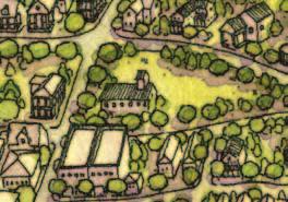
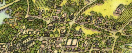
15 Hierarchy of Places on St. Helena Island Beaufort County Multi-Jurisdictional Form-Based Code Workshop and Charrette Report 2011 Opticos Design, Inc. 171


16 The St. Helena Transect T1 T2 T3 T4 T1NP T2R T2CB T3VE T3V T3V-LE T4VC T1 Natural Preserve T2 Rural - St Helena T2 Cottage Business T3 Village Edge T3 Village T3 Village - Land's End T4 Village Center Intent To preserve areas that contain sensitive habitats, open space, and limited agricultural uses. This Zone typically does not contain buildings, however small civic buildings or interpretive centers may be located within this Zone. The T1 Natural Zone implements the resource protection standards of the existing code. Intent To preserve the rural character of St. Helena Island. This Zone applies to areas that consist of sparsely settled lands in open or cultivated state. It may include large lot residential, farms where animals are raised or crops are grown, parks, woodland, grasslands, trails, and open space areas. T2 Rural Zone implements the comprehensive plan goals of preserving the rural character of portions of Beaufort County. Intent To preserve the rural character of St. Helena Island. This Zone applies to areas that are in the immediate vicinity of a Corner Store or other important rural intersections, where service and limited commercial uses can cluster in more closely-spaced buildings of residential character. T2 Cottage Business Zone implements the comprehensive plan goals of preserving the rural character of portions of Beaufort County. Intent To reinforce established neighborhoods, to maintain neighborhood stability and provide a transition between the center of a Village and the rural and natural boundaries. T3 Village Edge Zone implements the comprehensive plan goals of preserving the rural residential character of portions of Beaufort County. Intent To reinforce established neighborhoods, to maintain neighborhood stability and provide a transition between the center of a Village and rural areas. T3 Village Zone implements the comprehensive plan goals of preserving the rural residential character of portions of Beaufort County. Intent To provide a walkable, predominantly single-family neighborhood that integrates compatible multifamily housing types such as duplexes, and bungalow courts within walking distance to commercial areas and gathering places. T3 Village - Land's End Zone implements the comprehensive plan goals of preserving and building upon the walkable character of portions of Beaufort County. Intent To integrate appropriate, mediumdensity residential building types such as duplexes, townhouses, small courtyard housing, and mansion apartments with retail and service uses in an environment conducive to walking and bicycling. The T4 Village Center integrates open civic spaces, scenic vistas, a minimum of paving, preserved historic structures, and spaces for community gathering. Desired Form Natural environments, with distantly spaced, detached, low rise form, setback from the street. Desired Form Distantly spaced, detached, low rise form, setback from the street. Desired Form Detached, low rise form, closely setback from the street loosely define the street edge. Desired Form Detached, low rise form, setback from the street. Desired Form Detached, low rise form, setback from the street. Desired Form Closely spaced, detached, low rise form, setback from the street. Desired Form Predominantly detached, closely spaced low rise form, setback from the street. Building Height Building Height Building Height Building Height Building Height Building Height Building Height Where allowed, 2 stories max. 2 stories max. 2 stories max. 2.5 stories max. 2.5 stories max. 2.5 stories max. 2.5 stories max. General Use Resource Conservation, with limited Residential and Open Space Uses General Use Rural Residential and Agricultural, with limited Civic/Open Space and Service Uses General Use Service, limited Light Industrial, Commercial, Civic/Open Space, and Residential Uses General Use Residential with some Civic/Open Space and Service Uses General Use Residential with some Civic/Open Space and Service Uses General Use Residential, with some Civic/Open Space, and Service Uses General Use Residential, with Retail, and some Civic/Open Space and Service Uses Parking Characteristics Low Parking Requirements Individual Parking Lots, No On- Street Parking Parking Moderate Parking Requirements Individual Parking Lots, No On- Street Parking Parking Moderate Parking Requirements Individual Parking Lots, No On- Street Parking Parking Moderate Parking Requirements to promote walkability and minimize visual impact. Individual Parking Lots,Limited On- Street Parking Parking Low to moderate Parking Requirements to promote walkability and minimize visual impact. Individual Parking Lots, Some On- Street Parking Parking Low to moderate Parking Requirements to promote walkability and minimize visual impact. Individual Parking Lots, On-Street Parking Parking Low to moderate Parking Requirements to promote walkability and minimize visual impact. On street parking should be counted toward required nonresidential parking in selected areas. Shared or Individual Parking Lots, On-Street Parking Roadway Characteristics Narrow travel lanes, with open drainage swales and broad planting strips Roadway Characteristics Narrow travel lanes, with open drainage swales and broad planting strips Roadway Characteristics Narrow travel lanes, with open drainage swales and broad planting strips Roadway Characteristics Narrow travel lanes, with open drainage swales and broad planting strips Roadway Characteristics Narrow travel lanes, with open drainage swales and broad planting strips Roadway Characteristics Narrow to moderate travel lanes, with open drainage swales or valley gutters, and broad planting strips Roadway Characteristics Narrow to moderate travel lanes, with structured drainage and narrow planting strips Beaufort County Multi-Jurisdictional Form-Based Code Workshop and Charrette Report 2011 Opticos Design, Inc. 172
17 Beaufort County Transect Zones St. Helena Transect Zones T1 Natural Preserve NP - Natural Preserve T2-R Rural R - Rural T2-RC Rural Center CB - Cottage Business T3-E Edge VE - Village Edge T3-HN Hamlet Neighborhood V - Village T3-N Neighborhood V - Village - Land s End T4-HC-O Hamlet Center Open VC - Village Center Beaufort County Multi-Jurisdictional Form-Based Code Workshop and Charrette Report 2011 Opticos Design, Inc. 173
18


19 Beaufort County Multi-Jurisdictional Form-Based Code Workshop and Charrette Report 2011 Opticos Design, Inc. 175

20 Proposed Place Types Beaufort County Multi-Jurisdictional Form-Based Code Workshop and Charrette Report 2011 Opticos Design, Inc. 176
21 Phasing Strategy: Connectivity Beaufort County Multi-Jurisdictional Form-Based Code Workshop and Charrette Report 2011 Opticos Design, Inc. 177

22 Phasing Strategy: Connectivity Beaufort County Multi-Jurisdictional Form-Based Code Workshop and Charrette Report 2011 Opticos Design, Inc. 178

23 Proposed Regulating Plan Beaufort County Multi-Jurisdictional Form-Based Code Workshop and Charrette Report 2011 Opticos Design, Inc. 180
24

25 Potential Community Market Location Improved MLK Park Potential Pedestrian Connection Beaufort County Multi-Jurisdictional Form-Based Code Workshop and Charrette Report 2011 Opticos Design, Inc. 182

26 Sea Island Parkway Improved MLK Park MLK Drive Potential Pedestrian Connection Potential Community Market Beaufort County Multi-Jurisdictional Form-Based Code Workshop and Charrette Report 2011 Opticos Design, Inc. 183

27 Existing Gas Station/Car Wash Beaufort County Multi-Jurisdictional Form-Based Code Workshop and Charrette Report 2011 Opticos Design, Inc. 184

28 Gas Station/Car Wash Facade Improvements Beaufort County Multi-Jurisdictional Form-Based Code Workshop and Charrette Report 2011 Opticos Design, Inc. 185

29 Gas Station/Car Wash Facade Improvements Beaufort County Multi-Jurisdictional Form-Based Code Workshop and Charrette Report 2011 Opticos Design, Inc. 186

30 Martin Luther King Drive Existing Beaufort County Multi-Jurisdictional Form-Based Code Workshop and Charrette Report 2011 Opticos Design, Inc. 187

31 Penn Center: Existing Conditions Beaufort County Multi-Jurisdictional Form-Based Code Workshop and Charrette Report 2011 Opticos Design, Inc. 188

32 Conceptual Trail Interface at Penn Center Beaufort County Multi-Jurisdictional Form-Based Code Workshop and Charrette Report 2011 Opticos Design, Inc. 189
33
34 LANDS END WOODLAND FORT FREMONT HOSPITAL FORT FREMONT LAND'S END COMMUNITY St Helena Island 1 inch = 300 feet WATER / BEACH ACCESS PARK / RECREATION Beaufort County Multi-Jurisdictional Form-Based Code Workshop and Charrette Report 2011 Opticos Design, Inc. 191
35 LANDS END WOODLAND FORT FREMONT HOSPITAL FORT FREMONT LAND'S END COMMUNITY St Helena Island 1 inch = 300 feet WATER / BEACH ACCESS PARK / RECREATION Beaufort County Multi-Jurisdictional Form-Based Code Workshop and Charrette Report 2011 Opticos Design, Inc. 191
36 LANDS END WOODLAND FORT FREMONT HOSPITAL FORT FREMONT LAND'S END COMMUNITY St Helena Island 1 inch = 300 feet WATER / BEACH ACCESS PARK / RECREATION Beaufort County Multi-Jurisdictional Form-Based Code Workshop and Charrette Report 2011 Opticos Design, Inc. 191
37 LANDS END WOODLAND FORT FREMONT HOSPITAL FORT FREMONT LAND'S END COMMUNITY St Helena Island 1 inch = 300 feet WATER / BEACH ACCESS PARK / RECREATION Beaufort County Multi-Jurisdictional Form-Based Code Workshop and Charrette Report 2011 Opticos Design, Inc. 191


38 LANDS END WOODLAND FORT FREMONT HOSPITAL FORT FREMONT LAND'S END COMMUNITY St Helena Island 1 inch = 300 feet WATER / BEACH ACCESS PARK / RECREATION Beaufort County Multi-Jurisdictional Form-Based Code Workshop and Charrette Report 2011 Opticos Design, Inc. 191


39 Beaufort County Multi-Jurisdictional Form-Based Code Workshop and Charrette Report 2011 Opticos Design, Inc. 192

40 Proposed Place Types Beaufort County Multi-Jurisdictional Form-Based Code Workshop and Charrette Report 2011 Opticos Design, Inc. 193

41 Proposed Street & Block Framework Beaufort County Multi-Jurisdictional Form-Based Code Workshop and Charrette Report 2011 Opticos Design, Inc. 194

42 Proposed Regulating Plan Beaufort County Multi-Jurisdictional Form-Based Code Workshop and Charrette Report 2011 Opticos Design, Inc. 195
43

44 Land s End Road Land s End Rural Center Seaside Road Beaufort County Multi-Jurisdictional Form-Based Code Workshop and Charrette Report 2011 Opticos Design, Inc. 197

45 Land s End Road/Seaside Road Intersection Existing Beaufort County Multi-Jurisdictional Form-Based Code Workshop and Charrette Report 2011 Opticos Design, Inc. 198

46 Land s End Road/Seaside Road Intersection Proposed Beaufort County Multi-Jurisdictional Form-Based Code Workshop and Charrette Report 2011 Opticos Design, Inc. 199

47 Fort Fremont Potential Linear Park & Infill Housing Land s End Road Baypoint Road Fort Fremont Beaufort County Multi-Jurisdictional Form-Based Code Workshop and Charrette Report 2011 Opticos Design, Inc. 200
48
49 Proposed Zone Transitions: Corners Community Proposed Zone Transitions: Land s End T1 RC Resource Conservation RC Resource Conservation T2-R T2-CB T3-VE T3-V T3-V-LE T4-VC R Rural (Largest Parcels, Traditional Uses) CP Community Preservation (Traditional Businesses and Cottage Industries) R Rural (Largest Parcels, Traditional Uses) CP Community Preservation (Smaller Residential Parcels, Traditional Uses) N/A PMD Public Market District (Commercial, Civic, and Service Uses) R Rural (Largest Parcel Traditional Uses) R Rural (Traditional Business and Cottage Industries) R Rural (Largest Parcels, Traditional Uses) CP Community Preservation CP Community Preservation (Smaller Residential Parcels, Traditional Uses) CP Community Preservation (Small Residential Parcels) CP Community Preservation (Commercial, Civic, and Service Uses) Beaufort County Multi-Jurisdictional Form-Based Code Workshop and Charrette Report 2011 Opticos Design, Inc. 202
50 Implementation Projects - Corners Community 1. Consider expansion of CP district west to incorporate Lowcountry Store and environs at Yard Farm Road and Stevens Path 2. Continue Sea Island Parkway improvements for full extent of expanded CP district 3. Determine alignment for trail/sidewalk connection between Corners and Penn Center 4. Determine feasibility for new street connecting from west of Car Wash along southern edge of MLK Park east along existing utility alignment Beaufort County Multi-Jurisdictional Form-Based Code Workshop and Charrette Report 2011 Opticos Design, Inc. 203
51 Implementation Projects - Corners Community 5. Determine feasibility for a secondary east-west route north of Sea Island Parkway from near the Dollar Store to Halifax Drive 6. Work with Penn Center and Library to establish additional pedestrian/bicycle connection(s) between Penn Center and Corners 7. Expanded street network south of Sea Island Parkway in vicinity of Yard Farm Road with new civic space 8. Extension of Amazing Grace Lane west to Halifax Drive 9. New civic space extension at Ball Park Drive and Halifax Drive Beaufort County Multi-Jurisdictional Form-Based Code Workshop and Charrette Report 2011 Opticos Design, Inc. 204
52 Implementation Projects - Land s End Community 1. Secure and Improve pedestrian access to beach 2. Work with Fort Fremont and Land s End community to define access and parking, wayfinding, and signage strategy for Fort Fremont 3. Linear park and access improvements along Finch Road with coordinated infill strategy 4. Consider pedestrian improvements (sidewalks, lighting) from Seaside Road at Willow Whisp Lane to Land s End Road to Mixon/Finch Road in coordination with Fort Fremont improvements Beaufort County Multi-Jurisdictional Form-Based Code Workshop and Charrette Report 2011 Opticos Design, Inc. 205
53 Implementation Projects - Land s End Community 5. Wayfinding signage at Seaside Road and Land s End Road intersection 6. Extension of Bay Point Road to Capt. Rojas Road and completion of street grid between Bay Point and Land s End Road 7. Completion of street grid south of Mosse Road Beaufort County Multi-Jurisdictional Form-Based Code Workshop and Charrette Report 2011 Opticos Design, Inc. 206
CodeNEXT Overview August 19, Code Development Team
 CodeNEXT Overview August 19, 2016 Code Development Team Imagine Austin Policy 2 Imagine Austin Policy Direction A City of Complete Communities 3 Imagine Austin Policy Direction One implementation tool
VILLAGE OF SOUTHAMPTON
 VILLAGE OF SOUTHAMPTON Review of Built Conditions and Regulations Prepared by studio a/b architects with mapping by GIS Dept./Town of Southampton Cherished Character Issue Perspectives Architecture Streetscape
Applicant Type (Conditional Use Permit, Variance, Tract Map, etc.): Applicant: Address: Phone(s): Fax:
: Applicant: Address: Phone(s): Fax:") ENVIRONMENTAL QUESTIONNAIRE City of Twentynine Palms Community Development Department 6136 Adobe Road Twentynine Palms, CA 92277 (760) 367-6799 Fax (760) 367-5400 29palms.org : Please complete each statement
ENVIRONMENTAL QUESTIONNAIRE City of Twentynine Palms Community Development Department 6136 Adobe Road Twentynine Palms, CA 92277 (760) 367-6799 Fax (760) 367-5400 29palms.org : Please complete each statement
Integrating Travel Demand Management into the Long-Range Planning Process 2017 AMPO
 Integrating Travel Demand Management into the Long-Range Planning Process 2017 AMPO October 19, 2017 Chattanooga 2045 RTP Chattanooga 2045 RTP addresses both transportation supply and demand Continued
FORM-BASED CODES IN THE WEST. Rocky Mountain Land Use Institute March 2007
 FORM-BASED CODES IN THE WEST Rocky Mountain Land Use Institute March 2007 Speakers Matt Goebel, AICP, Clarion Associates Background: What s a form-based code? Recent examples from the western US. Brewster
DEPARTMENT OF PLANNING & ZONING COMPREHENSIVE PLANNING LAND PRESERVATION FOREST CONSERVATION GIS AGENDA
 DEPARTMENT OF PLANNING & ZONING COMPREHENSIVE PLANNING LAND PRESERVATION FOREST CONSERVATION GIS AGENDA WASHINGTON COUNTY PLANNING COMMISSION PUBLIC REZONING MEETING WASHINGTON COUNTY COURT HOUSE COURT
Planning Department Civic Center North 470 South Allison Parkway Lakewood, Colorado TTY/TDD Lakewood.
 Planning Department Civic Center North 470 South Allison Parkway Lakewood, Colorado 80226-3127 303.987.7505 303.987.7057 TTY/TDD Lakewood.org/Planning PLANNING COMMISSION REPORT SPECIAL USE PERMIT CASE
MARINA PARK PUBLIC ART AT FLAG PLAZA
 CONTEXTUAL OVERVIEW STANLEY PARK COAL HARBOUR HARBOUR GREEN PARK DEVONIAN HARBOUR PARK COAL HARBOUR COMMUNITY CENTRE & PARK CARDERO PARK MARINA PARK 10 MINUTE WALK 5 MINUTE WALK LOST LAGOON PUBLIC ART
CITY OF FORT COLLINS TYPE 1 ADMINISTRATIVE HEARING FINDINGS AND DECISION. Ryan Sagar 1196 Grant Street, Suite 313 Denver, CO 80203
 CITY OF FORT COLLINS TYPE 1 ADMINISTRATIVE HEARING FINDINGS AND DECISION HEARING DATE: January 11, 2018 PROJECT NAME: FTC Chippers SC CASE NUMBER: PDP #170027 APPLICANT: OWNER: HEARING OFFICER: LRK Consulting
Reston Town Center North Development. Community Update
 Reston Town Center North Development Community Update May 31, 2017 1 Presentation Agenda Project Overview Site and Current Property Ownerships Development Plan/Grid of Streets Proposed Ownership Comprehensive
NEW BUSINESS 1140 Lake Shore Blvd (L/LSHD)
") NEW BUSINESS 1140 Lake Shore Blvd (L/LSHD) Trust 8002368034, applicant. Application for major zoning relief to relocate a generator more than 2 from the principal structure where generators must be located
NEW BUSINESS 1140 Lake Shore Blvd (L/LSHD) Trust 8002368034, applicant. Application for major zoning relief to relocate a generator more than 2 from the principal structure where generators must be located
Downtown Boise Multimodal Center
 Treasure Valley High Capacity Transit Study Downtown Boise Multimodal Center Environmental Assessment June 2009 Prepared by the Federal Transit Administration and Valley Regional Transit. U.S. Department
Environmental Impact Questionnaire
 Community Development Department 11 English Street Petaluma, CA 94952 Phone: 707-778-4301 Email: cdd@ci.petaluma.ca.us Web: www.cityofpetaluma.net/cdd Building Geographic Information Systems Housing Neighborhood
The Practicalities of Form-Based Codes. (and How They re Being Applied in Albany)
") The Practicalities of Form-Based Codes (and How They re Being Applied in Albany) Victor Dover, FAICP Dover, Kohl & Partners Don Elliott, FAICP Clarion Associates The same and yet so different. 1 La Palma
The Practicalities of Form-Based Codes (and How They re Being Applied in Albany) Victor Dover, FAICP Dover, Kohl & Partners Don Elliott, FAICP Clarion Associates The same and yet so different. 1 La Palma
COMMERCIAL SITE AT GENERATION PARK
 COMMERCIAL SITE AT GENERATION PARK 77.9 Acre Site on Lockwood Road Generation Park Location Map Close Proximity to Major Destinations & Transportation Corridors Generation Park Features 4,000-acre master-planned
R1 Variation Zones. CODE AMENDMENT Q&A UPDATE October 6, 2016 CPC CA ENV ND. Department of City Planning
 Department of City Planning R1 Variation Zones CODE AMENDMENT Q&A UPDATE October 6, 2016 CPC-2016-2110-CA ENV-2016-2111-ND What are the R1 Variation Zones? The R1 Variation Zones are subsets of the R1
TRANSIT CENTER DISTRICT PLAN
 TRANSIT CENTER DISTRICT PLAN Informational Presentation Planning Commission 04.19.2012 San Francisco Planning Department In partnership with: San Francisco Redevelopment Agency Transbay Joint Powers Authority
AGREEMENT FOR 520 SECTOR PLAN ADDENDUM 2: ADDITIONAL SERVICE CODE STREAMLINING PROJECT
 AGREEMENT FOR 520 SECTOR PLAN ADDENDUM 2: ADDITIONAL SERVICE CODE STREAMLINING PROJECT THIS Addendum 2 (this Addendum ) made and entered into this date, 2015 supplements the Contract (the Contract ) made
PUBLIC WORKS ORGANIZATIONAL CHART
 PUBLIC WORKS ORGANIZATIONAL CHART C-108 Actual 2012-13 Adopted Year-End Estimated 2014-15 2015-16 PROGRAM EXPENSES/REVENUES Salaries & Benefits $ 1,725,030 $ 1,855,980 $ 1,676,130 $ 1,956,510 $ 1,979,470
FORM-BASED CODE WHY DOES THE ZONING CODE MATTER?
 FORM-BASED CODE FORM-BASED CODE WHY DOES THE ZONING CODE MATTER? FORM-BASED CODE WHY DOES THE ZONING CODE MATTER? IT DETERMINES THE FORM OF THE CITY, FOR GOOD OR FOR BAD FORM-BASED CODE OUR COMMON GOAL:
November 28, 2012 ALTERNATIVES ANALYSIS PUBLIC MEETING
 November 28, 2012 ALTERNATIVES ANALYSIS PUBLIC MEETING Project Background Description of the Project Alternatives Analysis Process Project Progress Activity Stations Comments Adjourn 2 VIA spent 2 years
Pueblo City-County Addressing Standards May 2010
 Pueblo City-County Addressing Standards May 2010 I. Definitions & Descriptions There can be up to four address types in the various databases within the County. They include situs, building, establishment
TABLE OF CONTENTS Part 10: Greenlands Zones
 TABLE OF CONTENTS Part 10: Greenlands Zones PURPOSE... 10.1 ~ 1 10.1 GENERAL PROVISIONS FOR GREENLANDS ZONES... 10.1 ~ 1 to 2 10.1.1 Accessory Uses in G1 and G2 Zones... 10.1 ~ 1 10.2 G1 and G2 ZONES (GREENLANDS)...
CITY PLANNING COMMISSION AGENDA ITEM NO: 6 STAFF: CARL SCHEULER FILE NO: CPC CA LEGISLATIVE
 Page 61 CITY PLANNING COMMISSION AGENDA ITEM NO: 6 STAFF: CARL SCHEULER FILE NO: CPC CA 09-00009 LEGISLATIVE PROJECT: ADDING NEW PART 8 TO CHAPTER 7, ARTICLE 3 OF THE ZONING CODE (SECTIONS 7.3.801-814)
Subdivision Application Form
 Applicant Information 1. Property Titleholder Subdivision Application Form Ravalli County Planning Department 215 South 4 th Street, Suite F, Hamilton, MT 59840 / (406) 375-6530 / planning@rc.mt.gov Name:
Logan City GIS Master Plan. Term Project. Colton Smith. David Tarboton CEE 6440
 Logan City GIS Master Plan Term Project Colton Smith David Tarboton CEE 6440 November 29, 2012 Introduction Logan City has lots of data available for streets, canals, trails, zoning maps, and municipalities.
Preliminary Potable Water Study Wolcott, PUD Project No
 Civil Engineering Surveying & Beyond Preliminary Potable Water Study Wolcott, PUD Project No. 09020.01 June 15, 2012 Image: Google Earth 2011 1 Contents A. Introduction... 1 B. Location and Descriptions...
North Metro Corridor Draft Environmental Impact Statement (DEIS) Public Hearings. December 9 & 10, 2009
 Public Hearings. December 9 & 10, 2009") North Metro Corridor Draft Environmental Impact Statement (DEIS) Public Hearings December 9 & 10, 2009 1 Welcome & Introductions 2 3 What Are We Doing Here Tonight? Public Hearing for RTD North Metro Corridor
North Metro Corridor Draft Environmental Impact Statement (DEIS) Public Hearings December 9 & 10, 2009 1 Welcome & Introductions 2 3 What Are We Doing Here Tonight? Public Hearing for RTD North Metro Corridor
Franklin D. Roosevelt Four Freedoms Park by Louis Kahn, Constructed 2012
 PUBLIC REALM Franklin D. Roosevelt Four Freedoms Park by Louis Kahn, Constructed 2012 PUBLIC REALM INSPIRATION Louis Kahn s design for the Four Freedoms Park is a powerful triangular form stretching into
LIST OF AMENDMENTS TO ZONING BYLAW NO. 801, 1999
 LIST OF AMENDMENTS TO ZONING BYLAW NO. 801, 1999 Bylaw Amendment 826 Lot B, DL. 31, Plan 26227 257 Hwy. 97 South Add craft & souvenir sales including fabric sales & business office as a principal permitted
Approval of Navy Yard Chiller Joint Development Agreement
 Planning, Program Development and Real Estate Committee Item V B July 9, 2015 Approval of Navy Yard Chiller Joint Development Agreement Washington Metropolitan Area Transit Authority Board Action/Information
Speed Limit and Safety Nexus Studies for Automated Enforcement Locations in the District of Columbia East Capitol Street at Southern Avenue NE
 Speed Limit and Safety Nexus Studies for Automated Enforcement Locations in the District of Columbia East Capitol Street at Southern Avenue NE Study Area and Location District PSA Ward ANC Phase Description
EASTSIDE CITY OF BELLEVUE/ PRIVATE PRIVATE PRIVATE MULTI-PRIVATE MULTI-PRIVATE
 SITE COMPARISON CHART CITY Bellevue County Kirkland Kirkland Redmond ADDRESS 555 116th Ave. Lane 118th Ave. 14955 90th St. ACREAGE 5.6 10.7 7.5 5.5 7.2 to 11.6 ACRES ZONING COMMERCIAL LIGHT INDUSTRIAL
ROCKSIDE WOODS BLVD. INDEPENDENCE, OHIO 44131
 DEVELOPMENT DEVELOPMENT SUMMARY: Available for Sale along Rockside Woods Blvd. and Brecksville Road (Route 21) are (7) seven development ready sites. These sites can serves a variety of uses including
COUNTY OF NEVADA PROJECT INFORMATION QUESTIONNAIRE
 COUNTY OF NEVADA PROJECT INFORMATION QUESTIONNAIRE The information provided in this questionnaire will be used for preparation of the project Initial Study (environmental review) and for overall project
Section Table of Permissible Uses
 Section 54.4 - Table of Permissible Uses Zones 1.00.000 1.01.000 1.01.100 AGRICULTURAL USES Agricultural operations, farming Agriculture P P P P P P P P P P P P P P P P P P P 1.01.110 Agricultural Product
Hennepin Avenue Downtown
 Hennepin Avenue Downtown Construction Kick-off Meeting Stakeholders, Owners, Managers January 14 & 17, 2019 Agenda Summary Background Principles Scope, Schedule, Budget Construction Utilities Roadway What
 www.amesassessor.org A Basic Tutorial For the Ames City Assessor s GIS Web Site For Real Estate Data and Maps Created July 1, 2008 Property of Ames City Assessor s Office and The Schneider Corporation
CONSTRUCTION & DEVELOPMENT MANUAL SUMTER COUNTY, FLORIDA
 CONSTRUCTION & DEVELOPMENT MANUAL SUMTER COUNTY, FLORIDA Original: June 1, 2004 Revised: May 31, 2005 Revised: August 8, 2006 Revised: September 1, 2006 Revised: August 20, 2007 Revised: November 1, 2011
EXTRA TERRITORIAL ZONING COMMISSION CASE ANALYSIS
 DOÑA ANA COUNTY COMMUNITY PLANNING AND ECONOMIC DEVELOPMENT DEPARTMENT Building Planning GIS 845 North Motel Boulevard Las Cruces, New Mexico 88007 (575) 647-7350 Fax: (575) 525-6131 Toll Free: 1 (877)
Anchorage Land Use Plan Map Update Vision
 Anchorage Land Use Plan Map Update Vision Carol Wong Manger, Tom Davis Project Manager and many others working hard to listen to the community. Hal Hart AICP Planning Director May 9 th 2017 1 Vision: the
DEVELOPING FORM-BASED CODES
 DEVELOPING FORM-BASED CODES American Planning Association, PA Chapter 2010 Annual Conference October 4, 2010 AGENDA What Are Form-Based Codes (FBC) Form-Based vs Conventional Zoning Codes How to Develop
Form-Based Codes: The Basics. Jorge E. Rousselin COA Planning and Development Review Urban Design
 Form-Based Codes: The Basics Jorge E. Rousselin COA Planning and Development Review Urban Design Form Based Codes: The Basics Purpose of tonight s presentation 1. What is a Form Based Code (FBC)? 2. What
Standish Corner Village. The Future Village: By Choice or By Chance? Today
 Standish Corner Village Lessons Learned Workshops The Future Village: By Choice or By Chance? Project Background Today The Role & Importance of Visioning Civic Engagement Implementation Tools & Techniques
Columbia Pike. Dover, Kohl & Partners Geoffrey Ferrell Associates
 Columbia Pike AForm-Based Code for the Corridor Dover, Kohl & Partners Geoffrey Ferrell Associates The Process Tonight s Agenda Welcome How will this process work? What is the team s approach? What is
Everything You Ever Wanted to Know About Form Based Codes
 Everything You Ever Wanted to Know About Form Based Codes (But were afraid to ask) Stuart Sirota, AICP Assistant Secretary 410.767.0901 stuart.sirota@maryland.gov Planning.maryland.gov Outline What are
Lacey Woodland District Regulatory Strategy
 Lacey Woodland District Regulatory Strategy I. Introduction The recommended regulatory strategy to implement the Woodland District Strategic Subarea Plan is to develop a character and form-based code and
Adopted by La Mesa City Council July 9, 2013 Resolution
 Adopted by La Mesa City Council July 9, 2013 Resolution 2013-059 Table of Contents ACKNOWLEDGEMENTS... A-1 INTRODUCTION... I-1 Vision... I-1 Background... I-1 Citizen Participation... I-3 Planning in La
2017 STP PROJECT APPLICATION (OREGON)
") Project Title Section 1. Applicant Information Name of Lead Agency/ Organization Address Phone Number Name & Title of Contact Person Email Address Certified Local Public Agency (Yes/No) Section 2. Project
Project Title Section 1. Applicant Information Name of Lead Agency/ Organization Address Phone Number Name & Title of Contact Person Email Address Certified Local Public Agency (Yes/No) Section 2. Project
FOR SALE BANK OWNED OFFICE CENTRAL LAKELAND HISTORIC DISTRICT
 Jack Strollo, Broker 500 S. Florida Avenue, Suite 420 Lakeland, Florida 33801 O. 863.683.3425 x103 C. 863.640.8238 jstrollo@resbroadway.com FOR SALE BANK OWNED OFFICE CENTRAL LAKELAND HISTORIC DISTRICT
Intent. Clarification (Planning) Change per PC work session on
 Change per PC work session on") TELECOMMUNICATIONS Intent The intent of the Telecommunications Plan is to ensure the adequate provision of telecommunications infrastructure in the County that will support economic growth and public safety,
TELECOMMUNICATIONS Intent The intent of the Telecommunications Plan is to ensure the adequate provision of telecommunications infrastructure in the County that will support economic growth and public safety,
County of Loudoun. Department of Planning and Zoning MEMORANDUM
 County of Loudoun Department of Planning and Zoning MEMORANDUM DATE: June 12, 2015 TO: FROM: Jacqueline Harlow, Project Manager Planner III, Land Use Review Kelly Williams, Planner III Community Planning
ARLINGTON COUNTY, VIRGINIA
 ARLINGTON COUNTY, VIRGINIA County Board Agenda Item Meeting of December 12, 2015 DATE: December 1, 2015 SUBJECT: SP-84-U-15-1 USE PERMIT ASSOCIATED WITH A SITE PLAN for a telecommunications facility; located
Wireless Telecommunication Facility. Project Narrative
 Wireless Telecommunication Facility Project Narrative Applicant: Owner: Rep.: 2785 Mitchell Drive Walnut Creek, CA 94598 Southern California Joint Pole Committee 279 E. Arrow Hwy, Ste. 104 San Dimas, CA
DEVELOPMENT CODE OF THE CITY OF LAWRENCE, KANSAS TEXT AMENDMENTS, MAY 4, 2010 EDITION. Amending Sections and
 DEVELOPMENT DE OF TE CITY OF LAWRENCE, KANSAS TEXT AMENDMENTS, MAY 4, 2010 EDITION Amending Sections 20-403 and 20-601 OF CAPTER 20 OF TE DE OF TE CITY OF LAWRENCE, KANSAS Incorporated By Reference Pursuant
Unified Development Code. Public Workshop No. 3 November 7, 2017
 Unified Development Code Public Workshop No. 3 November 7, 2017 Purpose of the Project 2 The overall goal of the project is to bring together the County s Land Development Regulations (Chapter 74 of the
Director of Public Works/City Engineer. Secretary. Word Processor. Streets and Facilities Supervisor. Traffic Signal Technician.
 PUBLIC WORKS ORGANIZATIONAL CHART Director of Public Works/City Engineer Secretary Word Processor Transit Services Manager Fleet Services Supervisor Streets and Facilities Supervisor Principal Principal
Request for Qualifications For Consultants to Prepare a Form-Based Code City of University Place, Washington
 Request for Qualifications For Consultants to Prepare a Form-Based Code City of University Place, Washington BACKGROUND AND OVERVIEW University Place is a community of about 33,000 people located on the
Building Success through Partnerships
 Building Success through Partnerships Washington APA Conference October 12, 2012 Vision Regional urban center Transit oriented district 5,000 new homes 25,000 new jobs Today Analysis of successful partnerships
Open house April 26 & 27, 2017
 Open house April 26 & 27, 2017 ROAD MAP ENVIRONMENTAL ASSESSMENT Approved by City Council 2012 and Province of Ontario 2013 LA SALLE CAUSEWAY Traffic Operations Study ACTION PLAN SHOVEL-READY Approved
26 th Street North and Old Dominion Drive Master Planning Task Force
 26 th Street North and Old Dominion Drive Master Planning Task Force Presentation to Arlington Joint Facilities Advisory Commission October 24, 2018 Site Master Planning Task Force On September 2018, the
ARLINGTON COUNTY, VIRGINIA
 ARLINGTON COUNTY, VIRGINIA County Board Agenda Item Meeting of May 20, 2017 DATE: May 10, 2017 SUBJECT: SP-339-U-17-2 USE PERMIT ASSOCIATED WITH A SITE PLAN for a telecommunications facility at Clarendon
6500 Harry Hines Boulevard Dallas, TX 75235
 CoStar-41051 LoopNet- 17906172 Xceligent -1379536 6500 Harry Hines Boulevard Dallas, TX 75235 Dallas Medical District Unique Site 5.31 Acres 81,000 + SF Offices Offered Exclusively by JacksonCooksey For
Washington Square FPO. 111 Washington Square > Office Space FOR LEASE > OFFICE SPACE 111 WASHINGTON AVENUE, MINNEAPOLIS, MN 55401
 FOR LEASE > OFFICE SPACE Washington Square 111 WASHINGTON AVENUE, MINNEAPOLIS, MN 55401 FPO 111 Washington Square > Office Space HENNEPIN AVE PARKING RAMP > Built in 1987, 111 Washington is part of a three
BEFORE THE CHRISTCHURCH DISTRICT PLAN INDEPENDENT HEARINGS PANEL
 BEFORE THE CHRISTCHURCH DISTRICT PLAN INDEPENDENT HEARINGS PANEL IN THE MATTER OF The Resource Management Act 1991 AND IN THE MATTER OF The Canterbury Earthquake (Christchurch Replacement District Plan)
YEAR 2035 TRANSPORTATION NETWORK
 40th Ave Smith Road NOTICE Traffic forecasts are for planning purposes only. Land uses and transportation network subject to change. LEGEND 2-Lane Local 2-Lane Collector 4-Lane Collector 4-Lane Arterial
YEAR 2035 TRANSPORTATION NETWORK
 40th Ave Smith Road NOTICE Traffic forecasts are for planning purposes only. Land uses and transportation network subject to change. LEGEND 2-Lane Local 2-Lane Collector 4-Lane Collector 4-Lane Arterial
Building: Residential Instructions
 Building and Development Services Department 1112 Manatee Ave West, Suite 408 Bradenton, FL 34205 Phone: (941) 749-3012 ManateeBADSOnline@mymanatee.org www.mymanatee.org Building: Residential Instructions
PLANNING COMMISSION WORK SESSION
 1 DEPARTMENT OF BUILDING AND DEVELOPMENT Date of Meeting: STAFF REPORT PLANNING COMMISSION WORK SESSION SUBJECT: ELECTION DISTRICT: FIDP-2016-0001, Broad Run CRITICAL ACTION DATE: STAFF CONTACTS: APPLICANT:
BOARD OF SUPERVISORS 2017 TRANSPORTATION SUMMIT INFORMATION ITEM
 BOARD OF SUPERVISORS 2017 TRANSPORTATION SUMMIT INFORMATION ITEM Date of Meeting: # 9 SUBJECT: ELECTION DISTRICTS: STAFF CONTACTS: Public and Private Infrastructure Improvements Adjacent to the Dulles
Karmic Connection 508 S. Broadway, Historic Fells Point, Baltimore
 PRESENTS: Karmic Connection 508 S. Broadway, Historic Fells Point, Baltimore VALUABLE REAL ESTATE, CASH FLOWING BUSINESS, BUSINESS ASSETS, AND INVENTORY OFFERED FOR SALE Offered at $899,000 REAL PROPERTY
This guide will tell you all you need to know about the new Front Desk application which can be found on the main Peoria County GIS website.
 New Front Desk Quick Guide, 2014 At a First Glance This guide will tell you all you need to know about the new Front Desk application which can be found on the main Peoria County GIS website. When you
Lheidli T enneh Final Agreement. Lands
 Lheidli T enneh Final Agreement Lands Introduction Treaty Components Self-government Lands Resources Fiscal Relationship Lands: Introduction 2000 Lands selection strategy 2003 AIP lands package - rural
AGENDA ITEM # 1. CITY COUNCIL COMMUNICATION FORM
 AGENDA ITEM # 1. CITY COUNCIL COMMUNICATION FORM FROM: Joel Rae, Director of Public Safety (ext. 113) THROUGH: Deb Hinsvark, Interim City Manager (ext. 228) DATE: December 18, 2012 RE: Police and Fire
Zoning Ordinance Update
 Zoning Ordinance Update Charlotte-Mecklenburg Planning Commission February 3, 2014 Presentation Outline 1. Where We ve Been 2. City Council Support/Direction 3. Immediate Next Steps TOD and TS Overlay
Variance Project Black Flag Attachments:
 Variance 15-01 Project Black Flag Attachments: 1. Locator 2. VAR 15-01 Staff report 3. Variance Exhibit 4. Applicant s Statement E Lookout Dr N Plano Rd 1402 E. Lookout Dr. N Greenville Ave Woodglen Dr
BLUE RIBBON Facilities
 BLUE RIBBON 2015 Facilities FACILITY PRIORITIES Police Administration Addition $4,484,864 Relocation of Fire Station 3 $4,829,683 (Does not include land purchase) City Hall Basement/Conference/Training/Emergency
Proposed FY 06 Project Development Program and FY 05 Project Development Program Update
 Washington Metropolitan Area Transit Authority Proposed FY 06 Project Development Program and FY 05 Project Development Program Update Presented to the Board of Directors: P D E C Planning & Development
Using Geographical Information Systems to Enhance Public Finance Analyses
 Using Geographical Information Systems to Enhance Public Finance Analyses Presented by: Tindale-Oliver & Associates, Inc. Presentation Overview 1 2 Introduction City of Tampa Background 3 4 Project Funding
Appendix A Existing Surface Utilities
 Appendix A Existing Surface Utilities PRELIMINARY INFRASTRUCTURE STUDY PROPOSED DUSEL SITE GILES COUNTY, VIRGINIA Prepared for: Kimballton Deep Underground Science and Engineering Laboratory Kimballton
Council of State Governments. Takoma Langley Transit Center Purple Line Project Briefing. October 28, 2013
 Council of State Governments Takoma Langley Transit Center Purple Line Project Briefing October 28, 2013 Takoma Langley Transit Center Purpose and Need Provide a safe, attractive and efficient facility
In recent years, many communities disappointed with the
 FOCUS 15 Essays Form-Based Design Standards for Smaller Communities Randall Arendt Town and Landscape Planner, M.Phil Urban Design; FRTPI, ASLA (Hon.); Greener Prospects, Brunswick, Maine. An active professional
GORE BUILDING. 238 N. Massachusetts Avenue, Lakeland, FL 33801
 GORE BUILDING 238 N. Massachusetts Avenue, Lakeland, FL 33801 CDB LOCATION REDEVELOPMENT PROJECT MUNN PARK HISTORIC DISTRICT INCENTIVES AVAILABLE ADJACENT PARKING INCLUDED BK698301 Phone: (863) 683-3425
1 OWENSBORO METROPOLITAN PLANNING COMMISSION. 3 The Owensboro Metropolitan Planning Commission
 1 OWENSBORO METROPOLITAN PLANNING COMMISSION 2 JULY 12, 2018 3 The Owensboro Metropolitan Planning Commission 4 met in regular session at 5:30 p.m. on Thursday, July 5 12, 2018, at City Hall, Commission
Final Presentation SUITLAND FEDERAL CENTER. SUITLAND FEDERAL CENTER MASTER PLANNING ULI minitap
 Final Presentation SUITLAND MASTER PLANNING ULI minitap GENERAL SERVICES ADMINISTRATION NATIONAL CAPITAL REGION OFFICE OF PLANNING & DESIGN QUALITY 7TH & D STREETS SW WASHINGTON, DC 20407 2:30 4:00 PM
An Introduction to Form Based Codes
 An Introduction to Form Based Codes Presented by: George J. Proakis, AICP NNECAPA Portsmouth, NH October 7, 2010 Form Based Codes for New England Form Follows Regulation Tools of Conventional Zoning The
Division C Land Development Division
 SECTION 1 - Applications Division C Land Development Division A. Atlas Amendment $ 650.00 plus $10.00 per acre B. Appeals Commercial Infill 1. Application to the BOCC $ 600.00 $ 650.00 plus $10.00 per
RSO P P P P P P P P P P P P P
 SECTION ONE: Chapter 20, Article 4, Section 20-402 of the Code of the City of Lawrence, Kansas, 2011 Edition, and amendments thereto is hereby amended and shall read as follows: 20-402 RESIDENTIAL DISTRICT
BUTLER COUNTY, KANSAS ZONING REGULATIONS. Sections: 1-1 Title Purpose Jurisdiction Sections: 2-1 Administration...
 BUTLER COUNTY, KANSAS ZONING REGULATIONS TABLE OF CONTENTS ARTICLE 1 TITLE; PURPOSE 1-1 Title... 1-1 1-2 Purpose... 1-1 1-3 Jurisdiction... 1-2 ARTICLE 2 ADMINISTRATION 2-1 Administration... 2-1 ARTICLE
The Maryland Transit Administration. A Plan to Connect Baltimore
 The Maryland Transit Administration A Plan to Connect Baltimore 1 What We ve Heard Over 1,100 stakeholder comments submitted through the Bus Network Improvement Project (BNIP) Six workshops, three pop-up
APPENDIX L. Aesthetics Technical Appendix
 APPENDIX L Aesthetics Technical Appendix APPENDIX L Aesthetics Technical Appendices This appendix contains a discussion and graphics describing the methodology employed to establish the building massing
Speed Limit and Safety Nexus Studies for Automated Enforcement Locations in the District of Columbia 1100 Block 4th Street NE
 Speed Limit and Safety Nexus Studies for Automated Enforcement Locations in the District of Columbia 11 Block 4th Street NE Study Area and Location District PSA Ward ANC Phase Description 1 14 6 6C Proposed
Peoria County Front Desk Map Application
 Peoria County Front Desk Map Application Quick Guide, 2017 At a First Glance This guide will tell users all they need to know about the Peoria County Front Desk application which can be found on the Peoria
Sense of Place Council & the The MI Place Partnership Initiative
 Sense of Place Council & the The MI Place Partnership Initiative www.miplace.org A survey to establish a baseline of data information on Placemaking, Form Based Codes and Charretting in Michigan Communities
Study Area and Location District PSA Ward ANC Phase Description G Proposed 2900 Block Military Road Northwest Eastbound
 Speed Limit and Safety Nexus Studies for Automated Enforcement Locations in the District of Columbia 29 Block Military Road NW E/B Study Area and Location District PSA Ward ANC Phase Description 2 21 3
Traffic Impact Study for the TAVA Homes Project at 1584 East Santa Clara Avenue in the City of Santa Ana
 Traffic Impact Study for the TAVA Homes Project at 1584 East Santa Clara Avenue in the City of Santa Ana March 2011 Prepared for: URS Corporation 2020 E. First Street, Suite #400 Santa Ana, CA 92705 Tel:
APPENDIX D. Traffic Impact Analysis
 APPENDIX D Traffic Impact Analysis TRAFFIC IMPACT ANALYSIS CALEXICO SOLAR FARM I County of Imperial, California July 8, 2011 LLG Ref. 3-11-2034 Prepared by: Cara Leone Transportation Planner II Under the
DESIGN CRITERIA MEMORANDUM
 State Route 49 Realignment Study DESIGN CRITERIA MEMORANDUM ATTACHMENT G SR 49 Realignment Study STATE ROUTE 49 El Dorado to Coloma El Dorado County, CA DESIGN CRITERIA MEMORANDUM Introduction The El
Appendix 2. Capital Funding Source Summary Table of Contents
 Capital Source Summary Table of Contents 2016 Corporate Services APP 2-3 Mayor and Council APP 2-5 Office of the Chief Administrative Officer APP 2-5 Office of the Chief Operating Officer APP 2-5 Planning
Municipal Service Park 3 December Consolidation of City services to one centralized complex
 Municipal Service Park 3 December 2010 Consolidation of City services to one centralized complex Overview: Operational Challenges and Opportunities South East Connector impacts Opportunities: The South