Existing Elevation Data Sets. Quality Level 2 (QL2) Lidar Data Sets. Better Land Characterization More Accurate Results!
|
|
|
- Beryl Gaines
- 5 years ago
- Views:
Transcription


1
 or")
 or worse Quality Level 2 (QL2) Lidar Data Sets Spatial")
 or better Interactive image comparisons: https://edac.unm.")
2 Existing Elevation Data Sets Out of Date: Most > 40 yrs old Data range from 15 yrs old to > 70 yrs old Spatial Resolution: 33 ft (10 m) or coarser Vertical Accuracy: 3.3 ft 6.6 ft (1 2 m) or worse Quality Level 2 (QL2) Lidar Data Sets Spatial Resolution: 2 ft or better Vertical Accuracy: 3.9 in (10 cm) or better Interactive image comparisons: Better Land Characterization More Accurate Results! 2

3 lidar: light detection and ranging sometimes called 3D laser scanning or laser elevation profiling Lidar measures distances to the Earth using laser pulses Processed pulses give precise 3D info about surface shape and features Result: A dense, detail-rich cloud of elevation points Point clouds yield many geospatial products: 1-ft Contours, 2-ft Bare Earth DEMs, Digital Surface Models (forest canopy, floodplain maps, urban canyon surface, structure surface, building footprints, etc.), Elevation Profiles, Detailed Hillshade/Slope/Aspect Maps 3


4 Lidar Point Cloud, Colored by Elevation La Cueva Area (Valles Caldera Project, 2010) Surface Model Side-View Profile 4
5 Lidar Point Cloud, Colored by Elevation La Cueva Area (Valles Caldera Project, 2010) Surface Model Side-View Profile 4a

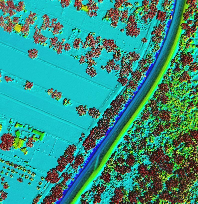
6 Perspective View of Embudo Area: NW to SE, across Rio Grande Santa Fe County Project 2014, QL2 Lidar Data Blue: Water Brown: Ground Points View using TIN Surface (image width: 0.5 mile elevation difference: 150 ft) 5

7 Perspective View of Embudo Area: NW to SE, across Rio Grande Santa Fe County Project 2014, QL2 Lidar Data Blue: Water Green: Trees, Shrubs, some Buildings Brown: Ground Points View using TIN Surface blended with Intensity Layer 6

8 Planimetric View of Embudo Area, across Rio Grande Santa Fe County Project 2014, QL2 Lidar Data Blue: Water Purple: Projected Flooding water 30 ft over riverbanks View using TIN Surface 7

9 8

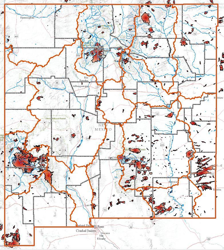
10 Santa Fe County Rio Hondo/Animas Curry/Roosevelt Counties Taos County Not QL2 and/or Not Publicly Available Funding Sources: Santa Fe County County, some USGS Rio Hondo/Animas Watersheds FEMA Curry/Roosevelt Counties NRCS, some USGS/FEMA Taos County Upper Rio Grande Watershed FEMA, some USGS 9

11 Value to New Mexico from Enhanced Elevation Data (QL2 Lidar Data) New Mexico s Greatest Concern: WATER watershed, drainage, runoff, drinking water, irrigation, flooding, floodplain, evaporation, water resource protection and delivery Economic Development and Tourism Wildfire and Urban Impacts flood hazard/risk, emergency response/mitigation, fuel load, access, recovery Transportation and Utility Corridors Urban Growth and Planning Forest Management restoration, thinning to increase water yield, post-fire mass wasting Energy Development oil and gas, solar, wind Homeland Security and Defense military installations, national laboratories, WIPP, 200-mi border with Mexico Tribal Lands Agricultural Demands irrigation, grazing, dryland farming LiDAR over Coconino Forest from NAU 10
 BLM")

12 Data Source: State (firebrick) BLM (brown) Data Source: NREL Wind: Blue Solar: Red 11


13 Data Source: USFS Data Source: USFS 12

14 Red: Buildings > 800 sq ft area Green: Vegetative Canopy Blue: Water Drainage/Flowlines, 3rd order and higher 13


15 Close-up, 1:2,000 scale Center-pivot irrigation with drainage/flowlines Derived from Lidar Close-up, 1:2,000 scale Derived from 10-m NED 14


16 First Return/Shaded Relief Derived from Lidar 2-ft resolution 10-cm (0.3-ft) elevation Aerial Photo NAIP m (3.3-ft) resolution No elevation 15
 Digitized from 7.")

17 Buildings and Canopy Derived from Lidar Point Cloud Elevation Data DRG (Digital Raster Graphic) Digitized from 7.5" Quad No Elevation Data Red: Building > 200 sq ft area Dk Green: Tree > 20 ft Khaki: Woodland, Small Tree 4 20 ft Orange: Shrubland ft Goldenrod: Herbaceous Cover 1 6 in 16


18 Remember: Better Land Characterization More Accurate Results! 17
19
20 Gar Clarke NM DoIT, NM GAC Chair Mike Inglis UNM Earth Data Analysis Center, Subcommittee Chair Mike Timmons NM Bureau of Geology Erle Wright Santa Fe County Paul Neville UNM EDAC 18
21

22 Identify lidar uses and users Meet with federal, state, and local partners and stakeholders Perform surveys to compile areas of interest, projects, and required data Inventory current and in-progress lidar acquisition projects Assess needs in a geospatial context Draft NM Statewide Lidar Acquisition Plan Plan and Acquisition are driven by Funding: New Mexico needs state and local cost shares
23 Quality Level 2 Lidar Data spatial resolution (cell size) 1 m 2 ft vertical accuracy (elevation) 10.0 cm 3.94 in pulse spacing 0.71 m pulse density 2.0 m Standard Lidar Products Raw Point Cloud Classified Point Cloud Bare-Earth Surface (Raster Digital Elevation Model) Breaklines Intensity Layer 3DEP (National 3D Elevation Program) Initiative Nationwide lidar coverage High-resolution lidar Publicly available

24 Perspective View of Embudo Area: NW to SE, across Rio Grande Santa Fe County Project 2014, QL2 Lidar Data Blue: Water Green: Trees, Shrubs, some Buildings Brown: Ground Points View using Point Cloud (image width: 0.5 mile elevation difference: 150 ft)
25 Perspective View of Embudo Area: NW to SE, across Rio Grande Santa Fe County Project 2014, QL2 Lidar Data Blue: Water Green: Trees, Shrubs, some Buildings Brown: Ground Points View using TIN Surface (image width: 0.5 mile elevation difference: 150 ft)

26 Red Triangle: 100-ft Cell Tower Red Lines: No Signal Coverage Features Derived from Surface, Building, and Canopy Lidar Data Products
Overview. 1. Aerial LiDAR in Wisconsin (20 minutes) 2. Demonstration of data in CAD (30 minutes) 3. High Density LiDAR (20 minutes)
 2. Demonstration of data in CAD (30 minutes) 3. High Density LiDAR (20 minutes)") Overview 1. Aerial LiDAR in Wisconsin (20 minutes) 2. Demonstration of data in CAD (30 minutes) 3. High Density LiDAR (20 minutes) 4. Aerial lidar technology advancements (15 minutes) 5. Q & A 1. Aerial
Overview 1. Aerial LiDAR in Wisconsin (20 minutes) 2. Demonstration of data in CAD (30 minutes) 3. High Density LiDAR (20 minutes) 4. Aerial lidar technology advancements (15 minutes) 5. Q & A 1. Aerial
N.J.P.L.S. An Introduction to LiDAR Concepts and Applications
 N.J.P.L.S. An Introduction to LiDAR Concepts and Applications Presentation Outline LIDAR Data Capture Advantages of Lidar Technology Basics Intensity and Multiple Returns Lidar Accuracy Airborne Laser
LIDAR MAPPING FACT SHEET
 1. LIDAR THEORY What is lidar? Lidar is an acronym for light detection and ranging. In the mapping industry, this term is used to describe an airborne laser profiling system that produces location and
Lidar Talking Points Status of lidar collection in Pennsylvania Estimated cost and timeline
 Lidar Talking Points Pennsylvania has an immediate need for new lidar (topographic) data coverage. Some uses of the data are enumerated later in this document. USGS has calculated an average return on
Hamilton County Enhances GIS Base Mapping with 1-foot Contours
 Hamilton County Enhances GIS Base Mapping with 1-foot Contours Presented by Larry Stout, Hamilton County GIS Manager Brad Fugate, Woolpert Inc. Today s Presentation Hamilton County s 2004 Base Mapping
UAV Surveying II. Precision. Accuracy. Reliability
 UAV Surveying II Precision. Accuracy. Reliability Part One: Project Lifecycle Deliverables Part Two: Evaluation of UAV Data Accuracy and Examples of Error Part Three: AGENDA Review of Results Examples
LiDAR Derived Contours
 LiDAR Derived Contours Final Delivery June 10, 2009 Prepared for: Prepared by: Metro 600 NE Grand Avenue Portland, OR 97232 Watershed Sciences, Inc. 529 SW Third Avenue, Suite 300 Portland, OR 97204 Metro
APPENDIX E2. Vernal Pool Watershed Mapping
 APPENDIX E2 Vernal Pool Watershed Mapping MEMORANDUM To: U.S. Fish and Wildlife Service From: Tyler Friesen, Dudek Subject: SSHCP Vernal Pool Watershed Analysis Using LIDAR Data Date: February 6, 2014
Technical Considerations and Best Practices in Imagery and LiDAR Project Procurement
 Technical Considerations and Best Practices in Imagery and LiDAR Project Procurement Presented to the 2014 WV GIS Conference By Brad Arshat, CP, EIT Date: June 4, 2014 Project Accuracy A critical decision
UTILIZACIÓN DE DATOS LIDAR Y SU INTEGRACIÓN CON SISTEMAS DE INFORMACIÓN GEOGRÁFICA
 UTILIZACIÓN DE DATOS LIDAR Y SU INTEGRACIÓN CON SISTEMAS DE INFORMACIÓN GEOGRÁFICA Aurelio Castro Cesar Piovanetti Geographic Mapping Technologies Corp. (GMT) Consultores en GIS info@gmtgis.com Geographic
UAV Flight Operations for Mapping. Precision. Accuracy. Reliability
 UAV Flight Operations for Mapping Precision. Accuracy. Reliability Part One: Why is Mapping different? Part Two: What about accuracy and precision? Part Three: What is the Workflow? Part Four: AGENDA What
Airborne LiDAR Data Acquisition for Forestry Applications. Mischa Hey WSI (Corvallis, OR)
") Airborne LiDAR Data Acquisition for Forestry Applications Mischa Hey WSI (Corvallis, OR) WSI Services Corvallis, OR Airborne Mapping: Light Detection and Ranging (LiDAR) Thermal Infrared Imagery 4-Band
Airborne LiDAR Data Acquisition for Forestry Applications Mischa Hey WSI (Corvallis, OR) WSI Services Corvallis, OR Airborne Mapping: Light Detection and Ranging (LiDAR) Thermal Infrared Imagery 4-Band
Workshops funded by the Minnesota Environment and Natural Resources Trust Fund
 Workshops funded by the Minnesota Environment and Natural Resources Trust Fund Conservation Applications of LiDAR Data Workshops funded by: Minnesota Environment and Natural Resources Trust Fund Presented
Volumetric Calculations. Sample Data
 Volumetric Calculations Sample Data Stockpiles of industrial materials are often difficult to measure accurately. LiDAR offers a fast and extremely accurate solution for taking periodical inventory of
2010 LiDAR Project. GIS User Group Meeting June 30, 2010
 2010 LiDAR Project GIS User Group Meeting June 30, 2010 LiDAR = Light Detection and Ranging Technology that utilizes lasers to determine the distance to an object or surface Measures the time delay between
3D Elevation Program- Status and Updates. Claire DeVaughan South Central Arc User Group Conference April 11, 2018
 + 1 3D Elevation Program- Status and Updates Claire DeVaughan South Central Arc User Group Conference April 11, 2018 + 2 3D Elevation Program (3DEP) Goals Complete acquisition in 8 years Address Federal,
An Introduction to Lidar & Forestry May 2013
 An Introduction to Lidar & Forestry May 2013 Introduction to Lidar & Forestry Lidar technology Derivatives from point clouds Applied to forestry Publish & Share Futures Lidar Light Detection And Ranging
Alaska Department of Transportation Roads to Resources Project LiDAR & Imagery Quality Assurance Report Juneau Access South Corridor
 Alaska Department of Transportation Roads to Resources Project LiDAR & Imagery Quality Assurance Report Juneau Access South Corridor Written by Rick Guritz Alaska Satellite Facility Nov. 24, 2015 Contents
Reality Check: Processing LiDAR Data. A story of data, more data and some more data
 Reality Check: Processing LiDAR Data A story of data, more data and some more data Red River of the North Red River of the North Red River of the North Red River of the North Introduction and Background
3D Elevation Program GeoCue Webinar April 29, The National Map
 + 3D Elevation Program GeoCue Webinar April 29, 2014 The National Map + 3D Elevation Program (3DEP) 2 Topics What is the 3DEP? Overview and background: National Elevation Dataset National Enhanced Elevation
Introduction to LiDAR
 Introduction to LiDAR Our goals here are to introduce you to LiDAR data. LiDAR data is becoming common, provides ground, building, and vegetation heights at high accuracy and detail, and is available statewide.
Data Acquisition Through the Geospatial Products and Services Contract (GPSC)
") Data Acquisition Through the Geospatial Products and Services Contract (GPSC) Kathryn Yoder GPSC COTR ESRI, 2015 U.S. Department of the Interior U.S. Geological Survey Overview Background Info Acquisition
Data Acquisition Through the Geospatial Products and Services Contract (GPSC) Kathryn Yoder GPSC COTR ESRI, 2015 U.S. Department of the Interior U.S. Geological Survey Overview Background Info Acquisition
Should Contours Be Generated from Lidar Data, and Are Breaklines Required? Lidar data provides the most
 Should Contours Be Generated from Lidar Data, and Are Breaklines Required? Lidar data provides the most accurate and reliable representation of the topography of the earth. As lidar technology advances
PROJECT BRIEFINGS: Statewide 2008 Orthoimagery LiDAR Elevation Data Program MN Geospatial Information Office. Chris Cialek
 PROJECT BRIEFINGS: Statewide 2008 Orthoimagery LiDAR Elevation Data Program MN Geospatial Information Office Chris Cialek MN Land Management Information Center (LMIC) chris.cialek@state.mn.us Mid-West
LiDAR Engineering and Design Applications. Sample Data
 LiDAR Engineering and Design Applications Sample Data High density LiDAR will return points on any visible part of a structure. Modeling of Existing Structures 2 The distance between any two positions
Aerial and Mobile LiDAR Data Fusion
 Creating Value Delivering Solutions Aerial and Mobile LiDAR Data Fusion Dr. Srini Dharmapuri, CP, PMP What You Will Learn About LiDAR Fusion Mobile and Aerial LiDAR Technology Components & Parameters Project
FOR 274: Surfaces from Lidar. Lidar DEMs: Understanding the Returns. Lidar DEMs: Understanding the Returns
 FOR 274: Surfaces from Lidar LiDAR for DEMs The Main Principal Common Methods Limitations Readings: See Website Lidar DEMs: Understanding the Returns The laser pulse travel can travel through trees before
Airborne Laser Scanning: Remote Sensing with LiDAR
 Airborne Laser Scanning: Remote Sensing with LiDAR ALS / LIDAR OUTLINE Laser remote sensing background Basic components of an ALS/LIDAR system Two distinct families of ALS systems Waveform Discrete Return
LiDAR QA/QC - Quantitative and Qualitative Assessment report -
 LiDAR QA/QC - Quantitative and Qualitative Assessment report - CT T0009_LiDAR September 14, 2007 Submitted to: Roald Haested Inc. Prepared by: Fairfax, VA EXECUTIVE SUMMARY This LiDAR project covered approximately
Lidar and GIS: Applications and Examples. Dan Hedges Clayton Crawford
 Lidar and GIS: Applications and Examples Dan Hedges Clayton Crawford Outline Data structures, tools, and workflows Assessing lidar point coverage and sample density Creating raster DEMs and DSMs Data area
Municipal Projects in Cambridge Using a LiDAR Dataset. NEURISA Day 2012 Sturbridge, MA
 Municipal Projects in Cambridge Using a LiDAR Dataset NEURISA Day 2012 Sturbridge, MA October 15, 2012 Jeff Amero, GIS Manager, City of Cambridge Presentation Overview Background on the LiDAR dataset Solar
LIDAR an Introduction and Overview
 LIDAR an Introduction and Overview Rooster Rock State Park & Crown Point. Oregon DOGAMI Lidar Project Presented by Keith Marcoe GEOG581, Fall 2007. Portland State University. Light Detection And Ranging
LIDAR ESSENTIALS: Module 4
 LIDAR ESSENTIALS: Module 4 Alan Lulloff Association of State Floodplain Managers 575 D'Onofrio Drive, Suite 200 Madison, WI 53719 608-828-3000 alan@floods.org www.floods.org Lewis Graham GeoCue Corporation
Lecture 23 - LiDAR. GEOL 452/552 - GIS for Geoscientists I. Scanning Lidar. 30 m DEM. Lidar representations:
 GEOL 452/552 - GIS for Geoscientists I Lecture 23 - LiDAR LiDAR - some background (thanks to Chris Kahle, DNR) Converting Lidar point data to a raster Look at online lidar data for Iowa (1m hillshaded)
CLASSIFICATION OF NONPHOTOGRAPHIC REMOTE SENSORS
 CLASSIFICATION OF NONPHOTOGRAPHIC REMOTE SENSORS PASSIVE ACTIVE DIGITAL CAMERA THERMAL (e.g. TIMS) VIDEO CAMERA MULTI- SPECTRAL SCANNERS VISIBLE & NIR MICROWAVE HYPERSPECTRAL (e.g. AVIRIS) SLAR Real Aperture
Topographic Lidar Data Employed to Map, Preserve U.S. History
 OCTOBER 11, 2016 Topographic Lidar Data Employed to Map, Preserve U.S. History In August 2015, the National Park Service (NPS) contracted Woolpert for the Little Bighorn National Monument Mapping Project
Esri International User Conference. July San Diego Convention Center. Lidar Solutions. Clayton Crawford
 Esri International User Conference July 23 27 San Diego Convention Center Lidar Solutions Clayton Crawford Outline Data structures, tools, and workflows Assessing lidar point coverage and sample density
LiDAR data overview. Dr. Keiko Saito Global Facility for Disaster Reduction and Recovery (GFDRR)
") LiDAR data overview Dr. Keiko Saito Global Facility for Disaster Reduction and Recovery (GFDRR) LiDAR (Light Detecting And Ranging) 3D height profile Laser emitted from sensor onboard aircraft to measure
LiDAR data overview Dr. Keiko Saito Global Facility for Disaster Reduction and Recovery (GFDRR) LiDAR (Light Detecting And Ranging) 3D height profile Laser emitted from sensor onboard aircraft to measure
Using LiDAR (Light Distancing And Ranging) data to more accurately describe avalanche terrain
 data to more accurately describe avalanche terrain") International Snow Science Workshop, Davos 009, Proceedings Using LiDAR (Light Distancing And Ranging) data to more accurately describe avalanche terrain Christopher M. McCollister, and Robert H. Comey,
International Snow Science Workshop, Davos 009, Proceedings Using LiDAR (Light Distancing And Ranging) data to more accurately describe avalanche terrain Christopher M. McCollister, and Robert H. Comey,
Rogue River LIDAR Project, 2012 Delivery 1 QC Analysis LIDAR QC Report September 6 th, 2012
 O R E G O N D E P A R T M E N T O F G E O L O G Y A N D M I N E R A L I N D U S T R I E S OLC Rogue River Delivery 1 Acceptance Report. Department of Geology & Mineral Industries 800 NE Oregon St, Suite
Connecticut Association of Assessing Officers CT Statewide GIS Data Acquisition & Services. June 22, :00 am
 Connecticut Association of Assessing Officers 2016 CT Statewide GIS Data Acquisition & Services June 22, 2016 9:00 am Presented by: Shawn Benham, PMP Project Manager ---------------------------- Brad Arshat,
Quality Control Concepts for LiDAR
 Quality Control Concepts for LiDAR January 24, 2012 Engineering Architecture Design-Build Surveying GeoSpatial Solutions Presentation Objectives Offer realistic and constructive advice for LiDAR project
Digital Raster Acquisition Project Eastern Ontario (DRAPE) 2014 Digital Surface Model and Digital Terrain Model
 2014 Digital Surface Model and Digital Terrain Model") Digital Raster Acquisition Project Eastern Ontario (DRAPE) 2014 Digital Surface Model and Digital Terrain Model User Guide Provincial Mapping Unit Mapping and Information Resources Branch Corporate Management
Digital Raster Acquisition Project Eastern Ontario (DRAPE) 2014 Digital Surface Model and Digital Terrain Model User Guide Provincial Mapping Unit Mapping and Information Resources Branch Corporate Management
MODULE 1 BASIC LIDAR TECHNIQUES
 MODULE SCENARIO One of the first tasks a geographic information systems (GIS) department using lidar data should perform is to check the quality of the data delivered by the data provider. The department
Light Detection and Ranging (LiDAR)
") Light Detection and Ranging (LiDAR) http://code.google.com/creative/radiohead/ Types of aerial sensors passive active 1 Active sensors for mapping terrain Radar transmits microwaves in pulses determines
Light Detection and Ranging (LiDAR) http://code.google.com/creative/radiohead/ Types of aerial sensors passive active 1 Active sensors for mapping terrain Radar transmits microwaves in pulses determines
A Method to Create a Single Photon LiDAR based Hydro-flattened DEM
 A Method to Create a Single Photon LiDAR based Hydro-flattened DEM Sagar Deshpande 1 and Alper Yilmaz 2 1 Surveying Engineering, Ferris State University 2 Department of Civil, Environmental, and Geodetic
The Use of UAV s for Gathering Spatial Information. James Van Rens CEO MAPPS Winter Conference January, 2015
 The Use of UAV s for Gathering Spatial Information James Van Rens CEO MAPPS Winter Conference January, 2015 1 UAV Technological Timeline 1980 s RPV (Remotely Piloted Vehicle) Operator on ground, almost
New Mexico s RGIS Program: State Geospatial Data Clearinghouse
 New Mexico s RGIS Program: State Geospatial Data Clearinghouse Laura Gleasner Su Zhang November 10, 2016 New Mexico RGIS: The State Digital Geospatial Data Clearinghouse The Resource Geographic Information
Burns, OR LIDAR Project, 2011 Delivery QC Analysis LIDAR QC Report February 13th, 2012
 O R E G O N D E P A R T M E N T O F G E O L O G Y A N D M I N E R A L I N D U S T R I E S OLC Burns, OR Delivery Acceptance Report. Department of Geology & Mineral Industries 800 NE Oregon St, Suite 965
2D Large Scale Automated Engineering for FEMA Floodplain Development in South Dakota. Eli Gruber, PE Brooke Conner, PE
 2D Large Scale Automated Engineering for FEMA Floodplain Development in South Dakota Eli Gruber, PE Brooke Conner, PE Project Acknowledgments FEMA Region 8 Staff: Brooke Conner, PE Casey Zuzak, GISP Ryan
LiDAR Applications. Examples of LiDAR applications. forestry hydrology geology urban applications
 LiDAR Applications Examples of LiDAR applications forestry hydrology geology urban applications 1 Forestry applications canopy heights individual tree and crown mapping estimated DBH and leaf area index
Light Detection and Ranging (LiDAR) Radiohead House of Cards
 Radiohead House of Cards") Light Detection and Ranging (LiDAR) Radiohead House of Cards http://the-moni-blog.blogspot.com/2009/03/lidar-is-going-mainstream-mtv-baby.html h =? Laser Vision GPS + IMU θ H X a h Types of aerial sensors
Light Detection and Ranging (LiDAR) Radiohead House of Cards http://the-moni-blog.blogspot.com/2009/03/lidar-is-going-mainstream-mtv-baby.html h =? Laser Vision GPS + IMU θ H X a h Types of aerial sensors
AIRBORNE GEIGER MODE LIDAR - LATEST ADVANCEMENTS IN REMOTE SENSING APPLICATIONS RANDY RHOADS
 Place image here (10 x 3.5 ) AIRBORNE GEIGER MODE LIDAR - LATEST ADVANCEMENTS IN REMOTE SENSING APPLICATIONS RANDY RHOADS Geospatial Industry Manager HARRIS.COM #HARRISCORP Harris Company Information SECURITY
Massive Data Algorithmics
 In the name of Allah Massive Data Algorithmics An Introduction Overview MADALGO SCALGO Basic Concepts The TerraFlow Project STREAM The TerraStream Project TPIE MADALGO- Introduction Center for MAssive
Synthetic Aperture Radar (SAR) Polarimetry for Wetland Mapping & Change Detection
 Polarimetry for Wetland Mapping & Change Detection") Synthetic Aperture Radar (SAR) Polarimetry for Wetland Mapping & Change Detection Jennifer M. Corcoran, M.S. Remote Sensing & Geospatial Analysis Laboratory Natural Resource Science & Management PhD Program
Synthetic Aperture Radar (SAR) Polarimetry for Wetland Mapping & Change Detection Jennifer M. Corcoran, M.S. Remote Sensing & Geospatial Analysis Laboratory Natural Resource Science & Management PhD Program
Geomatic & Information Technologies for Ports and Navigable Waterways. Expanding Our Global Opportunities
 Geomatic & Information Technologies for Ports and Navigable Waterways Airborne Remote Sensing Susan Jackson Tetra Tech Geomatics BD Director Hydrographic Surveying Robert Feldpausch Tetra Tech Principal
Central Coast LIDAR Project, 2011 Delivery 1 QC Analysis LIDAR QC Report February 17 th, 2012
 O R E G O N D E P A R T M E N T O F G E O L O G Y A N D M I N E R A L I N D U S T R I E S OLC Central Coast Delivery 1 Acceptance Report. Department of Geology & Mineral Industries 800 NE Oregon St, Suite
MassCEC Rooftop Solar Map
 MassCEC Rooftop Solar Map Data and Methods Summary Critigen, LLC Overview The detailed analysis of solar rooftop potential is a multi-step workflow with many facets and input parameters to the analysis
Assimilation of Break line and LiDAR Data within ESRI s Terrain Data Structure (TDS) for creating a Multi-Resolution Terrain Model
 for creating a Multi-Resolution Terrain Model") Assimilation of Break line and LiDAR Data within ESRI s Terrain Data Structure (TDS) for creating a Multi-Resolution Terrain Model Tarig A. Ali Department of Civil Engineering American University of Sharjah,
Assimilation of Break line and LiDAR Data within ESRI s Terrain Data Structure (TDS) for creating a Multi-Resolution Terrain Model Tarig A. Ali Department of Civil Engineering American University of Sharjah,
FOR 474: Forest Inventory. Plot Level Metrics: Getting at Canopy Heights. Plot Level Metrics: What is the Point Cloud Anyway?
 FOR 474: Forest Inventory Plot Level Metrics from Lidar Heights Other Plot Measures Sources of Error Readings: See Website Plot Level Metrics: Getting at Canopy Heights Heights are an Implicit Output of
Contents of Lecture. Surface (Terrain) Data Models. Terrain Surface Representation. Sampling in Surface Model DEM
 Data Models. Terrain Surface Representation. Sampling in Surface Model DEM") Lecture 13: Advanced Data Models: Terrain mapping and Analysis Contents of Lecture Surface Data Models DEM GRID Model TIN Model Visibility Analysis Geography 373 Spring, 2006 Changjoo Kim 11/29/2006 1
Lecture 13: Advanced Data Models: Terrain mapping and Analysis Contents of Lecture Surface Data Models DEM GRID Model TIN Model Visibility Analysis Geography 373 Spring, 2006 Changjoo Kim 11/29/2006 1
Automated Feature Extraction from Aerial Imagery for Forestry Projects
 Automated Feature Extraction from Aerial Imagery for Forestry Projects Esri UC 2015 UC706 Tuesday July 21 Bart Matthews - Photogrammetrist US Forest Service Southwestern Region Brad Weigle Sr. Program
GIS-Generated Street Tree Inventory Pilot Study
 GIS-Generated Street Tree Inventory Pilot Study Prepared for: MSGIC Meeting Prepared by: Beth Schrayshuen, PE Marla Johnson, GISP 21 July 2017 Agenda 2 Purpose of Street Tree Inventory Pilot Study Evaluation
Cooperating Technical Partners Information Exchange. LIDAR QA/QC and Extracting Building Footprints
 Cooperating Technical Partners Information Exchange LIDAR QA/QC and Extracting Building Footprints Audio and Web Settings Participation Open and hide your control panel using the orange arrow button at
LIDAR and Terrain Models: In 3D!
 LIDAR and Terrain Models: In 3D! Stuart.green@teagasc.ie http://www.esri.com/library/whitepapers/pdfs/lidar-analysis-forestry.pdf http://www.csc.noaa.gov/digitalcoast/_/pdf/refinement_of_topographic_lidar_to_create_a_bare_e
Automated Enforcement of High Resolution Terrain Models April 21, Brian K. Gelder, PhD Associate Scientist Iowa State University
 Automated Enforcement of High Resolution Terrain Models April 21, 2015 Brian K. Gelder, PhD Associate Scientist Iowa State University Problem Statement High resolution digital elevation models (DEMs) should
Lidar Sensors, Today & Tomorrow. Christian Sevcik RIEGL Laser Measurement Systems
 Lidar Sensors, Today & Tomorrow Christian Sevcik RIEGL Laser Measurement Systems o o o o Online Waveform technology Stand alone operation no field computer required Remote control through wireless network
Quinnipiac Post Flight Aerial Acquisition Report
 Quinnipiac Post Flight Aerial Acquisition Report August 2011 Post-Flight Aerial Acquisition and Calibration Report FEMA REGION 1 Quinnipiac Watershed, Connecticut, Massachusesetts FEDERAL EMERGENCY MANAGEMENT
Mobile Mapping Solutions for Ohio s Integrated Transportation Network. Brian Foster, CP
 Mobile Mapping Solutions for Ohio s Integrated Transportation Network Brian Foster, CP About Woolpert Established in 1911 Over 600 Professionals 25 Offices $12,000,000 invested in new technology in last
Western Land Area Programmatic Environmental Assessment. APPENDIX F: Viewshed Study
 APPENDIX F: Viewshed Study Dulles International Airport Western Land Area Viewshed Study FINAL Prepared by: EAC/Archaeology, Inc. September 26, 2017 Western Land Area This page is left intentionally blank.
Remote Sensing for Statewide Digital Geospatial Database
 Remote Sensing for Statewide Digital Geospatial Database Photogrammetry: Collecting and processing digital aerial imagery. Brenda Browning, C.P. Objective: Collection, processing, and disbursement of digital
Terrain Modeling and Mapping for Telecom Network Installation Using Scanning Technology. Maziana Muhamad
 Terrain Modeling and Mapping for Telecom Network Installation Using Scanning Technology Maziana Muhamad Summarising LiDAR (Airborne Laser Scanning) LiDAR is a reliable survey technique, capable of: acquiring
LIDAR 101 & 2014 MO/AR LIDAR PARTNERS PROJECT. NEMO GIS Workshop
 LIDAR 101 & 2014 MO/AR LIDAR PARTNERS PROJECT NEMO GIS Workshop May 22, 2014 PRESENTER Tim Donze Business Development Surdex Corporation PRESENTATION TOPICS What is LiDAR? Why is LiDAR Valuable? Missouri
Sandy River, OR Bathymetric Lidar Project, 2012 Delivery QC Analysis Lidar QC Report March 26 th, 2013
 O R E G O N D E P A R T M E N T O F G E O L O G Y A N D M I N E R A L I N D U S T R I E S OLC Sandy River, OR Bathymetric Lidar Project Delivery Acceptance Report. Department of Geology & Mineral Industries
Ada L. Benavides, Deputy Chief South Pacific Division Regional Integration Team. May 5, US Army Corps of Engineers BUILDING STRONG
 Building Strong Collaborative Relationships for a Sustainable Water Resources Future The Federal Support Toolbox for Integrated Water Resources Management Ada L. Benavides, Deputy Chief South Pacific Division
FEMA s Romance with LiDAR
 Example comparison between LiDAR-derived stream cross section and field surveyed cross section. Many such NCFMP examples demonstrated that the number of surveyed cross sections could be significantly reduced
Exercise 1: Introduction to LiDAR Point Cloud Data using the Fusion Software Package
 Exercise 1: Introduction to LiDAR Point Cloud Data using the Fusion Software Package Christopher Crosby, San Diego Supercomputer Center / OpenTopography (Adapted from tutorial by Ian Madin, DOGAMI) Last
High resolution survey and orthophoto project of the Dosso-Gaya region in the Republic of Niger. by Tim Leary, Woolpert Inc.
 High resolution survey and orthophoto project of the Dosso-Gaya region in the Republic of Niger by Tim Leary, Woolpert Inc. Geospatial Solutions Photogrammetry & Remote Sensing LiDAR Professional Surveying
MODELLING FOREST CANOPY USING AIRBORNE LIDAR DATA
 MODELLING FOREST CANOPY USING AIRBORNE LIDAR DATA Jihn-Fa JAN (Taiwan) Associate Professor, Department of Land Economics National Chengchi University 64, Sec. 2, Chih-Nan Road, Taipei 116, Taiwan Telephone:
Ground LiDAR fuel measurements of the Prescribed Fire Combustion and Atmospheric Dynamics Research Experiment
 Ground LiDAR fuel measurements of the Prescribed Fire Combustion and Atmospheric Dynamics Research Experiment Eric Rowell, Erik Apland and Carl Seielstad IAWF 4 th Fire Behavior and Fuels Conference, Raleigh,
BRIEF EXAMPLES OF PRACTICAL USES OF LIDAR
 BRIEF EXAMPLES OF PRACTICAL USES OF LIDAR PURDUE ROAD SCHOOL - 3/9/2016 CHRIS MORSE USDA-NRCS, STATE GIS COORDINATOR LIDAR/DEM SOURCE DATES LiDAR and its derivatives (DEMs) have a collection date for data
The Reference Library Generating Low Confidence Polygons
 GeoCue Support Team In the new ASPRS Positional Accuracy Standards for Digital Geospatial Data, low confidence areas within LIDAR data are defined to be where the bare earth model might not meet the overall
Raster GIS. Raster GIS 11/1/2015. The early years of GIS involved much debate on raster versus vector - advantages and disadvantages
 Raster GIS Google Earth image (raster) with roads overlain (vector) Raster GIS The early years of GIS involved much debate on raster versus vector - advantages and disadvantages 1 Feb 21, 2010 MODIS satellite
LORI COLLINS, RESEARCH ASSOCIATE PROFESSOR CONTRIBUTIONS BY: RICHARD MCKENZIE AND GARRETT SPEED, DHHC USF L IBRARIES
 LORI COLLINS, RESEARCH ASSOCIATE PROFESSOR CONTRIBUTIONS BY: RICHARD MCKENZIE AND GARRETT SPEED, DHHC USF L IBRARIES AERIAL AND TERRESTRIAL SURVEY WORKFLOWS Workflow from project planning applications
Automated Extraction of Buildings from Aerial LiDAR Point Cloud and Digital Imaging Datasets for 3D Cadastre - Preliminary Results
 Automated Extraction of Buildings from Aerial LiDAR Point Cloud and Digital Imaging Datasets for 3D Pankaj Kumar 1*, Alias Abdul Rahman 1 and Gurcan Buyuksalih 2 ¹Department of Geoinformation Universiti
BLM Fire Project, 2013 QC Analysis Lidar and Orthophoto QC Report November 25th, 2013
 O R E G O N D E P A R T M E N T O F G E O L O G Y 1937 A N D M I N E R A L I N D U S T R I E S Department of Geology & Mineral Industries 800 NE Oregon St, Suite 965 Portland, OR 97232 BLM Fire Project,
Leica ALS70. Airborne Laser Scanners Performance for diverse Applications
 Leica ALS70 Airborne Laser Scanners Performance for diverse Applications Three Models, One Result. Highest Productivity in all Applications. Imagine an affordable 500 khz pulse rate city-mapping LIDAR
Data Acquisition; Maintenance, and Dissemination
 Data Acquisition; Maintenance, and Dissemination Amar Nayegandhi, CP, CMS(RS), GISP Director of Remote Sensing Dewberry December 4, 2014 About MAPPS + MAPPS is the only national association of private
Investigating the Structural Condition of Individual Trees using LiDAR Metrics
 Investigating the Structural Condition of Individual Trees using LiDAR Metrics Jon Murray 1, George Alan Blackburn 1, Duncan Whyatt 1, Christopher Edwards 2. 1 Lancaster Environment Centre, Lancaster University,
Course Outline (1) #6 Data Acquisition for Built Environment. Fumio YAMAZAKI
 #6 Data Acquisition for Built Environment. Fumio YAMAZAKI") AT09.98 Applied GIS and Remote Sensing for Disaster Mitigation #6 Data Acquisition for Built Environment 9 October, 2002 Fumio YAMAZAKI yamazaki@ait.ac.th http://www.star.ait.ac.th/~yamazaki/ Course Outline
AT09.98 Applied GIS and Remote Sensing for Disaster Mitigation #6 Data Acquisition for Built Environment 9 October, 2002 Fumio YAMAZAKI yamazaki@ait.ac.th http://www.star.ait.ac.th/~yamazaki/ Course Outline
Notes: Notes: Notes: Notes:
 NR406 GIS Applications in Fire Ecology & Management Lesson 2 - Overlay Analysis in GIS Gathering Information from Multiple Data Layers One of the many strengths of a GIS is that you can stack several data
ALS40 Airborne Laser Scanner
 ALS40 Airborne Laser Scanner Airborne LIDAR for Professionals High Performance Laser Scanning Direct Measurement of Ground Surface from the Air The ALS40 Airborne Laser Scanner measures the topography
LiDAR Remote Sensing Data Collection: Yaquina and Elk Creek Watershed, Leaf-On Acquisition
 LiDAR Remote Sensing Data Collection: Yaquina and Elk Creek Watershed, Leaf-On Acquisition Submitted by: 4605 NE Fremont, Suite 211 Portland, Oregon 97213 April, 2006 Table of Contents LIGHT DETECTION
Name * Organization/Agency Name * State * Address * State of State GIS. Jon Gottsegen. ce of Information Technology.
 The primary purpose of the GMA is to provide NSGIC members, its sponsors, and other partners with a detailed summary of geospatial initiatives, capabilities, and issues within and across state governments.
LiDAR REMOTE SENSING DATA COLLECTION BISCUIT FIRE STUDY AREA, OREGON
 LiDAR REMOTE SENSING DATA COLLECTION BISCUIT FIRE STUDY AREA, OREGON Oblique view in the Biscuit Fire Study Area: Above Ground ESRI Grid (1-meter resolution) derived from all LiDAR points Submitted to:
WMS 10.1 Tutorial Hydraulics and Floodplain Modeling Simplified Dam Break Learn how to run a dam break simulation and delineate its floodplain
 v. 10.1 WMS 10.1 Tutorial Hydraulics and Floodplain Modeling Simplified Dam Break Learn how to run a dam break simulation and delineate its floodplain Objectives Setup a conceptual model of stream centerlines
Lidar Technical Report
 Lidar Technical Report Oregon Department of Forestry Sites Presented to: Oregon Department of Forestry 2600 State Street, Building E Salem, OR 97310 Submitted by: 3410 West 11st Ave. Eugene, OR 97402 April
Merging LiDAR Data with Softcopy Photogrammetry Data
 Merging LiDAR Data with Softcopy Photogrammetry Data Cindy McCallum WisDOT\Bureau of Technical Services Surveying & Mapping Section Photogrammetry Unit Overview Terms and processes Why use data from LiDAR
GIS Tools for Hydrology and Hydraulics
 1 OUTLINE GIS Tools for Hydrology and Hydraulics INTRODUCTION Good afternoon! Welcome and thanks for coming. I once heard GIS described as a high-end Swiss Army knife: lots of tools in one little package
Managing Lidar and Photogrammetric Point Clouds. Lindsay Weitz Cody Benkelman
 and Photogrammetric Point Clouds Lindsay Weitz Cody Benkelman Presentation Context What is lidar, and how does it work? Not this presentation! What can you do with lidar in ArcGIS? What does Esri recommend