Automating Geodatabase Creation with Geoprocessing
|
|
|
- Shawn Carter
- 5 years ago
- Views:
Transcription


1 Automating Geodatabase Creation with Geoprocessing Russell Brennan Ian Wittenmyer Esri UC 2014 Technical Workshop
2 Assumptions Geodatabase fundamentals Experience with geoprocessing (GP) Understanding of geodatabase design


3 Agenda Geodatabase creation options Geoprocessing review Schema creation in ModelBuilder Making model tools Using Python Making schema changes Enterprise considerations

4 Geodatabase Creation Options Esri UC 2014 Technical Workshop
5 Schema Creation Options Pros vs Cons ArcMap/ArcCatalog wizards Data Models (Solutions/Templates) UML Geoprocessing

6 Geoprocessing Review Esri UC 2014 Technical Workshop
7 What is geoprocessing? Suite of tools - Over 1000 tools and functions - Analysis - Data conversion - Dataset creation Framework - Link tools together (ModelBuilder) - Share/publish - Script and customize

8 ModelBuilder Create, edit and manage models Re-run workflows Visual programming language
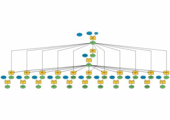
9 Model Elements

10 What tools should I use? Look in Data Management toolbox Many tools to create geodatabase objects


11 Demo 1 ModelBuilder Review Discover tools Renaming model elements Creating basic schema Pop-ups for gathering info
12 Esri UC 2014 Technical Workshop Schema Creation
13 What is schema?

14 Photo credit aius Source: flickr.com

15 Photo credit Tony Buser Source: flickr.com

16
 Source: flickr.")
17 Photo credits: bmb, aplysia_06, steve.abraham (flickr users) Source: flickr.com

18 Getting started Requirements Prototype Deployment

19 Esri UC 2014 Technical Workshop Model Tools
20 Model tools Built in tools = good but limited Model tools - Implement custom behavior - Group of tasks - Run like system tools
21 Why create model tools? Reduce clutter, improve readability - Fewer tools Reduce data entry - Fewer parameters to change
22 Growing pains

23 Organizing your tools
24 Turning models into model tools Model parameter - Allow tools to consume other tools Can be any parameter within the tool Input and output (derived) parameters
25 Creating a model tool

26 Creating a model tool
27 Creating a model tool
28 Creating a model tool

29 Creating a model tool
30 Creating a model tool
31 Creating a model tool

32 Creating a model tool

33 Organizing your models Organize your models into logical groups - Feature datasets - Departments in your organization - Applications you are building - Domains* Makes schema modular
34 Overriding Default Behavior Tips and tricks
35 Overriding Default Behavior Tips and tricks

36 Overriding Default Behavior Tips and tricks


37 Overriding Default Behavior Tips and tricks Geometry type = POINT Has Z = ENABLED Coordinate System = Web Mercator

38 Overriding Default Behavior Tips and tricks
39 Overriding Default Behavior Tips and tricks
40 Template Feature Class or Template Table More tips and tricks Create feature class and Create table tools All template fields will be in the output Use when creating the same field/type in multiple tables/feature classes


41 Template Feature Class or Template Table More tips and tricks
42 Demo 2 Schema Creation with Model Tools Implement data model Geodatabase behavior Template Feature Class/Table Model tools as sub models
43 Esri UC 2014 Technical Workshop Python
44 Script tools Get access to: - Programming logic - arcpy functions - Custom validation

45 Using Python for Geodatabase creation Improving user experience Focused functions Documentation - Reports
46 Reporting arcpy.list, arcpy.describe Examine contents of geodatabase Get information that is not reported through UI - Not easily returned from UI
47 Using a table to run a tool Look for: - Redundant info - Tools running multiple times Use cursors to loop through a table to get parameters.
48 Demo 3 Python Table to fields Reporting

49 Esri UC 2014 Technical Workshop Schema Changes
50 Data Modification Schema Changes Over time your data model will change. Use additional models or scripts to push out updates. Deploy when appropriate. Requirements Prototype Deployment
51 Schema Changes Change documentation No recreating schema or reloading data Schedule changes via simple scripts Report on dependencies
52 Domain Report Tool


53 Domain Report Tool
54

55 Esri UC 2014 Technical Workshop

56 Esri UC 2014 Technical Workshop
57 Scheduling Important to reduce downtime. Simple to schedule using OS scheduler
58 Inline Variables in ModelBuilder Tips and Tricks Use the contents of one variable as a substitute for another variable Enclose the substituting variable in percent signs (%) - Eg: %Input Workspace% Dynamic - For schema creation they are essentially relative paths Example: - %InputWorkspace%\Street Centerlines - Gets evaluated as \\Database Connections\LandUse_Ian.sde\StreetCenterlines
59 Demo 4 Modifying Geodatabase Inline variables Scripting models Schedule changes

60 Enterprise Geodatabases Esri UC 2014 Technical Workshop
61 Considerations for enterprise Creating Users Creating Roles Assigning Privileges Managing Versions Registering data as versioned Replicas

62 Limitations Create Network Datasets Create Parcel Fabrics Create Annotation Create Schematic Dataset

63 Final Thoughts Use model tools and python Make schema changes easily Use Python to report Geoprocessing creates full featured geodatabases
64 Other Sessions - Geoprocessing ModelBuilder: Branching, Iterating, and Other Advanced Methods - Tuesday, 15 Jul 2014, 1:30pm - 2:45pm - Location: Room 04 - Wednesday, 16 Jul 2014, 3:15pm - 4:30pm - Location: Room 03 Python: Building Geoprocessing Tools - Tuesday, 15 Jul 2014, 3:15pm - 4:30pm - Location: Room 05 B - Wednesday, 16 Jul 2014, 10:15am - 11:30am - Location: Room 05 B ModelBuilder: Tips and Tricks - Wednesday, 16 Jul 2014, 10:30am - 11:00am - Location: Demo Theater - Analysis and Geoprocessing Exhibit Hall B
65 Other Sessions - Geodatabase Geodatabase Administration: An Introduction - Tuesday, 15 Jul 2014, 1:30pm - 2:45pm - Location: Room 07 A/B - Wednesday, 16 Jul 2014, 1:30pm - 2:45pm - Location: Room 07 A/B Many other Geodatabase sessions can be found in the User Conference agenda -
66 Thank you Please fill out the session survey: First Offering ID: 1189 Second Offering ID: 1410 Online Paper pick up and put in drop box

67
Developing Qt Apps with the Runtime SDK
 Developing Qt Apps with the Runtime SDK Thomas Dunn and Michael Tims Esri UC 2014 Technical Workshop Agenda Getting Started Creating the Map Geocoding and Routing Geoprocessing Message Processing Work
Designing and Using Cached Map Services
 Esri International User Conference San Diego, California Technical Workshops July 2012 Designing and Using Cached Map Services Sterling Quinn Eric Rodenberg What we will cover Session Topics - Map cache
PYTHON: BUILDING GEOPROCESSING TOOLS. David Wynne, Andrew Ortego
 PYTHON: BUILDING GEOPROCESSING TOOLS David Wynne, Andrew Ortego http://esriurl.com/creatingtools http://esriurl.com/creatingtoolspro Today Putting it together Source code Validation Parameters Best Practices
Advanced Parcel Editing. Amy Andis Tim Hodson
 Advanced Parcel Editing Amy Andis Tim Hodson Overview What to expect in this technical workshop Review of the Parcel Fabric Data Model Advanced Tips and tricks for Parcel entry Assessing Quality of Parcel
Accessing and Administering your Enterprise Geodatabase through SQL and Python
 Accessing and Administering your Enterprise Geodatabase through SQL and Python Brent Pierce @brent_pierce Russell Brennan @russellbrennan hashtag: #sqlpy Assumptions Basic knowledge of SQL, Python and
Building Java Apps with ArcGIS Runtime SDK
 Building Java Apps with ArcGIS Runtime SDK Mark Baird and Vijay Gandhi A step back in time Map making 50 years ago - http://www.nls.uk/exhibitions/bartholomew/maps-engraver - http://www.nls.uk/exhibitions/bartholomew/printing
PYTHON: BUILDING GEOPROCESSING TOOLS. David Wynne, Geri Miller
 PYTHON: BUILDING GEOPROCESSING TOOLS David Wynne, Geri Miller Why we build geoprocessing tools Your work becomes part of the geoprocessing framework - Easy to access and run from within ArcGIS - Familiar
Working with Feature Layers. Russell Brennan Gary MacDougall
 Working with Feature Layers Russell Brennan Gary MacDougall Working with Feature Layers Session will focus on feature access and editing Highlight new features added over the last few releases Agenda Introduction
Creating Geoprocessing Services and Web Tools. Darren Baird, PE, Esri
 Creating Geoprocessing Services and Web Tools Darren Baird, PE, Esri Introduction Both ArcMap and ArcGIS Pro are covered Terms Geoprocessing Services and Web Tools are the same - ArcMap publishes geoprocessing
Building Geoprocessing Tools with Python: Beyond the Basics. Dave Wynne
 Building Geoprocessing Tools with Python: Beyond the Basics Dave Wynne Building Geoprocessing Tools with Python: Getting Started Subhead Here This session will focus on creating polished, well-designed
Python Map Automation Beyond the Basics of arcpy.mapping
 2013 Esri International User Conference July 8 12, 2013 San Diego, California Technical Workshop Python Map Automation Beyond the Basics of arcpy.mapping Jeff Barrette Jeff Moulds Esri UC2013. Technical
Working with Metadata in ArcGIS
 Esri International User Conference San Diego, California Technical Workshops July 26, 2012 Working with Metadata in ArcGIS Aleta Vienneau Metadata in ArcGIS ArcGIS metadata goals Editing metadata Setting
ArcPad An Introduction
 2013 Esri International User Conference July 8 12, 2013 San Diego, California Technical Workshop ArcPad An Introduction Chris LeSeuer, Marika Vertzonis, Hannah Ferrier Esri UC2013. Technical Workshop.
Using Python with ArcGIS
 Using Python with ArcGIS Jason Pardy (jpardy@esri.com) Esri UC2013. Technical Workshop. Agenda A whirlwind tour Python Essentials Using Python in ArcGIS Python Tools Accessing Data Map Automation ArcGIS
Python: Developing Geoprocessing Tools. David Wynne, Jon Bodamer
 Python: Developing Geoprocessing Tools David Wynne, Jon Bodamer Abstract Join us as we step through the process of creating geoprocessing tools using Python. Using script tools and Python toolboxes as
Building tools with Python
 Esri International User Conference San Diego, California Technical Workshops 7/25/2012 Building tools with Python Dale Honeycutt Session description Building Tools with Python A geoprocessing tool does
Python - Raster Analysis
 Esri International User Conference San Diego, California Technical Workshops July 2012 Python - Raster Analysis Kevin M. Johnston Ryan DeBruyn The problem that is being addressed You have a complex modeling
PYTHON. Scripting for ArcGIS. writeoutput = Inputfc = ar. .ext.{) OUtpUt fc =.. Paul A. Zandbergen. axcpy random. .arcpy, Describe (' is.
 OUtpUt fc =.. Paul A. Zandbergen. axcpy random. .arcpy, Describe (' is.") ' Esri Press REDLANDS CALIFORNIA 'Ti axcpy random From arcpy import env writeoutput = Inputfc = ar OUtpUt fc = I aitcount = int (arcpy,g arcpy, Describe (' st [f = c ~- ist = [] = clesc,oidfrel ext{) r
' Esri Press REDLANDS CALIFORNIA 'Ti axcpy random From arcpy import env writeoutput = Inputfc = ar OUtpUt fc = I aitcount = int (arcpy,g arcpy, Describe (' st [f = c ~- ist = [] = clesc,oidfrel ext{) r
Python Raster Analysis
 2013 Esri International User Conference July 8 12, 2013 San Diego, California Technical Workshop Python Raster Analysis Kevin M. Johnston Ryan DeBruyn Nawajish Noman Esri UC2013. Technical Workshop. The
Sharing Web Layers and Services in the ArcGIS Platform. Melanie Summers and Ty Fitzpatrick
 Sharing Web Layers and Services in the Platform Melanie Summers and Ty Fitzpatrick Agenda Platform overview - Web GIS information model - Two deployment options Pro Sharing - User experience and workflows
ArcGIS Pro: What s New in Editing and Data Management
 Federal GIS Conference February 9 10, 2015 Washington, DC ArcGIS Pro: What s New in Editing and Data Management Robert LeClair ArcGIS Pro Overview Esri FedUC 2015 Technical Workshop ArcGIS Pro: What's
ModelBuilder: An Introduction. Kevin Armstrong
 ModelBuilder: An Introduction Kevin Armstrong What is ModelBuilder? A user-friendly way to automate a series of tools Part of the ArcGIS geoprocessing framework - ModelBuilder can run any tool in the ArcToolbox,
ArcGIS Viewer for Microsoft Silverlight An Introduction
 Esri International User Conference San Diego, CA Technical Workshops July 12, 2011 ArcGIS Viewer for Microsoft Silverlight An Introduction Art Haddad, Rich Zwaap, and Derek Law Agenda Background Product
An Introduction to Data Interoperability
 Esri International User Conference San Diego, California 2012 Technical Workshops July 24/25 An Introduction to Data Interoperability Bruce Harold - Esri Dale Lutz Safe Software Background Why Data Interoperability?
What s New for Developers in ArcGIS Maura Daffern October 16
 What s New for Developers in ArcGIS 10.1 Maura Daffern October 16 mdaffern@esri.ca Today s Agenda This seminar is designed to help you understand: 1) Using Python to increase productivity 2) Overview of
Network Analyst Creating Network Datasets. Colin Childs Alan Hatakeyama
 Network Analyst Creating Network Datasets Colin Childs Alan Hatakeyama Agenda Preparing street data for use in a network dataset - Oneway streets - Hierarchy - RoadClass attribute Using turns, signposts,
Python: Building Geoprocessing Tools
 FedGIS Conference February 13 14, 2017 Washington, DC Python: Building Geoprocessing Tools Michael Rhoades Frank Orr Why we build geoprocessing tools Your work becomes part of the geoprocessing framework
Building Applications with the ArcGIS Runtime SDK for WPF
 Esri International User Conference San Diego, California Technical Workshops 24 th July 2012 Building Applications with the ArcGIS Runtime SDK for WPF Euan Cameron & Paul Pilkington Agenda Introduction
Network Analyst: An Introduction
 2013 Esri International User Conference July 8 12, 2013 San Diego, California Technical Workshop Network Analyst: An Introduction Patrick Stevens Robert Garrity Esri UC2013. Technical Workshop. Introduction
ArcGIS Pro Tasks: Tips and Tricks. Jason Camerano
 ArcGIS Pro Tasks: Tips and Tricks Jason Camerano Who has used Tasks in ArcGIS Pro? Show of hands What You Will Learn From This Session Spoiler: A Lot! As a User: - Helpful tricks to run Tasks efficiently
ArcMap Editing Tips and Tricks. Sean Jones
 ArcMap Editing Tips and Tricks Sean Jones Overview Topics - Tuning your editing map - Creating features - Editing features and attributes - Aligning and editing coincident features - Addins Format - Software
Enabling High-Quality Printing in Web Applications. Tanu Hoque & Jeff Moulds
 Enabling High-Quality Printing in Web Applications Tanu Hoque & Jeff Moulds Print Service Technical Session Outline What s new in 10.6x What is Print Service Out of the box print solutions Print service
Network Analysis with ArcGIS Online and On-premise Services
 2013 Esri International User Conference July 8 12, 2013 San Diego, California Technical Workshop Network Analysis with ArcGIS Online and On-premise Services Deelesh Mandloi Dmitry Kudinov Esri UC2013.
ArcGIS Pro: Mapping & Visualization. David Watkins, Edie Punt &
 ArcGIS Pro: Mapping & Visualization David Watkins, Edie Punt & Craig Williams @daviddwatkins, @epunt, & @williamscraigm Mapping an Visualization Vision In ArcGIS Pro Improve drawing performance and quality
Python: Beyond the Basics. Michael Rhoades
 Python: Beyond the Basics Michael Rhoades Python: Beyond the Basics Synopsis This session is aimed at those with Python experience and who want to learn how to take Python further to solve analytical problems.
Data Interoperability An Introduction
 Data Interoperability An Introduction Bruce Harold Dale Lutz - Esri Inc - Safe Software What is the Data Interoperability Extension? Moving data from app to app ETL in industry jargon If you are not the
ArcGIS Pro Editing: An Introduction. Jennifer Cadkin & Phil Sanchez
 ArcGIS Pro Editing: An Introduction Jennifer Cadkin & Phil Sanchez See Us Here WORKSHOP ArcGIS Pro Editing: An Introduction LOCATION SDCC - Ballroom 20 D TIME FRAME Thursday 10:00 11:00 ArcGIS Pro: 3D
Administering Your Microsoft SQL Server Geodatabase
 Esri International User Conference San Diego, California Technical Workshops July 25, 2012 Administering Your Microsoft SQL Server Geodatabase Thomas Dunn and Shannon Shields Topics for this presentation
Utility Network Management in ArcGIS: Migrating Your Data to the Utility Network. John Alsup & John Long
 Utility Network Management in ArcGIS: Migrating Your Data to the Utility Network John Alsup & John Long Presentation Outline Utility Network Preparation - Migration Patterns - Understanding the Asset Package
ArcGIS Desktop: Introduction to Geoprocessing with ModelBuilder Kevin Armstrong ESRI
 ArcGIS Desktop: Introduction to Geoprocessing with ModelBuilder Kevin Armstrong ESRI SERUG 2008 1 What is ModelBuilder? A user-friendly way to automate a series of tools Part of the ArcGIS geoprocessing
Using ArcGIS for Server in the Microsoft Azure Cloud
 Using ArcGIS for Server in the Microsoft Azure Cloud Nikhil Shampur Esri UC 2014 Demo Theater Agenda ArcGIS on Azure - What - Why - How - When What Esri UC 2014 Demo Theater Using ArcGIS in the Microsoft
ArcGIS Desktop The Road Ahead. Amadea Azerki
 ArcGIS Desktop The Road Ahead Amadea Azerki Agenda An Overview of ArcGIS 10 Desktop Enhancements User Interface Mapping Editing Analysis Sharing Q & A ArcGIS 10 Overview Focuses on Usability and Productivity
Esri Production Mapping: Configuring the Solution for Civilian Topographic Agencies. Sean Granata
 Esri Production Mapping: Configuring the Solution for Civilian Topographic Agencies Sean Granata What s New Version 4.0 (Released) - Distributed Generalization Version 5.0 - Support for 10K Map Products
Python Getting Started
 2013 Esri International User Conference July 8 12, 2013 San Diego, California Technical Workshop Python Getting Started Drew Flater, Ghislain Prince Esri UC2013. Technical cal Workshop op. Does this describe
Network Analyst Creating Network Datasets
 2013 Esri International User Conference July 8 12, 2013 San Diego, California Technical Workshop Network Analyst Creating Network Datasets Colin Childs Alan Hatakeyama Esri UC2013. Technical Workshop.
Creating Apps Using ArcGIS Online Templates. Matt Kennedy
 Creating Apps Using ArcGIS Online Templates Matt Kennedy Topics we will cover The publishing process Before you publish Where apps live Breakdown of apps Publishing web app templates The steps for publishing
Creating Mosaic Datasets and Publishing Image Services using Python
 Creating Mosaic Datasets and Publishing Image Services using Python Jie Zhang, Jamie Drisdelle Session Offering ID: 305 Overview Introduction to mosaic dataset Raster product for sensor imagery Automatic
Using Python with ArcGIS
 Using Python with ArcGIS Jason Pardy (jpardy@esri.com) Javier Abadia (javier.abadia@esri.es) Esri UC2013. Technical Workshop. Agenda A whirlwind tour Jason: Python Essentials Using Python in ArcGIS Python
Using Python in ArcGIS Oli Helm May 2, 2013
 Using Python in ArcGIS 10.1 Oli Helm May 2, 2013 ohelm@esri.ca Today s Agenda This seminar is designed to help you understand: 1) Python Essentials 2) What s new in Python in ArcGIS 10.1 3) Python Add-Ins
Understanding and Using Metadata in ArcGIS. Adam Martin Marten Hogeweg Aleta Vienneau
 Understanding and Using Metadata in ArcGIS Adam Martin Marten Hogeweg Aleta Vienneau Adam Martin National Government Account Management R&D Open Data Marten Hogeweg National Government Professional Services
Topology in the Geodatabase: An Introduction
 Topology in the Geodatabase: An Introduction Colin Zwicker Erik Hoel ESRI Super Secret Topology Laboratory, May 2016 Agenda ArcGIS Topology defined Validating a topology Editing a topology Geoprocessing
ArcPad An Introduction
 ArcPad An Introduction Chris LeSueur, Marika Vertzonis, Hannah Ferrier ArcPad Sessions at the UC Demo Theatre - Preparing and Deploying Data to ArcPad - Using ArcPad in the Field - Customizing ArcPad without
Topology in the Geodatabase an Introduction. Erik Hoel Doug Morgenthaler
 Topology in the Geodatabase an Introduction Erik Hoel Doug Morgenthaler ESRI Super Secret Topology Laboratory, May 2012 Agenda ArcGIS Topology defined Validating a topology Editing a topology Geoprocessing
Network Analyst: Performing Network Analysis
 Esri International User Conference San Diego, California Technical Workshops July 24, 2012 Network Analyst: Performing Network Analysis Jay Sandhu Deelesh Mandloi Goals We assume you have some familiarity
Troubleshooting Performance Issues with Enterprise Geodatabases. Ben Lin, Nana Dei, Jim McAbee
 Troubleshooting Performance Issues with Enterprise Geodatabases Ben Lin, Nana Dei, Jim McAbee blin@esri.com ndei@esri.com jmcabee@esri.com Workshop Agenda Performance Troubleshooting (Then & Now) Real-World
KENYA 2019 Training Schedule
 KENYA 2019 Training Schedule Monday Tuesday Wednesday Thursday Friday 4th Feb 5th Feb 6th Feb 7th Feb 8th Feb Using 11th Feb 12th Feb 13th Feb 14th Feb 15th Feb Using (cont...) Field Data Collection and
Understanding and using Metadata across the ArcGIS Platform. Aleta Vienneau Marten Hogeweg
 Understanding and using Metadata across the ArcGIS Platform Aleta Vienneau Marten Hogeweg Understanding and using Metadata across the ArcGIS Platform Metadata fundamentals ArcGIS platform Road ahead Metadata
What Makes a good content item GREAT?
 What Makes a good content item GREAT? Keith VanGraafeiland Tuesday - 4:30 PM - 5:15 PM SDCC - Demo Theater 04 - Living Atlas Overview Subhead Here Content items in ArcGIS Online Difficult to find what
Configuring the ArcGIS for Local Government Solution
 Configuring the ArcGIS for Local Government Solution Lindsay Thomas Steve Grise Scott Oppmann Esri UC 2015 Technical Workshop Agenda Introduction Configuration Patterns Implementation Approaches Your Feedback
Web AppBuilder Presented by
 Web AppBuilder Presented by Agenda Product overview Web AppBuilder for ArcGIS tour What s new in the ArcGIS Online June 2016 update Customization Community and Resources Summary The ArcGIS Platform enables
Editing Versioned Geodatabases : An Introduction
 Esri International User Conference San Diego, California Technical Workshops July 24, 2012 Editing Versioned Geodatabases : An Introduction Cheryl Cleghorn Shawn Thorne Assumptions: Basic knowledge of
Does Your Data Have Harmony. Dan Stone
 Does Your Data Have Harmony Dan Stone Agenda Introduction Configuration Patterns Implementation Approaches Your Feedback ArcGIS for Local Government Esri solutions for local government customers Series
Data Interoperability An Introduction
 2013 Esri International User Conference July 8 12, 2013 San Diego, California Technical Workshop Data Interoperability An Introduction Bruce Harold Esri Dale Lutz Safe Software Background Why Data Interoperability?
Python: Getting Started. Ben
 Python: Getting Started Ben Ramseth bramseth@esri.com @esrimapninja E M E R A L D S A P P H I R E T H A N K Y O U T O O UR SPONSORS Topics covered What s is python? Why use python? Basics of python ArcPy
Administering Your Oracle Geodatabase. Amit Kesarwani Mandar Purohit
 Administering Your Oracle Geodatabase Amit Kesarwani Mandar Purohit Intended Audience Desktop Web Device You are.. - A geodatabase administrator - An accidental DBA - A deliberate DBA Portal Portal Server
Leveraging SAP HANA and ArcGIS. Melissa Jarman Eugene Yang
 Melissa Jarman Eugene Yang Outline SAP HANA database ArcGIS Support for HANA Database access Sharing via Services Geodatabase support Demo SAP HANA In-memory database Support for both row and column store
Getting Started with ArcGIS Runtime SDK for Qt. Thomas Dunn & Nandini Rao
 Getting Started with ArcGIS Runtime SDK for Qt Thomas Dunn & Nandini Rao Agenda Getting Started Creating the Map Geocoding and Routing Geoprocessing Message Processing Work Offline The Next Release ArcGIS
Using Python in ArcGIS Steven Beothy May 28, 2013
 Using Python in ArcGIS 10.1 Steven Beothy sbeothy@esri.ca May 28, 2013 Today s Agenda This seminar is designed to help you understand: 1) Python and how it can be used 2) What s new in Python in ArcGIS
Customizing the Operations Dashboard for ArcGIS
 2013 Esri International User Conference July 8 12, 2013 San Diego, California Technical Workshop Customizing the Operations Dashboard for ArcGIS Kylie Donia and Tif Pun Esri UC2013. Technical Workshop.
Network Analyst Creating Network Datasets. Jay Sandhu Frank Kish
 Network Analyst Creating Network Datasets Jay Sandhu Frank Kish Agenda Preparing Street Data for use in a network dataset - One-way streets - Hierarchy - RoadClass attribute Using turns, signposts, and
ArcGIS Pro SDK for.net: An Overview of the Geodatabase API. Colin Zwicker Ling Zhang Nghiep Quang
 ArcGIS Pro SDK for.net: An Overview of the Geodatabase API Colin Zwicker Ling Zhang Nghiep Quang What will not be deeply discussed Add-in model & threading model - ArcGIS Pro SDK for.net: Beginning Pro
Desktop. ArcGIS Server. ArcGIS
 Getting Started with ArcGIS Server Nakul Bhatia and David Crosby ESRI Charlotte 1 Agenda g Overview of ArcGIS Server 9.3.1 Working with GIS Services Using g Web GIS Service Clients ArcGIS Online Map Caching
Esri Production Mapping An Introduction
 Esri International User Conference San Diego, California Technical Workshops July 25, 2012 Esri Production Mapping An Introduction Lana Tylka Amber Bethell Workshop Overview Part I - Industry challenges
ArcGIS Runtime SDK for.net Getting Started. Jo Fraley
 ArcGIS Runtime SDK for.net Getting Started Jo Fraley Agenda What is the ArcGIS Runtime? What s new for ArcGIS developers? ArcGIS Runtime SDK 10.2 for WPF ArcGIS Runtime SDK for.net Building Windows Store
ArcGIS Pro Tasks: An Introduction. Jason Camerano Amir Bar-Maor
 ArcGIS Pro Tasks: An Introduction Jason Camerano Amir Bar-Maor Live Call With Esri Technical Support Esri Technical support: Jason Customer: Amir Warning: there is a test in the end of the presentation
Introduction to Geodatabase and Spatial Management in ArcGIS. Craig Gillgrass Esri
 Introduction to Geodatabase and Spatial Management in ArcGIS Craig Gillgrass Esri Session Path The Geodatabase - What is it? - Why use it? - What types are there? - What can I do with it? Query Layers
Python: Beyond the Basics. Brittney White
 Python: Beyond the Basics Brittney White Topics Covered Cursors Geometry objects Leveraging other Python modules Cursors Used to: - Iterate over the set of rows in a table - Insert new rows into a table
ArcGIS Enterprise: Portal Administration BILL MAJOR CRAIG CLEVELAND
 ArcGIS Enterprise: Portal Administration BILL MAJOR CRAIG CLEVELAND Agenda Welcome & Introduction to ArcGIS Enterprise Portal for ArcGIS - Basic Configuration - Advanced Configuration - Deploying Apps
Administering Your ArcGIS Enterprise Portal Bill Major Craig Cleveland
 Administering Your ArcGIS Enterprise Portal Bill Major Craig Cleveland Agenda Welcome & Introduction to ArcGIS Enterprise Portal for ArcGIS Administration - Basic Configuration - Advanced Configuration
ArcGIS Runtime SDKs Building Offline Apps. Nick Furness
 ArcGIS Runtime SDKs Building Offline Apps Nick Furness Agenda The basics - Considerations - Building blocks - Service types New! Offline maps New! Preplanned workflow What we are covering and what not
ArcGIS Viewer for Silverlight Advanced Topics
 Esri International User Conference San Diego, California Technical Workshops July 26, 2012 ArcGIS Viewer for Silverlight Advanced Topics Rich Zwaap Agenda Add-ins overview Tools Behaviors Controls Layouts
Using Python with ArcGIS
 Using Python with ArcGIS Drew Flater, Nobbir Ahmed Offering 184 Agenda Python essentials Arcpy, functions & classes Script geoprocessing workflows Automate map management & production Customize Desktop
Collector for ArcGIS: What s New. Chris LeSueur & James Tedrick
 Collector for ArcGIS: What s New Chris LeSueur & James Tedrick Outline Product overview Workflows Preparing data for Collector for ArcGIS What s new in Collector for ArcGIS v18.1.0 (Aurora) Advanced topics
Parallel Python: Multiprocessing With ArcPy. Clinton Dow Geoprocessing Neeraj Rajasekar Spatial Analyst
 Parallel Python: Multiprocessing With ArcPy Clinton Dow Geoprocessing Neeraj Rajasekar Spatial Analyst Agenda What Multiprocessing Is What Multiprocessing Is Not Demo of Multiprocessing Modules - Multiprocessing
ArcMap: Tips and Tricks
 Esri International User Conference San Diego, California Technical Workshops July 23 27, 2012 ArcMap: Tips and Tricks Miriam Schmidts Jorge Ruiz-Valdepena Agenda Navigating ArcMap Repairing data links
ArcGIS Apps: An Overview
 Federal GIS Conference February 9 10, 2015 Washington, DC ArcGIS Apps: An Overview Chris LeSueur Product Manager Marisa Cowdry NCMEC Agenda Apps Introduction Rugged Device Apps Essential Mapping Apps -
Creating and Maintaining Your 3D Basemap. Brian Sims Dan Hedges Gert van Maren
 Creating and Maintaining Your 3D Basemap Brian Sims Dan Hedges Gert van Maren Complementary Resource Email (no marketing) A copy of the presentation Links to today s web demos Links to training materials
Developing Mobile Apps with the ArcGIS Runtime SDK for.net
 Developing Mobile Apps with the ArcGIS Runtime SDK for.net Rich Zwaap Morten Nielsen Esri UC 2014 Technical Workshop Agenda The ArcGIS Runtime Getting started with.net Mapping Editing Going offline Geocoding
ArcGIS Enterprise Security: An Introduction. Gregory Ponto & Jeff Smith
 ArcGIS Enterprise Security: An Introduction Gregory Ponto & Jeff Smith Agenda ArcGIS Enterprise Security Model Portal for ArcGIS Authentication Authorization Building the Enterprise Encryption Collaboration
Introduction to Web AppBuilder for ArcGIS: JavaScript Apps Made Easy
 Introduction to Web AppBuilder for ArcGIS: JavaScript Apps Made Easy Jianxia Song & Derek Law July 21, 2015 Agenda Product overview Web AppBuilder for ArcGIS tour What s New July 2015 ArcGIS Online update
ArcPy Tips & Tricks. Clinton Dow Geoprocessing Product Esri
 ArcPy Tips & Tricks Clinton Dow Geoprocessing Product Engineer @ Esri Tip #1 ArcPy in an IDE GIS from the comfort of your development environment Recommended IDEs - PyCharm - Python Tools for Visual Studio
ArcGIS for Developers: An Introduction. Moey Min Ken
 ArcGIS for Developers: An Introduction Moey Min Ken AGENDA Is development right for me? Building Apps on the ArcGIS platform Rest API & Web API Native SDKs Configurable Apps and Builders Extending the
Extending ArcGIS for Server. Jon Satchwell, Esri Switzerland Cédric Despierre Corporon, Esri France
 Extending ArcGIS for Server Jon Satchwell, Esri Switzerland Cédric Despierre Corporon, Esri France Agenda Introduction Server Object Extensions Server Object Interceptors THE BIG WEBGIS PICTURE Introduction
ArcGIS Runtime SDK for Qt: Building Apps. Koushik Hajra and Lucas Danzinger
 ArcGIS Runtime SDK for Qt: Building Apps Koushik Hajra and Lucas Danzinger Cross-platform apps Agenda for today Intro to Qt Framework and ArcGIS Runtime SDK for Qt App design patterns with this SDK SDK
Python: Beyond the Basics. Brittney White, Esri Jordan Douthitt, Pennsylvania State University
 Python: Beyond the Basics Brittney White, Esri Jordan Douthitt, Pennsylvania State University Topics Covered Cursors Geometry objects Leveraging other Python modules User presentation: Location-Based Analysis
Annotation/Labeling Workshop. Tim Rankin Pat Dolan
 Annotation/Labeling Workshop Tim Rankin Pat Dolan Agenda 8:00am - Introductions 8:05am - Goals of the Workshop 8:15am Labeling 8:45am Annotation Part I 9:15am Break 9:25am Annotation Part II 9:50am Questions
Caching Imagery Using ArcGIS
 2013 Esri International User Conference July 8 12, 2013 San Diego, California Technical Workshop Caching Imagery Using ArcGIS Hong Xu, Hua Wei Esri UC2013. Technical Workshop. Presentation Goals Publish
ArcGIS for Server Performance and Scalability Optimizing GIS Services
 Esri International User Conference San Diego, California Technical Workshops July 26, 2012 ArcGIS for Server Performance and Scalability Optimizing GIS Services Andrea Rosso (Esri), Craig Williams (Esri),
PUG List. Raster Analysis 3D Analysis Geoprocessing. Steve Kopp
 PUG List Raster Analysis 3D Analysis Geoprocessing Steve Kopp Contour Polygons Spatial Analyst - color-filled contours. Similar to thematic classification, where blue = -1000 to zero, and red = 0 to +1000,
Building WPF Apps with the new ArcGIS Runtime SDK for.net. Antti Kajanus Mike Branscomb
 Building WPF Apps with the new ArcGIS Runtime SDK for.net Antti Kajanus Mike Branscomb Agenda ArcGIS Runtime SDK for.net Windows Desktop API Build a map Edit Search Geocoding and Routing Perform analysis