EFFECTIVE GEODATABASE PROGRAMMING
|
|
|
- Imogen Quinn
- 6 years ago
- Views:
Transcription


1 Esri Developer Summit March 8 11, 2016 Palm Springs, CA EFFECTIVE GEODATABASE PROGRAMMING Colin Zwicker Erik Hoel
2 Purpose Cover material that is important to master in order for you to be an effective Geodatabase programmer Provide additional insight regarding how we (the Geodatabase development team) conceptualize the architecture General focus areas: - Best practices - Common questions - New programming patterns 2
3 Assumptions Good working knowledge of the Geodatabase and experience in programming against the GDB API Code examples will use Java, C#, or C++ Lots of technical content, very little time (60 minutes) - Please save questions for the end Slides intended to be later used by you as a reference - Extra bonus material in the downloadable version 3
4 Outline Unique Instancing of Objects Cursors Caching Geodatabase Data - Spatial and Schema Caches Schema Locks Core.Data - the Pro Managed SDK Top Developer Mistakes 4
5 Outline Unique Instancing of Objects Cursors Caching Geodatabase Data - Spatial and Schema Caches Schema Locks Core.Data - the Pro Managed SDK Top Developer Mistakes 5
6 Unique Instancing of Objects Geodatabase objects that will have at most one instance instantiated - Similar to COM singletons except they are not cocreateable - Examples: - Datasets (tables, feature classes, feature datasets) - Workspaces and versions Regardless of the API that handed out the reference, it is the same reference Changes to the object affect all holders of the reference 6
; IVersion default2 = vw.findversion(\"default\"); } System.out.println(default2.")
; IFeatureClass fc2 = workspace.openfeatureclass(\"gdb.dbo.stateboundaries\"); IFeatureDataset fd3 = workspace.")
7 Unique Instancing of Objects public void run(workspace workspace) throws IOException, AutomationException { IVersionedWorkspace vw = new IVersionedWorkspaceProxy(workspace); IVersion default1 = vw.getdefaultversion(); IVersion default2 = vw.findversion("default"); } System.out.println(default2.equals(default1)); <<- true public void run(workspace workspace) throws IOException, AutomationException { IFeatureClass fc1 = workspace.openfeatureclass("stateboundaries"); IFeatureClass fc2 = workspace.openfeatureclass("gdb.dbo.stateboundaries"); IFeatureDataset fd3 = workspace.openfeaturedataset("unitedstates"); IFeatureClassContainer fcc = new IFeatureClassContainerProxy(fd3); IFeatureClass fc3 = fcc.getclassbyname("stateboundaries"); System.out.println(fc1.equals(fc2)); <<- true System.out.println(fc1.equals(fc3)); <<- true System.out.println(fc2.equals(fc3)); <<- true } 7
; IFeature f1 = fc1.getfeature(1); IFeature f2 = fc1.getfeature(1); System.out.println(f2.")
8 Unique Instancing of Objects Special Case Rows / features uniquely instanced only within an edit session public void run(workspace workspace) throws IOException, AutomationException { IFeatureClass fc1 = workspace.openfeatureclass("stateboundaries"); IFeature f1 = fc1.getfeature(1); IFeature f2 = fc1.getfeature(1); System.out.println(f2.equals(f1)); <<- false IMultiuserWorkspaceEdit workspaceedit = new IMultiuserWorkspaceEditProxy(workspace); workspaceedit.startmultiuserediting(esrimultiusereditsessionmode.esrimesmnonversioned); IFeature fe1 = fc1.getfeature(1); IFeature fe2 = fc1.getfeature(1); System.out.println(fe2.equals(fe1)); <<- true } workspace.stopediting(false); 8
9 Outline Unique Instancing of Objects Cursors Caching Geodatabase Data - Spatial and Schema Caches Schema Locks Core.Data - the Pro Managed SDK Top Developer Mistakes 9
10 Cursor Types Three class cursors - Search (general queries) - Update (positioned updates) - Insert (bulk inserts) One QueryDef cursor - Defined query (e.g., IQueryDef.Evaluate) What s the difference? - Rows created by class cursors are bound to the class which created the cursor - Rows created by a QueryDef cursor are not bound to a class 10
; ICursor classcursor = testtable.itable_search(null, true); IRow classrow = classcursor.nextrow(); ITable rowtable = classrow.gettable(); System.out.println(rowTable.")
11 Cursor Types Example highlighting class binding public void run(workspace workspace) throws IOException, AutomationException { ITable testtable = workspace.opentable("parcels"); ICursor classcursor = testtable.itable_search(null, true); IRow classrow = classcursor.nextrow(); ITable rowtable = classrow.gettable(); System.out.println(rowTable.equals(testTable)); <<-- PRINTS true IQueryDef qdef = workspace.createquerydef(); qdef.settables("parcels"); ICursor querycursor = qdef.evaluate(); IRow queryrow = querycursor.nextrow(); } try { ITable querytable = queryrow.gettable(); } catch (AutomationException ax) { System.out.println(ax.getMessage()); <<-- PRINTS AutomationException Message } 11
12 Search Cursors All purpose class-based query API - Common APIs which create search cursors - ITable.Search, GetRow, GetRows, ISelectionSet.Search When in an edit session, the query may be satisfied by a cache (spatial cache, object pool) When used within an edit session will only flush the class cached rows - Could result in a database write Resulting rows can be modified - Store / Delete supported 12
13 Update Cursors Positional update cursor - NextRow->UpdateRow NextRow->UpdateRow - Update the row at the current cursor position Common APIs which create update cursors - ITable.Update, ISelectionSet2.Update Query is never satisfied by a cache - Use within an edit session will only flush the class cached rows Resulting rows can be modified using ICursor.UpdateRow or ICursor.DeleteRow - Should not be combined with Store and Delete 13
14 Update Cursors If the class supports Store events - An internal search cursor is created and UpdateRow and DeleteRow become equivalent to Row.Store and Row.Delete As a developer how do you know if the class supports Store events? - Non-simple feature types (!esriftsimple) - Class participates in geometric network or relationships that require messaging - Custom features (ObjectClassExtension overrides) UpdateRow method behaviors - Error if called with a row that was not retrieved from the update cursor - Error if called with a row not at the current position 14
15 Update Cursors Best Practices Do not use an update cursor across edit operations when editing - Very important when editing versioned data - Will throw an error Why? Because update cursors point to a specific state in the database - This state could get trimmed during a edit sessions - Updates could be lost! Best Practice always scope the cursor to the edit operation - If you start a new edit operation you should get a new update cursor 15
16 Insert Cursors Primary use is for bulk inserts API which creates an insert cursor - ITable.Insert Best performance when using buffering and proper flushing If the class supports Store events (non-simple), the search cursor semantics will be simulated - InsertRow becomes CreateRow and Store 16
17 Insert Cursors - Buffering Call the ITable.Insert method with the argument usebuffering set to true Periodically call Flush rows per flush is a good starting number - The higher the flush interval the less network traffic (but more re-insertion) Try to ensure that the class has no spatial cache extra processing is required to keep the cache in sync Crucial that calls to InsertRow and Flush have the proper error handling since both can result in rows written to the database 17
18 QueryDef Cursors Executes user defined query (not bound to class) QueryDef cursors always bypass any row cache held by the class / workspace IQueryDef.Evaluate within an edit session will cause all cached rows to be flushed Rows from QueryDef cursors do not support APIs which modify the row - Store not supported - Delete not supported 18
19 Recycling Cursors What are they? A recycling cursor is a cursor that does not create a new client side row object for each row retrieved from the database Internal data structures and objects will be re-used - Memory - Object instances (e.g., Geometry) Geodatabase APIs which support the creation of recycling cursors have a boolean method argument - recycling = true creates a recycling cursor 19
20 Recycling Cursors Interfaces supporting recycling cursors ITable / IFeatureClass - GetRows / GetFeatures - Search - Update ISelectionSet / ISelectionSet2 - Search - Update ITableWrite - UpdateRows 20
; ICursor cursor = testtable.itable_search(null, true); <<-- recycling IRow firstrow = cursor.nextrow(); IRow secondrow = cursor.nextrow(); } if (firstrow!= null && secondrow!")
21 Recycling Cursors - Example Calls to NextRow result in the same row instance public void run(workspace workspace) throws IOException, AutomationException { ITable testtable = workspace.opentable("road_node"); ICursor cursor = testtable.itable_search(null, true); <<-- recycling IRow firstrow = cursor.nextrow(); IRow secondrow = cursor.nextrow(); } if (firstrow!= null && secondrow!= null) { } System.out.println(secondRow.equals(firstRow)); <<-- PRINTS true 21
; <<-- recycling int gidx = cursor.findfield(\"location\"); IRow firstrow = cursor.nextrow(); IGeometry firstgeometry = new IGeometryProxy(firstRow.")
22 Recycling Cursors - Example public void run(workspace workspace) throws IOException, AutomationException { ITable testtable = workspace.opentable("road_node"); ICursor cursor = testtable.itable_search(null, true); <<-- recycling int gidx = cursor.findfield("location"); IRow firstrow = cursor.nextrow(); IGeometry firstgeometry = new IGeometryProxy(firstRow.getValue(gidx)); IRow secondrow = cursor.nextrow(); IGeometry secondgeometry = new IGeometryProxy(secondRow.getValue(gidx)); } if (firstgeometry!= null && secondgeometry!= null) { } System.out.println(secondGeometry.equals(firstGeometry)); <<-- true 22
23 Recycling Cursors When they should be used When you don t need to persist a reference to a row Don t pass it around - Isolate use of references to the local method which created the recycling cursor to minimize potential bugs - Do not pass the references around as some other method may decide to hold it Never directly edit a recycled row Proper use within an edit session can dramatically reduce resource consumption 23
; IMultiuserWorkspaceEdit workspaceedit = new IMultiuserWorkspaceEditProxy(workspace); workspaceedit.")
24 Recycling Cursor - Reduced resource consumption public void run(workspace workspace, boolean recycling) throws IOException, AutomationException { ITable testtable = workspace.opentable("road_node_small"); IMultiuserWorkspaceEdit workspaceedit = new IMultiuserWorkspaceEditProxy(workspace); workspaceedit.startmultiuserediting(esrimesmnonversioned); } ICursor cursor = testtable.itable_search(null, recycling); IRow row = cursor.nextrow(); while (row!= null) { System.out.println("OID: " + row.getoid()); row = cursor.nextrow(); } workspace.stopediting(false); <<-- BREAKPOINT Test data: 50,000 rows with ~75 fields - recycling = true ~60MB memory - recycling = false ~185MB memory 24
25 Non-Recycling Cursors - What are they? A cursor that creates a new client side row object for each row retrieved from the database New internal data structures and objects will be created for each row - Memory - Object instances (e.g., Geometry) Geodatabase APIs which support the creation of non-recycling cursors have a boolean method argument - recycling = false creates a non-recycling cursor 25
26 Non-Recycling Cursors - When to use? When references to the current row and its values need to be persisted Commonly used to cache sets of rows (long lived references) Some Geodatabase APIs require sets of rows should be retrieved as non-recycled rows Always edit non-recycled rows 26
27 Cursor FAQs Question: When should I release a reference to a cursor? Answer: Do not hold cursor references if they are not needed - Release ASAP after fetching is completed - Alternatively, release after application is done with the cursor 27
; ICursor cursor = testtable.itable_search(null, true); IRow row = cursor.nextrow(); workspace.stopeditoperation(); workspace.starteditoperation(); row = cursor.nextrow(); System.")
28 Cursor FAQs Question: If I need to use a cursor inside an edit session, where should I create the cursor? Answer: Inside the edit session, scope to edit operation // AVOID THIS PATTERN workspace.starteditoperation(); ICursor cursor = testtable.itable_search(null, true); IRow row = cursor.nextrow(); workspace.stopeditoperation(); workspace.starteditoperation(); row = cursor.nextrow(); System.out.println(row.getOID()); workspace.stopeditoperation(); 28
29 Cursor FAQs Question: Should I use a search cursor to update rows? Answer: Yes. In fact, using search cursors within an edit session is the recommended way to update rows 29
30 Cursor FAQs If I am editing existing data, what type of cursor should I use? ArcMap Engine Simple Data Engine Complex Data Inside Edit Session Search Search Search Outside Edit Session Search Update / ITableWrite Search ArcMap possibility that an active cache can satisfy the query and no DBMS query is required Engine Simple Data - Inside Edit Session take advantage of batched updates for edit operations - Outside Edit Session performance, can handle errors on a per row basis Engine Complex Data the system will emulate Search regardless 30
31 Outline Unique Instancing of Objects Cursors Caching Geodatabase Data - Spatial and Schema Caches Schema Locks Core.Data - the Pro Managed SDK Top Developer Mistakes 31
32 What is the Spatial Cache? Client side caching of feature values over a given spatial extent (Map Cache in ArcMap at 9.0+) Can speed up queries - Reduces roundtrips to the database When to use? - If making many spatial queries within a common extent ISpatialCacheManager2 - FillCache / EmptyCache - CacheExtent, CacheIsFull 32

fWorkspace; spcachemanager.")
33 Using the Spatial Cache //open feature class(es) before the cache is activated IFeatureClass featureclass = fworkspace.openfeatureclass( ParcelClass"); Spatial Query 1 ISpatialCacheManager spcachemanager = (ISpatialCacheManager)fWorkspace; spcachemanager.fillcache(queryenvelope); Spatial Query 2 Spatial Query 3 if (spcachemanager.cacheisfull) { //execute multiple spatial queries within the active cache extent } Spatial Query 4 33
 - Requires a static data model - GDB schema changes will not be reflected in the")
34 What is the Schema Cache? A cached snapshot of the Geodatabase schema - Used by ArcGIS (opening Map Documents, Reconcile) - Requires a static data model - GDB schema changes will not be reflected in the cache Can improve performance when opening datasets by reducing database round trips APIs to access the schema cache - IWorkspaceFactorySchemaCache 34
35 When to use the Schema Cache Beneficial when working with large static data models - Tables, fields, domains, subtypes, and relationships are well defined and will not change If the application opens and uses many classes - These should be opened at the start of the application and references maintained throughout the lifetime of the application - E.g., utility network models 35
36 How to use the Schema Cache Enable schema cache before tables are opened - Calls to OpenFeatureClass, OpenTable, IName.Open will be optimized - Can enable schema caching at the factory level (IWorkspaceFactorySchemaCache) Cache needs to be fresh - If in dynamic environments schema changes will not be visible until cache is refreshed if (scache.isschemacachestale(workspace)) scache.refreshschemacache(workspace); Your responsibility to disable the cache - Must be disabled before releasing the workspace object that is cached 36
37 Using Schema Caching Cast to IWorkspaceFactorySchemaCache from the workspace factory and open the workspace 1 IWorkspaceFactorySchemaCache scache = (IWorkspaceFactorySchemaCache)workspaceFactory; IWorkspace workspace = workspacefactory.open(propset, 0); scache.enableschemacache(workspace); IFeatureWorkspace featureworkspace = (IFeatureWorkspace)workspace; IFeatureClass parcel = featureworkspace.openfeatureclass("parcelclass"); //...open all feature classes used in application scache.disableschemacache(workspace); 37
38 Using Schema Caching Enable the schema cache on the workspace Alternatively EnableSchemaCaching will enable caching on all workspace passed out by the factory IWorkspaceFactorySchemaCache scache = (IWorkspaceFactorySchemaCache)workspaceFactory; IWorkspace workspace = workspacefactory.open(propset, 0); 2 scache.enableschemacache(workspace); IFeatureWorkspace featureworkspace = (IFeatureWorkspace)workspace; IFeatureClass parcel = featureworkspace.openfeatureclass("parcelclass"); //...open all feature classes used in application scache.disableschemacache(workspace); 38
39 Using Schema Caching Open all feature classes used in application Largest benefit for stand alone feature classes and tables IWorkspaceFactorySchemaCache scache = (IWorkspaceFactorySchemaCache)workspaceFactory; IWorkspace workspace = workspacefactory.open(propset, 0); scache.enableschemacache(workspace); 3 IFeatureWorkspace featureworkspace = (IFeatureWorkspace)workspace; IFeatureClass parcel = featureworkspace.openfeatureclass("parcelclass"); //...open all feature classes used in application scache.disableschemacache(workspace); 39
40 Using Schema Caching Disable the schema cache after the classes have been opened IWorkspaceFactorySchemaCache scache = (IWorkspaceFactorySchemaCache)workspaceFactory; IWorkspace workspace = workspacefactory.open(propset, 0); scache.enableschemacache(workspace); IFeatureWorkspace featureworkspace = (IFeatureWorkspace)workspace; IFeatureClass parcel = featureworkspace.openfeatureclass("parcelclass"); //...open all feature classes used in application 4 scache.disableschemacache(workspace); 40
workspaceFactory; IWorkspace workspace = workspacefactory.")
; IFeatureWorkspace featureworkspace = (IFeatureWorkspace)workspace; IFeatureClass parcel =")
41 Using Schema Caching - Gotchas Stale schema cached Geodatabase schema changes will not be visible until cache is refreshed IWorkspaceFactorySchemaCache scache = (IWorkspaceFactorySchemaCache)workspaceFactory; IWorkspace workspace = workspacefactory.open(propset, 0); scache.enableschemacache(workspace); IFeatureWorkspace featureworkspace = (IFeatureWorkspace)workspace; IFeatureClass parcel = featureworkspace.openfeatureclass("parcelclass"); //...open all feature classes used in application scache.disableschemacache(workspace); 41
42 Outline Unique Instancing of Objects Cursors Caching Geodatabase Data - Spatial and Schema Caches Schema Locks Core.Data - the Pro Managed SDK Top Developer Mistakes 42
43 Schema Locks Prevent clashes with other users when changing the geodatabase structure Exclusive and shared - ISchemaLock primarily used for establishing exclusive lock - Shared locks are applied when accessing the object - Promote a shared lock to an exclusive lock - Only one exclusive lock allowed Exclusive locks are not applied or removed automatically 43
44 Schema Locks When to use You must promote a shared lock to exclusive when doing schema modifications (DDL): - Modifications to attribute domains; coded or range - Adding or deleting a field to a feature or object class - Associating a class extension with a feature class - Creating a topology, geometric network, network dataset, terrain, schematic dataset, representation or cadastral fabric on a set of feature classes - Any use of the IClassSchemaEdit interfaces - IFeatureClassLoad.LoadOnlyMode - Rebuilding spatial and attribute indexes 44
45 Schema Locks Demote exclusive lock to shared lock when the modification is complete - Includes when errors are raised during the schema modification Keep your use of exclusive schema locks tight - Prevents clashes with other applications and users If your application keeps a reference to an object with an exclusive schema lock - You will need to handle the exclusive schema lock when the object is used 45
46 Outline Unique Instancing of Objects Cursors Caching Geodatabase Data - Spatial and Schema Caches Schema Locks Core.Data - the Pro Managed SDK Top Developer Mistakes 46
47 Core.Data ArcGIS Pro does not use the managed API for its internal implementation ArcObjects is not exposed to external developers -.NET API - Coarse grained objects (layer, CIM model, etc.) Add-In extensibility mechanism for external developers - Looser coupling at the application level than with ArcObjects Class Extensions 47
48 Core.Data Patterned after the Explorer Objects Data SDK - DDL Operations are not supported; only DML - DDL is done through Python, GP tools or the ArcGIS Pro UX - GP tools can be executed through the.net API 48
49 Core.Data Initially released at Pro 1.1 supporting the Web Geodatabase model - Defined by what the feature service supports - datastore, feature classes, tables, relationship classes, domains, subtypes, default values, attachments, editor tracking Will continue to grow to support ArcGIS Pro versioning, and feature service support database access, joins, query definitions (TBD) 49
50 Core.Data managed api implementation Client C# C++ Client Managed ArcObjects Native 50

51 Core.Data 51

52 Core.Data Geodatabase 52

53 Core.Data Feature Service 53

54 Core.Data Database (1.3 design) 54
55 Core.Data Dataset and Definition (abstract) 55

56 Core.Data Table 56
57 Core.Data FeatureClass 57


58 Core.Data Row and Feature 58


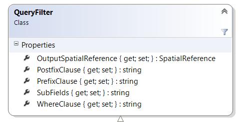


59 Core.Data QueryFilter, RowCursor, and Selection 59
60 Outline Unique Instancing of Objects Cursors Caching Geodatabase Data - Spatial and Schema Caches Schema Locks Core.Data - the Pro Managed SDK Top Developer Mistakes 60
61 Top Mistakes Misusing recycling cursors If recycling is enabled, a cursor only allocates memory for a single row regardless of how many rows are returned from the cursor - Performance benefits in terms of memory usage and running time, but has drawbacks for certain workflows - E.g., comparing the first two geometries from a feature cursor to see if they are equal 61
62 Top Mistakes Misusing recycling cursors 62
63 Top Mistakes Calling FindField in a Loop Relying on FindField as opposed to hard-coded field positions is a good practice but overusing FindField can hinder performance 63
64 Top Mistakes Cursors across edit operations Documented as a don t do this Blocked at
65 Top Mistakes DDL in edit sessions Methods that trigger DDL commands, such as IFeatureWorkspace.CreateTable or IClass.AddField, should never be called inside an edit session - DDL commands will commit any transactions that are currently open, making it impossible to rollback any unwanted edits if an error occurs - E.g., a custom editing application that adds new values to a coded value domain based on a user's edits, then fails unexpectedly when the application tries to commit the edits 65
66 Top Mistakes Calling Store in Store-triggered events Calling Store on the object again triggers the event model from within the model, leading to unexpected behavior - In some cases, this results in infinite recursion causing an application to hang, while in others, errors are returned with messages that might be difficult to interpret 66
67 Top Mistakes OnCreateFeature event Modifying the shape of the feature passed into the OnCreateFeature event, leading to unexpected behavior 67
68 Top Mistakes Using GetFeature versus GetFeatures For performance purposes, anytime more than one feature is being retrieved using a known object ID, always use the GetFeatures method 68
69 Top Mistakes Relying on name objects for caching Calling Open on a name object does not auto cache the reference to the returned dataset Relying only on the name object causes the underlying dbms to open the fully table reference each time Cache the open dataset reference at the start of the application 69
70 Top Mistakes Careless reuse of variables 70
71 Top Mistakes Change non-persisting schema objects When modifying geodatabase objects e.g., datasets, domains, fields, etc., you should be aware that these classes fall into two categories of the following behaviors: - Those that automatically persist schema changes in the geodatabase, that is, tables - Those that do not fields, domains, indexes A classic example of this are the methods, IClass.AddField and IFieldsEdit.AddField - When the former is called, the API adds a field to the database table - When the latter is called, a field is added to the field collection in memory but no change is made to the actual table 71
72 Top Mistakes Inserts and relationship class notification Notification (also known as messaging) ensures the proper behavior of composite relationships, feature-linked annotation, and custom class extensions - This behavior is not free - Edits and inserts to datasets that trigger notification is noticeably slower than the same operation on datasets that do not trigger any notification This performance hit can be mitigated by ensuring that all notified classes are opened before any inserts taking place 72
73 Top Developer Mistakes Misusing recycling cursors Calling FindField in a loop Using cursors across edit operations DDL in edit sessions Calling Store inside of store triggered events Using GetFeature when GetFeatures could be used Name objects and dataset caching Careless reuse of variables Modifying schema objects that don t persist Inserts and relationship class notification 73
74 Topic Summary Unique Instancing of Objects Cursors Caching Geodatabase Data - Spatial and Schema Caches Schema Locks Core.Data - the Pro Managed SDK Top Developer Mistakes 74


75 75
Effective Geodatabase Programming. Colin Zwicker Erik Hoel
 Effective Geodatabase Programming Colin Zwicker Erik Hoel Purpose Cover material that is important to master in order for you to be an effective Geodatabase programmer Provide additional insight regarding
Effective Geodatabase Programming. Colin Zwicker Erik Hoel
 Effective Geodatabase Programming Colin Zwicker Erik Hoel Purpose Cover material that is important to master in order for you to be an effective Geodatabase programmer Provide additional insight regarding
Effective Geodatabase Programming. Colin Zwicker Erik Hoel
 Effective Geodatabase Programming Colin Zwicker Erik Hoel Purpose Cover material that is important to master in order for you to be an effective Geodatabase programmer Provide additional insight regarding
ArcGIS Pro SDK for.net: An Overview of the Geodatabase API. Colin Zwicker Ling Zhang Nghiep Quang
 ArcGIS Pro SDK for.net: An Overview of the Geodatabase API Colin Zwicker Ling Zhang Nghiep Quang What will not be deeply discussed Add-in model & threading model - ArcGIS Pro SDK for.net: Beginning Pro
Implementing Enterprise Applications with the Geodatabase. Brent Pierce Forrest Jones
 Implementing Enterprise Applications with the Geodatabase Brent Pierce Forrest Jones Assumptions Good working knowledge of the Geodatabase Experience in programming against the GDB API Code examples will
The Developers API to the Geodatabase. Sud Menon Mike Frith
 The Developers API to the Geodatabase Sud Menon Mike Frith The Geodatabase API Geodatabase Data Access Objects A set of COM objects and interfaces Part of esricore.olb Exposes the complete Geodatabase
Easy ArcObjects Turbocharging
 Easy ArcObjects Turbocharging Brian Goldin Erik Hoel Purpose of this talk How to get things done quick while your boss thinks it s hard agonizing work Save time Be efficient Write less code Separate the
Introduction to Geodatabase and Spatial Management in ArcGIS. Craig Gillgrass Esri
 Introduction to Geodatabase and Spatial Management in ArcGIS Craig Gillgrass Esri Session Path The Geodatabase - What is it? - Why use it? - What types are there? - What can I do with it? Query Layers
Developer's Guide to Geodata Access in ArcGIS. Craig Gillgrass Brent Pierce Colin Zwicker Russell Brennan Gary MacDougall
 Developer's Guide to Geodata Access in ArcGIS Craig Gillgrass Brent Pierce Colin Zwicker Russell Brennan Gary MacDougall Presentation Outline Introduction Databases and Geodatabases SQL ArcObjects Plug
Topology in the Geodatabase: An Introduction
 Topology in the Geodatabase: An Introduction Colin Zwicker Erik Hoel ESRI Super Secret Topology Laboratory, May 2016 Agenda ArcGIS Topology defined Validating a topology Editing a topology Geoprocessing
Leveraging Relationship Classes in the Geodatabase
 Leveraging Relationship Classes in the Geodatabase Colin Zwicker Presentation Outline What is a relationship class? How to create a relationship class Navigating between related objects Editing with a
Accessing and Administering your Enterprise Geodatabase through SQL and Python
 Accessing and Administering your Enterprise Geodatabase through SQL and Python Brent Pierce @brent_pierce Russell Brennan @russellbrennan hashtag: #sqlpy Assumptions Basic knowledge of SQL, Python and
Network Analyst extension. Oi Origin-Destination i (OD) Cost Matrix
 Cost Matrix") Network Analysis in ArcGIS Engine and ArcGIS Desktop (Deep Dive) Michael Rice Matt Crowder Developer Summit 2007 1 General Information Prerequisites General understanding of Network Analyst Knowledge of
Network Analysis in ArcGIS Engine and ArcGIS Desktop (Deep Dive) Michael Rice Matt Crowder Developer Summit 2007 1 General Information Prerequisites General understanding of Network Analyst Knowledge of
Working with Versions in ArcInfo 8
 Working with Versions in ArcInfo 8 Today s Agenda Definition Concepts and Benefits Server (ArcSDE) - Client (ArcInfo) Overview of ArcInfo s Functionality Available Customization Demonstration... Questions?
Insight into the Utility Network. Erik Hoel and Tom Brown March 13, 2018
 Insight into the Utility Network Erik Hoel and Tom Brown March 13, 2018 Utility network New network framework to support utility and telco solutions Vision: Provide utility customers with the ability to
Configuring, Tuning and Managing ArcGIS Server. Dan O Leary James Cardona Owen Evans
 Configuring, Tuning and Managing ArcGIS Server Dan O Leary James Cardona Owen Evans Introductions and Overview Welcome and Thanks for Attending Approach of this Session Share Best Practices and Techniques
Leveraging SAP HANA and ArcGIS. Melissa Jarman Eugene Yang
 Melissa Jarman Eugene Yang Outline SAP HANA database ArcGIS Support for HANA Database access Sharing via Services Geodatabase support Demo SAP HANA In-memory database Support for both row and column store
DRAFT DRAFT WORKSPACE EXTENSIONS
 WORKSPACE EXTENSIONS A workspace extension extends the functionality of an entire geodatabase. IWorkspaceEditEvents : IUnknown OnAbortEditOperation OnRedoEditOperation OnStartEditing (in withundoredo:
Using the Geodatabase
 Using the Geodatabase February 13, 2002 Presented by: John Stroud, ESRI GeoDatabase Geodatabase comes in two flavors Personal mdb format ArcSDE rdbms format ArcGIS is a suite of three products ArcView,
ArcGIS Pro Editing. Jennifer Cadkin & Phil Sanchez
 ArcGIS Pro Editing Jennifer Cadkin & Phil Sanchez ArcGIS Pro Editing Overview Provides tools that allow you to maintain, update, and create new data - Modifying geometry, drawing new features - Entering
What s New for Developers in ArcGIS Maura Daffern October 16
 What s New for Developers in ArcGIS 10.1 Maura Daffern October 16 mdaffern@esri.ca Today s Agenda This seminar is designed to help you understand: 1) Using Python to increase productivity 2) Overview of
Object Persistence Design Guidelines
 Object Persistence Design Guidelines Motivation Design guideline supports architects and developers in design and development issues of binding object-oriented applications to data sources The major task
Editing Parcel Fabrics Tutorial
 Editing Parcel Fabrics Tutorial Copyright 1995-2010 Esri All rights reserved. Table of Contents Tutorial: Getting started with parcel fabric editing...................... 3 Tutorial: Creating new parcels
Topology in the Geodatabase an Introduction. Erik Hoel Doug Morgenthaler
 Topology in the Geodatabase an Introduction Erik Hoel Doug Morgenthaler ESRI Super Secret Topology Laboratory, May 2012 Agenda ArcGIS Topology defined Validating a topology Editing a topology Geoprocessing
UNIT III - JDBC Two Marks
 UNIT III - JDBC Two Marks 1.What is JDBC? JDBC stands for Java Database Connectivity, which is a standard Java API for databaseindependent connectivity between the Java programming language and a wide
ArcGIS Pro: What s New in Editing and Data Management
 Federal GIS Conference February 9 10, 2015 Washington, DC ArcGIS Pro: What s New in Editing and Data Management Robert LeClair ArcGIS Pro Overview Esri FedUC 2015 Technical Workshop ArcGIS Pro: What's
What's New in ArcGIS 9.2 Service Packs
 What's New in ArcGIS 9.2 Service Packs 18 July 2007 Updated for Service Pack 3 This document describes the main enhancements to 9.2 added by the service packs. It does not cover the bug fixes and quality
Working with Feature Layers. Russell Brennan Gary MacDougall
 Working with Feature Layers Russell Brennan Gary MacDougall Working with Feature Layers Session will focus on feature access and editing Highlight new features added over the last few releases Agenda Introduction
ArcGIS Runtime: Working with Maps Online and Offline. Will Crick Justin Colville [Euan Cameron]
![ArcGIS Runtime: Working with Maps Online and Offline. Will Crick Justin Colville [Euan Cameron]](/thumbs/72/66940731.jpg "ArcGIS Runtime: Working with Maps Online and Offline. Will Crick Justin Colville [Euan Cameron]") ArcGIS Runtime: Working with Maps Online and Offline Will Crick Justin Colville [Euan Cameron] ArcGIS Runtime session tracks at Dev Summit 2017 ArcGIS Runtime SDKs share a common core, architecture and
ArcGIS Runtime: Working with Maps Online and Offline Will Crick Justin Colville [Euan Cameron] ArcGIS Runtime session tracks at Dev Summit 2017 ArcGIS Runtime SDKs share a common core, architecture and
ArcGIS Pro Editing: An Introduction. Jennifer Cadkin & Phil Sanchez
 ArcGIS Pro Editing: An Introduction Jennifer Cadkin & Phil Sanchez See Us Here WORKSHOP ArcGIS Pro Editing: An Introduction LOCATION SDCC - Ballroom 20 D TIME FRAME Thursday 10:00 11:00 ArcGIS Pro: 3D
Developers Road Map to ArcGIS Desktop and ArcGIS Engine
 Developers Road Map to ArcGIS Desktop and ArcGIS Engine Core ArcObjects Desktop Team ESRI Developer Summit 2008 1 Agenda Dev Summit ArcGIS Developer Opportunities Desktop 9.3 SDK Engine 9.3 SDK Explorer
ArcGIS for Server Michele Lundeen
 ArcGIS for Server 10.1 Michele Lundeen Summary Vision Installation and Configuration Architecture Publishing Functional Enhancements Cloud Migration and Best Practices Powerful GIS capabilities Delivered
Fast Track to EJB 3.0 and the JPA Using JBoss
 Fast Track to EJB 3.0 and the JPA Using JBoss The Enterprise JavaBeans 3.0 specification is a deep overhaul of the EJB specification that is intended to improve the EJB architecture by reducing its complexity
Streamlining Editing Workflows. Amber Bethell
 Streamlining Editing Workflows Amber Bethell Workflow for solving geographic problems Ask a question Create or acquire data Validate and update data Analyze data Create cartographic product Act upon knowledge
Developer scenarios. Previous chapters of this book introduced several programming concepts, patterns,
 7 Developer scenarios Previous chapters of this book introduced several programming concepts, patterns, and new APIs. This chapter contains walkthroughs of example developer scenarios of building applications
Administering Your Oracle Geodatabase. Jim McAbee Mandar Purohit
 Administering Your Oracle Geodatabase Jim McAbee Mandar Purohit Intended Audience Desktop Web Device You are.. - A geodatabase administrator - An accidental DBA - A deliberate DBA - Not sure what DBA means
Tracking and defending changes in an ESRI Geodatabase
 Tracking and defending changes in an ESRI Geodatabase 2017 ESRI Petroleum User Group (PUG) Conference Jeff Wilcox Kinder Morgan Peter Veenstra - TRC Introduction and Overview Introductions Jeff Wilcox
ArcMap Editing Tips and Tricks. Sean Jones
 ArcMap Editing Tips and Tricks Sean Jones Overview Topics - Tuning your editing map - Creating features - Editing features and attributes - Aligning and editing coincident features - Addins Format - Software
Administering Your Oracle Geodatabase. Amit Kesarwani Mandar Purohit
 Administering Your Oracle Geodatabase Amit Kesarwani Mandar Purohit Intended Audience Desktop Web Device You are.. - A geodatabase administrator - An accidental DBA - A deliberate DBA Portal Portal Server
Lesson 12: ArcGIS Server Capabilities
 GEOG 482 / 582 : GIS Data Management Lesson 12: ArcGIS Server Capabilities Overview Learning Objective Questions: 1. What are the ArcGIS Server Services? 2. How is ArcGIS Server packaged? 3. What are three
ARCGIS ARCOBJECTS AND VISUAL STUDIO ONLINE TRAINING
 ARC ARCOBJECTS AND VISUAL STUDIO ONLINE TRAINING TYC Training Course.com COURSE GOALS This course will introduce the students in the use of ESRI s ArcObjects programming framework. Together with Visual
Best Practices with ArcSDE Technology. Katja Krivoruchko CA/NV/HI Technical Marketing ESRI
 Best Practices with ArcSDE Technology Katja Krivoruchko CA/NV/HI Technical Marketing ESRI Agenda What is ArcSDE Maintaining ArcSDE performance Geodatabase Toolset (GDBT) Upgrading ArcSDE Capacity Planning
Eternal Story on Temporary Objects
 Eternal Story on Temporary Objects Dmitri V. Korotkevitch http://aboutsqlserver.com About Me 14+ years of experience working with Microsoft SQL Server Microsoft SQL Server MVP Microsoft Certified Master
AutoCAD Map 3D and ESRI ArcSDE
 AUTOCAD MAP 3D 2009 WHITE PAPER AutoCAD Map 3D and ESRI ArcSDE Many organizations, such as utilities, telecommunication providers, and government agencies, depend on geospatial data that is stored in a
ArcGIS Pro Extensibility - Building and Deploying Addins with the new DotNet SDK
 ArcGIS Pro Extensibility - Building and Deploying Addins with the new DotNet SDK Charlie Macleod - Esri Esri UC 2014 Demo Theater New at 10.3 is the ArcGIS Pro Application - Extensibility is provided by
Why use an RDBMS? ❽ Data maintenance ❽ Standardized access ❽ Multi-user access ❽ Data protection
 1 Why use an RDBMS? ❽ Data maintenance ❽ Standardized access ❽ Multi-user access ❽ Data protection 2 RDBMSs offer Data protection ❽ Recovery ❽ Concurrency ❽ Security 3 Data protection ❽ Recovery from ❽
Managing Server Resources in ArcGIS
 in ArcGIS Server.NET Applications An ESRI Technical Paper October 2005 ESRI 380 New York St., Redlands, CA 92373-8100, USA TEL 909-793-2853 FAX 909-793-5953 E-MAIL info@esri.com WEB www.esri.com Copyright
Esri Geodatabase (File Geodatabase API) Reader/Writer
 Reader/Writer") FME Readers and Writers 2013 SP1 Esri Geodatabase (File Geodatabase API) Reader/Writer The Esri Geodatabase (File Geodatabase API) reader and writer modules allow FME to store data in and retrieve data
FME Readers and Writers 2013 SP1 Esri Geodatabase (File Geodatabase API) Reader/Writer The Esri Geodatabase (File Geodatabase API) reader and writer modules allow FME to store data in and retrieve data
Key Terms. Attribute join Target table Join table Spatial join
 Key Terms Attribute join Target table Join table Spatial join Lect 10A Building Geodatabase Create a new file geodatabase Map x,y data Convert shape files to geodatabase feature classes Spatial Data Formats
STARCOUNTER. Technical Overview
 STARCOUNTER Technical Overview Summary 3 Introduction 4 Scope 5 Audience 5 Prerequisite Knowledge 5 Virtual Machine Database Management System 6 Weaver 7 Shared Memory 8 Atomicity 8 Consistency 9 Isolation
Maintain Geodatabase
 Maintain Geodatabase An application for Spatializing acquire and other Non-spatial Databases Dennis Geasan GIS Technologies Haines, AK and Reno, NV dgeasan@gmail.com 775-750-1619 Introduction The challenge
Data Interoperability An Introduction
 Data Interoperability An Introduction Bruce Harold Dale Lutz - Esri Inc - Safe Software What is the Data Interoperability Extension? Moving data from app to app ETL in industry jargon If you are not the
Lightweight J2EE Framework
 Lightweight J2EE Framework Struts, spring, hibernate Software System Design Zhu Hongjun Session 5: Hibernate DAO Transaction Management and Concurrency Hibernate Querying Batch Processing Data Filtering
Annotation/Labeling Workshop. Tim Rankin Pat Dolan
 Annotation/Labeling Workshop Tim Rankin Pat Dolan Agenda 8:00am - Introductions 8:05am - Goals of the Workshop 8:15am Labeling 8:45am Annotation Part I 9:15am Break 9:25am Annotation Part II 9:50am Questions
hereby recognizes that Timotej Verbovsek has successfully completed the web course 3D Analysis of Surfaces and Features Using ArcGIS 10
 3D Analysis of Surfaces and Features Using ArcGIS 10 Completed on September 5, 2012 3D Visualization Techniques Using ArcGIS 10 Completed on November 19, 2011 Basics of Map Projections (for ArcGIS 10)
Moving Desktop Applications to ArcGIS Server
 Moving Desktop Applications to ArcGIS Server Kelly Hutchins Jian Huang ESRI Developer Summit 2008 1 Schedule 75 minute session 60 65 minute lecture 10 15 minutes Q & A following the lecture Cell phones
Creating Great Labels Using Maplex
 Esri International User Conference San Diego, CA Technical Workshops July 11 15, 2011 Creating Great Labels Using Maplex Craig Williams Natalie Vines 2 Presentation Overview What are the types of text
Manual Trigger Sql Server 2008 Insert Update Delete
 Manual Trigger Sql Server 2008 Insert Update Delete Am new to SQL scripting and SQL triggers, any help will be appreciated ://sql-serverperformance.com/2010/transactional-replication-2008-r2/ qf.customer_working_hours
Utility Network Management in ArcGIS: Migrating Your Data to the Utility Network. John Alsup & John Long
 Utility Network Management in ArcGIS: Migrating Your Data to the Utility Network John Alsup & John Long Presentation Outline Utility Network Preparation - Migration Patterns - Understanding the Asset Package
The Road to Runtime. Mark Cederholm UniSource Energy Services Flagstaff, Arizona
 The Road to Runtime Mark Cederholm UniSource Energy Services Flagstaff, Arizona A Brief History of Field Apps at UniSource ArcExplorer Free Users can customize map symbology No GPS No Editing No custom
6232B: Implementing a Microsoft SQL Server 2008 R2 Database
 6232B: Implementing a Microsoft SQL Server 2008 R2 Database Course Overview This instructor-led course is intended for Microsoft SQL Server database developers who are responsible for implementing a database
Object modeling and geodatabases. GEOG 419: Advanced GIS
 Object modeling and geodatabases GEOG 419: Advanced GIS CAD Data Model 1960s and 1970s Geographic data stored as points, lines, and areas No attributes; each feature type stored on a different layer No
InnoDB: What s new in 8.0
 InnoDB: What s new in 8.0 Sunny Bains Director Software Development Copyright 2017, Oracle and/or its its affiliates. All All rights reserved. Safe Harbor Statement The following is intended to outline
Extending the Geodatabase with Class Extensions. Erik Hoel Brian Goldin
 Extending the Geodatabase with Class Extensions Erik Hoel Brian Goldin Goals Develop an understanding of ArcInfo 8.1 Geodatabase what customization opportunities are available what class extensions are
Applications. ArcGIS Mobile. ArcGIS Desktop. ArcGIS Explorer. ArcGIS Engine. Web Application. Services. Data (Geodatabases) Desktop Developer Kit.
 Desktop Developer Kit.") Introduction to Programming ArcObjects Using the MS.NET Jorge Ruiz-Valdepeña Copyright 2001-2009 ESRI. All rights reserved. EdUC2009 Tech Workshops 1 What it is Applications ArcGIS Desktop ArcGIS Engine
Introduction to Programming ArcObjects Using the MS.NET Jorge Ruiz-Valdepeña Copyright 2001-2009 ESRI. All rights reserved. EdUC2009 Tech Workshops 1 What it is Applications ArcGIS Desktop ArcGIS Engine
ArcGIS Issues Addressed List
 ArcGIS 10.4.1 Issues Addressed List ArcGIS for Desktop (Also Contains ArcGIS Engine) Portal for ArcGIS ArcGIS Data Store Home Application ArcGIS for Server Amazon Documentation Feature Services Geocode
Lidar Working with LAS Datasets
 2013 Esri International User Conference July 8 12, 2013 San Diego, California Technical Workshop Lidar Working with LAS Datasets Raghav Vemula (3D Team) Esri UC2013. Technical Workshop. Agenda Las Dataset
MySQL for Developers. Duration: 5 Days
 Oracle University Contact Us: 0800 891 6502 MySQL for Developers Duration: 5 Days What you will learn This MySQL for Developers training teaches developers how to develop console and web applications using
Cartographic Techniques and Representations
 Cartographic Techniques and Representations NEARC 2007 ESRI Technical Session ESRI, Boston Overview of Presentation Labeling and Annotation Masking Layout Tips Cartographic Representations Labeling versus
See Knowledge Base article: Oracle s optimizer uses a full table scan when executing a query against a st_geometry attribute
 A Developers Guide to ArcGIS 10 Geodatabase Data Types Native spatial types for Oracle Thomas Brown Session prerequisites prerequisites An understanding of Spatial Types Familiar with many SQL concepts
KB_SQL 2016 (Version 5.8) Release Notes 03/28/2016. KBS eservice Center (http://www.kbsreporting.com/support) KBS.NET Download Agent...
 Release Notes 03/28/2016. KBS eservice Center (http://www.kbsreporting.com/support) KBS.NET Download Agent...") Table of Contents KBS eservice Center (http://www.kbsreporting.com/support)... 4 KBS.NET Download Agent... 5 KB_SQL ADO.NET Data Provider... 6 KB_SQL JDBC Driver... 7 *2924 - Prepared Statement should
Table of Contents KBS eservice Center (http://www.kbsreporting.com/support)... 4 KBS.NET Download Agent... 5 KB_SQL ADO.NET Data Provider... 6 KB_SQL JDBC Driver... 7 *2924 - Prepared Statement should
MySQL for Developers. Duration: 5 Days
 Oracle University Contact Us: Local: 0845 777 7 711 Intl: +44 845 777 7 711 MySQL for Developers Duration: 5 Days What you will learn This MySQL for Developers training teaches developers how to develop
Getting Started with ArcGIS Runtime. Jeff Shaner David Cardella
 Getting Started with ArcGIS Runtime Jeff Shaner David Cardella Agenda ArcGIS Runtime SDK Overview WPF SDK Java SDK ios, Android, Win Phone SDKs Road Ahead Making ArcGIS available from any device anywhere
Esri s ArcGIS Enterprise. Today s Topics. ArcGIS Enterprise. IT4GIS Keith T. Weber, GISP GIS Director ISU GIS Training and Research Center
 Esri s ArcGIS Enterprise IT4GIS Keith T. Weber, GISP GIS Director ISU GIS Training and Research Center Today s Topics Part 1: ArcGIS Enterprise architecture Part 2: Storing and serving data for the enterprise
Advanced Parcel Editing. Amy Andis Tim Hodson
 Advanced Parcel Editing Amy Andis Tim Hodson Overview What to expect in this technical workshop Review of the Parcel Fabric Data Model Advanced Tips and tricks for Parcel entry Assessing Quality of Parcel
Pictometry for ArcGIS Desktop Local Release Notes
 Version 10.4 The Desktop - Local 10.4 extension is compatible with ArcGIS Desktop 10.4. Version 10.3.2 This extension includes a new installer, which allows you to select a location (other than Program
Learning What s New in ArcGIS 10.1 for Server: Administration
 Esri Mid-Atlantic User Conference December 11-12th, 2012 Baltimore, MD Learning What s New in ArcGIS 10.1 for Server: Administration Derek Law Product Manager Esri - Redlands ArcGIS for Server Delivering
Esri Production Mapping An Introduction
 Esri International User Conference San Diego, California Technical Workshops July 25, 2012 Esri Production Mapping An Introduction Lana Tylka Amber Bethell Workshop Overview Part I - Industry challenges
BEAAquaLogic. Service Bus. Interoperability With EJB Transport
 BEAAquaLogic Service Bus Interoperability With EJB Transport Version 3.0 Revised: February 2008 Contents EJB Transport Introduction...........................................................1-1 Invoking
Concurrency and Recovery
 Concurrency and Recovery In this section, basic concurrency and recovery primitives of locking,, and logging are addressed. The first few tables cover different kinds of locking: reader/writer, optimistic,
What s s Coming in ArcGIS 10 Desktop
 What s s Coming in ArcGIS 10 Desktop Damian Spangrud ArcGIS Product Manager, ESRI dspangrud@esri.com (or at least turn to silent) ArcGIS 10 A Simple & Pervasive System for Using Maps & Geographic Information
Understanding and Using Geometry, Projections, and Spatial Reference Systems in ArcGIS Annette Locke, Rob Juergens
 Understanding and Using Geometry, Projections, and Spatial Reference Systems in ArcGIS Annette Locke, Rob Juergens Introduction We present fundamental concepts necessary for the correct and efficient use
Introduction to Computer Science and Business
 Introduction to Computer Science and Business The Database Programming with PL/SQL course introduces students to the procedural language used to extend SQL in a programatic manner. This course outline
Design a Geodatabase. Rasu Muthurakku, Enterprise Solutions Architect / Consultant
 Rasu Muthurakku, Enterprise Solutions Architect / Consultant Agenda Overview Key Factors Design - Recommendations Key Considerations, Best Practices and Recommendations / Lessons Learned! Overview What
Copyright 2012, Oracle and/or its affiliates. All rights reserved.
 1 Real Life Applications of Location Analytics Dan Geringer, Senior Software Development Manager, Oracle Jayant Sharma, Director Prod Mgmt, Oracle 2 The following is intended to outline our general product
What s New in Desktop 10.1
 What s New in Desktop 10.1 Damian Spangrud Esri Redlands Trip Down Memory Lane ArcGIS A Complete System for Geographic Information Cloud Web Online Mobile Enterprise Desktop Sharing Information sharing
SNS COLLEGE OF ENGINEERING, Coimbatore
 SNS COLLEGE OF ENGINEERING, Coimbatore 641 107 Accredited by NAAC UGC with A Grade Approved by AICTE and Affiliated to Anna University, Chennai IT6503 WEB PROGRAMMING UNIT 03 JDBC JDBC Overview JDBC implementation
PUG List. Raster Analysis 3D Analysis Geoprocessing. Steve Kopp
 PUG List Raster Analysis 3D Analysis Geoprocessing Steve Kopp Contour Polygons Spatial Analyst - color-filled contours. Similar to thematic classification, where blue = -1000 to zero, and red = 0 to +1000,
Best Practices for Designing Effective Map Services
 2013 Esri International User Conference July 8 12, 2013 San Diego, California Technical Workshop Best Practices for Designing Effective Map Services Ty Fitzpatrick Tanu Hoque What s in this session Map
Introducing ArcScan for ArcGIS
 Introducing ArcScan for ArcGIS An ESRI White Paper August 2003 ESRI 380 New York St., Redlands, CA 92373-8100, USA TEL 909-793-2853 FAX 909-793-5953 E-MAIL info@esri.com WEB www.esri.com Copyright 2003
Python: Working with Feature Data. Ghislain Prince David Wynne
 Python: Working with Feature Data Ghislain Prince David Wynne Python: Working with Feature Data Cursors Cursors provide record-by-record, feature-by-feature access - Basic necessity for many workflows
Manual Trigger Sql Server 2008 Examples Insert Update
 Manual Trigger Sql Server 2008 Examples Insert Update blog.sqlauthority.com/2011/03/31/sql-server-denali-a-simple-example-of you need to manually delete this trigger or else you can't get into master too
Into into Locking and Blocking. Dmitri Korotkevitch (http://aboutsqlserver.com) 1
 1") Into into Locking and Blocking Dmitri Korotkevitch (http://aboutsqlserver.com) 1 About me 20 years of experience in IT 14+ years of experience working with Microsoft SQL Server Microsoft SQL Server MVP
Into into Locking and Blocking Dmitri Korotkevitch (http://aboutsqlserver.com) 1 About me 20 years of experience in IT 14+ years of experience working with Microsoft SQL Server Microsoft SQL Server MVP
Data Management in Application Servers. Dean Jacobs BEA Systems
 Data Management in Application Servers Dean Jacobs BEA Systems Outline Clustered Application Servers Adding Web Services Java 2 Enterprise Edition (J2EE) The Application Server platform for Java Java Servlets
ArcGIS Pro SDK for.net Beginning Pro Customization. Charles Macleod
 ArcGIS Pro SDK for.net Beginning Pro Customization Charles Macleod Session Overview Extensibility patterns - Add-ins - Configurations Primary API Patterns - QueuedTask and Asynchronous Programming - async
Your Prioritized List. Priority 1 Faulted gridding and contouring. Priority 2 Geoprocessing. Priority 3 Raster format
 Your Prioritized List Priority 1 Faulted gridding and contouring Priority 2 Geoprocessing Priority 3 Raster format Priority 4 Raster Catalogs and SDE Priority 5 Expanded 3D Functionality Priority 1 Faulted
Seminar report Google App Engine Submitted in partial fulfillment of the requirement for the award of degree Of CSE
 A Seminar report On Google App Engine Submitted in partial fulfillment of the requirement for the award of degree Of CSE SUBMITTED TO: SUBMITTED BY: www.studymafia.org www.studymafia.org Acknowledgement
ArcGIS Runtime SDK for ios and macos: Building Apps. Suganya Baskaran, Gagandeep Singh
 ArcGIS Runtime SDK for ios and macos: Building Apps Suganya Baskaran, Gagandeep Singh Get Started Core Components Agenda - Display Map Content - Search for Content - Perform Analysis - Edit Content Summary
What's New in ArcGIS 9.2 Service Packs
 What's New in ArcGIS 9.2 Service Packs 8 July 2008 Updated for Service Pack 6 This document describes the main enhancements to 9.2 added by the service packs. It does not cover the bug fixes and quality
Understanding Impact of J2EE Applications On Relational Databases. Dennis Leung, VP Development Oracle9iAS TopLink Oracle Corporation
 Understanding Impact of J2EE Applications On Relational Databases Dennis Leung, VP Development Oracle9iAS TopLink Oracle Corporation J2EE Apps and Relational Data J2EE is one of leading technologies used