Retrieval of crop characteristics from high resolution airborne scanner data
|
|
|
- Earl Harper
- 5 years ago
- Views:
Transcription


1 Retrieval of crop characteristics from high resolution airborne scanner data K. Richter 1, F. Vuolo 2, G. D Urso 1, G. Fernandez 3 1 DIIAT, Facoltà di Agraria, Università degli studi di Napoli Federico II, Italy 2 ARIESPACE srl,italy 3 Department of Thermodynamics Faculty of Physics,University of Valencia, Spain
2 Introduction / Background Increase of E.O. data in last years availability of high spectral, spatial and temporal resolution imagery Development of methodologies for canopy parameter estimation Empirical-statistical methods (vegetation indices) Physical approaches (RT model inversion) Operational applications: opportunity to estimate canopy parameters in a cost-effective way and on a largescale Well-timed information, for direct application of irrigation/fertilization (precision farming) Systematic monitoring of the land parameters - trace of plant growth trend: adjusting of agricultural practices for a sustainable use of the natural resources in the future
3 Objectives of the study (a) Evaluation of some of the methods and models developed for the estimation of Leaf Area Index (LAI) from E.O. data (b) Test of spectral sampling proposed for the Sentinel-2 multi-spectral mission using these optimal algorithms
4 ESA AgriSAR 2006 campaign: Imagery and in situ data acquisition Compact Airborne Spectrographic Imager (CASI 1500, ITRES Research Limited) overpass: 05. July 2006, 10:00 UTC 1.5 m spatial resolution, 288 spectral channels (ranging from 368 to 1042 nm) (Spectral calibration and atmospheric correction carried out by Univ.Valencia (Guanter et al., 2006), using an optimized version of the MODTRAN4 radiative transfer code) Collection of ground data of LAI: LI-COR LAI-2000
 Sugar beet")


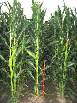
5 Maize 222 ( 102 ha) Sugar beet 102 ( 18 ha) Study area Goermin farm (northeastern part of DEMMIN)
,")
,")
6 Sugar beet (102), 06/07/2006 Maize (222), 05/07/2006
7 Methodology: Models and inversion techniques PROSAILH model - PROSPECT [N, Cab, Cw, Cm] (Jacqemoud et al., 1990) - SAILH [Prospect, LAI, ALA, ALFA-soil, HOT] (Verhoef 1984) 1-dimensional, turbid medium model
8 L e a f l e v e l Leaf variables: - N - Chl a+b - C w - C m PROSPECT Leaf reflectance & trans mittance C a n o p y l e v e l canopy structure: - LAI - HOT - ALA SAILH CANOPY REFLECTANCE Illumination & View geometry Soil reflectance nm
9 Model inversion Iterative optimization algorithm: Sequential Quadratic Programming (SQP) - drawbacks: local minimum, high time and computation demand Look up table (LUT): cases of canopy parameter combinations R i meas Ref measured RMSE = 1 n λ n λ ( i i R ) mea s RLUT i= 1 2 R i LUT Ref simulated
10 Range of input variables (lower and upper bounds (LB, UP) for PROSAILH model inversion using SQP algorithm, and classes/ distributions of input variables for establishment of the LUT. Variables Min (LB) Max (UP) Number of classes (LUT) Distribution of variables Leaf parameters: (PROSPECT) N Uniform C ab [µg/cm²] Gaussian C m [g/cm²] Uniform C w [g/cm²] Uniform Canopy structure variables (SAIL) LAI [m² m -2 ] Gaussian ALA [ ] Gaussian HotS 0.25(field 222), 0.33 (field 102) ALFA Uniform
11 Spectral samplings: B1 chosen according to the results of a study from Thenkabail et al. (2004): Optimal bands characterizing vegetation and crops due to their sensitivity to chlorophyll, soil background, biomass, LAI, plant moisture and vegetation stress.. VIS: (in [nm], band center, spectral width: 10 nm) Red edge: NIR: 885
12 Spectral samplings: B2 Spectral bands proposed for the upcoming E.O. multi-spectral satellite Sentinel-2 developed by ESA in the framework of GMES (Global Monitoring for Environment and Security) VIS: (in [nm], band center (spectral width)) 490 (65) 560 (35) 665 (30) Red edge: 705 (15) 740 (15) NIR: 775 (20), 842 (115) 865 (20)
13 Spatial resolution pixel size: 1.50 m pixel size: 20 m

14 Spatial resolution pixel size: 1.50 m pixel size: 20 m
15 The CLAIR model (Clevers, 1989) 1 WDVI LAI ln 1 * α WDVI = WDVI = ρ ρ i r ρ ρ si sr * : extinction coefficient, expressing the increase of LAI for a unit of WDVI ( here: set to 0.8) ρ i ; ρ r : reflectance of the observed canopy in red and infrared bands ρ si ; ρ sr corresponding values for bare soil conditions Red band: 676 nm NIR band: 885 nm
 using LUT and band configuration")
16 Results: Evaluation using ground data of LAI, field 102: Map of with-in field variability of LAI for sugar beet field (102) using LUT and band configuration B1
 using LUT and band")
17 Results: Evaluation using ground data of LAI, field 222: Map of with-in field variability of LAI for maize field (222) using LUT and band configuration B1
18 B1: Optimal bands B2: Sentinel-2 bands Measured and estimated LAI values for both fields achieved by LUT approach for the two different band configurations B1 (left) and B2 for SENTINEL-2 (right).
19 Conclusions Higher accuracy in LAI estimation by using physical model inversion than a statistical-empirical approach Higher suitability of the LUT approach in operational applications than SQP Choice of the Sentinel-2 proposed spectral bands revealed a quite high LAI accuracy compared to best spectral sampling However: results are limited to only one sensor and two different crop types, small LAI-range (max ) Conclusively, the results of the study may represent the basis for developing an operational physical based model for the retrieval of LAI from the Sentinel-2 2 sensor data


20 Thank you for your attention!
CHRIS Proba Workshop 2005 II
 CHRIS Proba Workshop 25 Analyses of hyperspectral and directional data for agricultural monitoring using the canopy reflectance model SLC Progress in the Upper Rhine Valley and Baasdorf test-sites Dr.
Potential of Sentinel-2 for retrieval of biophysical and biochemical vegetation parameters
 Insert the title of your slide Potential of Sentinel-2 for retrieval of biophysical and biochemical vegetation parameters D. Scheffler, T. Kuester, K. Segl, D. Spengler and H. Kaufmann Motivation Insert
Study on LAI Sampling Strategy and Product Validation over Non-uniform Surface. Lingling Ma, Xiaohua Zhu, Yongguang Zhao
 of Opto Electronics Chinese of Sciences Study on LAI Sampling Strategy and Product Validation over Non-uniform Surface Lingling Ma, Xiaohua Zhu, Yongguang Zhao of (AOE) Chinese of Sciences (CAS) 2014-1-28
Optimizing LUT-based RTM inversion for retrieval of biophysical parameters
 Optimizing LUT-based RTM inversion for retrieval of biophysical parameters Jochem Verrelst 1, Juan Pablo Rivera 1, Anna Leoneko 2, Luis Alonso 1, Jose Moreno 1 1 : University of Valencia, Spain 2 : Swansea
Author's personal copy
 Remote Sensing of Environment 120 (2012) 208 218 Contents lists available at SciVerse ScienceDirect Remote Sensing of Environment journal homepage: www.elsevier.com/locate/rse Spatially constrained inversion
Emulation of radiative transfer models. Jochem Verrelst, Juan Pablo Rivera & Jose Moreno Image Processing Laboratory, Univ. of Valencia (Spain)
") Emulation of radiative transfer models Jochem Verrelst, Juan Pablo Rivera & Jose Moreno Image Processing Laboratory, Univ. of Valencia (Spain) Annual OPTIMIZE Workshop and MC Meeting 22 February 217 Which
Emulation of radiative transfer models Jochem Verrelst, Juan Pablo Rivera & Jose Moreno Image Processing Laboratory, Univ. of Valencia (Spain) Annual OPTIMIZE Workshop and MC Meeting 22 February 217 Which
IEEE TRANSACTIONS ON GEOSCIENCE AND REMOTE SENSING, VOL. 39, NO. 7, JULY
 IEEE TRANSACTIONS ON GEOSCIENCE AND REMOTE SENSING, VOL. 39, NO. 7, JULY 2001 1491 Scaling-Up and Model Inversion Methods with Narrowband Optical Indices for Chlorophyll Content Estimation in Closed Forest
A. Verger 1, B. Martinez 1, F. Camacho-de Coca 2, J. García-Haro 1 and J.Meliá 1. CEOS/LPV Workshop, 15/03/2007, Davos
 Assessment of FVC and LAI ground measurement s uncertainties and estimation of reference maps for the validation of LSA SAF products over the Barrax cropland area A. Verger 1, B. Martinez 1, F. Camacho-de
Estimating forest parameters from top-of-atmosphere radiance data
 Estimating forest parameters from top-of-atmosphere radiance data V. Laurent*, W. Verhoef, J. Clevers, M. Schaepman *Contact: valerie.laurent@wur.nl Guest lecture, RS course, 8 th Decembre, 2010 Contents
ARTMO s Global Sensitivity Analysis (GSA) toolbox to quantify driving variables of leaf and canopy radiative transfer models
 toolbox to quantify driving variables of leaf and canopy radiative transfer models") [1] ARTMO s Sobol', I.M., Global GSA sensitivity toolbox indices for nonlinear mathematical models and their Monte Carlo estimates, Mathematics and Computers in Simulation, 55(1-3), 271-28, 21. 1/2 ARTMO
[1] ARTMO s Sobol', I.M., Global GSA sensitivity toolbox indices for nonlinear mathematical models and their Monte Carlo estimates, Mathematics and Computers in Simulation, 55(1-3), 271-28, 21. 1/2 ARTMO
Optical Theory Basics - 2 Atmospheric corrections and parameter retrieval
 Optical Theory Basics - 2 Atmospheric corrections and parameter retrieval Jose Moreno 3 September 2007, Lecture D1Lb2 OPTICAL THEORY-FUNDAMENTALS (2) Radiation laws: definitions and nomenclature Sources
Application of the SCAPE-M atmospheric correction algorithm to the processing of MERIS data over continental water bodies
 Application of the SCAPE-M atmospheric correction algorithm to the processing of MERIS data over continental water bodies L. Guanter 1, J. A. Domínguez 2, L. Conde 2, A. Ruiz-Verdú 2, V. Estellés 3, R.
SPEEDING UP THE SIMULATION OF VEGETATION FLUORESCENCE THROUGH EMULATION: PRACTICAL APPLICATIONS FOR FLEX DATA PROCESSING
 SPEEDING UP THE SIMULATION OF VEGETATION FLUORESCENCE THROUGH EMULATION: PRACTICAL APPLICATIONS FOR FLEX DATA PROCESSING Jochem Verrelst, Juan Pablo Rivera & Jose Moreno Image Processing Laboratory, Univ.
Validation of spectral continuity between PROBA-V and SPOT-VEGETATION global daily datasets
 Validation of spectral continuity between PROBA-V and SPOT-VEGETATION global daily datasets W. Dierckx a, *, E. Swinnen a, P. Kempeneers a a Flemish Institute for Technological Research (VITO), Remote
Optical/Thermal: Principles & Applications
 Optical/Thermal: Principles & Applications Jose F. Moreno University of Valencia, Spain Jose.Moreno@uv.es Lecture D1T2 1 July 2013 23/07/2013 1 OPTICAL PRINCIPLES AND APPLICATIONS Information content of
Retrieval of Surface Reflectance and LAI Mapping with Data from ALI, Hyperion and AVIRIS
 Retrieval of Surface Reflectance and LAI Mapping with Data from ALI, Hyperion and AVIRIS P. Gong 1, G. Biging 1, R. Pu 1, and M. R. Larrieu 2 1 Center for Assessment and Monitoring of Forest and Environmental
CHRIS / PROBA Data Analysis at the Swiss Midlands Testsite
 CHRIS / PROBA Data Analysis at the Swiss Midlands Testsite 4th CHRIS / PROBA Workshop Frascati 19-21 September 2006 Mathias Kneubühler, RSL, Univ. Zürich, CH Benjamin Koetz, Silvia Huber, Juerg Schopfer,
MERIS land products. Principles & validation. F. Baret, M. Weiss, K. Pavageau, D. Béal, B. Berthelot, M. Huc, J. Moreno, C. Gonzales & P.
 MERIS land products LAI, fapar, fcover Principles & validation F. Baret, M. Weiss, K. Pavageau, D. Béal, B. Berthelot, M. Huc, J. Moreno, C. Gonzales & P. Regner MERIS (A)ATSR user workshop - Frascati
MEASUREMENTS AND MODELLING OF BI-DIRECTIONAL REFLECTANCE OF WHEAT: PROSAIL VALIDATION RESULTS
 MEASUREMENTS AND MODELLING OF BI-DIRECTIONAL REFLECTANCE OF WHEAT: PROSAIL VALIDATION RESULTS D. Barman, V.K. Sehgal, R.N. Sahoo, S. Nagarajan* and A. Chakraborty Division of Agricultural Physics *Nuclear
ARTMO'S NEW MACHINE LEARNING REGRESSION ALGORITHMS (MLRA) MODULE FOR SEMIAUTOMATIC MAPPING OF BIOPHYSICAL PARAMETERS
 MODULE FOR SEMIAUTOMATIC MAPPING OF BIOPHYSICAL PARAMETERS") 8 th EARSeL SIG Imaging Spectroscopy Workshop, 8-10 April, Nantes, France 1 ARTMO'S NEW MACHINE LEARNING REGRESSION ALGORITHMS (MLRA) MODULE FOR SEMIAUTOMATIC MAPPING OF BIOPHYSICAL PARAMETERS Jochem Verrelst
8 th EARSeL SIG Imaging Spectroscopy Workshop, 8-10 April, Nantes, France 1 ARTMO'S NEW MACHINE LEARNING REGRESSION ALGORITHMS (MLRA) MODULE FOR SEMIAUTOMATIC MAPPING OF BIOPHYSICAL PARAMETERS Jochem Verrelst
Remote Sensing ISSN
 Remote Sens. 2009, 1, 1139-1170; doi:10.3390/rs1041139 Article OPEN ACCESS Remote Sensing ISSN 2072-4292 www.mdpi.com/journal/remotesensing Enhanced Automated Canopy Characterization from Hyperspectral
VALERI 2003 : Concepcion site (Mixed Forest) GROUND DATA PROCESSING & PRODUCTION OF THE LEVEL 1 HIGH RESOLUTION MAPS
 GROUND DATA PROCESSING & PRODUCTION OF THE LEVEL 1 HIGH RESOLUTION MAPS") VALERI 2003 : Concepcion site (Mixed Forest) GROUND DATA PROCESSING & PRODUCTION OF THE LEVEL 1 HIGH RESOLUTION MAPS Marie Weiss 1 Introduction This report describes the production of the high resolution,
VALERI 2003 : Concepcion site (Mixed Forest) GROUND DATA PROCESSING & PRODUCTION OF THE LEVEL 1 HIGH RESOLUTION MAPS Marie Weiss 1 Introduction This report describes the production of the high resolution,
Prof. Vidya Manian Dept. of Electrical l and Comptuer Engineering. INEL6007(Spring 2010) ECE, UPRM
 ECE, UPRM") Inel 6007 Introduction to Remote Sensing Chapter 5 Spectral Transforms Prof. Vidya Manian Dept. of Electrical l and Comptuer Engineering Chapter 5-1 MSI Representation Image Space: Spatial information
Inel 6007 Introduction to Remote Sensing Chapter 5 Spectral Transforms Prof. Vidya Manian Dept. of Electrical l and Comptuer Engineering Chapter 5-1 MSI Representation Image Space: Spatial information
Application of Hyperspectral Remote Sensing for LAI Estimation in Precision Farming
 Preprint/Prétirage Application of Hyperspectral Remote Sensing for LAI Estimation in Precision Farming Anna Pacheco, Abdou Bannari Remote Sensing and Geomatics of Environment Laboratory Department of Geography,
CHRIS PROBA instrument
 CHRIS PROBA instrument Wout Verhoef ITC, The Netherlands verhoef @itc.nl 29 June 2009, D1L5 Contents Satellite and instrument Images Multi-angular analysis Toolbox CHRIS-PROBA PROBA-CHRIS Project for On-Board
Gabelsbergerstrasse. 51, D Munich, Germany, Tel , Fax: ,
 ANALYSES OF HYPERSPECTRAL AND DIRECTIONAL DATA FOR AGRICULTURAL MONITORING USING THE CANOPY REFLECTANCE MODEL SLC PROGRESS IN THE UPPER RHINE VALLEY AND BAASDORF TEST-SITES Heike Bach (1), Silke Begiebing
THE USE OF AIRBORNE HYPERSPECTRAL REFLECTANCE DATA TO CHARACTERIZE FOREST SPECIES DISTRIBUTION PATTERNS
 THE USE OF AIRBORNE HYPERSPECTRAL REFLECTANCE DATA TO CHARACTERIZE FOREST SPECIES DISTRIBUTION PATTERNS Weihs, P., Huber K. Institute of Meteorology, Department of Water, Atmosphere and Environment, BOKU
The NIR- and SWIR-based On-orbit Vicarious Calibrations for VIIRS
 The NIR- and SWIR-based On-orbit Vicarious Calibrations for VIIRS Menghua Wang NOAA/NESDIS/STAR E/RA3, Room 3228, 5830 University Research Ct. College Park, MD 20746, USA Menghua.Wang@noaa.gov Workshop
Hyperspectral CHRIS Proba imagery over the area of Frascati and Tor Vergata: recent advances on radiometric correction and atmospheric calibration
 4th CHRIS Proba workshop, 19 Semptember 2006 Tor Vergata University, Rome Hyperspectral CHRIS Proba imagery over the area of Frascati and Tor Vergata: recent advances on radiometric correction and atmospheric
Airborne Hyperspectral Imaging Using the CASI1500
 Airborne Hyperspectral Imaging Using the CASI1500 AGRISAR/EAGLE 2006, ITRES Research CASI 1500 overview A class leading VNIR sensor with extremely sharp optics. 380 to 1050nm range 288 spectral bands ~1500
UAV-based Remote Sensing Payload Comprehensive Validation System
 36th CEOS Working Group on Calibration and Validation Plenary May 13-17, 2013 at Shanghai, China UAV-based Remote Sensing Payload Comprehensive Validation System Chuan-rong LI Project PI www.aoe.cas.cn
Linking sun-induced fluorescence and photosynthesis in a forest ecosystem
 Linking sun-induced fluorescence and photosynthesis in a forest ecosystem COST ES1309 Tagliabue G, Panigada C, Dechant B, Celesti M, Cogliati S, Colombo R, Julitta T, Meroni M, Schickling A, Schuettemeyer
Modeling reflectance and transmittance of leaves in the µm domain: PROSPECT-VISIR
 Modeling reflectance and transmittance of leaves in the 0.4-5.7 µm domain: PROSPECT-VISIR F. Gerber 1,2, R. Marion 1, S. Jacquemoud 2, A. Olioso 3 et S. Fabre 4 1 CEA/DASE/Télédétection, Surveillance,
THE EFFECT OF TOPOGRAPHIC FACTOR IN ATMOSPHERIC CORRECTION FOR HYPERSPECTRAL DATA
 THE EFFECT OF TOPOGRAPHIC FACTOR IN ATMOSPHERIC CORRECTION FOR HYPERSPECTRAL DATA Tzu-Min Hong 1, Kun-Jen Wu 2, Chi-Kuei Wang 3* 1 Graduate student, Department of Geomatics, National Cheng-Kung University
Attività cal/val missione FLEX e possibili sinergie con PRISMA
 Attività cal/val missione FLEX e possibili sinergie con PRISMA Colombo R. 1, Miglietta F. 2, Cogliati S. 1 1 Department of Earth and Environmental Sciences, University Milano-Bicocca, Milano, Italy 2 CNR-IBIMET,
PROSPECT+SAIL: 15 Years of Use for Land Surface Characterization
 PROSPECT+SAIL: 15 Years of Use for Land Surface Characterization S. Jacquemoud, W. Verhoef, F. Baret, P.J. Zarco-Tejada G.P. Asner, C. François, and S.L. Ustin State of Science of Environmental Applications
GROUND DATA PROCESSING & PRODUCTION OF THE LEVEL 1 HIGH RESOLUTION MAPS
 GROUND DATA PROCESSING & PRODUCTION OF THE LEVEL 1 HIGH RESOLUTION MAPS VALERI 2002 LARZAC site (grassland) Philippe Rossello, Marie Weiss December 2005 CONTENTS 1. Introduction... 2 2. Available data...
Testing Hyperspectral Remote Sensing Monitoring Techniques for Geological CO 2 Storage at Natural Seeps
 Testing Hyperspectral Remote Sensing Monitoring Techniques for Geological CO 2 Storage at Natural Seeps Luke Bateson Clare Fleming Jonathan Pearce British Geological Survey In what ways can EO help with
CORRELATION BETWEEN NDVI AND SURFACE TEMPERATURES USING LANDSAT ETM IMAGERY FOR SAN ANTONIO AREA. Remote Sensing Project By Newfel Mazari Fall 2005
 CORRELATION BETWEEN NDVI AND SURFACE TEMPERATURES USING LANDSAT ETM IMAGERY FOR SAN ANTONIO AREA Remote Sensing Project By Newfel Mazari Fall 2005 Procedure Introduction and Objectives Site Date Acquisition
GEOMETRY AND RADIATION QUALITY EVALUATION OF GF-1 AND GF-2 SATELLITE IMAGERY. Yong Xie
 Prepared by CNSA Agenda Item: WG.3 GEOMETRY AND RADIATION QUALITY EVALUATION OF GF-1 AND GF-2 SATELLITE IMAGERY Yong Xie Institute of Remote Sensing and Digital Earth, Chinese Academy of Science GF-1 and
TOA RADIANCE SIMULATOR FOR THE NEW HYPERSPECTRAL MISSIONS: STORE (SIMULATOR OF TOA RADIANCE)
") TOA RADIANCE SIMULATOR FOR THE NEW HYPERSPECTRAL MISSIONS: STORE (SIMULATOR OF TOA RADIANCE) Malvina Silvestri Istituto Nazionale di Geofisica e Vulcanologia In the frame of the Italian Space Agency (ASI)
TOA RADIANCE SIMULATOR FOR THE NEW HYPERSPECTRAL MISSIONS: STORE (SIMULATOR OF TOA RADIANCE) Malvina Silvestri Istituto Nazionale di Geofisica e Vulcanologia In the frame of the Italian Space Agency (ASI)
Definitions (1/1) Leaf Area Index (LAI, notation used: L) One half the total green leaves area per unit ground area
 Leaf Area Index (LAI, notation used: L) One half the total green leaves area per unit ground area") PINEWOOD LAI AND APAR ESTIMATION BY MULTI-SPECTRAL AND MULTI-ANGULAR SATELLITE DATA R. Benedetti, M. Chiesi*, S. Cristofori, P. Marcoionni**,. Maselli*, I. Pippi** La.M.M.A., Building D - Via Madonna del
PINEWOOD LAI AND APAR ESTIMATION BY MULTI-SPECTRAL AND MULTI-ANGULAR SATELLITE DATA R. Benedetti, M. Chiesi*, S. Cristofori, P. Marcoionni**,. Maselli*, I. Pippi** La.M.M.A., Building D - Via Madonna del
sensors ISSN
 Sensors 2009, 9, 768-793; doi:10.3390/s90200768 Article OPEN ACCESS sensors ISSN 1424-8220 www.mdpi.com/journal/sensors Comparison Between Fractional Vegetation Cover Retrievals from Vegetation Indices
Integration of airborne LiDAR and hyperspectral remote sensing data to support the Vegetation Resources Inventory and sustainable forest management
 Integration of airborne LiDAR and hyperspectral remote sensing data to support the Vegetation Resources Inventory and sustainable forest management Executive Summary This project has addressed a number
End-to-End Simulation of Sentinel-2 Data with Emphasis on Atmospheric Correction Methods
 End-to-End Simulation of Sentinel-2 Data with Emphasis on Atmospheric Correction Methods Luis Guanter 1, Karl Segl 2, Hermann Kaufmann 2 (1) Institute for Space Sciences, Freie Universität Berlin, Germany
Empirical and Physical Estimation of Canopy Water Content from CHRIS/PROBA Data
 Remote Sens. 2013, 5, 5265-5284; doi:10.3390/rs5105265 Article OPEN ACCESS Remote Sensing ISSN 2072-4292 www.mdpi.com/journal/remotesensing Empirical and Physical Estimation of Canopy Water Content from
MULTI-TEMPORAL SAR DATA FILTERING FOR LAND APPLICATIONS. I i is the estimate of the local mean backscattering
 MULTI-TEMPORAL SAR DATA FILTERING FOR LAND APPLICATIONS Urs Wegmüller (1), Maurizio Santoro (1), and Charles Werner (1) (1) Gamma Remote Sensing AG, Worbstrasse 225, CH-3073 Gümligen, Switzerland http://www.gamma-rs.ch,
Quality assessment of RS data. Remote Sensing (GRS-20306)
") Quality assessment of RS data Remote Sensing (GRS-20306) Quality assessment General definition for quality assessment (Wikipedia) includes evaluation, grading and measurement process to assess design,
Quality assessment of RS data Remote Sensing (GRS-20306) Quality assessment General definition for quality assessment (Wikipedia) includes evaluation, grading and measurement process to assess design,
An evaluation of prediction accuracy and stability of a new vegetation. index for estimating vegetation leaf area index
 An evaluation of prediction accuracy and stability of a new vegetation index for estimating vegetation leaf area index Hailing Jiang a,b, Lifu Zhang* b, Hang Yang b, Xiaoping Chen c, Shudong Wang b, Xueke
Menghua Wang NOAA/NESDIS/STAR Camp Springs, MD 20746, USA
 Ocean EDR Product Calibration and Validation Plan Progress Report: VIIRS Ocean Color Algorithm Evaluations and Data Processing and Analyses Define a VIIRS Proxy Data Stream Define the required in situ
The Gain setting for Landsat 7 (High or Low Gain) depends on: Sensor Calibration - Application. the surface cover types of the earth and the sun angle
 depends on: Sensor Calibration - Application. the surface cover types of the earth and the sun angle") Sensor Calibration - Application Station Identifier ASN Scene Center atitude 34.840 (34 3'0.64"N) Day Night DAY Scene Center ongitude 33.03270 (33 0'7.72"E) WRS Path WRS Row 76 036 Corner Upper eft atitude
Sensor Calibration - Application Station Identifier ASN Scene Center atitude 34.840 (34 3'0.64"N) Day Night DAY Scene Center ongitude 33.03270 (33 0'7.72"E) WRS Path WRS Row 76 036 Corner Upper eft atitude
CHLOROPHYLL RETRIEVAL FROM CANOPY REFLECTANCE OVER ORCHARDS USING HYPERSPECTRAL TECHNIQUES
 CHLOROPHYLL RETRIEVAL FROM CANOPY REFLECTANCE OVER ORCHARDS USING HYPERSPECTRAL TECHNIQUES P. Kempeneers a, S. De Backer b, P. J. Zarco-Teada c, S. Delalieux d, G. Sepulcre- Cantó c, F. Morales f, Ruth
Prototyping GOES-R Albedo Algorithm Based on MODIS Data Tao He a, Shunlin Liang a, Dongdong Wang a
 Prototyping GOES-R Albedo Algorithm Based on MODIS Data Tao He a, Shunlin Liang a, Dongdong Wang a a. Department of Geography, University of Maryland, College Park, USA Hongyi Wu b b. University of Electronic
Recent Progress of BaoTou Comprehensive Cal&Val Site. Prof. Chuan-rong Li. Academy of Opto-Electronics(AOE), Chinese Academy of Sciences
, Chinese Academy of Sciences") LANDNET WG meeting #4 CEOS/WGCV-41 Plenary Recent Progress of BaoTou Comprehensive Cal&Val Site Prof. Chuan-rong Li Academy of Opto-Electronics(AOE), Chinese Academy of Sciences National Remote Sensing
LANDNET WG meeting #4 CEOS/WGCV-41 Plenary Recent Progress of BaoTou Comprehensive Cal&Val Site Prof. Chuan-rong Li Academy of Opto-Electronics(AOE), Chinese Academy of Sciences National Remote Sensing
Monitoring vegetation dynamics using MERIS fused images
 Monitoring vegetation dynamics using MERIS fused images Raul Zurita-Milla (1), G. Kaiser (2), J. Clevers (1), W. Schneider (2) and M.E. Schaepman (1) (1) Wageningen University, The Netherlands (2) University
Genetic Algorithm based Inversion Modelling of PROSAIL for Retrieval of Wheat Biophysical Parameters from Bi-directional Reflectance Data
 Vol. 14, No. 1, pp. 87-95 (2014) Journal of Agricultural Physics ISSN 0973-032X http://www.agrophysics.in Research Article Genetic Algorithm based Inversion Modelling of PROSAIL for Retrieval of Wheat
CROP MAPPING WITH SENTINEL-2 JULY 2017, SPAIN
 _p TRAINING KIT LAND01 CROP MAPPING WITH SENTINEL-2 JULY 2017, SPAIN Table of Contents 1 Introduction to RUS... 3 2 Crop mapping background... 3 3 Training... 3 3.1 Data used... 3 3.2 Software in RUS environment...
Update on Pre-Cursor Calibration Analysis of Sentinel 2. Dennis Helder Nischal Mishra Larry Leigh Dave Aaron
 Update on Pre-Cursor Calibration Analysis of Sentinel 2 Dennis Helder Nischal Mishra Larry Leigh Dave Aaron Background The value of Sentinel-2 data, to the Landsat world, will be entirely dependent on
Street, Toronto, ON, M5S 3G3, Canada b Ontario Ministry of Natural Resources, Ontario Forest Research. Available online: 08 Aug 2011
 This article was downloaded by: [University of Toronto Libraries] On: 2 October 211, At: 7:29 Publisher: Taylor & Francis Informa Ltd Registered in England and Wales Registered Number: 172954 Registered
Airborne LiDAR Data Acquisition for Forestry Applications. Mischa Hey WSI (Corvallis, OR)
") Airborne LiDAR Data Acquisition for Forestry Applications Mischa Hey WSI (Corvallis, OR) WSI Services Corvallis, OR Airborne Mapping: Light Detection and Ranging (LiDAR) Thermal Infrared Imagery 4-Band
Airborne LiDAR Data Acquisition for Forestry Applications Mischa Hey WSI (Corvallis, OR) WSI Services Corvallis, OR Airborne Mapping: Light Detection and Ranging (LiDAR) Thermal Infrared Imagery 4-Band
Sensors and applications for drone based remote sensing
 Sensors and applications for drone based remote sensing Dr. Ilkka Pölönen Dr. Eija Honkavaara, NLS Dr. Heikki Saari, VTT Dr. Sakari Tuominen, Mr. Jere Kaivosoja, Luke Laboratory Joint research with Finnish
Analisi di immagini iperspettrali satellitari multitemporali: metodi ed applicazioni
 Analisi di immagini iperspettrali satellitari multitemporali: metodi ed applicazioni E-mail: bovolo@fbk.eu Web page: http://rsde.fbk.eu Outline 1 Multitemporal image analysis 2 Multitemporal images pre-processing
Hyperspectral Remote Sensing of Closed Forest Canopies: Estimation of Chlorophyll Fluorescence and Pigment Content
 Hyperspectral Remote Sensing of Closed Forest Canopies: Estimation of Chlorophyll Fluorescence and Pigment Content Pablo J. Zarco-Tejada A thesis submitted to the Faculty of Graduate Studies in partial
APPLICATION OF HYPERION DATA TO AGRICULTURAL LAND CLASSIFICATION AND VEGETATION PROPERTIES ESTIMATION IN SWITZERLAND
 APPLICATION OF HYPERION DATA TO AGRICULTURAL LAND CLASSIFICATION AND VEGETATION PROPERTIES ESTIMATION IN SWITZERLAND S. Eckert, M. Kneubühler a Remote Sensing Laboratories (RSL), University of Zürich,
EVALUATION OF DIURNAL HYPERSPECTRAL BRF DATA ACQUIRED WITH THE RSL FIELD GONIOMETER DURING THE DAISEX 99 CAMPAIGN
 EVALUATION OF DIURNAL HYPERSPECTRAL BRF DATA ACQUIRED WITH THE RSL FIELD GONIOMETER DURING THE DAISEX 99 CAMPAIGN G. Strub (1), U. Beisl (2), M. Schaepman (1), D. Schläpfer (1), C. Dickerhof (1), K. Itten
Analysis Ready Data For Land (CARD4L-ST)
") Analysis Ready Data For Land Product Family Specification Surface Temperature (CARD4L-ST) Document status For Adoption as: Product Family Specification, Surface Temperature This Specification should next
Analysis Ready Data For Land Product Family Specification Surface Temperature (CARD4L-ST) Document status For Adoption as: Product Family Specification, Surface Temperature This Specification should next
SEA BOTTOM MAPPING FROM ALOS AVNIR-2 AND QUICKBIRD SATELLITE DATA
 SEA BOTTOM MAPPING FROM ALOS AVNIR-2 AND QUICKBIRD SATELLITE DATA Mohd Ibrahim Seeni Mohd, Nurul Nadiah Yahya, Samsudin Ahmad Faculty of Geoinformation and Real Estate, Universiti Teknologi Malaysia, 81310
THE SCIENTIFIC MODULES OF FLEX END-TO-END SIMULATOR: THE SCENE GENERATOR AND THE LEVEL-2 RETRIEVAL MODULES.
 THE SCIENTIFIC MODULES OF FLEX END-TO-END SIMULATOR: THE SCENE GENERATOR AND THE LEVEL-2 RETRIEVAL MODULES. N. Sabater (1), J.P. Rivera (1), C. Tenjo (1) ), J. Vicent (1), L. Alonso (1), J. Verrelst (1)
Evaluation of Sentinel-2 Red-Edge Bands for Empirical Estimation of Green LAI and Chlorophyll Content
 Sensors 2011, 11, 7063-7081; doi:10.3390/s110707063 OPEN ACCESS sensors ISSN 1424-8220 www.mdpi.com/journal/sensors Article Evaluation of Sentinel-2 Red-Edge Bands for Empirical Estimation of Green LAI
Article A Novel Principal Component Analysis Method for the Reconstruction of Leaf Reflectance Spectra and Retrieval of Leaf Biochemical Contents
 Article A Novel Principal Component Analysis Method for the Reconstruction of Leaf Reflectance Spectra and Retrieval of Leaf Biochemical Contents Liangyun Liu *, Bowen Song, Su Zhang and Xinjie Liu Key
Spatial and multi-scale data assimilation in EO-LDAS. Technical Note for EO-LDAS project/nceo. P. Lewis, UCL NERC NCEO
 Spatial and multi-scale data assimilation in EO-LDAS Technical Note for EO-LDAS project/nceo P. Lewis, UCL NERC NCEO Abstract Email: p.lewis@ucl.ac.uk 2 May 2012 In this technical note, spatial data assimilation
Comparison of Full-resolution S-NPP CrIS Radiance with Radiative Transfer Model
 Comparison of Full-resolution S-NPP CrIS Radiance with Radiative Transfer Model Xu Liu NASA Langley Research Center W. Wu, S. Kizer, H. Li, D. K. Zhou, and A. M. Larar Acknowledgements Yong Han NOAA STAR
Retrieving leaf area index using a genetic algorithm with a canopy radiative transfer model
 Remote Sensing of Environment 85 (2003) 257 270 www.elsevier.com/locate/rse Retrieving leaf area index using a genetic algorithm with a canopy radiative transfer model Hongliang Fang a, Shunlin Liang a,
Overview of the EnMAP Imaging Spectroscopy Mission
 Overview of the EnMAP Imaging Spectroscopy Mission L. Guanter, H. Kaufmann, K. Segl, S. Foerster, T. Storch, A. Mueller, U. Heiden, M. Bachmann, G. Rossner, C. Chlebek, S. Fischer, B. Sang, the EnMAP Science
NATIONAL TECHNICAL UNIVERSITY OF ATHENS PERMANENT COMMITTEE FOR BASIC RESEARCH NTUA BASIC RESEARCH SUPPORT PROGRAMME THALES 2001
 NATIONAL TECHNICAL UNIVERSITY OF ATHENS PERMANENT COMMITTEE FOR BASIC RESEARCH NTUA BASIC RESEARCH SUPPORT PROGRAMME THALES 001 «USE OF LIDAR TECHNOLOGY FOR ATMOSPHERIC CORRECTION OF DIGITAL REMOTE SENSING
GEOG 4110/5100 Advanced Remote Sensing Lecture 2
 GEOG 4110/5100 Advanced Remote Sensing Lecture 2 Data Quality Radiometric Distortion Radiometric Error Correction Relevant reading: Richards, sections 2.1 2.8; 2.10.1 2.10.3 Data Quality/Resolution Spatial
Hyperspectral remote sensing tools for precision farming applications
 Hyperspectral remote sensing tools for precision farming applications Roberto Colombo 1, Cinzia Panigada 1, Sergio Cogliati 1, Micol Rossini 1, Chiara Cilia 1, Lorenzo Busetto 1,2, Michele Meroni 1,3,
Global and Regional Retrieval of Aerosol from MODIS
 Global and Regional Retrieval of Aerosol from MODIS Why study aerosols? CLIMATE VISIBILITY Presented to UMBC/NESDIS June 4, 24 Robert Levy, Lorraine Remer, Yoram Kaufman, Allen Chu, Russ Dickerson modis-atmos.gsfc.nasa.gov
Cloud masking in remotely sensed hyperspectral images using linear and nonlinear spectral mixture analysis
 Cloud masking in remotely sensed hyperspectral images using linear and nonlinear spectral mixture analysis J. Amorós-López, L. Gómez-Chova, A. Plaza, J. Plaza, J. Calpe, L. Alonso, J. Moreno () GPDS, Dept.
Classify Multi-Spectral Data Classify Geologic Terrains on Venus Apply Multi-Variate Statistics
 Classify Multi-Spectral Data Classify Geologic Terrains on Venus Apply Multi-Variate Statistics Operations What Do I Need? Classify Merge Combine Cross Scan Score Warp Respace Cover Subscene Rotate Translators
ON THE SPECTRAL RESOLUTION REQUIREMENTS FOR THE DERIVATION OF LEAF AREA INDEX FROM HYPERSPECTRAL REMOTE SENSING DATA
 ON THE SPECTRAL RESOLUTION REQUIREMENTS FOR THE DERIVATION OF LEAF AREA INDEX FROM HYPERSPECTRAL REMOTE SENSING DATA T. Peisker a, D. Spengler a, K. Segl a, L. Guanter a, H. Kaufmann a a GFZ, Helmholtz
ISPRS Hannover Workshop 2013, May 2013, Hannover, Germany
 New light-weight stereosopic spectrometric airborne imaging technology for highresolution environmental remote sensing Case studies in water quality mapping E. Honkavaara, T. Hakala, K. Nurminen, L. Markelin,
Remote Sensing of Environment
 Remote Sensing of Environment 112 (2008) 3846 3864 Contents lists available at ScienceDirect Remote Sensing of Environment journal homepage: www.elsevier.com/locate/rse Calibration and validation of hyperspectral
AISASYSTEMS PRODUCE MORE WITH LESS
 AISASYSTEMS PRODUCE MORE WITH LESS AISASYSTEMS SPECIM s AISA systems are state-of-the-art airborne hyperspectral imaging solutions covering the VNIR, NIR, SWIR and LWIR spectral ranges. The sensors unbeatable
ENMAP RADIOMETRIC INFLIGHT CALIBRATION
 ENMAP RADIOMETRIC INFLIGHT CALIBRATION Harald Krawczyk 1, Birgit Gerasch 1, Thomas Walzel 1, Tobias Storch 1, Rupert Müller 1, Bernhard Sang 2, Christian Chlebek 3 1 Earth Observation Center (EOC), German
Investigation of a model inversion technique to estimate canopy biophysical variables from spectral and directional reflectance data
 Investigation of a model inversion technique to estimate canopy biophysical variables from spectral and directional reflectance data Marie Weiss, Frédéric Baret, Ranga Myneni, Agnès Pragnère, Youri Knyazikhin
Calculation steps 1) Locate the exercise data in your PC C:\...\Data
 Locate the exercise data in your PC C:\...\Data") Calculation steps 1) Locate the exercise data in your PC (freely available from the U.S. Geological Survey: http://earthexplorer.usgs.gov/). C:\...\Data The data consists of two folders, one for Athens
Calculation steps 1) Locate the exercise data in your PC (freely available from the U.S. Geological Survey: http://earthexplorer.usgs.gov/). C:\...\Data The data consists of two folders, one for Athens
SEQUENTIAL CLASSIFIER TRAINING FOR RICE MAPPING WITH MULTITEMPORAL REMOTE SENSING IMAGERY
 ISPRS Annals of the Photogrammetry Remote Sensing and Spatial Information Sciences Volume IV-4/W2 2017 SEQUENTIAL CLASSIFIER TRAINING FOR RICE MAPPING WITH MULTITEMPORAL REMOTE SENSING IMAGERY Y. Guo a.
Houborg, Rasmus; McCabe, Matthew
 KAUST Repository Application of a regularized model inversion system (REGFLEC) to multi-temporal RapidEye imagery for retrieving vegetation characteristics Item type Authors Citation Eprint version Article
An Overview of the CHRIS/PROBA Mission: A New Generation of Multiangle Hyperspectral Remote Sensing and Its Application to Agriculture
 An Overview of the CHRIS/PROBA Mission: A New Generation of Multiangle Hyperspectral Remote SUGIANTO, Ray MERTON and Shawn LAFFAN, Australia Key word: CHRIS/PROBA, Multi-angle hyperspectral, agriculture
Hyperspectral Image Acquisition and Analysis
 Hyperspectral Image Acquisition and Analysis PECORA 15 Workshop 7 Airborne Remote Sensing: A Fast-track Approach to NEPA Streamlining for Transportation Jen Aitken, ITRES Research Limited CASI Hyperspectral
The Use and Applications of Unmanned- Aerial Systems (UAS) In Agriculture
 In Agriculture") The Use and Applications of Unmanned- Aerial Systems (UAS) In Agriculture R O B E R T A U S T I N, D E P A R T M E N T O F S O I L S C I E N C E N C S T A T E U N I V E R S I T Y DJI Inspire Photo Credit:
The Use and Applications of Unmanned- Aerial Systems (UAS) In Agriculture R O B E R T A U S T I N, D E P A R T M E N T O F S O I L S C I E N C E N C S T A T E U N I V E R S I T Y DJI Inspire Photo Credit:
Chapter 4. Estimation and Validation of LAI using Physical and Semi-empirical BRDF models
 Chapter 4 Estimation and Validation of LAI using Physical and Semi-empirical BRDF models Chapter 4 Estimation and Validation of LAI using Physical and Semiempirical BRDF models ------------------------------------------------------------------------------------------------------------
MERIS US Workshop. Vicarious Calibration Methods and Results. Steven Delwart
 MERIS US Workshop Vicarious Calibration Methods and Results Steven Delwart Presentation Overview Recent results 1. CNES methods Deserts, Sun Glint, Rayleigh Scattering 2. Inter-sensor Uyuni 3. MOBY-AAOT
GENESIS Generator of Spectral Image Simulations
 MBT Space Division - GENESIS Generator of Spectral Image Simulations Dr. Yael Efraim, Dr. N. Cohen, Dr. G. Tidhar, Dr. T. Feingersh Dec 2017 1 Scope GENESIS: End-to-end simulation of hyper-spectral (HS)
OCEANSAT-2 OCEAN COLOUR MONITOR (OCM-2)
") OCEANSAT-2 OCEAN COLOUR MONITOR (OCM-2) Update of post launch vicarious, lunar calibrations & current status Presented by Prakash Chauhan Space Applications Centre Indian Space Research Organistaion Ahmedabad-
OCEANSAT-2 OCEAN COLOUR MONITOR (OCM-2) Update of post launch vicarious, lunar calibrations & current status Presented by Prakash Chauhan Space Applications Centre Indian Space Research Organistaion Ahmedabad-
P H A S E O N E I N D U S T R I A L. T h e w o r l d l e a d e r i n h i g h r e s o l u t i o n i m a g i n g
 P H A S E O N E I N D U S T R I A L T h e w o r l d l e a d e r i n h i g h r e s o l u t i o n i m a g i n g 1 WE ARE A WORLD LEADING PROVIDER of medium format digital imaging systems and solutions for
Leaf Equivalent Water Thickness assessment using reflectance at optimum wavelengths
 RESEARCH ARTICLE Leaf Equivalent Water Thickness assessment using reflectance at optimum wavelengths Mohammad Reza Mobasheri *, Sayyed Bagher Fatemi Remote Sensing Department, K.N.Toosi University of Technology,
Continued Development of the Look-up-table (LUT) Methodology For Interpretation of Remotely Sensed Ocean Color Data
 Methodology For Interpretation of Remotely Sensed Ocean Color Data") Continued Development of the Look-up-table (LUT) Methodology For Interpretation of Remotely Sensed Ocean Color Data Curtis D. Mobley Sequoia Scientific, Inc. 2700 Richards Road, Suite 107 Bellevue, WA
Continued Development of the Look-up-table (LUT) Methodology For Interpretation of Remotely Sensed Ocean Color Data Curtis D. Mobley Sequoia Scientific, Inc. 2700 Richards Road, Suite 107 Bellevue, WA
TELEDYNE GEOSPATIAL SOLUTIONS
 GEOSPATIAL SOLUTIONS THE CONTENTS TELEDYNE GEOSPATIAL SOLUTIONS Capability Overview... 4 Hosted Payloads... 6 Payload Operations as a Service... 8 TCloud Data Management... 10 Imagery Sales... 12 About