Software and Hardware improvements using 1mm x 1mm resolution 3D road surface data
|
|
|
- Angelina Patterson
- 5 years ago
- Views:
Transcription
1 Software and Hardware improvements using 1mm x 1mm resolution 3D road surface data By John Laurent Pavemetrics Systems inc years on the Road To Progressively Better Data


2 Pavemetrics: Sensors for Infrastructure Inspection Founded 2009; a Spinoff of Canada s National Optics Institute (INO) 3D sensor development Automated data processing algorithm development Technology used for Roads, Runways, Rails, Tunnels (400+ systems) 40+ countries 2
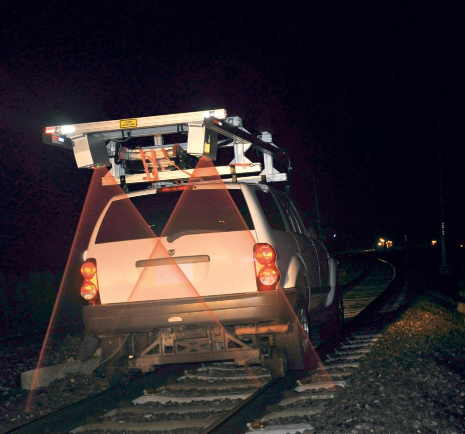


3 APPLICATION: Rails 3


4 LTSS Tunnel scanning 4

5 LCMS/LTSS Capabilities


6 LCMS/LTSS Capabilities 3D Reconstruction Brick Tunnel


7 APPLICATION: Roads 7
8 Technologies Offered LCMS LRIS - Line Scan Imaging LRMS Rut measurement system 8


9 Technologies Offered LCMS LRIS - Line Scan Imaging LRMS Rut measurement system 9

10 Technologies Offered LCMS
 4m 4m Data rate per km 0.")
11 Specifications LCMS-1 vs LCMS - 2 Specifications LCMS -1 LCMS-2 Acquisition Rate 5,600 profiles/s 28,000 profiles/s Range Accuracy/Resolution 0.5mm / 0.25mm 0.25mm / 0.05mm* Lateral Resolution 1mm 1mm Field of View (lateral) 4m 4m Data rate per km 0.6 Gb/km 3 Gb/km 11
12 Improved vertical resolution ASTM and AASHTO standards utilized by the road profiling industry (ASTM E950, AASHTO M328, 56, 57) require the use of sensors with a vertical resolution of 0.05 mm or greater. vertical resolution specifications previously published by Pavemetrics for the LCMS were not based on comparable test methods adopted by other line lasers (RoLine, Gocator) currently accepted in the industry. However, LCMS sensors do indeed meet the 0.05 mm requirement when vertical measurements are made with comparable tests. 12
13 Gocator model 2342A-3B-12 Resolution and Test Method The vertical resolution (Z) of the Gocator is reported as mm Selcom s test to determine resolution involves multiple scans of an object with a diffuse, painted white surface (a calibration target) LMI Gocator 2300 & 2880 Series User Manual, Document revision: D Resolution is defined as the maximum variability of height measurements across multiple frames, with a 95% confidence 13

14 LCMS Resolution Evaluation Procedure 1/3 The objective of the Pavemetrics test was to likewise establish resolution by determining the maximum variability of height measurements across multiple frames, with a 95% confidence The first step in the evaluation was to create a similar calibration target The Pavemetrics-developed target is a precision-machined cylinder with a diffuse, painted surface Close-up View of Pavemetrics Calibration Target 14

15 LCMS Resolution Evaluation Procedure 2/3 A computer-controlled, highaccuracy, translation table was then used to control the position of the calibration target/object in relation to the LCMS The LCMS is setup to scan within its working range and is initialized for scanning the target While the LCMS was scanning, the translation table was used to move the target away from the sensor at a step distance of 0.05 mm This movement produced a change in vertical distance (of 0.05 mm) which the LCMS was used to measure Computer-controlled Translation Table 15
16 LCMS Resolution Evaluation Procedure 3/3 The cylinder was put into rotation in order to simulate the motion of a vehicle. LCMS height/distance measurements were made across multiple frames with outputs at 1 inch intervals with the LCMS. Likewise, the variability of height measurements made across multiple frames was then analyzed The analysis established the maximum variability of height measurements made by the LCMS across multiple frames to be mm at a confidence level of 95% 16
17 LCMS-2 Crack detection Same road sections were scanned with both the LCMS 1 and LCMS 2 LCMS 1 scans were at the standard 5mm interval LCMS 2 scans were at 5mm, 2mm and 1mm for comparison purposes 17
18 Example 1 5mm LCMS 1 18

19 Example 1 5mm LCMS 2 19

20 Example 1 2mm LCMS 2 20

21 Example 1 1mm LCMS 2 21


22 Example 1 All Configurations LCMS 1 5MM LCMS 2 5MM LCMS 2 2MM LCMS 2 1MM 22

23 Example 2 5mm LCMS 1 23

24 Example 2 5mm LCMS 2 24

25 Example 2 2mm LCMS 2 25

26 Example 2 1mm LCMS 2 26


27 Example 2 All Configurations LCMS 1 5MM LCMS 2 5MM LCMS 2 2MM LCMS 2 1MM 27
28 Example 3 5mm LCMS 1 28

29 Example 3 5mm LCMS 2 29

30 Example 3 2mm LCMS 2 30

31 Example 3 1mm LCMS 2 31


32 Example 3 All Configurations LCMS 1 5MM LCMS 2 5MM LCMS 2 2MM LCMS 2 1MM 32

33 Example 4 5mm LCMS 1 33

34 Example 4 5mm LCMS 2 34

35 Example 4 2mm LCMS 2 35

36 Example 4 1mm LCMS 2 36


37 Example 4 All Configurations LCMS 1 5MM LCMS 2 5MM LCMS 2 2MM LCMS 2 1MM 37
38 LCMS-2 Crack detection The LCMS 2 provides more complete crack detection and is more sensitive to finer cracks Improvements are apparent even if you operate an LCMS 2 using a 5mm collection interval However 2mm and 1mm intervals will further improve results 38

39 Storage needs Specifications LCMS-2 Data rate per km 3Gb/km 10,000 mile network 48Tb 16 units x 50$ $800 39


40 New Feature Man made object detection Open Manhole Cover Closed Manhole Cover Storm-drain 40
41 Problem (Example 1) This pavement is in excellent shape; not a crack to be seen However, there is a small break in the surface around the edge of the manhole cover Total Cracking is 3.2 meters (~10.5 feet); 100% is false cracking This generates 3.2 m of false cracking 100% of this cracking is false 41


42 Solution We deliberately detect the MMO first in order to exclude it from crack detection This also allows us to add value by inventorying it Now the cracking quantity here is 0 meters; which is correct 42
43 Data That Are Reported Bounding box: the X, Y location of box which is drawn around the detected object (can relate back to GPS and milepoint) Area: the calculated area of the object Radius: only reported for manholes, radius of the manhole Width and Height: width and height of the drain or its bounding box Perimeter: list of points that form the perimeter of the object, useful for highlighting the object in images used for reporting Type: two types reported at present; closed manhole or stormdrain/open man-hole 43

44 LCMSRoadInspect Interface Type: 0 (Closed Manhole) Bounding Box Height: 2.9 feet Bounding Box Width: 2.9 feet Radius: 1.4 feet Location: 3.6 meters in X and 6.4 in Y. 44
45 Example 2: Without MMO Detection Total Cracking is 5 meters (~16 feet); 100% is false cracking 45

46 Example 2: With MMO Detection 46

47 Example 3: Without MMO Detection Total Cracking is 6.35 meters; false cracking is 4.07m. 180% over reporting. 47

48 Example 3: With MMO Detection 48

49 Example 4: Without MMO Detection Total Cracking is meters; false cracking is 1.66m. 8% over reporting. 49

50 Example 4: With MMO Detection 50

51 Example 5: Without MMO 51

52 Example 5: With MMO Detection 52
53 Questions? 53
Pavemetrics. Automatic detection of sealed cracks using images and 3D data. PAVEMETRICS Systems Inc.
 Automatic detection of sealed cracks using images and 3D data Vision Technology for Inspection of Transportation Infrastructures PAVEMETRICS Systems Inc. 150 Boulevard René-Lévesque Est, Suite 1820 Québec,
3D Mapping of Pavements: Geometry and DTM
 BUDAPEST, HUNGARY 2015 3D Mapping of Pavements: Geometry and DTM John Laurent, Pavemetrics inc. www.pavemetrics.com The Sensor Technology Most Relied-on by DOTs worldwide Collect Your Own, or Contract-out
3D laser road profiling for the automated measurement of road surface conditions and geometry.
 3D laser road profiling for the automated measurement of road surface conditions and geometry. John Laurent 1, Jean François Hébert 1, Daniel Lefebvre 2, Yves Savard 3 1 Pavemetrics Systems inc., Canada
OPTIMIZING 3D SURFACE CHARACTERISTICS DATA COLLECTION BY RE-USING THE DATA FOR PROJECT LEVEL ROAD DESIGN
 OPTIMIZING 3D SURFACE CHARACTERISTICS DATA COLLECTION BY RE-USING THE DATA FOR PROJECT LEVEL ROAD DESIGN Benoit Petitclerc, P.E. John Laurent, M. Sc Richard Habel, M. Sc., Pavemetrics Systems Inc., Canada
ROAD SURFACE STRUCTURE MONITORING AND ANALYSIS USING HIGH PRECISION GPS MOBILE MEASUREMENT SYSTEMS (MMS)
") ROAD SURFACE STRUCTURE MONITORING AND ANALYSIS USING HIGH PRECISION GPS MOBILE MEASUREMENT SYSTEMS (MMS) Bonifacio R. Prieto PASCO Philippines Corporation, Pasig City, 1605, Philippines Email: bonifacio_prieto@pascoph.com
ROAD SURFACE STRUCTURE MONITORING AND ANALYSIS USING HIGH PRECISION GPS MOBILE MEASUREMENT SYSTEMS (MMS) Bonifacio R. Prieto PASCO Philippines Corporation, Pasig City, 1605, Philippines Email: bonifacio_prieto@pascoph.com
USING FULL LANE 3D ROAD TEXTURE DATA FOR THE AUTOMATED DETECTION OF SEALED CRACKS, BLEEDING AND RAVELING
 USING FULL LANE 3D ROAD TEXTURE DATA FOR THE AUTOMATED DETECTION OF SEALED CRACKS, BLEEDING AND RAVELING John Laurent 1, Jean François Hébert 1, Mario Talbot 1 1 Pavemetrics Systems Inc., Québec, Canada
Road Surface Texture Evaluation with 3-D Laser Data
 Road Surface Texture Evaluation with -D Laser Data Shuvo Islam 1, Mustaque Hossain, and Humaira Zahir ( 1 Kansas State University, Manhattan, KS, USA, sislam@ksu.edu) ( Kansas State University, Manhattan,
MOBILE INSPECTION SYSTEM FOR HIGH-RESOLUTION ASSESSMENT OF TUNNELS
 MOBILE INSPECTION SYSTEM FOR HIGH-RESOLUTION ASSESSMENT OF TUNNELS M. Gavilán*, F. Sánchez, J.A. Ramos and O. Marcos EUROCONSULT GROUP Avenida Montes de Oca 9-11, 28703, Madrid, Spain *Corresponding author:
STEMMER IMAGING DAYS GOCATOR ALL-IN-ONE 3D SMART SENSORS: INDUSTRIAL APPLICATIONS. Ing. Christian Leitner Territory Manager EMEAR
 STEMMER IMAGING DAYS GOCATOR ALL-IN-ONE 3D SMART SENSORS: INDUSTRIAL APPLICATIONS Ing. Christian Leitner Territory Manager EMEAR LMI TECHNOLOGIES About Our Company QUICK FACTS 37 years experience 175 employees
4.1 Identification of Potential Water Ponding 4.2 Monitoring of Road Inventory 4.3 Monitoring of surface condition
 TRIMM is supported by funding from the 7 th Framework Programme Call: SST.2011.5.2-2. Theme: Advanced and cost effective road infrastructure construction, management and maintenance Alex Wright 4.1 Identification
3D Data Acquisition in Tunnels Optimizing Track Time Using Terrestrial Mobile LiDAR. Scanning. Michael R. Frecks, PLS.
 3D Data Acquisition in Tunnels Optimizing Track Time Using Terrestrial Mobile LiDAR Scanning Michael R. Frecks, PLS President/CEO AREMA 2013 1207 Understanding mobile 3D LiDAR? light detection and ranging
Using Mobile LiDAR To Efficiently Collect Roadway Asset and Condition Data. Pierre-Paul Grondin, B.Sc. Surveying
 Using Mobile LiDAR To Efficiently Collect Roadway Asset and Condition Data Pierre-Paul Grondin, B.Sc. Surveying LIDAR (Light Detection and Ranging) The prevalent method to determine distance to an object
New Technologies for Pavement Evaluation
 New Technologies for Pavement Evaluation TxDOT 3-D Pavement Survey Technology For 86 th Annual Transportation Short Course at Texas A&M University, 2012 Dr. Yaxiong (Robin) Huang, Robin.Huang@txdot.gov
Georeferencing West Virginia DOT s Roadside Assets: An Asset Inventory Case Study. Geoff Dew April 13,
 : An Asset Inventory Case Study Geoff Dew April 13, 2010 General Project Scope 17,817 miles collected across all systems. System Type Delivered Miles 1 Interstates 1100.820 2 US Routes 2184.538 3 WV Routes
CS8800 WALKING PROFILER
 CS8800 WALKING PROFILER Overview CS8800 Design and Measurement Method Operational Procedures Recent and Pending Enhancements Base Price & Options Comments on October 20009 FHWA Collections CS8800 DESIGN
Name Class Date. Area Using Tangrams. The area of the small square is 1 square unit. Find the area of each of the other tangram pieces.
 Name Class Date -5 Area of Composite Figures Going Deeper Essential question: How can you find the area of a polygon by breaking it into simpler shapes? CC..G. EXPLORE Area Using Tangrams video tutor The
MATH-8 Review Volume of 3D shapes 2018 N Exam not valid for Paper Pencil Test Sessions
 MATH-8 Review Volume of 3D shapes 2018 N Exam not valid for Paper Pencil Test Sessions [Exam ID:2YBSPT 1 What is the volume of a cube with a length of 8 inches? A 96 in 3 B 256 in 3 C 512 in 3 D 384 in
mm. What is the length of the radius to
 Math 1201 Review For Final Unit One: 1. Convert 99 inches to feet and inches. 2. What is the height of this right circular cone if the diameter is 24 cm? 13 3. Solve for x: 8 x 13 4. My drivers license
Three-Dimensional Laser Scanner. Field Evaluation Specifications
 Stanford University June 27, 2004 Stanford Linear Accelerator Center P.O. Box 20450 Stanford, California 94309, USA Three-Dimensional Laser Scanner Field Evaluation Specifications Metrology Department
Machine Vision: A Closer Look
 Machine Vision: A Closer Look Kambiz Nayebi Kim Bowling 1 Components of Machine Vision Optics: Maps the 3 D world size objects onto the small sensor Lens Protective glass window Sensor: Converts the projection
Strategy. Using Strategy 1
 Strategy Using Strategy 1 Scan Path / Strategy It is important to visualize the scan path you want for a feature before you begin taking points on your part. You want to try to place your points in a way
A New Way to Control Mobile LiDAR Data
 A New Way to Control Mobile LiDAR Data Survey control has always been a critically important issue when conducting mobile LiDAR surveys. While the accuracies currently being achieved with the most capable
CCTV Sewer Imaging Technology Update
 SARBS Collections Training Seminar Jan. 26, 2012 CCTV Sewer Imaging Technology Update Lori S. Weiss City of Santa Barbara, CA Public Works Department, Wastewater Treatment Gary N. Skipper, P.E. Vice President
TUNNELINGS SYSTEM Inspection of brick tunnels and covered ways SSL (Circle, Hammersmith & City and District Lines) LONDON UNDERGROUND LIMITED
 LONDON UNDERGROUND LIMITED") TUNNELINGS SYSTEM Inspection of brick tunnels and covered ways SSL (Circle, Hammersmith & City and District Lines) LONDON UNDERGROUND LIMITED Inspection date: July 6 th 2014 Report date: September 22 nd
TUNNELINGS SYSTEM Inspection of brick tunnels and covered ways SSL (Circle, Hammersmith & City and District Lines) LONDON UNDERGROUND LIMITED Inspection date: July 6 th 2014 Report date: September 22 nd
1201 Common Mathematics Assessment Answer Sheet Name: Mathematics Teacher:
 0 Answer Sheet Name: Mathematics Teacher:. A B C D. A B C D. A B C D. A B C D. A B C D 6. A B C D 7. A B C D 8. A B C D 9. A B C D 0. A B C D. A B C D. A B C D. A B C D. A B C D. A B C D 6. A B C D 7.
Mobile Mapping Solutions for Ohio s Integrated Transportation Network. Brian Foster, CP
 Mobile Mapping Solutions for Ohio s Integrated Transportation Network Brian Foster, CP About Woolpert Established in 1911 Over 600 Professionals 25 Offices $12,000,000 invested in new technology in last
Lesson 7.3 Understanding the Pythagorean Theorem and Solids
 Lesson 7.3 Understanding the Pythagorean Theorem and Solids For this practice, you may use a calculator. Use 3.14 as an approimation for π. Round your answer to the nearest tenth where necessary. For each
How do you roll? Fig. 1 - Capstone screen showing graph areas and menus
 How do you roll? Purpose: Observe and compare the motion of a cart rolling down hill versus a cart rolling up hill. Develop a mathematical model of the position versus time and velocity versus time for
Jeffrey A. Schepers P.S. EIT Geospatial Services Holland Engineering Inc. 220 Hoover Blvd, Suite 2, Holland, MI Desk
 Jeffrey A. Schepers P.S. EIT Geospatial Services Holland Engineering Inc. 220 Hoover Blvd, Suite 2, Holland, MI 49423 616-594-5127 Desk 616-322-1724 Cell 616-392-5938 Office Mobile LiDAR - Laser Scanning
Mathematics 1201 Common Mathematics Assessment Sample FINAL 80 Marks
 Mathematics 0 Sample 0 Name: Mathematics Teacher: 0 Selected Response 0 marks Constructed Response 0 marks FINAL 80 Marks FORMULAE Surface Area Clinder Cone Sphere Volume Pramid Cone Sphere Conversions
1. What referent (for the Imperial System) would be the most appropriate to use to estimate the measure of: a. 6 ft. = in. b. 39 ft. = yd.
 would be the most appropriate to use to estimate the measure of: a. 6 ft. = in. b. 39 ft. = yd.") Math 101 Review For Midterm Exam Unit One: 1. What referent (for the Imperial System) would be the most appropriate to use to estimate the measure of: a. a cellphone b. the width of the gym c. the height
Math 101 Review For Midterm Exam Unit One: 1. What referent (for the Imperial System) would be the most appropriate to use to estimate the measure of: a. a cellphone b. the width of the gym c. the height
Minimizing Noise and Bias in 3D DIC. Correlated Solutions, Inc.
 Minimizing Noise and Bias in 3D DIC Correlated Solutions, Inc. Overview Overview of Noise and Bias Digital Image Correlation Background/Tracking Function Minimizing Noise Focus Contrast/Lighting Glare
AC : MEASURING AND MODELING OF A 3-D ROAD SURFACE
 AC 2008-2782: MEASURING AND MODELING OF A 3-D ROAD SURFACE Pramod Kumar, University of Louisiana at Lafayette Pavel Ikonomov, Western Michigan University Suren Dwivedi, University of Louisiana-Lafayette
C in. 2. D in Find the volume of a 7-inch tall drinking glass with a 4-inch diameter. C lateral faces. A in. 3 B in.
 Standardized Test A For use after Chapter Multiple Choice. Which figure is a polyhedron? A B 7. Find the surface area of the regular pyramid. A 300 ft 2 B 340 ft 2 C 400 ft 2 C D D 700 ft 2 2. A polyhedron
3D SCANNING & INSPECTION
 3D SCANNING & INSPECTION Terry Arden CEO LMI Technologies Capital Markets Day 30 November 2016 CMD 2016 30-11-2016 1 3D Scanning and Inspection 3D technology enables the measurement of shape We design
THE REFERENCE FILE. Cadd Support Office May Included in this issue:
 THE REFERENCE FILE May 2018 Included in this issue: Page 2 Page 2 Page 2-3 Page 4-7 Page 8-10 Page 11 New Title Sheet Cells New Signal Cells Cross Section Sheets Guardrail Mash Standards RDM (AASHTO 2011)
T-SCAN 3 3D DIGITIZING
 T-SCAN 3 3D DIGITIZING 2 T-SCAN 3: THE HANDHELD LASER SCANNER Launching the innovative concept of an intuitive-to-use high-precision laser scanner a few years ago, Steinbichler Optotechnik, as the first
Recent Innovations in the Management of Irish National Roads
 Recent Innovations in the Management of Irish National Roads Dr. Kieran Feighan PMS Ray McGowan PMS Tom Casey NRA (Ireland) Andrew O Sullivan NRA (Ireland) NRA Pavement Management System dtims version
Removing Drift from Inertial Navigation System Measurements RPUG Robert Binns Mechanical Engineering Vehicle Terrain Performance Lab
 Removing Drift from Inertial Navigation System Measurements RPUG 2009 Mechanical Engineering Vehicle Terrain Performance Lab December 10, 2009 Outline Laboratory Overview Vehicle Terrain Measurement System
Lesson 10 ~ Three-Dimensional Figures
 Lesson 10 ~ Three-Dimensional Figures Name a solid that fits each description. 1. a can of beans 2. a shoe box 3. a pyramid with five lateral faces 4. a solid with six vertices 5. a prism with bases shaped
MATH-8 LPMS Measurement and Geometry Exam not valid for Paper Pencil Test Sessions
 MATH-8 LPMS Measurement and Geometry Exam not valid for Paper Pencil Test Sessions [Exam ID:BR7HTL 1 The angle relationship between DEC and BEC is A supplementary angles B complementary angles C congruent
GeoSmart Asia Locate 18
 MOBILE MAPPING GeoSmart Asia Locate 18 ESP Associates, P.A. ESP Associates, P.A. ABOUT ESP Founded in 1986 (28 Years of Experience with DOT s) ESP has 14 offices throughout the US 37 States, Canada, and
DEFLECTION AND TWIST MEASUREMENT SYSTEM (DTMS) Model 47
 Model 47") Features DEFLECTION AND TWIST MEASUREMENT SYSTEM (DTMS) Model 47 Results are not affected by the motion or acceleration of the structure being tested Three or five degrees of freedom are measured between
Features DEFLECTION AND TWIST MEASUREMENT SYSTEM (DTMS) Model 47 Results are not affected by the motion or acceleration of the structure being tested Three or five degrees of freedom are measured between
3.2 Extrema & Function Analysis Name: 1
 Precalculus Write our questions and thoughts here! 3.2 Etrema & Function Analsis Name: 1 Absolute ma/min absolutel the. Relative ma/min a point on the function that is. Finding a ma/min means finding the
Measurements using three-dimensional product imaging
 ARCHIVES of FOUNDRY ENGINEERING Published quarterly as the organ of the Foundry Commission of the Polish Academy of Sciences ISSN (1897-3310) Volume 10 Special Issue 3/2010 41 46 7/3 Measurements using
3D Measurement and Control, Made Easy
 3D Measurement and Control, Made Easy WHAT WE DO LMI Technologies is a global leader in 3D scanning, visualization, measurement, and control technology. We focus on developing products to deliver a customer
Multi-Speed Deflectometer. An innovative tool for local authority network asset management
 Multi-Speed Deflectometer An innovative tool for local authority network asset management What is the MSD? Falling Weight Deflectometer The Multi-Speed Deflectometer (MSD) is a new, innovative technique
Airborne and Mobile LiDAR for Transport Corridor Survey Dr. Bharat Lohani Director, Geokno India Pvt. Ltd. & Professor, Geoinformatics IIT Kanpur
 www.geokno.com Airborne and Mobile LiDAR for Transport Corridor Survey Dr. Bharat Lohani Director, Geokno India Pvt. Ltd. & Professor, Geoinformatics IIT Kanpur Geokno has executed and is executing multiple
MATH-8 Review Surface Area 3D 2018 N Exam not valid for Paper Pencil Test Sessions
 MATH-8 Review Surface Area 3D 2018 N Exam not valid for Paper Pencil Test Sessions [Exam ID:J42YVD 1 What is the surface area of the rectangular prism shown? A 48 cm 2 B 24 cm 2 C 52 cm 2 D 26 cm 2 2 A
Pathway Services Inc. Technology Presentation
 Lauren Tran Budapest, Hungary 2015 Largest Vendor of this kind in the U.S. Largest Fleet of Full Service Vehicles in U.S. (26) More Than 5 Million Kilometers Collected Using Our Equipment Nearly 50% of
Name: Date: Class: Honors Geometry Advancement Practice (Part 2)
") Name: Date: lass: Honors Geometry Advancement Practice (Part 2) Part 1 Multiple hoice: Identify the choice that best completes the statement or answers the question. Place your answer on the Scantron sheet
Name: Date: lass: Honors Geometry Advancement Practice (Part 2) Part 1 Multiple hoice: Identify the choice that best completes the statement or answers the question. Place your answer on the Scantron sheet
SPRINGBOARD UNIT 5 GEOMETRY
 SPRINGBOARD UNIT 5 GEOMETRY 5.1 Area and Perimeter Perimeter the distance around an object. To find perimeter, add all sides. Area the amount of space inside a 2 dimensional object. Measurements for area
Fast and Reliable Pavement Profile Scanning. Alexander Reiterer Fraunhofer Institute For Physical Measurement Techniques (IPM)
") Fast and Reliable Pavement Profile Scanning Alexander Reiterer Fraunhofer Institute For Physical Measurement Techniques (IPM) Fast and Reliable Pavement Profile Scanning Alexander Reiterer Fraunhofer Institute
Fast and Reliable Pavement Profile Scanning Alexander Reiterer Fraunhofer Institute For Physical Measurement Techniques (IPM) Fast and Reliable Pavement Profile Scanning Alexander Reiterer Fraunhofer Institute
Chapter 6 : Results and Discussion
 Refinement and Verification of the Virginia Tech Doppler Global Velocimeter (DGV) 86 Chapter 6 : Results and Discussion 6.1 Background The tests performed as part of this research were the second attempt
For full credit, show all work. Label all answers. For all problems involving a formula, show the formula and each step to receive full credit.
 Accelerated Review 1: Pythagorean Theorem/Dim Geo II Name: For full credit, show all work. Label all answers. For all problems involving a formula, show the formula and each step to receive full credit.
Unit 1: Area Find the value of the variable(s). If your answer is not an integer, leave it in simplest radical form.
. If your answer is not an integer, leave it in simplest radical form.") Name Per Honors Geometry / Algebra II B Midterm Review Packet 018-19 This review packet is a general set of skills that will be assessed on the midterm. This review packet MAY NOT include every possible
Name Per Honors Geometry / Algebra II B Midterm Review Packet 018-19 This review packet is a general set of skills that will be assessed on the midterm. This review packet MAY NOT include every possible
Evaluating the Performance of a Vehicle Pose Measurement System
 Evaluating the Performance of a Vehicle Pose Measurement System Harry Scott Sandor Szabo National Institute of Standards and Technology Abstract A method is presented for evaluating the performance of
Study on Gear Chamfering Method based on Vision Measurement
 International Conference on Informatization in Education, Management and Business (IEMB 2015) Study on Gear Chamfering Method based on Vision Measurement Jun Sun College of Civil Engineering and Architecture,
UULA FOCALSPEC 3D LINE CONFOCAL SCANNER DID THEY TELL YOU THAT NO-ONE CAN MEASURE IT? WE CAN.
 FocalSpec builds optical sensors to measure and inspect the quality of the advanced materials and devices in use today and currently in development for the future. Our sensors combine 3D topography, 3D
PYRAMIDS AND CONES WHAT YOU LL LEARN. Ø Finding the surface areas and volume of pyramids Ø Finding the surface areas and volume of cones
 PYRAMIDS AND CONES A pyramid is a solid with a polygonal base and triangular lateral faces that meet at a vertex. In this lesson, you will work with regular pyramids. The base of a regular pyramid is a
USING THE DEFINITE INTEGRAL
 Print this page Chapter Eight USING THE DEFINITE INTEGRAL 8.1 AREAS AND VOLUMES In Chapter 5, we calculated areas under graphs using definite integrals. We obtained the integral by slicing up the region,
Name: Period: 2018 Geometry Spring Final Exam Review
 2018 Geometry Spring Final Exam Review 1. Find the number of lunch combinations that can be created if you order a soup, sandwich, drink and dessert. There are 4 soup choices, 5 sandwich choices, 3 drink
How Iowa DOT is using its Linear Referencing System. Eric Abrams Spatial Coordinator Iowa DOT Gis.iowadot.gov
 How Iowa DOT is using its Linear Referencing System Eric Abrams Spatial Coordinator Iowa DOT Gis.iowadot.gov Eric.abrams@dot.iowa.gov Linear Referencing System A set of procedures and methods for specifying
CASE 1 TWO LANE TO FOUR LANE DIVIDED TRANSITION GEO-610-C NOT TO SCALE GEOMETRIC DESIGN GUIDE FOR MATCH LINE LINE MATCH. 2 (0.6m) shoulder transition
 shoulder transition") CASE 1 2 (0.6m) Joint Line See sheet #5 for description of variables 4 (1.2m) Transition taper is tangent to Edge of Pavement curve at this point. 1:25 Paved shoulder transition 16 (4.m) Median width 16
CASE 1 2 (0.6m) Joint Line See sheet #5 for description of variables 4 (1.2m) Transition taper is tangent to Edge of Pavement curve at this point. 1:25 Paved shoulder transition 16 (4.m) Median width 16
Washington State Math Championship 2009 Geometry 5 th
 Geometry 5 th 1. If the area of a square is 40 square units and you double the dimensions of both the length and the width, what will the area of the new square be? 2. If you walk 50 yards south, then
EyeTech. Particle Size Particle Shape Particle concentration Analyzer ANKERSMID
 EyeTech Particle Size Particle Shape Particle concentration Analyzer A new technology for measuring particle size in combination with particle shape and concentration. COMBINED LASERTECHNOLOGY & DIA Content
3D Laser Imaging for Pavement Survey at 60 mph and True 1mm Resolution
 3D Laser Imaging for Pavement Survey at 60 mph and True 1mm Resolution Kelvin C. P. Wang Oklahoma State University & WayLink kelvin.wang@okstate.edu 2013 Arizona Pavements/Materials Conference ASU MU,
TEST REVIEW: UNIT 8 Surface Area 2018
 Class: Date: TEST REVIEW: UNIT 8 Surface Area 2018 Find the area. The figure is not drawn to scale. 1. 5. Find the area. All lengths are in centimeters. Round answer to the nearest tenth. 2. 6. A can of
FOCALSPEC 3D LINE CONFOCAL SCANNER UULA DID THEY TELL YOU THAT NO-ONE CAN MEASURE IT? WE CAN.
 FOCALSPEC 3D LINE CONFOCAL SCANNER UULA DID THEY TELL YOU THAT NO-ONE CAN MEASURE IT? WE CAN. FocalSpec 3D Line Confocal Scanner UULA UULA is an automated optical 3D imaging and metrology system for sub-micron
CCBC Math 081 Geometry Section 2.2
 2.2 Geometry Geometry is the study of shapes and their mathematical properties. In this section, we will learn to calculate the perimeter, area, and volume of a few basic geometric shapes. Perimeter We
Three-dimensional nondestructive evaluation of cylindrical objects (pipe) using an infrared camera coupled to a 3D scanner
 using an infrared camera coupled to a 3D scanner") Three-dimensional nondestructive evaluation of cylindrical objects (pipe) using an infrared camera coupled to a 3D scanner F. B. Djupkep Dizeu, S. Hesabi, D. Laurendeau, A. Bendada Computer Vision and
Three-dimensional nondestructive evaluation of cylindrical objects (pipe) using an infrared camera coupled to a 3D scanner F. B. Djupkep Dizeu, S. Hesabi, D. Laurendeau, A. Bendada Computer Vision and
Precise laser-based optical 3D measurement of welding seams under water
 Precise laser-based optical 3D measurement of welding seams under water ISPRS/CIPA Workshop Underwater 3D Recording & Modeling" Piano di Sorrento (Napoli), Italy 16. 17. April 2015 Tanja Ekkel (M.Sc.)
Lesson 3: Definition and Properties of Volume for Prisms and Cylinders
 : Definition and Properties of Volume for Prisms and Cylinders Learning Targets I can describe the properties of volume. I can find the volume of any prism and cylinder using the formula Area of Base Height.
STATEMENT REGARDING FEDERALLY SPONSORED RESEARCH OR THE NAMES OF THE PARTIES TO A JOINT RESEARCH AGREEMENT.
 TITLE OF INVENTION. A distance measuring device using a method of spanning separately targeted endpoints. This application claims the benefit of U.S. Provisional Application No. 61/477,511, filed April
MATH STUDENT BOOK. 7th Grade Unit 9
 MATH STUDENT BOOK 7th Grade Unit 9 Unit 9 Measurement and Area Math 709 Measurement and Area Introduction 3 1. Perimeter 5 Perimeter 5 Circumference 11 Composite Figures 16 Self Test 1: Perimeter 24 2.
IB Math SL Year 2 Name: Date: 8-3: Optimization in 2D Today s Goals: What is optimization? How do you maximize/minimize quantities using calculus?
 Name: Date: 8-3: Optimization in 2D Today s Goals: What is optimization? How do you maximize/minimize quantities using calculus? What is optimization? It involves finding the or value of a function subjected
Counting Particles or Cells Using IMAQ Vision
 Application Note 107 Counting Particles or Cells Using IMAQ Vision John Hanks Introduction To count objects, you use a common image processing technique called particle analysis, often referred to as blob
3D TECHNOLOGY FOR PAVEMENT PRESERVATION
 3D TECHNOLOGY FOR PAVEMENT PRESERVATION Technical Discussion for WASHTO 2015 Magdy Mikhail, P.E. Robin Huang Todd Copenhaver Footer Text March 23, 2015 Date Capabilities of 3D Technology for Pavement Preservation
Unit #13 : Integration to Find Areas and Volumes, Volumes of Revolution
 Unit #13 : Integration to Find Areas and Volumes, Volumes of Revolution Goals: Beabletoapplyaslicingapproachtoconstructintegralsforareasandvolumes. Be able to visualize surfaces generated by rotating functions
11. Mensuration. Q 2 Find the altitude of a trapezium, the sum of the lengths of whose bases is 6.5 cm and whose area is 26 cm 2.
 11. Mensuration Q 1 Find the volume of a cuboid whose length is 8 cm, breadth 6 cm and height 3.5 cm. Q 2 Find the altitude of a trapezium, the sum of the lengths of whose bases is 6.5 cm and whose area
POINT CLOUD ANALYSIS FOR ROAD PAVEMENTS IN BAD CONDITIONS INTRODUCTION
 POINT CLOUD ANALYSIS FOR ROAD PAVEMENTS IN BAD CONDITIONS Yoshiyuki Yamamoto, Associate Professor Yasuhiro Shimizu, Doctoral Student Eiji Nakamura, Professor Masayuki Okugawa, Associate Professor Aichi
Mobile LiDAR for Ground Applications. Spar 2006, March Paul Mrstik, Terrapoint Canada Inc. Craig Glennie, Terrapoint USA LLC
 Mobile LiDAR for Ground Applications Spar 2006, March 27 2006 Paul Mrstik, Terrapoint Canada Inc. Craig Glennie, Terrapoint USA LLC Agenda Introduction to Terrapoint What is mobile LiDAR? Advantages of
Tribometers. nanovea.com
 Tribometers The Nanovea Tribometer offers precise and repeatable wear and friction testing using rotative and linear modes on a single system. Designed, at the core, with a high quality motor and a 20bit
Appendix B: Vehicle Dynamics Simulation Results
 Appendix B: Vehicle Dynamics Simulation Results B-1 Vehicle dynamic analyses were undertaken for the three barrier types under each of the curve, shoulder, and barrier placement factors identified. This
b. find the lateral area of the cylinder c. If the radius is doubled, what happens to the volume?
 im: How do we find the volume and surface area of pyramids? o Now: If the radius and the height of a cylinder is 4 a. find the volume of the cylinder b. find the lateral area of the cylinder c. If the
Notice that the height of each rectangle is and the width of each rectangle is.
 Math 1410 Worksheet #40: Section 6.3 Name: In some cases, computing the volume of a solid of revolution with cross-sections can be difficult or even impossible. Is there another way to compute volumes
Lesson 6 Reteach. Surface Area of Prisms. Example. Exercises. 232 in^ tt^^ Find the surface area of the rectangular prism.
 Lesson 6 Reteach Surface Area of Prisms T h e s u m of the areas of all the surfaces, or faces, of a three-dimensional shape is the surface area. T h e surface area of a rectangular prism with length f,
Chapter Test A For use after Chapter 12
 Chapter Test A For use after Chapter Tell whether the solid is a polyhedron. If it is, find the number of faces, vertices, and edges.. 2. 3.. Determine whether the polyhedron is regular and/or conve. 2.
Lesson 6 Reteach. Perimeter of the base = 14. S. A. = area of the 2 bases + lateral area = = 52 m^.
 Lesson 6 Reteach Surface Area of Prisms The sum of the areas of all the surfaces, or faces, of a three-dimensional shape is the surface area. Find the surface area of the rectangular prism. The area of
Large & Small Numbers
 Large & Small Numbers Scientists frequently work with very large or small numbers. Astronomers work with galaxies that contain billions of stars at great distances from us. On the other hand, biologists
Multisensor Coordinate Measuring Machines ZEISS O-INSPECT
 Multisensor Coordinate Measuring Machines ZEISS O-INSPECT Having all the necessary options for reliable measurements. ZEISS O-INSPECT // RELIABILITY MADE BY ZEISS 2 The O-INSPECT multisensor measuring
1.1 Metric Systems. Learning Target: to practice converting between different metric units. Main Ideas:
 1.1 Metric Systems Learning Target: to practice converting between different metric units Formula sheet Multiplying and dividing fractions Definitions Metric System The International System of Units, abbreviated
POINT CLOUDS AND DERIVATIVES FOR NATIONWIDE GEOSPATIAL INFORMATION GEORGE VOSSELMAN
 POINT CLOUDS AND DERIVATIVES FOR NATIONWIDE GEOSPATIAL INFORMATION GEORGE VOSSELMAN OVERVIEW Point cloud generation and quality control New lidar technologies Dense matching Updating nationwide point clouds
Naturalistic observations to investigate conflicts between drivers and VRU in the PROSPECT project
 Naturalistic observations to investigate conflicts between drivers and VRU in the PROSPECT project Marie-Pierre Bruyas, Sébastien Ambellouis, Céline Estraillier, Fabien Moreau (IFSTTAR, France) Andrés
A New Rutting Measurement Method Using Emerging 3D Line-Laser-Imaging System
 Technical Paper ISSN 1997-1400 Int. J. Pavement Res. Technol. 6(5):667-672 Copyright @ Chinese Society of Pavement Engineering A New Rutting Measurement Method Using Emerging 3D Line-Laser-Imaging System
Similarity Review (Unit 4)
") Similarity Review (Unit 4) Name Using a compass and straightedge construct the image of the figure after a dilation with point C as the center of dilation and the given scale factor. Label the vertices
Similarity Review (Unit 4) Name Using a compass and straightedge construct the image of the figure after a dilation with point C as the center of dilation and the given scale factor. Label the vertices
Creating Value. Delivering Solutions
 Creating Value Delivering Solutions LIDAR...Light Detection and Ranging Technology from the military (1960 s) Rapid, highly accurate DEM coverage of large to medium sized project areas Feature extraction
Section G. POSITIONAL ACCURACY DEFINITIONS AND PROCEDURES Approved 3/12/02
 Section G POSITIONAL ACCURACY DEFINITIONS AND PROCEDURES Approved 3/12/02 1. INTRODUCTION Modern surveying standards use the concept of positional accuracy instead of error of closure. Although the concepts
DO NOW Geometry Regents Lomac Date. due. 3D: Area, Dissection, and Cavalieri
 DO NOW Geometry Regents Lomac 2014-2015 Date. due. 3D: Area, Dissection, and Cavalieri (DN) ON BACK OF PACKET Name Per LO: I can define area, find area, and explain dissection and Cavalieri s Principle
Big Spatial Data Performance With Oracle Database 12c. Daniel Geringer Spatial Solutions Architect
 Big Spatial Data Performance With Oracle Database 12c Daniel Geringer Spatial Solutions Architect Oracle Exadata Database Machine Engineered System 2 What Is the Oracle Exadata Database Machine? Oracle