Implementing and Optimizing ArcGIS Server Map Caches
|
|
|
- Hubert Anthony
- 5 years ago
- Views:
Transcription


1 Implementing and Optimizing ArcGIS Server Map Caches Sterling Quinn Jeremy Bartley David Wilcox ESRI Developer Summit


2 Schedule 75 minute session minute lecture minutes Q & A following the lecture Cell phones and pagers Please complete the session survey we take your feedback very seriously!
3 Introductions Who are we? Sterling Quinn: ArcGIS Server Product Engineer Jeremy Bartley: ArcGIS Server Product Engineer David Wilcox: ArcGIS Online Product Engineer Who are you? Who s created a map cache before? Who s created large map caches (more than a few hours to create)? Who doesn t know what a map cache is?
4 What to expect in this session Basic to advanced topics 9.2 and 9.3 solutions Outline What is map caching? Why should I cache? How to create a cache Common caching questions Case study: ArcGIS Online 9.3 improvements Q & A
5 What is map caching?

6 What does it mean to cache a map service? A cached service has a set of map images that have been pre-rendered rendered for rapid display. 1:500,000 1:250,000 You create map and globe service caches at pre- determined scale levels.

7 The cached images are stored on disk
8 Why cache a map service? Which is faster? Let the server draw the map OR Get the image from a prebuilt cache By caching, you only have to render the map once: When you create the cache. Caching is an investment.
9 Industry Standard Google Maps and Google Earth Microsoft Virtual Earth Yahoo! Maps ArcGIS Online others You want performance, scalability,, and high quality!


10 Keep Cartographic Quality and Performance with ArcGIS Server cached map services Shaded Relief Transparent Layers Maplex Labeling Low-res relief Solid colors Annotation
11 Demo Viewing a high-quality cached map service
12 Why should I cache?
13 Pre-cached map days Dynamic maps Not scalable Will NEVER be as fast as cached maps Simple Cartography Simple maps to aid in performance Not simple in map authoring-- --defined by XML (ArcIMS( ArcIMS)
14 Pre-cached map days Map authoring was for the developer Complicated map authoring led to the disconnect between GIS Analysts and GIS Developers Caching encourages non GIS developers to get involved in putting maps on the web Hated by Cartographers Simple cartography for performance was not aesthetically pleasing
15 Maps on the web in today's world Maps for general public consumption MUST be cached Cache + Dynamic services in web applications (while improved at 9.3) is not as scalable for mass consumption
16 Maps on the web in today's world Data that is truly dynamic (query and geoprocessing results, changing data) should be treated as graphics in the client application Dynamic maps are for: INTRANET applications Applications with a small, highly-focused audience
17 Other caching solutions Microsoft MapCruncher Cuts up an existing single scale map OSGEO WMS-C Tile Caching Prototype spec for building cache from WMS services KaMap pre-caching system Works off of Minnesota MapServer Etc.


18 Why can t you just cut an existing single scale thematic map?
19 The ArcMap advantage The most challenging part of a cached map services solution is in the map authoring Not orthos or imagery that is easy But Street, Topo,, Relief (see Google Maps), Landuse,, etc. maps A street map service cached at 20 levels is not one map, but 20 different maps integrated together ArcMap allows you to create a high-quality map at many scale levels.


20 Example You are the GIS Analyst at a county government. Your boss would like you to build a cached map service of your county. She would like you to build this map so that it can be viewable from 1:1,000,000 down to 1:10,000. Easy right?


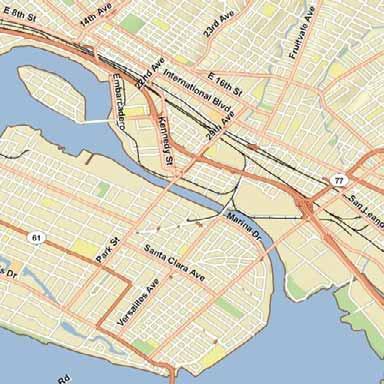
21 , 37.75
22 How to create a cache

23 Author the map Choose a set of scale levels and design at those ArcGIS Online, Google Maps, VE scales, or your own? Add the scales to the ArcMap dropdown list Make the map look good at each scale
24 Authoring tips Copy layers Can set a different scale range and symbology for each copy Group layers by scale level Only have to set the scale range at the group layer level
25 More authoring tips Set the Full Extent to the area that you want to cache ArcMap allows a custom Full Extent Use the Maplex labeling engine
26 Tips for the background color Transparent color defaults to near-white (253, 253, 253) Avoid using a background color that s already in your map


27 Anti-aliasing Smooths edges of labels and lines by blending them with the background Choose background color carefully! Improves display quality (over standard rendering in ArcMap) Cannot set this up in ArcMap. Use the caching tools. Takes longer to cache
28 Publish the map as a service Use either ArcCatalog or Manager Raise the default Maximum Number of Instances if necessary Access this setting in the Service Properties Default is 2 instances max. If you have more server power, you can raise it. Must start the service before caching


29 Create the cache Must do this from ArcCatalog or ArcToolbox Use the Caching tab of the Service Properties
30 Caching jobs are defined by Cache tiling scheme Full extent of the map service (derived from the data frame full extent in the source MXD) For example: Tiling origin is -180, 90 Map service extent is the bounding box of Colorado Tiles will only be generated within and around the bounding box of Colorado The tile rows and columns will be referenced from the tile origin (-180, 90)
31 Demo Basic cache creation
32 Two types of caching scenarios 1. Small scope: Cities, Counties, etc. 2. Large scope: The continental United States down to 1:10,000 The geographic extent and the levels of detail (scale levels) of the area of your caching job directly influence the amount time you will need to devote to the caching process
33 Generating a large map cache Can be time consuming Tip: Create the cache for a small area before building the whole thing. 1. Set a custom Full Extent on your map to a small area. 2. Build the test cache 3. Examine appearance of symbology, labels, etc. 4. Test the performance of the cache in your preferred client application 5. Make necessary adjustments and build again
34 Factors that influence cache creation time Geographic extent Number and choice of scale levels Complexity of the map If it takes a long time to draw in ArcMap, it will take a long time to cache. Anti-aliasing Generally twice as long to generate Data source type Enterprise geodatabase vs. local copies of data Server resources For example, SOC machines and available service instances Network bandwidth between SOC machine and cache directory
35 Tile size influences cache creation time Larger size produces fewer tiles Less disk space (block size) Faster creation Easier to manage Smaller size produces more tiles Allows partial update of the display Takes approximately 5X as long and takes up 1Gb more of space when creating a cache at 128x128 tile size versus 512x512 tile size with the same data (Hawaii) ArcGIS Online uses 512 X 512 Google Maps and Virtual Earth use 256 X 256
36 Tips for large scope caching jobs When caching very large geographic areas break up caching job to distinct areas. Use UpdateMapServerCache to cache each area You can use a script if you have many areas See blog post: Strategies for large caching jobs
37 Using the cache Map caches can be used in ArcMap ArcReader Web Mapping Applications ArcGlobe ArcGIS Explorer Google Maps Virtual Earth Etc.
38 Using map caches in ArcMap Gives you a high level of control of how you view the cache Continuous zoom Associates current view with a level of detail in the map cache and then resamples up to match the current view Image quality can vary depending on how far away you are from a cached scale Can easily blend with other services and data Reprojection supported ArcMap reprojects an existing tile instead of generating a dynamic map. Some performance lost.
39 ArcMap creates a local cache Improves performance for areas you ve already visited Can get out of sync with server side cache Cache administrator must notify clients to clear their caches when an update is available Clear cache in layer Properties
40 ArcGIS Server Web mapping applications 9.2 Service Pack 2 or above highly recommended Allows for easier overlay of caches To get the performance benefit of the cache: Navigation is limited to the cached scales Cached tiles cannot be projected on the fly Use a common tiling scheme when overlaying caches Don t have to cache at all scales
41 Using map caches in 9.2 Service Pack 2 and above Internet Explorer 6 with transparent PNG images. IE 6 and earlier does not honor transparency in PNG24 Best practice is to use PNG8 or PNG32 In.NET Web mapping applications with IE 6 If you try to use PNG24 for an overlay cache, the Web application will generate the image dynamically, thereby slowing performance. In Java Web mapping applications with IE 6 If you try to use PNG24 for an overlay cache, you will not be able to see what s below it.


42 Updating the cache Necessary if you want to see changes in your data Gives you the performance benefit of caching, even with changing data
43 Will updating allow me to cache my data? How up to date does my map need to be? Determines update frequency If real-time display is not required, you may be able to cache with scheduled updates If real-time data display is required, use graphics layer or dynamic map How big is my cache? Determines update time What is the acceptable amount of time that my cache update can take before it becomes inefficient?
44 How to update a cache Manually: Launch update tool from Caching tab of the Service Properties Automatically: Use scripting to call the update tool Schedule a job on your operating system to run the script See the ArcGIS Server Development Blog for an example Python script Note: Users must clear local cache to see updates ArcGIS Desktop and ArcGIS Explorer maintain these local caches
45 Common Caching Questions
46 How do I choose the best cache settings? Choose your closest scale level carefully Zoom in just as far as you need without getting any closer Use fused caches whenever possible Create logical groups of layers and overlay the fused caches to get a multi-layer effect Choose one tiling scheme for all your caches But you don t have to create tiles at all of the scale levels

47 How do I create tiles for only some of the levels in my tiling scheme? 1. Cancel Generate Map Server Cache while in progress 2. Run Update Map Server Cache and check only the desired scales

48 Case study: Creating caches for ArcGIS Online
49 ArcGIS Online is A set of GIS services hosted by ESRI Includes a variety of maps Imagery Street map Shaded relief Etc. All map services on ArcGIS Online are cached Demo...
50 Planned scales and tiling scheme ahead of time Chose one tiling scheme for all caches Chose scales that wouldn t overlap at 180 degrees longitude This tiling scheme is available on the ArcGIS Server Development Blog Cartographers designed the maps around these chosen scales Cached each map only at the scales appropriate for its intended use
51 Chose cache settings carefully Used anti-aliasing with lines and text PNG8 format for overlay services Boundaries, Street network for overlaying imagery, etc. Used JPG image format for base maps Street map, imagery, etc.
52 Set Tile Compression Quality = 90 for JPG tiles Higher quality than default JPGs Default quality is 75 Increasing to 90 removes chatter around text and linework Tile sizes about 30% greater than default JPGs A reasonable increase

53 Image Format comparison JPG100 PNG24 JPG75 JPG90 (Current Service)
54 Made small test caches of a known area Chose Salt Lake City for its mix of landscapes Urban and rural Flat and mountainous Used test caches to verify map design choices Did the maps look good at all scales? Ran code to report the rows and columns in the test caches This gave an estimate of the size of the final cache See blog post Working with map caches programmatically to get the code


55 Monitored the caching jobs Used Windows Performance Monitor (perfmon) to see where hardware was being stressed during caching
56 Copied caches to production server Windows Copy/Paste inefficient for moving large numbers of files Large caches contain millions of files Windows indexes files before copying SecureCopy a more reliable option Reports if there are failures Experimented with other methods (xcopy, RoboCopy, imaging software, scripting zip file creation, etc.) Always looking for new alternatives...
57 Additional work Created globe caches Overlayed map cache on globe and then cached the globe This factored into original choice of scales See blog post: Creating a 3D globe cache from a 2D map cache Configured web server to return a No data tile for uncached areas See blog post: Configuring your server to return a Data not available tile for empty map cache areas
58 Caching improvements in ArcGIS Server 9.3

59 New workflow Set the tiling scheme, then create the tiles Uses Manage Map Server Cache Tiles tool for both Create and Update

60 Caching tab is also available in Manager You can use it to: Define the tiling scheme for a service Enable cache on demand You cannot use it to launch the caching tools

61 Easier to select tiling schemes Select tiling scheme from common mapping solutions: ArcGIS Online, Microsoft Virtual Earth, Google Maps Allows for successful overlay of caches Your map must match the coordinate system of the service whose tiling scheme you re using (WGS 84 for ArcGIS Online, WGS 84 Web Mercator for VE/Google)
62 Other tiling scheme options Select tiling scheme from an existing service Browse to a tiling scheme file (9.2 solution)

63 Cache on demand

64 On-demand caching Creates tiles as they are visited by users and adds them to your cache First visitor to an area must wait for the tiles to be created Enable in ArcCatalog or Manager Use the Caching tab of the Service Properties

65 Performance tips for on-demand caching Use with ArcGIS Server Internet connections Tip: Pre-create tiles for areas that you anticipate will be most popular, then create the rest on demand

66 Cache by feature class Cache only within boundary of features you supply You can supply a feature class with just one feature Avoid numerous features or geographically small features Saves time and disk space California example:

67 Cache by feature class Set the feature class in the Manage Map Server Cache Tiles tool Optionally, track the status of which features have been cached Tip: Create the rest of the tiles on demand
68 Fixed memory leak / locking situations Affects caching scenarios with: SDC data Compressed File Geodatabase data TIFF images MrSID images

69 Add and remove scales from an existing cache Use the Manage Map Server Cache Scales tool Edits the cache configuration and the cache folders on disk

70 Improvements to ArcMap as a client Improved display of resampled cached tiles Improves the look of ArcGIS Online Street Map Helps eliminate issues like disappearing boundaries :


71 Improvements to ArcMap as a client Zooming in past the lowest level uses a resample of the last available resolution New Caching tab on the layer properties

72 Client-side caching improvements Clients can opt out of caching locally Server administrators can prohibit local caching of tiles on client Set in Caching tab of Service Properties Use this option if you re updating your cache frequently
73 WMS services take advantage of cache 1. Enable the WMS capability on a cached map service 2. The WMS service will use the cached images instead of generating an image on the fly Only uses cached images when there is no need to change projection, layer order, layer visibility, background, etc.
74 Updated documentation Caching Help greatly expanded between 9.2 and 9.3 Web help is constantly updated Web Help is available at 9.3 Beta (requires a login): ArcGIS Server Development Blog posts address specific problems and are later moved to the web help
75 9.3 caching demo 1. Open ArcMap and show projection 2. Build a full cache for small scales (zoomed out) 3. Create the rest of the tiles on demand
76 In Conclusion Slides and code will be available on EDN Please fill out session surveys! Still have questions? 1. Tech talk, Meet the Team 2. Ask a Developer link on web page ESRI Developer Summit
Creating 2D Map Caches with
 Creating 2D Map Caches with ArcGIS Server 9.2 Presented by: The multi-threaded, threaded, over-clocked, dual core Diplo Matt Still AND the fast, the furious, the fully cached, Jonathan Fisk ArcGIS Server
What should y you expect in this session? Basic to advanced topics Outline What is map caching? Why should I cache? Caching workflow How to create a c
 Designing, Deploying, and Using Cached Map Services David Crosby & Craig Mesimer What should y you expect in this session? Basic to advanced topics Outline What is map caching? Why should I cache? Caching
Advanced Map Caching. Tom Brenneman
 Advanced Map Caching g Topics Sterling Quinn Tom Brenneman Schedule Advanced topics Key caching properties C Caching g strategies g Test caches Strategic cache creation On--demand caching On Creating a
Designing and Using Cached Map Services
 Esri International User Conference San Diego, California Technical Workshops July 2012 Designing and Using Cached Map Services Sterling Quinn Eric Rodenberg What we will cover Session Topics - Map cache
Designing and Using Basemaps. Jennifer Hughey
 Designing and Using Basemaps Jennifer Hughey Agenda The ArcGIS System Basemaps are a key component of your system Cartographic design considerations Using basemap layers in ArcMap Best practices for designing
Best Practices for Designing Effective Map Services
 2013 Esri International User Conference July 8 12, 2013 San Diego, California Technical Workshop Best Practices for Designing Effective Map Services Ty Fitzpatrick Tanu Hoque What s in this session Map
Architecting ArcGIS Server Solutions for Performance and Scalability
 Architecting ArcGIS Server Solutions for Performance and Scalability Dave Wrazien Eric Miller ESRI Developer Summit 2008 1 Schedule 75 minute session 60 65 minute lecture 10 15 minutes Q & A following
SERVER GIS: HIGH PERFORMANCE DELIVERED!
 SERVER GIS: HIGH PERFORMANCE DELIVERED! Jayateerth Deshpande & Sanjay Shrivastava Reliance Industries Ltd. Abstract: In the current era of using web technologies for sharing information, WebGIS is becoming
ArcGIS Desktop The Road Ahead. Amadea Azerki
 ArcGIS Desktop The Road Ahead Amadea Azerki Agenda An Overview of ArcGIS 10 Desktop Enhancements User Interface Mapping Editing Analysis Sharing Q & A ArcGIS 10 Overview Focuses on Usability and Productivity
Getting Started with ArcGIS for Server. Charmel Menzel and Ken Gorton
 Getting Started with ArcGIS for Server Charmel Menzel and Ken Gorton Agenda What is ArcGIS for Server? Types of Web services Publishing resources onto the Web Clients to ArcGIS for Server Editions and
Introduction to ArcGIS Server 10.1
 Introduction to ArcGIS Server 10.1 E-Learning for the GIS Professional Any Time, Any Place! geospatialtraining.com Module Outline What is ArcGIS Server? GIS Resources and Services ArcGIS Server Components
Visualization with ArcGlobe. Brady Hoak
 Visualization with ArcGlobe Brady Hoak Contents What is ArcGlobe? 3D Mapping and ArcGlobe Displaying data in ArcGlobe ArcGlobe tools Tips for constructing ArcGlobe documents New at ArcGIS 9.3 ArcGIS integration
Cartographic Techniques and Representations
 Cartographic Techniques and Representations NEARC 2007 ESRI Technical Session ESRI, Boston Overview of Presentation Labeling and Annotation Masking Layout Tips Cartographic Representations Labeling versus
What's New in ArcGIS 9.2 Service Packs
 What's New in ArcGIS 9.2 Service Packs 18 July 2007 Updated for Service Pack 3 This document describes the main enhancements to 9.2 added by the service packs. It does not cover the bug fixes and quality
LAB 1: Introduction to ArcGIS 8
 LAB 1: Introduction to ArcGIS 8 Outline Introduction Purpose Lab Basics o About the Computers o About the software o Additional information Data ArcGIS Applications o Starting ArcGIS o o o Conclusion To
NCDA&CS, Emergency Programs, ISS Group. --- Daniel Madding, Robert Hilton, Yongjun Lei, Tim Muhs, Ed Shipman
 NCDA&CS, Emergency Programs, ISS Group --- Daniel Madding, Robert Hilton, Yongjun Lei, Tim Muhs, Ed Shipman Outline What is Map Caching? Advantages / Disadvantages NCDA&CS Caching Strategies Cache Settings
Building Basemaps: MapCaches and VectorTiles. Matthias Schenker Gerhard Trichtl
 Building Basemaps: MapCaches and VectorTiles Matthias Schenker Gerhard Trichtl What are Basemaps for Basemaps provide a optimal background and orientation for displaying your data on top Should be - Fast
Raster Serving with ArcGIS
 Raster Serving with ArcGIS Agenda Introduction to server technology Workflow considerations ESRI raster serving technology ArcGIS Server Basic (ArcSDE) ArcGIS Server Standard/Advanced Web Services ArcGIS
Answer the following general questions: 1. What happens when you right click on an icon on your desktop? When you left double click on an icon?
 Name: Date: June 27th, 2011 GIS Boot Camps For Educators Practical: Explore ArcGIS 10 Desktop Tools and functionality Day_1 Lecture 1 Sources: o ArcGIS Desktop help o ESRI website o Getting to Know ArcGIS
Caching Imagery Using ArcGIS
 2013 Esri International User Conference July 8 12, 2013 San Diego, California Technical Workshop Caching Imagery Using ArcGIS Hong Xu, Hua Wei Esri UC2013. Technical Workshop. Presentation Goals Publish
What's New in ArcGIS 9.2 Service Packs
 What's New in ArcGIS 9.2 Service Packs 8 July 2008 Updated for Service Pack 6 This document describes the main enhancements to 9.2 added by the service packs. It does not cover the bug fixes and quality
What s s Coming in ArcGIS 10 Desktop
 What s s Coming in ArcGIS 10 Desktop Damian Spangrud ArcGIS Product Manager, ESRI dspangrud@esri.com (or at least turn to silent) ArcGIS 10 A Simple & Pervasive System for Using Maps & Geographic Information
Lab Assignment 4 Basics of ArcGIS Server. Due Date: 01/19/2012
 Lab Assignment 4 Basics of ArcGIS Server Due Date: 01/19/2012 Overview This lab assignment is designed to help you develop a good understanding about the basics of ArcGIS Server and how it works. You will
Introduction to GIS 2011
 Introduction to GIS 2011 Digital Elevation Models CREATING A TIN SURFACE FROM CONTOUR LINES 1. Start ArcCatalog from either Desktop or Start Menu. 2. In ArcCatalog, create a new folder dem under your c:\introgis_2011
Implementing Security for ArcGIS Server Java Solutions
 Implementing Security for ArcGIS Server Java Solutions Shreyas Shinde Jay Theodore ESRI Developer Summit 2008 1 Schedule 75 minute session 60 65 minute lecture 10 15 minutes Q & A following the lecture
Desktop. ArcGIS Server. ArcGIS
 Getting Started with ArcGIS Server Nakul Bhatia and David Crosby ESRI Charlotte 1 Agenda g Overview of ArcGIS Server 9.3.1 Working with GIS Services Using g Web GIS Service Clients ArcGIS Online Map Caching
Pictometry for ArcGIS Desktop Local Release Notes
 Version 10.4 The Desktop - Local 10.4 extension is compatible with ArcGIS Desktop 10.4. Version 10.3.2 This extension includes a new installer, which allows you to select a location (other than Program
Best Practices for Designing Effective Map Services
 FedGIS Conference February 24 25, 2016 Washington, DC Best Practices for Designing Effective Map Services James Tedrick, Esri Matt Sokol, MD Dept. of Information Technology Web Mapping & Service Types
Geographical Information Systems Institute. Center for Geographic Analysis, Harvard University. LAB EXERCISE 1: Basic Mapping in ArcMap
 Harvard University Introduction to ArcMap Geographical Information Systems Institute Center for Geographic Analysis, Harvard University LAB EXERCISE 1: Basic Mapping in ArcMap Individual files (lab instructions,
The ArcMap Interface and Using Basic ArcMap Analysis Tools to Create a Map
 The ArcMap Interface and Using Basic ArcMap Analysis Tools to Create a Map *You will need a computer with ESRI ArcGIS Desktop version 9.3 or higher installed* Data Download 1. Save the zipped folder with
Configuring, Tuning and Managing ArcGIS Server. Dan O Leary James Cardona Owen Evans
 Configuring, Tuning and Managing ArcGIS Server Dan O Leary James Cardona Owen Evans Introductions and Overview Welcome and Thanks for Attending Approach of this Session Share Best Practices and Techniques
ESRI Technology Update. Joe Holubar Larry Young
 ESRI Technology Update Joe Holubar Larry Young Continued Improvement Improving Quality and Extending and Refining Functionality First Half of 2009: Minor Update Release (ArcGIS 9.3.1) ArcGIS Explorer Fall
Enabling High-Quality Printing in Web Applications. Tanu Hoque & Jeff Moulds
 Enabling High-Quality Printing in Web Applications Tanu Hoque & Jeff Moulds Print Service Technical Session Outline What s new in 10.6x What is Print Service Out of the box print solutions Print service
2013 Esri International User Conference July 8 12, 2013 San Diego, California
 Vistronix is a leader in Technology Solutions and Information Management Services. 2013 Esri International User Conference July 8 12, 2013 San Diego, California Building Cache Tiles with ArcGIS Server
How to Create a Tile Package
 United States Department of Agriculture Digital Mobile Sketch Mapping (DMSM) How to Create a Tile Package (TPK) Forest Service Introduction A tile package (.tpk) allows you to use a set of packaged tiles
Integrating CAD Data with ArcGIS
 Integrating CAD Data with ArcGIS Agenda An Overview of CAD Drawings CAD Data Structure in ArcGIS Visualization Georeferencing Data Conversion ArcGIS for AutoCAD Q & A CAD Drawings - Overview Widely used
Implementing ArcGIS Mobile Applications for the Enterprise
 Implementing ArcGIS Mobile Applications for the Enterprise Myles Sutherland Glenn Meister ESRI Developer Summit 2008 1 Schedule 75 minute session 60 65 minute lecture 10 15 minutes Q & A following the
Desktop Mapping: Creating Vector Tiles. Craig Williams
 Desktop Mapping: Creating Vector Tiles Craig Williams Edie Punt @williamscraigm @epunt Overview Why vector tiles? Vector tiles in ArcGIS ArcGIS vector tile basemaps Consuming and styling vector tiles Overview
Explore some of the new functionality in ArcMap 10
 Explore some of the new functionality in ArcMap 10 Scenario In this exercise, imagine you are a GIS analyst working for Old Dominion University. Construction will begin shortly on renovation of the new
Annotation/Labeling Workshop. Tim Rankin Pat Dolan
 Annotation/Labeling Workshop Tim Rankin Pat Dolan Agenda 8:00am - Introductions 8:05am - Goals of the Workshop 8:15am Labeling 8:45am Annotation Part I 9:15am Break 9:25am Annotation Part II 9:50am Questions
ArcGIS Pro: Mapping & Visualization. David Watkins, Edie Punt &
 ArcGIS Pro: Mapping & Visualization David Watkins, Edie Punt & Craig Williams @daviddwatkins, @epunt, & @williamscraigm Mapping an Visualization Vision In ArcGIS Pro Improve drawing performance and quality
Desktop Mapping: Creating Vector Tiles. Craig Williams &
 Desktop Mapping: Creating Vector Tiles Craig Williams & Edie Punt @williamscraigm @epunt Overview Why vector tiles? Vector tiles in ArcGIS ArcGIS vector tile basemaps Consuming and styling vector tiles
ArcGIS for Server Michele Lundeen
 ArcGIS for Server 10.1 Michele Lundeen Summary Vision Installation and Configuration Architecture Publishing Functional Enhancements Cloud Migration and Best Practices Powerful GIS capabilities Delivered
Using and Managing Raster Data in Server Applications
 Using and Managing Raster Data in Server Applications Peter Becker Feroz Abdul-Kadar ESRI Developer Summit 2008 1 Schedule 75 minute session 60 65 minute lecture 10 15 minutes Q & A following the lecture
Tutorial 1 Exploring ArcGIS
 Tutorial 1 Exploring ArcGIS Before beginning this tutorial, you should make sure your GIS network folder is mapped on the computer you are using. Please refer to the How to map your GIS server folder as
ArcGIS Runtime SDK for WPF
 Esri Developer Summit in Europe November 9 th Rotterdam ArcGIS Runtime SDK for WPF Mike Branscomb Mark Baird Agenda Introduction SDK Building the Map Query Spatial Analysis Editing and Geometry Programming
Caching Tile Cache Creation & Management
 Exploring Options for Map Caching Tile Cache Creation & Management Presented By: Todd Wascher, Business Development Manager 04.21.2011 We Visualize Your World Whachutalkinbout? What we ll cover with this
Setting up a 3D Environment for the City of Portland
 Setting up a 3D Environment for the City of Portland www.learn.arcgis.com 380 New York Street Redlands, California 92373 8100 USA Copyright 2018 Esri All rights reserved. Printed in the United States of
What s New in ArcGIS Server 10
 What s New in ArcGIS Server 10 Derek Law ArcGIS Server Product Management What s s new in ArcGIS Server 10? Agenda Highlights: Enhanced Web mapping More powerful server-based analysis Geo-collaboration
Geospatial Day II Introduction to ArcGIS Editor for Open Street Map
 Geospatial Day II Introduction to ArcGIS Editor for Open Street Map Geospatial Operations Support Team (GOST) Katie McWilliams kmcwilliams@worldbankgroup.org GOST@worldbank.org 0 Using OSM for Network
MAPLOGIC CORPORATION. GIS Software Solutions. Getting Started. With MapLogic Layout Manager
 MAPLOGIC CORPORATION GIS Software Solutions Getting Started With MapLogic Layout Manager Getting Started with MapLogic Layout Manager 2011 MapLogic Corporation All Rights Reserved 330 West Canton Ave.,
Encoded URLs in hyperlinks. TerraGo Publisher for ArcGIS TerraGo Publisher for ArcGIS Server TerraGo Arc2Edge Version 7.3.
 TerraGo Publisher for ArcGIS TerraGo Publisher for ArcGIS Server TerraGo Arc2Edge Version 7.3.1, December 2017 What is TerraGo Publisher for ArcGIS? What is TerraGo Arc2Edge? What s new in this release?
ArcMap: Tips and Tricks
 Esri International User Conference San Diego, California Technical Workshops July 23 27, 2012 ArcMap: Tips and Tricks Miriam Schmidts Jorge Ruiz-Valdepena Agenda Navigating ArcMap Repairing data links
Bringing your Data to Life in the ArcGIS API for JavaScript: Vector Tiles. Craig Williams &
 Bringing your Data to Life in the ArcGIS API for JavaScript: Vector Tiles Craig Williams & Rene Rubalcava @williamscraigm @odoenet Overview Why vector tiles? Vector tiles in ArcGIS ArcGIS vector tile basemaps
IndianaMap Release 3. Rick Hill, Paul Rohwer,, Chris Dintaman, Becky Meyer, and Denver Harper
 IndianaMap Release 3 Rick Hill, Paul Rohwer,, Chris Dintaman, Becky Meyer, and Denver Harper IndianaMap Agenda Session 1 & 2 Overview Tentative rollout schedule Old versus New Design and construction of
Managing Image Data on the ArcGIS Platform Options and Recommended Approaches
 Managing Image Data on the ArcGIS Platform Options and Recommended Approaches Peter Becker Petroleum requirements for imagery and raster Traditional solutions and issues Overview of ArcGIS imaging capabilities
INTRODUCTION TO GIS WORKSHOP EXERCISE
 111 Mulford Hall, College of Natural Resources, UC Berkeley (510) 643-4539 INTRODUCTION TO GIS WORKSHOP EXERCISE This exercise is a survey of some GIS and spatial analysis tools for ecological and natural
Architecting ArcGIS Server Solutions for Linux and Solaris
 Architecting ArcGIS Server Solutions for Linux and Solaris David Cordes Cherry Lin Egor Podgornov ESRI Developer Summit 2008 1 Schedule 75 minute session 60 65 minute lecture made up of moments of horror
This will display various panes in a window.
 Map Map projections in ArcMap can be a bit confusing, because the program often automatically reprojects data for display, and there are a ways to permanently project data to new data sets. This describes
ArcGIS Basics Working with Labels and Annotation
 ArcGIS Basics Working with Labels and Annotation Labeling in ArcGIS has changed considerably from the old ArcView 3.X version. In ArcGIS label positions are generated automatically, are not selectable,
GIS Workbook #1. GIS Basics and the ArcGIS Environment. Helen Goodchild
 GIS Basics and the ArcGIS Environment Helen Goodchild Overview of Geographic Information Systems Geographical Information Systems (GIS) are used to display, manipulate and analyse spatial data (data that
Basic Mapping: Livelihood Zones In Haiti
 Basic Mapping: Livelihood Zones In Haiti - 2009 Barbara Parmenter, revised by Carolyn Talmadge 9/10/2016 DATA SOURCES... 1 MAPPING NETWORK DRIVES OUTSIDE THE DATA LAB... 2 SETTING UP YOUR ARCMAP SESSION...
Overview of Server Technologies. Katja Krivoruchko ESRI
 Overview of Server Technologies Katja Krivoruchko ESRI Agenda Introduction to Server Technology Workflow Considerations ESRI Server Technology ArcSDE ArcGIS Server ArcGIS Image Server File Server Implementation
Working with Feature Layers. Russell Brennan Gary MacDougall
 Working with Feature Layers Russell Brennan Gary MacDougall Working with Feature Layers Session will focus on feature access and editing Highlight new features added over the last few releases Agenda Introduction
An ESRI White Paper July 2009 Best Practices for Creating an ArcGIS Server Web Mapping Application for Municipal/Local Government
 An ESRI White Paper July 2009 Best Practices for Creating an ArcGIS Server Web Mapping Application ESRI 380 New York St., Redlands, CA 92373-8100 USA TEL 909-793-2853 FAX 909-793-5953 E-MAIL info@esri.com
Digitising a map in arcgis desktop 10.3
 Digitising a map in arcgis desktop 10.3 1 CONTENTS 2 Evaluating your map... 2 3 Setting up the base map... 3 4 Georeferencing your map/maps... 3 4.1 Georeferencing tips.... 4 5 Digitising your maps...
for ArcSketch Version 1.1 ArcSketch is a sample extension to ArcGIS. It works with ArcGIS 9.1
 ArcSketch User Guide for ArcSketch Version 1.1 ArcSketch is a sample extension to ArcGIS. It works with ArcGIS 9.1 ArcSketch allows the user to quickly create, or sketch, features in ArcMap using easy-to-use
GIS IN ECOLOGY: CREATING RESEARCH MAPS
 GIS IN ECOLOGY: CREATING RESEARCH MAPS Contents Introduction... 2 Elements of Cartography... 2 Course Data Sources... 3 Tasks... 3 Establishing the Map Document... 3 Laying Out the Map... 5 Exporting Your
Building Applications with the ArcGIS Runtime SDK for WPF
 Esri International User Conference San Diego, California Technical Workshops 24 th July 2012 Building Applications with the ArcGIS Runtime SDK for WPF Euan Cameron & Paul Pilkington Agenda Introduction
Overview. Review. GEOL 452/552 - GIS for Geoscientists I. Lecture 4. what is a feature class? What is georeferenced Data? what are layers?
 GEOL 452/552 - GIS for Geoscientists I Lecture 4 Overview Tutorial and HW 1 went OK? Today Review of concepts from last lecture Scales Labels ArcMap follow-along tour More material about ArcMap in WebCT
Exercise 1: Getting to know ArcGIS
 The Scenario You are working for the California Visitor s Commission. You have been asked to prepare a map of California for several dignitaries from out of the country. Your map will need to include enough
ArcGIS Runtime: Styling Maps. Ralf Gottschalk, Daniel Lee, Lucas Danzinger
 ArcGIS Runtime: Styling Maps Ralf Gottschalk, Daniel Lee, Lucas Danzinger Map Styling What is this session about? Creating beautiful functional maps for your Runtime Apps - Not about cartography It is
Managing Imagery and Raster Data Using Mosaic Datasets
 2013 Esri International User Conference July 8 12, 2013 San Diego, California Technical Workshop Managing Imagery and Raster Data Using Mosaic Datasets Hong Xu, Prashant Mangtani Esri UC2013. Technical
Tutorial 1: Finding and Displaying Spatial Data Using ArcGIS
 Tutorial 1: Finding and Displaying Spatial Data Using ArcGIS This tutorial will introduce you to the following: Websites where you may browse to find geospatial information Identifying spatial data, usable
What is coming in. ArcGIS Server 10. Ismael Chivite ArcGIS Server Product Manager James Cardona Technical Marketing
 What is coming in ArcGIS Server 10 Ismael Chivite ArcGIS Server Product Manager James Cardona Technical Marketing ArcGIS Server is a complete server based GIS Delivering GIS with powerful services and
Deploying and Using ArcGIS Explorer for Petroleum Users Bern Szukalski ESRI Redlands
 Deploying and Using ArcGIS Explorer for Petroleum Users Bern Szukalski ESRI Redlands 1 ArcGIS: A Comprehensive GIS System Mobile, Web, Server, Desktop 2 Mapping, Cartography, Visualization, Editing, Data
Geography 281 Mapmaking with GIS Project One: Exploring the ArcMap Environment
 Geography 281 Mapmaking with GIS Project One: Exploring the ArcMap Environment This activity is designed to introduce you to the Geography Lab and to the ArcMap software within the lab environment. Please
Data Interoperability An Introduction
 Data Interoperability An Introduction Bruce Harold Dale Lutz - Esri Inc - Safe Software What is the Data Interoperability Extension? Moving data from app to app ETL in industry jargon If you are not the
Moving Desktop Applications to ArcGIS Server
 Moving Desktop Applications to ArcGIS Server Kelly Hutchins Jian Huang ESRI Developer Summit 2008 1 Schedule 75 minute session 60 65 minute lecture 10 15 minutes Q & A following the lecture Cell phones
Basic Tasks in ArcGIS 10.3.x
 Basic Tasks in ArcGIS 10.3.x This guide provides instructions for performing a few basic tasks in ArcGIS 10.3.1, such as adding data to a map document, viewing and changing coordinate system information,
Publishing image services in ArcGIS
 Esri International User Conference San Diego, California Technical Workshops July 26, 2012 Publishing image services in ArcGIS Wenxue Ju & Melanie Harlow What is an image service? A way to make image and
Web Server (IIS 6) ArcGIS Server 9.1. ArcGIS Server 9.1 Server Object Manager. Server Object Container
 ArcGIS Server 9.1. ArcGIS Server 9.1 Server Object Manager. Server Object Container") Deploying and Tuning ArcGIS Server Presented by Jim Mason and Ian Sims ESRI Server Development ArcGIS Server Case Study San Francisco Routing Application Point to Point Driving Directions Enter Two Addresses
Deploying and Tuning ArcGIS Server Presented by Jim Mason and Ian Sims ESRI Server Development ArcGIS Server Case Study San Francisco Routing Application Point to Point Driving Directions Enter Two Addresses
ArcGIS Enterprise: Advanced Topics in Administration. Thomas Edghill & Moginraj Mohandas
 ArcGIS Enterprise: Advanced Topics in Administration Thomas Edghill & Moginraj Mohandas Outline Overview: Base ArcGIS Enterprise Deployment - Key Components - Administrator Endpoints Advanced Workflows:
Streamlining Editing Workflows. Amber Bethell
 Streamlining Editing Workflows Amber Bethell Workflow for solving geographic problems Ask a question Create or acquire data Validate and update data Analyze data Create cartographic product Act upon knowledge
Well Unknown ID AKA EPSG: 3857
 Well Unknown ID AKA EPSG: 3857 Pamela Kanu November 2016 WGS 1984 WEB MERCATOR ALIASES: AUXILIARY SPHERE, WKID: 3857, WKID: 102100, WKID: 102113, SHERICAL MERCATOR, WGS 84/PSEUDO-MERCATOR, OPEN LAYERS:
ArcPad An Introduction
 ArcPad An Introduction Chris LeSueur, Marika Vertzonis, Hannah Ferrier ArcPad Sessions at the UC Demo Theatre - Preparing and Deploying Data to ArcPad - Using ArcPad in the Field - Customizing ArcPad without
Search & Rescue Map Specifications and Production Workflows
 Search & Rescue Map Specifications and Production Workflows About The Search & Rescue map product and production procedures discussed in this document can be utilized to support search, rescue, and relief
Creating a reference map
 Chapter 1 Creating a reference map Reference maps are basic, traditional maps. Their purpose is to illustrate geographic boundaries for cities, counties, and other areas. Reference maps have no underlying
Developers Road Map to ArcGIS Desktop and ArcGIS Engine
 Developers Road Map to ArcGIS Desktop and ArcGIS Engine Core ArcObjects Desktop Team ESRI Developer Summit 2008 1 Agenda Dev Summit ArcGIS Developer Opportunities Desktop 9.3 SDK Engine 9.3 SDK Explorer
ArcMap Tips and Tricks
 2013 Esri International User Conference July 8 12, 2013 San Diego, California Technical Workshop ArcMap Tips and Tricks Jack Horton Jorge Ruiz-Valdepeña Esri UC2013. Technical Workshop. Jorge s Agenda
Introduction to Geodatabase and Spatial Management in ArcGIS. Craig Gillgrass Esri
 Introduction to Geodatabase and Spatial Management in ArcGIS Craig Gillgrass Esri Session Path The Geodatabase - What is it? - Why use it? - What types are there? - What can I do with it? Query Layers
A Second Look at DEM s
 A Second Look at DEM s Overview Detailed topographic data is available for the U.S. from several sources and in several formats. Perhaps the most readily available and easy to use is the National Elevation
Interactive Maps Purpose: Login to the System: Interactive Maps ONTINUE AGREE
 Interactive Maps Purpose: The purpose of this application is to provide the facility to the citizen to navigate to a Property through an On-line Free Web Application in real time. The application uses
In this lab, you will create two maps. One map will show two different projections of the same data.
 Projection Exercise Part 2 of 1.963 Lab for 9/27/04 Introduction In this exercise, you will work with projections, by re-projecting a grid dataset from one projection into another. You will create a map
Basic Steps for Creating an Application with the ArcGIS Server API for JavaScript
 Chapter 4: Working with Maps and Layers Now that you have a taste of ArcGIS Server and the API for JavaScript it s time to actually get to work and learn how to build some great GIS web applications! The
Lesson 8 : How to Create a Distance from a Water Layer
 Created By: Lane Carter Advisor: Paul Evangelista Date: July 2011 Software: ArcGIS 10 Lesson 8 : How to Create a Distance from a Water Layer Background This tutorial will cover the basic processes involved
ArcGIS Enterprise Systems: Performance and Scalability
 Federal GIS Conference 2014 February 10 11, 2014 Washington DC ArcGIS Enterprise Systems: Performance and Scalability Andrew Sakowicz Introductions Target audience - GIS, DB, System administrators - Testers
Managing Imagery And Raster Data Using Mosaic Dataset. Peter Becker & Cody Benkelman
 Managing Imagery And Raster Data Using Mosaic Dataset Peter Becker & Cody Benkelman ArcGIS is a Comprehensive Imagery Platform Imagery is integral to the ArcGIS Platform System of Engagement System of
Geography 281 Mapmaking with GIS Project One: Exploring the ArcMap Environment
 Geography 281 Mapmaking with GIS Project One: Exploring the ArcMap Environment This activity is designed to introduce you to the Geography Lab and to the ArcMap software within the lab environment. Before
An Introduction to Using Lidar with ArcGIS and 3D Analyst
 FedGIS Conference February 24 25, 2016 Washington, DC An Introduction to Using Lidar with ArcGIS and 3D Analyst Jim Michel Outline Lidar Intro Lidar Management Las files Laz, zlas, conversion tools Las