Schema transformations in mass data harmonization process. Yohann Ly 8/9 Octobre 2013 Marne la Vallée
|
|
|
- Marcia Marylou Mitchell
- 6 years ago
- Views:
Transcription


1 Schema transformations in mass data harmonization process Yohann Ly 8/9 Octobre 2013 Marne la Vallée
2 Mass data harmonization process Problematic : Multiple data providers Multiple storage format Multiple data schema Amount of data INSPIRE format GMLs Data Provider 1 Oracle Central organization Data Provider 2 Data Provider Post GIS Enterprise GIS Centralized database Access SQL Server GeoMedia INSPIRE schema
3 What is Enterprise GIS? Enterprise GIS (EGIS) Desktop application built on top of GeoMedia as well as an EGIS Service that allows the enterprise capabilities to be accessed from Geospatial Portal. Deployed in Poland, Netherlands, Nigeria, Spain, Austria and Sweden. It has a SDK, English documentation for users, administrators and developers Intergraph Corporation 3
.")

4 Sophisticated access control SSO based on the Windows domain Open architecture to add custom authentication method (e.g. with LDAP). Traditional login-password authentication method available. Integration with third-party identity providers implementing Web SSO with SAML 2.0 protocol available. This is a Windows domain SSO example. EGIS can utilize Web SSO with SAML 2.0.


5 Sophisticated access control User interface to manage Roles and groups and users Users can be placed inside some organization structure. 5


6 Sophisticated access control Access rights for Feature classes / Attributes / Spatial Extent 6


7 Data AK7 Server Hides the database-level complexity to the end user. Enterprise GIS will give end user access to data he s allowed to have, and easy-to-use interface to work with it. Different data sources are treated as they would be only one 7
8 Diapositive 7 AK7? niezwiązane w warsztatami. To jest techniczna ciekawostka, raczej na koniec, jeżeli wogóle Alina Kmiecik; 01/10/2013

 placed in a tree")
9 Categories tree End user doesn t work on raw database tables (e.g. SKJZ_L), he works on friendly names (e.g. Roads) placed in a tree structure.


10 Feature properties Names of classes and attributes can be changed in easy way


11 Relations You can define relations between objects. Three types of relations: 1. Attribute. 2. Spatial. 3. Dependency table. 10


12 Relations You can define relations between objects. 11
13 Analysis It is possible to prepare various dynamic analysis (even analysis on analysis), register them in the system to work on them: Attribute query Attribute selection Join Union Buffer Zone Functional Attributes Analytical Merge Aggregation Spatial query Spatial Intersection Spatial difference
14 Analysis It is possible to prepare various dynamic analysis (even analysis on analysis), register them in the system to work on them: Data Provider 1 Oracle Central organization Data Provider 2 Data Provider Post PostGIS GIS Enterprise GIS Centralized database Access SQL Server Dynamic queries definitions INSPIRE schema


15 Data exchange Map different data models and exchange data. Translate dictionary entries, force values or convert geometry on-the-fly 14


16 Data exchange Different update policy: none, update and append, update only, append only or synchronize.


17 Class mapping For each class mapping there is attributes mapping defined.


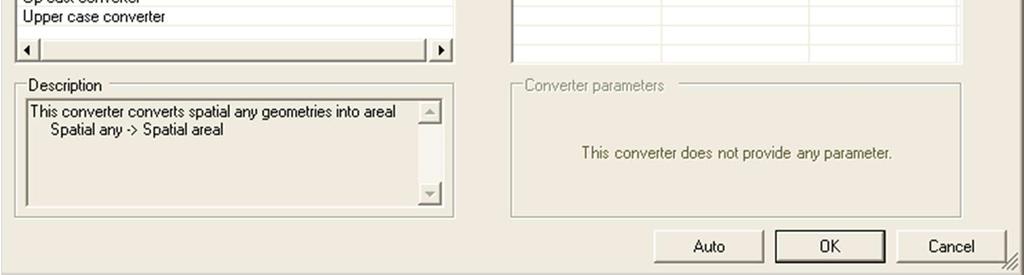
18 Attribute conversion
19 Data exchange Here s an example of what can we do along with transferring data. Source: MS Access Table name: LAKE Destination: Oracle Table name: GREAT_LAKES Column Type Column Type ID Autonumber ID INTEGER NAME Text Untrimmed values NAME VARCHAR DESC Text DESCRIPTION VARCHAR DETAILS GEOMETRY BLOB Area GEOM SDO_GEOMETRY Compound IMPORTED_BY VARCHAR Problem Table names don't match. Copying ID values may lead to unique constraint violation. Source attribute NAME may have leading and trailing white chars. Different column names with feature description. Lack of DETAILS column in the destination database. Different geometry type. Lack of IMPORTED_BY column in the source database. Solution Translate. Renumber. Trim. Translate. Skip. Convert. Force value. 18


20 Data exchange Data exchange can: Test schema Test import Import data


21 Import test


22 Import test Error Warning Ok


23 Import test


24 Data exchange report
25 Schema transformations First schema transformation is made on the Data Exchange level Source databases schemas Target database (INSPIRE application schema) Second schema transformation is made on GML files INSPIRE application schema GML Exporter (XLST transformation) INSPIRE complaint GML files


26 GML Exporter Feature classes to export Spatial filter Theme (INSPIRE) Output folder Output coordinate system
27 Why such a tool is needed? mass-data cadastral parcels 32 mln records many diffuse sources transportation network: source datasets, many different models transportation network: - 15 source application schemas
28 Thank you
Stir It Up: Achieving GIS Interoperability
 Stir It Up: Achieving GIS Interoperability City of Tacoma, Washington, USA Mike Murnane, Community & Economic Development John Shell, Public Works 2006 ESRI International User Conference - August 9, 8:30
The cadastral data and standards based on XML in Poland
 The cadastral data and standards based on XML in Poland Jarosław Bydłosz, Piotr Parzych AGH University of Science and Technology Cracow, Poland 1 XML XML Extensible Markup Language Extensible Markup Language
May 2013 Oracle Spatial and Graph User Conference
 May 2013 Oracle Spatial and Graph User Conference May 22, 2013 Ronald Reagan Building and International Trade Center Washington, DC USA Paul Calhoun & Vince Smith GIS Systems Analyst City Of Virginia Beach
Create a personal geodatabase
 Create a personal geodatabase To create a personal geodatabase that corresponds to the same release as the ArcGIS for Desktop client you are using, follow these steps: 1. In ArcCatalog, right-click the
GIS Basics for Urban Studies
 GIS Basics for Urban Studies Date: March 21, 2018 Contacts: Mehdi Aminipouri, Graduate Peer GIS Faciliator, SFU Library (maminipo@sfu.ca) Keshav Mukunda, GIS & Map Librarian Librarian for Geography (kmukunda@sfu.ca)
Announcements. Data Sources a list of data files and their sources, an example of what I am looking for:
 Data Announcements Data Sources a list of data files and their sources, an example of what I am looking for: Source Map of Bangor MEGIS NG911 road file for Bangor MEGIS Tax maps for Bangor City Hall, may
Reporting and Exchange of Air Quality Information Under CAFE Directive Using INSPIRE Services Testbed Results
 Reporting and Exchange of Air Quality Information Under CAFE Directive Using INSPIRE Services Testbed Results Alina Kmiecik, Dominik Kobus, Magdalena Bednarek, Anna Zamolska, Piotr Krok, Marek Brylski,
Using INSPIRE Services for Reporting and Exchange of Air Quality Information under CAFE Directive Test bed Results
 Using INSPIRE Services for Reporting and Exchange of Air Quality Information under CAFE Directive Test bed Results Alina Kmiecik, Dominik Kobus, Magdalena Bednarek, Piotr Krok, Anna Zamolska 26,6/2012,
InCLUDE Data Exchange. Julia Harrell, GISP GIS Coordinator, NC DENR
 InCLUDE Data Exchange Julia Harrell, GISP GIS Coordinator, NC DENR Julia.harrell@ncdenr.gov InCLUDE Project Partners NC Department of Environment & Natural Resources: The State of NC s lead environmental
ORACLE SPATIAL AT IOWA DOT. Eric Abrams Iowa Department of Transportation GIS-T 2012
 ORACLE SPATIAL AT IOWA DOT Eric Abrams Iowa Department of Transportation GIS-T 2012 HISTORY High and Low Roads to GIS Development Bijan Azad - Beirut, Lebanon 1997 1998 combine business data Road data
Introduction to Geodatabase and Spatial Management in ArcGIS. Craig Gillgrass Esri
 Introduction to Geodatabase and Spatial Management in ArcGIS Craig Gillgrass Esri Session Path The Geodatabase - What is it? - Why use it? - What types are there? - What can I do with it? Query Layers
XML and Inter-Operability in Distributed GIS
 XML and Inter-Operability in Distributed GIS KIM Do-Hyun and KIM Min-Soo, Republic of Korea Key words: GML(Geography Markup Language), Interoperability, GIS. SUMMARY Web GIS (Geographic Information Systems)
County of Los Angeles. Chief Information Office Preferred Technologies for Geographic Information Systems (GIS) Version 2 May 2015
 Version 2 May 2015") County of Los Angeles Chief Information Office Preferred Technologies for Geographic Information Systems (GIS) Version 2 May 2015 CIO Preferred Technologies for GIS This document lists the preferred Geographic
County of Los Angeles Chief Information Office Preferred Technologies for Geographic Information Systems (GIS) Version 2 May 2015 CIO Preferred Technologies for GIS This document lists the preferred Geographic
Oracle Database 10g: Introduction to SQL
 ORACLE UNIVERSITY CONTACT US: 00 9714 390 9000 Oracle Database 10g: Introduction to SQL Duration: 5 Days What you will learn This course offers students an introduction to Oracle Database 10g database
What s New in Desktop 10.1
 What s New in Desktop 10.1 Damian Spangrud Esri Redlands Trip Down Memory Lane ArcGIS A Complete System for Geographic Information Cloud Web Online Mobile Enterprise Desktop Sharing Information sharing
Store and Manage Data in a DBMS With ArcView Database Access. Presented By: Andrew Arana & Canserina Kurnia
 Store and Manage Data in a DBMS With ArcView Database Access Presented By: Andrew Arana & Canserina Kurnia Overview Topics to be Covered: General method for accessing data database themes, database tables
Training courses. Course Overview Details Audience Duration. Applying GIS
 Training courses (Last update: December 2017) Remarks: As part of a course a certificate is issued for each attendee. All software used during the courses is Open Source Software. Contact: allspatial Geospatial
Contents About This Guide... 5 About Notifications... 5 Managing User Accounts... 6 Managing Companies Managing Password Policies...
 Cloud Services Identity Management Administration Guide Version 17 July 2017 Contents About This Guide... 5 About Notifications... 5 Managing User Accounts... 6 About the User Administration Table...
OneStop Reporting 4.5 OSR Administration User Guide
 OneStop Reporting 4.5 OSR Administration User Guide Doc. Version 1.2 Updated: 10-Dec-14 Copyright OneStop Reporting AS Contents Introduction... 1 Who should read this manual... 1 What s included in this
Lecture 8. Database Management and Queries
 Lecture 8 Database Management and Queries Lecture 8: Outline I. Database Components II. Database Structures A. Conceptual, Logical, and Physical Components III. Non-Relational Databases A. Flat File B.
2012 Peer Small Business Data
 Welcome The installation program installs the following data sets: 2012 Peer Small Business Data 2012 Peer Small Business Data In order to use this data set you should be running CRA Wiz and Fair Lending
Copyright 2012, Oracle and/or its affiliates. All rights reserved.
 1 Real Life Applications of Location Analytics Dan Geringer, Senior Software Development Manager, Oracle Jayant Sharma, Director Prod Mgmt, Oracle 2 The following is intended to outline our general product
Querying Microsoft SQL Server (461)
") Querying Microsoft SQL Server 2012-2014 (461) Create database objects Create and alter tables using T-SQL syntax (simple statements) Create tables without using the built in tools; ALTER; DROP; ALTER COLUMN;
Querying Microsoft SQL Server 2012-2014 (461) Create database objects Create and alter tables using T-SQL syntax (simple statements) Create tables without using the built in tools; ALTER; DROP; ALTER COLUMN;
GEOSPATIAL ENGINEERING COMPETENCIES. Geographic Information Science
 GEOSPATIAL ENGINEERING COMPETENCIES Geographic Information Science The character and structure of spatial information, its methods of capture, organisation, classification, qualification, analysis, management,
VECTOR ANALYSIS: QUERIES, MEASUREMENTS & TRANSFORMATIONS
 VECTOR ANALYSIS: QUERIES, MEASUREMENTS & TRANSFORMATIONS GIS Analysis Winter 2016 Spatial Analysis Operations performed on spatial data that add value Can reveal things that might otherwise be invisible
Data Assembling Topics:
 Topics: 1. GPX to Shape file 2. Data conversion with FME 3. Create a polygon feature 4. Merging /Appending data into a new dataset 5. Reproject data from one coordinate system to another 6. Data clipping
HOW TO SETUP CFS POLICIES WITH LDAP AND SSO TO RESTRICT INTERNET ACCESS ON CFS 3.0
 HOW TO SETUP CFS POLICIES WITH LDAP AND SSO TO RESTRICT INTERNET ACCESS ON CFS 3.0 DESCRIPTION This article explains about how to integrate Premium Content Filtering Service with LDAP (With Single Sign
DOCUMENT HISTORY REV. NO. CHANGES DATE. 000 New Document 30 Mar Document Revision:
 DOCUMENT HISTORY DOCU-PROOF ENTERPRISE INSTALLATION GUIDE REV. NO. CHANGES DATE 000 New Document 30 Mar. 2010 001 Document Revision: 23 Jun. 2010 Added database support for MS SQL Server and ORACLE. 002
Key Terms. Attribute join Target table Join table Spatial join
 Key Terms Attribute join Target table Join table Spatial join Lect 10A Building Geodatabase Create a new file geodatabase Map x,y data Convert shape files to geodatabase feature classes Spatial Data Formats
AGIC 2012 Workshop Leveraging Free RDBMS in ArcGIS
 AGIC 2012 Workshop Leveraging Free RDBMS in ArcGIS Prescott, AZ October 2012 Instructors: Bo Guo, PE, PhD Terry Li Workshop Outline Part I Introduction Why RDBMS Discussion on Obstacles for using RDBMS
Marushka Server. Product Specification
 Introductory Information Product Marushka Server represents a new generation of tools (devices) for publication and use of GIS data in the Internet and intranet. It is built on component technology in.net
ArcGIS for Server Administration. Andrew Sakowicz
 ArcGIS for Server Administration Andrew Sakowicz asakowicz@esri.com Target audience Administrators (GIS, DBA, System) Architects Developers Level: Intermediate Outline Key administrative functions Configuring
Enterprise Guide. Delivering Information to the People Who Need to Know. Adrian Bruty Product Manager Business Intelligence SAS EMEA
 Enterprise Guide Delivering Information to the People Who Need to Know Adrian Bruty Product Manager Business Intelligence SAS EMEA Introduction Enterprise Guide Objectives Version 1.2 Demo 2 Challenges
Oracle 12C DBA Online Training. Course Modules of Oracle 12C DBA Online Training: 1 Oracle Database 12c: Introduction to SQL:
 Course Modules of Oracle 12C DBA Online Training: 1 Oracle Database 12c: Introduction to SQL: A. Introduction Course Objectives, Course Agenda and Appendixes Used in this Course Overview of Oracle Database
White Paper. Export of Fabasoft Folio Objects to a Relational Database. Fabasoft Folio 2017 R1 Update Rollup 1
 White Paper Export of Fabasoft Folio Objects to a Relational Database Fabasoft Folio 2017 R1 Update Rollup 1 Copyright Fabasoft R&D GmbH, Linz, Austria, 2018. All rights reserved. All hardware and software
GeoSync manual. GeoSync utility setup manual
 GeoSync manual GeoSync utility setup manual 04-02-2016 1 Intro GeoSync is a part of the GIS4Mobile concept the part that connect the office GIS to the GIS4Mobile data storage (Gis4Mobile Cloud). GeoSync
Integration Overview, Example Data Model & Reports for Oracle Business Intelligence Cloud Service
 Integration Overview, Example Data Model & Reports for Oracle Business Intelligence Cloud Service Oracle Field Service Cloud Product Management November 2016 Key Objectives Integration Overview Walkthrough
THE GEOMEDIA ARCHITECTURE ADVANTAGE
 THE GEOMEDIA ARCHITECTURE ADVANTAGE White Paper April 04, 2014 Contents 1. Introduction... 3 2. GeoMedia Overview... 3 3. The GeoMedia Architecture Advantage... 3 3.1 GeoMedia Data Servers... 4 3.2 Geographic
Giving Your Headings Meaningful Names (Desktop and Plus) p. 158 Rearranging the Order of the Output p. 160 Formatting Data p. 163 Formatting Columns
 p. 158 Rearranging the Order of the Output p. 160 Formatting Data p. 163 Formatting Columns") Acknowledgments p. xxi Introduction p. xxiii Getting Started with Discoverer An Overview of Discoverer p. 3 Business Intelligence and Your Organization p. 4 Business Intelligence and Trends p. 5 Discoverer's
Acknowledgments p. xxi Introduction p. xxiii Getting Started with Discoverer An Overview of Discoverer p. 3 Business Intelligence and Your Organization p. 4 Business Intelligence and Trends p. 5 Discoverer's
ArcGIS Issues Addressed List
 ArcGIS 10.4.1 Issues Addressed List ArcGIS for Desktop (Also Contains ArcGIS Engine) Portal for ArcGIS ArcGIS Data Store Home Application ArcGIS for Server Amazon Documentation Feature Services Geocode
Integrating ArcGIS desktop in data interoperability environments with heterogeneous GIS clients
 Data-Interoperability based on Common Databases Integrating ArcGIS desktop in data interoperability environments with heterogeneous GIS clients M.Sc Abdurasyid Moestofa / Prof. Rainer Kettemann Stuttgart
Getting Started with VMware View View 3.1
 Technical Note Getting Started with VMware View View 3.1 This guide provides an overview of how to install View Manager components and provision virtual desktops. Additional View Manager documentation
WIRELESS DATABASE VIEWER PLUS (ENTERPRISE EDITION) SERVER SIDE USER GUIDE
 SERVER SIDE USER GUIDE") WIRELESS DATABASE VIEWER PLUS (ENTERPRISE EDITION) SERVER SIDE USER GUIDE PRODUCT VERSION: 4.2 Wireless Database Viewer Plus(Enterprise Edition) Page 1 CONTENTS 1 INTRODUCTION...4 1.1 FEATURES...4 2 INSTALLATION...5
WIRELESS DATABASE VIEWER PLUS (ENTERPRISE EDITION) SERVER SIDE USER GUIDE PRODUCT VERSION: 4.2 Wireless Database Viewer Plus(Enterprise Edition) Page 1 CONTENTS 1 INTRODUCTION...4 1.1 FEATURES...4 2 INSTALLATION...5
GEOMEDIA SMART CLIENT 2015 PRODUCT FEATURES AND COMPARISONS
 GEOMEDIA SMART CLIENT 2015 PRODUCT FEATURES AND COMPARISONS GeoMedia Smart Client enables the entire organization to access and utilize rich geospatial data in their business processes. It delivers an
Compass INSPIRE Services. Compass INSPIRE Services. White Paper Compass Informatics Limited Block 8, Blackrock Business
 Compass INSPIRE Services White Paper 2010 Compass INSPIRE Services Compass Informatics Limited Block 8, Blackrock Business Park, Carysfort Avenue, Blackrock, County Dublin, Ireland Contact Us: +353 1 2104580
Installing Blank SiriusSQL Database 4.0
 Installing Blank SiriusSQL Database 4.0 (ONLY APPLICABLE IF YOU START WITH SiriusSQL 4005A OR HIGHER!) To install a new blank SiriusSQL database, follow these steps. Copy and Unzip Files 1) Browse to \\Fileserver04\f-drive\V40\Sirius.FS\Data
GEOMEDIA SMART CLIENT 2016
 PRODUCT DESCRIPTION GEOMEDIA SMART CLIENT 2016 PRODUCT FEATURES AND COMPARISONS GeoMedia Smart Client enables the entire organization to access and utilize rich geospatial data in their business processes.
Facilities Management Data Input, Editing and Management. Adrien Litton
 Facilities Management Data Input, Editing and Management Adrien Litton Overview What is FM in GIS? Data input Data editing Data management Supporting the Real Property Life-Cycle GIS Integrates the Facility
External Data Connector for SharePoint
 External Data Connector for SharePoint Last Updated: July 2017 Copyright 2014-2017 Vyapin Software Systems Private Limited. All rights reserved. This document is being furnished by Vyapin Software Systems
The coastal data in the regional and national territorial data repertory. Genova 24 Aprile 2012 Anna Cerrato Regione Liguria
 The coastal data in the regional and national territorial data repertory Genova 24 Aprile 2012 Anna Cerrato Regione Liguria www.rndt.gov.it Experience from data providers in using transformation tools
Peoria County Front Desk Map Application
 Peoria County Front Desk Map Application Quick Guide, 2017 At a First Glance This guide will tell users all they need to know about the Peoria County Front Desk application which can be found on the Peoria
Using ESRI data in Autodesk ISD Products
 GI13-3 Using ESRI data in Autodesk ISD Products 1.5 hr. Class 02-Dec-03 3:30pm - 5:00pm Session Description: We will focus on using data in a variety of ESRI formats within the Autodesk GIS product line,
Introduction to Computer Science and Business
 Introduction to Computer Science and Business This is the second portion of the Database Design and Programming with SQL course. In this portion, students implement their database design by creating a
Introduction to Bentley Map
 Presenter: Chris Slavin, Project Manager, Professional Services Geospatial Bentley Systems, Incorporated 685 Stockton Drive Exton, PA 19341 www.bentley.com Lesson Name: Introduction to XFM...3 The Bentley
AutoCAD Map 3D and ESRI ArcSDE
 AUTOCAD MAP 3D 2009 WHITE PAPER AutoCAD Map 3D and ESRI ArcSDE Many organizations, such as utilities, telecommunication providers, and government agencies, depend on geospatial data that is stored in a
1Z0-071 Exam Questions Demo Oracle. Exam Questions 1Z Oracle Database 12c SQL.
 Oracle Exam Questions 1Z0-071 Oracle Database 12c SQL Version:Demo 1. the Exhibit and examine the structure of the CUSTOMERS and CUST_HISTORY tables. The CUSTOMERS table contains the current location of
Jet Data Manager 2014 SR2 Product Enhancements
 Jet Data Manager 2014 SR2 Product Enhancements Table of Contents Overview of New Features... 3 New Features in Jet Data Manager 2014 SR2... 3 Improved Features in Jet Data Manager 2014 SR2... 5 New Features
Transformative characteristics and research agenda for the SDI-SKI step change: A Cadastral Case Study
 Transformative characteristics and research agenda for the SDI-SKI step change: A Cadastral Case Study Dr Lesley Arnold Research Fellow, Curtin University, CRCSI Director Geospatial Frameworks World Bank
Using Free and Open Source GIS to Automatically Create Standards- Based Spatial Metadata
 Using Free and Open Source GIS to Automatically Create Standards- Based Spatial Metadata Claire Ellul University College London Overview The Problem with Metadata Automation Results Further Work The Problem
SYNTHESYS.NET INTERACTION STUDIO Database Output Actions
 SYNTHESYS.NET INTERACTION STUDIO Database Output Actions Synthesys.Net Database Output Action 1 DATABASE OUTPUT ACTION DATABASE OUTPUT ACTION WIZARD...3 Database Output Name... 3 Settings... 3 Output Type...
Poom Malakul Na Ayudhya
 DataClient 1.0.6 Manual By Poom Malakul Na Ayudhya pmalakul@gmail.com (Under Development) Page 1 Contents 1. Introduction 2. Installation 2.1. Knowledge Requirements 2.2. Software Requirements 2.3. DataClient
QGIS LAB SERIES GST 102: Spatial Analysis Lab 3: Advanced Attributes and Spatial Queries for Data Exploration
 QGIS LAB SERIES GST 102: Spatial Analysis Lab 3: Advanced Attributes and Spatial Queries for Data Exploration Objective Understanding Attribute Queries and Spatial Queries Document Version: 2014-06-19
Course Outline and Objectives: Database Programming with SQL
 Introduction to Computer Science and Business Course Outline and Objectives: Database Programming with SQL This is the second portion of the Database Design and Programming with SQL course. In this portion,
1Z0-071 Exam Questions Demo Oracle. Exam Questions 1Z Oracle Database 12c SQL.
 Oracle Exam Questions 1Z0-071 Oracle Database 12c SQL Version:Demo 1. the Exhibit and examine the structure of the CUSTOMERS and CUST_HISTORY tables. The CUSTOMERS table contains the current location of
FME Extension for ArcGIS
 FME Extension for ArcGIS Welcome to the FME Extension for ArcGIS The FME Extension for ArcGIS uses Safe Software's FME technology. The FME Extension for ArcGIS allows users to integrate spatial data formats
What s s Coming in ArcGIS 10 Desktop
 What s s Coming in ArcGIS 10 Desktop Damian Spangrud ArcGIS Product Manager, ESRI dspangrud@esri.com (or at least turn to silent) ArcGIS 10 A Simple & Pervasive System for Using Maps & Geographic Information
WIRELESS DATABASE VIEWER PLUS (ENTERPRISE EDITION) SERVER SIDE USER GUIDE
 SERVER SIDE USER GUIDE") WIRELESS DATABASE VIEWER PLUS (ENTERPRISE EDITION) SERVER SIDE USER GUIDE PRODUCT VERSION: 2.0 Wireless Database Viewer Plus(Enterprise Edition) Page 1 CONTENTS 1 INTRODUCTION...4 1.1 FEATURES...4 2 INSTALLATION...5
WIRELESS DATABASE VIEWER PLUS (ENTERPRISE EDITION) SERVER SIDE USER GUIDE PRODUCT VERSION: 2.0 Wireless Database Viewer Plus(Enterprise Edition) Page 1 CONTENTS 1 INTRODUCTION...4 1.1 FEATURES...4 2 INSTALLATION...5
Schema transformations: From Production Database to INSPIRE data using WFS Experiences from ELF Nordic cluster
 Schema transformations: From Production Database to INSPIRE data using WFS Experiences from ELF Nordic cluster Presentation to: Author: Date: INSPIRE Schema transformation workshop Mauritz Bomark, Frank
Configuring a Microstrategy Resource in Metadata Manager 9.5.0
 Configuring a Microstrategy Resource in Metadata Manager 9.5.0 2012 Informatica Corporation. No part of this document may be reproduced or transmitted in any form, by any means (electronic, photocopying,
Integration Services. Creating an ETL Solution with SSIS. Module Overview. Introduction to ETL with SSIS Implementing Data Flow
 Pipeline Integration Services Creating an ETL Solution with SSIS Module Overview Introduction to ETL with SSIS Implementing Data Flow Lesson 1: Introduction to ETL with SSIS What Is SSIS? SSIS Projects
Computational Geometry Algorithms Library. Geographic information Systems
 Computational Geometry Algorithms Library in Geographic information Systems Edward Verbree, Peter van Oosterom and Wilko Quak TU Delft, Department of Geodesy, Thijsseweg 11, 2629 JA Delft, the Netherlands
Example Workflow: 3. On the Review dialog, click on the Properties button for the Coordinate system. The Coordinate System Properties dialog appears.
 Calculating LRS Measures for Linear Data Crossing the Road Network The following GeoMedia Transportation workflow might be used as a means to calculate LRS measure values where another linear feature crosses
Getting started with Oracle
 Getting started with Oracle The purpose of these pages is to enable you to get started with using Oracle software. They explain how to create an Oracle account and how to start up and begin to use the
ArcGIS Enterprise: An Introduction. Philip Heede
 Enterprise: An Introduction Philip Heede Online Enterprise Hosted by Esri (SaaS) - Upgraded automatically (by Esri) - Esri controls SLA Core Web GIS functionality (Apps, visualization, smart mapping, analysis
This guide will tell you all you need to know about the new Front Desk application which can be found on the main Peoria County GIS website.
 New Front Desk Quick Guide, 2014 At a First Glance This guide will tell you all you need to know about the new Front Desk application which can be found on the main Peoria County GIS website. When you
Design a Geodatabase. Rasu Muthurakku, Enterprise Solutions Architect / Consultant
 Rasu Muthurakku, Enterprise Solutions Architect / Consultant Agenda Overview Key Factors Design - Recommendations Key Considerations, Best Practices and Recommendations / Lessons Learned! Overview What
1 Active Databases (3 points)
") UNIVERSITE LIBRE DE BRUXELLES January 22, 203 Faculté des Sciences Appliquées INFO-H-45 Advanced Database Management Systems January Exam The exam is divided in four sections. All sub-questions are worth
UNIVERSITE LIBRE DE BRUXELLES January 22, 203 Faculté des Sciences Appliquées INFO-H-45 Advanced Database Management Systems January Exam The exam is divided in four sections. All sub-questions are worth
Establishing a Geospatial EnvironmentChapter1:
 Chapter 1 Establishing a Geospatial EnvironmentChapter1: The lessons in this chapter describe working with the SDF format, and feature sources such as raster and ODBC points. Feature sources can be both
Methodological approach for cross-theme harmonization of Polish spatial data sets the case study for the Annex I themes
 Methodological approach for cross-theme harmonization of Polish spatial data sets the case study for the Annex I themes Elżbieta Bielecka, Agnieszka Zwirowicz-Rutkowska, Alina Kmiecik, Marek Brylski, Magdalena
BASICS BEFORE STARTING SAS DATAWAREHOSING Concepts What is ETL ETL Concepts What is OLAP SAS. What is SAS History of SAS Modules available SAS
 SAS COURSE CONTENT Course Duration - 40hrs BASICS BEFORE STARTING SAS DATAWAREHOSING Concepts What is ETL ETL Concepts What is OLAP SAS What is SAS History of SAS Modules available SAS GETTING STARTED
AHC IE Data Shelter User Guide
 AHC IE Data Shelter User Guide Click on the links to jump to sections: Pre-requisites Connecting PC Instructions: Login to Data Shelter MAC Instructions: Login to Data Shelter Connecting via Fairview Secure
TatukGIS Editor. Introduction
 TatukGIS Editor Introduction TatukGIS Editor is a desktop product designed for visualization, coverage, processing, and simple analysis of spatial data. The latest available product version at the time
Create Golden Templates
 About Golden Templates, page, page About Golden Templates This chapter explains one of two installation scenarios for Packaged CCE building golden templates for Cisco Systems contact center applications
C Exam Code: C Exam Name: IBM InfoSphere DataStage v9.1
 C2090-303 Number: C2090-303 Passing Score: 800 Time Limit: 120 min File Version: 36.8 Exam Code: C2090-303 Exam Name: IBM InfoSphere DataStage v9.1 Actualtests QUESTION 1 In your ETL application design
1. Attempt any two of the following: 10 a. State and justify the characteristics of a Data Warehouse with suitable examples.
 Instructions to the Examiners: 1. May the Examiners not look for exact words from the text book in the Answers. 2. May any valid example be accepted - example may or may not be from the text book 1. Attempt
GML, WFS and SVG: A New Frontier of Internet GIS
 GML, WFS and SVG: A New Frontier of Internet GIS Zhong-Ren Peng Director Center for Advanced Spatial Information Research Associate Professor Department of Urban Planning University of Wisconsin-Milwaukee
Building an Enterprise GeoDatabase to Support a Service Oriented Architecture
 Dan Widner VDOT Dan.Widner@vdot.virginia.gov Paul Bucher Keane, Inc Paul.Bucher@vdot.virginia.gov Historical Perspective and Vision Technical Approach Historical Perspective and Vision A Bit of History
The Interoperability of Location-Tracking Service based on Geographic Information
 The Interoperability of Location-Tracking Service based on Geographic Information Do Hyun KIM and Byung Tae JANG, Korea Key words: Interoperability, Location-Tracking, GIS SUMMARY Tracking Service based
Publishing Statistical Data and Geospatial Data as Linked Data Creating a Semantic Data Platform
 Publishing Statistical Data and Geospatial Data as Linked Data Creating a Semantic Data Platform Hans Viehmann Product Manager EMEA ORACLE Corporation January 22, 2017 @SpatialHannes Safe Harbor Statement
User Guide. Data Preparation R-1.0
 User Guide Data Preparation R-1.0 Contents 1. About this Guide... 4 1.1. Document History... 4 1.2. Overview... 4 1.3. Target Audience... 4 2. Introduction... 4 2.1. Introducing the Big Data BizViz Data
1 Copyright 2011, Oracle and/or its affiliates. All rights reserved.
 1 Copyright 2011, Oracle and/or its affiliates. All rights reserved. ORACLE PRODUCT LOGO S15402 Google Maps, ESRI, Traffic, ipad: Bring it all Together With Oracle Spatial LJ Qian Jayant Sharma Sr. Mgr.,
Using Linked Data Concepts to Blend and Analyze Geospatial and Statistical Data Creating a Semantic Data Platform
 Using Linked Data Concepts to Blend and Analyze Geospatial and Statistical Data Creating a Semantic Data Platform Hans Viehmann Product Manager EMEA ORACLE Corporation October 17, 2018 @SpatialHannes Safe
EASYHA SQL SERVER V1.0
 EASYHA SQL SERVER V1.0 CONTENTS 1 Introduction... 2 2 Install SQL 2016 in Azure... 3 3 Windows Failover Cluster Feature Installation... 7 4 Windows Failover Clustering Configuration... 9 4.1 Configure
Logi Ad Hoc Reporting Management Console Overview
 Logi Ad Hoc Reporting Management Console Overview Version 12 July 2016 Page 2 Table of Contents INTRODUCTION...3 System Requirements...4 Management Console Overview...5 Configuration Wizard Overview...9
EMS FOR MICROSOFT OUTLOOK Installation Guide
 EMS FOR MICROSOFT OUTLOOK Installation Guide V44.1 Last Updated: March 5, 2018 EMS Software emssoftware.com/help 800.440.3994 2018 EMS Software, LLC. All Rights Reserved. Table of Contents CHAPTER 1: EMS
Oracle Spatial 10g: Platform for Enterprise Geospatial Solutions
 11/30/2005-8:00 am - 9:30 am Room:Macaw 1/2 (Swan) Walt Disney World Swan and Dolphin Resort Orlando, Florida Oracle Spatial 10g: Platform for Enterprise Geospatial Solutions Xavier Lopez - Oracle USA,
TRIMS Web. Next Generation TRIMS TD T. Go.
 TRIMS Web Next Generation TRIMS Go. Overview The what: What is it? What are its benefits? The who: Who are its clients? Who developed it? The how: How is it architected? How is it deployed? The Application
Statistical Viewer. Coping with the Complexity
 Statistical Viewer Coping with the Complexity Overview What s DataCove and Ghosting EuroStat as a Data Resource DataCove Statistical Viewer The Way from Here to There Conclusions What We Do Data Modelling:
DATABASE VIEWER PLUS FOR IPAD: USER GUIDE PRODUCT VERSION: 4.1
 DATABASE VIEWER PLUS FOR IPAD: USER GUIDE PRODUCT VERSION: 4.1. CONTENTS User Guide 1 INTRODUCTION...5 1.1 FEATURES...5 2 INSTALLATION...6 2.1 DESKTOP INSTALLATION...6 2.2 IPAD INSTALLATION:...10 3 USING
WIRELESS DATABASE VIEWER PLUS FOR POCKET PC PHONE: USER GUIDE PRODUCT VERSION: 1.5
 WIRELESS DATABASE VIEWER PLUS FOR POCKET PC PHONE: USER GUIDE PRODUCT VERSION: 1.5. CONTENTS User Guide 1 INTRODUCTION...4 2 INSTALLATION...5 2.1 DESKTOP INSTALLATION...5 2.2 POCKET PC PHONE INSTALLATION:...9