Hd Hydrologic Information System
|
|
|
- Darcy Shaw
- 6 years ago
- Views:
Transcription


1 Sharing Hydrologic Data with the CUAHSI Hd Hydrologic Information System David Tarboton, David Maidment, Ilya Zaslavsky, Dan Ames, Jon Goodall, Jeffery Horsburgh, Tim Whiteaker, Michael Piasecki, David Valentine, Tom Whitenack, Kim Schreuders CUAHSI HIS Sharing hydrologic data Support EAR
 An")

2 Consortium of Universities for the Advancement of Hd Hydrologic Si Science, Inc. 110 US University members 6 affiliate members 12 International affiliate members (as of March 2009) An organization representing more than one hundred United States universities, receives support from the National Science Foundation to develop infrastructure and services for the advancement of hydrologic science and education in the U.S.


3 Goal A system that enhances access to hd hydrologic data for education and research to better understand hydrologic processes. How can we better organize hydrologic data to enhance the analysis it can support? How can we better provide access to the data sources, tools and models dlthat enable the synthesis, visualization and evaluation of the behavior of hydrologic systems? Water quantity Water quality Precipitation Meteorology
4 CUAHSI HIS The CUAHSI Hydrologic Information System (HIS) is an internet t based system to support the sharing of hydrologic data. It is comprised of hydrologic databases and servers connected through web services as well as software for data publication, discovery and access. HIS Central Data Discovery and Integration platform Like search portals Google, Yahoo, Bing HydroServer Data Publication platform Like web servers Data Services Water Data Services Spatial Data Services HydroDesktop Data Synthesis and Research platform Like HTML Like browsers


 Streaming Data Loader")


5 Query, Visualize, and Edit data using ODM Tools CUAHSI Water Data Services System Platform independent Analysis GIS Matlab Splus R IDL Java C++ VB Discovery and Access Hydro Desktop HydroExcel Base Station Computer(s) Streaming Data Loader Excel, text ODM Database WaterML Service Registry Hydrotagger GetSites GetSiteInfo GetVariableInfo GetValues Harvester HIS Central Telemetry Network ODM Data Loader USGS NWIS WaterOneFlow Web Service Water Metadata Catalog Sensors EPA STORET NCDC Others


6 Water Data Streamflow Groundwater levels Precipitation & Climate ODM Soil moisture data Water Quality Flux tower data 6
7 Why an Observations Data Model dl Provides a common persistence model for observations data Syntactic heterogeneity (File types and formats) Semantic heterogeneity Language for observation attributes (structural) Language to encode observation attribute values (contextual) Publishing and sharing research data Metadata to facilitate unambiguous interpretation Enhance analysis capability 7
8 Scope Focus on Hydrologic Observations made at a point Exclude Remote sensing or grid data. These are part of a digital watershed but not suitable for an atomic database model and individual value queries Primarily store raw observations and simple derived information to get data into its most usable form. Limit inclusion of extensively synthesized information and model outputs at this stage.
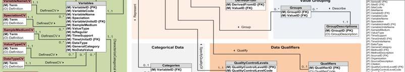
9 What are the basic attributes to be associated with each single data value and how can these best be organized? Value DateTime Variable Location Units Interval (support) Accuracy Offset OffsetType/ Reference Point Source/Organization Censoring Data Qualifying Comments Method Quality Control Level Sample Medium Value Type Data Type
10 Point Observations Information Model Utah State Data Source Univ Little Bear River Network Little Bear River at Mendon Rd Sites Dissolved Oxygen Variables 9.78 mg/l, 1 October 2007, 5PM Values {Value, Time, Metadata} A data source operates an observation network A network is a set of observation sites A site is a point location where one or more variables are measured A variable is a property describing the flow or quality of water A value is an observation of a variable at a particular time Metadata provide additional information about the value
11 Observations Data Model (ODM) A relational database at the single observation level l (atomic model) When Time, T Stores observation data made at points t Metadata for unambiguous interpretation Traceable heritage from raw measurements to usable s V information i Standard format for data What sharing Variables, V Cross dimension retrieval and analysis A data value v i (s,t) Where Space, S 11
12 Data Storage Relational Database Values Value Date Site Variable Sites Site Name Latitude Longitude Value Name Date Latitude Site Variable Longitude 4.5 Cane3/3/2007 Creek Streamflow Cane3/4/2007 Creek Streamflow Town3/3/2007 Lake Temperature Town3/4/2007 Lake Temperature Site Name Latitude Longitude 1 Cane Creek Town Lake Simple Intro to What Is a Relational Database
13 Why Use a RDBMS Mature and stable technology Structured Query Language (SQL) Sharing of data among multiple li l applications i Data integrity and security Access by multiple users at the same time Tools for backup and recovery Reduced application development time
14 Observations Data Model Sites Values and Time Variables Horsburgh, J. S., D. G. Tarboton, D. R. Maidment and I. Zaslavsky, (2008), "A Relational Model for Environmental and Water Resources Data," Water Resour. Res., 44: W05406, doi: /2007wr
15 The Data Cube what where when When Time, T t 3/4/2007 / A data value D s Where What V i Streamflow Cane Creek Space, S Variables, V


16 Data Values Table Time, T t v i (s,t) s V i Space, S Variables, V


17 Simplified ODM Structure Sites Table SiteID SiteCode SiteName Latitude Longitude LatLongID 1 AcmeP1 Backyard Pond AcmePR2 Mill River gage Station Spatial References Table SpatialReferenceID SRSID SRSName 0 Unknown NAD NAD83 Units Table UnitsID UnitsName UnitsAbbreviation 12 parts per million ppm 23 cubic feet per second cfs


18 Discharge, Stage, Concentration and Daily Average Example

19 Water Chemistry from a Profile in a Lake
20 Stage and Discharge Example


21 Daily Average Discharge Example Daily Average Discharge Derived from 15 Minute Discharge Data


22 Stage and Streamflow Example


23 HydroServer A Platform for Publishing Space Time Hydrologic Datasets Map Server Time Series Analyst HydroServer Website HydroServer Capabilities Web Service HydroServer Database Configuration Tool WaterOneFlow Services HydroServer Database Spatial Services WaterOneFlow WaterOneFlow WaterOneFlow ODM ODM ODM ODM Databases and WaterOneFlow Web Services ArcGIS Server Spatial Data Services
24 HydroServer Goals A platform pato for publishing space time ehydrologic og datasets that: Provides local control of data Makes data universally available Is autonomous HydroServer should be functional independent of the rest of HIS Texas Hydrologic Information System INRAConstellation of Experimental Watersheds


25 Ongoing Data Collection Point Observations Data Internet Applications Historical Data Files ODM Database GIS Data GetSites GetSiteInfo GetVariableInfo GetValues WaterML WaterOneFlow Web Service HydroServer Dt Data presentation, tti visualization, and analysis through Internet enabled applications
26 HydroServer Regions A region is an experimental epe etawatershed, ed, research site, etc. for which data are published Little Bear River Experimental Watershed Reynolds Creek Experimental Watershed T.W. Daniels Experimental Forest Organizing concept for HydroServer One or more ODM dtb databases/wateroneflow /Wt services for a region One or more spatial data services for a region


27 Publication of Point Observations Observations Data Model (ODM) ODM Tools ODM Data Loader ODM Streaming Data Loader ODM Controlled Vocabularies WaterOneFlow web services Data are transmitted in WaterML format


28 Managing Data Within ODM ODM Tools Query and export export data series and metadata Visualize plot and summarize data series Edit delete, modify, adjust, interpolate, average, etc.


 SDL Loads data from")


29 Loading data into ODM Interactive ODM Data Loader Loads data from spreadsheets and ODM Data Loader comma separated tables in simple format Streaming Data Loader (SDL) SDL Loads data from datalogger files on a prescribed schedule Interactive configuration SQL Server Integration Services (SSIS) Microsoft application accompanying SQL Server useful for programming complex loading or data management functions SSIS
")


30 Publication of Spatial (GIS) Datasets Publishing spatial datasets using ArcGIS Server Using OGCstandards that can be consumed by a number of GIS clients WMS, WFS, WCS


31 Data Presentation Via a Map Interface Internet Map Server built using ArcGIS Web browser client Combine spatial data and observational data Launch data visualization tools Based on a Region


32 Data Preview, Visualization, and Analysis Time Series Analyst Web Browser Client Cet Multiple ODM Database Support Variety of plot types Descriptive statistics Linked to the map application Data preview and download


33 HydroServer Website HydroServer e home page Observational data services GIS data services Online map Time Series Analyst Data Query and Download
34 HydroServer Capabilities Database Hd HydroServer Capabilities Dtb Database Configuration Tool Simple Windows application for creating metadata records in your database Associating Regions with services and maps

35 HydroServer Capabilities Web Service Publish capabilities of each HydroServer Published observational data services Published spatial data services Information transmitted in XML format Supports automatic cataloging of available services at HIS Central Makes HydroServers self describing


36 ICEWATER A Regional HIS ICEWATER INRA Constellation of Experimental p WATERsheds Coalition of 8 universities Point Observations Stream gages Water quality sampling Weather stations Soil moisture Snow monitoring Groundwater level/quality Spatially Distributed Data Land use/cover Terrain Hydrography AK WA OR CA I D NV UT AZ MT W Y CO NM
37 How do I Create a HydroServer? 1. Get a Windows Server Machine with IIS and.net Framework 2. Install Microsoft SQL Server 3. InstallHydroServer Software from his.cuahsi.org ODM and Utilities WaterOneFlow web services HydroServerWebsite Website, TSA, Map, Capabilities 4. Install ArcGIS 5. Create Services and Document them in Capabilities database 6. Register Services With HIS Central and register variables with the Ontology
38 HydroServer Future Considerations Security and Data Access Control More generic data model Flexibility in attributes Moving platforms Additional data types Tighter integration with Hydrologic Ontology Enhanced spatial data dt sharing What features and functionality does HydroServer need What features and functionality does HydroServer need to better serve the community?
39 Conclusions HydroServer provides a self contained autonomous data publication system Local control of data Downloadable user (data publisher) configurable software stack that contains: ODM and associated tools WaterOneFlow web services Geographic data sharing using WFS, WCS, WMS from ArcGIS server Time Series Analyst ArcGIS server based web map application HydroServer Capabilities web service that publishes metadata about regions and services (observational and spatial)
40 Demonstrations ICEWATER: ICEWATER (local): Little Bear River: tt e ea e
Jeffery S. Horsburgh. Utah Water Research Laboratory Utah State University
 Advancing a Services Oriented Architecture for Sharing Hydrologic Data Jeffery S. Horsburgh Utah Water Research Laboratory Utah State University D.G. Tarboton, D.R. Maidment, I. Zaslavsky, D.P. Ames, J.L.
Texas Water Data Services
 Texas Water Data Services David R. Maidment Center for Research in Water Resources University of Texas at Austin SSpeed Conference Houston Tx, Oct 30, 2008 Communicating Water Data During Flood Emergencies
Lecture 11. A Nationwide Infrastructure for Water Observations
 Lecture 11 A Nationwide Infrastructure for Water Observations GIS in Water Resources Spring 2015 Acknowledgement Many slides of this lecture were prepared by: David Maidment David Tarboton Kim Schreuder
Data Interoperability in the Hydrologic Sciences
 Data Interoperability in the Hydrologic Sciences The CUAHSI Hydrologic Information System David G Tarboton 1, David Maidment 2, Ilya Zaslavsky 3, Dan Ames 4, Jon Goodall 5, Richard P Hooper 6, Jeff Horsburgh
How to use Water Data to Produce Knowledge: Data Sharing with the CUAHSI Water Data Center
 How to use Water Data to Produce Knowledge: Data Sharing with the CUAHSI Water Data Center Jon Pollak The Consortium of Universities for the Advancement of Hydrologic Science, Inc. (CUAHSI) August 20,
CUAHSI HYDROLOGIC INFORMATION SYSTEM: OVERVIEW OF VERSION 1.1
 CUAHSI HYDROLOGIC INFORMATION SYSTEM: OVERVIEW OF VERSION 1.1 Edited by David R. Maidment Center for Research in Water Resources The University of Texas at Austin July 12, 2008 Distribution Copyright 2008,
A USER S GUIDE TO REGISTERING AND MAINTAINING DATA SERVICES IN HIS CENTRAL 2.0
 A USER S GUIDE TO REGISTERING AND MAINTAINING DATA SERVICES IN HIS CENTRAL 2.0 Prepared by Jon Pollak, CUAHSI Water Data Center User Support Specialist September 2014 1 DISCLAIMERS The HIS Central application
CUAHSI ODM Tools Version 1.0 Design Specifications October 27, 2006
 CUAHSI ODM Tools Version 1.0 Design Specifications October 27, 2006 Jeffery S. Horsburgh 1 Abstract The CUAHSI Hydrologic Information System (HIS) Project is developing information technology infrastructure
A relational model for environmental and water resources data
 Click Here for Full Article WATER RESOURCES RESEARCH, VOL. 44, W05406, doi:10.1029/2007wr006392, 2008 A relational model for environmental and water resources data Jeffery S. Horsburgh, 1 David G. Tarboton,
CUAHSI HYDROLOGIC INFORMATION SYSTEM 2010 STATUS REPORT
 CUAHSI HYDROLOGIC INFORMATION SYSTEM 2010 STATUS REPORT David G. Tarboton 1, David Maidment 2, Ilya Zaslavsky 3, Daniel P. Ames 4, Jon Goodall 5, Jeffery S. Horsburgh 1 1. Utah Water Research Laboratory,
CUAHSI HYDROLOGIC INFORMATION SYSTEM: 2009 STATUS REPORT
 CUAHSI HYDROLOGIC INFORMATION SYSTEM: 2009 STATUS REPORT Edited by David R. Maidment Center for Research in Water Resources The University of Texas at Austin October 23, 2009 Distribution Copyright 2009,
An application for loading data into the CUAHSI Hydrologic Information System Observations Data Model. March Prepared by:
 ODM WEB DATA LOADER An application for loading data into the CUAHSI Hydrologic Information System Observations Data Model March 2012 Prepared by: Jeffery S. Horsburgh Utah Water Research Laboratory Utah
Managing Hydrologic Data, Observations and Terrain Analysis
 Managing Hydrologic Data, Observations and Terrain Analysis David Tarboton Utah State University http://www.engineering.usu.edu/dtarb/ Outline The CUAHSI Hydrologic Information System CUAHSI HIS Sharing
Water and Sediment Quality Status and Trends in the Coastal Bend Area Phase 1: Data Archiving and Publishing
 Water and Sediment Quality Status and Trends in the Coastal Bend Area Phase 1: Data Archiving and Publishing Publication CBBEP 77 Project Number 1105 May 15, 2012 Prepared by: Paul A. Montagna, Ph.D.,
Hydrologic Data Discovery, Download, Visualization, and Analysis: A Brief Introduction to HydroDesktop
 International Environmental Modelling and Software Society (iemss) 2012 International Congress on Environmental Modelling and Software Managing Resources of a Limited Planet, Sixth Biennial Meeting, Leipzig,
CUAHSI Community Observations Data Model (ODM) Version 1.0 Design Specifications
 Version 1.0 Design Specifications") CUAHSI Community Observations Data Model (ODM) Version 1.0 Design Specifications May 17, 2007 David G. Tarboton 1, Jeffery S. Horsburgh 1, David R. Maidment 2 Abstract The CUAHSI Hydrologic Information
CUAHSI Community Observations Data Model (ODM) Version 1.0 Design Specifications May 17, 2007 David G. Tarboton 1, Jeffery S. Horsburgh 1, David R. Maidment 2 Abstract The CUAHSI Hydrologic Information
Open Geospatial Consortium
 Open Geospatial Consortium Date: 2011-07-12 Reference number of this document: OGC 11-013r6 Category: Engineering Report Editors: Luis Bermudez, David Arctur OGC Engineering Report: Water Information Services
USING HYDRODESKTOP TO FIND DATA FOR WATERSHED HYDROLOGY
 USING HYDRODESKTOP TO FIND DATA FOR WATERSHED HYDROLOGY Exercise 4 February 10, 2011 by: Gonzalo E. Espinoza, Dr. Tim Whiteaker, and Dr. David Maidment Center for Research in Water Resources The University
ODM STREAMING DATA LOADER
 ODM STREAMING DATA LOADER An application for loading streaming sensor data into the CUAHSI Hydrologic Information System Observations Data Model March 2012 Prepared by: Jeffery S. Horsburgh Utah Water
ODM 1.1. An application Hydrologic. June Prepared by: Jeffery S. Horsburgh Justin Berger Utah Water
 ODM M STREAMING VERSION DATAA LOADER 1.1 An application for loading streaming sensor data into the CUAHSI Hydrologic Information System Observations Data Model June 2008 Prepared by: Jeffery S. Horsburgh
CUAHSI Community Observations Data Model (ODM) Version 1.1 Design Specifications
 Version 1.1 Design Specifications") CUAHSI Community Observations Data odel (OD) Version 1.1 Design Specifications ay 2008 David G. Tarboton 1, Jeffery S. Horsburgh 1, David R. aidment 2 Abstract The CUAHSI Hydrologic Information System
CUAHSI Community Observations Data odel (OD) Version 1.1 Design Specifications ay 2008 David G. Tarboton 1, Jeffery S. Horsburgh 1, David R. aidment 2 Abstract The CUAHSI Hydrologic Information System
Design and Development of an Integrated Web-based System for USGS and AHPS Data Analysis Using Open Source Cyberinfrastructure. Bryce Wayne Anderson
 Design and Development of an Integrated Web-based System for USGS and AHPS Data Analysis Using Open Source Cyberinfrastructure Bryce Wayne Anderson A project report submitted to the faculty of Brigham
Wade Sheldon. Georgia Coastal Ecosystems LTER University of Georgia
 Wade Sheldon Georgia Coastal Ecosystems LTER University of Georgia email: sheldon@uga.edu Regardless of Q/A procedures, data quality issues guaranteed with environmental sensor data Without good Q/C data
HIS document 4 Configuring web services for an observations database (version 1.0)
") HIS document 4 Configuring web services for an observations database (version 1.0) A setup guide January 2008 Prepared by: David Valentine and Tom Whitenack San Diego Supercomputer Center University of
HIS document 4 Configuring web services for an observations database (version 1.0) A setup guide January 2008 Prepared by: David Valentine and Tom Whitenack San Diego Supercomputer Center University of
User Interface Design Considerations for a Time-Space GIS
 International Environmental Modelling and Software Society (iemss) 2012 International Congress on Environmental Modelling and Software Managing Resources of a Limited Planet, Sixth Biennial Meeting, Leipzig,
CUAHSI Community Observations Data Model (ODM) Version Design Specifications
 Version Design Specifications") CUAHSI Community Observations Data odel (OD) Version 1.1.1 Design Specifications arch 2008 Jeffery S. Horsburgh 1, David G. Tarboton 1 Abstract The CUAHSI Hydrologic Information System has developed information
CUAHSI Community Observations Data odel (OD) Version 1.1.1 Design Specifications arch 2008 Jeffery S. Horsburgh 1, David G. Tarboton 1 Abstract The CUAHSI Hydrologic Information System has developed information
HYDROEXCEL SOFTWARE MANUAL
 HYDROEXCEL 1.1.1 SOFTWARE MANUAL May, 2009 by: Tim Whiteaker Aparna Boddupalli Edited by: Clark Siler Center for Research in Water Resources The University of Texas at Austin Distribution The HydroExcel
Open-Source Data Catalog for Managing Hydrologic Data. Sarva Teja Pulla
 Open-Source Data Catalog for Managing Hydrologic Data Sarva Teja Pulla A project submitted to the faculty of Brigham Young University in partial fulfillment of the requirements for the degree of Master
A Web Services Based Water Data Sharing Approach. Using Open Geospatial Standards. Rohit Kumar Khattar
 A Web Services Based Water Data Sharing Approach Using Open Geospatial Standards Rohit Kumar Khattar A project report submitted to the faculty of Brigham Young University in partial fulfillment of the
Web Based Access to Water Related Data Using OGC WaterML 2.0
 Web Based Access to Water Related Data Using OGC WaterML 2.0 Adrian Almoradie a.almoradie@unesco-ihe.org Andreja Jonoski a.jonoski@unesco-ihe.org Ioana Popescu i.popescu@unesco-ihe.org Dimitri Solomatine
ODM Tools Version 1.2
 ODM Tools Version 1.2 An application for interfacing with the CUAHSI Hydrologic Information System Observations Data Model October 2007 Prepared by: Jeffery S. Horsburgh Environmental Management Research
HYDROEXCEL SOFTWARE MANUAL
 HYDROEXCEL 1.1.6 SOFTWARE MANUAL December, 2011 by: Tim Whiteaker Center for Research in Water Resources The University of Texas at Austin Distribution The HydroExcel file and documentation are provided
ODM TOOLS. An application for interfacing with the CUAHSI Hydrologic Information System Observations Data Model. August 2011.
 ODM TOOLS An application for interfacing with the CUAHSI Hydrologic Information System Observations Data Model August 2011 Prepared by: Jeffery S. Horsburgh Utah Water Research Laboratory Utah State University
DATA UPLOADING TUTORIAL: CLOUD HYDROSERVER
 DATA UPLOADING TUTORIAL: CLOUD HYDROSERVER Cloud Publication with the CUAHSI Water Data Center Version 1.0 Prepared by Rick Hooper and Jon Pollak October 2014 1 P a g e CONTENTS Disclaimer... 3 Introduction
HYDRODESKTOP VERSION 1.1 BETA QUICK START GUIDE
 HYDRODESKTOP VERSION 1.1 BETA QUICK START GUIDE A guide to help you get started using this free and open source desktop application for discovering, accessing, and using hydrologic data. September 15,
CUAHSI HIS CENTRAL 1.2
 CUAHSI HIS CENTRAL 1.2 Web based Data Service Repository for HIS Web services April 4, 2010 by: Tom Whitenack San Diego Supercomputer Center University of California, San Diego Distribution Copyright 2010,
Unifying Hydrological Time Series Data for a Global Water Portal
 Unifying Hydrological Time Series Data for a Global Water Portal Pathai Suwannawiwat Chayakorn Netramai The Sirindhorn International Thai-German Graduate School of Engineering King Mongkut s University
CE 549 Lab 1 - Linking Streamflow Data to a Gauging Station
 CE 549 Lab 1 - Linking Streamflow Data to a Gauging Station Prepared by Venkatesh Merwade Lyles School of Civil Engineering, Purdue University vmerwade@purdue.edu January 2018 Objective The objective of
HYDRODESKTOP VERSION 1.4 QUICK START GUIDE
 HYDRODESKTOP VERSION 1.4 QUICK START GUIDE A guide to using this free and open source application for discovering, accessing, and using hydrologic data February 8, 2012 by: Tim Whiteaker Center for Research
An Architectural Overview Of HydroShare, A Next-Generation Hydrologic Information System
 City University of New York (CUNY) CUNY Academic Works International Conference on Hydroinformatics 8-1-2014 An Architectural Overview Of HydroShare, A Next-Generation Hydrologic Information System Jefferson
DATA FORMATTING GUIDE:
 DATA FORMATTING GUIDE: Data Publication with the CUAHSI Water Data Services Version 2.0 Prepared by Liza Brazil Adapted from Rick Hooper March 2018 1 P a g e CONTENTS Disclaimer... 3 Introduction and Purpose
HYDROLOGY OF JACOB S WELL SPRING
 HYDROLOGY OF JACOB S WELL SPRING A tutorial for using HydroDesktop to discover and access water data November 30, 2010 Prepared by Tim Whiteaker Center for Research in Water Resources The University of
Introduction to HydroDesktop
 Introduction to HydroDesktop Prepared by Tim Whiteaker, Jingqi Dong, Fernando R. Salas, David R. Maidment CONTENTS Introduction... 1 Goals and Objectives... 2 Computer and Data Requirements... 2 Participating
Exercise 3: Query, Visualize, and Edit Data Using ODM Tools
 Exercise 3: Query, Visualize, and Edit Data Using ODM Tools Jeffery S. Horsburgh 1 4-25-2012 Objectives In this exercise you will learn how Query, Visualize, and Edit data in an ODM database using the
EXERCISE 3: PUBLISHING AN ODM DATABASE WITH WATERONEFLOW
 EXERCISE 3: PUBLISHING AN ODM DATABASE WITH WATERONEFLOW As far as your local setup goes, you are now ready for action with your ODM database. But what if you want to share the data with others online?
Title Vega: A Flexible Data Model for Environmental Time Series Data
 Title Vega: A Flexible Data Model for Environmental Time Series Data Authors L. A. Winslow 1, B. J. Benson 1, K. E. Chiu 3, P. C. Hanson 1, T. K. Kratz 2 1 Center for Limnology, University of Wisconsin-Madison,
DEOS : Web Services and Data Feeds
 DEOS : Web Services and Data Feeds DEOS Technical Note #17 Version 2 Copyright 2006-2008 Center for Climatic Research All material herein is copyright by The Center for Climatic Research Published: October
Web Services USGS/EPA Collaboration
 Web Services USGS/EPA Collaboration June 11, 2008 Dwane Young, U.S. EPA; Jon Scott, USGS; Dorinda Gellenbeck,, USGS; Nate Booth, USGS NJ Water Monitoring Council Meeting 1 USGS NWIS* & STORET Over Time
CUAHSI. Conservation Authority Hydrologic Information System
 Conservation Authority Hydrologic Information System Data Management Application Groundwater Surface Water Quality Water Level / Low Flow Baseflow Neil MacFarlane, David T. Krupicz CUAHSI 1 Introduction
Finding Data using Hydrologic Info Systems
 Finding Data using Hydrologic Info Systems We have a server at UF with datasets on it that are served over the internet via WebServices. 10 other testbeds have HIS server with their data networks. To see
HIS document 2 Loading Observations Data with the ODDataLoader (version 1.0)
") HIS document 2 Loading Observations Data with the ODDataLoader (version 1.0) A guide to using CUAHSI s ODDataLoader tool for loading observations data into an Observations Data Model compliant database
HIS document 2 Loading Observations Data with the ODDataLoader (version 1.0) A guide to using CUAHSI s ODDataLoader tool for loading observations data into an Observations Data Model compliant database
Levels Of Data Interoperability In The Emerging North American Groundwater Data Network
 City University of New York (CUNY) CUNY Academic Works International Conference on Hydroinformatics 8-1-2014 Levels Of Data Interoperability In The Emerging North American Groundwater Data Network Boyan
Groundwater Information Network
 Groundwater Information Network Groundwater Geoscience Program Geological Survey of Canada Boyan Brodaric boyan.brodaric@canada.ca 06 Dec 2017 Abstract Groundwater Information Network Fed-prov-terr-int
Functional Description Document (Version 1.0) A guide through of the underlying technologies for the semantic tagging application HydroTagger
 A guide through of the underlying technologies for the semantic tagging application HydroTagger") HYDROTAGGER Functional Description Document (Version 1.0) A guide through of the underlying technologies for the semantic tagging application HydroTagger May 2008 Prepared by: Michael Piasecki Department
HYDROTAGGER Functional Description Document (Version 1.0) A guide through of the underlying technologies for the semantic tagging application HydroTagger May 2008 Prepared by: Michael Piasecki Department
Development of a Ground Water Data Portal for Interoperable Data Exchange and Mediation within the NGWMN
 Development of a Ground Water Data Portal for Interoperable Data Exchange and Mediation within the NGWMN Jessica M. Lucido, Nathaniel L. Booth, I-Lin Kuo, and William L. Cunningham U.S. Department of the
Hydrologic Modeling using HEC-HMS
 Hydrologic Modeling using HEC-HMS CE 412/512 Spring 2017 Introduction The intent of this exercise is to introduce you to the structure and some of the functions of the HEC-Hydrologic Modeling System (HEC-HMS),
Sava HIS Final Report
 Sava HIS Final Report Project: Hydrological Information System of the International Sava River Basin Commission (Sava HIS) Contract title: Establishment of Sava HIS Identification number: 3-15-9/1-2 Delivery
ATMOS A Data Collection and Presentation Toolkit for the Nevada Climate Change Portal
 ATMOS A Data Collection and Presentation Toolkit for the Nevada Climate Change Portal Andrew Dittrich, Sergiu Dascalu and Mehmet Gunes Department of Computer Science and Engineering, University of Nevada,
A Framework of Information Technology for Water Resources Management
 A Framework of Information Technology for Water Resources Management P.S.V.S. Sridhar T. N. Jowhar Wadia Institute of Himalyan Geology, Anant Bhaskar Garg U. Kedareswarudu ABSTRACT The use of the information
ODM. Hydrologic. August Prepared by: Utah Water
 ODM M DATA LOADER An application for loading data into the CUAHSI Hydrologic Information System Observations Data Model August 2011 Prepared by: Jeffery S. Horsburghh Utah Water Research Laboratory Utah
Spatial Hydrologic Modeling Using NEXRAD Rainfall Data in an HEC-HMS (MODClark) Model
 Model") v. 10.0 WMS 10.0 Tutorial Spatial Hydrologic Modeling Using NEXRAD Rainfall Data in an HEC-HMS (MODClark) Model Learn how to setup a MODClark model using distributed rainfall data Objectives Read an existing
v. 10.0 WMS 10.0 Tutorial Spatial Hydrologic Modeling Using NEXRAD Rainfall Data in an HEC-HMS (MODClark) Model Learn how to setup a MODClark model using distributed rainfall data Objectives Read an existing
Introduction to INSPIRE. Network Services
 Introduction to INSPIRE. Network Services European Commission Joint Research Centre Institute for Environment and Sustainability Digital Earth and Reference Data Unit www.jrc.ec.europa.eu Serving society
WASP AT. Final Report: Enhancement and Demonstration of Stream Water Quality Modeling Using Analysis Tools for WASP 5.0
 WASP AT Final Report: Enhancement and Demonstration of Stream Water Quality Modeling Using Analysis Tools for WASP 5.0 EPA United States Environmental Protection Agency Developed by the Integrated Decision
v Prerequisite Tutorials GSSHA Modeling Basics Stream Flow GSSHA WMS Basics Creating Feature Objects and Mapping their Attributes to the 2D Grid
 v. 10.1 WMS 10.1 Tutorial GSSHA Modeling Basics Developing a GSSHA Model Using the Hydrologic Modeling Wizard in WMS Learn how to setup a basic GSSHA model using the hydrologic modeling wizard Objectives
HYDROOBJECTS VERSION 1.1
 o HYDROOBJECTS VERSION 1.1 July, 2008 by: Tim Whiteaker Center for Research in Water Resources The University of Texas at Austin Distribution The HydroObjects software, source code, and documentation are
A Cyber-Infrastructure for a Virtual Observatory and Ecological Informatics System -VOEIS
 A Cyber-Infrastructure for a Virtual Observatory and Ecological Informatics System -VOEIS Clemente Izurieta 1, Sean Cleveland 1, Ivan Judson 1, Pol Llovet 1, Geoffrey Poole 1, Brian McGlynn 1, Lucy Marshall
Integration of a Web Processing Service (WPS), GIS and hydraulic modelling (TELEMAC) for geophysical analysis
, GIS and hydraulic modelling (TELEMAC) for geophysical analysis") Integration of a Web Processing Service (WPS), GIS and hydraulic modelling (TELEMAC) for geophysical analysis Yicheng Zhang Department of Engineering, University of Liverpool September 16, 2014 Publications
Integration of a Web Processing Service (WPS), GIS and hydraulic modelling (TELEMAC) for geophysical analysis Yicheng Zhang Department of Engineering, University of Liverpool September 16, 2014 Publications
When using this architecture for accessing distributed services, however, query broker and/or caches are recommendable for performance reasons.
 Integration of semantics, data and geospatial information for LTER Abstract The long term ecological monitoring and research network (LTER) in Europe[1] provides a vast amount of data with regard to drivers
Water Resources Data Management with HEC-DSSVue Course Control Number #152
 Water Resources Data Management with HEC-DSSVue Course Control Number #152 This class is designed to provide Corps water resource professionals with the basic skills to utilize the HEC Data Storage System
Comparison of multiple point and single point calibration performance for the Saginaw River Watershed
 Comparison of multiple point and single point calibration performance for the Saginaw River Watershed Fariborz Daneshvar, A 1. Pouyan Nejadhashemi 1, Matthew R. Herman 1 1 Department of Biosystems and
Computation of Slope
 Computation of Slope Prepared by David R. Maidment and David Tarboton GIS in Water Resources Class University of Texas at Austin September 2011, Revised December 2011 There are various ways in which slope
LifeWatch/EnvEurope User Forum Use Case Ecology
 LifeWatch/EnvEurope User Forum Use Case Ecology User Forum Barcelona, March 2012 Michael Mirtl (EAA, Environment Agency Austria) Wouter Los (LifeWatch) Infrastructure for Biodiversity and Ecosystem Research
DATABASE ON SALINITY PATTERNS IN FLORIDA BAY *
 DATABASE ON SALINITY PATTERNS IN FLORIDA BAY * N. Rishe, M. Chekmasov, M. Chekmasova, D. Hernandez, A. Roque, N. Terekhova, A. Zhyzhkevych High Performance Database Research Center, School of Computer
US Geo-Explorer User s Guide. Web:
 US Geo-Explorer User s Guide Web: http://usgeoexplorer.org Updated on October 26, 2016 TABLE OF CONTENTS Introduction... 3 1. System Interface... 5 2. Administrative Unit... 7 2.1 Region Selection... 7
AGENDA. Water Resources Data Management with HEC-DSSVue
 AGENDA Hydrologic Engineering Center Training course on Water Resources Data Management with HEC-DSSVue Course Control Number #152 Davis, California This class is designed to provide Corps water resource
Big data for big river science: data intensive tools, techniques, and projects at the USGS/Columbia Environmental Research Center
 Big data for big river science: data intensive tools, techniques, and projects at the USGS/Columbia Environmental Research Center Ed Bulliner U.S. Geological Survey, Columbia Environmental Research Center
Spatial Hydrologic Modeling HEC-HMS Distributed Parameter Modeling with the MODClark Transform
 v. 9.0 WMS 9.0 Tutorial Spatial Hydrologic Modeling HEC-HMS Distributed Parameter Modeling with the MODClark Transform Setup a basic distributed MODClark model using the WMS interface Objectives In this
Outline. The Collaborative Research Platform for Data Curation and Repositories: CKAN For ANGIS Data Portal. Open Access & Open Data.
 Outline The Collaborative Research Platform for Data Curation and Repositories: CKAN For ANGIS Data Portal Open Access & Open Data ANGIS data portal New developed features Future works Hsiung-Ming Liao,
Wade Sheldon. Georgia Coastal Ecosystems LTER University of Georgia CUAHSI Virtual Workshop Field Data Management Solutions
 Wade Sheldon Georgia Coastal Ecosystems LTER University of Georgia email: sheldon@uga.edu CUAHSI Virtual Workshop Field Data Management Solutions 01-Oct-2014 Georgia Coastal Ecosystems LTER started in
How Did Conductivity Vary Along the Wichita River from April 2003 November 2003?
 How Did Conductivity Vary Along the Wichita River from April 2003 November 2003? Jorge Luna GEO 327 G December 7, 2017 Problem The Wichita River has some of the best striped bass fishing in the United
Ag-Analytics Data Platform
 Ag-Analytics Data Platform Joshua D. Woodard Assistant Professor and Zaitz Faculty Fellow in Agribusiness and Finance Dyson School of Applied Economics and Management Cornell University NY State Precision
Motions from the 91st OGC Technical and Planning Committee Meetings Geneva, Switzerland Contents
 Motions from the 91st OGC Technical and Planning Committee Meetings Geneva, Switzerland Contents "The Open Geospatial Consortium and EarthCube White Paper... 2 Vote for OGC Sensor Observation Service 2.0
Deliverable D3.12. Contract number: OJEU 2010/S Deliverable: D3.12 Author: Igor Antolovic Date: Version: Final
 Deliverable D3.12 Final and public version of the implemented web site with full functionality that hosts all relevant information on the Climate Atlas of the Carpathian Region, including a public download
March Goals of the Exercise
 Water Data in Time and Space Prepared by David R. Maidment Waterways Centre for Freshwater Research University of Canterbury Based in part on material from Brent Watson Horizons Regional Council Palmerston
GEOGRAPHIC INFORMATION SYSTEMS Lecture 02: Feature Types and Data Models
 GEOGRAPHIC INFORMATION SYSTEMS Lecture 02: Feature Types and Data Models Feature Types and Data Models How Does a GIS Work? - a GIS operates on the premise that all of the features in the real world can
HOW TO DOWNLOAD AND USE THE OBSERVATIONS DATA MODEL
 HOW TO DOWNLOAD AND USE THE OBSERVATIONS DATA MODEL Specification Download and use the ODM databases with ODMTools, MS Access, MS Excel, SQL Server 2005 and ArcGIS January 7, 2010 By: Harish Sangireddy
Transformative characteristics and research agenda for the SDI-SKI step change:
 Transformative characteristics and research agenda for the SDI-SKI step change: A Cadastral Case Study Dr Lesley Arnold Research Fellow, Curtin University, CRCSI Director Geospatial Frameworks World Bank
Introduction to SDIs (Spatial Data Infrastructure)
") www.grid.unep.ch Regional training workshop on geographical information system for energy planning Introduction to SDIs (Spatial Data Infrastructure) Dakar, 12 August 2014 Gregory Giuliani Andrea de Bono,
www.grid.unep.ch Regional training workshop on geographical information system for energy planning Introduction to SDIs (Spatial Data Infrastructure) Dakar, 12 August 2014 Gregory Giuliani Andrea de Bono,
Transformative characteristics and research agenda for the SDI-SKI step change: A Cadastral Case Study
 Transformative characteristics and research agenda for the SDI-SKI step change: A Cadastral Case Study Dr Lesley Arnold Research Fellow, Curtin University, CRCSI Director Geospatial Frameworks World Bank
INTRODUCTION TO GIS WORKSHOP EXERCISE
 111 Mulford Hall, College of Natural Resources, UC Berkeley (510) 643-4539 INTRODUCTION TO GIS WORKSHOP EXERCISE This exercise is a survey of some GIS and spatial analysis tools for ecological and natural
Exercise 5. Height above Nearest Drainage Flood Inundation Analysis
 Exercise 5. Height above Nearest Drainage Flood Inundation Analysis GIS in Water Resources, Fall 2016 Prepared by David G Tarboton Purpose The purpose of this exercise is to illustrate the use of TauDEM
Manage your environmental monitoring data with power, depth and ease
 EQWin Software Inc. PO Box 75106 RPO White Rock Surrey BC V4A 0B1 Canada Tel: +1 (604) 669-5554 Fax: +1 (888) 620-7140 E-mail: support@eqwinsoftware.com www.eqwinsoftware.com EQWin 7 Manage your environmental
Exercise 3: Spatial Analysis GIS in Water Resources Fall 2013
 Exercise 3: Spatial Analysis GIS in Water Resources Fall 2013 Prepared by David G. Tarboton and David R. Maidment Goal The goal of this exercise is to serve as an introduction to Spatial Analysis with
Hydrologic Data Sharing Using Open Source Software and Low-Cost Electronics
 Brigham Young University BYU ScholarsArchive All Theses and Dissertations 2015-03-01 Hydrologic Data Sharing Using Open Source Software and Low-Cost Electronics Jeffrey Michael Sadler Brigham Young University
Reducing Consumer Uncertainty
 Spatial Analytics Reducing Consumer Uncertainty Towards an Ontology for Geospatial User-centric Metadata Introduction Cooperative Research Centre for Spatial Information (CRCSI) in Australia Communicate
Part 1. Slope calculations
 Exercise 3: Spatial Analysis GIS in Water Resources Prepared by David G. Tarboton and David R. Maidment Updated to ArcGIS Pro by Paul Ruess, August 2016 Updated David Tarboton, September 2017 Goal The
CEOS Water Portal Project <<Final Project Summary>>
 CEOS Water Portal Project Satoko Horiyama MIURA Space Applications and Operations Center (SAOC) JAXA Contents 1. Goal 2. Concept 3. History 4. Data Partners 5. Available Data
Interoperability Between GRDC's Data Holding And The GEOSS Infrastructure
 City University of New York (CUNY) CUNY Academic Works International Conference on Hydroinformatics 8-1-2014 Interoperability Between GRDC's Data Holding And The GEOSS Infrastructure Volker Andres Henning
Catalog-driven, Reproducible Workflows for Ocean Science
 Catalog-driven, Reproducible Workflows for Ocean Science Rich Signell, USGS, Woods Hole, MA, USA Filipe Fernandes, Centro Universidade Monte Serrat, Santos, Brazil. 2015 Boston Light Swim, Aug 15, 7:00am
L-THIA EXERCISE. Click on L-THIA GIS Extension Software Zip File with Sample GIS Dataset to download the file.
 L-THIA EXERCISE Overview This exercise was developed for the Fox-Wolf Watershed Alliance - Stormwater 2003 Conference. Funding was provided by the University of Wisconsin Sea Grant Institute and UW Land