Sensor and sensor network panel. Alexandre Bayen Electrical Engineering and Computer Science Civil and Environmental Engineering UC Berkeley
|
|
|
- Kory Nichols
- 5 years ago
- Views:
Transcription


1 Sensor and sensor network panel Alexandre Bayen Electrical Engineering and Computer Science Civil and Environmental Engineering UC Berkeley


2 Classical vs. modern source of traffic information Dedicated infrastructure: Self inductive loops Pavement sensors FasTrak, EZ-pass RFID Cameras Radars License plate readers Mobile devices: 1+B smartphones on earth
 vs.")
3 2008 (511.org) vs. 2010
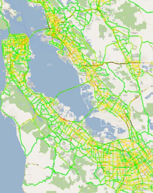
4 Example: 0.5% of Mobile Millennium data (one day)
5 Example: 0.5% of Mobile Millennium data (one day)
6 Example: 0.5% of Mobile Millennium data (one day)
7 Example: 0.5% of Mobile Millennium data (one day)
8 Example: 0.5% of Mobile Millennium data (one day)
9 Example: 0.5% of Mobile Millennium data (one day)


10 Example: 0.5% of Mobile Millennium data (one day)
 Learning (must be done from sparse data) Time dynamics must be captured (streaming")
11 Challenges of traffic estimation Example: combined path-inference / map matching: Naïve projection on map does not work. Routing cannot be decoupled from map matching Probabilistic model needs to be built (most probable travel time) Learning (must be done from sparse data) Time dynamics must be captured (streaming data) Real-time computations (implementation architecture must reflect computational needs) 10 Example of trajectory reconstruction failure True trajectory Naïve reconstruction Raw GPS point
12 Granularity of the data (GPS data) Physical model and data assimilation enable state estimation Works even with low penetration rate Interpolation will just not do the job
13 Flow reconstruction (inverse modeling) Physical model and data assimilation enable state estimation Works even with low penetration rate Interpolation will just not do the job 10 measurement points

14 Flow reconstruction (inverse modeling) Physical model and data assimilation enable state estimation Works even with low penetration rate Interpolation will just not do the job 10 measurement points

15 Creation of a private public marketplace How can the government acquire private sector data Aging infrastructure does not support data needs anymore Procurement procedures are new to the government Pricing of this new data is unknown too Contract conformance is new as well : first ever procurement of GPS data by the State of California, administered by UC Berkeley.


16 How to buy data: example of problems How to build good quality metrics for procurement Example problems Delay of the data Time variations in the data Spatial coverage of the data Thu am peak Thu pm peak Fri am peak


17 Mission 2015: integrated corridor management Parking Ramp Metering Smartphone enabled reroute BART CMS Local Arterial Traffic Signals Express Lanes HOT/HOV control


18 An enormous potential for behavior change Efficient use of social networks Frustration on congestion is enormous Lack of information prevents reroutes Lack of coordination makes reroutes dangerous for social optimality

19 Mission 2015: full coordinated control of I210 I210 corridor in Los Angeles 40 km of freeways 5 major arterials Hundred of traffic lights, meters, changeable message signs Several radio stations, and multiple phone apps

")

20 The emergence of the human as a sensor Best known sensor for earthquakes: accelerometer USGS has dedicated array of embedded accelerometers Human is faster than USGS by posting on Twitter All smartphones have accelerometers, UCLA already succeeded in capturing a P-wave from a smartphone (CENS) Information could be enhanced by having additional accelerometer information available. UC Berkeley ishake app and shake table testing procedure USGS shakemap (from static USGS sensors)


21 Floating Sensor Network Floating sensor network Summer 2012: deployment of 100 floating / submersible units in the San Francisco Bay / Sacramento Delta, DWR Stillwater, OK, rapid levee breech repair demo, DHS

22 Floating Sensor Network Floating sensor network Summer 2012: deployment of 100 floating / submersible units in the San Francisco Bay / Sacramento Delta, DWR Stillwater, OK, rapid levee breech repair demo, DHS

23 Floating Sensor Network Floating sensor network Summer 2012: deployment of 100 floating / submersible units in the San Francisco Bay / Sacramento Delta, DWR Stillwater, OK, rapid levee breech repair demo, DHS
Welcome to the Workshop on Mathematical Foundations of Traffic. Alexandre Bayen, Rinaldo Colombo, Paola Goatin, Benedetto Piccoli
 Welcome to the Workshop on Mathematical Foundations of Traffic Alexandre Bayen, Rinaldo Colombo, Paola Goatin, Benedetto Piccoli INRIA, Sophia Antipolis, March 2013 Large scale infrastructure systems Physical
Mobile Millennium Using Smartphones as Traffic Sensors
 Mobile Millennium Using Smartphones as Traffic Sensors Dan Work and Alex Bayen Systems Engineering, Civil and Environmental Engineering, UC Berkeley Intelligent Infrastructure, Center for Information Technology
Arterial data quality and traffic estimation
 Arterial data quality and traffic estimation Qijian Gan Postdoctoral Researcher PATH University of California, Berkeley qgan@berkeley.edu 10th SF Bay Area ITE Annual Workshop May 2nd, 2018 Outline Introduction
TMC of the Future. Matt Lee Associate Vice President
 TMC of the Future Matt Lee Associate Vice President Overview Traffic Operations Centers Transportation Management Centers TMCs are transforming to be more proactive in addressing recurring as well as non-recurring
Connecting a Mobile York Region
 Connecting a Mobile York Region Presentation to ITS Canada Victoria 2014 Gregg Loane, P.Eng. June 1, 2014 Connecting a Mobile York Region Overview Who is York Region? York s ITS Program Background Data
Welcome to our world of smart city and managed motorway solutions. October 2017
 Welcome to our world of smart city and managed motorway solutions. October 2017 Addinsight helps to manage congestion - it s the future of smart cities and motorways. 1 Addinsight and SAGE Automation Addinsight
Intelligent Transportation Traffic Data Management
 Intelligent Transportation Traffic Data Management Ugur Demiryurek Asscociate Director, IMSC Viterbi School of Engineering University of Southern California Los Angeles, CA 900890781 demiryur@usc.edu 1
Earthquake Early Warning Where we are and where we are going. Doug Given USGS National Earthquake Early Warning Coordinator
 Earthquake Early Warning Where we are and where we are going Doug Given USGS National Earthquake Early Warning Coordinator USGS Earthquake Hazard Responsibilities USGS Mission: reduce losses due to geological
The USC 2 T Project The USC Clever Transportation Project
 The USC 2 T Project The USC Clever Transportation Project Traffic Data Management Cloud Futures Workshop 2011 Microsoft, Redmond, WA, 6/2/2011 Barak Fishbain Viterbi School of Engineering University of
CAN MOBILE MILLENNIUM HANDLE CONGESTION PRICING?
 CAN MOBILE MILLENNIUM HANDLE CONGESTION PRICING? Sarah M. Stern, Department of Mechanical Engineering, University of California, Berkeley, CA, 94720-1710, smstern@berkeley.edu ABSTRACT The Internet s adaptability
PeMS, Berkeley Highway Lab System, Data Fusion and Future Data Needs
 PeMS, Berkeley Highway Lab System, Data Fusion and Future Data Needs TRB Workshop on Data Fusion Beckman Conference Center Irvine, California April 15~17, 2009 Xiao-Yun Lu Research Engineer California
Connected Car. Dr. Sania Irwin. Head of Systems & Applications May 27, Nokia Solutions and Networks 2014 For internal use
 Connected Car Dr. Sania Irwin Head of Systems & Applications May 27, 2015 1 Nokia Solutions and Networks 2014 For internal use Agenda Introduction Industry Landscape Industry Architecture & Implications
MOBILE MILLENNIUM. Societal need for [traffic] information systems
![MOBILE MILLENNIUM. Societal need for [traffic] information systems](/thumbs/74/71316432.jpg "MOBILE MILLENNIUM. Societal need for [traffic] information systems") MOBILE MILLENNIUM Alex Bayen Assistant Professor, Systems Engineering, Civil and Environmental Engineering, UC Berkeley bayen@berkeley.edu http://traffic.berkeley.edu Societal need for [traffic] information
MOBILE MILLENNIUM Alex Bayen Assistant Professor, Systems Engineering, Civil and Environmental Engineering, UC Berkeley bayen@berkeley.edu http://traffic.berkeley.edu Societal need for [traffic] information
SMARTATL. A Smart City Overview and Roadmap. Evanta CIO Executive Summit 1
 SMARTATL A Smart City Overview and Roadmap Evanta CIO Executive Summit 1 Southeast USA Overview Evanta CIO Executive Summit 2 Metro Atlanta Overview Evanta CIO Executive Summit 3 Permits, New Units under
Data Driven Analysis in Transportation Systems
 Data Driven Analysis in Transportation Systems http://imsc.usc.edu/ Ugur Demiryurek, Ph.D. Associate Director, Integrated Media Systems Center (IMSC) Viterbi School of Engineering University of Southern
Doug Couto Texas A&M Transportation Technology Conference 2017 College Station, Texas May 4, 2017
 Cyber Concerns of Local Government and What Does It Mean to Transportation Doug Couto Texas A&M Transportation Technology Conference 2017 College Station, Texas May 4, 2017 Transportation and Infrastructure
Trade-offs between inductive loops and GPS probe vehicles for travel time estimation: A Mobile Century case study
 Trade-offs between inductive loops and GPS probe vehicles for travel time estimation: A Mobile Century case study Pierre-Emmanuel Mazaré Telenav, Inc. 1130 Kifer Rd, Sunnyvale, CA 94086 pierrem@telenav.com
Number of state sponsored/hosted pilot programs in the following areas:
 Number of state sponsored/hosted pilot programs in the following areas: Connected vehicles 1: IMO and 2: if grant is successful Automated vehicles 0 but some research Fully autonomous vehicles - 0 Which
Optimal RErouting Strategies for Traffic mangement (ORESTE)
") Optimal RErouting Strategies for Traffic mangement (ORESTE) Guillaume Costeseque Inria Sophia Antipolis Méditerranée San Francisco, May 11, 2015 Outline 1 Associated Team ORESTE 2 Ramp-metering 3 Optimal
Optimal RErouting Strategies for Traffic mangement (ORESTE) Guillaume Costeseque Inria Sophia Antipolis Méditerranée San Francisco, May 11, 2015 Outline 1 Associated Team ORESTE 2 Ramp-metering 3 Optimal
Travel Time on the Highway 7 Corridor YORK REGION. Robert Bruce President TPA North America Inc.
 Travel Time on the Highway 7 Corridor YORK REGION Robert Bruce President TPA North America Inc. Presentation Overview Introduction to vivanext project Project Description Bluetooth Traffic Monitoring Overview
ITS Canada Annual Conference and General Meeting. May 2013
 Evaluation of Travel Time Data Collection Technologies: An Innovative Approach for a Large- Scale Network ITS Canada Annual Conference and General Meeting May 2013 Study Steps Obtain the traffic data from
UDOT Freeway and Traffic Signal Performance Metrics
 UDOT Freeway and Traffic Signal Performance Metrics September 26, 2016 Grant Farnsworth, PE, PTOE UDOT Traffic Mobility Engineer Kelly Burns Eric Rasband Utah Demographics Speed Report Benefit of Past
Connected Corridors Face-to-Face Meeting. Tuesday, Dec 6th, :30 3:30 pm Caltrans D7 HQ
 Connected Corridors Face-to-Face Meeting Tuesday, Dec 6th, 2016 1:30 3:30 pm Caltrans D7 HQ Dec 6th, 2016 Agenda 2 Introductions Schedule Update Outreach High Level Design and Implementation Software Hardware
Next-generation IT Platforms Delivering New Value through Accumulation and Utilization of Big Data
 Next-generation IT Platforms Delivering New Value through Accumulation and Utilization of Big Data 46 Next-generation IT Platforms Delivering New Value through Accumulation and Utilization of Big Data
Innovative LED Streetlight Replacement RFP. June 6, 2017 Item 3.6
 Innovative LED Streetlight Replacement RFP June 6, 2017 Item 3.6 Key Premises Goal: Convert streetlights at little/no cost to the General Fund. 1.Non-exclusive use of the poles 2.Real revenue 3.Comply
Managed Lane owner decision needed San Mateo County s options Understanding revenues & costs Pros & cons of County s options Proposed next steps
 San Mateo County Transportation Authority Meeting August 2, 2018 1 OVERVIEW Managed Lane owner decision needed San Mateo County s options Understanding revenues & costs Pros & cons of County s options
Away from Isolation: Caltrans Arterial Management
 Away from Isolation: Caltrans Arterial Management David Man CALTRANS TRAFFIC OPERATIONS NOV 19, 2015 1 Agenda Introduction Basic Facts Past Present Future 2070s and Cabinets 2 Basic Facts 5,000 State traffic
2: ShakeAlert Distributing Alerts Earthquake Early Warning
 2: ShakeAlert Distributing Alerts Earthquake Early Warning Doug Given USGS Earthquake Early Warning Coordinator WSSPC/NEPM Meeting May 22, 2014 Principal EEW Collaborators USGS Given, D., Cochran, E.,
Performance Evaluation of Non-Intrusive Methods for Traffic Data Collection. Kamal Banger, Ministry of Transportation of Ontario
 Abstract Performance Evaluation of Non-Intrusive Methods for Traffic Data Collection Kamal Banger, Ministry of Transportation of Ontario Nancy Adriano, P.Eng., Ministry of Transportation of Ontario For
Mobile Century data documentation
 Mobile Century data documentation December 16, 2009 Contents 1 USER AGREEMENT, TERMS OF USE 1 2 DESCRIPTION OF THE DATA 2 2.1 Inductive loop detector data................... 2 2.1.1 Inductive loop detector
Intelligent Transportation Systems (ITS) for Critical Infrastructure Protection
 for Critical Infrastructure Protection") Intelligent Transportation Systems (ITS) for Critical Infrastructure Protection Presented at the Transportation Research Board January 2002 Annual Meeting Washington DC, USA HAMED BENOUAR Executive Director
Intelligent Transportation Systems (ITS) for Critical Infrastructure Protection Presented at the Transportation Research Board January 2002 Annual Meeting Washington DC, USA HAMED BENOUAR Executive Director
Defining and Measuring Urban Conges on
 Primer on Defining and Measuring Urban Conges on Introduc on Traffic congestion has become a major challenge in most urban areas. In recent years, the development of measures to mitigate traffic congestion
3. If so, was this taken into consideration when designing the RFP?
 9770 Culver Boulevard, Culver City, California 90232 Charles D. Herbertson, P.E., LS Public Works Director and City Engineer Mate Gaspar, P.E. Engineering Services Manager (310) 253-5600 FAX (310) 253-5626
Virginia Connected Corridor
 Virginia Connected Corridor NATMEC 2016 Mike Mollenhauer Director, Center for Technology Implementation Virginia Tech Transportation Institute 5/4/2016 Virginia Connected Corridor In 2014, VDOT and VTTI
Creating transportation system intelligence using PeMS. Pravin Varaiya PeMS Development Group
 Creating transportation system intelligence using PeMS Pravin Varaiya PeMS Development Group Summary Conclusion System overview Routine reports: Congestion monitoring, LOS Finding bottlenecks Max flow
1995 Metric CSJ 's & SPECIAL PROVISION ITEM 4. Scope of Work
 1995 Metric CSJ 's 0015-13-235 & 3136-01-098 SPECIAL PROVISION TO ITEM 4 Scope of Work For this project, Item 4, "Scope of Work", of the Standard Specifications, is hereby amended with respect to the clauses
Advanced Transportation Optimization Systems (ATOS)
") Advanced Transportation Optimization Systems (ATOS) By Andrew Andrusko Undergraduate Student Student in Civil Engineering, Urban & Regional Studies, Social Studies, Geography, Geology Programs Minnesota
Advanced Transportation Optimization Systems (ATOS) By Andrew Andrusko Undergraduate Student Student in Civil Engineering, Urban & Regional Studies, Social Studies, Geography, Geology Programs Minnesota
Diomo Motuba Associate Research Fellow Transportation Seminar Series December 6, 2011
 Diomo Motuba Associate Research Fellow Transportation Seminar Series December 6, 2011 Outline Objectives Need For Study Travel Demand Models TDM OD/Travel Time Data Collection Methods Bluetooth Technology
Biometric Entry-Exit. July 11, 2017
 Biometric Entry-Exit July 11, 2017 CBP Assumes Biometric Exit Mission in 2013 1996 Congress passed legislation mandating the creation of a biographic entry and exit system 2001 Post 9/11 Congress passed
The Promise and Challenges of Creating Intelligent Travelers. Presented by Melanie Crotty, Director Traveler Information &Coordination MTC
 The Promise and Challenges of Creating Intelligent Travelers Presented by Melanie Crotty, Director Traveler Information &Coordination MTC 1 Questions to Answer 1. What are the impacts of traveler information
CS 4518 Mobile and Ubiquitous Computing Smartphone Sensing. Emmanuel Agu
 CS 4518 Mobile and Ubiquitous Computing Smartphone Sensing Emmanuel Agu Smartphone Sensors Typical smartphone sensors today accelerometer, compass, GPS, microphone, camera, proximity Future sensors? Heart
Accelerating solutions for highway safety, renewal, reliability, and capacity. Connected Vehicles and the Future of Transportation
 Accelerating solutions for highway safety, renewal, reliability, and capacity Regional Operations Forums Connected Vehicles and the Future of Transportation ti Session Overview What are connected and automated
SPECIAL PROVISION Scope of Work
 2004 Specifications CSJ 0914-00-301 & 0914-00-314 SPECIAL PROVISION 004---018 Scope of Work For this project, Item 004, Scope of Work, of the Standard Specifications, is hereby amended with respect to
Practical Use of ADUS for Real- Time Routing and Travel Time Prediction
 Practical Use of ADUS for Real- Time Routing and Travel Time Prediction Dr. Jaimyoung Kwon Statistics, Cal State East Bay, Hayward, CA, USA Dr. Karl Petty, Bill Morris, Eric Shieh Berkeley Transportation
Vehicle Re-Identification using Wireless Magnetic Sensors: Algorithm Revision, Modifications and Performance Analysis
 Vehicle Re-Identification using Wireless Magnetic Sensors: Algorithm Revision, Modifications and Performance Analysis Rene O. Sanchez, Christopher Flores, Roberto Horowitz, Ram Rajagopal and Pravin Varaiya
Earthquake Early Warning
 Earthquake Early Warning 1 CISN California Integrated Seismic Network 2000 seismic station sites Seismic networks Information products Real-time/rapid products Detections, locations, magnitudes ShakeMaps
Understanding the Potential for Video Analytics to Support Traffic Management Functions
 Understanding the Potential for Video Analytics to Support Traffic Management Functions Project Summary Slides November 2014 ENTERPRISE Program Program Goals Facilitate rapid progress in the development
congestion energy & environment accessibility aging infrastructure
 Living with and loving transportation technologies Dan Work Assistant Professor, Civil and Environmental Engineering, Coordinated Science Laboratory, and Electrical and Computer Engineering (courtesy)
San Antonio TransGuide: TOC Update ITS Texas 2009
 San Antonio TransGuide: TOC Update ITS Texas 2009 Brian G. Fariello, P.E. Traffic Management Engineer TxDOT- San Antonio bfariel@dot.state.tx.us (210) 731-5247 San Antonio TransGuide Partner Agencies Current
Muni Service Equity Strategy. Presentation to SFCTA Plans and Programs Committee April 19, 2016
 Muni Service Equity Strategy Presentation to SFCTA Plans and Programs Committee April 19, 2016 Building on Affordability and Access All San Francisco residents within ¼ mile of a transit stop Systemwide
 telensa.com @Telensa Telensa is the only firm monetizing multiple IoT applications including smart lighting and smart parking. We deliver ultra-scalable, private network solutions through Ultra Narrow
TRAFFIC DATA FUSION OF VEHICLE DATA TO DETECT SPATIOTEMPORAL CONGESTED PATTERNS
 19th ITS World Congress, Vienna, Austria, 22/26 October 2012 EU-00014 TRAFFIC DATA FUSION OF VEHICLE DATA TO DETECT SPATIOTEMPORAL CONGESTED PATTERNS H. Rehborn*, M. Koller#, B. S. Kerner* *Daimler AG,
ANALYZING AND COMPARING TRAFFIC NETWORK CONDITIONS WITH A QUALITY TOOL BASED ON FLOATING CAR AND STATIONARY DATA
 15th World Congress on Intelligent Transport Systems ITS Connections: Saving Time, Saving Lives New York, November 16-20, 2008 ANALYZING AND COMPARING TRAFFIC NETWORK CONDITIONS WITH A QUALITY TOOL BASED
Implementing a Big Data Strategy PRASA Passenger Rail Agency of South Africa
 Implementing a Big Data Strategy PRASA Passenger Rail Agency of South Africa MarkLogic World 2016 San Francisco AGENDA Agenda Introduction About the customer Project Goals Challenges The Solution Demo
Chapter 2 Trajectory and Floating-Car Data
 Chapter 2 Trajectory and Floating-Car Data Measure what is measurable, and make measurable what is not so. Galileo Galilei Abstract Different aspects of traffic dynamics are captured by different measurement
The Freeway Performance Measurement System (PeMS) (PeMS Version 3)
 (PeMS Version 3)") The Freeway Performance Measurement System (PeMS) (PeMS Version 3) Table of Contents Background Capabilities Your Feedback Appendix 1 Background What is PeMS? The Freeway Performance Measurement System
The Freeway Performance Measurement System (PeMS) (PeMS Version 3) Table of Contents Background Capabilities Your Feedback Appendix 1 Background What is PeMS? The Freeway Performance Measurement System
3 rd ETSI TC ITS Workshop Session 7
 3 rd ETSI TC ITS Workshop Session 7 Motorway operator s expectations towards ITS cooperative systems standardization Jacques Boussuge, Director Operations, ASECAP/ASFA 11/02/2011 ASECAP Association Européenne
Regulation and the Internet of Things
 Regulation and the Internet of Things 15 th Global Symposium for Regulators (GSR15) Prof. Ian Brown The views expressed in this presentation are those of the author and do not necessarily reflect the opinions
Public Sensing Using Your Mobile Phone for Crowd Sourcing
 Institute of Parallel and Distributed Systems () Universitätsstraße 38 D-70569 Stuttgart Public Sensing Using Your Mobile Phone for Crowd Sourcing 55th Photogrammetric Week September 10, 2015 Stuttgart,
Error Assessment for Emerging Traffic Data Collection Devices
 Error Assessment for Emerging Traffic Data Collection Devices Ted Bailey, WSDOT Ron Vessey, WSDOT Bahar Namaki, Aalborg Univ. Jonathan Corey, UW Yegor Malinovskiy, UW Yinhai Wang, UW 1 Presentation Outline
To realize Connected Vehicle Society. Yosuke NISHIMURO Ministry of Internal Affairs and Communications (MIC), Japan
, Japan") To realize Connected Vehicle Society Yosuke NISHIMURO Ministry of Internal Affairs and Communications (MIC), Japan Services provided by Connected Vehicle 1 Vehicle 5G V2X Connected Vehicle Big Data AI
To realize Connected Vehicle Society Yosuke NISHIMURO Ministry of Internal Affairs and Communications (MIC), Japan Services provided by Connected Vehicle 1 Vehicle 5G V2X Connected Vehicle Big Data AI
DS595/CS525: Urban Network Analysis --Urban Mobility Prof. Yanhua Li
 Welcome to DS595/CS525: Urban Network Analysis --Urban Mobility Prof. Yanhua Li Time: 6:00pm 8:50pm Wednesday Location: Fuller 320 Spring 2017 2 Team assignment Finalized. (Great!) Guest Speaker 2/22 A
M2M spectrum management in China. LI Bo Senior Engineer
 Document RSG1SG5-IoT-16/9-E 17 November 2016 English only ITU Workshop on Spectrum Management for Internet of Things Deployment (Geneva, 22 November 2016) M2M spectrum management in China LI Bo Senior
The Most Comprehensive Solution for Indoor Mapping Applications
 The Most Comprehensive Solution for Indoor Mapping Applications TRIMBLE INDOOR MOBILE MAPPING SOLUTION TRIMBLE INDOOR MOBILE MAPPING SOLUTION (TIMMS): HIGH EFFICIENCY, MAXIMUM FLEXIBILITY, ALL-IN-ONE PACKAGE
Caltrans Connected Corridors Program and Corridor System Management/Pilot Project
 Caltrans Connected Corridors Program and Corridor System Management/Pilot Project Nick Compin PhD Chief, Office of Strategic Development Caltrans HQ Division of Traffic Operations Sacramento, CA Transportation
PriMo by Athonet: mobile network solutions for Mission Critical Applications
 PriMo by Athonet: mobile network solutions for Mission Critical Applications Company Profile Athonet has deployed the World s 1 st LTE network in a real emergency, World s 1 st LTE Smartgrid, Europe s
Autonomous Model of Software Architecture for Smart Grids
 Autonomous Model of Software Architecture for Smart Grids Zenon Chaczko 1, Shahrzad Aslanzadeh 1, Alqarni Lulwah 1 1 University of Technology, Sydney, Faculty of Engineering and IT, Sydney, Australia Zenon.Chaczko@uts.edu.au,
THE SOUTHERN GATEWAY MANAGED LANES PROJECT. Public Meetings Summer 2015 June 23, June 25, July 7, July 9
 THE SOUTHERN GATEWAY MANAGED LANES PROJECT Public Meetings Summer 2015 June 23, June 25, July 7, July 9 History & Background Began in 2001 as a Major Investment Study (MIS), Schematic, and Environmental
Honorable Mayor and Members of the City Council. Memorandum of Understanding: Interstate 80 Integrated Corridor Mobility (I-80 ICM) Project
 Project") Office of the City Manager CONSENT CALENDAR May 1, 2012 To: From: Honorable Mayor and Members of the City Council Christine Daniel, Interim City Manager Submitted by: Andrew Clough, Director, Public Works
Office of the City Manager CONSENT CALENDAR May 1, 2012 To: From: Honorable Mayor and Members of the City Council Christine Daniel, Interim City Manager Submitted by: Andrew Clough, Director, Public Works
NETWORK SOLUTIONS FOR THE INTERNET OF THINGS. First-Half 2017 Results
 NETWORK SOLUTIONS FOR THE INTERNET OF THINGS First-Half 2017 Results SPEAKERS WILLIAM GOUESBET - CO-FOUNDER EXECUTIVE OFFICER Chairman and Chief Executive Officer IT and Telecommunications Engineer (IFSIC
Transportation Data for Chicago Traffic Management Center. Abraham Emmanuel Deputy Commissioner, CDOT
 Transportation Data for Chicago Traffic Management Center Abraham Emmanuel Deputy Commissioner, CDOT Chicago Traffic Management Center (TMC) Proposed in the early 2000s with a core building and Advanced
Lecture 8 Wireless Sensor Networks: Overview
 Lecture 8 Wireless Sensor Networks: Overview Reading: Wireless Sensor Networks, in Ad Hoc Wireless Networks: Architectures and Protocols, Chapter 12, sections 12.1-12.2. I. Akyildiz, W. Su, Y. Sankarasubramaniam
Investigating the Performance of Transport Infrastructure Using Real-Time Data and a Scalable Agent-Based Model
 Investigating the Performance of Transport Infrastructure Using Real-Time Data and a Scalable Agent-Based Model Kenichi Soga, Bingyu Zhao University of California, Berkeley Krishna Kumar, Gerry Casey University
Reduction Deliverable Intelligent V2V and V2I communication
 Reduction 2011-2014 Deliverable 1.4.1 Intelligent V2V and V2I communication Test report with communication between the Bluetooth detectors and the incar system or smart phones 26-08- 2013 Public Document
Big Data - Some Words BIG DATA 8/31/2017. Introduction
 BIG DATA Introduction Big Data - Some Words Connectivity Social Medias Share information Interactivity People Business Data Data mining Text mining Business Intelligence 1 What is Big Data Big Data means
CS 528 Mobile and Ubiquitous Computing Lecture 7b: Smartphone Sensing. Emmanuel Agu
 CS 528 Mobile and Ubiquitous Computing Lecture 7b: Smartphone Sensing Emmanuel Agu Smartphone Sensors Typical smartphone sensors today accelerometer, compass, GPS, microphone, camera, proximity Use machine
Multi-Access Positioning System M.A.P.S
 Multi-Access Positioning System M.A.P.S UCD Multi-Access Positioning System EEC173B Winter 2006 Ting (Randy) Chang Michael Hsu Alex Sung George Louie (MIA) 1 Introduction and Motivation Introduction Cartography
How to Build Privacy into Intelligent Transportation Systems PROFESSOR DOROTHY J. GLANCY SANTA CLARA UNIVERSITY SCHOOL OF LAW
 How to Build Privacy into Intelligent Transportation Systems PROFESSOR DOROTHY J. GLANCY SANTA CLARA UNIVERSITY SCHOOL OF LAW University of Minnesota Center for Transportation Studies ITS Institute Advanced
5G a Network Operator s Point of View. Tilemachos Doukoglou, Ph.D. Cosmote / OTE S.A. Labs
 5G a Network Operator s Point of View Tilemachos Doukoglou, Ph.D. Cosmote / OTE S.A. Labs 11 July 2017 5G? Is 5G a solution to all our problems? or 5G is a solution waiting for the problem? From a different
CCA Enterprise Deployment Guidelines. CCA Enterprise Deployment Guidelines
 CCA Enterprise Deployment Guidelines Revision: Creation Date: Last Saved: CCA Enterprise Deployment Guidelines 2015 Cisco Systems, Inc. All rights reserved. 1 TABLE
M2M Communications. Vlada Krasojevic Regional Sales Manager Globalstar Europe Satellite Services Ltd.
 M2M Communications Vlada Krasojevic Regional Sales Manager Globalstar Europe Satellite Services Ltd. Globalstar Introduction Safe Harbor Language This presentation contains certain statements that are
Industry 4.0 & Transport for Digital Infrastructure
 Industry 4.0 for Digital Infrastructure u Vehicle to Anything Connectivity (V2X) ICT changes Transport Automotive World IT World V2I IVN-Sensor X-by-Wire, MOST, CDMA, DSRC, WLAN,.. RSU Distance Sens. Multi
WHY UNDERGROUND TRANSIT?
 WHY UNDERGROUND TRANSIT? The population of Toronto will double in the coming decades. We must invest in rapid transit that can accommodate future population growth and stimulate development. SUBWAYS Less
DYNAMIC SPECTRUM MANAGEMENT CONNECTING THE WORLD
 DYNAMIC SPECTRUM MANAGEMENT CONNECTING THE WORLD Why dynamic spectrum management? GLOBAL INTERNET TRAFFIC WILL TRIPLE OVER THE NEXT FIVE YEARS (CISCO 2016). 7.5 Billion People in the world 4 Billion Don
Deployment of ITS Projects in Pasadena A Local Agency Perspective
 Deployment of ITS Projects in Pasadena A Local Agency Perspective ITS California Annual Meeting October 2, 2013 Norman Baculinao, PE Pasadena and the Region Source: Census Transportation Planning Package,
The Practical Side of Cell Phones as Traffic Probes
 The Practical Side of Cell Phones as Traffic Probes The information contained in this document is considered proprietary, and may not be reproduced or redistributed without the consent of Delcan Inc. Cell
Rapid Stochastic Assessment of Post-hazard Connectivity and Flow Capacity of Lifeline Networks
 Seismic Risk Assessment and Management of Transportation Networks Ma rch 18, 29 Rapid Stochastic Assessment of Post-hazard Connectivity and Flow Capacity of Lifeline Networks Junho Song Assistant Professor
California Earthquake Clearinghouse. After Action Report: March 28, 2014, M 5.1 La Habra Earthquake Clearinghouse Activation
 California Earthquake Clearinghouse After Action Report: March 28, 2014, M 5.1 La Habra Earthquake Clearinghouse Activation Notification received at 9:11 p.m. via text from USGS Earthquake Notification
California Cybersecurity Integration Center (Cal-CSIC)
") California Cybersecurity Integration Center (Cal-CSIC) Agenda Mission and Scope Whole of State Government Approach Where is the Cal-CSIC? Cal-CSIC Partners Attaining Cyber Maturity in Parallel Machine
California Cybersecurity Integration Center (Cal-CSIC) Agenda Mission and Scope Whole of State Government Approach Where is the Cal-CSIC? Cal-CSIC Partners Attaining Cyber Maturity in Parallel Machine
2-4 April 2019 Taets Art and Event Park, Amsterdam CLICK TO KNOW MORE
 Co-Host Host 2-4 April 2019 Taets Art and Event Park, Amsterdam CLICK TO KNOW MORE Presentation Outline review modern survey methodologies available to support railway requirements measuring everything
CEN 538 Wireless LAN & MAN Networks
 King Saud University College of Computer and Information Sciences Department of Computer Engineering CEN 538 Wireless LAN & MAN Networks Dr. Ridha OUNI rouni@ksu.edu.sa LMS web site References Text book
Sensor networks. Ericsson
 Sensor networks IoT @ Ericsson NETWORKS Media IT Industries Page 2 Ericsson at a glance Organization & employees CEO Börje Ekholm Technology & Emerging Business Finance & Common Functions Marketing & Communications
Connected Corridors: I-210 Pilot Integrated Corridor Management System
 PARTNERS FOR ADVANCED TRANSPORTATION TECHNOLOGY INSTITUTE OF TRANSPORTATION STUDIES UNIVERSITY OF CALIFORNIA, BERKELEY Connected Corridors: I-210 Pilot Integrated Corridor Management System Processing
OR 217,I-5 Experience Portland, OR
 OR 217,I-5 Experience Portland, OR By: Abby Caringula Parsons Brinckerhoff July 8th, 2011 Presentation Outline Background VISUM Network Adjustment Model Origin-Destination(O-D) Demand Development ANM Export
Precision Roadway Feature Mapping Jay A. Farrell, University of California-Riverside James A. Arnold, Department of Transportation
 Precision Roadway Feature Mapping Jay A. Farrell, University of California-Riverside James A. Arnold, Department of Transportation February 26, 2013 ESRA Fed. GIS Outline: Big picture: Positioning and
Evaluation of Seed Selection Strategies for Vehicle to Vehicle Epidemic Information Dissemination
 Evaluation of Seed Selection Strategies for Vehicle to Vehicle Epidemic Information Dissemination Richard Kershaw and Bhaskar Krishnamachari Ming Hsieh Department of Electrical Engineering, Viterbi School
HOW TO USE TECHNOLOGY TO UNDERSTAND HUMAN MOBILITY IN CITIES? Stefan Seer Mobility Department Dynamic Transportation Systems
 HOW TO USE TECHNOLOGY TO UNDERSTAND HUMAN MOBILITY IN CITIES? Stefan Seer Mobility Department Dynamic Transportation Systems Sustainable transport planning requires a deep understanding on human mobility
Validation of Simulation Models Using Vehicle Trajectories. TRB Annual Meeting January 11, 2015
 Validation of Simulation Models Using Vehicle Trajectories TRB Annual Meeting January 11, 2015 1 Overview Project Objectives and the Project Team State of Practice for Aggregate Calibration Trajectory
Wireless# Guide to Wireless Communications. Objectives
 Wireless# Guide to Wireless Communications Chapter 1 Introduction to Wireless Communications Jorge Olenewa jolenewa@georgebrown.ca Office: E425 ext. 6809 Objectives Explain how the major wireless technologies