GUI: GPS-Less Traffic Congestion Avoidance in Urban Area with Inter-Vehicular Communication
|
|
|
- Shannon Harmon
- 5 years ago
- Views:
Transcription
1 GUI: GPS-Less Traffic Congestion Avoidance in Urban Area with Inter-Vehicular Communication Zhen Jiang, Jie Wu, Paul Sabatino CIS Dept., Temple University CS Dept., West Chester Unviersity Information Security Center, West Chester University Presenter: Zhen Jiang or
2 Outline Target Problem Challenges Our Approach Experimental Results Conclusion


3 Target Problem Turn problem
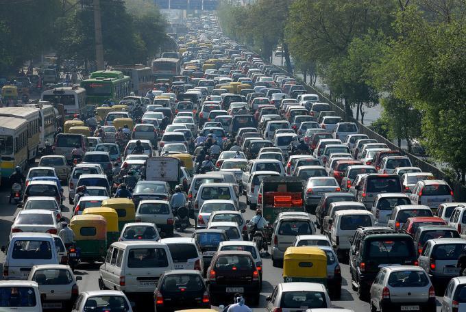
4 Challenges Mass congestion in urban area


5 GPS? A short range focus in order to clearly see the lane and the turn Cannot have a seamless shift in navigation service Signal is interfered by buildings and other factors Inaccurate turn will lead to more severe results


6 Accurate turn navigation with the prediction using the information at the global view level becomes very critical!


7 Our approach Form and distribute the information with V2V communication (to enhance the efficiency of prediction) Free of traffic Collaboration to identify blocked street Distribute information in opposite direction to alert incoming vehicles
8 Our contribution The information is not simply the location of the congestion. It is a snapshot at the global view level Mutual impact of all congestions, i.e., delay chain problem. Subject to any dynamic change in traffic Both target congestion and information delivery Normalized as an index, for vehicle easy to carry and calculate in the presence of dynamics Such normalization is difficult because the block impact can be different when the relative positions of the source and the destination change!
9 Information Collection The congestion identified among neighboring vehicles [7] Identification of the block of congested segment Calculation of mutual impact of blocks
10 Mutual impact of blocks
11 Mutual impact of blocks Delay chain and relative effect Blocked in the direction to the destination whenever no congestion-free path exists. *MCC block region Type 1 an intersection is inside block region if and only if both east and north direction are blocked (by adjacent congested segment or blocked intersection) Heuristic search of congestion-free path in the reversed direction, by our block information constitution In the proactive manner Total four types, sufficient enough for guiding the vehicle in any possible direction
12 Solution for information collection The congestion can be identified among neighboring vehicles, by the collaboration with V2V communication in [7]. Identification of the block of congested segment at the end node [16] when the information can be propagated via V2V communication (or carried by vehicle) in the opposite direction. End node will receive information from both directions at the intersection, and then determine whether this intersection is inside the (MCC) block region.
13 Navigation solution Follow the GPS guidance when the vehicle is out of any block region. To avoid entering the block region along the boundary, perimeter routing until it is safe to approach the destination in the congestionfree path. Escape from a congestion region.
14 Solution (of type 1)
15 Extension 2 directions => multiple directions Sufficiency of our approach Size of block Mobility and disconnections end node end node end node previous location of end node location (lagged information) (a) succeeding end node (b) (c) (d) succeeding end node direct comm. incorrect info. driving direction direct transfer of role lagged location info. indirect role transfer
16 Experimental Results Map of New York City, Manhattan, OpenStreetMap [17] Central Park to Madison Square Park Daily traffic with different volume (10 to 120% of the average) Trace Data generated by SUMO [8] Average speed (~10 min to pass through, with +/- 25%) Random congested segment (1 to 40%) V2V communication

17 GPS Probability of encountering congestion GUI
18 Existing proactive solution with the consideration of dwell time (under ideal mode) GUI
19 Summary (of experimental results) Block region is an accurate estimation of mutual impact of congestions. Up to 35% reduction is achieved with our block information, compared with the best proactive solution in existing work. GPS navigation in urban area may frequently encounter the live-lock and delay chain problem. The vehicle requires to take double time to reach the destination, compared with the performance of GUI.
20 Conclusion Precise information collection/distribution with a fully distributed manner Dynamic adjustment Retrieving a global view of possible congestionfree path with a simple index Optimistic manner adopted, reducing the overhead cost Study of the mutual impact of congestions Quick way for the vehicle to pass urban canyons.
21 Thank you! Questions and Comments
GUI: GPS-Less Traffic Congestion Avoidance in Urban Areas with Inter-Vehicular Communication
 West Chester University Digital Commons @ West Chester University Computer Science College of Arts & Sciences 24 GUI: GPS-Less Traffic Congestion Avoidance in Urban Areas with Inter-Vehicular Communication
Analysis of GPS and Zone Based Vehicular Routing on Urban City Roads
 Analysis of GPS and Zone Based Vehicular Routing on Urban City Roads Aye Zarchi Minn 1, May Zin Oo 2, Mazliza Othman 3 1,2 Department of Information Technology, Mandalay Technological University, Myanmar
A Joint Replication-Migration-based Routing in Delay Tolerant Networks
 A Joint -Migration-based Routing in Delay Tolerant Networks Yunsheng Wang and Jie Wu Dept. of Computer and Info. Sciences Temple University Philadelphia, PA 19122 Zhen Jiang Dept. of Computer Science West
Mobility Control for Complete Coverage in Wireless Sensor Networks
 Mobility Control for Complete Coverage in Wireless Sensor Networks Zhen Jiang Computer Sci. Dept. West Chester University West Chester, PA 9383, USA zjiang@wcupa.edu Jie Wu Computer Sci. & Eng. Dept. Florida
Analyzing Routing Protocols Performance in VANET Using p and g
 Analyzing Routing Protocols Performance in VANET Using 802.11p and 802.11g Rasha Kaiss Aswed and Mohammed Ahmed Abdala Network Engineering Department, College of Information Engineering, Al-Nahrain University
Lecture 6: Vehicular Computing and Networking. Cristian Borcea Department of Computer Science NJIT
 Lecture 6: Vehicular Computing and Networking Cristian Borcea Department of Computer Science NJIT GPS & navigation system On-Board Diagnostic (OBD) systems DVD player Satellite communication 2 Internet
Social-Aware Routing in Delay Tolerant Networks
 Social-Aware Routing in Delay Tolerant Networks Jie Wu Dept. of Computer and Info. Sciences Temple University Challenged Networks Assumptions in the TCP/IP model are violated DTNs Delay-Tolerant Networks
Poonam kori et al. / International Journal on Computer Science and Engineering (IJCSE)
") An Effect of Route Caching Scheme in DSR for Vehicular Adhoc Networks Poonam kori, Dr. Sanjeev Sharma School Of Information Technology, RGPV BHOPAL, INDIA E-mail: Poonam.kori@gmail.com Abstract - Routing
An Effect of Route Caching Scheme in DSR for Vehicular Adhoc Networks Poonam kori, Dr. Sanjeev Sharma School Of Information Technology, RGPV BHOPAL, INDIA E-mail: Poonam.kori@gmail.com Abstract - Routing
Methods to Resolve Traffic Jams using VANET
 Methods to Resolve Traffic Jams using VANET Rohit Kumar Department of Computer Sc. & Engineering Chandigarh University, Gharuan Mohali, Punjab Abstract - In this paper we have proposed a method to avoid
Mutually Exclusive Data Dissemination in the Mobile Publish/Subscribe System
 Mutually Exclusive Data Dissemination in the Mobile Publish/Subscribe System Ning Wang and Jie Wu Dept. of Computer and Info. Sciences Temple University Road Map Introduction Problem and challenge Centralized
Schedule-Driven Coordination for Real-Time Traffic Control
 Schedule-Driven Coordination for Real-Time Traffic Control Xiao-Feng Xie, Stephen F. Smith, Gregory J. Barlow The Robotics Institute Carnegie Mellon University International Conference on Automated Planning
Replica Distribution Scheme for Location-Dependent Data in Vehicular Ad Hoc Networks using a Small Number of Fixed Nodes
 Replica Distribution Scheme for Location-Dependent Data in Vehicular d Hoc Networks using a Small Number of Fixed Nodes Junichiro Okamoto and Susumu Ishihara Graduate School of Engineering, Shizuoka University,
Enhancement of Routing in Urban Scenario using Link State Routing Protocol and Firefly Optimization
 Enhancement of Routing in Urban Scenario using Link State Routing Protocol and Firefly Optimization Dhanveer Kaur 1, Harwant Singh Arri 2 1 M.Tech, Department of Computer Science and Engineering, Lovely
Aanchal Walia #1, Pushparaj Pal *2
 An Implemented approach of VANET using Location Information based Technique for safe city and vehicle Aanchal Walia #1, Pushparaj Pal *2 #1. M.Tech Scholor,ECE,Krukshetra University, *2. A.P.ECE Department,
A Deterministic Fault-Tolerant and Deadlock-Free Routing Protocol in 2-D Meshes Based on Odd-Even Turn Model
 A Deterministic Fault-Tolerant and Deadlock-Free Routing Protocol in 2-D Meshes Based on Odd-Even Turn Model Jie Wu Dept. of Computer Science and Engineering Florida Atlantic University Boca Raton, FL
A New Fault Information Model for Fault-Tolerant Adaptive and Minimal Routing in 3-D Meshes
 A New Fault Information Model for Fault-Tolerant Adaptive and Minimal Routing in 3-D Meshes hen Jiang Department of Computer Science Information Assurance Center West Chester University West Chester, PA
Reliable Routing In VANET Using Cross Layer Approach
 Reliable Routing In VANET Using Cross Layer Approach 1 Mr. Bhagirath Patel, 2 Ms. Khushbu Shah 1 Department of Computer engineering, 1 LJ Institute of Technology, Ahmedabad, India 1 er.bhagirath@gmail.com,
Routing Protocol with Quality Optimization for Vehicular Ad Hoc Networks
 Routing Protocol with Quality Optimization for Vehicular Ad Hoc Networks E. Priyanka 1, M.Vijaya Kanth 2 M.Tech, Department of CSE, JNTUACE, Ananthapuramu, Andhra Pradesh, India 1 Lecturer, Department
Offloading Floating Car Data through V2V Communications
 Offloading Floating Car Data through V2V Communications Razvan Stanica (INSA Lyon), Marco Fiore (IEIIT - CNR), Francesco Malandrino (Politecnico di Torino) 3èmes Journées Nationales des Communications
Performance Comparison of Mobility Generator C4R and MOVE using Optimized Link State Routing (OLSR)
") IOSR Journal of Engineering (IOSRJEN) ISSN (e): 2250-3021, ISSN (p): 2278-8719 Vol. 06, Issue 11 (November. 2016), V1 PP 25-29 www.iosrjen.org Performance Comparison of Mobility Generator and MOVE using
IOSR Journal of Engineering (IOSRJEN) ISSN (e): 2250-3021, ISSN (p): 2278-8719 Vol. 06, Issue 11 (November. 2016), V1 PP 25-29 www.iosrjen.org Performance Comparison of Mobility Generator and MOVE using
Histogram-Based Density Discovery in Establishing Road Connectivity
 Histogram-Based Density Discovery in Establishing Road Connectivity Kevin C. Lee, Jiajie Zhu, Jih-Chung Fan, Mario Gerla Department of Computer Science University of California, Los Angeles Los Angeles,
CHAPTER 5 CONCLUSION AND SCOPE FOR FUTURE EXTENSIONS
 130 CHAPTER 5 CONCLUSION AND SCOPE FOR FUTURE EXTENSIONS 5.1 INTRODUCTION The feasibility of direct and wireless multi-hop V2V communication based on WLAN technologies, and the importance of position based
STRAW - An integrated mobility & traffic model for vehicular ad-hoc networks
 STRAW - An integrated mobility & traffic model for vehicular ad-hoc networks David R. Choffnes & Fabián E. Bustamante Department of Computer Science, Northwestern University www.aqualab.cs.northwestern.edu
Implementation and Evaluation of Mobility Models with OPNET
 Lehrstuhl Netzarchitekturen und Netzdienste Institut für Informatik Technische Universität München Implementation and Evaluation of Mobility Models with OPNET Abschlussvortrag zur Masterarbeit von Thomas
Load Balanced Link Reversal Routing in Mobile Wireless Ad Hoc Networks
 Load Balanced Link Reversal Routing in Mobile Wireless Ad Hoc Networks Nabhendra Bisnik, Alhussein Abouzeid ECSE Department RPI Costas Busch CSCI Department RPI Mobile Wireless Networks Wireless nodes
MC-Safe: Multi-Channel Real-time V2V Communication for Enhancing Driving Safety
 RTSS 2018 MC-Safe: Multi-Channel Real-time V2V Communication for Enhancing Driving Safety Yunhao Bai, Kuangyu Zheng, Zejiang Wang, Xiaorui Wang, Junmin Wang Dept. of Electrical and Computer Engineering
A limited-global information model for fault-tolerant routing in dual-cube
 The International Journal of Parallel, Emergent and Distributed Systems, Vol. 21, No. 1, February 2006, 61 77 A limited-global information model for fault-tolerant routing in dual-cube ZHEN JIANG * and
A Review on Vehicular Ad-Hoc Network
 A Review on Vehicular Ad-Hoc Network Arshdeep Kaur 1, Shilpa Sharma 2 M.Tech Student, Dept. of Computer Science Engineering, Lovely Professional University, Phagwara, Punjab, India 1 Assistant Professor,
A Simulation Framework for V2V Wireless Systems
 A Simulation Framework for V2V Wireless Systems CHRISTIAN NELSON, CARL GUSTAFSON, FREDRIK TUFVESSON DEPARTMENT OF ELECTRICAL AND INFORMATION TECHNOLOGY, LUND UNIVERSITY, SWEDEN IN COLLABORATION WITH ALEXEY
ON THE PROBABILITY OF K-CONNECTIVITY IN WIRELESS AD HOC NETWORKS UNDER DIFFERENT MOBILITY MODELS
 ON THE PROBABILITY OF K-CONNECTIVITY IN WIRELESS AD HOC NETWORKS UNDER DIFFERENT MOBILITY MODELS Natarajan Meghanathan 1 and Sireesha Gorla 1, Jackson State University, 1400 Lynch St, Jackson, MS, USA
Methods to Resolve Traffic Jams using VANET
 Methods to Resolve Traffic Jams using VANET Rohit Kumar Department of Computer Sc. & Engineering Chandigarh University, Gharuan Mohali, Punjab Abstract VANET has been an important technology for managing
v9 Quick Start Guide
 v9 Quick Start Guide overview Driving Screen Most of your time using CoPIlot Truck will be spent on this screen. Let s take a moment and get familiar with the items you can interact with. Zoom Out Zoom
Study on Indoor and Outdoor environment for Mobile Ad Hoc Network: Random Way point Mobility Model and Manhattan Mobility Model
 Study on and Outdoor for Mobile Ad Hoc Network: Random Way point Mobility Model and Manhattan Mobility Model Ibrahim khider,prof.wangfurong.prof.yinweihua,sacko Ibrahim khider, Communication Software and
Mobile-Gateway Routing for Vehicular Networks 1
 Mobile-Gateway Routing for Vehicular Networks 1 Hsin-Ya Pan, Rong-Hong Jan 2, Andy An-Kai Jeng, and Chien Chen Department of Computer Science National Chiao Tung University Hsinchu, 30010, Taiwan {hypan,
Learn how to enter a destination and operate the navigation system. Steering Wheel Controls Use the steering wheel controls to control the system.
 * Learn how to enter a destination and operate the navigation system. Basic Navigation Operation A real-time navigation system uses GPS and a map database to show your current location and help guide you
Vertex-Based Multihop Vehicle-to-Infrastructure Routing for Vehicular Ad Hoc Networks
 Vertex-Based Multihop Vehicle-to-Infrastructure Routing for Vehicular Ad Hoc Networks Raj K. Shrestha, Sangman Moh, Ilyong Chung, and Dongmin Choi Dept. of Computer Engineering, Chosun University 375 Seoseok-dong,
A Survey of Vehicular Ad hoc Networks Routing Protocols
 International Journal of Innovation and Applied Studies ISSN 2028-9324 Vol. 3 No. 3 July 2013, pp. 829-846 2013 Innovative Space of Scientific Research Journals http://www.issr-journals.org/ijias/ A Survey
PERFORMANCE EVALUATION OF DSDV, AODV ROUTING PROTOCOLS IN VANET
 PERFORMANCE EVALUATION OF DSDV, AODV ROUTING PROTOCOLS IN VANET K. Venkateswarlu 1, G. Murali 2 1 M. Tech, CSE, JNTUA College of Engineering (Pulivendula), Andhra Pradesh, India 2 Asst.Prof (HOD), CSE,
EE 122: Intra-domain routing
 EE : Intra-domain routing Ion Stoica September 0, 00 (* this presentation is based on the on-line slides of J. Kurose & K. Rose) Internet Routing Internet organized as a two level hierarchy First level
Analytical Investigation and Implementation of Carry and Forward based Routing Protocol for Vehicular Ad hoc Network
 Analytical Investigation and Implementation of Carry and Forward based Routing Protocol for Vehicular Ad hoc Network by c Aslinda Hassan A thesis submitted to the School of Graduate Studies in partial
Context-Aware Vehicular Cyber-Physical Systems with Cloud Support: Architecture, Challenges, and Solutions
 Context-Aware Vehicular Cyber-Physical Systems with Cloud Support: Architecture, Challenges, and Solutions Siran Pavankumar(149344152) siranpavankumar@gmail.com Computer Science Department Seoul National
Learn how to enter a destination and operate the navigation system. Steering Wheel Controls Use the steering wheel controls to control the system.
 NAVIGATION NAVIGATION* Learn how to enter a destination and operate the navigation system. Basic Navigation Operation A real-time navigation system uses GPS and a map database to show your current location
NAVIGATION USER MANUAL
 NAVIGATION USER MANUAL POWERED by Welcome Dear Customer, Thank you for selecting NDrive as your navigation software. This guide is created so that you can find quick and simple answers to your questions,
Executive Summary. City of Goodyear. Prepared for: Prepared by: November, 2008 Copyright 2008, Kimley-Horn and Associates, Inc.
 Goodyear Intelligent Transportation Systems Strategic Plan Executive Summary Prepared for: City of Goodyear Prepared by: 191376000 Copyright 2008, Kimley-Horn and Associates, Inc. I. INTRODUCTION The City
Connected components - 1
 Connected Components Basic definitions Connectivity, Adjacency, Connected Components Background/Foreground, Boundaries Run-length encoding Component Labeling Recursive algorithm Two-scan algorithm Chain
Table of contents. Main Map Screen... 2 Basic Commands... 5 Exploring menu screens... 5 Using keyboards... 5 Performing a search...
 Table of contents Welcome!... 2 Main Map Screen... 2 Basic Commands... 5 Exploring menu screens... 5 Using keyboards... 5 Performing a search... 7 Go screen... 7 How to Navigate... 8 Navigate to an address...
Copyright The McGraw-Hill Companies, Inc. Permission required for reproduction or display.
 Chapter 17. PATH ANALYSIS AND NETWORK APPLICATIONS 17.1 Path Analysis 17.1.1 Source Raster 17.1.2 Cost Raster Box 17.1 Cost Raster for a Site Analysis of Pipelines 17.1.3 Cost Distance Measures 17.1.4
ENHANCED PARKWAY STUDY: PHASE 3 REFINED MLT INTERSECTION ANALYSIS
 ENHANCED PARKWAY STUDY: PHASE 3 REFINED MLT INTERSECTION ANALYSIS Final Report Prepared for Maricopa County Department of Transportation Prepared by TABLE OF CONTENTS Page EXECUTIVE SUMMARY ES-1 STUDY
COM-208: Computer Networks - Homework 6
 COM-208: Computer Networks - Homework 6. (P22) Suppose you are interested in detecting the number of hosts behind a NAT. You observe that the IP layer stamps an identification number sequentially on each
Getting started. Mounting your navigation device. 1. Push the EasyPort Mount on your TomTom START against the windshield in your car.
 TomTom START 1. Getting started Getting started Mounting your navigation device 1. Push the EasyPort Mount on your TomTom START against the windshield in your car. 1 2. Adjust the angle of your device.
Before Using the Navigation System
 Before Using the Navigation System WARNING Read this manual first Read this manual carefully before using the navigation system. We are not liable for accidents or other problems resulting from failure
VERGILIUS: A Scenario Generator for VANET
 VERGILIUS: A Scenario Generator for VANET Eugenio Giordano 1,2, Enzo De Sena 3, Giovanni Pau 1, and Mario Gerla 1 1 University of California at Los Angeles, California, USA. 2 DEIS, WiLab - University
Learn how to enter a destination and operate the navigation system. Steering Wheel Controls Use the steering wheel controls to give voice commands.
 NAVIGATION* Learn how to enter a destination and operate the navigation system. Basic Navigation Operation A real-time navigation system uses GPS and a map database to show your current location and help
QUICK TIPS SANTA FE. Phone Pairing Navigation Blue Link TOPICS
 QUICK TIPS SANTA FE TOPICS Phone Pairing Navigation Blue Link PHONE PAIRING Connecting for the First Time 1. To begin, the vehicle s shifter must be in PARK 2. Press the PHONE button 3. Touch YES 4. Turn
Detection and Removal of Blackhole Attack Using Handshake Mechanism in MANET and VANET
 IOSR Journal of Mobile Computing & Application (IOSR-JMCA) e-issn: 2394-0050, P-ISSN: 2394-0042.Volume 2, Issue 1. (Mar. - Apr. 2015), PP 01-05 www.iosrjournals.org Detection and Removal of Blackhole Attack
Heterogeneous Community-based Routing in Opportunistic Mobile Social Networks
 Heterogeneous Community-based Routing in Opportunistic Mobile Social Networks Yunsheng Wang Kettering University Jie Wu Temple University Mingjun Xiao University of Science and Tech. of China Daqiang Zhang
NAVIGATION* Basic Navigation Operation. Learn how to enter a destination and operate the navigation system.
 NAVIGATION* Learn how to enter a destination and operate the navigation system. Basic Navigation Operation A real-time navigation system uses GPS and a map database to show your current location and help
Performance Enhancement of Routing Protocols for VANET With Variable Traffic Scenario
 Performance Enhancement of Routing Protocols for VANET With Variable Traffic Scenario Uttara Vyas 1, Prof. Kamlesh Chopra 2, Prof. Prashant Lakkadwala 3 1 Computer Science and Engineering,Acropolis Technical
Connected Car. Dr. Sania Irwin. Head of Systems & Applications May 27, Nokia Solutions and Networks 2014 For internal use
 Connected Car Dr. Sania Irwin Head of Systems & Applications May 27, 2015 1 Nokia Solutions and Networks 2014 For internal use Agenda Introduction Industry Landscape Industry Architecture & Implications
Collaboration with: Dieter Pfoser, Computer Technology Institute, Athens, Greece Peter Wagner, German Aerospace Center, Berlin, Germany
 Towards traffic-aware aware a routing using GPS vehicle trajectories Carola Wenk University of Texas at San Antonio carola@cs.utsa.edu Collaboration with: Dieter Pfoser, Computer Technology Institute,
Connecting a Mobile York Region
 Connecting a Mobile York Region Presentation to ITS Canada Victoria 2014 Gregg Loane, P.Eng. June 1, 2014 Connecting a Mobile York Region Overview Who is York Region? York s ITS Program Background Data
Improving Energy and Efficiency in cluster based VANETs through AODV Protocol
 Improving Energy and Efficiency in cluster based VANETs through AODV Protocol Prerana Deshmukh PG Department of Computer Science and Engineering, J.D.College of Engineering & Managment, RTMNU, Maharashtra,
MOBILE APP USER MANUAL
 MOBILE APP USER MANUAL available for ios / Android / Windows Phone Table of Contents 1. Motorimage Metasat Mobile App... page 3 2. Main Page... page 4 3. Commands... page 5 4. Status... page 6 5. Map...
PRIME/ESSENTIAL NAVIGATION QUICK START GUIDE
 PRIME/ESSENTIAL NAVIGATION QUICK START GUIDE EN Initial set-up 1. Select your preferred language, then tap to confirm your selection. Later you can change it in Regional settings. 2. Read the End User
An Analysis of Simulators for Vehicular Ad hoc Networks
 World Applied Sciences Journal 23 (8): 1044-1048, 2013 ISSN 1818-4952 IDOSI Publications, 2013 DOI: 10.5829/idosi.wasj.2013.23.08.584 An Analysis of Simulators for Vehicular Ad hoc Networks Syed A. Hussain
Franklin D. Roosevelt Four Freedoms Park by Louis Kahn, Constructed 2012
 PUBLIC REALM Franklin D. Roosevelt Four Freedoms Park by Louis Kahn, Constructed 2012 PUBLIC REALM INSPIRATION Louis Kahn s design for the Four Freedoms Park is a powerful triangular form stretching into
Design Concept: Navigation during a call
 Design Concept: Navigation during a call Anna Kaufman 15 May 2012 In-call navigation: the problem Obviously, users shouldn t be talking on the phone while driving, because it s not safe to be distracted
SECTION 2 NAVIGATION SYSTEM: DESTINATION SEARCH
 NAVIGATION SYSTEM: DESTINATION SEARCH SECTION 2 Destination search 62 Selecting the search area............................. 62 Destination search by Home........................... 64 Destination search
NAVIGATION* Basic Navigation Operation. Learn how to enter a destination and operate the navigation system.
 * Learn how to enter a destination and operate the navigation system. Basic Navigation Operation NAVIGATION A real-time navigation system uses GPS and a map database to show your current location and help
Inferring Maps from GPS Data
 Inferring Maps from GPS Data 1. Why infer maps from GPS traces? 2. Biagioni/Eriksson algorithm 3. Evaluation metrics 4. Similar approaches: satellite images, map update 5. Lab 4 1 2 3 OpenStreetMap Licensed
SIMULATION BASED AND ANALYSIS OF ROUTING PROTOCOLS FOR VANET USING VANETMOBISIM AND NS-2
 International Journal of Computer Engineering & Technology (IJCET) Volume 6, Issue 9, Sep 2015, pp. 32-41, Article ID: IJCET_06_09_004 Available online at http://www.iaeme.com/ijcet/issues.asp?jtype=ijcet&vtype=6&itype=9
Intelligent Transportation System For Vehicular Ad-Hoc Networks
 INTERNATIONAL JOURNAL OF TECHNOLOGY ENHANCEMENTS AND EMERGING ENGINEERING RESEARCH, VOL 2, ISSUE 6 69 Intelligent Transportation System For Vehicular Ad-Hoc Networks T. Sujitha, S. Punitha Devi Department
Fault-Tolerant Wormhole Routing Algorithms in Meshes in the Presence of Concave Faults
 Fault-Tolerant Wormhole Routing Algorithms in Meshes in the Presence of Concave Faults Seungjin Park Jong-Hoon Youn Bella Bose Dept. of Computer Science Dept. of Computer Science Dept. of Computer Science
PERSONAL communications service (PCS) provides
 provides") 646 IEEE/ACM TRANSACTIONS ON NETWORKING, VOL. 5, NO. 5, OCTOBER 1997 Dynamic Hierarchical Database Architecture for Location Management in PCS Networks Joseph S. M. Ho, Member, IEEE, and Ian F. Akyildiz,
646 IEEE/ACM TRANSACTIONS ON NETWORKING, VOL. 5, NO. 5, OCTOBER 1997 Dynamic Hierarchical Database Architecture for Location Management in PCS Networks Joseph S. M. Ho, Member, IEEE, and Ian F. Akyildiz,
Traffic balancing-based path recommendation mechanisms in vehicular networks Maram Bani Younes *, Azzedine Boukerche and Graciela Román-Alonso
 WIRELESS COMMUNICATIONS AND MOBILE COMPUTING Wirel. Commun. Mob. Comput. 2016; 16:794 809 Published online 29 January 2015 in Wiley Online Library (wileyonlinelibrary.com)..2570 RESEARCH ARTICLE Traffic
Evaluation of Effective Vehicle Probe Information Delivery with Multiple Communication Methods
 Communications and Network, 2015, 7, 71-80 Published Online May 2015 in SciRes. http://www.scirp.org/journal/cn http://dx.doi.org/10.4236/cn.2015.72007 Evaluation of Effective Vehicle Probe Information
GPS Navigation. Manual
 GPS Navigation Manual Contents 1 Warnings and Safety Information...3 2 Frequently Asked Questions...3 3 Getting Started...5 3.1 Navigator...5 3.1.1 Power Supply and Charge...5 3.1.1.1 Power Supply...5
Data Plane Monitoring in Segment Routing Networks Faisal Iqbal Cisco Systems Clayton Hassen Bell Canada
 Data Plane Monitoring in Segment Routing Networks Faisal Iqbal Cisco Systems (faiqbal@cisco.com) Clayton Hassen Bell Canada (clayton.hassen@bell.ca) Reference Topology & Conventions SR control plane is
TRAFFIC LIGHT CONTROLLER
 TRAFFIC LIGHT CONTROLLER 1 ANITA DIDAL, 2 PRAGATI SACHAN, 3 ANCHAL KATIYAR, 4 PALLAVI GAUTAM M.Tech Scholar, VLSI, Jayoti Vidyapeeth Women s University Jaipur, Rajasthan, INDIA E mail: 1 anitadidal90@gmail.com,
CD7100. E-iSERV Operation Guide
 E-iSERV Operation Guide CD700 We appreciate your purchase of this head unit. Please read through this manual in order to ensure correct operation. We suggest that after reading it you keep this manual
Citymob for Roadmaps v1.0 USER GUIDE. Alberto Pardo Calvo. Advisors Francisco J. Martinez Piedad Garrido
 USER GUIDE Alberto Pardo Calvo Advisors Francisco J. Martinez Piedad Garrido Collaborators Juan Carlos Cano Carlos T. Calafate Pietro Manzoni Manuel Fogue Teruel, March 2011 1 Table of Contents 1. Citymob
ARCHITECTURE FOR A THIRD GENERATION URBAN TRAFFIC CONTROL
 ARCHITECTURE FOR A THIRD GENERATION URBAN TRAFFIC CONTROL Rahmat R. A., Jumari K., Hassan A. and Basri, H. Fakulti Kejuruteraan, Universiti Kebangsaan alaysia ALAYSIA Keywords: traffic control, physical
Learn how to enter a destination and operate the navigation system.
 NAVIGATION Learn how to enter a destination and operate the navigation system. Basic Navigation Operation A real-time navigation system uses GPS and a map database to show your current location and help
ELANTRA TOPICS. Phone Pairing Navigation Blue Link
 QUICK TIPS ELANTRA TOPICS Phone Pairing Navigation Blue Link PHONE PAIRING Connecting for the First Time 1. To begin, the vehicle s shifter must be in PARK 2. Press the PHONE button 3. Touch YES 4. Turn
Learn how to enter a destination and operate the navigation system.
 NAVIGATION* Learn how to enter a destination and operate the navigation system. Basic Navigation Operation A real-time navigation system uses GPS and a map database to show your current location and help
MARINA PARK PUBLIC ART AT FLAG PLAZA
 CONTEXTUAL OVERVIEW STANLEY PARK COAL HARBOUR HARBOUR GREEN PARK DEVONIAN HARBOUR PARK COAL HARBOUR COMMUNITY CENTRE & PARK CARDERO PARK MARINA PARK 10 MINUTE WALK 5 MINUTE WALK LOST LAGOON PUBLIC ART
Static Versioning of Global State for Race Condition Detection
 Static Versioning of Global State for Race Condition Detection Steffen Keul Dept. of Programming Languages and Compilers Institute of Software Technology University of Stuttgart 15 th International Conference
Welcome! Presented by Paul Pearson National Corvette Museum, August 28, 2014
 Welcome! Presented by Paul Pearson National Corvette Museum, August 28, 2014 Linking IP to Driver Mode Selector If your car IP gauges don t change when you turn the driver mode selector, you just need
New Mexico Watch: User Guide
 New Mexico Watch: User Guide The New Mexico Watch (nmwatch.org) interactive website distributes maps, data, and related information of natural disasters within New Mexico. This application is developed
NAVIGATION* WARNING. Basic Navigation Operation. Learn how to enter a destination and operate the navigation system.
 NAVIGATION* Learn how to enter a destination and operate the navigation system. Basic Navigation Operation A real-time navigation system uses GPS and a map database to show your current location and help
A Method for Sharing Traffic Jam Information using Inter-Vehicle Communication (Invited Paper)
") A Method for Sharing Traffic Jam Information using Inter-Vehicle Communication (Invited Paper) Naoki Shibata, Takashi Terauchi, Tomoya Kitani, Keiichi Yasumoto, Minoru Ito, Teruo Higashino Department of
A Method for Sharing Traffic Jam Information using Inter-Vehicle Communication (Invited Paper) Naoki Shibata, Takashi Terauchi, Tomoya Kitani, Keiichi Yasumoto, Minoru Ito, Teruo Higashino Department of
Fairness Example: high priority for nearby stations Optimality Efficiency overhead
 Routing Requirements: Correctness Simplicity Robustness Under localized failures and overloads Stability React too slow or too fast Fairness Example: high priority for nearby stations Optimality Efficiency
Keywords: Adhoc Network, Vehicular Adhoc Network, VANET, position-based routing protocols. I. INTRODUCTION
 ISSN: 2349-7637 (Online) (RHIMRJ) Research Paper Available online at: www.rhimrj.com A Review: Position based Routing Protocols in VANET Rathod Kirit R 1st PhD Scholar, Rai University, Ahmedabad, Gujarat
P Public web interface prototype
 LIFE+10 ENV/IT/000389 INTEGREEN Action 4: Implementation & Integration P.4.1.5 Public web interface prototype Project Coordinating Beneficiary Project Associated Beneficiary n.2 Project Associated Beneficiary
On Constructing the Minimum Orthogonal Convex Polygon in 2-D Faulty Meshes
 On Constructing the Minimum Orthogonal Convex Polygon in 2-D Faulty Meshes Jie Wu Department of Computer Science and Engineering Florida Atlantic University Boca Raton, FL 33431 E-mail: jie@cse.fau.edu
Hikvision traffic management solution ensures safe vehicle flow in Yangon, Myanmar
 Hikvision traffic management solution ensures safe vehicle flow in Yangon, Myanmar Published on 17 Oct 2017 Hikvision, a supplier of video surveillance products and solutions, is ensuring safe vehicle
Automatic Incident Detection Solutions UK & Ireland Partner
 1 Automatic Incident Detection Solutions UK & Ireland Partner Sprinx AID Solutions ver. 2.4.0 - SVS Automatic Incident Detection 3 Sprinx SX-TRAFFIC system allows reliable detection of incidents and events
ATTACHMENT 3 ZAB Page 1 of 8. The police department feels that the expanded use and hours are okay with the recommended security upgrades.
 Page 1 of 8 From: White, Byron E. Sent: Wednesday, April 24, 2013 8:28 AM To: Greene, Elizabeth Subject: Re: 1799 University comments The police department feels that the expanded use and hours are okay
PolNav Navigation Software
 PolNav Navigation Software User s Manual Version 2008 Q1 For use with PC/PDA/Personal Navigators I Polstar Technologies, Inc. http://www.polstargps.com Tel: +886-3-552-5279 Fax: +886-3-552-5269 Address:
On A Traffic Control Problem Using Cut-Set of Graph
 1240 On A Traffic Control Problem Using Cut-Set of Graph Niky Baruah Department of Mathematics, Dibrugarh University, Dibrugarh : 786004, Assam, India E-mail : niky_baruah@yahoo.com Arun Kumar Baruah Department