Lecture ID: WT
|
|
|
- Nigel Williams
- 5 years ago
- Views:
Transcription
1 GNSS Online Lecture # 1 Lecture ID: WT Lecture Topic: GNSS Data Processing in RTKLIB Dinesh Manandhar Center for Spatial Information Science The University of Tokyo Contact Information: dinesh@iis.u-tokyo.ac.jp 11 th May 2018 Slide : 1
2 Webinar Information Lecture Type : Webinar Webinar ID : WT Webinar Topic : GNSS Data Processing in RTKLIB Technical Level : Intermediate Pre-Requisite (Recommended): Webinar ID : WT : Introduction to GNSS Webinar ID : WT : GNSS Field Survey Or general knowledge about GNSS, field survey and data collection. Date : 11th MAY 2018 Friday, Time : 18:00 (JST) 09:00 (UTC) Duration : 75 minutes Resource Person : Dinesh Manandhar, Associate Professor, The University of Tokyo This Webinar is Technical. We discuss the followings: (1) How to setup u-blox receiver to collect raw data for RTK (2) How to convert u-blox data into RINEX format (3) How to download base-station data from our ABN stations (NetR9) (4) How to process raw data for RTK using RTKLIB Registration : or Slide : 2
3 u-center Software Installation Slide : 3

4 Install u-center Software u-center is a software for u-blox receivers Available for Windows and Android Device It can also be used with other receivers that output NMEA data Download the software from Install the software with driver Select Use Windows USB Serial Driver Follow the instructions Connect u-blox receiver to one of the USB ports. The device is now ready for use. Slide : 4

5 Select COM Port to Connect the Receiver Click here This will show the COM port on which u-blox receiver is connected Select the port which is connected to u-blox Hint: If you don t know which COM port is used for u-blox: * disconnect the receiver * check COM ports now Re-connect the receiver check the COM ports You will see one new COM port now. Select this COM port to connect the receiver Slide : 5
6 Troubleshooting COM Port Setting Slide : 6

 OR (2) USB Serial Device (COM ID) (3) Repeat update process for all USB ports")
7 U-center 8.27 U-center 8.29 Run Device Manager You will see SENSORS u-blox GNSS Location Sensor If your receiver doesn t work with this setting, update this driver Instructions for update are given in the next few slides After update you will see (1) U-blox Virtual COM Port (COM ID) OR (2) USB Serial Device (COM ID) (3) Repeat update process for all USB ports that you want to connect the u-blox receiver (4) Otherwise it will use Virtual COM port Slide : 7

8 Click Mouse Right Button Slide : 8

9 Select this option Slide : 9

10 Select this option Slide : 10

11 Select this option Slide : 11
12 A new COM Port will be installed Next, Remove usb cable and re-connect once again. You should see the same COM port Slide : 12

13 Run u-center and select COM Port. You will see the New COM port here. Select it. It should work now See the COM Port and green light blinking here Slide : 13
14 u-blox Receiver Setup to Log Raw Data for RTK Slide : 14
15 Output Data Types from a GPS Receiver PVT Data Position, Velocity and Time All receivers output these data Data format is NMEA Raw Data Pseudorange, Carrier-phase and Doppler Required for RTK Some receivers output these data File format may be proprietary or RINEX Observation File Navigation Message Data Satellite Ephemeris, Almanac and Clock Data, Satellite Health Status etc. Required for RTK File format may be proprietary or RINEX Navigation File Satellite Related Data Number and Type of Satellites, Azimuth, Elevation, Satellite Types and Signals Many Receivers output these data Data Format is NMEA Signal Quality Data C/No or SNR Other Data Noise related data Receiver specific proprietary information Slide : 15

16 Connect receiver by selecting COM port Select COM Port Select Speed If COM port is open properly, You will see Green color flashing Slide : 16

17 Select GNSS Config Tab Enable QZSS & L1SAIF Enable either Beidou or Glonass. Both systems can t be enabled at the same time. Slide : 17
 etc Slide")
18 Select RAWX This logs raw data for each visible satellite like: Pseudorange CarrierPhase Doppler SNR (C/No) etc Slide : 18

19 Select SFRBX Select Enable This logs Navigation Data bits for each visible satellite Slide : 19

20 After setting all the parameters, save it to EPROM by selecting RECEIVER-> ACTION -> SAVE CONFIG Slide : 20

21 After setting all the parameters, save the output by selecting FILE-> SAVE or by clicking RED Record circle. Slide : 21


22 Output rate can be changed from 1Hz to 5Hz or 10Hz Change UBX-CFG-RATE parameter Change Measurement Period to 200 [ms] for 5[Hz] output Slide : 22
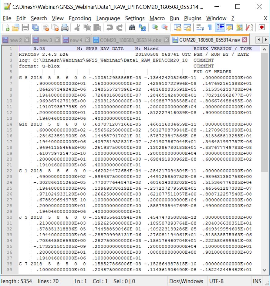
23 Convert from UBX format to RINEX Slide : 23
24 RTKLIB Main Menu, Ver b26 RTKVIDEO RTKPLOT RTKGET RTKCONV RTKNAVI STRSVR NTRIPBROWSER RTKPOST Slide : 24

25 Convert from UBX to RINEX 2 1 Select RTKCONV Select UBX file Select Format 6 7 Slide : 25

26 Slide : 26

27 Select RINEX Version 1 Select Satellite Types Select RAW Data Types C: Codephase L: Carrierphase D: Doppler S: SNR Select Frequencies Slide : 27

28 Slide : 28
29 Check RINEX Data RTKVIDEO RTKPLOT RTKGET RTKCONV RTKNAVI STRSVR NTRIPBROWSER RTKPOST Slide : 29

30 RTKPLOT to Check Data Click this button Use RTKPLOT Drag and Drop files here RINEX files NMEA File UBX file etc Slide : 30

31 Visible Satellites and Skyplot Slide : 31


32 SNR, Multipath and Elevation for J03 and G01 Satellites Slide : 32
33 How to Get Base-Station Data Slide : 33
34 Accessing Base-Station Data For Real-Time RTK Get NTRIP Address IP Address Port ID Mount Point Login ID Password For Post-Processing RTK IP Address Login ID Password Select the files Select the data format Download the files Always request Base-station data in RINEX format if possible. This will save your time in pre-processing of proprietary data formats Slide : 34

35 Sample of Data Files in NetR9 Slide : 35
36 Select Required Data Type and Data Slide : 36
37 RTK Post-Processing RTKVIDEO RTKPLOT RTKGET RTKCONV RTKNAVI STRSVR NTRIPBROWSER RTKPOST Slide : 37

38 Prepare Data Base Station Data RINEX OBS File RINEX NAV File Rover (User) Data RINEX OBS File Select Rover Observation Data Select Base Observation Data Select Navigation Data RTK Post-Processing Slide : 38


39 Slide : 39
40 Slide : 40
41 One Hour RTK Post-processing output Base Rover : NetR9 : NetR9 Show only RTK FIX Data Slide : 41
42 One Hour RTK Post-processing output Base Rover : NetR9 : U-bloxM8P Show only RTK FIX Data Slide : 42
43 Base Rover : U-bloxM8P : U-bloxM8P Slide : 43
44 Position Output Comparison between (a) High-end Base and High-end Rover (b) High-end Base and Low-end Rover Base: NetR9 (High-end) Rover: NetR9 (high-end) Base: NetR9 (high-end) Rover: U-blox M8P (Low-end) Slide : 44
45 Reference Slides Slide : 45
46 Data Formats: NMEA, RINEX References: Slide : 46
47 National Marine Electronics Association (NMEA) Format NMEA is format to output measurement data from a sensor in a pre-defined format in ASCII In the case of GPS, It output GPS position, velocity, time and satellite related data NMEA sentences (output) begins with a Talker ID and Message Description Example: $GPGGA,123519, ,N, ,E,1,08,0.9,545.4,M,46.9,M,,*47 $GP is Talker ID GGA is Message Description to indicate for Position Data Slide : 47
48 NMEA Data Format GGA - Fix data which provide 3D location and accuracy data. $GPGGA,123519, ,N, ,E,1,08,0.9,545.4,M,46.9,M,,*47 Where: GGA Global Positioning System Fix Data Fix taken at 12:35:19 UTC , N Latitude 48 deg ' N , E Longitude 11 deg ' E 1 Fix quality: 0 = invalid, 1 = GPS fix (SPS), 2 = DGPS fix, 3 = PPS fix, 4 = Real Time Kinematic 5 = Float RTK 6 = estimated (dead reckoning) (2.3 feature) 7 = Manual input mode 8 = Simulation mode 08 Number of satellites being tracked 0.9 Horizontal dilution of position 545.4,M Altitude, Meters, above mean sea level 46.9,M Height of geoid (mean sea level) above WGS84 ellipsoid (empty field) time in seconds since last DGPS update (empty field) DGPS station ID number *47 the checksum data, always begins with * Slide : 48
49 RINEX Data Format Receiver Independent Exchange Format (RINEX) is a data exchange format for raw satellite data among different types of receivers. Different types of receivers may output position and raw data in proprietary formats For post-processing of data using DGPS or RTK it is necessary to use data from different types of receivers. A common data format is necessary for this purpose. Example: How to post process data from Trimble, Novatel and Septenrtio receivers to compute a position? RINEX only provides Raw Data. It does not provide position output. User has to post-process RINEX data to compute position Raw data consists of Pseudorage, Carrierphase, Doppler, SNR RINEX basically consists of two data types *.*N file for Satellite and Ephemeris Related data. Also called Navigation Data *.*O file for Signal Observation Data like Pseudorange, Carrier Phase, Doppler, SNR Also called Observation Data Slide : 49

50 RINEX N File for GPS Slide : 50
51 RINEX O File GPS, GLONASS, GALILEO, QZSS, SBAS Slide : 51
52 RINEX O File, Continued from previous slide Slide : 52
53 Additional Information Please visit websites For Webinar: Main Page : Other: Contact: dinesh@iis.u-tokyo.ac.jp Sample Raw Data can be downloaded to Check Accuracy of RTK Processing 1. High-End Base (NetR9) Data vs Low-End Rover (u-blox M8T) Data 2. Low-End Base (u-blox M8T) Data vs Low-End Rover (u-blox M8T) Data Slide : 53
Seagull #GPK. User Manual. Product: Seagull #GPK Released: FW: 1.0
 Seagull #GPK User Manual Product: Seagull #GPK Released: 2018-12-06 FW: 1.0 CONTENTS GENERAL INFORMATION... 3 CONFIG FILE... 4 GENERAL... 4 EDITING... 4 SETTINGS AND VALUES TABLE... 5 FLIGHT CONTROLLER
How to use free RTK Software?
 MGA Webinar 1 st June How to use free RTK Software? Tokyo Univ. of Marine Science and Technology : Nobuaki Kubo Receiver used in this training 1. u-blox GNSS receiver (M8P or M8T) 2. Trimble NetR9 u-blox
1 General Information... 2
 Public Release Notes Topic : u-blox M8 Flash Firmware 3.01 HPG 1.20 UBX-16024900 Author : Mårten Ström Date : 18 Oct 2016 We reserve all rights in this document and in the information contained therein.
1 General Information... 2
 Public Release Notes Topic : u-blox M8 Flash Firmware 3.01 HPG 1.40 UBX-17021504 Author : Mårten Ström Date : 22 June 2017 We reserve all rights in this document and in the information contained therein.
Framework and Performance Evaluation of a Ray Tracing-Software Defined Radio Method for GNSS Positioning in an Urban Canyon Environment
 17 Nov. 2017, ITSNT2017 Framework and Performance Evaluation of a Ray Tracing-Software Defined Radio Method for GNSS Positioning in an Urban Canyon Environment Rei Furukawa, Tokyo University of Marine
Software Update Release Notes: GSG StudioView Scenario Builder Software GSG StudioView Version 4.5 Release Notes
 Software Update Release Notes: GSG StudioView Scenario Builder Software GSG StudioView Version 4.5 Release Notes Spectracom Corp., Rochester NY, USA December 21, 2015 GSG StudioView offers an easy way
SurvX 3.0 Software User Manual
 SurvX 3.0 Software User Manual (Android version) Content Chapter 1 Software Introduction...4 Chapter 2 SurvX installation and uninstallation... 4 2.1 SurvX Installation... 4 2.2 SurvX uninstallation...
Zodiac Software v3.00
 Zodiac Software v3.00 This Software Release Note applies to the following Conexant Global Positioning System (GPS) products: Jupiter board (5 V, with various RF connectors), TU30-D410 Jupiter board (3
Development of the Low Cost RTK GPS
 2009 International Symposium on GPS/GNSS Development of the Low Cost RTK GPS Receiver with an Open Source Program Package RTKLIB Tokyo University of Marine Science and Technology T. Takasu and A. Yasuda
DIGITAL COMMUNICATION SWAPNIL UPADHYAY
 DIGITAL COMMUNICATION SWAPNIL UPADHYAY SCOPE OF DIGITAL COMMUNICATION Internet Mobile Networks Wireless Networks OUR INTEREST ARDUINO SHIELDS Use SPI or UART to communicate with arduino boards JPG COLOR
User Manual For TX204B/TX204G/TX306 Receivers
 User Manual Version V1.0-20171124 User Manual For TX204B/TX204G/TX306 Receivers 2017 Tersus GNSS Inc. All rights reserved. Sales & Technical Support: sales@tersus-gnss.com & support@tersus-gnss.com More
Surveying. Session GPS Surveying 1. GPS Surveying. Carrier-Phase (RTK) Pseudo-Range (DGPS) Slide 1
 Pseudo-Range (DGPS) Slide 1") GPS Surveying Slide 1 GPS Surveying Surveying Mapping Standalone Relative Relative Standalone Post-Processed Real-Time Static / Fast Static Kinematic Stop & Go Rapid-Static Carrier-Phase (RTK) Pseudo-Range
GPS Surveying Slide 1 GPS Surveying Surveying Mapping Standalone Relative Relative Standalone Post-Processed Real-Time Static / Fast Static Kinematic Stop & Go Rapid-Static Carrier-Phase (RTK) Pseudo-Range
GNSS/GPS Overview for the DEP Status and Trend Networks
 GNSS/GPS Overview for the DEP Status and Trend Networks Florida Department of Environmental Protection Tom Biernacki Video of this presentation is posted at https://fldeploc.dep.state.fl.us/appdata/status/sol
Piksi Multi Settings. 1 Introduction. 2 Configure Settings Programmatically. Firmware Version v2.0
 Firmware Version v2.0 1 Introduction Piksi R Multi and Duro R have a number of settings that can be controlled by the end user via the provided Swift Console or through the SBP binary message protocol.
USB Dongle Series. User Manual
 USB Dongle Series Model:UD-731R User Manual All right reserved, 2010 2F., No.136, Ziqiang S. Rd., Zhubei City, Hsinchu County 30264, Taiwan (R.O.C.) TEL:886-3-6578491 FAX:886-3-6578492 MADE IN TAIWAN 2010,08,
GYNEO6MV2 GPS Module with Arduino
 GYNEO6MV2 GPS Module with Arduino This guide shows how to use the NEO-6M GPS module with the Arduino to get GPS data. GPS stands for Global Positioning System and can be used to determine position, time,
L70 GPS Protocol Specification
 L70 GPS Protocol Specification GPS Module Series Rev. L70_GPS_Protocol_Specification_V2.2 Date: 2014-08-19 www.quectel.com Our aim is to provide customers with timely and comprehensive service. For any
Presented at the FIG Working Week 2017, May 29 - June 2, 2017 in Helsinki, Finland
 Presented at the FIG Working Week 2017, May 29 - June 2, 2017 in Helsinki, Finland OUTLINE I INTRODUCTION II GNSS MEASUREMENTS AND METHODOLOGY III IV TEST RESULTS AND DISCUSSION Concluding Remarks ONE
GeoSDemo v1.34. User Manual
 GeoSDemo v1.34 User Manual R&D Center «GeoStar navigation» Ltd. Moscow, 2010 Table of Contents 1. About... 6 1.1. Introduction... 6 2. Abbreviations... 7 3. Installation Guide... 8 4. Operation... 12 4.1.
Designing a GPS Receiver Network with GNSS Algorithm for Accuracy and Safety
 International Global Navigation Satellite Systems Society IGNSS Symposium 2007 The University of New South Wales, Sydney, Australia 4 6 December, 2007 Designing a GPS Receiver Network with GNSS Algorithm
SIM18_NMEA Messages_Specification_V1.00
 SIM18_NMEA Messages_Specification_V1.00 Document Title SIM18 NMEA Messages Specification Version 1.00 Date 2011-2-9 Status Document Control ID Release SIM18_NMEA Messages_Specification_V1.00 General Notes
Quick Guide for egps
 Quick Guide for egps Effective 08/23/11 Page 1 of 13 Legal Information Address: Freiheitstraße 124 126, 15745 Wildau Germany Telephone: +49 3375 527366 E-Mail: support@eentwicklung.net All contents in
Piksi Multi Settings. 1 Introduction. 2 Configure Settings Programmatically. Firmware Version v1.5.12
 Firmware Version v1.5.12 1 Introduction Piksi R Multi and Duro R have a number of settings that can be controlled by the end user via the provided Swift Console or through the SBP binary message protocol.
NS3Kview Quick-Start Guide
 NS3Kview Quick-Start Guide Issue: P00 Bulletin NS51-QSG Revision P00 Date 1 June 2011 TABLE OF CONTENTS 1. DISCLAIMER... 3 2. DISTRIBUTION... 3 3. INSTALLING NS3KVIEW... 3 4. INTRODUCTION... 4 5. GETTING
Piksi Multi Settings. 1 Introduction. Firmware Version v1.3.10
 Firmware Version v1.3.10 1 Introduction Piksi R Multi has a number of settings that can be controlled by the end user via the provided Swift Console or through the SBP binary message protocol. This document
RTKLIB ver Manual
 2011 06 10 Contents 1 Overview... 1 2 System Requirement... 3 3 Instructions... 4 3.1 Installation/Uninstallation... 4 3.2 Real time Positioning with RTKNAVI... 6 3.3 Configure Input, Output and Log Streams
FURUNO GNSS Receiver
 FURUNO GNSS Receiver Model GT-86 (Document No. ) www.furuno.com IMPORTANT NOTICE GT-86 No part of this manual may be reproduced or transmitted in any form or by any means, electronic or mechanical, including
FURUNO GNSS Receiver
 FURUNO GNSS Receiver Model GT-87 (Document No. ) www.furuno.com IMPORTANT NOTICE GT-87 No part of this manual may be reproduced or transmitted in any form or by any means, electronic or mechanical, including
Location Aware Programming Framework
 Location Aware Programming Framework CSE237B Course Project, Fall 2004 by Apurva Sharma Introduction Time as a variable has been integrated into programming for quite some time. Most languages provide
L80 GPS Protocol Specification
 L80 GPS Protocol Specification GPS Module Series Rev. L80_GPS_Protocol_Specification_V1.0 Date: 2013-07-09 www.quectel.com Our aim is to provide customers with timely and comprehensive service. For any
IGS RTCM-SC104 RINEX Working Group Report. Ken MacLeod, Loukis Agrotis, Nacho Romero IGS Workshop July 24/2012 Olsztyn, Poland
 IGS RTCM-SC104 RINEX Working Group Report Ken MacLeod, Loukis Agrotis, Nacho Romero IGS Workshop July 24/2012 Olsztyn, Poland 1 Overview IGS/RTCM-SC104 SC104 RINEX Working Group Organization/Composition
GPS Monitoring Station Data Management
 GPS Monitoring Station Data Management Héctor Manuel Maestro Alegre Abstract- GPS is nowadays the most important GNSS and the only one fully operative. Nowadays, this navigation system is becoming omnipresent
GSR Reference Station Software
 GNSS Reference Station GSR Reference Station Software Reference Manual GNSS Reference Station Tplljb GSR Reference Station Software Version 7.2.1 Preliminary For Internal Use Only Reference Manual Preliminary
Scepter / Scepter II Getting Configured for Real Time Networks with an Internet Hot Spot
 a. Turn Your Mi-Fi, Cell Phone or other Internet Hot Spot On b. Turn Your Scepter Data Collector On 1 c. In the center of the data collector tap Wi-Fi a. Tap Menu in the bottom Right Corner and then Wi-Fi
Vutog GPS Simulator White Paper
 Vutog GPS Simulator White Paper -------------------------------------------------------- The Vutog GPS Simulator provides a complete suite for all your GPS simulating needs and more. It is designed to
L70 GPS Protocol Specification
 L70 GPS Protocol Specification GPS Module Series Rev. L70_GPS_Protocol_Specification_V2.3 Date: 2015-08-21 www.quectel.com Our aim is to provide customers with timely and comprehensive service. For any
L30 GPS Protocol Specification
 L30 GPS Protocol Specification GPS Module Series Rev. L30_GPS_Protocol_Specification_V2.0 Date: 2013-04-12 www.quectel.com Our aim is to provide customers with timely and comprehensive service. For any
GPS/GLONASS NV08C-RTK-EVK. Evaluation Kit. User Guide. Version 1.0. NVS Technologies AG
 GPS/GLONASS NV08C-RTK-EVK Evaluation Kit User Guide Version 1.0 NVS Technologies AG Letzaustrasse 2, 9462 Montlingen Switzerland Tel +41 71 760 07 36 Fax +41 71 760 07 38 www.nvs-gnss.com NV08C-RTK-EVK.
Piksi Multi Settings. 1 Introduction. Firmware Version v1.4.10
 Firmware Version v1.4.10 1 Introduction Piksi Multi has a number of settings that can be controlled by the end user via the provided Swift Console or through the SBP binary message protocol. This document
StarView. (for NovAtel SUPERSTAR II-Based Products) User Manual. OM Rev 4
 User Manual. OM Rev 4") StarView User Manual (for NovAtel SUPERSTAR II-Based Products) OM-20000081 Rev 4 Proprietary Notice StarView User Manual for SUPERSTAR II-Based Products Publication Number: OM-20000081 Revision Level:
StarView User Manual (for NovAtel SUPERSTAR II-Based Products) OM-20000081 Rev 4 Proprietary Notice StarView User Manual for SUPERSTAR II-Based Products Publication Number: OM-20000081 Revision Level:
SL871 & SL869 V2 Families Evaluation Kit User Guide. 1VV r
 SL871 & SL869 V2 Families Evaluation Kit User Guide APPLICABILITY TABLE PRODUCT SL869 V2 EVK SL869 V2 S EVK SL871 EVK SL871-S EVK Reproduction forbidden without written authorization from Telit Communications
L50. Quectel GPS Engine. GPS Protocol Specification. L50_GPS_Protocol_V1.0
 L50 GPS Engine GPS Protocol Specification L50_GPS_Protocol_V1.0 Document Title L50 GPS Protocol Specification Version 1.0 Date 2011-08-08 Status Document Control ID Release L50_GPS_Protocol General Notes
The Global Positioning Sytem II 10/13/ /13/2015 GEO327G/386G, UT Austin /13/2015 GEO327G/386G, UT Austin 5-4
 The Global Positioning System II Field Experiments Mexico DGPS Field Campaign Cenotes in Tamaulipas, MX, near Aldama 10/13/2015 GEO327G/386G, UT Austin 5-1 10/13/2015 GEO327G/386G, UT Austin 5-2 Are Cenote
Supergeo Webinar. Boost Your Field Productivity & Accuracy with SuperGIS Mobile Solutions. March 25, 2015
 Supergeo Webinar Boost Your Field Productivity & Accuracy with SuperGIS Mobile Solutions March 25, 2015 1 Presenters Olivia Lin Tech Support Engineer GIS Training & Support Center Sarah Liu Sales and Marketing
Simplify The Complexity. Orion Analyzer User Manual Ver. 0.4
 Simplify The Complexity Orion Analyzer User Manual Ver. 0.4 Skylab M&C Technology Co., Ltd Room.801, Building.211, Terra Industrial Park, Futian District, Shenzhen, China Tel: (86) 755-83408280 Fax: (86)
Release 4.1. Description
 Leica MobileMatriX Release 4.1 Products - Options Packages - Hardware Description Leica MobileMatriX 4.1 Leica Geosystems, 2004-2010 1 PRODUCTS Three different Editions are available: Standard Edition
Cube-a Field Software User Manual 4.0 SUITE.
 Cube-a Field Software User Manual 4.0 SUITE www.stonexpositioning.com Contents Software Introduction... 3 1. Cube-a installation and uninstallation... 4 Cube-a Installation... 4 1.1 Cube-a First Run...
Flytec Bluetooth Option
 Option English Setup Bluetooth In order to use the Bluetooth/SMS option, the Bluetooth module must be installed and tested by Flytec or Bräuniger. With the BT module installed and the SMS feature unlocked
GPS Firmware A1037-A
 GPS Firmware A1037-A A description of the standard GPS firmware provided on Tyco Electronics GPS modules A1037-A User s Manual Version 1.2 Software Revision 4.30 This page was intentionally left blank.
novatel.com For comprehensive Waypoint information, visit:
 novatel.com For comprehensive Waypoint information, visit: www.novatel.com/waypoint novatel.com Waypoint EXCEPTIONAL POST-PROCESSING SOFTWARE Enhance your GNSS Position, Velocity and Attitude Accuracy
SmartWorx Viva How to Record Static Observation Data On-Board GS Receivers Operating in Base Mode
 SmartWorx Viva How to Record Static Observation Data On-Board GS Receivers Operating in Base Mode Firmware Version 4.03 AUG12 The Viva system provides many options that improve on needed hardware in the
Product Guide UPDATED. Look into NovAtel s Precise Positioning Engines and Enclosures
 Look into NovAtel s Precise Positioning Engines and Enclosures See why NovAtel s extensive product line, including L1 and L1/L2 positioning UPDATED engines and enclosures, is on the leading edge of positioning
Getting Started for GIS data
 EZSurv Getting Started for GIS data Version 2.94 2012-2014 Effigis, All rights reserved. 1 Summary Information Why post-processing? Compatible data collection software Basic post-processing concepts 2
MGA Webinar Series : 5 Threats to GNSS : Can We Falsify GPS Data?
 MGA Webinar Series : 5 Threats to GNSS : Can We Falsify GPS Data? Dinesh Manandhar Center for Spatial Information Science The University of Tokyo Contact Information: dinesh@iis.u-tokyo.ac.jp 22 nd June
POS MV V5 Release Notes
 POS MV V5 Release Notes Document # PUBS-CINS-004279 Revision: 26 Date: May 31, 2018 THE INFORMATION CONTAINED HEREIN IS PROPRIETARY TO APPLANIX CORPORATION. RELEASE TO THIRD PARTIES OF THIS PUBLICATION
Software Release Notice
 Introduction NavCom Technology, Inc. A John Deere Company 20780 Madrona Ave, Torrance, CA. 90503 Tel: 310-381-2000 Fax: 310-381-2001 E-mail: customerservice@navcomtech.com Software Release Notice V3.6.9.0
MEDIATEK (MTK) FAQ. O r i g i n G P S. c om
 FAQ. O r i g i n G P S. c om") MEDIATEK (MTK) FAQ O r i g i n G P S. c om Document History Revision Date History Author 1.0 8.5.2016 EPO Management, TTFF testing Mark K. 1.1 21.7.2016 Performance test condition note, Title update Mark
MEDIATEK (MTK) FAQ O r i g i n G P S. c om Document History Revision Date History Author 1.0 8.5.2016 EPO Management, TTFF testing Mark K. 1.1 21.7.2016 Performance test condition note, Title update Mark
GNSS Logger Unit with RTKLIB. Tiphat Areeyapinun Shizuoka University
 GNSS Logger Unit with RTKLIB Tiphat Areeyapinun Shizuoka University 1 GNSS Logger Unit with RTKLIB 2 Objective To record GNSS RAW data directly from a receiver module for post processing Small footprint
MaCORS Quick Guide. Rover Configuration for Topcon GR 3 using Carlson SurvCE 2.x & Internal CDMA Modem
 MaCORS Quick Guide Rover Configuration for Topcon GR 3 using Carlson SurvCE 2.x & Internal CDMA Modem This Quick Guide outlines configuring the Topcon GR 3 with Carlson SurvCE & Internal CDMA modem to
SE878Kx-Ax Family EVK User Guide. 1VV Rev
 SE878Kx-Ax Family EVK User Guide 1VV0301480 Rev 0 2018-06-20 NOTICES SPECIFICATIONS ARE SUBJECT TO CHANGE WITHOUT NOTICE NOTICES While reasonable efforts have been made to ensure the accuracy of this document,
Qinertia THE NEXT GENERATION INS/GNSS POST-PROCESSING SOFTWARE. For all mobile surveying applications
 Qinertia THE NEXT GENERATION INS/GNSS POST-PROCESSING SOFTWARE For all mobile surveying applications Survey Efficiently, Survey Anywhere, Survey Serenely. QINERTIA has been designed to help surveyors get
GPS140 Windows Application User s Manual Version 2.0.x
 GPS140 Windows Application User s Manual Version 2.0.x SWM-640020010 Rev. A ISO9001 and AS9100 Certified RTD Embedded Technologies, INC. 103 Innovation Blvd. State College, PA 16803-0906 Phone: +1-814-234-8087
RT-2 L1TE NovAtel s Single Frequency RTK Solution
 RT-2 L1TE NovAtel s Single Frequency RTK Solution Precise thinking 2009 NovAtel Inc. All rights reserved. Printed in Canada. D12699 www.novatel.com 1-800-NOVATEL (U.S. & Canada) or 403-295-4900 Europe
Observed Differential Carrier Phase Float Accuracies on three Kinematic Surveys using a u-blox Antaris GPS Receiver under Open Sky Conditions
 Observed Differential Carrier Phase Float Accuracies on three Kinematic Surveys using a u-blox Antaris GPS Receiver under Open Sky Conditions By David MacDonald Waypoint Consulting Inc. June 2005 Three
User s guide December 2011
 User s guide User s guide December 2011 WARNINGS In writing this manual every care has been taken to offer the most updated, correct and clear information possible; however unwanted errors are always
ION GNSS TRENDS, INNOVATIONS AND ENHANCEMENTS FOR LOW-COST PPP
 ION GNSS+ 2017 TRENDS, INNOVATIONS AND ENHANCEMENTS FOR LOW-COST PPP September 27 TH, 2017 Session A1: Applications of Raw GNSS Measurements from Smartphones D. Calle, E. Carbonell, P. Navarro, I. Rodríguez,
Mr. Sumiya Altangerel Participant
 Mr. Sumiya Altangerel Participant Contents COUNTRY BACKGROUND CURRENT STATUS OF MONGOLIAN REAL-TIME GNSS NETWORK CHALLENGES ENHANCEMENT IDEA of REAL-TIME GNSS NETWORK GEOGRAPHY Location: East Asia, between
Qinertia THE NEXT GENERATION INS/GNSS POST-PROCESSING SOFTWARE. For all mobile surveying applications
 Qinertia THE NEXT GENERATION /GNSS POST-PROCESSING SOFTWARE For all mobile surveying applications Survey Efficiently, Survey Anywhere, Survey Serenely. QINERTIA has been designed to help surveyors get
Table of Contents 1 PURPOSE SCOPE DEFINITIONS PROCEDURE... 5
 Table of Contents 1 PURPOSE... 3 2 SCOPE... 3 3 DEFINITIONS... 4 4 PROCEDURE... 5 4.1 Overview - Performing a Site Calibration... 5 4.1.1 Upload Mine Grid Control... 6 4.1.2 Obtain SSM Data... 7 4.1.3
GPS MOBILE LOCATOR USER S MANUAL
 GM44-UB-USB < USB > GPS MOBILE LOCATOR USER S MANUAL Contents INTRODUCTION & APPLICATIONS.........3 PACKAGE CONTENTS.4 GETTING STARTED.. 5 OPERATING PROCEDURE.. 6 SPECIFICATION.....7 APPENDIX... 8 WARRANTY..9
Configuring Esri s Collector 10.4 on Android with your Arrow receiver
 Configuring Esri s Collector 10.4 on Android with your Arrow receiver Before the first step, make sure that you have initially paired your Arrow with your Android device. If not, we suggest you to download
Getting Started for GIS data
 EZSurv Getting Started for GIS data Version 2.96 2012-2016 Effigis, All rights reserved. 1 Summary Information Why post-processing? Compatible data collection software Basic post-processing concepts 2
EGNOS: free accuracy for mapping and GIS applications
 EGNOS: free accuracy for mapping and GIS applications Table of contents EGNOS basics: architecture and technical parameters EGNOS benefits for mapping and GIS EGNOS-enabled devices EGNOS applications and
RTD Fastrax itrax02 GPS Module Application and Driver Manual for Windows 98/2000/NT4/XP User s Manual Version 2.0.x
 RTD Fastrax itrax02 GPS Module Application and Driver Manual for Windows 98/2000/NT4/XP User s Manual Version 2.0.x SWM-640020012 Rev. A ISO9001 and AS9100 Certified RTD Embedded Technologies, INC. 103
GPS Module. Ct-G431. Specifications Sheet V0.3
 GPS Module Ct-G431 Specifications Sheet V0.3 Features: SiRF StarIV ultra low power chipset Compact module size for easy integration : 15 x 14 x 2.8 mm UART/ I 2 C pins reserved for customizing special
Connecting a GPS Rover to a Modem or Base Network
 Connecting a GPS Rover to a Modem or Base Network There are several types of modems and methods for connecting to a network available. The RTK tab in the GPS Rover dialog configures the modems and network
TODO EN UNO SETTOP m1 monitoring SOLUTION SUPPORTS TRImbLE 4D control AND 2017/09
 TODO SETTOP EN m1 UNO MONITORING SOLUTION supports Trimble 4D control AND 2017/09 What is the Settop M1? INTERNET The Settop M1 is a device which allows you to control and manage data received from sensors
Topcon GRS-1 1 Receiver Field Preparation
 Topcon GRS-1 1 Receiver Field Preparation What do you need to know to get started with your Topcon GRS-1? Topcon GRS-1 Receiver - Field Preparation Some Common Questions Which TopSURV modules do I buy?
1. Introduction Related Documents Binary Format Command Set Overview Common Commands...
 Contents 1. Introduction... 8 1.1. Related Documents... 8 2. Binary Format... 9 3. Command Set Overview... 11 3.1. Common Commands... 11 3.2. TX Oncore Message Syntax... 12 3.3. TX Oncore (12-Channel)
CHC GEOMATICS OFFICE QUICK TOUR
 CHC GEOMATICS OFFICE QUICK TOUR CHC LAND SURVEY SOLUTIONS -POST PROCESSING SOFTWARE Prerequisites: Install CGO software in PC Download the GNSS data from receiver to PC. Post processing workflow; Create
GNSS High Rate Binary Format (v2.1) 1 Overview
 1 Overview") GNSS High Rate Binary Format (v2.1) 1 Overview This document describes a binary GNSS data format intended for storing both low and high rate (>1Hz) tracking data. To accommodate all modern GNSS measurements
GNSS High Rate Binary Format (v2.1) 1 Overview This document describes a binary GNSS data format intended for storing both low and high rate (>1Hz) tracking data. To accommodate all modern GNSS measurements
ESRI ArcPad 7.1 Quick Reference
 ESRI ArcPad 7.1 GPS POSITION WINDOW SATELLITE SKYPLOT Shows the almanac of which satellites should be available. Black: Available and used for calculating the GPS position Blue: Available but not used
P. O. Box 31, Jerome, ID Ph: (208) Fax: (208)
 Fax: (208)") This document describes the new features included in versions of the Trimble Positions Mobile Extension software since version 3.1.0 was released. The new features are reported relative to the previous
This document describes the new features included in versions of the Trimble Positions Mobile Extension software since version 3.1.0 was released. The new features are reported relative to the previous
Setup a VSN Survey Style Using Trimble Access (MiFi Card)
") Setup a VSN Survey Style Using Trimble Access (MiFi Card) California Surveying & Drafting Supply Technical Support Services Notes: This tutorial is designed for users with a MiFi Card/VSN Setup. In order
Setup a VSN Survey Style Using Trimble Access (MiFi Card) California Surveying & Drafting Supply Technical Support Services Notes: This tutorial is designed for users with a MiFi Card/VSN Setup. In order
CHC Geomatics Office 2.0 User Guide
 CHC Geomatics Office 2.0 User Guide Revision 1.0 July 19, 2018 Table of Contents Table of Contents Table of Contents... 2 Preface... 11 Introduction... 11 Experience Requirements... 11 Technology and Service...
GPS Information User Manual. Ver. 1.0
 GPS Information User Manual Ver. 1.0 GPS Information Installation Procedure Users can use the GPSinfo.exe program to verify that the GPS is actually configured properly and working. Also, users can use
Trimble NetRS - UNAVCO Basic Use Guide
 T rimble Net RS - UNAVCO Basic Use Guide Article Number: 38 Rating: Unrated Last Updated: Wed, Jan 27, 2010 at 12:15 AM Trimble NetRS - UNAVCO Basic Use Guide UNAVCO, 2007 The purpose of this guide is
PC-CDU User's Manual Version 1.0 Build February 28, 1999
 PC-CDU User's Manual Version 1.0 Build February 28, 1999 USER'S NOTICE No part of this software may be reproduced, transmitted, transcribed, stored in a retrieval system, or translated into a language
A STUDY OF CITY BUILDING MODEL BASED POSITIONING METHOD USING MULTI-GNSS IN DEEP URBAN CANYON
 A STUDY OF CITY BUILDING MODEL BASED POSITIONING METHOD USING MULTI-GNSS IN DEEP URBAN CANYON Li-Ta Hsu, Yutaro Wada, Yanlei Gu and Shunsuke Kamijo Institute of Industrial Science, The University of Tokyo,
12-NOV E32 RYN25AI. High performance GPS / Glonass Antenna Module. Datasheet
 12-NOV-2018 56312E32 High performance GPS / Glonass Antenna Module Datasheet PRODUCT DESCRIPTION The REYAX GPS/Glonass receiver module with embedded GPS/Glonass antenna enables high performance navigation
Purpose : Understanding Projections, 12D, and the System 1200.
 Purpose : Understanding Projections, 12D, and the System 1200. 1. For any Cad work created inside 12D, the distances entered are plane (Horizontal Chord) distances. 2. Setting a projection, or changing
di-gps Pro L digital images GPS receiver (Built-in data Logger)
") di-gps Pro L digital images GPS receiver (Built-in data Logger) User Guide Ver 1.4 Please visit our website www.di-gps.com for the latest version of the user guide V1.4 1 Contents Introduction 3 Warning
di-gps Pro L digital images GPS receiver (Built-in data Logger) User Guide Ver 1.4 Please visit our website www.di-gps.com for the latest version of the user guide V1.4 1 Contents Introduction 3 Warning
u-center GNSS evaluation software for Windows User Guide Abstract
 u-center GNSS evaluation software for Windows User Guide Abstract This document leads you through the efficient use of the u-center evaluation software, the powerful and easy to use tool from u-blox for
Trimble Infrastructure GNSS Series Receivers
 RELEASE NOTES Trimble Infrastructure GNSS Series Receivers Introduction New features Changes Upgrading the firmware Version 4.15 Revision A May 2010 F Corporate office Trimble Navigation Limited Engineering
SE868-V3 EVK User Guide. 1VV r
 SE868-V3 EVK User Guide APPLICABILITY TABLE SE868-V3 Evaluation Kit User Guide PRODUCT SE868-V3 EVK Reproduction forbidden without written authorization from Telit Communications S.p.A. - All Rights Reserved.
Soil and Water Conservation Laboratory Standard Operating Procedure
 Soil and Water Conservation Laboratory Standard Operating Procedure Sherman 230, Soil and Water Conservation Laboratory, UH Mānoa Collecting GPS data with the Trimble handheld through ArcGIS & related
MobileMapper 300 Frequently Asked Questions
 April 13th, 2015 MobileMapper 300 Frequently Asked Questions What is the main application of MobileMapper 300? MobileMapper 300 provides professional grade accuracy to consumer handheld devices. A customer
How to achieve WIFI Client (Datalink) to receive RTK corrections from your Android or Windows device
 to receive RTK corrections from your Android or Windows device") How to achieve WIFI Client (Datalink) to receive RTK corrections from your Android or Windows device Note: Your device should be connected to cellular network WIFI client means the WIFI function will work
How to achieve WIFI Client (Datalink) to receive RTK corrections from your Android or Windows device Note: Your device should be connected to cellular network WIFI client means the WIFI function will work
TerraSystem LidarPod
 TerraSystem LidarPod a complete turnkey system New to the market, the TerraSystem UAV LidarPod is a complete turnkey system developed specifically for use on Unmanned Aerial Vehicles (UAVs). Survey industry
GPS Library for CCP XS
 CC Systems AB GPS Library for CCP XS Contents 1 Introduction 1 1.1 Purpose 1 1.2 References 1 1.3 Revision history 2 2 Background and principles 2 3 Installation 2 4 Using the GPS library 3 5 Functions