EUCOM/AFRICOM DEFENSE USER GROUP MEETING MARCH 2010 STUTTGART WELCOME!
|
|
|
- Randell Hamilton
- 5 years ago
- Views:
Transcription
1 EUCOM/AFRICOM DEFENSE USER GROUP MEETING MARCH 2010 STUTTGART WELCOME!
2 AGENDA March 23, Tuesday Registration Welcome and Introductions Getting Started with ArcGIS Server Break Building Rich Internet Applications on the ArcGIS Platform Lunch What s New at ArcGIS Closing Remarks Refreshments Networking WELCOME
3 Day 1: Training Agenda Getting Started with ArcGIS Server Introduction to ArcGIS Server ArcGIS Server Clients Making Great Web Maps Best Practices Caching Optimized Services Resources What is REST Building Rich Internet Applications on the ArcGIS Platform Leveraging REST JavaScript API Samples Flex API Templates Silverlight API Developer Resources What s New at ArcGIS 10 Desktop, Server, Imagery
4 Day 1: Training Agenda Getting Started with ArcGIS Server Introduction to ArcGIS Server ArcGIS Server Clients Making Great Web Maps Best Practices Caching Optimized Services Resources What is REST Building Rich Internet Applications on the ArcGIS Platform Leveraging REST JavaScript API Samples Flex API Templates Silverlight API Developer Resources What s New at ArcGIS 10 Desktop, Server, Imagery

5 A Geographic Information System (GIS) A GIS is a system for the Management, Analysis, Visualization and Dissemination of Geographic Information for effective, timely, and efficient collaboration, problem solving, and decision-making.
6 GIS Has Evolved to Support the Enterprise Client / Server Web Services (Mapping & Visualization) Services Oriented Architecture Web 2.0 Integrating distributed data and applications Connecting communities and enabling collaboration Supporting real-time operations Powering the specialist and reaching the generalist... and delivering critical mission capabilities


7 ArcGIS The System for Using and Managing Geographic Information Web Cloud Mobile Visualize Create Collaborate Discover Manage Analyze Enterprise Local Desktop Communicating Geographic Knowledge


8 ArcGIS System for Geographic Information Desktop Server Mobile Online A System A Complete Integrated System Professional GIS GeoBrowser Services Applications Knowledge Worker Field Data Collection Platform Services Sharing... For Using Geography Everywhere

 as Geoservices Use in a wide variety of clients Desktop Web")
9 What is ArcGIS Server? Author ArcGIS files in a familiar environment (ArcMap, ArcGlobe, ModelBuilder) Serve ArcGIS files (.mxd, 3dd,.tbx, etc.) as Geoservices Use in a wide variety of clients Desktop Web Mobile Serve Use Author ArcGIS Server ArcGIS Desktop
10 What types of services can ArcGIS Server offer? Map View or query a 2D map on the server Globe View or query a 3D globe on the server Geocode Perform address matching on the server Geodata Perform data replication, extraction, or query over the intranet or Internet Geoprocessing Run a tool or model on the server and get the results back Image Provide access to raster data though a Web service
11 SOAP REST WMS WFS-T KML WCS ArcGIS Server Front ends JS Flex ArcGIS Desktop ArcGIS Explorer Mobile Applications Browser Applications Composite Applications Web Tier Web Service Interfaces Web Controls Back end GIS Server Map Caching Workflows 2D Mapping 3D Globe Geodatabase Locator Geoprocessing Image
12 What clients can I use with ArcGIS Server? Web clients Server based:.net, JAVA browser based: JavaScript / Flex Silverlight via REST Mobile clients ArcGIS Mobile application for Windows Mobile devices.net SDK for Mobile and Tablet platforms Desktop clients ArcMap, ArcGIS Explorer, ArcReader, ArcGIS Engine application OGC clients OpenLayers, Gaia, Google Earth OGC
13 Demonstration Authoring and Publishing Services with ArcGIS Server Create a Map Service from an MXD Use Services from ArcMap
14 AGENDA March 23, Tuesday Registration Welcome and Introductions Getting Started with ArcGIS Server Break Building Rich Internet Applications on the ArcGIS Platform Lunch What s New at ArcGIS Closing Remarks Refreshments Networking WELCOME


15 Making Great Web Maps Streamlining workflows and communicating with maps Create Beautiful maps Desktop + OnLine Build Great User Experiences Publish Fast Map Services Compact Cache Ready-to-use Templates & RIA technology Fast on-the-fly & Cached Map Services
16 What makes a great web map? Great cartography Multi-scale Fast Informative Easy-to-use GIS users view Contains my authoritative information Makes my information useable and useful Up-to-date Easy to deploy and maintain
17 Great Web Maps Design implications A web map is a set of web map layers. Each layer is based on a web map service. A web map service in ArcGIS is published using a map document. You author your web map layers as map documents in ArcMap and publish them as map services. You combine a set of web map layers from multiple services in your web map application. Configure using web scripting
18 Elements of a Great Web Map 1. Multi-Scale Base Maps One or more maps that provide a framework or context for displaying operational information layers 2. Operational Layers Working layers Feeds, observations, sensor, incidents Query results Model results 3. Information Popups and Reports for Operational Layers Map layers as interactive reports 4. Web Map Application Configure vs. program


19 What kind of map services should I publish? Basemaps Geographic frame of reference Contain static vector and raster data Reusable in multiple applications Operational Layers Show a focused item of interest Support functionality of the application Displayed on top of base map


20 Basemaps Provide geographic reference Use ArcGIS Online Use your own resources Your authoritative data

21 ArcGIS Online Content Leverage data and services Basemaps & Globes Imagery & Elevation Demographics & Market Data Street Maps U.S. Coming soon Geocoding & Routing Services Europe Asia GeoEye Images DeLorme Basemaps


22 Map Templates Designed to be attractive and functional Variety of templates Street Map Topographic Map Hydrographic Map Demographic Map Geologic Map Parcel Map Soil Map You can contribute

23 A Cached Map Service Uses Pre-Rendered Tiles Tiles pre-rendered at fixed scales Rapid display of static base maps Richer symbols and more information


24 Keep Cartography Quality and Map Performance with ArcGIS Server Map Caching 1.5 seconds 4 seconds

25 How to build a base map Using ArcMap 1. Define map scales 2. Build a map for each map scale 3. Put the set of layers for each map scale in a group layer 4. Set scale-dependent drawing for each group layer 5. Generate a cached map service Pre-compute when you can!


26 Operational Layers The focused set of layers that users work with Editing and data access layers Observations, sensor feeds, incidents Query results Result layers that are derived from analytical models Earthquakes Inundation Areas & Affected Buildings Incidents, Customer Calls, Work Orders


27 Operational Layers The focused set of layers that users work with Like base maps, operational layers Require strong cartography Are scale-dependent They also know how to report themselves Operational layers as interactive reports Examples Earthquakes Stream Flow Work Orders
28 Demonstration Create Two Services Basemap Based on Map Template Cached Operational Layers Explore REST Endpoints
29 Day 1: Training Agenda Getting Started with ArcGIS Server Introduction to ArcGIS Server ArcGIS Server Clients Making Great Web Maps Best Practices Caching Optimized Services Resources What is REST Building Rich Internet Applications on the ArcGIS Platform Leveraging REST JavaScript API Samples Flex API Templates Silverlight API Developer Resources What s New at ArcGIS 10 Desktop, Server, Imagery
30 Making Great Web Maps Streamlining workflows and communicating with maps Create Beautiful maps Desktop + OnLine Build Great User Experiences Publish Fast Map Services Compact Cache Ready-to-use Templates & RIA technology Fast on-the-fly & Cached Map Services


 REST Web 2.")
31 Multiple Web Development Environments Rich Internet Applications Web Mapping Application JavaScript Flex Silverlight Web ADF (.Net/Java) REST Web 2.0 ArcGIS Server Fast, Flexible, and Agile

32 Web Application Development Platforms ArcGIS WebADF ArcGIS API for JavaScript ArcGIS API for Flex ArcGIS API for Silverlight App Execution Server with AJAX in browser Browser Browser with Flash Player Browser with Silverlight plug-in Development Visual Studio or NetBean IDE Notepad or other text editor Flex Builder or text editor with Flex SDK compiler Visual Studio or Expression Blend Languages.Net (C#, VB), Java JavaScript MXML and ActionScript.Net (C#, VB) ArcGIS Access SOAP endpoints and ArcObject REST API REST API REST API
33 REST what is it and why should I care? REpresentational State Transfer No need to persist client state in server session Held on client (scalable) Client state sent to server in URL parameters Allows unique URLs to be cached _StreetMap_World_2D/MapServer/export?bbox=-180,- 90,180,90&format=jpg&transparent=false&dpi=&f=image ArcGIS Services Directory Admin page to clear REST cache after changes to services
34 ArcGIS Server REST API Simple view of ArcGIS Server All GIS Services are exposed as resources Service level metadata Some resources have operations Map Service (export, find, identify) Map Service Layers (query) Image Services (export) Geocode Service (findaddresscandidates, Reverse Geocode) Geoprocessing (execute, submit job) Geometry Service (project, simplify, and others*)
35 ArcGIS JavaScript APIs Why JavaScript? JavaScript is one of the most used languages in the world. Pure client development JS Frameworks abstract away the browser complexity Stability Accessible programming language
36 ArcGIS JavaScript API Embed maps and tasks from any ArcGIS Server into your website Use content provided by ESRI or use your own content as a basemap Map can be in any supported projection This is a big advantage Built on top of Dojo JavaScript toolkit.
37 What is Dojo? Robust JavaScript Toolkit Active Community Dojo Dijits Strong Widgeting system Grids, charts, toolbars, trees, and many more Powerful eventing model Rich client side Graphics

38 Integrating Dojo Dijits into your application
39 What is in the JavaScript API? Map Layers Cached map services ArcGISTiledMapServiceLayer Dynamic map services ArcGISDynamicMapServiceLayer Graphics InfoWindow Tasks QueryTask Locator FindTask IdentifyTask Geoprocessor Geometry RouteTask
40 ArcGIS JavaScript API What do you need to know? Online SDK Sample driven Code gallery Samples powered by an ArcGIS Server sample server JavaScript hosted by ESRI Flexible release cycle Hosted by ArcGIS Online 24/7
41 Demonstration ArcGIS Server Resource Center JavaScript Resource Center Samples Mashup: Operational Service and Basemap Service

 Offers free Flex")


42 What is Adobe Flex? Flex is an application framework Enables rich internet application development Based on Adobe Flash platform (runtime and player) Offers free Flex SDK or Eclipse based Flex Builder Available to 97% connected PC with all browsers Current version is Flex 3.0 Adobe Flex Builder Web Map Web GIS Services Adobe Flash Player Flex SDK Flex Code Adobe Flex SDK Compiler MyApp.swf Web Server.html +.js +.xml


43 What the ArcGIS API for Flex does Display maps Tiled, Dynamic, ArcIMS and Image Service Tasks Geoprocess Query Identify Find Geometry Service Events Geometry Symbols Controls


44 Sample Flex Viewer Architecture Composite Application Architecture Widget programming model allows for horizontal implementation Business focused solution Designed for service centric web oriented architecture Map and ESRI technology centric Free!
45 Obtain the Software ArcGIS API for Flex Need ESRI Global Account to download Sample code API samples: Code Gallery: Adobe Flex Builder
46 Sample Flex Viewer Widget Programming Model Very lightweight programming model A Widget is a standalone file (.swf) A Widget encapsulates focused business logics (task) A Widget can be deployed by configuration A set of widgets can represent a business solution A solution can be expanded by adding widgets without increasing the complexity of the application Developing a widget is much easier than developing whole application

47 Configuring Existing Widgets Can be found in \FlexViewer\com\esri\solutions\flexviewer\widgets Each widget comes with a SWF file: compiled widget code XML file: widget configuration PrintWidget.swf PrintWidget.xml

48 Download Widgets from the ESRI Community Can be found at y Caution! - Not all code samples can be plugged into Sample Viewer Look for *Widget* in the name Check Flex version it was compiled in
49 Demonstration Flex Resource Center Sample Flex Viewer Configure Viewer Configure Widgets
 XAML-based UI (mostly compatible subset of WPF) Microsoft s response to Adobe Flex Available on Windows, Mac OS")
50 What Is Silverlight? Browser plug-in for creating rich interactive web applications..net-based API (subset of full.net framework) XAML-based UI (mostly compatible subset of WPF) Microsoft s response to Adobe Flex Available on Windows, Mac OS X, and Linux


51 Expression Blend and Visual Studio Integration designer Developer.xaml.vb /.cs
52 ArcGIS API for Microsoft Silverlight/WPF Built on Silverlight and WPF Platform Combine Rich Interactive Applications with ArcGIS Server and Bing Map Enterprise Services Applications rendered by Microsoft Silverlight plug-in Powered by ArcGIS Server REST services Only need URL to access a GIS Server Free to use No development or deployment license required for non-commercial use Access the online SDK and download the API library at the ArcGIS API for Microsoft Silverlight/WPF Server Resource Center

")


53 Features of the API Task Find Identify Query Address Locator Geoprocessing Routing Toolkit (also available on codeplex) Bookmark FeatureDataGrid Magnifyer MagnifyingGlass MapProgressBar MapTip Navigation OverviewMap Toolbar

54 Design Time Starter Templates Drag & Drop Application Creation Experience Builds on the Expression Interactivity SDK Behaviors Actions Triggers
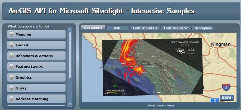
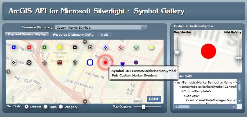
55 Resources Interactive samples Symbol Gallery
56 Demonstration Silverlight Resource Center Expression Blend IDE Configure Starter Application 57
57 Making Great Web Maps Streamlining workflows and communicating with maps Create Beautiful maps Desktop + OnLine Build Great User Experiences Publish Fast Map Services Compact Cache Ready-to-use Templates & RIA technology Fast on-the-fly & Cached Map Services


58 ArcGIS Online Resource Center A New Portal for Online Resources Online Maps and Globe Services Supporting and Building the ArcGIS Community ESRI Now Online Help Developer SDK s Blogs and Forums Code Galleries Knowledge Base Software Updates Videos Community Resources Future Metadata Catalog of GIS Services
59 AGENDA March 23, Tuesday Registration Welcome and Introductions Getting Started with ArcGIS Server Break Building Rich Internet Applications on the ArcGIS Platform Lunch What s New at ArcGIS Closing Remarks Refreshments Networking WELCOME
Getting Started with the ArcGIS Server JavaScript API
 Getting Started with the ArcGIS Server JavaScript API Agenda Introduction ArcGIS Server services and mashups REST API Services Directory JavaScript API ArcGIS Server Resource Center Dojo Maps, layers,
Getting Started with ArcGIS for Server. Charmel Menzel and Ken Gorton
 Getting Started with ArcGIS for Server Charmel Menzel and Ken Gorton Agenda What is ArcGIS for Server? Types of Web services Publishing resources onto the Web Clients to ArcGIS for Server Editions and
Building Mashups Using the ArcGIS APIs for FLEX and JavaScript. Shannon Brown Lee Bock
 Building Mashups Using the ArcGIS APIs for FLEX and JavaScript Shannon Brown Lee Bock Agenda Introduction Mashups State of the Web Client ArcGIS Javascript API ArcGIS API for FLEX What is a mashup? What
Desktop. ArcGIS Server. ArcGIS
 Getting Started with ArcGIS Server Nakul Bhatia and David Crosby ESRI Charlotte 1 Agenda g Overview of ArcGIS Server 9.3.1 Working with GIS Services Using g Web GIS Service Clients ArcGIS Online Map Caching
Author. Publish. Use
 Building Mashups Using the ArcGIS Web APIs Heather Gonzago Garima Vyas Agenda g Overview: Web Maps Overview: ArcGIS API for REST ArcGIS API for JavaScript p Google Maps Extension Bing Maps Extension ArcGIS
An Introduction to GIS for developers
 An Introduction to GIS for developers Part 4: GIS Sharing Canserina Kurnia & Tom Shippee Agenda Web GIS ArcGIS Online Cloud-based ArcGIS Server ArcGIS Server on-premises ArcGIS a complete platform discover,
Working with the ArcGIS Viewer for Flex Application Builder
 Working with the ArcGIS Viewer for Flex Application Builder Esri Canada User Conference St. John s November 15, 2012 Presented By: Greg Yetman gyetman@esri.ca Agenda This seminar is designed to help you
ICIT. Brian Hiller ESRI Account Manger. What s new in ArcGIS 10
 ICIT Brian Hiller ESRI Account Manger What s new in ArcGIS 10 ArcGIS 10 Fast Easy Powerful Everywhere late June 2010 ArcGIS System for Geographic Information Desktop Server Mobile Online A System A Complete
ESRI Technology Update. Joe Holubar Larry Young
 ESRI Technology Update Joe Holubar Larry Young Continued Improvement Improving Quality and Extending and Refining Functionality First Half of 2009: Minor Update Release (ArcGIS 9.3.1) ArcGIS Explorer Fall
ArcGIS Online. The Road Ahead Geoff Mortson
 ArcGIS Online The Road Ahead Geoff Mortson gmortson@esricanada.com ArcGIS Online Easily create and share maps Delivered as intelligent maps Access on virtually any device anyone, anywhere Compliments and
What s New in ArcGIS Server 10
 What s New in ArcGIS Server 10 Derek Law ArcGIS Server Product Management What s s new in ArcGIS Server 10? Agenda Highlights: Enhanced Web mapping More powerful server-based analysis Geo-collaboration
Web Mapping Applications with ArcGIS. Bernie Szukalski Derek Law
 Web Mapping Applications with ArcGIS Bernie Szukalski Derek Law Agenda Web Mapping and Map Services Fundamentals ArcGIS Web Mapping Applications - Hosted online - Hosted on-premise Summary Web Application
What is coming in. ArcGIS Server 10. Ismael Chivite ArcGIS Server Product Manager James Cardona Technical Marketing
 What is coming in ArcGIS Server 10 Ismael Chivite ArcGIS Server Product Manager James Cardona Technical Marketing ArcGIS Server is a complete server based GIS Delivering GIS with powerful services and
ArcGIS Viewer for Microsoft Silverlight An Introduction
 Esri International User Conference San Diego, CA Technical Workshops July 12, 2011 ArcGIS Viewer for Microsoft Silverlight An Introduction Art Haddad, Rich Zwaap, and Derek Law Agenda Background Product
Providing Interoperability Using the Open GeoServices REST Specification
 2013 Esri International User Conference July 8 12, 2013 San Diego, California Technical Workshop Providing Interoperability Using the Open GeoServices REST Specification Satish Sankaran Kevin Sigwart What
Leveraging OGC Services in ArcGIS Server. Satish Sankaran, Esri Yingqi Tang, Esri
 Leveraging OGC Services in ArcGIS Server Satish Sankaran, Esri Yingqi Tang, Esri GIS Creating and Managing Geo Information Products - Proprietary - Open Specifications - Standards Dissemination of Geo
Getting Started with the ArcGIS API for JavaScript. Julie Powell, Paul Hann
 Getting Started with the ArcGIS API for JavaScript Julie Powell, Paul Hann Esri Developer Summit Berlin November 19 2012 Getting Started with the ArcGIS API for JavaScript ArcGIS for Server Is a Platform
ArcGIS for Mobile An Introduction. Bonnie Stayer
 ArcGIS for Mobile An Introduction Bonnie Stayer Benefits of mobile GIS? Accessibility Timely Decisionmaking Efficiency and Accuracy Rapid Data Collection Types of mobile solutions? Apps & APIs Functionality
Extend GIS. The Reach. Of Your GIS. Chris Cappelli Nathan Bennett
 Extend The Reach GIS Of Your GIS Chris Cappelli Nathan Bennett Where do your co-workers, managers, customers, and citizens go when they want to find or make a map? GIS is a practical system for problem
ArcGIS Runtime SDK for WPF
 Esri Developer Summit in Europe November 9 th Rotterdam ArcGIS Runtime SDK for WPF Mike Branscomb Mark Baird Agenda Introduction SDK Building the Map Query Spatial Analysis Editing and Geometry Programming
Introduction to ArcGIS Server 10.1
 Introduction to ArcGIS Server 10.1 E-Learning for the GIS Professional Any Time, Any Place! geospatialtraining.com Module Outline What is ArcGIS Server? GIS Resources and Services ArcGIS Server Components
Interactive webmaps with ArcGIS. Kristel Meikas, AlphaGIS
 Interactive webmaps with ArcGIS Kristel Meikas, AlphaGIS Agenda Overview of ArcGIS tools and resources Introduction to ArcGIS APIs In depth with Flex maps In depth with JavaScript maps ArcGIS Server Publish
Introduction to JavaScript. Evan Caldwell & James Tedrick
 Introduction to JavaScript Evan Caldwell & James Tedrick Agenda Getting Started - Meet the Esri API for JavaScript! - Meet Dojo! - Tools of the trade My First App JS API fundamentals How JS apps work Where
Best Practices for Creating Web Maps. Brian Chong Justin Fan
 Best Practices for Creating Web Maps Brian Chong Justin Fan Agenda Overview of web maps Designing maps for the web Develop effective web maps What is a Web Map? Contains one or more GIS services Integrated
Tom Brenneman. Good morning and welcome, introductions and thank you for being here.
 Welcome Tom Brenneman Good morning and welcome, introductions and thank you for being here. This is a best practices seminar. We're going to be sharing with you what we found to be best practices that
Introduction to ArcGIS API for Flex. Bjorn Svensson Lloyd Heberlie
 Introduction to ArcGIS API for Flex Bjorn Svensson Lloyd Heberlie Agenda API Introduction Getting started API concepts and examples Getting more information API Introduction ArcGIS 10 A Complete System
ArcGIS for Server Michele Lundeen
 ArcGIS for Server 10.1 Michele Lundeen Summary Vision Installation and Configuration Architecture Publishing Functional Enhancements Cloud Migration and Best Practices Powerful GIS capabilities Delivered
Working with Feature Layers. Russell Brennan Gary MacDougall
 Working with Feature Layers Russell Brennan Gary MacDougall Working with Feature Layers Session will focus on feature access and editing Highlight new features added over the last few releases Agenda Introduction
Building Applications with the ArcGIS Runtime SDK for WPF
 Esri International User Conference San Diego, California Technical Workshops 24 th July 2012 Building Applications with the ArcGIS Runtime SDK for WPF Euan Cameron & Paul Pilkington Agenda Introduction
ESRI Software Evolution
 ArcGIS Jan Šlahař About ESRI ESRI - Environmental Systems Research Institute Founded in 1969, Redlands, California In 2002 Esri had approximately a 36 percent share of the GIS software market worldwide
What s s Coming in ArcGIS 10 Desktop
 What s s Coming in ArcGIS 10 Desktop Damian Spangrud ArcGIS Product Manager, ESRI dspangrud@esri.com (or at least turn to silent) ArcGIS 10 A Simple & Pervasive System for Using Maps & Geographic Information
Developers Road Map to ArcGIS Desktop and ArcGIS Engine
 Developers Road Map to ArcGIS Desktop and ArcGIS Engine Core ArcObjects Desktop Team ESRI Developer Summit 2008 1 Agenda Dev Summit ArcGIS Developer Opportunities Desktop 9.3 SDK Engine 9.3 SDK Explorer
Designing and Using Basemaps. Jennifer Hughey
 Designing and Using Basemaps Jennifer Hughey Agenda The ArcGIS System Basemaps are a key component of your system Cartographic design considerations Using basemap layers in ArcMap Best practices for designing
Leveraging OGC Services in ArcGIS Server. Satish Sankaran Yingqi Tang
 Leveraging OGC Services in ArcGIS Server Satish Sankaran ssankaran@esri.com Yingqi Tang ytang@esri.com Agenda Interoperability Enablers OGC and esri OGC Web Services ArcGIS and OGC Web Services - @ version
Creating Web Mapping Applications. Nikki Golding
 Creating Web Mapping Applications Nikki Golding Agenda Web Mapping and Map Services Fundamentals ArcGIS Web Mapping Applications - ArcGIS.com Viewer - ArcGIS Explorer Online - ArcGIS Viewer for Flex -
ArcGIS for Developers. Kevin Deege Educational Services Washington DC
 ArcGIS for Developers Kevin Deege Educational Services Washington DC Introductions Who am I? Who are you? ESRI Product Development Experience? What development languages are you using? What types of applications
ArcGIS Desktop The Road Ahead. Amadea Azerki
 ArcGIS Desktop The Road Ahead Amadea Azerki Agenda An Overview of ArcGIS 10 Desktop Enhancements User Interface Mapping Editing Analysis Sharing Q & A ArcGIS 10 Overview Focuses on Usability and Productivity
IndianaMap Release 3. Rick Hill, Paul Rohwer,, Chris Dintaman, Becky Meyer, and Denver Harper
 IndianaMap Release 3 Rick Hill, Paul Rohwer,, Chris Dintaman, Becky Meyer, and Denver Harper IndianaMap Agenda Session 1 & 2 Overview Tentative rollout schedule Old versus New Design and construction of
Leveraging OGC Services in ArcGIS Server
 Esri International User Conference San Diego, CA Technical Workshops Jul.14 th 2011 Leveraging OGC Services in ArcGIS Server Satish Sankaran Yingqi Tang Agenda Interoperability
Serving Imagery with ArcGIS Server 10.1
 Serving Imagery with ArcGIS Server 10.1 Presented by: André Piasta apiasta@esri.ca Esri Canada Users Conference Calgary, AB 28 May 2013 Today s Agenda ArcGIS server and image services Publishing of imagery
Best Practices for Designing Effective Map Services
 2013 Esri International User Conference July 8 12, 2013 San Diego, California Technical Workshop Best Practices for Designing Effective Map Services Ty Fitzpatrick Tanu Hoque What s in this session Map
A Developers Guide To Mobile GIS. David Cardella, Jeff Shaner
 A Developers Guide To Mobile GIS David Cardella, Jeff Shaner What is mobile GIS? Extends the reach of ArcGIS from the office to the field With a mobile GIS solution you can: - Carry your maps to the field
What s New for Developers in ArcGIS Maura Daffern October 16
 What s New for Developers in ArcGIS 10.1 Maura Daffern October 16 mdaffern@esri.ca Today s Agenda This seminar is designed to help you understand: 1) Using Python to increase productivity 2) Overview of
Free to download and distribute from
 Topics for this session Introduction Overview of features Using ArcGIS Explorer effectively Customization New features & capabilities Demonstrations *Note: Explorer 1200 What is ArcGIS Explorer GIS for
ArcGIS for Developers: An Introduction. Moey Min Ken
 ArcGIS for Developers: An Introduction Moey Min Ken AGENDA Is development right for me? Building Apps on the ArcGIS platform Rest API & Web API Native SDKs Configurable Apps and Builders Extending the
ArcGIS Runtime SDK for.net Getting Started. Jo Fraley
 ArcGIS Runtime SDK for.net Getting Started Jo Fraley Agenda What is the ArcGIS Runtime? What s new for ArcGIS developers? ArcGIS Runtime SDK 10.2 for WPF ArcGIS Runtime SDK for.net Building Windows Store
Developing Web Applications with ArcGIS Server. Kevin Deege Educational Services ESRI-Washington DC
 Developing Web Applications with ArcGIS Server Kevin Deege Educational Services ESRI-Washington DC Introductions Who am I? Who are you? ESRI Product Development Experience What development languages are
Esri Developer Summit in Europe Building Applications with ArcGIS Runtime SDK for Java
 Esri Developer Summit in Europe Building Applications with ArcGIS Runtime SDK for Java Mark Baird Mike Branscomb Agenda Introduction SDK Building the Map Editing Querying Data Geoprocessing Asynchronous
Advanced Standard Basic Notes
 9.3 Functionality Matrix Data Management Scalable Geodatabase Access Full Geodatabase Support Create Geodatabases Load Spatial Data into Geodatabases Manage Geodatabases One-Way Replication Two-Way Replication
Introduction to ArcGIS Server Architecture and Services. Amr Wahba
 Introduction to ArcGIS Server 10.1 - Architecture and Services Amr Wahba awahba@esri.com Agenda Architecture Features Publishing Security Cloud Powerful GIS capabilities Delivered as Web services To help
ArcGIS GeoEvent Server: Making 3D Scenes Come Alive with Real-Time Data
 ArcGIS GeoEvent Server: Making 3D Scenes Come Alive with Real-Time Data Morakot Pilouk, Ph.D. Senior Software Developer, Esri mpilouk@esri.com @mpesri Agenda 1 2 3 4 5 6 3D for ArcGIS Real-Time GIS Static
Using ArcGIS for Server. Javier Abadía, Esri España Peter McDaid, Esri UK
 Using ArcGIS for Server Javier Abadía, Esri España Peter McDaid, Esri UK 1. Intro 2. ArcGIS for Server = Geospatial Apps Server 3. Map Services Publishing Flow Apps 4. Spatial Functionality Services Publishing
Configuring and Customizing the ArcGIS Viewer for Silverlight. Katy Dalton
 Configuring and Customizing the ArcGIS Viewer for Silverlight Katy Dalton kdalton@esri.com Agenda Overview of the ArcGIS Viewer for Silverlight Extensibility endpoints - Tools, Behaviors, Layouts, Controls
Moving Desktop Applications to ArcGIS Server
 Moving Desktop Applications to ArcGIS Server Kelly Hutchins Jian Huang ESRI Developer Summit 2008 1 Schedule 75 minute session 60 65 minute lecture 10 15 minutes Q & A following the lecture Cell phones
ArcGIS Viewer for Silverlight Advanced Topics
 Esri International User Conference San Diego, California Technical Workshops July 26, 2012 ArcGIS Viewer for Silverlight Advanced Topics Rich Zwaap Agenda Add-ins overview Tools Behaviors Controls Layouts
ArcGIS Enterprise: An Introduction. Philip Heede
 Enterprise: An Introduction Philip Heede Online Enterprise Hosted by Esri (SaaS) - Upgraded automatically (by Esri) - Esri controls SLA Core Web GIS functionality (Apps, visualization, smart mapping, analysis
Introductions Who are we? Who are you? Development D l t experience i with ith ArcObjects A Obj t Development experience with ASP.NET Basic understand
 Moving Desktop Applications to ArcGIS Server Kelly Hutchins Alagiri Venkatachalapathy Introductions Who are we? Who are you? Development D l t experience i with ith ArcObjects A Obj t Development experience
Web App Builder: Code-free Development. Adam Ziegler, Esri-Northeast, Local Government Team
 Web App Builder: Code-free Development Adam Ziegler, aziegler@esri.com Esri-Northeast, Local Government Team Agenda Product overview Web AppBuilder for ArcGIS tour Adding Custom Widgets Community and Resources
Sharing Web Layers and Services in the ArcGIS Platform. Melanie Summers and Ty Fitzpatrick
 Sharing Web Layers and Services in the Platform Melanie Summers and Ty Fitzpatrick Agenda Platform overview - Web GIS information model - Two deployment options Pro Sharing - User experience and workflows
Web AppBuilder for ArcGIS: JavaScript Apps Made Easy
 Web AppBuilder for ArcGIS: JavaScript Apps Made Easy Ryan Sellman @rcsellman Agenda Product overview Web AppBuilder for ArcGIS tour Customization Community and Resources Summary The ArcGIS Platform enables
Best Practices for Designing Effective Map Services
 FedGIS Conference February 24 25, 2016 Washington, DC Best Practices for Designing Effective Map Services James Tedrick, Esri Matt Sokol, MD Dept. of Information Technology Web Mapping & Service Types
ArcGIS Viewer for Flex An Introduction
 2013 Esri International User Conference July 8 12, 2013 San Diego, California Technical Workshop ArcGIS Viewer for Flex An Introduction Bjorn Svensson and Heather Gonzago @Bjorn_Svensson @hgonzago Esri
Web AppBuilder Presented by
 Web AppBuilder Presented by Agenda Product overview Web AppBuilder for ArcGIS tour What s new in the ArcGIS Online June 2016 update Customization Community and Resources Summary The ArcGIS Platform enables
S s y t s em e s s Ar A ch c i h tec e t c ur u e e De D s e i s gn g, n C o C n o f n igu g r u at a ion o, n a n a d n D p e l p oy o m y en e t
 Systems Architecture Design, Configuration, and Deployment Tom Pattison and Michael Young Version 3.1 Agenda What is System Architecture? Design - System Architecture Business Data Application Technology
Getting Started with ArcGIS Runtime SDK for Qt. Thomas Dunn & Nandini Rao
 Getting Started with ArcGIS Runtime SDK for Qt Thomas Dunn & Nandini Rao Agenda Getting Started Creating the Map Geocoding and Routing Geoprocessing Message Processing Work Offline The Next Release ArcGIS
Building Apps with the ArcGIS Runtime SDK for ios
 Building Apps with the ArcGIS Runtime SDK for ios Nick Furness @geeknixta ArcGIS Runtime SDKs 10.2 Released! Runtime platforms OS X Desktop Desktop Client Windows Store QT ios.net JavaSE Mobile Android
Developing Qt Apps with the Runtime SDK
 Developing Qt Apps with the Runtime SDK Thomas Dunn and Michael Tims Esri UC 2014 Technical Workshop Agenda Getting Started Creating the Map Geocoding and Routing Geoprocessing Message Processing Work
Publishing image services in ArcGIS
 Esri International User Conference San Diego, California Technical Workshops July 26, 2012 Publishing image services in ArcGIS Wenxue Ju & Melanie Harlow What is an image service? A way to make image and
ESRI Mobile GIS Solutions Overview. Justin Fan
 ESRI Mobile GIS Solutions Overview Justin Fan Agenda Mobile GIS challenges ESRI Mobile GIS solutions ArcPad ArcGIS Mobile ArcGIS Engine Selecting a mobile GIS solution Q & A Objective To help you select
GEOSPATIAL ERDAS APOLLO. Your Geospatial Business System for Managing and Serving Information
 GEOSPATIAL ERDAS APOLLO Your Geospatial Business System for Managing and Serving Information ERDAS APOLLO Do you have large volumes of data, a geographicallydistributed user base and rapidly changing
Interoperability and Standards Supports in ArcGIS
 Esri International User Conference San Diego, California Technical Workshops July 26, 2012 Interoperability and Standards Supports in ArcGIS Satish Sankaran, Esri Yingqi Tang, Esri Agenda Esri s participation
Advances in GIS help create Smarter Communities
 Advances in GIS help create Smarter Communities POP(ovich) Quiz Who is a Desktop User? Who is an ArcGIS Online User? Who is a ArcGIS Server Admin? Who is a Programmer? Who works with or for a government
Extending ArcGIS for Server. Jon Satchwell, Esri Switzerland Cédric Despierre Corporon, Esri France
 Extending ArcGIS for Server Jon Satchwell, Esri Switzerland Cédric Despierre Corporon, Esri France Agenda Introduction Server Object Extensions Server Object Interceptors THE BIG WEBGIS PICTURE Introduction
ArcGIS API for Flex An Introduction
 Esri International User Conference San Diego, California Technical Workshops July 25, 2012 ArcGIS API for Flex An Introduction Lloyd Heberlie Heather Gonzago Before we begin Who are we? - Heather Gonzago
ArcGIS 9.2 Works as a Complete System
 ArcGIS 9.2 Works as a Complete System A New Way to Manage and Disseminate Geographic Knowledge Author/Serve/Use Maps Data Models Globes Metadata Use Desktop Explorer Web Map Viewer Mobile Open APIs Enterprise
An introduction to ArcGIS Runtime
 2013 Europe, Middle East, and Africa User Conference October 23-25 Munich, Germany An introduction to ArcGIS Runtime Christine Brunner Lars Schmitz Welcome! Christine Brunner, Germany - Software Developer
Developing.NET Applications for ArcGIS Engine. Deep Dhanasekaran and John Hauck
 Developing.NET Applications for ArcGIS Engine Deep Dhanasekaran and John Hauck Agenda Introduction to Engine Runtime Binding and Licensing Authoring Content for Engine Adding Functionality to Engine ArcGIS
Programming and Design Patterns for the ArcGIS Mobile SDK
 Programming and Design Patterns for the ArcGIS Mobile SDK Best Practices Jay Chen and Mike Shaw Developer Summit 2008 1 Agenda Overview Positioning ArcGIS Mobile Mobile Architecture ArcGIS Mobile Workflow
Administering Your ArcGIS Enterprise Portal Bill Major Craig Cleveland
 Administering Your ArcGIS Enterprise Portal Bill Major Craig Cleveland Agenda Welcome & Introduction to ArcGIS Enterprise Portal for ArcGIS Administration - Basic Configuration - Advanced Configuration
Real-Time GIS: Leveraging Stream Services
 Real-Time GIS: Leveraging Stream Services Mark Bramer Senior Technical Analyst Esri Professional Services mbramer@esri.com RJ Sunderman Product Engineer GeoEvent Extension Product Team rsunderman@esri.com
Developing Mobile Apps with the ArcGIS Runtime SDK for.net
 Developing Mobile Apps with the ArcGIS Runtime SDK for.net Rich Zwaap Morten Nielsen Esri UC 2014 Technical Workshop Agenda The ArcGIS Runtime Getting started with.net Mapping Editing Going offline Geocoding
Managing Image Data on the ArcGIS Platform Options and Recommended Approaches
 Managing Image Data on the ArcGIS Platform Options and Recommended Approaches Peter Becker Petroleum requirements for imagery and raster Traditional solutions and issues Overview of ArcGIS imaging capabilities
ArcGIS Enterprise: Portal Administration BILL MAJOR CRAIG CLEVELAND
 ArcGIS Enterprise: Portal Administration BILL MAJOR CRAIG CLEVELAND Agenda Welcome & Introduction to ArcGIS Enterprise Portal for ArcGIS - Basic Configuration - Advanced Configuration - Deploying Apps
Agenda. Introduction. Supported Formats. Creating a Custom REST Service. What s Next
 Using the ArcGIS Server REST API Jeremy Bartley Keyur Shah Agenda Introduction Design and Concepts Supported Formats REST API Admin Creating a Custom REST Service What s New (Since 9.3) What s Next Conclusion
ArcGIS API for Silverlight An Introduction
 Esri Middle East and Africa User Conference December 10 12 Abu Dhabi, UAE ArcGIS API for Silverlight An Introduction Jo Fraley Agenda Silverlight platform API Overview Building Apps Road Ahead ArcGIS is
Accessing OGC Services To access OGC WMS and WFS open the service in the directory that you want to consume, and click on either WMS or WFS.
 Using Web Services Web Services Overview This user guide contains instructions on how to consume a range of services through a range of both web based and desktop GIS applications. Web services are a live
# Users. Technical Knowledge. Users. GIS Professionals Developers
 Getting Started with ArcGIS Explorer 900 Ben Ramseth Overview What is ArcGIS Explorer? User interface Saving the map Adding notes Presentations Configuring and deploying What s new in ArcGIS G S Explorer
Creating Mosaic Datasets and Publishing Image Services using Python
 Creating Mosaic Datasets and Publishing Image Services using Python Jie Zhang, Jamie Drisdelle Session Offering ID: 305 Overview Introduction to mosaic dataset Raster product for sensor imagery Automatic
Building Applications with ArcGIS Runtime SDK for ios - Part I. Divesh Goyal Mark Dostal
 Building Applications with ArcGIS Runtime SDK for ios - Part I Divesh Goyal Mark Dostal Agenda The ArcGIS System Using the Runtime SDK for ios - Display Maps - Perform Analysis - Visualize Results Q&A
Configuring ArcGIS Enterprise in Disconnected Environments
 Configuring ArcGIS Enterprise in Disconnected Environments BILL MAJOR Disconnected Environments Not everyone has internet access? How many of you run disconnected today, i.e. no internet access? Many customers
3D in the ArcGIS Platform. Chris Andrews
 3D in the ArcGIS Platform Chris Andrews Geospatial 3D is already all around us 3D is expanding the GIS community s opportunity to provide value 3D City & Infrastructure Models Generated 3D features Photogrammetrc
What's New in ArcGIS 9.2 Service Packs
 What's New in ArcGIS 9.2 Service Packs 18 July 2007 Updated for Service Pack 3 This document describes the main enhancements to 9.2 added by the service packs. It does not cover the bug fixes and quality
Flex 3 Pre-release Tour
 Flex 3 Pre-release Tour Andrew Shorten shorten@adobe.com Enrique Duvos duvos@adobe.com Flex 3 Pre-release Tour Agenda Adobe Platform Update (45 mins) Flex Builder 3 Features (45 mins) Adobe & Open Source
Creating Transparency, Openness and Trust: Modern Approach to Redistricting
 Creating Transparency, Openness and Trust: Modern Approach to Redistricting Richard Leadbeater, Esri Jerry Howe, Utah Legislature Larry Boden, Esri NCSL Legislative Summit Sunday, Aug. 6 11:15 am-12:15
Goals Give you an overview of development with ArcGIS Server Give you a roadmap to other sessions Cover the breadth of the software Not a deep dive se
 ArcGIS Server 9.2: An Overview for Developers Sud Menon, Rex Hansen, Antony Jayaprakash, Mike Shaw Art Haddad, Jay Theodore, Fred Aubry Anne Reuland, David Cordes, Jeff Shaner, Dave Wrazien Developer Summit
ArcGIS Enterprise Extending Services. Bill Major
 ArcGIS Enterprise Extending Services Bill Major Agenda Introduction Geoprocessing tools Server Object Extensions Server Object Interceptors Demo APPS Desktop Web Device SHARING SERVICES Portal API DATA
Leveraging OGC Standards on ArcGIS Server
 Leveraging OGC Standards on ArcGIS Server Satish Sankaran Interoperability and Standards Team James Michel III ESRI Intel Team ArcGIS Server Complete Interoperable Server-Based GIS Desktop Explorer Web
Scientific and Multidimensional Raster Support in ArcGIS
 Scientific and Multidimensional Raster Support in ArcGIS Sudhir Raj Shrestha sshrestha@esri.com Brief breakdown Scientific Multidimensional data Ingesting Scientific MultiDim Data in ArcGIS Ingesting and
Building Java Apps with ArcGIS Runtime SDK
 Building Java Apps with ArcGIS Runtime SDK Mark Baird and Vijay Gandhi A step back in time Map making 50 years ago - http://www.nls.uk/exhibitions/bartholomew/maps-engraver - http://www.nls.uk/exhibitions/bartholomew/printing
ArcGIS Online: Managing Data. Jeremy Bartley Sentha Sivabalan
 ArcGIS Online: Managing Data Jeremy Bartley (jbartley@esri.com) Sentha Sivabalan (ssivabalan@esri.com) Agenda Creating and managing content like Apps, Maps, Scenes and Layers in ArcGIS Today s Topics: