Interoperability and Standards Supports in ArcGIS
|
|
|
- Rachel Chambers
- 6 years ago
- Views:
Transcription


1 Esri International User Conference San Diego, California Technical Workshops July 26, 2012 Interoperability and Standards Supports in ArcGIS Satish Sankaran, Esri Yingqi Tang, Esri
2 Agenda Esri s participation in Standards Bodies Interoperability Challenges - Tackling Interoperability challenges using standards Service Standards Demo s - The Open GeoServices REST Specification - The W*S Open Geospatial Consortium Standards Sharing Environmental Data in a Homogeneous Way Across Europe Demo s - A real world example leveraging interoperability principles and hybrid platforms. ArcGIS Online Leveraging Interoperability Demo s
3 ESRI Participates in Many Standards Organizations ISO ANSI/INCITS IHO WS-I OGC CEN OMA OASIS FGDC ACSM DGIWG ASPRS CSGDI EPSG
4 ISO Participation ESRI provides leadership role in ISO TC 211 Standards Development: - ISO 19115: Metadata (Project Leader) - ISO : Metadata Imagery extension (Editor) - ISO 19125: Simple Feature Access (Editor) - Part 1 Common Architecture - Part 2 SQL Option - ISO 19139: Metadata Implementation Specification (Project Leader supported Editor/committee process) - ISO : Web Feature Service ( Editing committee member representing USA) - ISO : Filter Encoding ( Editing committee member representing USA) Provide technical experts on many WI project teams Harmonization with ISO JTC SC 32: ISO/IEC : SQL Multimedia and Application Packages Part 3: Spatial
5 OGC Participation ESRI - Principal member - Actively participates: - Technical Committee - Planning Committee - Board of Directors - All three OGC programs - Interoperability program - Standards program - Community Outreach and Adoption program - Current chair - Metadata Working Group - Web Map Service Working Group - Has an elected member in the OGC Architecture Board
6 Interoperability Challenges Mobile Web Desktop Create Manage Visualize Analyze Collaborate Discover Cloud Enterprise Local - Multiple Platforms ( Operating Systems, Databases, ) - Multiple Architecture ( Local, Enterprise, Web, Cloud, ) - Multiple Clients ( Desktop, Web, Mobile, ) - Multiple Developer Environments (.NET, Java, ) - Multiple Protocols (SOAP, REST, OGC,.) - Multiple Encodings ( XML, Raster Formats, GML, JSON,.)


7 ArcGIS A Complete System Easier More Powerful and Everywhere Cloud Mobile Web Discover Create Manage Visualize Analyze Collaborate Enterprise Local Desktop
8 ArcGIS - is Open & Interoperable OGC Standards SOAP WCS ISO Open API s / Open Specifications File GDB KML WWW WMS SQL INSPIRE WFS Shapefile Geoservices REST ETL Open Data Access Vendor Specific Files
9 Interoperability Enablers Data Standards - Simple Features Model, - WKT, WKB, Spatial Types, GML, netcdf, Metadata Standards - ISO 19115, 119, 139, FGDC,. Service Standards - GeoServices REST Specification - OGC Web Services - WMS, WFS, WCS, CS-W, WMTS, WPS
10 Simple Features Simple Feature specification - Common Architecture - Geometry Model - Well Known Text Representation for Geometry - Well Known Binary Representation for Geometry - Well Known Text Representation for Spatial reference Systems - - Part 2 SQL Option - Database schema to support feature tables, Geometry, and Spatial Reference - SQL Geometry Type - SQL routines for constructing / obtaining a geometry object given its WKT, WKB representations - SQL Operations on Type Geometry -
11 GML GML or Geography Markup Language is an XML based encoding Standard for geographic information developed by the Open Geospatial Consortium (OGC). GML Profiles Point profile, Simple Features Profile - Simple Feature profile - Initially motivated to help WFS use of GML 3 - Constrains the many optional elements of GML schema - Provides 3 levels of compliancy: Level 0, 1 and 2 GML Application Schemas OSMasterMap, CityGML, WaterML, O&M, Top10NL,.

 Semantic Data Translation Data")
12 ArcGIS - Data Interoperability Extension ESRI & SAFE Co-Development based on FME Format Support Adds support for 110+ data formats Custom Formats Direct use in ArcGIS Desktop Quick Data Translation Data Interoperability Tools Toolbox Convert between data formats Spatial ETL (Extract, Transform, Load) Semantic Data Translation Data Restructuring
13 Interoperability Enablers Data Standards - Simple Features Model, - WKT, WKB, Spatial Types, GML, netcdf, Metadata Standards - ISO 19115, 119, 139, FGDC,. Service Standards - GeoServices REST Specification - OGC Web Services - WMS, WFS, WCS, CS-W, WMTS, WPS
14 ArcGIS 10.1 Metadata support Make metadata easier Complete support for FGDC and many ISO metadata standards - Content Standard for Digital Geospatial Metadata Metadata Services Implementation Specification for and Feature Cataloguing Methodology Support profiles of ISO metadata standards - North American Profile - INSPIRE Auto update of metadata per the data s intrinsic properties Validation - standards based metadata Extensible to support emerging profiles Templates supporting auto fill common metadata elements Provide methods for updating multiple metadata records (change address/phone number for example)
15 Interoperability Enablers Data Standards - Simple Features Model, - WKT, WKB, Spatial Types, GML, netcdf, Metadata Standards - ISO 19115, 119, 139, FGDC,. Service Standards - GeoServices REST Specification - OGC Web Services - WMS, WFS, WCS, CS-W, WMTS, WPS
16 Digital Government Strategy Make Open Data, Content, and Web APIs the New Default. Make Existing High-Value Data and Content Available through Web APIs.from Digital Government - Building a 21st Century Platform to Better Serve the American People
 - Multiple Architecture ( Local, Enterprise, Web, Cloud, ) - Multiple Clients (")
 - Multiple Encodings ( XML, Raster Formats, GML, JSON,.")
17 Interoperability Challenges Mobile Web Create Manage Visualize Analyze Collaborate Discover Cloud Enterprise Local Desktop - Multiple Platforms ( Operating Systems, Databases, ) - Multiple Architecture ( Local, Enterprise, Web, Cloud, ) - Multiple Clients ( Desktop, Web, Mobile, ) - Multiple Developer Environments (.NET, Java, ) - Multiple Protocols (SOAP, REST, OGC,.) - Multiple Encodings ( XML, Raster Formats, GML, JSON,.) Solution - Build interoperable Web services across platforms, applications, and programming languages.


18 Powerful GIS capabilities Delivered as Web services To help solve real problems ArcGIS Server
 Publisher Data")
19 ArcGIS for Server Web, Mobile and Desktop Clients Web Server Web Adaptor Administrator GIS Server(s) Publisher Data Server
20 ArcGIS Server - Popular Mass market Mapping Environments Google Maps Microsoft VE Building open and interoperable Systems Esri Client Solutions ArcGIS for Desktop ArcGIS for Mobile ArcGIS Online GIS Software Intergraph Autodesk PitneyBowes Yahoo Maps SAP Sharepoint IBM WebSphere Portal Business Applications php Ruby Python Solution Developer Frameworks ArcGIS Server
21 ArcGIS Server - Building open and interoperable Systems Supporting Multiple Protocols - Representational State Transfer (REST) - Simple Object Access Protocol (SOAP) - Open Geospatial Consortium (OGC) REST SOAP Internet OGC Catering to Multiple Communities: Spatial Data Infrastructures (SDI) Enterprise Architectures (EA) Neogeography/ Mashup (WEB 2.0)
22 ArcGIS Server - Building open and interoperable Systems Representational State Transfer (REST) REST Internet
23 REST The Elevator Pitch 4 Key Principles * Identification Of Resources Everything is a URL Manipulation Of Resources Through Representations Exchange standard formats using standard verbs Self-Descriptive Messages Every request asks the full question, every response includes the full answer Hypermedia As The Engine Of Application State Hyperlinks <a href= url >Yeah!</a>
24 ArcGIS Server - Building open and interoperable Systems Flex Google Maps Microsoft VE Yahoo Maps Silverlight Javascript ios Android Windows Mobile SAP Sharepoint IBM WebSphere Portal REST Services php Ruby Python ArcGIS Server
25 ArcGIS Server REST API The ArcGIS Server REST API provides a simple, open Web interface to services hosted by a Server. All GIS Services are exposed as resources All resources exposed by the REST API are accessible through a hierarchy of endpoints or Uniform Resource Locators (URLs) for each GIS service published with the Server. Some resources have operations - Ex. Map Resource (export, find, identify) Example:
26 Types of GIS Services Map View or query a 2D map on the server Geocode Perform address matching on the server Geometry Provides geometric calculations such as buffer, simplify, and project. Geoprocessing Provides spatial analysis and data processing services. Image Provide access to raster data though a Web service Feature Provide access to feature querying and editing.
27 Client Libraries Consuming the REST Services Client Libraries ArcGIS Developer Tools support for REST API - Web API - ArcGIS API for JavaScript - ArcGIS API for Flex. - ArcGIS API for Silverlight REST - Mobile Runtime SDK s - ArcGIS Runtime SDK for ios - ArcGIS Runtime SDK for Windows Phone - ArcGIS Runtime SDK for Android REST Web Link


28 Open Layers - Supporting ArcGIS REST Services Open layers ArcGIS Server
29 GDAL - Supporting ArcGIS REST Services

30 The Geoservices REST Specification ArcGIS Server s REST API is an Open Specification
31 Esri Open Specifications
32 .in Progress The Geoservices REST Specification has been submitted to the OGC for Consideration
33 Can I support Esri s REST Specification on my non ArcGIS Server Platform? GeoServices REST


34 Arc2Earth and the Geoservices REST Specification 5ea54edf8ff9451e32fff5cb

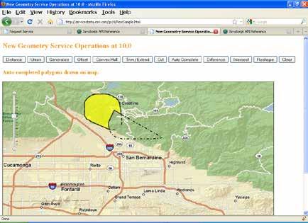
35 Geometry Service
36 ArcGIS Server - Building open and interoperable Systems Flex Google Maps Microsoft VE Yahoo Maps Silverlight Javascript ios Android Windows Mobile SAP Sharepoint IBM WebSphere Portal REST Services php Ruby Python ArcGIS Server
37 ArcGIS Server - Building open and interoperable Systems ArcGIS Desktop Google Earth ArcExplorer ArcGIS Online Imagine ENVI Gaia gvsig AutoCAD OpenLayers OGC Services GeoMedia Ionic QGIS udig ArcGIS Server MapInfo
38 ArcGIS Server - Building open and interoperable Systems Open GeoSpatial Consortium (OGC) OGC Internet
39 OGC Standards OGC Services WMS WMTS WCS WFS WPS Web Map Service Web Map Tiling Specification Web Coverage Service Web Feature Service Web processing service OGC Keyhole Markup Language KML

40 OGC Support in ArcGIS Server ArcGIS Server Inherits from ArcGIS Server OGC Services - Cartography - Security Framework - Performance & Scalability - Authoring, Publishing & Sharing WMS WMTS WCS WFS WPS Map Service Tiled Map Service Image Service Feature Service Geoprocessing Service KML WMTS and WPS Support New in 10.1
41 OGC Support in ArcGIS Server ArcGIS Server Differences with ArcGIS Server Services OGC Services - Interfaces - Transfer protocols - Encoding - Clients WMS WMTS WCS WFS WPS Map Service Tiled Map Service Image Service Feature Service Geoprocessing Service KML WMTS and WPS Support New in 10.1

42 ArcGIS Server OGC versus REST Services Difference Interfaces ArcGIS Server OGC Services OGC (ISO) Standards ArcGIS Server REST Services Geoservices REST specification Encoding style KVP, RESTful, SOAP REST Metadata encoding OWS XML Esri JSON Feature encoding GML, KML Esri JSON Feature editing Pessimistic locking No lock, last win Symbology encoding SLD Esri JSON Filter encoding OGC Filter spec Esri JSON Client applications OGC compliant clients (ArcGIS Desktop, udig, gvsig, OpenLayers, OpenScales etc.) Esri products (ArcGIS Desktop, ArcGIS JS/Flex/Silverlight API),
43 Feature Editing WFST Non-Esri Clients Gaia GetFeature ArcGIS Server OGC Services Quantum GIS OpenLayers WFST Filter Map Service GeoData Service
44 Web Geoprocessing - WPS Non-Esri Clients ArcGIS Server GetCapabilities, DescribeProcess OGC Services udig Quantum GIS WPS WMS GP Service Map Service OpenLayers
45 OGC / ISO standards support ( ArcGIS 10.1) WMS + SLD + Filter Encoding Support + Time Support WFS + Transactions + Filter Encoding Support WCS +GeoTiff, NITF, HDF, JPEG, JPEG2000, PNG WMTS + REST & KVP Encoding WPS + Synchronous + Asynchronous + Data and Services as inputs CSW + OGC Core + ISO ebrim
46 Server - ArcGIS Server ArcGIS Support for OGC Web services - Esri Geoportal Server - Client - Desktop Applications - API s - Viewers -.. More Information ESRI Web Site : White papers, Product Support Matrix, OGC compliancy -
47 ArcGIS 10.1 OGC Compliancy Compliancy Certificates available for WMS WFS WCS CS-W Simple Features
48 Sharing Environmental Data in a Homogeneous Way Across Europe - A real-world use case from European Environmental Agency (EEA)

49 Sharing Environmental Data in a Homogeneous Way Across Europe EEA s 32 member states Courtesy : 52 North. Org
50 Problem Data Consumers Data Providers Heterogeneous Interfaces: - Proprietary formats - FTP / HTTP Application-specific Interfaces EEA ArcGIS Server Based Infrastructure Courtesy : 52 North. Org
 Courtesy : 52 North.")
51 Solution Step 1 : Define a Standards based Data model for Observations and Measurements ( OGC O&M) Courtesy : 52 North. Org
52 Solution Step 2: Leverage a Standards based Service Protocol ( OGC SOS). Data Consumers Data Providers SOS 2.0 SOS 2.0 EEA Courtesy : 52 North. Org

53 Example Deployment ~ 1,500 air quality stations (measuring O3, CO, ) > 1,000,000 observations for 30 days Courtesy : 52 North. Org
54 Product Solution ArcGIS Server SOS Extension An Open Source Solution from 52 degrees North.. Leverages the GeoServices REST principles and the OGC SOS protocol. Data Consumers Data Providers SOS 2.0 SOS GeoServices SOS EEA ArcGIS Server Based Infrastructure
55 ArcGIS Online A complete, cloud-based, collaborative content management system for working with geographic information. Supporting Interoperability thru GeoServices REST Specification, OGC WMS, CSV, OGC KML,.

56 ArcGIS Online
57 GIS Creating and Managing Geo Information Products - Proprietary - Open Specifications - Standards Shapefiles Open FGDB Api Dissemination of Geo Products - Proprietary - Open Specifications - Standards Geoservices REST Specification Geoservices REST Specification

58 Steps to evaluate UC sessions My UC Homepage > Evaluate Sessions Choose session from planner OR Search for session
59 Thank you for attending Have fun at UC2012 Open for Questions Please fill out the evaluation: First Offering ID: XXXX
Leveraging OGC Services in ArcGIS Server. Satish Sankaran, Esri Yingqi Tang, Esri
 Leveraging OGC Services in ArcGIS Server Satish Sankaran, Esri Yingqi Tang, Esri GIS Creating and Managing Geo Information Products - Proprietary - Open Specifications - Standards Dissemination of Geo
Providing Interoperability Using the Open GeoServices REST Specification
 2013 Esri International User Conference July 8 12, 2013 San Diego, California Technical Workshop Providing Interoperability Using the Open GeoServices REST Specification Satish Sankaran Kevin Sigwart What
Leveraging OGC Services in ArcGIS Server. Satish Sankaran Yingqi Tang
 Leveraging OGC Services in ArcGIS Server Satish Sankaran ssankaran@esri.com Yingqi Tang ytang@esri.com Agenda Interoperability Enablers OGC and esri OGC Web Services ArcGIS and OGC Web Services - @ version
Leveraging OGC Services in ArcGIS Server
 Esri International User Conference San Diego, CA Technical Workshops Jul.14 th 2011 Leveraging OGC Services in ArcGIS Server Satish Sankaran Yingqi Tang Agenda Interoperability
Leveraging OGC Standards on ArcGIS Server
 Leveraging OGC Standards on ArcGIS Server Satish Sankaran Interoperability and Standards Team James Michel III ESRI Intel Team ArcGIS Server Complete Interoperable Server-Based GIS Desktop Explorer Web
Achieving Interoperability using the ArcGIS Platform. Satish Sankaran Roberto Lucchi
 Achieving Interoperability using the ArcGIS Platform Satish Sankaran Roberto Lucchi Thank you Please fill out the session survey in your mobile app Select [Achieving Interoperability using the ArcGIS Platform]
Achieving Interoperability Using Open Standards
 FedGIS Conference February 24 25, 2016 Washington, DC Achieving Interoperability Using Open Standards Satish Sankaran Marten Hogeweg Agenda Understanding Interoperability What, Why and How? ArcGIS Platform
SDI SOLUTIONS FOR INSPIRE: TECHNOLOGIES SUPPORTING A FRAMEWORK OF COOPERATION
 SDI SOLUTIONS FOR INSPIRE: TECHNOLOGIES SUPPORTING A FRAMEWORK OF COOPERATION Roberto Lucchi 1, Marten Hogeweg 1, Guenther Pichler 2 1 Esri, Redlands, CA, USA 2 Esri Kranzberg, Germany 1 Vision INSPIRE
Interoperability with ArcGIS
 Interoperability with ArcGIS Satish Sankaran Marten Hogeweg Agenda Understanding Interoperability What, Why and How? ArcGIS Platform An Open Platform Supporting Interoperability Examples from the real
How to become an INSPIRE node and fully exploit the investments made?
 How to become an INSPIRE node and fully exploit the investments made? Solution patterns for consumers: end users & developers (2/2) Roberto Lucchi 22 June 2010, Krakow 1 Geoportal extension Enabling discovery
Esri Support for Geospatial Standards
 APRIL 2017 ArcGIS Is Open and Interoperable Esri Support for Geospatial Standards Copyright 2017 Esri All rights reserved. Printed in the United States of America. The information contained in this document
ESRI & Interoperability. David Danko ISO TC 211 Metadata Project Leader OGC Metadata WG Chair ESRI Senior Consultant GIS Standards
 ESRI & Interoperability David Danko ISO TC 211 Metadata Project Leader OGC Metadata WG Chair ESRI Senior Consultant GIS Standards ddanko@esri.com GIS has always required Interoperability Social Factors
Getting Started with ArcGIS for Server. Charmel Menzel and Ken Gorton
 Getting Started with ArcGIS for Server Charmel Menzel and Ken Gorton Agenda What is ArcGIS for Server? Types of Web services Publishing resources onto the Web Clients to ArcGIS for Server Editions and
Agenda. Introduction. Supported Formats. Creating a Custom REST Service. What s Next
 Using the ArcGIS Server REST API Jeremy Bartley Keyur Shah Agenda Introduction Design and Concepts Supported Formats REST API Admin Creating a Custom REST Service What s New (Since 9.3) What s Next Conclusion
Understanding and Using Metadata in ArcGIS. Adam Martin Marten Hogeweg Aleta Vienneau
 Understanding and Using Metadata in ArcGIS Adam Martin Marten Hogeweg Aleta Vienneau Adam Martin National Government Account Management R&D Open Data Marten Hogeweg National Government Professional Services
Dynamic Situational Awareness. Through Developer Applications
 Dynamic Situational Awareness Through Developer Applications Mission Focused Applications Building Apps to support operations Agile Simple High-Performance Defense Developers GIS Simplifies Working With
International Organization for Standardization Technical Committee 211 (ISO/TC211)
") Esri Support for Geospatial Standards: Open Geospatial Consortium (OGC) International Organization for Standardization Technical Committee 211 (ISO/TC211) An Esri White Paper April 2015 Copyright 2015
Esri Support for Geospatial Standards: Open Geospatial Consortium (OGC) International Organization for Standardization Technical Committee 211 (ISO/TC211) An Esri White Paper April 2015 Copyright 2015
Scientific and Multidimensional Raster Support in ArcGIS
 Scientific and Multidimensional Raster Support in ArcGIS Sudhir Raj Shrestha sshrestha@esri.com Brief breakdown Scientific Multidimensional data Ingesting Scientific MultiDim Data in ArcGIS Ingesting and
INSPIRE: The ESRI Vision. Tina Hahn, GIS Consultant, ESRI(UK) Miguel Paredes, GIS Consultant, ESRI(UK)
 Miguel Paredes, GIS Consultant, ESRI(UK)") INSPIRE: The ESRI Vision Tina Hahn, GIS Consultant, ESRI(UK) Miguel Paredes, GIS Consultant, ESRI(UK) Overview Who are we? Introduction to ESRI Inc. and ESRI(UK) Presenters ArcGIS The ESRI Solution to
INSPIRE: The ESRI Vision Tina Hahn, GIS Consultant, ESRI(UK) Miguel Paredes, GIS Consultant, ESRI(UK) Overview Who are we? Introduction to ESRI Inc. and ESRI(UK) Presenters ArcGIS The ESRI Solution to
GEOSPATIAL ERDAS APOLLO. Your Geospatial Business System for Managing and Serving Information
 GEOSPATIAL ERDAS APOLLO Your Geospatial Business System for Managing and Serving Information ERDAS APOLLO Do you have large volumes of data, a geographicallydistributed user base and rapidly changing
Building Applications with the ArcGIS Runtime SDK for WPF
 Esri International User Conference San Diego, California Technical Workshops 24 th July 2012 Building Applications with the ArcGIS Runtime SDK for WPF Euan Cameron & Paul Pilkington Agenda Introduction
Web Map Servers. Mark de Blois. Septembre 2016
 Web Map Servers Mark de Blois Septembre 2016 Learning Objectives After this lecture you will be able to understand web map servers as used in Web-GIS applications Introduction A Web Map Server is a computer
PRODUCT BROCHURE ERDAS APOLLO MANAGING AND SERVING GEOSPATIAL INFORMATION
 PRODUCT BROCHURE ERDAS APOLLO MANAGING AND SERVING GEOSPATIAL INFORMATION ERDAS APOLLO Do you have large volumes of geospatial information, regularly updated data stores, and a distributed user base? Do
ArcGIS 9.2 Works as a Complete System
 ArcGIS 9.2 Works as a Complete System A New Way to Manage and Disseminate Geographic Knowledge Author/Serve/Use Maps Data Models Globes Metadata Use Desktop Explorer Web Map Viewer Mobile Open APIs Enterprise
DATA SHARING AND DISCOVERY WITH ARCGIS SERVER GEOPORTAL EXTENSION. Clive Reece, Ph.D. ESRI Geoportal/SDI Solutions Team
 DATA SHARING AND DISCOVERY WITH ARCGIS SERVER GEOPORTAL EXTENSION Clive Reece, Ph.D. ESRI Geoportal/SDI Solutions Team Geoportal Extension for ArcGIS Server Context within an Enterprise Spatial Data Infrastructure
An Introduction to Data Interoperability
 Esri International User Conference San Diego, California 2012 Technical Workshops July 24/25 An Introduction to Data Interoperability Bruce Harold - Esri Dale Lutz Safe Software Background Why Data Interoperability?
SDI Tecnological Components and Standards
 SDI Tecnological Components and Standards Salvador Bayarri sbayarri@gmail.com World Bank Consultant Contents The SDI architecture model Software components: the SDI stack Basic services Metadata SDI access
ERDAS APOLLO Managing and Serving Geospatial Information
 ERDAS APOLLO Managing and Serving Geospatial Information ERDAS APOLLO Do you have large volumes of geospatial information, regularly updated data stores, and a distributed user base? Do you need a single,
Developing a Free and Open Source Software based Spatial Data Infrastructure. Jeroen Ticheler
 Developing a Free and Open Source Software based Spatial Data Infrastructure Jeroen Ticheler 1 License This work is licensed under the Creative Commons Attribution-NonCommercial-ShareAlike 2.5 License.
EUCOM/AFRICOM DEFENSE USER GROUP MEETING MARCH 2010 STUTTGART WELCOME!
 EUCOM/AFRICOM DEFENSE USER GROUP MEETING 23-25 MARCH 2010 STUTTGART WELCOME! AGENDA March 23, Tuesday 0800-0900 Registration 0900-0915 Welcome and Introductions 0915-1000 Getting Started with ArcGIS Server
Esri Geoportal Server
 Esri Geoportal Server Implementing a Spatial Data Infrastructure @martenhogeweg Esri Geoportal Server Extending ArcGIS to enable discovery and use of geospatial resources in heterogeneous environments
What s New in ArcGIS Server 10
 What s New in ArcGIS Server 10 Derek Law ArcGIS Server Product Management What s s new in ArcGIS Server 10? Agenda Highlights: Enhanced Web mapping More powerful server-based analysis Geo-collaboration
FGDC Standards Program. Presented by Julie Binder Maitra To ISO Standards in Action Workshop November 16, 2013
 FGDC Standards Program Presented by Julie Binder Maitra To ISO Standards in Action Workshop November 16, 2013 1 Topics Policies guiding FGDC standards program FGDC Participation in Non-Federal Standards
Using ArcGIS for Server. Javier Abadía, Esri España Peter McDaid, Esri UK
 Using ArcGIS for Server Javier Abadía, Esri España Peter McDaid, Esri UK 1. Intro 2. ArcGIS for Server = Geospatial Apps Server 3. Map Services Publishing Flow Apps 4. Spatial Functionality Services Publishing
Leveraging metadata standards in ArcGIS to support Interoperability. Aleta Vienneau and Marten Hogeweg
 Leveraging metadata standards in ArcGIS to support Interoperability Aleta Vienneau and Marten Hogeweg Leveraging metadata standards in ArcGIS to support Interoperability Overview of metadata standards
Extend GIS. The Reach. Of Your GIS. Chris Cappelli Nathan Bennett
 Extend The Reach GIS Of Your GIS Chris Cappelli Nathan Bennett Where do your co-workers, managers, customers, and citizens go when they want to find or make a map? GIS is a practical system for problem
Working with the ArcGIS Viewer for Flex Application Builder
 Working with the ArcGIS Viewer for Flex Application Builder Esri Canada User Conference St. John s November 15, 2012 Presented By: Greg Yetman gyetman@esri.ca Agenda This seminar is designed to help you
Introduction to ArcGIS Server 10.1
 Introduction to ArcGIS Server 10.1 E-Learning for the GIS Professional Any Time, Any Place! geospatialtraining.com Module Outline What is ArcGIS Server? GIS Resources and Services ArcGIS Server Components
County of Los Angeles. Chief Information Office Preferred Technologies for Geographic Information Systems (GIS) Version 2 May 2015
 Version 2 May 2015") County of Los Angeles Chief Information Office Preferred Technologies for Geographic Information Systems (GIS) Version 2 May 2015 CIO Preferred Technologies for GIS This document lists the preferred Geographic
County of Los Angeles Chief Information Office Preferred Technologies for Geographic Information Systems (GIS) Version 2 May 2015 CIO Preferred Technologies for GIS This document lists the preferred Geographic
ArcGIS Online. The Road Ahead Geoff Mortson
 ArcGIS Online The Road Ahead Geoff Mortson gmortson@esricanada.com ArcGIS Online Easily create and share maps Delivered as intelligent maps Access on virtually any device anyone, anywhere Compliments and
ArcGIS Viewer for Microsoft Silverlight An Introduction
 Esri International User Conference San Diego, CA Technical Workshops July 12, 2011 ArcGIS Viewer for Microsoft Silverlight An Introduction Art Haddad, Rich Zwaap, and Derek Law Agenda Background Product
SMARTERDECISIONS. Geospatial Portal 2013 Open Interoperable GIS/Imagery Services with ERDAS Apollo 2013 and ERDAS Imagine 2013
 Geospatial Portal 2013 Open Interoperable GIS/Imagery Services with ERDAS Apollo 2013 and ERDAS Imagine 2013 Carahsoft Intergraph Government Solutions SMARTERDECISIONS Geospatial Portal 2013 Geospatial
Esri Support for Geospatial Standards: OGC and ISO/TC211. An Esri White Paper May 2015
 Esri Support for Geospatial Standards: OGC and ISO/TC211 An Esri White Paper May 2015 Copyright 2015 Esri All rights reserved. Printed in the United States of America. The information contained in this
Managing Image Data on the ArcGIS Platform Options and Recommended Approaches
 Managing Image Data on the ArcGIS Platform Options and Recommended Approaches Peter Becker Petroleum requirements for imagery and raster Traditional solutions and issues Overview of ArcGIS imaging capabilities
An Introduction to GIS for developers
 An Introduction to GIS for developers Part 4: GIS Sharing Canserina Kurnia & Tom Shippee Agenda Web GIS ArcGIS Online Cloud-based ArcGIS Server ArcGIS Server on-premises ArcGIS a complete platform discover,
Understanding and using Metadata across the ArcGIS Platform. Aleta Vienneau Marten Hogeweg
 Understanding and using Metadata across the ArcGIS Platform Aleta Vienneau Marten Hogeweg Understanding and using Metadata across the ArcGIS Platform Metadata fundamentals ArcGIS platform Road ahead Metadata
Esri Maps for SharePoint
 Esri International User Conference San Diego, California Technical Workshops July, 2012 Esri Maps for SharePoint Art Haddad Nathan Bennett Agenda Location Analytics - Esri Maps for SharePoint - Overview
Desktop. ArcGIS Server. ArcGIS
 Getting Started with ArcGIS Server Nakul Bhatia and David Crosby ESRI Charlotte 1 Agenda g Overview of ArcGIS Server 9.3.1 Working with GIS Services Using g Web GIS Service Clients ArcGIS Online Map Caching
ICIT. Brian Hiller ESRI Account Manger. What s new in ArcGIS 10
 ICIT Brian Hiller ESRI Account Manger What s new in ArcGIS 10 ArcGIS 10 Fast Easy Powerful Everywhere late June 2010 ArcGIS System for Geographic Information Desktop Server Mobile Online A System A Complete
ArcGIS Viewer for Flex An Introduction
 2013 Esri International User Conference July 8 12, 2013 San Diego, California Technical Workshop ArcGIS Viewer for Flex An Introduction Bjorn Svensson and Heather Gonzago @Bjorn_Svensson @hgonzago Esri
GENeric European Sustainable Information Space for Environment.
 GENeric European Sustainable Information Space for Environment http://www.genesis-fp7.eu/ Outline Introduction The GENESIS FP7 project The GENESIS solution s architecture GENESIS experience with INSPIRE
GeoServices REST API SWG response to justification comments for No-Votes
 Open Geospatial Consortium Date: 2013-05-10 Reference number of this document: OGC 13-031r1 Category: Technical Note Editor: Clemens Portele, Satish Sankaran GeoServices REST API SWG response to justification
Working with Metadata in ArcGIS
 Esri International User Conference San Diego, California Technical Workshops July 26, 2012 Working with Metadata in ArcGIS Aleta Vienneau Metadata in ArcGIS ArcGIS metadata goals Editing metadata Setting
The geospatial metadata catalogue. FOSS4G Barcelona. Jeroen Ticheler. Founder and chair. Director
 The geospatial metadata catalogue FOSS4G2010 - Barcelona Jeroen Ticheler Director Founder and chair GeoNetwork opensource Dutch National Geo Registry FAO GeoNetwork SwissTopo geocat.ch GeoNetwork history
Carmenta Server Product Description
 White paper Carmenta Server Product Description Carmenta AB, Tel +46-31-775 57 00, www.carmenta.com P315 121RD, 2010 Carmenta reserves the right to change the specifications at any time and without notice.
Introduction to ArcGIS Server Architecture and Services. Amr Wahba
 Introduction to ArcGIS Server 10.1 - Architecture and Services Amr Wahba awahba@esri.com Agenda Architecture Features Publishing Security Cloud Powerful GIS capabilities Delivered as Web services To help
Getting Started with the ArcGIS Server JavaScript API
 Getting Started with the ArcGIS Server JavaScript API Agenda Introduction ArcGIS Server services and mashups REST API Services Directory JavaScript API ArcGIS Server Resource Center Dojo Maps, layers,
Designing and Using Cached Map Services
 Esri International User Conference San Diego, California Technical Workshops July 2012 Designing and Using Cached Map Services Sterling Quinn Eric Rodenberg What we will cover Session Topics - Map cache
SuperGIS Server 3.2 Value Edition Specification
 SuperGIS Server 3.2 Value Edition Specification 20140826 Specification 1. All of the services support SOAP (Simple Object Access Protocol). 2. Use map file created by SuperGIS Desktop as map services SuperGIS
Using ESRI data in Autodesk ISD Products
 GI13-3 Using ESRI data in Autodesk ISD Products 1.5 hr. Class 02-Dec-03 3:30pm - 5:00pm Session Description: We will focus on using data in a variety of ESRI formats within the Autodesk GIS product line,
Web Mapping Applications with ArcGIS. Bernie Szukalski Derek Law
 Web Mapping Applications with ArcGIS Bernie Szukalski Derek Law Agenda Web Mapping and Map Services Fundamentals ArcGIS Web Mapping Applications - Hosted online - Hosted on-premise Summary Web Application
Lecture note on the history and principles of geo-webservices
 A SHORT INTRODUCTION TO GEO-WEBSERVICES Lecture note on the history and principles of geo-webservices Barend Köbben Version 1.0 February 24, 2010 Contents 1 From monolithic to distributed GIS architectures
3D in the ArcGIS Platform. Chris Andrews
 3D in the ArcGIS Platform Chris Andrews Geospatial 3D is already all around us 3D is expanding the GIS community s opportunity to provide value 3D City & Infrastructure Models Generated 3D features Photogrammetrc
Addressing Geospatial Big Data Management and Distribution Challenges ERDAS APOLLO & ECW
 Addressing Geospatial Big Data Management and Distribution Challenges ERDAS APOLLO & ECW Nouman Ahmed GeoSystems-Me (Hexagon Geospatial / ERDAS Regional Partner) Enterprise Solutions Architect Hexagon
Integrated Map Tool. Overview, Current Status, and Things to Come
 Integrated Map Tool Overview, Current Status, and Things to Come Integrated Mapping and Analysis Tool (IMAT) map widget Integrated Mapping Tool IMAT Reusable components for portrayal, query, analysis,
IMAGERY FOR ARCGIS. Manage and Understand Your Imagery. Credit: Image courtesy of DigitalGlobe
 IMAGERY FOR ARCGIS Manage and Understand Your Imagery Credit: Image courtesy of DigitalGlobe 2 ARCGIS IS AN IMAGERY PLATFORM Empowering you to make informed decisions from imagery and remotely sensed data
The GeoPortal Cookbook Tutorial
 The GeoPortal Cookbook Tutorial Wim Hugo SAEON/ SAEOS SCOPE OF DISCUSSION Background and Additional Resources Context and Concepts The Main Components of a GeoPortal Architecture Implementation Options
Leveraging metadata standards in ArcGIS to support Interoperability. David Danko and Aleta Vienneau
 Leveraging metadata standards in ArcGIS to support Interoperability David Danko and Aleta Vienneau Leveraging Metadata Standards in ArcGIS for Interoperability Why metadata and metadata standards? Overview
Regarding the quality attributes, the architecture of the system must be:
 The SDSS System Overview This chapter gives an overview of the software architecture of the RiskChanges SDSS system. One of the objectives within the project is the development of a SDSS system for probabilistic
Esri Developer Summit in Europe Building Applications with ArcGIS Runtime SDK for Java
 Esri Developer Summit in Europe Building Applications with ArcGIS Runtime SDK for Java Mark Baird Mike Branscomb Agenda Introduction SDK Building the Map Editing Querying Data Geoprocessing Asynchronous
GML, WFS and SVG: A New Frontier of Internet GIS
 GML, WFS and SVG: A New Frontier of Internet GIS Zhong-Ren Peng Director Center for Advanced Spatial Information Research Associate Professor Department of Urban Planning University of Wisconsin-Milwaukee
Tutorial International Standards. Web Map Server (WMS) & Web Feature Server (WFS) Overview
 & Web Feature Server (WFS) Overview") ISO/TC 211 17 th Plenary & Associated Meetings Berlin, Germany, DIN Institute / 2003-10-31 Advisory Group on Outreach Tutorial International Standards Web Map Server (WMS) & Web Feature Server (WFS) Overview
ISO/TC 211 17 th Plenary & Associated Meetings Berlin, Germany, DIN Institute / 2003-10-31 Advisory Group on Outreach Tutorial International Standards Web Map Server (WMS) & Web Feature Server (WFS) Overview
Learning What s New in ArcGIS 10.1 for Server: Administration
 Esri Mid-Atlantic User Conference December 11-12th, 2012 Baltimore, MD Learning What s New in ArcGIS 10.1 for Server: Administration Derek Law Product Manager Esri - Redlands ArcGIS for Server Delivering
Data Interoperability An Introduction
 2013 Esri International User Conference July 8 12, 2013 San Diego, California Technical Workshop Data Interoperability An Introduction Bruce Harold Esri Dale Lutz Safe Software Background Why Data Interoperability?
Android Team Awareness Kit (ATAK) and ArcGIS
 and ArcGIS") Android Team Awareness Kit (ATAK) and ArcGIS Darron Pustam Product Manager, Esri Craig Cleveland Product Engineer, Esri Verne LaClair Product Manager, PAR Agenda Connecting Intel and Operations in Real
Android Team Awareness Kit (ATAK) and ArcGIS Darron Pustam Product Manager, Esri Craig Cleveland Product Engineer, Esri Verne LaClair Product Manager, PAR Agenda Connecting Intel and Operations in Real
Open Source Software: What and Why?
 ESRI and Open Source A Love Story Presented by Bates Rambow Open Source Software: What and Why? What Software that has its source code published for anyone to inspect the source code. Generally released
Introduction to INSPIRE. Network Services
 Introduction to INSPIRE. Network Services European Commission Joint Research Centre Institute for Environment and Sustainability Digital Earth and Reference Data Unit www.jrc.ec.europa.eu Serving society
Publishing image services in ArcGIS
 Esri International User Conference San Diego, California Technical Workshops July 26, 2012 Publishing image services in ArcGIS Wenxue Ju & Melanie Harlow What is an image service? A way to make image and
SEXTANT 1. Purpose of the Application
 SEXTANT 1. Purpose of the Application Sextant has been used in the domains of Earth Observation and Environment by presenting its browsing and visualization capabilities using a number of link geospatial
Development of Java Plug-In for Geoserver to Read GeoRaster Data. 1. Baskar Dhanapal CoreLogic Global Services Private Limited, Bangalore
 Development of Java Plug-In for Geoserver to Read GeoRaster Data 1. Baskar Dhanapal CoreLogic Global Services Private Limited, Bangalore 2. Bruce Thelen CoreLogic Spatial Solutions, Austin, USA 3. Perumal
Web Services for Geospatial Mobile AR
 Web Services for Geospatial Mobile AR Introduction Christine Perey PEREY Research & Consulting cperey@perey.com Many popular mobile applications already use the smartphone s built-in sensors and receivers
Best Practices for Designing Effective Map Services
 2013 Esri International User Conference July 8 12, 2013 San Diego, California Technical Workshop Best Practices for Designing Effective Map Services Ty Fitzpatrick Tanu Hoque What s in this session Map
Discovery and Access of Geospatial Resources Using GIS Portal Toolkit Marten Hogeweg Product Manager GIS Portal Toolkit
 Discovery and Access of Geospatial Resources Using GIS Portal Toolkit Marten Hogeweg Product Manager GIS Portal Toolkit Outline Elements of Spatial Data Infrastructures Current trends Position of GIS portals
The cadastral data and standards based on XML in Poland
 The cadastral data and standards based on XML in Poland Jarosław Bydłosz, Piotr Parzych AGH University of Science and Technology Cracow, Poland 1 XML XML Extensible Markup Language Extensible Markup Language
Advances in GIS help create Smarter Communities
 Advances in GIS help create Smarter Communities POP(ovich) Quiz Who is a Desktop User? Who is an ArcGIS Online User? Who is a ArcGIS Server Admin? Who is a Programmer? Who works with or for a government
_ LUCIADFUSION V PRODUCT DATA SHEET _ LUCIADFUSION PRODUCT DATA SHEET
 _ LUCIADFUSION PRODUCT DATA SHEET V2016 LuciadFusion is the solution for efficient and effective use of geospatial data. It allows you to organize your data so that each user has one-click access to a
ArcGIS for Server Michele Lundeen
 ArcGIS for Server 10.1 Michele Lundeen Summary Vision Installation and Configuration Architecture Publishing Functional Enhancements Cloud Migration and Best Practices Powerful GIS capabilities Delivered
Serving Large-Scale Coverages - How to Tame an Elephant
 Serving Large-Scale s - How to Tame an Elephant OGC Workshop 2 INSPIRE Conference Edinburgh, 29-jun-2011 Peter Baumann Jacobs University rasdaman GmbH OGC WCS.SWG chair OGC spec editor Sensor & Image Data
Working with Feature Layers. Russell Brennan Gary MacDougall
 Working with Feature Layers Russell Brennan Gary MacDougall Working with Feature Layers Session will focus on feature access and editing Highlight new features added over the last few releases Agenda Introduction
Getting Started with the ArcGIS API for JavaScript. Julie Powell, Paul Hann
 Getting Started with the ArcGIS API for JavaScript Julie Powell, Paul Hann Esri Developer Summit Berlin November 19 2012 Getting Started with the ArcGIS API for JavaScript ArcGIS for Server Is a Platform
PRODUCT DESCRIPTION. ERDAS APOLLO 2014 Product Features and Comparisons
 PRODUCT DESCRIPTION ERDAS APOLLO 2014 Product Features and Comparisons ERDAS APOLLO is an enterprise-class, comprehensive data management, analysis, and delivery system enabling an organization to catalog,
ArcGIS Online: Managing Data. Jeremy Bartley Sentha Sivabalan
 ArcGIS Online: Managing Data Jeremy Bartley (jbartley@esri.com) Sentha Sivabalan (ssivabalan@esri.com) Agenda Creating and managing content like Apps, Maps, Scenes and Layers in ArcGIS Today s Topics:
Esri Production Mapping An Introduction
 Esri International User Conference San Diego, California Technical Workshops July 25, 2012 Esri Production Mapping An Introduction Lana Tylka Amber Bethell Workshop Overview Part I - Industry challenges
Using the Network Common Data Form for storage of atmospheric data
 Using the Network Common Data Form for storage of atmospheric data Maarten Plieger Royal Netherlands Meteorological Institute The NetCDF4 data format (Network Common Data Form) is used within the ADAGUC
What s New in ArcGIS 10.4 for Server
 What s New in ArcGIS 10.4 for Server Derek Law, Esri Jan 19, 2016 Esri Southwest User Conference Agenda Product story GIS Server Sharing content from ArcGIS Pro Portal for ArcGIS Client Apps Summary Strongly
An Open Source Software approach to Spatial Data Infraestructures.
 Second Part INSPIRE and SDI: heterogeneous GI accessing solution An Open Source Software approach to Spatial Data Infraestructures. Study of different scenarios Second Part: INDEX I. Intro: SDI: Beginings,
Land Information Management and its (3D) Database Foundation
 Database Foundation") Land Information Management and its (3D) Database Foundation Han Wammes, Oracle Netherlands November 18 th, 2011 1 Copyright 2011, Oracle and/or its affiliates. All rights Safe Harbor Statement The following
Land Information Management and its (3D) Database Foundation Han Wammes, Oracle Netherlands November 18 th, 2011 1 Copyright 2011, Oracle and/or its affiliates. All rights Safe Harbor Statement The following
ArcMap: Tips and Tricks
 Esri International User Conference San Diego, California Technical Workshops July 23 27, 2012 ArcMap: Tips and Tricks Miriam Schmidts Jorge Ruiz-Valdepena Agenda Navigating ArcMap Repairing data links
Spatial Data on the Web
 Spatial Data on the Web Tools and guidance for data providers The European Commission s science and knowledge service W3C Data on the Web Best Practices 35 W3C/OGC Spatial Data on the Web Best Practices
XML and Inter-Operability in Distributed GIS
 XML and Inter-Operability in Distributed GIS KIM Do-Hyun and KIM Min-Soo, Republic of Korea Key words: GML(Geography Markup Language), Interoperability, GIS. SUMMARY Web GIS (Geographic Information Systems)