Sharing geographic data across the GEF IW Portfolio: IW:LEARN Web-based GIS
|
|
|
- Annis Grant
- 5 years ago
- Views:
Transcription

 sean.")

1 1 Sharing geographic data across the GEF IW Portfolio: IW:LEARN Web-based GIS March 2009 Sean Khan (Project Manager) Dr. Richard Cooper (Regional Coordinator)
2 2 OUTLINE Introduction Why GeoNetwork Opensource? Current implementation of GEF/UNEP IW:LEARN's WebGIS The Future
3 3 Introduction Sharing geographic data geographic data = geospatial, spatial data data associated with location on Earth's surface include map products (hardcopy and online), satellite images, aerial images, shapefiles, grids, coverages, etc. (but also sharing on non-spatial data) Approach adopted to facilitate data sharing creation of searchable online metadata catalogue using GeoNetwork Opensource (GN) software GN website:
4 4 Introduction Why a metadata catalogue? metadata is CENTRAL to developing any digital collection of files metadata data about data / descriptive records for datasets and information key for resource discovery and use i.e., to help projects and partners locate relevant datasets and decide whether it is useful several metadata standards used to aid authors to assign metadata to their files International standards or schema exist ISO19139 (for geographic data) Dublin Core (15 descriptors/elements; for general documents) more about metadata: see
5 5 Introduction Why open source software? cost (GN is free to download and install) avoids dependence on vendors (vendor lock-in) for support and services avoid costly upgrades and dropping of support of older software versions adoption of open standards (avoid non-standard formats and compatibility issues in proprietary software) software can be readily customised (source code can be viewed and edited by anyone) distribution to stakeholders not restricted any translation possible investment may be too great for proprietary software developer.
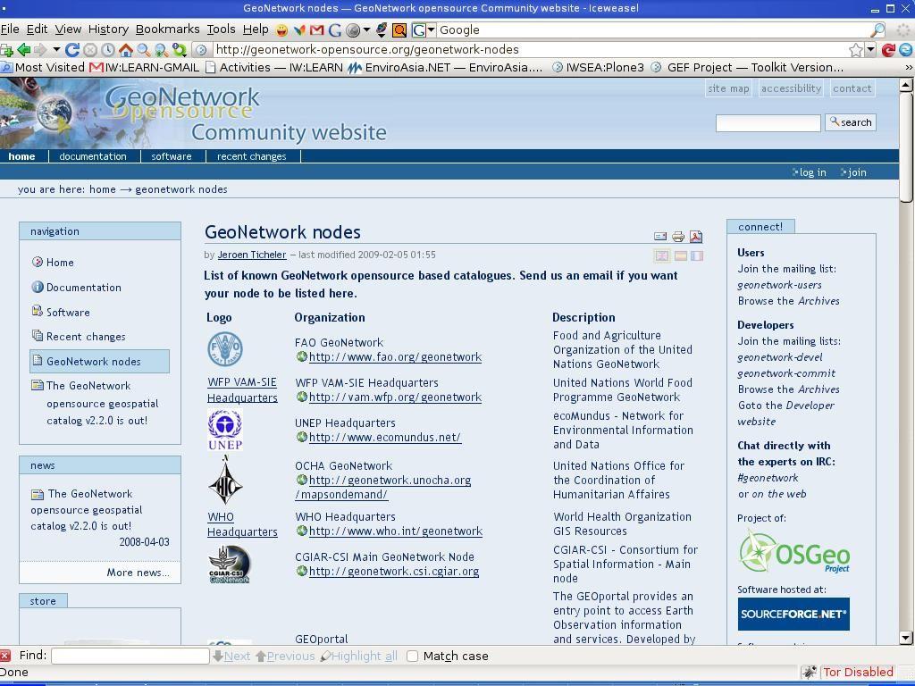
6 6 Why GeoNetwork Opensource? GN is a combined metadata catalogue with advanced search discovery tool, and embedded geographic data/map viewer. open source software easy to install and user-friendly framework for developing online metadata catalogue good documentation for administrators and users active community of developers allows option for search and locating datasets on local server AND remote GN sites (next slide) includes features for automatic harvesting of remote GN site metadata (next slide)
 www.iwlearn.net Other GN apps (e.g.")
7 Why UNEP EcoMundus (GeoNetwork app) GeoNetwork Opensource 7 How GN works GEF/UNEP IW:LEARN WebGIS (GeoNetwork app) Other GN apps (e.g., FAO, IWMI, SOPAC, etc
8 8
9 9 Why GeoNetwork Opensource? demonstrated applications worldwide initiated by FAO with first release in 2001 current version represents outcome of support from FAO, WFP, UNEP, UNOCHA, Open Source Geospatial Foundation (OSGeo) used widely by international, regional and national organisations worldwide GN user gallery:
10 10
11 11 Why GeoNetwork Opensource? A word about standards GN uses international standards to describe geographic data (ISO19139) and general documents (Dublin Core) (and uses OGC WMS standards for visualising maps). Why international standards ensure metadata can be interpreted by software and users, and makes data and information resources easier to locate on internet. Adding new metadata users can be assigned editor status to add new records (i.e, do not need to rely on one or two IT administrators).
12 12 Current implementation of WebGIS GN application available from inserted into all new project websites using IW:LEARN's Website Toolkit (implemented) to be inserted into new release of IWLEARN's knowledgebase at GN is being populated with metadata from datasets from GEF IW projects and partners, and additional useful datasets (discussed later). Key features of IW:LEARN's WebGIS...(following slides)
 URL: http://geonetwork.start.or.th/geonetwork/srv/en/main.")
13 Homepage of IW:LEARN's WebGIS 13 Metadata being added (see later slide) GN a combined: metadata catalogue; advanced search functionality; and embedded map viewer (for visualisation) URL:
")
14 14 Advanced search option Option to search resources of particular project or partners (i.e., category)
 file, plus Download option (not")
15 Search results 15 Example of results metadata, download etc Note result options Metadata, Interactive map and Google Earth (KML) file, plus Download option (not shown)

16 Metadata for selected result 16 Example of metadata

17 Metadata for selected result 17 Distribution information

18 18 GN as a geographic data and map viewer Map viewer opened Drag corner to enlarge map Select data layers to add from local or remote servers worldwide

19 Banner of new iwlearn.net 19 Mockup of WebGIS inserted into new WebGIS now inserted into project websites based on IW:LEARN's Website Toolkit

20 20 GN as a geographic data and map viewer Bathymetry data overlay Add data layer
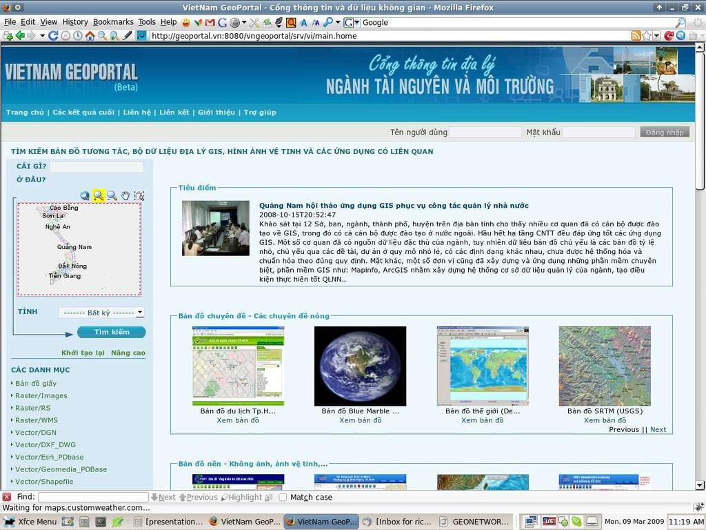
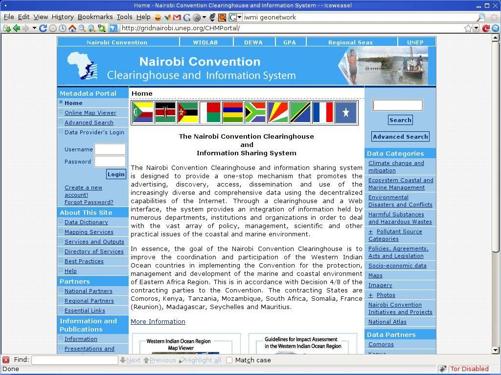
21 21 Current implementation of WebGIS Metadata records being added by IW:LEARN and projects by IW:LEARN harvesting useful existing metadata records from existing GeoNetwork sites developed by other organisations (e.g. FAO, IWMI, SOPAC) Vietnamese site - Database of Ministry of Natural Resources and Environment manually importing existing metadata records (e.g., UNEP Nairobi Convention Clearinghouse) manually entering metadata for datasets to be archived. by projects manually entering metadata for datasets
22 22

23 UNEP/GEF Volta River Basin Project Clearinghouse 23 using IW:LEARN WebGIS inserted into project website GEF Volta site

24 24 Metadata to be imported from NCC site with help from IW:LEARN Metadata to be added by GEF Volta project
25 25
26 26 Current implementation of WebGIS Benefits to projects of using the WebGIS: assists stakeholders in finding what data exists it is possible to allow download of actual data from the WebGIS if ownership rights permit helps identify a contact person for data of interest adding metadata and developing the catalogue is relatively straightforward helps GEF IW project to better manage and archive data resources
27 27 The Future improve customisation of WebGIS homepage layout including allowing projects to have greater control over layout e.g., localisation of content - hide metadata records from projects/ partners from geographic regions outside their area of interest. consultant hired to implement functionality populate WebGIS with more metadata recently hired GIS specialist to add and review metadata records encourage projects to add metadata by providing training in using GN and writing good metadata planning workshop in Tunisia in 2009 software upgrade (more features, e.g. to improve harvesting of nongeonetwork based metadata catalogues) consultant hired to implement
28 28 Thank you Dr. Richard Cooper, GEF/UNEP IW:LEARN Regional Coordinator/ Environmental Specialist SEA START RC, Chulalongkorn University, 5th Floor, Chulawich 1 Building, Bangkok THAILAND richard@iwlearn.org URL: Tel: Fax:
29 29 GeoNetwork Notes Useful links 1. The Complete GeoNetwork Manual: 2. Documentation and software: 3. Examples of implementation:
30 30 GN as a search tool (continued) Ecomundus - UNEP is developing a tool called EcoMundus which will link to GN nodes around the world and focuses on providing uses with quality environmental data; emphasis on 'quality' as it searches specific domains, not the whole web. EcoMundus can be accessed at

31 Adding metadata 31 Administration Log in Add new metadata

32 Adding metadata 32
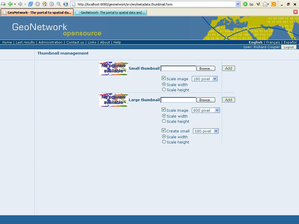
33 Adding thumbnails 33

34 Assigning a category 34

35 Adding privileges to dataset 35
Risk Habitat Megacity
 Contact Internet: Coordination: Data management: www.risk-habitat-megacity.ufz.de Dr. Dirk Heinrichs [dirk.heinrichs@ufz.de] Dr. Kerstin Krellenberg [kerstin.krellenberg@ufz.de] Christian Gadge [christian.gadge@ufz.de]
Description. Speaker Patrizia Monteduro (International Consultant, FAO) TRAINING GEONETWORK OPENSOURCE Islamabad, Pakistan, Jan 29-31, 2014
 TRAINING GEONETWORK OPENSOURCE Islamabad, Pakistan, Jan 29-31, 2014") BUILDING PROVINCIAL CAPACITY IN PAKISTAN FOR CROP ESTIMATION, FORECASTING, AND REPORTING BASED ON THE INTEGRATED USE OF REMOTELY SENSED DATA (GCP/PAK/125/USA) Description Speaker Patrizia Monteduro (International
BUILDING PROVINCIAL CAPACITY IN PAKISTAN FOR CROP ESTIMATION, FORECASTING, AND REPORTING BASED ON THE INTEGRATED USE OF REMOTELY SENSED DATA (GCP/PAK/125/USA) Description Speaker Patrizia Monteduro (International
The complete manual. By the developers. V 2.4 Copyright The Open Source Geospatial Foundation
 The complete manual By the developers V 2.4 Copyright 2007-2009 The Open Source Geospatial Foundation Table of Contents Preface... vi I. User Guide... 1 1. A Geographic Information Management System for
GeoNetwork User Manual
 GeoNetwork User Manual Release 2.6.4 GeoNetwork April 05, 2012 Contents 1 Preface 3 1.1 About this Project..................................... 3 1.2 License Information....................................
GeoNetwork User Manual
 GeoNetwork User Manual Release 2.10.4-0 GeoNetwork December 08, 2017 Contents 1 Preface 3 1.1 About this Project............................................ 3 1.2 License Information...........................................
GeoNetwork User Manual
 GeoNetwork User Manual Release 2.10.4-0 GeoNetwork December 22, 2014 Contents 1 Preface 3 1.1 About this Project..................................... 3 1.2 License Information....................................
Metadata for Data Discovery: The NERC Data Catalogue Service. Steve Donegan
 Metadata for Data Discovery: The NERC Data Catalogue Service Steve Donegan Introduction NERC, Science and Data Centres NERC Discovery Metadata The Data Catalogue Service NERC Data Services Case study:
Developing a Free and Open Source Software based Spatial Data Infrastructure. Jeroen Ticheler
 Developing a Free and Open Source Software based Spatial Data Infrastructure Jeroen Ticheler 1 License This work is licensed under the Creative Commons Attribution-NonCommercial-ShareAlike 2.5 License.
The geospatial metadata catalogue. FOSS4G Barcelona. Jeroen Ticheler. Founder and chair. Director
 The geospatial metadata catalogue FOSS4G2010 - Barcelona Jeroen Ticheler Director Founder and chair GeoNetwork opensource Dutch National Geo Registry FAO GeoNetwork SwissTopo geocat.ch GeoNetwork history
GeoNetwork opensource
 GeoNetwork opensource Spatial data management Geographic data sharing for everyone 20070907 François Prunayre FOSS4G2007 - LAB09 1 Getting started with GeoNetwork opensource Installation at a glimpse Directory
Fundisa Web Map Applications
 Fundisa Web Map Applications 2013-01-09 Prepared by SANSA Earth Observation 1 Using the SANSA Fundisa Web Map Applications The Fundisa web map applications were created to aid students in their search
Reducing Consumer Uncertainty
 Spatial Analytics Reducing Consumer Uncertainty Towards an Ontology for Geospatial User-centric Metadata Introduction Cooperative Research Centre for Spatial Information (CRCSI) in Australia Communicate
Benefits of CORDA platform features
 Benefits of CORDA platform features Functionalities, main tools and the benefits of using CORDA platform Copernicus service providers (land monitoring and emergency services) require reference data for
Windsor Essex Environmental Metadata System (WEEMS)
") Windsor Essex Environmental Metadata System (WEEMS) Utilizing Open Source Geospatial Metadata Technologies For Making g Research Based Data Available for Collaboration Grgicak-Mannion, A 1., Ciborowski,
Windsor Essex Environmental Metadata System (WEEMS) Utilizing Open Source Geospatial Metadata Technologies For Making g Research Based Data Available for Collaboration Grgicak-Mannion, A 1., Ciborowski,
Reducing Consumer Uncertainty Towards a Vocabulary for User-centric Geospatial Metadata
 Meeting Host Supporting Partner Meeting Sponsors Reducing Consumer Uncertainty Towards a Vocabulary for User-centric Geospatial Metadata 105th OGC Technical Committee Palmerston North, New Zealand Dr.
INSPIRE: The ESRI Vision. Tina Hahn, GIS Consultant, ESRI(UK) Miguel Paredes, GIS Consultant, ESRI(UK)
 Miguel Paredes, GIS Consultant, ESRI(UK)") INSPIRE: The ESRI Vision Tina Hahn, GIS Consultant, ESRI(UK) Miguel Paredes, GIS Consultant, ESRI(UK) Overview Who are we? Introduction to ESRI Inc. and ESRI(UK) Presenters ArcGIS The ESRI Solution to
INSPIRE: The ESRI Vision Tina Hahn, GIS Consultant, ESRI(UK) Miguel Paredes, GIS Consultant, ESRI(UK) Overview Who are we? Introduction to ESRI Inc. and ESRI(UK) Presenters ArcGIS The ESRI Solution to
Compass INSPIRE Services. Compass INSPIRE Services. White Paper Compass Informatics Limited Block 8, Blackrock Business
 Compass INSPIRE Services White Paper 2010 Compass INSPIRE Services Compass Informatics Limited Block 8, Blackrock Business Park, Carysfort Avenue, Blackrock, County Dublin, Ireland Contact Us: +353 1 2104580
Knowledge Inventory for hydrogeology research
 Knowledge Inventory for hydrogeology research This project has received funding from the European Union s Horizon 2020 research and innovation programme under grant agreement No 642047. REDIAM Environmental
The Scottish Spatial Data Infrastructure (SSDI)
") The Scottish Spatial Data Infrastructure (SSDI) INSPIRE Conference Istanbul Monday 25 th June 2012 15:55 Geoportals and registries II Tim Duffy BGS Edinburgh (trd@bgs.ac.uk) Shona Nicol Alex Ramage NERC
The Scottish Spatial Data Infrastructure (SSDI) INSPIRE Conference Istanbul Monday 25 th June 2012 15:55 Geoportals and registries II Tim Duffy BGS Edinburgh (trd@bgs.ac.uk) Shona Nicol Alex Ramage NERC
SEXTANT 1. Purpose of the Application
 SEXTANT 1. Purpose of the Application Sextant has been used in the domains of Earth Observation and Environment by presenting its browsing and visualization capabilities using a number of link geospatial
eresearch Collaboration across the Pacific:
 eresearch Collaboration across the Pacific: Marine Systems and Australian Marine Science Craig Johnson University of Tasmania Outline Introduce the Australian Ocean Network Possibilities for trans-pacific
The French Geoportal : linking discovery and view network services. INSPIRE Conference Krakow
 The French Geoportal : linking discovery and view network services ( BRGM ) D.Richard (IGN) F. Robida Context of the French Geoportal The governance mechanism Transversal organisation based on the Ministry
Long-term preservation for INSPIRE: a metadata framework and geo-portal implementation
 Long-term preservation for INSPIRE: a metadata framework and geo-portal implementation INSPIRE 2010, KRAKOW Dr. Arif Shaon, Dr. Andrew Woolf (e-science, Science and Technology Facilities Council, UK) 3
GeoPortal 4 Everybody
 GeoPortal 4 Everybody Karel Charvát, Jáchym Čepický, Štěpán Kafka, Premysl Vohnout, Martin Vlk Czech Centre for Science and Society Help Service Remote Sensing DT Member What is GeoPortal GeoPortal is
ARCHITECTURE OF SPATIAL DATA INFRASTRUCTURE (SDI) (DRAFT)
 (DRAFT)") ARCHITECTURE OF SPATIAL DATA INFRASTRUCTURE (SDI) (DRAFT) Author: Carlo Cipolloni September 20, 2018 Version 1.0 A SDI platform to support the SEIS in the ENP South region Introduction Based on the Contribution
ARCHITECTURE OF SPATIAL DATA INFRASTRUCTURE (SDI) (DRAFT) Author: Carlo Cipolloni September 20, 2018 Version 1.0 A SDI platform to support the SEIS in the ENP South region Introduction Based on the Contribution
GeoNode Integration with SDIs and Community Mapping
 GeoNode Integration with SDIs and Community Mapping Salvador Bayarri sbayarri@gmail.com World Bank Consultant Contents Accessing other SDI services Catalog harvesting through Geonetwork Cascading external
FDO Data Access Technology at a Glance
 Autodesk Geospatial FDO Data Access Technology at a Glance Work seamlessly with your geospatial data whatever the format 1 The Challenge The growing need for openness and interoperability between traditional
Metadata or "data about data" describe the content, quality, condition, and other characteristics of data. The Federal Geographic Data Committee
 Metadata or "data about data" describe the content, quality, condition, and other characteristics of data. The Federal Geographic Data Committee (http://www.fgdc.gov/) approved the Content Standard for
Web Map Servers. Mark de Blois. Septembre 2016
 Web Map Servers Mark de Blois Septembre 2016 Learning Objectives After this lecture you will be able to understand web map servers as used in Web-GIS applications Introduction A Web Map Server is a computer
REPORT OF THE WORKING GROUP 2: REGIONAL FUNDAMENTAL DATA
 UNITED NATIONS E/CONF.97/3/Add.2 ECONOMIC AND SOCIAL COUNCIL Seventeenth United Nations Regional Cartographic Conference for Asia and the Pacific Bangkok, 18-22 September 2006 Item 5 of the provisional
A Concept of a Virtual Research Environment for Long-Term Ecological Projects with Free and Open Source Software
 A Concept of a Virtual Research Environment for Long-Term Ecological Projects with Free and Open Source Software Mirko Filetti * and Albrecht Gnauck Brandenburg University of Technology at Cottbus Dept.
International Oceanographic Data and Information Exchange - Ocean Data Portal (IODE ODP)
") International Oceanographic Data and Information Exchange - Ocean Data Portal (IODE ODP) Enabling science through seamless and open access to marine data Credits This presentation was developed by: Mr.
International Oceanographic Data and Information Exchange - Ocean Data Portal (IODE ODP) Enabling science through seamless and open access to marine data Credits This presentation was developed by: Mr.
Relation between Geospatial information projects related to GBIF
 Relation between Geospatial information projects related to GBIF Synthesys 3.6-Synthesys 3.7-GBIF.DE- BioGeomancer The most up to date work can always be found at: http://www.biogeografia.com/synthesys
Data discovery and access via the SeaDataNet CDI system
 Data discovery and access via the SeaDataNet CDI system Central dataproducts and data services on distributed data. Peter Thijsse MARIS CLIPC IS-ENES workshop, KNMI, November 2014 Outline 1. Introduction
Data Product Catalogue. T. Loubrieu, M. Treguer, G. Maudire, IFREMER
 Data Product Catalogue T. Loubrieu, M. Treguer, G. Maudire, IFREMER High level Scope / Requirements Product definition : result of an action or process (aiming at fulfilling user's demand). For seadatanet
METAINFORMATION INFRASTRUCTURE FOR GEOSPATIAL INFORMATION
 2010/2 PAGES 1 7 RECEIVED 15. 6. 2009 ACCEPTED 2. 3. 2010 T. KLIMENT METAINFORMATION INFRASTRUCTURE FOR GEOSPATIAL INFORMATION ABSTRACT Tomáš KLIMENT email: tomas.kliment@stuba.sk Research field: Spatial
ArcGIS Online. The Road Ahead Geoff Mortson
 ArcGIS Online The Road Ahead Geoff Mortson gmortson@esricanada.com ArcGIS Online Easily create and share maps Delivered as intelligent maps Access on virtually any device anyone, anywhere Compliments and
United Nations Spatial Data Infrastructure (UNSDI)
") United Nations Spatial Data Infrastructure (UNSDI) & UN Geographic Information Working Group (UNGIWG) T. Suha ÜLGEN Senior Advisor on Spatial Data Infrastructure Office of the Assistant Secretary-General
United Nations Spatial Data Infrastructure (UNSDI) & UN Geographic Information Working Group (UNGIWG) T. Suha ÜLGEN Senior Advisor on Spatial Data Infrastructure Office of the Assistant Secretary-General
Call for Participation in AIP-6
 Call for Participation in AIP-6 GEOSS Architecture Implementation Pilot (AIP) Issue Date of CFP: 9 February 2013 Due Date for CFP Responses: 15 March 2013 Introduction GEOSS Architecture Implementation
Data Partnerships to Improve Health Frequently Asked Questions. Glossary...9
 FAQ s Data Partnerships to Improve Health Frequently Asked Questions BENEFITS OF PARTICIPATING... 1 USING THE NETWORK.... 2 SECURING THE DATA AND NETWORK.... 3 PROTECTING PRIVACY.... 4 CREATING METADATA...
GeoDCAT-AP Representing geographic metadata by using the "DCAT application profile for data portals in Europe"
 GeoDCAT-AP Representing geographic metadata by using the "DCAT application profile for data portals in Europe" Andrea Perego, Vlado Cetl, Anders Friis-Christensen, Michael Lutz, Lorena Hernandez Joint
 Plone development in UNEP Country Environmental Profiles Gerard.Cunningham@unep.org Capacity Building and Partnerships Section Division of Early Warning and Assessment United Nations Environment Programme
Putting the Pieces together: Combining Open Source Components to create a WebGIS.
 Putting the Pieces together: Combining Open Source Components to create a WebGIS. Shriram Ilavajhala University of Maryland College Park, MD. USA. Today s Topics A quick background on our project Our legacy
Webservice-energy.org GEO Community Portal & Spatial Data Infrastructure for Energy
 Webservice-energy.org GEO Community Portal & Spatial Data Infrastructure for Energy Lionel Menard / Oct. 23 2017 Centre Observation, Impacts, Energy Research activities: Use of Earth observation data (Models,
Egyptian Survey Authority Geographic Information Management System (ESA GIM)
") Egyptian Survey Authority Geographic Information Management System (ESA GIM) Sohail El ABD and Kholoud SAAD, Egypt Key words: GIS, theme, etc. SUMMARY ESA can be regarded as the backbone for supplying
Egyptian Survey Authority Geographic Information Management System (ESA GIM) Sohail El ABD and Kholoud SAAD, Egypt Key words: GIS, theme, etc. SUMMARY ESA can be regarded as the backbone for supplying
Report of the working group on meteorological visualisation applications. November Convener: Jens Daabeck Report: Iain Russell.
 Report of the working group on meteorological visualisation applications November 2005 Convener: Jens Daabeck Report: Iain Russell Slide 1 Output formats as they relate to meteorological plots Moderator:
SeaDataNet, Pan-European infrastructure for marine ands ocean data management + EMODNET Preparatory Action Hydrographic and Seabed Mapping
 SeaDataNet, Pan-European infrastructure for marine ands ocean data management + EMODNET Preparatory Action Hydrographic and Seabed Mapping By Dick M.A. Schaap Technical Coordinator SeaDataNet & Coordinator
National Data Network The Basics. What is the NDN?
 The Basics www.nationaldatanetwork.org What is the NDN? The National Data Network is an environment which facilitates the secure sharing of Information Resources. Information resources can be documents,
Jeffery S. Horsburgh. Utah Water Research Laboratory Utah State University
 Advancing a Services Oriented Architecture for Sharing Hydrologic Data Jeffery S. Horsburgh Utah Water Research Laboratory Utah State University D.G. Tarboton, D.R. Maidment, I. Zaslavsky, D.P. Ames, J.L.
The Value of Metadata
 The Value of Metadata Why is metadata important to your agency / organization? Metadata has tremendous value to Individuals within your organization, as well as to individuals outside of your organization
EarthLookCZ as Czech way to GMES
 EarthLookCZ as Czech way to GMES Karel Charvat 1 and Petr Horak 1 1 WirelessInfo, Czech Republic, charvat@wirelessinfo.cz Abstract Global Monitoring for Environment and Security is one of 4 ranges of solutions
Deliverable D3.12. Contract number: OJEU 2010/S Deliverable: D3.12 Author: Igor Antolovic Date: Version: Final
 Deliverable D3.12 Final and public version of the implemented web site with full functionality that hosts all relevant information on the Climate Atlas of the Carpathian Region, including a public download
NATIONAL GEOPORTAL USER GUIDE
 NATIONAL GEOPORTAL USER GUIDE National Spatial Data Management Division January 2016 TABLE OF CONTENTS GENERAL OVERVIEW... 1 ABOUT THIS MANUAL... 2 ACCESSING THE GEOPORTAL... 3 ADDING DATA TO THE GEOPORTAL...
Reservoir Mapping Tool User Guide
 Reservoir Mapping Tool User Guide This tool delineates estimated inundation area and calculates the area given a location of dam points and estimated dam height data within Irrawaddy, Salween, Mekong,
Developing data catalogue extensions for metadata harvesting in GIS
 University of Bergen Department of Informatics Developing data catalogue extensions for metadata harvesting in GIS Author: André Mossige Long master thesis June 2018 Acknowledgements I would like to thank
Research, stakeholders and results transfer in the Pacific islands: first results of a multi-organisation project
 19th International Congress on Modelling and Simulation, Perth, Australia, 12 16 December 2011 http://mssanz.org.au/modsim2011 Research, stakeholders and results transfer in the Pacific islands: first
PortalU, a Tool to Support the Implementation of the Shared Environmental Information System (SEIS) in Germany
 in Germany") European conference of the Czech Presidency of the Council of the EU TOWARDS eenvironment Opportunities of SEIS and SISE: Integrating Environmental Knowledge in Europe http:/www.e-envi2009.org/proceedings/
European conference of the Czech Presidency of the Council of the EU TOWARDS eenvironment Opportunities of SEIS and SISE: Integrating Environmental Knowledge in Europe http:/www.e-envi2009.org/proceedings/
Metadata Workshop 3 March 2006 Part 1
 Metadata Workshop 3 March 2006 Part 1 Metadata overview and guidelines Amelia Breytenbach Ria Groenewald What metadata is Overview Types of metadata and their importance How metadata is stored, what metadata
Towards a joint service catalogue for e-infrastructure services
 Towards a joint service catalogue for e-infrastructure services Dr British Library 1 DI4R 2016 Workshop Joint service catalogue for research 29 September 2016 15/09/15 Goal A framework for creating a Catalogue
Outline. The Collaborative Research Platform for Data Curation and Repositories: CKAN For ANGIS Data Portal. Open Access & Open Data.
 Outline The Collaborative Research Platform for Data Curation and Repositories: CKAN For ANGIS Data Portal Open Access & Open Data ANGIS data portal New developed features Future works Hsiung-Ming Liao,
Singapore. Mr Soh Kheng Peng. Singapore Land Authority
 Country Report 2006 (Based on the PCGIAP-Data Integration Template 2006) Singapore Country/state: Name of contact person: Affiliation, Organization: Function, Position: Address: Email address: Tel, Fax
Addressing Geospatial Big Data Management and Distribution Challenges ERDAS APOLLO & ECW
 Addressing Geospatial Big Data Management and Distribution Challenges ERDAS APOLLO & ECW Nouman Ahmed GeoSystems-Me (Hexagon Geospatial / ERDAS Regional Partner) Enterprise Solutions Architect Hexagon
Open Source Software Solutions
 Open Source Software Solutions Ned Horning horning@amnh.org http://biodiversityinformatics.amnh.org 1 Overview Introduction to open source software Geospatial software options Open Source Geospatial Foundation
ArcGIS Server: publishing geospatial data to the web using the EEA infrastructure
 ArcGIS Server: publishing geospatial data to the web using the EEA infrastructure *IMPORTANT: Map Services should be published using the EEA Map Services Tick Sheet for guidance. Contact Sebastien Petit
Session 7.3: Special interest points in the realisation of databases
 Session 7.3: Special interest points in the realisation of databases V1 Pier-Giorgio Zaccheddu Federal Agency for Cartography and Geodesy (BKG) Richard-Strauss-Allee 11 60598 Frankfurt am Main Tel.: +49
Initial GMES Service for Geospatial Reference Data Access. Remote Sensing Department. INDRA ESPACIO
 Initial GMES Service for Geospatial Reference Data Access Remote Sensing Department. INDRA ESPACIO Brussels, 260-09-2011 CONTENT 01 Overview 02 EU-DEM 03 Hydrography 04 Production Coordination 05 Access
INSPIRE & Environment Data in the EU
 INSPIRE & Environment Data in the EU Andrea Perego Research Data infrastructures for Environmental related Societal Challenges Workshop @ pre-rda P6 Workshops, Paris 22 September 2015 INSPIRE in a nutshell
The European Commission s science and knowledge service. Joint Research Centre
 The European Commission s science and knowledge service Joint Research Centre GeoDCAT-AP The story so far Andrea Perego, Antonio Rotundo, Lieven Raes GeoDCAT-AP Webinar 6 June 2018 What is GeoDCAT-AP Geospatial
Leveraging metadata standards in ArcGIS to support Interoperability. David Danko and Aleta Vienneau
 Leveraging metadata standards in ArcGIS to support Interoperability David Danko and Aleta Vienneau Leveraging Metadata Standards in ArcGIS for Interoperability Why metadata and metadata standards? Overview
GeoNetwork: metadata and cataloging French (GeoSource) and Swiss (geocat.ch) experiences
 and Swiss (geocat.ch) experiences") GeoNetwork: metadata and cataloging French (GeoSource) and Swiss (geocat.ch) experiences camptocamp SA / 12. mars 2009 / www.camptocamp.com / info@camptocamp.com Camptocamp, a Franco-Swiss company A Franco-Swiss
GeoNetwork: metadata and cataloging French (GeoSource) and Swiss (geocat.ch) experiences camptocamp SA / 12. mars 2009 / www.camptocamp.com / info@camptocamp.com Camptocamp, a Franco-Swiss company A Franco-Swiss
NMR Guide. 3/14/ Broadbean
 NMR Guide //08 0 Broadbean What is the new manage responses tab and where can I access? The New Manage Responses has been built as a dynamic page that allows users to keyword search and filter their adverts'
Uniform Resource Management
 IST-Africa 2008 Conference Proceedings Paul Cunningham and Miriam Cunningham (Eds) IIMC International Information Management Corporation, 2008 ISBN: 978-1-905824-07-6 Uniform Resource Management Karel
The Butterfly Effect. A proposal for distribution and management for butterfly data programs. Dave Waetjen SESYNC Butterfly Workshop May 10, 2012
 The Butterfly Effect A proposal for distribution and management for butterfly data programs Dave Waetjen SESYNC Butterfly Workshop May 10, 2012 http://butterfly.ucdavis.edu Citizen Science based Observation
The New Electronic Chart Product Specification S-101: An Overview
 The New Electronic Chart Product Specification S-101: An Overview Julia Powell Marine Chart Division, Office of Coast Survey, NOAA 1315 East West Hwy, Silver Spring, MD 20715 Julia.Powell@noaa.gov 301-713-0388
Accessing OGC Services To access OGC WMS and WFS open the service in the directory that you want to consume, and click on either WMS or WFS.
 Using Web Services Web Services Overview This user guide contains instructions on how to consume a range of services through a range of both web based and desktop GIS applications. Web services are a live
The GeoPortal Cookbook Tutorial
 The GeoPortal Cookbook Tutorial Wim Hugo SAEON/ SAEOS SCOPE OF DISCUSSION Background and Additional Resources Context and Concepts The Main Components of a GeoPortal Architecture Implementation Options
Introduction to INSPIRE. Network Services
 Introduction to INSPIRE. Network Services European Commission Joint Research Centre Institute for Environment and Sustainability Digital Earth and Reference Data Unit www.jrc.ec.europa.eu Serving society
HMA Standardisation Status
 HMA Standardisation Status GSCB Meeting, 18-19 June 2009, Frascati P.G. Marchetti, ESA Y. Coene, SPACEBEL GSCB Meeting, 18 June 2009 Slide 1 Overview Context and Objectives Evolution of specifications
CREATING SMART TRANSPORT SERVICES BY FACILITATING THE RE-USE OF OPEN GIS DATA
 OPEN TRANSPORT NET TOMAS MILDORF 16 JUNE 2014 INSPIRE CONFERENCE 2014, AALBORG, DENMARK CREATING SMART TRANSPORT SERVICES BY FACILITATING THE RE-USE OF OPEN GIS DATA 2 1 OTN AT A GLANCE Full title OpenTransportNet
Spanish Water Information System ( SIA ) metadata management
 metadata management") Expert workshop on metadata management and referential datasets Spanish Water Information System ( SIA ) metadata management Eduardo García ADASA Sistemas Nice - France Agenda About SIA SIA Architecture
Expert workshop on metadata management and referential datasets Spanish Water Information System ( SIA ) metadata management Eduardo García ADASA Sistemas Nice - France Agenda About SIA SIA Architecture
How to Register where a Brownfield Land Register has been published.
 How to Register where a Brownfield Land Register has been published. Version 3 Date 21/12/2017 Contents About this guide 1 Why register the location of a published file? 2 The CSV file 2 Spatial files
Lynnes, Yang, Hu, Domenico and Enloe Category: Technical Note March Interoperability between OGC CS/W and WCS Protocols
 Status of this RFC This RFC Technical Note describes a project to provide a catalog search service for the Thematic Realtime Environmental Data Distribution System (THREDDS). Specifically, the project
SDI and Metadata Entry and Updating Tools
 SDI and Metadata Entry and Updating Tools Abbas Rajabifard, Mohsen Kalantari and Andrew Binns Centre for Spatial Data Infrastructures and Land Administration Department of Geomatics, The University of
Presented by Kit Na Goh
 Developing A Geo-Spatial Search Tool Using A Relational Database Implementation of the FGDC CSDGM Model Presented by Kit Na Goh Introduction Executive Order 12906 was issued on April 13, 1994 with the
The EOC Geoservice: Standardized Access to Earth Observation Data Sets and Value Added Products ABSTRACT
 The EOC Geoservice: Standardized Access to Earth Observation Data Sets and Value Added Products K. Dengler, T. Heinen, A. Huber, K. Molch, E. Mikusch German Aerospace Center (DLR) German Remote Sensing
Metadata Overview: digital repositories
 Metadata Overview: digital repositories Presented during Pre-African Summit Workshop no 2: Building digital repositories in public, special and research libraries by Makaba Macanda macanmb@unisa.ac.za
Challenges that can be overcome with the aid of ESA GIM Click to edit Master text styles
 Click to edit Agenda Master By: Egyptian Survey Authority Geographic Information Management System Kholoud Saad Salama Egypt (ESA GIM) 1 About Egyptian Survey Authority Third ESA GIM level Business Requirements
ECAI Data Portal and new 4D GIS Platform
 ECAI Data Portal and new 4D GIS Platform Hsiung-Ming Liao, GIS Center, Academia Sinica Yao-Hsien Yeh, GIS Center, Academia Sinica Chen-Jen Lee, IIS, Academia Sinica Copyright Elitegroup Computer Systems.
Introduction to ArcGIS online
 Introduction to ArcGIS online Frédéric Dujardin ODIN Africa Training Course on Marine Biodiversity Management Oostende, Belgium, 18 March 2014 What is ArcGIS online? Online version of Esri s ArcGIS System
DATA MODELS FOR MACHU. Legislation CONCEPT
 DATA MODELS FOR MACHU Legislation CONCEPT 1 November 2016 Content 1. WHY USE MACHU DATA MODELS?... 3 2. FORMAT CHARACTERISTICS... 4 3. DATA MODEL DESCRIPTION OF THE LEGISLATION LAYER... 5 4 METADATA FORMATS...
GEOSPATIAL ENGINEERING COMPETENCIES. Geographic Information Science
 GEOSPATIAL ENGINEERING COMPETENCIES Geographic Information Science The character and structure of spatial information, its methods of capture, organisation, classification, qualification, analysis, management,
Persistent identifiers, long-term access and the DiVA preservation strategy
 Persistent identifiers, long-term access and the DiVA preservation strategy Eva Müller Electronic Publishing Centre Uppsala University Library, http://publications.uu.se/epcentre/ 1 Outline DiVA project
Lecture note on the history and principles of geo-webservices
 A SHORT INTRODUCTION TO GEO-WEBSERVICES Lecture note on the history and principles of geo-webservices Barend Köbben Version 1.0 February 24, 2010 Contents 1 From monolithic to distributed GIS architectures
GeoDCAT-AP: Use cases and open issues
 Authors Affiliation Andrea Perego, Anders Friis-Christensen, Michael Lutz European Commission, Joint Research Centre (JRC) (https://ec.europa.eu/jrc/) This paper illustrates some issues and use cases identified
Practical Benefits of Organised Spatial Data
 Practical Benefits of Organised Spatial Data Ray Scanlon Information Manager Geological Survey of Ireland Outline of talk Organising at a Corporate Level GSI Journey What do customers want? Example of
INSPIRE Conference Automatic metadata generation for the Web geo-resources
 INSPIRE Conference 2011 Automatic metadata generation for the Web geo-resources B. Borjas, A.J. Florczyk, F.J. López-Pellicer, J. Nogueras-Iso, F.J. Zarazaga-Soria June 28, 2011. Edinburgh Advanced Information
Server Usage & Third-Party Viewers
 Server Usage & Third-Party Viewers October 2016 HiPER LOOK Version 1.4.16.0 Copyright 2015 PIXIA Corp. All Rights Reserved. Table of Contents HiPER LOOK Server Introduction... 2 Google Earth... 2 Installation...2
New Mexico s RGIS Program: State Geospatial Data Clearinghouse
 New Mexico s RGIS Program: State Geospatial Data Clearinghouse Laura Gleasner Su Zhang November 10, 2016 New Mexico RGIS: The State Digital Geospatial Data Clearinghouse The Resource Geographic Information
Starter kit - Health GeoLab Collaborative ArcGIS Online platform
 Starter kit - Health GeoLab Collaborative ArcGIS Online platform Version 1.2 (04.09.2018) In collaboration with and with the support of: 0 Revision History Revision Revision Date Comment By 1.0 08 September