Species Distribution according to Annex III, 19 Species Distribution data specification version 2.0.
|
|
|
- Caroline O’Brien’
- 5 years ago
- Views:
Transcription


1 INSPIRE Infrastructure for Spatial Information in Europe Species Distribution according to Annex III, 19 Species Distribution data specification version 2.0. Nils Valland Norwegian Biodiversity Information Centre

![unit or other analytical unit [Directive 2007/2/EC] Occurrence is chosen to mean the spatial representation of a species at a specific location Species is a human expert judgement or interpretation](/docs-images/88/115355141/images/2-1.jpg "of a defined concept, debated and not consistent throughout the world, names needs to refer to an authoritative list or register Aggregated means to form into a class or cluster.")

2 Definitions Raw observations aggregated in 10x10 km grids 2000s 1990s 1980s 1970s 1960s s s s before 1900 Source: Steve Wilkinson, JNCC Polygon enclosing occurrence data for a certain period Distribution using prediction models Species Distribution is defined as geographical distribution of occurrence of animal and plant species aggregated by grid, region, administrative unit or other analytical unit [Directive 2007/2/EC] Occurrence is chosen to mean the spatial representation of a species at a specific location Species is a human expert judgement or interpretation of a defined concept, debated and not consistent throughout the world, names needs to refer to an authoritative list or register Aggregated means to form into a class or cluster. Closely related to, but not synonymous with the term amalgamated, which means to combine to form one structure. Both terms are used throughout the text of the data specification, as being suitable for describing the process of converting raw observations into a distribution of occurrence From these definitions the distributions may be represented in a wide range of formats, such as points, grid cells at different scales or polygons of specific defined areas
 Desv.")

3 Challenges and possibilities Distribution map in Atlas Florae Europaeae Occurence map in Neslia paniculata (L.) Desv. Ballmustard Overwhelming number of species, potentially species in Europe Data of species occurrence is extremely fragmented in institutions and organisations in and between memberstates Numerous worldwide, european and national inititatives to collect and present species distribution data, most of them by environmental or scientific institutions or networks. Generally each species group initiatives use specific datamodels, aggregation methods, representions and dataportals INSPIRE Dataspecification of Species distribution provides an unique possibility to share harmonized spatial data across country borders and species groups in an interoperable webmap service and thus enable maximum data distribution between various sources Occurence map in
 Lestes sponsa")


4 European atlas of dragonflies (Odonata) Lestes sponsa (Hansemann,1823) Emerald Damselfly Artskart Lestes sponsa Map: Vincent Kalkman, European Invertebrate Survey Nederland / Netherlands Centre for Biodiversity naturalis IUCN Odonata Specialist Group

5 Use cases 1. Generate European Species Distribution Spatial Data Report (Art.17, conventions etc.) 2. Simple Query and View Species Distribution 3. Expertly Query, View, Visualise and Analyse Species Distribution 4. Download Species Distribution Data 5. Provide Species Distribution Data Using INSPIRE Specifications
6 Dataspecifications Species Distribution GCM Coverage Coverage Coverages (Domain and Range):: CoverageByDomainAndRange + coveragefunction: CoverageFunction [0..1] + domainset: Any + rangeset: Any [0..*] {ordered} {gridfunctionrequiresgriddom ain} SpeciesDistributionCov erage + inspireid: Identifier + referencespeciesid: CharacterString + referencespeciesschem e: ReferenceSpeciesSchem evalue ::CoverageByDomainAndRange + coveragefunction: CoverageFunction [0..1] + domainset: Any + rangeset: Any [0..*] {ordered} ::Coverage + m etadata: Any [0..*] + rangetype: RecordType «voidable, lifecycleinfo» + beginlifespanversion: DateTim e + endlifespanversion: DateTime + domainextent: EX_GeographicExtent {domainism ultisurfaceorrectifiedgridorm ultipoint} {rangesetisspeciesdistributionunit} SourceInformation + aggregationmethod: AggregationMethodValue [1..*] sourcem ethod: SourceM ethodvalue + inspireid: Identifier [0..1] +m etadata + methodreference: CharacterString [0..1] + sourceprovider: SourceProviderType [1..*] + validfrom: DateTim e + validto: DateTime [0..1] + localspeciesname: LocalSpeciesNameType [0..*] SourceM ethodvalue AggregationM ethodvalue + observationaggregation + scientificanalysis GeneralSourceM ethodvalue + linesampling Article17SourceM ethodvalue + m onitoring + statisticalsam pling + com pletesurvey + gridmapping + estim atepartial + random + estim ateexpert + litterature + absentdata SourceProv idertype + inistitutionnam e: CI_ResponsibleParty + sourcedatabase: CharacterString [0..*] QualifierValue LocalSpeciesNameType + congruent + localspeciesnamevalue: CharacterString + includedin + localspeciesschem eid: CharacterString + includes + overlaps + qualifier: QualifierValue [0..1] + excludes ReferenceSpeciesSchemeValue + eunomen + eunis + naturedirectives SpeciesDistributionUnit + inspireid: Identifier [0..1] + distributioninfo: DistributionInfoType [0..*] DistributionInfoType + countingmethod: CountingMethodValue + countingunit: CountingUnitValue + numericalrange: RangeType [0..1] + specificnumericalcount: Integer [0..1] + residencystatus: ResidencyStatusValue [0..1] + sensitiveinfo: Boolean [0..1] {num ericalrangeem pty} {specificnumericalcountem pty} ResidencyStatusValue CountingMethodValue + concentration + counted + cultivated + estimated + extinct + calculated + introducedestablished + introducedimperm anent + native + naturallyim permanent + perm anent + probablyextinct RangeType + re-introducedortranslocated + reproducing + upperbound: Integer [0..1] + wintering + lowerbound: Integer [0..1] CountingUnitValue Article17CountingUnitValue GeneralCountingUnitValue + adults + colonies + individuals + localities + males + pairs + breedingfemales + callingm ales + floweringstem s + inhabitedlogs + inhabitedstonesorboulders + inhabitedtrees + shoots + tufts + length + area SpeciesDistributionCoverage The spatial representation of a species occurrence Multisurfaces Rectified grids Multipoints ReferenceSpeciesShemeValue Reference list defining a nomenclatural and taxonomical standard where all local names and taxonomic concepts have to be mapped to Eu-nomen Eunis Natura2000 Recommended Directive species (about 1200), IUCN Red List species (2314), responsibility species, etc.
7 Dataspecifications Species Distribution GCM Coverage Coverage Coverages (Domain and Range):: CoverageByDomainAndRange + coveragefunction: CoverageFunction [0..1] + domainset: Any + rangeset: Any [0..*] {ordered} {gridfunctionrequiresgriddom ain} SpeciesDistributionCov erage + inspireid: Identifier + referencespeciesid: CharacterString + referencespeciesschem e: ReferenceSpeciesSchem evalue ::CoverageByDomainAndRange + coveragefunction: CoverageFunction [0..1] + domainset: Any + rangeset: Any [0..*] {ordered} ::Coverage + m etadata: Any [0..*] + rangetype: RecordType «voidable, lifecycleinfo» + beginlifespanversion: DateTim e + endlifespanversion: DateTime + domainextent: EX_GeographicExtent {domainism ultisurfaceorrectifiedgridorm ultipoint} {rangesetisspeciesdistributionunit} ReferenceSpeciesSchemeValue + eunomen + eunis + naturedirectives SpeciesDistributionUnit + inspireid: Identifier [0..1] + distributioninfo: DistributionInfoType [0..*] DistributionInfoType + countingmethod: CountingMethodValue + countingunit: CountingUnitValue + numericalrange: RangeType [0..1] + specificnumericalcount: Integer [0..1] + residencystatus: ResidencyStatusValue [0..1] + sensitiveinfo: Boolean [0..1] DistributionInfoType The description of the status of the subject of distribution within the aggregation unit, like the indication of the abundance by counting, estimation or calculation of the number of occurrences or populationsize of the particular species CountingMethodValue Code list SourceInformation + aggregationmethod: AggregationMethodValue [1..*] sourcem ethod: SourceM ethodvalue + inspireid: Identifier [0..1] +m etadata + methodreference: CharacterString [0..1] + sourceprovider: SourceProviderType [1..*] + validfrom: DateTim e + validto: DateTime [0..1] + localspeciesname: LocalSpeciesNameType [0..*] SourceM ethodvalue AggregationM ethodvalue + observationaggregation + scientificanalysis {num ericalrangeem pty} {specificnumericalcountem pty} ResidencyStatusValue + concentration + cultivated + extinct + introducedestablished + introducedimperm anent + native + naturallyim permanent + perm anent + probablyextinct + re-introducedortranslocated + reproducing + wintering CountingMethodValue + counted + estimated + calculated RangeType + upperbound: Integer [0..1] + lowerbound: Integer [0..1] CountingUnitValue 2 Code lists ResidencyStatusValue 2 Code lists GeneralSourceM ethodvalue CountingUnitValue + linesampling Article17SourceM ethodvalue + m onitoring + com pletesurvey + estim atepartial + estim ateexpert + absentdata + statisticalsam pling + gridmapping + random + litterature Article17CountingUnitValue GeneralCountingUnitValue SourceProv idertype + inistitutionnam e: CI_ResponsibleParty + sourcedatabase: CharacterString [0..*] LocalSpeciesNameType + localspeciesnamevalue: CharacterString + localspeciesschem eid: CharacterString + qualifier: QualifierValue [0..1] QualifierValue + congruent + includedin + includes + overlaps + excludes + adults + colonies + individuals + localities + males + pairs + breedingfemales + callingm ales + floweringstem s + inhabitedlogs + inhabitedstonesorboulders + inhabitedtrees + shoots + tufts + length + area
8 Dataspecifications Species Distribution GCM Coverage Coverage «featuret ype» Coverages (Domain and Range):: CoverageByDomainAndRange + coveragefunction: CoverageFunction [0..1] + domainset: Any + rangeset: Any [0..*] {ordered} {gridfunctionrequiresgriddomain} SpeciesDistributionCov erage + inspireid: Identifier + referencespeciesid: CharacterString + referencespeciesschem e: ReferenceSpeciesSchem evalue ::CoverageByDomainAndRange + coveragefunction: CoverageFunction [0..1] + dom ainset: Any + rangeset: Any [0..*] {ordered} ::Coverage + metadata: Any [0..*] + rangetype: RecordType «voidable, lifecycleinfo» + beginlifespanversion: DateT im e + endlifespanversion: DateTime + dom ainextent: EX_GeographicExtent {domainismultisurfaceorrectifiedgridorm ultipoint} {rangesetisspeciesdistributionunit} «featuret ype» SourceInformation + aggregationmethod: AggregationMethodValue [1..*] sourcem ethod: SourceMethodValue + inspireid: Identifier [0..1] +m etadata + methodreference: CharacterString [0..1] + sourceprovider: SourceProviderType [1..*] + validfrom : DateT im e + validto: DateTime [0..1] + localspeciesname: LocalSpeciesNameType [0..*] SourceMethodValue AggregationMethodValue + observationaggregation + scientificanalysis GeneralSourceM ethodvalue + linesampling Article17SourceM ethodvalue + monitoring + statisticalsam pling + com pletesurvey + gridm apping + estimatepartial + random + estimateexpert + litterature + absentdata ReferenceSpeciesSchemeValue + eunomen + eunis + naturedirectives SpeciesDistributionUnit + inspireid: Identifier [0..1] + distributioninfo: DistributionInfoType [0..*] «datat ype» DistributionInfoType + countingmethod: CountingM ethodvalue + countingunit: CountingUnitValue + numericalrange: RangeType [0..1] + specificnumericalcount: Integer [0..1] + residencystatus: ResidencyStatusValue [0..1] + sensitiveinfo: Boolean [0..1] {num ericalrangeem pty} {specificnum ericalcountempty} ResidencyStatusValue CountingM ethodvalue + concentration + counted + cultivated + estimated + extinct + calculated + introducedestablished + introducedim perm anent + native + naturallyimpermanent + perm anent «datat ype» + probablyextinct RangeType + re-introducedort ranslocated + reproducing + upperbound: Integer [0..1] + wintering + lowerbound: Integer [0..1] CountingUnitValue Article17CountingUnitValue GeneralCountingUnitValue SourceInformation Refers to the methods hows observations have been made or recorded that are aggregated by using a given aggregationmethod assigned to the species distribution unit SourceMethodValue 2 code lists AggregationMethod observationaggregation scientificanalysis SourceProvider Name of institution compiling data from source databases to a complete dataset SourceProv idertype + inistitutionnam e: CI_ResponsibleParty + sourcedatabase: CharacterString [0..*] «datat ype» LocalSpeciesNameType + localspeciesnamevalue: CharacterString + localspeciesschem eid: CharacterString + qualifier: QualifierValue [0..1] QualifierValue + congruent + includedin + includes + overlaps + excludes + adults + colonies + individuals + localities + males + pairs + breedingfemales + callingmales + floweringstem s + inhabitedlogs + inhabitedstonesorboulders + inhabitedt rees + shoots + tufts + length + area
9 Species occurrence representations Total registrations (occurrence) of a species 2. Distribution as centre points in 10x10 km grid cells 3. Distribution as grid cells 10x10 km 4. Polygon distribution based on enclosing cells

10 Species presence and absence User interpretation of species distribution datasets improved by reason for absence Not searched for Searched for, but not found Presence

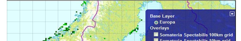
11 Species distribution test pilot Implemented in cooperation between the Norwegian Mapping Authority (INSPIRE coordinator in Norway) and the Norwegian Biodiversity Information Centre Bird data from Norway Sweden Denmark Finland (coming later) WMS-implementation in an Open Layers client with grid cells 10x10 km and 100x100 km in ETRS89/UTM33 html


12 Northern Lapwing
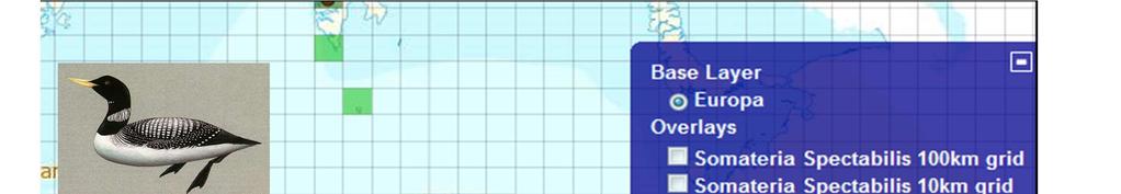


13 Yellow-billed Loon


14


15 King Eider
TWG BR-HB-SD. INSPIRE Thematic Working Group on Biogeographical Region, Habitats and Biotopes, Species Distribution
 TWG BR-HB-SD INSPIRE Thematic Working Group on Biogeographical Region, Habitats and Biotopes, Species Distribution Presenter: Anders Friis-Christensen, Editor, TWG BR-HB-SD INSPIRE Conference 2011, Edinburgh,
Cross-Nature, first steps
 VIII Jornadas Ibéricas de Infraestructuras de Datos Espaciales Lisboa 15-17 noviembre 2017 Cross-Nature, first steps SUMMARY 1. CROSS-NATURE GENERAL OVERVIEW 2. AN UPDATED STANDARD: PLINIAN CORE 3. PLINIAN
UN-GGIM: Europe core data and adaptation of INSPIRE models Dominique Laurent (IGN)
") Workshop about extensions of INSPIRE data specifications 20-21 June 2017 UN-GGIM: Europe core data and adaptation of INSPIRE models Dominique Laurent (IGN) UN-GGIM General presentation UN-GGIM(United Nations
Workshop about extensions of INSPIRE data specifications 20-21 June 2017 UN-GGIM: Europe core data and adaptation of INSPIRE models Dominique Laurent (IGN) UN-GGIM General presentation UN-GGIM(United Nations
INSPIRE Coverage Types
 INSPIRE Infrastructure for Spatial Information in Europe INSPIRE Coverage Types Title Status Creator Date 2012-06-15 Subject Publisher Type Description Contributor Format Source Rights Identifier Language
Methodological approach for cross-theme harmonization of Polish spatial data sets the case study for the Annex I themes
 Methodological approach for cross-theme harmonization of Polish spatial data sets the case study for the Annex I themes Elżbieta Bielecka, Agnieszka Zwirowicz-Rutkowska, Alina Kmiecik, Marek Brylski, Magdalena
INSPIRE data specifications Advanced. Stijn Keijers (SADL KU Leuven)
") 1 INSPIRE data specifications Advanced Stijn Keijers (SADL KU Leuven) Modules 2 1. Understanding INSPIRE data specifications 2. Introduction UML 3. Introduction XML/GML 4. Transforming data into INSPIRE
1 INSPIRE data specifications Advanced Stijn Keijers (SADL KU Leuven) Modules 2 1. Understanding INSPIRE data specifications 2. Introduction UML 3. Introduction XML/GML 4. Transforming data into INSPIRE
Implementing INSPIRE UIDs and life-cycle information in a European SDI.
 Implementing INSPIRE UIDs and life-cycle information in a European SDI. Nathalie Delattre, IGN Belgium Work team: Romain Kereneur, IGN, France Noémie Grémeaux, IGN, France Marcus Brühl, BKG, Germany Esa
Implementing INSPIRE UIDs and life-cycle information in a European SDI.
 Implementing INSPIRE UIDs and life-cycle information in a European SDI. Nathalie Delattre, IGN Belgium Work team: Romain Kereneur, IGN, France Noémie Grémeaux, IGN, France Marcus Brühl, BKG, Germany Esa
UN-GGIM : Europe core data and its impact on cadastral themes
 PCC - CLR KEN meeting Bratislava 17 November 2016 UN-GGIM : Europe core data and its impact on cadastral themes Dominique Laurent, France General presentation of UN-GGIM UN-GGIM (United Nations initiative
Introduction to INSPIRE. Network Services
 Introduction to INSPIRE. Network Services European Commission Joint Research Centre Institute for Environment and Sustainability Digital Earth and Reference Data Unit www.jrc.ec.europa.eu Serving society
Integration of INSPIRE & SDMX data infrastructures for the 2021 population and housing census
 Integration of INSPIRE & SDMX data infrastructures for the 2021 population and housing census Nadezhda VLAHOVA, Fabian BACH, Ekkehard PETRI *, Vlado CETL, Hannes REUTER European Commission (*ekkehard.petri@ec.europa.eu
The Plan4business Approach to Transfer Open Data into Real Estate Businesses
 The Plan4business Approach to Transfer Open Data into Real Estate Businesses Jan Ježek 1, Tomáš Mildorf 1, Karel Charvát Jr. 2, and Karel Charvát 3 1 University of West Bohemia, Pilsen, Czech Republic
How to Register where a Brownfield Land Register has been published.
 How to Register where a Brownfield Land Register has been published. Version 3 Date 21/12/2017 Contents About this guide 1 Why register the location of a published file? 2 The CSV file 2 Spatial files
INSPIRE overview and possible applications for IED and E-PRTR e- Reporting Alexander Kotsev
 INSPIRE overview and possible applications for IED and E-PRTR e- Reporting Alexander Kotsev www.jrc.ec.europa.eu Serving society Stimulating innovation Supporting legislation The European data puzzle 24
The European Soil Data Centre, the European Soil Bureau Network and INSPIRE Data Specifications for Soil
 The European Soil Data Centre, the European Soil Bureau Network and INSPIRE Data Specifications for Soil Marc Van Liedekerke, Panos Panagos, Luca Montanarella Land Management and Natural Harzards Unit
enetwild Wildlife: collecting and sharing data on wildlife populations, transmitting animal and human disease agents
 The Enetwild Project enetwild Wildlife: collecting and sharing data on wildlife populations, transmitting animal and human disease agents Standards for data collection on wildlife distribution and abundance
SEIS. (Shared Environmental Information System) From concept to information services
 From concept to information services") SEIS (Shared Environmental Information System) From concept to information services Stefan Jensen EEA supported by Sheila Cryan and Jon Maidens GSDI 11, Rotterdam 19.6.2009 What is SEIS is about... Sharing
SEIS (Shared Environmental Information System) From concept to information services Stefan Jensen EEA supported by Sheila Cryan and Jon Maidens GSDI 11, Rotterdam 19.6.2009 What is SEIS is about... Sharing
5 Data content and structure
 5 Data content and structure The INSPIRE theme Utility and governmental services has been split in 3 separate main packages, that are developed hereafter. Though main features of the 3 sub-themes have
Basic Principles of MedWIS - WISE interoperability
 Co-ordination committee seminar of the national focal points Basic Principles of MedWIS - WISE interoperability Eduardo García ADASA Sistemas Nice - France Agenda WISE vs MedWIS WISE WISE DS WISE vs WISE
Proposed Changes to the Generic Conceptual Model and Encoding Guidelines
 Infrastructure for Spatial Information in Europe Changes to the Generic Conceptual Model and Encoding Guidelines Title Creator Changes to the Generic Conceptual Model and Encoding Guidelines CPO Date 2011-06-15
Beyond Rasters: Introducing The New OGC Web Coverage Service 2.0
 Beyond Rasters: Introducing The New OGC Web Coverage Service 2.0 Peter Baumann Jacobs University Bremen rasdaman GmbH Jacobs University Bremen International, multi-cultural,300+ students, 0 nations, 75%
Project European CDDA and INSPIRE : scope, transformation workflow and mapping rules
 Project European CDDA and INSPIRE : scope, transformation workflow and mapping rules INSPIRE Conference 2014 Workshop: Implementing Existing European Spatial Data of Designated Areas Based on the INSPIRE
INSPIRE: The ESRI Vision. Tina Hahn, GIS Consultant, ESRI(UK) Miguel Paredes, GIS Consultant, ESRI(UK)
 Miguel Paredes, GIS Consultant, ESRI(UK)") INSPIRE: The ESRI Vision Tina Hahn, GIS Consultant, ESRI(UK) Miguel Paredes, GIS Consultant, ESRI(UK) Overview Who are we? Introduction to ESRI Inc. and ESRI(UK) Presenters ArcGIS The ESRI Solution to
INSPIRE: The ESRI Vision Tina Hahn, GIS Consultant, ESRI(UK) Miguel Paredes, GIS Consultant, ESRI(UK) Overview Who are we? Introduction to ESRI Inc. and ESRI(UK) Presenters ArcGIS The ESRI Solution to
INSPIRE & Environment Data in the EU
 INSPIRE & Environment Data in the EU Andrea Perego Research Data infrastructures for Environmental related Societal Challenges Workshop @ pre-rda P6 Workshops, Paris 22 September 2015 INSPIRE in a nutshell
CREATING SMART TRANSPORT SERVICES BY FACILITATING THE RE-USE OF OPEN GIS DATA
 OPEN TRANSPORT NET TOMAS MILDORF 16 JUNE 2014 INSPIRE CONFERENCE 2014, AALBORG, DENMARK CREATING SMART TRANSPORT SERVICES BY FACILITATING THE RE-USE OF OPEN GIS DATA 2 1 OTN AT A GLANCE Full title OpenTransportNet
European Marine Data Exchange
 European Marine Data Exchange By Dick M.A. Schaap MARIS (NL) EU SeaDataNet Technical Coordinator EU EMODnet Ingestion Coordinator Noordzeedagen 2018 - October 2018 Acquisition of ocean and marine data
Delivery Manual for Articles 12 and 17:
 EUROPEAN TOPIC CENTRE ON BIOLOGICAL DIVERSITY Delivery Manual for Articles 12 and 17: 1. Role of National Coordinator 2. How to ensure data are technically valid 3. Uploading your data 4. What happens
Christian Ansorge 27th April CDDA webinar 27th April Linked Approach as reporting mechanism
 Christian Ansorge 27th April 2017 CDDA webinar 27th April 2017 Linked Approach as reporting mechanism Generic Linked Approach Scope Background and motivation for reporting reusing INSPIRE Introduction
HUMBOLDT Application Scenario: Protected Areas
 CC by Erlend Schei Copyright by Kecko Copyright by Michael Bezzina CC by Gunnar Ries Copyright by Michael Bezzina Copyright by Michael Bezzina Copyright by Michael Bezzina CC by fs999 CC by Jordan Nielsen
Technical implementation of INSPIRE: feed-back from experiences
 Technical implementation of INSPIRE: feed-back from experiences Lisbon 27 February 2013 1 Modèle TN-02.018-1.2 Dominique.laurent@ign.fr Plan Introduction Metadata Services Interoperability 2 Introduction
EXPOFACTS. Exposure Factors Sourcebook for Europe GENERAL
 EXPOFACTS Exposure Factors Sourcebook for Europe GENERAL 10.7.2006 This document describes the general structure of ExpoFacts Sourcebook, as well as the principles according to which data have been collected
How to Report on Data Quality in a Multinational Environment?
 How to Report on Data Quality in a Multinational Environment? Presentation to: By: Date: SDMQ2015 Anja Hopfstock, BKG 20.01.2015 Agenda ELF architecture Data Quality Management Data Quality Reporting Summary
Achieving Global Cyber Security Through Collaboration
 Achieving Global Cyber Security Through Collaboration Steve Purser Head of Core Operations Department December 2013 European Union Agency for Network and Information Security www.enisa.europa.eu Agenda
European Location Framework (ELF) acting as a facilitator implementing INSPIRE
 acting as a facilitator implementing INSPIRE") www.eurogeographics.org European Location Framework (ELF) acting as a facilitator implementing INSPIRE Saulius Urbanas, Mick Cory (EuroGeographics) 29 October 2016 Copyright 2013 EuroGeographics EuroGeographics
www.eurogeographics.org European Location Framework (ELF) acting as a facilitator implementing INSPIRE Saulius Urbanas, Mick Cory (EuroGeographics) 29 October 2016 Copyright 2013 EuroGeographics EuroGeographics
esignature Infrastructure Marketing Model
 www.peppol.eu esignature Infrastructure Marketing Model esignature Long Demo Objectives of PEPPOL esignature The overall objective of PEPPOL esignature is to provide cross European interoperability of
INSPIRE in a nutshell, and overview of the European Union Location Framework
 INSPIRE in a nutshell, and overview of the European Union Location Framework Francesco Pignatelli European Commission, DG JRC 10 th European Congress and Exhibition on Intelligent Transport Systems and
Keep it simple! a Nordic view on technical simplification issues. Nordic INSPIRE Network. INSPIRE Conference 2017
 Keep it simple! a Nordic view on technical simplification issues 1 The network Formed in 2007 as a result of the INSPIRE directive Share experience and knowledge Develop common standpoints Exchange action
This document is a preview generated by EVS
 TECHNICAL REPORT RAPPORT TECHNIQUE TECHNISCHER BERICHT CEN/TR 15449-5 April 2015 ICS 07.040; 35.240.70 English Version Geographic information - Spatial data infrastructures - Part 5: Validation and testing
Monitoring and Reporting Drafting Team Monitoring Indicators Justification Document
 INSPIRE Infrastructure for Spatial Information in Europe Monitoring and Reporting Drafting Team Monitoring Indicators Justification Document Title Draft INSPIRE Monitoring Indicators Justification Document
INSPIRE Data Specifications Base Models Activity Complex
 INSPIRE Infrastructure for Spatial Information in Europe INSPIRE Data Specifications Base Models Activity Complex Title Status Creator D2.10.3: Generic Activity Complex, Version 1.0rc2 Baseline version
ELF- joining Europe together
 ELF- joining Europe together An open standard based multinational web mapping project, building on INSPIRE Presentation to: ISO/TC211 Standards in Action Workshop By: Date: Jari Reini 10 th June 2015 19
Addressing the needs of INSPIRE: The Challenges of improving Interoperability within the European Union
 Addressing the needs of INSPIRE: The Challenges of improving Interoperability within the European Union Andrew Coote Facilitator, Addresses Thematic Working Group andrew.coote@consultingwhere.com Disclaimer
Current status of WP3: smart meters
 Current status of WP3: smart meters, Statistics Estonia Partners: Statistics Austria, Statistics Denmark, Statistics Sweden ESSnet Big Data meeting 13-15 June 2016 Tallinn Outline Overview of the smart
INSPIRE trenutni status i buduće aktivnosti
 INSPIRE trenutni status i buduće aktivnosti Vlado Cetl Dani IPP 2017, Zagreb, Hrvatska Joint Research Centre The European Commission s science and knowledge service What is INSPIRE? 7.500 data providers
INSPIRE on tools workshop
 INSPIRE on tools workshop Geoportal, Registry, Validator Robert Tomas, Michael Lutz, Lorena Hernandez, Marco Minghini, Daniele Francioli, Emanuela Epure The European Commission s science and knowledge
Transboundary data interoperability for Maritime Spatial Planning. Yuji KATO
 Transboundary data interoperability for Maritime Spatial Planning Yuji KATO CONTEXT THE MARITIME SPATIAL PLANNING DIRECTIVE DIRECTIVE 2014/89/EU establishing a framework for Maritime Spatial Planning (MSP)
SeaDataNet, Pan-European infrastructure for marine ands ocean data management + EMODNET Preparatory Action Hydrographic and Seabed Mapping
 SeaDataNet, Pan-European infrastructure for marine ands ocean data management + EMODNET Preparatory Action Hydrographic and Seabed Mapping By Dick M.A. Schaap Technical Coordinator SeaDataNet & Coordinator
The descriptions of the elements and measures are based on Annex D of ISO/DIS Geographic information Data quality.
 7 Data quality This chapter includes a description of the data quality elements and sub-elements as well as the corresponding data quality measures that should be used to evaluate and document data quality
Challenges to be INSPIRE compliant: CDDA into Protected Sites
 Challenges to be INSPIRE compliant: CDDA into Protected Sites María Cabello Pedro Mendive Summary Background The project Lessons learned Harmonizati on process Background Annex 1 Addresses Protected Sites
PortalU, a Tool to Support the Implementation of the Shared Environmental Information System (SEIS) in Germany
 in Germany") European conference of the Czech Presidency of the Council of the EU TOWARDS eenvironment Opportunities of SEIS and SISE: Integrating Environmental Knowledge in Europe http:/www.e-envi2009.org/proceedings/
European conference of the Czech Presidency of the Council of the EU TOWARDS eenvironment Opportunities of SEIS and SISE: Integrating Environmental Knowledge in Europe http:/www.e-envi2009.org/proceedings/
Draft version 17 th July Reporting tool guidelines for the delivery of Article 12 and 17 data
 Reporting tool guidelines for the delivery of Article 12 and 17 data Draft version 17th July 2018 Contents 1 Introduction... 3 2 Reporting tool for Article 12 and 17 reporting... 3 2.1 Downloading and
Draft version 13 th July Delivery manual for Article 12 data
 Delivery manual for Article 12 data Draft version 13 th July 2018 Contents 1 Introduction... 3 2 Data preparation process... 3 2.1 Overview... 3 2.2 Data validation... 4 2.3 Tabular data standards for
The European Commission s science and knowledge service. Joint Research Centre
 The European Commission s science and knowledge service Joint Research Centre GeoDCAT-AP The story so far Andrea Perego, Antonio Rotundo, Lieven Raes GeoDCAT-AP Webinar 6 June 2018 What is GeoDCAT-AP Geospatial
Introduction to INEXDA s Metadata Schema
 1 Introduction to INEXDA s Metadata Schema Christian Hirsch (Deutsche Bundesbank) July 2018 The views expressed here do not necessarily reflect the opinion of the Deutsche Bundesbank, the INEXDA network,
N. Marusov, I. Semenov
 GRID TECHNOLOGY FOR CONTROLLED FUSION: CONCEPTION OF THE UNIFIED CYBERSPACE AND ITER DATA MANAGEMENT N. Marusov, I. Semenov Project Center ITER (ITER Russian Domestic Agency N.Marusov@ITERRF.RU) Challenges
Web apps for INSPIRE: the ELISE Energy pilot example
 Web apps for INSPIRE: the ELISE Energy pilot example 6 September 2017 Authors: Daniele Francioli Giacomo Martirano Maria Teresa Borzacchiello Francesco Pignatelli Outline Overview of the ELISE Energy Pilot
BIODIVERSITY INFORMATION
 BIODIVERSITY INFORMATION RETRIEVAL ACROSS NETWORKED DATA SETS By Dr Sarinder Kaur ISKO UK Conference 2009 B I I A L Institute of Biological Sciences Faculty of Science University of Malaya, Kuala Lumpur
Czech experience about transformation of the themes Elevation and Orthoimagery
 Czech experience about transformation of the themes Elevation and Orthoimagery Veronika KUSOVA LAND SURVEY OFFICE CZECH OFFICE FOR SURVEYING, MAPPING AND CADASTRE Zeměměřický úřad, Pod sídlištěm 1800/9,
The Social Tenure Domain Model
 The Social Tenure Domain Model Christiaan Lemmen, The Netherlands International Symposium Progressing towards U-Cadastre Kuala Lumpur, Malaysia, October 15th 2009 The Agenda - Social Tenure Domain Model
Raster national datasets transformation to INSPIRE specifications
 http://www.ign.es Instituto Geográfico Nacional Raster national datasets transformation to INSPIRE specifications Orthoimageries and Elevation Julián Delgado Hernández INSPIRE KEN workshop Barcelona 29
Best Practice Network for SDI in Nature Conservation
 Co-funded by the Community Programme econtentplus ECP-2007-GEO-317007 Best Practice Network for SDI in Nature Conservation http://www.nature-sdi.eu Newsletter no. 4 - July 2011 Natura 2000 and the new
Transformation of El - OI data for INSPIRE
 Transformation of El - OI data for INSPIRE 29 Septembre 2015 1 ISN 15.12x Methodology Define some strategy Theme EL Meeting n 1 : information => decision: launch small test to gain experience Meeting n
ENISA & Cybersecurity. Steve Purser Head of Technical Competence Department December 2012
 ENISA & Cybersecurity Steve Purser Head of Technical Competence Department December 2012 Agenda Protecting Critical Information Infrastructure Input to EU & MS Cyber Security Strategies Assisting Operational
ANNEX 1 Guidelines to fill DEVOTES Catalogue of Monitoring Networks
 WP 1 Deliverable 1.3 ANNEX 1 Guidelines to fill DEVOTES Catalogue of Monitoring Networks Dissemination level PUBLIC LEAD CONTRACTOR JRC- JOINT RESEARCH CENTRE, EUROPEAN COMMISSION AUTHORS Heliana Teixeira
MetOcean Themes in INSPIRE
 MetOcean Themes in INSPIRE Cliquez pour modifier le style du titre 4th Workshop on the use of GIS/OGC standards in meteorology Cliquez pour modifier le style des sous-titres Frédéric du Guillaud masque
OpenBIM Latest developments at Rijkswaterstaat
 OpenBIM Latest developments at Rijkswaterstaat Benno.Koehorst@rws.nl May 27,28 2013 Goals about use of information at RWS - simplify the flow of information from the building contractor to the project
GEOSPATIAL ENGINEERING COMPETENCIES. Geographic Information Science
 GEOSPATIAL ENGINEERING COMPETENCIES Geographic Information Science The character and structure of spatial information, its methods of capture, organisation, classification, qualification, analysis, management,
Toward Horizon 2020: INSPIRE, PSI and other EU policies on data sharing and standardization
 Toward Horizon 2020: INSPIRE, PSI and other EU policies on data sharing and standardization www.jrc.ec.europa.eu Serving society Stimulating innovation Supporting legislation The Mission of the Joint Research
Infrastructure for Spatial Information in Europe. Proposed action for update of MIWP: Alternative encodings for INSPIRE data
 INSPIRE Infrastructure for Spatial Information in Europe Proposed action for update of MIWP: Alternative encodings for INSPIRE data Type Creator MIWP Action fiche DG ENV Date/status/version 20/11/2017
(Version 1.1.0) Mobile App Guide
 Mobile App Guide") (Version 1.1.0) Mobile App Guide Table of Contents 1 Introduction to the MyNatura2000 app... 3 2 First steps... 3 3 Login and registration... 5 4 Listing of Natura2000 protected sites... 6 4.1 Searching
(Version 1.1.0) Mobile App Guide Table of Contents 1 Introduction to the MyNatura2000 app... 3 2 First steps... 3 3 Login and registration... 5 4 Listing of Natura2000 protected sites... 6 4.1 Searching
EU policy and the way forward for smart meters and smart grids
 Transmission & Distribution SMART GRIDS Europe 2012 Amsterdam 9-11 October 2012 EU policy and the way forward for smart meters and smart grids Manuel Sánchez, PhD Smart Grid Team Leader European Commission,
EUDAT. Towards a pan-european Collaborative Data Infrastructure - A Nordic Perspective? -
 EUDAT Towards a pan-european Collaborative Data Infrastructure - A Nordic Perspective? - Damien Lecarpentier CSC-IT Center for Science, Finland NeIC Conference Trondheim, 16 May 2013 Data trends Exponential
INSPIRE status report
 INSPIRE Team INSPIRE Status report 29/10/2010 Page 1 of 7 INSPIRE status report Table of contents 1 INTRODUCTION... 1 2 INSPIRE STATUS... 2 2.1 BACKGROUND AND RATIONAL... 2 2.2 STAKEHOLDER PARTICIPATION...
EUDAT. Towards a pan-european Collaborative Data Infrastructure
 EUDAT Towards a pan-european Collaborative Data Infrastructure Damien Lecarpentier CSC-IT Center for Science, Finland CESSDA workshop Tampere, 5 October 2012 EUDAT Towards a pan-european Collaborative
Delivery guide for Environmental Noise Data:
 Delivery guide for Environmental Noise Data: DF0: Definition of reporting structure Type of Document: Draft guidelines Annex DF0 Prepared by: Colin Nugent, Núria Blanes, Jaume Fons, Miquel Sáinz de la
Social Validation of INSPIRE Annex III Data Structures in EU Habitats (27th of June 16:00 room Fintry) Karel Charvat Help Service Remote Sensing
 Karel Charvat Help Service Remote Sensing") Social Validation of INSPIRE Annex III Data Structures in EU Habitats (27th of June 16:00 room Fintry) Karel Charvat Help Service Remote Sensing Content Lessons learn from user communities Why harmonize
Social Validation of INSPIRE Annex III Data Structures in EU Habitats (27th of June 16:00 room Fintry) Karel Charvat Help Service Remote Sensing Content Lessons learn from user communities Why harmonize
Compass INSPIRE Services. Compass INSPIRE Services. White Paper Compass Informatics Limited Block 8, Blackrock Business
 Compass INSPIRE Services White Paper 2010 Compass INSPIRE Services Compass Informatics Limited Block 8, Blackrock Business Park, Carysfort Avenue, Blackrock, County Dublin, Ireland Contact Us: +353 1 2104580
Preparing for High-Luminosity LHC. Bob Jones CERN Bob.Jones <at> cern.ch
 Preparing for High-Luminosity LHC Bob Jones CERN Bob.Jones cern.ch The Mission of CERN Push back the frontiers of knowledge E.g. the secrets of the Big Bang what was the matter like within the first
Sub-national dimensions of INSPIRE
 www.eurogeographics.org CONNECTING YOU TO THE Sub-national dimensions of INSPIRE SDIs in the evolving EU society Dave Lovell, Secretary General and Executive Director 24 June 2013 Copyright 2013 EuroGeographics
Consolidation Team INSPIRE Annex I data specifications testing Call for Participation
 INSPIRE Infrastructure for Spatial Information in Europe Technical documents Consolidation Team INSPIRE Annex I data specifications testing Call for Participation Title INSPIRE Annex I data specifications
Towards a pan-european infrastructure for marine and ocean data management + Importance of standards
 Towards a pan-european infrastructure for marine and ocean data management + Importance of standards By Dick M.A. Schaap Technical Coordinator SeaDataNet & Coordinator EMODnet Bathymetry Hydrography Day,
Frank KÖSTER, Germany Head of Hydrographic Surveying Department Hamburg Port Authority
 Integrated Bathymetric Data Management - the platform for decision making in the Port of Hamburg Frank KÖSTER, Germany Head of Hydrographic Surveying Department Hamburg Port Authority Ottokarl Büchsenschütz-Nothdurft,
For each use case, the business need, usage scenario and derived requirements are stated. 1.1 USE CASE 1: EXPLORE AND SEARCH FOR SEMANTIC ASSESTS
 1 1. USE CASES For each use case, the business need, usage scenario and derived requirements are stated. 1.1 USE CASE 1: EXPLORE AND SEARCH FOR SEMANTIC ASSESTS Business need: Users need to be able to
Pan-European Soil Databases
 Pan-European Soil Databases Interest for Landslides Mapping Panos Panagos, Arwyn Jones http://eusoils.jrc.ec.europa.eu E-mail: panos.panagos@jrc.it 1 The new system of European Data Centers for the environment
User Manual for the delivery of a new national Natura 2000 database to the Commission. Version 1.1
 User Manual for the delivery of a new national Natura 2000 database to the Commission Version 1.1 The Natura 2000 network of protected sites consists of the sites classified under the Birds Directive first
A corporate approach to processing microdata in Eurostat
 A corporate approach to processing microdata in Eurostat Pál JANCSÓK and Christine WIRTZ Eurostat Unit B4 1 Agenda Introduction Generic SAS Tool (GSAST) architecture Microdata processing Architecture Metadata
BRAHMS 7 UPGRADE NOTES
 BRAHMS 7 UPGRADE NOTES July 2012 A POWERFUL AND FLEXIBLE ONLINE SERVICE... 2 BRAHMS WEBCONNECT... 3 ONLINE HERBARIUM TRANSACTIONS: IMAGE BASED LOANS... 4 WEBSITE STYLE AND CSS FILE EDITING... 4 HERBARIUM
Ilkka Kotilainen. Project Manager Finnish Transport Agency CODECS Workshop on Hybrid Communication 19th of May 2017
 Ilkka Kotilainen Project Manager Finnish Transport Agency CODECS Workshop on Hybrid Communication 19th of May 2017 Picture: Wikimedia Common, S. Solberg J. Why hybrid communication? Main objective: scale
Land Cover spatial datasets harmonization in Portugal using HALE
 Land Cover spatial datasets harmonization in Portugal using HALE Teresa Zuna, Alexandra Fonseca, Danilo Furtado, Ana Luísa Gomes, André Serronha, Paulo Patrício Introduction DGT is the entity responsible
Maximum Entropy (Maxent)
") Maxent interface Maximum Entropy (Maxent) Deterministic Precise mathematical definition Continuous and categorical environmental data Continuous output Maxent can be downloaded at: http://www.cs.princeton.edu/~schapire/maxent/
Maxent interface Maximum Entropy (Maxent) Deterministic Precise mathematical definition Continuous and categorical environmental data Continuous output Maxent can be downloaded at: http://www.cs.princeton.edu/~schapire/maxent/
Global Monitoring for Environment and Security
 Global Monitoring for Environment and Security Final Report for the GMES Initial Period (2001-2003) Version 3.5 1 The GMES initiative was launched in May 1998 in Baveno and adopted by the ESA and EU Councils
Structured Implementation and Information Frameworks (SIIFs) with the Urban Waste Water Treatment Directive
 with the Urban Waste Water Treatment Directive") Improving waste water management support from the European Structural and Investment Funds 4 th meeting of the CoR/EC Technical Platform for Cooperation on the Environment Wednesday 8 October 2014 Structured
Improving waste water management support from the European Structural and Investment Funds 4 th meeting of the CoR/EC Technical Platform for Cooperation on the Environment Wednesday 8 October 2014 Structured
GLOBAL INFRASTRUCTURES FOR SUPPORTING BIODIVERSITY RESEARCH
 GLOBAL INFRASTRUCTURES FOR SUPPORTING BIODIVERSITY RESEARCH Main problem to solve How can we measure and calculate Essential Biodiversity Variables (EBVs) on a global scale? Which variables are most meaningful?
Developing a social science data platform. Ron Dekker Director CESSDA
 Developing a social science data platform Ron Dekker Director CESSDA MEMBERS» Austria» Belgium» Czech Republic» Denmark» Finland» France» Germany» Greece» Hungary» Netherlands» Norway» Portugal» Slovakia»
Promoting semantic interoperability between public administrations in Europe
 ISA solutions, Brussels, 23 September 2014 Vassilios.Peristeras@ec.europa.eu Promoting semantic interoperability between public administrations in Europe What semantics is about? ISA work in semantics
Estonian research infrastructure policy. Toivo Räim Vilnius,
 Estonian research infrastructure policy Toivo Räim Vilnius, 13.05.2016 Estonian R&D and innovation strategy 2007-2013 - To ensure a sufficient number of people and competitive infrastructure - In order
16474/08 JJ/ap 1 DGH4
 COUNCIL OF THE EUROPEAN UNION Brussels, 28 November 2008 16474/08 PROCIV 185 COCON 40 COSDP 1097 DEVGEN 255 ENV 912 FORETS 74 ONU 105 RECH 396 RELEX 969 SAN 300 TELECOM 212 NOTE from : Council Secretariat
Observation trends: Expectations from European Comission regarding data exchange and interoperability
 Observation trends: Expectations from European Comission regarding data exchange and interoperability Marcin Wichorowski (IO PAN), Sławomir Sagan (IO PAN), Declan Dunne (UCC MaREI), John Barton (UCC-TYNDALL)
ULISSE. Carlo Albanese Telespazio. ASI Workshop on Space Foundations Rome, 29 May 2012
 ULISSE Carlo Albanese Telespazio ASI Workshop on Space Foundations Rome, 29 May 2012 Motivation for ULISSE Space data peculiarity: Large range of scientific domains; Long preparation time of space experiments;
This document is a preview generated by EVS
 CEN WORKSHOP CWA 15264-1 April 2005 AGREEMENT ICS 35.240.15 English version Architecture for a European interoperable eid system within a smart card infrastructure This CEN Workshop Agreement has been