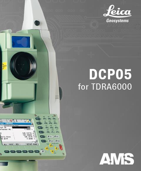
DCP Pocket for TDRA6000. Gerald Koeck / Commercial Support November 2011
|
|
|
- Georgina Blake
- 6 years ago
- Views:
Transcription
1 DCP Pocket for TDRA6000 Gerald Koeck / Commercial Support November
")
 8-10 hours of continuous operation Various accessories such as hand strap, neck strap, docking station, carrying")
2 DCP Pocket for TDRA6000 Features of the new Getac Pocket PC solution with DCP Pocket: Mobile Metrology software solution DCP Pocket RS232, USB and Bluetooth communication Integrated Auto Focus Camera for reporting Integrated weather station (Temperature & Air Pressure) IP67 Standard (waterproof) MIL-STD 810G (shockproof) Sunlight readable display 480X640 pixels (Touch Screen) Field replaceable battery with 5600mAh (Li-Ion) 8-10 hours of continuous operation Various accessories such as hand strap, neck strap, docking station, carrying bag, etc. 2

 or USB cable connection.")

3 DCP Pocket - Communication Communication to the TDRA6000 or a Laptop is established via Bluetooth connection. Data exchange between the Pocket PC and Laptop via Bluetooth (PIM service) or USB cable connection. DCP Pocket will automatically reconnect if BT communication is out of range! Bluetooth (class2) wireless connection with 10-15m range 3


4 DCP Pocket Main Menu Job Setup File handling and measurement default settings Coordinate Systems Alignments, Move Station and Coordinate System Management Features Feature based measurements and Scanning Data Exchange Jobfile Import/Export via Bluetooth Data Viewer Data viewer for measurement data Instrument Steering Remote controlled instrument steering 4


5 DCP Pocket Job Setup Open Opens an existing jobfile New Create a new jobfile (with active alignment import option) Settings Measurement default settings Continue Continues directly to the alignment menu Connect Establishes BT communication to selected sensor BT Status BT communication status (auto connect) 5

6 DCP Pocket Job Settings 2 Face Option for manual and automatic 2 Face measurements CS Left and Right Handed Coordinate Systems are supported Average Number of points used for averaged coordinates Overwrite An warning will be shown if overwriting coordinates Offset Active Offset values will be shown with every recording Increment Point ID`s are automatically incremented 6


7 DCP Pocket Coordinate Systems Best Fit Best-Fit alignment to multiple points or circle centers Plane Line Point alignment with gravity option Move Station Move station process with gravity option CS Manager Managing and activating Coordinate Systems 7
 and Actuals/Measured (Instrument Coordinate")
8 DCP Pocket Best-Fit Alignment Best-Fit Routine will calculate a Best-Fit alignment with RMS deviations based on Nominals (Ship Coordinate System) and Actuals/Measured (Instrument Coordinate System). 8


9 DCP Pocket Best-Fit Alignment The Best- Fit Process: Setup Definition of number of points. Gravity option offers 2 point Best-Fit alignment Measure Measurement with Special Measurement Options. Nominals can be imported or hand entered Result Best- Fit results Details De-selecting and recalculation of alignment is possible in the detail page To Measurement Record Data Show deviation details Saves Alignment 9

10 DCP Pocket 321 Alignment Alignment Routine will calculate the alignment to the ship coordinate system based on plane and line directions and an origin point with known XYZ coordinates. Gravity based alignments are possible. 10


11 DCP Pocket 321 Alignment (1/2) The 321 Alignment process will guide the user through the Plane, Line and Origin Point measurement. Example of the Plane measurement process: Setup Definition of Alignment. Status view of alignment features Plane Setup Definition of plane points and selection of gravity option Measure Guided measurement of plane points Results Display of the plane alignment feature To Plane Setup To Measurement Plane point recording Saves feature and returns to Alignment Setup page 11


12 DCP Pocket 321 Alignment (2/2) The status of the required alignment features is shown every time a feature measurement has been completed: Setup Plane measurement complete with green status Setup Plane and Line measurement complete with green status Setup All alignment features are measured (green status). Origin coordinates X,Y,Z are displayed for verification Alignment features are stored and can be reviewed in the Data Viewer Saves and activates alignment 12


13 DCP Pocket Move Station Operator can select between automatic and manual target matching. Automatic mode will continuously calculate a Best-Fit while measuring the common pass points. Station 1 measured 3 Pass Points for the Move Station process Station 2 without measurements NOT Oriented Station 2 measured 3 Pass Points with automatic matching. Points can be measured in any sequence. Results of moved station with solution values. 13

14 DCP Pocket CS Manager CS3 CS1 CS2 CS Manager Multiple coordinate systems can be created with DCP Pocket. Switching between these coordinate systems is possible within the same jobfile. 14


15 DCP Pocket CS Manager Active coordinate systems can be inherited from an existing job if required. Within a jobfile is possible to switch between coordinate systems or delete alignments if necessary. Delete Removes selected CS from jobfile Activate Activates selected CS for current jobfile 15


 Distance Distance")
16 DCP Pocket - Features Point Point measurement or point construction Point Set Measurement of a Point Set with a specified RMS Scan Area or plane scan (reflectorless mode) Line Line measurement or line construction (scan option) Plane Plane measurement (scan option) Circle Circle measurement Angle Angle analysis (line-line / plane-line) Distance Distance analysis (points, planes, lines, circle centers) 16


17 DCP Pocket Point Feature The Measurement Flow of a Point Feature: Setup Point definition, Nominal and tolerance value definition. Measure Measurement with Special Measurement Options Result Measured values with deviations Settings Reflector selection and offset definitions To Measurement Motorized Positioning Measure new point Save and close Record Data 17

18 DCP Pocket Point Feature Construction The construction of Midpoints between Line-Line and Point-Point can be calculated with the Point Feature function: Setup Select Construction Mode To Feature selection Construction Select the construction features Results Shows the calculated Midpoint Save and close 18
19 DCP Pocket Point Feature Construction The construction of Intersection Points between Plane-Line and 3 Planes can be calculated with the Point Feature function: Setup Select Construction Mode To Feature selection Construction Select the intersecting features Results Shows the calculated Intersection Point Save and close 19


20 DCP Pocket Line Feature Construction The construction of Line between 2 intersecting Planes can be calculated with the Line Feature function: Setup Select Construction Mode To Feature selection Construction Select the intersecting features Results Shows the calculated Intersection Line 20


21 DCP Pocket Special Measurement Modes Special Measurement options are available in all measurement and alignment modes: Hidden Point Linear Hidden Point measurement Circle Center Circle center measurement Separate Recording Separate recording of DIST and REC X or Y or Z Single or Dual Coordinate measurement Vision Mode Line of sight intersection point (measured or selected plane) 21

22 DCP Pocket Special Measurement Modes (1/3) In many cases the nominal positions are not directly visible (hidden) or can not be measured in a conventional way. Special Measurement will cover most these cases. Hidden Point measurement with a linear device. Point 5/5 Point 4/5 Point 3/5 Point 2/5 Point 1/5 XYZ Result Separate Recording of X, Y and/or Z values in case of a missing edge or corner point. Z X XYZ Result Y 22
 Circle Center measurement with or")

23 DCP Pocket Special Measurement Modes (2/3) Circle Center measurement with or without projection plane XYZ Result Separate Recording of distance and angles XYZ Result 23


24 DCP Pocket Special Measurement Modes (3/3) Vision Point measurement with intersection plane (e.g. circle hole) A Vision Point result is created when the line of sight is intersecting the selected/measured plane. Basically a mixture of separate recording or a feature measurement with a projection plane. 24

25 DCP Pocket Circle Feature Circle Best- Fit Routine calculates planar and radial deviations of the measured circle feature. 25


26 DCP Pocket Circle Feature The measurement flow for Line and Plane is identical Advanced Setup Tolerances and Nominal values can be defined or imported from DCP Project Setup Circle measurement definition Result Circle results with deviations Details Circle point deviations To Measurement Show circle points with deviations Save and close 26

27 DCP Pocket Plane Feature Plane Best- Fit Routine calculates planar deviations, origin and plane direction 27


28 DCP Pocket Plane Feature Plane Features can be measured, constructed or scanned: Setup Tolerances and Nominal values can be defined or imported from DCP Project Measurement Measurement of plane points Result Plane results with deviations Details Planar deviations in detail To Measurement Record Data Show Plane point deviations Save and close 28


29 DCP Pocket Scanning Scanning Routine offers reflectorless scanning of surfaces with user definable boundary and point spacing. 29


30 DCP Pocket Measurement Flow Scanning The measurement of a Line or Plane is scan in reflectorless mode: Setup Definition of Scan Resolution (Grid size) and measurement of Boundary Points Measurement Display of # Scan Points Measurement Progress Bar Results Scan Point Cloud Data. Record Boundary Pts. Start Scanning Process 30

31 DCP Pocket Point Set Point Set A set of points with nominal coordinates can be measured in the optional automatic mode. Automatic measurements are ideal for repetitive measurements or positioning of components. 31


32 DCP Pocket Point Set Point Sets can be measured automatically and are typically imported from DCP Project: Setup Definition of number of points and common tolerance. Measurement Selection of Automatic Mode. Measurement Deviations of each point are shown for 1 second Results Point Set Deviations To Measurement Page Mode Selection 32

33 DCP Pocket Angle Feature Angle Feature Calculation from existing features or direct measurement of angle features. 33


34 DCP Pocket Angle Feature Angle features can be measured or constructed: Setup Nominal angle value can be hand entered or imported from DCP Project Measurement Measurement of angle feature points Result Angle Result To Measurement Record Data Save and close 34

35 DCP Pocket Distance Feature Distance Feature Calculation from measured features or direct measurement of 3D distances. 35


36 DCP Pocket Distance Feature Distance features can be measured or constructed: Setup Nominal distance value can be hand entered or imported from DCP Project Measurement Measurement of distance feature points Result Distance Result To Measurement Record Data Save and close 36


37 DCP Pocket Data Viewer Tree style display of feature groups Tolerance based background color of features. Display of Nominal and Actual data with deviations. Origin coordinate, unit vector and used feature points are included for data review. Laser Pointer to identify selected feature on the object. 37
 from the list. Select the files for data transfer to the workstation.")
38 DCP Pocket Data Exchange (1/4) Transferring Job Files from DCP Pocket to a PC : Select the corresponding Workstation with activated PIM (Bluetooth Data Synchronization) from the list. Select the files for data transfer to the workstation. A notification will be displayed at your workstation once the job files have been received. 38

39 DCP Pocket Data Exchange (2/4) Transferring Job Files from a PC to DCP Pocket: Select a job file and send it to the corresponding Pocket PC. A notification will be displayed once the data has been transmitted to the Pocket PC. 39
 from the list.")

40 DCP Pocket Data Exchange (3/4) Transferring Job Files from DCP Pocket to a PC : Select the corresponding Workstation with activated PIM (Bluetooth Data Synchronization) from the list. Select the files for data transfer to the workstation Select on the BT Device utility the Receive a File option A notification will be displayed at your workstation once the job files have been received 40


41 DCP Pocket Data Exchange (4/4) Transferring Job Files from a PC to DCP Pocket: Select the Pocket PC device Select on the BT Device utility the Send a File option Select a job file and send it to the corresponding Pocket PC A notification will be displayed once the data has been transmitted to the Pocket PC 41
42 DCP Project for DCP Pocket and DCP05 42


43 DCP Project DCP Project is compatible with DCP Pocket and DCP05. Project planning and reporting will be done with DCP Project. Workstation with DCP Project On-board Application DCP05 for TDRA6000 Pocket PC Application DCP Pocket for TDRA6000 Measurement Reports 43

44 DCP Project Data Tree The tree structured data viewer offers convenient reviewing and planning of the complete measurement task. 44


45 DCP Project - Alignments Data review of alignment types and Best-Fit deviation table. 45


46 DCP Project - Stations Multiple Stations results and with individual deviation tables: 46

47 DCP Project - Features Point features with deviation table: 47


48 DCP Project - Analysis Result table of measured or calculated distances and angles: 48
49 DCP Project - Reports All or individual data groups can be reported: 49
 Data Viewer with Feature Group")
50 TDRA6000 with DCP Pocket/Project - Summary Wireless Sensor Communication / Data Exchange IP54 / 67 Standard for truly Industrial Applications Sunlight readable touch screens Feature Based Measurements and Reflectorless Scanning Automatic Point Recognition during Move Station Process Motorized and Automatic Inspection (AIM and Point Set Positioning) Data Viewer with Feature Group Display and Laser Pointer Function DCP Project compatible with DCP Pocket and DCP 05 Onboard 50


51
DCP Pocket for Leica TDRA6000 Mobile and ruggedized large-volume metrology package
 www.leica-geosystems.com/metrology DCP Pocket for Leica TDRA6000 Mobile and ruggedized large-volume metrology package DCP Pocket for Leica TDRA6000 - Feature based measurements - Scanning - Angle and distance
DCP05 for TDRA6000 Software Structure V8.9
 DCP05 for TDRA6000 Software Structure V8.9 1 DCP 05 for TDRA6000 Basics Navigation and function selection is done via Arrow and Function Keys F1-F6. The 2 nd layer of function keys can be displayed by
Leica TDRA6000 Product Brochure
 Leica TDRA6000 Product Brochure Version 01/2009 www.leica-geosystems.com/metrology The Laser Station Leica TDRA6000 The Leica TDRA6000 Laser Station is a portable inspection system designed for precision
Leica Absolute Tracker AT401 Absolutely portable
 www.leica-geosystems.com/metrology Leica Absolute Tracker AT401 Absolutely portable Leica Absolute Tracker Absolutely portable» The Leica Absolute Tracker AT401 is a portable coordinate measuring machine
Leica Viva SmartWorx Viva on TS
 Leica Viva SmartWorx Viva on TS Contents 2. Volumes 3. Check & Adjust 4. CS Connection Wizard 5. Robotic Screen 6. Summary 2 Contents 2. Volumes 3. Check & Adjust 4. CS Connection Wizard 5. Robotic Screen
All rights reserved. The rights of DCP05 are owned by A.M.S. Accuracy Management Services Ltd., Oulu, Finland.
 Proprietary information Information in this document is subject to change without notice. Companies, names, and data used in examples herein are fictitious unless otherwise noted. No part of this document
AV300 VIDEO MEASURING SYSTEM.
 VIDEO MEASURING SYSTEM www.starrett-precision.co.uk 2 Starrett - Total Solution Provider Contents Page With Starrett Metrology products, the system is only a part of the whole package. From application
Juniper Systems, Inc West 1700 North Logan, Utah, TEL WEB
 Juniper Systems, Inc. 1132 West 1700 North Logan, Utah, 84321 TEL 435.753.1896 EMAIL js@junipersys.com WEB www.junipersys.com The ultra-rugged Archer Field PC is your reliable field companion. It is rock
Provided by Xpert Survey Equipment Click Topcon GPT-8003A for Product Info and Updated Pricing GPT-8000A/GTS-810A SERIES AUTO TRACKING TOTAL STATION
 Provided by Xpert Survey Equipment Click Topcon GPT-8003A for Product Info and Updated Pricing GPT-8000A/GTS-810A SERIES AUTO TRACKING TOTAL STATION The Solo Survey System that puts you in control The
Alignment Software for Linear Guides
 Alignment Software for Linear Guides You have made a good choice..., in combination with the display unit, is the optimum solution for the alignment of linear guides. The following functions and characteristics
Leica Builder... Built to Build
 Leica Builder... Built to Build Leica Builder... Built to Build Instead of tediously setting up strings, with the Builder T100 my masons can start work right away. The Builder T100 or T200 can determine
Leica FlexLine TS09plus Full Precision at High Performance
 Leica FlexLine TS09plus Full Precision at High Performance The First Plus: Original Leica Geosystems Quality For most, quality is relative. Not so at Leica Geosystems. To ensure our instruments meet the
Parallel Roll Alignment Software
 Parallel Roll Alignment Software You have made a good choice..., in combination with the display unit, is the optimum solution for the alignment of parallel rolls. The following functions and characteristics
AV300 VIDEO MEASURING SYSTEM.
 VIDEO MEASURING SYSTEM www.starrett-precision.co.uk Starrett - Total Solution Provider With Starrett Metrology products, the system is only a part of the whole package. From application analysis, system
TAG GD700 rugged tablet
 white paper TAG GD700 rugged tablet Designed to be ready for always-connected duty The TAG GD700 Suitable for a wide range of deployments The TAG GD700 is a 7-inch tablet that s part of TAG Global System
GeoMax Total Station Zoom30 Series
 GeoMax Total Station Zoom30 Series GeoMax About Us GeoMax is an internationally active company developing, manufacturing and distributing quality construction and surveying instruments. We provide a comprehensive
GD_MD_GJ C C SERIES. High Performance Thermographic IR Camera
 GD_MD_GJ161202 C C SERIES High Performance Thermographic IR Camera www.aptgroup.com.au info@aptgroup.com.au 1300700002 C SERIES High Performance Thermographic IR Camera Guide Infrared C series thermographic
Leica Builder... Built to Build
 Leica Builder... Built to Build Leica Builder... Built to Build Instead of tediously setting up strings, with the Builder T100 my masons can start work right away. The Builder T100 or T200 can determine
Alignment Software for Bearing Ways and Bores
 Alignment Software for Bearing Ways and Bores A well-rounded system, in combination with the display unit, is the optimum solution for the alignment of bearing ways and bores. The following functions and
3D Laser Scanner VS1000 User Manual
 3D Laser Scanner VS1000 User Manual 1 VS1000 Introduction SMART MAX GEOSYSTEMS CO., LTD VS1000 3D Laser Scanner based on pulses ranging principle, could quick acquire massive point cloud data from the
Nautiz Handheld Mobile Phone Comparison
 Nautiz Handheld Mobile Phone Comparison NAUTIZ 2X, 4X, 8X MANGOESMAPPING PTY LTD Nautiz 2X Nautiz 4X Nautiz 8X Size 150 mm x 73.5 mm x 16 mm 156 mm x 74 mm x 25.5 mm (6.1" x 2.9" x 1.0") 190.9 mm x 79.7
ROTALIGN touch Precision Meets Connectivity
 ROTALIGN touch Precision Meets Connectivity A new way to align Laser alignment tool for the smart factory ROTALIGN touch is the first cloud-enabled touchscreen laser shaft alignment system with integrated
Softrock GeoMos Manual For AutoSlope Users
 Softrock GeoMos Manual For AutoSlope Users Software Version 5 Manual Version 1.6 Softrock Solutions specialise in slope monitoring. We have developed software and systems that will assist you with your
GeoMax Total Station Zoom30 Series
 GeoMax Total Station Zoom30 Series GeoMax About Us GeoMax is an internationally nology group with strong mar- The close cooperation within active company developing, ket positions within measure- the Hexagon
Leica Absolute Trackers
 PRODUCT BROCHURE Leica Absolute Trackers Probing Solutions Leica Absolute Tracker AT402 and B-Probe ENTRY-LEVEL ULTRA-PORTABLE Probing System The Leica B-Probe is a handheld and battery-powered point probing
Leica FlexLine TS06plus Top Precision meets High Efficiency
 Leica FlexLine TS06plus Top Precision meets High Efficiency The First Plus: Original Leica Geosystems Quality For most, quality is relative. Not so at Leica Geosystems. To ensure our instruments meet the
Fully rugged at a lower price without compromising on quality, guaranteed!
 Fully rugged at a lower price without compromising on quality, guaranteed! A reliable companion in every situation our tablets accompany business in their mobility solutions, with rugged Windows or Android
Leica TPS800 Series Powerful, efficient, reliable and intuitive. PinPoint Technology
 Leica TPS800 Series Powerful, efficient, reliable and intuitive PinPoint Technology powerful Leica TPS800 Performance Series... Three classes of accuracy TPS800 total stations are available in angular
Portable Ground Control Station Sentinels portable Ground Control Station (GCS) is designed for controlling unmanned vehicles
 is designed for controlling unmanned vehicles") Portable Ground Control Station Sentinels portable Ground Control Station (GCS) is designed for controlling unmanned vehicles Key Features UAV Factory s off-the-shelf portable Ground Control Station (GCS)
Portable Ground Control Station Sentinels portable Ground Control Station (GCS) is designed for controlling unmanned vehicles Key Features UAV Factory s off-the-shelf portable Ground Control Station (GCS)
X-Rite MA98 Portable Multi-Angle Spectrophotometers
 X-Rite MA98 Portable Multi-Angle Spectrophotometers Color can make or break a product. Metallics, pearlescents, and other complex special effect finishes deliver limitless possibilities for enhancing product
Advanced Vision Guided Robotics. David Bruce Engineering Manager FANUC America Corporation
 Advanced Vision Guided Robotics David Bruce Engineering Manager FANUC America Corporation Traditional Vision vs. Vision based Robot Guidance Traditional Machine Vision Determine if a product passes or
BIT. Borehole Inclination Tester. Advanced, Friendly, Robust. Product Data Sheet
 BIT Borehole Inclination Tester Advanced, Friendly, Robust Product Data Sheet BIT Model 2.0 BIT Borehole Inclination Tester All piling specifications prescribe the allowable deviation of the pile axis
WTS Inclinometer. All-weather radio telemetry Inclinometer system. Features. WTS Wireless Inclinometer. Dimensions
 WTS Inclinometer All-weather radio telemetry Inclinometer system Features Advanced MEMS inclinometer design for ultra-reliability and performance Distortion free digital 2 way radio system for data integrity
Image Measuring Instrument
 EASY QUICK ACCURATE SAVE Time & Cost Improved efficiency & accuracy L26 All new Image Measuring Instrument Top Series come with new innovative design in structural quality, functionality, and accuracy,
DATA COLLECTORS FC-100 / FC-2000
 FC-100 / FC-2000 DATA COLLECTORS Topcon Field Computers; FC-100 and FC-2000 Compact, ultra bright, sealed and sturdy field computers. The demands of modern field data collection and control have changed
Leica TM6100A Industrial Theodolite Product Brochure
 www.leica-geosystems.com/metrology Leica TM6100A Industrial Theodolite Product Brochure Always exceeding the standards Leica Geosystems Leica Geosystems Industrial Theodolites are known around the world
ROTALIGN touch Precision Meets Connectivity
 ROTALIGN touch Precision Meets Connectivity A new way to align Laser alignment tool for the smart factory ROTALIGN touch is the first cloud-enabled touchscreen laser shaft alignment system with integrated
Ch 22 Inspection Technologies
 Ch 22 Inspection Technologies Sections: 1. Inspection Metrology 2. Contact vs. Noncontact Inspection Techniques 3. Conventional Measuring and Gaging Techniques 4. Coordinate Measuring Machines 5. Surface
Tablet PC System Solution
 Tablet PC System Solution ENTERPRISE MOBILITY INTERCONNECT, PROTECT, OPTIMIZE Communication and collaboration in hazardous areas become increasingly important. Cameras, smartphones and tablet PCs which
SKF Shaft Alignment Tool Vertical machines app
 SKF Shaft Alignment Tool Vertical machines app Flange mounted machines Instructions for use Table of contents 1. Using the Vertical shaft alignment app... 2 1.1 How to change the app language...2 1.2
Gregory Walsh, Ph.D. San Ramon, CA January 25, 2011
 Leica ScanStation:: Calibration and QA Gregory Walsh, Ph.D. San Ramon, CA January 25, 2011 1. Summary Leica Geosystems, in creating the Leica Scanstation family of products, has designed and conducted
Provided by Xpert Survey Equipment Click Topcon GPT-8205A for Product Info and Updated Pricing GPT-8200A/GTS-820A SERIES AUTO TRACKING TOTAL STATION
 Provided by Xpert Survey Equipment Click Topcon GPT-8205A for Product Info and Updated Pricing GPT-8200A/GTS-820A SERIES AUTO TRACKING TOTAL STATION The Solo Survey System that puts you in control The
TECHNOLOGY SOLUTIONS TRANSFORMING CONSTRUCTION LAYOUT. Trimble Field Link TRANSFORMING THE WAY THE WORLD WORKS
 TECHNOLOGY SOLUTIONS TRANSFORMING CONSTRUCTION LAYOUT Taking full advantage of the Trimble Tablet s processor and multi-touch screen functionality, has been designed to work the way you work. Featuring
Leica Viva TS11 & TS15 Hardware
 Leica Viva TS11 & TS15 Hardware Contents 1. Introduction 2. Product Variants 3. Side Cover 4. Display and Keyboard 5. Environmental Rating 6. Telescope 8. Operating System & Software 9. Summary 1. Introduction
Leica FlexLine plus. Product Presentation V4.00
 Leica FlexLine plus Product Presentation V4.00 Leica FlexLine plus Table of contents 1. FlexLine plus - Product Concept 2. FlexLine plus - Hardware Features 3. FlexField plus - Onboard Firmware 4. FlexLine
Bag Lifting Tethering Crane Lifting Debogging Transport. No. 2: Customized package
 Recovery Manager Software All recovery methods in one software Your next recovery will be much smoother with SefrinTec. SefrinTec s perfect interaction between the pressure-sensitive sensors inside the
TPS1100 Professional Series
 20 30 40 50 TPS1100 Professional Series Application programs Field Manual 2 English Version 1.0 The quick way to start with the TPS1100 Programs. 2 For additional details on single TPS1100 application
Galileo Standard Series
 Galileo Standard Series AV200 AV300 AV350 EZ200 EZ300 Galileo AV300 The Galileo AV300 combines high-resolution images with the latest software and a precision mechanical platform to deliver 12" x 6" x
Thank you for buying a ZEPCAM T2. We hope you will enjoy our product as much as we enjoyed creating it.
 1 Thank you for buying a ZEPCAM T2. We hope you will enjoy our product as much as we enjoyed creating it. Before starting please check: If the product or the packaging is not visibly damaged. Make sure
PCMM System Specifications Leica Absolute Tracker and Leica T-Products
 www.leica-geosystems.com/metrology PCMM System Specifications Leica Absolute Tracker and Leica T-Products Leica Absolute Tracker accuracy The measurement uncertainty of a coordinate U xyz is defined as
INSTALERT VARIABLE MESSAGE SIGN
 PRODUCT SPECIFICATIONS: INSTALERT VARIABLE MESSAGE SIGN InstAlert Variable Message Sign Open Dimensions: 1 5/8 x 28 x 60 Folded Dimensions: 3 ¼ x 28 x 30 Folded sign fits in police cruiser trunk, SUV hatch
PCMM System Specifications Leica Absolute Tracker and Leica T-Products
 www.leica-geosystems.com/metrology PCMM System Specifications Leica Absolute Tracker and Leica T-Products Leica Absolute Tracker accuracy Feature Benefit The measurement uncertainty of a coordinate U xyz
TAG GD3030 rugged tablet
 white paper TAG GD3030 rugged tablet The rugged design that boost efficiency in critical situations The TAG GD3030 Makes Every Task More Efficient The TAG GD3030 is the latest 10.1 IP65 Windows tablet
VECTRA-TOUCH
 179 introduction The «Vectra-Touch» height measuring instruments are of universal use in any production field. They are the result of 30 years of experience in development and manufacturing. This experience
Increase Field Survey Efficiency by Merging Technologies in NOVA MultiStation. Vincent Lui Leica Geosystems Ltd
 Increase Field Survey Efficiency by Merging Technologies in NOVA MultiStation Vincent Lui Leica Geosystems Ltd Advantages of Laser Scanning Advantages of TPS Measurements Advantages of Imaging Advantages
Leica Captivate. Software Release Notes. Field Controllers: CS20, CS35 Total Stations: TS16, TS60, MS60. Release date 1 st December 2017
 Leica Captivate v3.00 Software Release Notes Product Leica Captivate Field Controllers: CS20, CS35 Total Stations: TS16, TS60, MS60 Release date 1 st December 2017 Maintenance date 1 st December 2017 Available
Leica Industrial Theodolites & Total Stations Precision in Large-Scale Measurement
 Leica Industrial Theodolites & Total Stations Precision in Large-Scale Measurement - when it has to be right Discoveries in Every Dimension Low-Cost Measurement No matter your industrial measurement requirements
SUPPORT KIT. for sales trainers and store staff. How to become a MyKronoz expert
 SUPPORT KIT for sales trainers and store staff How to become a MyKronoz expert LEARN UNDERSTAND MASTER Activity tracker with color touchscreen TIME ACTIVITY NOTIFICATIONS KEY FACTS Unique selling points
Survey Pro Software. Includes Spectra Precision Central: Spectra Precision s cloud computing solution. Survey Pro: Simply The Best
 Survey Pro Software Includes Spectra Precision Central: Spectra Precision s cloud computing solution. Survey Pro: Simply The Best SURVEY PROSimplicity, Reliability, and Security Spectra Precision Ranger
SP ProLine 30. Straightness Professional Package with IT. Another fine solution by PC /13
 Straightness Professional Package with IT PC 1020 11/13 Another fine solution by Content of Straightness Professional Package with IT T330 Self Levelling Sweep Laser (BG 830203) The T330 levelling laser
In North America call toll free: Fax
 WTS Inclinometer All-weather radio telemetry Inclinometer system Features Advanced MEMS inclinometer design for ultra-reliability and performance Distortion free digital 2 way radio system for data integrity
ROTALIGN touch Precision Meets Connectivity
 ROTALIGN touch Precision Meets Connectivity A new way to align Laser alignment tool for the smart factory ROTALIGN touch is the first cloud-enabled touchscreen laser shaft alignment system with integrated
X PAD Construction 2.5.5
 News X PAD Construction January 2014 X PAD Construction 2.5.5 This document contains a list of all changes, new features, bug fixed introduced in this last version of X PAD Construction. GPS RTCM3.1: RTCM3.1
Handheld Mobile Computer SIRIO 4000 User Manual
 Handheld Mobile Computer SIRIO 4000 User Manual CATALOGUE Chapter 1 Getting Started... 4 Chapter 2 About The Device... 6 Chapter 3 Call Function... 8 Chapter 4 Barcode Reader... 10 Chapter 5 RFID Reader...
What s New In SA CHAPTER
 What s New In SA CHAPTER 1 One of the advantages of SpatialAnalyzer is that development occurs at a brisk pace. New feature requests, bug fixes, and changes are implemented quickly, giving you the opportunity
SURVEY PRODUCT CATALOG
 NIKON SURVEY PRODUCT CATALOG WWW.NIKONPOSITIONING.COM Contents Nikon Products Nikon Total Stations 1 10 Nikon Theodolites 11 14 Nikon Auto Levels 15 18 Accessories Nikon Total Station Accessories 19 Nikon
Industrial Metrology. Multisensor Measuring Machines O-INSPECT 322/442
 Industrial Metrology Multisensor Measuring Machines O-INSPECT 322/442 The moment the answer is right in front of your eyes. This is the moment we work for. // Certainty Made By Zeiss 2 Table of Contents
TPS1100 Professional Series
 20 30 40 50 TPS1100 Professional Series Application programs Field Manual 2 English Version 2.1 The quick way to start with the TPS1100 Programs. 2 For additional details on single TPS1100 application
Rugged Mobile Computer PT21 / PT26. Portable Innovation Technology The Power Behind Your Rugged Mobile Computing
 Rugged Mobile Computer PT21 / PT26 The Power Behind Your Rugged Mobile Computing Application If you are looking for a mobile computer that you can collect data for a whole day, your search is over. PT21
What s New In SA CHAPTER
 What s New In SA CHAPTER 1 One of the advantages of SpatialAnalyzer is that development occurs at a brisk pace. New feature requests, bug fixes, and changes are implemented quickly, giving you the opportunity
V-STARS Measurement Report
 V-STARS Measurement Report Introduction: The following report is a summary of the V-STARS work carried out at an Aerospace facility in Winnipeg Canada. Four measurements were undertaken using the V-STARS
Geomagic Leica Tracker Plug-In 1.0 User s Manual
 Geomagic Leica Tracker Plug-In 1.0 User s Manual Document version 1.0.1 Overview The Geomagic Leica Tracker Plug-In supports the Leica AT901 Laser Tracker in Geomagic Qualify, Geomagic Qualify Probe, Geomagic
STEALTH SERIES SHAFT ALIGNMENT SYSTEMS S T W I R E L E S S 5 - A X I S
 ALIGN WITH THE BEST STEALTH SERIES SHAFT ALIGNMENT SYSTEMS S - 6 8 0 T W I R E L E S S 5 - A X I S Highest Accuracy in Industry Win 7/8 IP65 Rugged Tablets 10" Outdoor Touchscreen Display Patented Dual-Beam
AUTOMATIC MODELLING METHOD FOR STEEL STRUCTURES USING PHOTOGRAMMETRY
 AUTOMATIC MODELLING METHOD FOR STEEL STRUCTURES USING PHOTOGRAMMETRY S. H. Jung a, J. H. Yu a*, J. K. Lee b, L. Ge a a School of Surveying and Spatial Information Systems, University of New South Wales,
TECHNICAL NOTES TRIMBLE SURVEY CONTROLLER SOFTWARE
 TRIMBLE SURVEY CONTROLLER SOFTWARE TECHNICAL NOTES The Trimble Survey Controller software is the data collection solution that will make your survey work faster, easier, and more productive than ever before.
IRISPen Air 7. Quick User Guide. (ios)
") IRISPen Air 7 Quick User Guide (ios) This Quick User Guide helps you get started with the IRISPen TM Air 7. Please read this guide before operating this scanner and its software. All information is subject
IRISPen Air 7 Quick User Guide (ios) This Quick User Guide helps you get started with the IRISPen TM Air 7. Please read this guide before operating this scanner and its software. All information is subject
501, , 1052, , 1602, 1604 EXCEL EXCEL 1602UC EXCEL 1052UC EXCEL 501HC. Micro-Vu Corporation. Precision Measurement Systems
 501, 502 1051, 1052, 1054 1601, 1602, 1604 1602UC 1052UC 501HC Precision Measurement Systems 501, 502 1051, 1052, 1054 1601, 1602, 1604 Excel 501 HM/HC Excel 502 HM/HC Excel 501 Excel 502 Scale Resolution
MetLogix M2 Measuring Solution Features
 MetLogix M2 Measuring Solution Features Supporting popular measuring microscope and optical comparator systems worldwide. Features & Benefits Clean, Intuitive Design The user interface design of the M2
2012 Product Catalogue
 It s Professional 2012 Product Catalogue FOIF Canada Inc. 4180 Boul. Thimens Saint-Laurent, QC, H4R 2B9, Canada Tel: +1 (514) 336-0003 Fax: +1 (514) 336-0300 Email: info@foif.ca Web: www.foif.ca 2 2012
Portable Ground Control Station
 Portable Ground Control Station A Universal Off-the Shelf Solution Datasheet V2.1 System Overview UAV Factory s off-the-shelf portable Ground Control Station (GCS) is a flexible and universal solution
Roll angle in 6DOF tracking. CMSC Charlotte-Concord, July 2008
 Roll angle in 6DOF tracking CMSC Charlotte-Concord, July 2008 Author: Stephen Kyle Senior honorary research fellow, University College London Honorary research fellow, Coventry University Presenter: Steven
Introduction to 3D Machine Vision
 Introduction to 3D Machine Vision 1 Many methods for 3D machine vision Use Triangulation (Geometry) to Determine the Depth of an Object By Different Methods: Single Line Laser Scan Stereo Triangulation
GeoMax TPS family. Works when you do.
 Works when you do GeoMax TPS family GeoMax has a complete TPS portfolio to fulfill the needs of all users. Ensure ultimate reliability with GeoMax TPS systems even in challenging environments. Providing
MV300 VIDEO MEASURING SYSTEM.
 VIDEO MEASURING SYSTEM www.starrett-precision.co.uk Starrett - Total Solution Provider With Starrett Metrology products, the system is only a part of the whole package. From application analysis, system
User s guide. November LSE S.r.l. All rights reserved
 User s guide November 2015 2015 LSE S.r.l. All rights reserved WARNING In writing this manual every care has been taken to offer the most updated, correct and clear information possible; however unwanted
PRODUCT BROCHURE TIGO SF. 3D coordinate measuring machine for the shop floor
 PRODUCT BROCHURE TIGO SF 3D coordinate measuring machine for the shop floor 2 TIGO SF Coordinate measuring machine for the shop floor ONE FLOW WITH TIGO SF In production you are aiming at a constant flow
First choice for every job. The new thermal imagers testo have the best image in their class,
 Thermography App First choice for every job. The new thermal imagers 865 872 have the best image in their class, 1 making it easier than ever before for you to examine buildings and systems. One of many
OPTALIGN smart RS5 The power of precision shaft alignment
 OPTALIGN smart RS5 The power of precision shaft alignment Always one step ahead with precision shaft alignment RS5 technology 5-axis XL HD PSD Precision built-in inclinometer Ambient light compensation
MetLogix M3 Measuring Solution Features
 MetLogix M3 Measuring Solution Features Supporting industry-leading, video-based metrology equipment worldwide. Features & Benefits Designed for Multi-Touch software control. In addition to the conventional
Shortcut and Hot keys available from the main Geomet screen.
 Editor Keys Function Description Junior 101 GeoPlus 301 GeoCad DCC Future Development The Bisector routine determines the bisecting or symmetry a Bisector feature between the last two compatible features
ND 1202 ND 1203 ND monochrome flat-panel display for position values, dialogs and inputs, graphics functions and soft keys
 ND 1202 ND 1203 ND 1204 Axes* 2 (XY) 3 (XYQ) or 3 (XYZ) 4 (XYZQ) Encoder inputs*» 1 V PP or «TTL (other interfaces upon request) Subdivision factor 10-fold (only for 1 V PP ) Display step 1) Display Functions
Automatically search for holes and locate hole centers to offset measurement
 New Tools in PolyWorks 2018 InnovMetric Software Inc. All rights reserved. PolyWorks is a registered trademark of InnovMetric Software Inc. InnovMetric, PolyWorks Inspector, PolyWorks Modeler, PolyWorks
Portable Miniature DVR
 DVR-601 Portable Miniature DVR > Good coverture > PIR detective recording and stop automatically > Detection recording integrated with alarm perfectly > Internal Lithium battery > Internal microphone >
Leica FlexLine Equipment List
 Leica FlexLine Equipment List FlexLine Equipment List TS02 Instruments Total Stations for Prism Measurements 765268 TS02, 3"(1mgon) total station, laser plummet, 1 standard keyboard, user manual 765265
NEW - Quick Mode - The revolutionary way to simplify measurement!
 + D i g i m a r NEW - Quick Mode - The revolutionary way to simplify measurement! The new Height Measuring Instrument Digimar 817 CLM Quick Height 2 Digimar 817 CLM Quick Height The new Height Measuring
8. Hidden Surface Elimination
 8. Hidden Surface Elimination Identification and Removal of parts of picture that are not visible from a chosen viewing position. 1 8. Hidden Surface Elimination Basic idea: Overwriting Paint things in
Part # Description List
 HT580 - Mobile Computer HT580 - MOBILE COMPUTER HT580-725AAG HT580, 1D CCD, DOS, BT, Li-Ion Battery, Power Supply, RS232/USB Cable, Case, Hand Strap $470.00 HT580-725ABG HT580, 1D CCD, DOS, BT, Li-Ion
LAR 350 rotation laser: Tough DUAL SLOPE laser kit Made in Germany. World s first MOTION CONTROL
 LAR 350 rotation laser: Tough DUAL SLOPE laser kit Made in Germany World s first MOTION CONTROL LAR 350 rotating laser with MOTION CONTROL: Welcome to the new age of laser control For serious professionals:
Portable MEMS Inclinometer
 DATASHEET Portable MEMS Inclinometer Proven MEMS technology Wireless communication to readout Lightweight Rugged construction On board calibration in probe Probes and reels are interchangeable Portable
Meet the Mesa Rugged Notepad featuring the advantages of both a tablet PC and a rugged handheld computer, without the disadvantages of either.
 Meet the Mesa Rugged Notepad featuring the advantages of both a tablet PC and a rugged handheld computer, without the disadvantages of either. The Mesa is a data collection powerhouse with massive screen