Forest Retrievals. using SAR Polarimetry. (Practical Session D3P2a)
|
|
|
- Kory Warren
- 6 years ago
- Views:
Transcription
 Laurent FERRO-FAMIL - Eric POTTIER University of")
1 Forest Retrievals using SAR Polarimetry (Practical Session D3P2a) Laurent FERRO-FAMIL - Eric POTTIER University of Rennes 1

2 Pol-InSAR Practical Forest Application
3


4 PolSARpro SIM PolSARproSim is a rapid, coherent, fully polarimetric and interferometric SAR simulation of forest.


5 PolSARpro SIM The SAR image is evaluated as a coherent sum of scattering events from small elements of the scene Direct-Ground, Direct-Volume and Ground-Volume contributions are included, with both trees and short vegetation comprising Volume terms. DECIDUOUS GV DG DV PINE RANDOM HEDGE Given the map of tree locations and dimensions a grid of points is used to sample the attenuation of the coherent wave in 3D
6 B = 10m PolSARpro SIM Pol-InSAR Data = 45 o h=3km r 2 r 1 h v =10m y Bragg Surface Scattering Geometric configuration Platform altitude : 3000m Incidence angle: 45 Horizontal Baseline : 10m Vertical Baseline : 0m System Configuration Frequency : 1.5 GHz Azimuth resolution : m Range resolution : m Ground Surface Configuration Surface properties : 0 (smoothest) Ground moisture Content : 0 (driest) Azimuth / Range ground slope : 0 % Forest configuration Tree Species : 0 (hedge) Tree Height: 10m Forest stand density : 0.2 Forest Stand Circular Area : 1 Ha
7 PolSARpro SIM DATA_MASTERDIR config.txt s11.bin, s12.bin s21.bin, s22.bin DATA_SLAVEDIR config.txt s11.bin, s12.bin s21.bin, s22.bin flat_earth.bin kz.bin
8 MAIN MENU
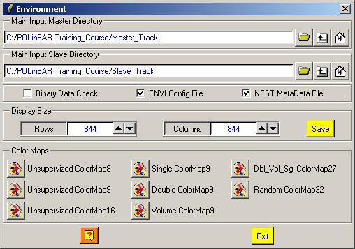
9 ENVIRONMENT Configure Data Main Directories location Input Master Directory: C:/Pol-InSAR_Training_Course/Master_Track Input Slave Directory: C:/Pol-InSAR_Training_Course/Slave_Track


10 PROCESS DATA
11 PROCESS DATA

12 ELEMENTS Do it Yourself: Select some elements, set the parameters and view the corresponding BMP files (select BMP).

13 ELEMENTS DATA_MASTERDIR config.txt s11.bin, s12.bin s21.bin, s22.bin Axy.bin, Ixy.bin Ixy_db.bin sxy_pha.bin Axy.bmp, Ixy.bmp Ixy_db.bmp sxy_pha.bmp
14 PROCESS DATA
15 RAW INTERFEROGRAM Do it Yourself: Select polarization channels, set the parameters and view the corresponding BMP files. Note: The Output Directory is automatically set to: MasterDir_SlaveDir
16 RAW INTERFEROGRAM DATA_MASTERDIR_SLAVEDIR config.txt interferogram_xx_xx.bin interferogram_xx_xx.bmp
17 PROCESS DATA

18 FLAT EARTH REMOVAL DATA_SLAVEDIR config.txt s11.bin, s12.bin s21.bin, s22.bin DATA_SLAVEDIR_FER config.txt s11.bin, s12.bin s21.bin, s22.bin Do it Yourself: Enter Flat Earth file name, set the parameters and run the function. Note: The Input Slave Directory is automatically set to: SlaveDir_FER
19 RAW INTERFEROGRAM Do it Yourself: Select polarization channels, set the parameters and view the corresponding BMP files. Note: The Output Directory is automatically set to: MasterDir_SlaveDir_FER

20 RAW INTERFEROGRAM DATA_MASTERDIR_SLAVEDIR_FER config.txt interferogram_xx_xx.bin interferogram_xx_xx.bmp
21 PROCESS DATA
22 COHERENCE ESTIMATION Do it Yourself: Select polarization channels (linear, circular, pauli), set the parameters (Box Car = 11x11) and view the corresponding BMP files (select BMP).

23 COHERENCE ESTIMATION DATA_MASTERDIR_SLAVEDIR_FER config.txt cmplx_coh_xx.bin cmplx_coh_xx_mod.bmp cmplx_coh_xx_pha.bmp
24 PROCESS DATA
25 HEIGHT ESTIMATION
26 HEIGHT ESTIMATION INVERSION PROCEDURES DEM Differencing Algorithm Coherence Amplitude Inversion Procedure Ground Phase Estimation RVOG Inversion Procedure


27 VOLUME COHERENCE MODEL Modeling z Parameter Estimation z h v h v 0 0 Simplifications : Only 2 significant mechanisms Low density medium No refraction
28 VOLUME COHERENCE MODEL VOL j 0 e h v 0 h f(ze) v 0 jkz z dz f(z) dz 0 k z Topographic Phase 4 sin( ) 0 Vertical Wavenumber POLARIZATION INDEPENDENT
29 VOLUME COHERENCE MODEL VOL j 0 e h v 0 h f(ze) v 0 jkz z dz f(z) dz Vertical Structure function z cos( ) f(z) e 0 Case of Uniform Random Layer 0 Incidence Angle Extinction Coefficient POLARIZATION INDEPENDENT
, S.R.")
30 RVOG COHERENCE MODEL RVOG = Random Volume Over Ground 2 Layer Combined Surface and random Volume Scattering w 1w w w e j 0 VOL Surface Scattering Contribution Volume Scattering Contribution B. Treuhaft (2000), S.R. Cloude (2003) POLARIZATION DEPENDENT G / V ratio
31 FOREST HEIGHT ESTIMATION w v Polarisation Channel corresponding to Volume Scattering j v e 0 VOL 0 w 2HV w s Polarisation Channel corresponding to Surface Scattering j we s ws e 0 1w 0VOL j s HH-VV
32 FOREST HEIGHT ESTIMATION 0 j0 we v VOL h v 1 w v j VOL w s Model 0 we s w s 1w s 4 Parameters 4 Observables INVERSION
33 v z 0 0 h jk s VOL s v j s VOL j v e w w w e w e w DEM Differencing Algorithm z s v v k ) w ( arg ) w ( arg h FOREST HEIGHT ESTIMATION
34 FOREST HEIGHT ESTIMATION Coherence Amplitude Inversion Procedure Assumption: Only Volume Scattering is present j0 wv e VOL wv VOL min h v ( w v ) p p 1 e e p 1 h ph v v D Search Procedure Look Up Table (LUT)
35 L 1 w w arg ˆ L L 1 w w e w 1 w e w e w v s 0 v s j s s VOL j s VOL j v Topographic Phase Estimation s s w 1 w L With: Estimation of L 0 C BL AL 1 L L 1 w w 2 2 v s 2 v s s * v s 2 v w w C w w w 2 B 1 w A 2A 4 AC B B L 2 FOREST HEIGHT ESTIMATION
36 FOREST HEIGHT ESTIMATION RVOG Inversion Procedure min h v, ( w v ) e j ˆ 0 p p 1 e e p 1 h ph v v 1 1 Expensive 2-D Search Procedure! h v arg ˆ 1 ( w ) 2 sinc ( w ) k z v 0 k z v Suitable Compromise DEM Differencing Inversion Coherence Amplitude Inversion
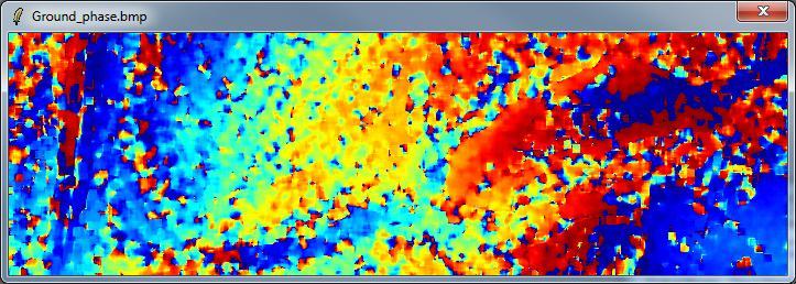
37 HEIGHT ESTIMATION DATA_MASTERDIR_SLAVEDIR_FER config.txt DEM_diff_heights.bin, Coh_heights.bin Ground_phase.bin, Ground_phase_median.bin RVOG_phase_heights.bin, RVOG_heights.bin DEM_diff_heights.bmp, Coh_heights.bmp Ground_phase.bmp, Ground_phase_median.bmp RVOG_phase_heights.bmp, RVOG_heights.bmp 2HV Do it Yourself: Set the parameters (Median Size = 21, Factor = 0.4) and view the corresponding BMP files. HH-VV

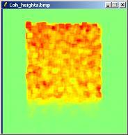
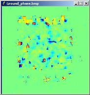

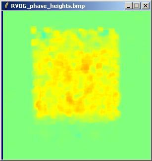
38 HEIGHT ESTIMATION DEM_diff_heights Coh_heights Ground_phase Ground_phase_median RVOG_phase_heights RVOG_heights
39 PROCESS DATA
40 Do it Yourself: Select a BMP file Select a BIN file Select Input Data Format Select Show Select Area (line or rect) SAVE PLOT HEIGHT ESTIMATION
41 HEIGHT ESTIMATION DEM_diff_heights Coh_heights RVOG_heights
42 PROCESS DATA
43 Do it Yourself: Select a BMP file Select a BIN file Select Input Data Format Select Pixel Select Show Select Representation X Range / Y Range = 200pix XY Range = 30 pix (3D) Set Min / Max Values PLOT HEIGHT ESTIMATION
44 HEIGHT ESTIMATION DEM_diff_heights Coh_heights RVOG_heights

45 Pol-InSAR Practical Forest Application
46 MAIN MENU
47 ENVIRONMENT Configure Data Main Directories location Input Master Directory: C:/Taunstein_ESAR/master_slc Input Slave Directory: C:/Traunstein_ESAR/slave_slc
48 PROCESS DATA
49 PROCESS DATA

50 RAW INTERFEROGRAM Do it Yourself: Select polarization channels, set the parameters and view the corresponding BMP files. Note: The Output Directory is automatically set to: MasterDir_SlaveDir

51 RAW INTERFEROGRAM DATA_MASTERDIR_SLAVEDIR config.txt interferogram_xx_xx.bin interferogram_xx_xx.bmp
52 PROCESS DATA
53 FLAT EARTH REMOVAL DATA_SLAVEDIR config.txt s11.bin, s12.bin s21.bin, s22.bin DATA_SLAVEDIR_FER config.txt s11.bin, s12.bin s21.bin, s22.bin Do it Yourself: Enter Flat Earth file name, set the parameters and run the function. Note: The Input Slave Directory is automatically set to: SlaveDir_FER
54 RAW INTERFEROGRAM Do it Yourself: Select polarization channels, set the parameters and view the corresponding BMP files. Note: The Output Directory is automatically set to: MasterDir_SlaveDir_FER

55 RAW INTERFEROGRAM DATA_MASTERDIR_SLAVEDIR_FER config.txt interferogram_xx_xx.bin interferogram_xx_xx.bmp


56 Convert S2 - T6 : Multilook

57 Convert S2 - T6 : Multilook Do it Yourself: Select Multi Look : Row = 6 and Col = 2 Select Output Data Format : 2 x [S2] >> [T6] Note: The Output Directory is automatically set to: MasterDir_SlaveDir_FER_MLK
58 PROCESS DATA

59 PROCESS DATA Do it Yourself: Set the parameters : Num Looks = 3 ; Window Size = 3. Note: The Output Directory is automatically set to: MasterDir_SlaveDir_FER_MLK_LEE


60 Create RGB file PROCESS DATA

61 PROCESS DATA
62 PROCESS DATA
 and view the corresponding BMP")
63 PROCESS DATA Do it Yourself: Select the correlation coefficients, set the parameters (Box Car= 5x5) and view the corresponding BMP files.


64 PROCESS DATA

65 PROCESS DATA
66 PROCESS DATA
, set the parameters (Box Car = 7x7) and view the corresponding BMP files (select")
67 COHERENCE ESTIMATION Do it Yourself: Select polarization channels (linear, circular, pauli), set the parameters (Box Car = 7x7) and view the corresponding BMP files (select BMP).
68 COHERENCE ESTIMATION

69 COHERENCE ESTIMATION
70 PROCESS DATA
71 HEIGHT ESTIMATION
72 HEIGHT ESTIMATION 2HV HH-VV Do it Yourself: Set the parameters (Median Size = 21, Factor = 0.4) and view the corresponding BMP files. 2D Kz File : DataDirectory / kz-ph-mlk / kz.bin
73 HEIGHT ESTIMATION

74 HEIGHT ESTIMATION Min = 0m Max = 50m

75 HEIGHT ESTIMATION Data Analysis : Histogram


76 HEIGHT ESTIMATION Do it Yourself: Select a BMP file Select a BIN file Select Input Data Format Select Show Select Area SAVE PLOT
77 PROCESS DATA

 Set Min / Max Values PLOT HEIGHT")
78 Do it Yourself: Select a BMP file Select a BIN file Select Input Data Format Select Pixel Select Show Select Representation X Range / Y Range = 30pix XY Range = 30 pix (3D) Set Min / Max Values PLOT HEIGHT ESTIMATION

79 Questions?
PolSARpro v4.03 Forest Applications
 PolSARpro v4.03 Forest Applications Laurent Ferro-Famil Lecture on polarimetric SAR Theory and applications to agriculture & vegetation Thursday 19 April, morning Pol-InSAR Tutorial Forest Application
Do It Yourself 8. Polarization Coherence Tomography (P.C.T) Training Course
 Training Course") Do It Yourself 8 Polarization Coherence Tomography (P.C.T) Training Course 1 Objectives To provide a self taught introduction to Polarization Coherence Tomography (PCT) processing techniques to enable
Do It Yourself 8 Polarization Coherence Tomography (P.C.T) Training Course 1 Objectives To provide a self taught introduction to Polarization Coherence Tomography (PCT) processing techniques to enable
Coherence Based Polarimetric SAR Tomography
 I J C T A, 9(3), 2016, pp. 133-141 International Science Press Coherence Based Polarimetric SAR Tomography P. Saranya*, and K. Vani** Abstract: Synthetic Aperture Radar (SAR) three dimensional image provides
Software Tool PolSARpro v3.0
 Software Tool PolSARpro v3.0 Eric POTTIER Tuesday 4 September, Lecture D2L5-2 04/09/07 Lecture D2L5 part 2 Software Tool : PolSARpro v3.0 Eric POTTIER 1 CONTEXT The initiative development of PolSARpro
Tree Height Estimation Methodology With Xband and P-band InSAR Data. Lijun Lu Guoman Huang Qiwei Li CASM
 Tree Height Estimation Methodology With Xband and P-band InSAR Data Lijun Lu Guoman Huang Qiwei Li CASM Outline CASMSAR dataset and test area Height Estimation with RVoG method Height Estimation with dual-band
GIS. PDF created with pdffactory Pro trial version ... SPIRIT. *
 Vol8, No 4, Winter 07 Iranian Remote Sensing & - * // // RVOG /4 / 7/4 99754 * 0887708 Email aghababaee@mailkntuacir PDF created with pdffactory Pro trial version wwwpdffactorycom Treuhaft and Cloude,
Do It Yourself 2. Representations of polarimetric information
 Do It Yourself 2 Representations of polarimetric information The objectives of this second Do It Yourself concern the representation of the polarimetric properties of scatterers or media. 1. COLOR CODED
An Overview of the PolSARpro v3.0 Software The Educational Toolbox for Polarimetric and Interferometric Polarimetric SAR Data Processing
 An Overview of the PolSARpro v3.0 Software The Educational Toolbox for Polarimetric and Interferometric Polarimetric SAR Data Processing Eric Pottier, Laurent Ferro-Famil, Sophie Allain Shane Cloude, Irena
MODELLING OF THE SCATTERING BY A SMOOTH DIELECTRIC CYLINDER: STUDY OF THE COMPLEX SCATTERING MATRIX
 MODELLING OF THE SCATTERING BY A SMOOTH DIELECTRIC CYLINDER: STUDY OF THE COMPLEX SCATTERING MATRIX L Thirion 1, C Dahon 2,3, A Lefevre 4, I Chênerie 1, L Ferro-Famil 2, C Titin-Schnaider 3 1 AD2M, Université
STUDIES OF PHASE CENTER AND EXTINCTION COEFFICIENT OF BOREAL FOREST USING X- AND L-BAND POLARIMETRIC INTERFEROMETRY COMBINED WITH LIDAR MEASUREMENTS
 STUDIES OF PHASE CENTER AND EXTINCTION COEFFICIENT OF BOREAL FOREST USING X- AND L-BAND POLARIMETRIC INTERFEROMETRY COMBINED WITH LIDAR MEASUREMENTS Jaan Praks, Martti Hallikainen, and Xiaowei Yu Department
FOREST HEIGHT ESTIMATION FROM INDREX-II L-BAND POLARIMETRIC INSAR DATA
 FOREST HEIGHT ESTIMATION FROM INDREX-II L-BAND POLARIMETRIC INSAR DATA Q. Zhang a, *, J.B. Mercer a, S.R. Cloude b a Intermap Technologies Corp., #12, 555-4 th Avenue SW, Calgary, AB, Canada T2P 3E7 -
AN APPROACH TO DETERMINE THE MAXIMUM ACCEPTABLE DISTORTION LEVEL IN POLARIMETRIC CALIBRATION FOR POL-INSAR APPLICATIONS
 AN APPROACH O DEERMINE HE MAXIMUM ACCEPABLE DISORION LEEL IN POLARIMERIC CALIBRAION FOR POL-INSAR APPLICAIONS Yong-sheng Zhou (1,,3), Wen Hong (1,), Fang Cao (1,) (1) Institute of Electronics, Chinese
Eric Pottier, Laurent Ferro-Famil, Sophie Allain, Stéphane Méric. Irena Hajnsek, Kostas Papathanassiou, Alberto Moreira,
 PolSARpro v4.0 Software and ALOS-PALSAR Pol-SAR Data Processing Eric Pottier, Laurent Ferro-Famil, Sophie Allain, Stéphane Méric Shane Cloude, Irena Hajnsek, Kostas Papathanassiou, Alberto Moreira, Mark
Exploiting the High Dimensionality of Polarimetric Interferometric Synthetic Aperture Radar Observations
 Exploiting the High Dimensionality of Polarimetric Interferometric Synthetic Aperture Radar Observations Robert Riley rriley@sandia.gov R. Derek West rdwest@sandia.gov SAND2017 11133 C This work was supported
Interferometric processing. Rüdiger Gens
 Rüdiger Gens Why InSAR processing? extracting three-dimensional information out of a radar image pair covering the same area digital elevation model change detection 2 Processing chain 3 Processing chain
Interferometry Tutorial with RADARSAT-2 Issued March 2014 Last Update November 2017
 Sentinel-1 Toolbox with RADARSAT-2 Issued March 2014 Last Update November 2017 Luis Veci Copyright 2015 Array Systems Computing Inc. http://www.array.ca/ http://step.esa.int with RADARSAT-2 The goal of
Sentinel-1 Toolbox. Interferometry Tutorial Issued March 2015 Updated August Luis Veci
 Sentinel-1 Toolbox Interferometry Tutorial Issued March 2015 Updated August 2016 Luis Veci Copyright 2015 Array Systems Computing Inc. http://www.array.ca/ http://step.esa.int Interferometry Tutorial The
Interferometry Module for Digital Elevation Model Generation
 Interferometry Module for Digital Elevation Model Generation In order to fully exploit processes of the Interferometry Module for Digital Elevation Model generation, the European Space Agency (ESA) has
InSAR Operational and Processing Steps for DEM Generation
 InSAR Operational and Processing Steps for DEM Generation By F. I. Okeke Department of Geoinformatics and Surveying, University of Nigeria, Enugu Campus Tel: 2-80-5627286 Email:francisokeke@yahoo.com Promoting
In addition, the image registration and geocoding functionality is also available as a separate GEO package.
 GAMMA Software information: GAMMA Software supports the entire processing from SAR raw data to products such as digital elevation models, displacement maps and landuse maps. The software is grouped into
Polarimetric SAR tomography of tropical forests using P-Band TropiSAR data
 Polarimetric SAR tomography of tropical forests using P-Band TropiSAR data Yue Huang, Laurent Ferro-Famil, Cedric Lardeux SAPHIR team, IETR University of Rennes 1, France 19/01/2011 Objectives Global objectives:
TanDEM-X Pol-InSAR Inversion for Mangroves of East Africa
 TanDEM-X Pol-InSAR Inversion for Mangroves of East Africa Seung-Kuk Lee, Temilola Fatoyinbo, David Lagomasino, Batuhan Osmanoglu, Carl Trettin, Marc Simard NASA/Goddard Space Flight Center Biospheric Sciences
Po P ls l A S Rpro v5.0. Pr P actic i al E. E. Po P ttie i r E.Pottier (2013)
") PolSARprov5.0 Practical E. Pottier General Presentation of PolSARpro v5.0 Software SOFTWARE DIRECTORY STRUCTURE PolSARpro_v5.0.tcl is the executable file that launches the POLSARPRO user interface DATA
PolSARprov5.0 Practical E. Pottier General Presentation of PolSARpro v5.0 Software SOFTWARE DIRECTORY STRUCTURE PolSARpro_v5.0.tcl is the executable file that launches the POLSARPRO user interface DATA
RESOLUTION enhancement is achieved by combining two
 IEEE GEOSCIENCE AND REMOTE SENSING LETTERS, VOL. 3, NO. 1, JANUARY 2006 135 Range Resolution Improvement of Airborne SAR Images Stéphane Guillaso, Member, IEEE, Andreas Reigber, Member, IEEE, Laurent Ferro-Famil,
fraction of Nyquist
 differentiator 4 2.1.2.3.4.5.6.7.8.9 1 1 1/integrator 5.1.2.3.4.5.6.7.8.9 1 1 gain.5.1.2.3.4.5.6.7.8.9 1 fraction of Nyquist Figure 1. (top) Transfer functions of differential operators (dotted ideal derivative,
Pine Forest Height Inversion Using Single-Pass X-Band PolInSAR Data
 IEEE TRANSACTIONS ON GEOSCIENCE AND REMOTE SENSING, VOL. 46, NO. 1, JANUARY 2008 59 Pine Forest Height Inversion Using Single-Pass X-Band PolInSAR Data Franck Garestier, Pascale C. Dubois-Fernandez, Senior
MULTI-BASELINE POLINSAR INVERSION AND SIMULATION OF INTERFEROMETRIC WAVENUMBER FOR FOREST HEIGHT RETRIEVAL USING SPACEBORNE SAR DATA
 MULTI-BASELINE POLINSAR INVERSION AND SIMULATION OF INTERFEROMETRIC WAVENUMBER FOR FOREST HEIGHT RETRIEVAL USING SPACEBORNE SAR KRISHNAKALI GHOSH March, 2018 SUPERVISORS: Mr. Shashi Kumar Dr. Valentyn
Signal Processing Laboratory
 C.S.L Liege Science Park Avenue du Pré-Aily B-4031 ANGLEUR Belgium Tel: +32.4.382.46.00 Fax: +32.4.367.56.13 Signal Processing Laboratory Anne Orban VITO June 16, 2011 C. Barbier : the team Remote Sensing
Chalmers Publication Library
 Chalmers Publication Library Two-Level Forest Model Inversion of Interferometric TanDEM-X Data This document has been downloaded from Chalmers Publication Library (CPL). It is the author s version of a
PolSARpro v4.0 Main Window
 PolSARpro v4.0 Main Window Figure n 1 : PolSARpro v4.0 Main Window Description: The PolSARpro v4.0 Software proposes a new interface based on a full-screen main window as shown in Figure n 1. Minimizing
SAR IMAGE PROCESSING FOR CROP MONITORING
 SAR IMAGE PROCESSING FOR CROP MONITORING Anne Orban, Dominique Derauw, and Christian Barbier Centre Spatial de Liège Université de Liège cbarbier@ulg.ac.be Agriculture and Vegetation at a Local Scale Habay-La-Neuve,
IMPROVEMENT OF VEGETATION PARAMETER RETRIEVAL FROM POLARIMETRIC SAR INTERFEROMETRY USING A SIMPLE POLARIMETRIC SCATTERING MODEL
 IMPROVEMENT OF VEGETATION PARAMETER RETRIEVAL FROM POLARIMETRIC SAR INTERFEROMETRY USING A SIMPLE POLARIMETRIC SCATTERING MODEL Maxim Neumann 1, Laurent Ferro-Famil 1, and Andreas Reigber 2 1 SAPHIR Team,
Forest Structure Estimation in the Canadian Boreal forest
 Forest Structure Estimation in the Canadian Boreal forest Michael L. Benson Leland E.Pierce Kathleen M. Bergen Kamal Sarabandi Kailai Zhang Caitlin E. Ryan The University of Michigan, Radiation Lab & School
Sentinel-1 Toolbox. TOPS Interferometry Tutorial Issued May 2014
 Sentinel-1 Toolbox TOPS Interferometry Tutorial Issued May 2014 Copyright 2015 Array Systems Computing Inc. http://www.array.ca/ https://sentinel.esa.int/web/sentinel/toolboxes Interferometry Tutorial
Lateral Ground Movement Estimation from Space borne Radar by Differential Interferometry.
 Lateral Ground Movement Estimation from Space borne Radar by Differential Interferometry. Abstract S.Sircar 1, 2, C.Randell 1, D.Power 1, J.Youden 1, E.Gill 2 and P.Han 1 Remote Sensing Group C-CORE 1
DINSAR: Differential SAR Interferometry
 DINSAR: Differential SAR Interferometry Fabio Rocca 1 SAR interferometric phase: ground motion contribution If a scatterer on the ground slightly changes its relative position in the time interval between
Radar Data Processing, Quality Analysis and Level-1b Product Generation for AGRISAR and EAGLE campaigns
 Radar Data Processing, Quality Analysis and Level-1b Product Generation for AGRISAR and EAGLE campaigns German Aerospace Center (DLR) R. Scheiber, M. Keller, J. Fischer, R. Horn, I. Hajnsek Outline E-SAR
Motion compensation and the orbit restitution
 InSA R Contents Introduction and objectives Pi-SAR Motion compensation and the orbit restitution InSAR algorithm DEM generation Evaluation Conclusion and future work Introduction and Objectives L-band
Interferometric Evaluation of Sentinel-1A TOPS data
 Interferometric Evaluation of Sentinel-1A TOPS data N. Yague-Martinez, F. Rodriguez Gonzalez, R. Brcic, R. Shau Remote Sensing Technology Institute. DLR, Germany ESTEC/Contract No. 4000111074/14/NL/MP/lf
Repeat-pass SAR Interferometry Experiments with Gaofen-3: A Case Study of Ningbo Area
 Repeat-pass SAR Interferometry Experiments with Gaofen-3: A Case Study of Ningbo Area Tao Zhang, Xiaolei Lv, Bing Han, Bin Lei and Jun Hong Key Laboratory of Technology in Geo-spatial Information Processing
Interferometric coherence optimization
 Interferometric coherence optimization using the polarimetric signatures Boularbah Souissi, Mounira Ouarzeddine, Aichouche Belhadj-Aissa Department of telecommunication Faculty of Electronics and Computing,
POLSARpro v3.0: THE VERSATILE EDUCATIONAL TOOLBOX FOR POLARIMETRIC AND INTERFEROMETRIC SAR DATA PROCESSING
 POLSARpro v3.0: THE VERSATILE EDUCATIONAL TOOLBOX FOR POLARIMETRIC AND INTERFEROMETRIC SAR DATA PROCESSING Eric Pottier (1), Laurent Ferro-Famil (1), Sophie Allain (1), Shane Cloude (2), Irena Hajnsek
SAR Interferometry. Dr. Rudi Gens. Alaska SAR Facility
 SAR Interferometry Dr. Rudi Gens Alaska SAR Facility 2 Outline! Relevant terms! Geometry! What does InSAR do?! Why does InSAR work?! Processing chain " Data sets " Coregistration " Interferogram generation
InSAR Processing. Sentinel 1 data Case study of subsidence in Mexico city. Marie-Pierre Doin, Cécile Lasserre, Raphaël Grandin, Erwan Pathier
 1 InSAR Processing Sentinel 1 data Case study of subsidence in Mexico city Marie-Pierre Doin, Cécile Lasserre, Raphaël Grandin, Erwan Pathier NSBAS processing chain (based on ROI_PAC): ROI-PAC: Rosen et
TREE HEIGHT RETRIEVAL USING SINGLE BASELINE POLARIMETRIC INTERFEROMETRY. S. R. Cloude (1), D. Corr (2)
, D. Corr (2)") TREE HEIGHT RETRIEVAL USING SINGLE BASELINE POLARIMETRIC INTERFEROMETRY S. R. Cloude (1), D. Corr (2) (1) AEL Consultants, Granary Business Centre, Coal Rd., Cupar, KY15 5YQ,Scotland Tel/Fax : ++44-()1334-652919/4192
TREE HEIGHT RETRIEVAL USING SINGLE BASELINE POLARIMETRIC INTERFEROMETRY S. R. Cloude (1), D. Corr (2) (1) AEL Consultants, Granary Business Centre, Coal Rd., Cupar, KY15 5YQ,Scotland Tel/Fax : ++44-()1334-652919/4192
Chalmers Publication Library
 Chalmers Publication Library Mapping Topography and Forest Parameters in a Boreal Forest with Dual-Baseline TanDEM-X Data and the Two-Level Model This document has been downloaded from Chalmers Publication
IEEE TRANSACTIONS ON GEOSCIENCE AND REMOTE SENSING, VOL. 35, NO. 5, SEPTEMBER
 IEEE TRANSACTIONS ON GEOSCIENCE AND REMOTE SENSING, VOL. 35, NO. 5, SEPTEMBER 1997 1267 -Radar Equivalent of Interferometric SAR s: A Theoretical Study for Determination of Vegetation Height Kamal Sarabandi,
ADVANCED CONCEPTS IN POLARIMETRY PART 2 (Polarimetric Target Classification) 1 INTRODUCTION
 1 INTRODUCTION") ADVANCED CONCEPTS IN POLARIMETRY PART 2 (Polarimetric Target Classification) Eric POTTIER (1), Jong-Sen LEE (2), Laurent FERRO-FAMIL (1) (1) I.E.T.R UMR CNRS 6164 University of Rennes1 Image and Remote
ADVANCED CONCEPTS IN POLARIMETRY PART 2 (Polarimetric Target Classification) Eric POTTIER (1), Jong-Sen LEE (2), Laurent FERRO-FAMIL (1) (1) I.E.T.R UMR CNRS 6164 University of Rennes1 Image and Remote
FIRST RESULTS OF THE ALOS PALSAR VERIFICATION PROCESSOR
 FIRST RESULTS OF THE ALOS PALSAR VERIFICATION PROCESSOR P. Pasquali (1), A. Monti Guarnieri (2), D. D Aria (3), L. Costa (3), D. Small (4), M. Jehle (4) and B. Rosich (5) (1) sarmap s.a., Cascine di Barico,
Processing and Analysis of ALOS/Palsar Imagery
 Processing and Analysis of ALOS/Palsar Imagery Yrjö Rauste, Anne Lönnqvist, and Heikki Ahola Kaukokartoituspäivät 6.11.2006 NewSAR Project The newest generation of space borne SAR sensors have polarimetric
Memorandum. Clint Slatton Prof. Brian Evans Term project idea for Multidimensional Signal Processing (EE381k)
") Memorandum From: To: Subject: Date : Clint Slatton Prof. Brian Evans Term project idea for Multidimensional Signal Processing (EE381k) 16-Sep-98 Project title: Minimizing segmentation discontinuities in
Memorandum From: To: Subject: Date : Clint Slatton Prof. Brian Evans Term project idea for Multidimensional Signal Processing (EE381k) 16-Sep-98 Project title: Minimizing segmentation discontinuities in
Polarimetric Radar Remote Sensing
 Proceedings of ISAP2007, Niigata, Japan 1A2 Polarimetric Radar Remote Sensing Yoshio Yamaguchi Department of Information Engineering, Niigata University Ikarashi 2-8050, Niigata, 950-2181, Japan yamaguch@ie.niigata-u.ac.jp
A Hybrid Entropy Decomposition and Support Vector Machine Method for Agricultural Crop Type Classification
 PIERS ONLINE, VOL. 3, NO. 5, 2007 620 A Hybrid Entropy Decomposition and Support Vector Machine Method for Agricultural Crop Type Classification Chue-Poh Tan 1, Hong-Tat Ewe 2, and Hean-Teik Chuah 1 1
SAR Polarimetry Workstation
 SAR Polarimetry Workstation The PCI Geomatics SAR Polarimetry Workstation provides a complete set of tools and applications designed specifically for the processing and analysis of Polarimetric SAR (POLSAR)
ON THE PHYSICAL NATURE OF URBAN SAR PERMANENT SCATTERERS
 ON THE PHYSICAL NATURE OF URBAN SAR PERMANENT SCATTERERS Daniele Perissin (1), Claudio Prati (1) (1) Politecnico di Milano, Piazza L. da Vinci 32, 20133 Milano, Italy, Email: perissin@elet.polimi.it KEY
URBAN FOOTPRINT MAPPING WITH SENTINEL-1 DATA
 URBAN FOOTPRINT MAPPING WITH SENTINEL-1 DATA Data: Sentinel-1A IW SLC 1SSV: S1A_IW_SLC 1SSV_20160102T005143_20160102T005208_009308_00D72A_849D S1A_IW_SLC 1SSV_20160126T005142_20160126T005207_009658_00E14A_49C0
Synthetic Aperture Radar (SAR) Polarimetry for Wetland Mapping & Change Detection
 Polarimetry for Wetland Mapping & Change Detection") Synthetic Aperture Radar (SAR) Polarimetry for Wetland Mapping & Change Detection Jennifer M. Corcoran, M.S. Remote Sensing & Geospatial Analysis Laboratory Natural Resource Science & Management PhD Program
Synthetic Aperture Radar (SAR) Polarimetry for Wetland Mapping & Change Detection Jennifer M. Corcoran, M.S. Remote Sensing & Geospatial Analysis Laboratory Natural Resource Science & Management PhD Program
Brix workshop. Mauro Mariotti d Alessandro, Stefano Tebaldini ESRIN
 Brix workshop Mauro Mariotti d Alessandro, Stefano Tebaldini 3-5-218 ESRIN Dipartimento di Elettronica, Informazione e Bioingegneria Politecnico di Milano Outline A. SAR Tomography 1. How does it work?
A knowledge based classification method for polarimetric SAR data
 A knowledge based classification method for polarimetric AR data M. Dabboor*, V. Karathanassi Laboratory of Remote ensing, chool of Rural and urveying Engineering, National Technical University of Athens,
Concept and methodology of SAR Interferometry technique
 Concept and methodology of SAR Interferometry technique March 2016 Differen;al SAR Interferometry Young s double slit experiment - Construc;ve interference (bright) - Destruc;ve interference (dark) http://media-2.web.britannica.com/eb-media/96/96596-004-1d8e9f0f.jpg
Scattering Properties of Electromagnetic Waves in Stratified air/vegetation/soil and air/snow/ice media : Modeling and Sensitivity Analysis!
 Scattering Properties of Electromagnetic Waves in Stratified air/vegetation/soil and air/snow/ice media : Modeling and Sensitivity Analysis! M. Dechambre et al., LATMOS/IPSL, Université de Versailles 1
Sentinel-1 InSAR AP workshop
 Sentinel-1 InSAR AP workshop Sentinel-1 InSAR progress and experience at GAMMA U. Wegmüller, C. Werner, A. Wiesmann, T. Strozzi Gamma Remote Sensing AG - Progress made since S1A Expert Users meeting at
Forest Vertical Parameter Estimation Using PolInSAR Imagery Based on Radiometric Correction
 International Journal of Geo-Information Article Forest Vertical Parameter Estimation Using PolInSAR Imagery Based on Radiometric Correction Yu Zhang 1, Chu He 1,2, *, Xin Xu 1 and Dong Chen 3 1 Signal
ALOS-2/PALSAR-2 Calibration and Validation Results
 ALOS-2/PALSAR-2 Calibration and Validation Results Ver. 2018.08.07 JAXA EORC & ALOS-2 Project Team 1 Content 1. Update of the calibration factor (CF) 2. Evaluation results for PALSAR-2 standard products
Course Outline (1) #6 Data Acquisition for Built Environment. Fumio YAMAZAKI
 #6 Data Acquisition for Built Environment. Fumio YAMAZAKI") AT09.98 Applied GIS and Remote Sensing for Disaster Mitigation #6 Data Acquisition for Built Environment 9 October, 2002 Fumio YAMAZAKI yamazaki@ait.ac.th http://www.star.ait.ac.th/~yamazaki/ Course Outline
AT09.98 Applied GIS and Remote Sensing for Disaster Mitigation #6 Data Acquisition for Built Environment 9 October, 2002 Fumio YAMAZAKI yamazaki@ait.ac.th http://www.star.ait.ac.th/~yamazaki/ Course Outline
Interferometric Processing of TanDEM-X. Images for Forest Height Estimation
 Interferometric Processing of TanDEM-X Images for Forest Height Estimation Daniel Molina Hurtado Department of Radio Science and Engineering School of Electrical Engineering Aalto University A final project
SAR Polarimetry Workstation
 Technical Specifications SAR Polarimetry Workstation The SAR Polarimetry Workstation provides a complete set of tools and applications designed specifically for the processing and analysis of Polarimetric
A Comparison of ALOS PALSAR-2 Calibration Data by Using External DEM
 CEOS SAR Calibration and Validation Workshop 2016 A Comparison of ALOS PALSAR-2 Calibration Data by Using External DEM Tokyo Denki University, Japan, 7 th -9 th September 2016 *Choen KIM College of Forest
SAR Imaging in the Time Domain for
 SAR Imaging in the Time Domain for Nonlinear Sensor Trajectories and SAR Tomography Othmar Frey Co-Authors: Christophe Magnard, Maurice Rüegg, Erich Meier Remote Sensing Laboratories University of Zurich,
WEIGHTED PYRAMID LINKING FOR SEGMENTATION OF FULLY-POLARIMETRIC SAR DATA
 WEIGHTED PYRAMID LINKING FOR SEGMENTATION OF FULLY-POLARIMETRIC SAR DATA Ronny Hänsch, Olaf Hellwich Berlin Institute of Technology, Computer Vision and Remote Sensing Franklinstrasse 28/2, Office FR3-,
Lidar and GIS: Applications and Examples. Dan Hedges Clayton Crawford
 Lidar and GIS: Applications and Examples Dan Hedges Clayton Crawford Outline Data structures, tools, and workflows Assessing lidar point coverage and sample density Creating raster DEMs and DSMs Data area
Four-component Scattering Power Decomposition with Rotation of Coherency Matrix
 1 Four-component Scattering Power Decomposition with Rotation of Coherency Matrix Yoshio Yamaguchi, Fellow, IEEE, Akinobu Sato, Wolfgang Martin Boerner, Life Fellow, IEEE, Ryoichi Sato, Member, IEEE, and
ADVANCED CONCEPTS IN POLARIMETRY PART 2 (Polarimetric Target Classification) 1 INTRODUCTION
 1 INTRODUCTION") ADVANCED CONCEPTS IN POLARIMETRY PART 2 (Polarimetric Target Classification) Eric POTTIER (1), Jong-Sen LEE (2), Laurent FERRO-FAMIL (1) (1) I.E.T.R UMR CNRS 6164 University of Rennes1 Image and Remote
ADVANCED CONCEPTS IN POLARIMETRY PART 2 (Polarimetric Target Classification) Eric POTTIER (1), Jong-Sen LEE (2), Laurent FERRO-FAMIL (1) (1) I.E.T.R UMR CNRS 6164 University of Rennes1 Image and Remote
Atmospheric distortions of spaceborne SAR polarimetric signatures at X and Ka-band
 Atmospheric distortions of spaceborne SAR polarimetric signatures at X and Ka-band S. Mori 1,2, Frank. S. Marzano 1,2 and N. Pierdicca 1 1. Sapienza University of Rome, Italy 2. CETEMPS University of L
PSI Precision, accuracy and validation aspects
 PSI Precision, accuracy and validation aspects Urs Wegmüller Charles Werner Gamma Remote Sensing AG, Gümligen, Switzerland, wegmuller@gamma-rs.ch Contents Aim is to obtain a deeper understanding of what
WIDE AREA DEFORMATION MAP GENERATION WITH TERRASAR-X DATA: THE TOHOKU-OKI EARTHQUAKE 2011 CASE
 WIDE AREA DEFORMATION MAP GENERATION WITH TERRASAR-X DATA: THE TOHOKU-OKI EARTHQUAKE 2011 CASE Nestor Yague-Martinez (1), Michael Eineder (2), Christian Minet (2), Birgitt Schättler (2) (1) Starlab Barcelona
Sentinel-1 processing with GAMMA software
 Documentation User s Guide Sentinel-1 processing with GAMMA software Including an example of Sentinel-1 SLC co-registration and differential interferometry Version 1.1 May 2015 GAMMA Remote Sensing AG,
Synthetic Aperture Radar Interferometry (InSAR)
") CEE 6100 / CSS 6600 Remote Sensing Fundamentals 1 Synthetic Aperture Radar Interferometry (InSAR) Adapted from and the ESA Interferometric SAR overview by Rocca et al. http://earth.esa.int/workshops/ers97/program-details/speeches/rocca-et-al/
CEE 6100 / CSS 6600 Remote Sensing Fundamentals 1 Synthetic Aperture Radar Interferometry (InSAR) Adapted from and the ESA Interferometric SAR overview by Rocca et al. http://earth.esa.int/workshops/ers97/program-details/speeches/rocca-et-al/
Mission Status and Data Availability: TanDEM-X
 Mission Status and Data Availability: TanDEM-X Irena Hajnsek, Thomas Busche, Alberto Moreira & TanDEM-X Team Microwaves and Radar Institute, German Aerospace Center irena.hajnsek@dlr.de 26-Jan-2009 Outline
The 2017 InSAR package also provides support for the generation of interferograms for: PALSAR-2, TanDEM-X
 Technical Specifications InSAR The Interferometric SAR (InSAR) package can be used to generate topographic products to characterize digital surface models (DSMs) or deformation products which identify
SCIENCE CHINA Earth Sciences. Improvement of a 3D radar backscattering model using matrix-doubling method
 SCIENCE CHINA Earth Sciences RESEARCH PAPER July 200 Vol.53 No.7: 029 035 doi: 0.007/s430-00-0055-6 Improvement of a 3D radar backscattering model using matrix-doubling method NI WenJian,2, GUO ZhiFeng
Heath Yardley University of Adelaide Radar Research Centre
 Heath Yardley University of Adelaide Radar Research Centre Radar Parameters Imaging Geometry Imaging Algorithm Gamma Remote Sensing Modular SAR Processor (MSP) Motion Compensation (MoCom) Calibration Polarimetric
ALOS-2 PALSAR-2 support in GAMMA Software
 ALOS-2 PALSAR-2 support in GAMMA Software Urs Wegmüller, Charles Werner, Andreas Wiesmann, Gamma Remote Sensing AG CH-3073 Gümligen, http://www.gamma-rs.ch 11-Sep-2014 1. Introduction JAXA has made available
InSAR DEM; why it is better?
 InSAR DEM; why it is better? What is a DEM? Digital Elevation Model (DEM) refers to the process of demonstrating terrain elevation characteristics in 3-D space, but very often it specifically means the
Bistatic SAR coherence improvement through spatially variant polarimetry
 1 Bistatic SAR coherence improvement through spatially variant polarimetry By Daniel Andre Centre for Electronic Warfare, Cranfield University, Defence Academy of the United Kingdom, Shrivenham, UK. Abstract
Operational process interferometric for the generation of a digital model of ground Applied to the couple of images ERS-1 ERS-2 to the area of Algiers
 Operational process interferometric for the generation of a digital model of ground Applied to the couple of images ERS-1 ERS-2 to the area of Algiers F. Hocine, M.Ouarzeddine, A. elhadj-aissa,, M. elhadj-aissa,,
IDENTIFICATION OF THE LOCATION PHASE SCREEN OF ERS-ENVISAT PERMANENT SCATTERERS
 IDENTIFICATION OF THE LOCATION PHASE SCREEN OF ERS-ENVISAT PERMANENT SCATTERERS M. Arrigoni (1), C. Colesanti (1), A. Ferretti (2), D. Perissin (1), C. Prati (1), F. Rocca (1) (1) Dipartimento di Elettronica
IMPROVING DEMS USING SAR INTERFEROMETRY. University of British Columbia. ABSTRACT
 IMPROVING DEMS USING SAR INTERFEROMETRY Michael Seymour and Ian Cumming University of British Columbia 2356 Main Mall, Vancouver, B.C.,Canada V6T 1Z4 ph: +1-604-822-4988 fax: +1-604-822-5949 mseymour@mda.ca,
Airborne Differential SAR Interferometry: First Results at L-Band
 1516 IEEE TRANSACTIONS ON GEOSCIENCE AND REMOTE SENSING, VOL. 41, NO. 6, JUNE 2003 Airborne Differential SAR Interferometry: First Results at L-Band Andreas Reigber, Member, IEEE, and Rolf Scheiber Abstract
ALOS PALSAR VERIFICATION PROCESSOR
 ALOS PALSAR VERIFICATION PROCESSOR P. Pasquali (1), A. Monti Guarnieri (2), D. D Aria (3), L. Costa (3), D. Small (4), M. Jehle (4) and B. Rosich (5) (1) sarmap s.a., Cascine di Barico, 6989 Purasca, Switzerland,
InSAR Data Coherence Estimation Using 2D Fast Fourier Transform
 InSAR Data Coherence Estimation Using 2D Fast Fourier Transform Andrey V. Sosnovsky 1, Viktor G. Kobernichenko 1, Nina S. Vinogradova 1, Odhuu Tsogtbaatar 1,2 1 Ural Federal University, Yekaterinburg,
Detection of Buried Objects using GPR Change Detection in Polarimetric Huynen Spaces
 Detection of Buried Objects using GPR Change Detection in Polarimetric Huynen Spaces Firooz Sadjadi Lockheed Martin Corporation Saint Anthony, Minnesota USA firooz.sadjadi@ieee.org Anders Sullivan Army
ADVANCED CONCEPTS IN POLARIMETRIC SAR IMAGE ANALYSIS A TUTORIAL REVIEW
 ADVANCED CONCEPTS IN POLARIMETRIC SAR IMAGE ANALYSIS A TUTORIAL REVIEW ABSTRACT Eric POTTIER (), Jong-Sen LEE (2), Laurent FERRO-FAMIL () () : I.E.T.R UMR CNRS 664, University of Rennes Image and Remote
Wavefronts and Rays. When light or other electromagnetic waves interact with systems much larger than the wavelength, it s a good approximation to
 Chapter 33: Optics Wavefronts and Rays When light or other electromagnetic waves interact with systems much larger than the wavelength, it s a good approximation to Neglect the wave nature of light. Consider
A Correlation Test: What were the interferometric observation conditions?
 A Correlation Test: What were the interferometric observation conditions? Correlation in Practical Systems For Single-Pass Two-Aperture Interferometer Systems System noise and baseline/volumetric decorrelation
TOPOGRAPHIC NORMALIZATION INTRODUCTION
 TOPOGRAPHIC NORMALIZATION INTRODUCTION Use of remotely sensed data from mountainous regions generally requires additional preprocessing, including corrections for relief displacement and solar illumination
INVESTIGATING THE PERFORMANCE OF SAR POLARIMETRIC FEATURES IN LAND-COVER CLASSIFICATION
 INVESTIGATING THE PERFORMANCE OF SAR POLARIMETRIC FEATURES IN LAND-COVER CLASSIFICATION Liang Gao & Yifang Ban Division of Geoinformatics, Royal Institute of Technology (KTH) Drottning Kristinas väg 30,
Generate Digital Elevation Models Using Laser Altimetry (LIDAR) Data. Christopher Weed
 Data. Christopher Weed") Generate Digital Elevation Models Using Laser Altimetry (LIDAR) Data Christopher Weed Final Report EE 381K Multidimensional Digital Signal Processing December 11, 2000 Abstract A Laser Altimetry (LIDAR)
Generate Digital Elevation Models Using Laser Altimetry (LIDAR) Data Christopher Weed Final Report EE 381K Multidimensional Digital Signal Processing December 11, 2000 Abstract A Laser Altimetry (LIDAR)
CLASSIFICATION OF EARTH TERRAIN COVERS USING THE MODIFIED FOUR- COMPONENT SCATTERING POWER DECOMPOSITION,
 CLASSIFICATION OF EARTH TERRAIN COVERS USING THE MODIFIED FOUR- COMPONENT SCATTERING POWER DECOMPOSITION, Boularbah Souissi (1), Mounira Ouarzeddine (1),, Aichouche Belhadj-Aissa (1) USTHB, F.E.I, BP N
Geometric Accuracy Evaluation, DEM Generation and Validation for SPOT-5 Level 1B Stereo Scene
 Geometric Accuracy Evaluation, DEM Generation and Validation for SPOT-5 Level 1B Stereo Scene Buyuksalih, G.*, Oruc, M.*, Topan, H.*,.*, Jacobsen, K.** * Karaelmas University Zonguldak, Turkey **University